
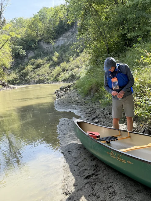
Put-in off Jasmine Road
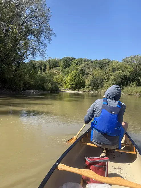
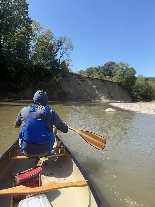
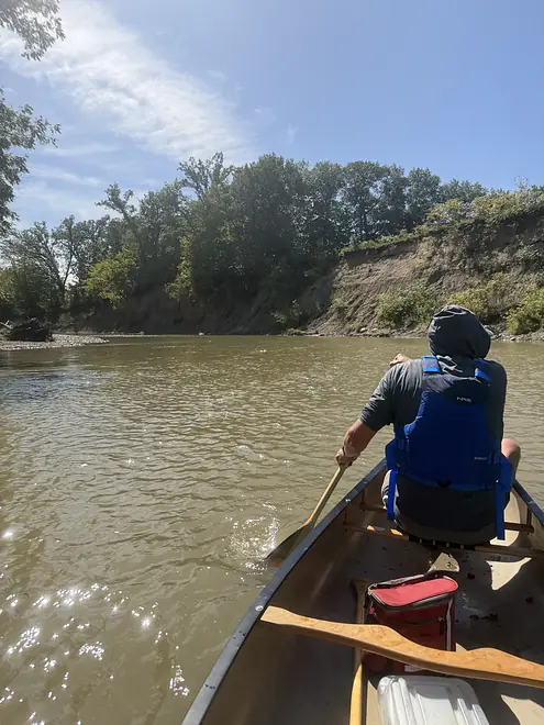
Take-out at Red Jacket Trail Park


Le Sueur River


As an avid reader of upper Midwest river paddling content, I’ve always found it interesting how Wisconsin-oriented it all is. Bloggers rarely seem to venture into Minnesota further than the Driftless rivers in the southeast corner of the state. After a somewhat spontaneous canoe outing took me to the Mankato area in south central Minnesota — well away from Driftless geology, in an area more known for flat farmland — I feel compelled to write my first trip review, to report that the somewhat obscure Le Sueur River is worth the trip.
My dad and I live in Des Moines and St. Paul, respectively. We decided to meet up somewhere roughly in the middle to canoe a river together. Looking at water levels on USGS gauges, the Le Sueur River near Mankato stood out as one of few options that wasn’t low that weekend.
I couldn’t find a ton of information about the Le Sueur. It’s part of a thick tangle of navigable streams that feed into the Minnesota River at Mankato via the Blue Earth River, including the Watonwan, Le Sueur, Maple, and Cobb (apparently including a Big and Little Cobb). Only the Blue Earth and the Watonwan are featured as official Minnesota DNR Water Trails, though access points on the nearby Le Sueur are noted on its map for those two.
The consensus seems to be that the premier river run of the Mankato area is the Blue Earth River below the Rapidan Dam. Unfortunately, floodwaters breached the dam in June 2024, flooding the valley with debris and a century’s worth of sediment. The DNR currently cautions against paddling that section. Greg Breining’s “Paddling Minnesota” features a page on the Le Sueur, calling it an “intimate stream” with 200-foot bluffs (!) but includes no photos. Looking on Google streetview, the bluffs at various bridge crossings looked intriguing. We opted to do the 7.9 mile segment from CR 8 (Jasmine Rd) to the takeout at Red Jacket Trail Park.
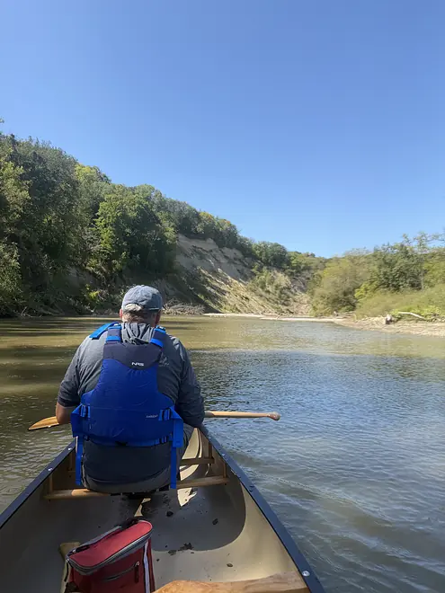
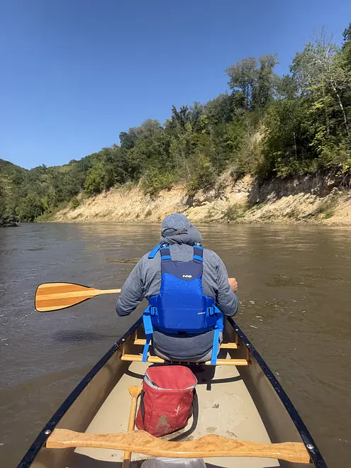
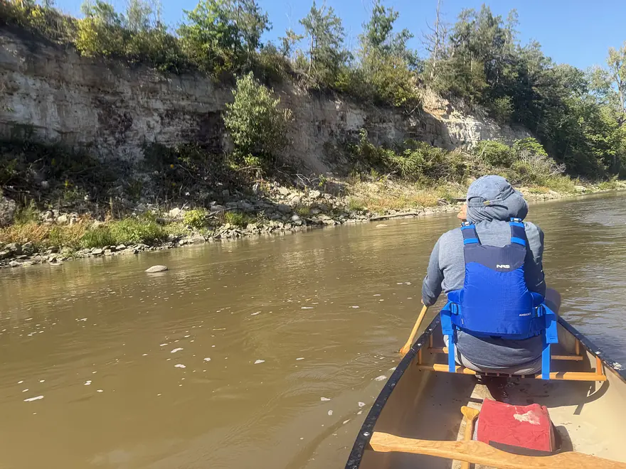
The access point at Jasmine Rd had a decent parking lot with a rough trail down to the river directly underneath the bridge. The high and near-vertical eroded dirt bank upstream was immediately impressive, towering above not just the river but even well above the bridge.
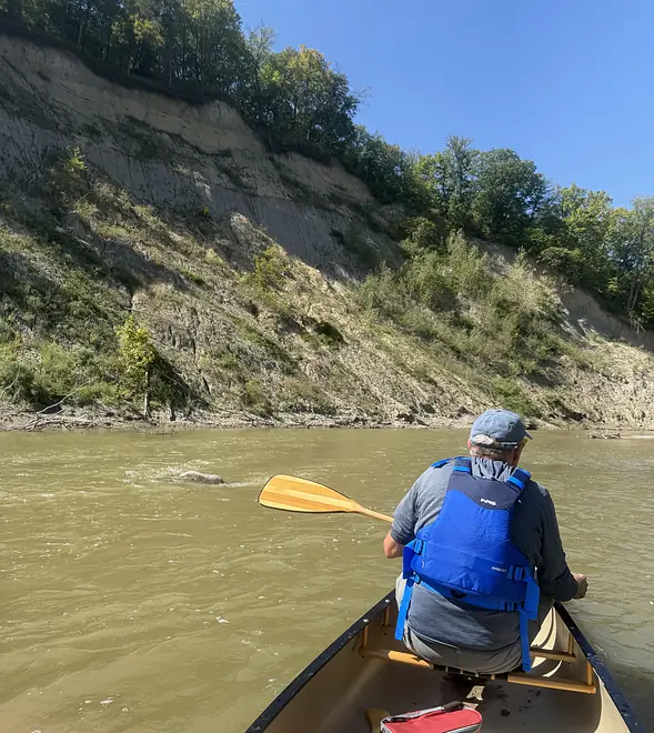
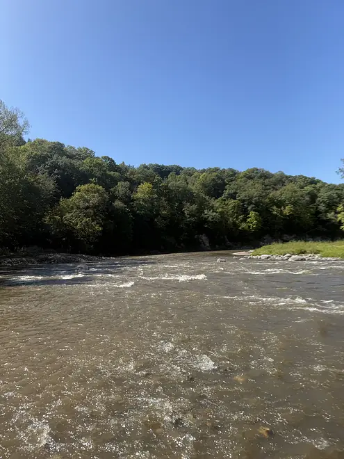
The river itself was very cloudy with a bed of dark clay and sand. It was also quite low. We realized later that the USGS gauge must be far downstream, near the Le Sueur’s confluence with the Blue Earth. The Cobb River, which we encountered a couple miles in, showed much lower water conditions on its USGS gauge. A few miles later we reached the Maple River, which looked like a raging torrent compared to the Le Sueur at that point. We had no depth issues downstream of the Maple — so if you see good water levels on the Le Sueur gauge but low levels on the Cobb, consider putting in on the Maple instead of the Le Sueur! That said, we only had to get out of the canoe maybe 4 or 5 times, and even that was probably only because we are both inexperienced canoeists with little experience reading such opaque, muddy water.
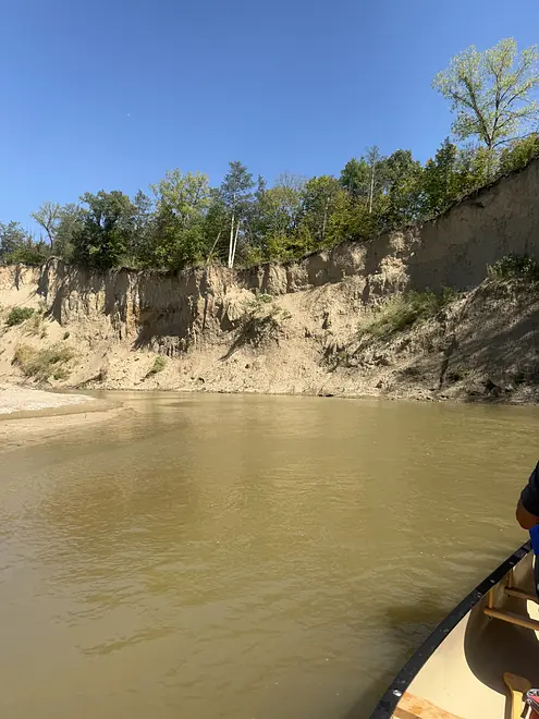
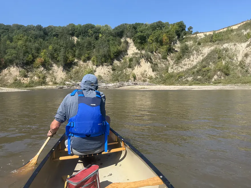
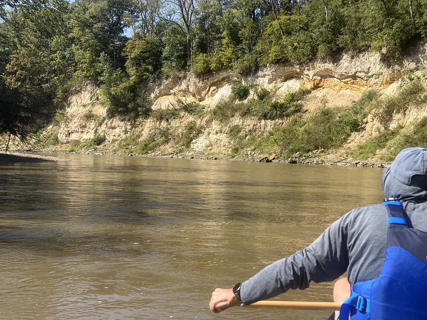
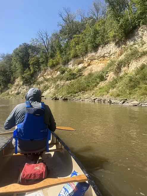
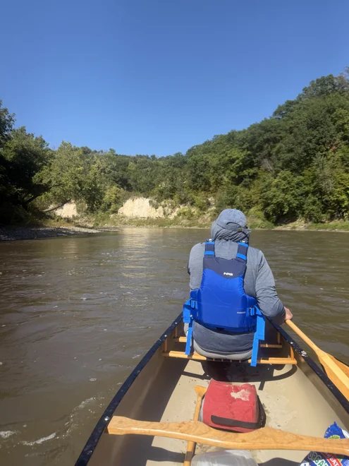
Overall, it was a neat and fun paddle! I haven’t canoed a ton of rivers, including many of the destination rivers of the region, but I think I’ve done enough to know that spectacular high banks like we saw are a rarity. On the Le Sueur, they appeared around nearly every bend, ranging from Badlands-style steep eroded dirt and clay bluffs, to huge sand banks like I’ve seen on the Eau Claire River in western Wisconsin, to stunning sheer limestone cliffs not unlike the more well-known Driftless rivers. The latter appeared more as we got closer to the confluence with the Blue Earth. My iPhone photos don’t quite do their scale justice; Greg Breining’s 200-foot estimate seems reasonable.
As far as wildlife, we spotted herons, eagles, kingfishers, large jumping fish, and just one other human. At these water levels, the river had a decent current and occasional riffles, but probably only one short spot that I think might approach “Class 1” rapids. The bigger challenge was spotting boulders (of which there were many) and deadfall in the shallow and murky water.
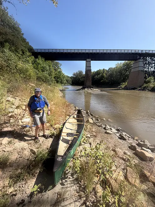
The takeout at Red Jacket Trail Park was heralded by the park’s titular rail-to-trail bridge that towers over the river, but was otherwise hard to spot. It’s little more than a steep pile of rocks with a narrow trail leading up to the parking lot, and involved some tricky footwork. If I did it again, I’d take out a couple miles downstream at CR 90, after the Le Sueur joins the Blue Earth River — not only for a potentially easier takeout, but because the downstream bluffs I could see from the highway bridge at Red Jacket Valley looked like the tallest and strangest ones yet.
I find the idea of “reviewing” a stretch of river, complete with a numerical rating, to be a little contrary to the point. The joy of the riparian experience comes from the obscurity of these undeveloped semi-wildernesses hidden on the margins of modern life — even if they’re not visually spectacular or a perfect paddle. But the Le Sueur felt pretty unique!
Thank you Wyatt for the review and the cool pictures!
WisconsinRiverTrips.com is always very appreciative of guest reviews, and if you, the reader, is ever interested in submitting one, you can use this online form.
- Upstream from Wildwood County Park: The river upstream from the park is likely navigable but poorly documented. I’m not sure what it entails. Out of desperation I asked Gemini and it said:
- The upper Le Sueur (above St. Clair / Wildwood Park) drains heavily tiled agricultural basins. It is extremely flash-flood-prone, drops quickly after rain, and is notorious for severe logjams, agricultural fence wire, and cattle crossings. While “navigable” at high water, it requires frequent, thorny portages.
- Wildwood County Park to Hwy 83 Bridge: 3.6 miles. Starts wooded and generic with maybe a few strainers. Opens up later with some nice exposed banks. View from Hwy 83 is scenic. Note Hwy 83 is likely a poor access and may not be viable.
- Hwy 83 Bridge to 598th Ave Bridge: 5.4 miles. Heavily eroded stretch, but still could be nice with a few large sandbars and exposed sand banks. Note Hwy 83 is likely a poor access and may not be viable.
- 598th Ave Bridge to Hungry Hollow Stop: 4.0 miles. A great stretch with longer pitches of light rapids, long spans of steep super scenic banks. Example street view. Note this might be a shallower and rockier stretch better suited for maneuverable and shallow drafting boats.
- T 170/Hungry Hollow Stop to Jasmine Road: 7.0 miles. “Paddling Southern Minnesota” warns this stretch may suffer from riprap, concrete wing dams, riverside garbage, and possibly a few downed cottonwoods. But it’s also described as having a deep river gorge and have a “dramatic beauty”. I found this streetview image that looked cool….and here is another by the put-in.
- Jasmine Road to Red Jacket Trail Park: 9.0 miles.
- Jasmine Road to Hwy 16: 2.5 miles. A shallower stretch with large gravel bars. The Cobb River joins up and add significant volume.
- Hwy 16 to Red Jacket Trail Park: 6.4 miles. A terrific stretch with impressive rock and dirt banks.
- Red Jacket Trail Park to Confluence on Blue Earth River: 1.5 miles. Last leg and potentially the best with maybe the largest exposed banks and most impressive bluffs.
- Confluence to Fort Le Hillier Landing River Access: 0.4 miles. Short leg on the Blue Earth River before reaching a nice access at I-90. This stretch is about 11 miles downstream from the famous Rapidan Dam Park breach and you may see very scoured and eroded banks. It should be navigable though.
Trip Map
Overview Map
Photos Size:
How did your trip turn out? Questions or comments? Feel free to leave your feedback.
