
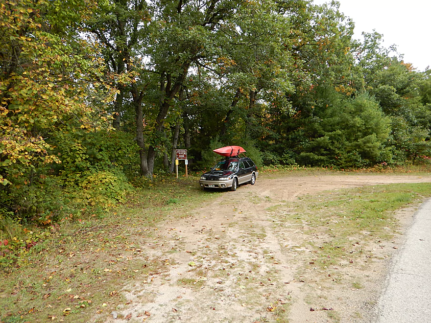
Great parking by 11th Road Bridge
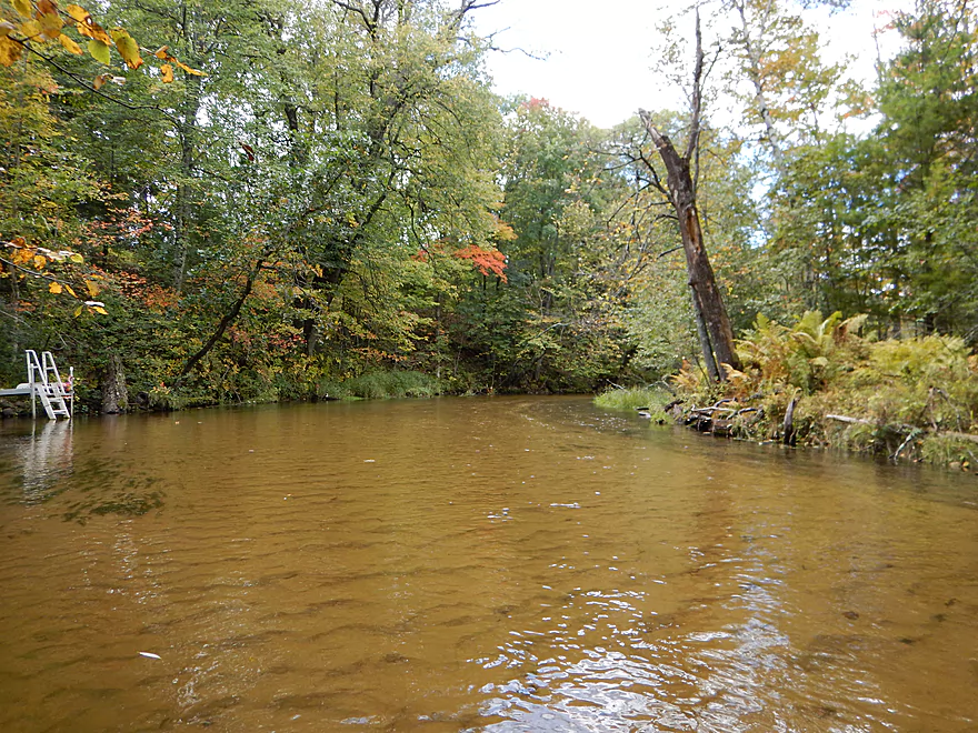
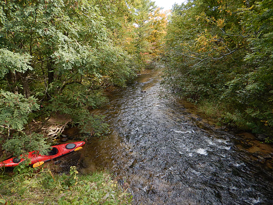
Attractive put-in
Small trail leading down to the landing and riffles
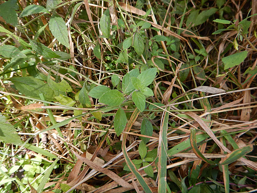
Wild mint!
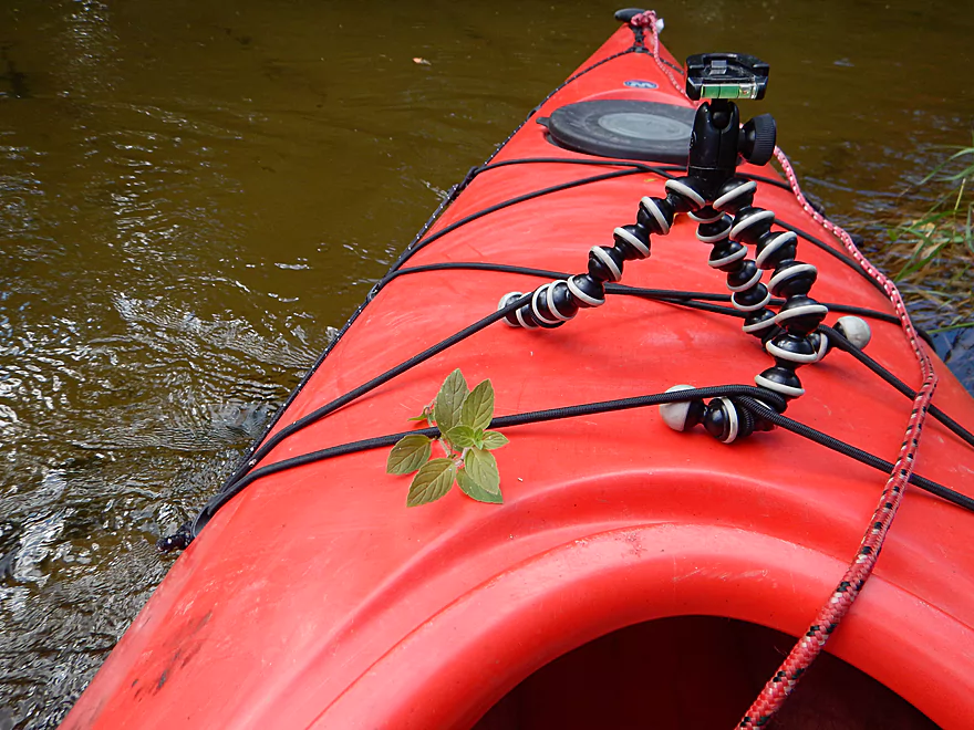
Kayak equivalent of a car air freshener
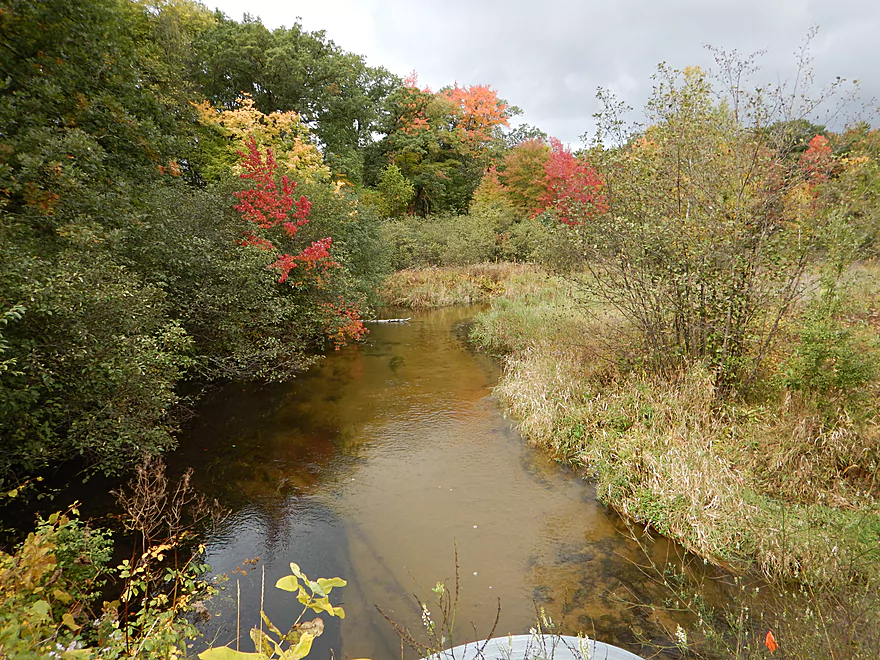
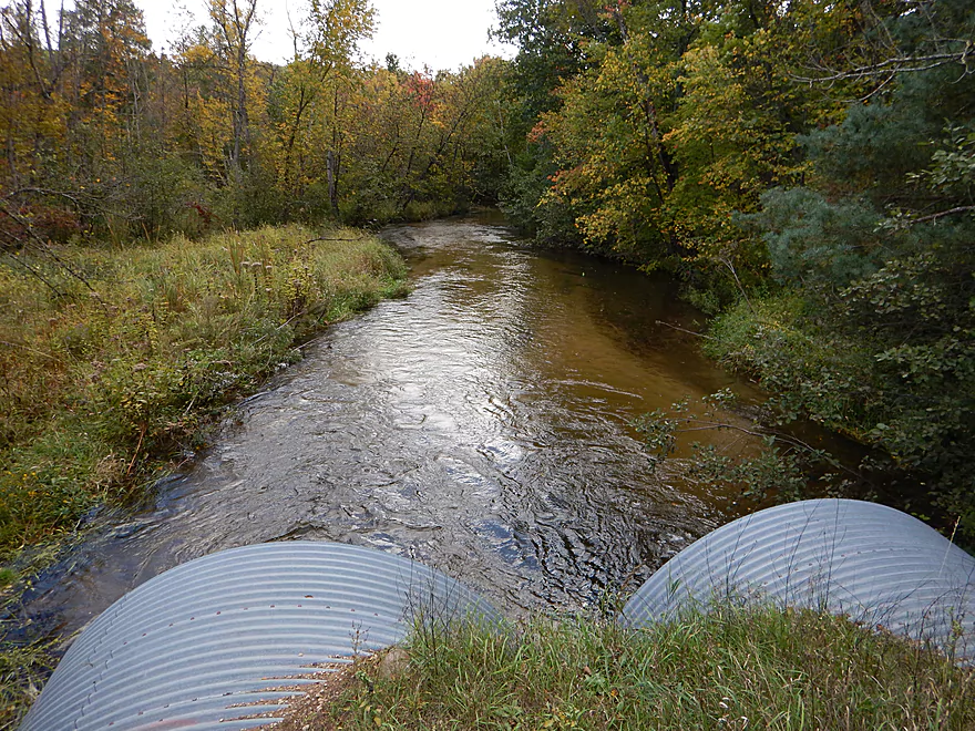
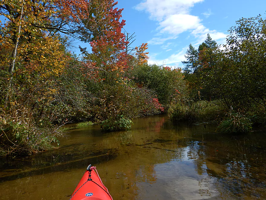
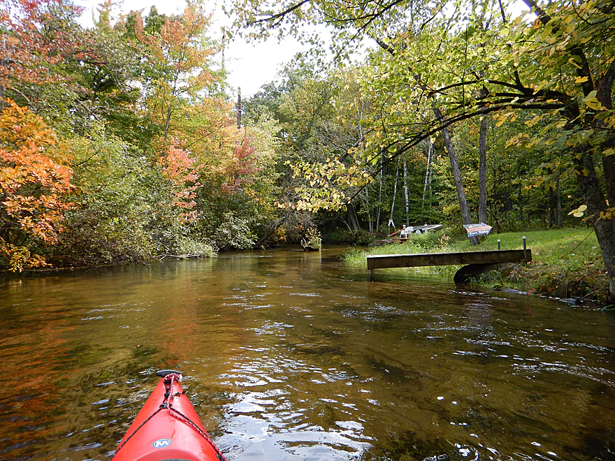
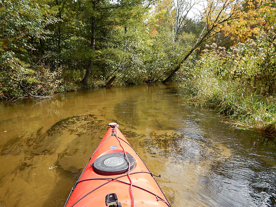
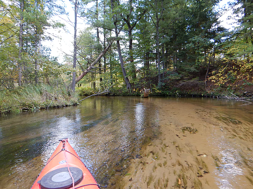
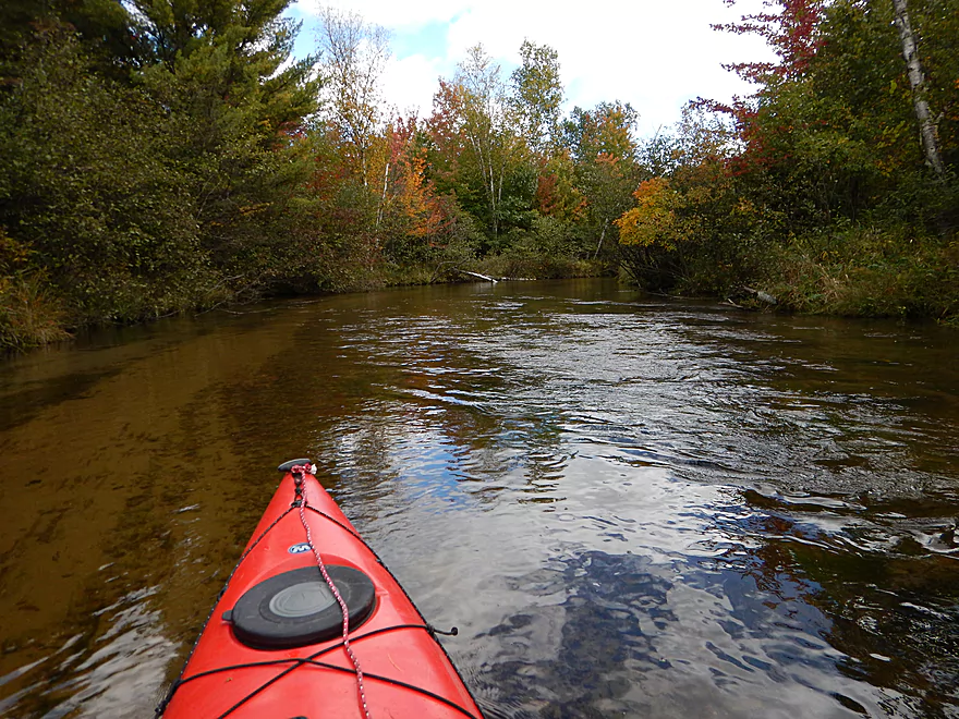
Entering the eyes of the Mecan
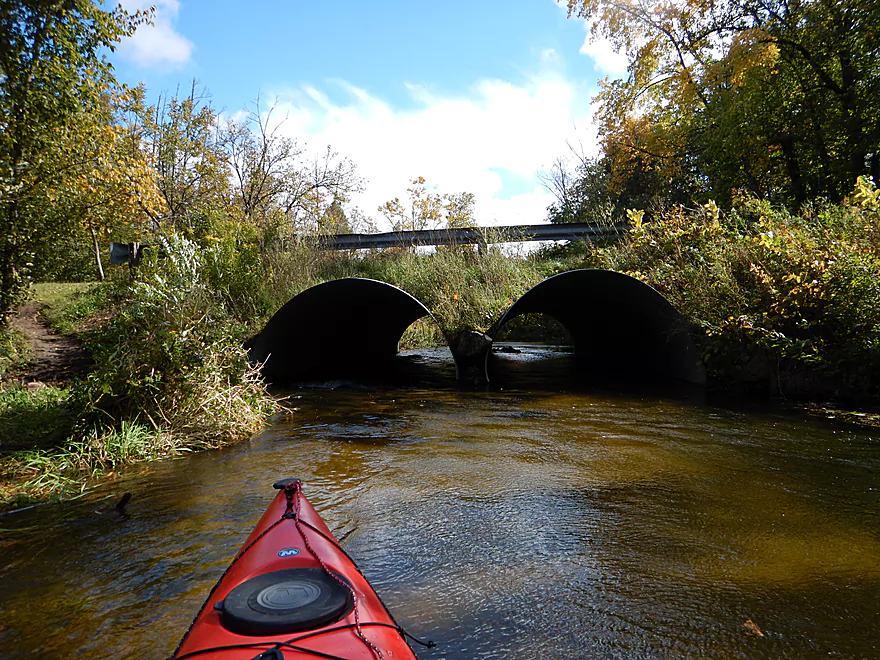
Downstream view from the 11th Road Bridge
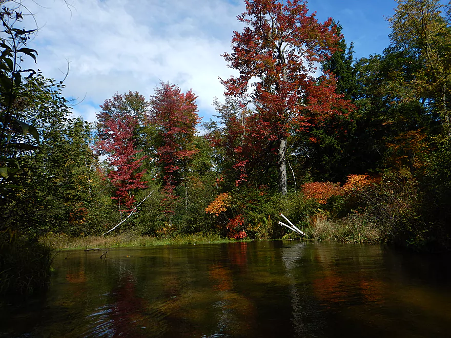
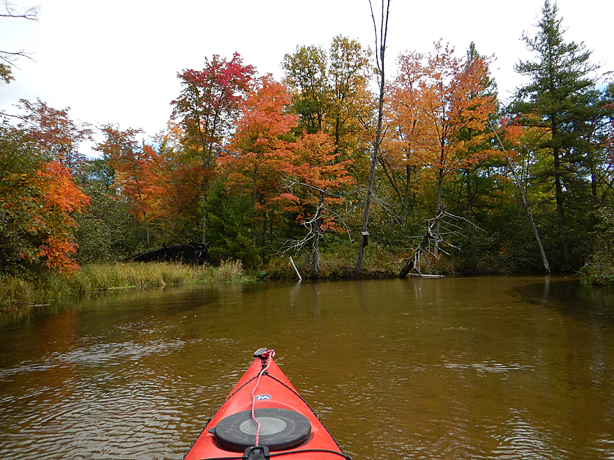
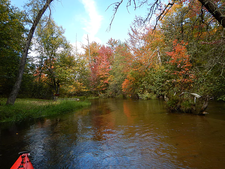
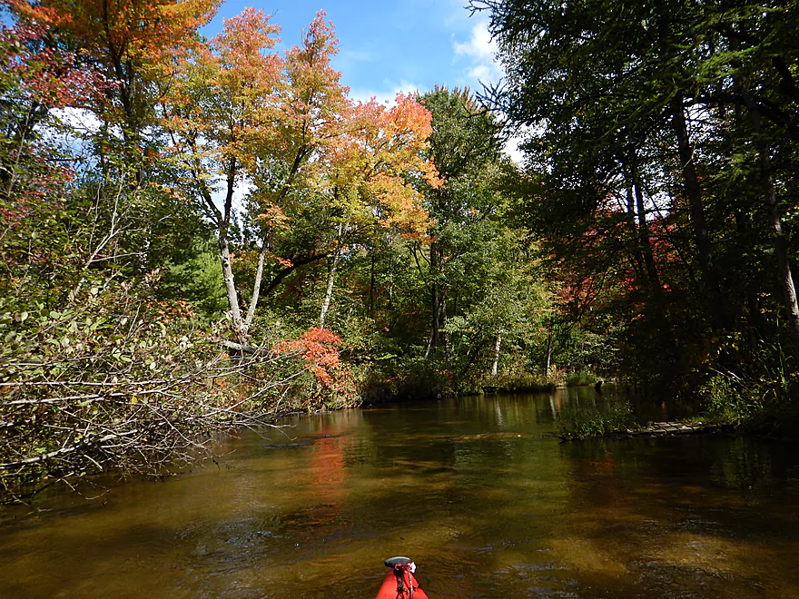
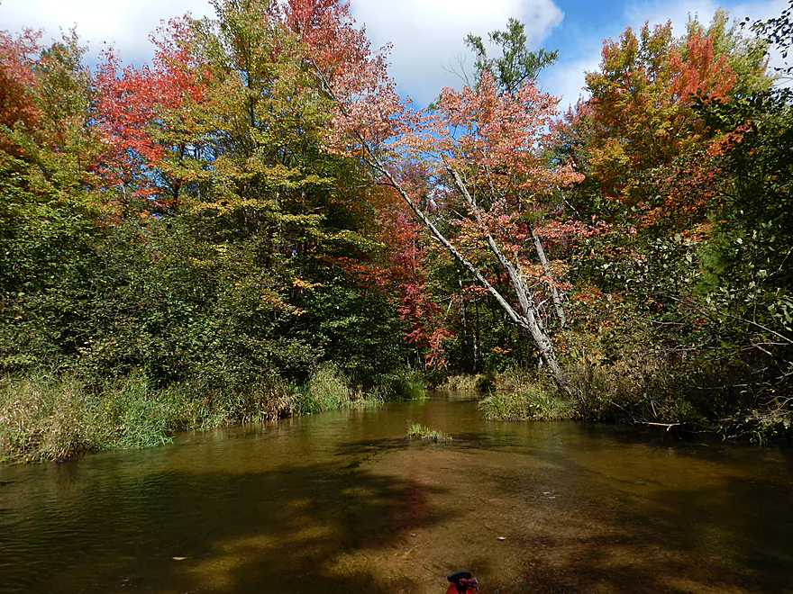
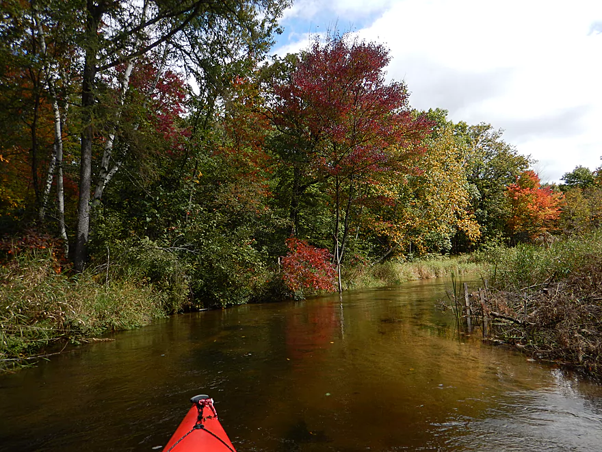
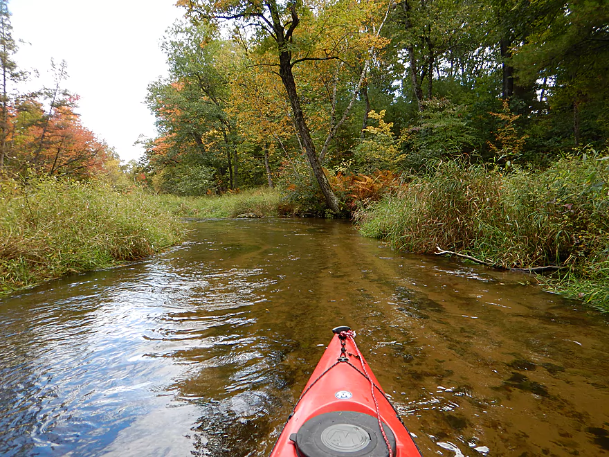
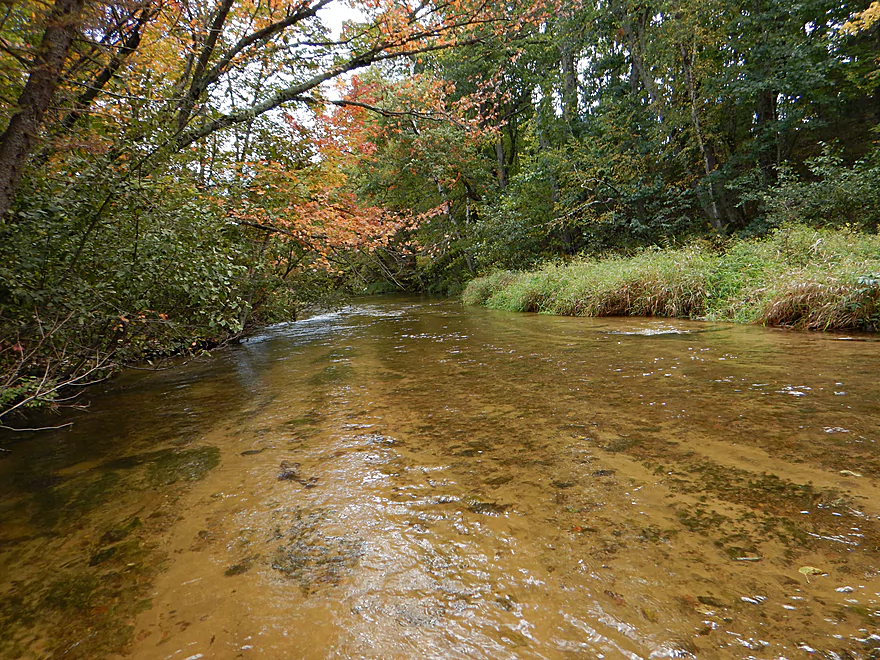
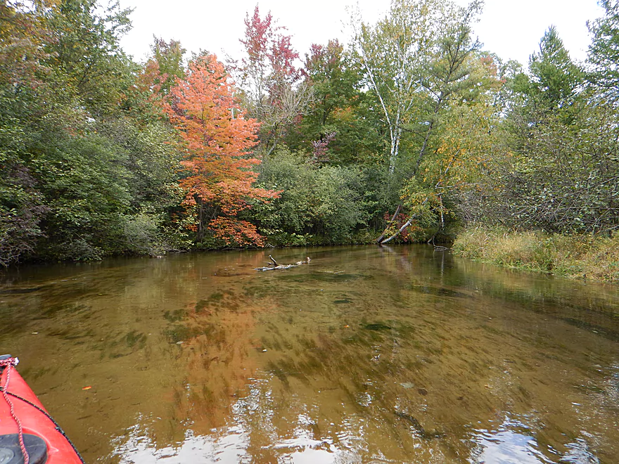
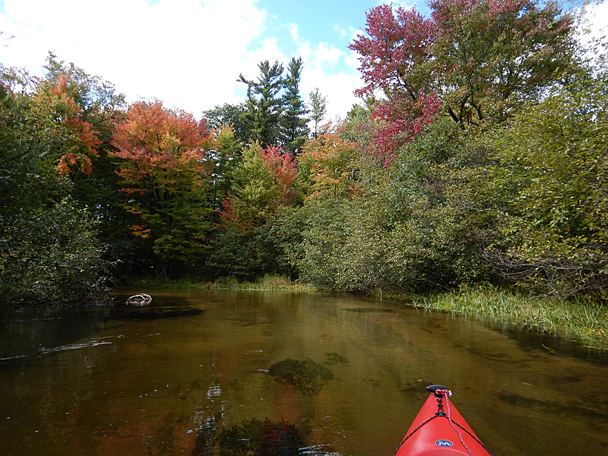
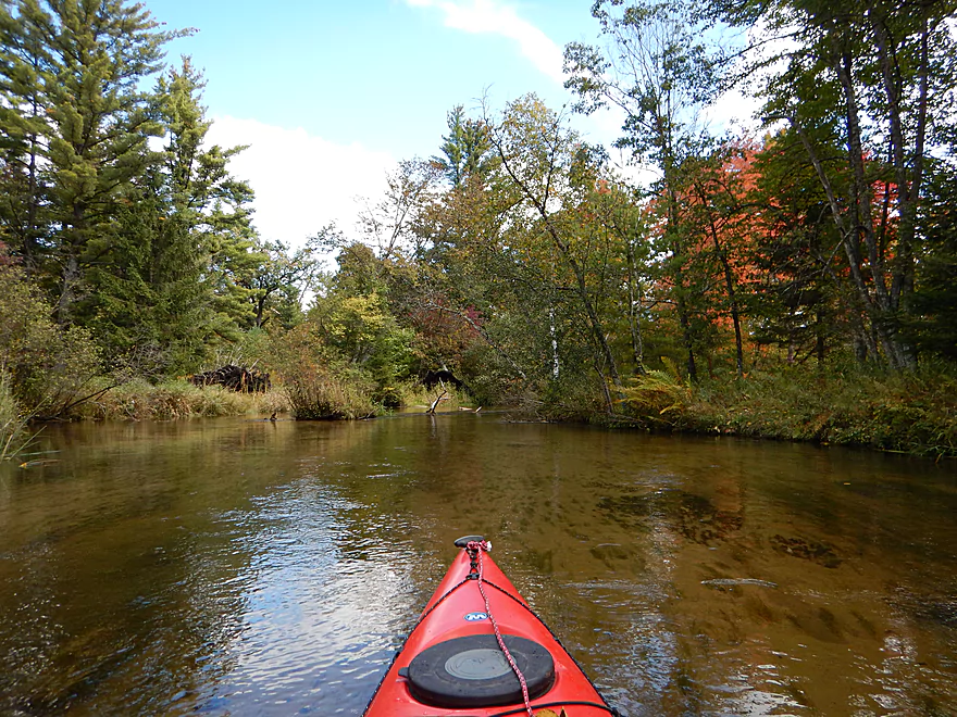
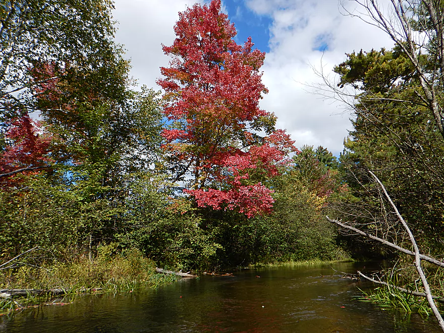
Great fall color
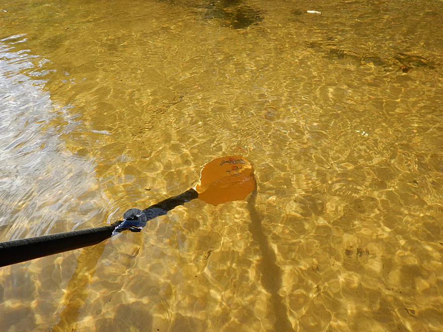
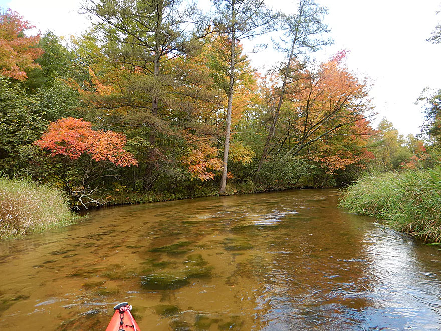
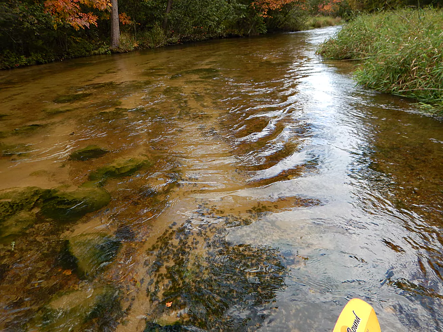
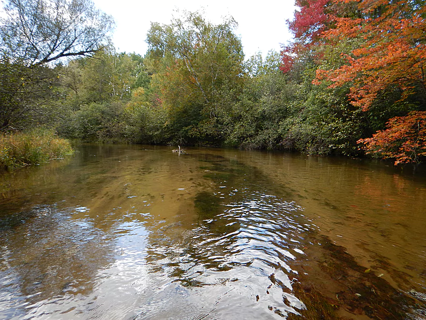
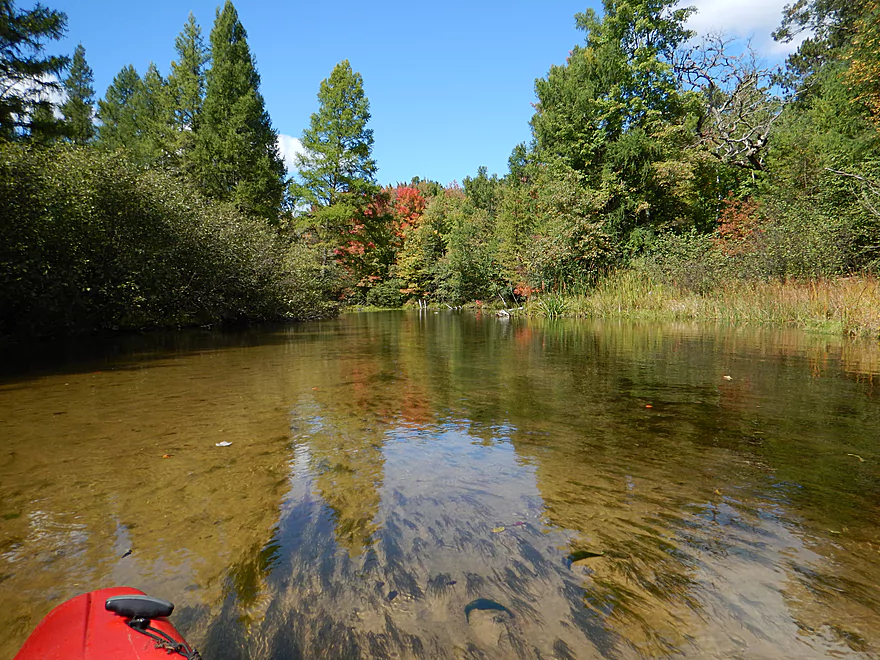
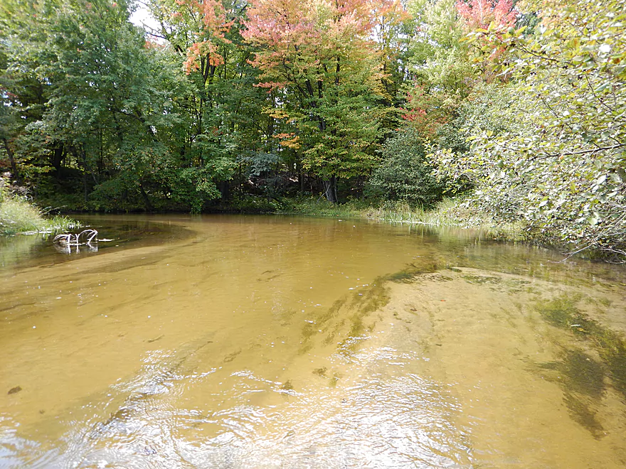
Superb water clarity
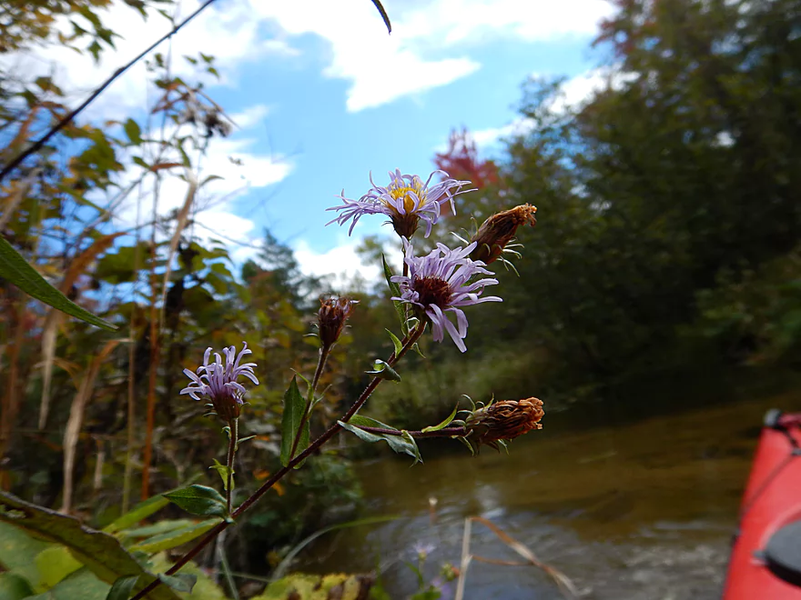
Blue aster
Why timing is everything with paddling
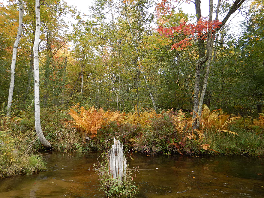
Even the ferns are turning
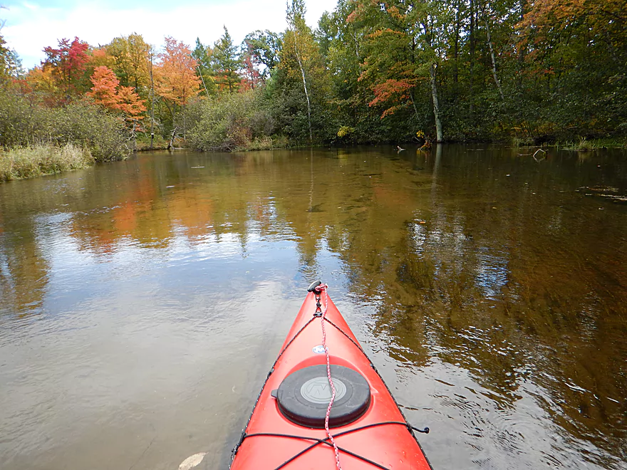
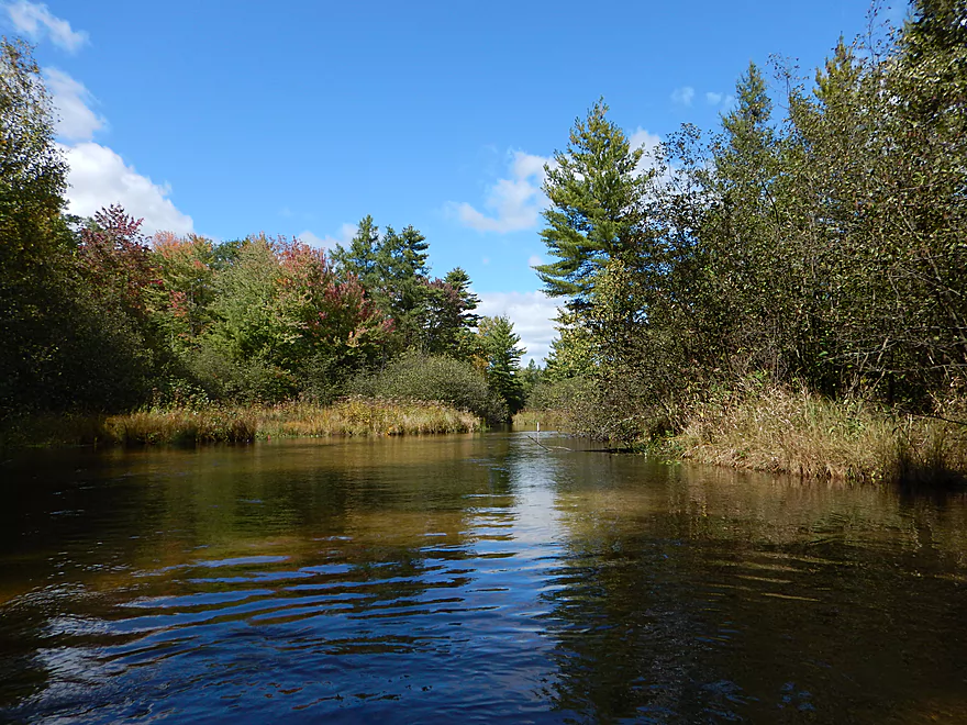
Like a smooth mirror
One of just a few homes

Ugh…billboards for kayakers
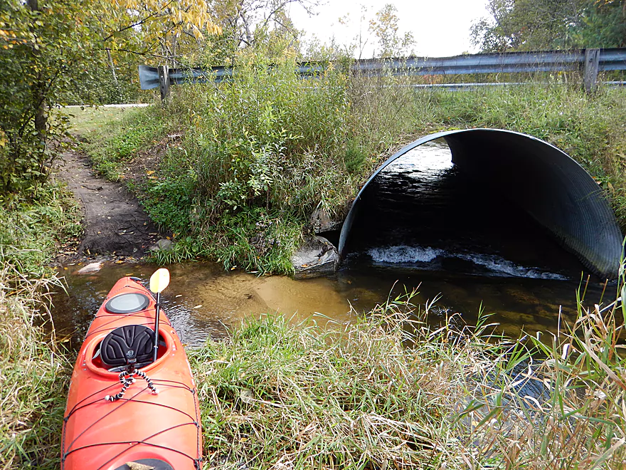
Tight but doable duck-under
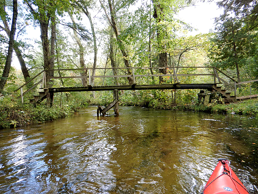
Rustic pedestrian bridge
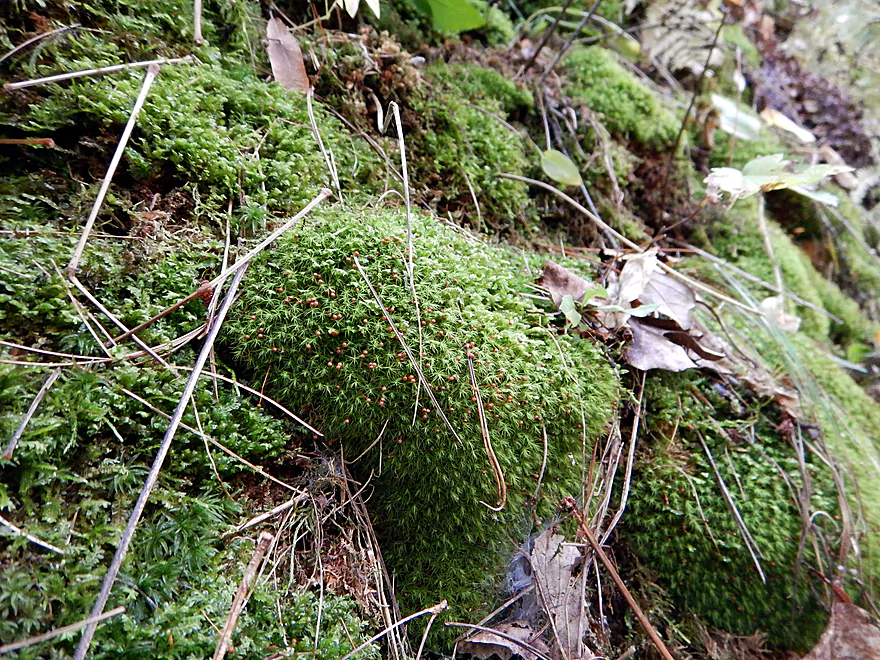
Clump of moss with red spore capsules
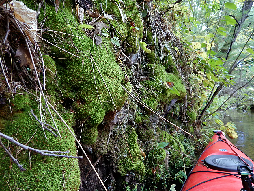
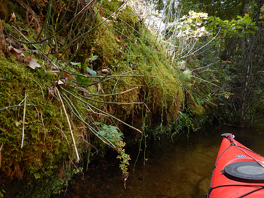
Wall of moss
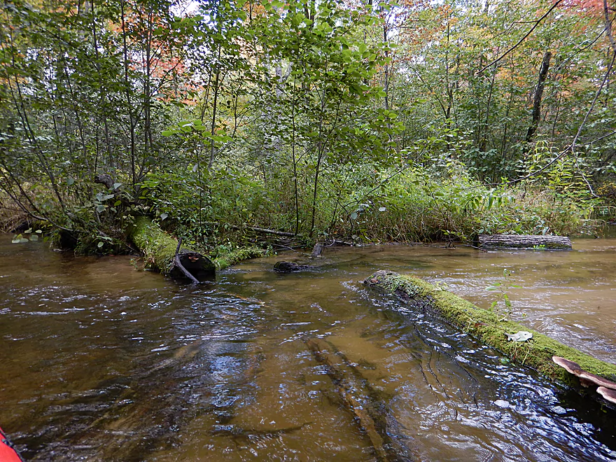
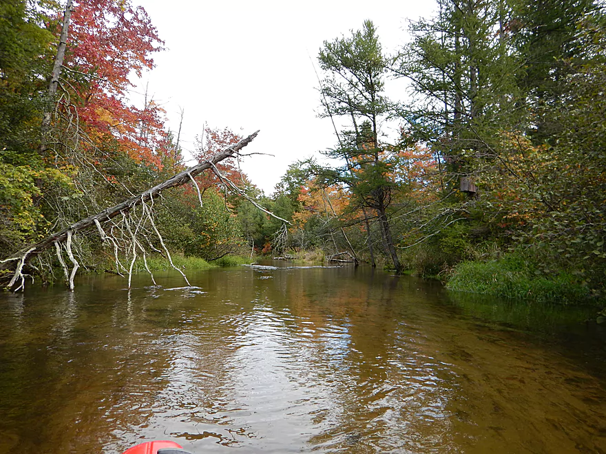
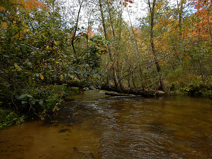
Excellent chainsaw work by the locals
Cool stripes in the gravel
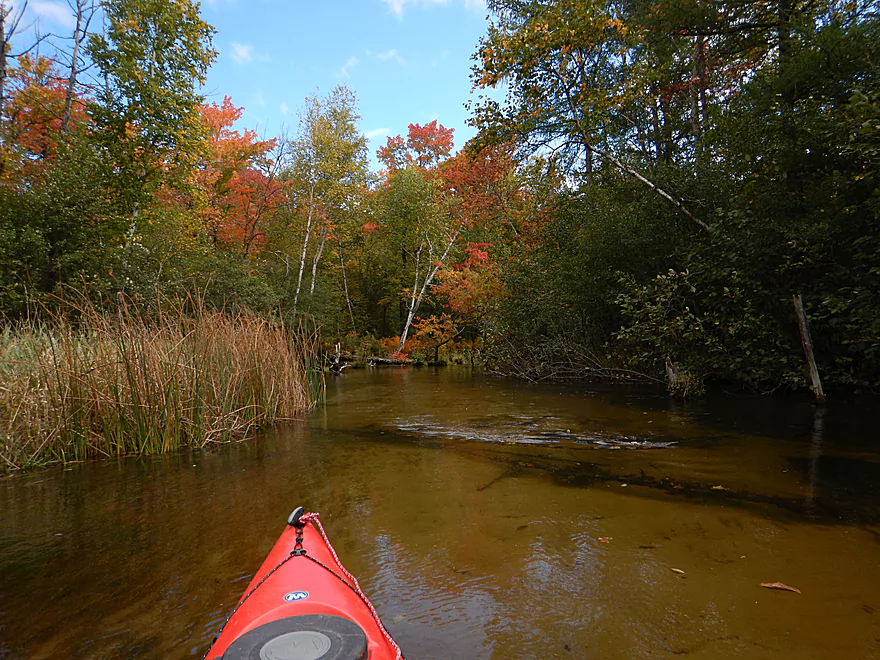
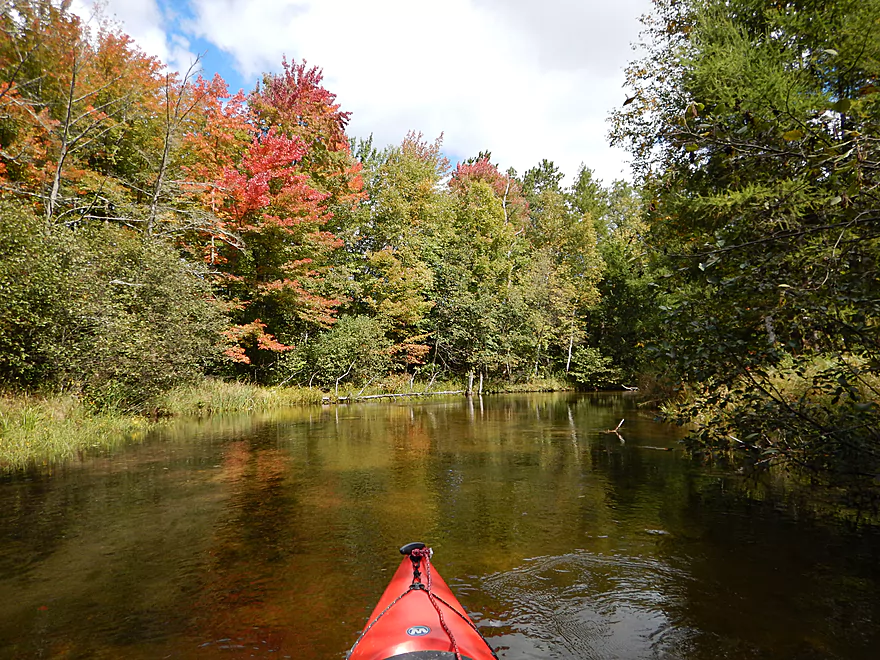
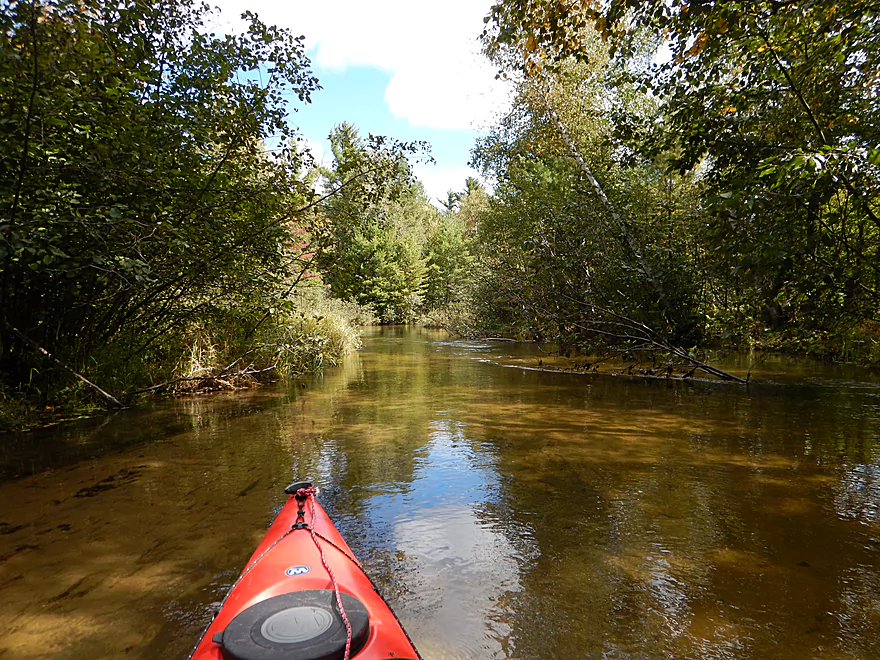
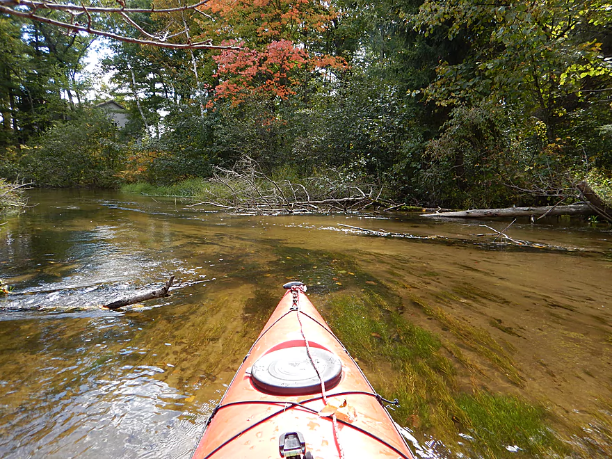
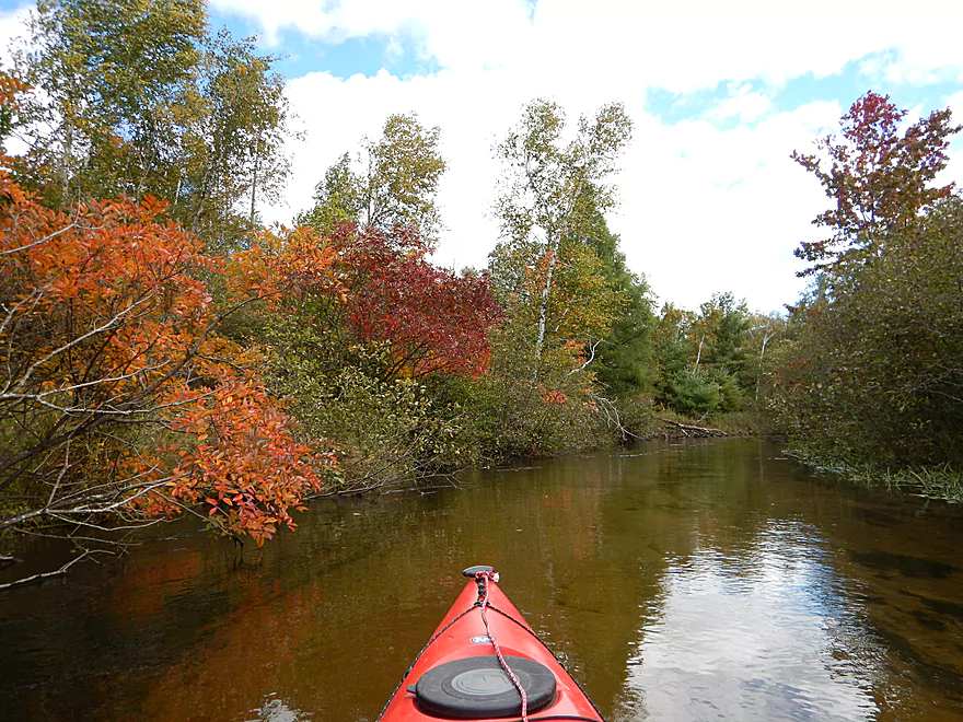
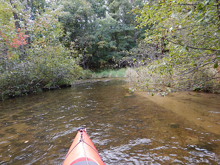
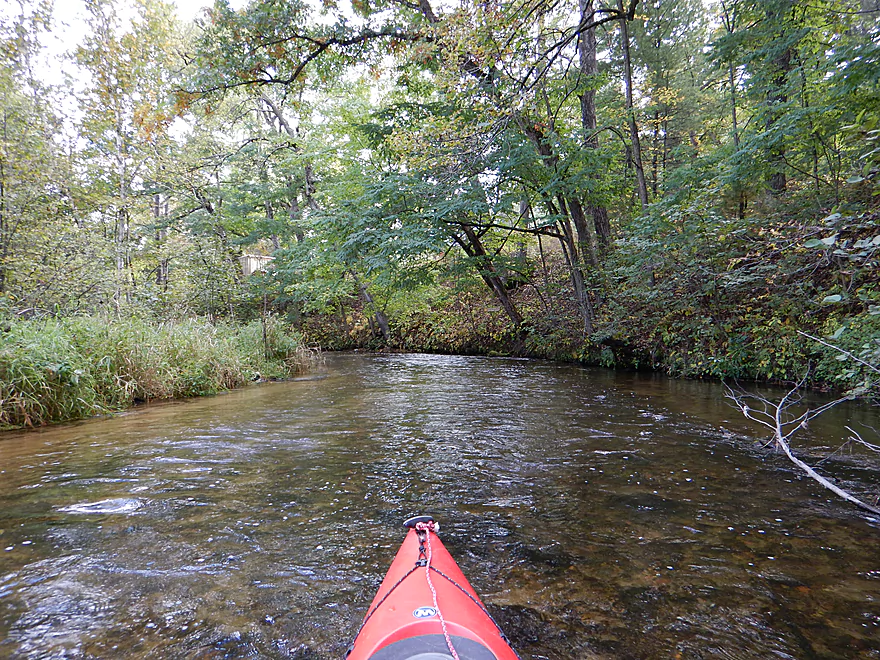
Most of the trip was like this
Occasional rocky substrate
Unique gravel pattern
This is a very sandy river
Another nice mirror picture
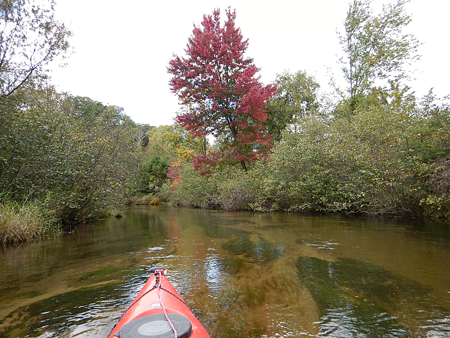
Personal favorite photo
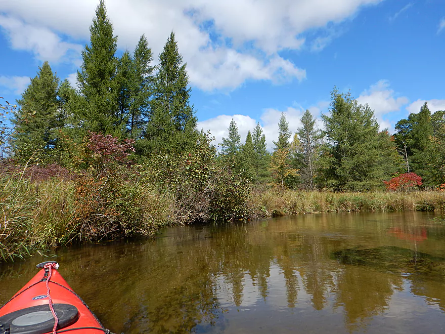
A surprising number of white pines
If you paddle during spring or high water, you may not get this
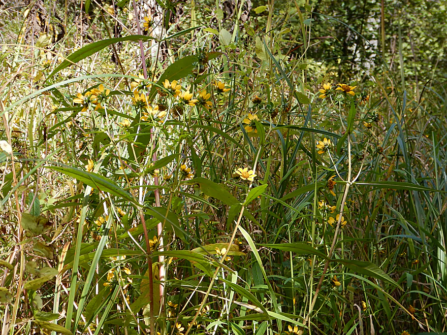
Beggar’s ticks in flower
Scouring-rush horsetail
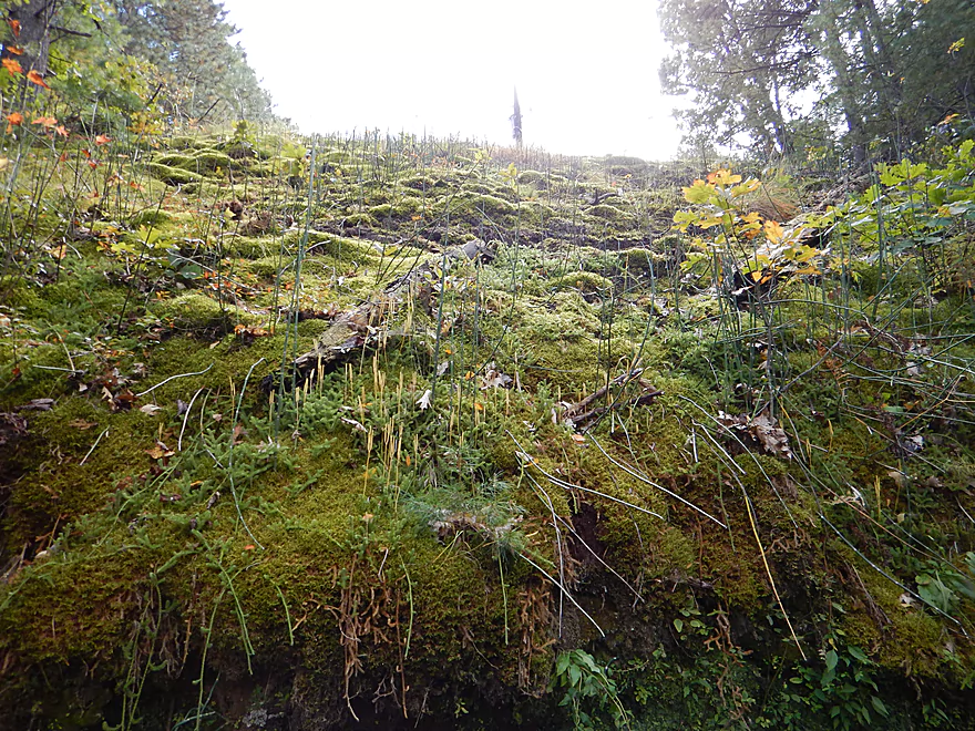
Scouring rush and club moss (front center) on moss mountain
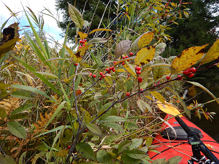
Winterberry
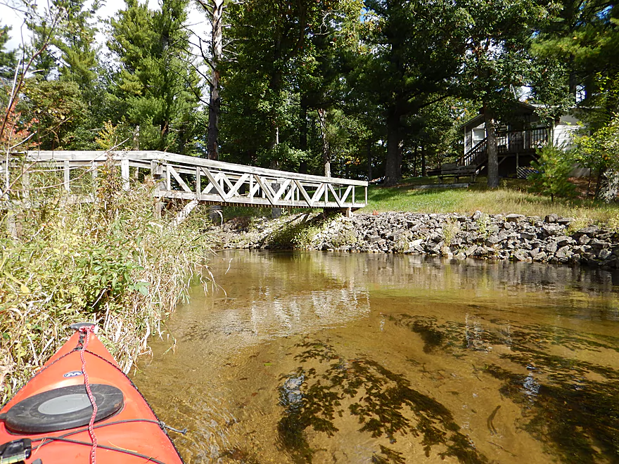
Another nice pedestrian bridge
Lot of maples on the river
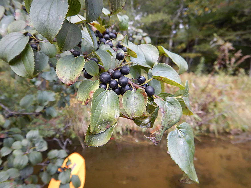
Buckthorn–attractive berries, but highly invasive
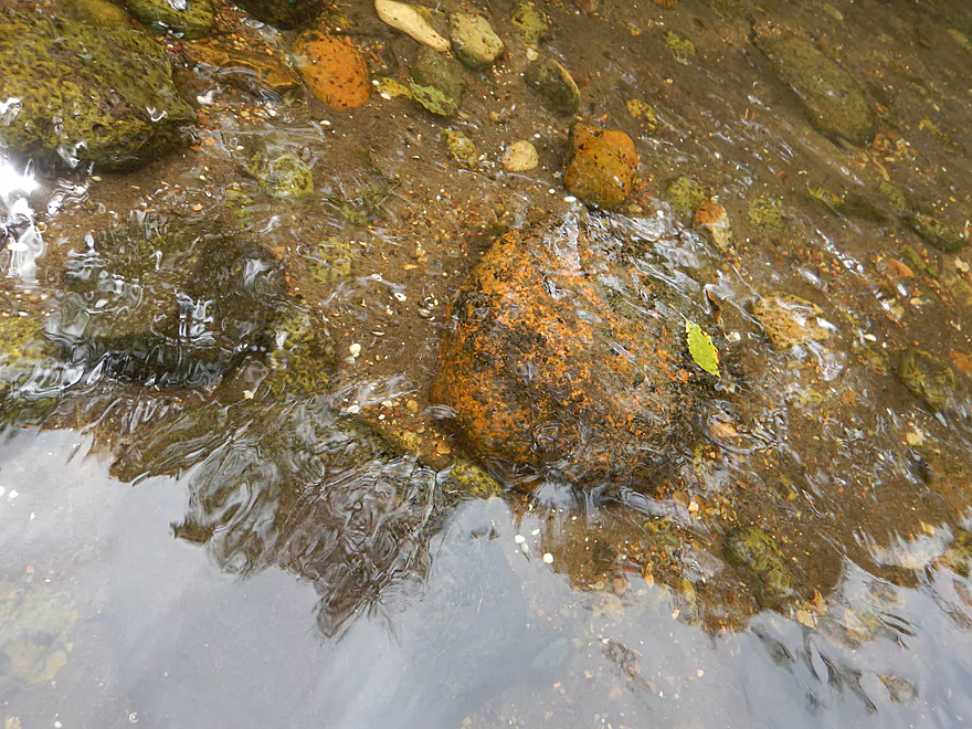
Maybe iron in the water? (looks like rust)
Current picking up into light riffles
An off-ramp sign for kayakers
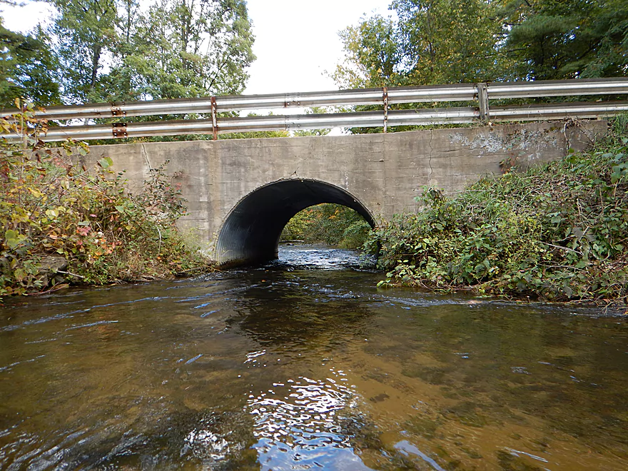
Hwy JJ Bridge
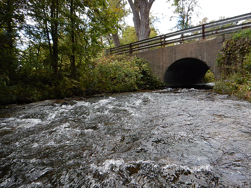
Fun rapids below the bridge
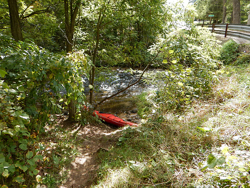
Nice trail downstream east of bridge
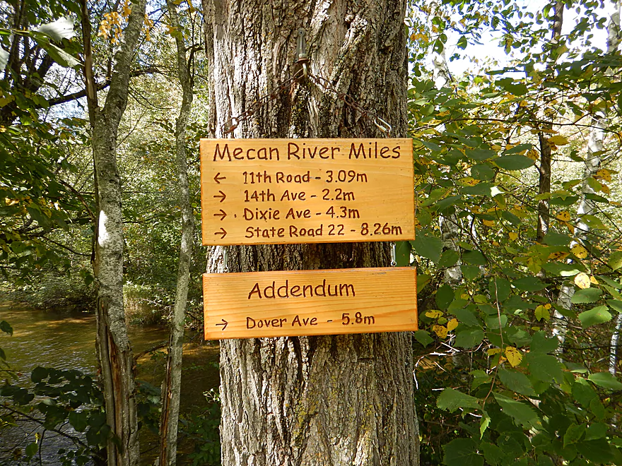
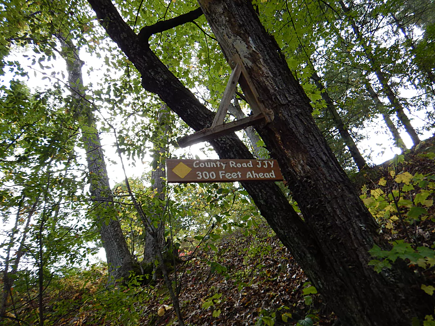
Handy distance reference (but not accurate)
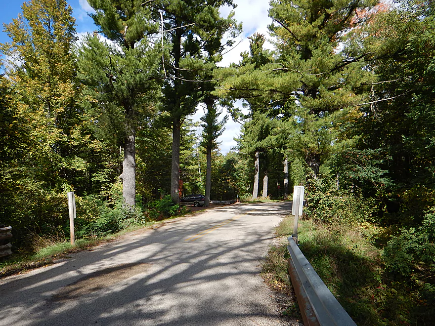
Fantastic parking under a cathedral of pines
Mecan River – Upper

Despite the Mecan being a popular paddle, this section is often overlooked and undeservedly so. This is a fine wilderness paddle and one of the clearest rivers in southern Wisconsin–a must paddle for south central Wisconsinites (you “northerners” already have lots of these type of rivers).
Very good bridge put-in at 11th Road. Small trail on the northwest side of the bridge leads down to the water and some light rapids. I suggest putting in a bit upstream so you don’t have to fight the current. Parking is available at a nice pull-off area 100′ to the north.
There is a popular livery in “Mecan River Outfitters” but I don’t know if they put in this far to the north. Their number is 920-295-3439. I had trouble reaching them, so perhaps they don’t have fall hours. There is another rental service in “Lake of the Woods Campground” but I don’t know much about them. Their number is 920-787-3601.
Otherwise, this is an easy bike shuttle. Relatively flat, no gravel, minor traffic and only 2.34 miles.
The Mecan is largely spring-fed, which keeps the river extremely stable and means it can usually be paddled when other rivers are too high or too low (especially the upper sections). I’ve included a reference to the nearby Silver Creek gauge at 30 CFS (not a super accurate representation, but better than nothing). It had recently rained in the area, but I don’t know if that affected the depth much. I suspect it was a tad above average and certainly could have been paddled at a much lower depth. I never once got stuck on any shallow areas for reference.
The gradient is a medium 4′ per mile, with some riffly areas near the put-in and take-out. Much more consistent and with less “slow areas” than the next section of the Mecan.
FANTASTIC water quality and this is the “star” of the trip. The reason why the water is so clear is because the river is largely spring-fed. While the next (more famous/popular) segment of the Mecan has nice water quality, this was actually much better. For the most part, the substrate is sand (this is a very sandy part of the state), with occasional attractive gravel beds.
I’ll start quick with a personal anecdote. I’ve paddled the Mecan before, but from Hwy JJ to Hwy 22 (the classic section). Really liked the river and was definitely hoping to revisit the river this year. A video review by “Morrall Films” spoke highly of a downstream section from the Germania Marsh to 2nd Hwy N bridge. Alas, it was not to be. I had called the local livery three times, but nobody answered. That’s okay, as this seemed like an easy bike shuttle. I drove up to the marsh dam and discovered the main road to the dam (and the put-in) was blocked by a gate. Ugh…deja Grand River. I suspect (if this is the same as the Grand Marsh), the DNR opens this only from May to Labor Day and then a brief period afterwords for gun season. I would have to drag my kayak 940′ from the parking lot to the dam…which was doable in my book. I had dragged a kayak 700′ just a week earlier for the East Fork of the Black River. So I locked up my kayak and drove down to the Hwy N bridge to park the car and start the bike shuttle. When I took the bike out of the car, I realized one of the quick release bolts for the front tire was gone. Frantically searched everywhere for it with no luck. I decided I had driven this far, why not try a “walk” shuttle at five miles (or hitchhike). At about a mile in, nobody passed my way and it started to rain (was a 0% chance of this in the forecast) First time I gave up on a trip.
The next day was Sunday and with a fixed bike, decided to give the Mecan another go. Because of the rain, I was worried that the lower sections would be not flooded per say but higher than preferred, so decided to do a far upper section instead and am glad I did.
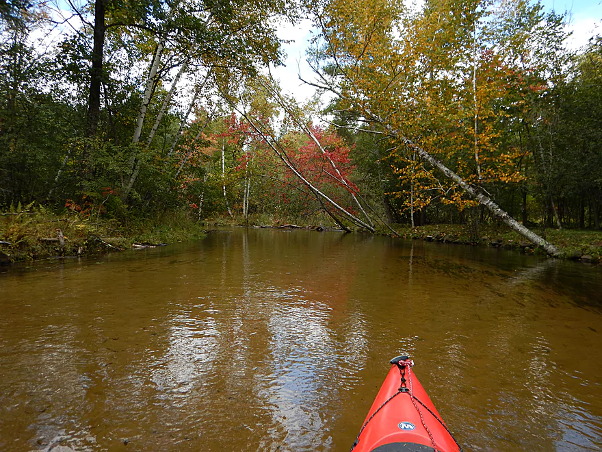
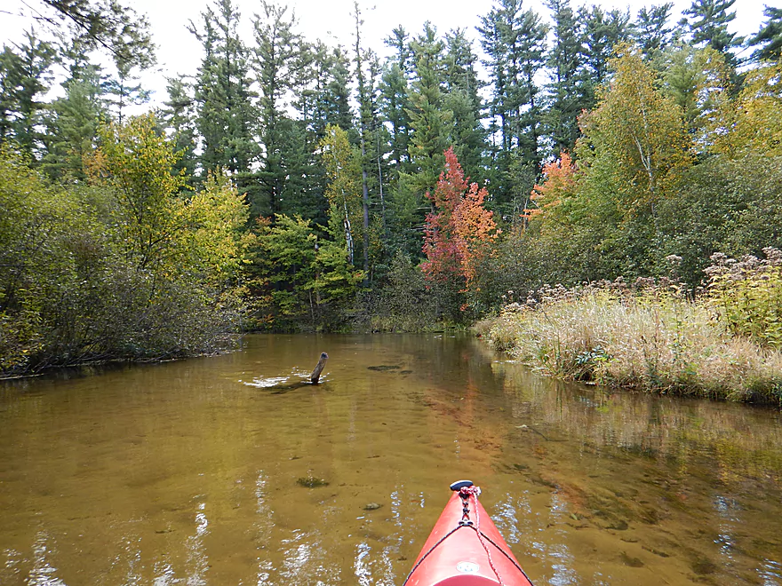
This far upper section (about 4 miles upstream of the popular JJ launch) is rarely paddled, most likely due to rumors (false) of deadfall in the water. I would be surprised if you saw another kayaker on this stretch, despite how popular the next section of the Mecan is. For this trip, I lucked out on the timing (mid-September) as the trees were turning color and the color was terrific. I had paddled the lower Mecan early in the spring when everything was so dead, and it was such a nice change of pace to see the trees fleshed out and in color.
The combination of clear water, clean sand, lack of mud banks and attractive white pines really made this a five-star trip…a trip I easily preferred to the next river segment as the current was more consistent, water cleaner, and the plant life/trees were better.
Some dragonflies but not much else I can remember (the disadvantage of being so behind on my reviews). Some nice aquatic plants, but generally mostly a sandy substrate. Some of the plant highlights were wild mint growing by the put-in, numerous white pines (Wisconsin’s largest tree), and gorgeous fall colors (especially the maples). More wooded and not as scrubby as the section after Hwy JJ. There were two nice, I believe, sandstone banks, but they were absolutely plastered with mosses, lichens and other exotic plants, so it was difficult to tell what rock was hiding behind it all. Many ferns but not as many as after Hwy JJ. Numerous wild berries on this trip, but all I think are toxic. Many dying wildflowers and this would have been a great July/August paddle for them.
No log jams, thanks to the clean-up efforts of locals. Maybe a tight duck-under at one point, but not bad. There were some light rapids, but mostly minor (really, the put-in and the take-out are the main ones). The Hwy JJ rapids are rockier and faster than you would think…almost class 2. I “t-boned” my kayak in these rapids a few years ago so know not to underestimate them, but honestly, they are pretty easy and safe (very shallow water too if something were to go wrong).
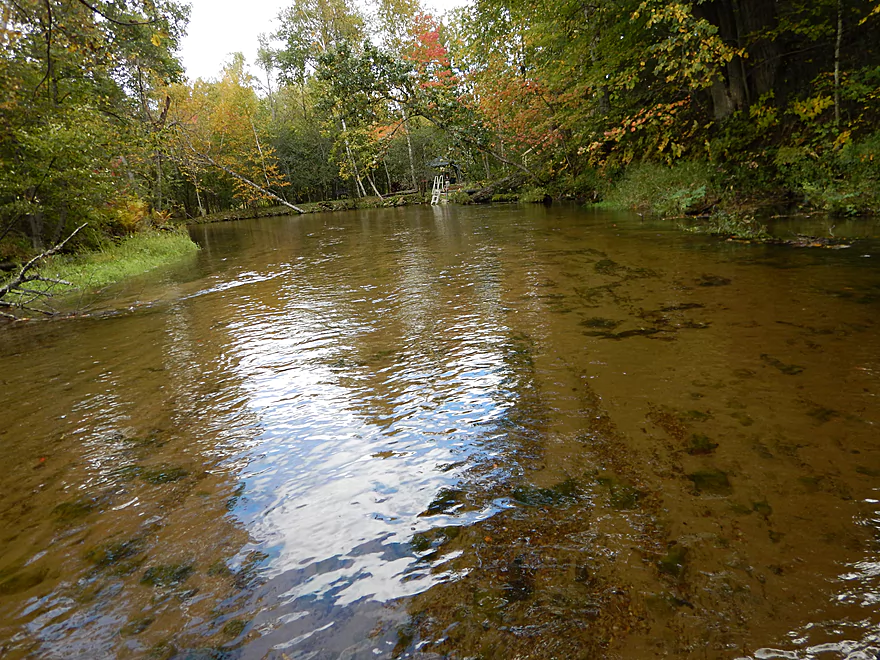
Very good bridge take-out either above or below the bridge. On the SW side, there is a nice grassy launch area that you can use if you want to avoid the rapids. There is private property nearby, so be considerate. The main put-in is at the NE side of the bridge with a small trail leading down below the rapids. The rapids are fun and you should definitely run them! On the NW side….maybe 50′ to the north, is the main parking area under an attractive white pine canopy. Warning: this lot does fill up in the summer, so you may want to come early. Might be able to park by the road, but it wouldn’t be ideal.
Very little. The river (up to this point) is largely spring-fed and reasonably protected from commercial, agricultural and residential pollutants. You’ll see only a couple of homes on the river, which is very nice.
Detailed Overview
Generally speaking, the further upstream you go on the Mecan, the better. Upper Mecan segments tend to have less mud, better current, better clarity, and more attractive shorelines.
- Mecan Springs to 9th Ave: 1.4 miles.
- Mecan Springs Boat Launch to Hwy GG: 0.6 miles. The river starts as a spring-fed lake sandwiched between two moraines. This is a neat lake paddle with clear water and visible springs located mostly along the western end. Trip length can be expanded by 1-2 miles if you explore the various bays throughout the lake.
- Hwy GG to 9th Ave: 1.4 miles. The first mile of the river has a few snags to dodge, but is super scenic with nearly perfect water clarity.
- 9th Ave to Hwy 21: 2.3 miles. Satellite maps indicate there could be many logjams and portages.
- Hwy 21 to Cumberland Road: 2.3 miles. Satellite maps indicate there could be many logjams and portages.
- Cumberland Road to 11th Ave: 3.9 miles. A great section with fast current, clear water and scenic white pines. A few logjams to portage but not bad.
- 11th Ave to Hwy Y/JJ: 3.7 miles. A fantastic section and my favorite on the entire river.
- Hwy Y/Dakota to Dixie Ave: 5.4 miles.
- Hwy Y to 14th Ave: 2.8 miles. An excellent section with white pines, tamaracks, narrow twisty turns and crystal clear water.
- 14th Ave to Dixie Ave: 2.5 miles. While not as good as the previous leg and more open, this is still a good stretch. This includes the "Mecan River Pine-Oak Forest State Natural Area".
- Dixie Ave to Hwy 22: 4.5 miles.
- Dixie Ave to Dover Ave: 2.0 miles. An ok section, but not as good as upstream sections. Even more open and slower, with far fewer pines.
- Dover Ave to Hwy E: 1.8 miles. River starts to become less interesting but is still ok.
- Hwy E to Hwy 22: 0.7 miles. Nothing special about this section. Open and somewhat simple.
- Hwy 22 to Germania Marsh Dam: 5.8 miles.
- Hwy 22 to Duck Creek Road/Electric Fence: 4.2 miles. More open and not as interesting, but the brisk current and good clarity are enjoyable.
- Duck Creek Road/Electric Fence to Dam: 1.6 miles. River slows and empties into a mile long shallow marsh. The Germania Marsh features nice scenery and good wildlife. Take-out is on a small access road off Hwy N.
- Dam to Elk Road: 6.3 miles. The most popular section on the Lower Mecan.
- Dam to Hwy N: 5.2 miles. River turns into a flowage pond and marsh. Take-out is on a small access road off Hwy N.
- Hwy N to Elk Road: 1.1 miles. The river completely moves east, creating a really cool corridor.
- Elk Road to Hwy 23: 2.4 miles. Traditionally a section with many logjams, but it does get cleared out periodically by the local livery. Hwy 23 is a poor access option.
- Hwy 23 to Hwy C: 2.7 miles. Again, this usually has logjams but they are often cleared out by the locals. Hwy 23 is a poor access option.
- Hwy C to Mouth: 1.1 miles. Simple open stretch leading to the Fox River.
- Mouth to the Princeton Locks: 3.1 miles. An uninteresting stretch on the Fox River.
For further information on the Fox River, see my Fox River review.
Trip Map
Overview Map
Video
Photos Size:
I love this part of the Mecan!It has a real “Up North” feeling. I’m glad to see someone cut a path at that downed tree. I had to portage over it with my wife and daughter. It was one of my daughters 1st time out kayaking and she wasn’t happy.
I really like your site. It has a lot of good info on some of the smaller rivers and creeks that I like to paddle. If I could make one suggestion, Date of the trip.
Thanks for the comment! I actually might be up there tomorrow… As for dates, they are posted on the front page, but yeah, I might post these on the trips themselves in the future.
Hi Aaron,
If your going to be up in this area, you might like to try Neenah Creek. The water level is high right now which makes it paddlable. I put in on Co. Rd. CX and paddle down to the Fox. Then get out by the Co. Rd. CM bridge. Plus with the water level so high you can get around all dead falls.
Appreciate the info. Actually prefer shallow paddles if possible and might head down to Southwest Wisconsin (the only county it seems that hasn’t been deluged in rain). We’ll see…
I did this trip today from 11th St. to 14th Ave. with a bike shuttle. The paddle was about 7 miles and took me 2 1/2 hours. It was such a wonderful place! Thank you for your write up, it encouraged me to try this river. I was able to navigate the hairpin turns, riffles, and dead fall in my 10 foot kayak.
Thanks Marsha for the comment!
Just did this section yesterday, a few duck-unders, but otherwise it is clear all the way. The water was crystal clear and the fall colors were just starting to show. It should be spectacular in the coming weeks. We had bikes to do a bike shuttle but happened to stop in at Blader’s Dakota Inn,and found someone who offered to give us a lift top the top for free (5-10 min drive). Blader’s is just a few hundred feet from the JJ bridge, and is a good place to grab a burger and a beer and/or use the bathroom before or after a trip.
Appreciate the comment Eric! Good to hear that the upper section is mostly clear.
Forgot to mention that we had 14′ kayaks, and did not feel they were too big, some sites and books I saw recommended against anything bigger than 13′, I don’t know about the lower sections but this section is totally doable in a 14’if you have have level of boat control.
Appreciate the tip about the kayak length. The upper Mecan can be be fast and tight for longer kayaks, but yeah good experience can help.
Six of us made this trip from 11th Rd to 14th Ave. (6.8 mi, 2 1/2 hours, 14.5 cfs, 3.7′ at Chaffee Creek). The flow was excellent and the clarity incredible. There were no portages required, though plenty of evidence of clean-up after the July 2019 wind storms. That was much appreciated!
That’s terrific news that the Mecan is navigable. I initially feared it would be in bad shape from July’s derecho. Thanks for the update.
We did the section from 11th to 14th Ave on 5/30/22, the Silver Creek gage was at about 45 CFS, Chaffy Creek was at 12.3 CFS, Levels were good, no portages, no bugs, jsta a few slideovers/duck unders. The paddle was about 7.2 miles and took us 3 hrs including a short stop for lunch. A great trip and a good place to do a bike shuttle. The “Zelensky”* and the take out are both easy with plenty of parking. The water clarity is fantastic as is the scenery. An absolutely beautiful trip that I would recommend to anyone. You could easily extend this trip by starting further upstream at Cumberland Rd or ending further downstream at Dixiec, Dover, Hwy E or Hwy 22, but I agree that the river becomes less interesting and scenic after 14th Ave. Here is a link to a video/map/pics of our trip using the Relive App which I highly recommend. https://www.relive.cc/view/v1OwQJ37NXq
Logjam update…as of Sept 16, 2024 Cumberland to Y was recently cleared of jams by Mad City Paddlers, but there are still some low trees that have to be ducked under.
Logjam update…Mad City Paddlers just cleared out a jam between 11th and Dakota. https://www.facebook.com/MadCityPaddlers/posts/pfbid029Qkz9B4jz9oQPVm9AEkbF8aEWjDiDdegZvsGbq5wXpcmNbbfYh55PVWTm1F57UAZl