
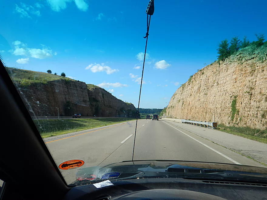
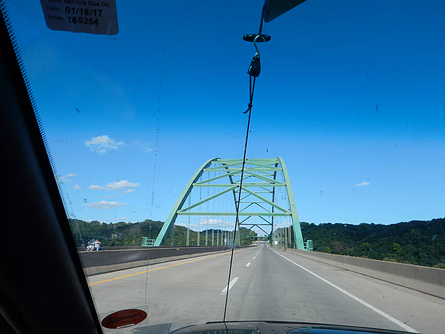
Scenic drive to Iowa on Hwy 151
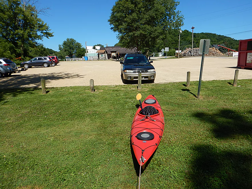
Starting the trip by Burtons Furnace Road
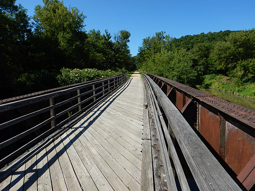
There is a popular bike path nearby (the Heritage Trail)
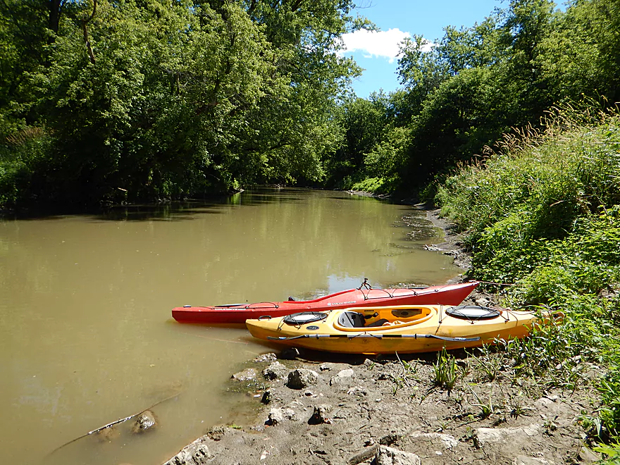
Great canoe launch, poor kayak launch

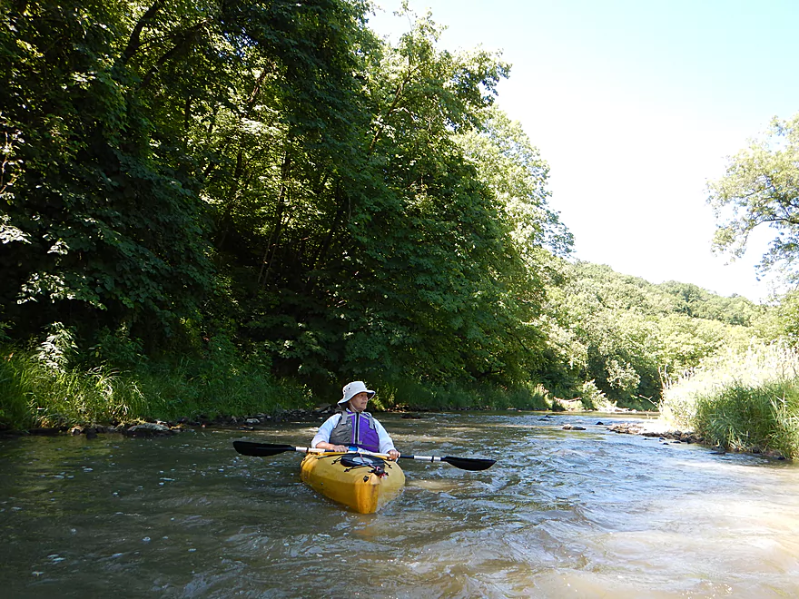
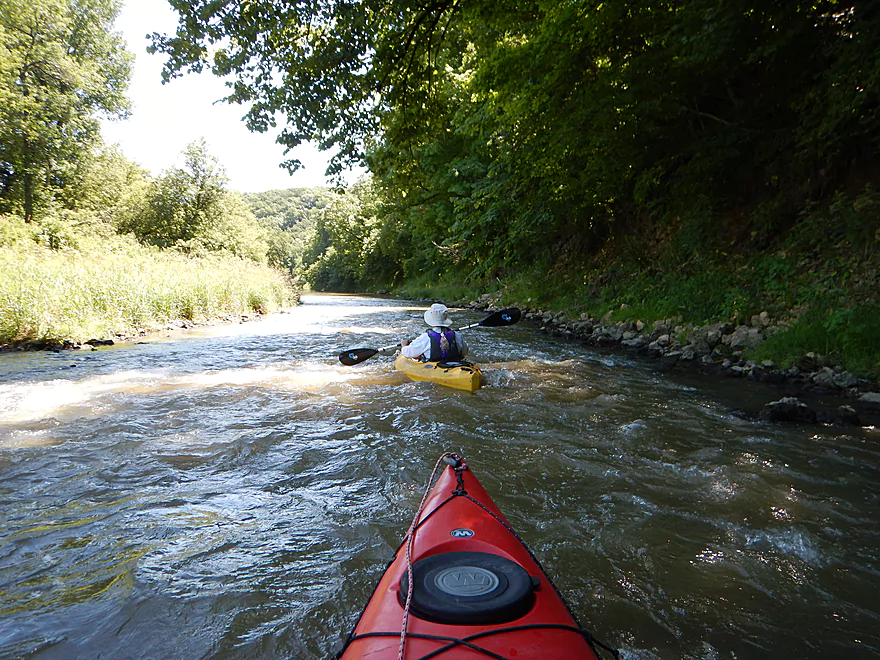
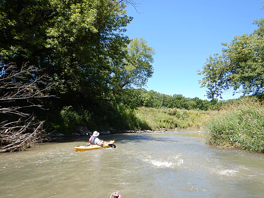
Light rapids to start the trip
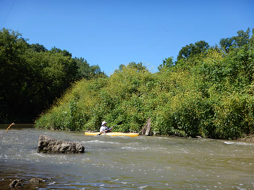
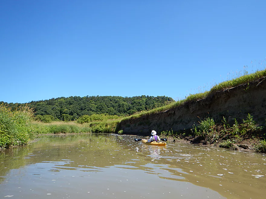
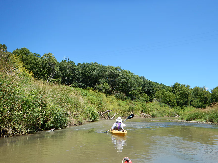
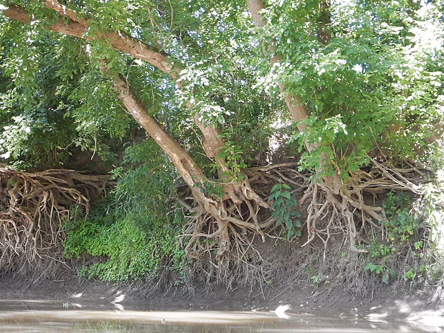
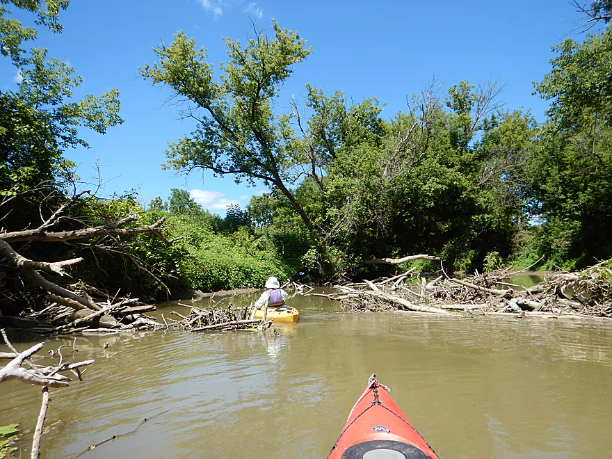
The dirt banks were huge…
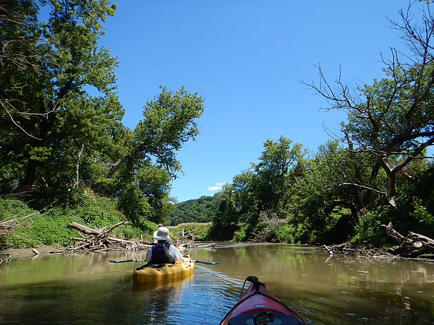
First half of the trip was zippy
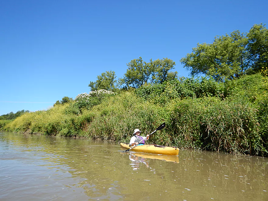
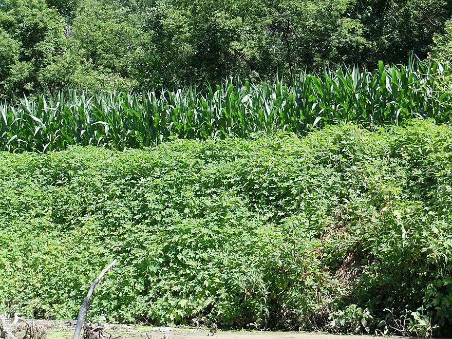
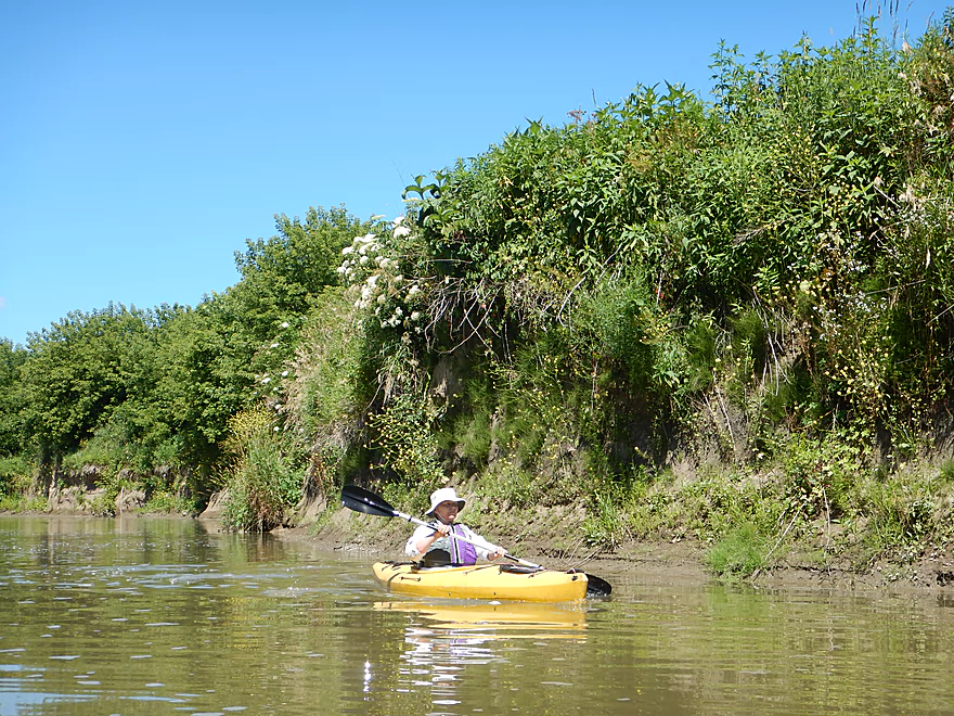
Weedy banks with many invasive species
Tons of Japanese Hops (very invasive)
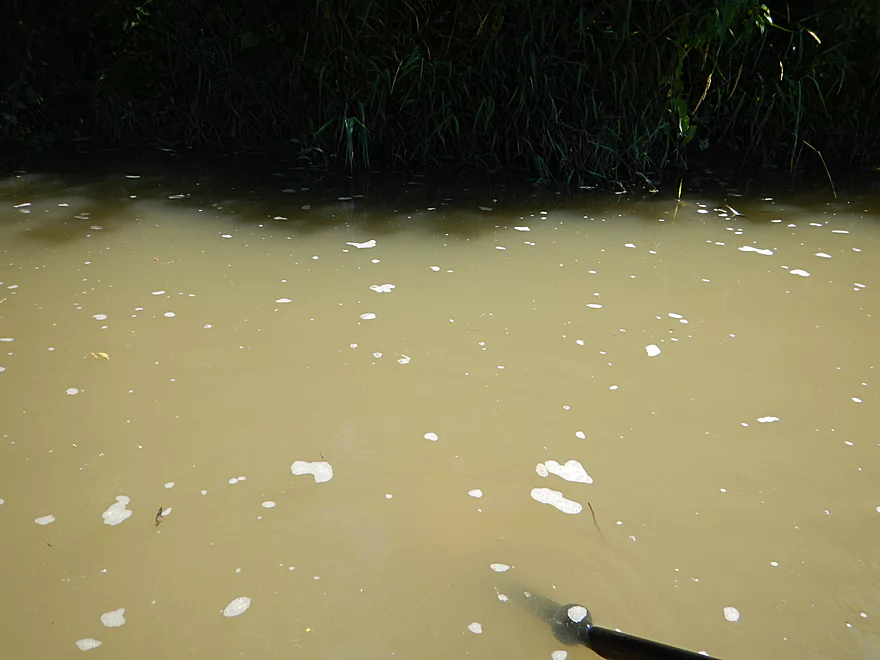
Water quality was not good
At times a very deep river
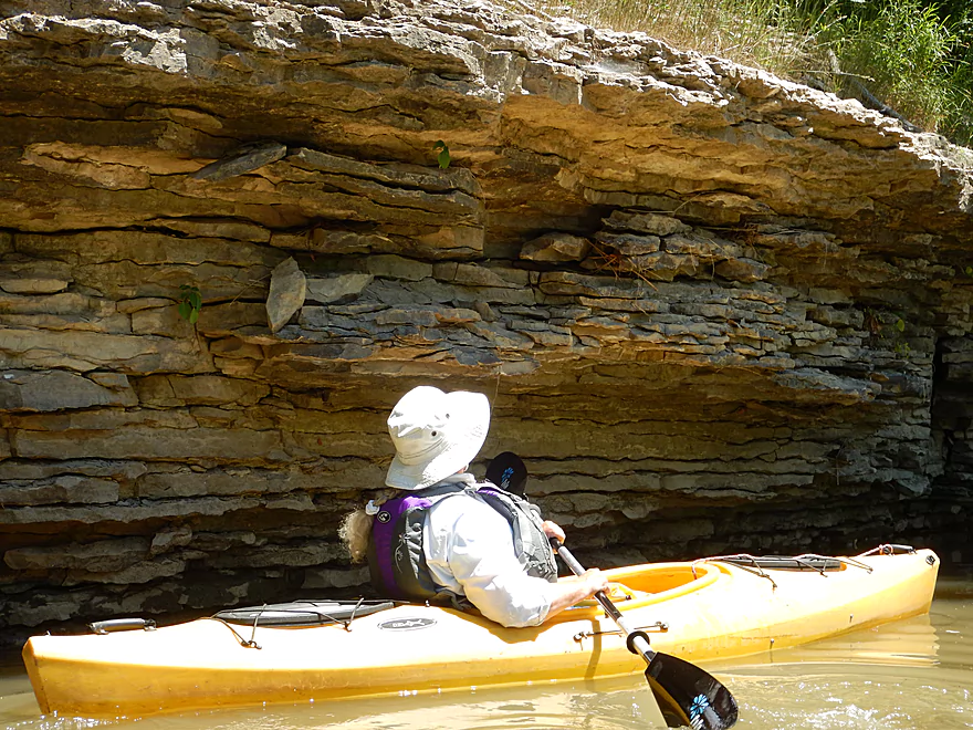
At first we thought these were nice limestone outcrops…
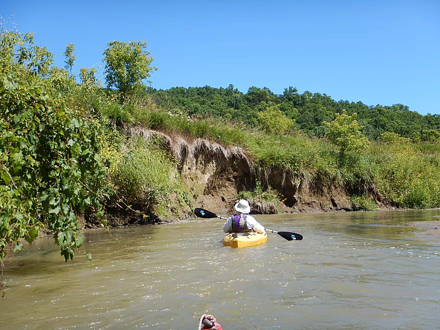
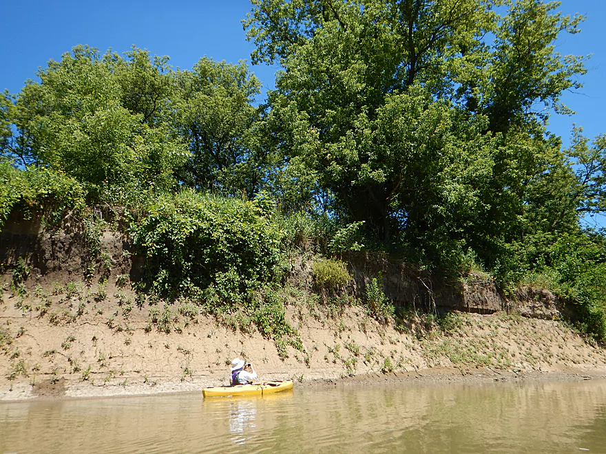
Very exposed banks
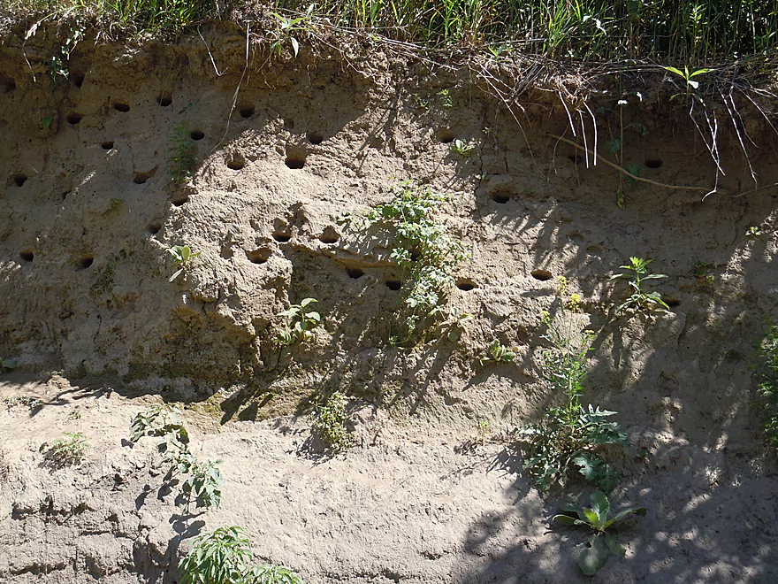
But home to local bank swallows
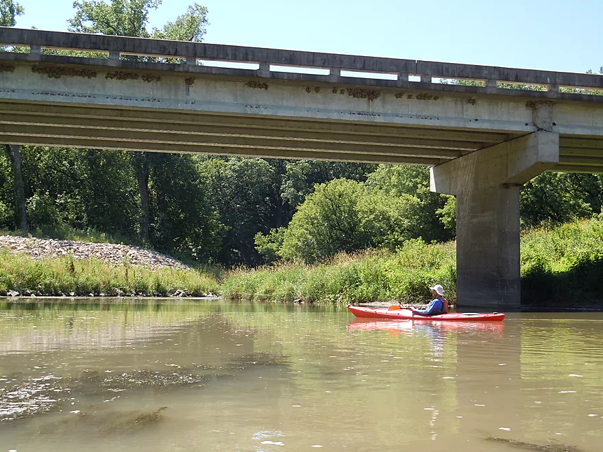
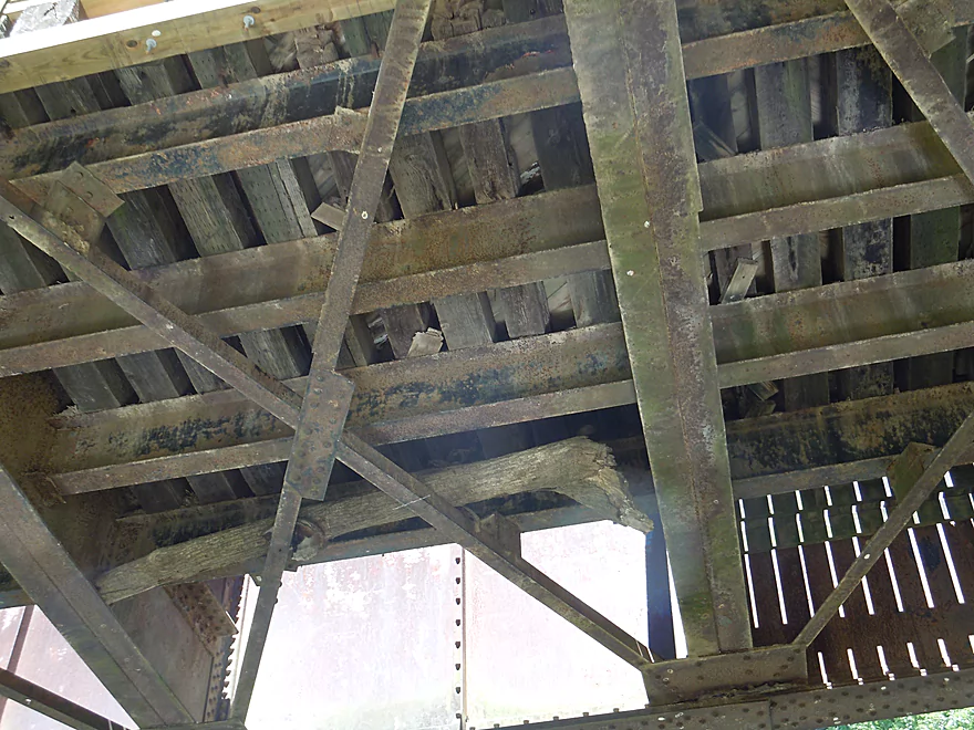
Paddling under Access Road
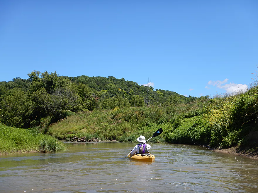
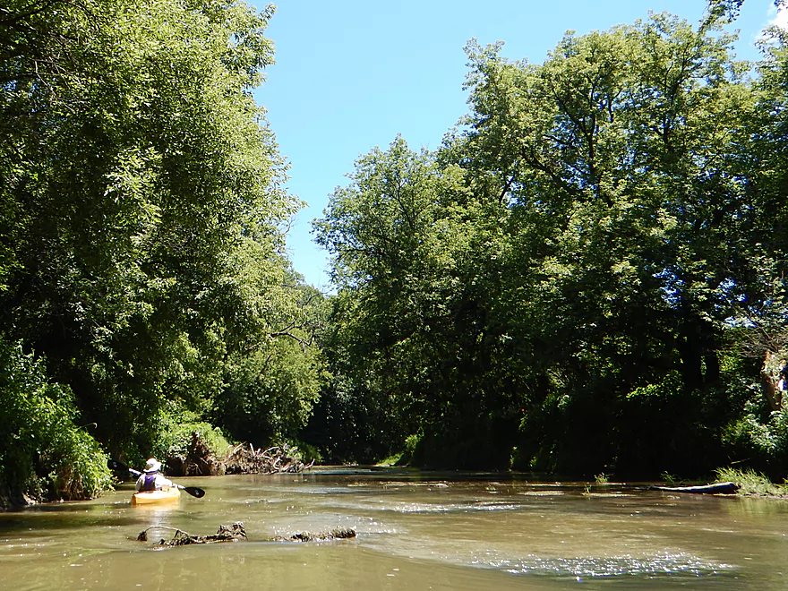
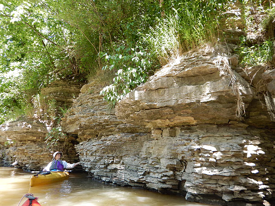
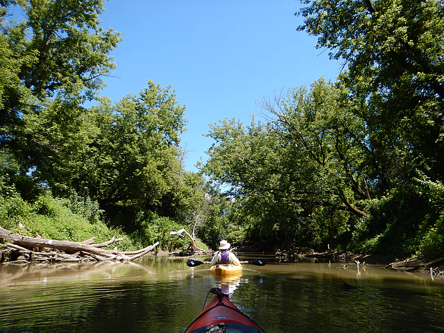
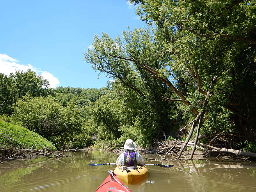
Entering a nice section by a steep hill
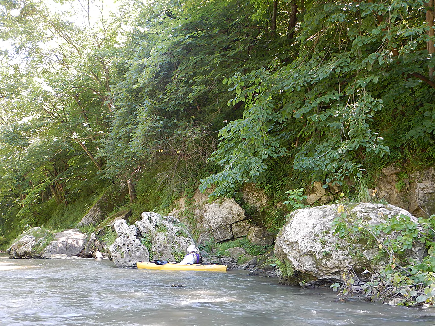
Some large boulders
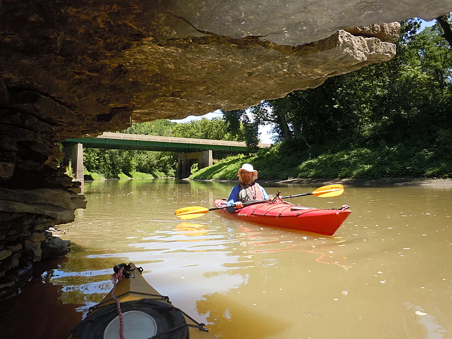
A trip highlight
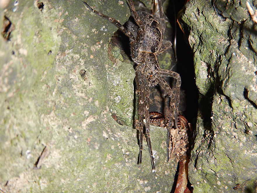
Huge fishing spider
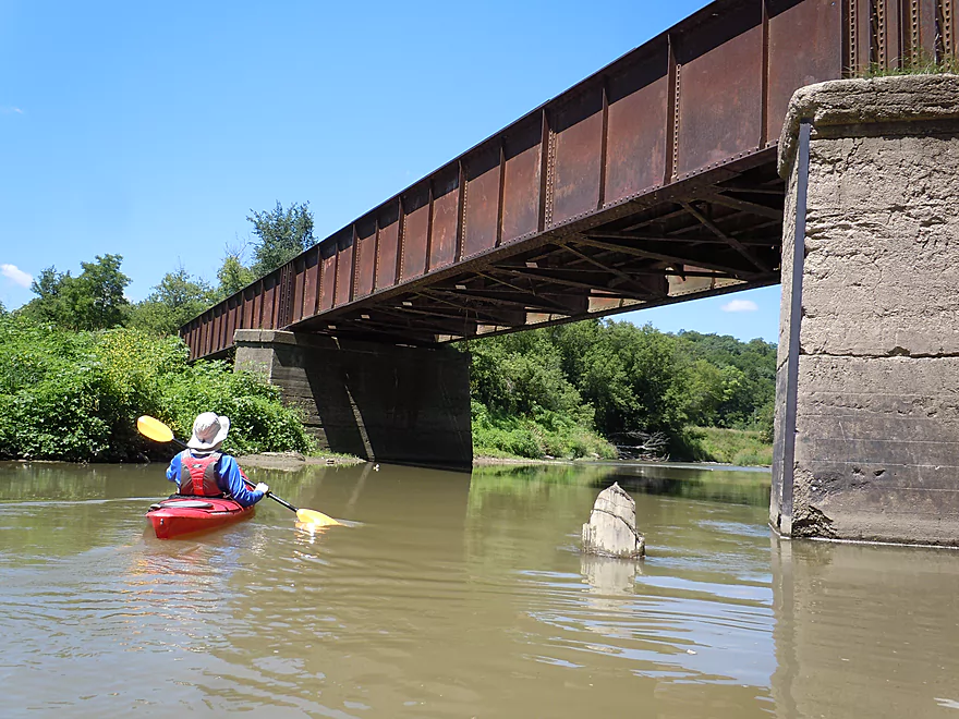
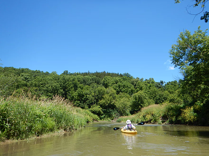
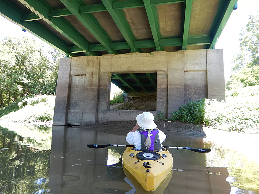
Paddling under the Heritage Trail
This creek does experience serious flooding!
Still fun riffles
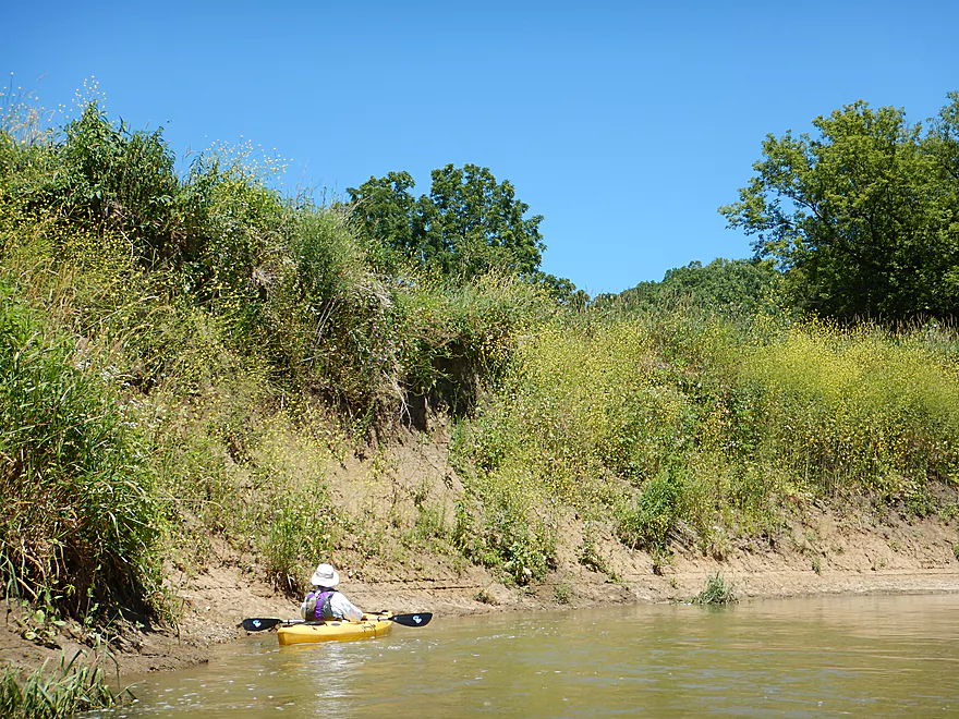
These dirt banks were kind of scenic
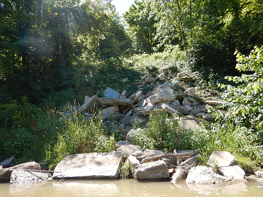
Tragedy of poor land management
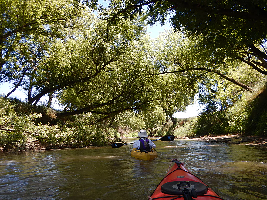
Pleasant open section
Nice hills (but thought they would be much bigger)
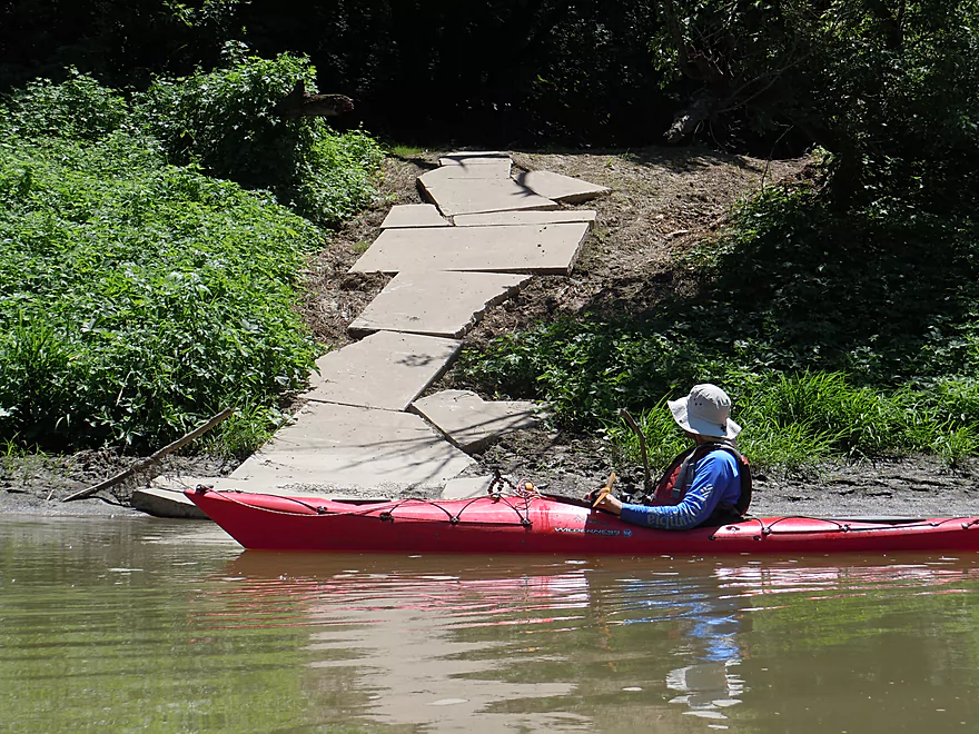
Interesting sidewalk
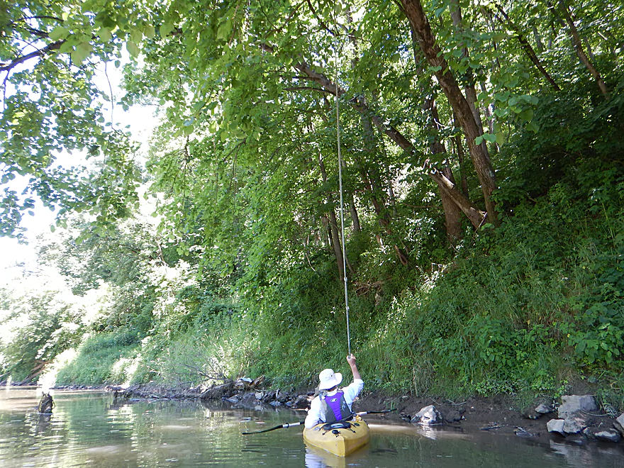
A swing rope
Just do not let go of the rope
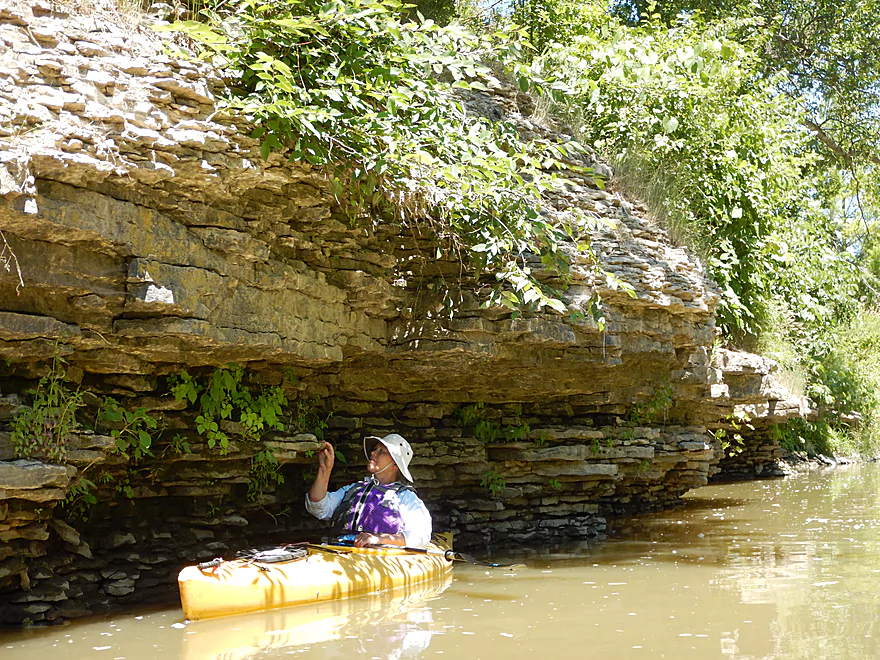
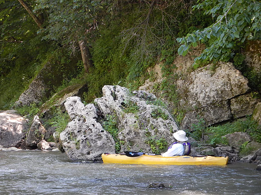
The second limestone outcrop
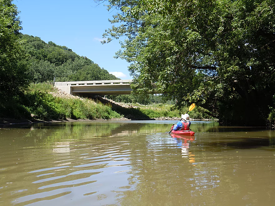
Just by Hwy 52/3
Hiding behind that interesting bridge pylon…
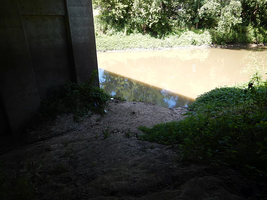
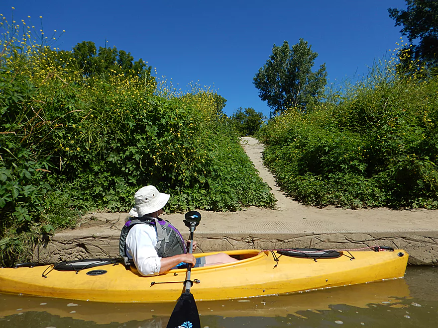
Is a popular take-out path for paddlers
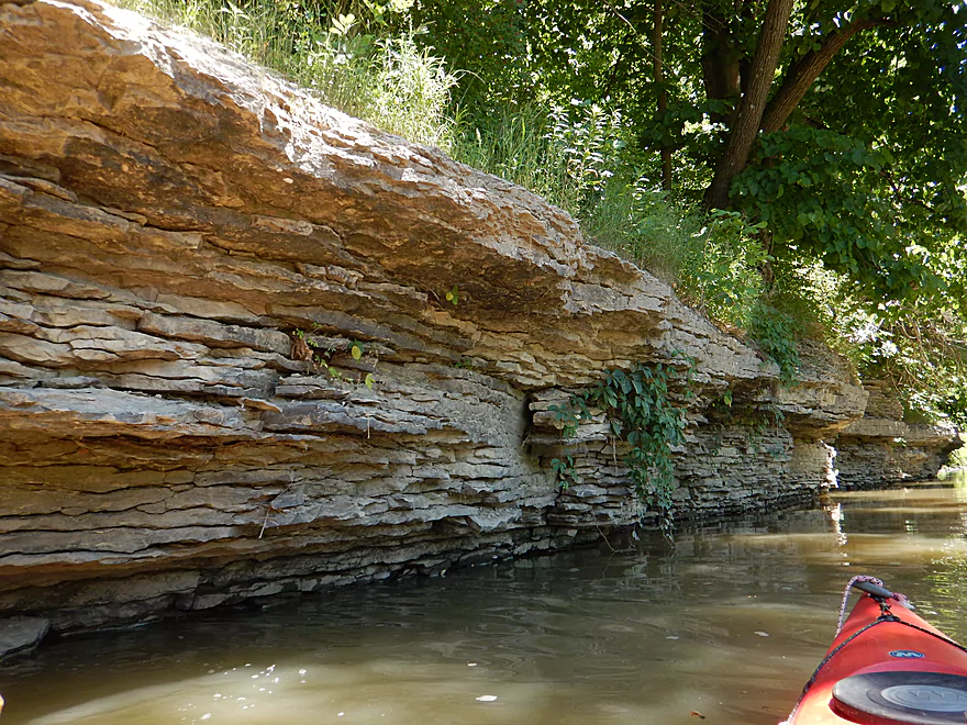
But if you continue on, you can see more outcrops
Cool texture
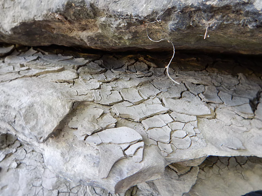
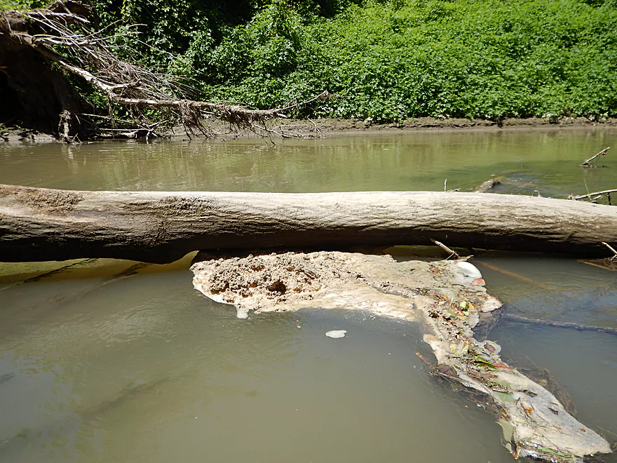
Mud left on the limestone shelf from earlier flooding
Last few miles had a lot of debris
Clinging to the banks for dear life
It looks bad, but we never had to portage
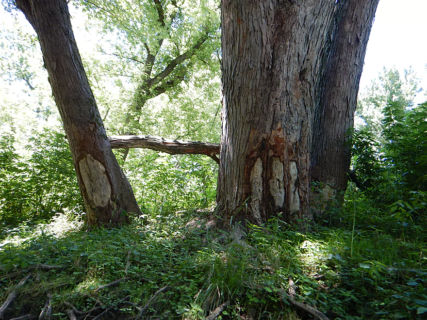
Skinned knees from winter ice flows
Finally at our take-out
Herbert Road is muddy but doable
It is a long hike up the embankment to reach the car
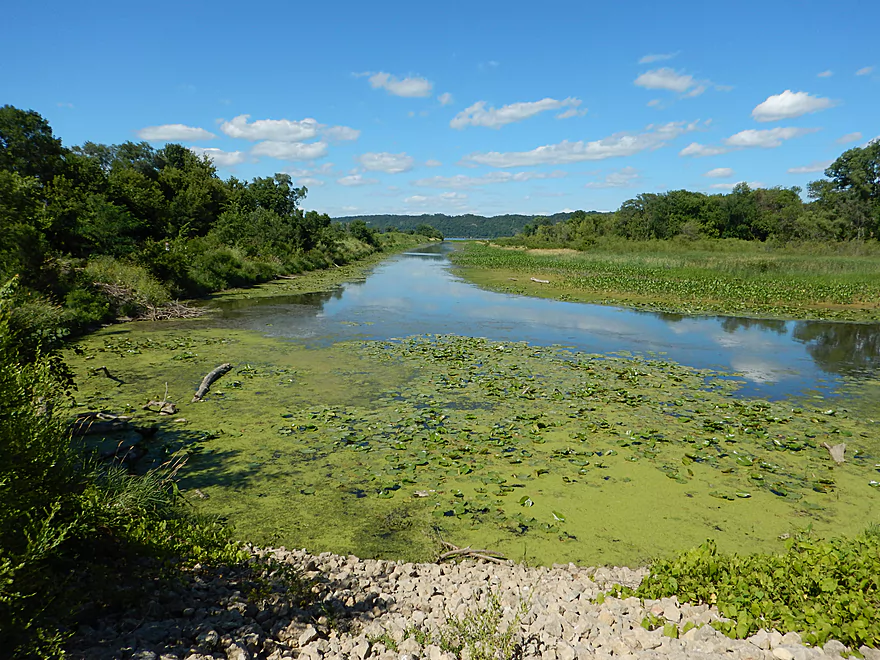
Really cool lily beds at Deere Dike Park
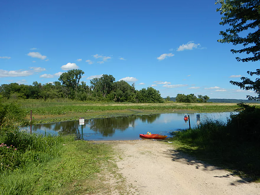
Great boat launch can serve as an alternate take-out (or put-in)
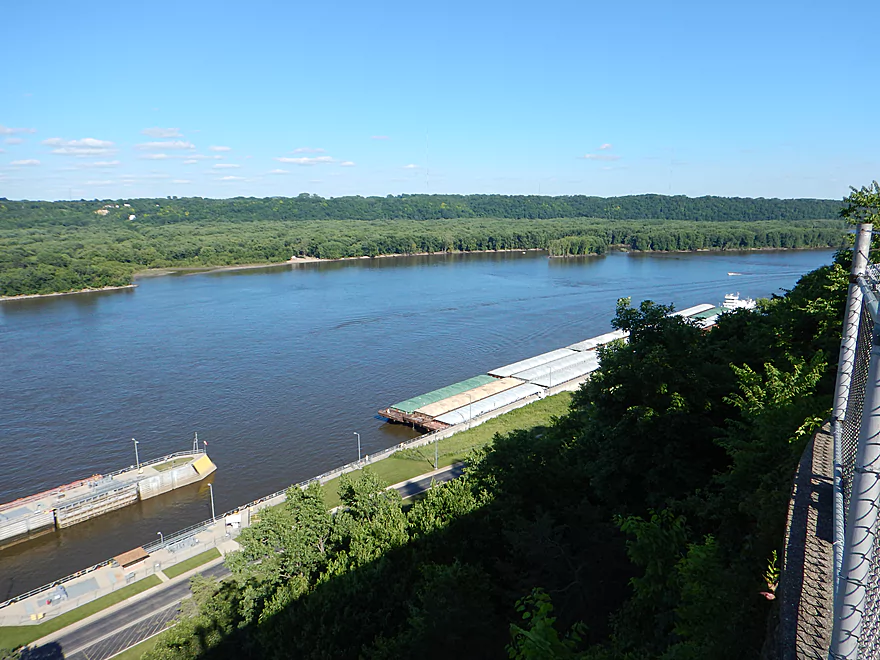
Checking out a barge from Eagle Point Park
Because of the local dam, it has to go through the locks
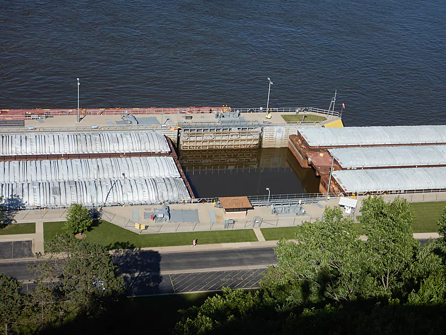
But does not fit, so has to be split up
Looking upstream
Driving back to Wisconsin
Little Maquoketa River


The Little Maquoketa River is a Mississippi tributary just north of Dubuque, Iowa and west of Grant County, Wisconsin. It’s not a very long river that splinters into shallow tributaries upstream of Durango, but downstream to the mouth it is plenty big enough for paddling. I initially heard about it from the book “Paddling Iowa“, which got me excited to do the trip based on a positive description of car sized boulders, limestone walls, and coursing through one of Iowa’s deepest valleys.
Perhaps my expectations were unrealistically high, but honestly I was pretty crestfallen when I saw the take-out and then the put-in. Aside from the strong cow manure smell, the river was incredibly muddy, water clarity was nonexistent, and strange things floated on the surface of the water. Much of this river flows through steep terrain and farm country, which with poor to no regulatory oversight, has resulted in devastating erosion and damage to the river (much worse than I’ve ever ever seen in Wisconsin).
Once we started the paddle, the clarity never improved, but the first third of the trip was perhaps the most interesting part and reminded me somewhat of the lower Grant River. Very open, with occasional riffles and Class 1 rapids flanked by large mud banks and cornfields. The pools were incredibly deep (4-6′ on average) with some much deeper (wear your life jacket!), while in contrast the riffles were shallow and bumpy. The banks were filled with “disturbed ground” species and invasive weeds (especially Japanese Hops) which gave the river a messy, disorganized vibe. Many of the mud banks were massive (say 10-20′ high) and bigger than any I’ve seen on any Wisconsin river.
Shortly after Access Road, the river arcs south and enters a nice area flanked by a wooded hill to the north. It’s here that we encountered the three large limestone boulders I saw pictured in “Paddling Iowa”. While nice, that was pretty much it for boulders on the entire river (not counting all the concrete fill that had been dumped haphazardly into the river).
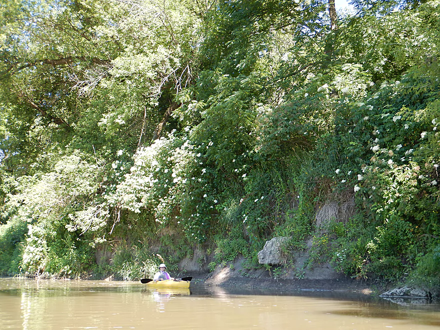
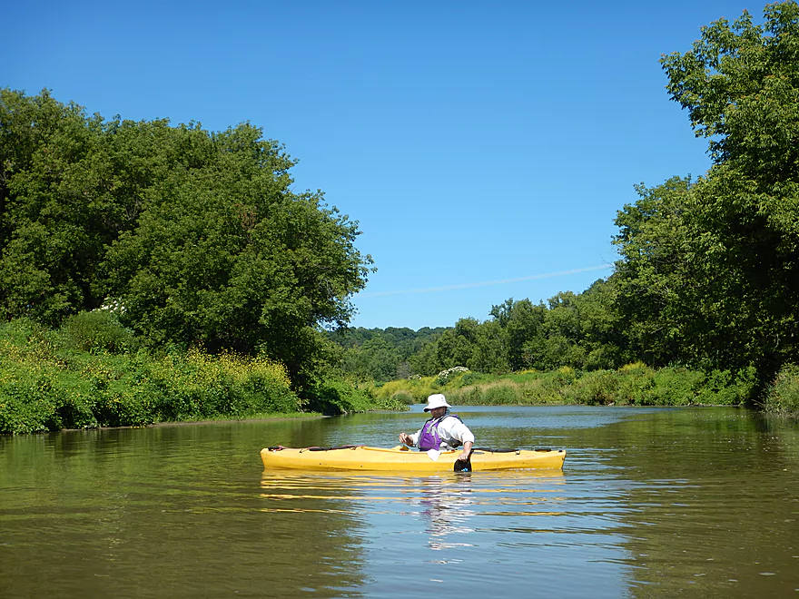
Following the Heritage Trail bridge, the river arcs north with views of the adjacent hills. This was nice, but the hills didn’t seem especially big or special, which I had firmly expected from the guidebook description that this river flowed through “one of Iowa’s deepest valleys”. Maybe this is nicer in the spring or fall when the hillsides are more visible. There are certainly enough sugar maples to make for an interesting fall color trip.
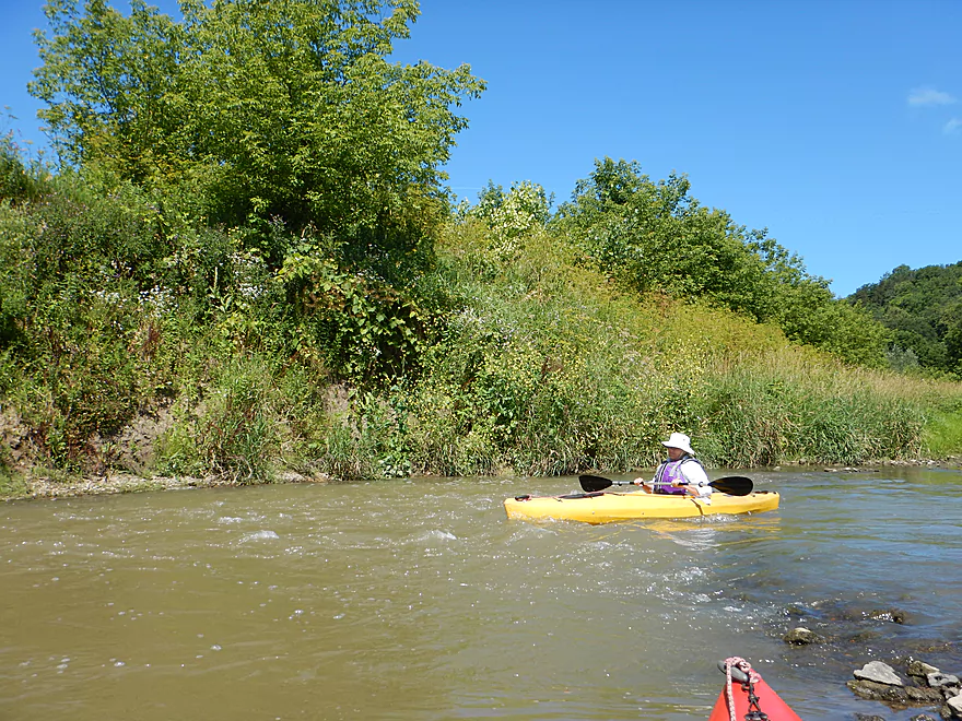
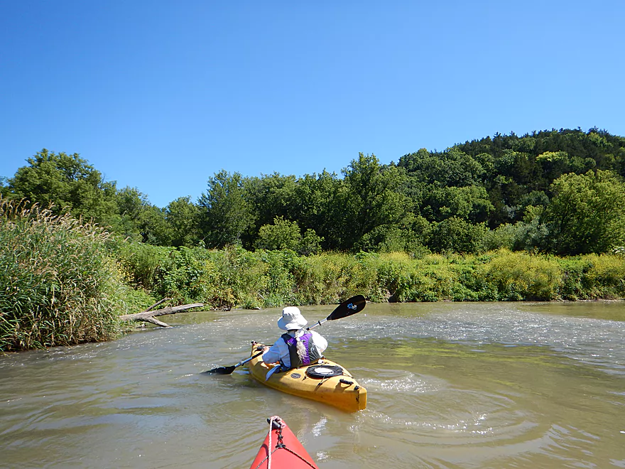
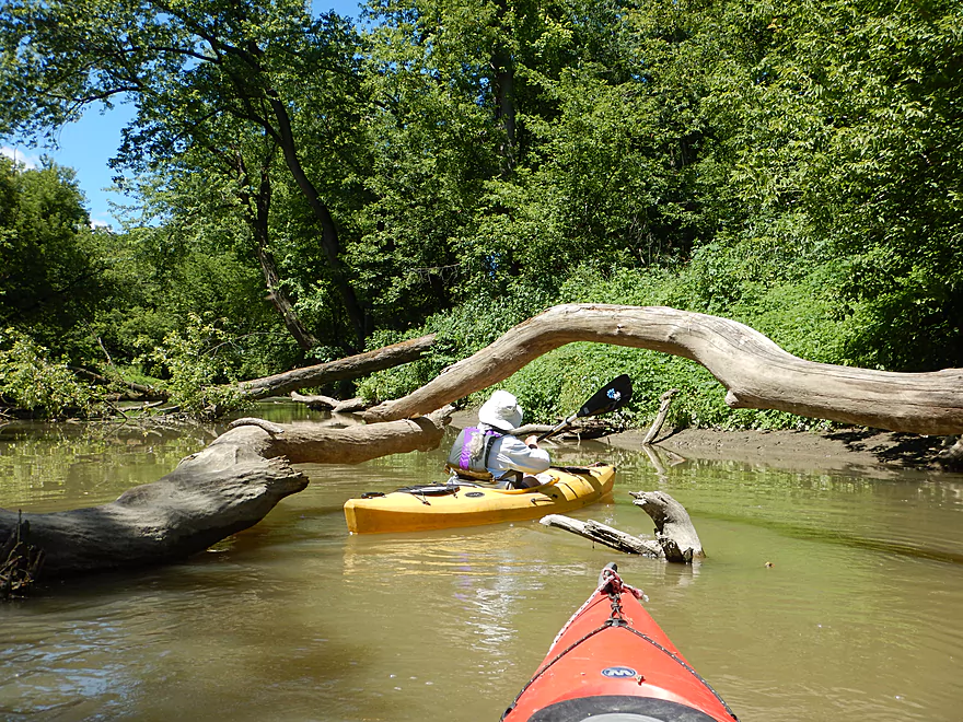
About at the halfway point, most of the rapids die off, and the open grassy areas are replaced by messy hardwoods struggling to stand in the unstable mud banks. Many not succeeding and ending up in the river. The channel is wide enough to get around these obstacles but it was unsightly. Many of the trees and debris had this ghostly grey look to them from being dipped during earlier spring floods.
Just prior to Hwy 3/52 there is a small but nice limestone outcrop (finally!). The rock is thinly layered, crumbly, and undercut–very scenic. Most locals take out here where there is a hidey access path downstream/east of the bridge, which I suggest in hindsight. But the trick is the best limestone outcrops are actually AFTER the bridge and hiding just around the corner, which most locals miss. These were quite cool and the highlight of the trip. I recommend paddlers check these out and simply double back upstream to take out.
Now certainly you can paddle the next 2.4 miles to Herber Road (which we did) but there is nothing going for this section. No geology, no riffles, no sandbars, virtually no wildlife or anything else that makes a river distinct. This segment was mostly a floodplain paddle and I suspect it frequently gets beat-up by Mississippi backfills. Half-dead boxelders are everywhere as is the mud and honestly it was a pretty boring segment. It was a relief when we reached Herber Road (not an easy take-out BTW) to end the trip.
Now, I actually don’t want to sound too negative about the trip, as I may be unfairly judging it based on my preconceived expectations. Also the locals really like it. One kayaker we talked to was doing it again based on a previous positive experience. Was told by another local that 150 paddlers paddle this leg on summer weekends. So if you are a local and have never seen limestone outcrops or boulders on a river before, it may be worth checking out, but otherwise, the prospects in neighboring Grant County, Wisconsin are much more interesting.
That’s not to say that Iowa paddling is bad…northeast Iowa is part of the driftless area and includes some special paddles most notably the legendary Upper Iowa River. Other cool Iowa driftless paddles include the Yellow River, Turkey River, Little Turkey River, Volga River, the North Fork of the Maquoketa River, Catfish Creek, and Whitewater Creek which I hope to all do in the future. For more information on these see the book “Paddling Iowa” which I highly recommend.
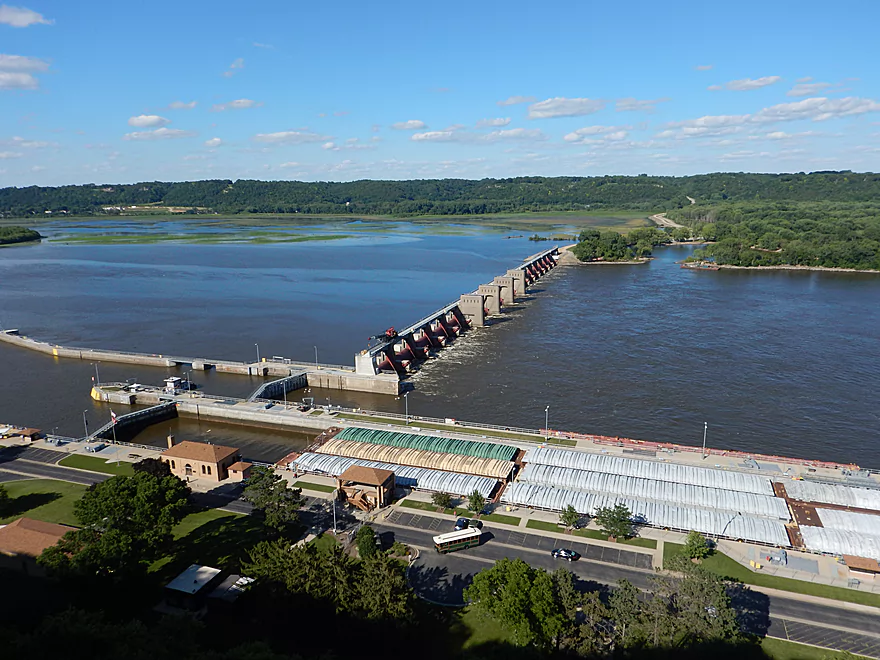
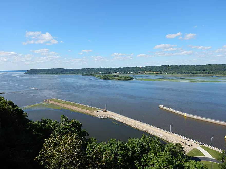
After the trip, we scouted the Mississippi at Deere Point Park and honestly that one scene by the boat landing looked more interesting than our entire Little Maquoketa trip. Then we checked out Eagle Point Park, which is Dubuque’s most famous park and overlook. It costs $1 to enter (Iowans can be strange), but at the top of the hill (eastern part of park atop the tall rock face) are a series of overlooks panning the entire Mississippi valley including a lock and dam below. Absolutely gorgeous. If you are lucky (and we were), you can see a barge pass through the locks. It is quite the operation as it has to be split up to get through.
Update from the webmaster. Four days after the trip, Dubuque County experienced heavy rains and the Little Maquoketa River flash flooded. Hwy 52 by Durango was under water and the Sageville Road bridge was impassible. This just goes to show how volatile the river can be and to stay off of it after a big rain. The area also experienced 75 mph wind gusts which could result in new logjams that we didn’t encounter. Article from Tri-State News.
There is a good canoe launch by the Heritage Trail parking lot in Durango, just between Burtons Furnace Road and the bike trail bridge. The canoe launch consists of a pseudo pier/one foot concrete ledge which is great for canoes but for tippy kayaks can be a real pain. Don’t fall in. The water is deep and dirty here (and most everywhere else). For really tippy kayaks just launch directly under the Burtons Furnace Road bridge.
While you need to pay to use the bike trail, the parking lot is free to use, but does get pretty full on weekend afternoons (were told 150 paddlers per weekend use this in the summer). To avoid having to drag your boat 250′ from the parking lot to the launch, most paddlers temporarily double park in the ditch to unload their gear, and then park in the main lot.
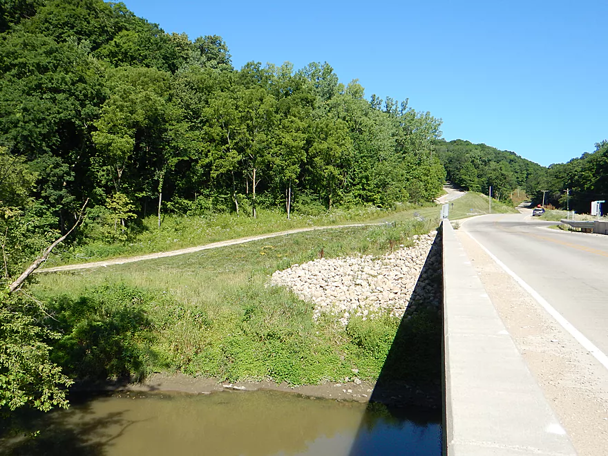
Herber Road is a doable, but not great access option with some mud. There is a faint trail used by paddlers on the northwest side of the brand-new bridge that leads to the shoulder, but this requires you drag your boat 150′ up a steep embankment and over rocky fill. There is a farm road nearby which is tempting to park on, but that is likely private and you’re best off just parking on the shoulder where there is room.
Most paddlers will take out at the prior bridge (Hwy 52), which I recommend. But if you do this, paddle past the bridge and around the corner to see some cool limestone outcrops, then you can double back to disembark.
I’m not aware of any local liveries, but Dubuque is a big city and it is quite possible there is one hiding somewhere.
For bike shuttlers, the shuttle length is 5.9 miles with some minor hills (98′ of climbing and 66′ of descent). Much of this route can be done on the Heritage Trail, which is a scenic bike trail but does require a trail pass. There is a self-pay station in Durango by the parking lot (it costs $2.10 for an adult).
If you take out at Deere Dike Park, this would be a longer 7.5 mile shuttle. If you (as most paddlers do) take out at Hwy 52 by Sageville, that would be only 3.6 mile shuttle.
No hazards really and this is a safe river for paddlers including canoers.
The current is pool-and-riffle (fast, then very slow, then fast, then slow, etc…). There are some riffles, including a few Class 1’s, but nothing too noteworthy. After Access Road and the subsequent bike trail bridge, the riffles pretty much disappear.
There is quite a bit of deadfall in the river, but you can always go around it. The highest concentration of deadfall was after the Hwy 52/3 bridge, and this segment could experience logjams after a big storm.
Iowa, unlike Wisconsin, hasn’t gotten as much rain for 2017 and in fact parts of south-central Iowa have near drought conditions. The depth we went at was probably fairly typical for mid-summer. For the first three miles the river has a pool and riffle configuration where there are shallow riffles and then extremely deep pools (many over 8′). For the rest of the trip, the current slows and the river is more consistent in depth.
My estimated (and very rough) guide below is based on a much further upstream gauge near Rickardsville.
- < 9.5′: You might have to walk many of the riffles (say, 6 times)
- 9.6-10′: Good depth. Some riffles will be a bit bumpy but the rest of the river will be plenty deep. Trip was done at 9.75′.
- 10.1-10.5′: River would be high at this point and might not be attractive for paddling.
- 10.6’+: River might be at flood stage.
The wildcard variable is the Mississippi River which I suspect when high can backfill the Little Maquoketa River for miles.
Very few signs of wildlife. One turtle, a food begging hawk, a great blue heron and several fishing jumping out of the water (probably to see where they were going).
- Graf/Graf Road to Twin Springs: 3.8 miles. Steep gradient that needs high depths to be floatable. Some Class 1-2 whitewater, but also some strainers.
- Twin Springs/Asbury Road to Burtons Furnace Road: 7.5 miles. Smaller creek with some rapids (Class 1-2). Strainers and low water can be issues.
- Twin Springs/Asbury Road to Budd Road: 2.2 miles. Shallow with multiple rapids near the start. Likely a few stronger Class 2 rapids and some strainers.
- Budd Road to Cedar Ridge Road: 3.5 miles. Many Class 1 rapids. Maybe one logjams.
- Cedar Ridge Road to Burtons Furnance Road: 1.2 miles. Handful of Class 1 rapids.
- Burtons Furnace Road to Herber Road: 7.1 miles.
- Burtons Furnace Road to Hwy 3/23: 4.8 miles. River starts open with some riffles before getting very messy with sloppy hardwoods and lots of mud. Ok rock outcrop just before Hwy 3.
- Hwy 3/23 to Herber Road: 2.3 miles. Weak section filled with half dead muddy box elders. Nice outcrop just after Hwy 3.
- Herber Road to Mississippi: 1.9 miles. Kind of a muddy flood bottom. Maybe a logjam or two.
- Mississippi Take-out Options:
- Mouth to Mud Lake Park: 3.2 miles. Paddle upstream on the Mississippi to reach the take-out. Do not attempt when facing a headwind. A shortcut is the north distributary (if open).
- Mouth to Deere Dike Park: 0.8 miles. After Herber, take the south distributary and then wrap around the peninsula to reach Deere Dike Park. Nice section and part of the Mississippi.
Note…there are likely additional paddling options on the north branches of the Little Maquoketa River as well.
Honestly the Mississippi looked much more interesting than Little Maquoketa River. Here are some trip ideas.
Mud Lake Park to Deere Dike Park: 4.2 miles. Good public access at Mud Lake Park (opposite the Platte River mouth) where you can see gorgeous rock bluffs on the Wisconsin side of the river. Paddle south through Mud Lake and a protected subchannel due to an adjacent long narrow island (1.8 miles). Explore up the Little Maquoketa River distributaries if you wish. By John Deere Dike Park paddle west past the dike to see gorgeous lilly beds, then take out at the public ramp. You can also do round trips from either access location.
Dubuque Water Trail: 9 miles. Start south of the dam by A.Y. McDonald Park. Float down the western shore by urban Dubuque, past the Mines of Spain to Massey Station Road. Easy to subdivide or to do roundtrip loops. For further information see the official webpage for the trail.
Catfish Creek/Mines of Spain: 2-3 miles. This is a round trip where you start at a landing by Mines of Spain Road, paddle as far upstream as you can and then float back downstream. There is really neat geology on this trip and it is very scenic. Be sure to check out Julien Dubuque Monument after the trip. This trip can easily be connected with the Dubuque Water Trail described earlier. The best part of the park is Horse Shoe Bluff which many visitors overlook. Park at the trailhead and hike to the overlook which is north of the bluff. It’s Iowa’s Grand Canyon!
Trip Map
Overview Map
Video
Photos Size:
Deere dike boat launch is no longer accessible due to silting in. Mississippi River needs to be over 10 ft to even get thru, but current would be dangerous at that level. 2023
Thanks for the update. That is interesting.