
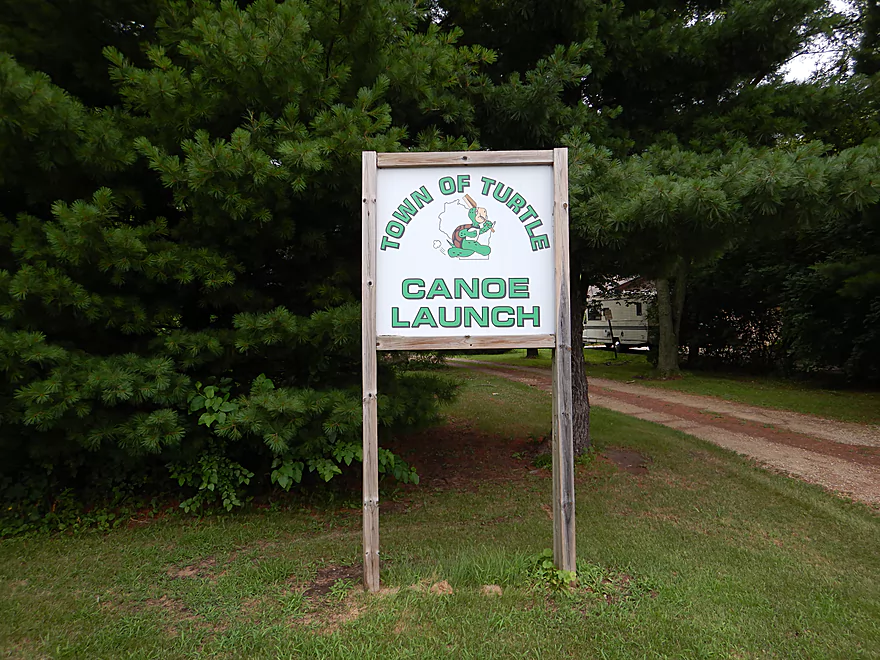
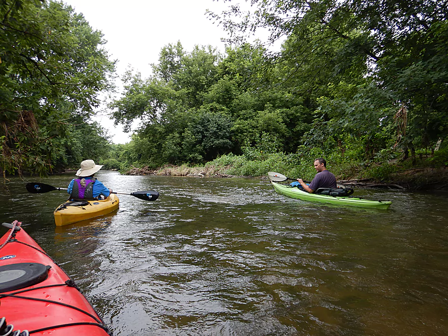
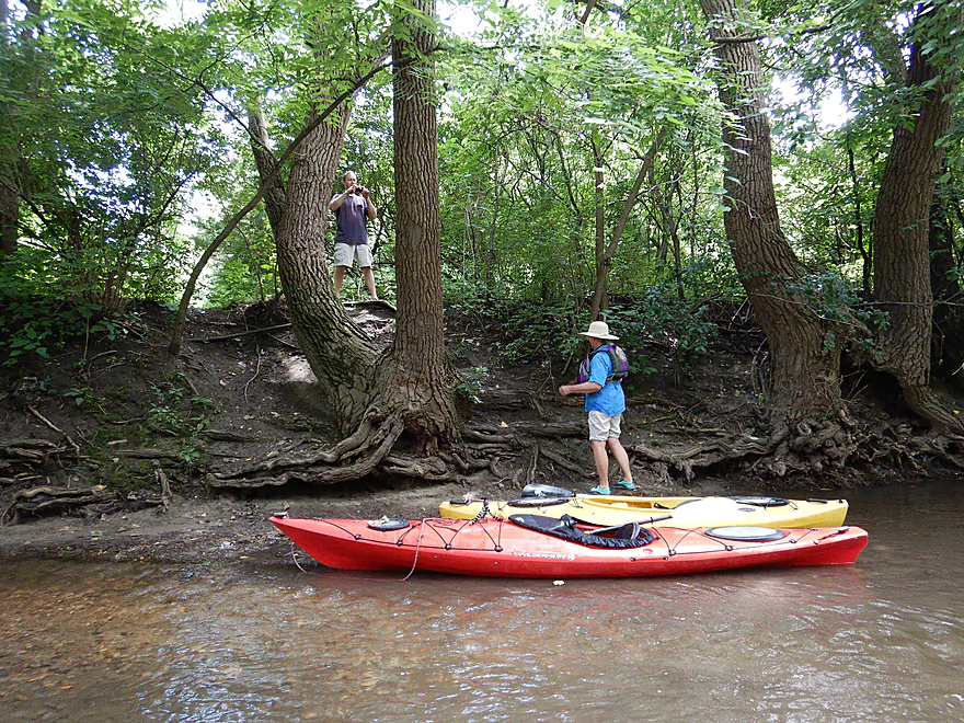
Starting the trip at the Town of Turtle Canoe Launch
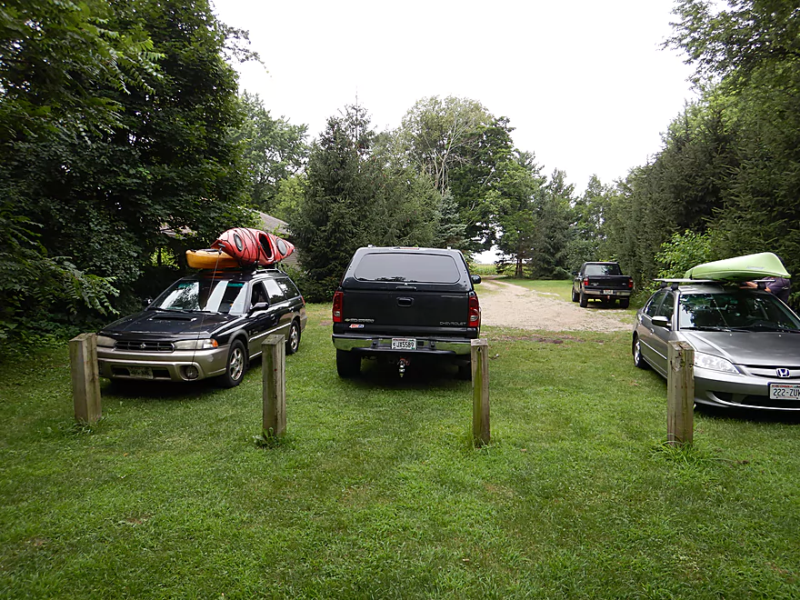
Nice access with good parking
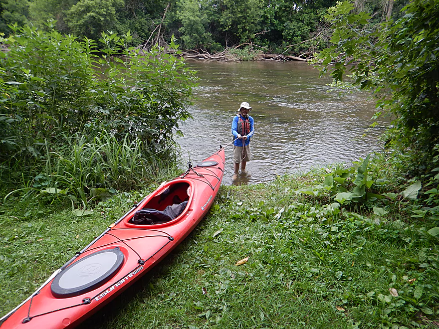
Launching requires a little wading, but not bad
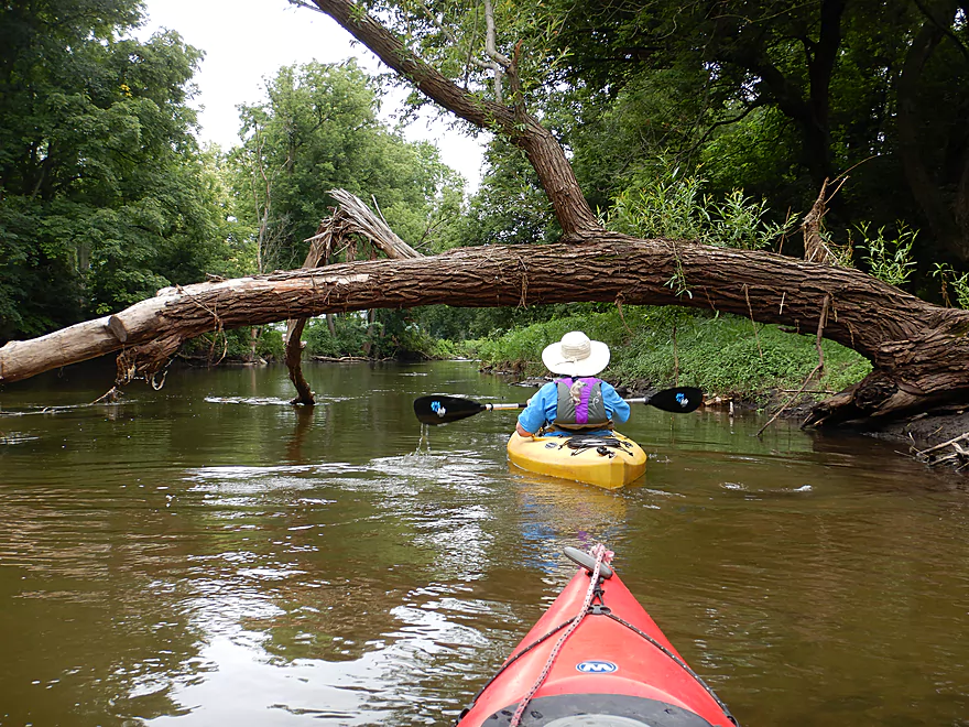
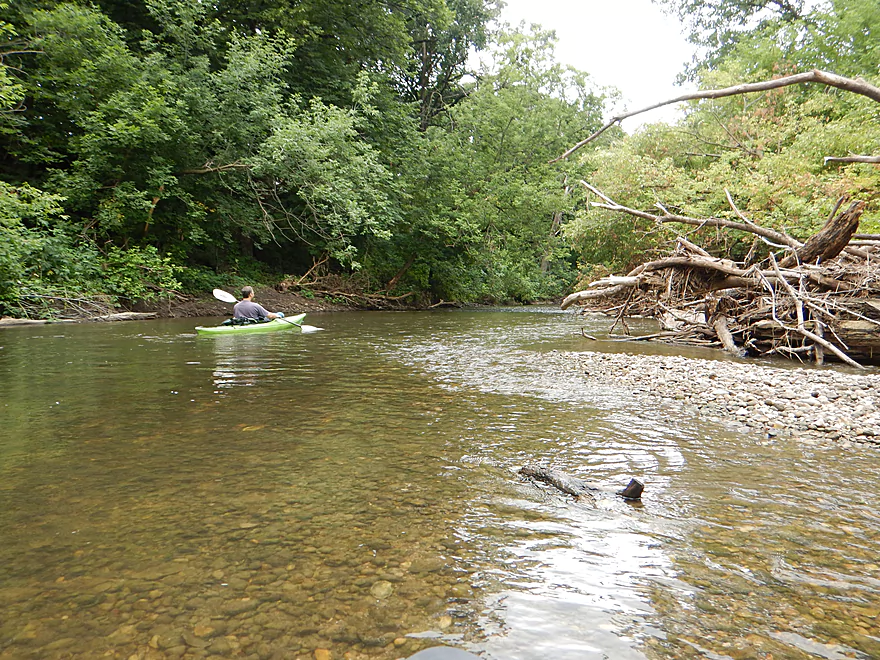
Logjams were never an issue
One of countless light riffles
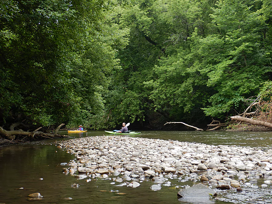
Entering an old silted in gravel pit
Cool high water marks
A little Caribbean in Beloit
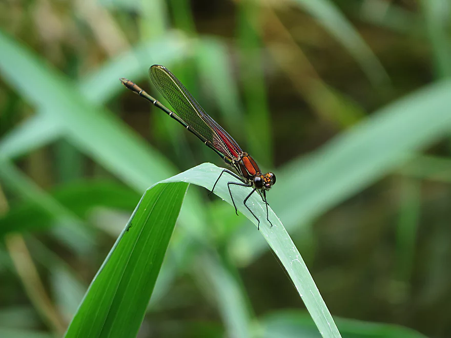
Rubyspot damselfly
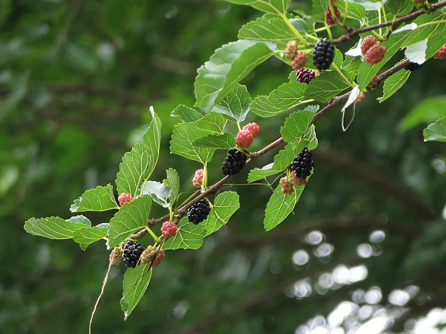
Some riverside snacks
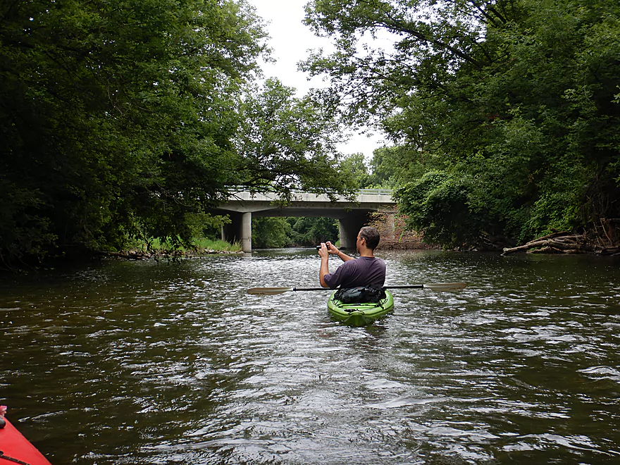
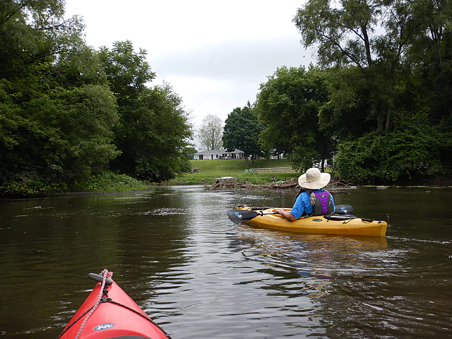
Coming up on Shopiere Road
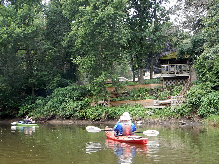
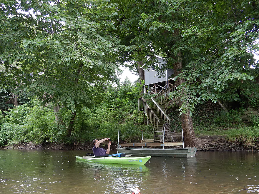
Many riverside homes had attractive decks
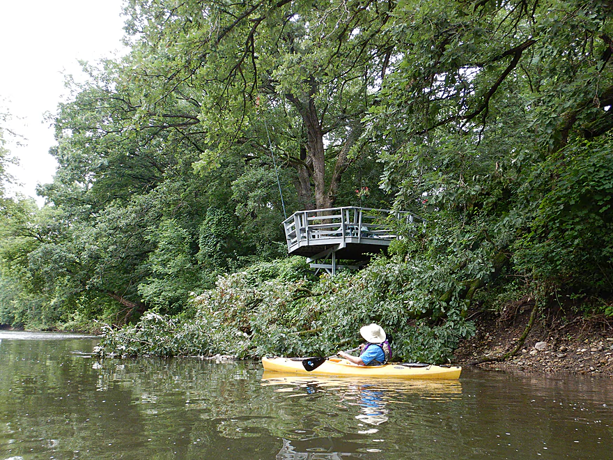
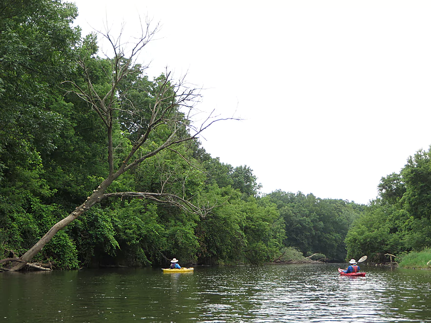
This octagonal porch just missed being squashed by that tree
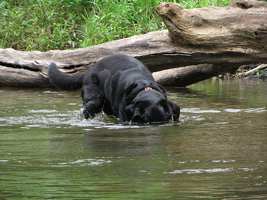
He was digging for something…
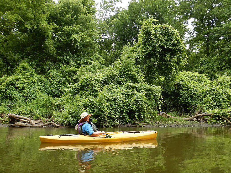
The grapevines were fantastic…very jungle-like
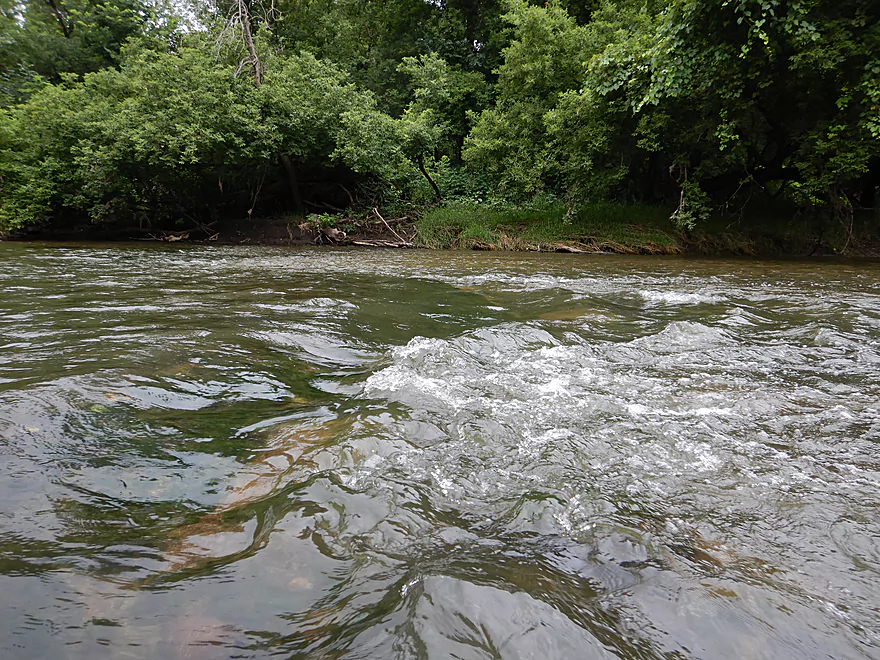
The rapids did not get much bigger than this
Flat and open…not as interesting
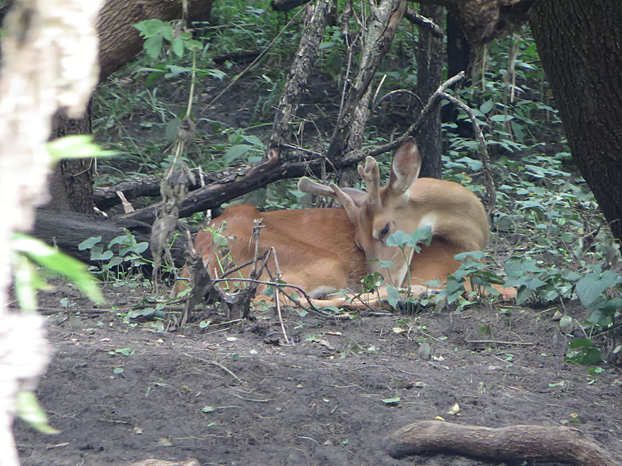
Taking a nap
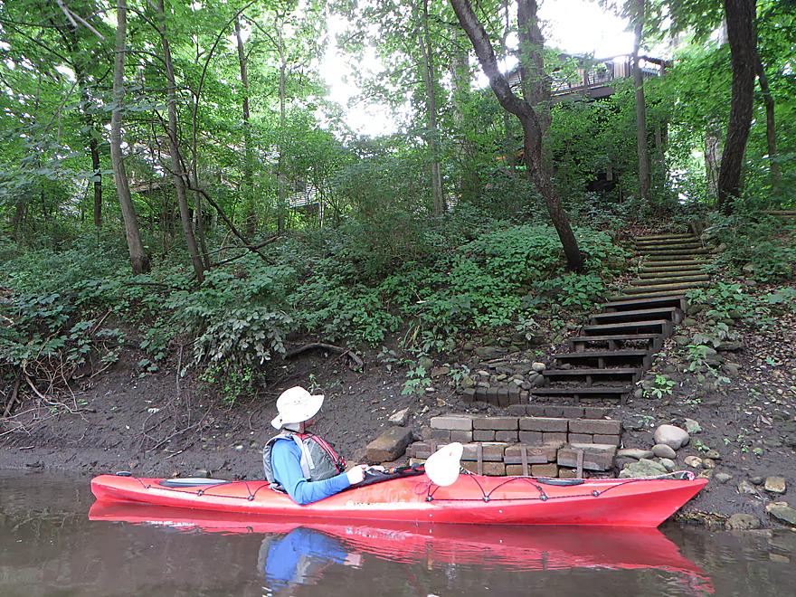
Quite the stairway
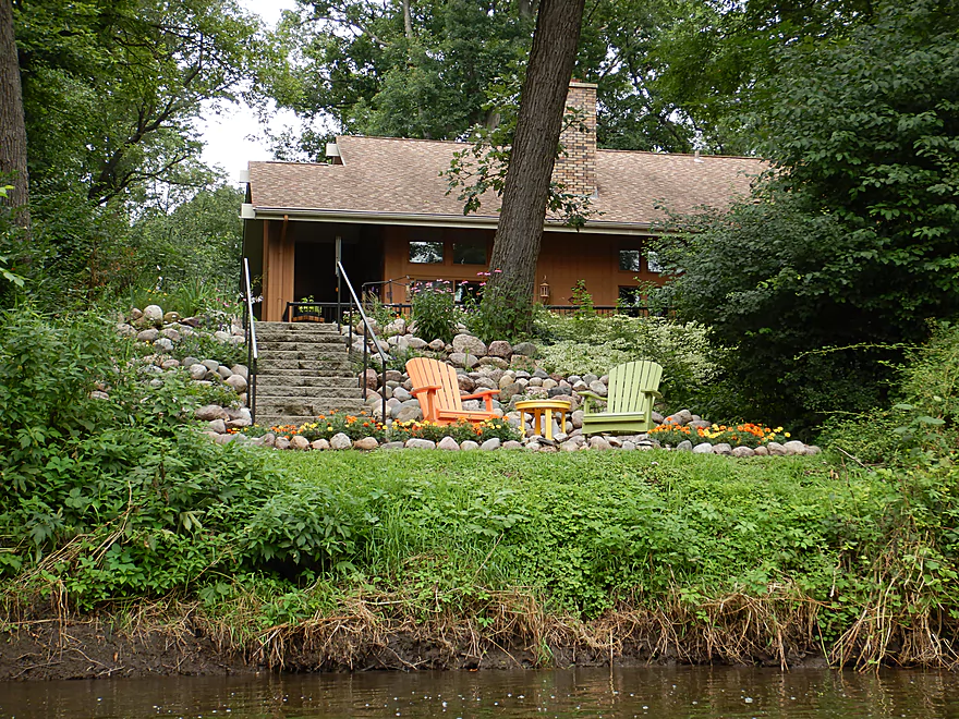
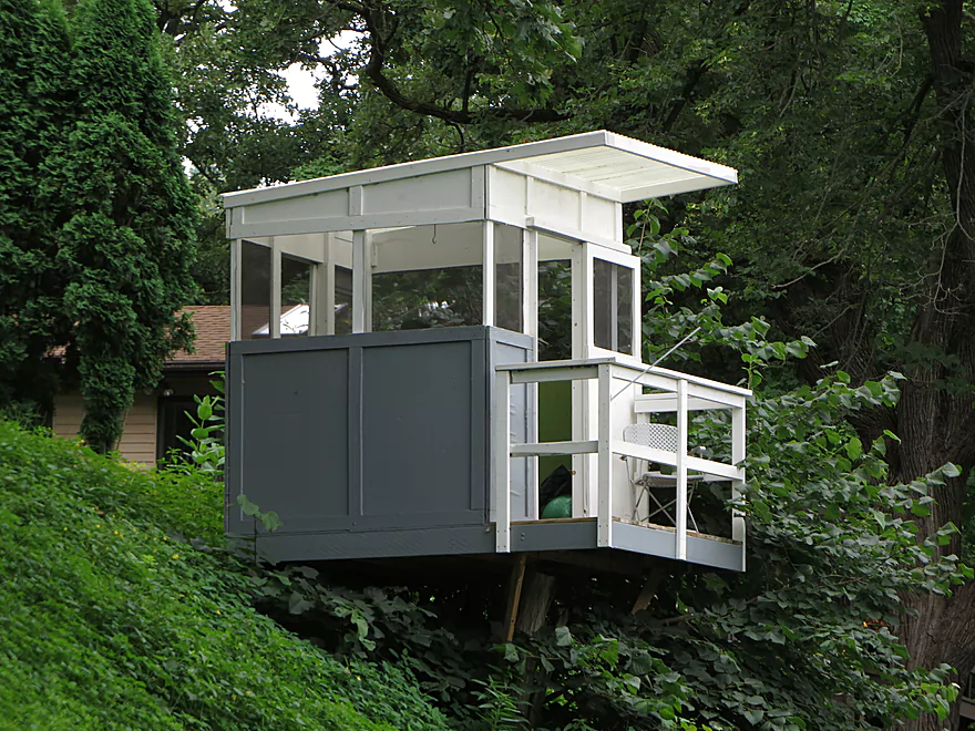
A very colorful property
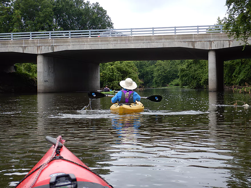
Coming up on Cranston Road
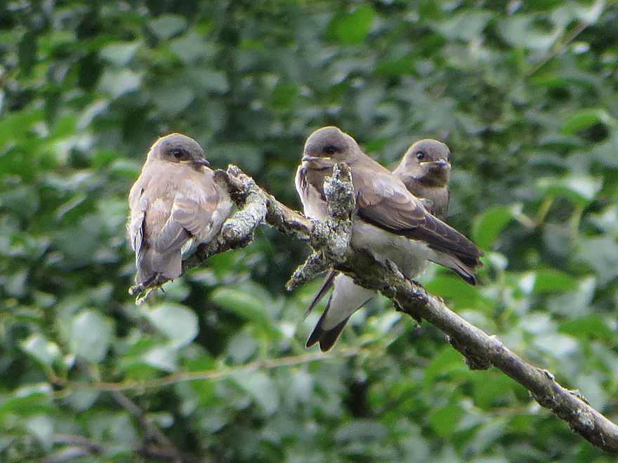
A cluster of baby swallows
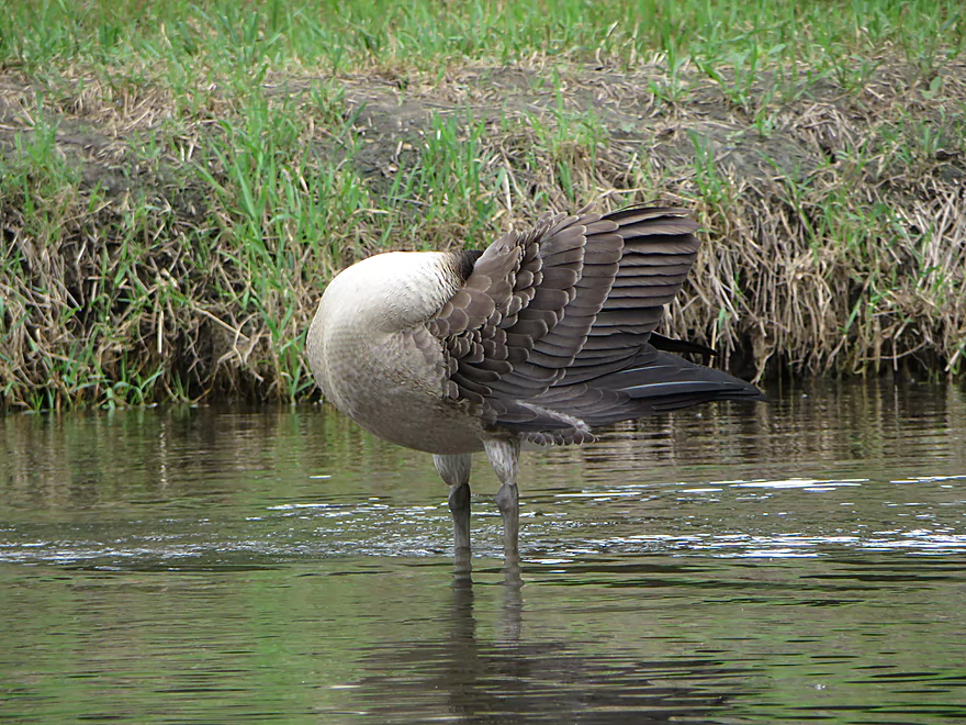
Goose playing peek-a-boo
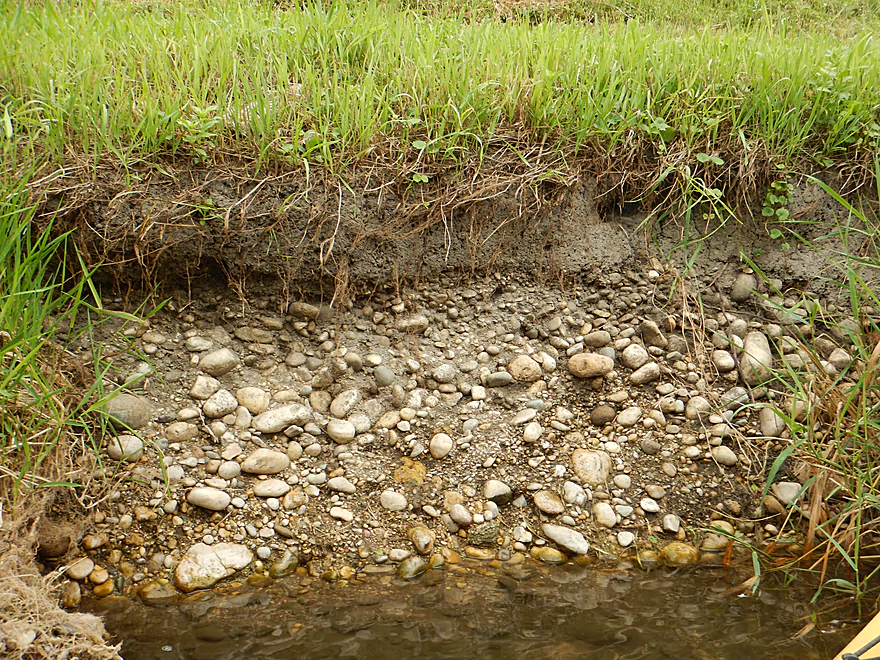
I think this is glacial outwash
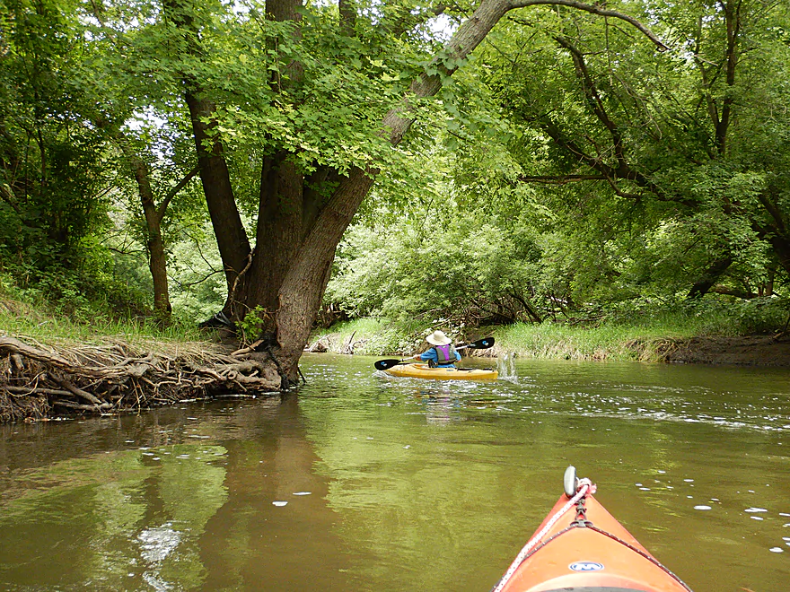
Paddling around a large island
Not sure what these mini-shacks were for
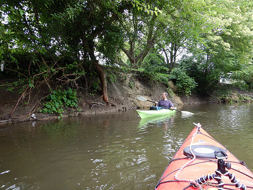
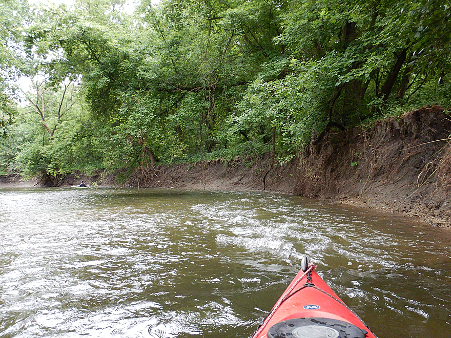
Dirt banks are starting to get big
Fun rapids by the banks
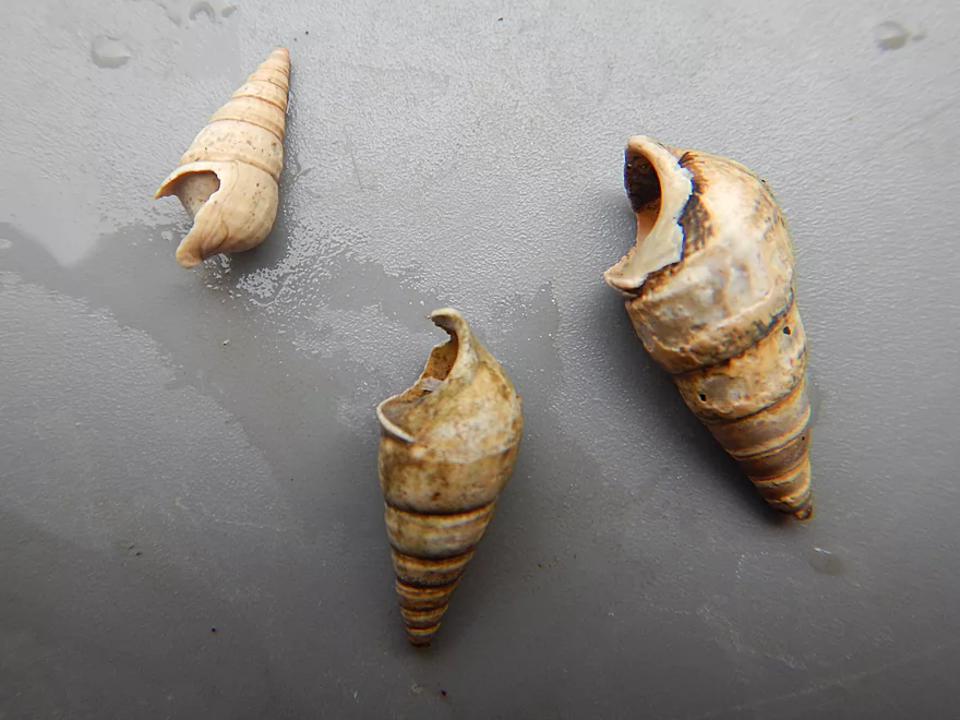
There were a lot of snailshells
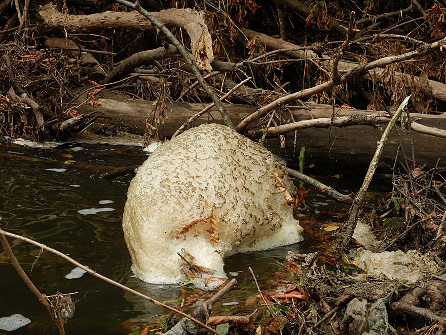
A foam slug
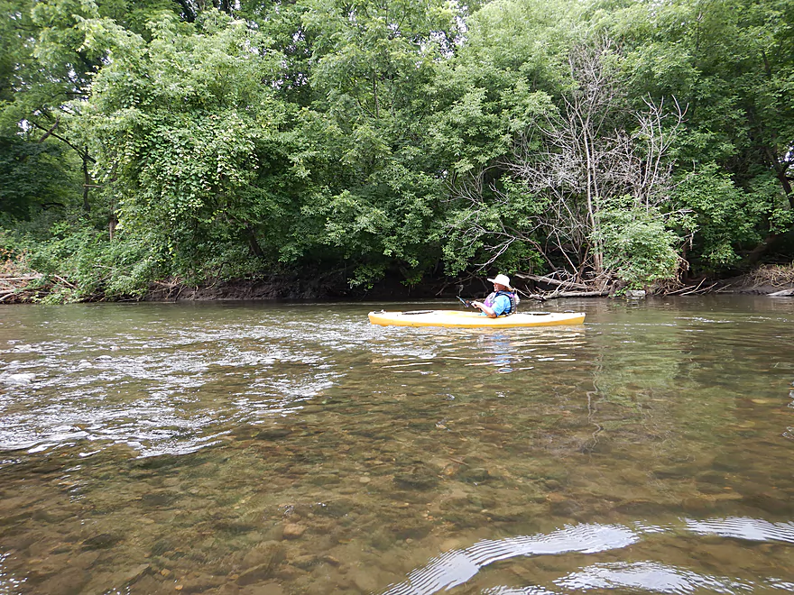
Water clarity at times was good
Cool gravel bar
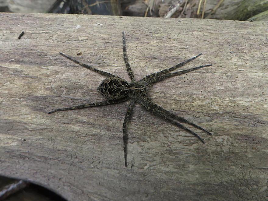
A huge fishing spider
Trying not to run into these cairns
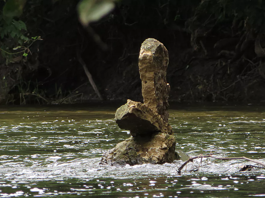
Cleverly balanced rocks
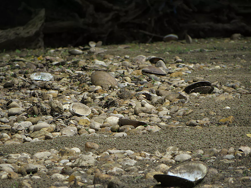
Part of a clam apocalypse
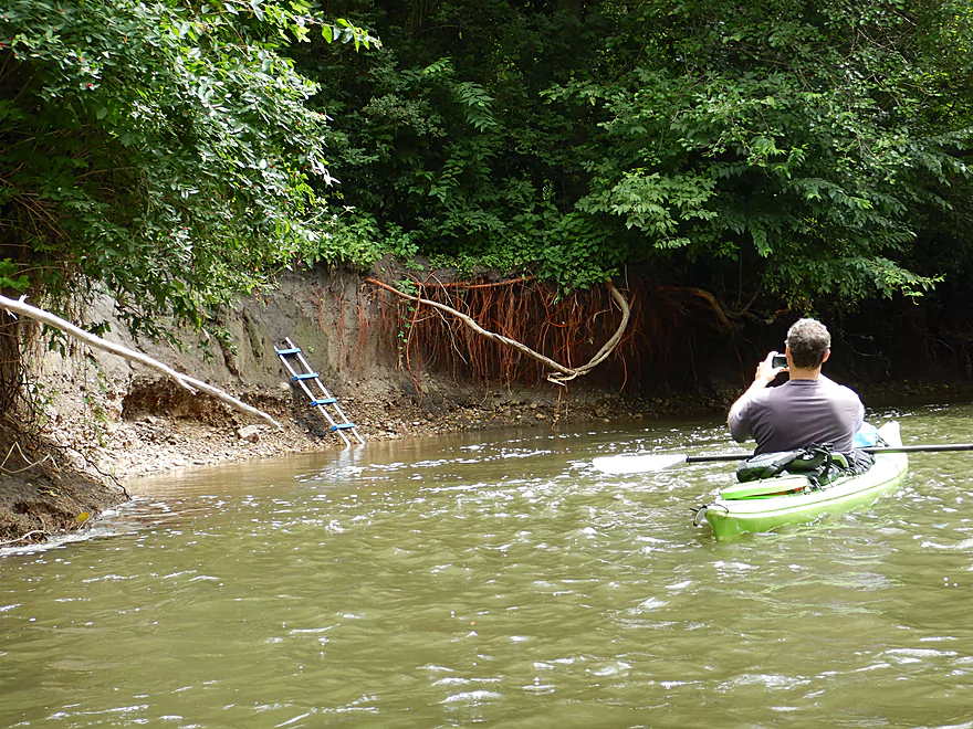
Odd ladder location…there is a much better access downstream
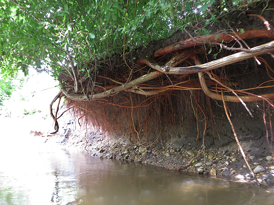
Fantastic roots
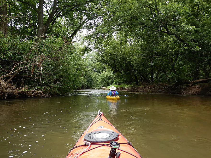
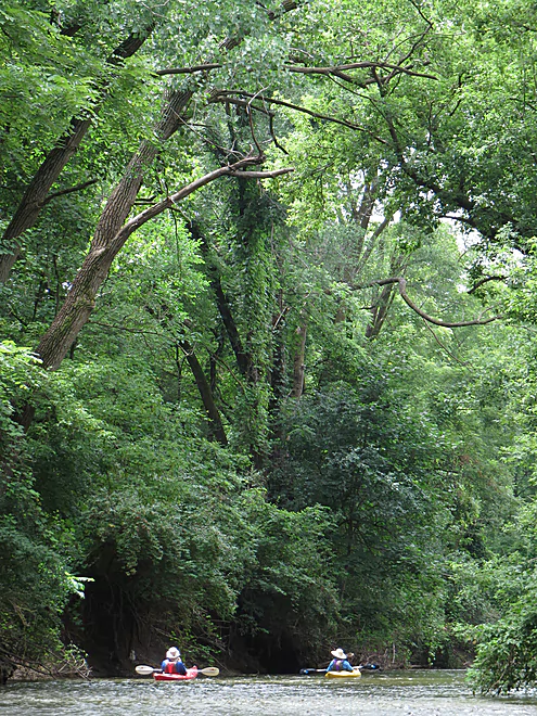
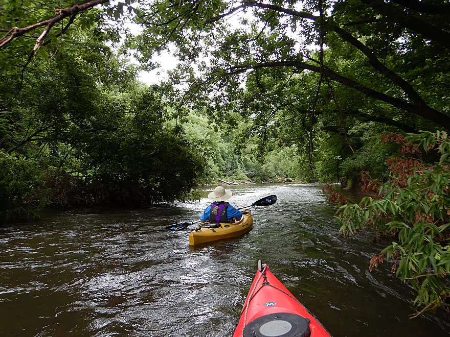
This really felt like a jungle paddle
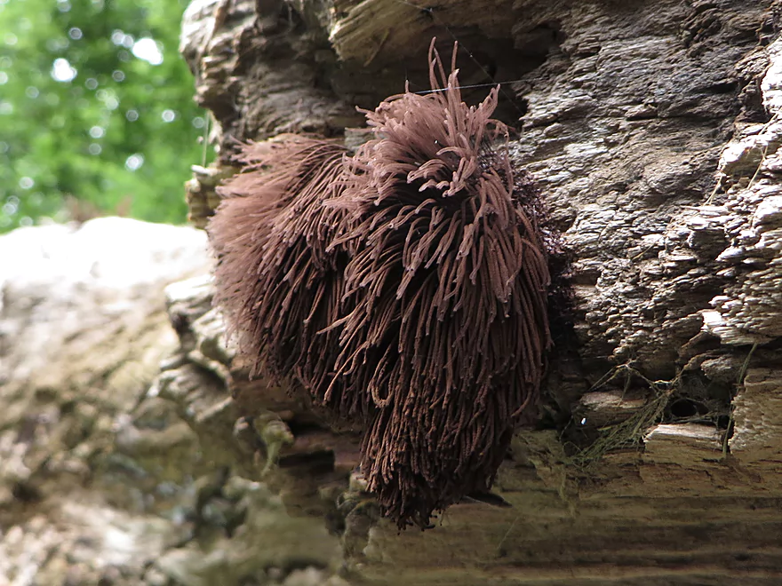
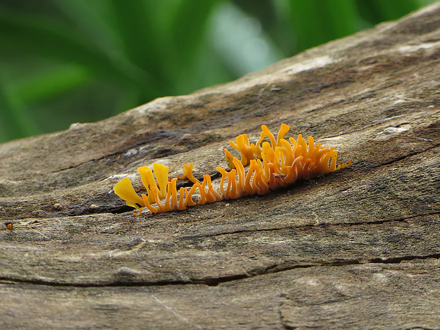
An exotic fungus
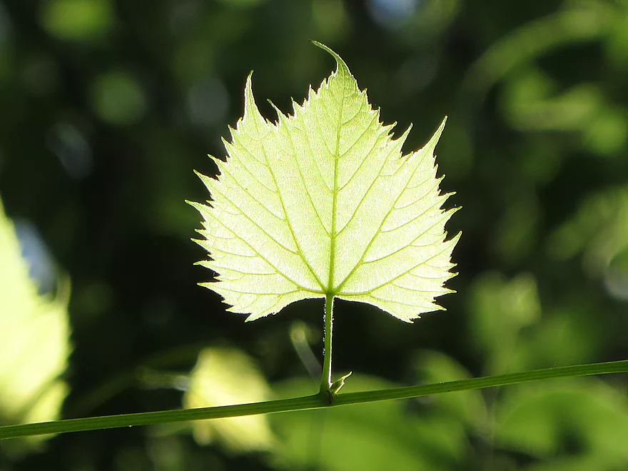
A backlit grape leaf
We missed our take-out and had to wade back upstream
Not a big deal as the water felt good
An obscure but decent take-out
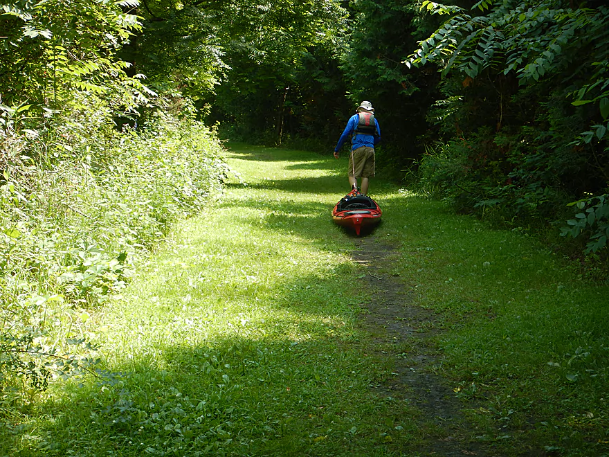
Dragging our boats 350 feet to reach the parking lot
Turtle Creek – Beloit


The Turtle is a great paddling prospect located in southern Wisconsin. In fact our previous upper Turtle paddle was one of the better 2017 trips. While I had hoped to return to this creek, plans were moved a little ahead of schedule when our crazy weather (playing paddling roulette) again left the Beloit area as one of the few areas not to have rain in the forecast. I opted for a lower section on the Turtle, which despite flowing through Beloit, was densely wooded (ideal photography for the predicted overcast conditions).
The trip started technically in the Town of Turtle which is a northern suburb of Beloit. The township was named after the Turtle Indians whose totem was the turtle. Abraham Lincoln actually camped along the creek in this very town while he was in the army scouting for Chief Black Hawk.
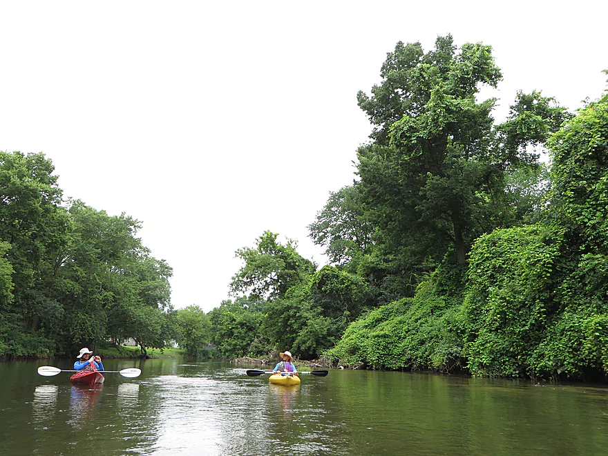
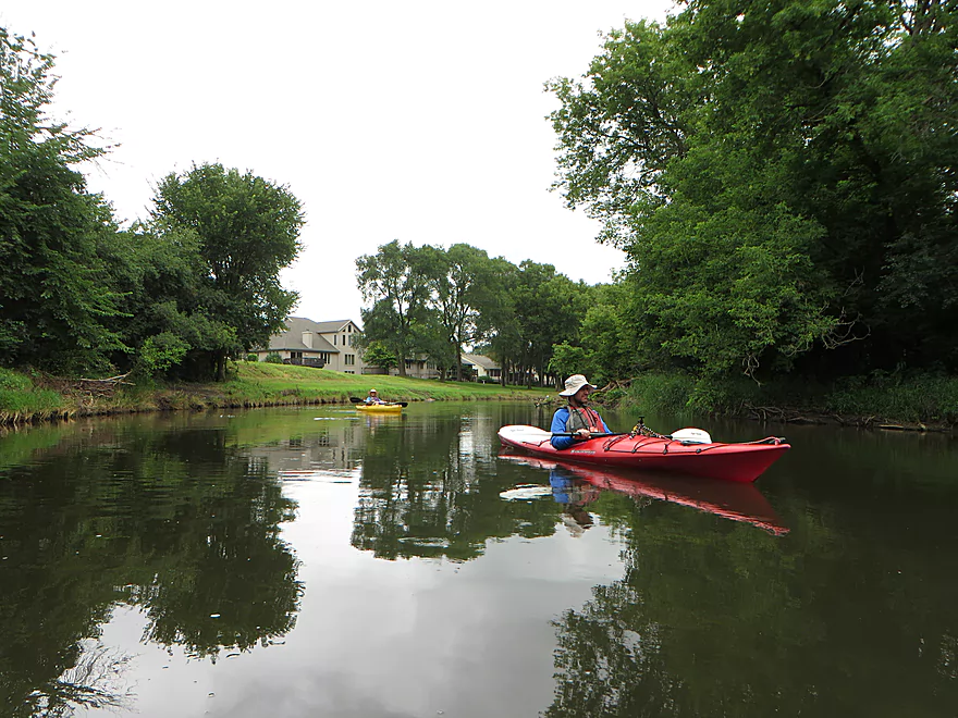
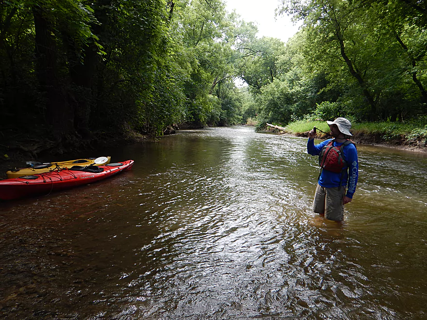
At the town put-in (which was really nice), we met two local paddlers taking out. They said the stretch from Sweet Allyn Park to the Town of Turtle Landing (where we were) was actually the most popular stretch of the river. They described a massive logjam under the interstate bridge, with full-sized trees, but said someone had fortunately chainsawed a narrow passage through it. They also liked the downstream section that we were about to do, but said it could be bumpy in very low water. They said it was currently navigable–which was a good omen for our trip.
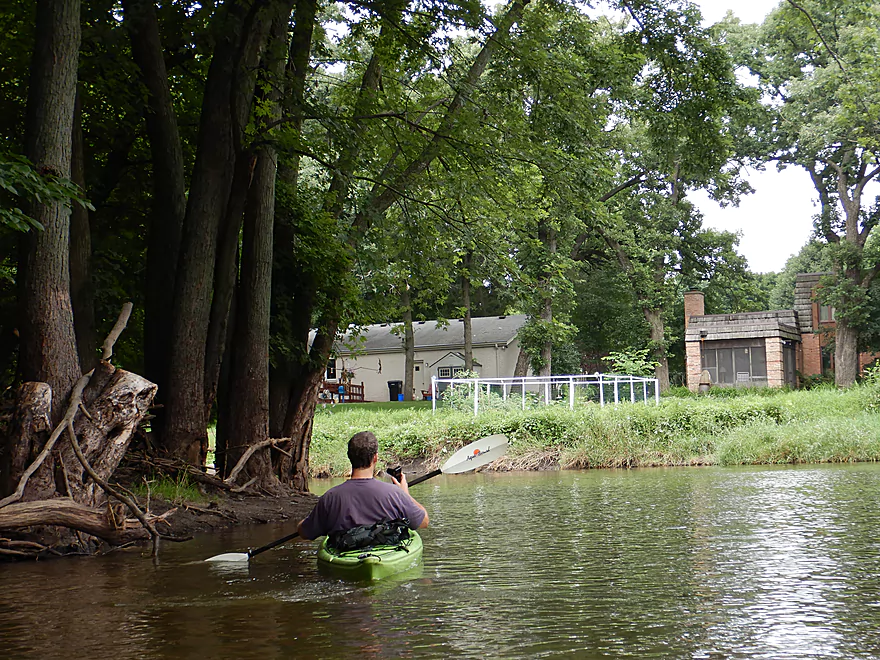
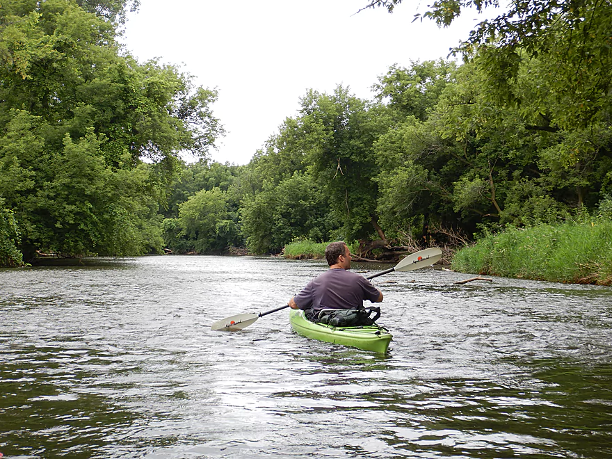
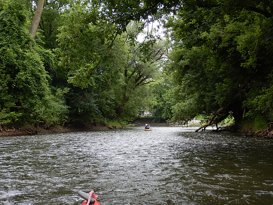
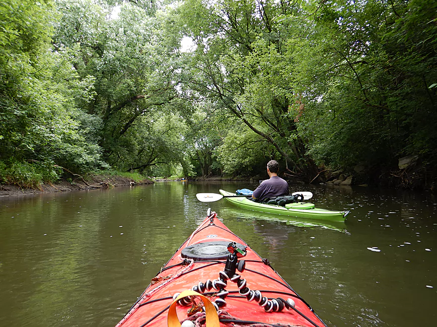
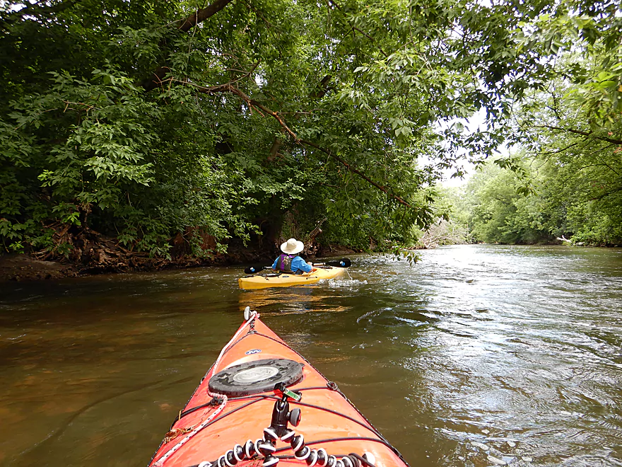
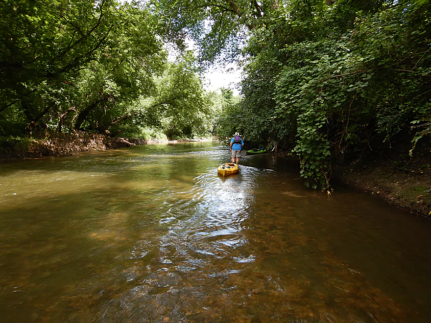
The first leg of the trip was nice with clear riffly water, an attractive gravel substrate, and little mud. The channel was surprisingly wide and at times felt like a small river. Shortly after the put-in, we paddled into a side slough which it turns out used to be a 30′ deep gravel pit. But today it likely only serves as a sediment trap as the the pit has almost completely filled in with silt.
Past Shopiere Road we entered Beloit proper and started to see many more houses. A decent number were creatively landscaped and highlights included unique porches, elaborate staircases, attractive gardens, micro-shacks, and even a few sculptures. On the flip side, paddling through a big city meant noise, and we heard our share…from highway noise to every imaginable outdoor power tool (lawn mower, leaf blower, weed whacker, chainsaw, power washer, etc…you name it we heard it). This middle third was the weakest part of the trip. Here the once peppy current died, the channel ran wide, straight and slow, and the scenery become monotonous.
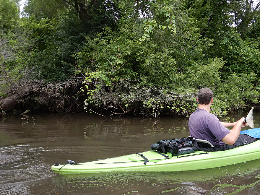
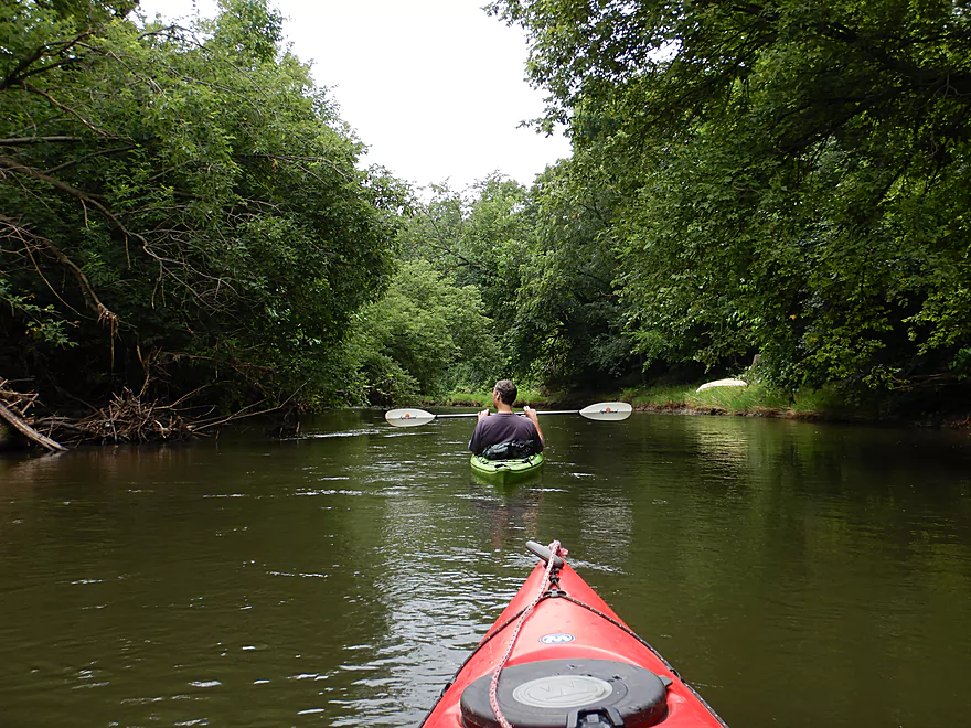
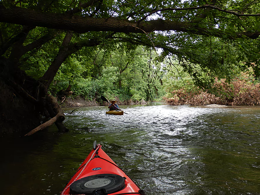
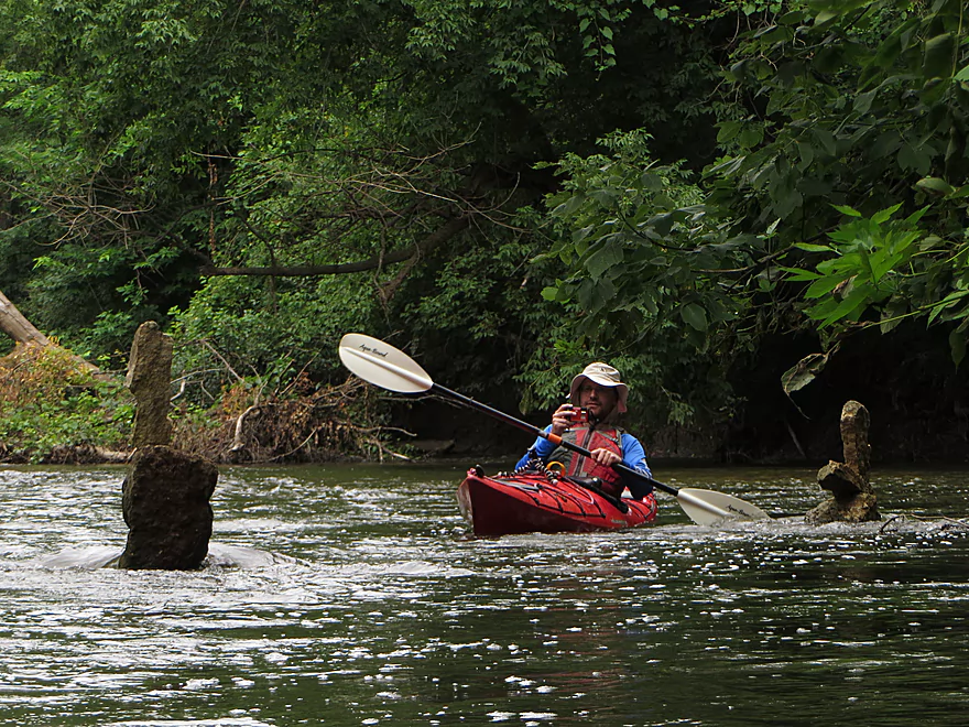
Just upstream of Cranston Road we entered the Turtle Creek Floodplain which is a large protected area of the creek that runs for several miles. This meant very dense woods despite being in a major city. I really liked this section. Thick undergrowth, massive grapevine clusters, and exposed roots hid the banks while tall trees arched over the channel. It felt like a jungle paddle…not something you would expect in Beloit. After Cranston Road the creek started to wiggle again, and the current picked up and created the best riffles of the trip. While I struggle to call these rapids per say (they weren’t that big), they still were fun. In spots the fast current would move in sheets which kept things moving along.
We accidentally missed and overshot our take-out (easy to do) and had to wade back to the access because of the fast current. Adventurous paddlers could continue 3-4 more miles to reach the Rock River where there are multiple access options (see overview section). In summary this was a nice trip and almost 4 stars, but it was hurt a little by the uninteresting middle section. For a future trip, I hope to run the last 3-4 miles of the Turtle to the Rock River which falls at a good gradient and should have better rapids.
We saw several carp, many small snails, a huge fishing spider, several bank beaver holes (and slides), a handful of great blue herons, and several flocks of geese. There was a surprising number of deer with the highlights being a spotted fawn and a buck sleeping by the river. Our biggest surprise was seeing so many clams…among the most I’ve ever seen in a river. But almost all were dead…as if some sort of clam apocalypse had struck.
Our put-in was at the “Town of Turtle Canoe Launch” just a few hundred yards south of the E. Inman Parkway bridge. Relatively new, this is a great little canoe launch with good parking and no access fees.
An alternate upstream put-in would be S. Lathers Road bridge. Parking may be tricky here, but this would add a nice 2.2 mile stretch to a trip. There is a massive logjam under the interstate, but according to a local somebody has chainsawed a narrow path through this.
A further upstream access would be Sweet Allyn Park which is a great access option and a popular put-in. This would add 1.5 + 2.2 miles to the trip and would likely be a fine paddle.
An alternate downstream access just a few hundred yards downstream would be a small landing off E. Trail Drive, but that wouldn’t be nearly as nice as the “Town of Turtle Creek Canoe Launch”.
We took out at Turtle Creek Greenway Trail (just upstream of Milwaukee Road/Hwy 81). Not many paddlers know about this option, but it is a decent access with a public parking lot and good privacy. However you will need to drag your boat 350′ over a grass trail to reach the parking lot and the access itself is somewhat hidden. From the main trail, you follow a hidden dirt trail to reach the water (see satellite map). Here you can disembark on the shallow gravel, but you must then pull your boat up a steep bank. Make sure you scout this before-hand so you don’t miss it (like some of us kind of did). There is an easier (and perhaps more well-used) access off a trail straight west of the parking lot, but it would require a longer walk.
There are multiple alternate downstream access options. For more information see the overview map. But in a nutshell the entire stretch from Hwy 81 to the mouth should be interesting with some good rapids. Likely the best downstream take-out option is actually on the Rock River at the “John Jose Canoe and Kayak Launch“. To here from Hwy 81/Milwaukee Street would be 3.8 miles.
Your easiest bet would be to car shuttle (we did). The 3.9 mile bike shuttle is a bit tricky because the roads through Beloit are very busy and with poor shoulders. You’ll be stuck on sidewalks for the most part, except for upper Shopiere Road which doesn’t appear to have decent shoulders or sidewalks…fun… If you study the map, you might find a better route than what I suggested.
At normal levels this is a pretty safe leg. While there are a number of riffles here and there, nothing that is serious or noteworthy. There are however occasional strainers, but these were easy to avoid because the creek is so wide. In very high water, they might be a bit more problematic.
There are no logjams or other hazards to worry about. A good trip for beginners and canoers.
There is a gauge on the creek at Clinton, Wisconsin. The following is a rough depth guide.
- 0-80 CFS: 60 CFS is typically an average late summer depth. Clarity might be excellent at these levels, but many of the riffles would likely be too bumpy to enjoy.
- 81-130 CFS: An above average depth that should be suitable for a trip, but with a few bumps here and there (minor). We did the trip at 110 CFS which was a good depth with say only 5% of the riffles being bumpy.
- 131-200 CFS: Likely an enjoyable flowrate with good padding.
- 201-300 CFS: The creek is starting to get pretty high here. Likely still runnable and the fast current could be fun. Be careful of strainers.
- 301-400 CFS: Very high conditions, likely only suitable for experienced paddlers.
- 401+ CFS: Maybe too high to be enjoyable. I don’t know for certain.
Detailed Overview
Special thanks to Friendsofturtlecreek.com for many of these tidbits.
- Turtle Lake Boat Ramp to Turtle Lake Road: 0.8 miles. Half of this would be a lake paddle on spring-fed Turtle Lake. The other half would be over an extremely small channel that would likely require very high water to be navigable.
- Turtle Lake Road to Island Road: 3.2 miles. Artificially straightened, and perhaps requiring a few culvert portages, this marshy section would likely not be for most but could have its appeal. Google has a nice street view image of this section.
- Island Road to Dam Road: 2.5 miles. More straightened channels running through thick marshes. This could have some subtle beauty to it. An alt take-out would likely be Hwy P.
- Dam Road to North Terrace Street: 2.8 miles. For 1.5 miles the creek finally meanders naturally for the first time, but in the last mile, the creek is impounded by a dam to form Comus Lake. Take out above the dam at the public Comus Lake boat ramp.
- North Terrace Street to School Section Road: 6.3 miles. Good marsh prospect with perhaps a logjam or two. Launch below the dam but be wary of a second lowhead dam. On my to-do list.
- School Section Road to East Creek Road: 6.9 miles.
- School Section Road to Hwy 14: 2.2 miles. Great section, with terrific water clarity.
- Hwy 14 to Hwy C: 2.4 miles. A bit more weedy, but still a great section with good water clarity. Spooner Park is an alternate access.
- Hwy C to E. Creek Road: 2.2 miles. A nice section with some scenic springs.
- East Creek Road to Hwy 140: 6.8 miles.
- East Creek Road to O'Riley Landing: 1.9 miles. Good stretch with scenic wild rice.
- O'Riley Landing to S. Carvers Rock Road: 3.1 miles. Little Turtle Creek comes in and significantly increases the size of the main channel. This is still a pleasant stretch with good clarity and an attractive gravel bottom.
- S. Carvers Rock Road to Hwy 140: 1.9 miles. This stretch is more wooded and hilly. There are several hidden limestone outcrops on this leg.
- Hwy 140 to Sweet Allyn Park: 5.2 miles.
- Hwy 140 to Turtle Creek Parkway/Smith Road: 3.8 miles. A good leg with deep clear water. The latter parts are a bit weedy though.
- Turtle Creek Parkway to Sweet-Allyn Park: 1.4 miles. A more shallow, but terrifically scenic stretch with fantastic clarity. The highlight is a historic five arch stone bridge.
- Sweet-Allyn Park to S. Lathers Road: 1.5 miles. Likely a nice prospect. The take-out at S. Lathers Road is good and used by paddlers…but vague No Parking signs don’t make it clear where you can park.
- S. Lathers Road to Town of Turtle Creek Canoe Launch: 2.2 miles. Likely a nice prospect.
- Town of Turtle Creek Canoe Launch to Milwaukee Road/Turtle Creek Greenway Trail: 5.5 miles. A nice trip through the Turtle Creek floodplain and outskirts of Beloit with occasional riffles, an attractive gravel bottom, and lush jungle-like vegetation.
- Milwaukee Road to Colley Road: 0.4 miles. Good prospect.
- Colley Road to Turtle Creek Park: 1.6 miles. Good prospect. Take-out is west of Dearborn Street. Disembark north of the creek and park to the west. Bank is a bit steep here. A nicer launch is south of the creek by Turtle Tap. Turtle Tap is private, but supposedly there is a strip of public land you can use to launch from.
- Turtle Creek Park to Dickop Street: 1.0 mile. A very good prospect.
- Dickop Street to John Jose Canoe and Kayak Launch: 0.8 miles. A final short section on Turtle Creek, then a paddle upstream on the Rock River to reach a take-out.
Trip Map
Overview Map
Video
Photos Size:
Really interested in creek fishing
Honestly, I’m just not much of an expert when it comes to fishing and I can’t say for certain whether the Turtle is or isn’t good in this department.
Re the clams: There are lots of clam shells at Macktown in Rockton in river running by Pecatonica?) Anthropologists who did the dig for that area determined Native Americans had eaten the clams and dumped shells back into river at this spot. Maybe something similar along Turtle Creek?
My worry is that some type of pesticide wiped them out. They are bottom feeders and strainers so are very sensitive to chemical pollutants.