
Halls Creek Landing
This spot (roughly) marks the end of rapids on the Black River
Halls Creek is a neat paddle on its own
Cool rocks!
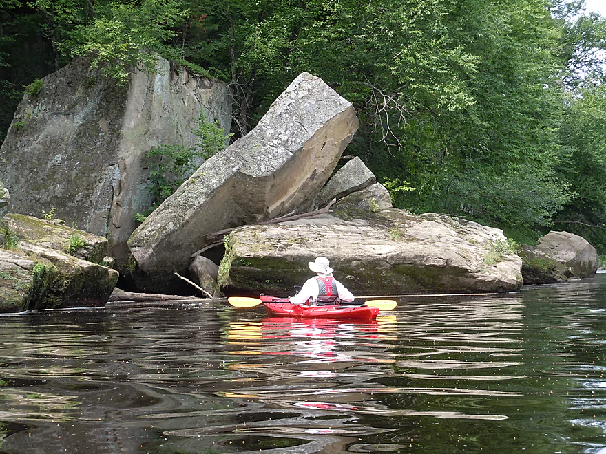
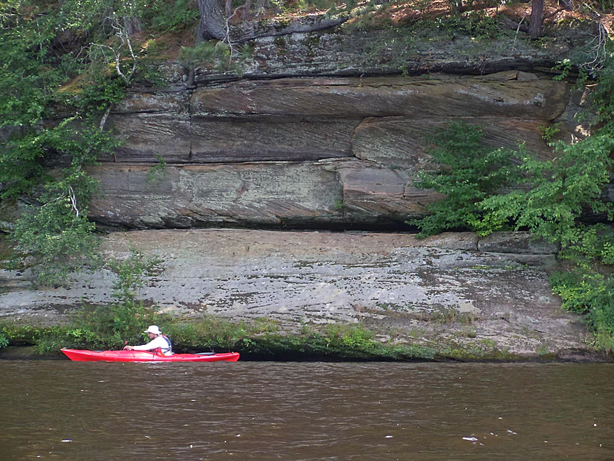
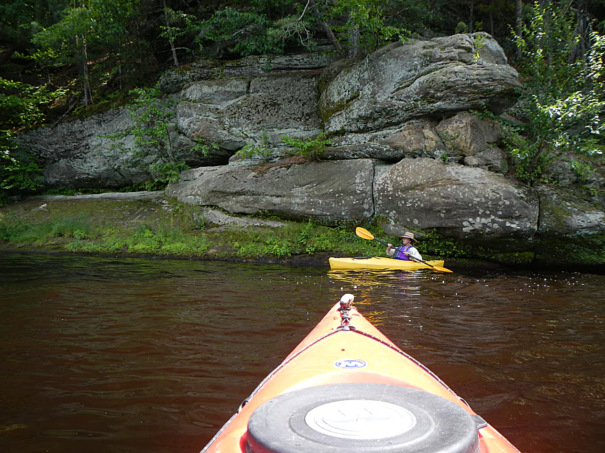
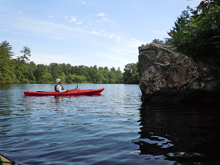
First major outcrop
Lot of ferns
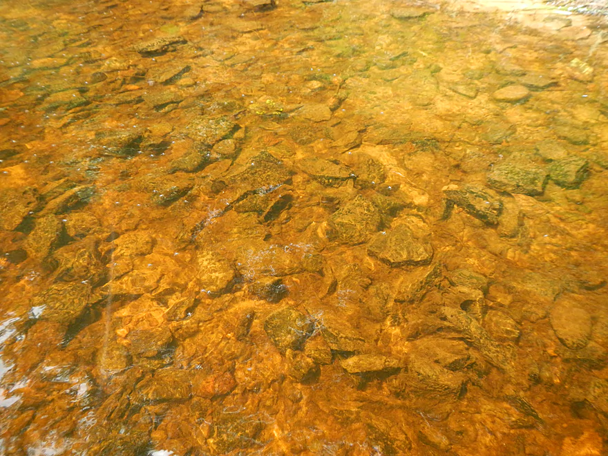
Root beer water
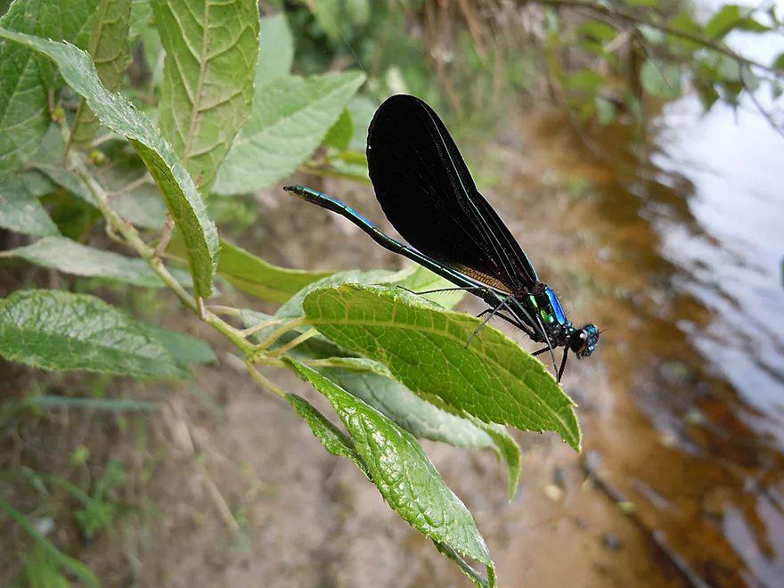
Damselfly
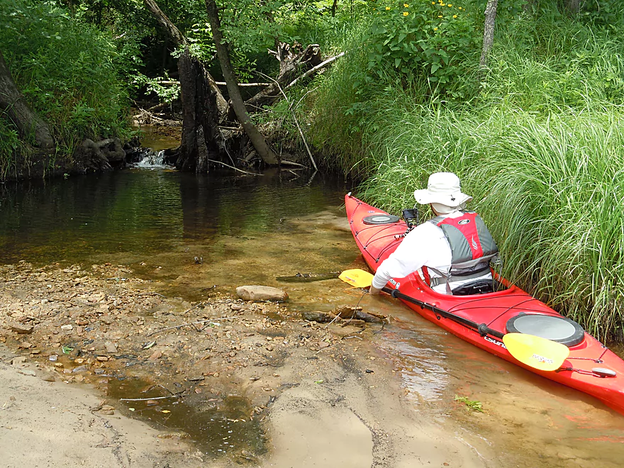
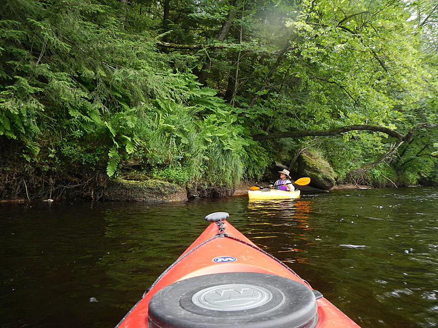
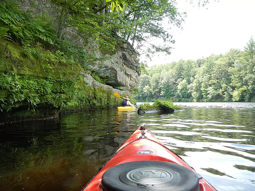
Checking out a small side creek
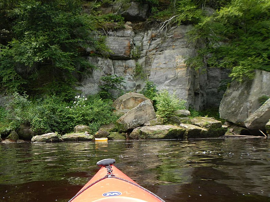
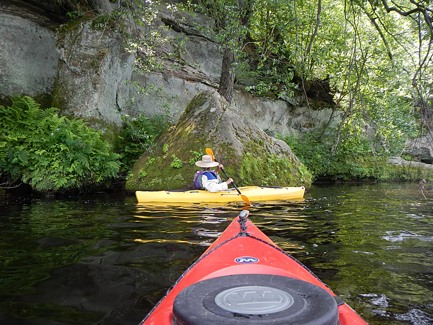
One of a handful of nice outcrops
Water raining from the cliff side
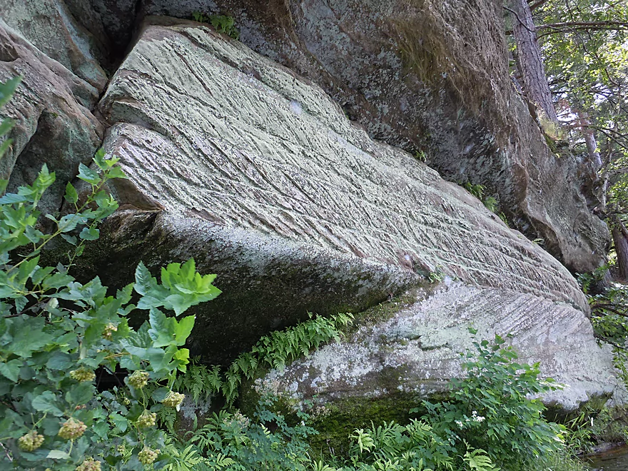
Glacial scrape marks
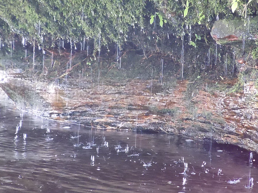
Micro-waterfall
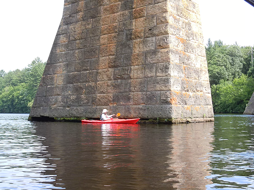
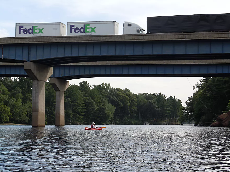
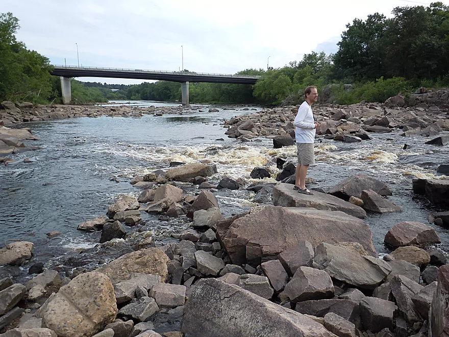
Impressive railroad briddge
Warped rocks
This part of the river has a lot of boat traffic
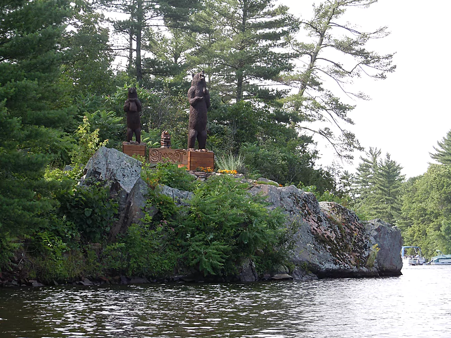
It says “sweet”
I-94
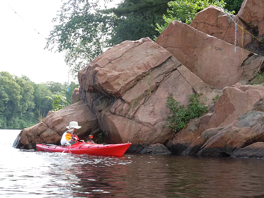
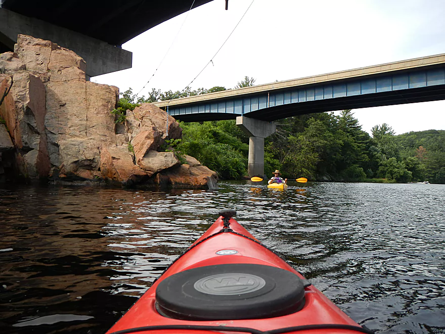
That is a tarzan rope hanging from the bridge…
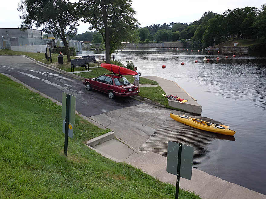
Taking out above the dam

You can portage the dam if you wish
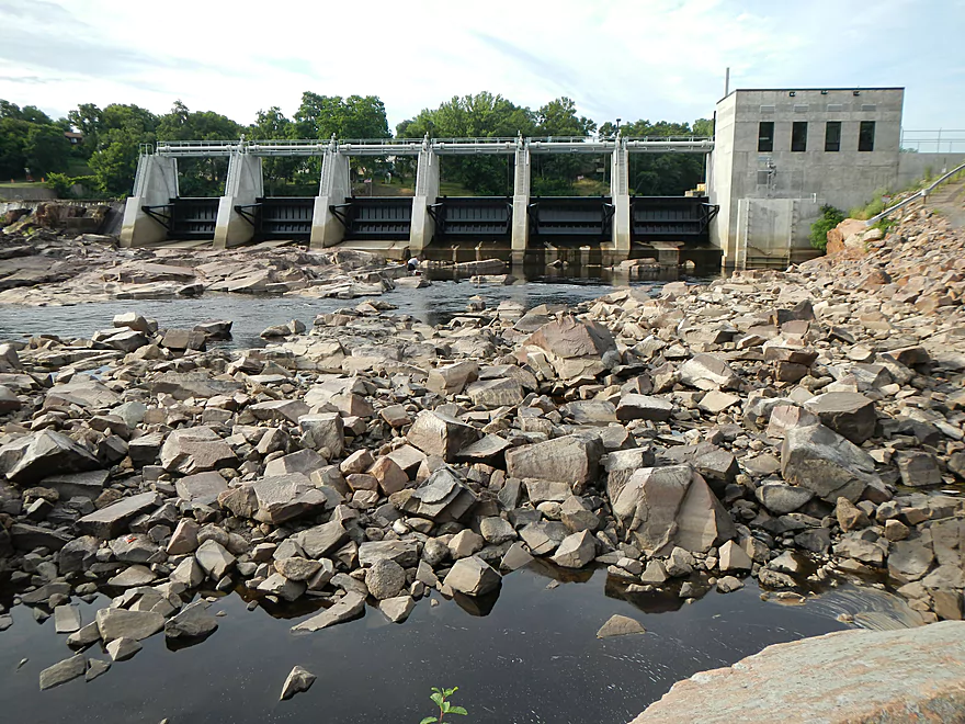
There is a scenic boulder garden below the dam
And fun rapids
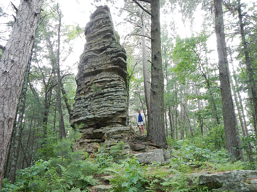
If you have time after a trip, check out Castle Mound
Black River Flowage


There are a number of nice prospects in the Black River area, but for this trip we did a more obscure segment that is probably only say the 4th/5th best route…yet was still very nice. You can kind of divide the Black River in two. Paddling above the dam at Black River Falls and paddling below. The vast majority of trips occur below the dam, which is quite nice for about 20-30 miles (and still decent after that). Far upstream on the upper Black, you have very obscure segments that I don’t know much about and probably require decent rainfall. Then you have the rapids, which make the Black River famous…but few, other than experts, paddle these regions. The rapids and boulder gardens pretty much die at the mouth of Halls Creek though, which makes this a navigable section all the way to the dam.
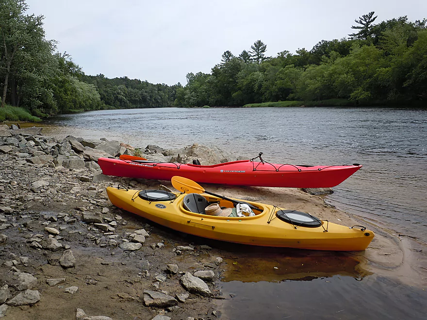
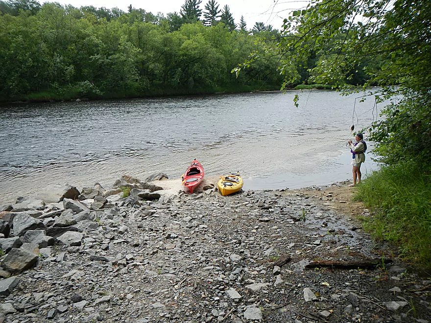
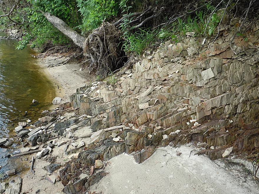
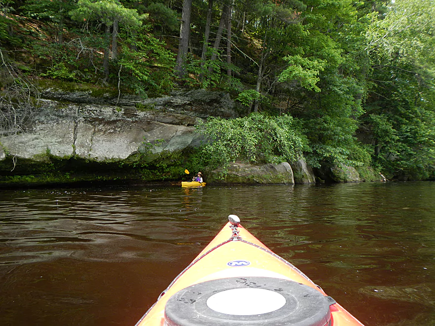
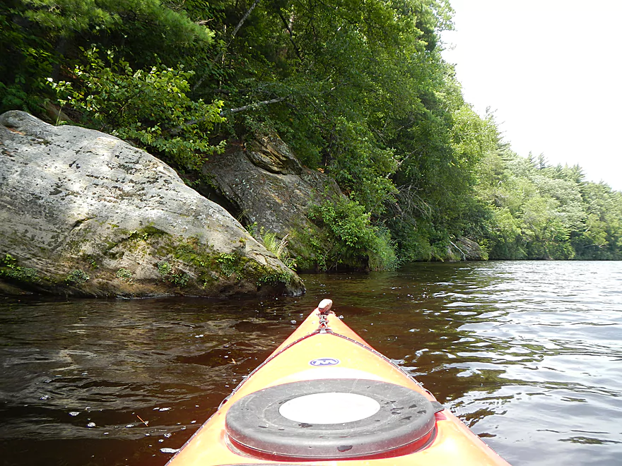
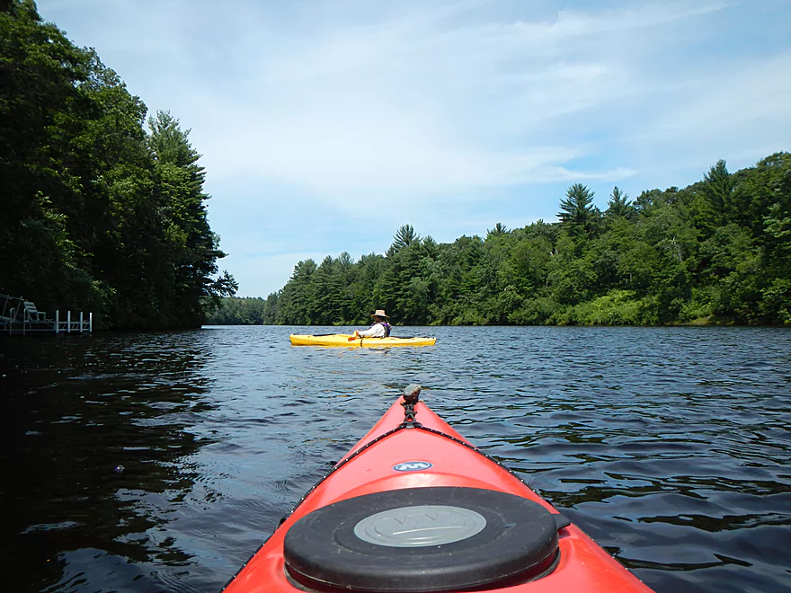
When I asked the local livery companies about shuttling above the dam, almost all turned me down…they pretty much serve exclusively below the dam. Eventually I was able to convince Black River Canoe Rental & Liquor (715-284-8136) to shuttle two of us to Halls Creek for 40 dollars while we left our car at the dam. Despite the local liveries knowing nothing about upstream paddling (even though they should!), we came across a very nice canoe landing at Halls Creek where friendly locals let us know that this was a very nice section of the river. At the put in, you’ll see the “last” of the rapids and some very cool stratified rocks to the right of the landing. Just a heads up that neither the Halls Creek nor the Dam landings have outhouses.
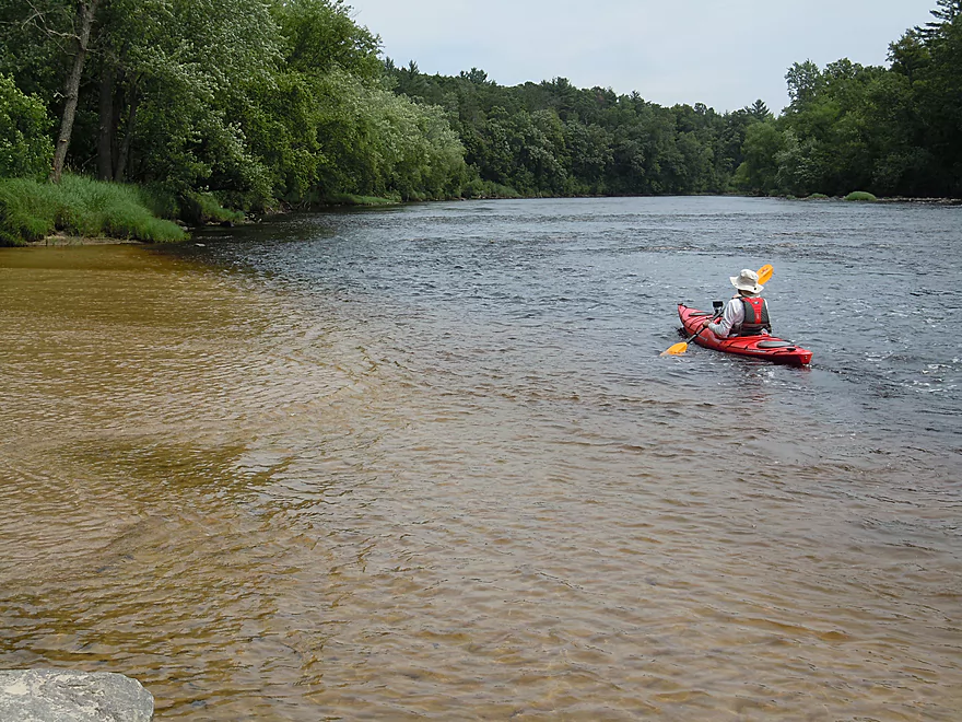
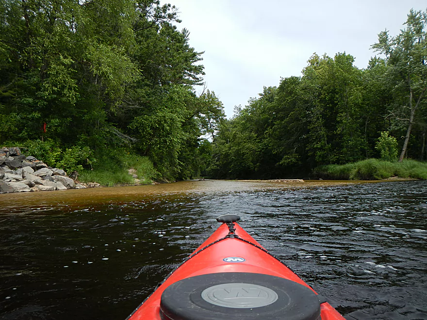
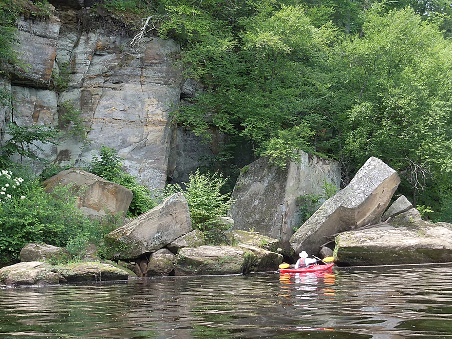
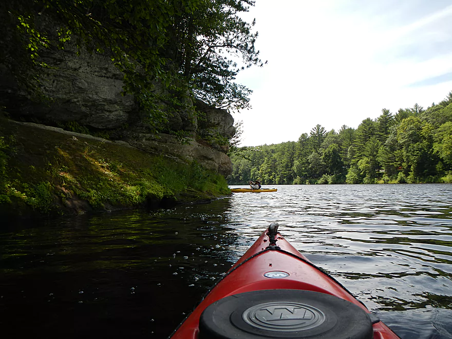
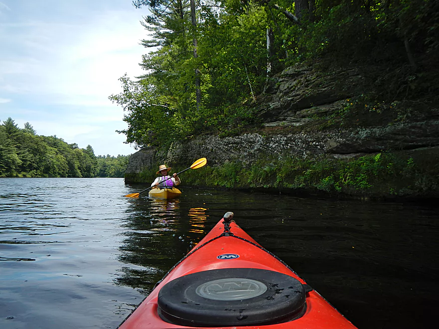
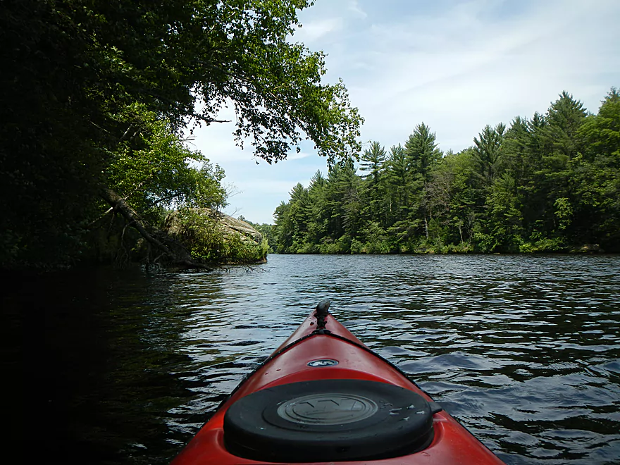
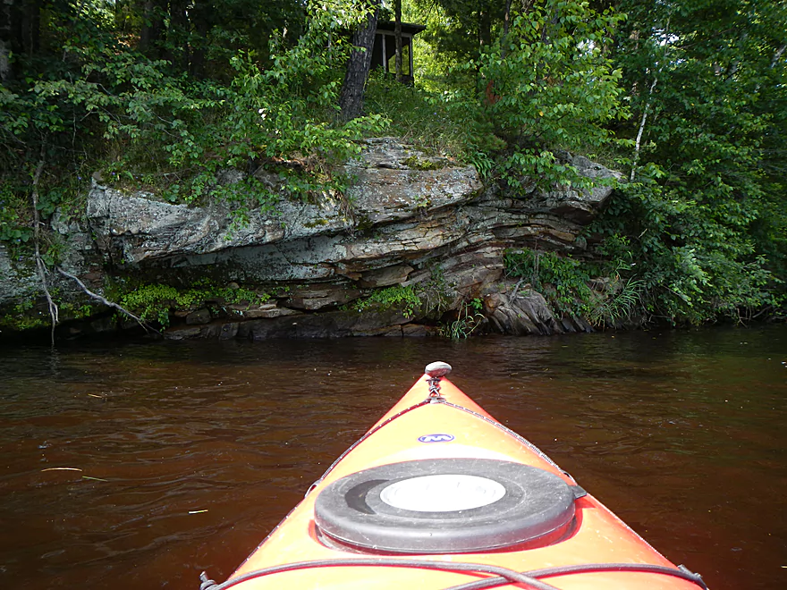
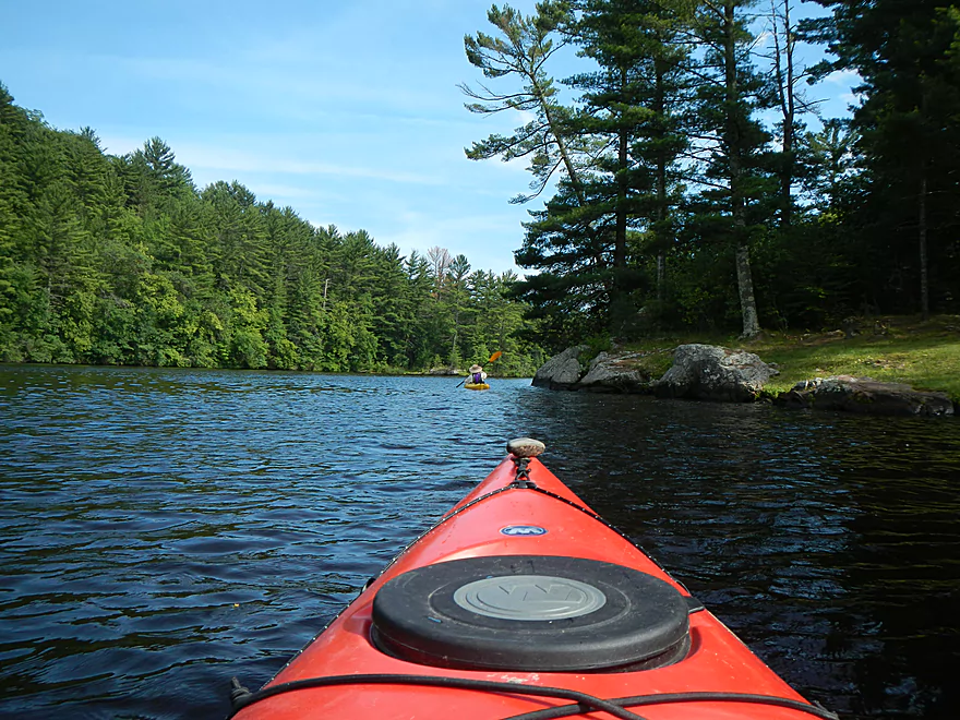
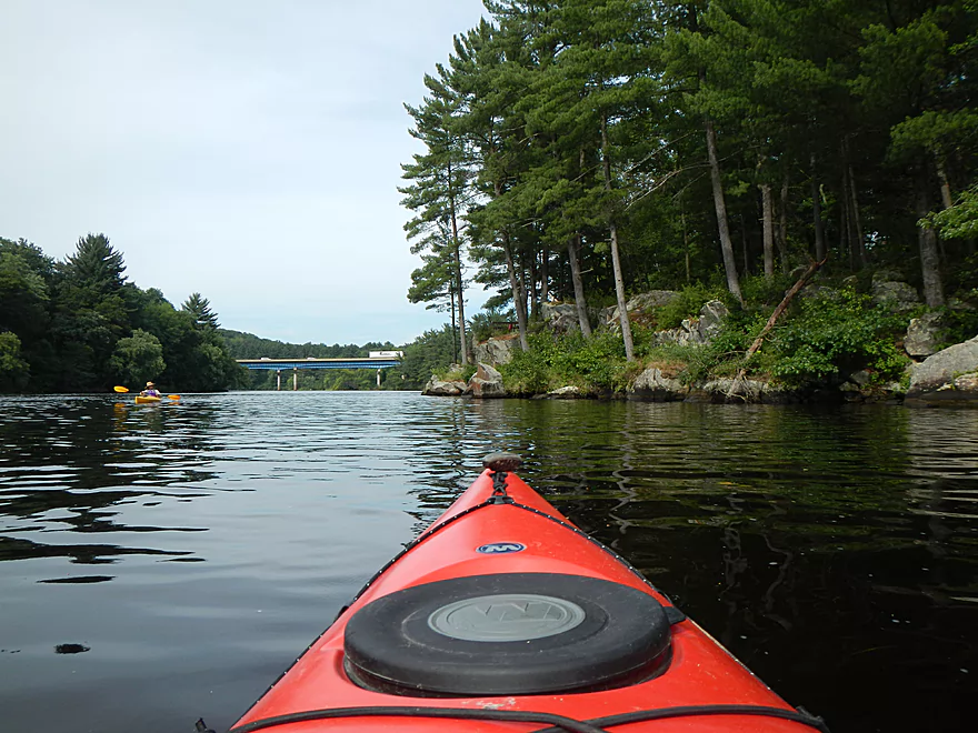
After the first bend you’ll see some very nice rock formations and this is the start of a ~3 mile stretch that has beautiful bluffs. It kind of reminded me of the Dells/Kickapoo. There are shallow areas here and there, but if you stick to the main channel you’ll be fine (we went during low water, too). While I’ve labelled this section as a flowage, this is only partly true. The flowage does not kick in maybe until mile 2 of the trip…and then doesn’t really become pronounced until halfway through the trip. Even then the river stays very narrow because of the steep hills so this doesn’t feel like a classic flowage.
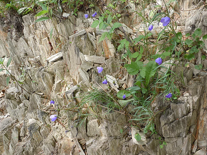
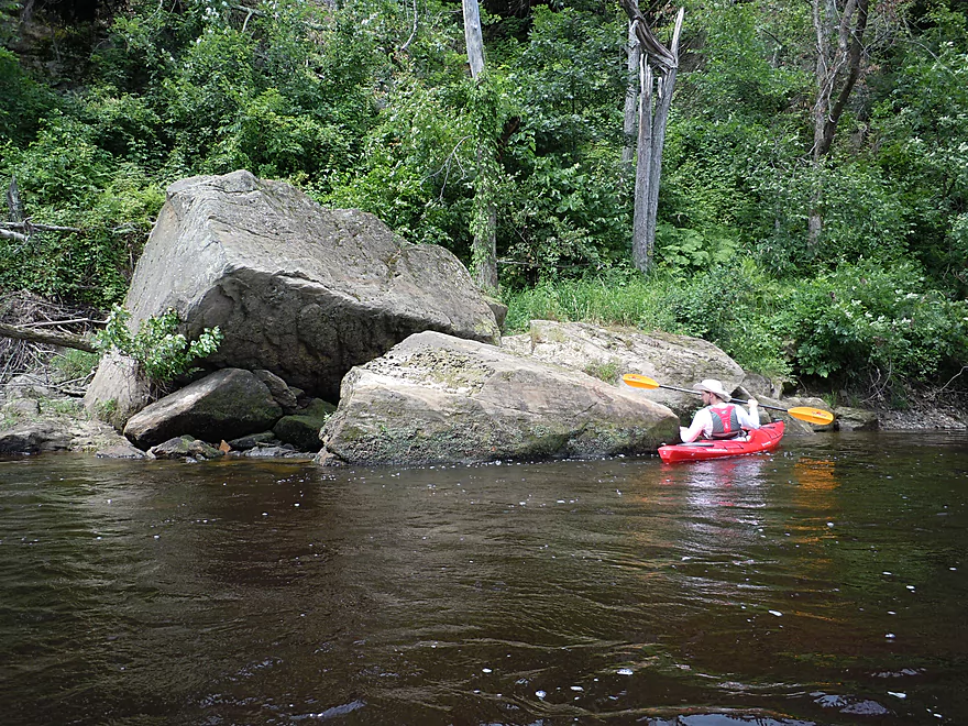
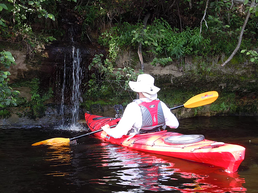
The bluffs aren’t the only treat on this segment. You’ll encounter a lot of nice plants (mosses, ferns, flowers) on this trip. The water is very beautiful, clean, and has a root beer color to it which is unique (well, relative to southern Wisconsin rivers). There are also several nice “micro-waterfalls” and “raining” bluffs that are very nice. On occasion you’ll see a random boulder in the water which you can paddle around. Maybe about mile two into the trip there is a nice tiny creek/sandy area that you can get out and explore (all in the pictures).
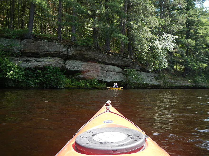
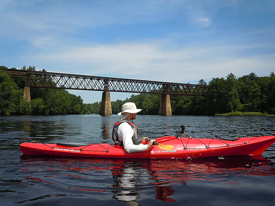
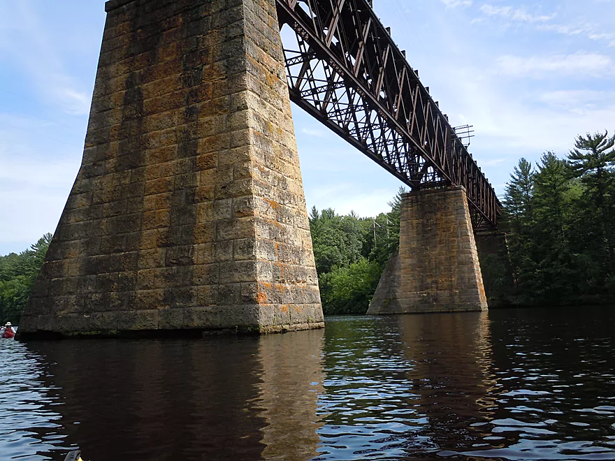
Roughly speaking, the halfway point on the trip is marked by a very large railroad bridge (impressive structure). Unfortunately this marks the end of the better half of the trip. The upper first 3-4 miles are protected from development by a state natural area and are very nice. But once the state natural area ends, development, piers and power boats are prevalent and there is even a private island/party area. Before you go under the railroad bridge, hang a sharp right and you’ll come across the best of the “micro-waterfalls”–which I used to clean off the dirty nose of my kayak…
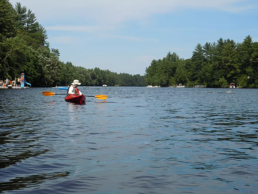
As the flowage kicks in, the deeper water allows the power boaters to go nuts and they are a nuisance. Because of the bluffs on the river, the waves don’t dissipate like normal, but bounce hard off the cliffs and can be a mouthful to handle. Some boaters were considerate and slowed down when they passed us, but they were a small minority. One particular tubing power boat must have passed us at full speed six times! Besides the wake, the noise of the boats (and the people) were unfortunate. Some of the locals don’t seem to care for scenic beauty and just want to party on the water–a shame as there are plenty of opportunities to do that elsewhere, while scenic areas like this are unique.
The other (minor) gripe I had that kept this from being a five star trip was the lack of current after the flowage kicks in. Current helps make trips go a lot more effortlessly…and it is a lot of work to paddle many miles with no helping current. The development and piers detract from the shoreline beauty and while they start as a trickle, become much more common once you get close to Black River Falls. In some ways the lower half reminded me of Lake Wisconsin in terms of lakefront development and activity.
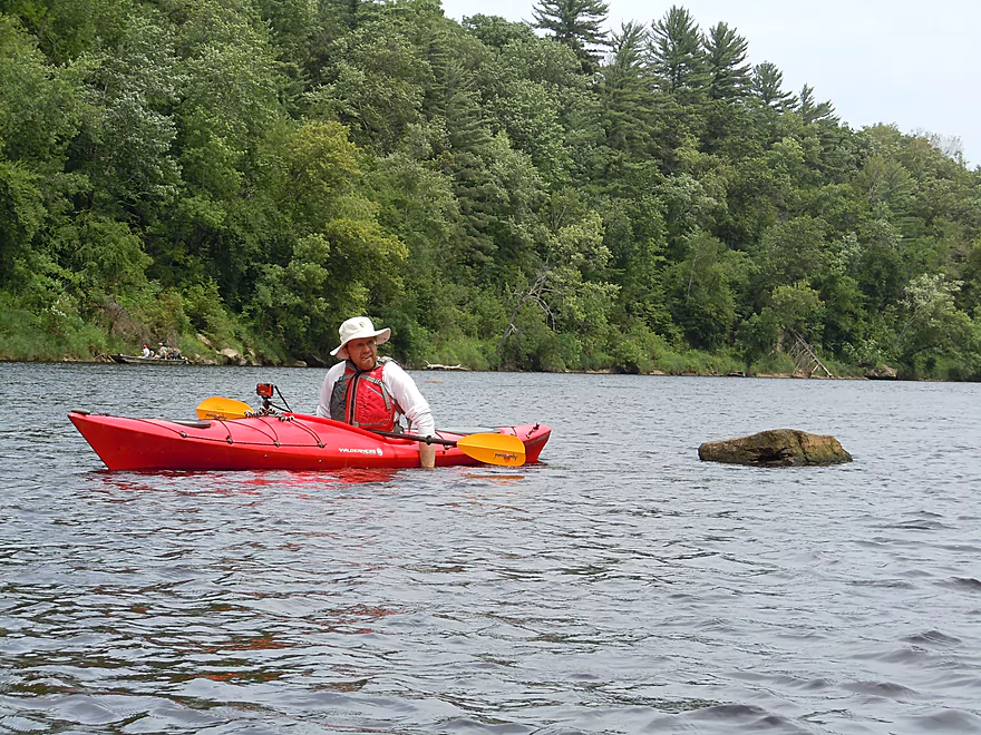
These are minor gripes though, and all in all, this was a positive trip despite the second half. There are still nice areas that are completely buried in the flowage on the second half. The white pines are quite scenic, and you’ll see occasional nice mini-bluffs and boulders (would be more glorious without the dam). We came across a teenage eagle by its nest, which was a treat as well. Again, despite this being a flowage, it is still very narrow so it seems somewhat like a river…but with no current.
The take-out before the dam is easy to spot. It will be the large landing to the left of the dam. The dam itself is roped off somewhat, but obviously you don’t want to get near it. Our shuttle driver told us the story of a family on a pontoon boat that went over (during high water). His cousin attempted to recover the bodies later below the dam, but ended up drowning as well, despite being roped to other rescuers. There are pretty mean rapids below the dam as you’ll see from the pictures. Getting back to the take-out…it is a nice (but busy) public boat ramp, with free parking, but no bathrooms. There is a portage path around the dam but it isn’t terrific and would be a bit of a hike, especially for one person, as the path is quite rocky.
Even if you don’t have to portage, make sure to explore around below the dam. You can access the bottom area from both sides of the river, but the side by the landing is probably easiest. Here you’ll see a wonderful panorama of the dam gates, the rapids, boulder piles and the downstream sections of the river. Very photogenic…
The canoe trip author Mike Svob suggested visiting nearby Castle Mound, which we did. It’s a nice public trail system/overlook in a state campground that is marked on the map and has some nice rock formations, but also has a lot of mosquitoes and campfire smoke. Maybe figure 40 minutes of hiking round trip to get to the Mound (very scenic). The trail system is part of the famous ski trail system in the Black River Forest that is quite extensive and is considered by multiple sources to be one of the best cross country ski trail systems in the state.
Quick Overview
Black River:
- Upstream of Hwy 73: Obscure sections of the Black with little known about them. Some legs will have logjam issues.
- Hwy 73 to Lake Arbutus: 48 miles. Good legs with a mix of rapids, boulder gardens and undeveloped banks. Only reason these legs don't receive more paddling traffic is because they're located away from population centers.
- Lake Arbutus: 3 miles. A scenic but challenging lake because of the waves.
- Hatfield Dam to Halls Creek Landing: 7 miles. Some of the best and most fun whitewater on the Black River.
- Halls Creek Landing to Black River Falls Dam: 6 miles. An impounded part of the river, but nice with cool cliffs.
- Black River Falls Dam to North Bend: 37 miles. This is the heart of the Lower Black and sees the most paddling traffic. No major rapids, but there are many scenic cliffs and creek inlets.
- North Bend to Mouth: 30 miles. This is the second half of the Lower Black. While not as scenic, there are still cool sandbars and sandbanks. Few paddle these stretches.
Noteworthy Tributaries:
- Robinson Creek: One of the best paddles in all of Wisconsin.
- Halls Creek: Also one of the best and with amazing sandstone walls.
- Morrison Creek: Very scenic creek with some fun whitewater.
- Wedges Creek: Great paddle with amazing boulder gardens.
- East Fork of the Black River: Some fun riffles and unique granite geology.
- Perry Creek: Shallow but a super scenic creek.
- Dickey Creek: A wonderfully scenic creek with fantastic sandstone…but too many logjams.
- Beaver Creek: Some fun rapids and amazing sandstone in Galesville, but logjams on the downstream portions.
- Popple River: A shallow whitewater river that is very nice.
- Arnold Creek: A pleasant tributary to Lake Arbutus with really nice reflections.
- Rock Creek: Many scenic boulder gardens, but usually this creek is too shallow to run.
- Roaring Creek: Very scenic creek with a great waterfall at the mouth, but might be a challenge to paddle.
- Vismal Creek: Super scenic but has a lot of logjams and is shallow. Requires very high water conditions.
- Plus countless small creeks that are too small to paddle but quite fun to explore by foot. If you know of viable paddling options, let me know! Am very curious to know more about Douglas Creek, Levis Creek, O’Neal Creek, and Crawley Creek.
Detailed Overview
Headwaters to Neillsville:
- Upstream of Division Drive: Likely too many logjams to be navigable.
- Division Drive to Sawyer Ave: (6.5 miles) Rocky and a few light rapids. Maybe 4 logjams.
- Sawyer Ave to Hwy 64: (2.5 miles) Rocky and a few light rapids.
- Hwy 64 to Bridge Road: (14.4 miles) Solid prospect reviewed by Mike Svob. Some Class 1 rapids and nice gravel bars. Intermediate access points at Bahnkes Ave and Hwy AT.
- Bridge Road to Hwy X: (6.0 miles) Little is known of this section…likely pretty simple.
- Hwy X to Colby Factory Road: (6.0 miles) Little is known about this section…likely some rapids and outcrops. Intermediate alt access points at Hwy 29 and Hwy N.
- Colby Factory Road to Popple River Mouth: (7.9 miles) This stretch has far fewer rapids than downstream legs with only a few minor rapids. It should still be pleasant though.
- Popple River Mouth to Reese Ave: (5.3 miles)
- Popple River Mouth to Warner Drive: (1.0 miles) This is a slower and less interesting stretch, but does include 4 Class 1's and scenic Hemlock Rapids which are Class 3.
- Warner Drive to Greenwood Park: (3.4 miles) A good leg with many rapids (3 Class 2's and 17 Class 1's).
- Greenwood Park to Reese Ave: (0.9 miles) A slower stretch with just 2 Class 1's. Part of this passes through the community of Greenwood.
- Reese Ave to Twenty Six Rd: (5.1 miles)
- Reese Ave to Sladich Rd: (0.7 miles) A mostly nondescript wooded stretch. The exception is Greenwood Rapids where an island splits the river. The right side is scenic, but the left side has fun Class 3 rapids.
- Sladich Rd to Willard Rd: (1.6 miles) A somewhat slow and relatively uninteresting leg. Highlights include one nice outcrop, a few gravel bars and a 400' stretch of Class 1 rapids.
- Willard Rd to Twenty Six Rd: (2.8 miles) A great leg with 10 Class 1's and 2 Class 2's. Highlights also include scenic boulder gardens and a few outcrops.
- Twenty Six Road to Hwy H: (5.0 miles) Multiple Class 1 & 2 rapids.
- Hwy H to Grand Ave/Hill Road: (8.0 miles) A great trip with several Class 2 rapids and scenic granite outcrops.
Note, for more details on the Upper Black, I highly recommend “Indian Head Rivers” by Michael Duncanson.
Alternate Black River Trips – Neillsville to Black River Falls:
- Grand Ave/Hill Road to Opelt Road Landing: (6.7 miles)
- Grand Ave/Hill Road to Hwy 10: (2.2 miles) Nice section with a handful of rapids. These are mostly Class 1 at lower depths, but strengthen to Class 2 during high flow rates.
- Hwy 10 to River Road Landing: (4.3 miles) Fantastic whitewater section. Maybe six Class 2’s and two class 3’s. Scenic boulder gardens and a few outcrops.
- Opelt Road Landing to Bryan Ave Bridge: (1.1 miles) Not sure there is anything special about this stretch.
- Opelt Ave Bridge to Hwy 95: (4.4 miles) Ok…nothing special.
- Hwy 95 to West Arbutus County Ramp/Hatfield Dam: (4.8 miles)
- Hwy 95 to North Arbutus Boat Landing: (2.4 miles) Includes a scenic gorge, boulder gardens and rapids including the Class 3 Red Granite Rapids. River slows after rapids.
- North Arbutus Boat Ramp to West Arbutus County Ramp: (2.4 miles) A large open water paddle on Lake Arbutus that can feature challenging waves on summer afternoons.
- Hatfield Dam to West/East Channel Confluence: 0.2 or 0.3 miles.
- West Dam to West/East Channel Confluence: 0.3 miles. There is a large boulder field and Class 2 rapids below the west dam. At the outlet of the west channel is a Class 4 drop. This is easy to scout and portage.
- East Dam to West/East Channel Confluence: 0.2 miles. Perhaps the most extraordinary rapids in the state with Class 4/5+ rapids. The action starts below the dam where steep granite banks narrow the river significantly and force it down deep chutes. The gorge starts with Class 2-3 rapids but ends with two significant drops. American Whitewater warns “between the dam and this point lie some serious drops which contain near inescapable boiling cauldrons at moderate to high flows”.
- Hatfield Dam Confluence/West Clay School Road to Powerhouse Road Landing: (3.1 miles)
- Hatfield Dam Confluence to Hwy K: (0.3 miles) One of the most scenic paddling areas in the state with massive granite outcrops. There is one set of Class 2 rapids.
- Hwy K to Powerhouse Road Landing: (2.8 miles) The first half mile by Hwy K is very scenic and contains one Class 3. The second mile is mostly flatwater. The third mile is almost continuous rapids and features one Class 3.
- Powerhouse Road Landing to Halls Creek Landing: (4.0 miles) Scenic section with a few Class 2 rapids and a steep ledge.
- Halls Creek Landing to Black River Falls Dam: (6.2 miles) Wonderful sandstone cliffs.
Alternate Black River Trips – Black River Falls to Mouth:
- Black River Falls Dam to Mason’s Landing: (4.7 miles) A great little section.
- Mason’s Landing to Irving Landing: (9 miles) A good section.
- Irving Landing to Lost Falls Campground (2.3 miles) A popular stretch. Highlights include a few small outcrops, two tiny waterfalls, several impressive sandbars, and one large sandbank. A side hike to Roaring Falls can be arranged. Note Lost Falls Campground is private and you must purchase a pass from them to use their access.
- Lost Falls Campground to Grinde Landing: (6.4 miles) A popular section with some nice outcrops and a waterfall by Roaring Creek. Wolf Creek may also have a cool slot canyon. The river splinters into multiple channels, some of which may be quite shallow in later summer. As of 2023, Grinde Landing is closed because somebody stole the owner's deer stand.
- Grinde Landing to Melrose Landing: (3.9 miles) A shorter section but with a really nice rock outcrop before Melrose Landing. As of 2023, Grinde Landing is closed because somebody stole the owner's deer stand.
- Melrose to North Bend: (10.1 miles) Likely the most popular stretch with the best sandbars on the river, three sets of outcrops, and a few waterfalls.
- North Bend to Hwy 53: (13.3 miles) Likely a nice paddle with sandbars, large sandbanks and maybe a few outcrops. Unfortunately it is very long.
- Hwy 53 to Hwy 35: (8 miles) A nice section with epic sand banks.
- Hwy 35 to Lytle Road: (4.0 miles) Goes through the Van Loon Floodplain Forest. This can be a shallow trip but features many nice sandbars.
- Lytle Road to Fred Funk Boat Landing (Mississippi): (5.0 miles) Multiple options because of the river delta.
Trip Map
View Black River Flowage in a larger map
Overview Map
Video
Photos Size: