
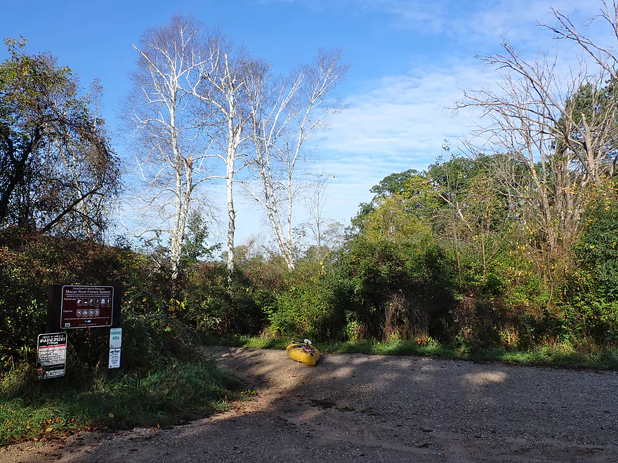
Starting the trip at the Mecan Springs boat launch
The only launch on the lake
Morning dew droplets
Highbush cranberry
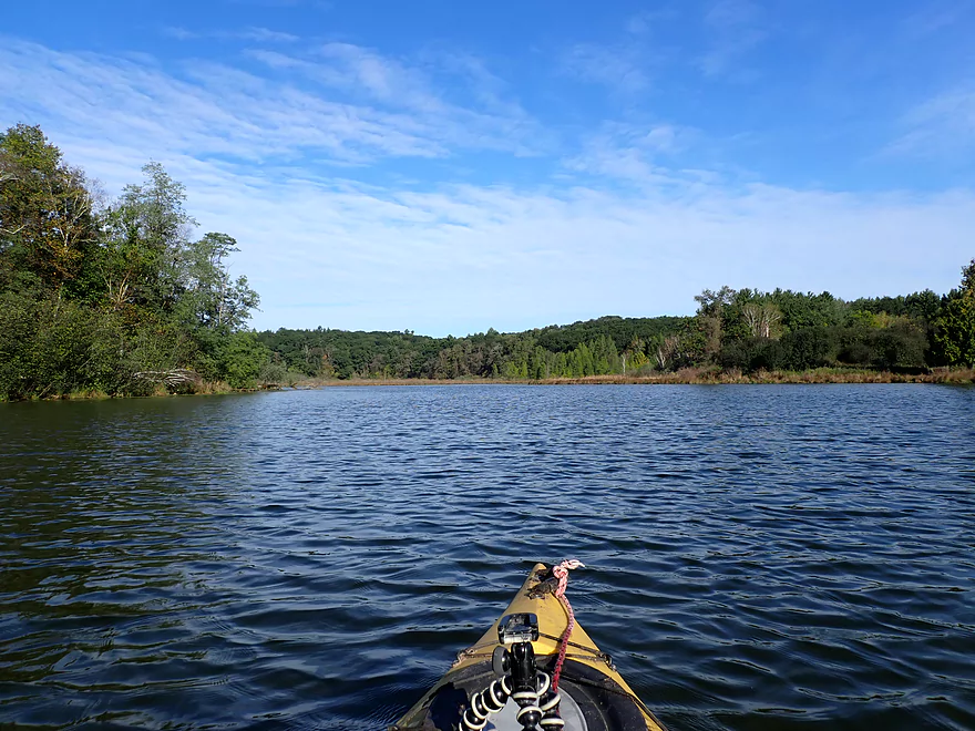
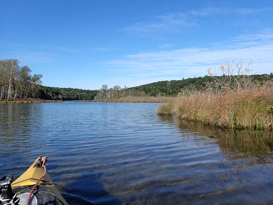
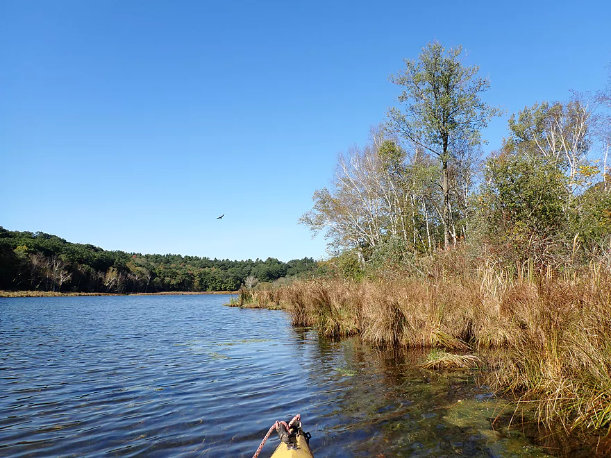
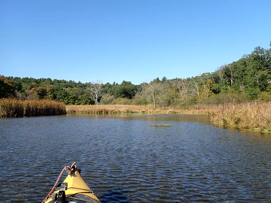
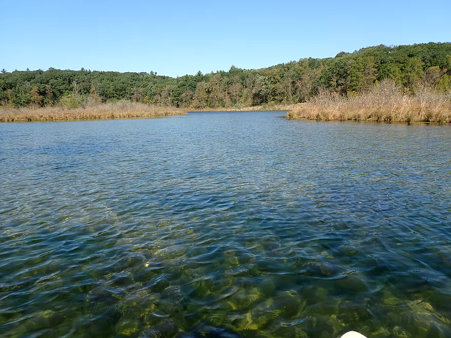
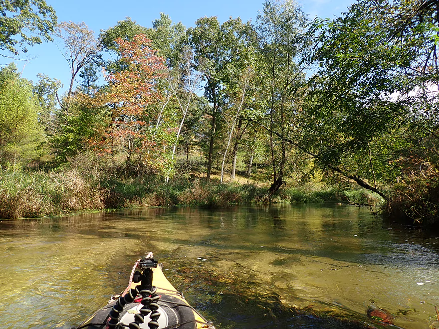
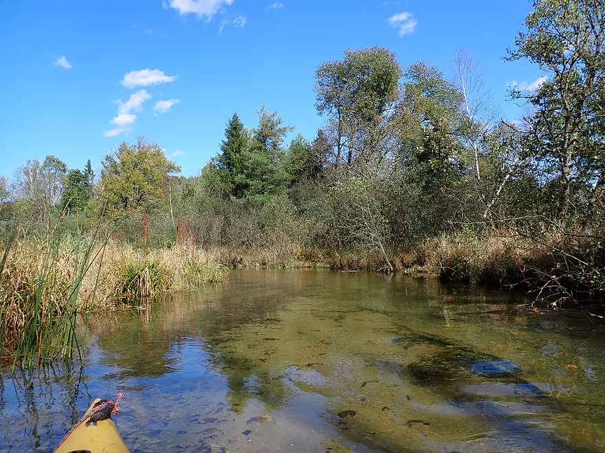
Out onto the main lake
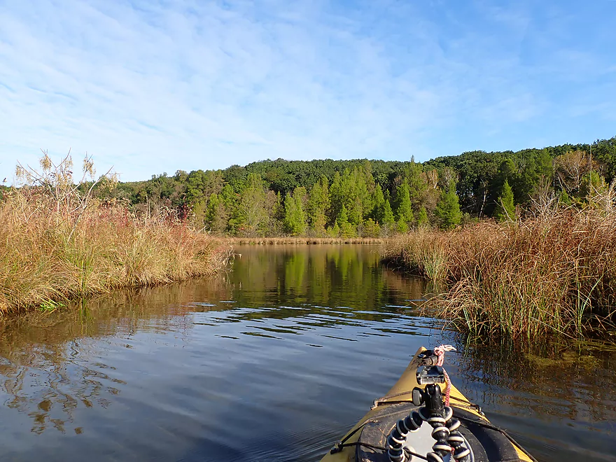
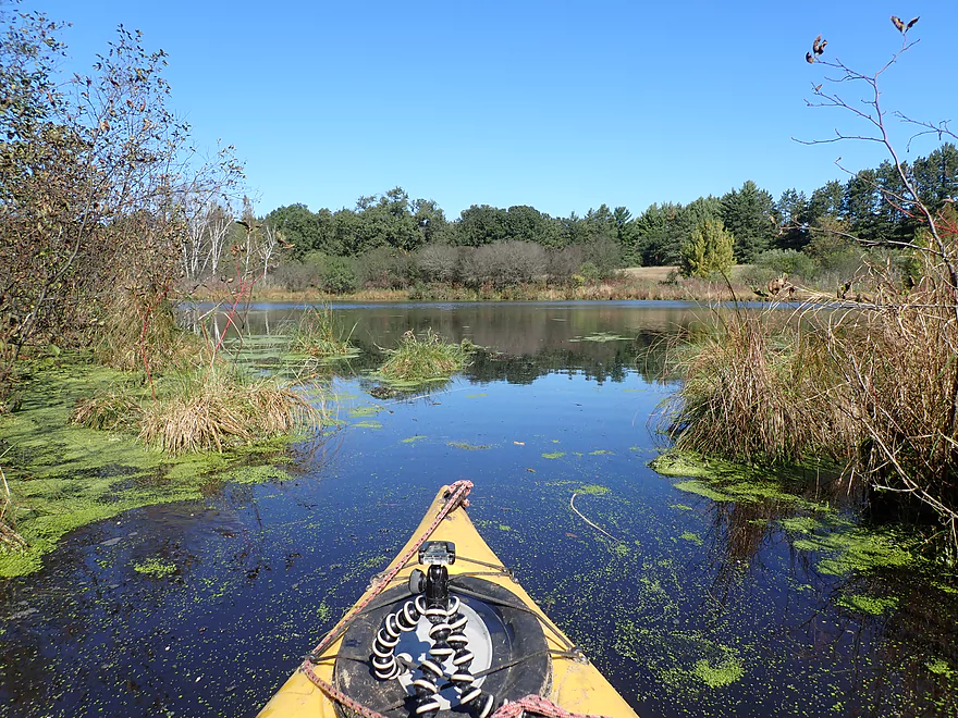
Exploring one of the side bays
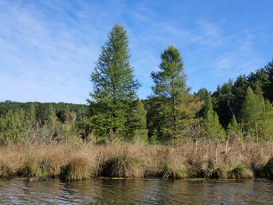
Tamaracks along the shoreline
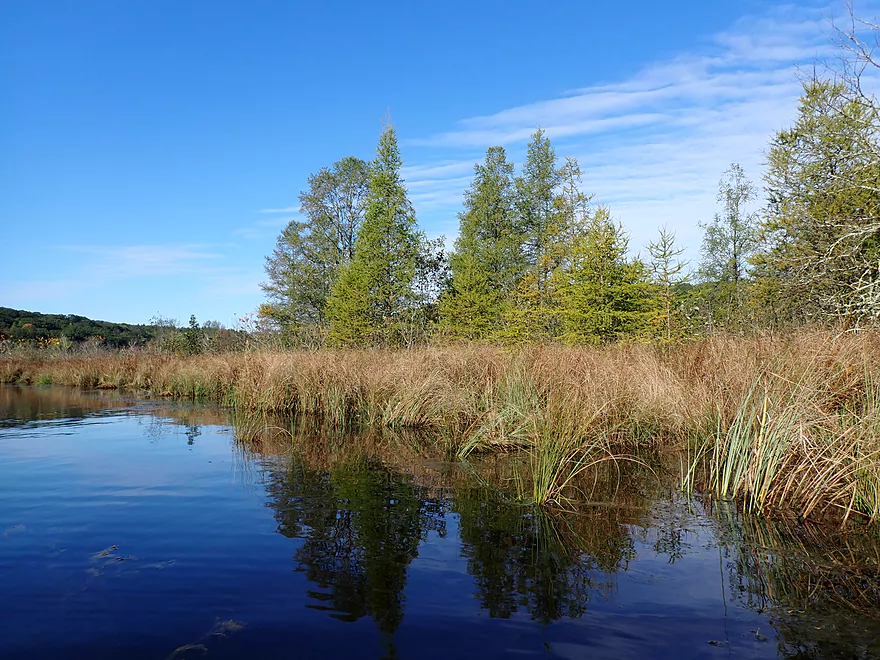
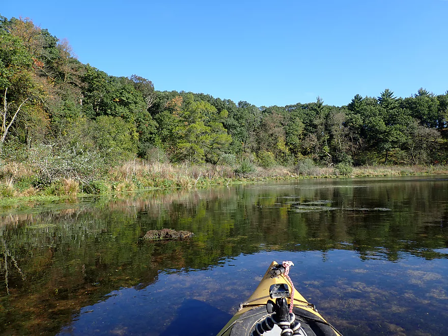
Scenic reflections
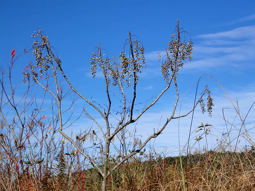
Poison Sumac
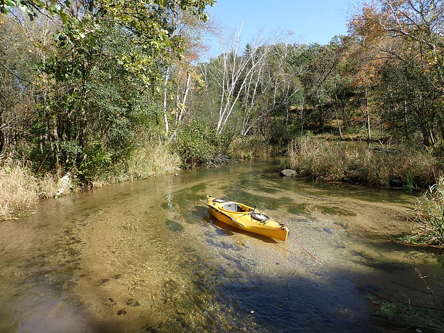
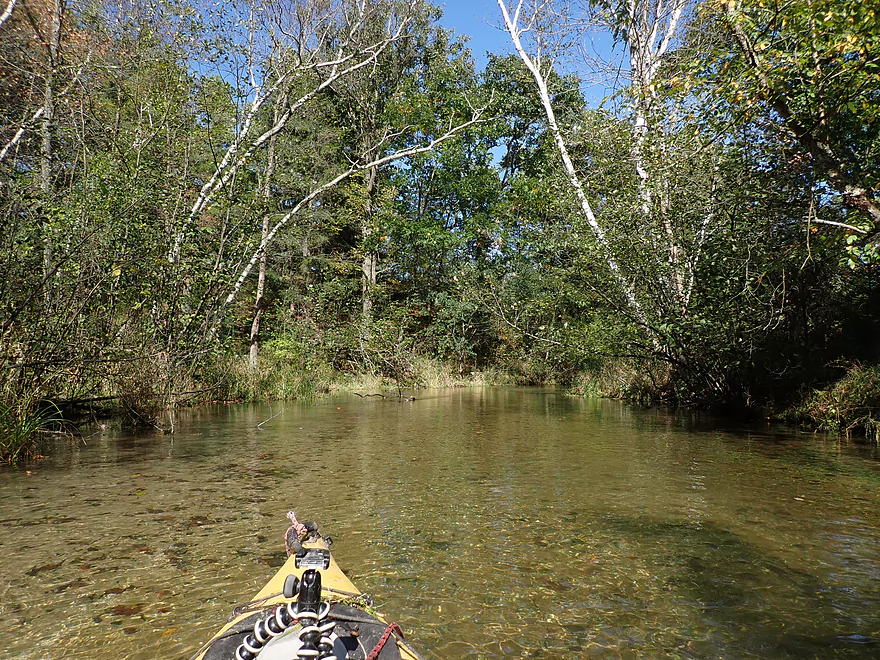
Out of the bay and onto the main lake again
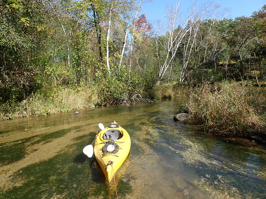
Exploring the northernmost bay
This bay has several visible springs
Pretty cool
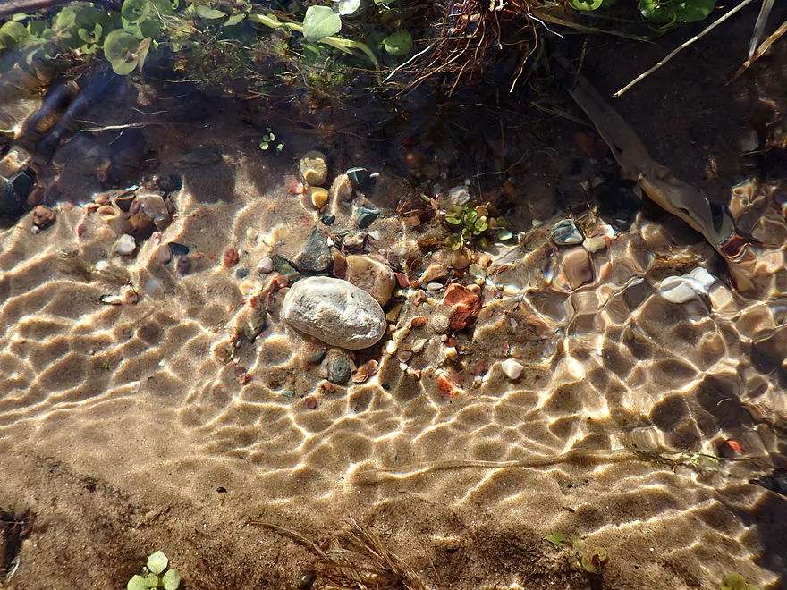
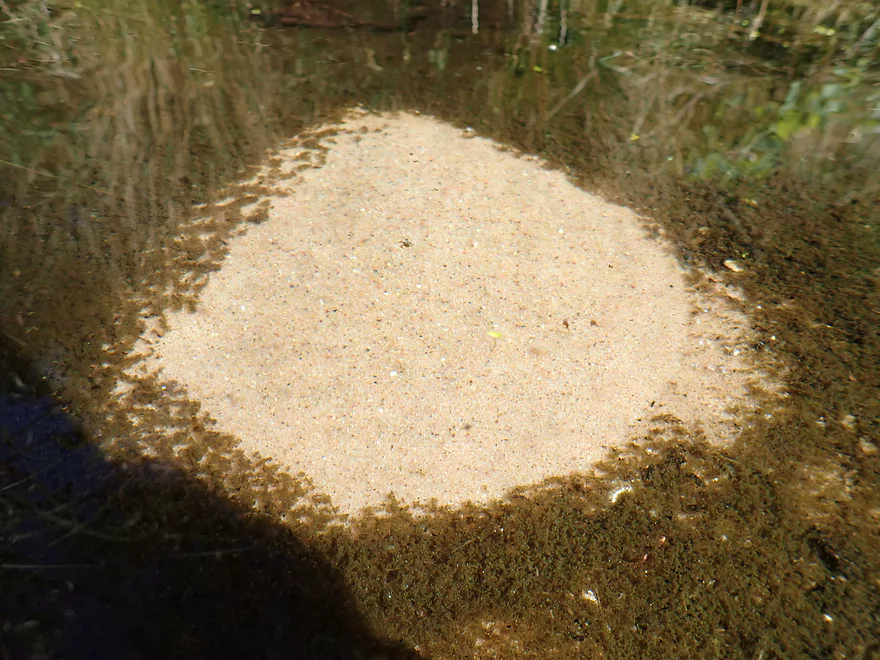
Another set of springs
And an attractive pebble garden
Paddling to the far western end of the lake
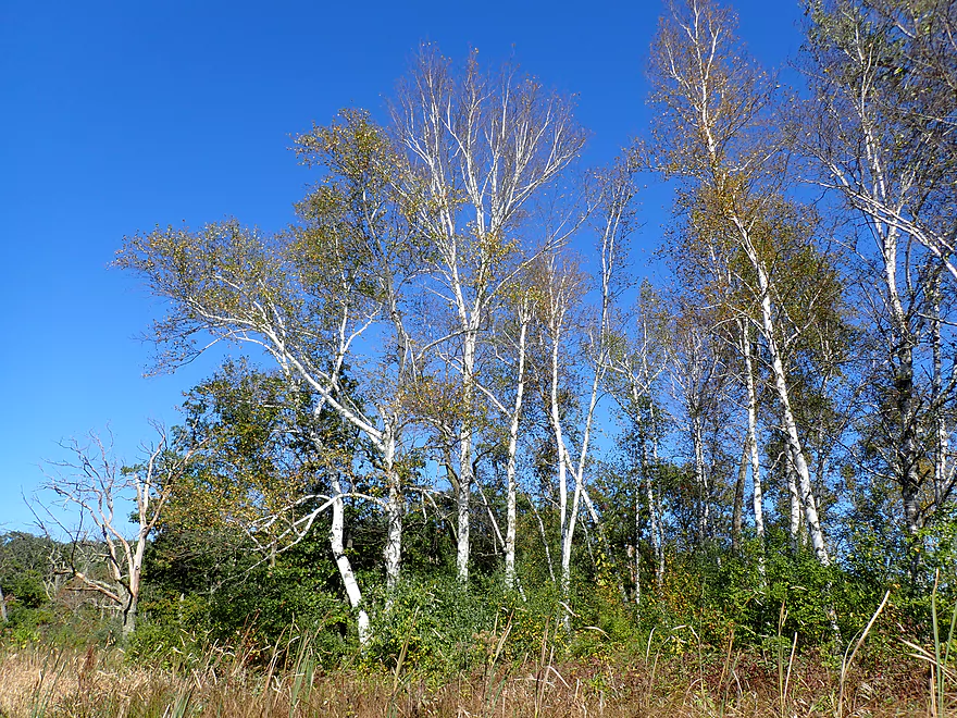
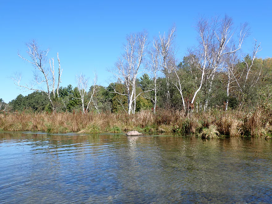
Many nice birch along the shore
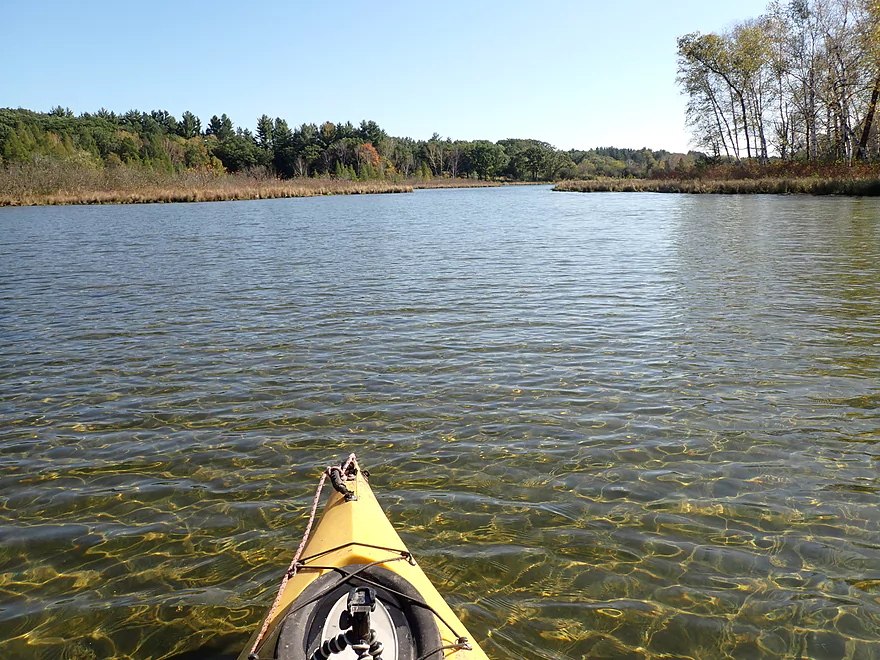
The western bay is the biggest but shallowest
A spring boil
Returning back
View of the side bays
Reverse view
Lot of crooks and crannies to explore
Scenic shoreline
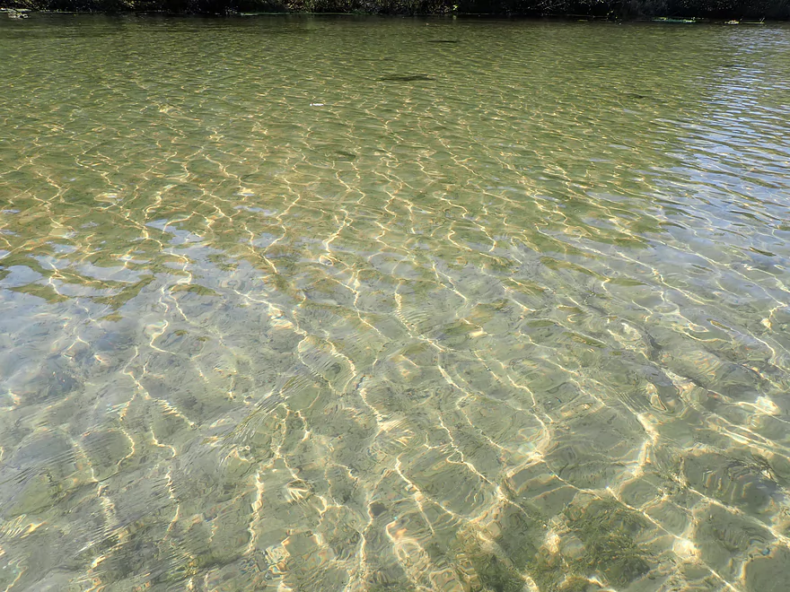
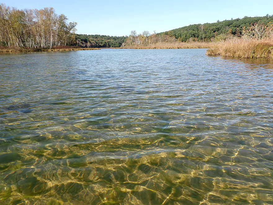
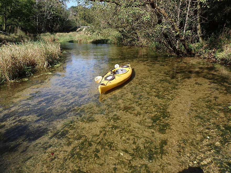
Water clarity was stunning
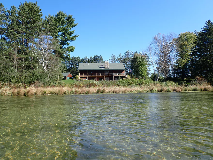
One of the only homes on the lake
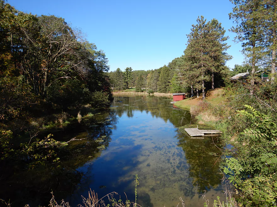
The far southern end of the lake
The Mecan River starts just south of Hwy GG
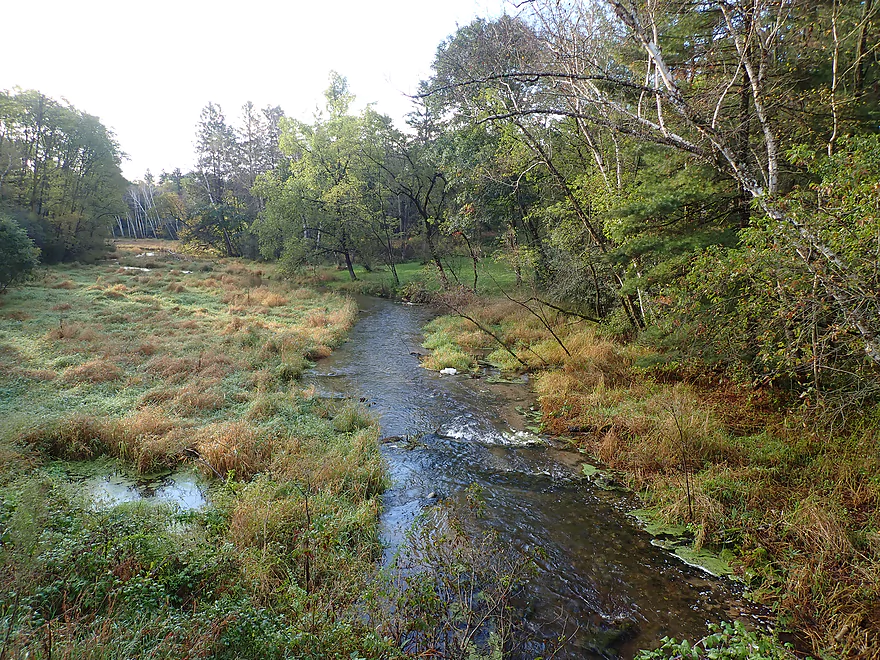
View from the bridge
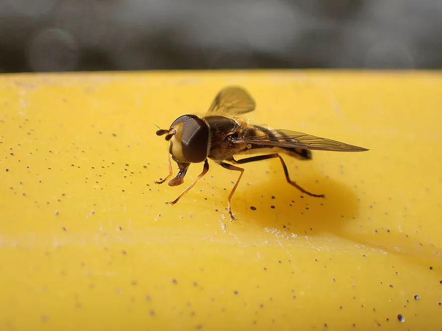
The always photogenic hoverfly
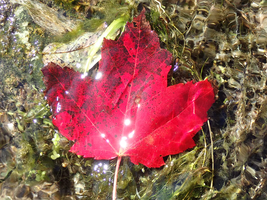
Submerged maple leaf
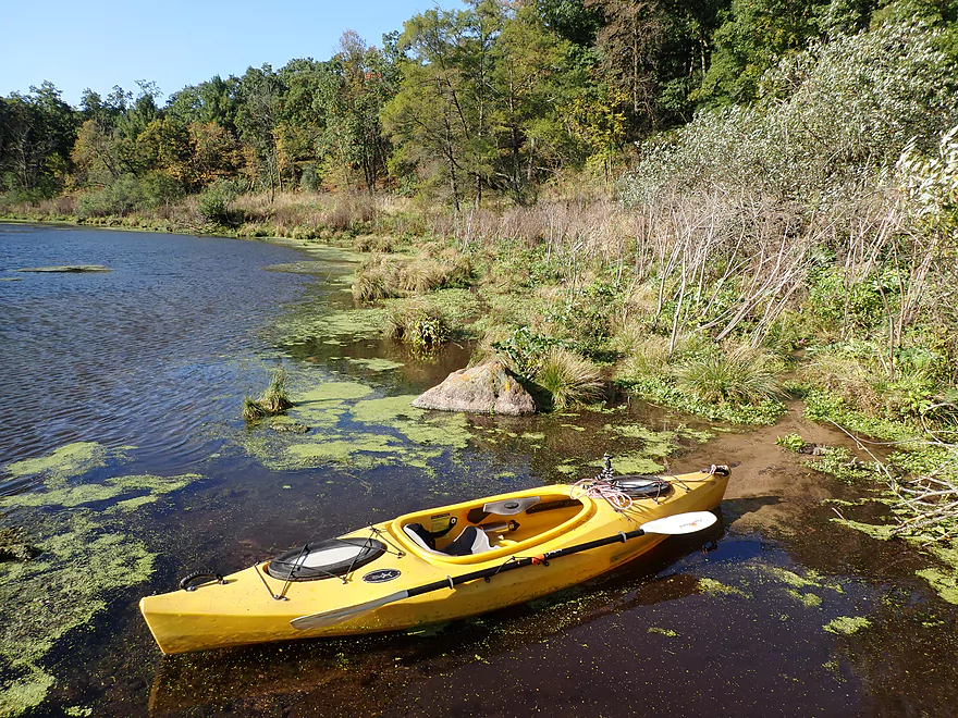
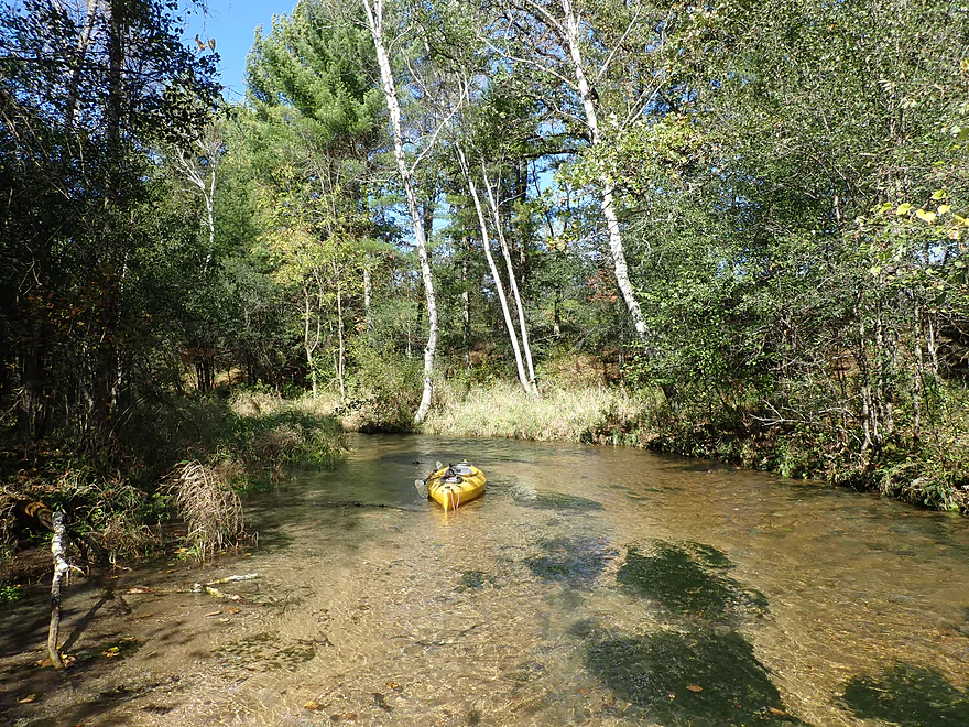
Getting out for pictures
Perfect clarity
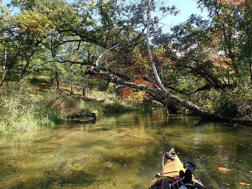
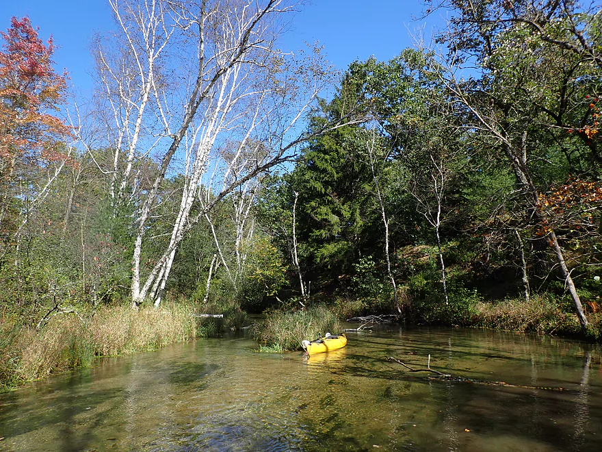
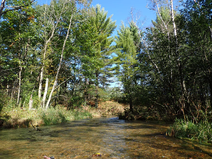
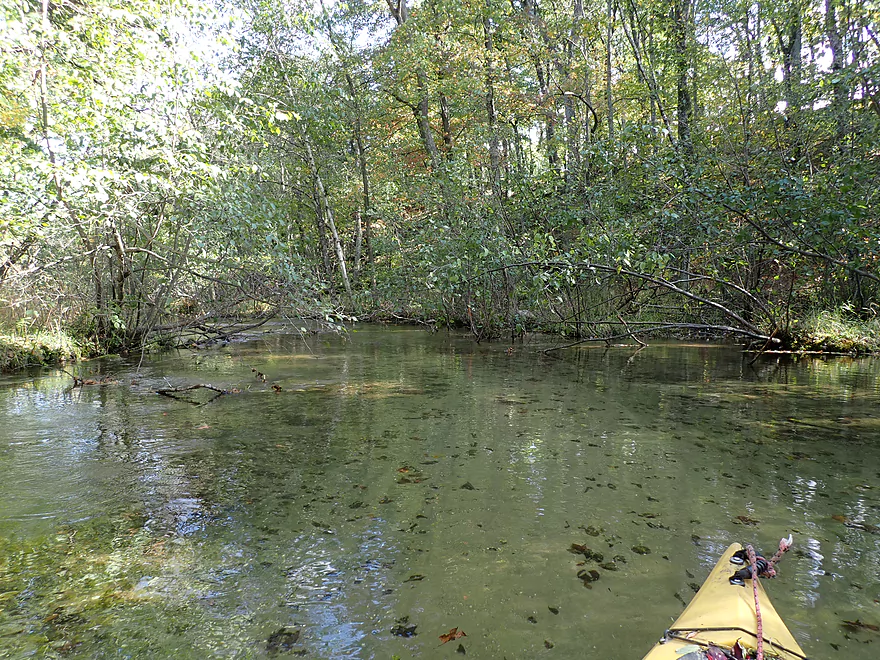
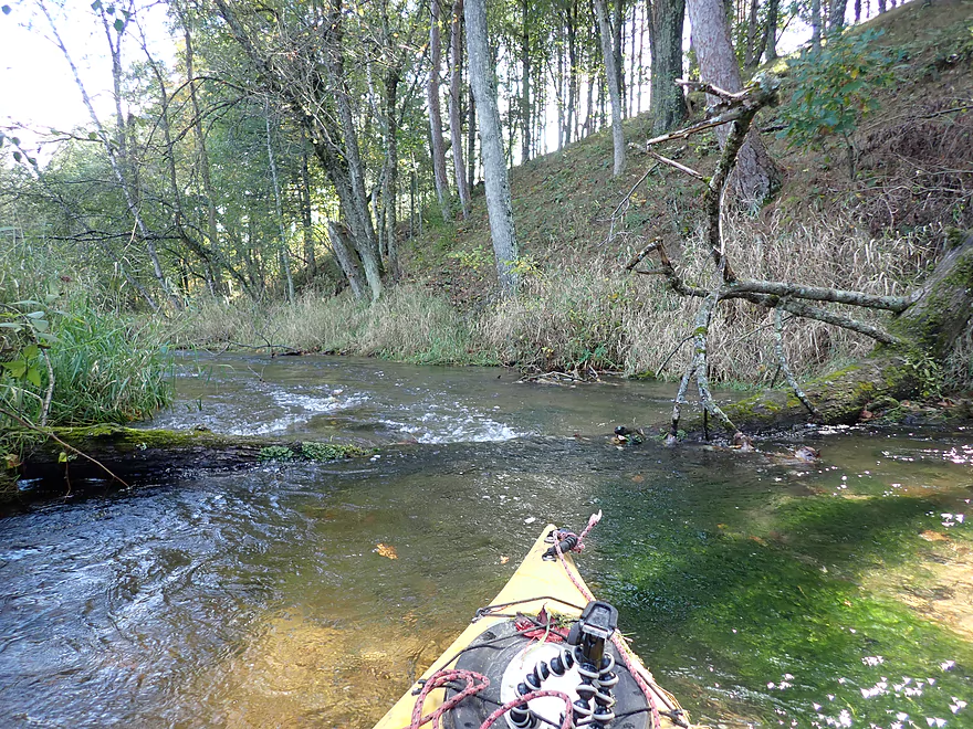
Entering a brief wooded section
Some logjam cleanup work
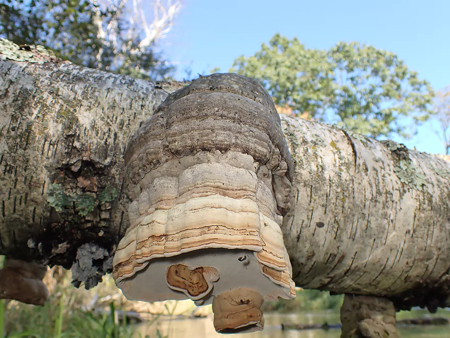
Birch Polypore
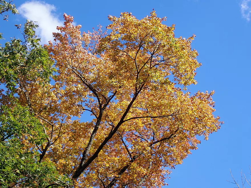
Some color, but still a week away from peak
Starting to see more congestion
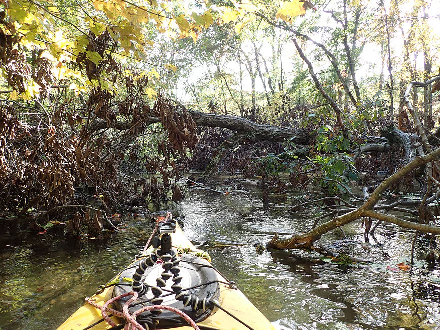
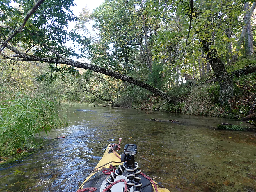
I didn’t have to portage, but some jams took effort to get around
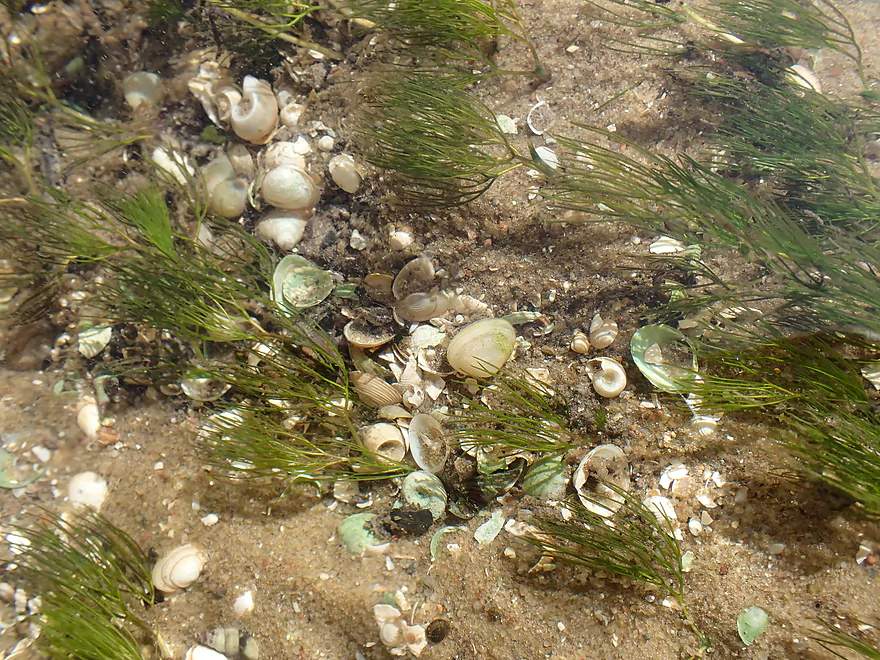
Just a small fraction of the shells that I saw
My favorite part of the river
So clean
Getting out for pictures
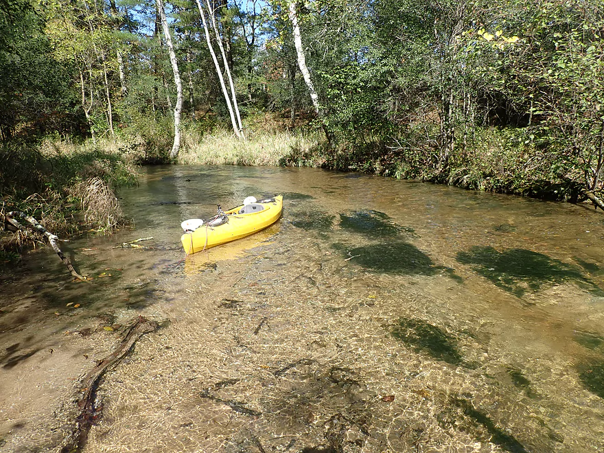
Leaving the kayak in for scale
Very sandy substrate
Some nice white pines
Reverse view
Pretty cool
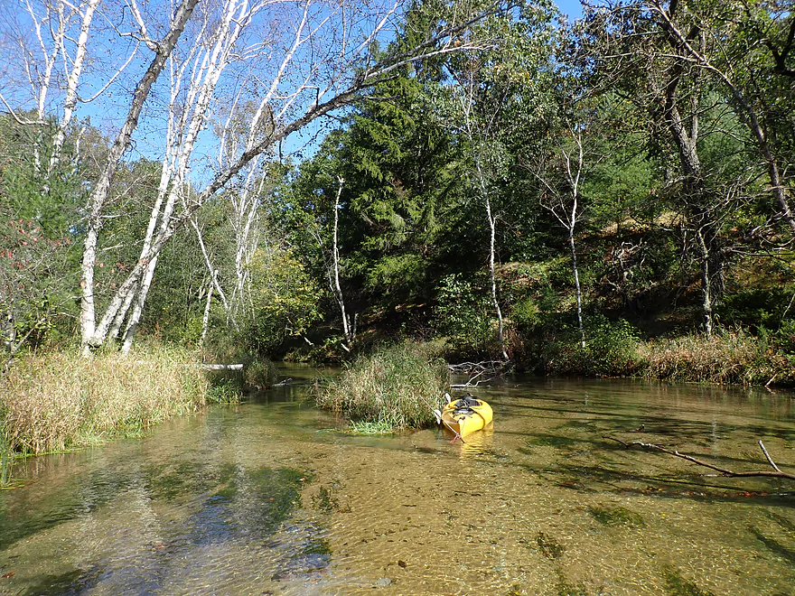
Entering another wooded section
Current starts to pick up
Some fall color
Still some downed trees, but not bad
The final stretch
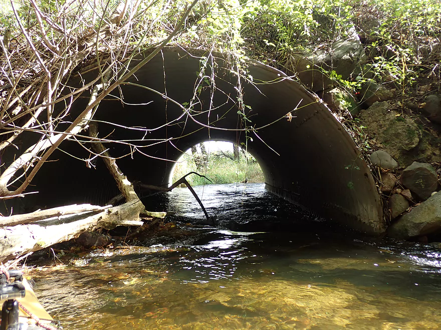
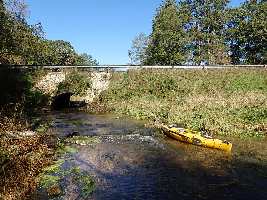
Some obstacles in the 9th Ave culvert
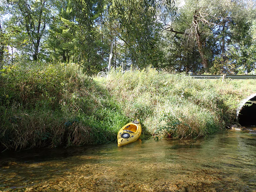
Reverse view
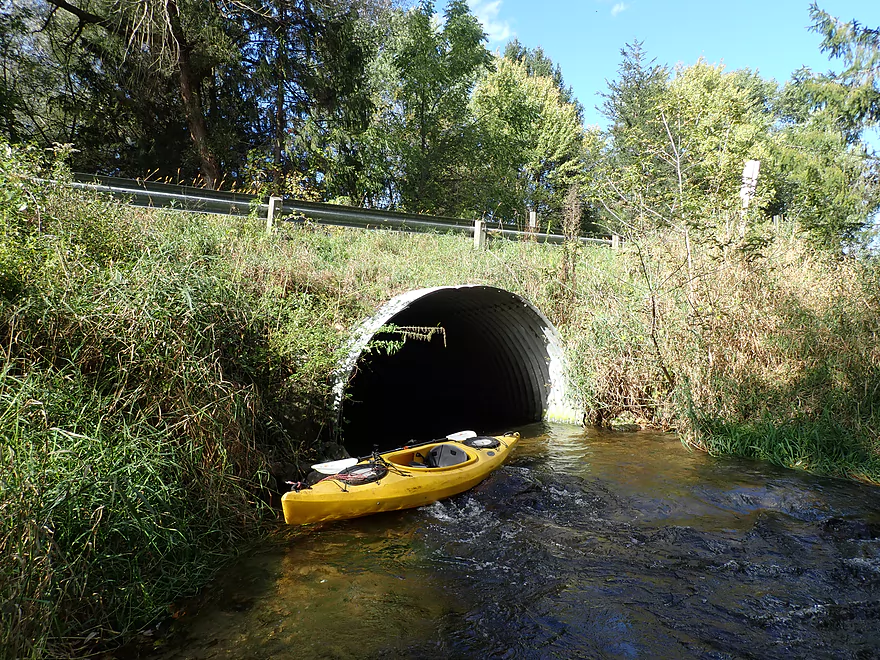
Taking out at 9th Ave
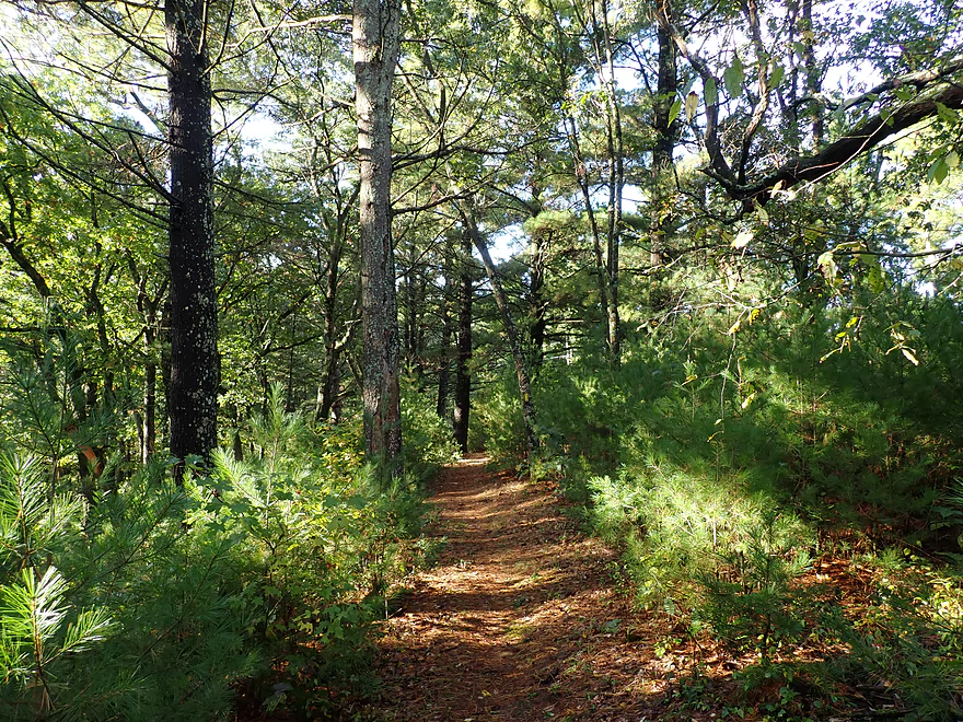
Checking out the nearby Ice Age Trail
Mecan Springs


One of my favorite paddling rivers in central Wisconsin is the Mecan River. This is a gem known for its good current, clarity, lack of mud, and undeveloped shoreline. I’ve paddled the Mecan four times before, but this time I wanted to do something different and explore its headwaters. The Mecan’s origins are unique in that it “springs” out of nowhere. Located just east of Coloma is a moraine lake sandwiched between two hills which is fed entirely by numerous springs. This is where the Mecan begins its journey.
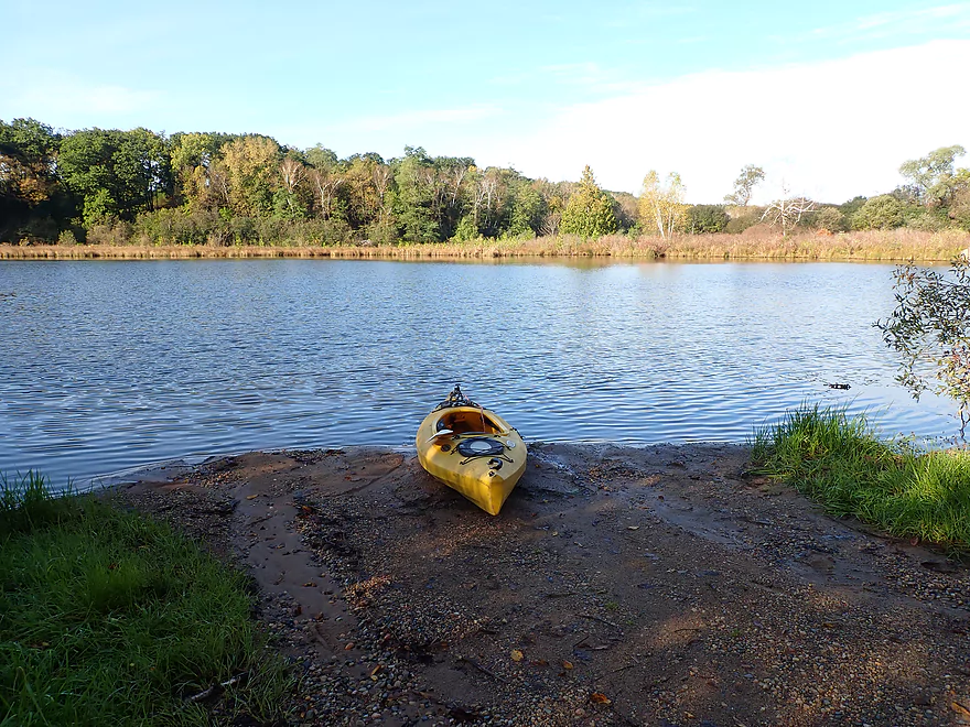
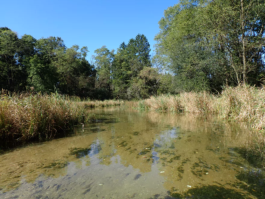
The main lake is referred to as “Mecan Springs”, which is a protected state natural area and is serviced by a boat ramp along the north shore. I don’t think this is a popular natural area, and if you paddle it you’ll likely have the entire lake to yourself (as I did). It’s one of the prettier lakes in Wisconsin with nearly perfect clarity and white birch lining the shore. There are numerous spring-fed bays along the north shore that paddlers can venture into and explore. Unfortunately most of the springs were hidden amongst the weeds. When looking for springs, try to find clumps of watercress and out-of-place rock clusters along the shoreline.
The best springs were featured in the northernmost bay. Here tiny little spring brooks ran over attractive pebble gardens and fed the main lake. In some spots the lake is fed by underwater springs where “boils” bubble up like little volcanoes. You definitely don’t want to wade over these as they are usually accompanied by quicksand. In fact much of the lake bottom is quite soft and wading in general isn’t recommended. The eastern end of the lake doesn’t have as many springs, but is scenic with the highlight being the white pines along the shore.
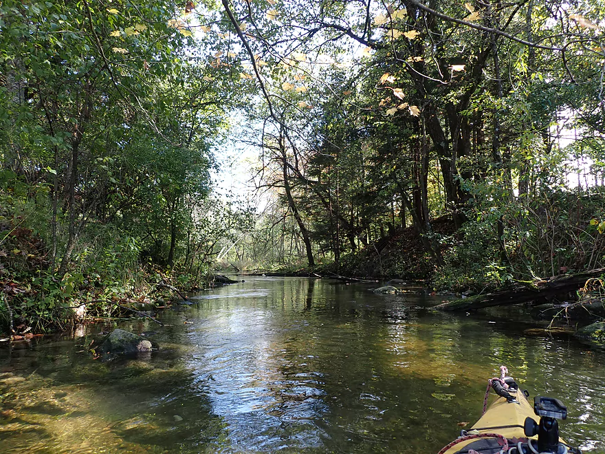
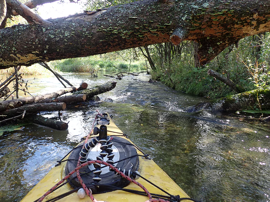
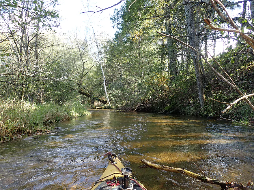
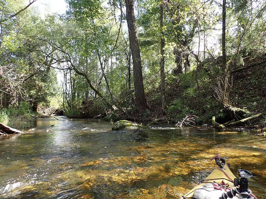
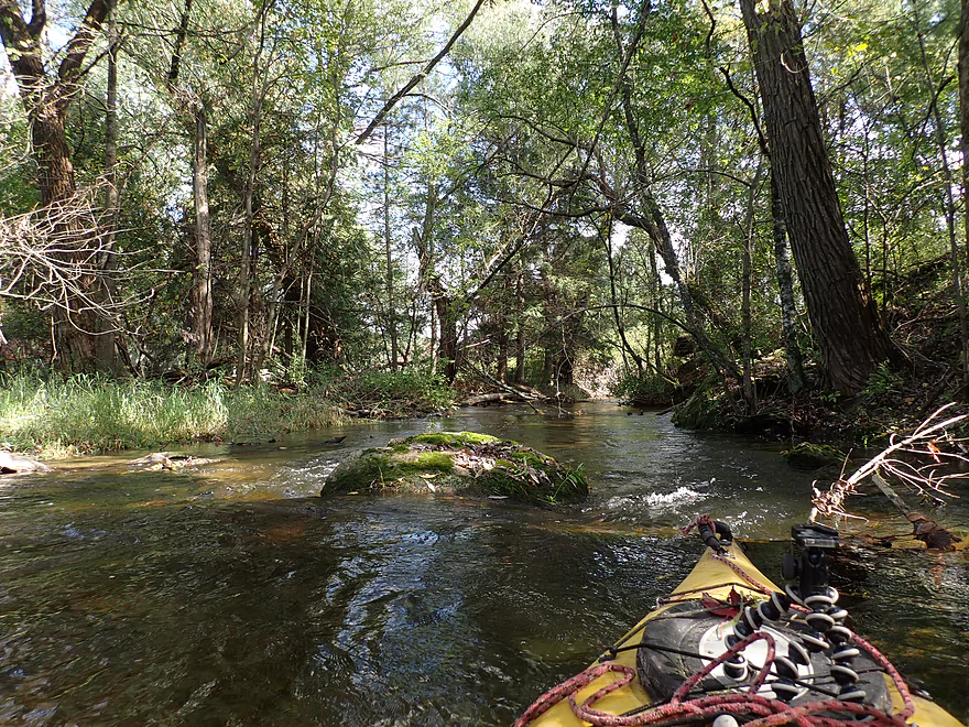
Past Hwy GG, Mecan Springs ends and the Mecan River begins. While not very big (~30 feet wide), it was still plenty navigable and super scenic. The clarity was stunning, and the substrate was filled with white shells and sand. This is definitely a paddle to save for sunny weather, as otherwise you won’t be able to appreciate the clarity in overcast conditions. Following a short open section, the river narrowed and became more wooded. Here and there were several downed trees in the water. Significant cleanup work has been done on the Upper Mecan, and while strictly speaking I never had to portage a downed tree, there were some that needed some effort to get around. Portaging or wading the downed trees though wouldn’t be a big deal because of the flat shoreline and clean/shallow channel.
After this cluster, the river opened up and logjams were mostly not an issue from then on. Along many of the open tight curves were stunning vistas of the sandy bottom topped by immaculately clear and calm water. Something else most appreciated were the lack of alders, which can be a nuisance on lower Mecan paddles. In the final couple hundred yards, the current picked up and there were several fun riffles. The bridge access at 9th Ave was a bit small, but was decent.
In summary, this was a really nice paddle…both the lake portion (the springs) and the river. It would have been a clear five star trip had there been less deadfall (although I never had to portage it and most was located in a short stretch). I’m not sure I can think of a river or creek with better clarity than the Upper Mecan. Cedar Creek and the Crystal River come close…but I think this takes the prize. Something else remarkable about this river is that it is incredibly stable and rarely gets too high even after a big rain. This makes it a perfect trip to do on one of those “everything else it too high to paddle” weekends.
Mecan Springs has a boat ramp located along the northeast shore. This is a very good access with free parking. Note there are no outhouses here or at the take-out.
Are there other access points on Mecan Springs? Well my initial plan was to launch at the Ice Age trailhead located at the west end of the lake. But…there was a steep hill here and my plans had to be scuttled.
If you really wanted to, I suppose you could launch at the Hwy GG bridge. A long guardrail separates the road from the river, but you could park southeast of the bridge and pull your boat ~177′ along the grassy embankment to reach the water. While the DNR owns the land NW and SE of the bridge, the parcels SW and NE of the bridge are private so be mindful of where you are at.
9th Ave was a good bridge take-out. Just downstream of the culvert the creek is shallow and it is easy to get out on the grassy bank here. Parking is a bit tight west of the bridge but doable. Note, do not stray too far away from the DOT right-of-way as the adjacent properties have No Trespassing signs.
Adventurous paddlers could continue 2.3 miles to Hwy 21 where there is a very nice public landing. But…satellite maps indicate there could be many logjams on this stretch.
While the Lower Mecan River does have a shuttle/rental service, I doubt they service the river this far upstream.
This was a pretty easy bike shuttle at 1.9 miles. There is one decent 100′ hill, but otherwise it is mostly flat. Traffic is light, but there are occasional Amish buggies and horse apples on the road to dodge.
Current: There is practically none on the lake/springs. The creek has a moderate current with some faster sections closer to the take-out.
Wind: The lake portion is in the open, so wind can be an issue.
Rapids: There are a number of light rapids…none greater than Class 1. The trickiest rapids are actually right at the take-out where a tree blocks half of the culvert and the other half has a decent-sized underwater rock. It’s all manageable, but be careful.
Logjams: Technically speaking I never had to portage a downed tree, but there were a few that had to be ducked/hopped/zig-zagged with most congestion occurring in a short section after Hwy GG. Extensive logjam cleanup work on the upper Mecan has been done which is appreciated. Note, even if you do have to portage a tree here or there, it’s not a big deal because of the shallow banks, lack of mud, and shallow water.
Quicksand: This usually accompanies springs. Be careful if you decide to wade the lake portion of the trip. The river portion should be fine for wading.
The Upper Mecan is surprisingly stable because of its spring-fed origins. There is no gauge on the river, but there is one on a nearby tributary known as Chaffee Creek. That likely receives more run-off so isn’t a great analogue, but it’s the best I could find.
- 0-10 CFS: Perhaps a few shallow spots, but generally navigable.
- 11-20 CFS: A fine depth for paddling. For reference, I did the trip at 17 CFS. A few years ago I did a trip downstream from Cumberland Road at 13 CFS which was also a good depth.
- 21+ CFS: A high depth, but the creek would still likely be viable for paddling.
Detailed Overview
Generally speaking, the further upstream you go on the Mecan, the better. Upper Mecan segments tend to have less mud, better current, better clarity, and more attractive shorelines.
- Mecan Springs to 9th Ave: 1.4 miles.
- Mecan Springs Boat Launch to Hwy GG: 0.6 miles. The river starts as a spring-fed lake sandwiched between two moraines. This is a neat lake paddle with clear water and visible springs located mostly along the western end. Trip length can be expanded by 1-2 miles if you explore the various bays throughout the lake.
- Hwy GG to 9th Ave: 1.4 miles. The first mile of the river has a few snags to dodge, but is super scenic with nearly perfect water clarity.
- 9th Ave to Hwy 21: 2.3 miles. Satellite maps indicate there could be many logjams and portages.
- Hwy 21 to Cumberland Road: 2.3 miles. Satellite maps indicate there could be many logjams and portages.
- Cumberland Road to 11th Ave: 3.9 miles. A great section with fast current, clear water and scenic white pines. A few logjams to portage but not bad.
- 11th Ave to Hwy Y/JJ: 3.7 miles. A fantastic section and my favorite on the entire river.
- Hwy Y/Dakota to Dixie Ave: 5.4 miles.
- Hwy Y to 14th Ave: 2.8 miles. An excellent section with white pines, tamaracks, narrow twisty turns and crystal clear water.
- 14th Ave to Dixie Ave: 2.5 miles. While not as good as the previous leg and more open, this is still a good stretch. This includes the "Mecan River Pine-Oak Forest State Natural Area".
- Dixie Ave to Hwy 22: 4.5 miles.
- Dixie Ave to Dover Ave: 2.0 miles. An ok section, but not as good as upstream sections. Even more open and slower, with far fewer pines.
- Dover Ave to Hwy E: 1.8 miles. River starts to become less interesting but is still ok.
- Hwy E to Hwy 22: 0.7 miles. Nothing special about this section. Open and somewhat simple.
- Hwy 22 to Germania Marsh Dam: 5.8 miles.
- Hwy 22 to Duck Creek Road/Electric Fence: 4.2 miles. More open and not as interesting, but the brisk current and good clarity are enjoyable.
- Duck Creek Road/Electric Fence to Dam: 1.6 miles. River slows and empties into a mile long shallow marsh. The Germania Marsh features nice scenery and good wildlife. Take-out is on a small access road off Hwy N.
- Dam to Elk Road: 6.3 miles. The most popular section on the Lower Mecan.
- Dam to Hwy N: 5.2 miles. River turns into a flowage pond and marsh. Take-out is on a small access road off Hwy N.
- Hwy N to Elk Road: 1.1 miles. The river completely moves east, creating a really cool corridor.
- Elk Road to Hwy 23: 2.4 miles. Traditionally a section with many logjams, but it does get cleared out periodically by the local livery. Hwy 23 is a poor access option.
- Hwy 23 to Hwy C: 2.7 miles. Again, this usually has logjams but they are often cleared out by the locals. Hwy 23 is a poor access option.
- Hwy C to Mouth: 1.1 miles. Simple open stretch leading to the Fox River.
- Mouth to the Princeton Locks: 3.1 miles. An uninteresting stretch on the Fox River.
For further information on the Fox River, see my Fox River review.
Trip Map
Overview Map
Video
Photos Size:
My husband and I enjoy your sight. It has helped us get started in kayaking. Yesterday, 6/14/2020 we did the upper Mecan (listed as Mecan 1). This is the first one we did that I would not recommend. Mecan Springs is fine to kayak through, but one you hit the river it was very shallow. I had to get out and pull my kayak along the river at one point. Also a lot a debris that is difficult to navigate, moreso than other rivers. Our favorite part so far is from 11th to JJ.
Yeah…it is shallow and has some deadfall…but I thought it was really scenic. Certainly the downstream legs are more open and navigable. Thanks for the feedback.