
A stile for snowmobiles!
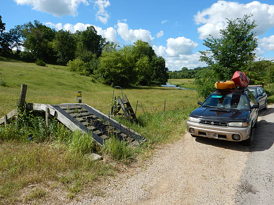
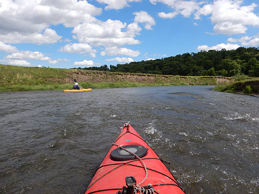
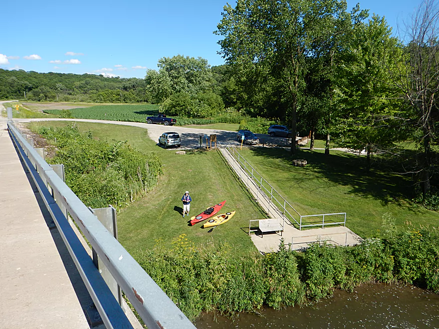
Decent put-in at Bean Street
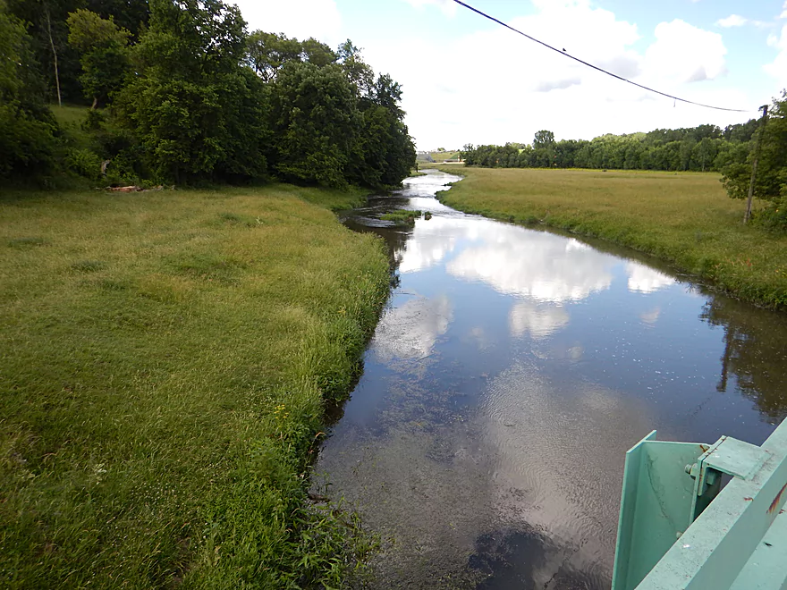
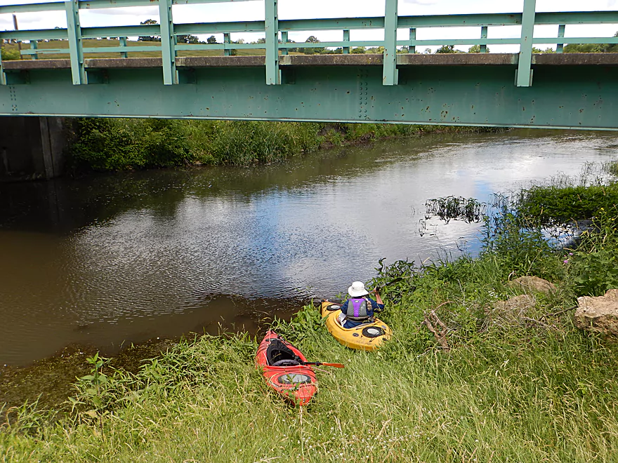
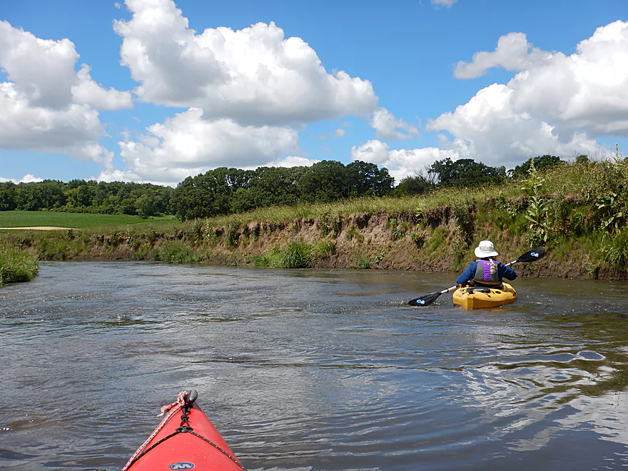
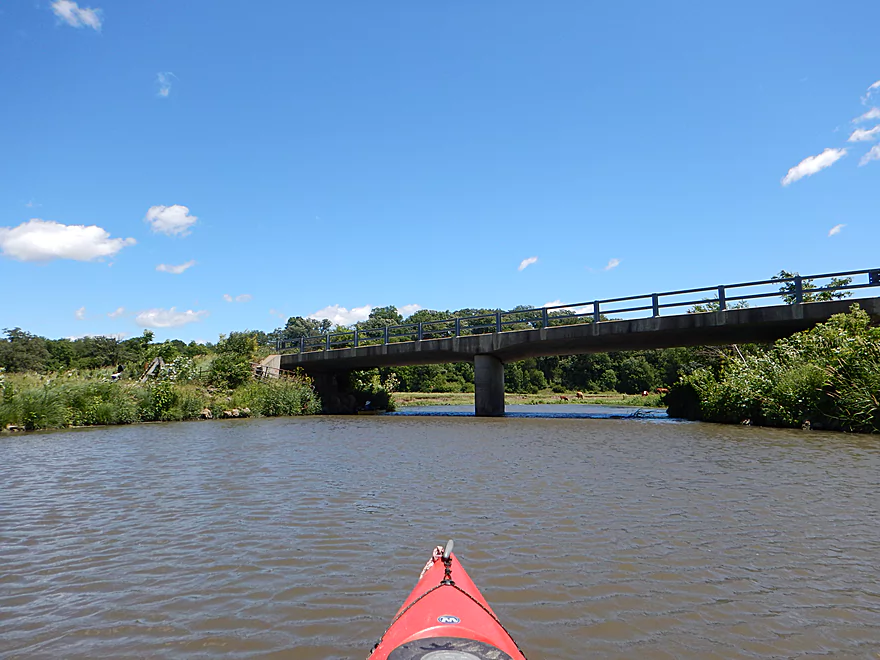
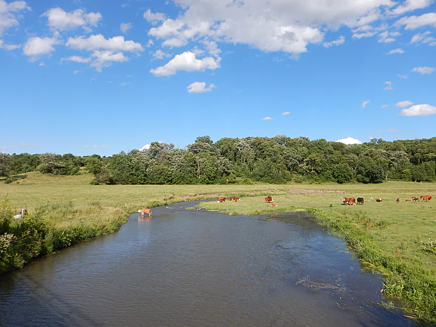
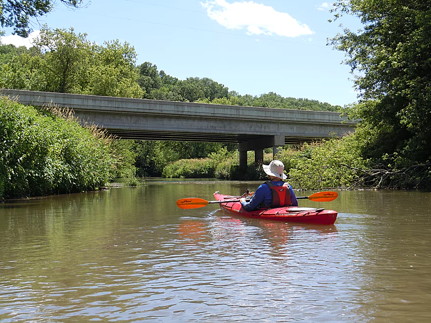
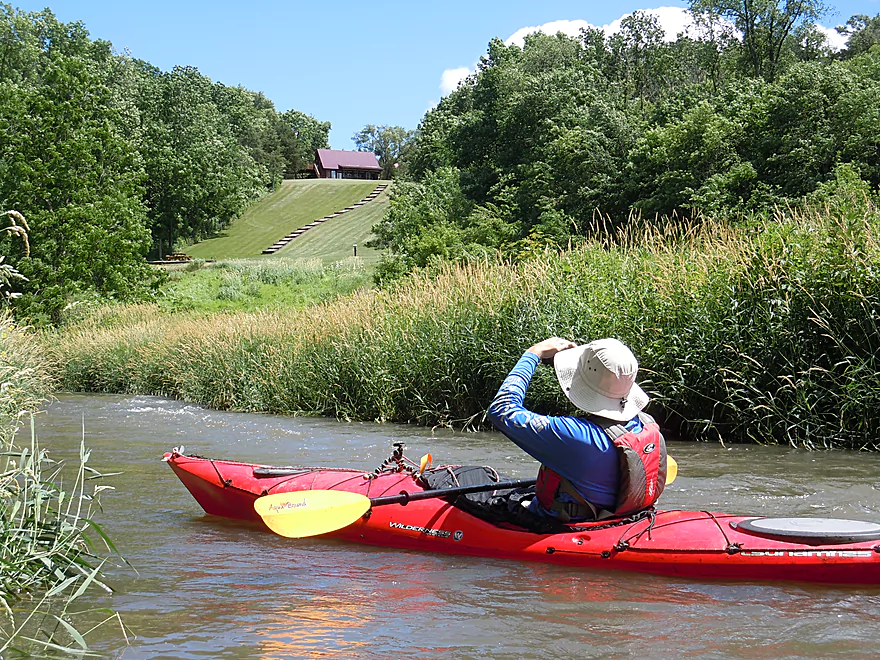
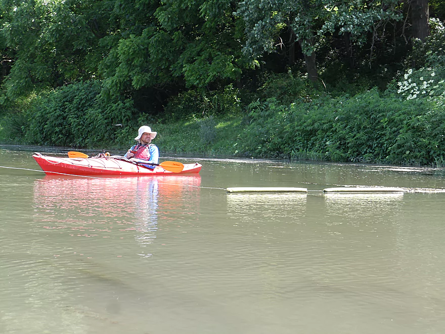
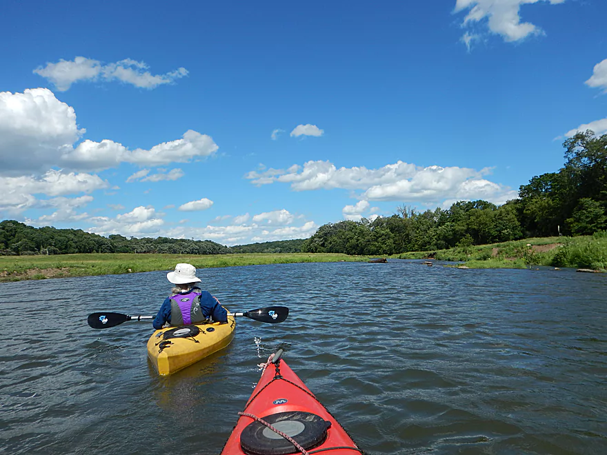
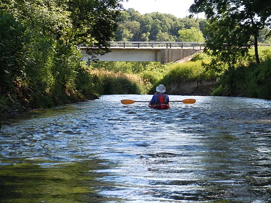
Looking downstream from the bridge
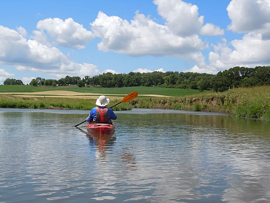
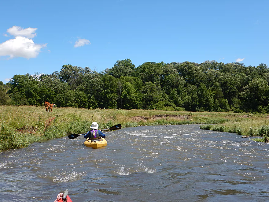
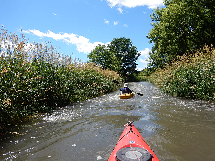
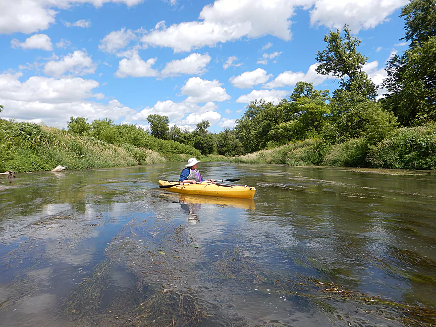
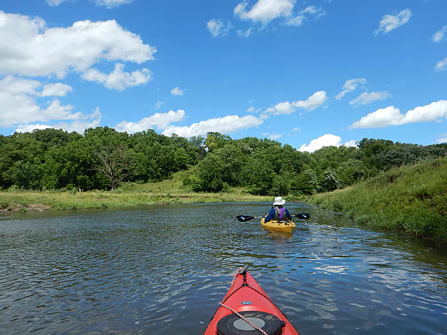
First couple miles are very open

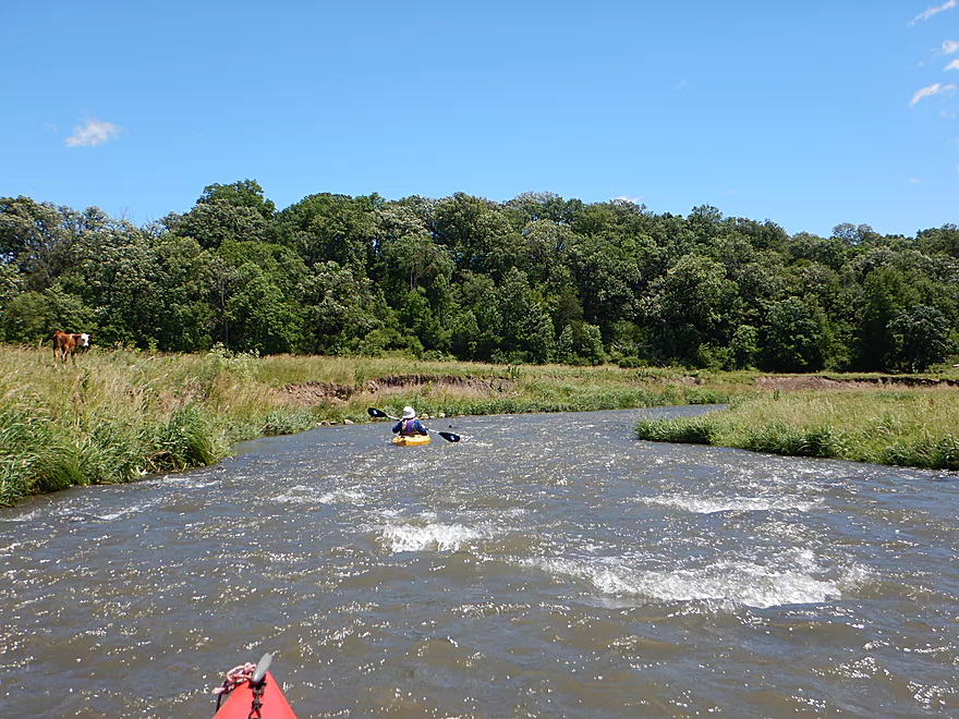
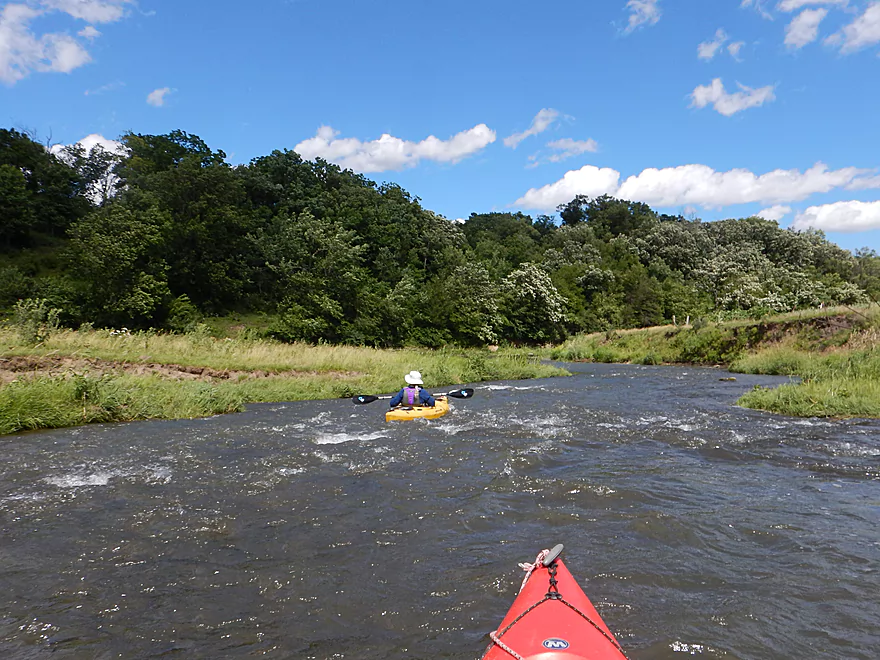
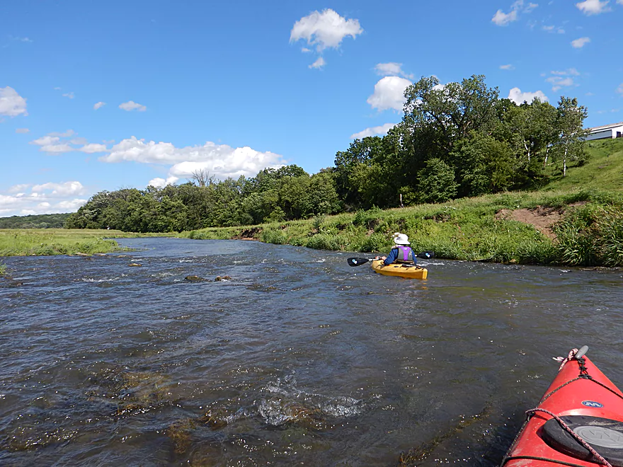
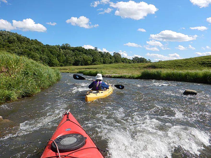
First of many light rapids
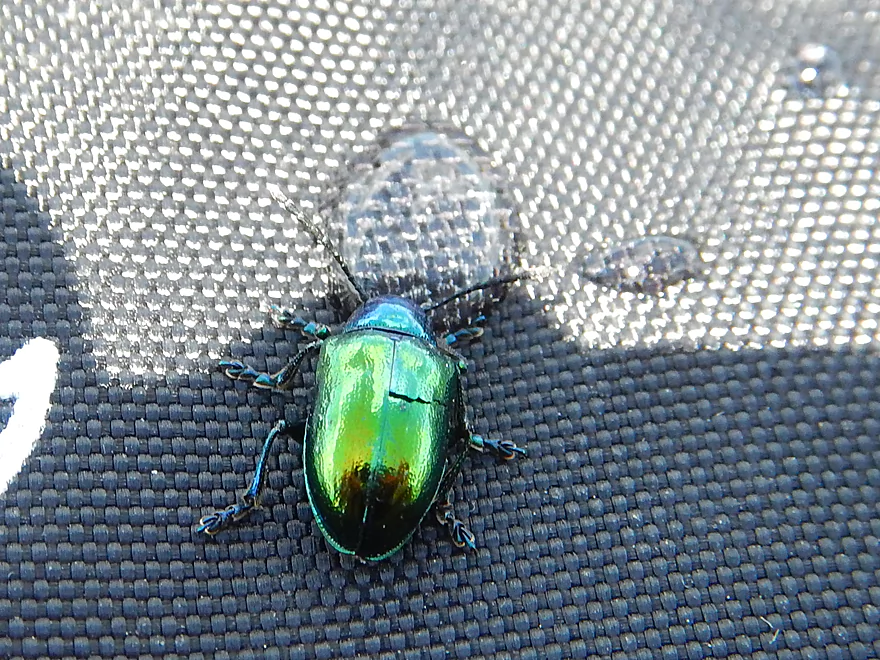
Metallic green beetle
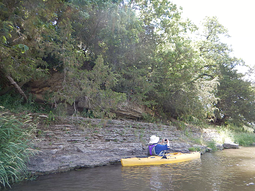
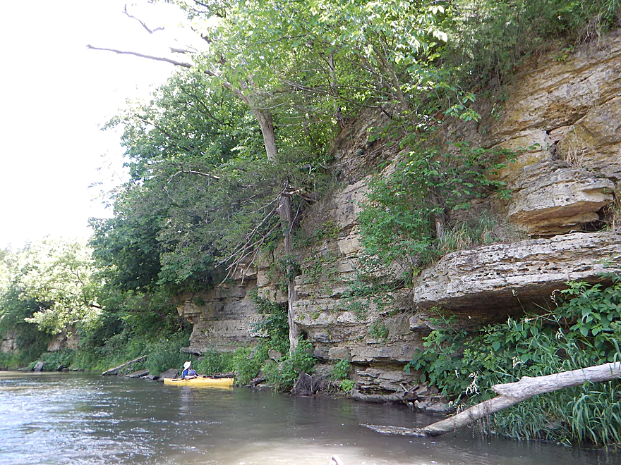
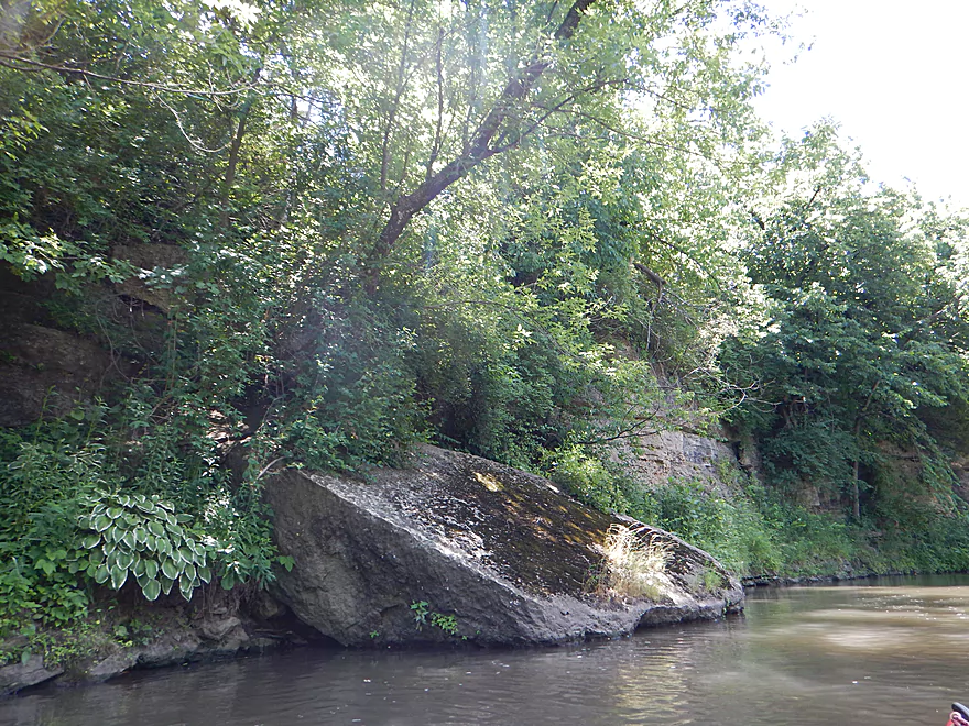
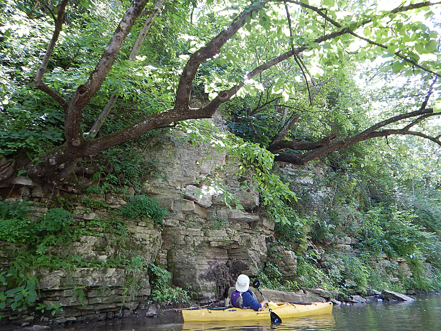
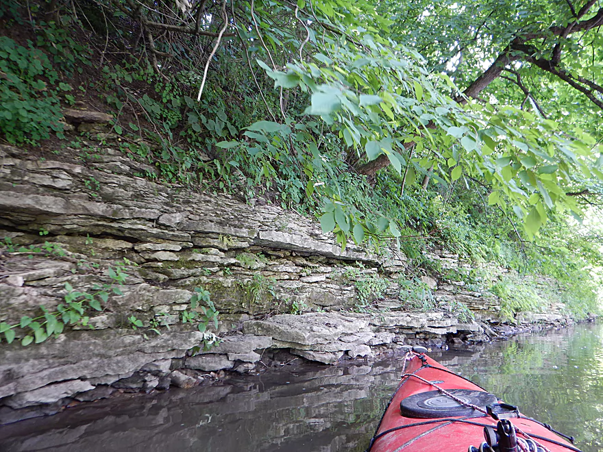
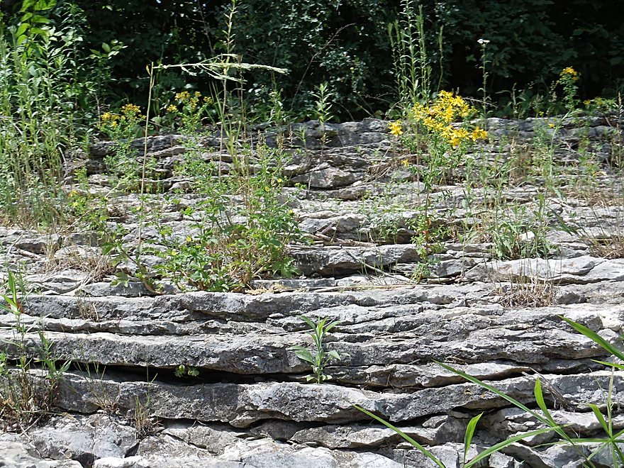
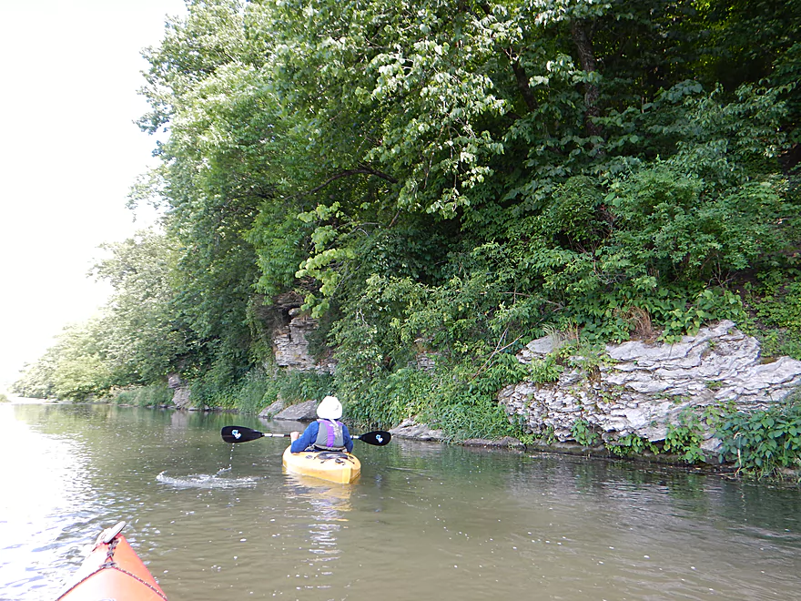
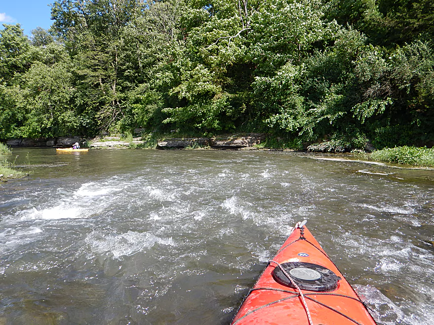
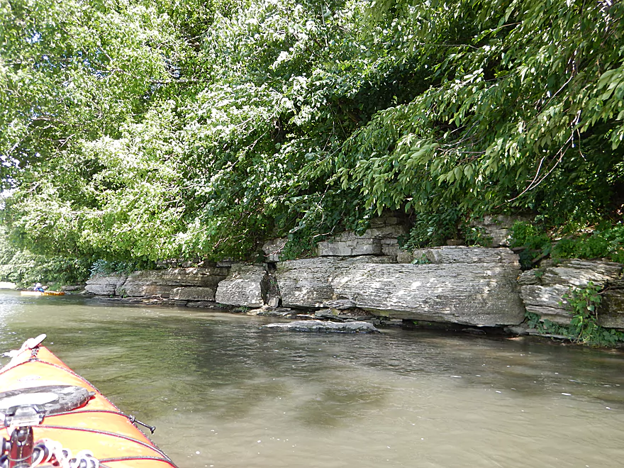
First limestone outcrop
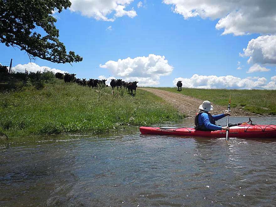
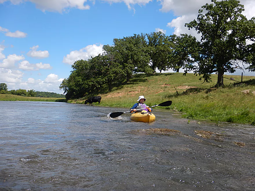
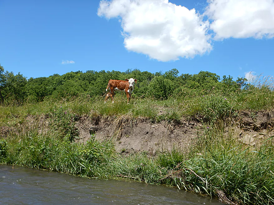
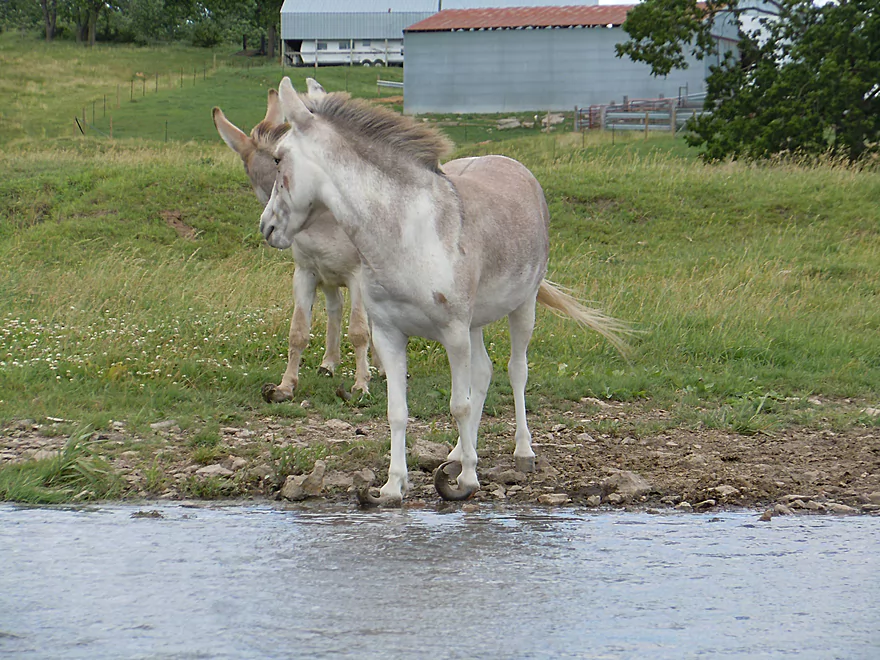
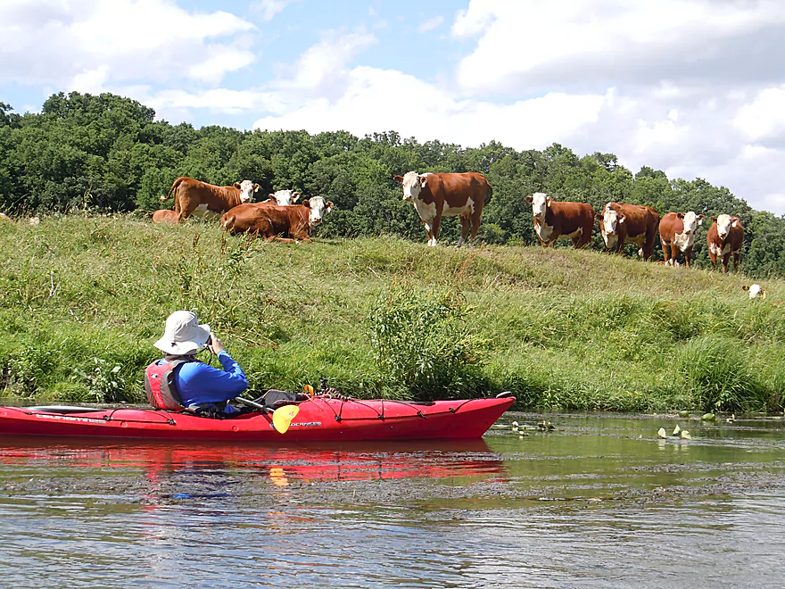
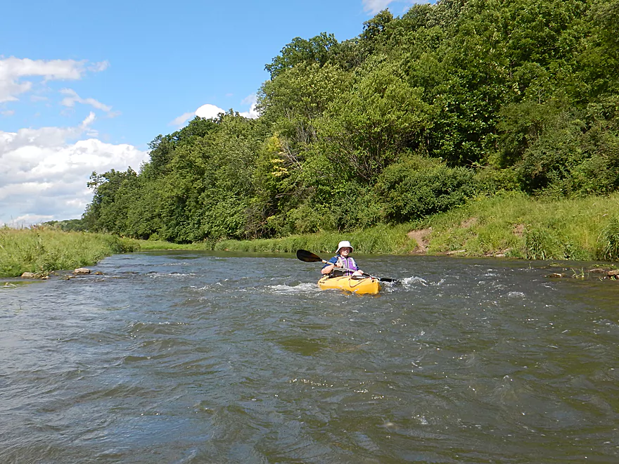
First of many cattle
Really nice oak savannas
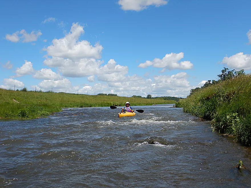
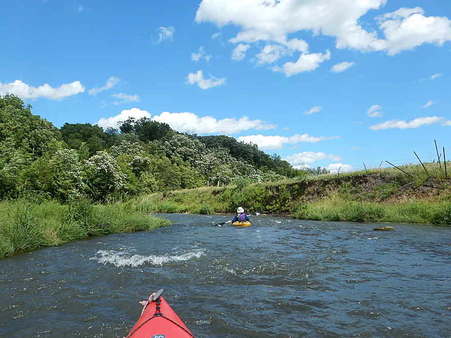
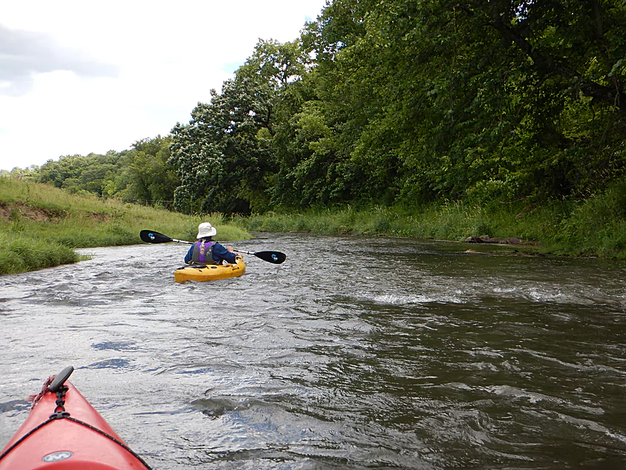
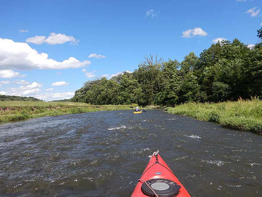
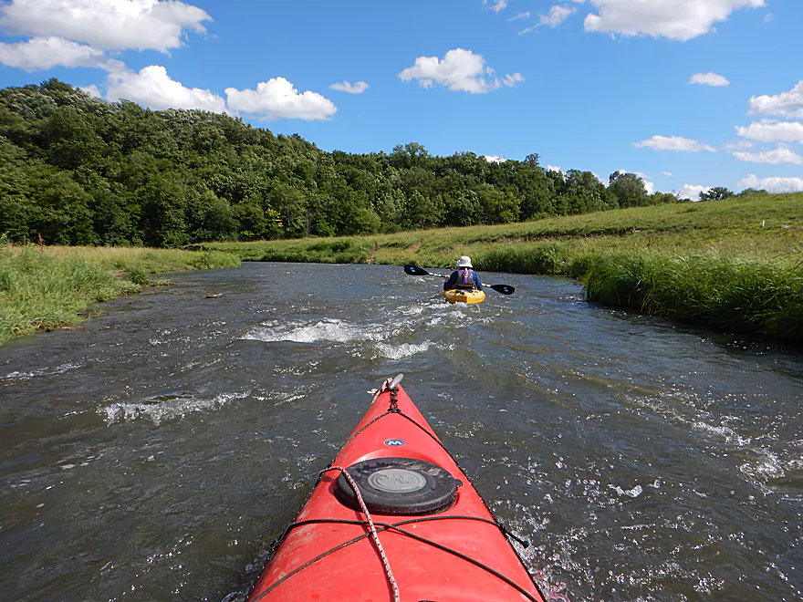
More riffly fun
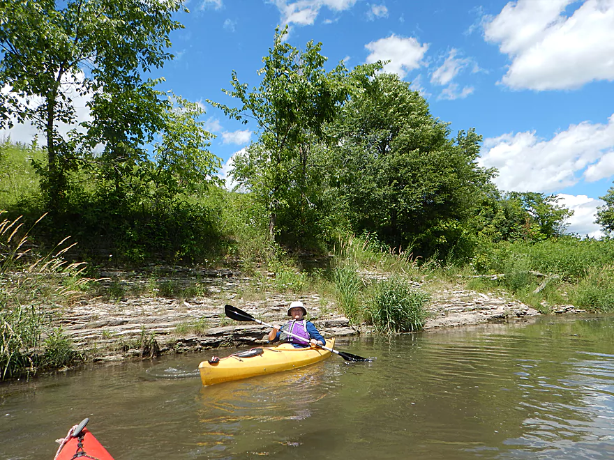
Nice limestone outcrop (with a chain)
And another
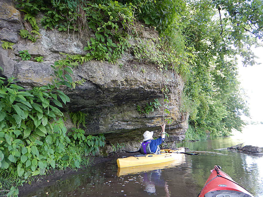
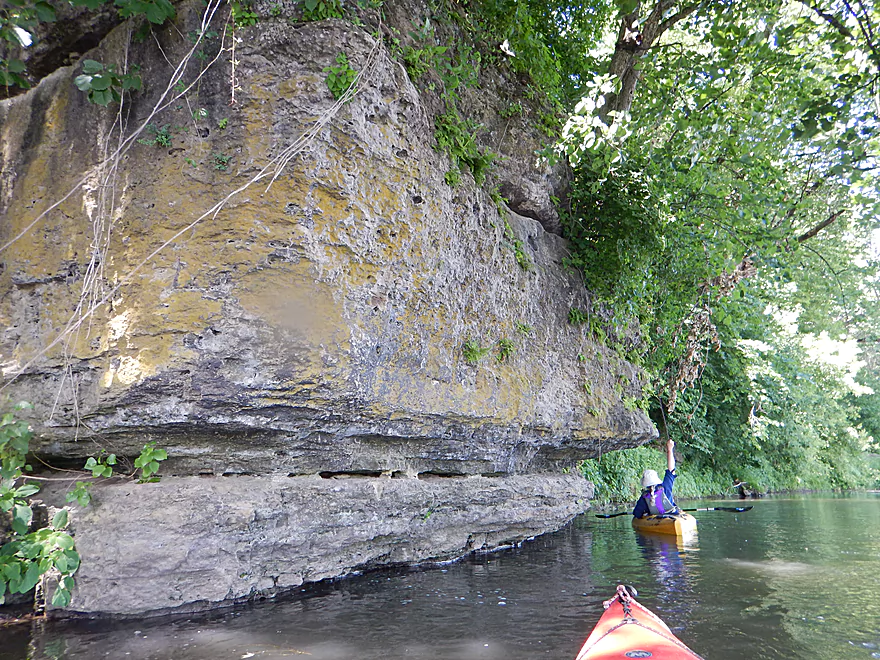
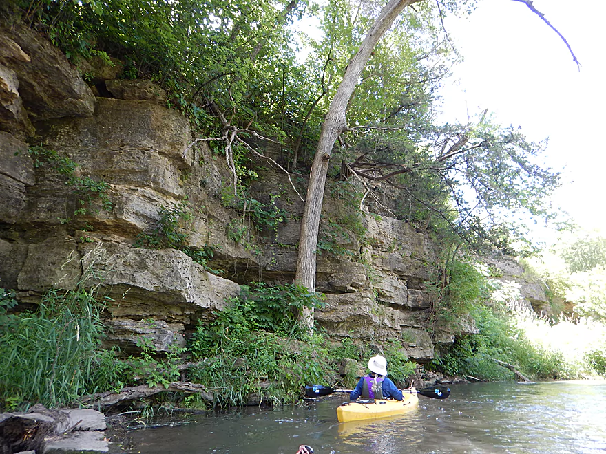
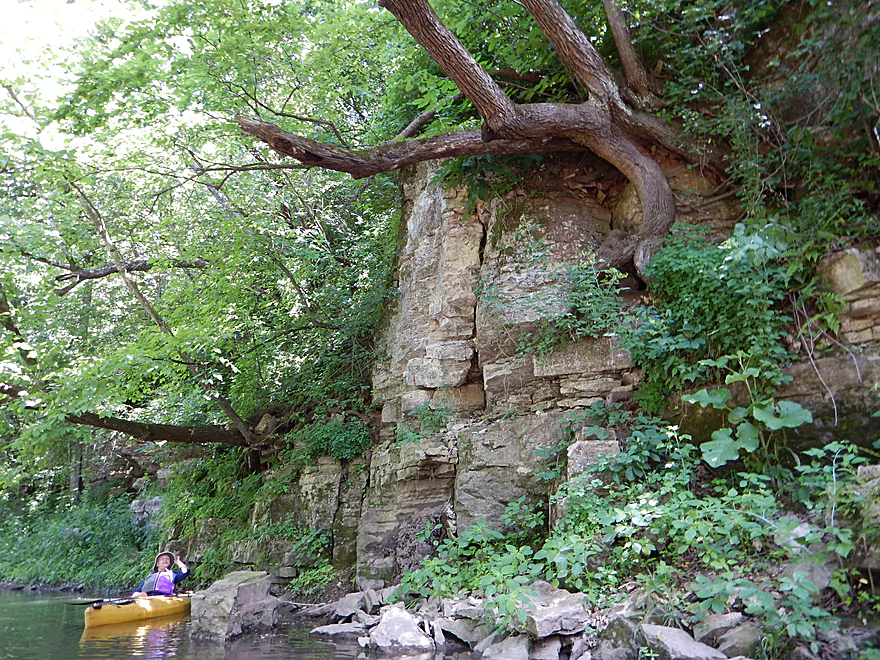
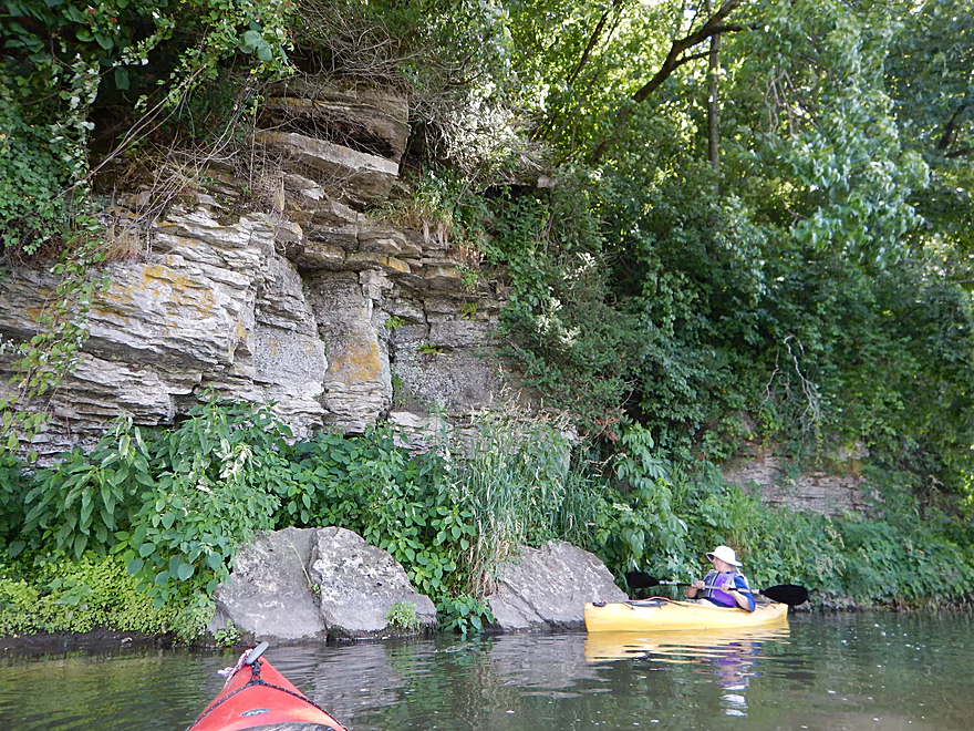
This one has a nice overhang
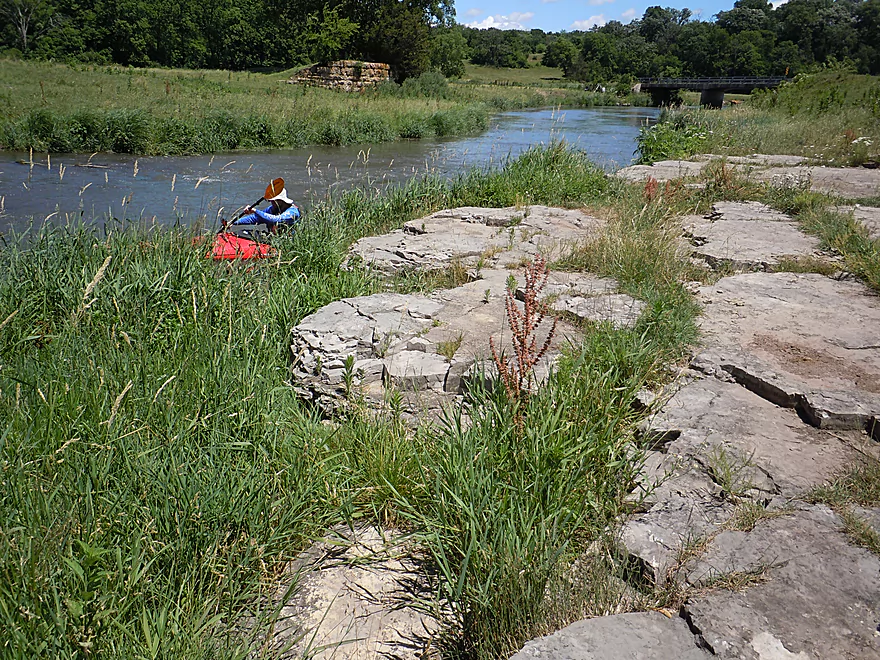
Coming up on a neat section of the river
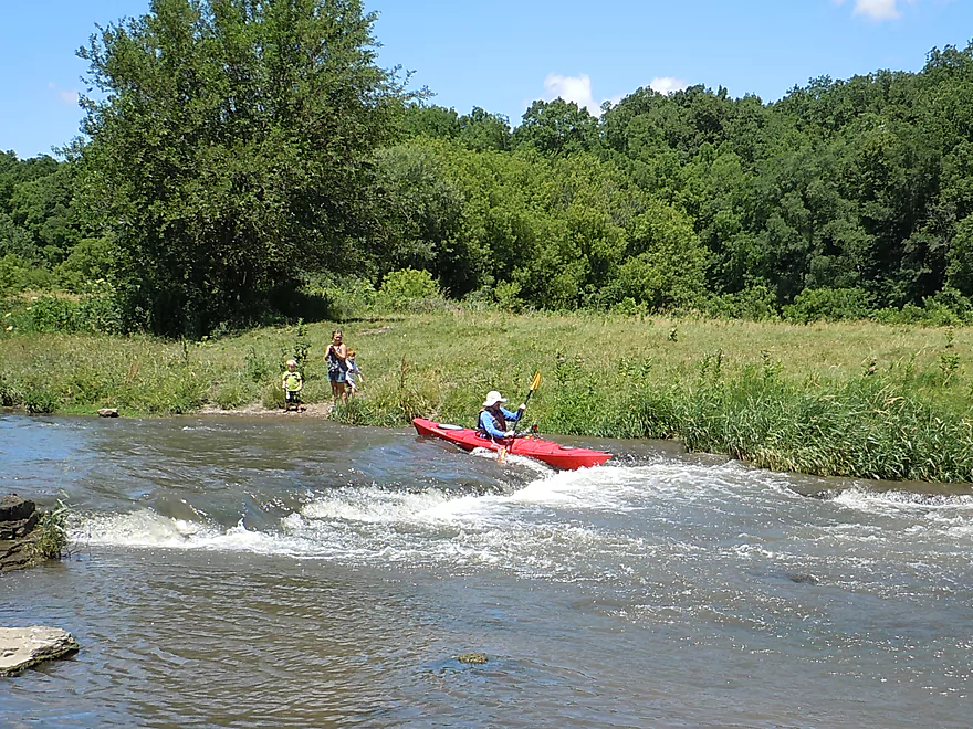
Fun rapids
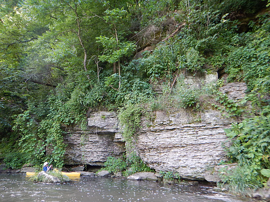
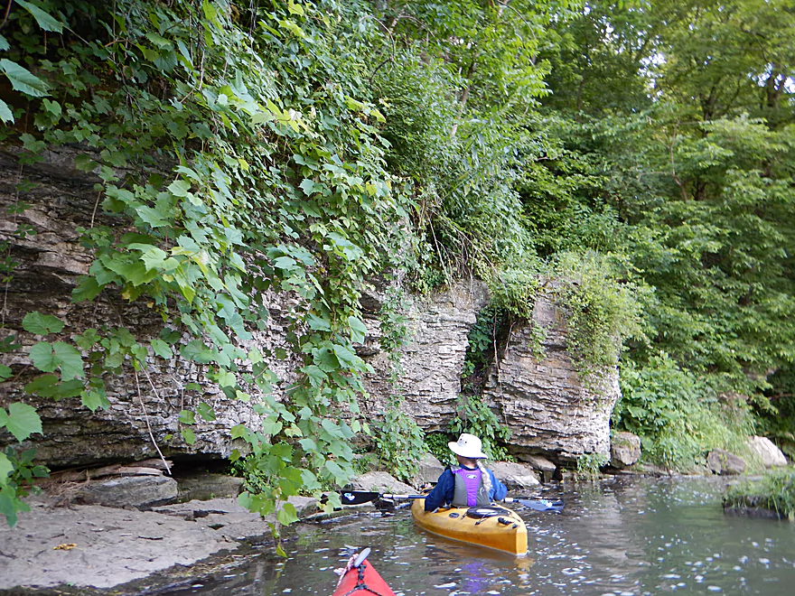
A long wall of limestone
Actually a narrow isthmus with the downstream section just on the other side
More large outcrops
One of several massive boulders on the river
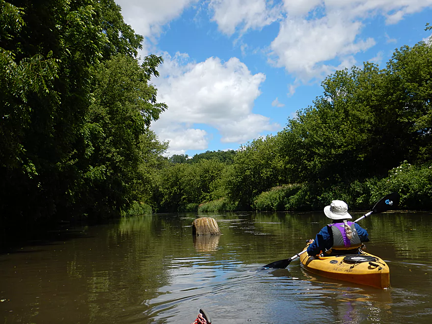
Stump in the middle of nowhere
First fence to duck under
Scouting some rapids from a bedrock shelf
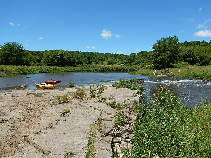
A fun ledge to run
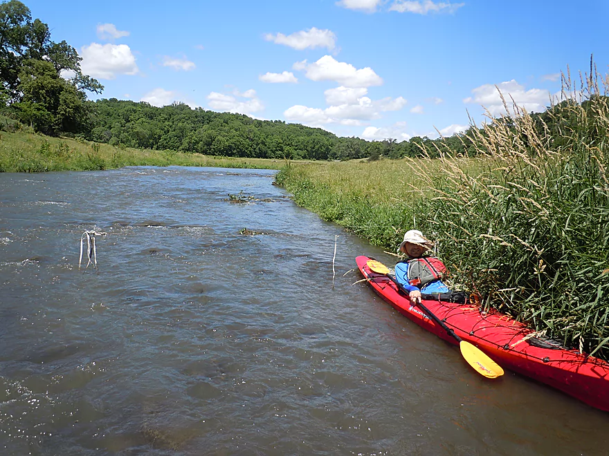
Looking downstream
Horse Shoe Bend Road is an access option
Lots more cattle
Zipping around the corner
The calf was separated from its mother
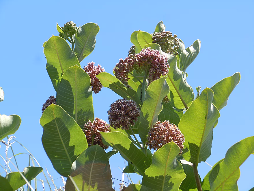
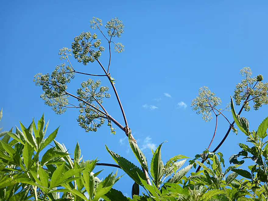
Milkweed plants growing skyward
Coming up on a low pair of fences
Just barely ducked under
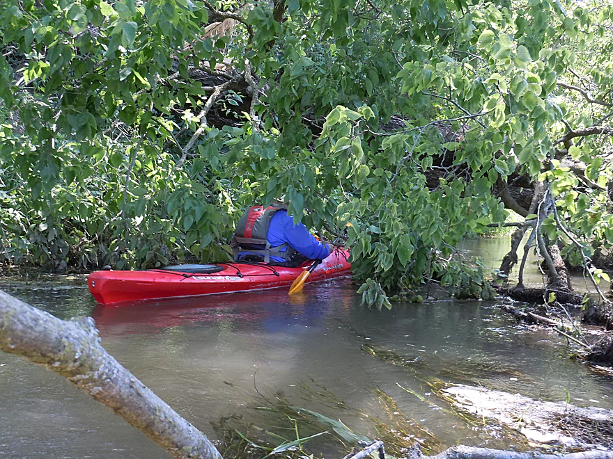
Only major downed tree…but easy to get through
I do not think Hwy 11 would be a good access option
Really cool brick-like texture to the limestone
Reverse view
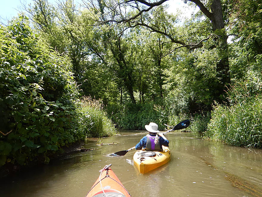
Narrowest part of the trip
Quite the mow job
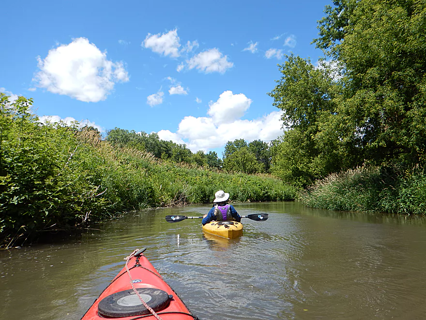
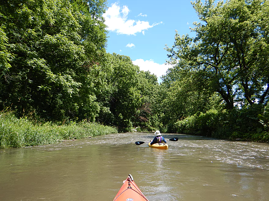
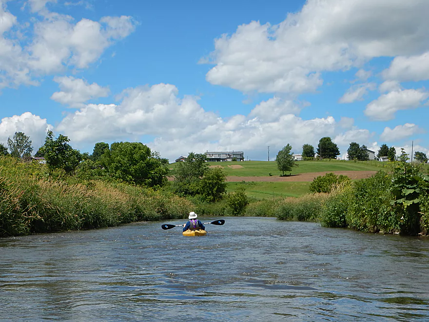
Next few miles have very tall grassy banks
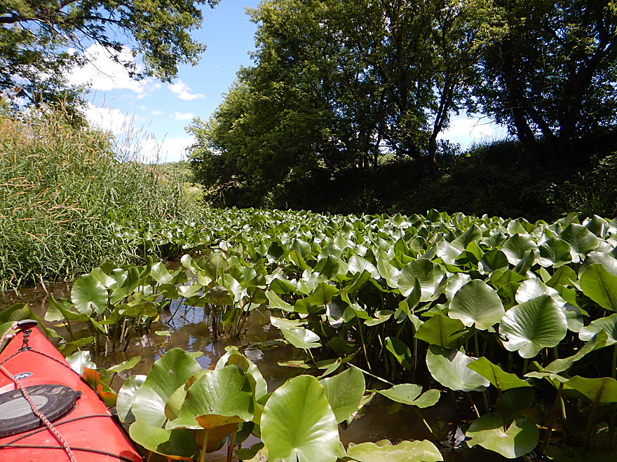
A surprise lily bed
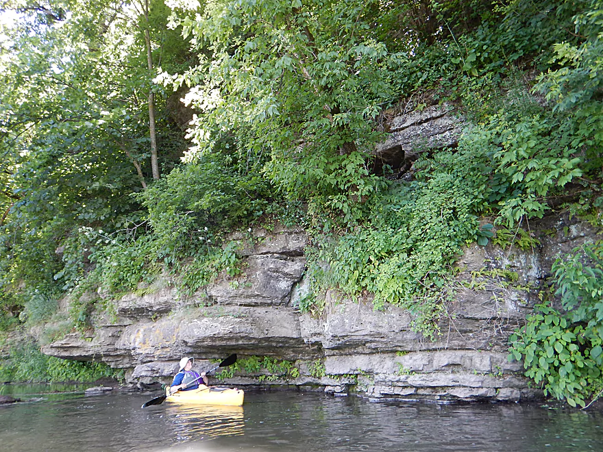
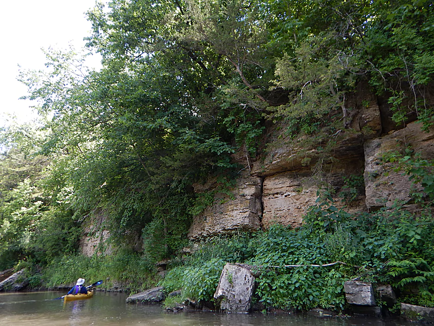
More exquisite limestone textures
Pondweeds make an appearance
Like a small staircase
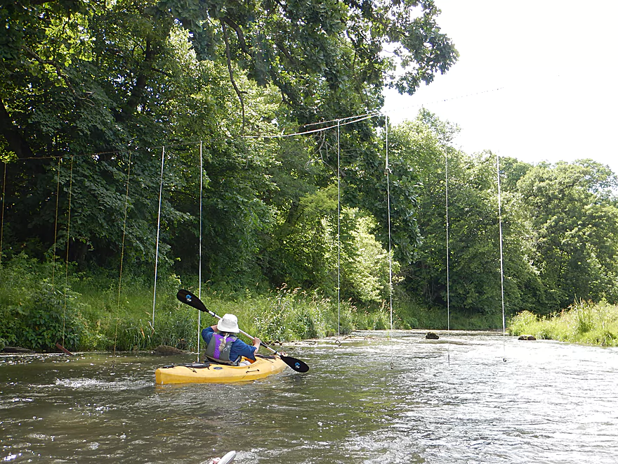
The Hanging Gardens of Benton
The later fences were very easy to duck under
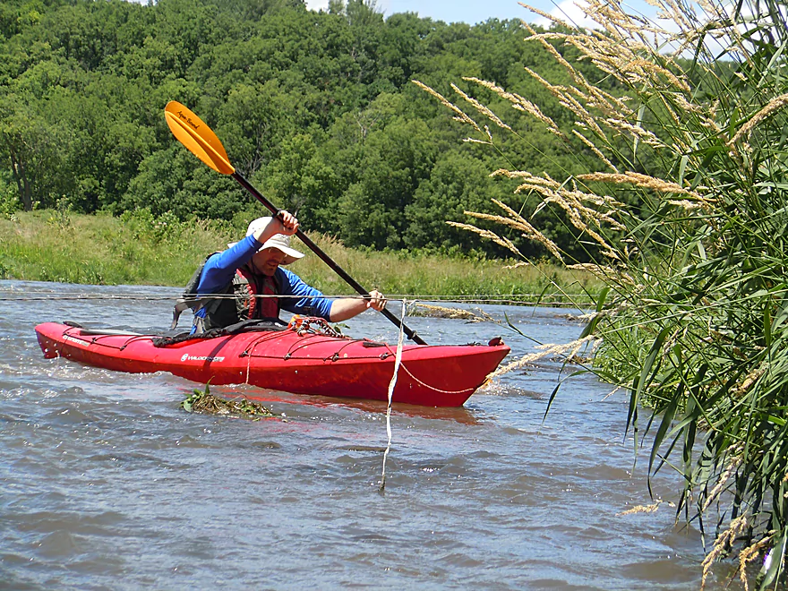
This one has a life jacket…
More fun rapids
That folks is why you trim hooves (the mules could barely walk)
Mud banks are getting taller
This fence has metal nuts and bolts hanging from it…
Still not done with the limestone
Bennett Road would be a good alternate access
Starting to get shallow
A fun chute
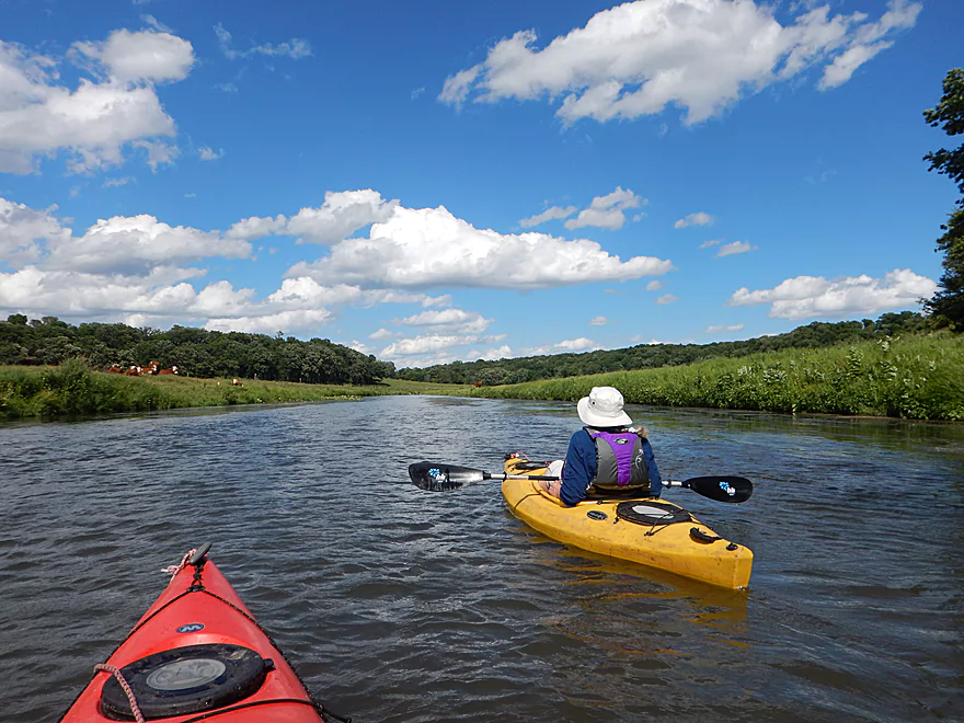
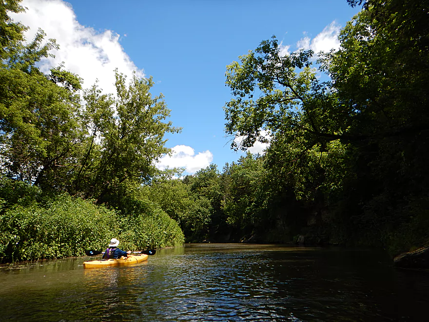
Nice blue sky and clouds
More curious onlookers
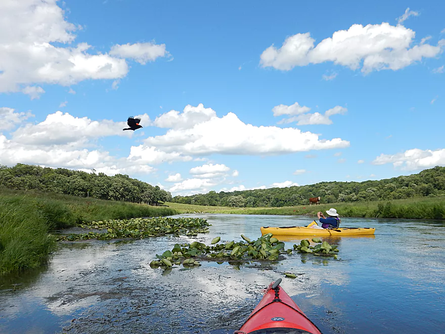
Blackbird photobombing my lily shot
Current stays fast
Nearing the end of the trip
Getting wet on the final rapids
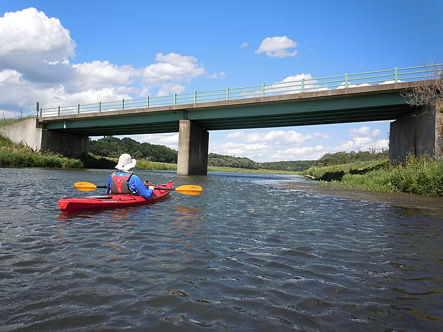
Great take-out at Hwy W
Fever River – Bean Street


One of Southwest Wisconsin’s many driftless gems, the Fever River is frequently too shallow to paddle, but when navigable it can be an amazing experience. Previously, this blog had reviewed the most popular section, Hwy W to Buncombe Road, which was a great paddle (although shallow). After ANOTHER rainy week, most Wisconsin Rivers were quite high (AGAIN) but with one exception in the Fever which provided an excuse to return to this really nice stream.
The trip started at Bean Street which is somewhat significant as it is here that Governor Tommy Thompson sat at a card table by the bridge and signed a proclamation declaring the river’s name was officially the Fever River (not the Galena). Today fishermen use the bridge to access the river, and while somewhat of a grey area, paddlers do as well.
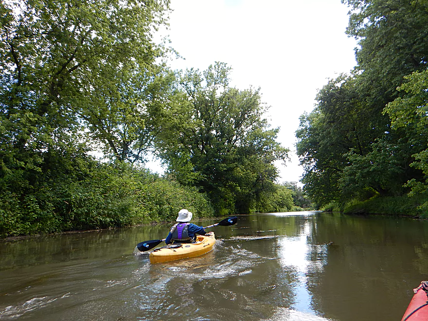
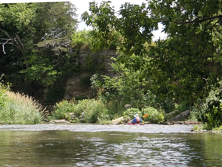
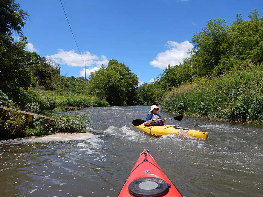
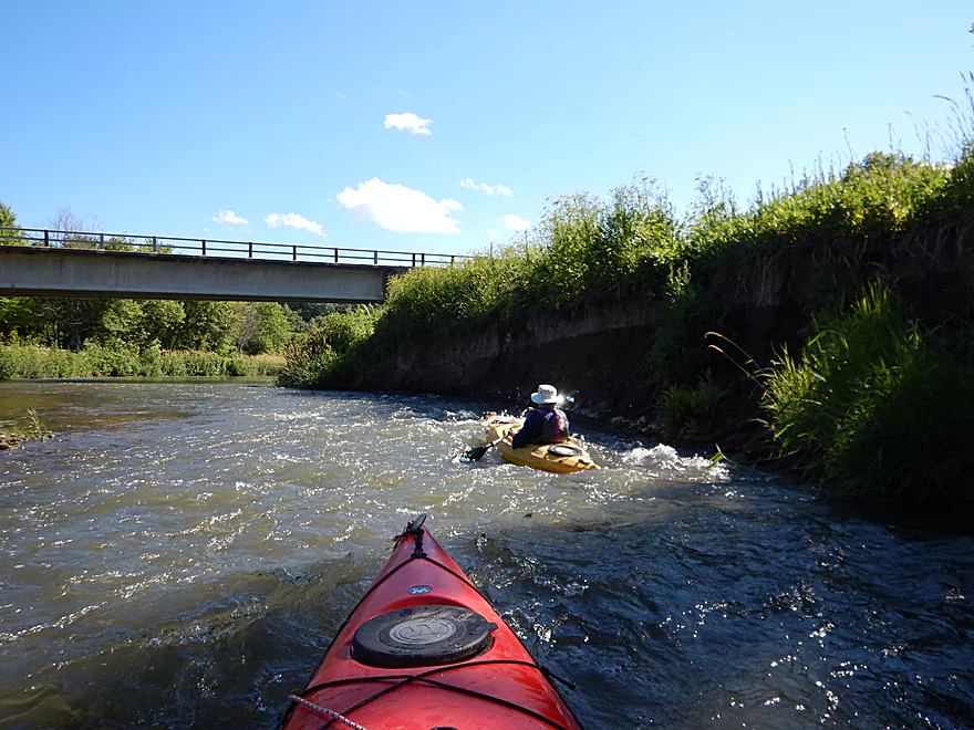
The first two miles (until Horse Shoe Bend Road) were my favorite, and I would give it five stars. After launching, you’ll paddle past attractive oak savannas and over fun little ledges. Like most of the river, many beef cattle graze up to and in the Fever. Most will simply find paddlers curious and will stare incessantly at you. As the river approaches Hwy 11, you’ll go over a larger set of rapids and past a scenic limestone wall that was one of the coolest parts of the trip. Close to Horse Shoe Bend Road, you’ll duck under your first fence (low but doable, maybe electric) and come across a one foot ledge. What is unique about this particular ledge is that it is created by a huge layer of very flat rock (perhaps shale) that extends across the river and into the adjacent cow pasture. This made scouting the rapids very easy.
A unique feature of this segment is the giant horseshoe shape it makes flowing around Benton. The river totally doubles back on itself, prevented from short-cutting by limestone bluffs. Hwy 11 traverses an actual isthmus at this point, and it is possible to look to the north and see the river, and then run over to the other side of the road and see the river 2.5 miles downstream on the other side–a proverbial “double-take.”
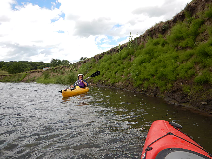
Horse Shoe Bend Road is an alternate put-in/take-out if you wish. Shortly after Horse Shoe Bend Road are a very low pair of fences which are tricky to duck under. The river does change a bit after Horse Shoe Bend Road, as the banks become weedier and more overgrown. The rapids continue, as do the limestone outcrops, which are quite striking. Some have a unique brick-like layering to them, others have plants growing out the sides akin to the Hanging Gardens of Babylon. This trip very much reminded me of the Grant River which I did a few years back and really liked.
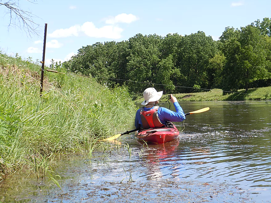
By Bennett Road the river opens back up and is quite scenic but the banks do get muddier and grow in size. You could take out at Bennett Road, and in fact we wondered if we should have in hindsight as this was a deceptively long trip. You often paddle around submerged rocks of which there are many and why you don’t want to do this segment at low levels. The take-out is at Hwy W which is a great park for paddlers.
As a historical side note Benton, which this segment wraps around, is a historically significant little town as once it was an epicenter of lead and zinc mining. Many Cornish immigrants arrived in Wisconsin to mine the rich deposits of lead and zinc, including my third great grandfather who worked roughly three decades in Benton as a miner before prices collapsed and he had to leave. Benton looked very different back them. The early settlers would take advantage of the fast current to build a dam and mill race by Hwy 11/Horse Shoe Bend, which thankfully has long ago been removed. But you can still see a picture of it here. For more information on the history of Benton check the local museum “Swindler’s Ridge“.
We launched from Bean Street, which is a good access, but…there are signs here that mark this as private property. Now there is a public easement here for “fishermen” to access the water, which creates a bit of a grey area. I think you are ok to park in the pull-off and to launch here but be considerate of private property. Don’t litter, make a lot of noise, loiter, or destroy anything. On the eastern side there is a stile for getting over the fence (and another for snowmobiles!) and this area is easy to launch from. If you are concerned about private property, I think you could just launch from the west side of the bridge instead.
There is a small park by the Hwy W bridge which is a great take-out and is very popular with paddlers. This too strangely enough has a “fishing only sign”, but really this is fine to use as a take-out. Only downside to this park is there is no outhouse. Note, you can take out on earlier or on later bridges which I’ll cover later.
I’m not aware of any local liveries. The bike shuttle is 3.6 miles and somewhat hilly (240′ of climbing and 171′ of descent). For a driftless bike shuttle though, this isn’t bad.
This is a fast river with many riffles and a handful of rapids, but none greater than Class 1. The biggest ledge is just prior to Horse Shoe Bend, but it is super easy to scout and is pretty doable.
No logjams to worry about. There is one downed tree but it is easy to get under.
The only concern are the fences.
- Fence #1: Just prior to Horse Shoe Bend Road, there is a low fence, possibly electric, but this is pretty easy to get under if you hug the left shoreline.
- Fence #2: Just after Horse Shoe Bend Road is a low fence, likely electric followed by a barbed wire fence. This was tricky to get under but we were able to do this. I suggest beaching yourself in the shallows on the far left, getting very low in your boat and inching your way though. Don’t get caught up in the rapids in the center of the channel. The fence continues over land, but you should still be able to portage this on land if you wish (not easy though and it would help to have a 2nd person pass the boat over). Obviously this can be an issue in high water.
- Fence #3-5: There are several later fences but they are super easy to get under.
This is a notoriously shallow river and you need to keep a close eye on the gauge at Buncombe. It’s not that the Fever dries up…but there are countless large limestone rocks in the river bed that are easy to hit. On the flip side water levels can rise sharply after a big rain. A few days after our trip, levels spiked to 10′ in just 6 hours! This suggests the river is prone to flash flooding after a heavy rain so do be careful.
- 0-2.9′: Very likely too shallow. My downstream trip on the Fever at 2.7′ was my lowest paddling experience ever.
- 3.0-3.2′: You can do the trip at this depth and most of the river would be ok, but many of the rapids would be quite bumpy. We did the trip at 3.1′, which was doable but I would have preferred a slightly higher depth as we did end up hitting many rocks going over the riffles.
- 3.3-3.6′: Likely an ideal depth and the rapids should be well padded.
- 3.7’+: This would be a relatively high level for the river. Some of the rapids might become Class 2 or stronger. At a certain point this river will become too high to paddle.
A few blue herons, cricket frogs (known for the unique clacking they make), a kingfisher, one deer and several ducks. Oh, and many, many hereford and black angus cows.
Detailed Overview
- Upstream from Knee Deep Road: The creek is likely too small to run. Peter noted that Hwy H doesn't have a good access option.
- Knee Deep Road to Bean Street: 6.4 miles.
- Knee Deep Road to Twin Bridge Road: 1.3 miles. Creek is small and a bit congested. There will be 1-2 logjams, but also some outcrops.
- Twin Bridge Road to Bean Street: 5.1 miles. River widens noticeably after Twin Bridge Road. This is a shallow trip with good geology and many Class 1 rapids. There may be cow fences to deal with.
- Bean Street to Hwy W: 8.0 miles. Great section with limestone outcrops and many light rapids.
- Bean Street to Horse Shoe Bend: 2.2 miles. A five star section with open oak savannas, fun rapids including a one-foot ledge and a wonderful limestone wall north of Hwy 11. One fence to duck under which is low but manageable.
- Horse Shoe Bend to Bennett Road: 4.1 miles. You should be able to launch at Horse Shoe Bend no problem (public fishing area). This segment is not as interesting and a bit weedy and overgrown, but still fast and with a few really nice outcrops. One tricky fence to get under.
- Bennett Road to Hwy W: 1.8 miles. Bennett Road should be doable as a put-in (another fishing access). River really opens up after this bridge and is quite nice with more rapids and a few limestone outcrops.
- Hwy W to Buncombe Road Fishing Pull-off: 5.8 miles. A great section on the Fever with some cool tunnels.
- Buncombe Road to W. Council Hill Road: 5.5 miles.
- Buncombe Road to N. Birkbeck Road: 3.0 miles.
- N. Birkbeck Road to W. Council Hill Road: 2.5 miles. Put-in and take-out are likely very brushy and somewhat difficult (but think they are doable). Parking at W. Council Hill Road is a challenge.
- W. Council Hill Road to W. Buckhill Road: 4.4 miles. Both put-in and take-out are brushy with W. Buckhill being more feasible.
- W. Buckhill Road to Galena/Depot Park: 5.0 miles. This stretch starts interesting with good driftless scenery and riffles. Then it becomes slower and less interesting. The last part through historic Galena is very pleasant.
- Galena/Depot Park to Mouth/Gear's Ferry Landing on Mississippi River: 5.6 miles. On the Mississippi veer right and paddle upstream to reach the boat ramp. Motorboat traffic might be an issue.
Trip Map
Overview Map
Video
Photos Size: