
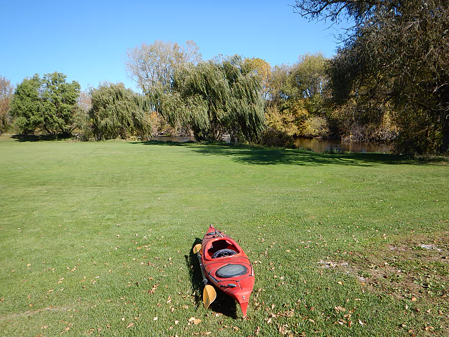
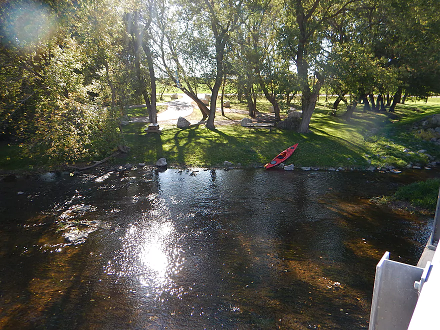
A bit of a hike to access the water at Johnsonville
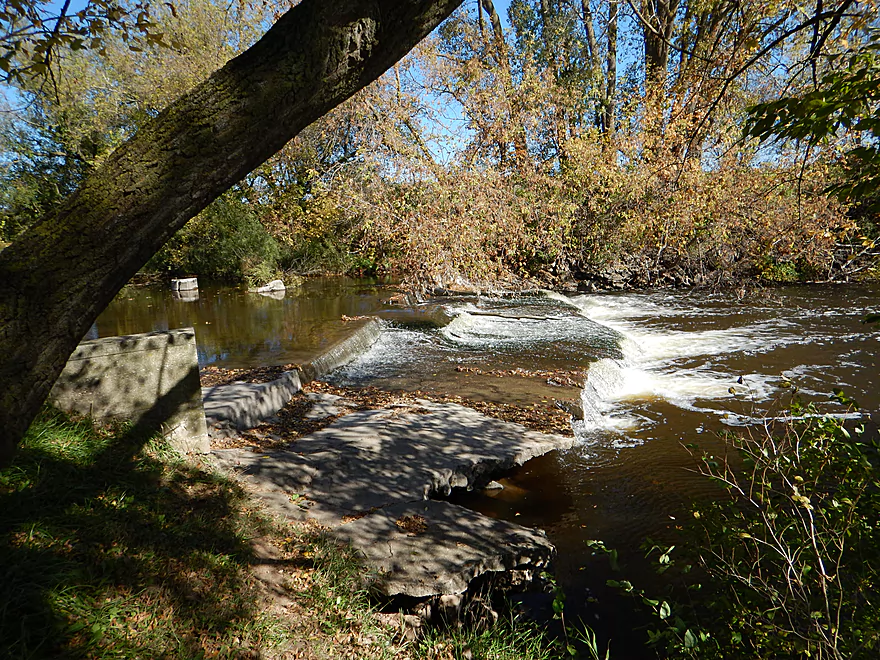
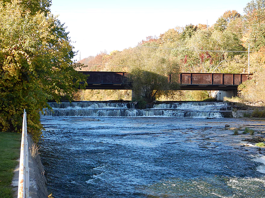
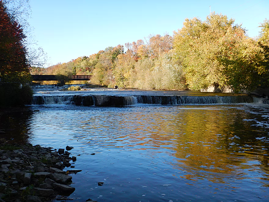
The Johnsonville dam
Tame now, but can be dangerous in high water
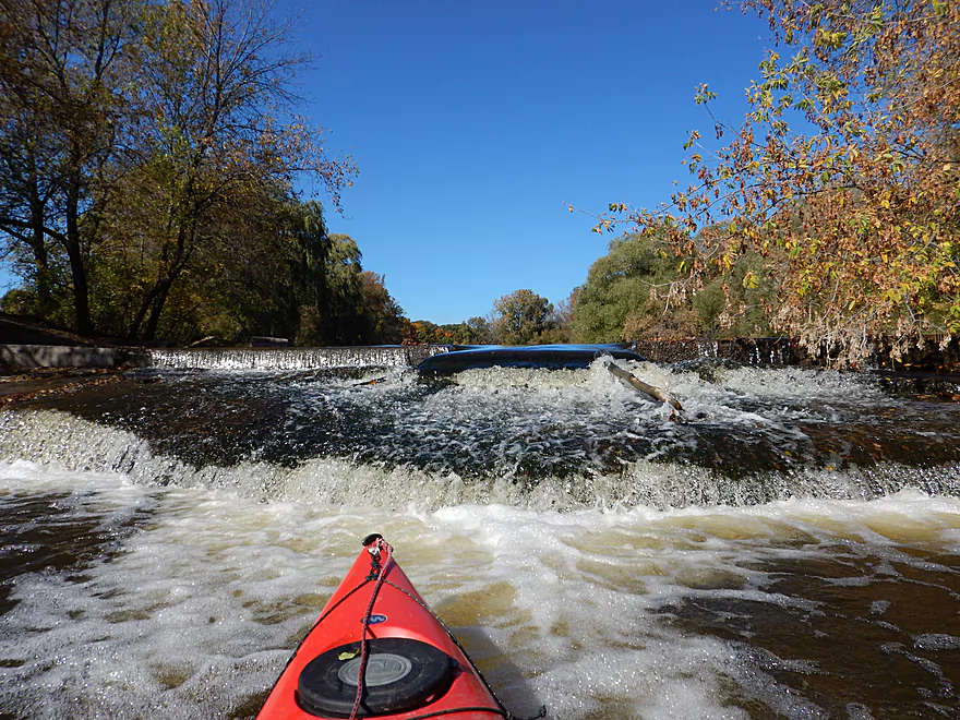
A minor ledge that follows the dam
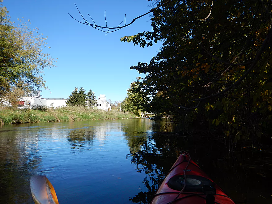
A very noisy brat factory
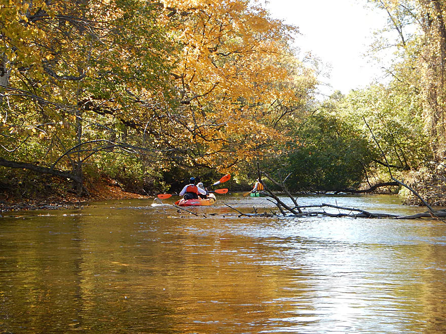
Was surprised to see other kayakers on the water
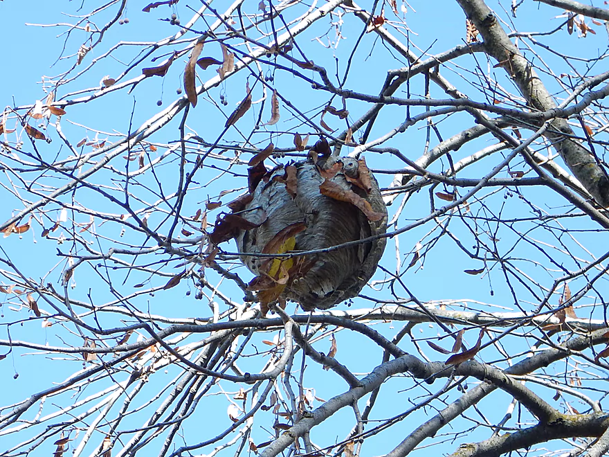
Paper wasp nest
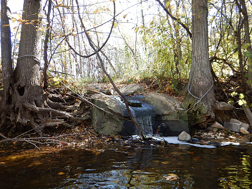
Mystery effluent coming from the brat factory
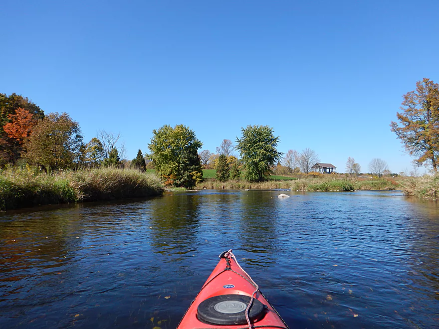
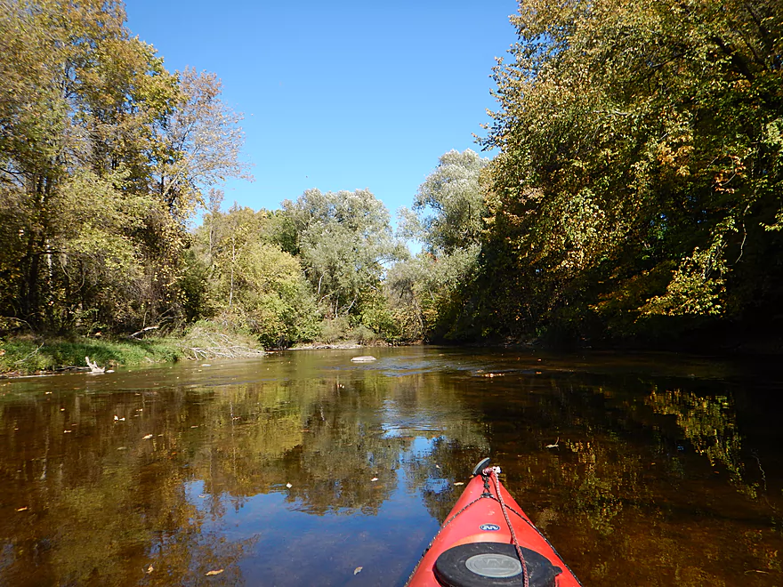
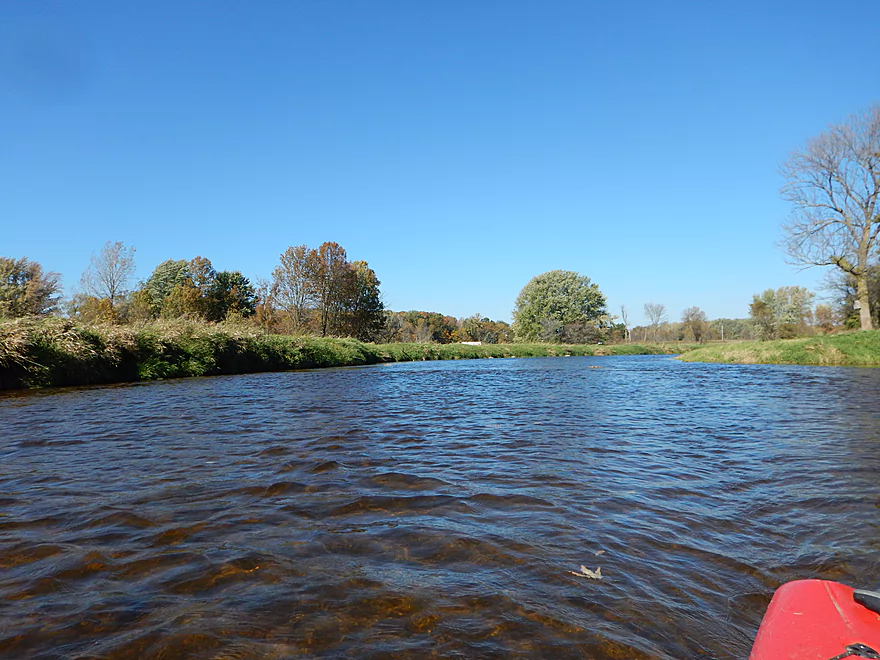
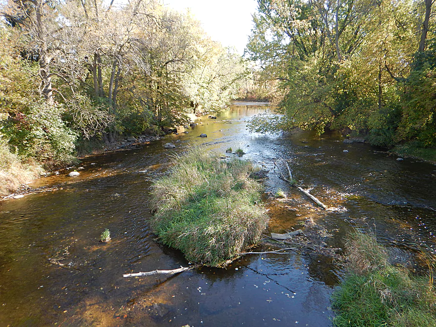
River mostly had shallow banks (an exception)
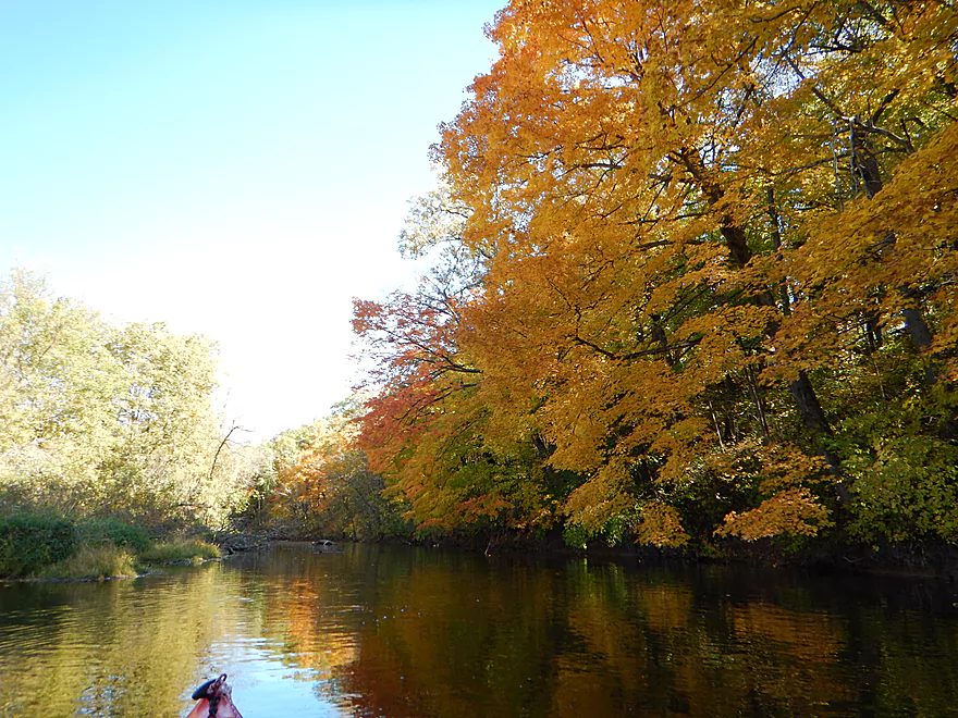
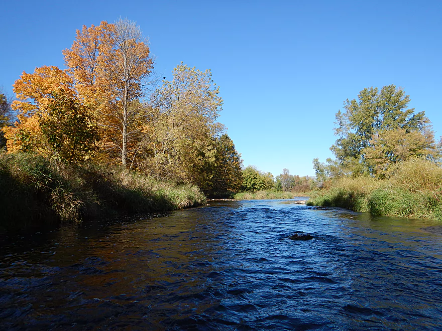
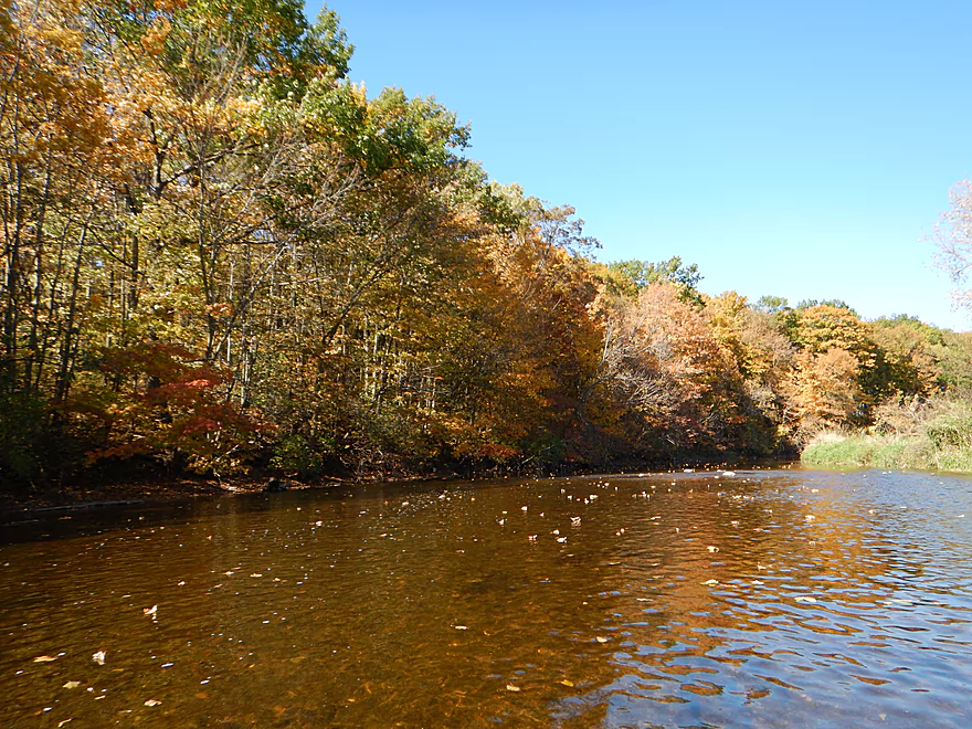
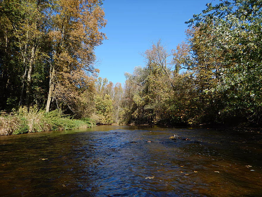
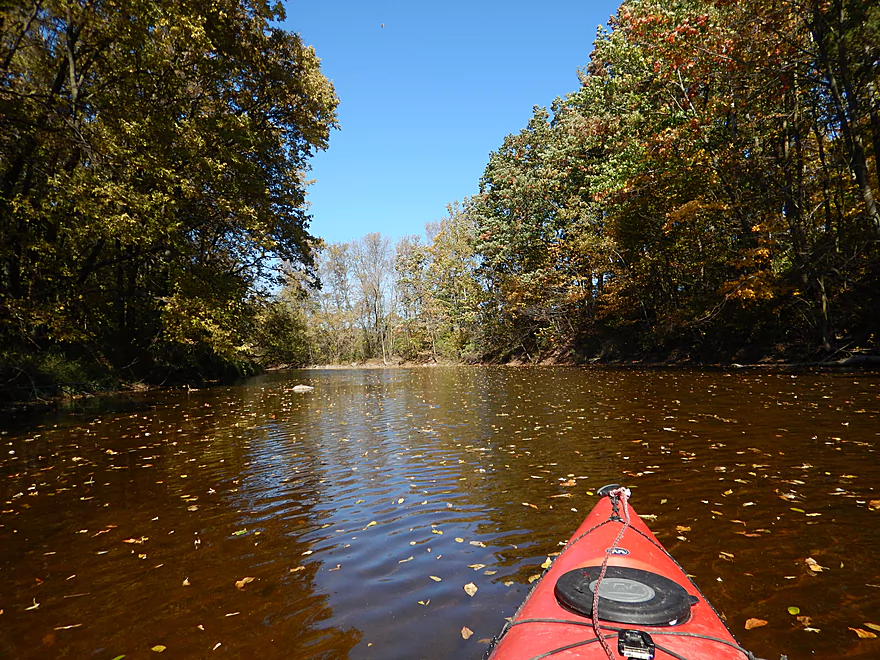
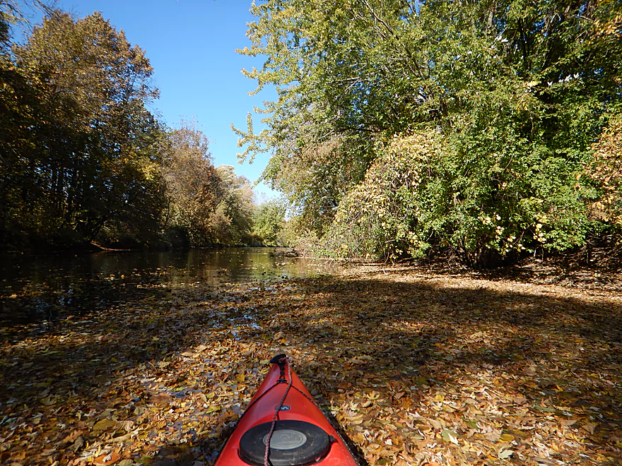
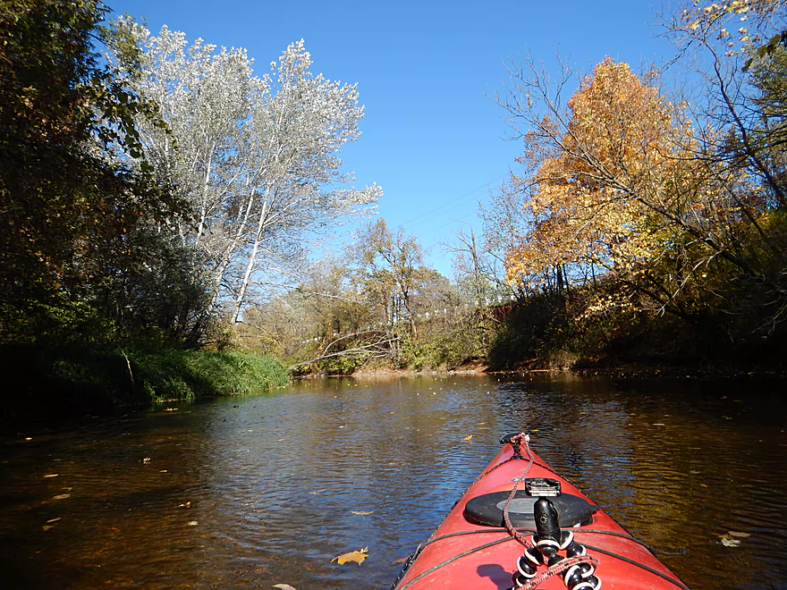
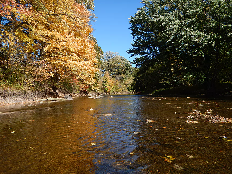
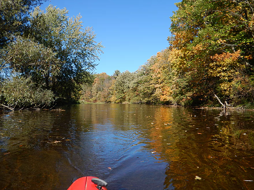
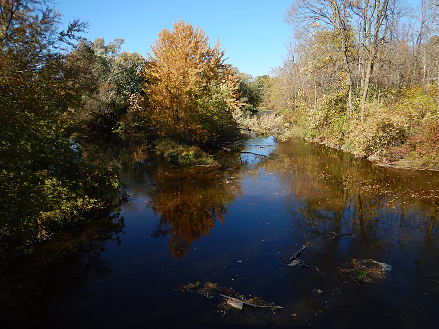
Nice fall color
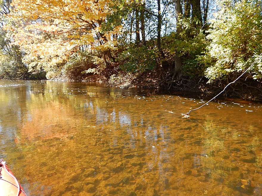
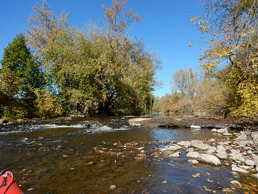
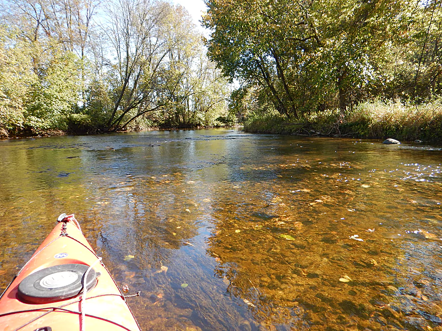
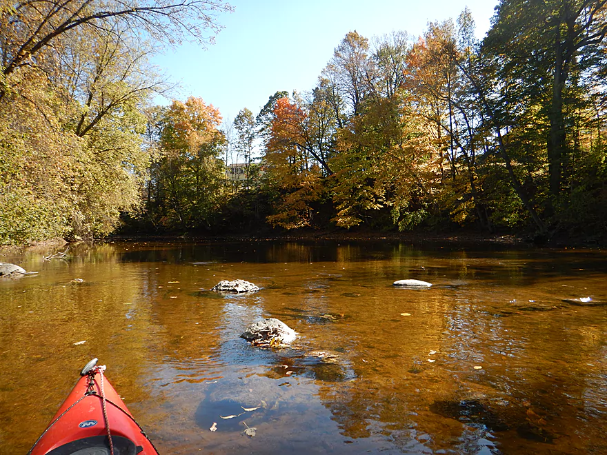
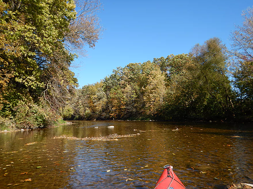
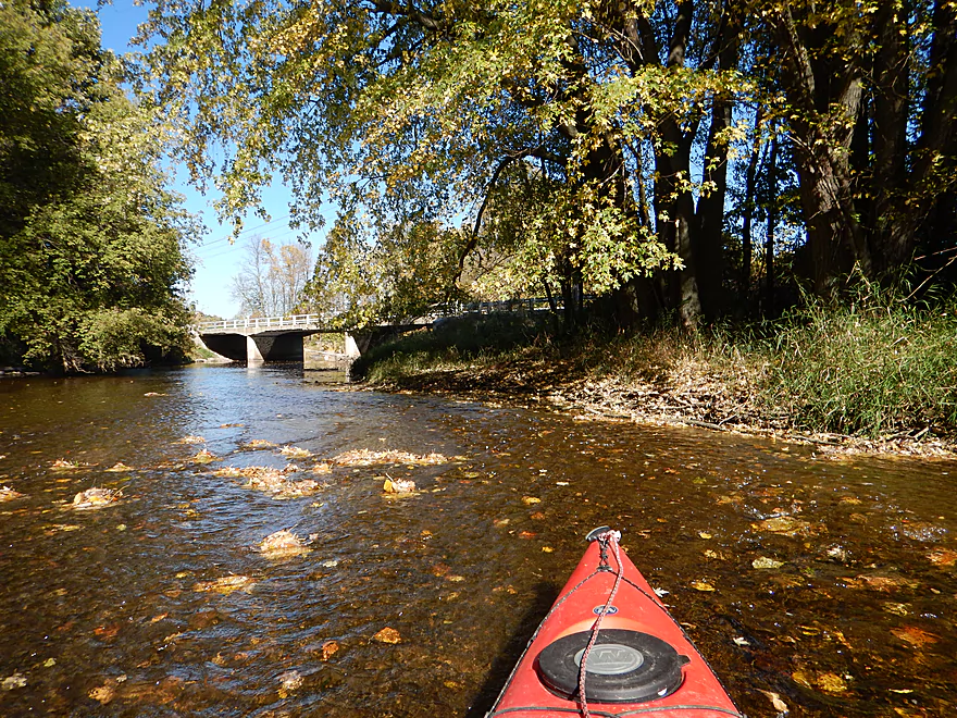
Really good water clarity
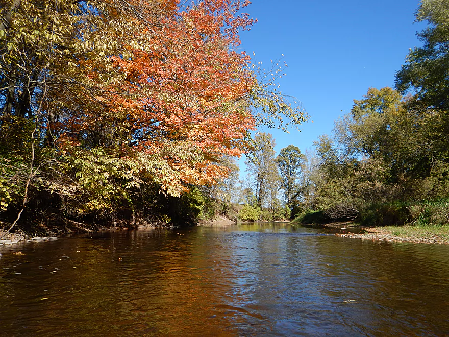
One of many riffles
Most unfortunate that such a nice river endures this
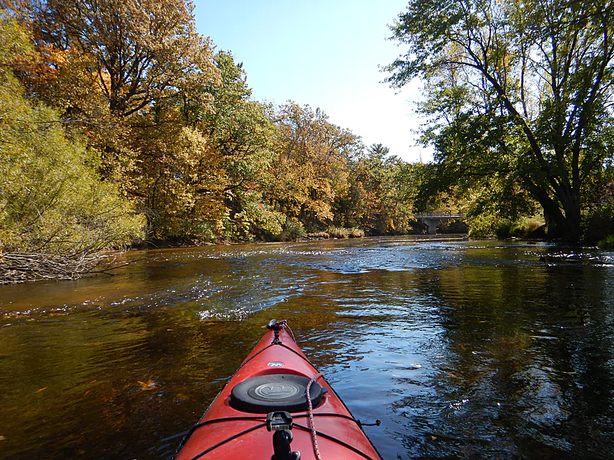
Woodland Road (very wooded from here on)
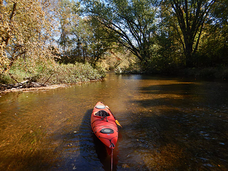
Such a shallow trip…this time I get out
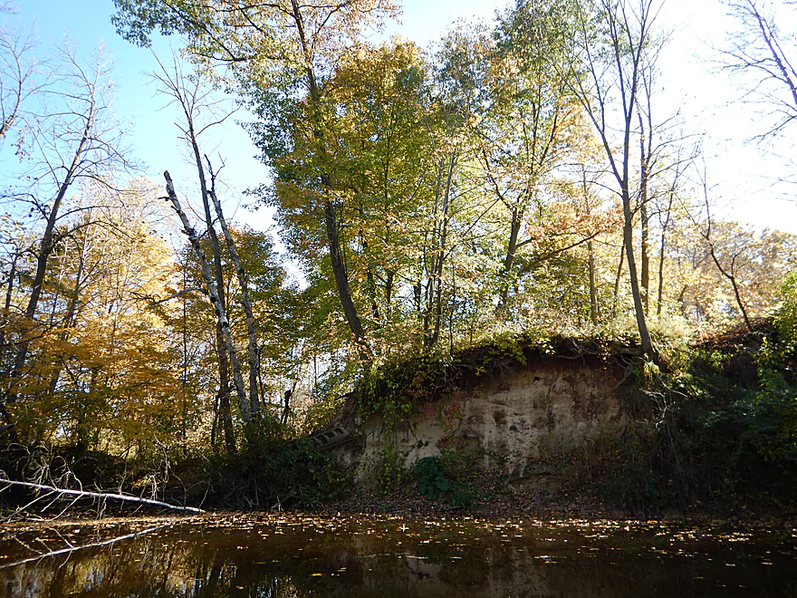
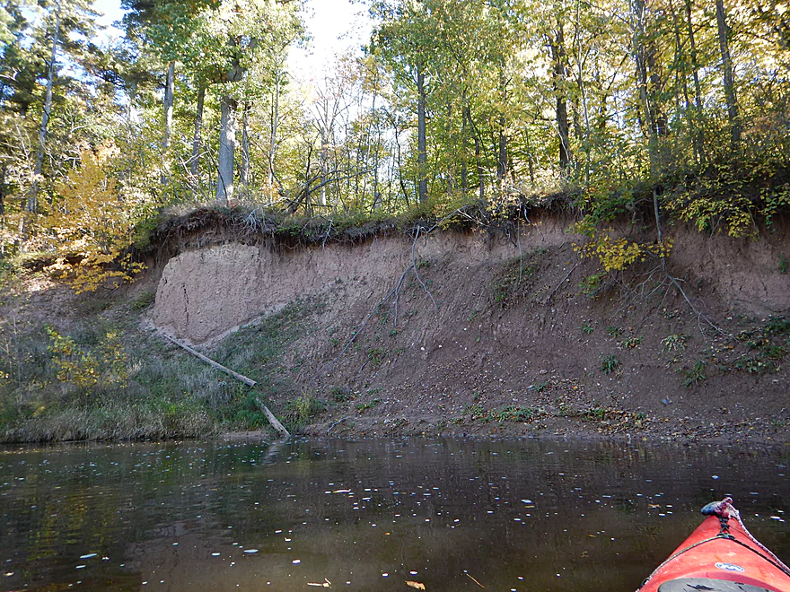
Exposed bank
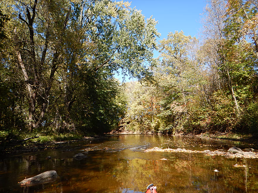
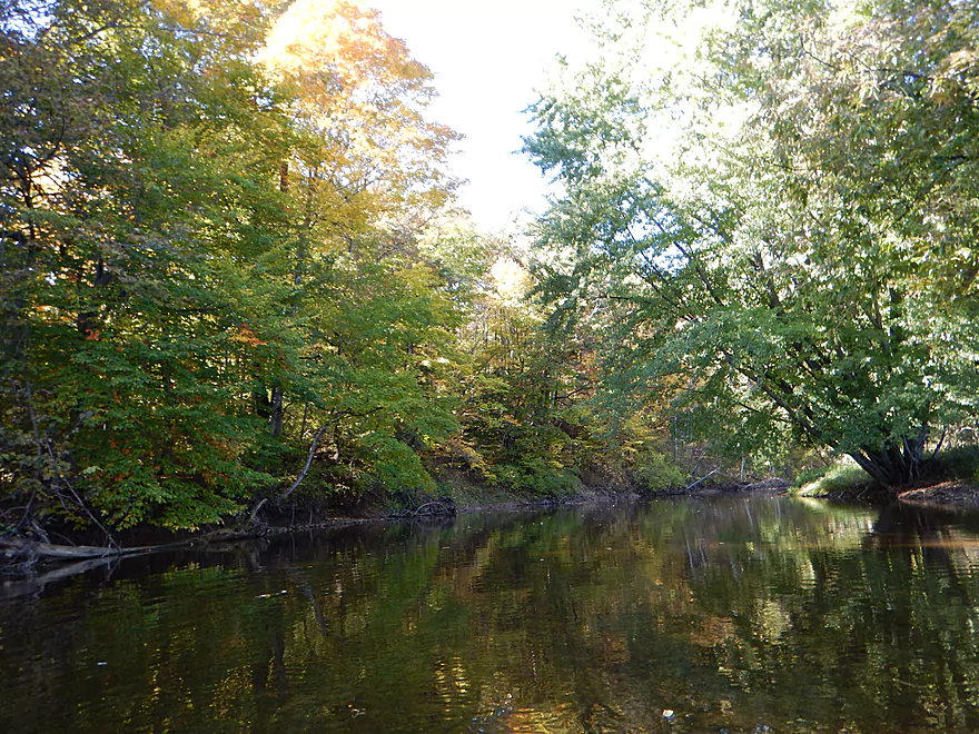
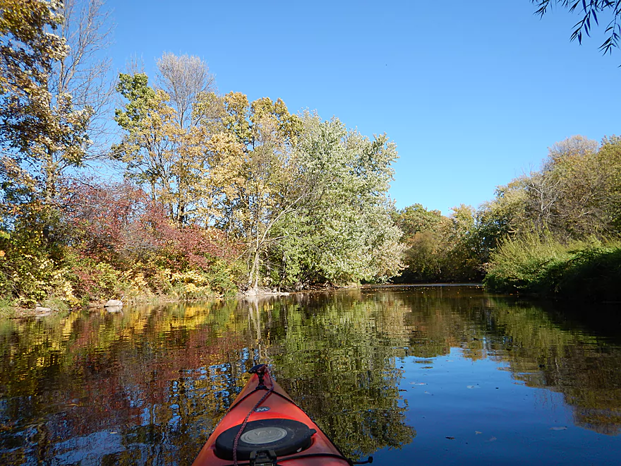
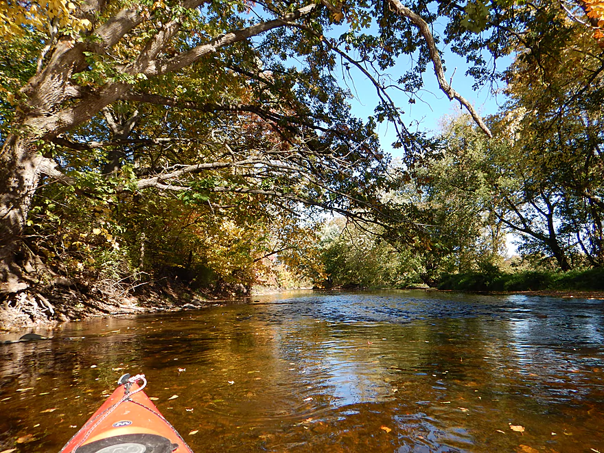
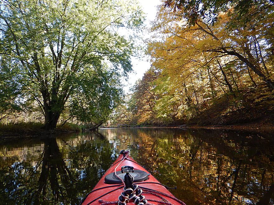
One of my favorite photos
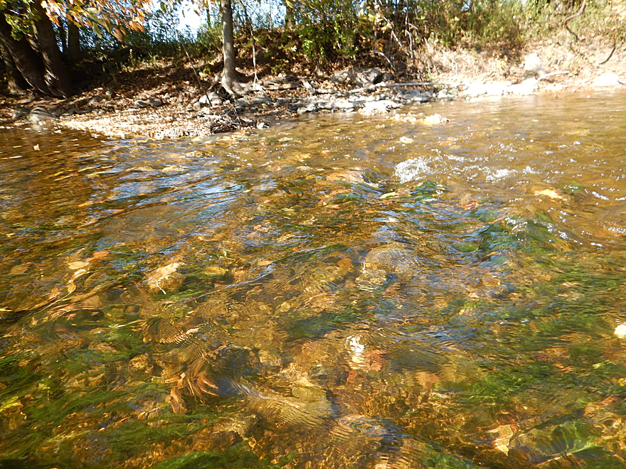
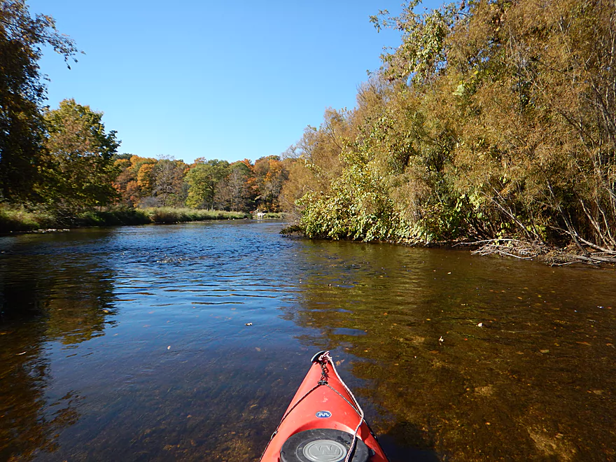
Very transparent water
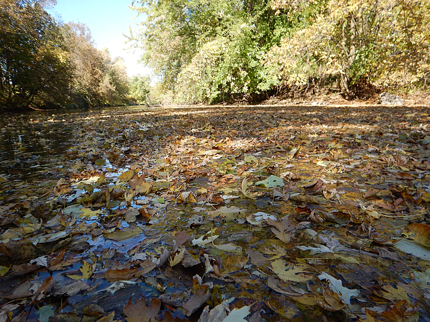
A leaf carpet
Fun to barge through
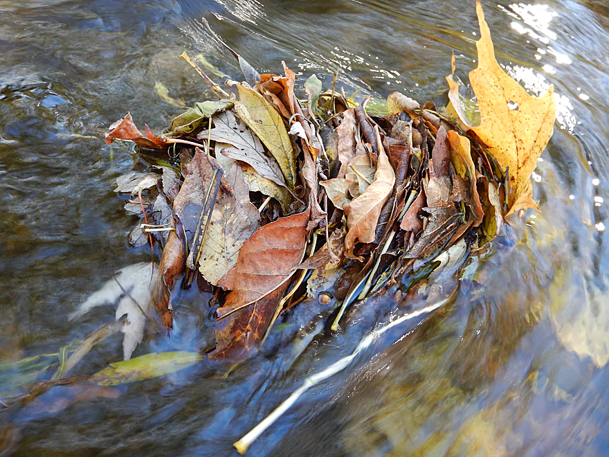
Wad of leaves (much better than my Yellow River version)
Getting seriously stuck at Hwy M
Dassow Park is a great take-out
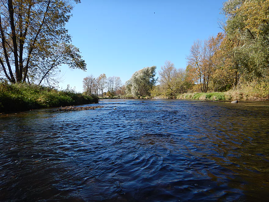
Looking upstream
Looking downstream toward a future trip
Scouting the famous Sheboygan Falls
A cool ledge follows the main falls (tough yakking!)
Sheboygan River – Johnsonville


I’ve been interested in the Sheboygan River for a while based on pictures I’ve seen and a favorable review from canoe author Mike Svob. The idea this year was to save it for fall because of its abundant sugar maple population and a chance to experience the famous salmon run (they can get HUGE). While I did this perhaps a tad on the early side, it still worked well for a fall color paddle. No salmon unfortunately (turns out they hang out well downstream between the Kohler Dam and Hwy 43…shucks). This upper stretch was still very nice though with clear, swift current, clean gravel substrate, and attractive wooded banks.
Starting at the fire station in Johnsonville is a good way to begin the trip. Johnsonville is not much of a city and mostly services the local Johnsonville sausage factory (which will flank both sides of the river). Don’t run the low-head dam (dangerous), but I thought the second ledge (a partly removed dam) was manageable and is easy to scout if need be.
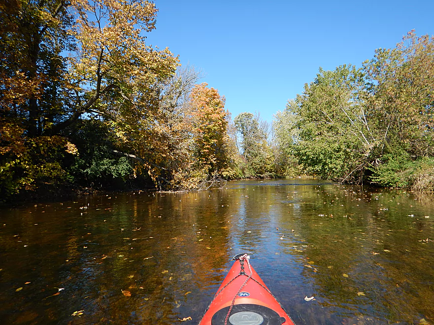
The trip starts on a great note, with many overhanging trees, super clear water and fun little riffles. You’ll paddle by a large clay bank before the river straightens out and opens up a bit by the Hwy J bridge. Hwy J is an access option with a pull-off on its southeast side and a small trail leading to the water. Canoe author Mike Svob strongly suggests paddlers put in here over Johsonville, but I disagree, as the fire station is a better launch site and allows you to run a nice sub-stretch of the river. The river loses its openness after Hwy J and becomes pretty narrow and shallow (which is nice and gives it character).
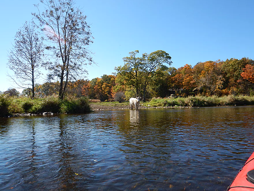
On the downside, there were some noise issues. The sausage factory (home of ‘Johnsonville Brats’) was very active, making a lot of noise and spewing smoke into the air, but really the major problem was the farm machinery, which was exceedingly loud for more than a mile. Just unlucky timing though and doubt most would deal with this. While the river mostly has a healthy wilderness buffer along its shoreline, there were some sections in which cows had direct access to the water and you could smell the manure. Most unfortunate, but not indicative of the river at large.
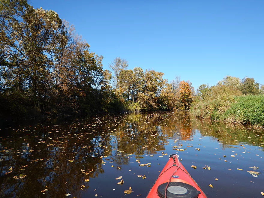
Again, the main impetus for doing the trip was the fall color and I was a tad early (drat!), but it was still nice. There were many leaves floating on the water and fluttering through the air, which kind of reminded me of falling snow. Neat experience.
After Woodland Road, most of the farm problems go away and the woods (aptly) return, which are quite beautiful. I definitely thought the second half of the trip was more scenic than the first (most of my photos are from the second half). The lighting was very challenging though and I don’t think I captured the essence of the trip, but there are still some nice pictures.
In conclusion, this was a great trip that I’ll give 4.5 stars for its clear water, riffles, rocks and nicely wooded banks. Highly recommended!
There is a public parking lot northwest of the Hwy JM bridge in Johnsonville that makes for a good landing (right by the fire station). If you want to run some minor rapids, you’ll have to drag your boat maybe 300′ over grass to launch just below the dam (I think it is worth it).
Great access and public parking for taking out at Dassow Park. Neither the put-in nor the take-out have facilities.
I’m not aware of any commercial liveries that service the upper stretches of the river.
The bike shuttle is hilly, but not unbearably so. Small shoulders, but light traffic and a length of only 3 miles make biking a good shuttle option.
No log jams!
For the most part, no hazards. However, there are two noteworthy ledges by the put-in (both super easy to avoid by just putting in downstream).
The first ledge is a low-head dam. Do not run this, as the shallow dam looks tippy and the re-circulating current grippy. If coming from upstream, this seems like an easy portage (canoe author Mike Svob was actually quite concerned about even attempting a portage, which frankly I didn’t see as an issue).
There is a second ledge shortly after the dam which is runnable and perhaps a low class 2. In higher water, this could be meaner though.
Pay attention, as this is important. I went at 86 CFS per a gauge downstream in Sheboygan. This is doable, but for most would not be ideal. Now much of the river (maybe 90%) had no issues. However, many of the riffles (and there were a lot) were bumpy and I did have to get out several times. There was a canoeing family that went ahead of me, and I did see their paint on the rocks from time to time… When navigating, remember: still water runs deep.
What’s frustrating is that 86 CFS is actually relatively high for this river, so it is a tough river to time. I’m totally guessing here, but think 95 to 130 CFS might be ideal. 130-160 might be on the high side and 160+ might be near flood stage (guestimates…don’t hold me to any of this). I wouldn’t run the river too high though, as it has a lot of quaint character with the riffles, bends and clear water that would be easily drowned in high water.
The current itself was mostly pool and riffle. Pleasantly up-tempo, but never pushy.
Not much (typical for many fall paddles). Saw a crayfish, huge flocks of geese, bank beaver holes (I think), some fish darting through the water and dragonflies.
The Sheboygan is famous for its salmon, which do their run in October and can grow to be quite large. My hope was to spot them from the kayak, but as it turns out, Johnsonville was too far upstream for that (not that the salmon are lazy, they just don’t care for the three dams between Johnsonville and Lake Michigan). In hindsight there actually was an amazing stretch of the Sheboygan to kayak for Salmon spotting, but that was from Rochester Park to Esslingen Park (9.5 miles). Oh well…next October.
The prime fishing spots are below the Kohler dam (the last on the river), but access is controlled by ‘River Wildlife’, an upscale, exclusive resort that owns over five miles of shoreline. The corporation regularly patrols the shoreline and calls the police on trespassers (fishermen who don’t pay the insane access fees), but kayakers should be ok.
Detailed Overview
Thanks to Mike Svob, author of "Paddling Southern Wisconsin", for much of this information.
- Upstream of Hwy CCC: River looks too small and channelized to be interesting.
- Hwy CCC to Palm Tree Road landing: 3.17 miles. Interesting creek prospect with a mix of wetlands and woods. Part of a State Natural Area with a cool bridge. Warning: the weeds in late summer can make navigation difficult. A group got lost here and had to call 911.
- Palm Tree Road to Sheboygan Marsh Tower: 8.8 miles. The heart of the Sheboygan Marsh and probably similar to Horicon Marsh. Some flowage paddling and channelized sections.
- Sheboygan Marsh Tower to Hwy MM: 1.1 Miles. Probably nice, but with logjams and a possible fish barrier. Am not 100% sure that Hwy MM is ok for public access.
- Hwy MM to Kiel (8th St.): 5.9 miles. First 1.3 miles is mostly wooded and probably nice, with perhaps a few jams. Then it is open marsh to Kiel.
- Kiel (8th St. landing) to Kiel (Rockville Road landing): 2 miles. Seemingly pleasant urban paddle, but a dam and two flowages to contend with.
- Kiel (Rockville Road) to Steinthal Road/Dam: 0.7 miles. Very big flowage...looks boring.
- Steinthal Road/Dam to Rockville Road: 1.2 miles. Looks like a pleasant wooded section with maybe one logjam.
- Rockville Road to Millhouse (Gierke Road/Dam): 2.5 miles. Mostly minor flowage paddling.
- Millhouse Dam to Hwy FF: 5 miles and a good prospect. Dam might not be a good put-in though. Hwy 57 is a half-mile downstream and a good backup plan.
- Hwy FF to Johnsonville Dam: 5 miles and also a good prospect. Be careful of the dam in high water.
- Johnsonville to Dassow Park: 6.4 miles. A good stretch. Hwy J and Hwy M are alternate launch options.
- Dassow Park to Hwy TT: 5 miles and a good prospect.
- Hwy TT to Hwy C: 3 miles and also seems good.
- Hwy C to Settlers Park (by the dam): 2.8 miles. A mediocre urban paddle through the city of Sheboygan Falls.
- Settlers Park to Sheboygan Falls View Park: 0.3 miles. A scenic but dangerous section with strong whitewater. Americanwhitewater.org has a nice review.
- Sheboygan Falls View Park to Rochester Park: 0.7 miles. A narrow wooded stretch with perhaps some Class 1 and even Class 2 rapids.
- Rochester Park to Esslingen Park: 9.5 miles. Despite being mostly a golf course paddle and needing to portage two dams, this is a really nice paddle. This trip is best timed in October when fall color can be quite good and you can see large salmon spawn.
- Esslingen Park to North Side Municipal Beach: 5.6 miles.
- Esslingen Park to Kiwanis Park: 2.1 miles. Slow current and uninteresting shore scenery make this IMO a somewhat boring stretch.
- Kiwanis park to Sheboygan Harbor Boat Ramp: 2.2 miles. Mix of urban and maritime scenery. There are some interesting sights, including the historic "Fish Shanty Village", but it's not IMO an elite stretch.
- Sheboygan Harbor Boat Ramp to Breakwater Mouth: 0.5 miles. This is the length of the breakwater and is fairly protected, but outside of the lighthouse isn't super interesting.
- Breakwater Mouth to North Side Municipal Beach: 0.8 miles. This connects the breakwater mouth to the public beach. Because this is on the open lake, it can be very rough (especially near the breakwater where tricky waves and currents form). For most paddlers this is NOT recommended.
Trip Map
Overview Map
Video
Photos Size:
Found your site when googling for some info on kayaking the Sheboygan River. So glad I did. Very helpful. I followed your exact route on July 16, 2016, and had an enjoyable time. River was shallow and I scraped the bottom more than I’d have liked, but still happy I did this. Maybe go in spring next time when it’s deeper.
Thanks for creating and maintaining this site. Looking forward to trying some of your other trips in the future.
Thanks Scott for the comment! Yes, this is a great paddling prospect and I look forward to returning to it. I suspect some of the downstream sections might be really nice.
Did the 9.5 from Falls to Esslingin Park. Beautiful and great 3 hour downstream paddle two portages. Great idea, thanks.
Thanks for the comment Jon! I hope to do this section later this year.
Aaron,
Have you ever kayaked the Sheboygan River from the Sheboygan Marsh Park to Kiel WI?
It looks like it would a great paddle and it looks like a take out on Water street in Kiel a block before the dam.
5 miles as the crow flies, maybe?
I get my Remix XP10 tomorrow. :)
Thanks for the advice on a kayak.
Gary M.
Hi Gary,
No I haven’t although it looks like an interesting prospect. I do want to get back to the Sheboygan River this year is possible. If you do this leg, definitely let me know how it turned out.
Onion River from county road V to Sheboygan falls – Rochester park is a nice fast run with good scenery and a lot of class I and I+ Rapids .
As a reverence We have done this stretch when the Sheboygan River was running at 775 Cfs and at 937 cfs.
Steep gradient but you need the flow not to scrape.
Checkout site miles paddled.com for their review.
Just found your site today and really like it!
I really want to do that section…almost did it last year. I might save it for a fall paddle when the salmon are spawning. Thanks for the feedback.
Any day on the water is better than any other day, so when the mercury hits 65 degrees on April 8th, you gotta grab the opportunity, right? There was plenty of water, but never pushy. We could have drifted the whole way except for minor strainers on the sides – easy to avoid because the river is plenty wide. Highlight was a goose sitting on her nest amid tall grass on a small island — and the crazy-mad gander who taunted us from nest to 10 minutes downstream.
Sounds like a nice trip! You’re from the Pigeon river, eh? That’s a cool prospect that is definitely on my todo list…
we are beginner paddlers with basic kayaks. We want to paddle the sheboygan river. I’m unclear how you deal with the dams. When you stop at a sidebank and walk your kayaks do you do this while still in the river? or along a side trail?
Hi Sandi…by law each dam is supposed to have a portage path. Most are marked or somewhat obvious…you simply take out along the shore…then re-enter where you can. Some dams are tricky to portage though (such as the one in downtown Sheboygan Falls). For more information you might contact the DNR or local city council.
Just did Rodchester to my house (~ 11 miles) in 5 hours with 2 teenage boys. River is down to normal again. Did it in 3 hours a month ago. Postage around both dams to the left. They are marked, but the signs are a little overgrown.
@ Aaron, let me know when you are coming. I love this trip. Salmon are starting to swim up already.
Thanks for updated and the offer!