
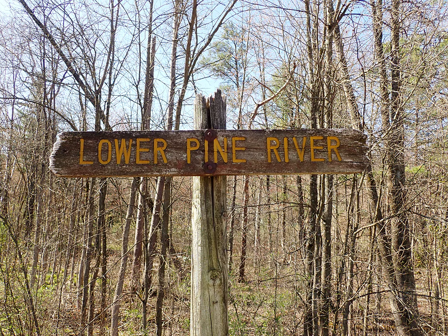
Welcome to the Pine River
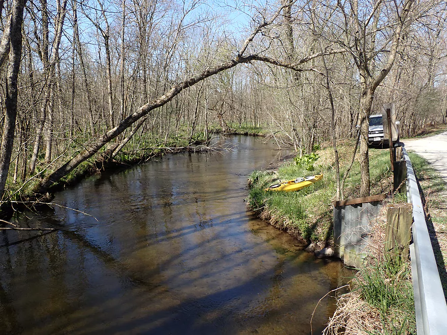
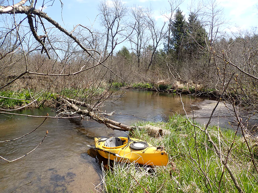
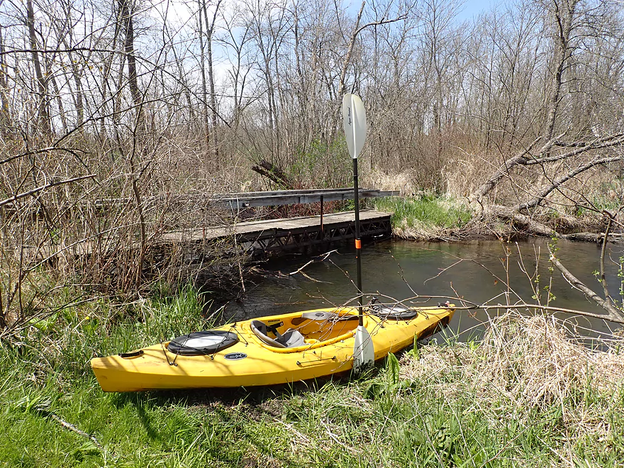
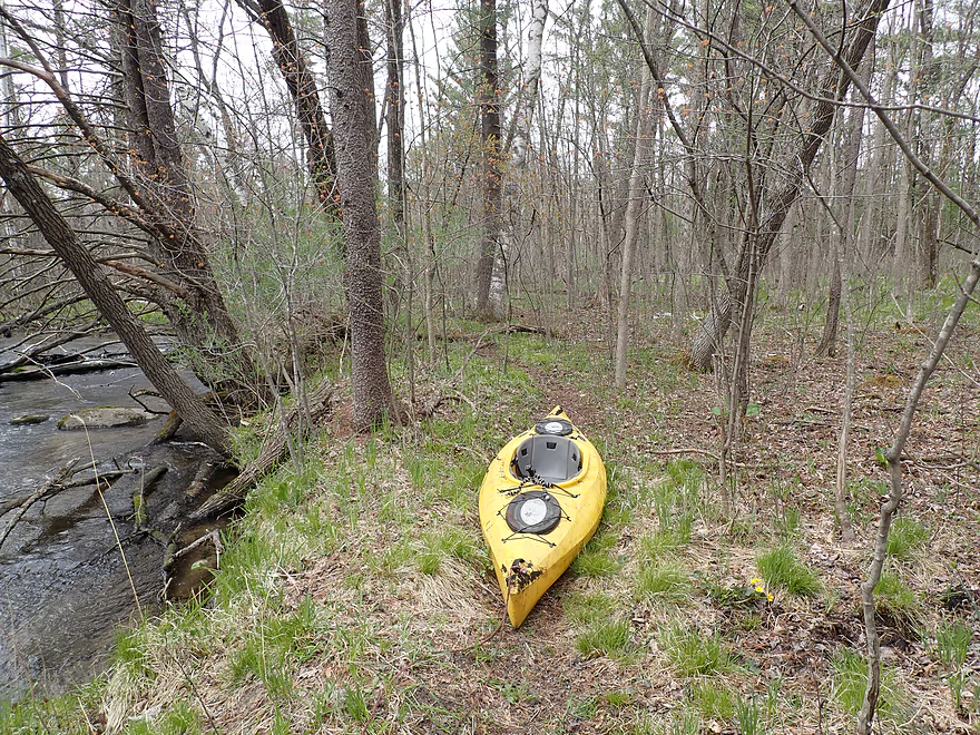
Nice put-in option at Apache Road
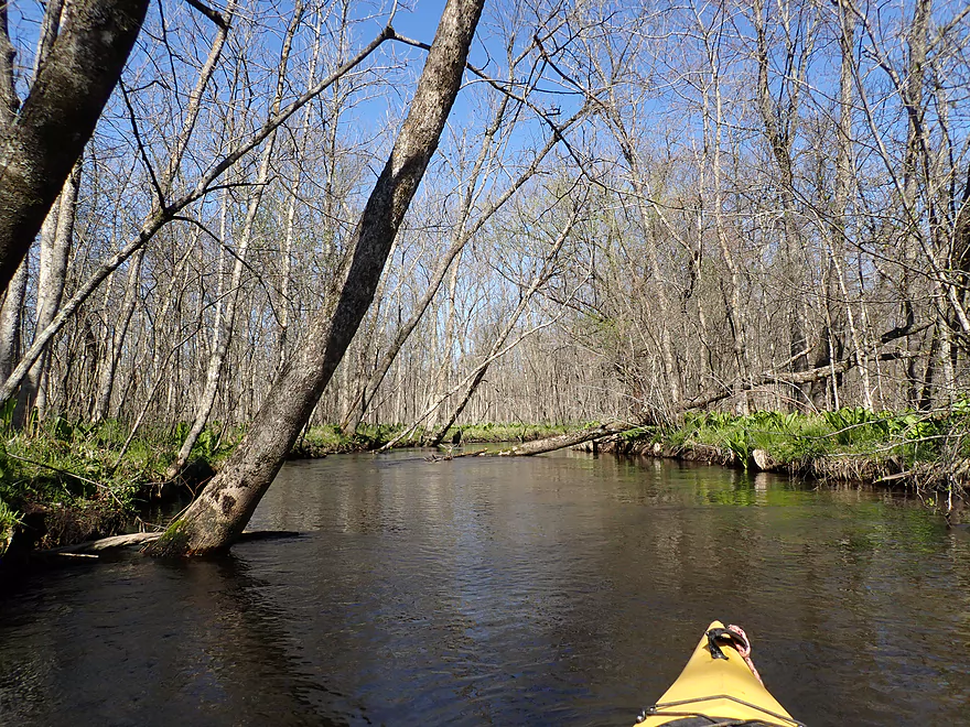
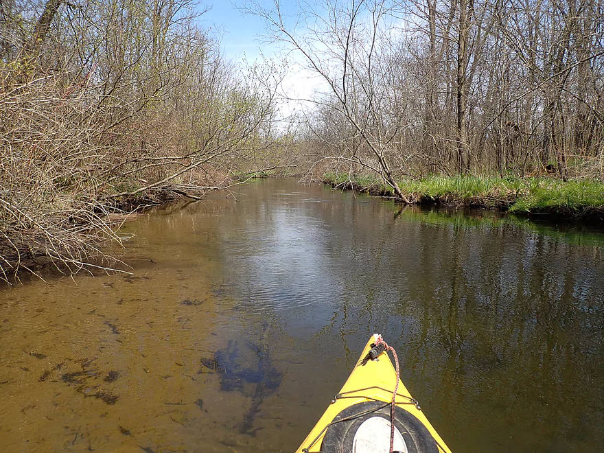
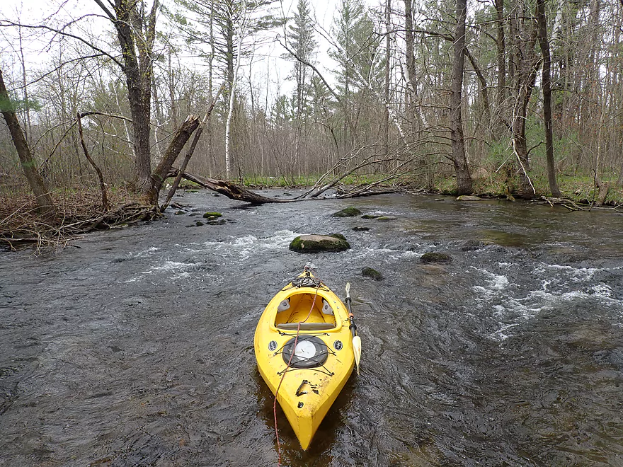
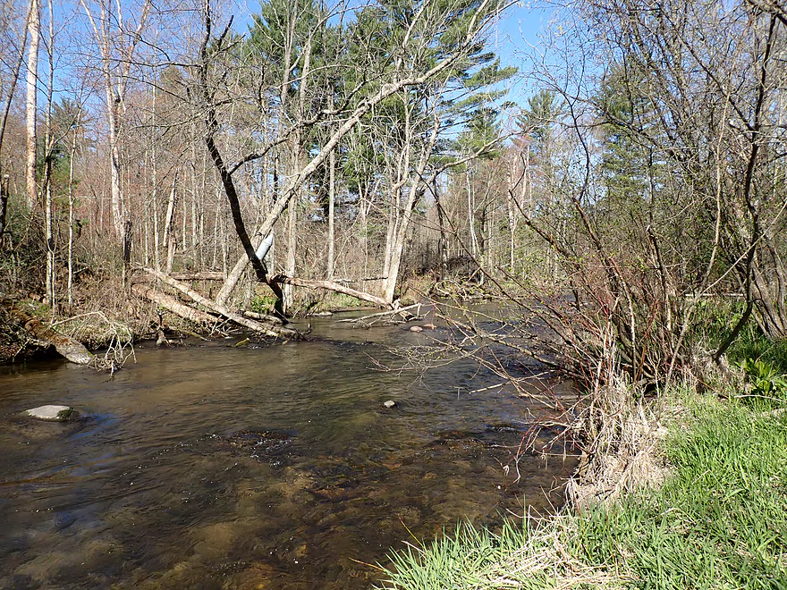
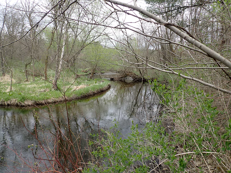
Dense woods in the first mile
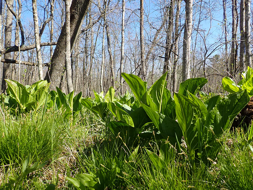
Skunk cabbage was everywhere
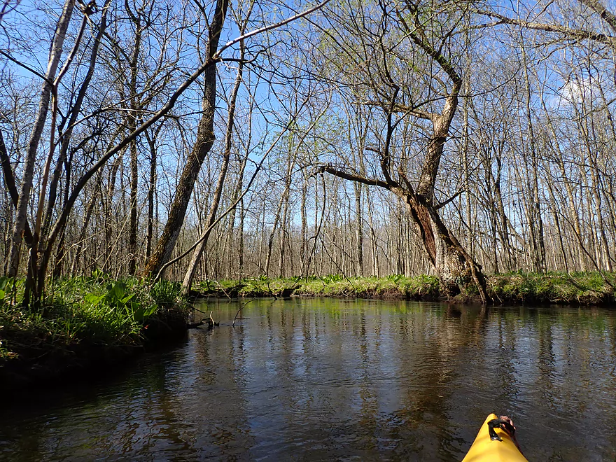
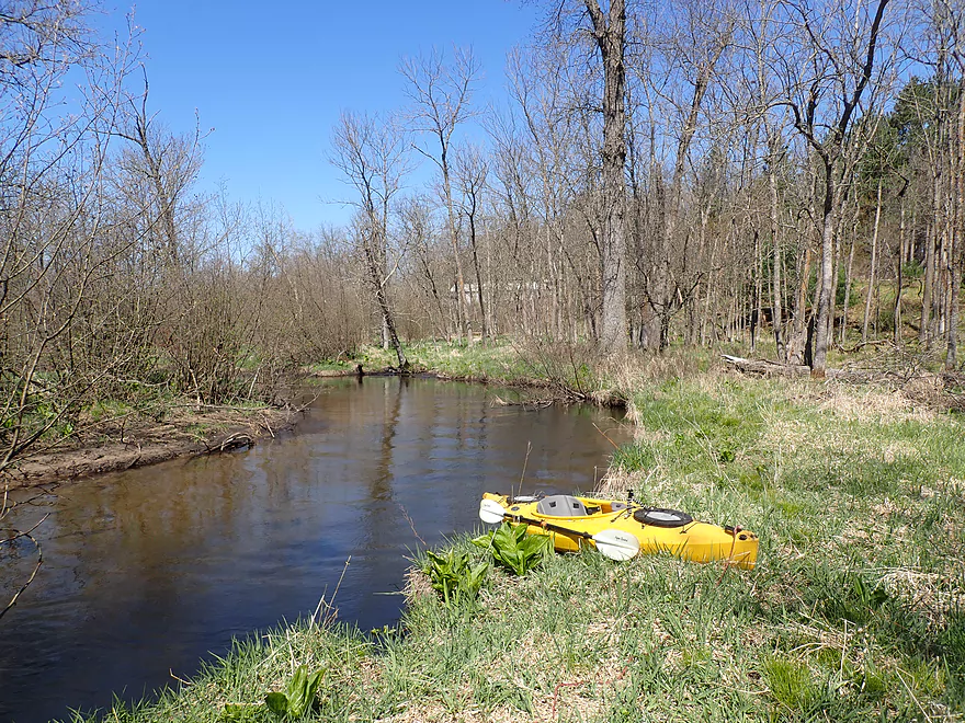
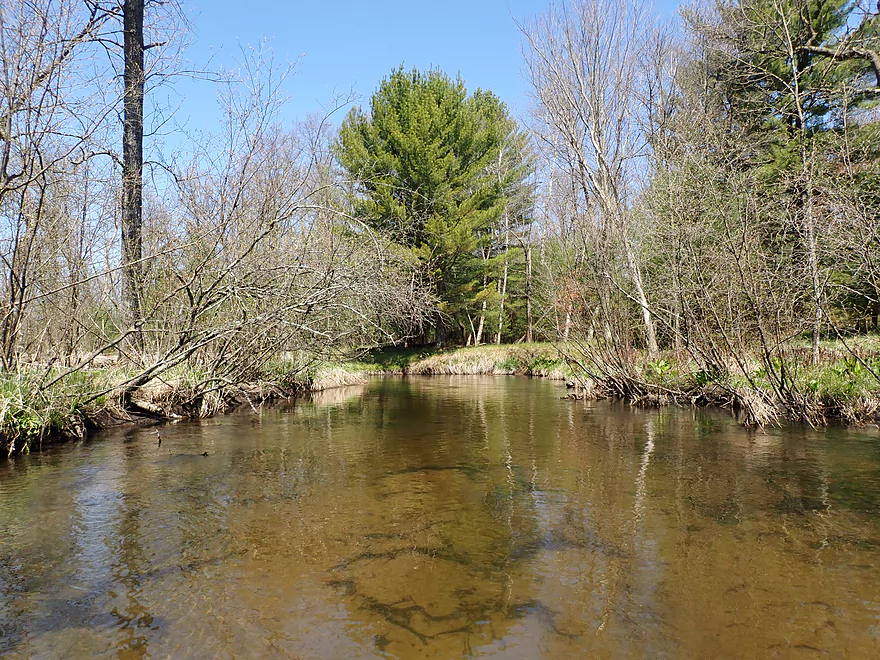
Scenic river
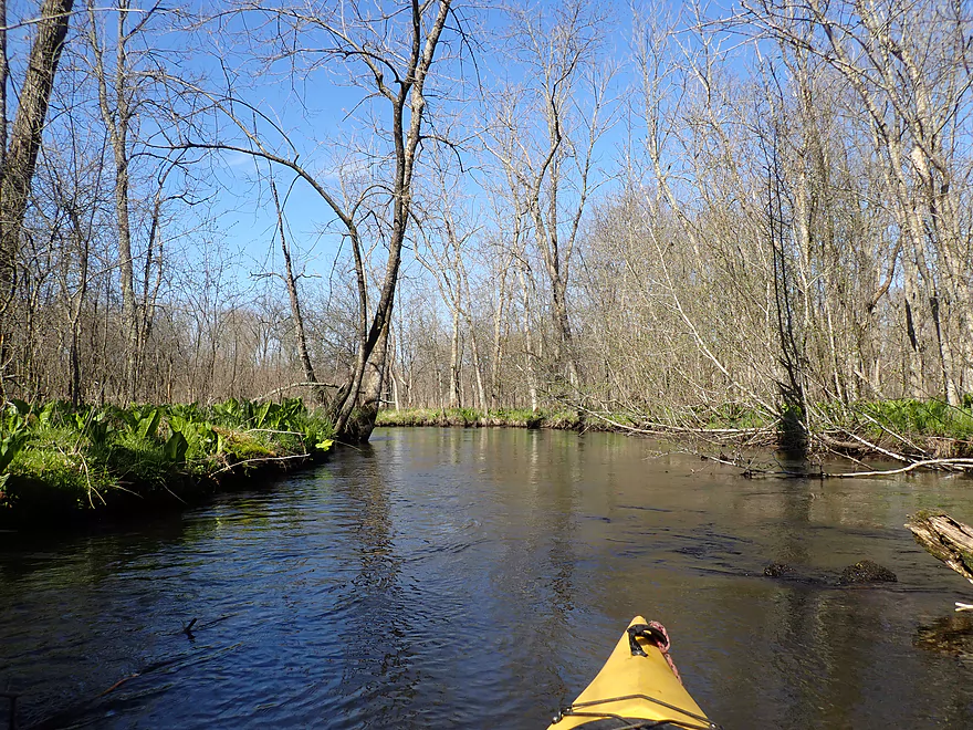
Very much reminded me of the Mecan River
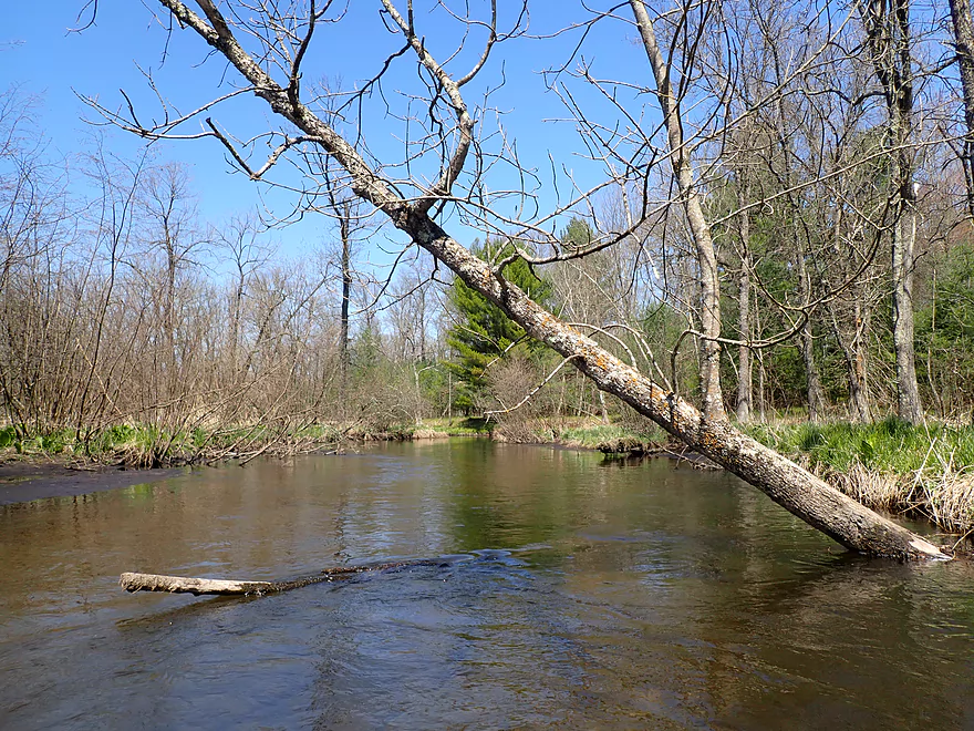
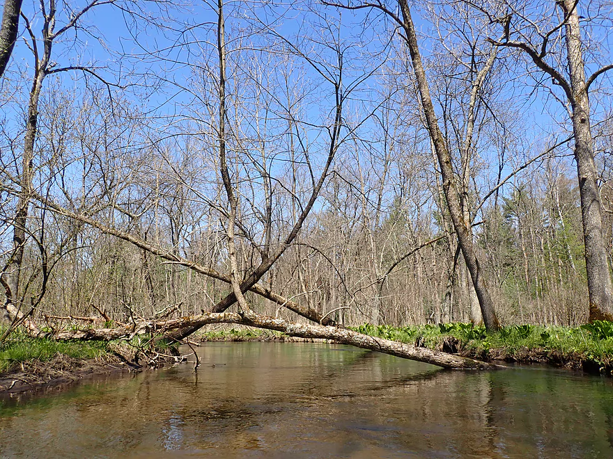
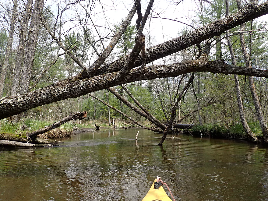
Future logjams
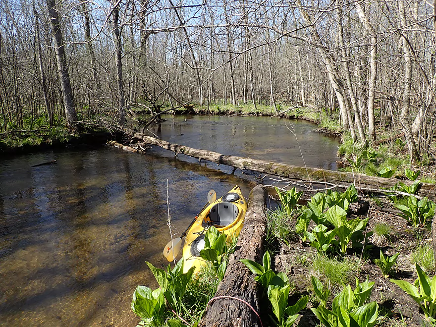
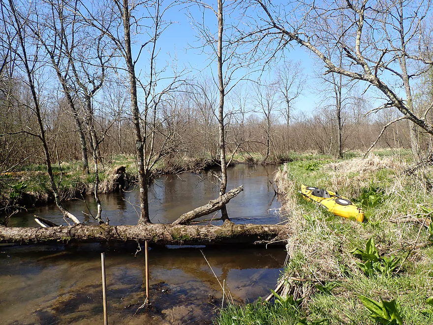
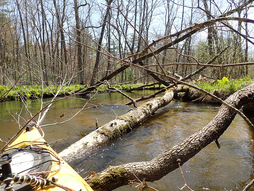
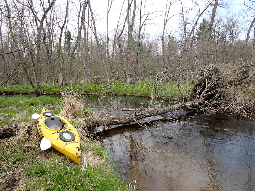
Present logjam…first portage (easy)
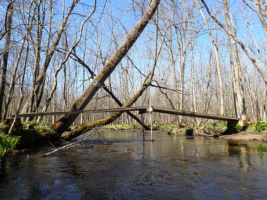
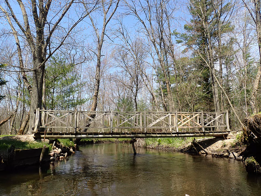
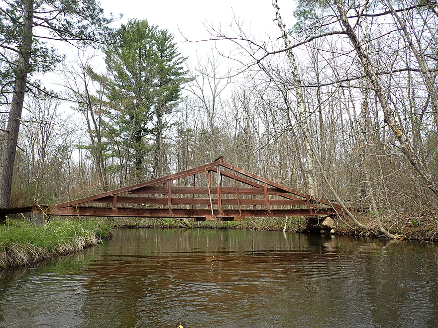
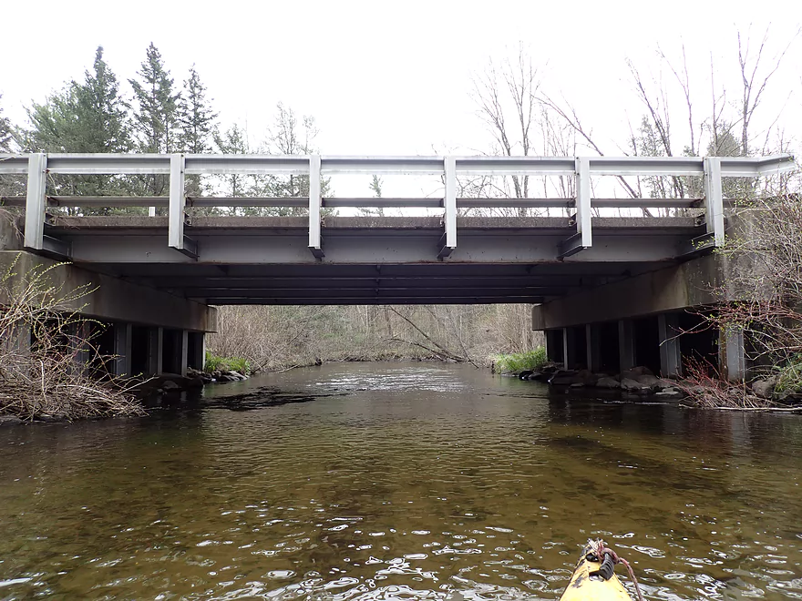
Lots of bridges on this trip
Trees growing very close to the shoreline
Portage #2
Portage #3
Portage #4
Bypassing a big mess of alders

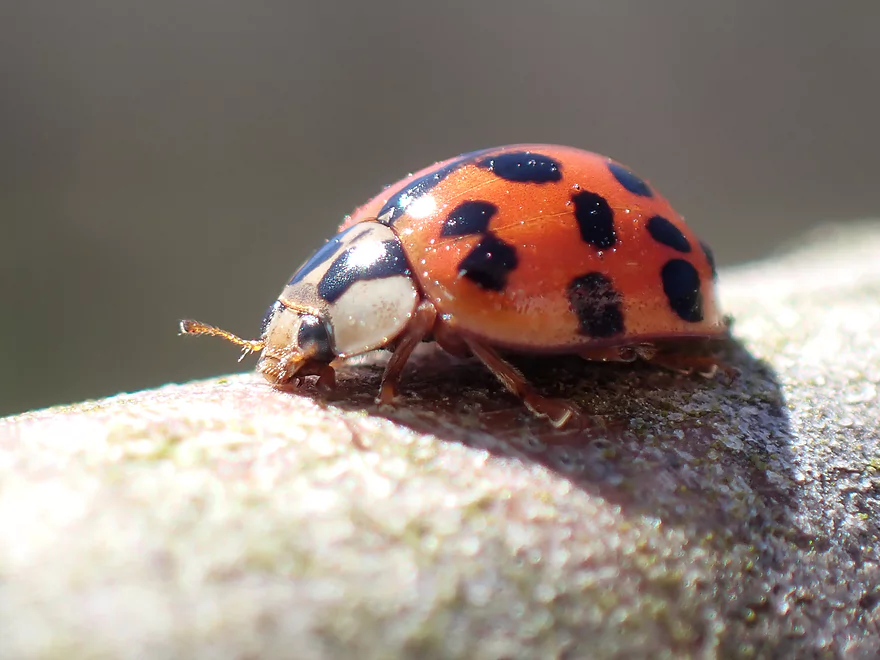
Friendly ladybug
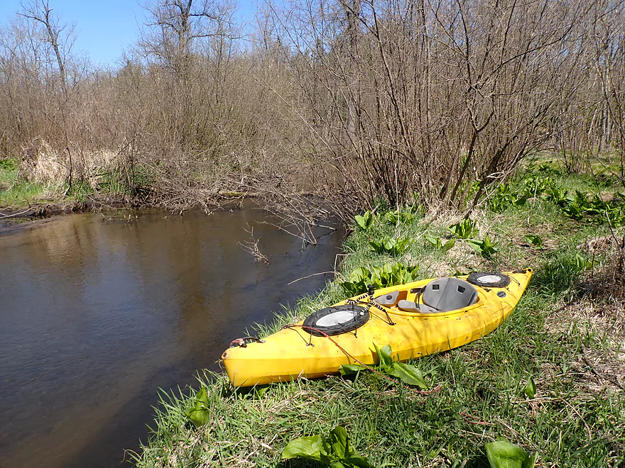
Cool
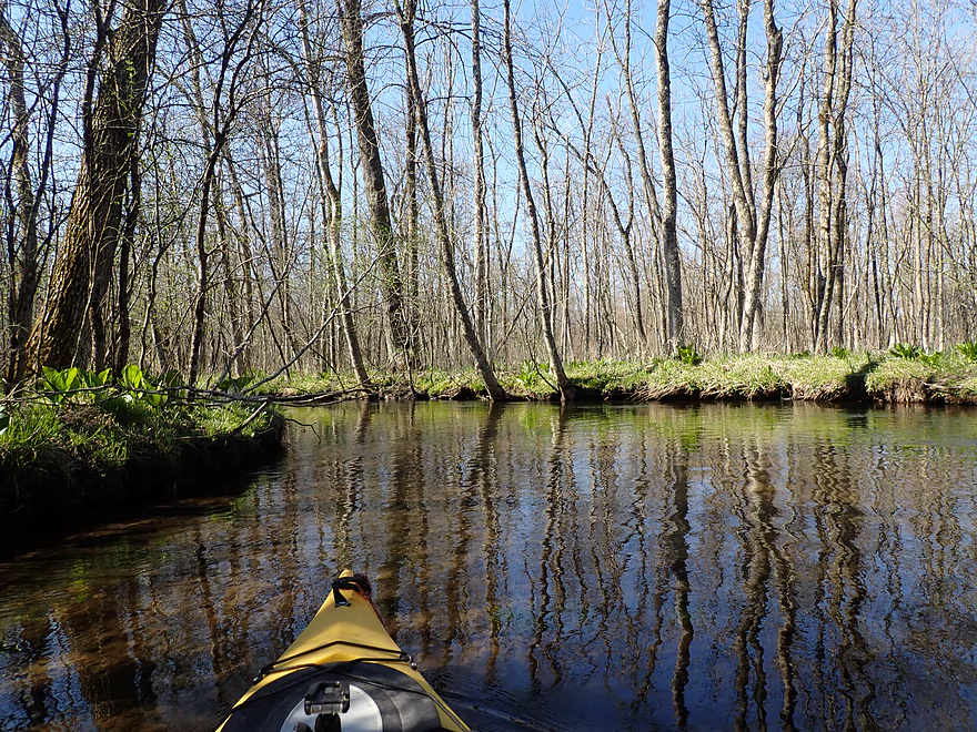
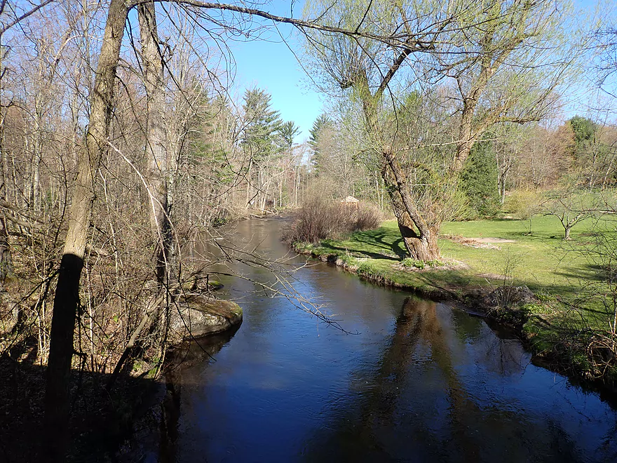
River starts to open up
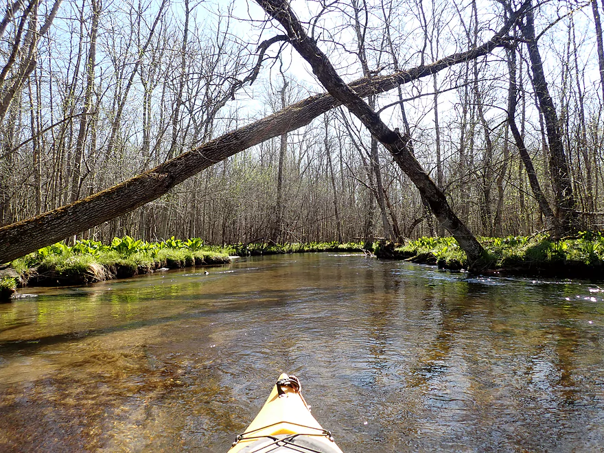
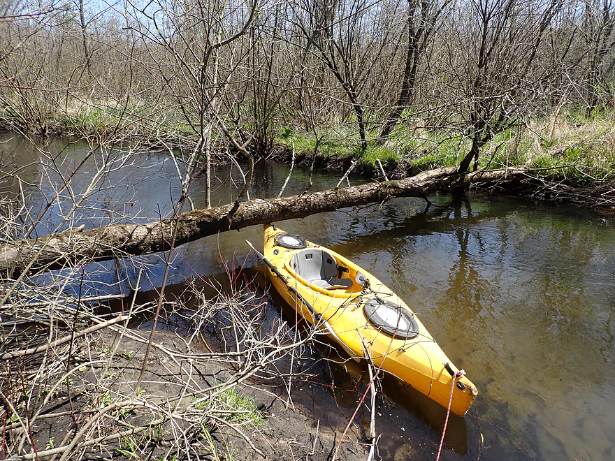
There were a number of “hop-overs”
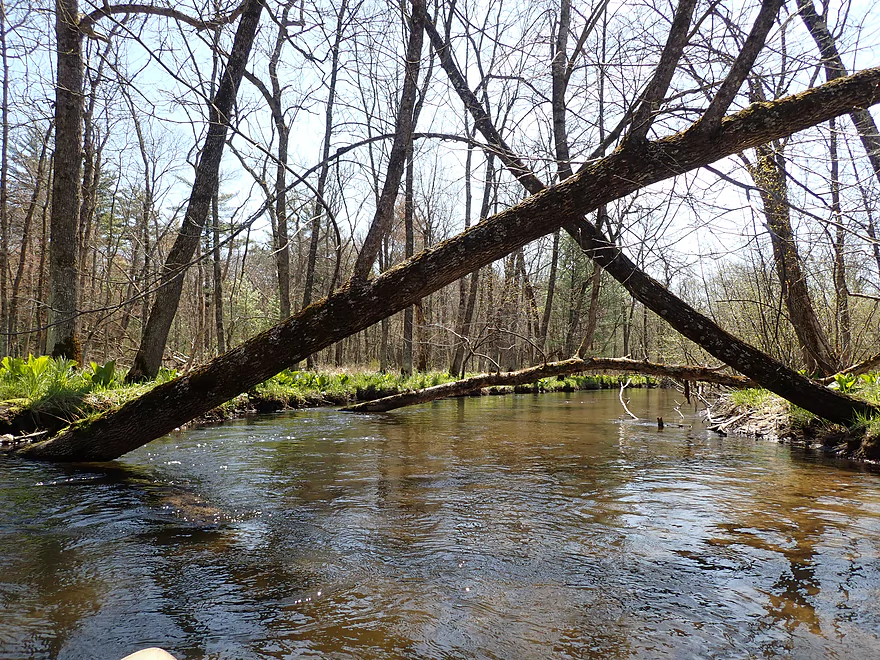
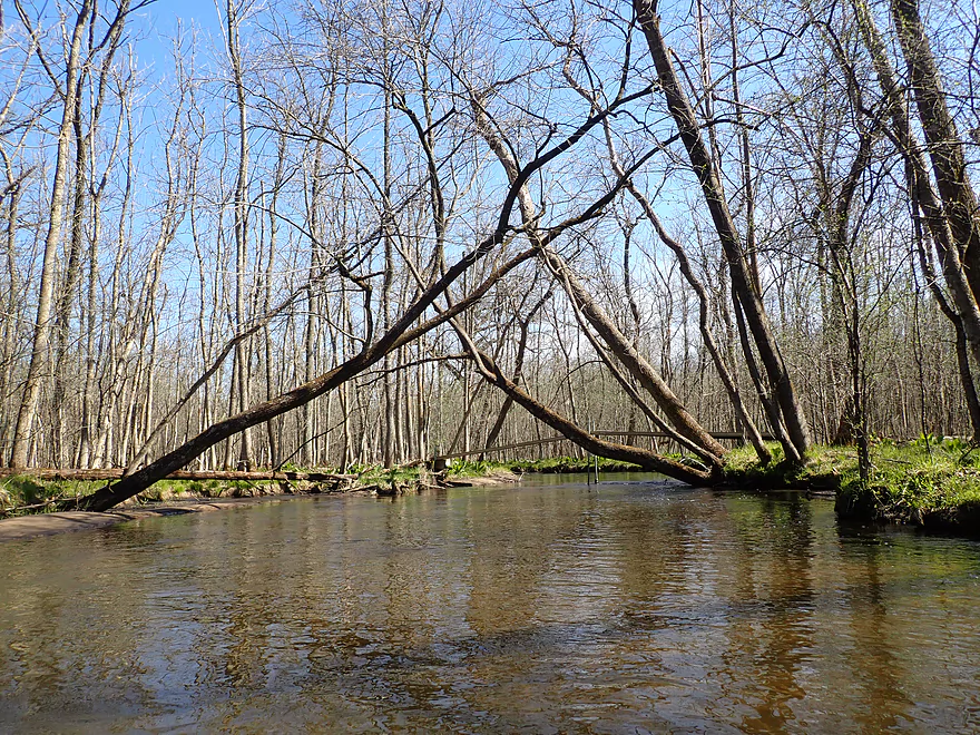
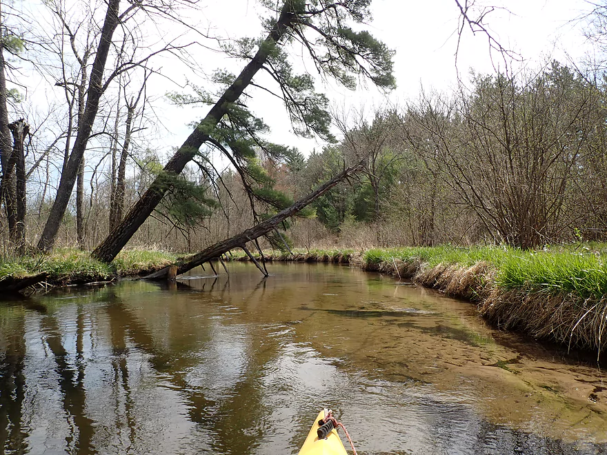
Dueling trees (loser ends up in the water)
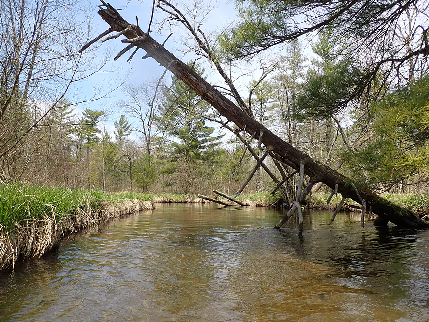
One of many “duckers”
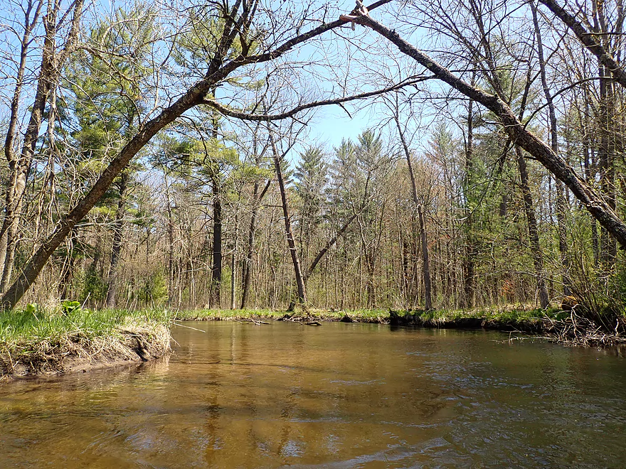
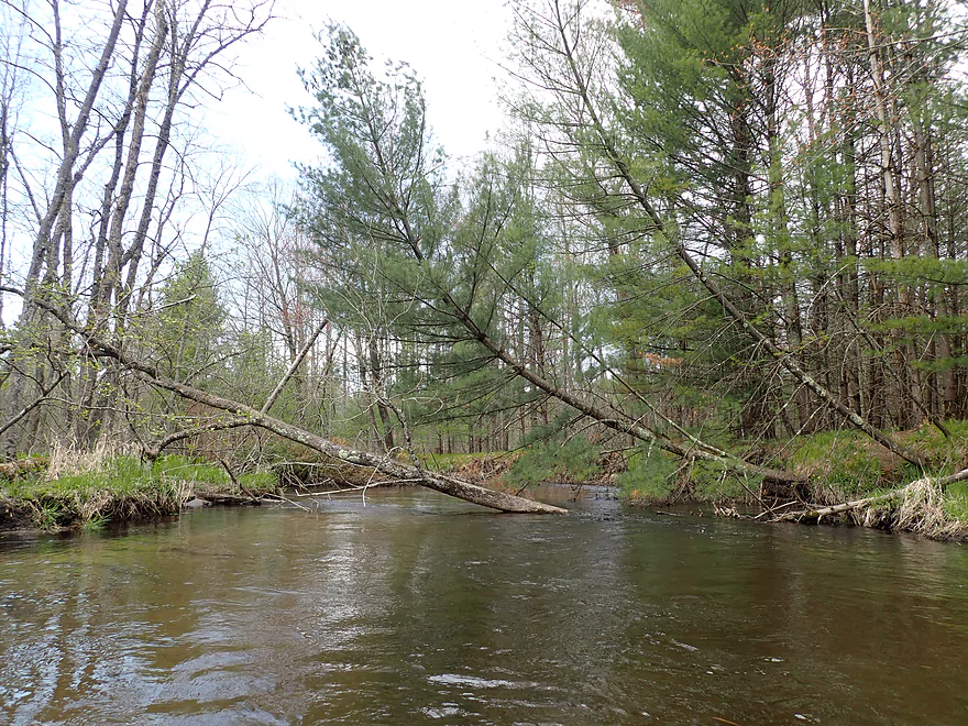
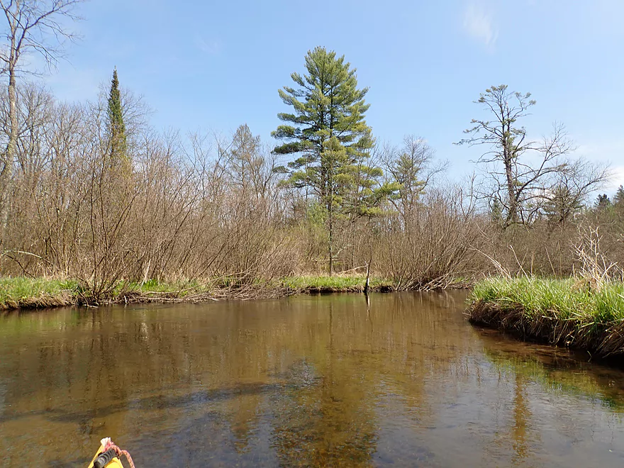
Starting to see more pines
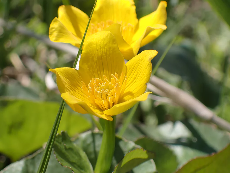
Marsh marigolds
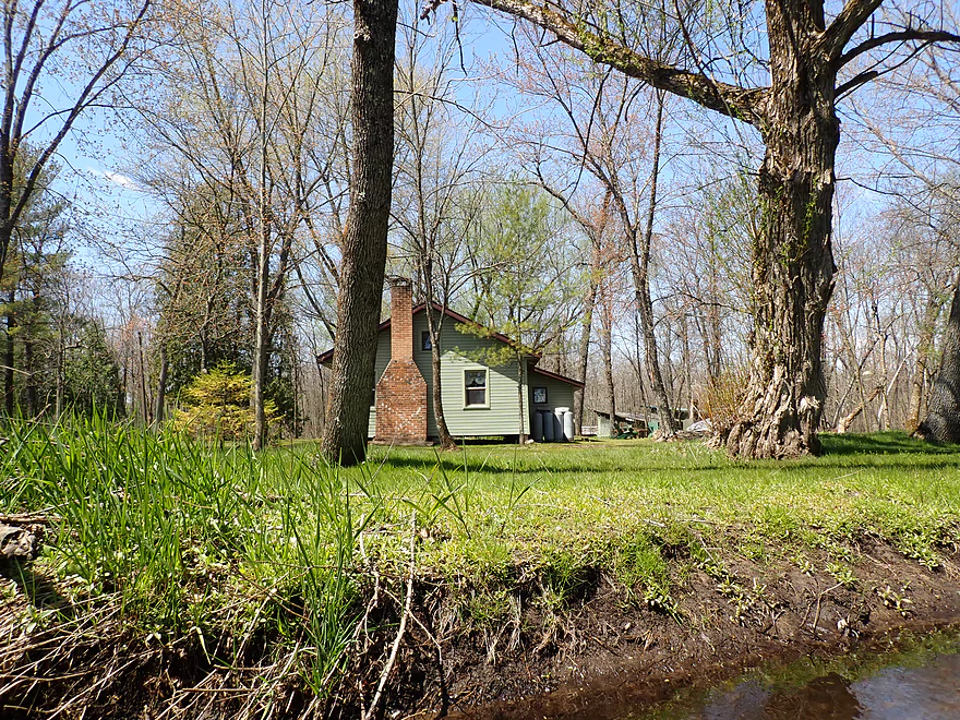
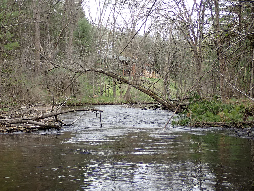
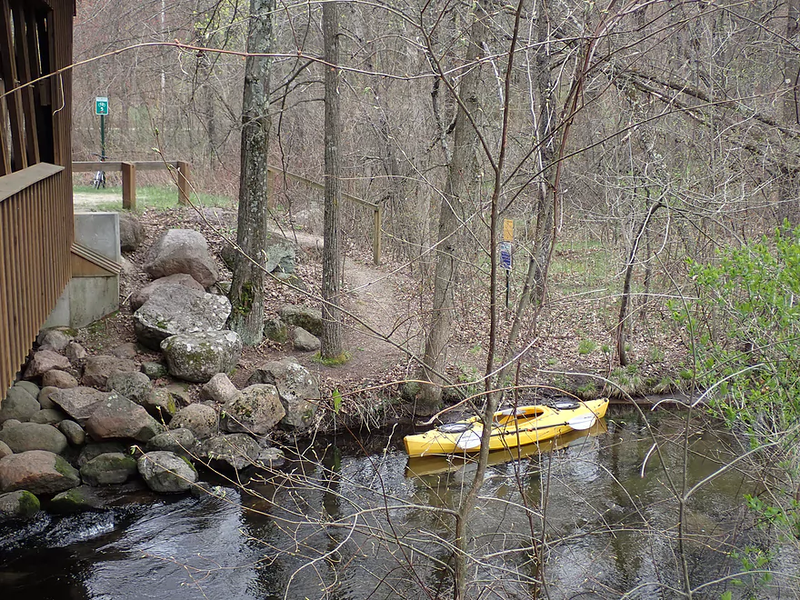
A cabin on a small island
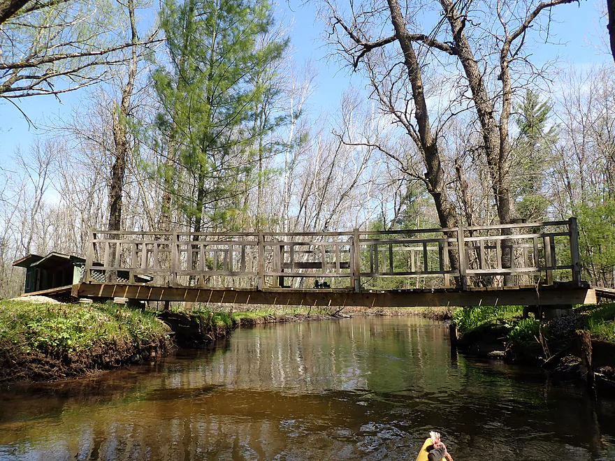
The island was connected by a series of bridges
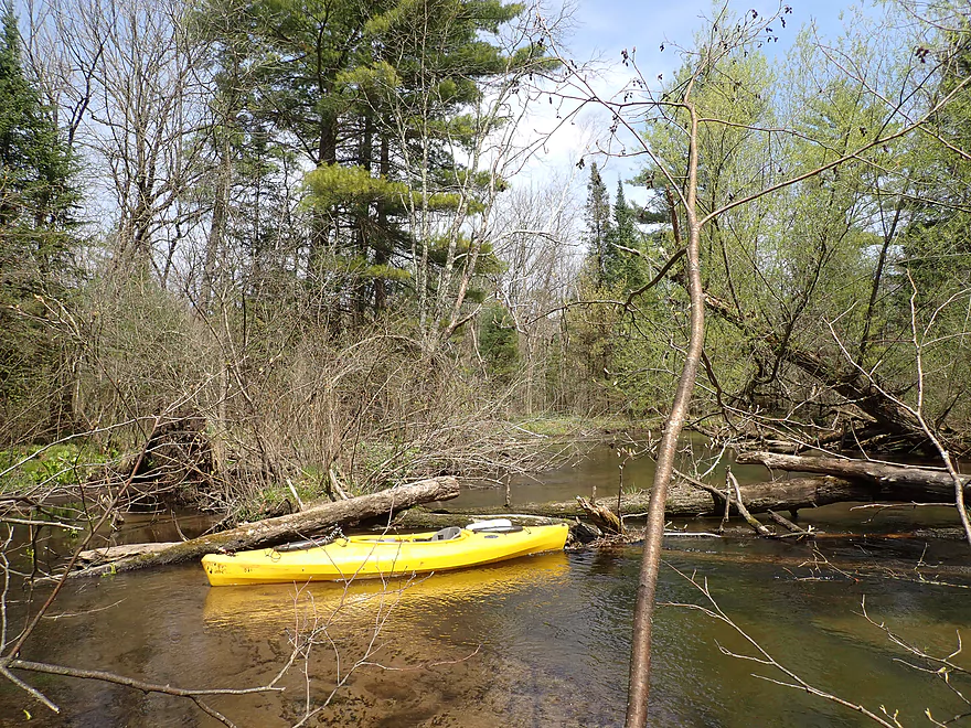
Logjam portage #5…this was mucky
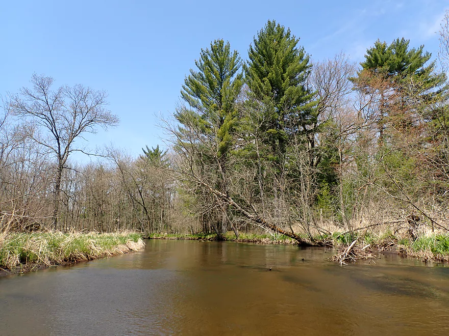
River really starts to open up
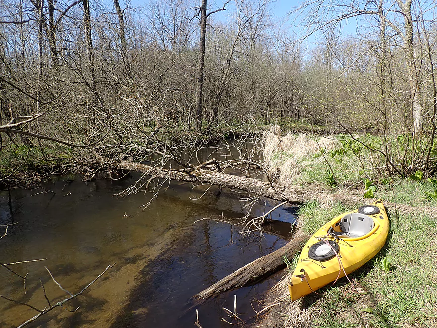
Logjam portage #6…another mucky spot
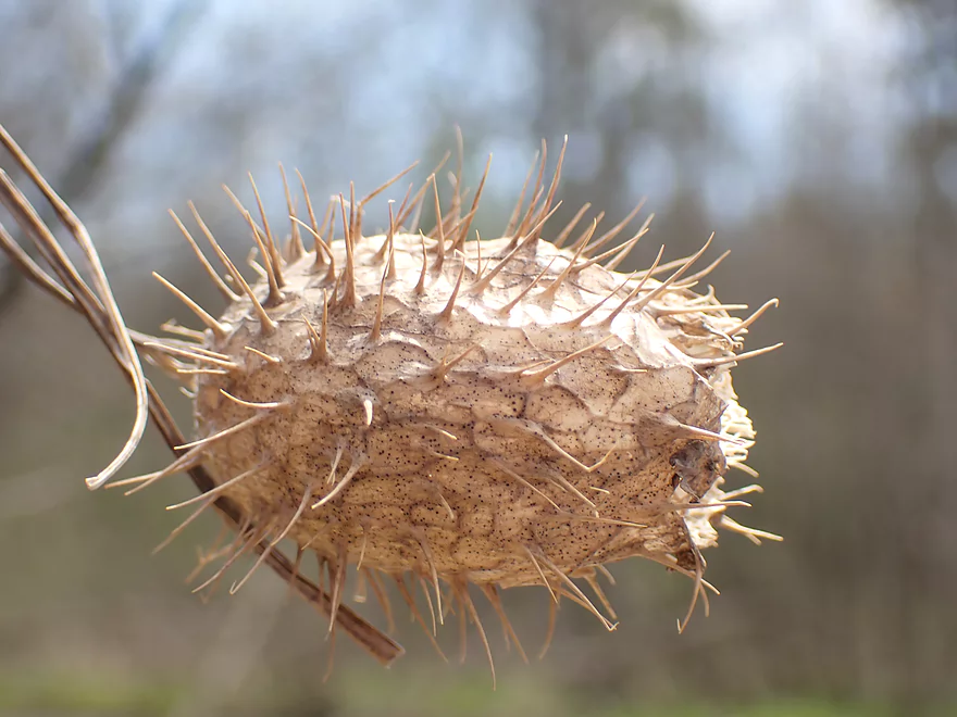
A wild cucumber seed pod
Logjam portage #7 (easy)
Starting to get more wooded again
Good clarity in spots
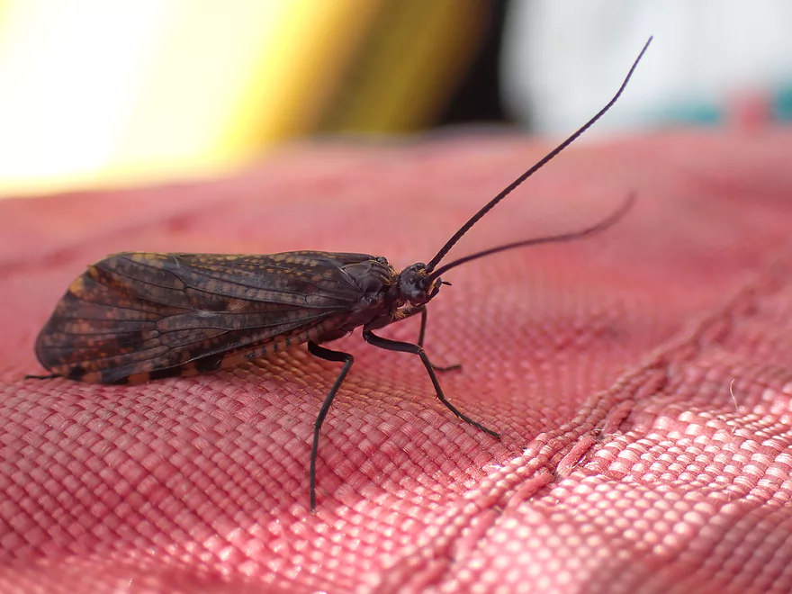
A caddisfly
I had to portage this low bridge
More good clarity
Logjam portage #8
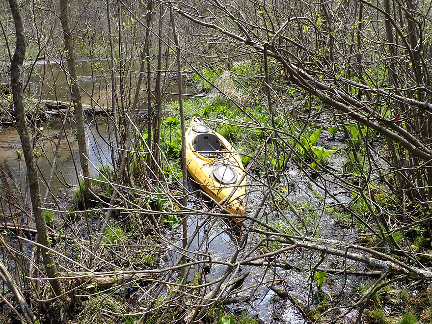
This was nasty…there was no firm ground to step on
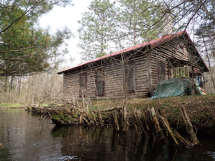
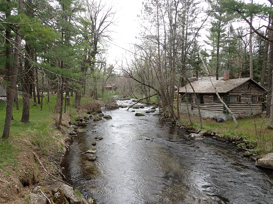
A rustic log cabin
Reminds me of the Bois Brule

The first serious rapids of the trip
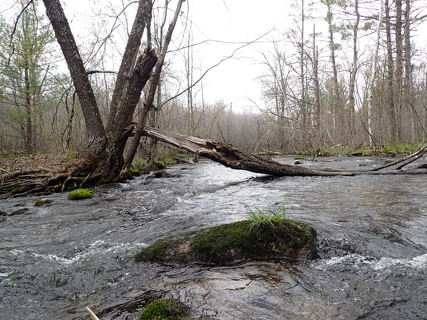
Too low for my taste
So I portaged
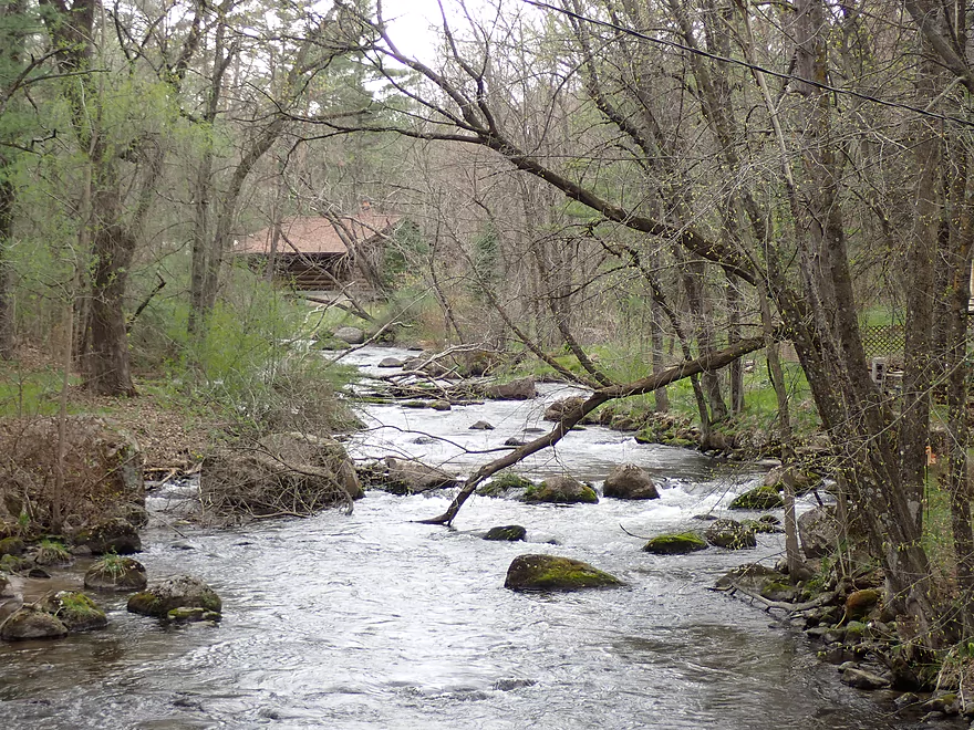
Very scenic rapids
Hwy A is a viable access
Some more light rapids after Hwy A
The final stretch
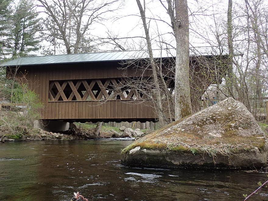
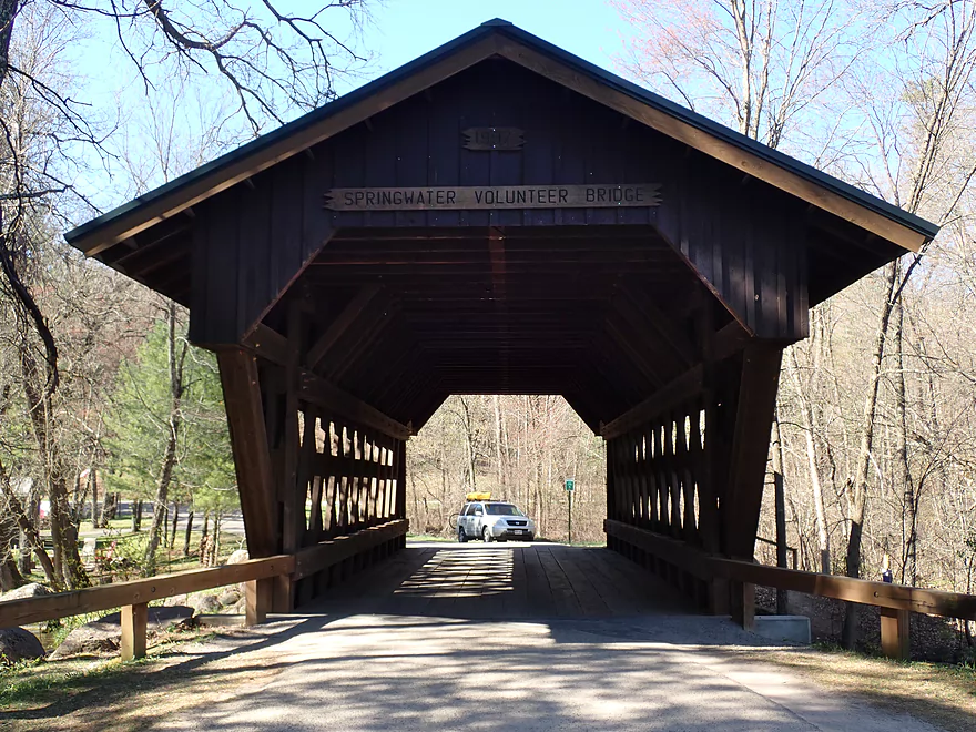
Covered Bridge Park
Coming up on the best part of the river
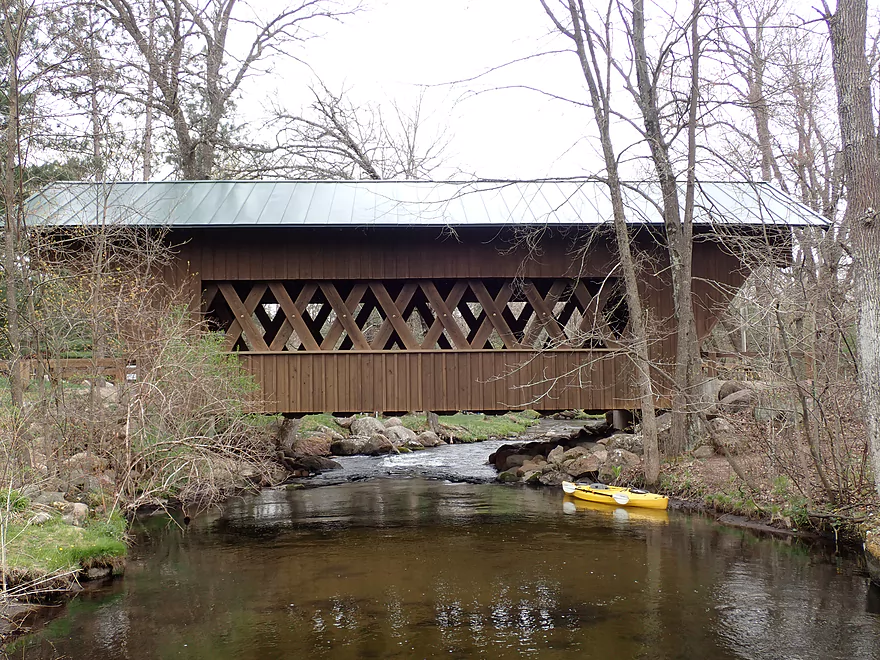
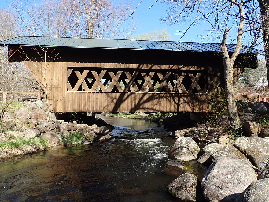
The Saxeville Covered Bridge
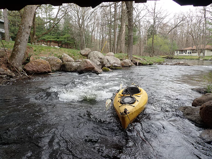
Fun rapids under the bridge
Has a Waupaca River vibe
Reverse view
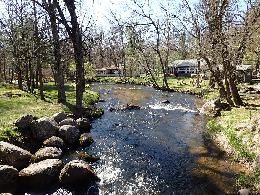
Great take-out option at the park
Parking is available along the shoulder
Scouting Portage Street
Super cool stretch
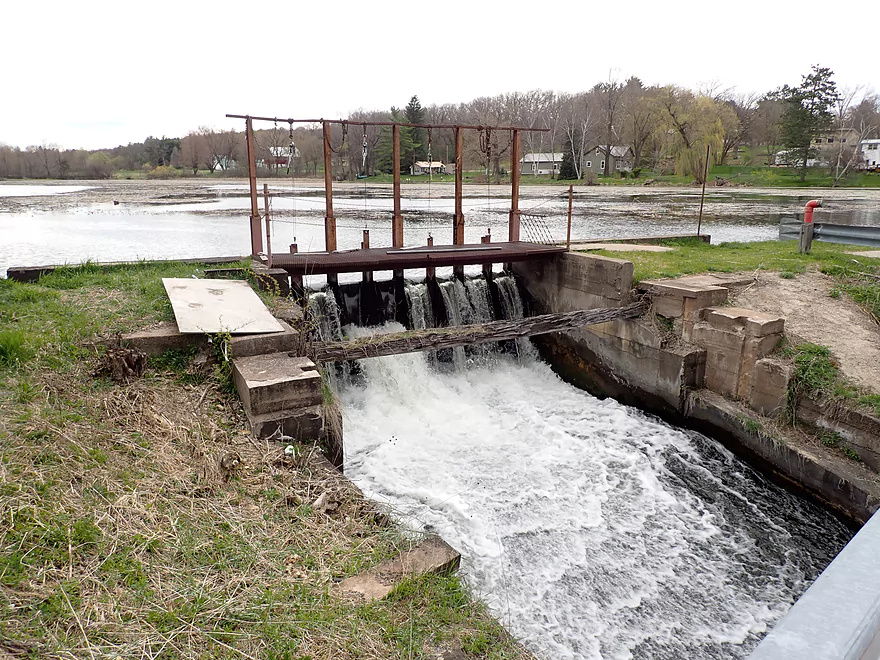
Scouting Hwy W and the dam
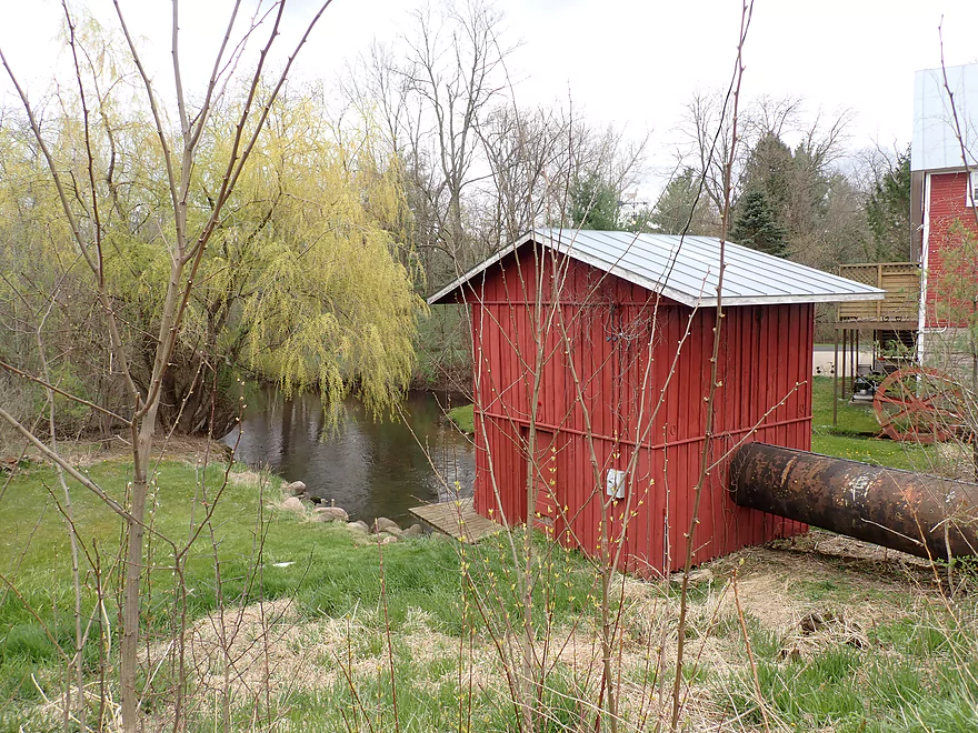
It’s a manageable portage by the powerhouse
Scouting a wayside on 26th Road
A future trip idea
Pine River – Apache Road to Covered Bridge Road

The Pine River in Waushara County has been a prospect I’ve wanted to do for some time, but I’ve always had lingering concerns about the number of logjams. Recently I discovered a rare second edition to an already rare paddling guide by Frank Piraino that positively described a stretch from Apache Road to Hwy A. He mentioned a few “pull-overs” but didn’t seem too concerned about logjams, so I decided to go for it. But I did modify his trip just a bit, as I chose to take out further downstream at Covered Bridge Road because of the nice park there.
The trip started on a fantastic note at Apache Road which was a nice bridge access and quite scenic. The first mile really reminded me of the Mecan River below JJ. Huge groves of skunk cabbage grew along a tidy shoreline, while trees crowded the water’s edge and arched over the channel. In some cases they arched a bit too close to the river and I had to portage. The portages to start with weren’t too bad as the shoreline was relatively flat and mud-free (but that would change).
As the river progressed though, it did lose some of its magic. The woods thinned while the deadfall became more frequent. I was able to duck under or hop over many downed trees, but this proved tricky at times because of the pushy current. This contrasted to Frank Piraino’s experience who referred to lazy current…I suspect he did his trip when the river was much lower.
One of the surprises of the trip was encountering a small island with a cabin on it. It was a quaint scene as the island was connected to the mainland by four rustic wood bridges. I talked to the owner who was doing nearby landscaping and apparently flooding is an issue. They had to jack up the house two years ago, but flooding remains a threat. I asked if she saw any other kayakers and she said no…which I thought was interesting. While I did see boot prints at the other portage spots, they could have come from trout fishermen.
The next few miles really opened up which dramatically cut down on the deadfall. The scenery though became less interesting although there were occasional highlights in pine groves and clear water. Many small bridges crossed the creek (I lost count), but I was able to get under all no problem, except for one at the end which required a muddy portage. Large chunks of the shoreline here were part of a public DNR fishery area. Unfortunately DNR parking is positioned far from the river so access is not practical for paddlers. I did see two fishermen, so I suspect the Pine is a productive trout stream.
Just upstream from Hwy A I encountered my first rapids of the trip. They were scenic and looked like fun…but unfortunately I didn’t see any practical lines through it because of a downed tree, so I portaged. The scenery did change after Hwy A as the river became more wooded and I started to see boulders and more rapids. If the Upper Pine was like the Mecan River, this last stretch was very similar to the Waupaca River.
Finally I came to Covered Bridge Park. Along the north bank was a “Zoo Garden” which was a landscaped trail system through managed gardens. But the highlight of the park was the Saxeville Covered Bridge that spans the Pine River. Chances are you’ve seen it already as its quite popular with photographers. Sadly the bridge is not as photogenic as it used to be as its rustic shingled roof was recently replaced with an ugly green metal monstrosity. I’m sure it’s more weatherproof, but it looks bad. If you’re curious you can actually see both versions of the bridge on Google Images (metal roof vs shingles).
Directly under the bridge were a fun set of rapids that despite being downstream of my take out, I decided to run. After the rapids, I waded back upstream where there was a great take-out area along the southwest bank. Many visitors were at the park ogling the covered bridge and they found my kayaking under it somewhat amusing.
In summary this was a scenic Ice Age paddle with many good highlights, but also some low-lights. Simply put there were too many portages. By my count I portaged 8 logjams, one set of rapids, and one low bridge. This didn’t even factor in all the “hoppers” and “duckers” which were frequent. I did see evidence of chainsaw cleanup work on the river and hopefully if local “logjam angels” revisit this river, it could be made into a very nice water trail.
However…don’t give up on the Pine yet. I did a quite a bit of research on this river as well as some in-person scouting. I believe that there are 2-3 viable water trails downstream from my trip with far fewer logjams. In fact the most impressive part of the river occurs immediately after the Saxeville Covered Bridge. Here the river becomes quite rugged as it deals with dense glacial boulders and fast current. It looks tricky in spots but inviting. In hindsight, I should have done Hwy A to the fishing wayside on Hwy 26 which likely would have been cool. Another time; another trip!
Apache Road: This was a good bridge access with a small but suitable pull-off shoulder and a good launch area. Note, the neighboring woods have No Trespassing signs, so stay confined to the DOT right-of-way when launching.
Alternate Put-ins:
- Aniwa Road (0.7 miles upstream of put-in): A scenic leg, but likely 2-3 logjam portages.
- Hwy A (5.7 miles downstream of put-in): This is practically at the end of my current trip, but in hindsight I wished I had launched here as I believe the downstream leg had more potential than what I did.
Covered Bridge Road: There is a public park here with a scenic covered bridge. On the upstream side is a nice area for taking out. Shoulder parking is available.
Alternate Take-outs:
- Hwy A (0.2 miles upstream of take-out): This would be a suitable take-out with the best access being on the northeast corner (which I believe trout fishermen use). Honestly though this is a better put-in than a take-out…as the downstream leg has more potential than the upstream leg.
- Portage Street (0.4 miles downstream of take-out): This section has dense boulder gardens and rapids, and looks really cool. For taking out, the best option will be the lawn in front of “Ding Tavern”. Make sure to get their permission before using their property (or just take out later at the dam).
- Hwy W/Saxeville Dam (1.2 miles downstream of take-out): The above, plus an open flowage section of paddling. There are actually two dams…the easier one to take out/portage is the north one. Parking isn’t great, but I think you can park west of Hwy W.
- 26th Road Wayside (3.5 miles downstream of take-out): The above, plus a nice section of small river paddling. There will be multiple low bridge portages and I estimate one logjam portage. For taking out there is a small gravel pull-off and steep path that lead to the water.
Covered Bridge Road to Apache Road: 4.0 miles / 98′ of ascent. This had some minor hills but was otherwise a nice shuttle route.
- Strainers: During my trip the channel was above normal and a bit pushy. There were many downed trees to dodge in fast current, especially in the first two miles. There were also many “hoppers” and “duckers” to deal with.
- Logjam Portages: (see map for locations)
- #1: Easy portage
- #2: Simple portage of two downed trees
- #3: A simple portage
- #4: This is a medium difficult portage because of a dense thicket of alders
- #5: This was a tricky portage because of the muddy shoreline.
- #6: Easy portage getting out, but a tricky re-entry because of the muddy shoreline
- #7: A simple portage
- #8: A difficult portage as the shoreline was very mucky and muddy
- Low Bridges: There is one bridge by 24th Ave that will have to be portaged. This is unfortunately kind of a muddy area though.
- Rapids:
- Just upstream of Hwy A there are Class 2+ rapids. These are tricky because the current goes under a semi-fallen log. I suggest portaging.
- There are minor riffles between Hwy A and Covered Bridge Road.
- Directly under the covered bridge are fun Class 1 rapids.
Nearest Gauge: Waupaca River @ Waupaca – This should be a reasonable representation of the Pine River.
- 0-180 CFS: A low depth but manageable with excellent clarity.
- 181-220 CFS: An average summer depth.
- 221-290 CFS: An above average depth.
- 291-380 CFS: A high depth. I did the trip at 340 CFS and the current was a bit pushy. Clarity was ok in brief spots but not all the time.
- 381-470 CFS: A very high depth. Likely viable for skilled paddlers who keep on their toes.
- 471+ CFS: The river might be too high for an enjoyable run.
Detailed Overview
- 19th Road to Hwy K: 1.7 miles. A neat prospect with clear water and no logjams.
- Hwy K to Aniwa Road Shoulder: 0.7 miles. Maybe 4 logjams.
- Aniwa Road Shoulder to Aniwa Road Bridge: 1.0 miles. Good prospect but likely 5 logjams.
- Aniwa Road to Apache Road: 0.7 miles. Likely a scenic and wooded section but 2-3 logjams are likely present.
- Apache Road to Covered Bridge Road: 5.8 miles.
- Apache Road to Hwy A: 5.7 miles. Good scenery and clear water. But there are multiple portages...8 for logjams, 1 for a low bridge and 1 for a Class 2+ set of rapids that has a strainer.
- Hwy A to Covered Bridge Park: 0.2 miles. A good stretch with some boulders and rapids. There is one minor logjam that requires limbo'ing. The scenic Saxeville Covered Bridge is by the park.
- Covered Bridge Road to 26th Road Wayside: 3.5 miles.
- Covered Bridge Road to Portage Street: 0.4 miles. An incredibly scenic stretch with dense boulder gardens and rapids. Some of the rapids are Class 3 and require difficult tight turns.
- Portage Street to Hwy W/Dam: 0.8 miles. The creek widens and slows into an impounded pond. This can get shallow and some wading may be required.
- Hwy W/Dam to 26th Road Wayside: 2.3 miles. This is a very nice stretch with boulders, tree canopies, pines, and quaint cottages. There is a low bridge to duck under and one logjam to portage.
- 26th Road Wayside to Hwy E/Dam: 2.7 miles. Maybe 6 logjam portages.
- Hwy E/Dam to 28th Court: 2.2 miles. An attractive stretch with many rapids...but likely many jams...perhaps 17.
- 28th Court to Poy Sippi Community Park: 5.3 miles. A mediocre stretch guest reviewed by Denny Caneff. This is a mostly open stretch, with maybe one noteworthy logjam. Some flowage paddling is required.
- Poy Sippi to Badger Drive Landing: 10.2 miles.
- Poy Sippi to Mouth on Lake Poygan: 8.5 miles. A good stretch guest reviewed by Denny Caneff.
- Mouth on Lake Poygan to Badger Drive Landing: 1.7 miles. This is a short stretch due north on Lake Poygan to reach a landing. Big lake paddling can be dangerous...do not do this when it is windy.
Trip Map
Overview Map
Video
Photos Size: