
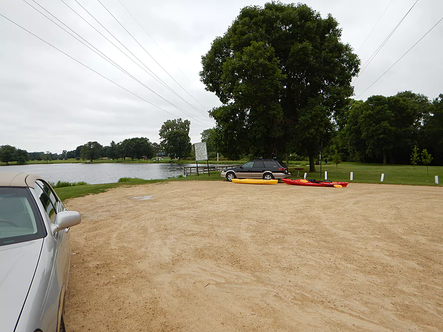
Put-in at Fisherman’s Park
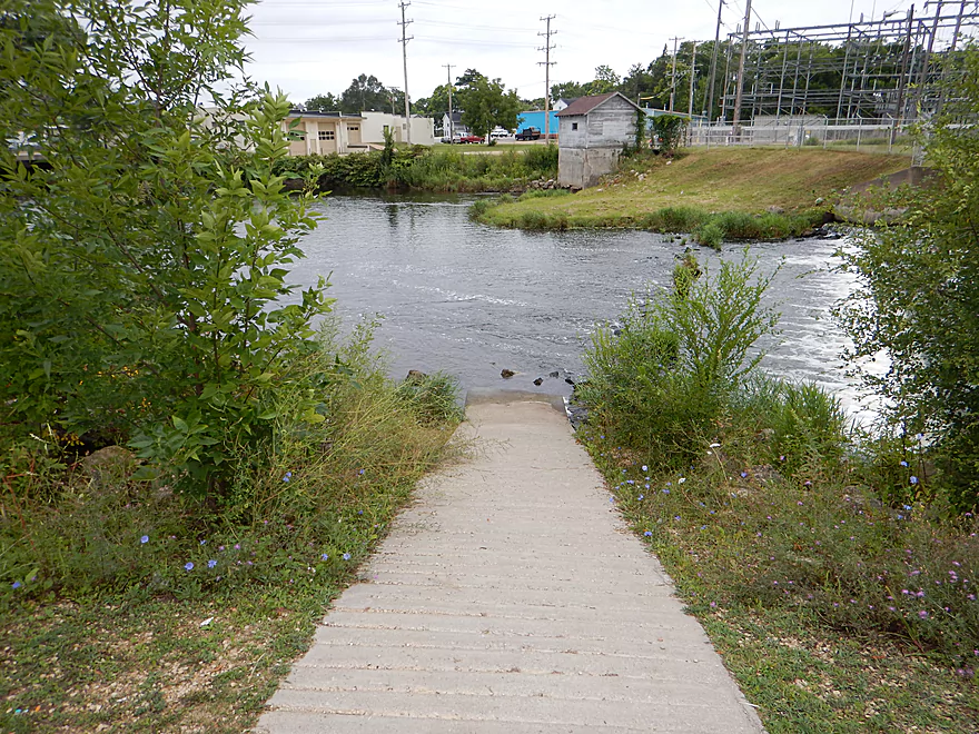
Also a nice portage path
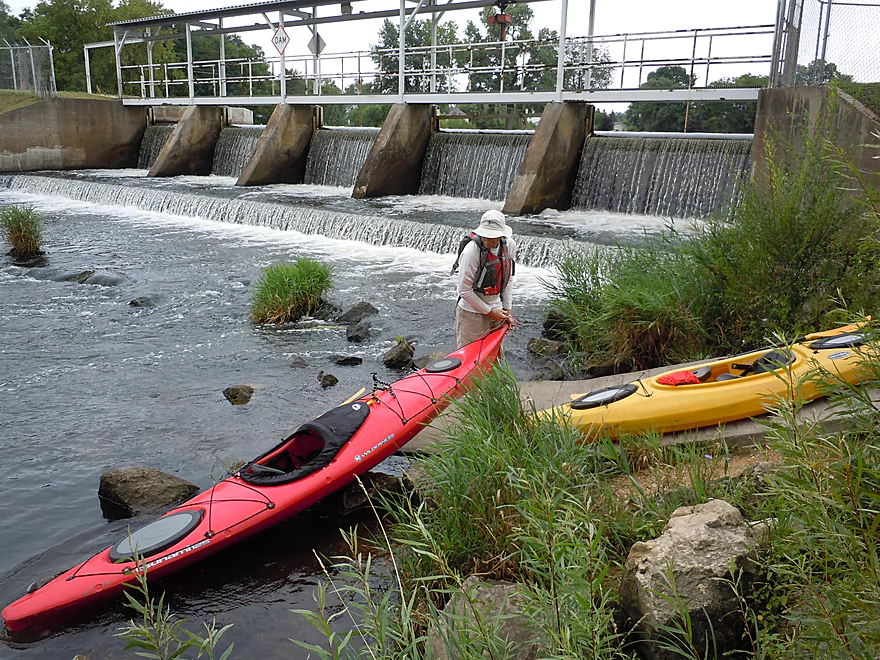
Dam located at the park
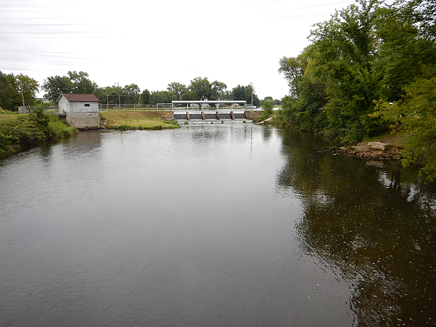
Reverse view of dam
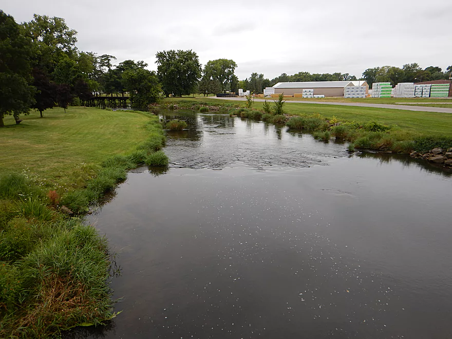
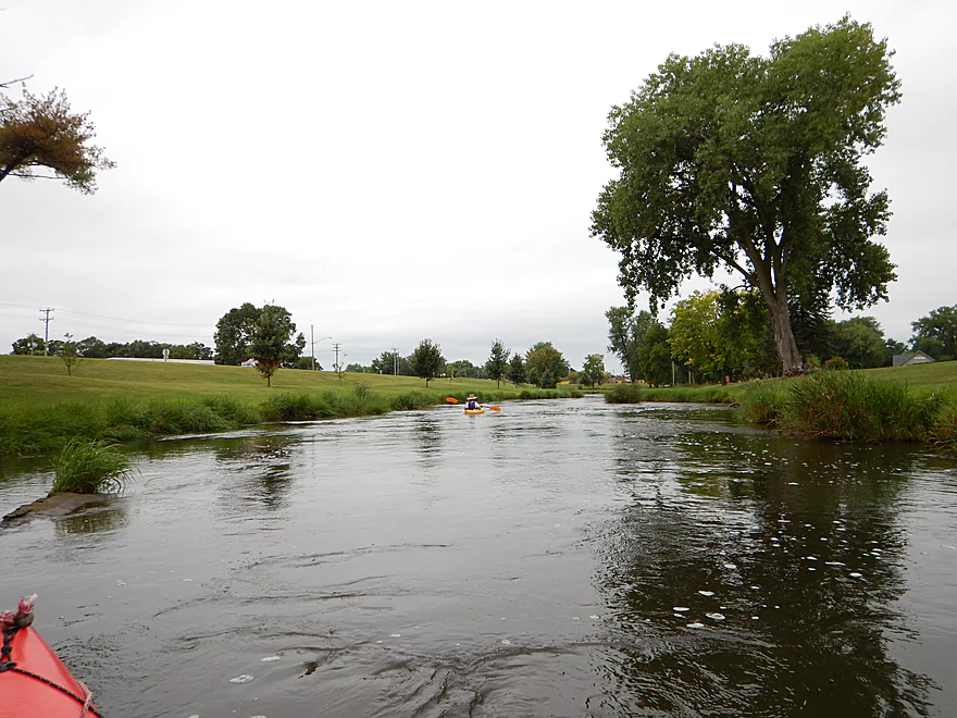
Lot of park green space in the first section
Some decent-sized boulders after the dam
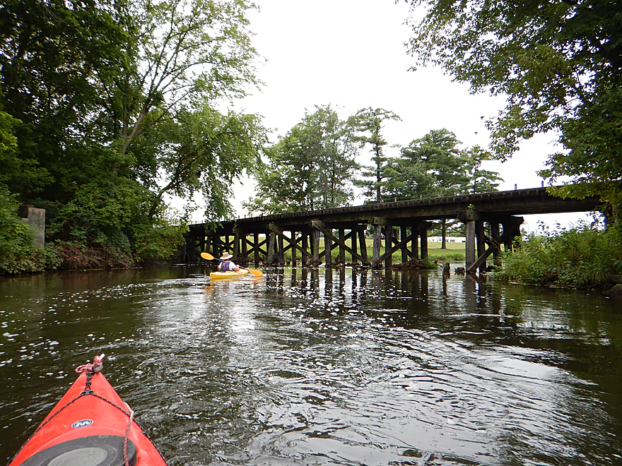
Railroad spur
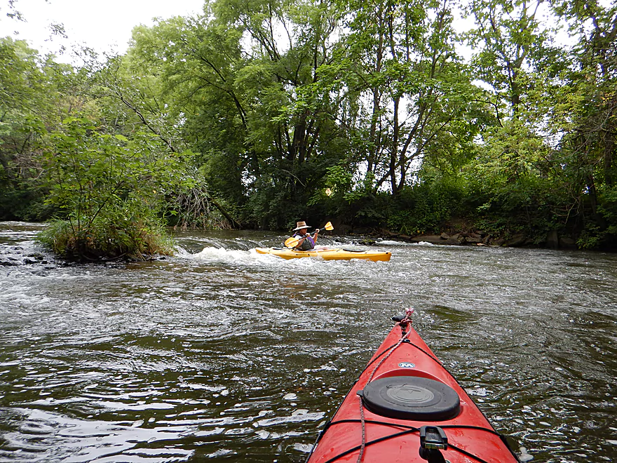
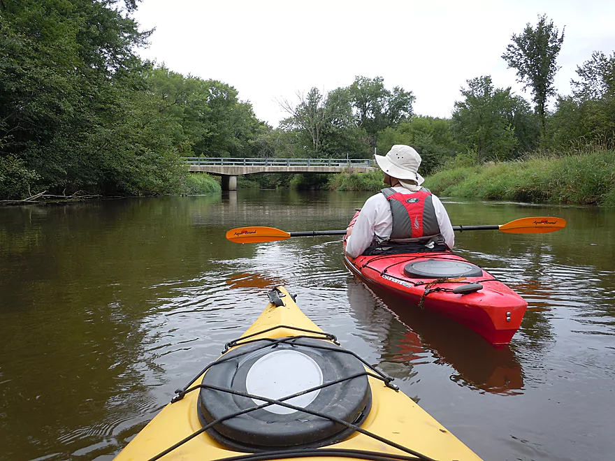
Water was a smidgen high
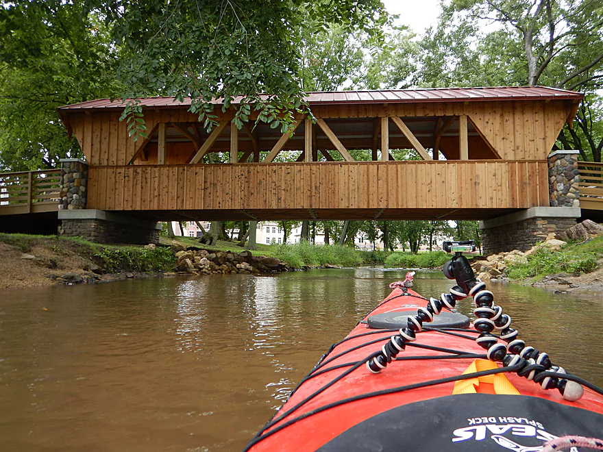
Beaver Creek enters under a nice covered bridge
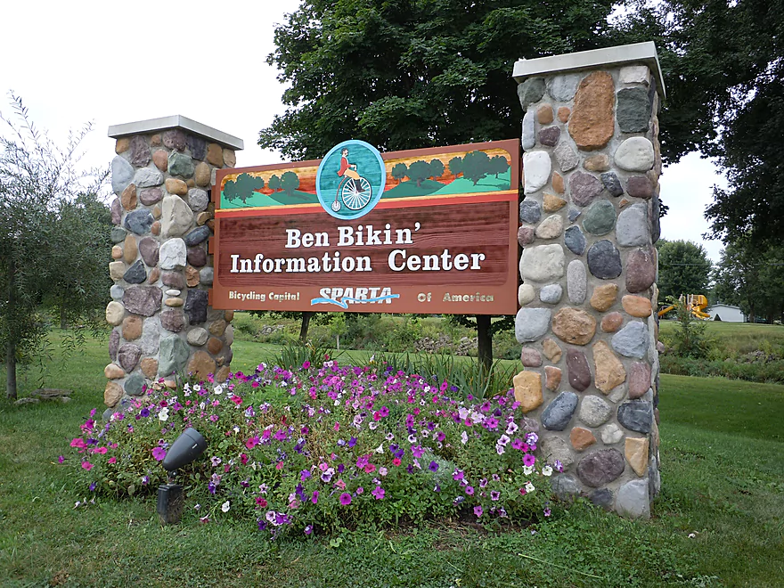
Ben Bikin’ Information Center
Good alt put-in
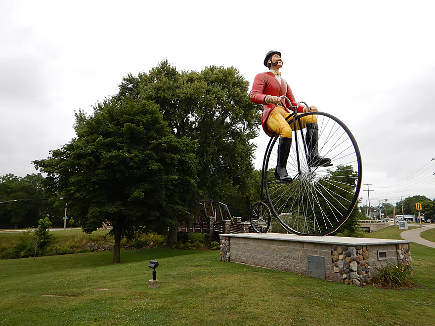
It is Ben Bikin himself!
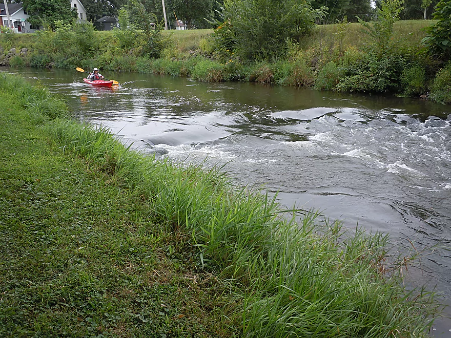
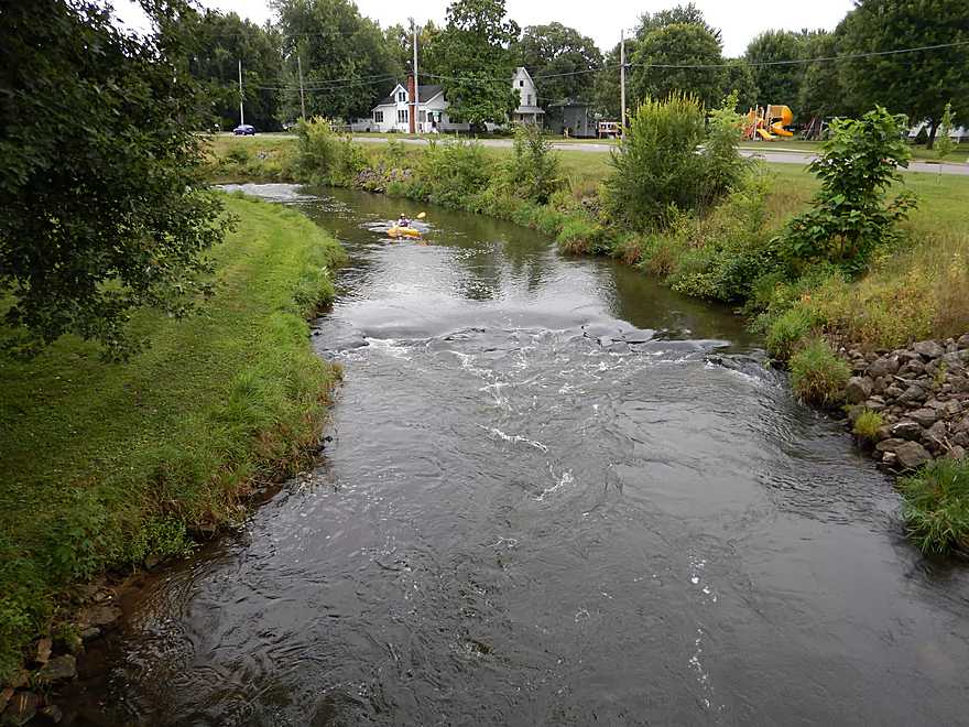
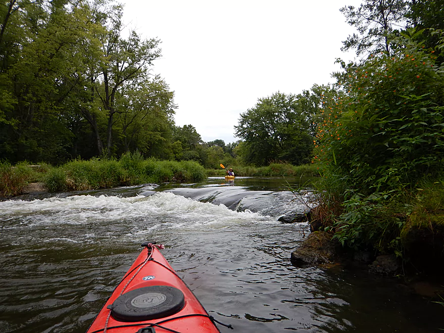
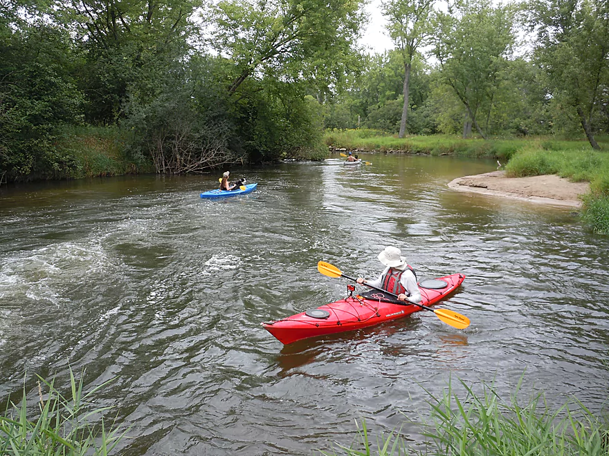
Some fun riffles
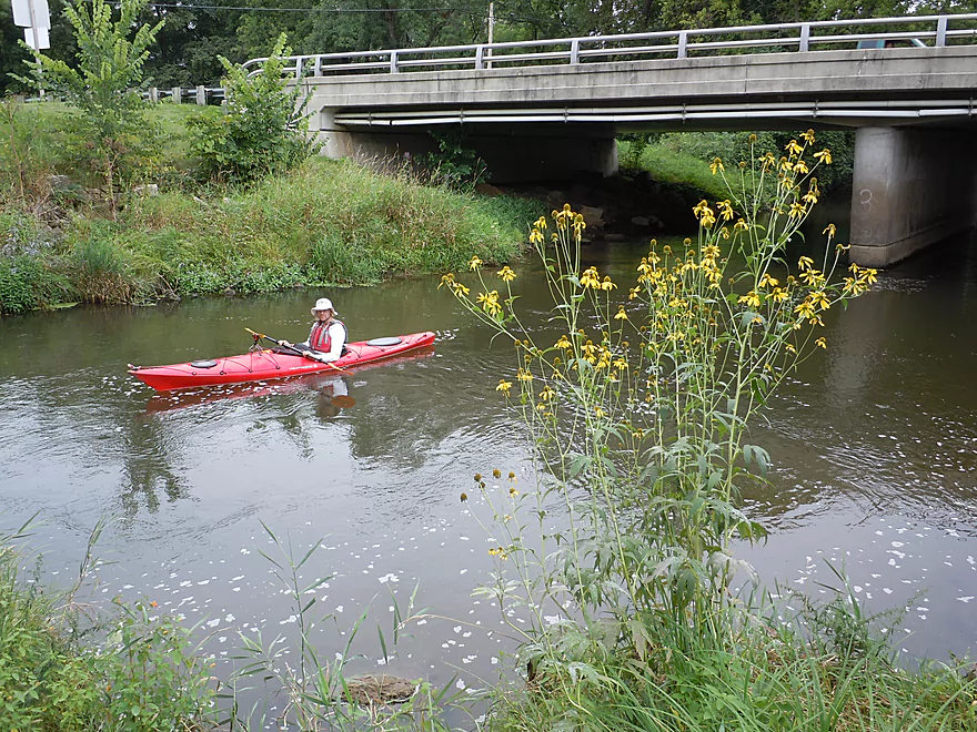
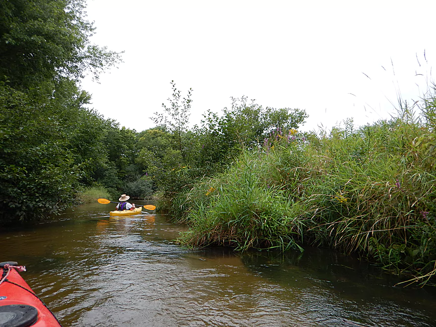
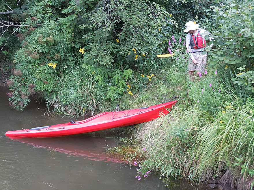
Fantastic trip for riverside wildflowers
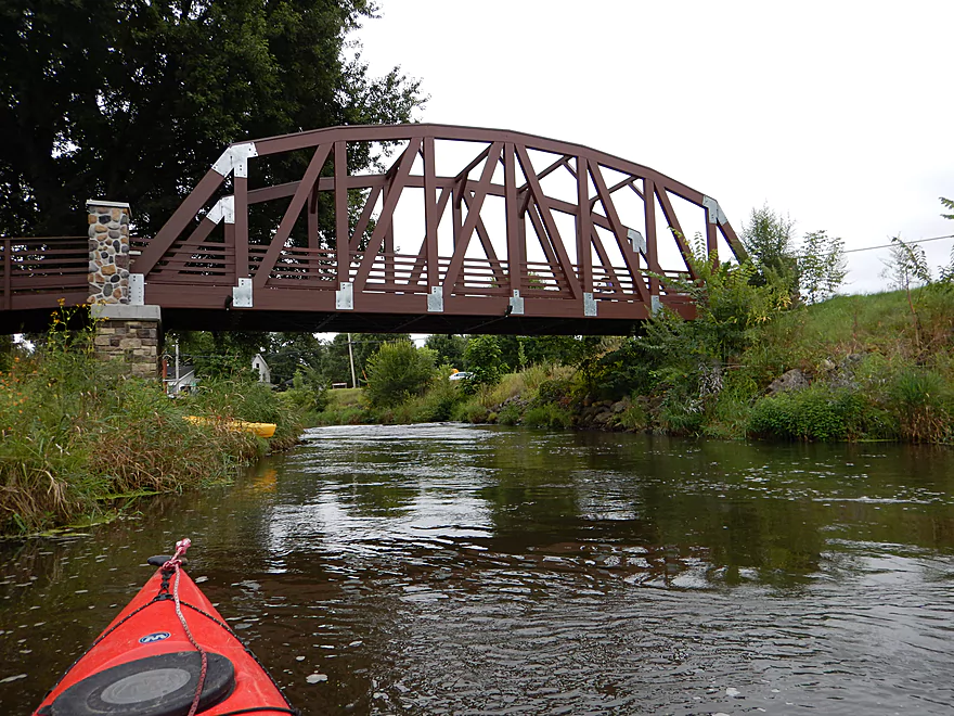
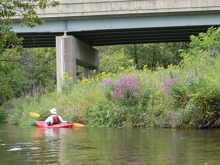
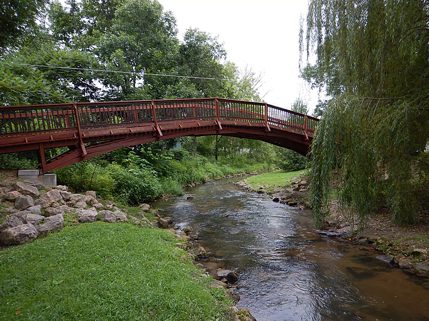
Nice pedestrian bridge
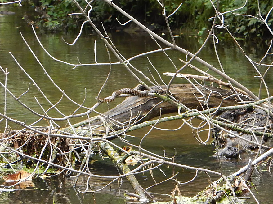
A plump water snake
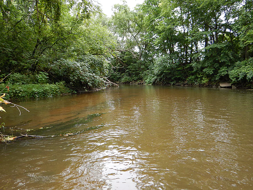
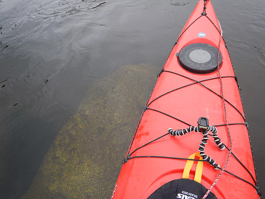
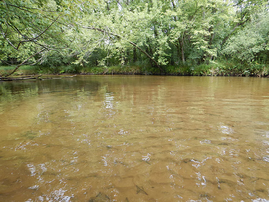
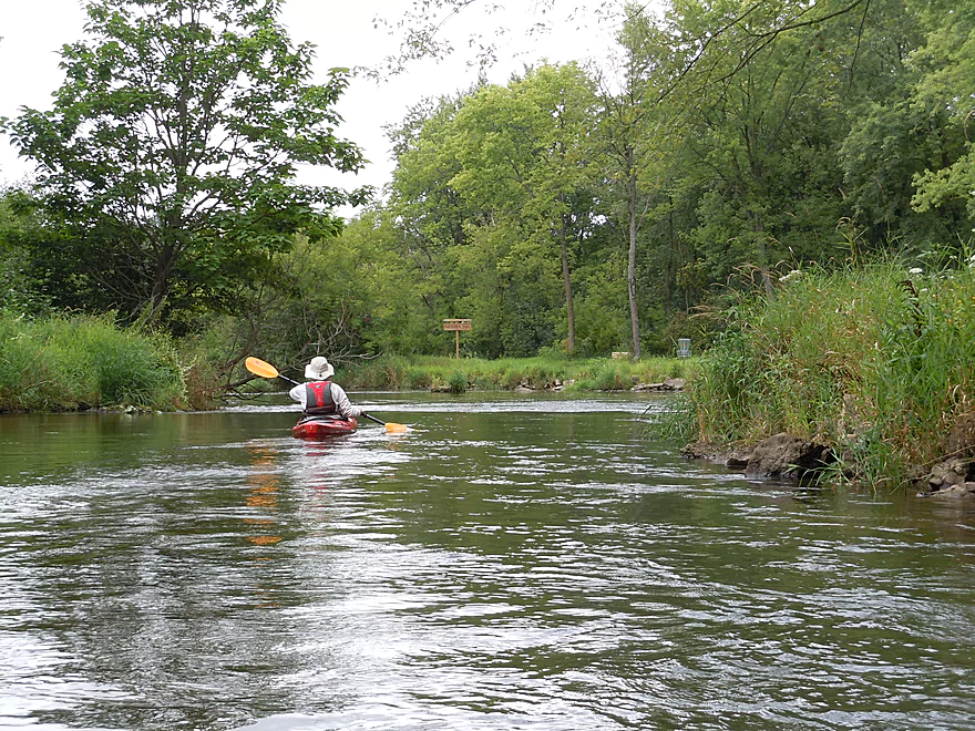
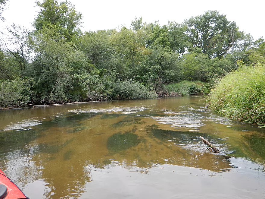
Water quality starts milky clear, but gets better
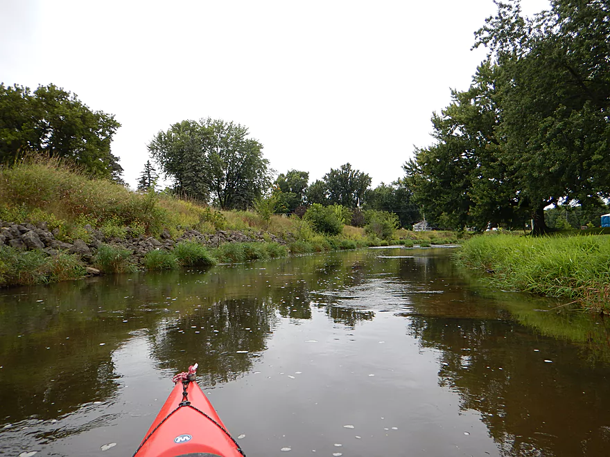
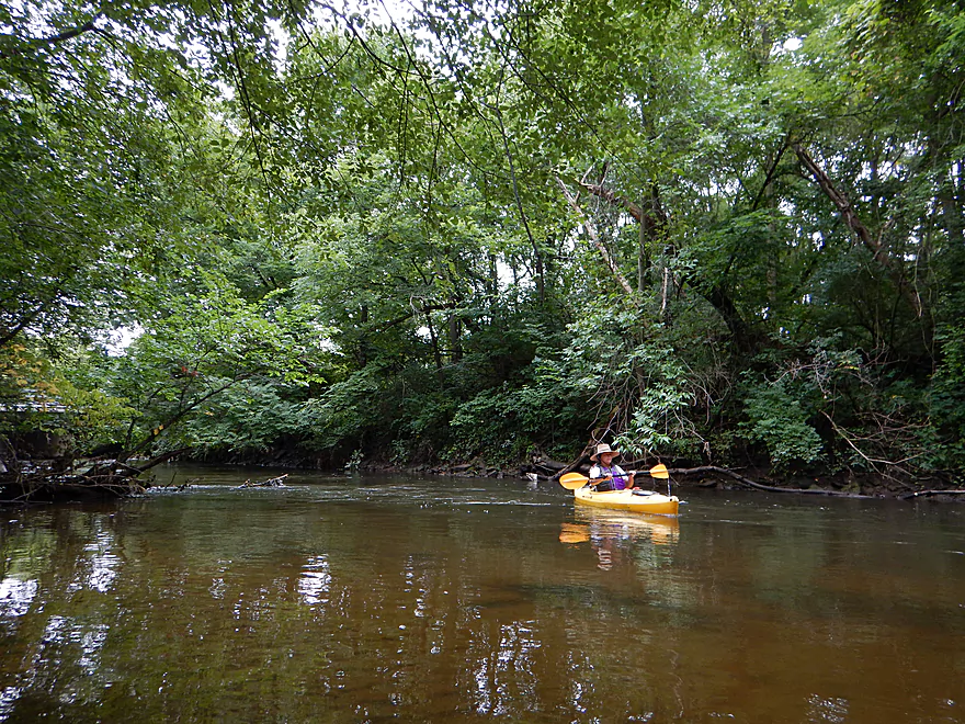
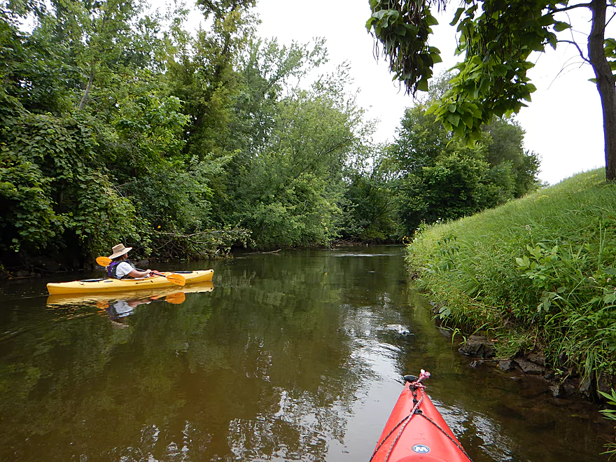
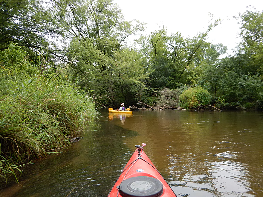
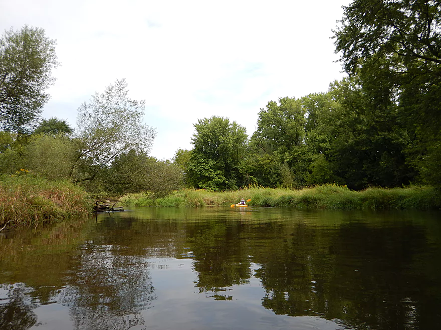
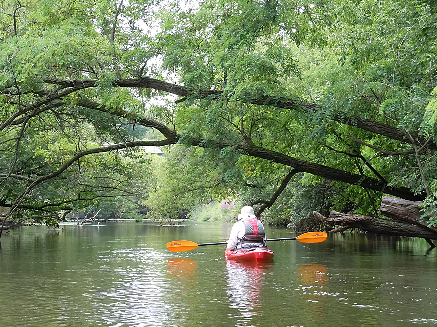
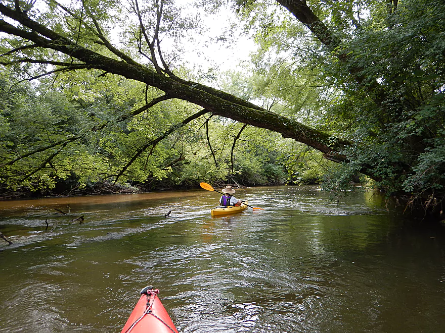
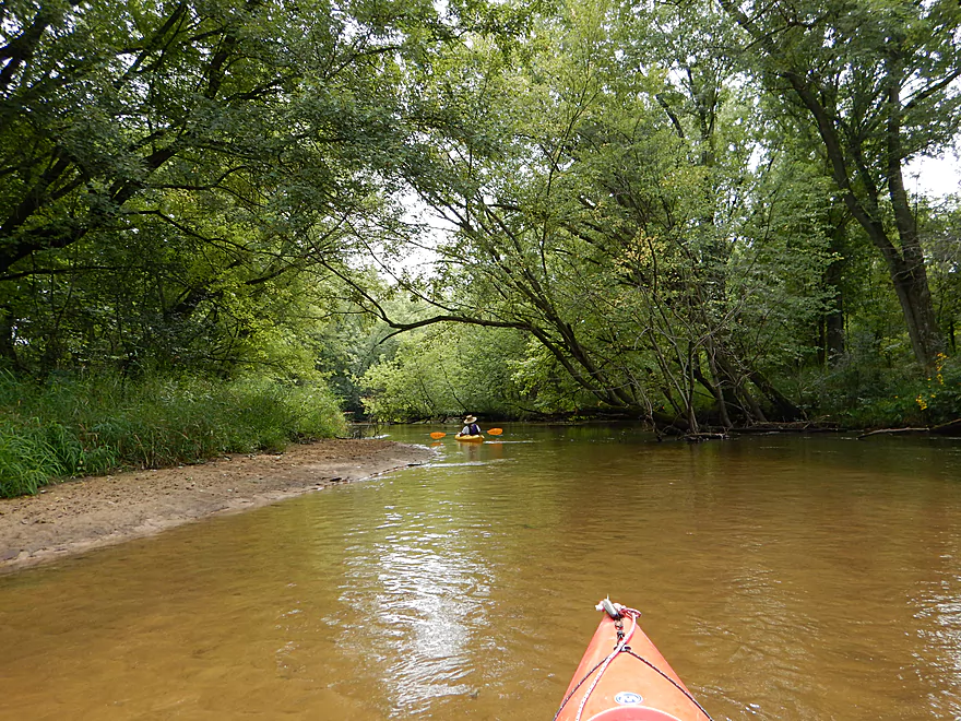
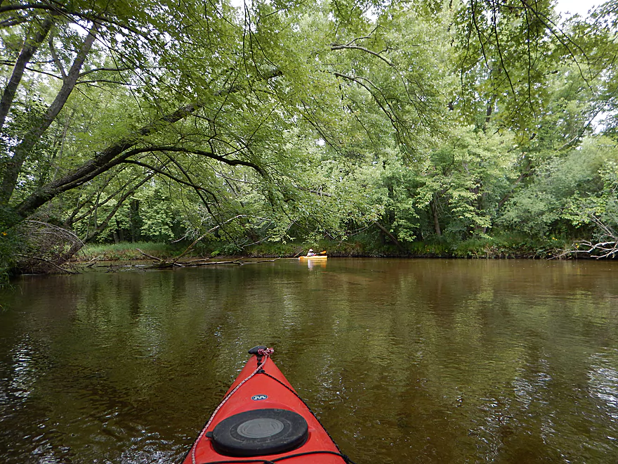
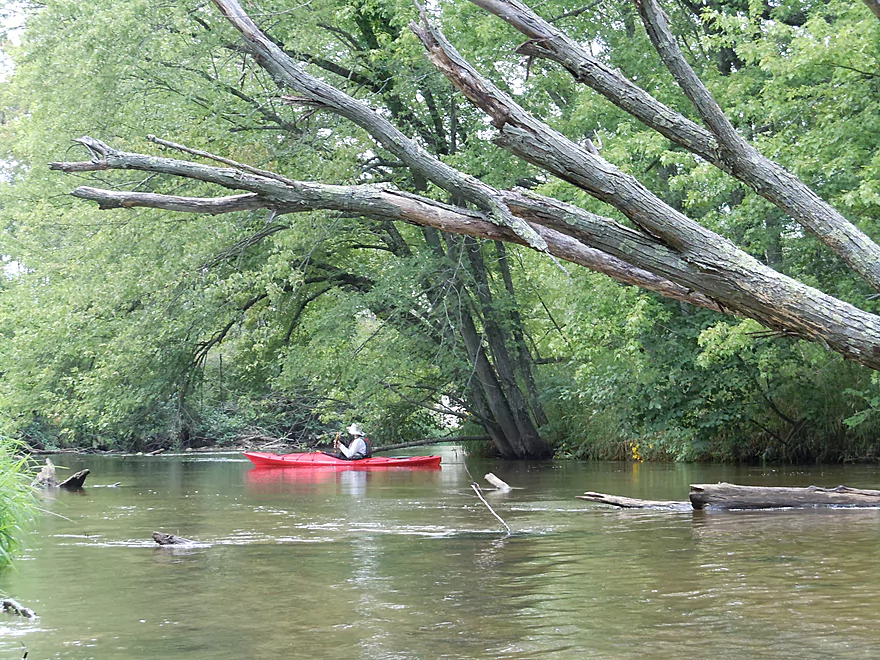
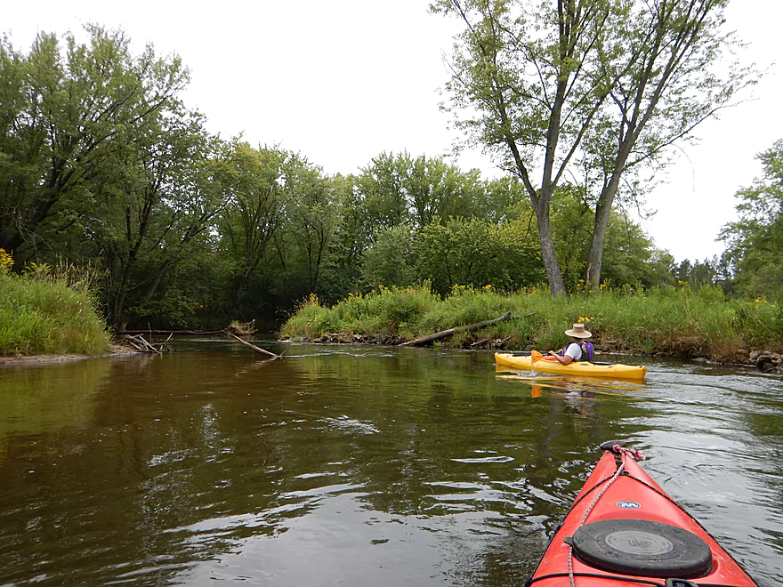
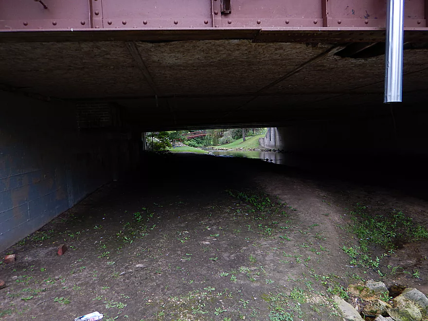
Steep banks + over-arching trees create a tunnel effect
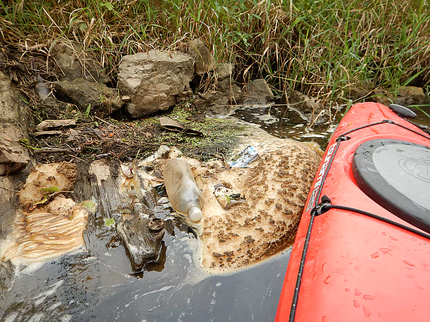
River needs a garbage cleanup
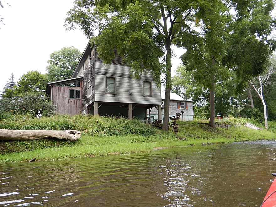
An old mill and former dam
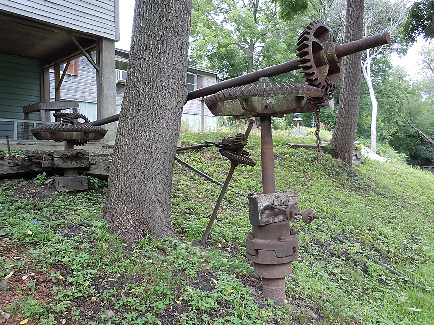
All that remains of the water wheel
Dam was not completely removed
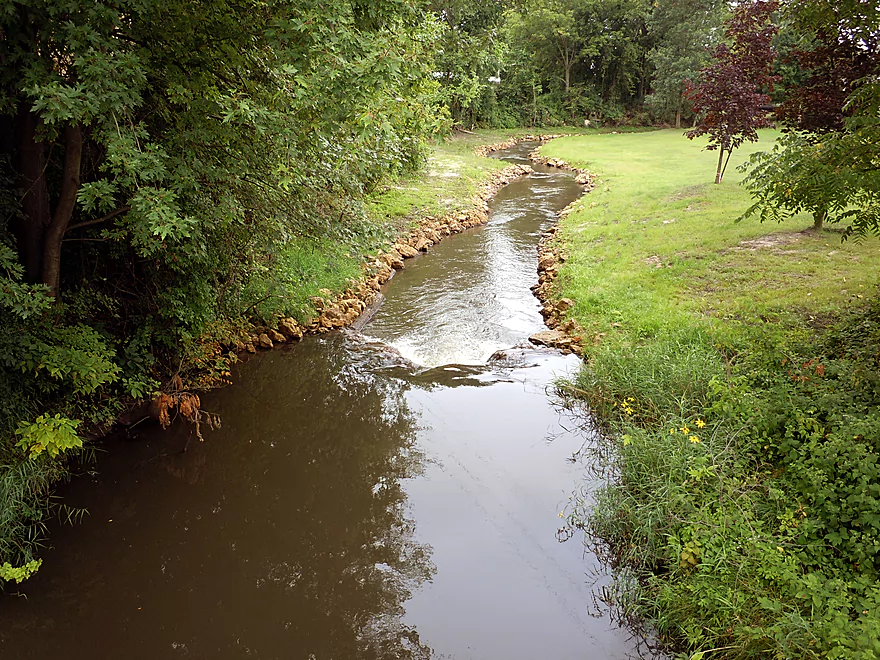
A fun run
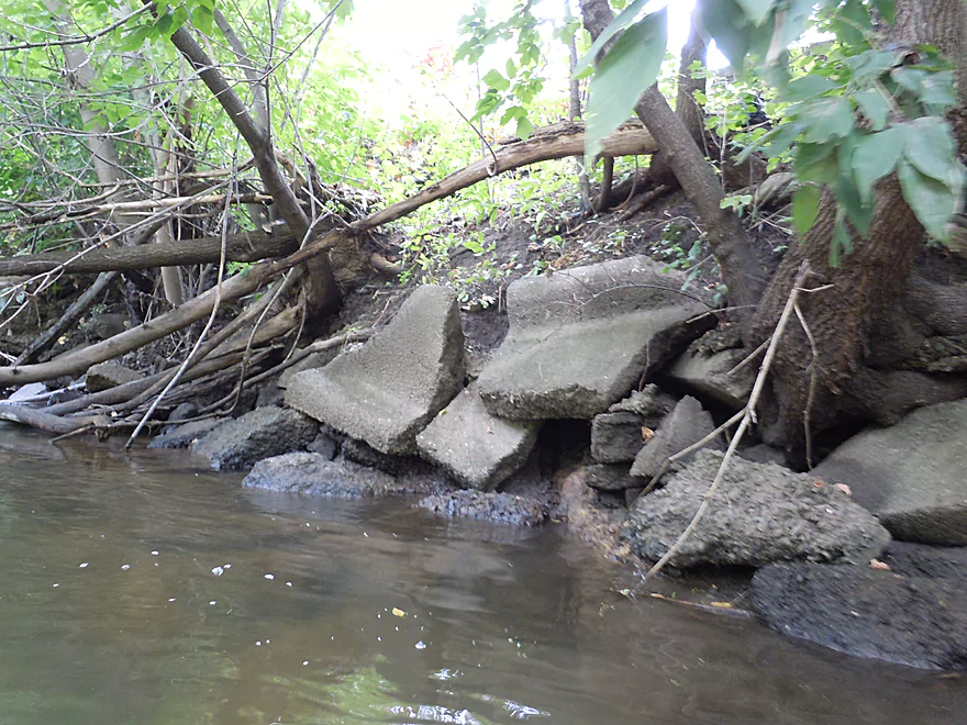
Lot of artificial fill…some of which looked like construction debris
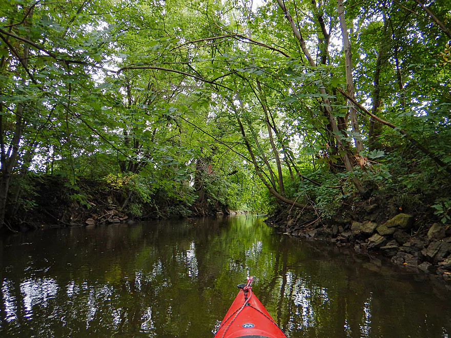
Awesome tree canopies
Some chainsaw work on the river
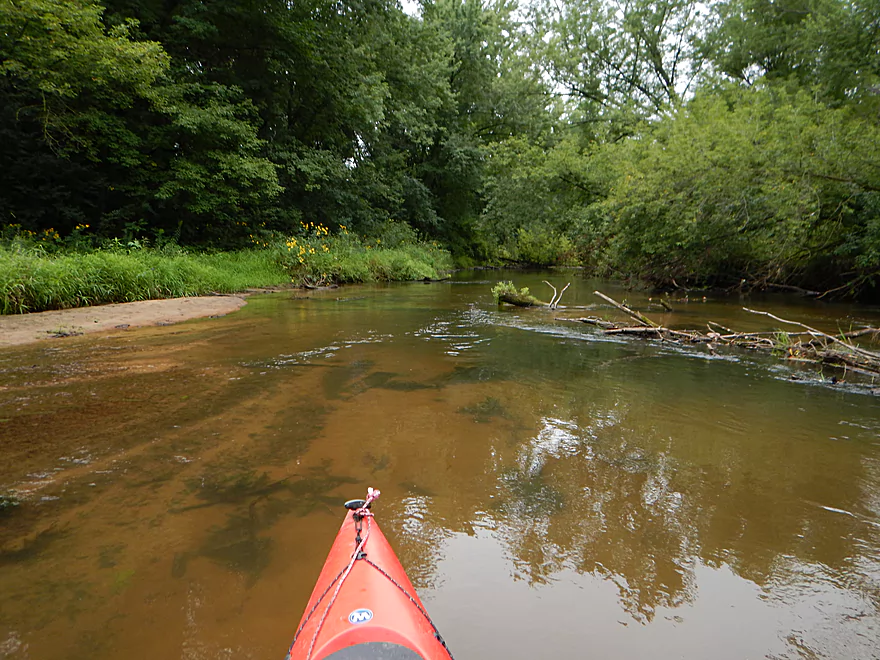
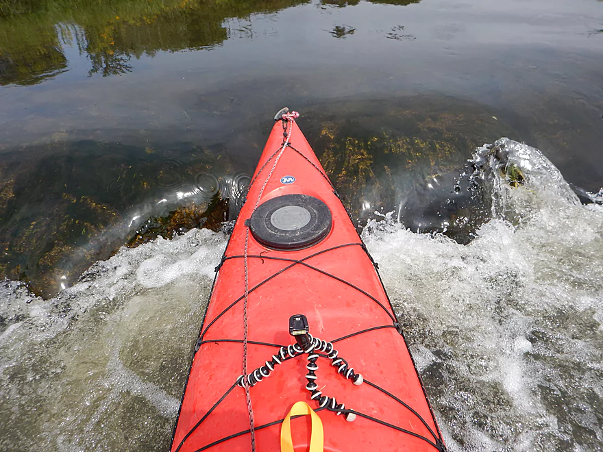
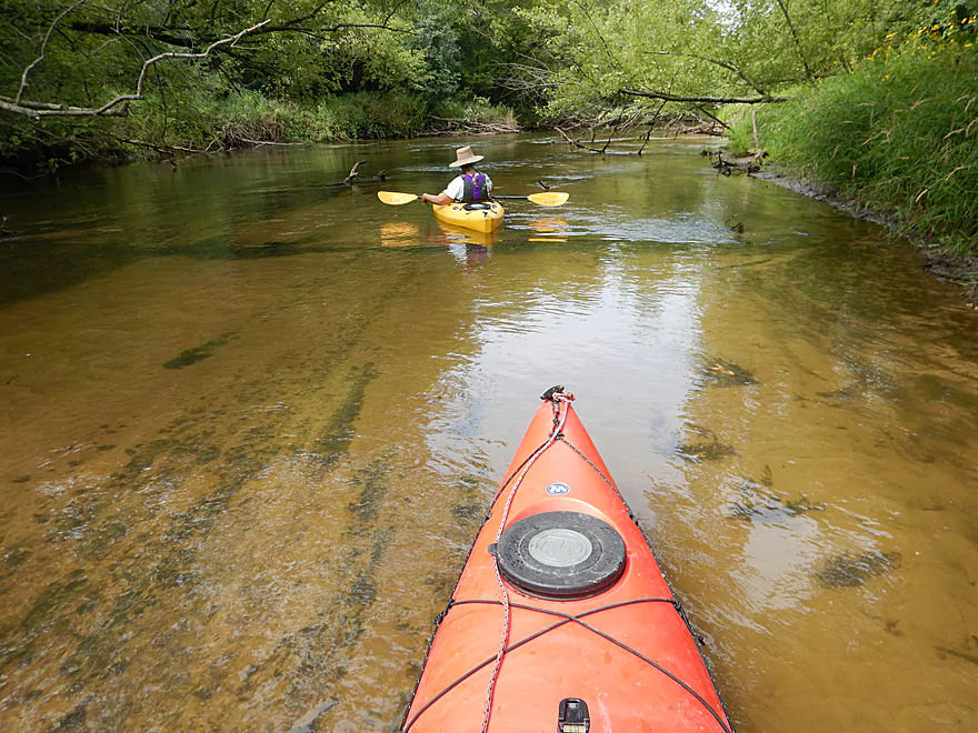
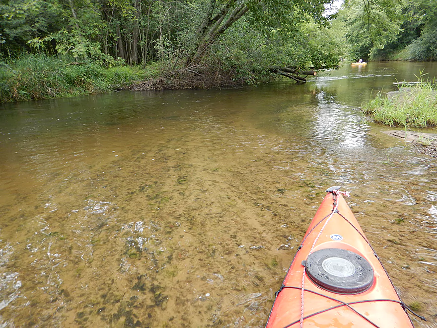
Wonderful vistas of the sandy bottom through clear water
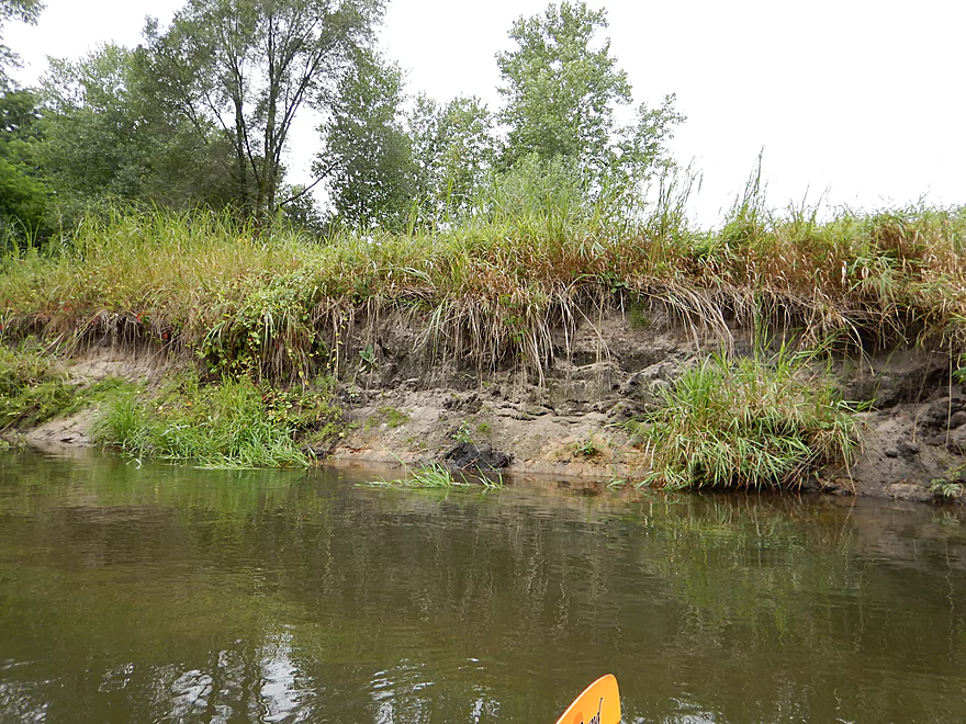
Some dirty sand banks
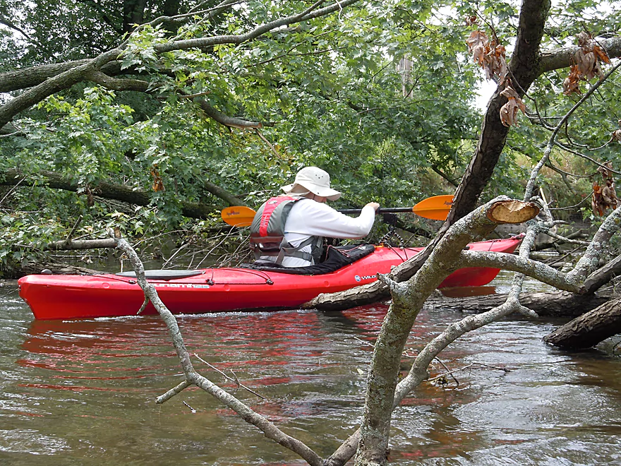
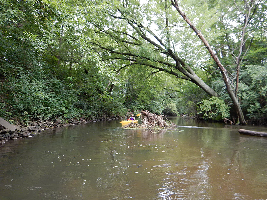
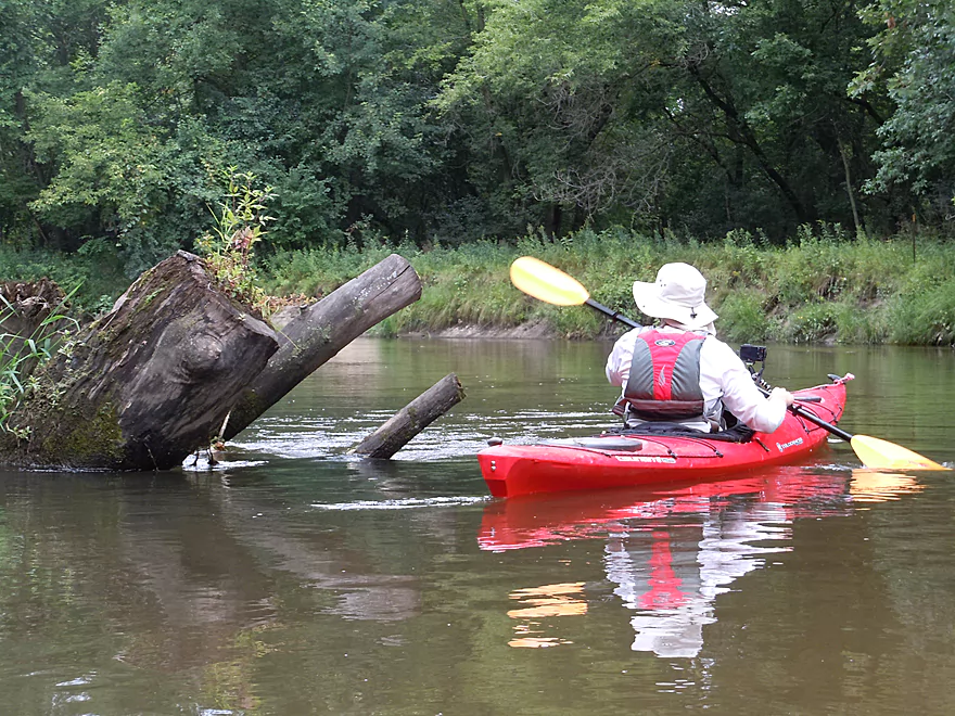
A tricky log jam and hop-over
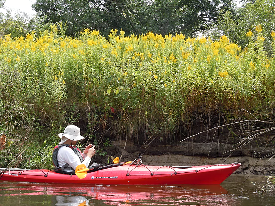
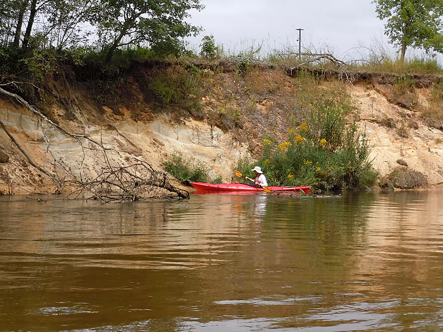
Again, fantastic wildflowers
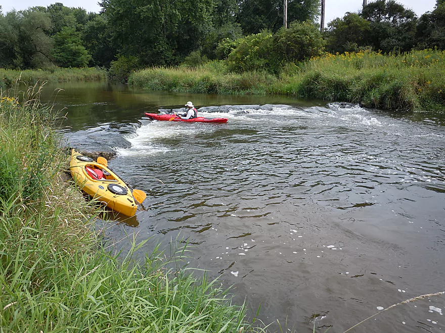
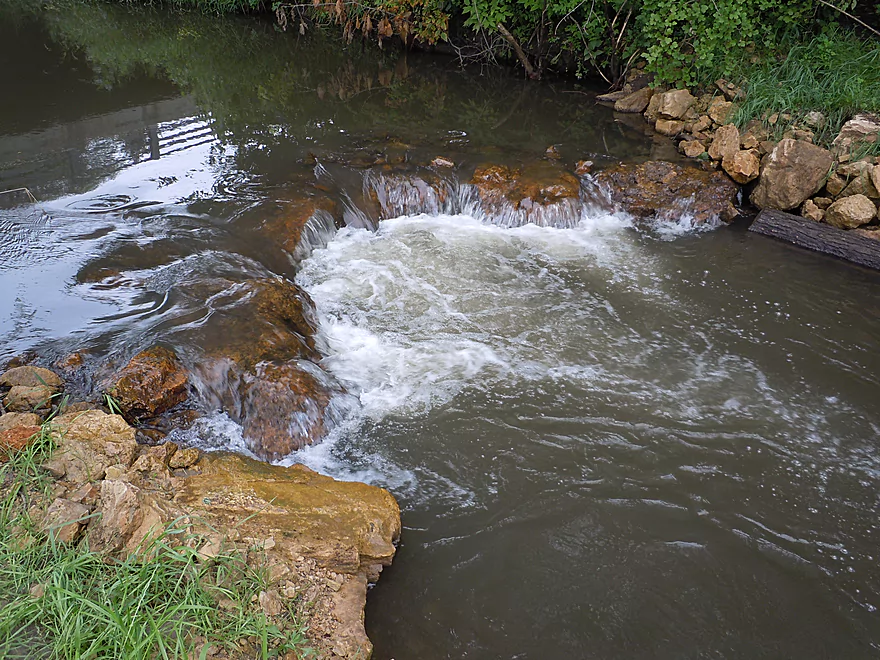
Second favorite ledge
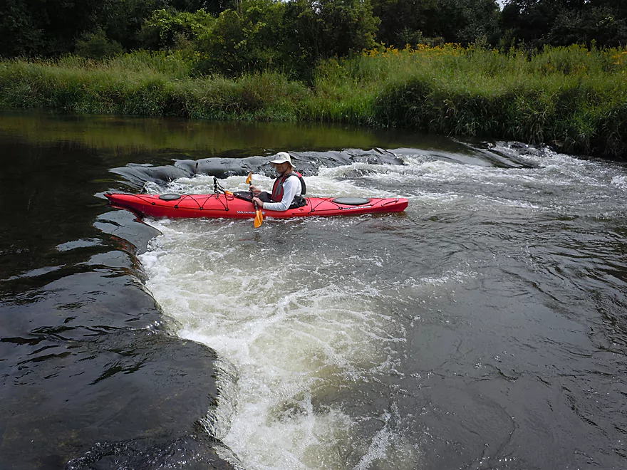
Fun to play in
Current is actually keeping me in place
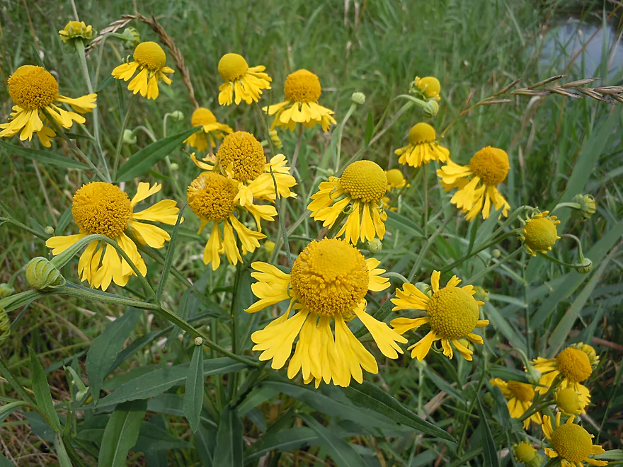
Badminton birdies! (actually sneezeweed)
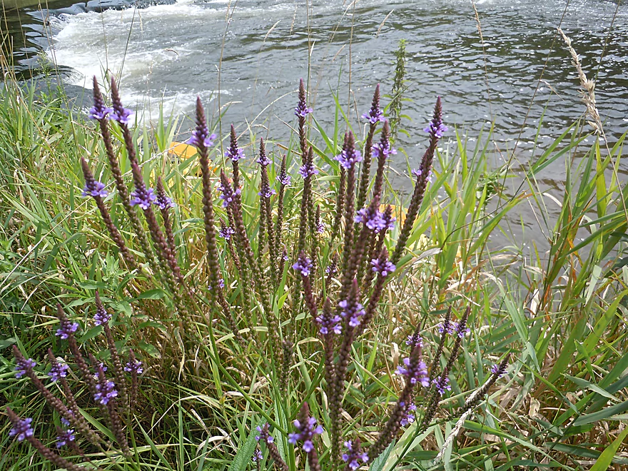
Blue vervain
Purple loosestrife
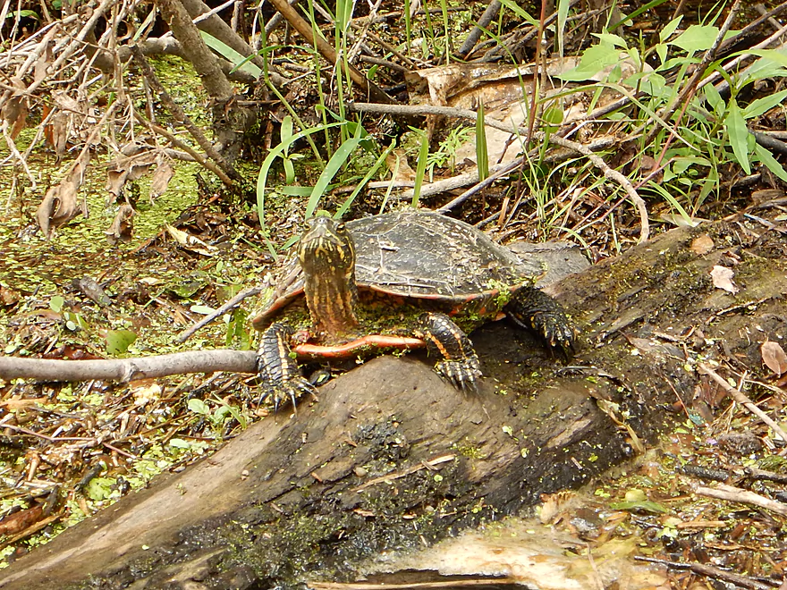
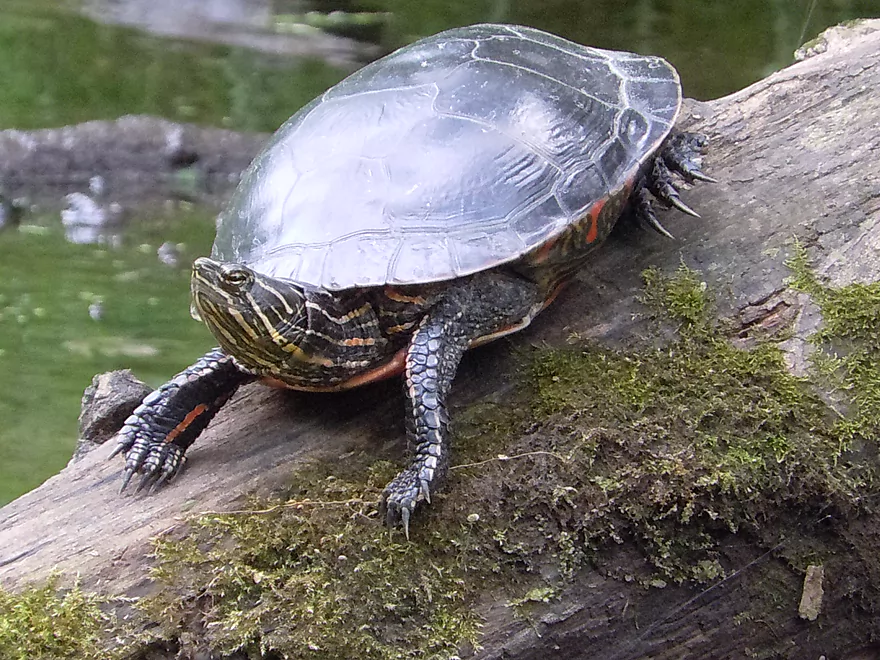
A spunky painted turtle
Can not have enough of these shots!
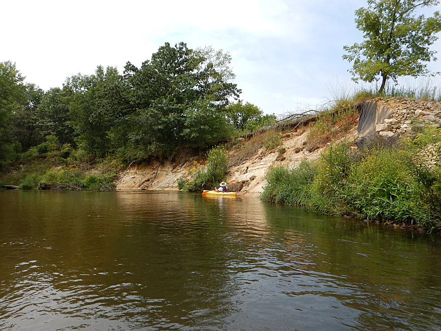
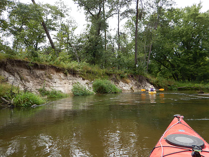
Some striking sand banks
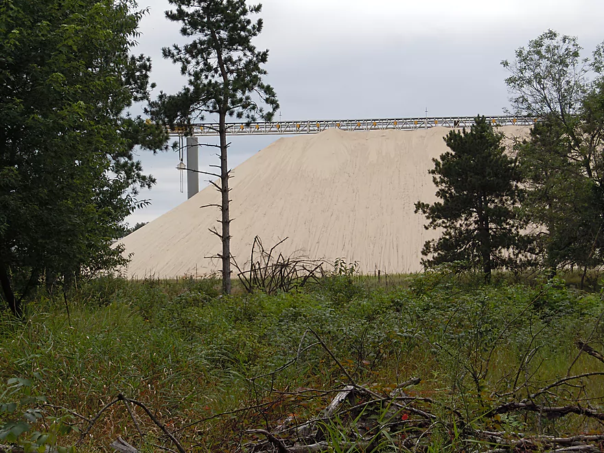
The very noisy frac sand mine
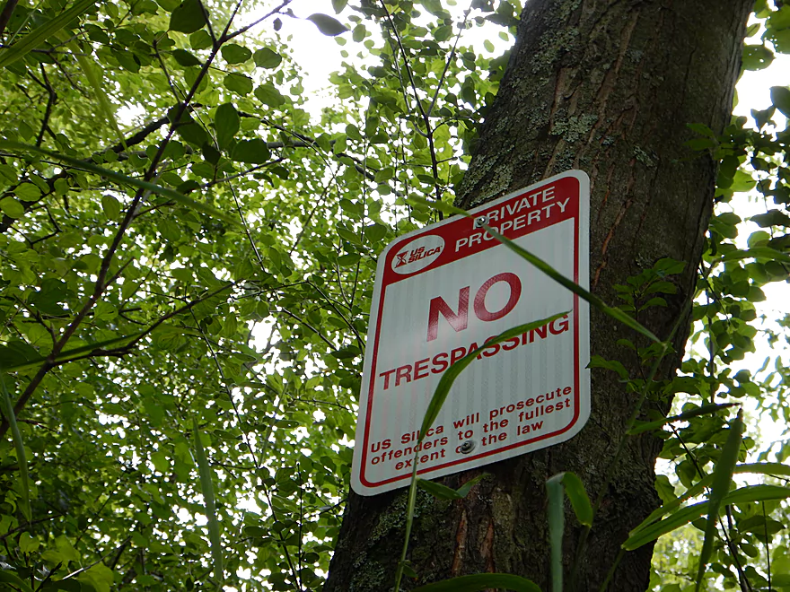
Large number of these on the river bank. You do know what Silica means?
Another painted turtle
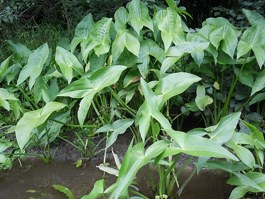
Arrowhead (duck potato)
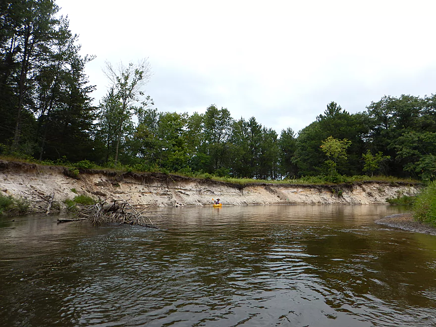
Another nice sand bank
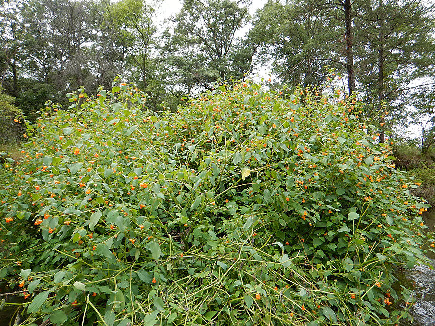
Touch-me-not (jewelweed)
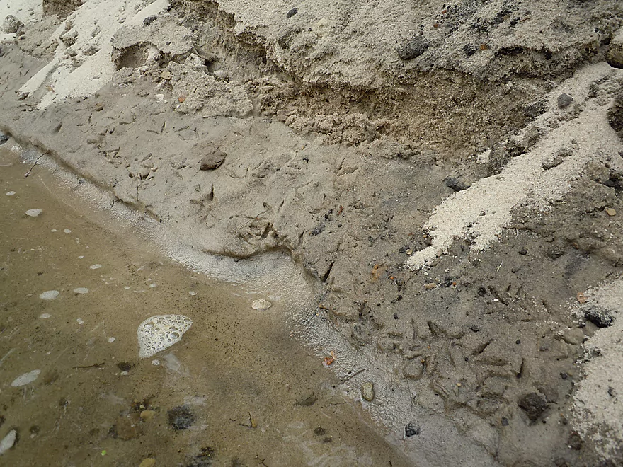
Bird calligraphy
Nice wavelike sand patterns
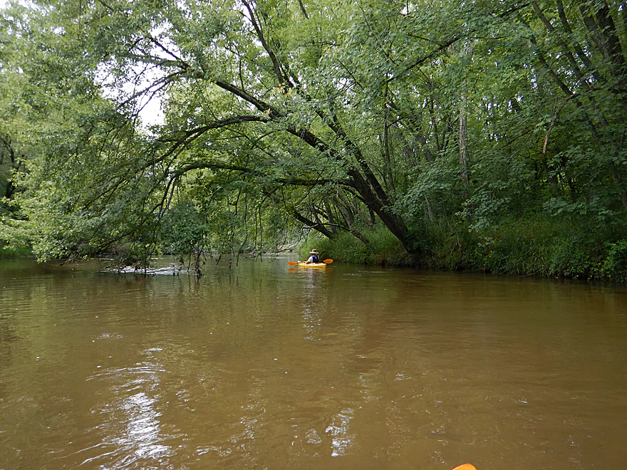
Occasionally some nice tree canopies
Passing by Amundson Park
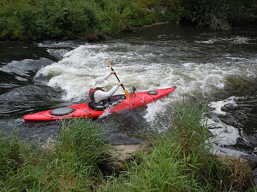
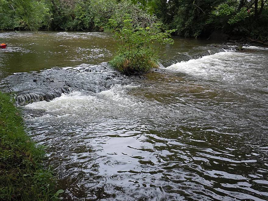
Best ledge of the trip (I took on some water here)
Pretty fun
Other kayakers (and dogs) enjoying the ledge
More flowing pondweed
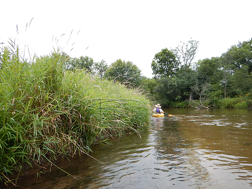
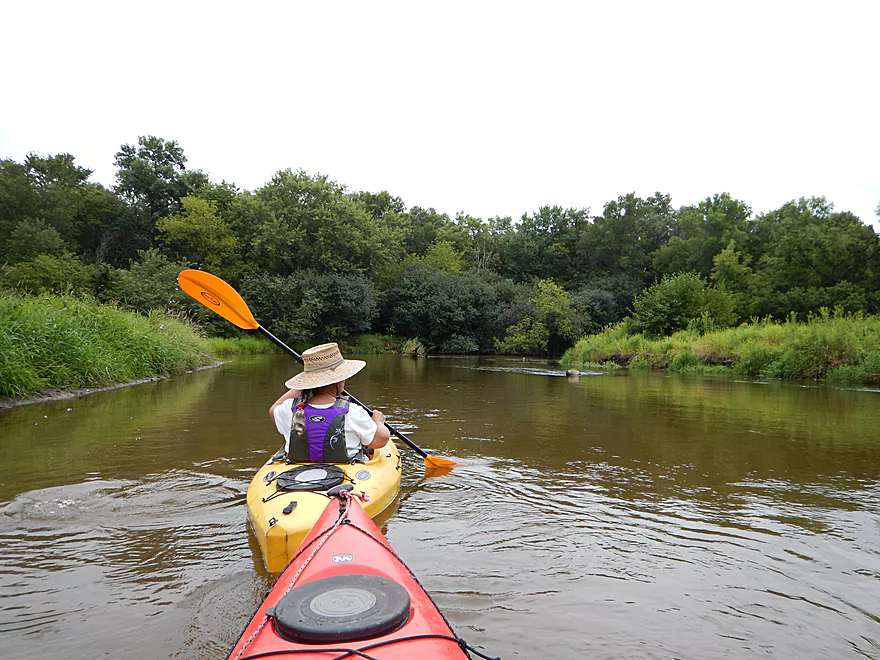
Nasty invasive reed canary grass (most rivers have this)
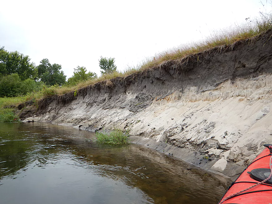
Nice white color to the sand
Take-out at Hammer Road
Not ideal, but workable take-out ledge
Ok parking, but the trail is a drag
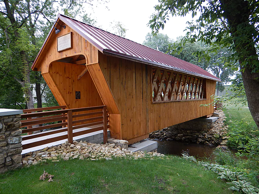
Checking out more covered bridges on Beaver Creek
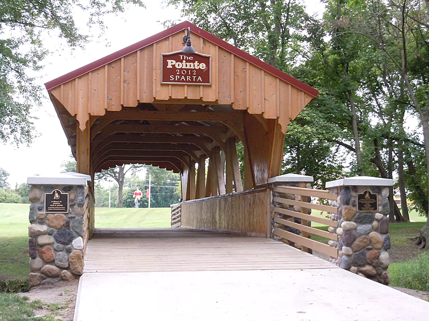
Ben is bikin’ through this one
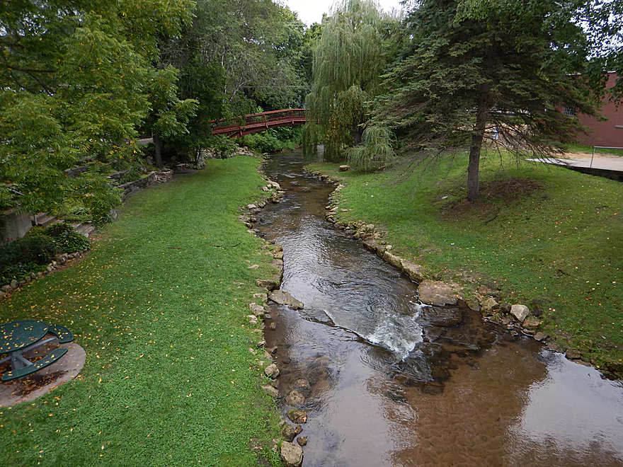
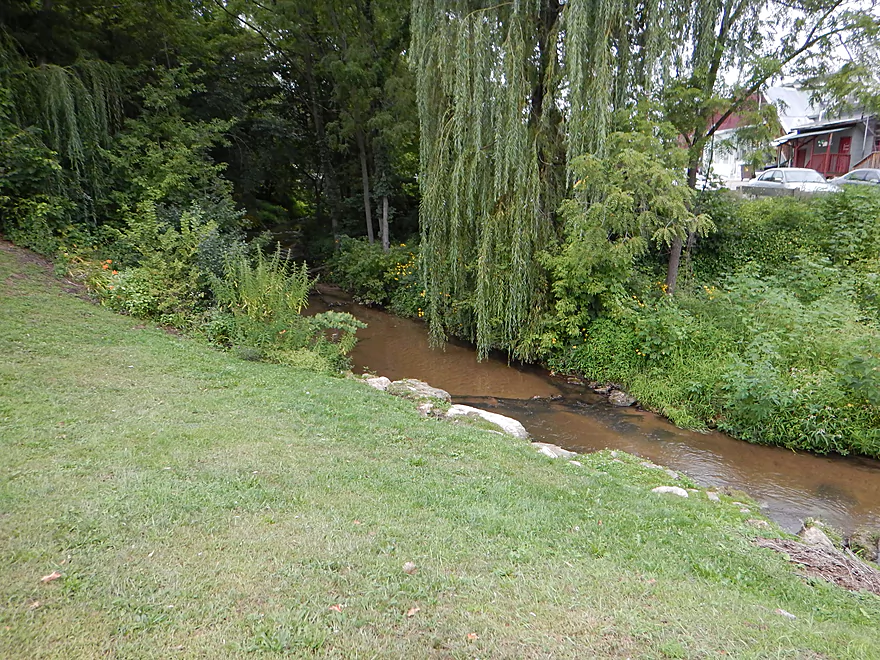
Beaver is a wonderful little creek
As far upstream as I scouted it (close to West Franklin Street)
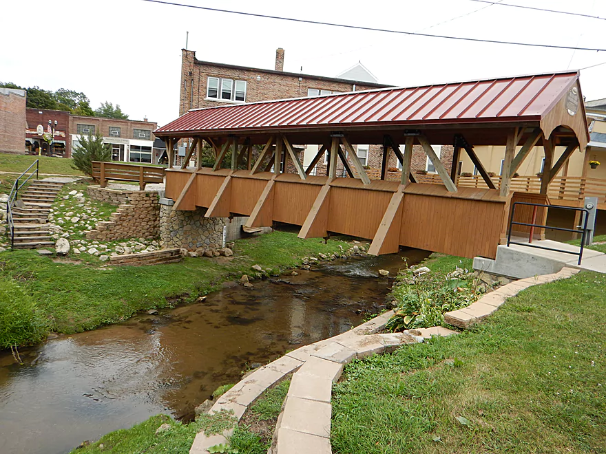
This is the third covered bridge over the creek
An attractive non-covered bridge over the creek
There is even an entire building over the creek!
Fisherman’s Creek is also nice…would be a good launch into the main river
Would be a bit bumpy though
La Crosse River

A pleasant five-mile paddle originating in the city of Sparta. The La Crosse River has a great recipe for paddlers in swift clear water, fun ledges, and is nestled in an attractive setting.
You will have a bevy of options for putting in, with almost contiguous green space access from Memorial Park to Fisherman’s Park to Evans-Bosshard Park to the bike trail informational center to Howard Huff Park. A very friendly city when it comes to water access! The bike trail informational center (with the oversized “Ben Bikin” statue) is by far the most popular, but you miss some nice parts of the river by putting in this far downstream. We put in at Fisherman’s Park, which is a dual access park for Perch Lake above the dam and the La Crosse River below the dam. Great put-in with fine parking, good portage path and launch area (in fact three). While it was nice to check out the dam, it would have been fun to start in Fisherman’s Creek or Beaver Creek, which I’ll talk more about in the alternative trips section below. I know for certain that Fisherman’s Park, Evans-Bosshard Park and the bike informational center all have facilities.
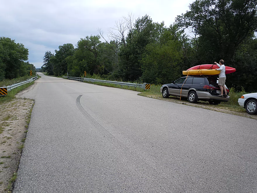
This is a treat for bike shuttlers, as the river parallels the La Crosse River State Trail. Maybe 30% of your 4.5 mile shuttle will be on conventional roads though and the trail here does not overlook the river…it does have scenic views of a large frac sand mine though! (more on that later) The trail is marked in green on Google’s map and I’ve marked it in my map below as well. This trail does require a state trail pass though (which I believe your local state park should sell). Sparta is famous in bike circles for being the junction between the famous Elroy-Sparta Bike Trail and the La Crosse River Bike Trail (the city itself has some nice bike trails, too). The river has a livery service in Ellistone Canoe Rentals, but note that they prefer to schedule shuttles in advance.
The La Crosse River is actually a pretty stable river for much of the year because most of its watershed is spring-fed. We ran this at 150 CFS, which was very good. Water seemed just a smidgen high (from the previous day’s rain) on the upper part of the river, but perfect on the lower sections. I suspect the river can be run under 100 CFS and perhaps as low as 75 CFS (don’t quote me on this, as it would make for bumpy ledges). For the most part, the river has a lot of padding to it. My personal preference would be to not run the river over 200 CFS, as this would really hurt the wonderful water clarity we enjoyed. The gauge is smack in Sparta, so is very accurate. The La Crosse is a very zippy river at 5.5′ per mile, which makes this a lot of fun to paddle and you’ll encounter multiple riffles and ledges.
Water clarity was very good (at least at our 150 CFS flow rate). The upper section wasn’t as clear because of its depth, but was certainly nice and you could see the rock substrate and boulders easily enough below your kayak. The town part of the trip had a lot of artificial fill to protect the banks, which was not ideal, but it was nice having stable banks. The latter/majority part of the trip was extremely sandy and here the water clarity was at its best. There are a couple of minor sandbars on the river, and this is an inviting river for swimming.
Not an inordinate number of animals on this trip (perhaps scared away by the nearby noisy frac sand mine). Did see a nice fat water snake, couple of painted turtles, many cliff swallow nests under the bridges (a given on most Wisconsin rivers) ,a muskrat, kingfisher and a few dragonflies. The plant life was more exotic, with many riverside wildflowers in full bloom. This was among the best I’ve experienced for the sheer quantity of wildflowers and is probably atypical for the river, as the trip was probably just lucky seasonal timing. It was quite striking paddling by walls of yellow, blue, purple and orange. Below the water, there were attractive pondweeds flowing gently in the water (like Harry Potter dementor capes) and occasional clumps of coontail and elodea. A decent percentage of the shoreline was dominated by reed canary grass, which is unfortunate, as this is an invasive species imported from Europe for cow food….but really is a problem on practically every southern river and creek in Wisconsin.
From the dam to Howard Huff Park, the river is very open and developed, but done so tastefully, with mostly park green space flanking the river. At Evans-Bosshard Park, you’ll see where Beaver Creek enters the La Crosse and a fine covered bridge over the creek. A little further down, past Hwy 71/16, the river does a big bend around a local bike informational center which, for all practical purposes, is a park. Most noticeable will be a giant biker statue whose name is “Ben Bikin.” The river here is riffly and fun, with the most significant drop being just before the South Water Street bridge. All in all, this is pretty safe.
After this bridge, the river changes character, with steep banks and trees on either side, creating a wonderful canopy effect. Soon you’ll encounter the remnants of an old mill and dam, which has long been removed. There is a baby riffle, then a more steep ledge where the dam was not completely removed. Doable, just wear your life jacket. All that remains of the mill wheel is the old gear assembly and the large, picturesque mill house.
This won’t be your first ledge, as maybe half a mile later you’ll encounter another fine ledge, this one looking super artificial, with a suspicious V-shape. Fun though…the shape actually creates a small hydraulic that you can let pull your boat up against the current and smack into the falls itself (see pictures/video). I wouldn’t do this at high flow rates….this did seem pretty safe, but obviously, don’t be reckless. From here the river opens up, widens out, and becomes incredibly sandy. Here you’ll have great views of the sandy bottom of the river through the clear water.
Near the end of the trip you’ll come across Amundson Park, with another artificial V-shpaed ledge that is quite fun to run (seems safe enough, too, as Morral Films actually took a swim break in the falls itself). This and the park are pretty new. This is not a practical park for kayak access (despite the boat launch) because the road from the park to the launch is gated. Despite this and other boat launches, the river is, thankfully, not big enough for powerboats and they were not seen. From here to the take-out, the banks were filled with wonderful walls of wildflowers (atypical, as this was a seasonal bloom).
Webmaster Update: As of 2024-04-30, a number of logjams have popped up upstream from Amundsen Park. Some portages will be required.
Never had to portage on this trip and log jams weren’t really an issue. There was one place in which I had a tough “hop-over” and then had do a reverse z-pattern through a tangle, which was not as easy as it sounds…but much preferable to a portage. There are numerous ledges on this trip (some over a foot), but I thought they were easy for the most part. Longer boats, inexperienced paddlers or paddlers in high water may want to take them more seriously though.
Webmaster Update: As of 2024-04-30, a number of logjams have popped up upstream from Amundsen Park. Some portages will be required.
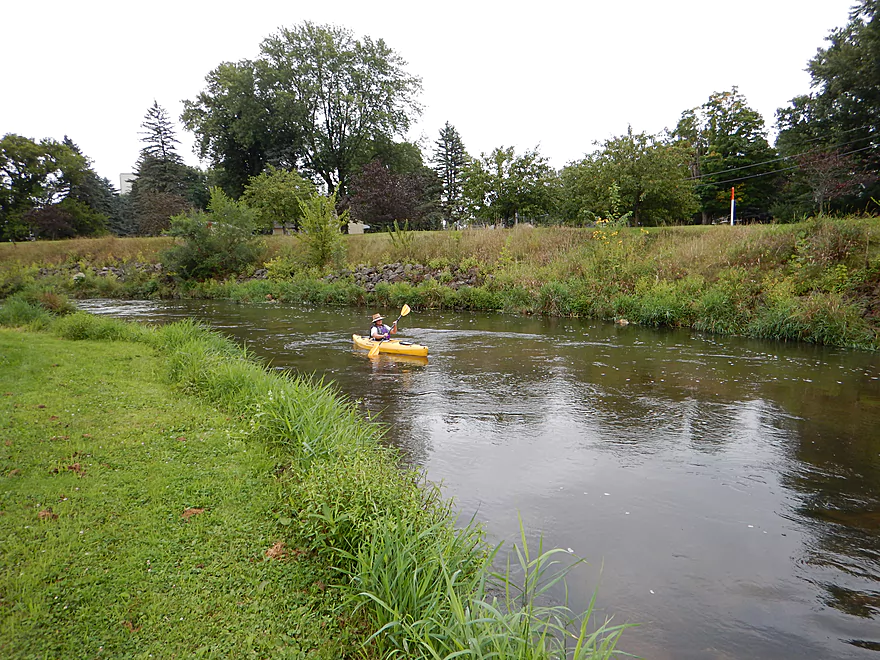
I suspect this is a popular river for paddling, but we only saw two other kayakers on the trip. Around Sparta there is occasional trash floating in the water, and this section is certainly overdue for a garbage cleanup. The local at risk program SAILS actually does clean up the river periodically and does a very good job. Monroe Country prisoners have also participated in river cleanups which is very much appreciated.
The early Sparta section also has a large amount of artificial rip-rap to protect the banks. Some works aesthetically and some doesn’t (the construction debris wasn’t very nice). Very little agriculture, with only one cornfield visible. For being so close to Sparta though, all in all, I can’t complain about the river.
Except for the frac sand mine. It is right next to the river and you can see glimpses of it at times. This operation is very loud and could be heard for the majority of the trip (supposedly they run 24-7). Kind of new, this mine is part of a recent trend where high quality sand (think central Wisconsin) is shipped to places where drilling for hard- to get shale oil and gas takes place. The sand is then used in a process known as fracking, which is very destructive to the water table. Even sand mining itself is very troubling and the League of Wisconsin Conservation Voters has a great overview. Some of the major issues are:
- Basically, fine sand dust blows off the open pit sand mines and can get into your lungs and cause silicosis
- Sand mines require a lot of water and can draw down and disrupt the water table
- Toxic chemicals are used to wash the sand and these get into the water supply
- The noise pollution from these is incredible, 24/7, and no doubt spooks a lot of wildlife (and homeowners)
- They are, of course, an enabling component to fracking (very bad…see the documentary “Gasland” for more information)
Because the sand industry is so new (and because our politicians are so inept), the industry is poorly regulated if at all. In fact, US Silica (the Illinois company that runs the Sparta operation and posts many “no tresspassing” signs on the south bank of the river) actually brags to its shareholders and clients that Wisconsin is such a great environment for sand mining because of the loose regulations. Sigh…
Our take-out was at Hammer Road, which was not terrific, but acceptable for a bridge access point. Bit of mud at the take-out ledge, the grass was overgrown and the guard rails prevent you from parking close to the take-out. But if you take out on the northwest side, there is a rough trail leading from the water. Just wear your shoes, as the terrain is quite pokey here.
All in all, a great trip that I almost gave 4.5 stars. Really, no weaknesses, but nothing super exotic. Clear, fast water is a great formula for any paddle trail. I think I actually might have liked the La Crosse better than the lower Black, which is by far more popular (the upper Black is a different story though).
- Ellistone Canoe Rentals
- Morrall River Films (nice video review)
- Mike Svobb – Easily the best paddle guide to the La Crosse River
- Fort McCoy
Detailed Overview
- Fort McCoy - Upper Leg: The river looks nice here, but this goes through the heart of military training grounds so is not likely suitable for paddling.
- Fort McCoy - Lower Leg: (2.5 miles) This is technically part of a Federal Army base. You can navigate the river, but only if you register with the Fort McCoy Natural Resources department and follow their rules.
- Squaw Lake Dam to Buckley Ct: (1.4 miles) Very interesting prospect with clear water, one small waterfall, and a few nice Robinson Creek style cliffs.
- Buckley Ct to Hwy BB: (1.1 miles) An ok prospect.
- Hwy BB to Sparta: (7.1 miles)
- Hwy BB to Angelo Wayside: (5.3 miles) Clean sandy water with little development. Ends in a small flowage.
- Angelo Wayside to Sparta/Fisherman's Park: (3.3 miles) Not as interesting...but ok. River widens and has more of a messy feel with more hardwoods.
- Sparta to Hammer Road Bridge: (5.4 miles)
- Fisherman's Park to Ben Bikin Park: (0.4 miles) Nice open stretch though Sparta with some rocks.
- Ben Bikin Park to Amundson Park: (3.5 miles) The most popular and best section on the entire river. Very nice with clean water and good current. As of 2024-04-30, a number of logjams have popped up upstream from Amundsen Park. Some portages will be required.
- Amundson Park to Hammer Road: (1.5 miles) A more wooded stretch. Includes a fun ledge to kayak over.
- Hammer Road Bridge to Hwy J: (5.6 miles) Likely a good prospect...but I bet it isn't as nice as upstream sections.
- Hwy J to 17th Ave: (6.8 miles) Mediocre prospect. Upstream sections are likely nicer.
- 17th Ave to Neshonoc Lake Dam: (6.6 miles) Half the trip goes through a slow flowage. The lake is nice as far as lakes go...but I suspect this is a relatively weak section.
- Neshonoc Lake Dam to Veterans Memorial County Park: (4.2 miles) An ok paddle with some fun ledges and a nice box canyon.
- Veterans Memorial County Park to Holiday Heights Launch: (8.4 miles)
- Veterans Memorial County Park to N. Kinney Coulee Road/I90 Bridge: (2.6 miles) A mediocre stretch with some sandbars and Class 1 rapids under I90, but mostly generic eroded banks that have been heavily straightened by the railroad. Road noise here is pretty loud.
- N. Kinney Coulee Road to Holiday Heights Launch: (5.8 miles) A good leg. Features include fast current, some sandbars, mostly open banks with some nice bluff vistas, and a few really nice sandbanks. Be mindful of strainers in fast current.
- Holiday Heights Launch to Mouth on Mississippi: (6.9 miles)
- Holiday Heights Launch to Hwy B/Earl's Landing: (2.2 miles) A more wooded stretch with mediocre floodplain trees. Train traffic is heavy in this area and chances are good you'll paddle under a moving train.
- Hwy B/Earl's Landing to Mouth/Riverside Park: (4.7 miles) This is a good leg. It's more open and has really nice views of the distant bluffs.
Trip Map
Overview Map
Video
Photos Size:
Paddlers, if you have the time and inclination, you should definitely travel beyond Hammer Road (the takeout for the above-described trip) and continue on to Icarus Road (a narrow but mowed takeout path) or on to County Road J, near Rockland, which features a well-developed takeout and parking lot for the canoe rental fleets. While there are no fun ledges like in the first segment just beyond Sparta, the appealing river features encountered there pretty much continue: steady current, an occasional but navigable deadfall, sandy bottom.
The river slows down and widens out a bit, but is certainly no more difficult. The sand mine was quiet the day I went by. A flotilla of canoe renters were enjoying the river; some were hilariously clueless about steering a canoe (or even holding a paddle). Total paddling time from Sparta to County J was 3 hours (and I paddle fast).
Thanks for the feedback Denny. Yeah Hammer Road was a bit steep/weedy for an access, and a trip like this would benefit from a longer length.
This was an amazing trip. Water was clear and moving at a decent flow. How ever the storms took down a lot
More trees into the river. Still able to get through them but can get difficult at some points.
I didn’t realize that storm damage had created downed trees on the Upper La Crosse. Your update is appreciated.
Hey Aaron, just did the La Crosse river from Evan-Bosshard park to Icarus Rd. What Denny didn’t mention from July 3 2023, the DNR acquired the house on Icarus next to the river several years ago and removed it, it’s now called Brinkman’s Landing. It has a nice large gravel turn around and plenty of parking. Unfortunately the river landing itself is muddy. This gives several options for shorter trips. The Sparta gauge was at 3.91, it took us 3:15 of mostly floating.
Thanks Don. I didn’t know about that new landing and will add to the overview map.
We went down this stretch this past weekend. It was a fun run, but no time to put the paddle down and relax. The big thing to be on the look out for rocks just under the surface. Beautiful trip though. We didn’t find the sand mine as obtrusive as you. I would like to mention that it might be considered irresponsible to spout off about things that are not true about businesses in the area. I don’t want to get into any arguments here, but would like to share that the sand US Silica mines is not only for frac use. More importantly, they do NOT use chemicals to wash sand at this site. It is dredged from what will become a community lake once mining has commenced. They are regulated by the EPA, DNR and MSHA. Keeping dust down is a priority, they even wet the roads they drive machinery over to minimize Silica exposure to workers and surounding community. There are berms all around the grounds to help minimize noise. I know people who work hard there to support their families. They can attest that nightly wildlife is thriving in this area regardless of the “noise.” Workers observe Does raising their fawns(at least one set of twins this season), geese making nests and raising their young, Killdeer chattering about pertecting their nests from other wildlife. The company also donates to local cheritable causes and suppports our fire services. They are even willing to let the volunteer fire fighters that are also employees leave work to go on emergent calls. Like I said before, I’m not here to argue, just to ask for more consideration before slandering businesses that provide quality employment opportunities in our community. I am also not affiliated with US Sillica, just a local that didn’t appreciate the false information portrayed in this article. Let’s be more responsible and respectful in the future. Those opinions are irrelevant to the paddling experience itself.