
Grant River
This is one of the great paddling rivers of Southern Wisconsin. It’s highlight are exotically textured limestone cliffs which you rarely see in other parts of the state.
Trip Reports
Hwy 61 to Mt. Ridge Road
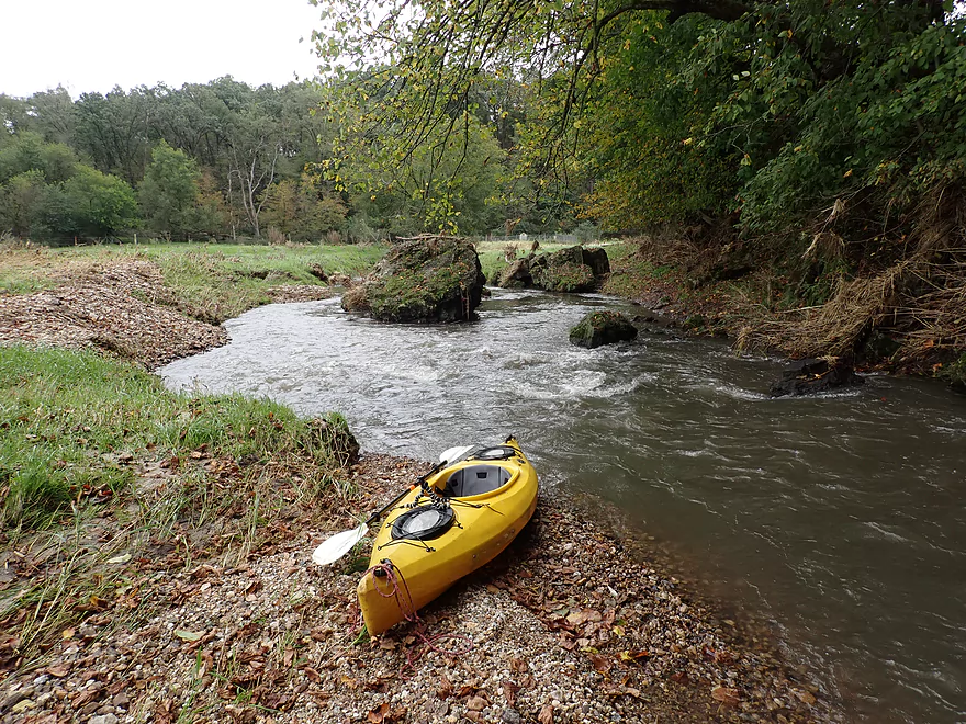
Date Paddled: September 28th, 2019
Distance: 4.8 miles
Time: 4 hours 15 minutes (2-3 hours would be more typical)
This is about as far upstream on the Grant River that you can paddle. There are some fun rapids and scenic outcrops...but there is a lot of mud and pasture to deal with. There are also 3-4 logjams, one of which forced me to take an unplanned swim.
Read More...Mt. Ridge Road to Pine Knob Road
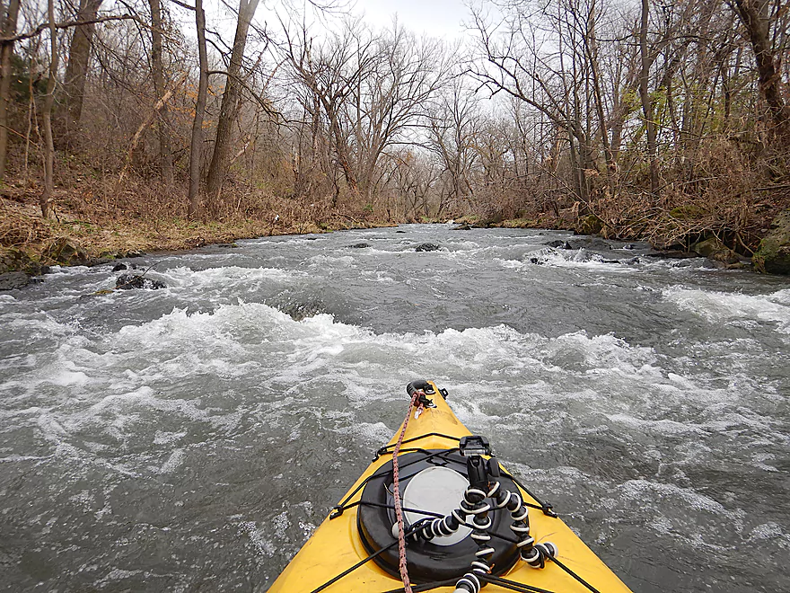
Date Paddled: October 27th, 2018
Distance: 2.6 miles
Time: 2 hours 10 minutes (75 minutes would be more typical)
The far upper portion of the Grant River (called the Rogers Branch) is actually navigable during high water. This was a surprisingly nice trip through trout-land with no logjams, fun rapids and scenic limestone rock formations.
Read More...University Farm Road to Short Cut Road
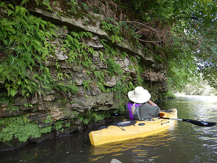
Date Paddled: August 11th, 2018
Distance: 3.7 miles
Time: 3 hours 5 minutes (2 hours would be more typical)
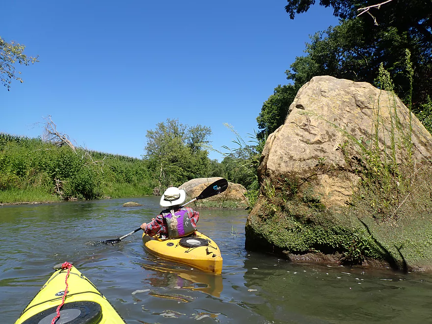
An obscure upstream segment on the Grant River that was a mixed bag. The access spots were a bit challenging and the water a bit muddy...but there were some nice limestone outcrops and rapids.
Read More...Short Cut Road fishing access to Grant River Road
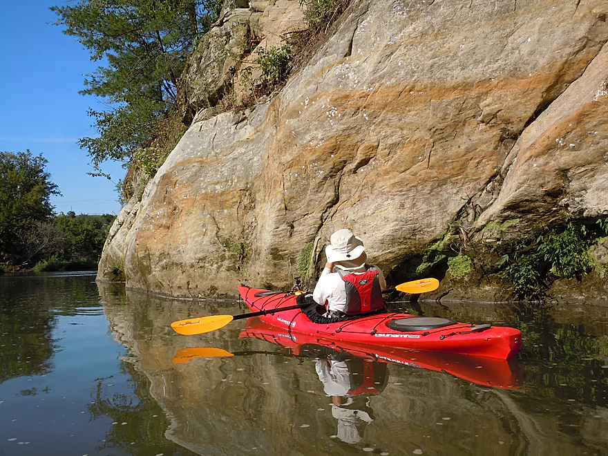
Date Paddled: August 31st, 2014
Distance: 5.4 miles
Time: 5 hours 59 minutes (atypical expect 2-3 hours)
Not being the cleanest river nor the best wilderness experience, the Grant River is pretty much a one-trick pony. But it is a good trick though! What makes the Grant special are the occasional limestone and sandstone bluffs, which are fantastic and make this trip worth doing. Put-in: For a river fraught with access issues, […]
Read More...Grant River Rd to Blackjack Rd
Date Paddled: August 13th, 2021
Distance: 6.4 miles
Time: Expect 3 hours
This is yet another great leg on the Grant River with fun rapids and scenic outcrops. A surprise highlight were the many sandstone cliffs, since most of the Grant cuts through limestone.
Read More...Hwy U to Camel Ridge Road
Date Paddled: July 25th, 2020
Distance: 5.7 miles
Time: Expect 2.5 hours
Fast current, beautiful scenery, 9+ sandstone outcrops, fun rapids, and zero logjams--another winning trip on the Grant River.
Read More...Camel Ridge Road to Chaffie Hollow Road
Date Paddled: August 24th, 2019
Distance: 3.1 miles
Time: 3 hours 5 minutes (90 minutes would be more typical)
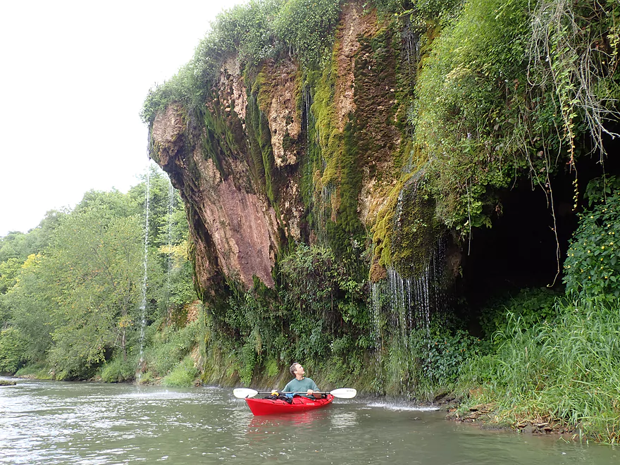
Between the back fields and hidden valleys of the Driftless Area flows one of the most popular tubing stretches in the state. Despite the heavy tube traffic, this segment of the Grant is still a great kayak trip, with highlights being good current, sandstone outcrops, and a fantastic "dripping rock."
Read More...Overview Map
Detailed Overview
- Pine Grove Road to Hwy 61: 2.1 miles. Very small and would need flood-like levels to be navigable. Likely not interesting with several fences, 3-4 logjams, and flowing mostly through cow pasture.
- Hwy 61 to Mt. Ridge: 5.0 miles. A rugged and small paddle that needs high water. Unfortunately there is a lot of mud and pasture to deal with not to mention a few logjams. However, there are many fun rapids and several scenic outcrops.
- Mt. Ridge to Pine Knob Road: 2.6 miles.
- Mt. Ridge to Hwy K: 1.7 miles. Narrow and fast with several rock outcrops. No logjams, but a few tricky strainers.
- Hwy K to Pine Knob Road: 0.9 miles. A neat section with more outcrops, a longer set of Class 2 rapids, and Klondike Springs.
- Pine Knob to Hwy A: 2.7 miles. Likely way too many logjams.
- Hwy A to Grays Mill Road: 0.7 miles. Maybe one downed tree. Mostly a simple farm field paddle.
- Grays Mill Road to University Farm Road: 3.4 miles. Maybe 2-3 downed trees and one set of rock outcrops. River gains significant volume in this stretch from tributaries.
- University Farm Road to Short Cut Road: 3.7 miles.
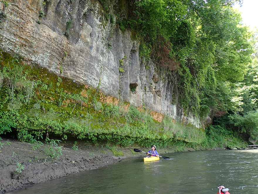
- University Farm Road to Slab Town Road: 1.5 miles. Very muddy and one noteworthy strainer, but also has a great series of limestone outcrops.
- Slab Town Road to Short Cut Road: 2.0 miles. Less muddy and with several sets of fun rapids, but has only one tiny outcrop and there is a logjam to deal with.
- Short Cut Road to Grant River Road: 5.5 miles. Great section with some attractive outcrops.
- Grant River Road to Hwy U/Blackjack Road: 6.2 miles.
- Grant River Road to Pigeon River Road(1st): 1.4 miles. Great stretch with some of the best outcrops on the river. Grant River Road is a bad access.
- Pigeon River Road(1st) to Hwy U/Blackjack Road: 4.8 miles. A good leg with a mix of sandstone and limestone outcrops. Outcrops aren't as common as other legs, but it's still a nice stretch..
- Hwy U to Camel Ridge Road: 6.0 miles. Good stretch with some nice rock outcrops.
- Camel Ridge Road to Chaffie Hollow Road: 3.2 miles. Very scenic section with good current. Features a waterfall and some nice outcrops. Very popular with tubers.
- Access note – The Chaffie Hollow Road landing is private. Get permission from one of the three liveries like “Y’Allbee Tubin” to use it, or take out under the bridge (the latter is not easy).
- Chaffie Hollow Road to Hwy N/Burton: 3.3 miles. I don’t know much about this section. Likely more open and less interesting…but likely some outcrops and light rapids.
- Access note – The landing at Burton is private. If you take out here, use the bridge instead.
- Hwy N to Great River Road: 8.5 miles. Should be a few nice rock outcrops, but the channel is much larger and muddier. Maybe 3 logjams. Take out at Hwy 133 on SE side…not an ideal launch area.
- Great River Road to Mouth: 1.6 miles.
- Mouth/Mississippi to Potosi Point: 1.2 miles. A short trip on the Mississippi before disembarking at Potosi Point.