
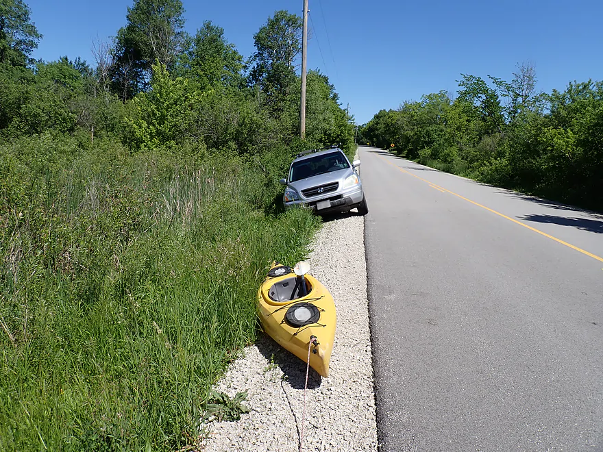
Starting the trip at Carver School Road
This was a bad access…poor parking, weedy bank, and muddy
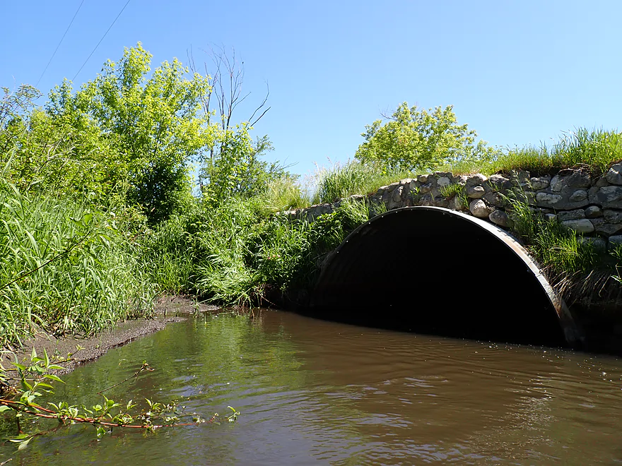
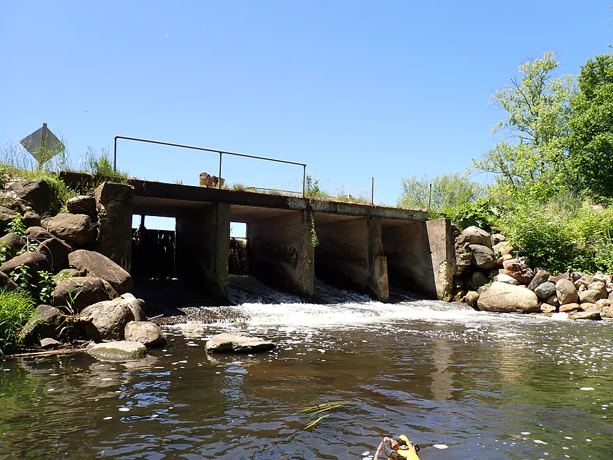
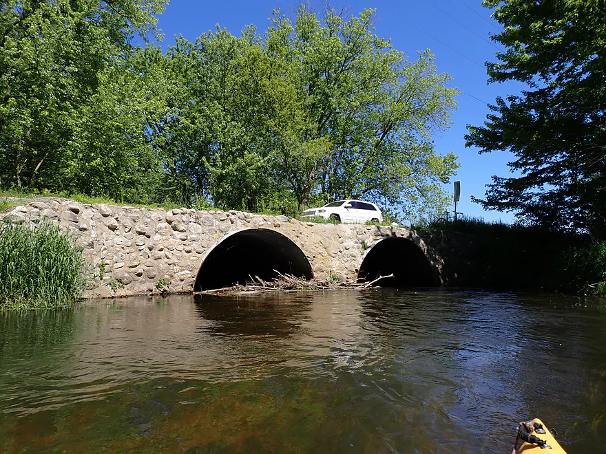
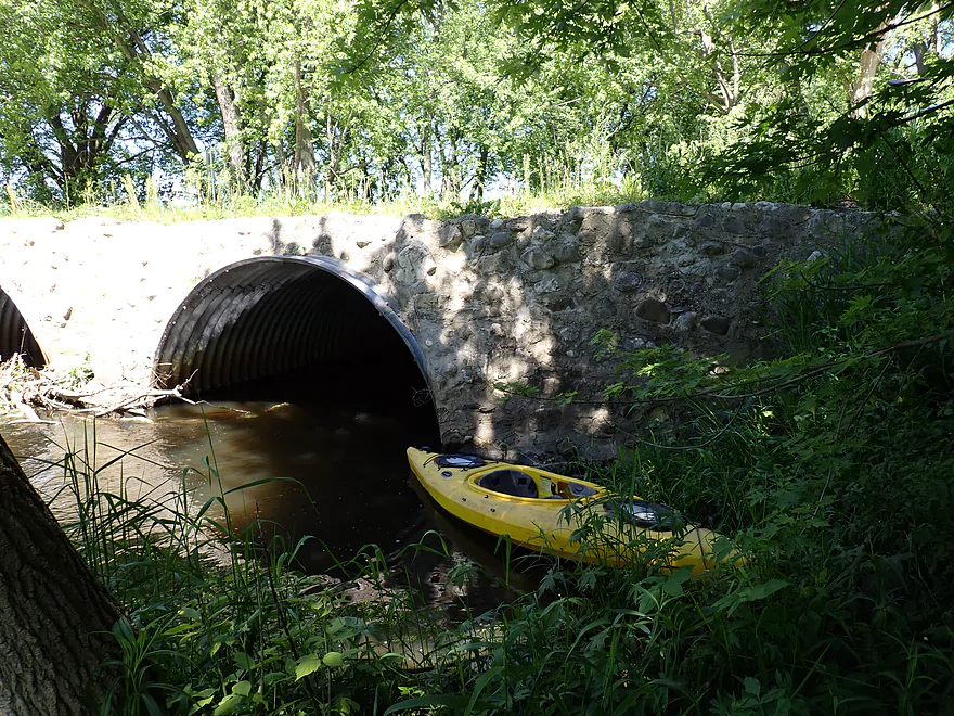
Always fun to take culvert pictures
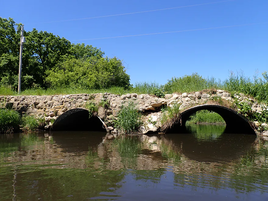
Cool stone bridge
Lots of quick mud in the first half mile
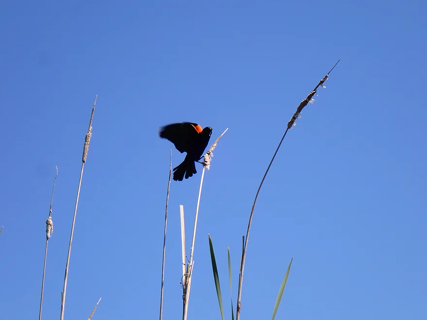
One of several boisterous blackbirds defending its territory
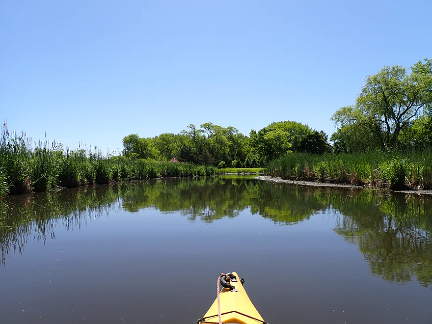
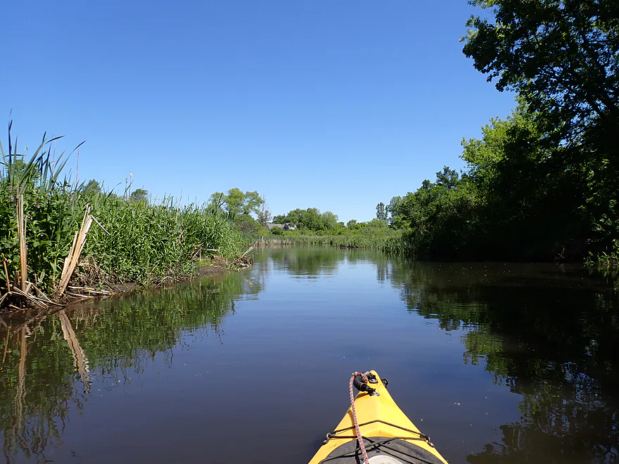
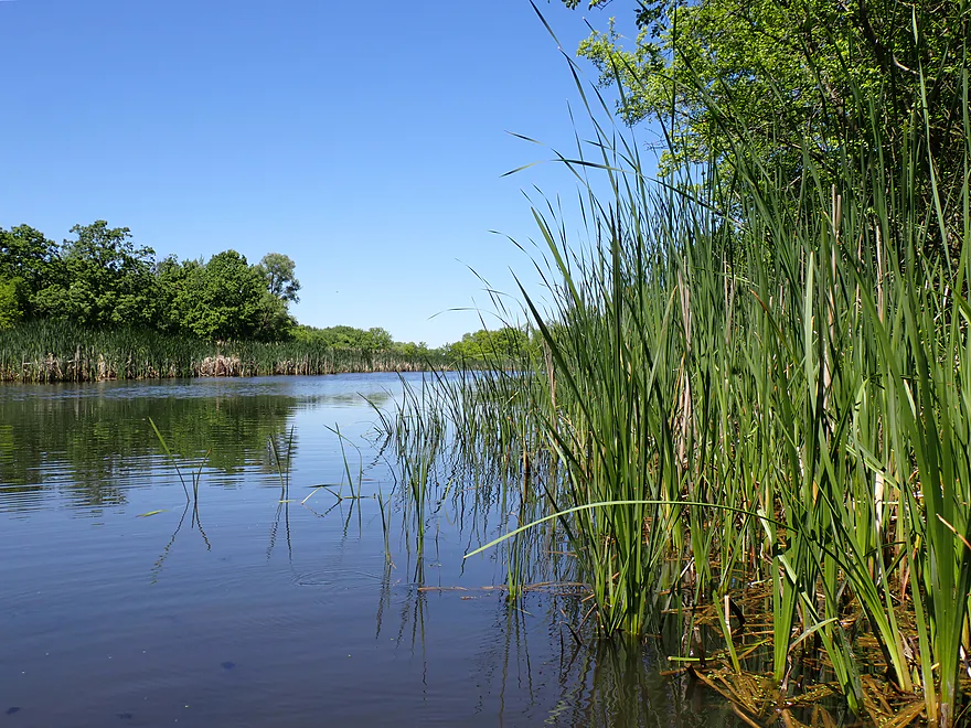
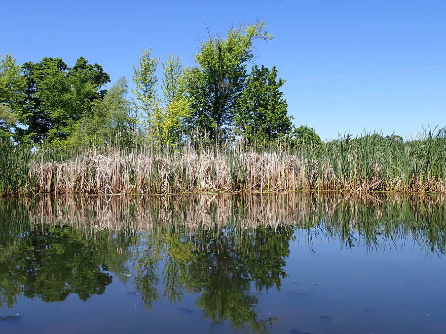
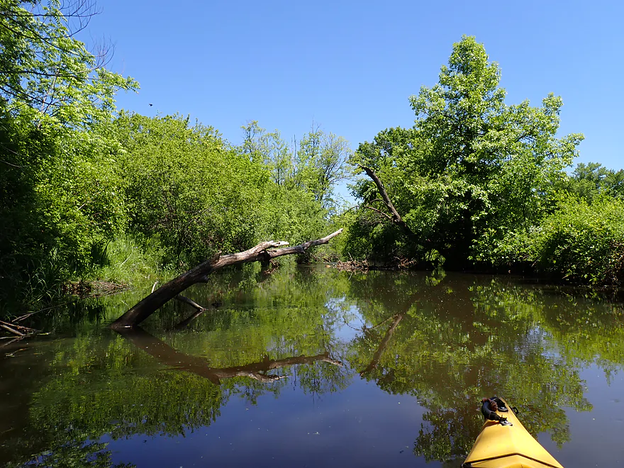
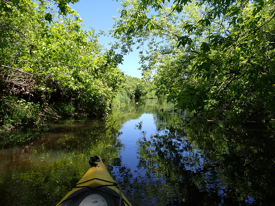
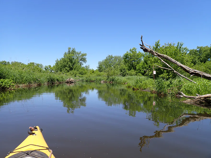
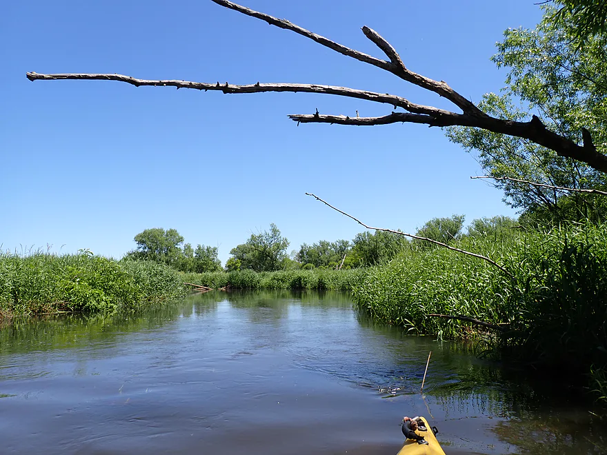
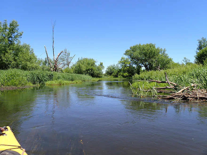
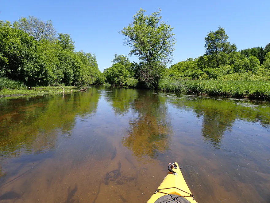
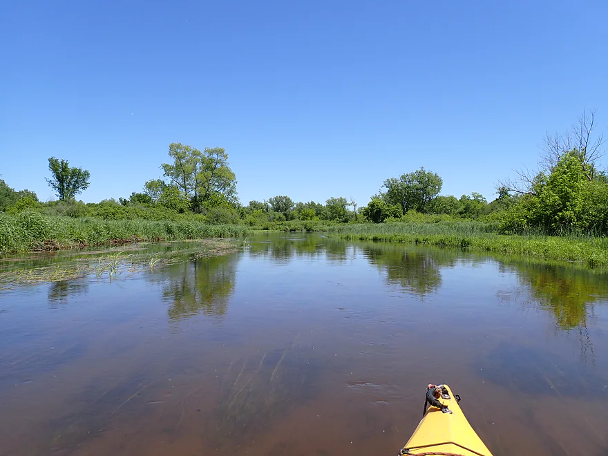
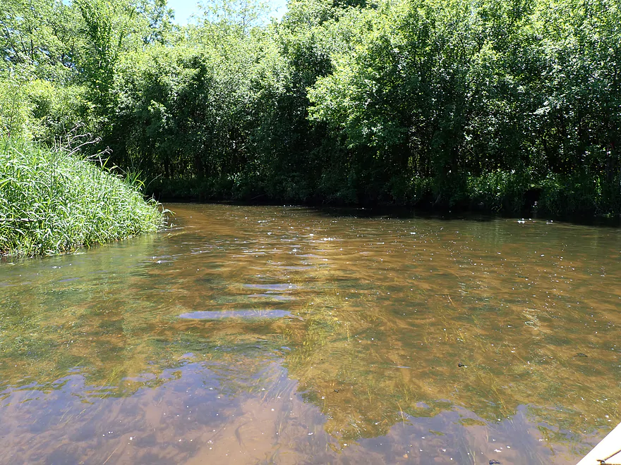
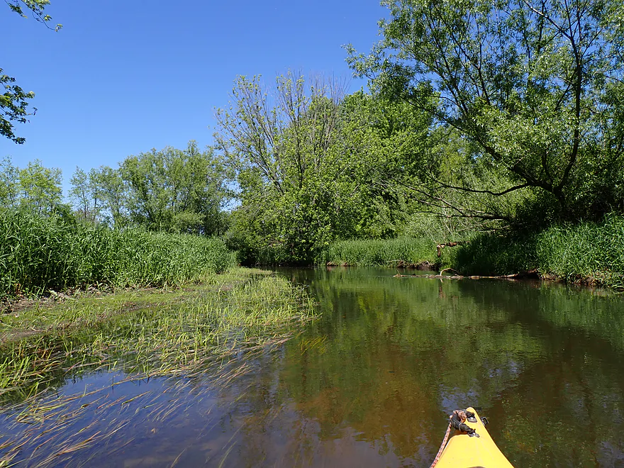
First part of the trip flowed through a marsh
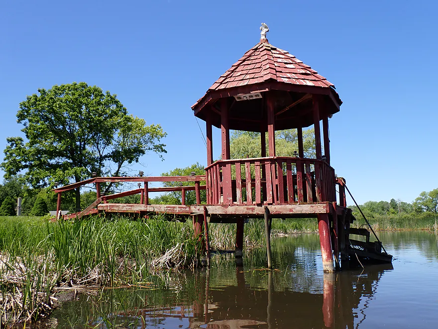
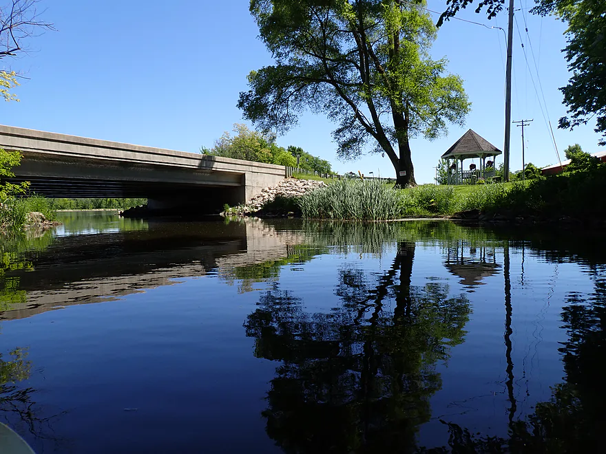
Nice gazebo
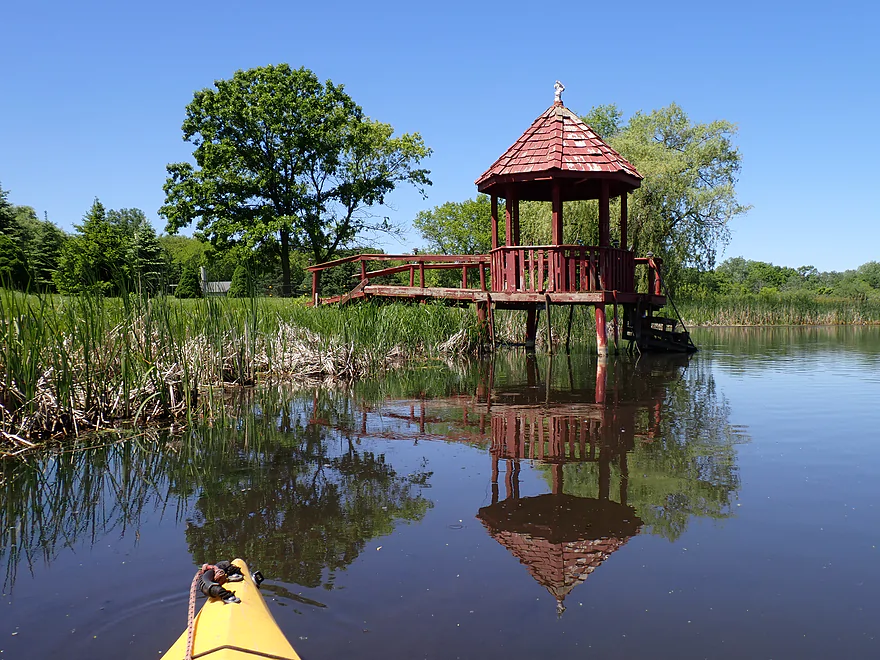
Waiting for the ripples to subside for a mirror photo
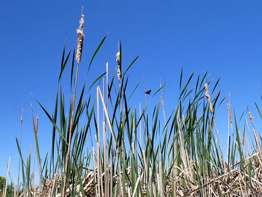
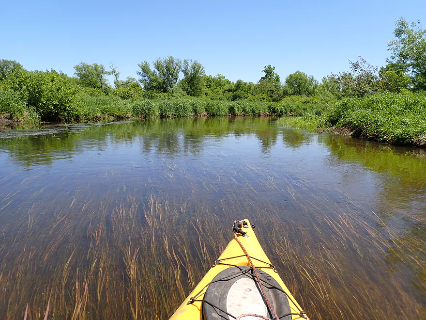
Cattail scenery was good
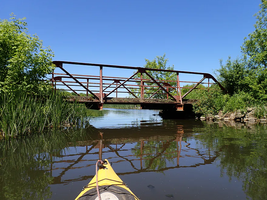
Old farm bridge
Hwy 20 isn’t a good bridge access…but better than Carver School Rd
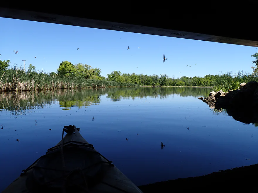
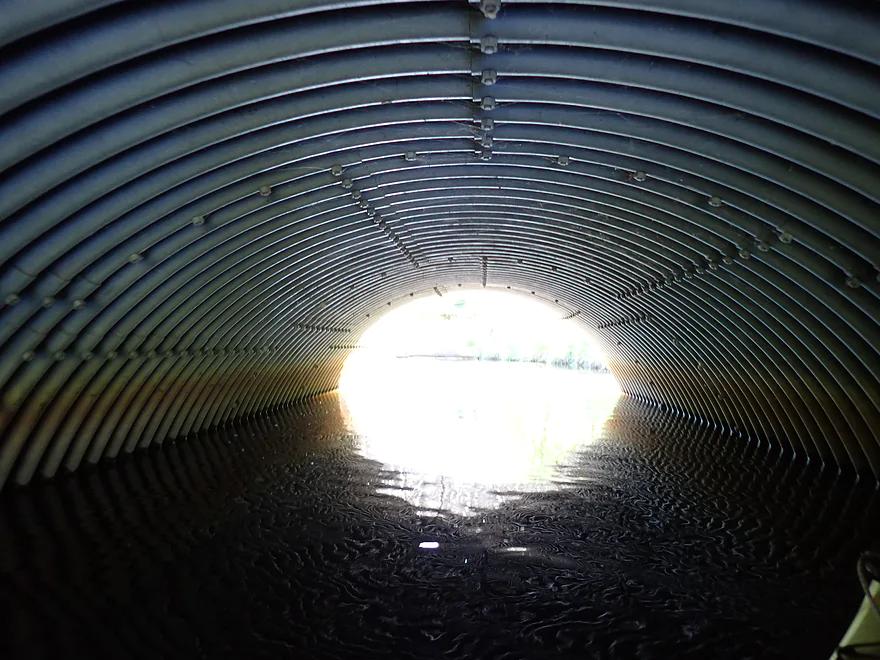
Spooking a swarm of swallows under the bridge
Entering the Hillburn millpond
Nice reflections
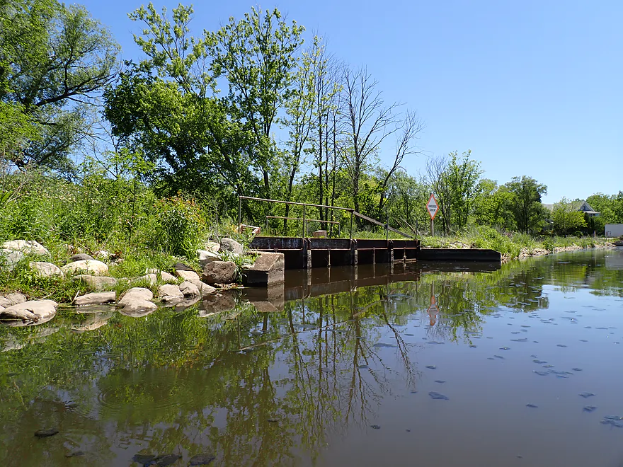
Small dam
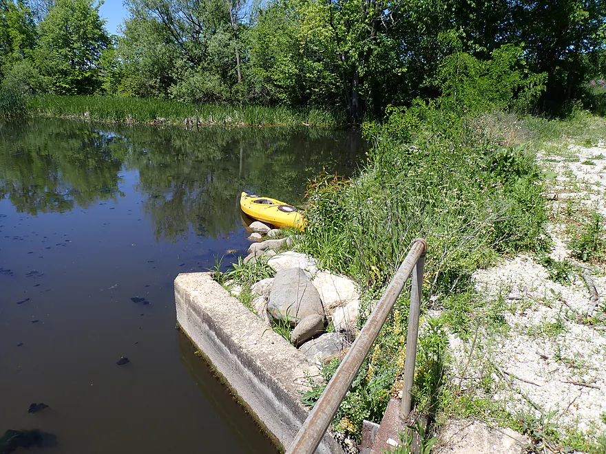
Portage was not difficult
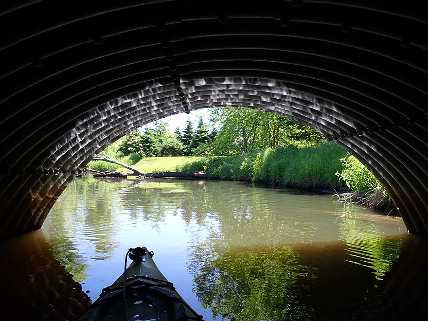
Reverse view
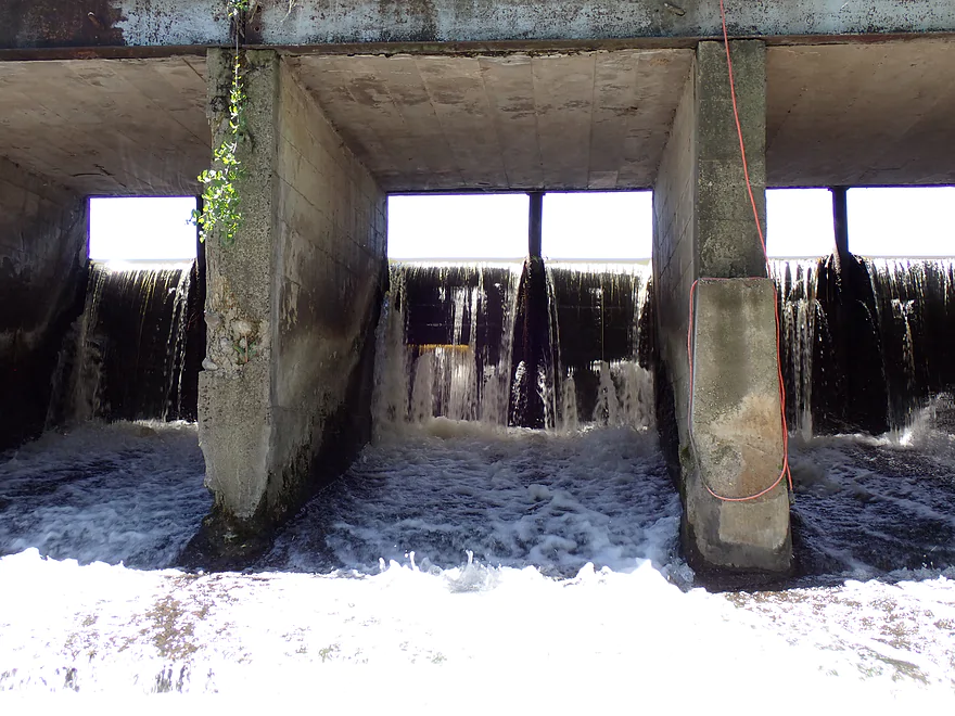
Not a good sign…one of the gates is leaking
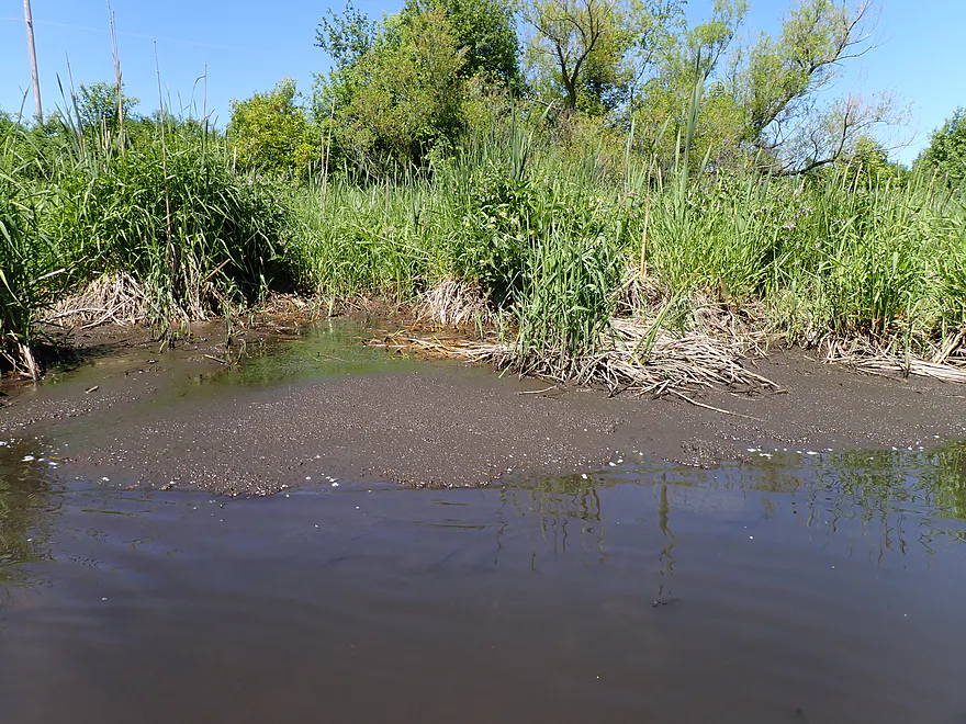
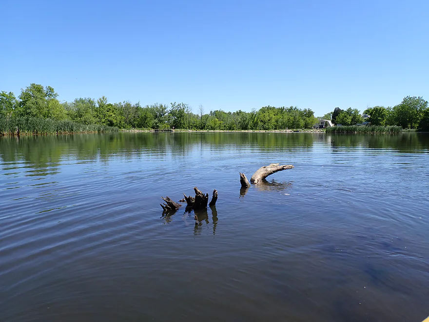
Only shallow spot in the entire trip
Neat experience doing paddles on windless days
Creek after the dam was a bit narrow
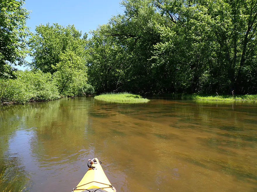
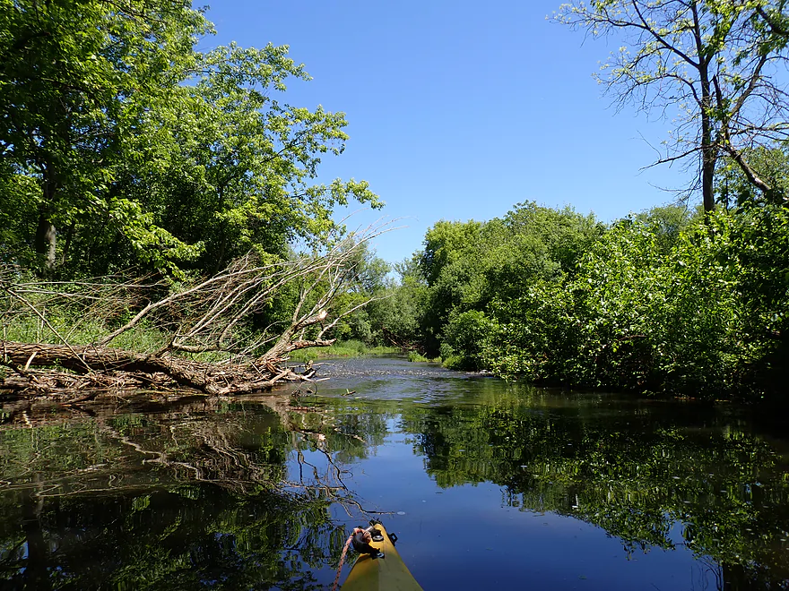
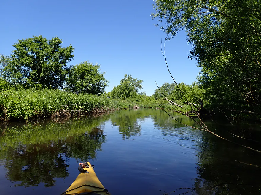
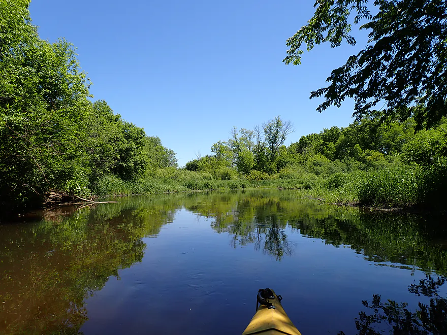
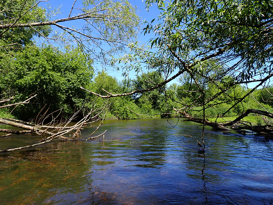
But then the creek starts to open up and meander naturally
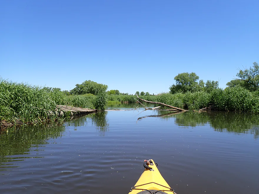
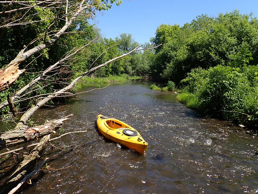
Only “logjam”…super easy to hop over
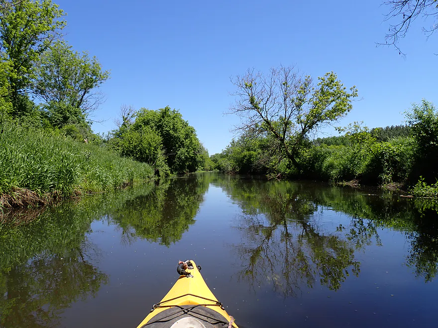
Nice mirror shot
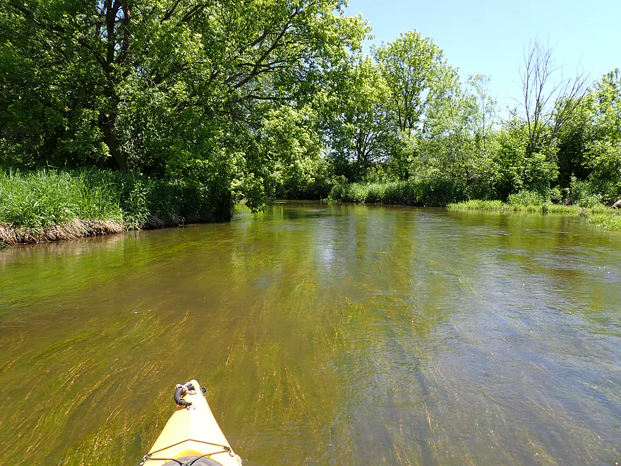
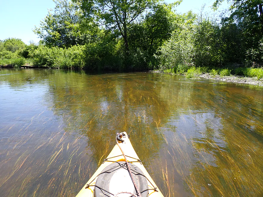
Very clean sandy substrate
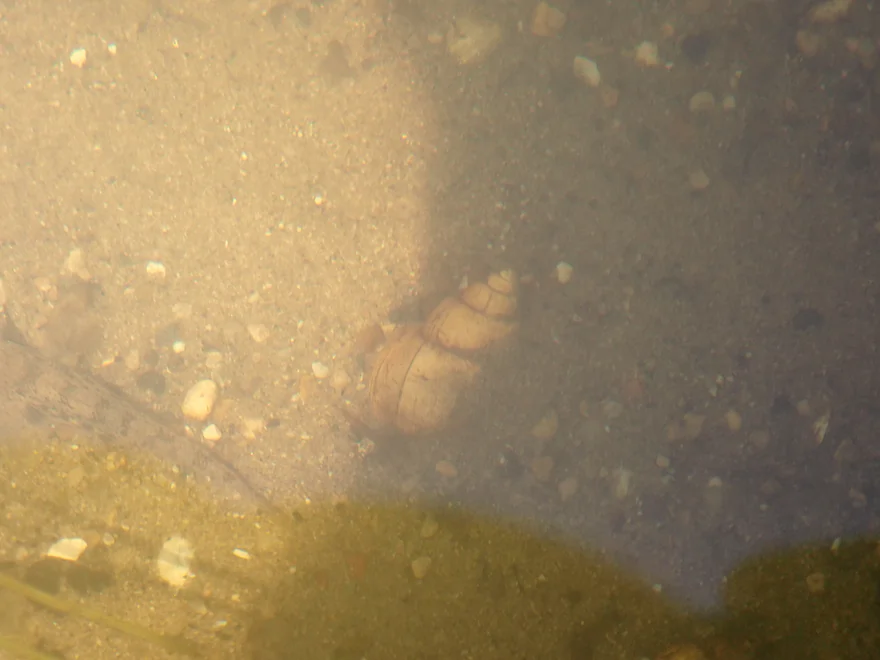
Saw a number of snails on the trip
Paddling over flowing pondweeds
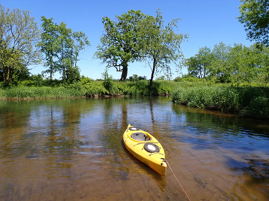
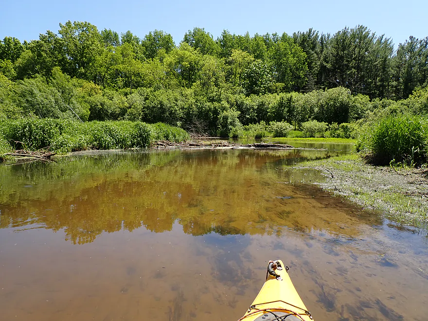
Nice vista
This reminded me of Turtle Creek
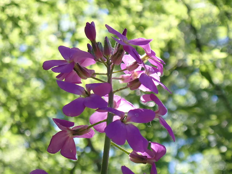
Dames rocket
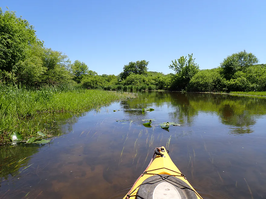
Some lilies and wild rice…this might be more scenic later in the year
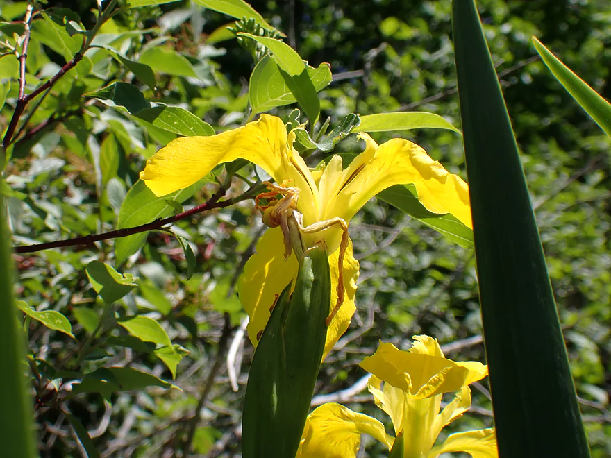
Yellow flag irises
More wild rice
Ending the trip at Bell School Road
Little weedy, but not a bad bridge access
Honey Creek – Carver School Road


Honey Creek is one of the more underrated water trails in Southeast Wisconsin. This past week we had a lot of storms and heavy downpours that left most rivers and creeks in Wisconsin with dangerously high water and/or with newfound logjams. But per my analysis, one of the few creeks to escape the carnage was Honey Creek so I decided to go for it.
I actually paddled Honey Creek in 2022, but that was from Bell School Road to Hwy 20 (nice trip). This section would be the immediately preceding/upstream leg starting at Carver School Road. Unfortunately unlike last year, this bridge put-in was pretty bad. The south side was posted and the north side had steep weedy banks with some quick mud where I wanted to launch. I made do, but in hindsight I would have preferred launching from Hwy 20, or perhaps even much further upstream in East Troy.
For the first half mile the creek flowed through an attractive cattail marsh with boisterous blackbirds. One beaked a muskrat in the head and a few buzzed by me at close range…must have been a nearby nest. The scenery was nice with a rustic farm bridge, a stone culvert by the put-in, and an attractive red gazebo on stilts.
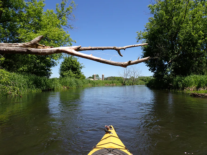
I passed under the Hwy 20 bridge where I startled a large flock of nesting swallows. This was followed by an old millpond (Hillburn Pond) which was remarkably silted in and shallow. Careful navigation was required not to get stuck on the mud.
There are actually two dams, and you can portage either. I chose the west dam as it was further from a house. Portaging dams is legal in Wisconsin, but it’s still nice to keep a low profile. As I re-entered the creek, I could see that one of the gates was leaking. I suspected pressure from the silt (which is heavier than water) is threatening the integrity of the dam and it may fail in the future.
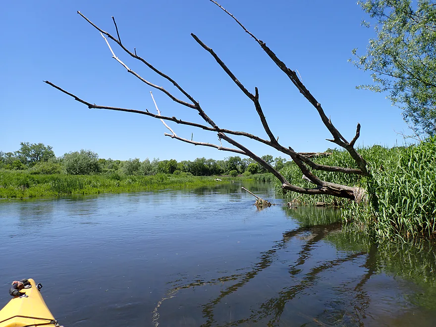
The next half mile flowed through a wooded and straight leg that was likely artificially channelized by farmers. This wasn’t that interesting, but it was great not to have to deal with any logjams (here or anywhere on this trip).
The rest of the trip was really nice and the creek started to meander naturally again. In what reminded me of Turtle Creek, the channel became shallower, clearer, and faster. The current moved in sheets over a sandy substrate with a bit of gravel. Many streams in “drumlin country” tend to be atypically clean and clear, and this is one of the reasons I like to do “Ice Age paddles”.
I ended the trip at Bell School Road where I bumped into another kayaking group that was just putting in. All in all I liked my trip…good water clarity, no logjams, and good wildlife. The only downside was the dam portage (not really difficult) and a horrible put-in (Hwy 20 isn’t great either but would have been better). For paddlers new to Honey Creek though, I actually think the next leg is more interesting and more scenic, and you should start with that.
Sights included deer, ducks, little minnows, a great blue heron, a lot of songbirds, and some clamshells (including a live one). The blackbirds were very active in the cattails and became defensive if you got close to their nests. In one case a blackbird “beaked” an innocent muskrat on the head who just swam a bit too close to the cattails. Blackbirds are famously territorial…here is a Capital Times article on a person attacked by one in Madison. The highlight of the trip were all the large turtles (10 by my count). A few were softshells, but most were snappers. I’ve never seen so many snappers on a paddling trip.
Skydive Milwaukee: For much of my trip, I could see/hear planes flying overhead. I didn’t realize what was going on until I saw a parachute floating down. Skydive Milwaukee (despite its namesake) is located in East Troy and their main jump area is almost immediately above this stretch of Honey Creek. If you’re willing to pony up $280, you can do a weekend tandem jump.
Carver School Road: This was a poor bridge access. The north side was too close to a home (and had a No Trespassing sign). The south side is doable, but has a brushy and muddy bank. Parking on the steep shoulders is not easy.
Alternate Put-ins:
- Church Street (3.3 miles upstream from my put-in): This should be a decent bridge put-in and this bonus leg would be scenic. But I suspect logjams would be an issue (figure ~8), and there might be a tricky fence to deal with by the I-43 tunnel.
- Hwy 20 (0.9 miles downstream from my put-in): The east side of the bridge is too close to a home and the southwest side has a fence. But the northwest side is viable as an access. You will still have to drag your boat past a long guardrail though. Hwy 20 is a busy road, so leaving your vehicle by Hillburn Road might be preferable.
Bell School Road: This is an ok bridge access used by kayakers. Just be careful which side you get out on, as some spots are muddy. Parking on the shoulder is a bit tight but is doable.
Alternate Take-outs:
- Hwy 20 (3.7 miles downstream from my take-out): This is a good bridge access with a little parking spot and trail along the northwest corner. This bonus leg is very good, and I suspect most paddlers would get out here.
Bike Shuttle – Bell School Road to Carver School Road: 3.3 miles with 30′ of ascent. This was a super easy bike shuttle.
Logjams/Fences: None.
Dams: There is one dam. It was an easy portage.
Rapids: There is a minor set of riffles below the dam (Class 1). Not much else besides that.
Current: The first half is pretty slow, but the second half of the trip had good current. Like nearby Turtle Creek, the current moved in sheets and at a decent clip, but never seemed dangerous.
Trip Gauge: Mukwonago River @ Mukwonago – 55 CFS or 2.55′. Note, Honey Creek doesn’t have its own gauge, so I’m using the Mukwonago gauge as a reference which likely is not representative. This leg is actually deeper than the next leg (which I did previously).
- 0-27 CFS: Probably too shallow.
- 28-35 CFS: Low end…some wading required.
- 36-45 CFS: Good clarity…should be a viable depth.
- 46-65 CFS: An average spring depth….good for paddling.
- 66-85 CFS: High depth…clarity won’t be as good.
- 86-120 CFS: A very high depth…maybe still viable for paddling.
- 121+ CFS: These might be flood conditions and a poor time to paddle the creek.
Detailed Overview
To see an overview map, click here.
- Townline Road to Church Street: 1.3 miles. Looks very open and nice. Flows through a former millpond by the community of East Troy. Streetview image of Townline Road is scenic.
- Church Street to Carver School Road: 3.3 miles. Much of this looks scenic...but. There are likely 8 major logjams and a fence by I-43 might be a major problem. Carver School Road is a poor access.
- Carver School Road to Bell School Road: 3.7 miles.
- Carver School Road to Hwy 20: 0.9 miles. Nice marshy stretch with a cool gazebo. Carver School Road is a bad access...Hwy 20 isn't great either but is better.
- Hwy 20 to Bell School Road: 2.8 miles. Starts with a millpond and an easy dam portage. After that it opens up with good clarity. Overall a nice leg.
- Bell School Road to Hwy 20: 3.6 miles.
- Bell School Road to Hill Valley Road: 2.1 miles. Nice rocky stretch with clear water. Starts shallow, but gets deeper by the railroad tracks.
- Hill Valley Road to Hwy 20: 1.6 miles. Another great stretch with more clarity. Nice wooded leg near the take-out.
- Hwy 20 to Hwy D: 3.0 miles. A good prospect, but maybe a logjam or two. Likely not as nice as the upstream legs.
- Hwy D to Old Hwy DD: 0.8 miles. Creek starts to widen, but should still be nice. Maybe one logjam.
- Old Hwy DD to Hwy DD/Honey Lake Public Beach: 2.3 miles. Maybe one to two logjams.
- Hwy DD to Spring Prairie Road: 2.5 miles. Starts with a narrow old millrace that looks interesting. Then opens up into a marsh area. Maybe one logjam.
- Spring Prairie Road to Echo Lake Boat Launch: 0.9 miles. Simple stretch slowed by a downstream dam.
- Downstream Options: Echo Lake marks the confluence of the White River, Honey Creek and the Illinois Fox River. There are additional take-out options on Echo Lake as well as downstream trips you can take on the Illinois Fox.
Trip Map
Overview Map
Video
Photos Size:
Great review as always, thanks for the content! I’ll put it on the list. It’s amazing you encountered a shallow spot considering the 5 inches of rain last month.
I was surprised too!