
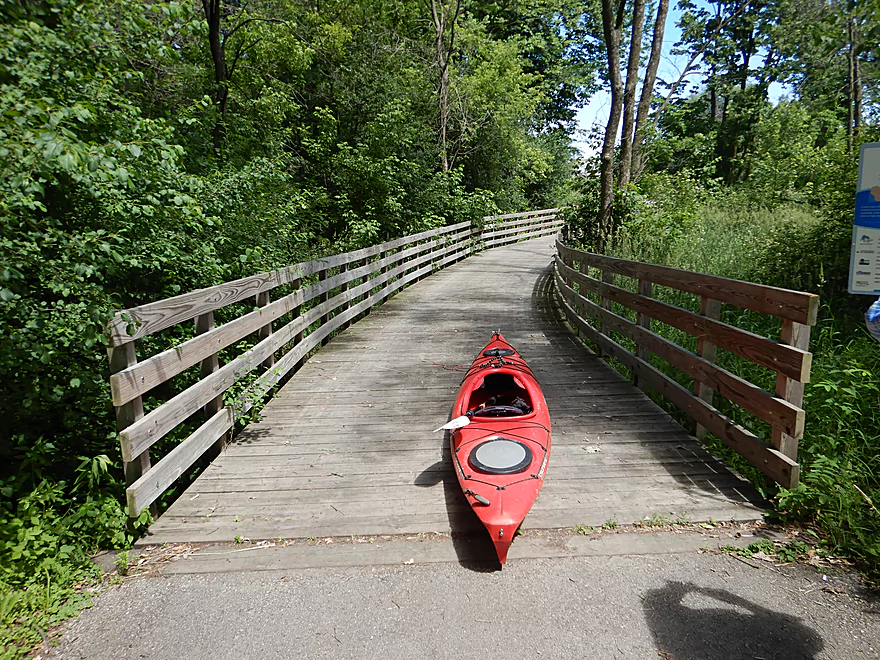
We had to drag our boats 600 feet to reach the water
Nice launch at Quaas Creek Park
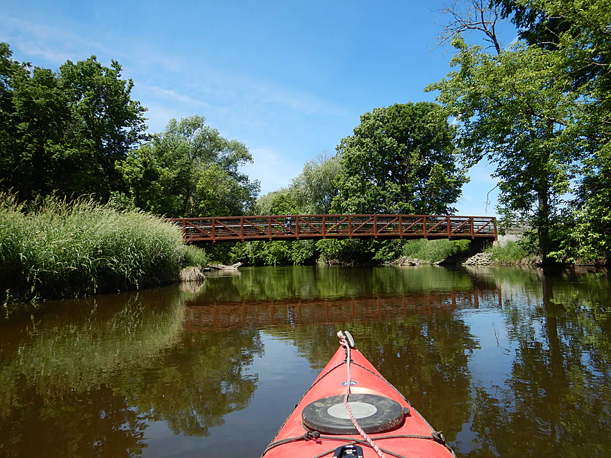
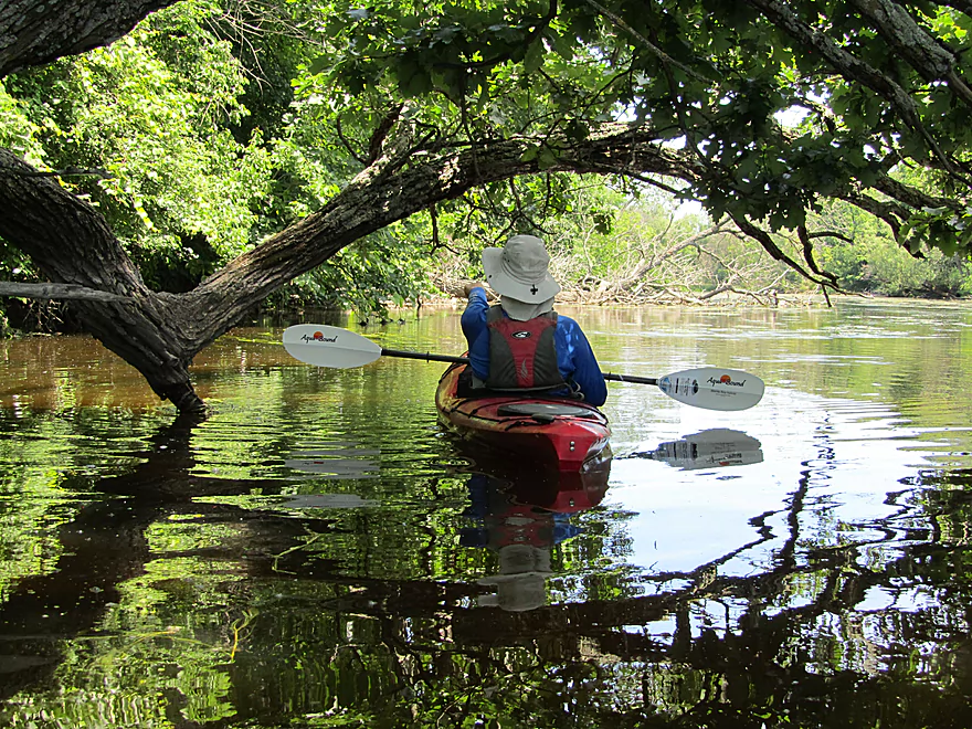
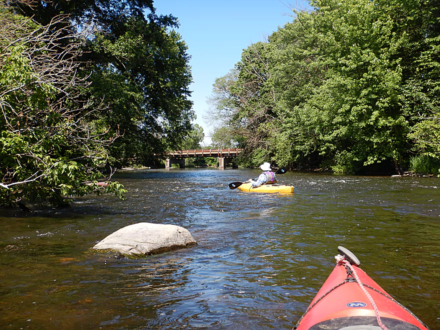
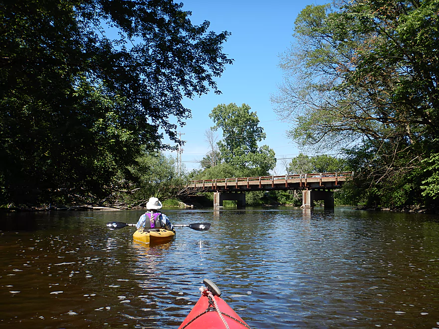
Attractive pedestrian bridge
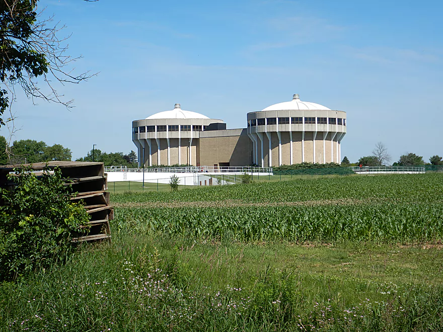
West Bend has an elaborate sanitation plant that uses special microorganisms
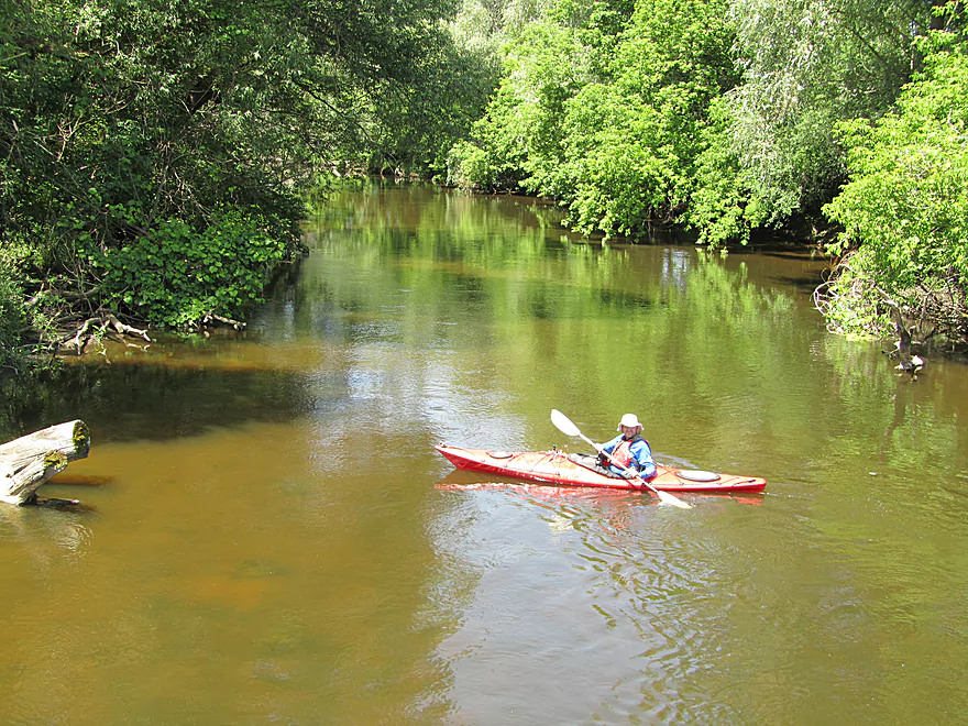
View upstream from bridge
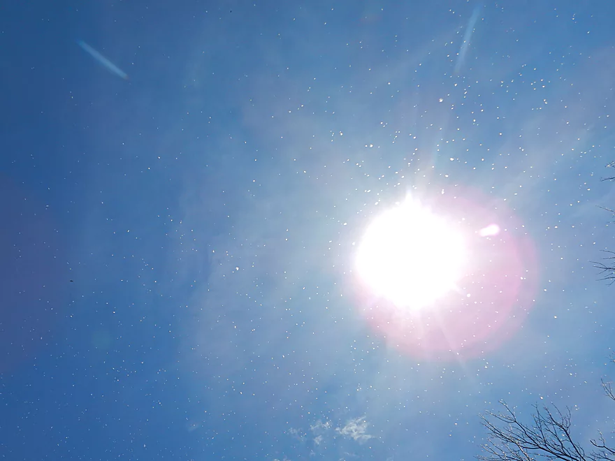
A June snow?
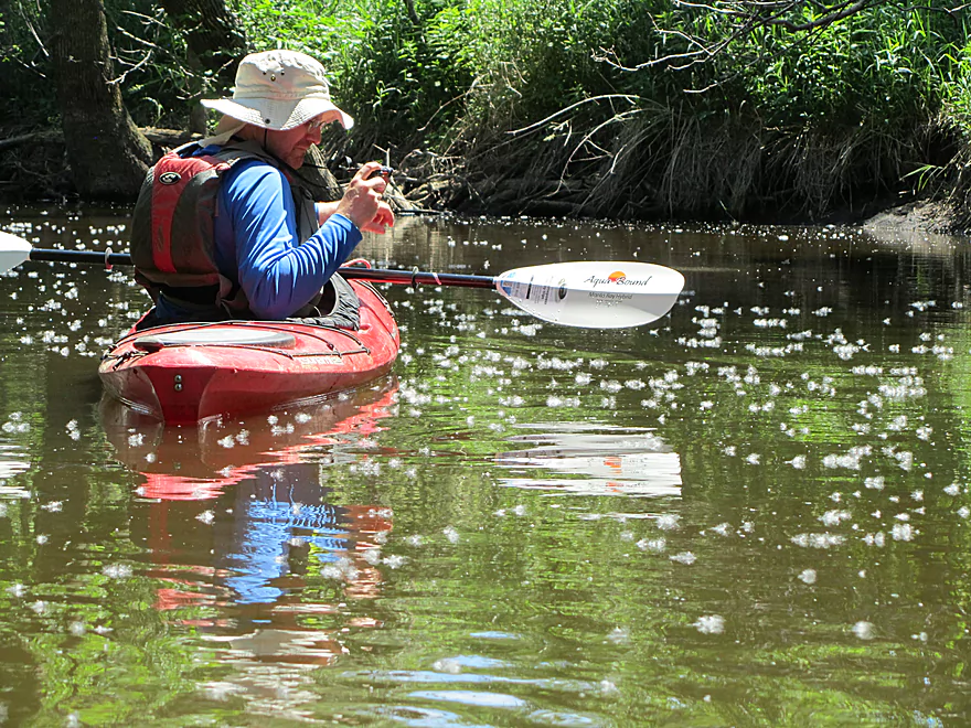
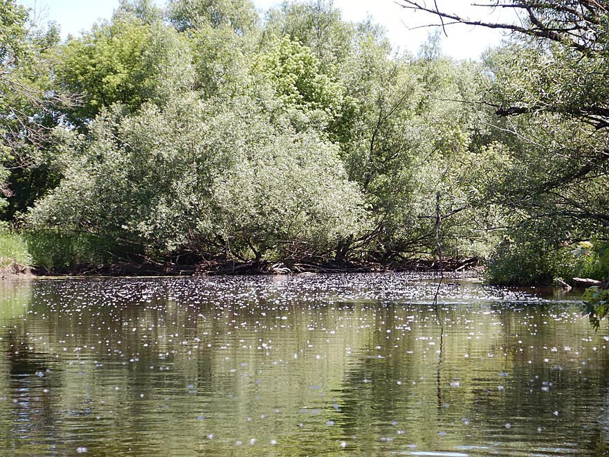
Nope…cottonwood seeds
Really cool
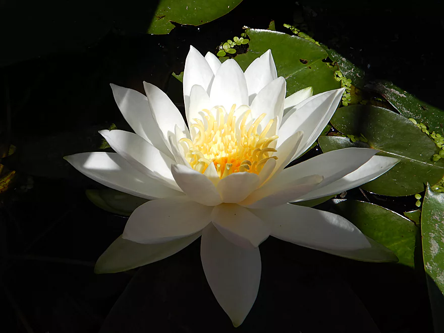
Waterlilies were in bloom
Countless more cottonwood seeds
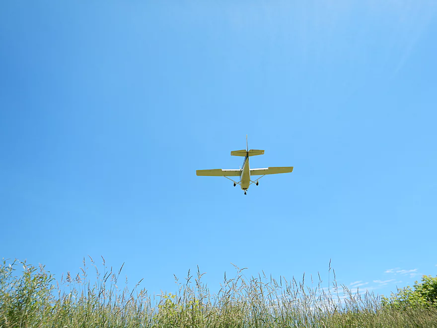
This plane landed right over our heads
Water clarity was good
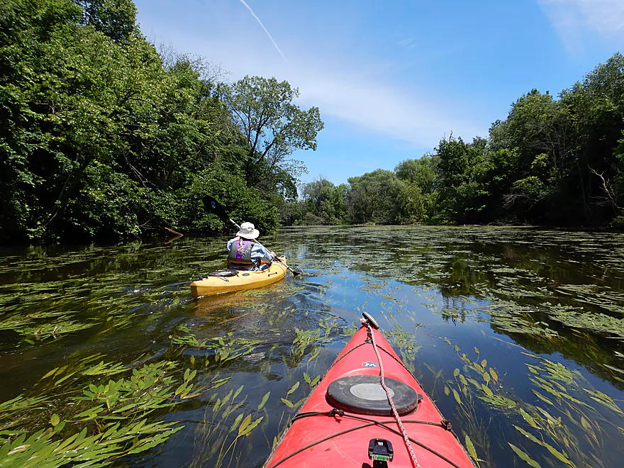
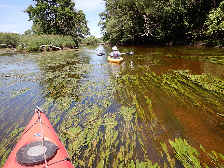
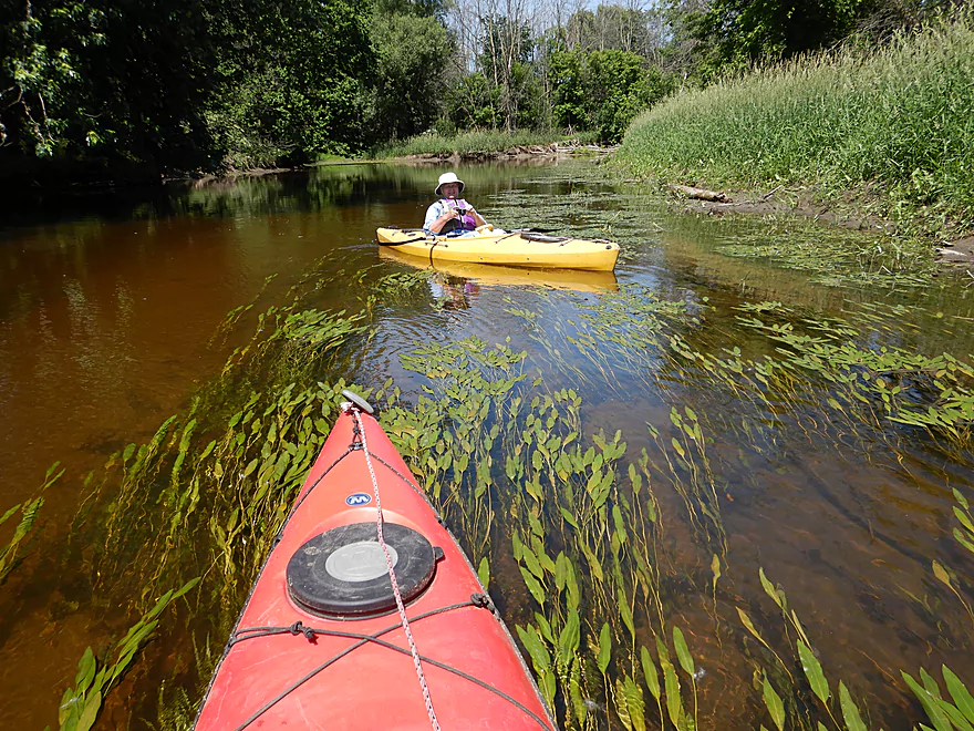
The flowing potamogeton was very scenic
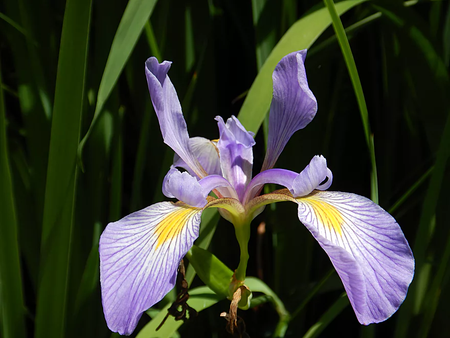
Blueflag was an occasional sight along the shore
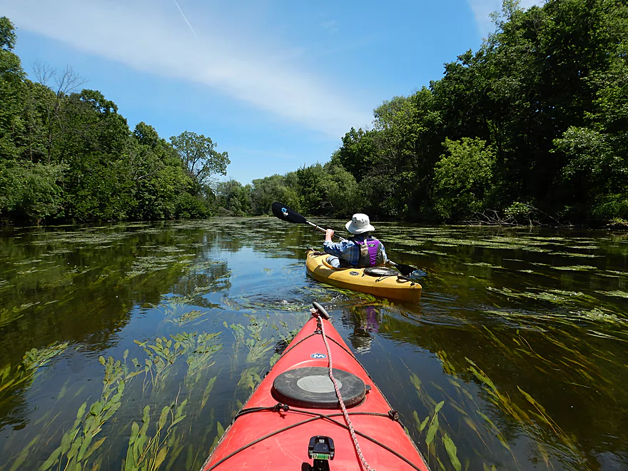
A sea of potamogeton
Really cool
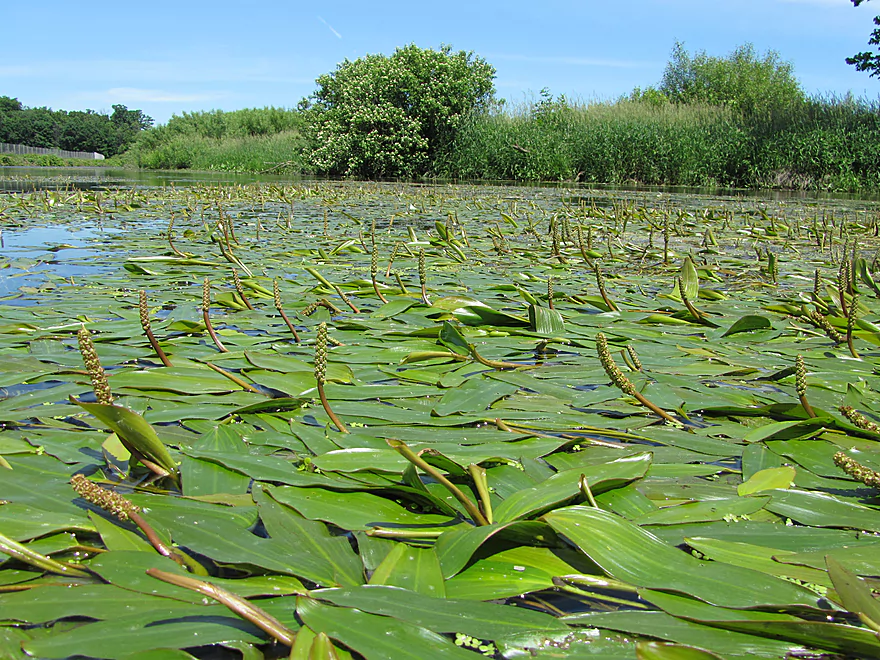
Potamogeton flowers
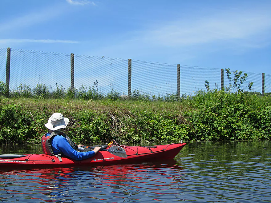
The local airport was massive
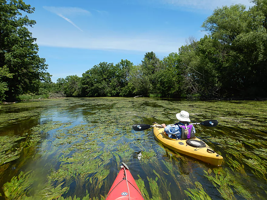
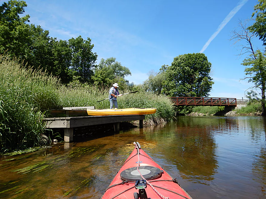
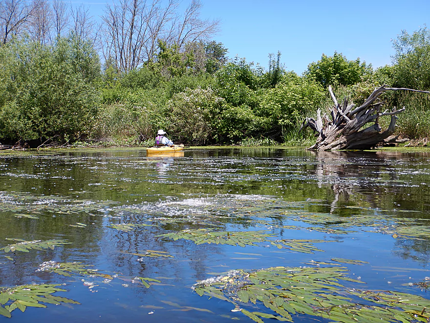
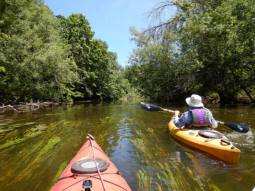
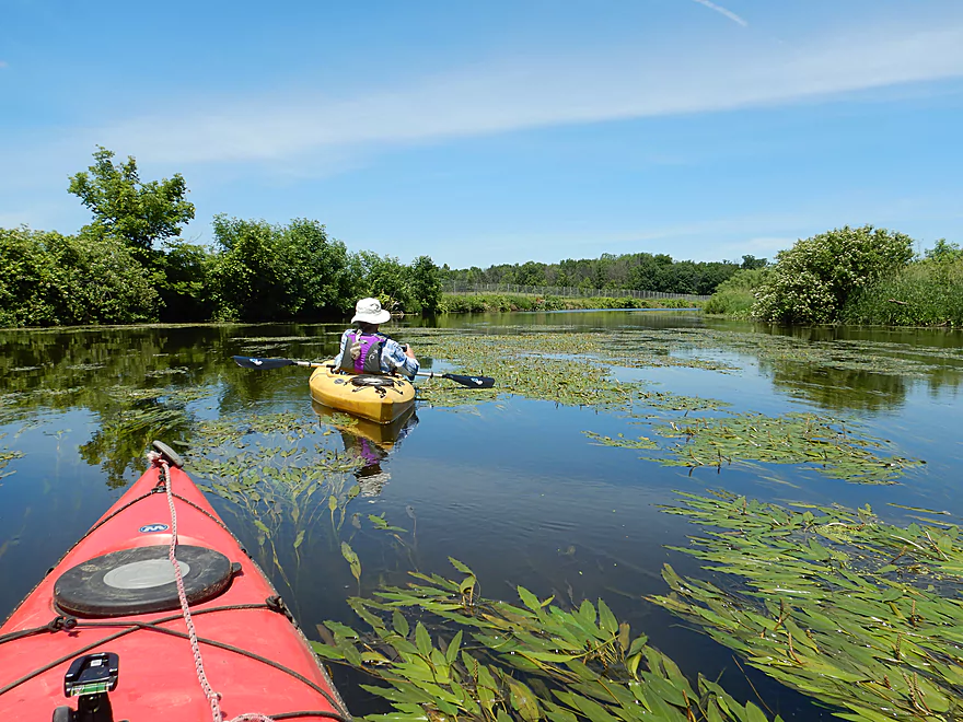
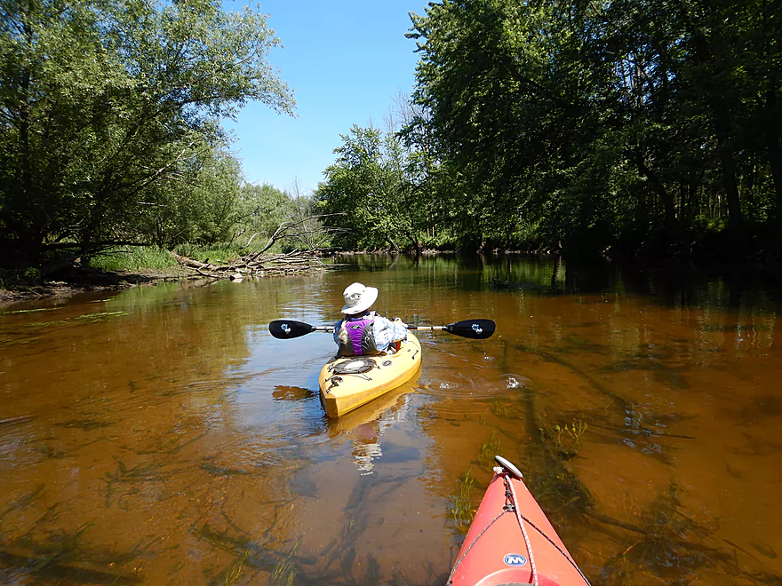
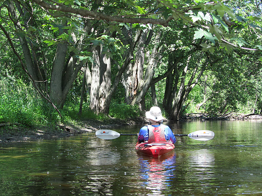
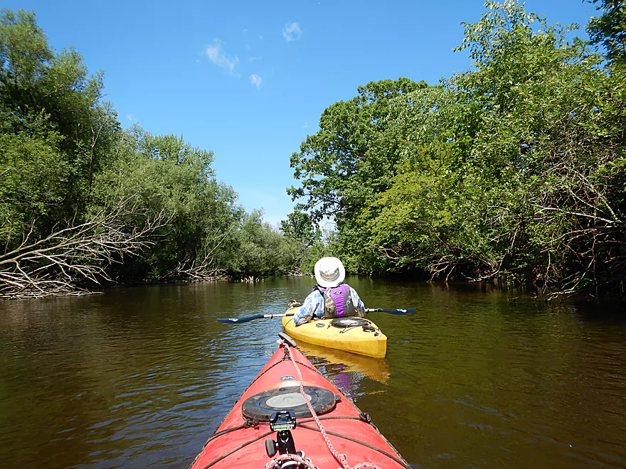
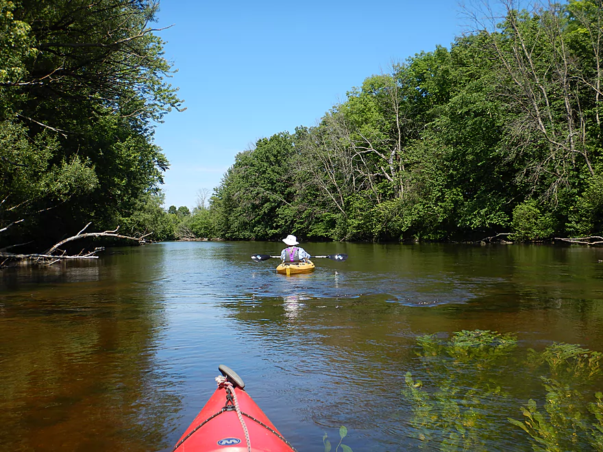
A nice way to experience the river
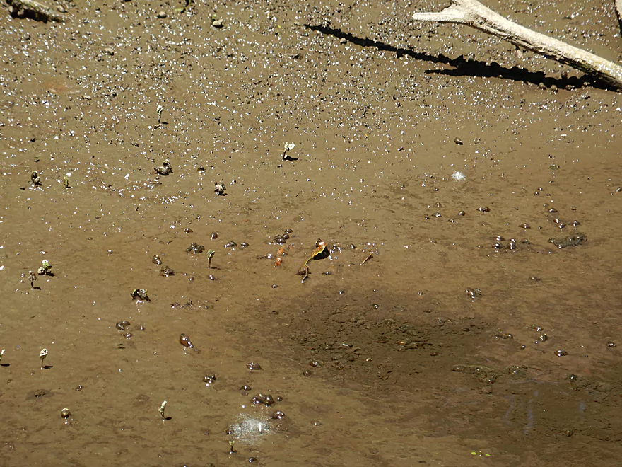
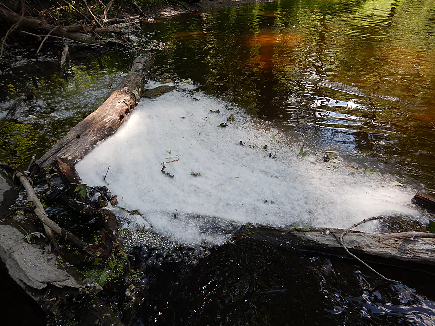
Interesting scene…super tiny snails and bubbling mud
More great clarity
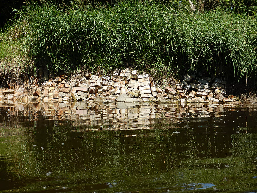
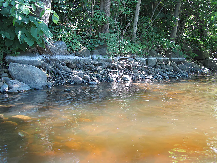
Appreciate the bank protection…but not sure about bricks in the river
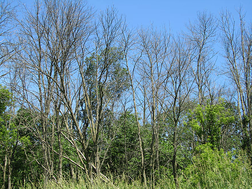
Emerald ash borer war zone
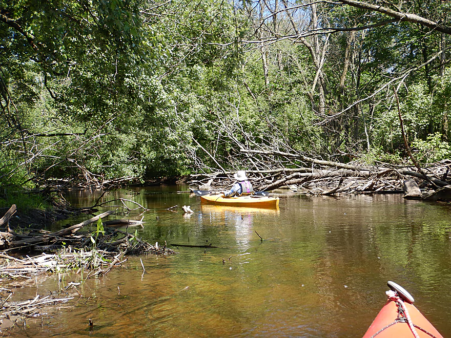
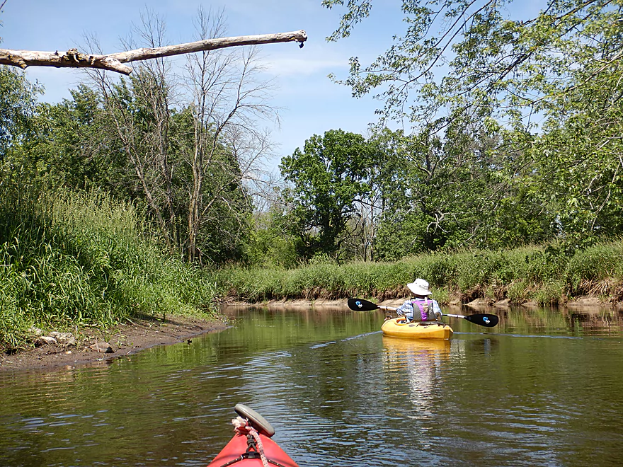
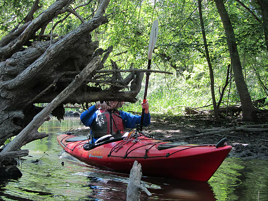
Coming up on a bit of deadfall
This one was really easy to get over
A row of very old silver maples
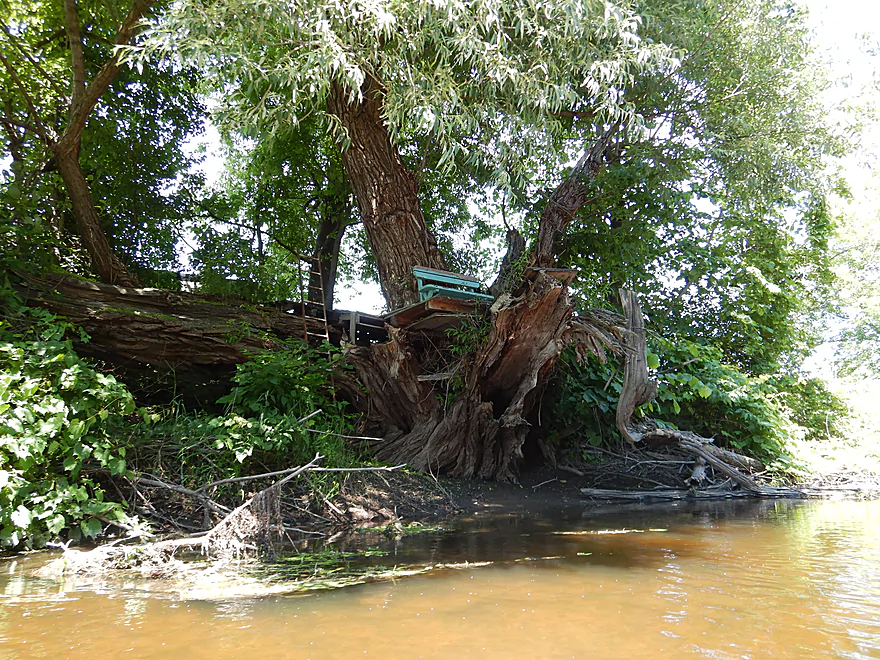
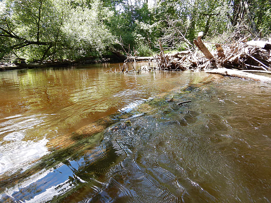
A cottonwood traffic jam…not what nature intended
This logjam was negotiable but a bit tricky because of the shallow mud
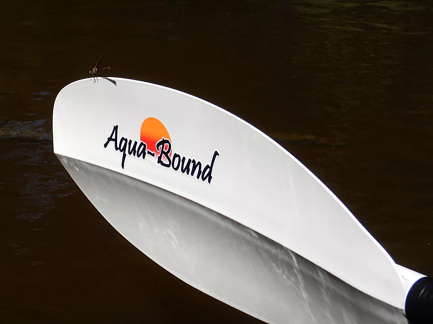
A dragonfly admiring my brand new paddle
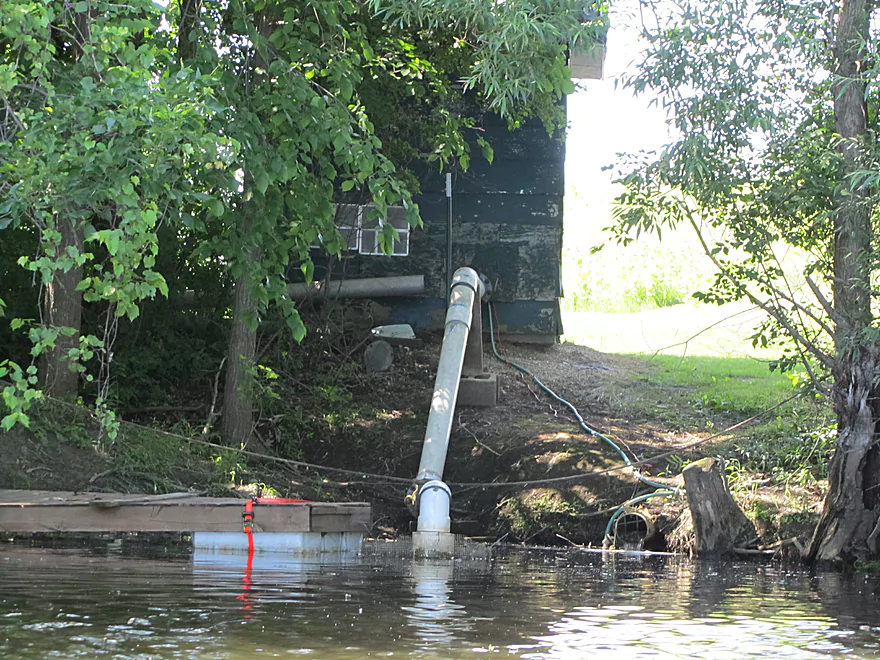
Local golf course slurping up the Milwaukee River
The river really widens out here near the end
And gets rockier
The only rapids on the trip
High water mark looks like a chalk line
Coming up on Hwy M
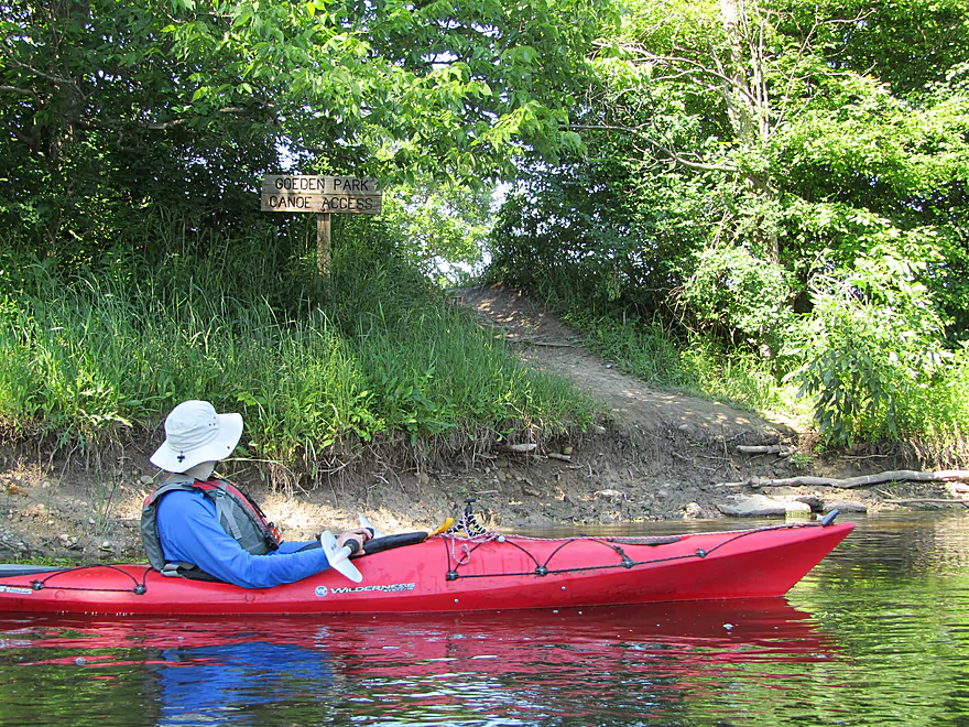
And Goeden Park
Which was a great canoe landing
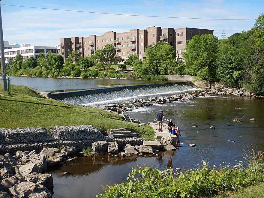
Scouting the Washington Street Dam…wished we had launched here
Milwaukee River: Quaas Creek to Goeden Park


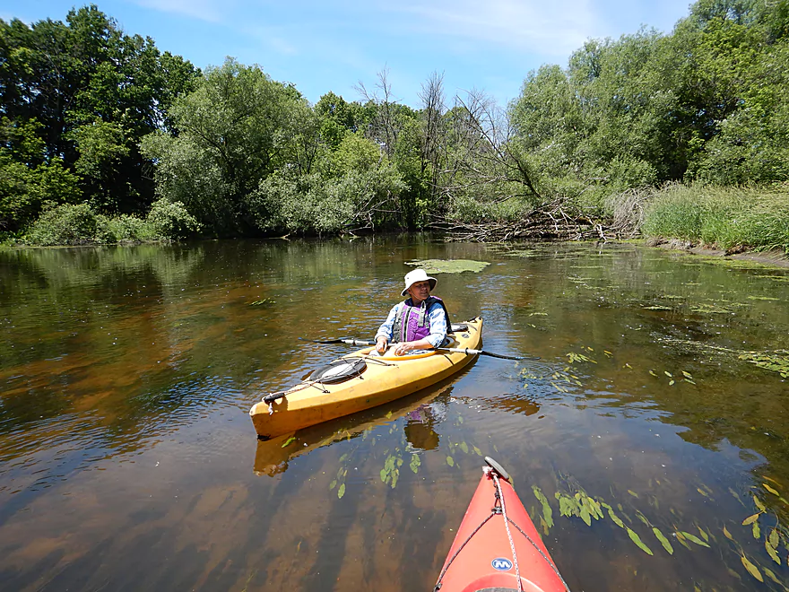
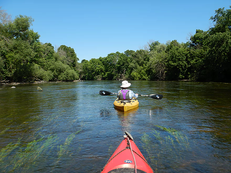
This trip started nice with a great put-in located on an attractive part of the river. We were soon greeted by what appeared to be a June snowstorm, but instead was a huge mass of cottonwood seeds. The sheer number was impressive and it was quite the sight to see so many little balls of cotton floating in the air and on the water.
Despite being close to West Bend this was a pretty undeveloped section with only a few homes and no visible agriculture. An exception was the West Bend airport which was surprisingly large. It (and its huge fence) would parallel the river for almost 3 miles. We saw countless planes including one that landed just 40′ above our heads. Often our boats vibrated from the sound, especially when one of the old WWII planes flew over.
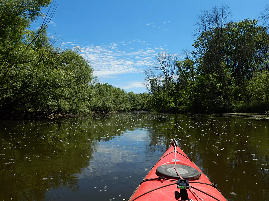
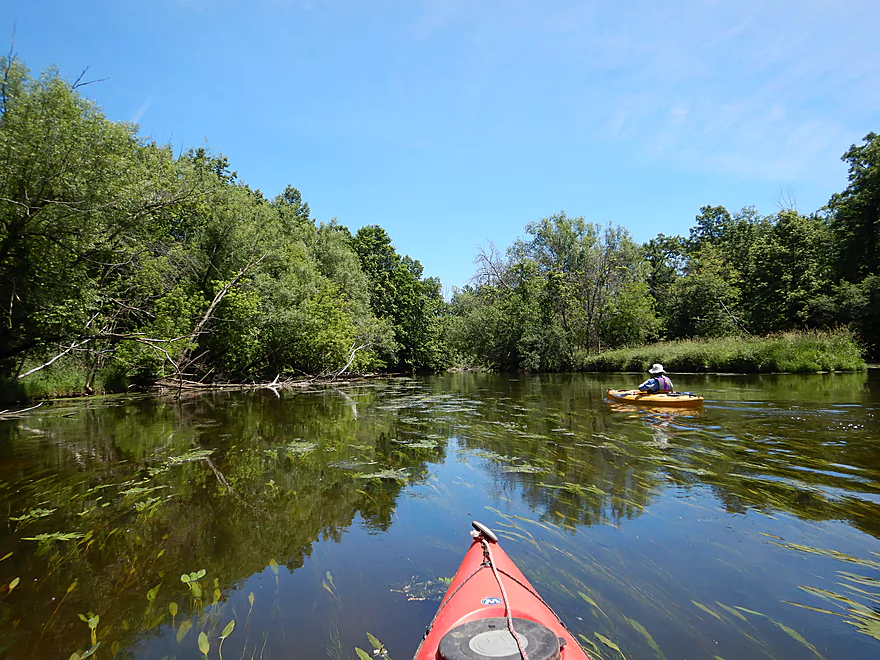
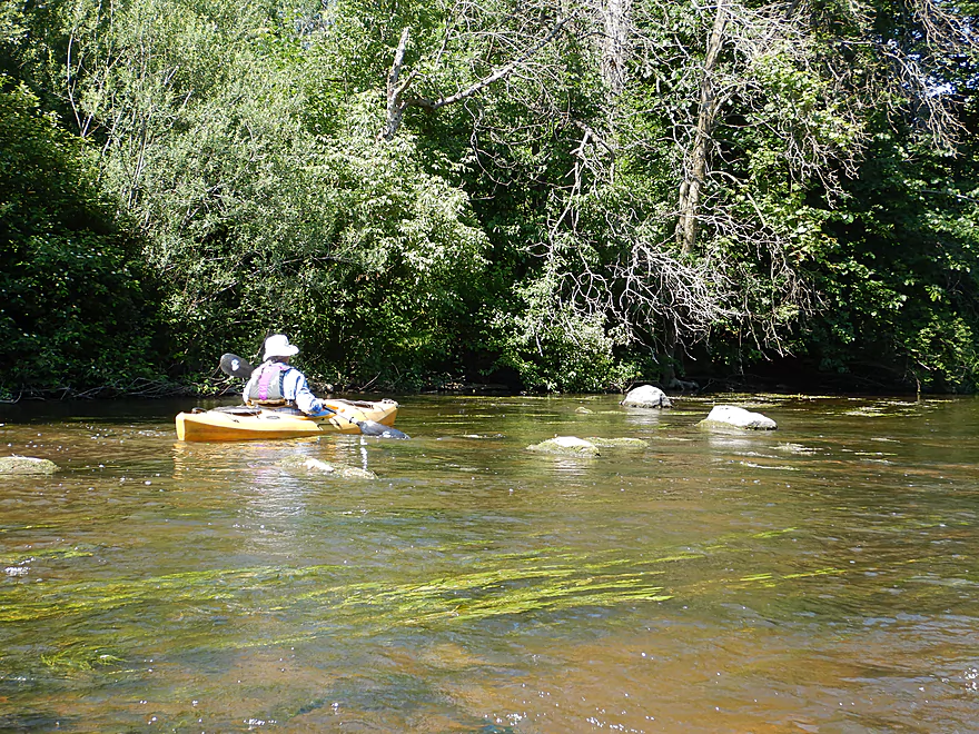
This part of the Milwaukee was very wide and flat. The water clarity was good and you could often see the bottom and its fish-tank-like substrate (mostly coarse sand) through even 3-4′ depths. The highlight (like the Newburg section) was the long flowing strands of potamogeton which gracefully flowed in unison with the current. Very scenic when you had the right lighting. The lack of mud and general cleanliness was another nice attribute of the river, but at times the scenery was a bit repetitive. This is a popular segment with locals and we did see four other paddlers.
The last half-mile by the take-out was another highlight. Here the channel becomes surprisingly rocky and even featured a small boulder garden. After flowing over some light rapids (the only ones on the trip) we came to the take-out by the Hwy M bridge which was a great launch site.
In summary this was perhaps not an elite paddle, but it still was still a good trip and I would recommend it for locals. Afterwords we scouted the adjacent upstream segment (West Bend) and that looked even better with fast current, many light rapids and a rocky substrate. Future trip!
Quaas Creek Park was a decent put-in option. The only downside was we had to drag our boats 600′ to reach the water, but it was over an attractive boardwalk. There was a nice launching pier on the river itself.
An alternate upstream put-in would be South River Road where there is a somewhat hidden park and launch next to the bridge. That would add a nice 1.8 mile stretch.
Another alternate upstream put-in would be the dam northwest of the Washington Street bridge. Public parking is available west of the river and it would be easy to launch below the dam. This would add 1.8 + 2.2 miles and be a great prospect with fast current and a lot of rocks.
Webmaster’s Update: There are as of September 2024 several downed trees that have to be portaged on this leg.
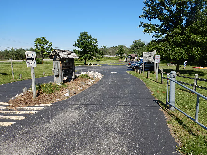
The take-out was at Goeden County Park just northeast of Hwy M. This was a great little canoe launch and park which featured free parking, outhouses, and a shallow landing.
An alternate downstream take-out would be Newburg, just east of the Main Street bridge, where there is public access. That would add 3.3 miles to the trip and be an open segment with a few light rapids at the end.
“Zodiac Kayak Adventures” offers rentals and shuttles for the entire leg from West Bend to Newburg. They can be contacted at (262) 353-3780.
The bike shuttle wouldn’t be bad at 3.9 miles with no appreciable hills. A small part of the route would be over the Quaas Creek Trail which would be scenic.
The current by the put-in and take-out was decent, but deceptive, as the rest of the trip was a bit on the slow side.
Generally speaking this was a safe trip with no real hazards. Very suitable for larger kayaks and canoes.
There was a downed tree close to the end of the trip, but that was easy to get over (could be a different story in shallow water). This was followed by another downed tree that we narrowly squeaked passed, but that would be a super easy portage because of the adjacent mudbar.
Webmaster’s Update: There are as of September 2024 several downed trees that have to be portaged on this leg.
The nearest gauge is a decent ways downstream at Cedarburg but should still be somewhat helpful. We did the trip at 278 CFS and outside of a few shallow areas the river was usually 2-4′ deep. Note this is UNLIKE the West Bend section just upstream which is very shallow and requires much more water than the below figures indicate.
- 0-100 CFS: Exceptionally low. Some sections may require walking.
- 101-200 CFS: Likely a good depth with fantastic clarity. There might be a few shallow spots.
- 201-300 CFS: An average spring depth, but a high summer depth. Ok clarity and good padding for the shallow parts.
- 301-400 CFS: You start to lose some clarity at this depth.
- 401-600 CFS: Likely little to no clarity and not as interesting, but should be plenty navigable.
- 601+ CFS: A very high depth. This could be navigable, but I don’t know.
Sights included a great blue heron, a few clams and many dragonflies. At one location super tiny snails were crawling over bubbling mud which I thought was cool. The most dramatic visual on the trip though was all the dead ash trees. This was the heart of the emerald ash borer plague and it has left a lot of dead ash trees in its wake.
Detailed Overview
Additional access options are visible on the overview map. Special thanks to Milwaukeeriverkeeper.org which has some detailed information on the river, including this great map.
- Upstream from Happy Road: Not viable for kayaking.
- Happy Road to Meadow Road: (0.7 miles) Small but mostly open stretch partly straightened by farmers. Likely ok.
- Meadow Road to Cty W: (1.5 miles) Very open stretch that flows past wetgrass marshes and farms. Likely an ok prospect with no logjams.
- CTY W to CampbellSport: (4.5 miles)
- Hwy W to Campbellsport Wayside: (4.1 miles) Starts as a narrow wet grass marsh and widens into a slower cattail marsh. Marsh recedes when sandwiched between two drumlins and becomes rockier and faster with some rapids. Overall a varied and scenic paddle. As of 2025 one logjam will have to be portaged.
- Campbellsport Wayside to Columbus PARC: (0.4 miles) A pleasant and scenic leg flowing past the outskirts of Campbellsport and a local town park.
- Campbellsport/Columbus PARC to Cty Y: (2.8 miles) Maybe 2-3 logjams. Otherwise this is a scenic stretch.
- Cty Y to Hwy 45: (1.7 miles) Maybe 3-5 logjams.
- Hwy 45 to Auburn Ashford Drive: (1.3 miles) Maybe 1-3 logjams...some riffles.
- Auburn Ashford Drive to Old Bridge Road: (0.7 miles) Maybe 1-3 logjams.
- Old Bridge Road to West/Main Branch Confluence: (2.0 miles) Maybe two logjams. For those launching above Kewaskum, I think they will start on the West Branch instead.
- Alternate - Hwy 45 to West/Main Branch Confluence: (0.7 miles) Probably one logjam...but more viable than starting from Old Bridge Road.
- West Branch/Main Branch Confluence: (2.8 miles) A mediocre prospect. Maybe one logjam..I don't know much more.
- Kewaskum Dam/Park to Cty H: (2.9 miles) Solid prospect.
- Cty H to First West Bend Dam: (6.3 miles) A solid prospect with some flowage paddling at the end. The take-out entails dragging your boat across a private parking lot.
- First West Bend Dam (Barton Ave) to the Second West Bend Dam: (1.3 miles) Mostly an urban flowage paddle. The first dam is a difficult portage or put-in.
- 2nd West Bend Dam to Quaas Creek Park: (3.8 miles)
- 2nd West Bend Dam (Washington Street) to South River Road: (2.1 miles) Terrific section with a restored prairie, fast current, light rapids, and good urban scenery.
- South River Road to Quaas Creek Park: (1.7 miles) A paddle through urban woods...pleasant but not top-notch.South River Road to Cty M: (6.3 miles) A pleasant stretch with little development and clear water.
- Cty M to Main Street Bridge (Newburg): (3.4 miles) Good prospect with small boulder gardens in shallow water.
- Main Street Bridge (Newburg) to Cty A Bridge: (6.3 miles) A popular paddle with great water clarity.
- CTY A to Waubedonia Park (Waubeka): (5.7 miles) A decent leg with good current, some rocky stretches, and nice color in the fall. North Branch joins up and significantly enlarges the river.
- Waubedonia Park to Ehlers Park/Mink Ranch Road: (5.3 miles) A good stretch with a number of light rapids.
- Ehlers Park to Peninsula Park: (2.5 miles) A suburban stretch with maybe one set of rapids.
- Peninsula Park to Grafton Canoe Launch (south Saukville on Cty O): (1.9 miles) Kind of a suburban paddle.
- Grafton Canoe Launch to Veterans Memorial Park (Grafton): (4.1 miles) Some suburban and flowage paddling, although I think there are minor rapids in the upper stretch.
- Grafton Dam (SW of Bridge Street) to Lime Kiln Park: (1.3 miles) A terrific section with class 2-3 whitewater and scenic dells.
- Lime Kiln Park to Hwy T: (1.6 miles) A good section with the scenic 'Grafton Dells' and some Class 1 whitewater. I'm not sure Cty T is a good take-out.
- Cty T to Pioneer Road: (1.9 miles) A solid prospect.
- Pioneer Road to Thiensville Park: (6.9 miles) A solid d prospect but with some flowage paddling at the end.
- Thiensville Park to Badger Meter River Park: (4.8 miles) This is a less popular stretch of the Milwaukee. While not bad, it had somewhat repetitive scenery and lacked unique features.
- Badger Meter River Park to Kletzsch Park: (5.3 miles) This is a solid prospect.
- Kletzsch Park to Estabrook Park: (4.1 miles) Some flowage paddling and a nasty low-head dam to portage. A second dam has been, I believe, recently removed so this section might be very different now.
- Estabrook Park to Riverside Park: (3.1 miles) A number of decent rapids in this wooded but urban paddle.
- Riverside Park to McKinley Marina: (6.3 miles) A great trip on the last section of the Milwaukee.
- Riverside Park to Bruce Street Boat Ramp: (3.9 miles) A scenic paddle through downtown Milwaukee featuring some skyscrapers and great architecture.
- Bruce Street Boat Ramp to McKinley Marina: (2.5 miles) A bonus add-on section along Lake Michigan that features scenic vistas of the downtown.
Trip Map
Overview Map
Video
Photos Size:
Thank you for your write ups, they have been very helpful planning my trips.
I just wanted to add a note about the River Rd drop. I have done the drop in on the MKE river at River Rd in West Bend twice now in the last few weeks. Will say that the route from River Rd to Quass Creek Park is excellent. Navigable, nice looking, clear, etc. Very naturesque with little feel you are in the city. My first trip I continued to Goeden Park. I was less happy with the run from Quass to Goeden than I was from River to Quass. The whole area around the airport was bogged down with heavy Potamogeton which made paddling difficult. Beyond that, the first deadfall was exposed and required a hurdle and drag in 4′ water (thankfully I’m tall). The second was not a problem, just a bit of a pain. The end before the bridge required mostly dragging the boat due to low water.
Looking forward to trying some of the other spots soon.
I do appreciate the comments. While I liked our trip from Quaas to Goeden, I do think the upstream parts by West Bend would have been more interesting which seems to be backed by your observations. The Milwaukee has been low though…was the section by River Road on the shallow side?
It’s too bad to hear about your issues with the Potamogeton and downed trees. Perhaps this is a product of the the lower water levels and it being later in the summer.
I just want to say thank you for this incredible resource that you have compiled! We just bought our first canoe to get our five year old out on the rivers and I am overwhelmingly grateful to have stumbled upon your site!
Thanks for the thanks!
Thank you for reporting on your outing. Very helpful information. Looks like it was a find day!
Update as of September 2024…there are several logjams in this section that require portaging.
Update as of Sept 2025…there are still two logjams upstream from Goeden County Park.