
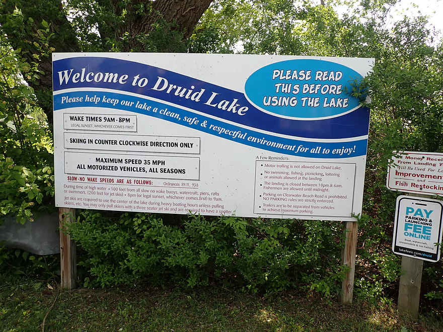
Welcome to Druid Lake
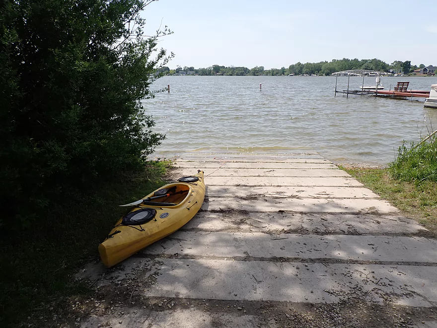
Small but ok boat ramp
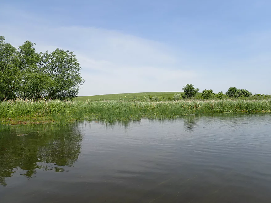
Druid Lake isn’t super interesting
It has a very developed shoreline
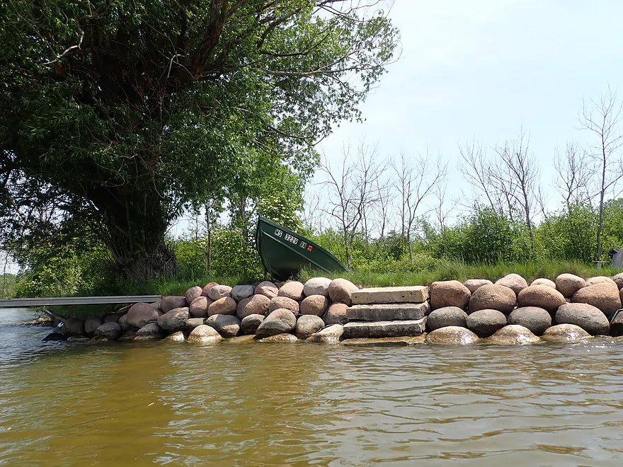
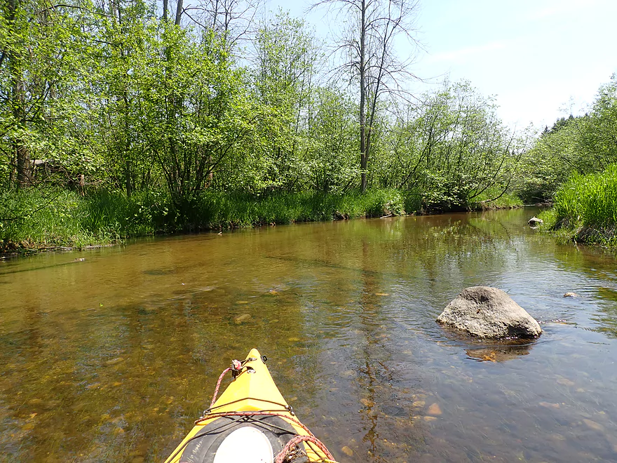
An interesting bank made of glacial boulders
Not something you typically see on a lake
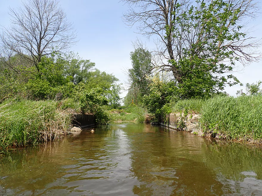
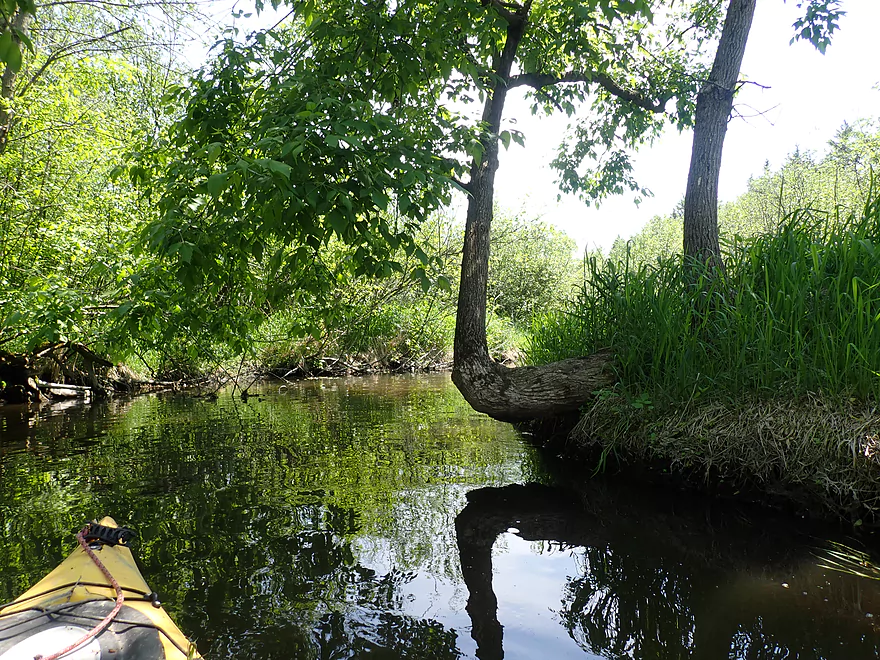
The lake, a natural kettle lake, transitions to a river
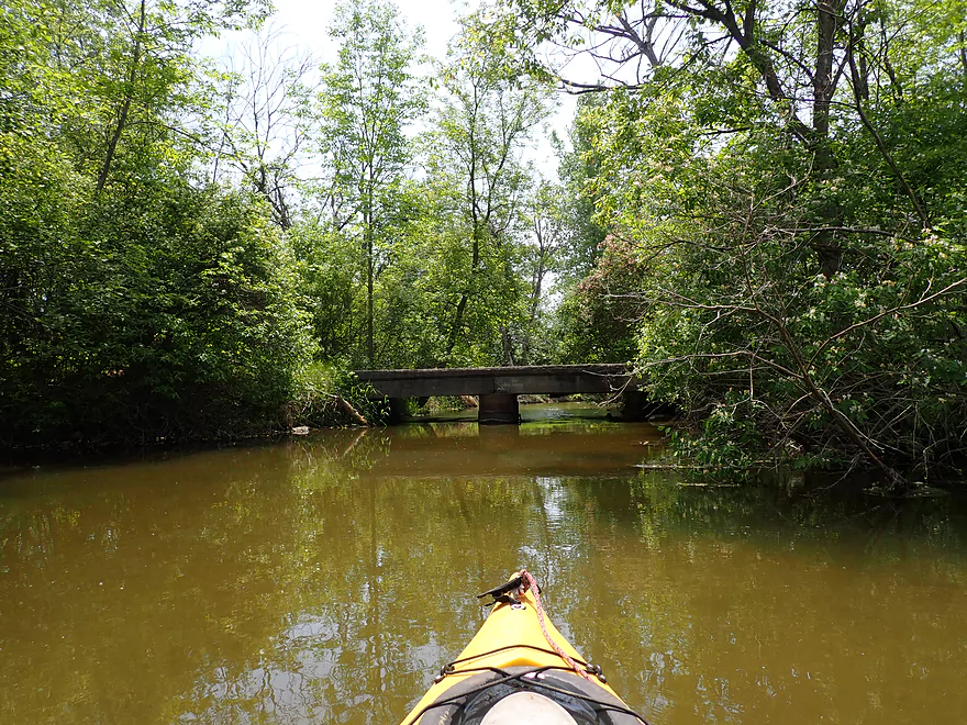
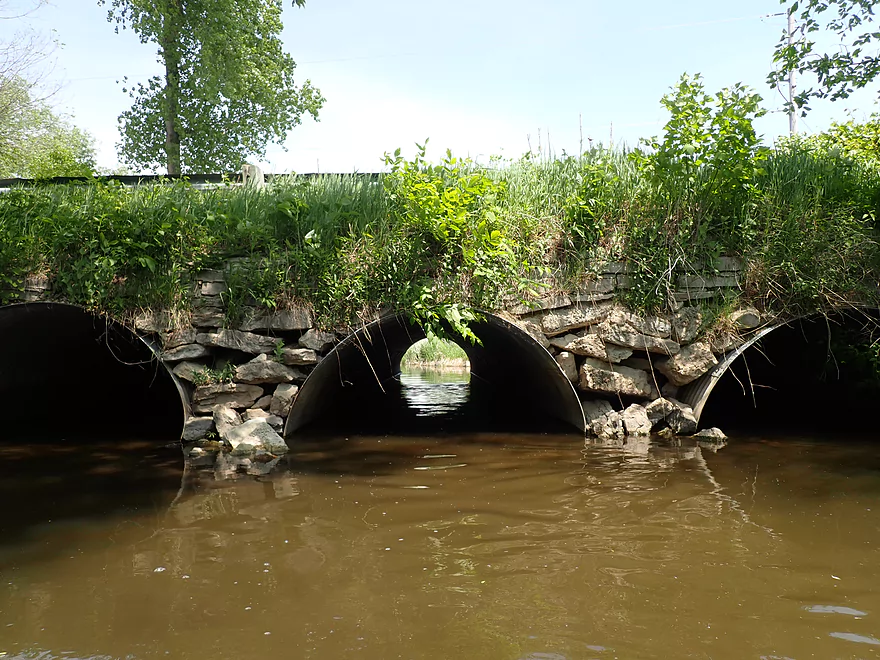
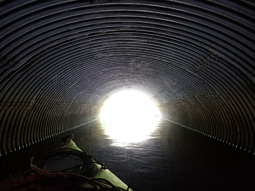
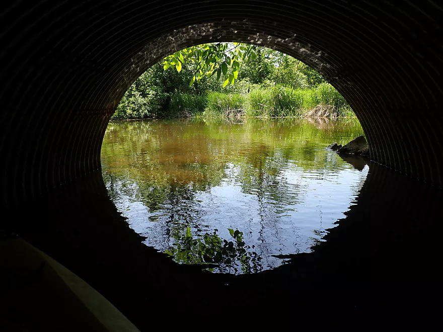
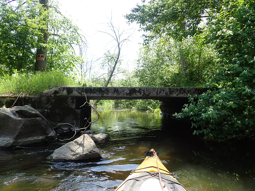
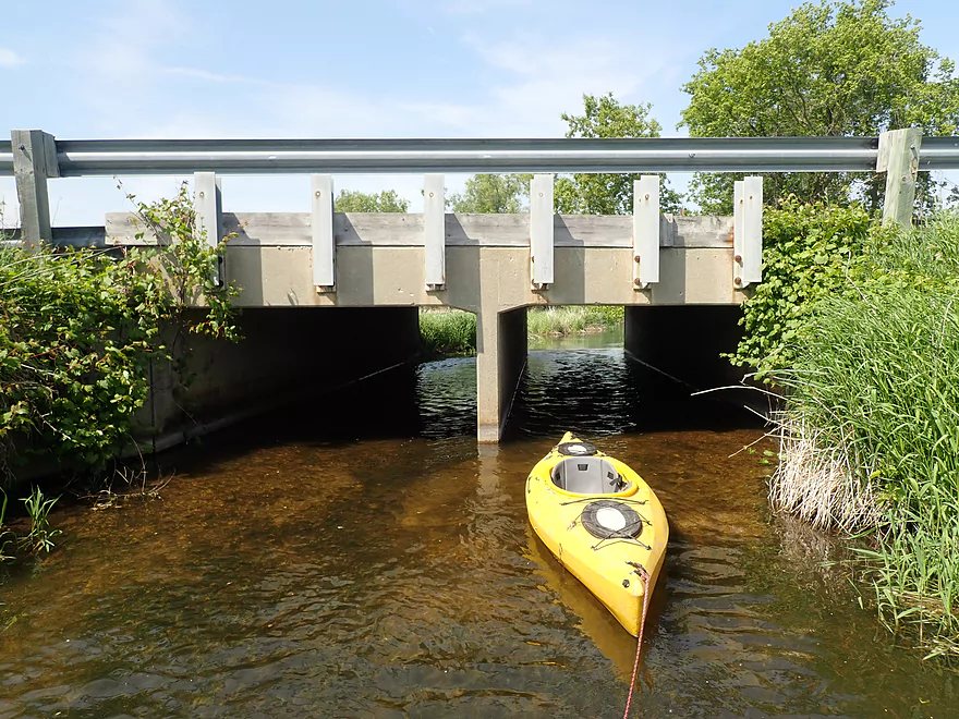
Super low bridge
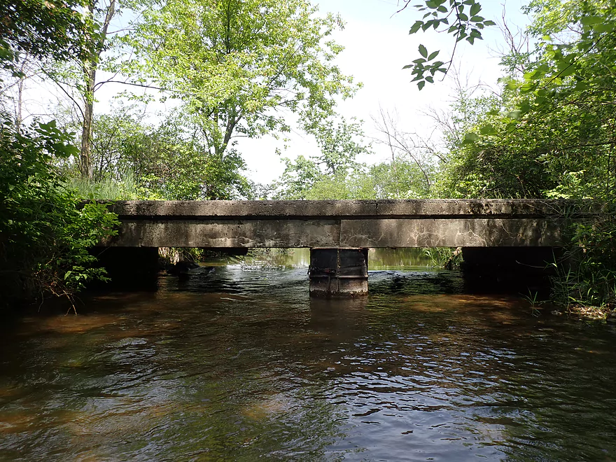
I barely squeaked under
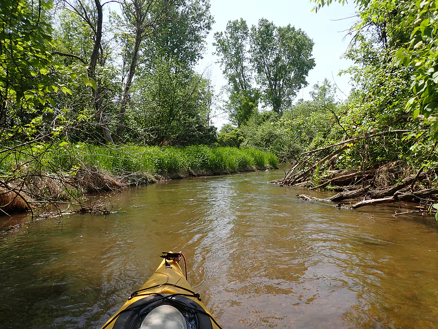
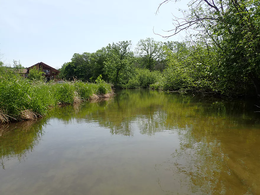
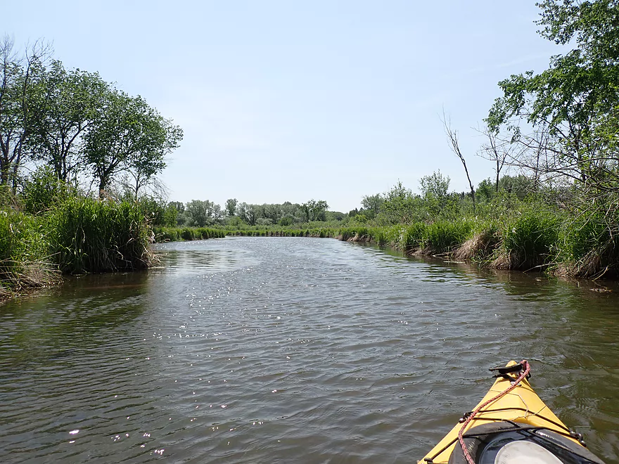
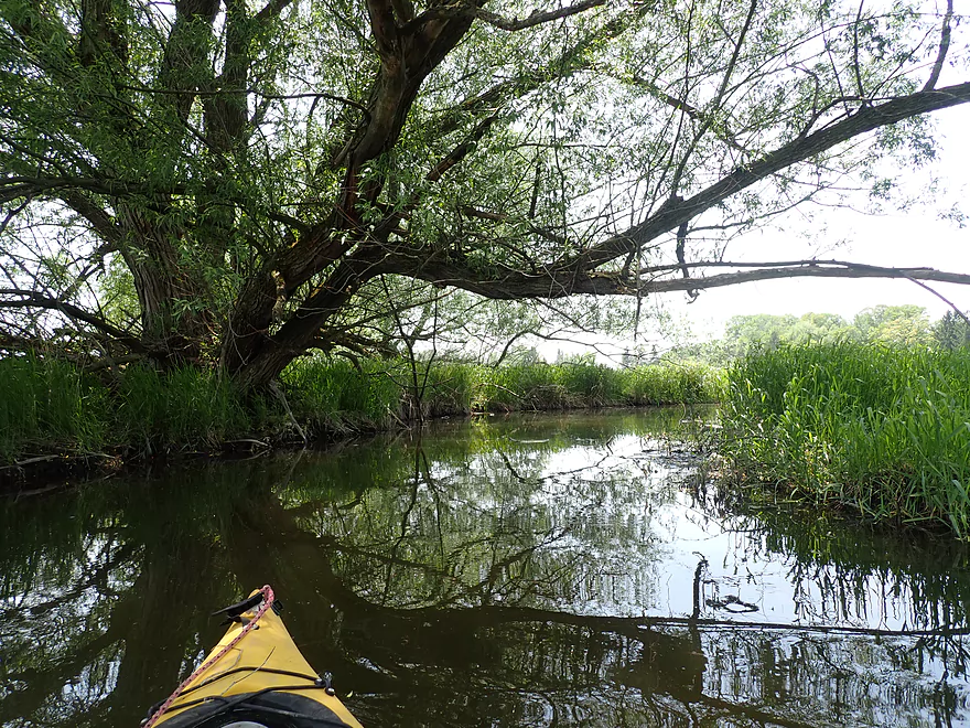
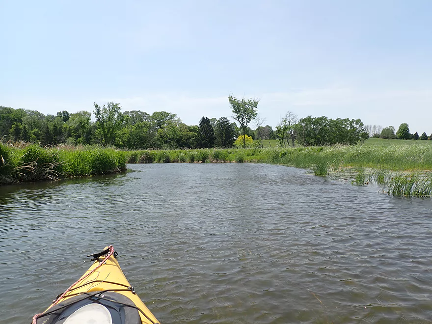
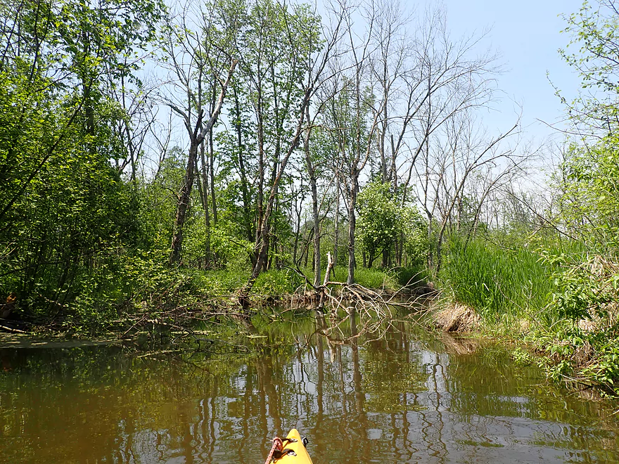
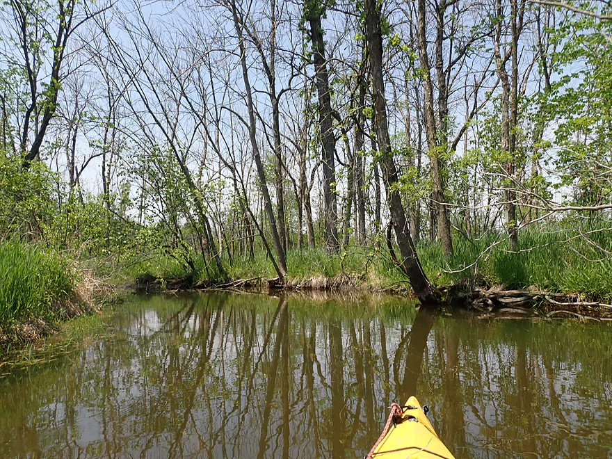
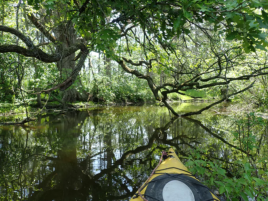
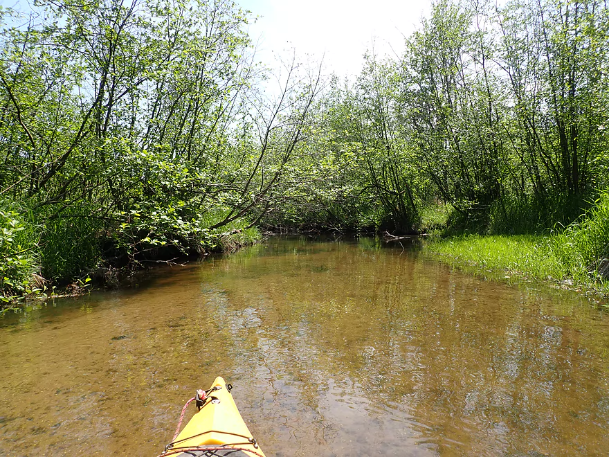
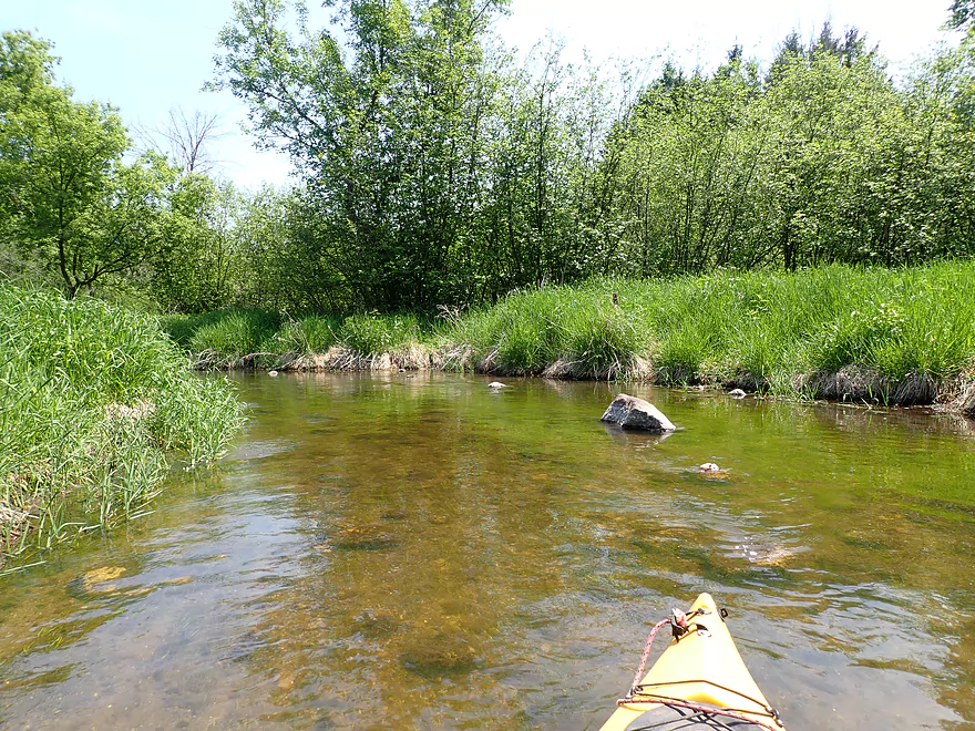
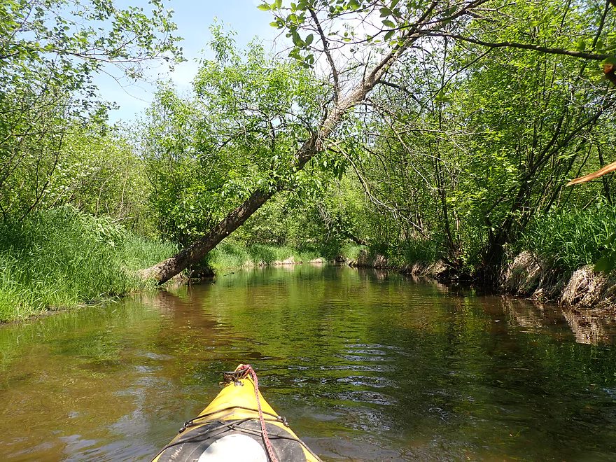
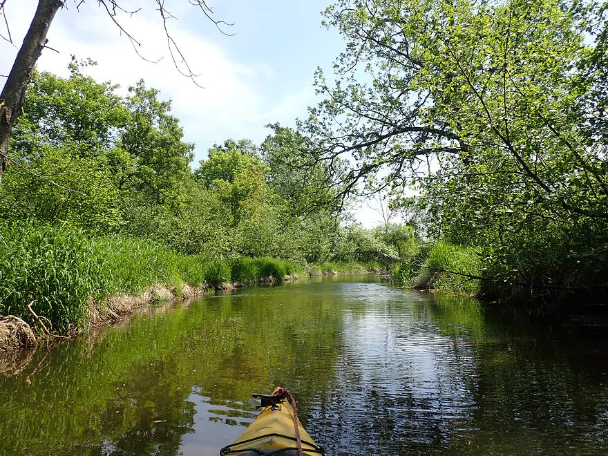
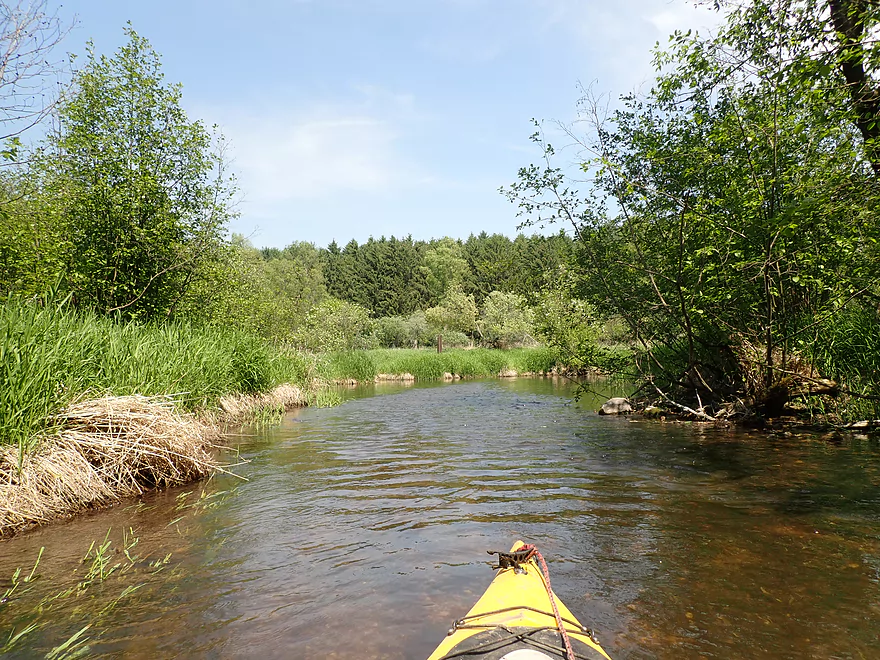
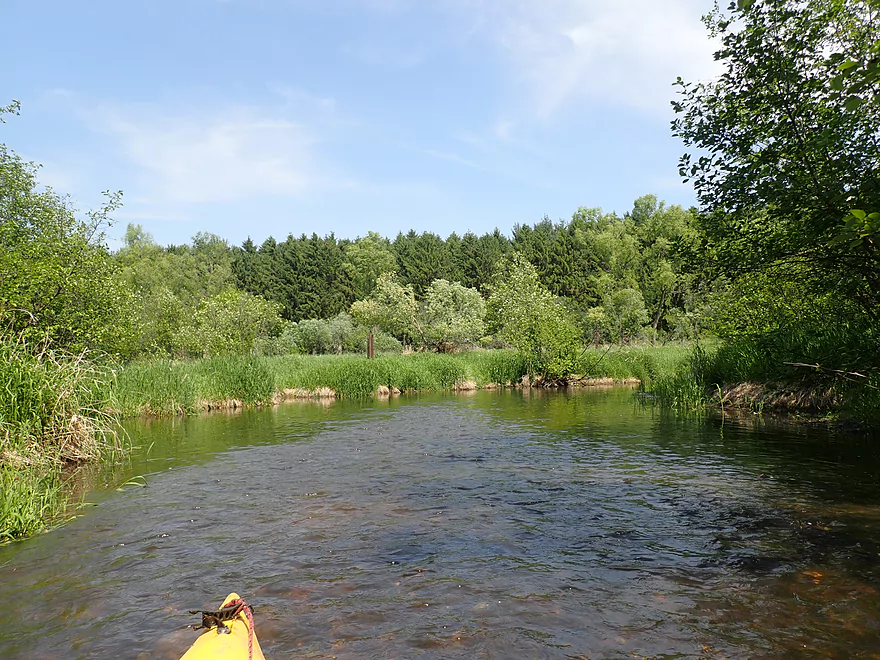
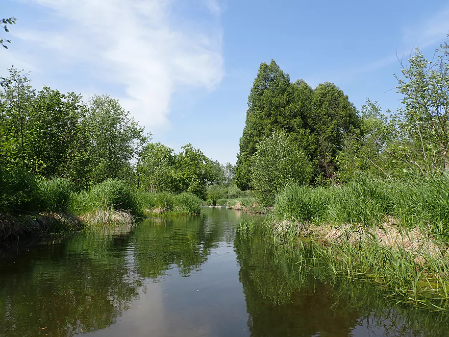
Next stretch was very nice
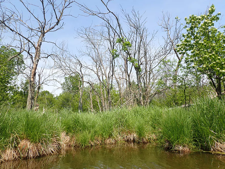
So many dead ash trees
Druid Lake Road
Time for an NDE
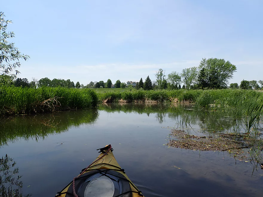
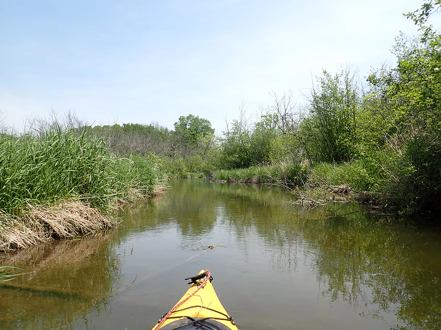
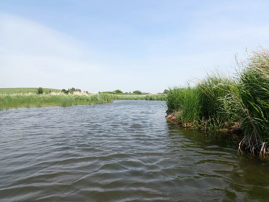
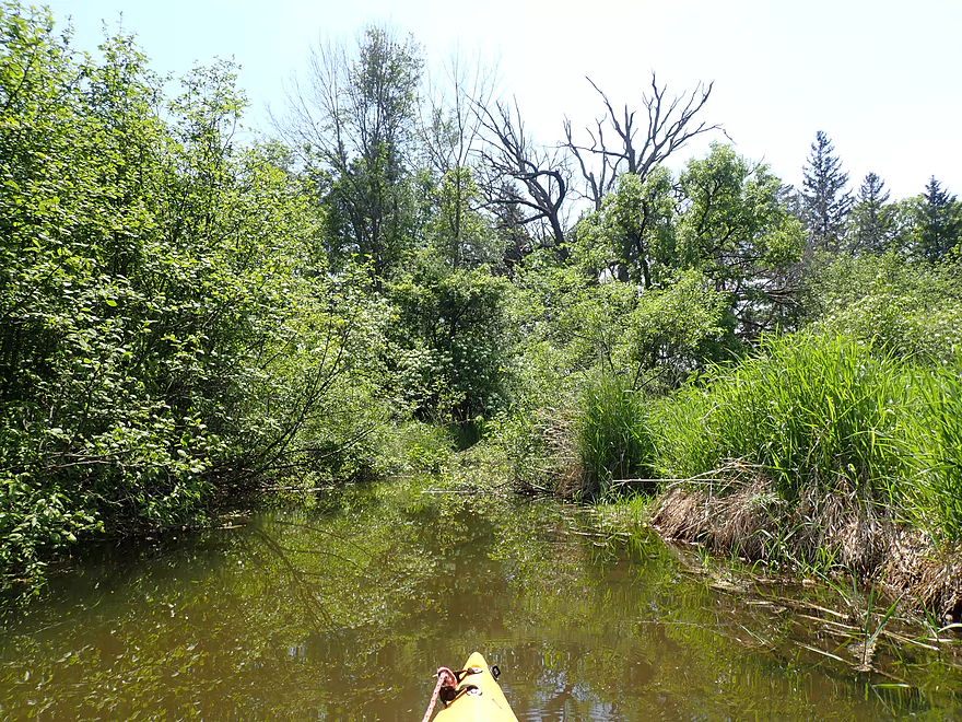
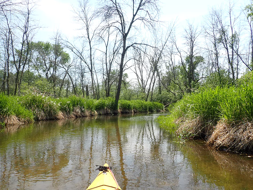
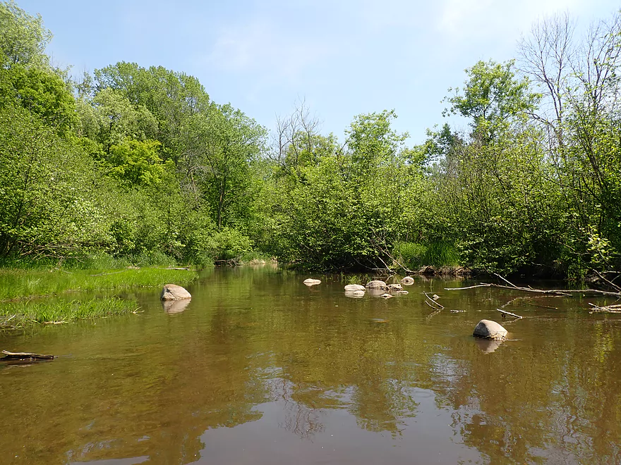
Creek opens up for a bit
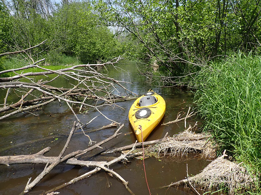
Able to sneak past this jam
Large drumlin in the distance
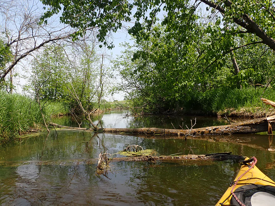
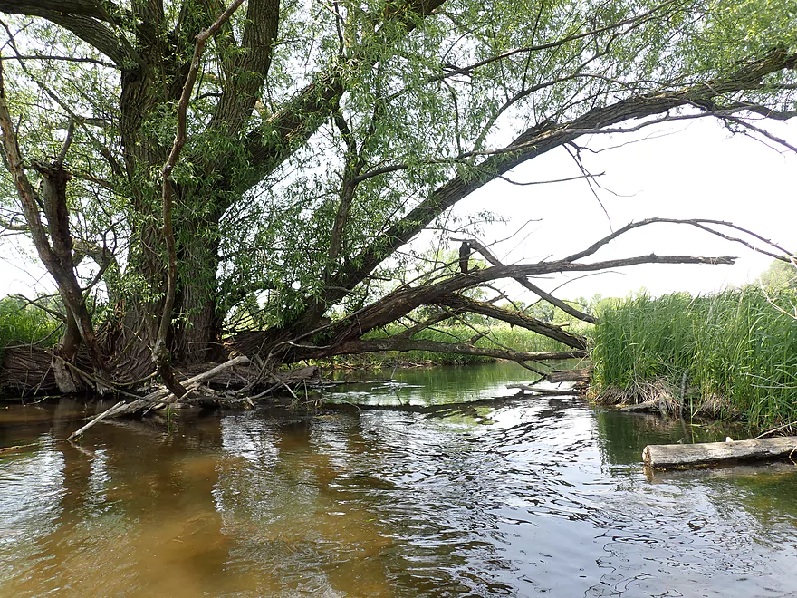
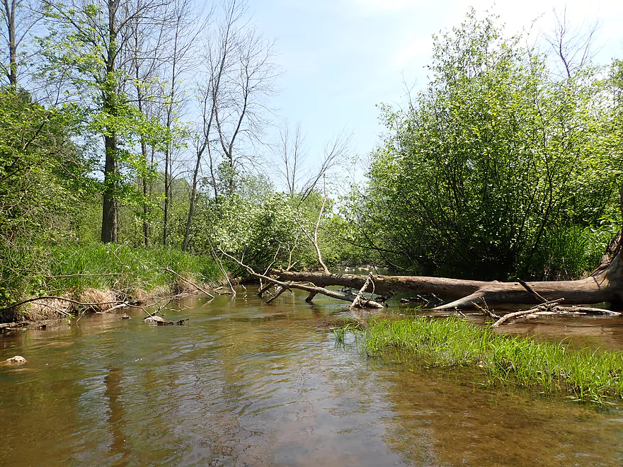
Yet another logjam
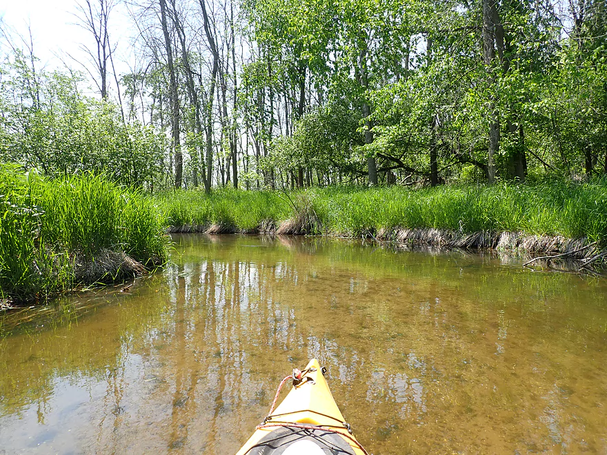
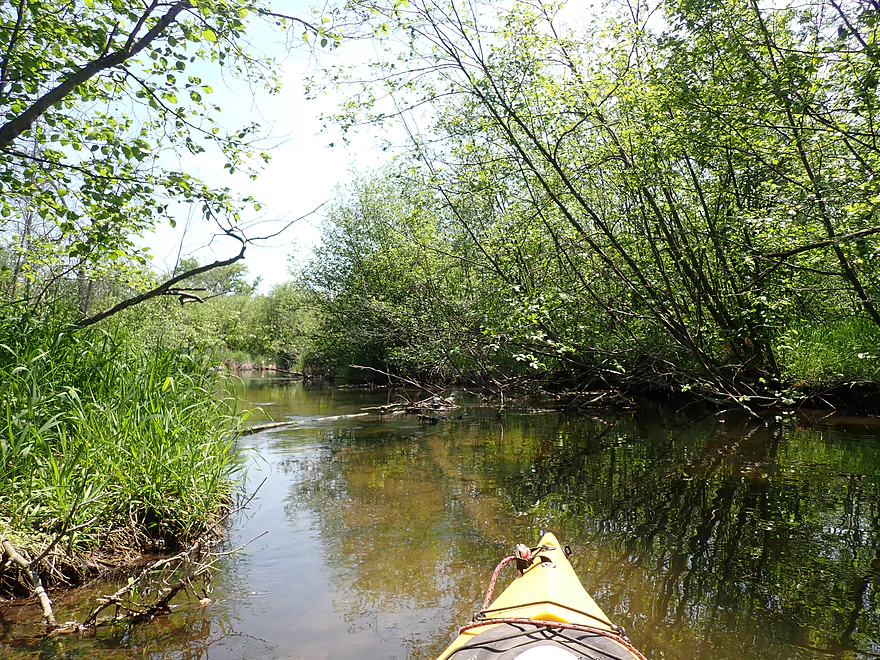
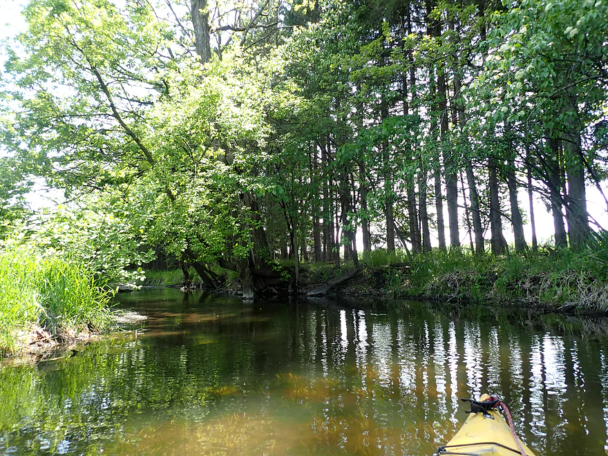
Entering a slow wooded stretch
Ghosts of forests past
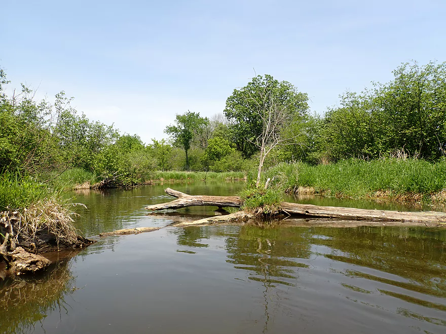
Yet another logjam
Example of brushy, overgrown banks
Another low bridge
Another logjam
Finally a bridge I was able to fit under
Another logjam
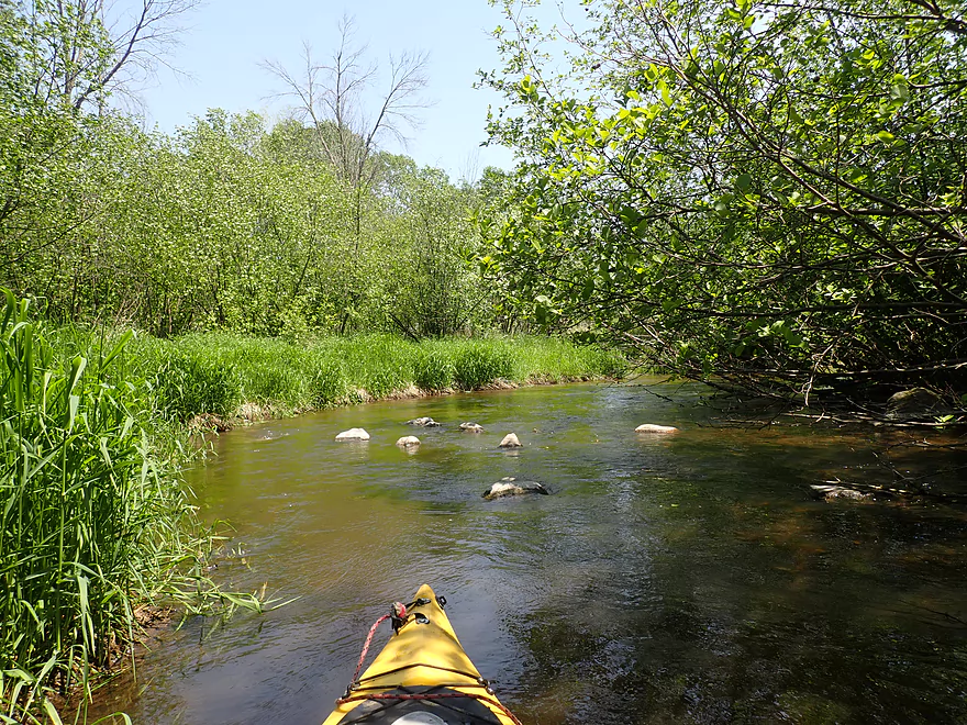
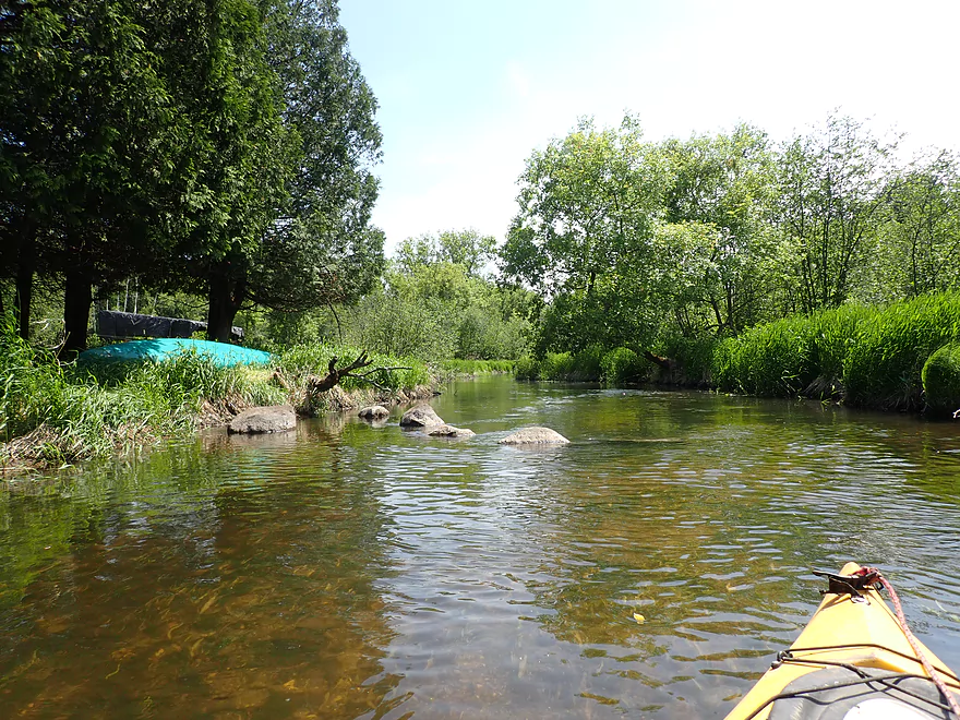
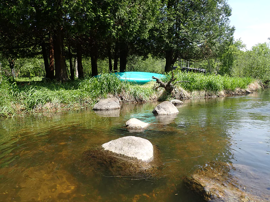
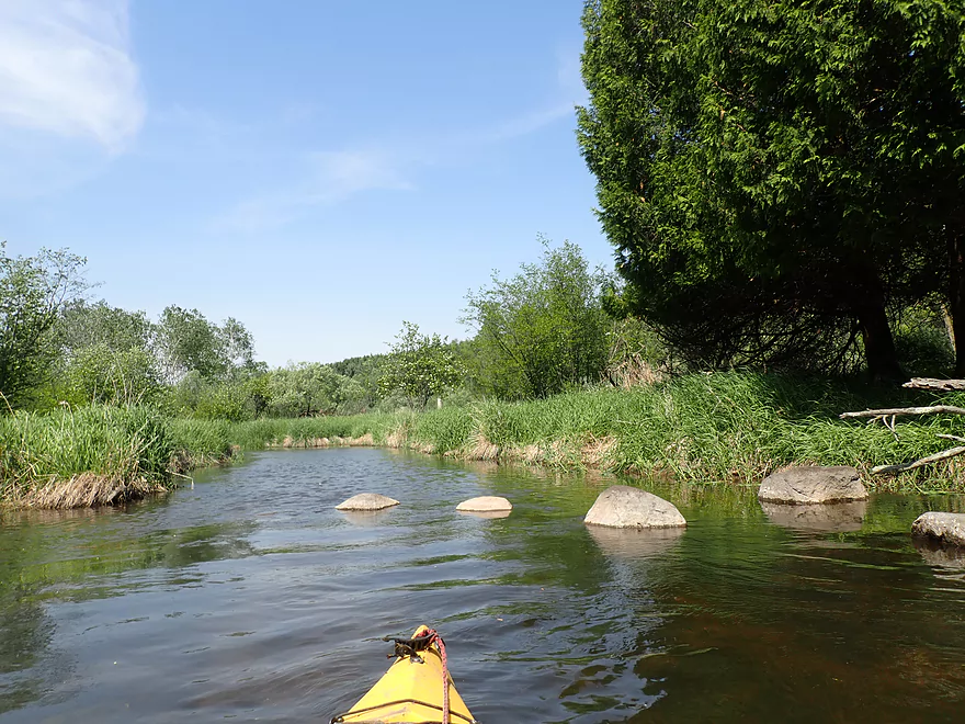
Some small but nice boulder gardens
Second half of the trip had ok clarity
Reminded me of the Upper Bark
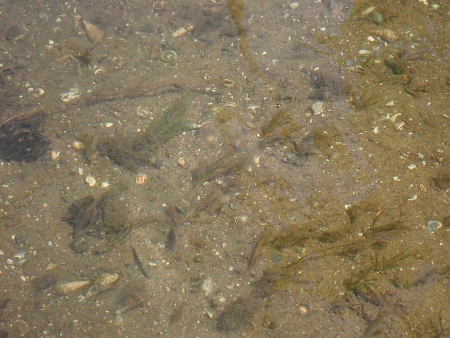
A lot of small snail and clam shells on the bottom
Another jam…this wasn’t too bad to get past
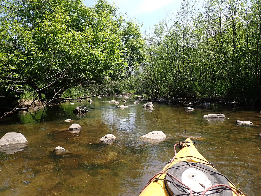
Another boulder garden
Poorly pictured…the worst logjam of the trip
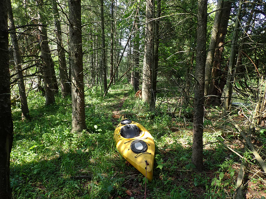
It required a difficult portage
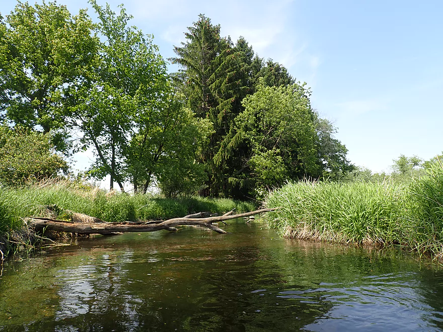
Some pines on the trip
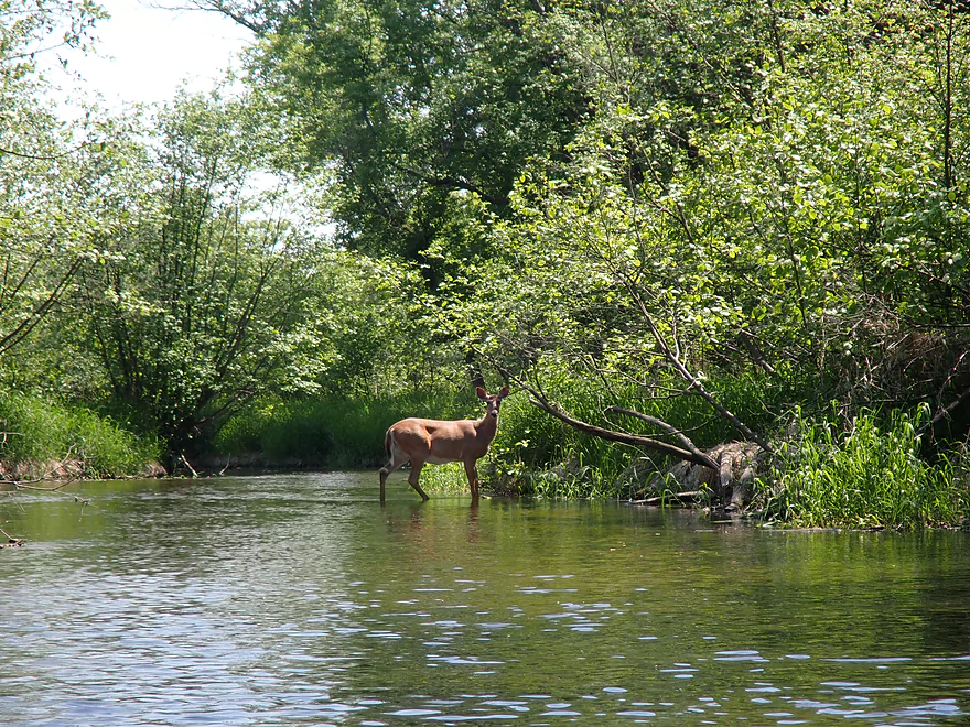
Friendly deer
Looks like I’m not the only one to paddle the Upper Ashippun
Last boulder garden
Last logjam
Taking out at Hwy O
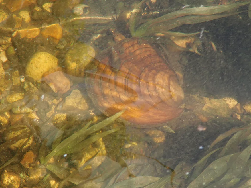
Several nice clams in the river
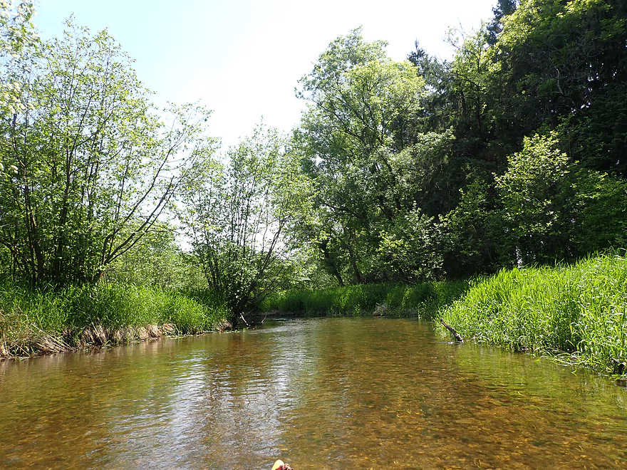
Looking downstream at a possible future trip
Ashippun River – Druid Lake to Hwy O

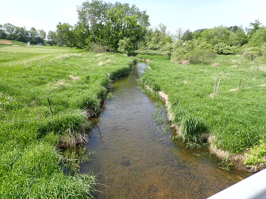
I started the trip at Druid Lake where there is a public boat ramp along the north shore. Most “river lakes” are artificial impoundments, but Druid Lake, despite being part of the Ashippun River, is surprisingly enough a natural kettle lake.
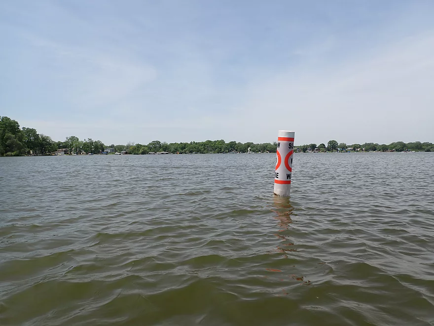
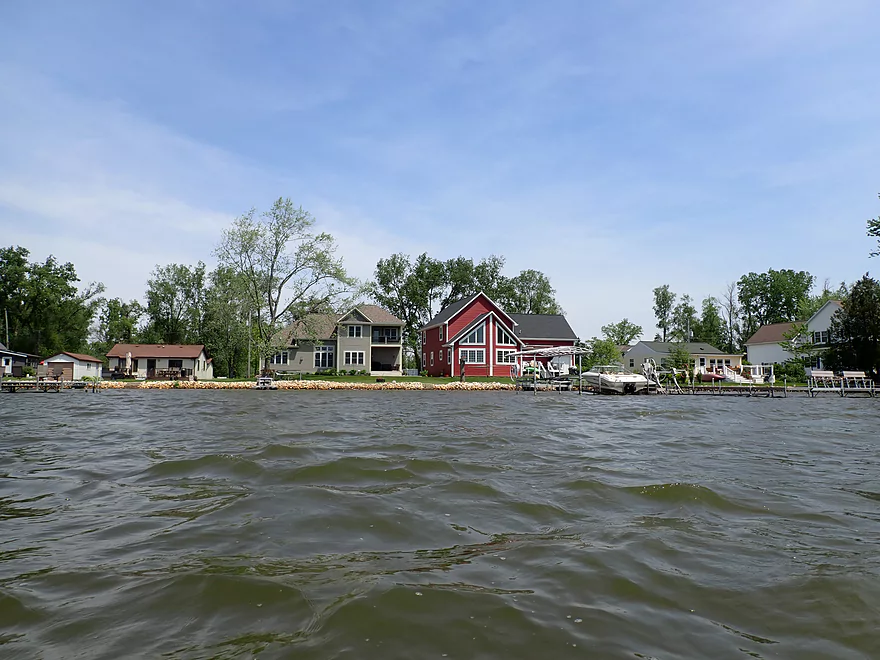
Crossing the lake proved more difficult than expected because of a strong headwind. The lake itself is quite developed with a number of shoreline homes and motorboats. Most of the boats were constrained to the outside and I believe subject to an odd rule they had to move in a counterclockwise direction (I hoped my kayak was exempt as I wasn’t going the long way). Finding the lake outlet was a bit tricky at first, but once I got closer to the southeast shore it was impossible to miss. What’s interesting is that the river inlet is located just 700′ north of the outlet and paddlers that weren’t careful could take the wrong “exit”.
The next half mile (Druid Lake outlet to Druid lake Road) was really nice and reminded me of the Mukwonago River. Here the Ashippun was shallow but clear with a nice gravel bottom. I often saw little minnows (and occasionally big carp) dart around in the clear water. The banks, while mostly marsh-like, were filled with countless dead ash trees which seems to be a reoccurring theme for many Southeast Wisconsin paddles.
The river changed after the Druid Lake Road bridge, which I believe is a viable access option. The next half mile of creek opened up and went through a nice open marsh back-dropped by a gigantic drumlin. Unfortunately it was also back-dropped by some large McMansions. The homes off of Druid Lake had some of the largest lawns I’ve ever seen. They were practically small farm fields filled with nothing but well mowed grass. Extreme low-density development isn’t a good use of land, and this has to be one of the worst examples inside of what is technically the Milwaukee metro area.
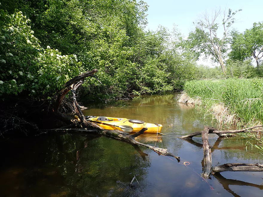
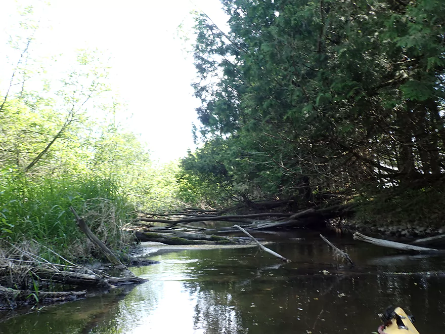
The next half mile went through messy woods filled with brushy, weedy trees. The substrate became muddy and the current mostly died. Here I encountered a few major logjams and the trip lost two stars.
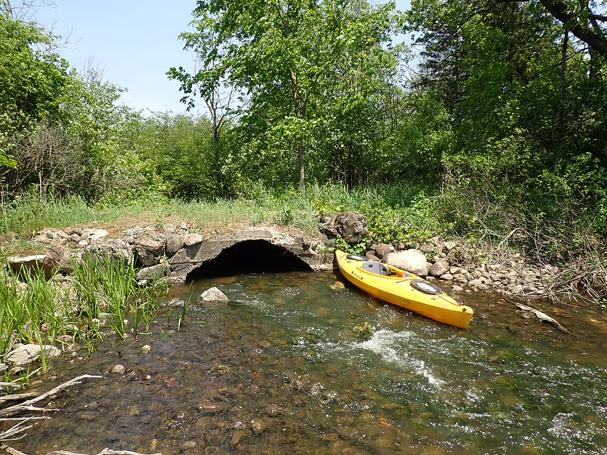
After I portaged a small farm culvert, the river became much clearer, more open, rockier, and nicer. There were even a few little boulder gardens that were nice and reminded me of the Upper Bark River. But every time the river got interesting , I encountered a major logjam. Most I was able to get past with little difficulty, and in some cases the water was shallow enough I could just wade past them. The worst logjam was by a stand of pines where a complete cluster blocked the river ( I suspect a tornado blew through here). This required a long and difficult portage through dense undergrowth. I did expect some logjams for this trip…but there was just one too many.
I was much relieved to end the trip at Hwy O. Despite this being just a three mile trip, I was exhausted from all the portages. It didn’t help that it was quite hot and I was paddling into a strong headwind (often 30 mph…sometime as strong as 40mph). On top of this, I didn’t get the nice blue skies I expected for my pictures, but instead got a hazy mess caused by New Mexico’s largest fire in history. The fire was started by the Feds as ironically a fire prevention effort. Oops.
Overall I was slightly disappointed in the trip. While scenic in spots, I actually thought it would be more exotic. Maybe if it were cleared of logjams it could become a nice water trail. Paddlers willing to keep things simple could just paddle Druid Lake and its inlet/outlet, which would be fairly obstruction free.
Sights included some minnows, a handful of carp, a snapping turtle, one owl, one friendly deer, and a great blue heron. The highlight was all the clams and snail shells which you usually don’t expect for small rivers like this.
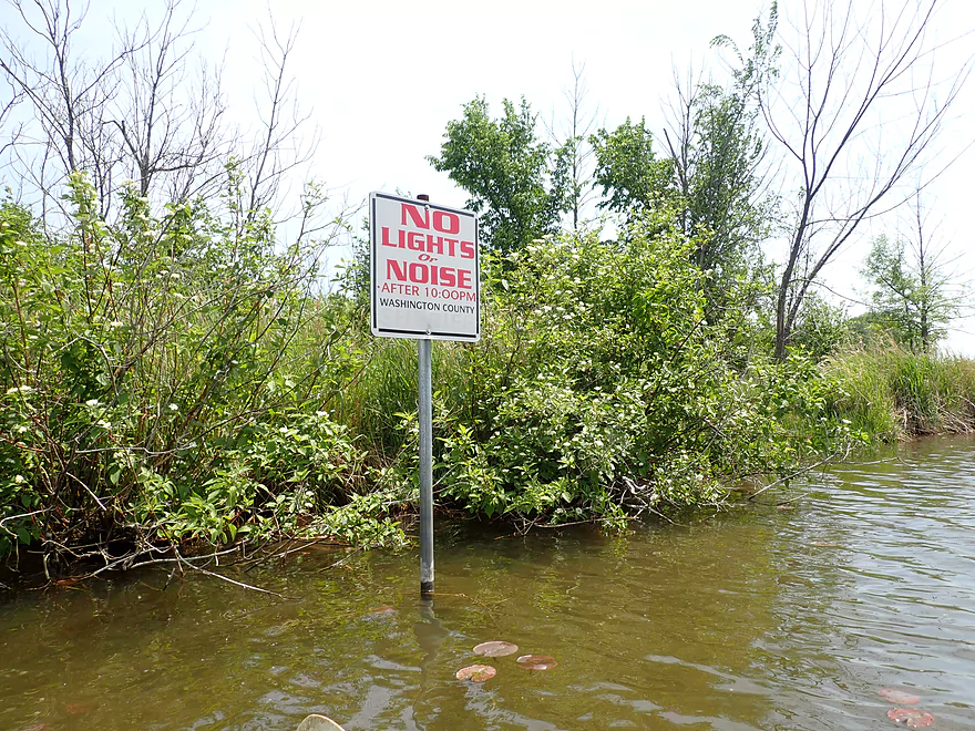
Druid Lake – Clearwater Beach Road: This is I believe the only public boat ramp on the lake. It’s an ok access, but it is crowded, costs five dollars, and it can be difficult to find a parking spot during busy times. In fact Clearwater Beach Road has No Parking signs everywhere supposedly for fire truck access, but I suspect it’s just the local government trying to discourage outsiders from using the lake.
Alternate Put-ins:
- Druid Lake Road (1.3 miles downstream from my put-in). This might be an option if you really want to avoid Druid Lake.
Hwy O: The shoulder here is steep which isn’t great for parking bigger cars. Otherwise this is a doable (but not ideal) bridge access.
Alternate Take-outs:
- Hwy O – 2nd Bridge (2.8 miles downstream from my take-out). This is a good bridge access, but this leg might have 5 major logjams.
Bike Shuttle – Hwy O to Druid Lake Landing: 3.9 miles with 75′ of ascent. There is one decent hill, but otherwise this was an easy and pleasant bike shuttle.
Current: The current is very slow outside of a few riffles.
Logjams: Five logjams required portaging. See trip map for locations and details.
Low Bridges: There are four bridges on this trip. Two will need to be portaged. See trip map for locations and details.
Trip Depth: 20 CFS per the Bark River guage @ Delafield
- < 15 CFS: Maybe too shallow for paddling.
- 16-30 CFS: Mostly navigable, but a few shallow spots will require getting out.
- 31-55 CFS: Average depth. Good target range.
- 56-80 CFS Above average depth but manageable. You might be able to float over some logjams at these levels.
- 81-100 CFS: Banks might overflow at this depth. Poor clarity, but a trip might be viable.
- 101+ CFS: This might be too high for suitable paddling.
On my drive to Druid Lake, a kayak blew off a car just ahead of me. Winds that day were strong (30-40 mph), but regardless, paddlers should always be careful to secure their boat carefully. The following are some helpful roof rack safety tips.
- Avoid J-Bars: Try not to use them or to prop the boat up on its side (which the car ahead of me did). Not only will the boat catch more wind, but it will have less secure pressure points against the car.
- Use front and back tie-downs: Often kayakers neglect to use these, but they help a lot in securing your boat. You especially need front/back tie-downs when traveling at highway speeds or if you have a longer boat on your roof. I’m a big fan of rope ratchets for this purpose.
- J-Bar Alternatives: Most kayakers use J-bars to free up more room on their roof, but an alternative would be to just get wider cross bars that extend beyond the rails. This frees up a lot of room for multiple boats. Saddles are a very secure way to attach a boat to a car. If you have good foam pads, you can lay these on the cross bars and achieve a pretty secure tie down as well.
- Pre-Trip Stress Tests: Before you pull out of the driveway make sure to “stress test” your kayak while tied to your roof. I find it’s best to do this to the rear of the boat and to violently rock it back and forth. If it moves then, chances are good it will move when a semi passes by or you are hit by a strong side-gust of wind.
- Tighten Boats Securely: Online you’ll often find paddlers warning not to over-tighten your boat in fear of damaging it. In my opinion this is often bad advice. I think it is better to risk slightly damaging your boat, than having it fly free and kill the person behind you. Yes some kayaks can be damaged by over tightening, which is why you want to pick your boat carefully. Some kayaks when warped have a “plastic memory” and will go back to their previous shape when off the rack and in the sun.
For more details on bridge access options and their viability, see the overview map.
- Hwy 83 to Druid Lake (North Landing): 3.8 miles. Maybe 9 logjams. The second half is much more open.
- Druid Lake (North Landing) to Hwy O: 3.3 miles.
- Druid Lake (North Landing) to Druid Lake Road: 1.3 miles. Part lake paddle, part river paddle. Druid Lake isn’t that interesting, but the river portion is nice and flows though an attractive marsh.
- Druid Lake Road to Hwy O: 2.0 miles. Attractive in part with a few small boulder gardens. The problem with this stretch are its obstacles. This included five major logjams and one low bridge that all had to be portaged.
- Druid Lake (North Landing) to Druid Lake Road: 1.3 miles. Part lake paddle, part river paddle. Druid Lake isn’t that interesting, but the river portion is nice and flows though an attractive marsh.
- Hwy O1st to Hwy O2nd: 2.8 miles. Some nice scenory, but barbed wire strainers and many logjams make this an impractical leg for kayaking.
- Hwy O2nd to Hwy P1st: 3.4 miles.
- Hwy O2nd to Washington Road: 3.0 miles. Nice section that is mostly marsh, but some rocky and riffly sections. Two logjams and a low bridge.
- Washington Road to Hwy P1st: 0.4 miles. Terrific rocky section with pines that is very scenic.
- Hwy P1st to Aldery Millpond Dam (Hwy O3rd): 2.7 miles. Partly reviewed by Rick Kark.
- Hwy P1st to Roosevelt Road: 1.2 miles. Nice prospect but with maybe 3-6 logjams.
- Roosevelt Road to Hwy P2nd: 0.6 miles. Mostly open marsh paddle. Likely no logjams.
- Hwy P2nd to Aldery Millpond Dam (Hwy O3rd): 0.9 miles. No logjams. Mostly open flowage paddling.
- Alderly Millpond Dam to Lincoln Road: 0.6 miles. 1-2 jams. Mostly open with clear water and some rocky riffles.
- Lincoln Road to Norwegian Road1st: 1.9 miles. Maybe 28 logjams.
- Norwegian Road1st to Norwegian Road2nd: 2.1 miles. Maybe 30 logjams.
- Norwegian Road2nd to Mapleton Road1st: 0.5 miles. Maybe 2-3 logjams.
- Mapleton Road1st to Brown Street: 1.0 mile. Likely an attractive section with clear water, many rocks and light rapids. Unfortunately there are many logjams (~15+).
- Brown Street to Mouth of Ashippun Lake Creek: 2.0 miles. A LOT of logjams…maybe 40+.
- Ashippun Lake Access Road Landing to Mouth of Ashippun Lake Creek: 0.6 miles. An alternate way to access the lower Ashippun River. Start on the lake, then work up a side creek before joining the main branch. Maybe 2 logjams. Likely scenic, but could be difficult to navigate unless in high water. See map for details.
- Mouth of Ashippun Lake Creek to Mill Street Dam: 2.3 miles. Half of this goes through an open marsh, then the second half is a flowage pond created by a dam.
- Mill Street Dam to Mapleton Road2nd: 1.0 mile. Wooded section with maybe 2-4 logjams.
- Mapleton Road2nd to Pennsylvania St.: 0.6 miles. More open. Maybe one logjam.
- Pennsylvania St. to Mapleton Road3rd: 1.6 miles. Maybe 3 logjams.
- Mapleton Road3rd to Ski Slide Road: 1.5 miles. Maybe 3 logjams.
- Ski Slide Road to Mouth on Rock River: 0.8 miles. Maybe 1-2 logjams.
Trip Map
Overview Map
Video
Photos Size: