
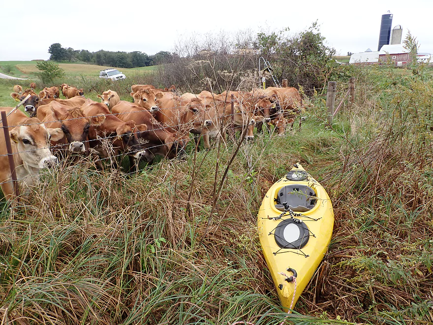
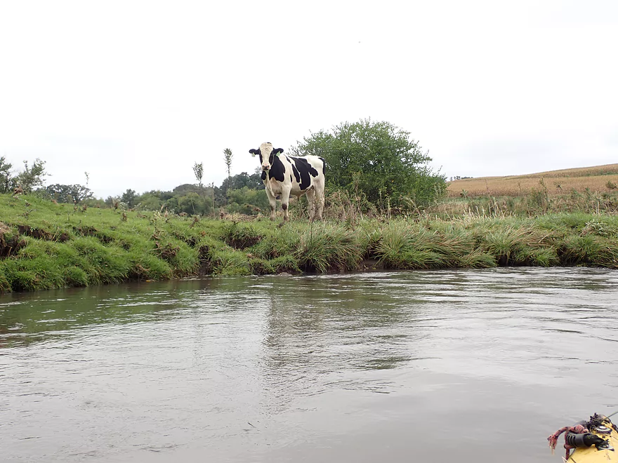
Curious cows watch me launch
Small but doable access by Hwy 61
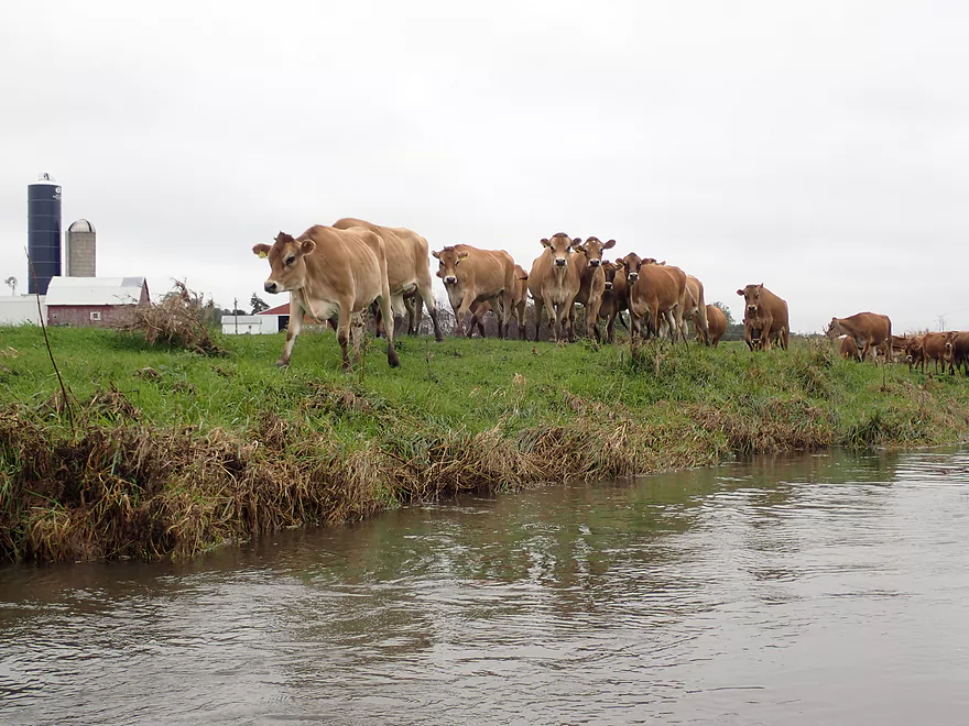
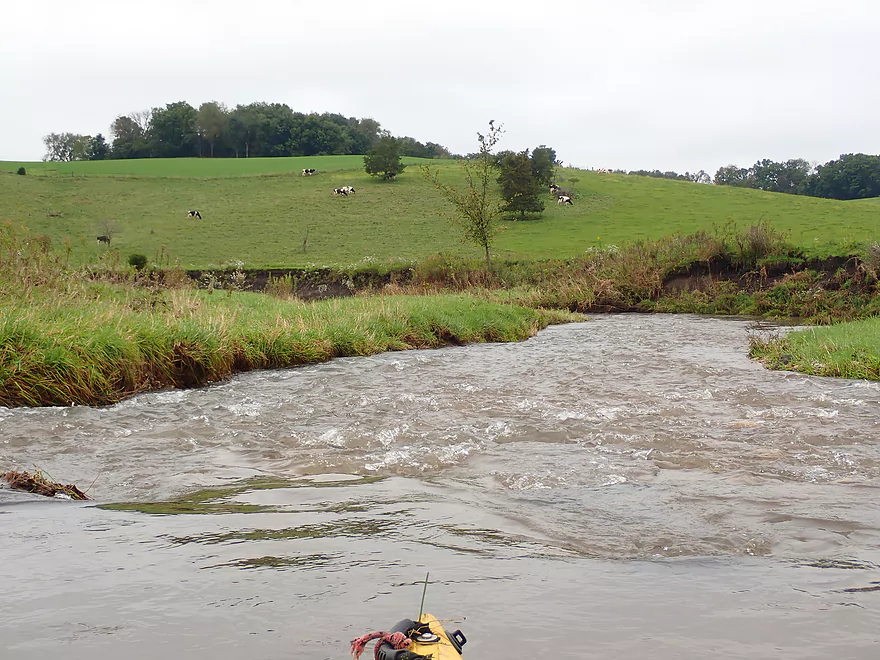
The cows kept running after me
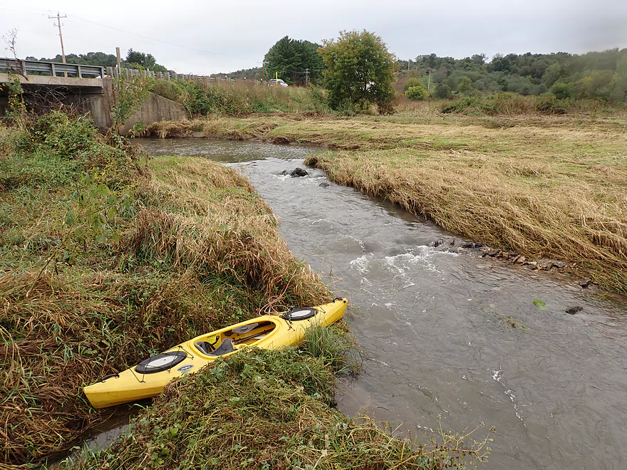
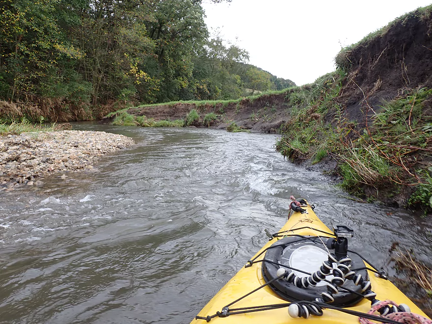
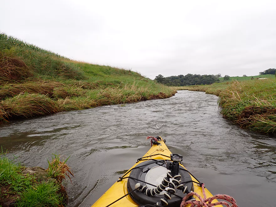
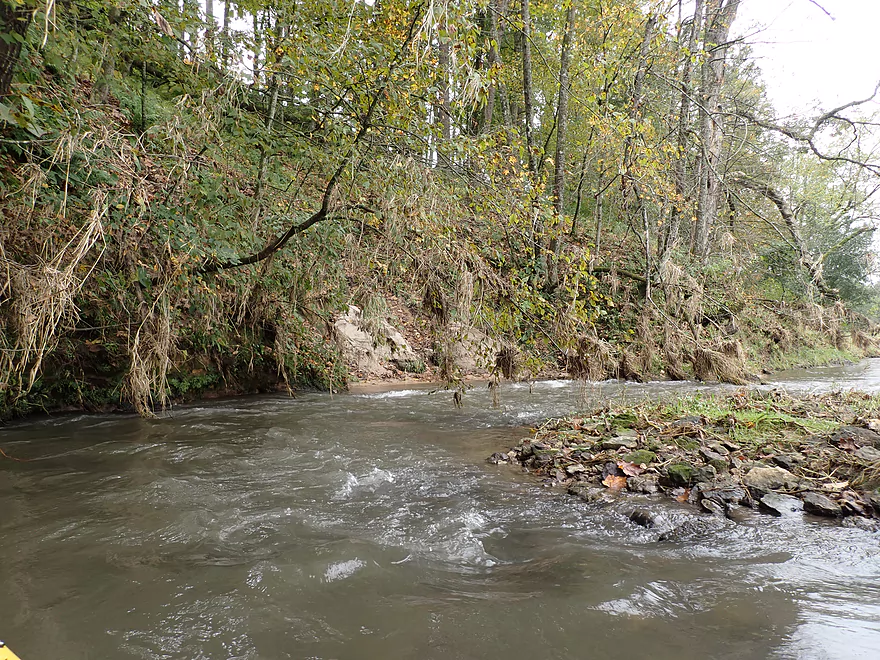
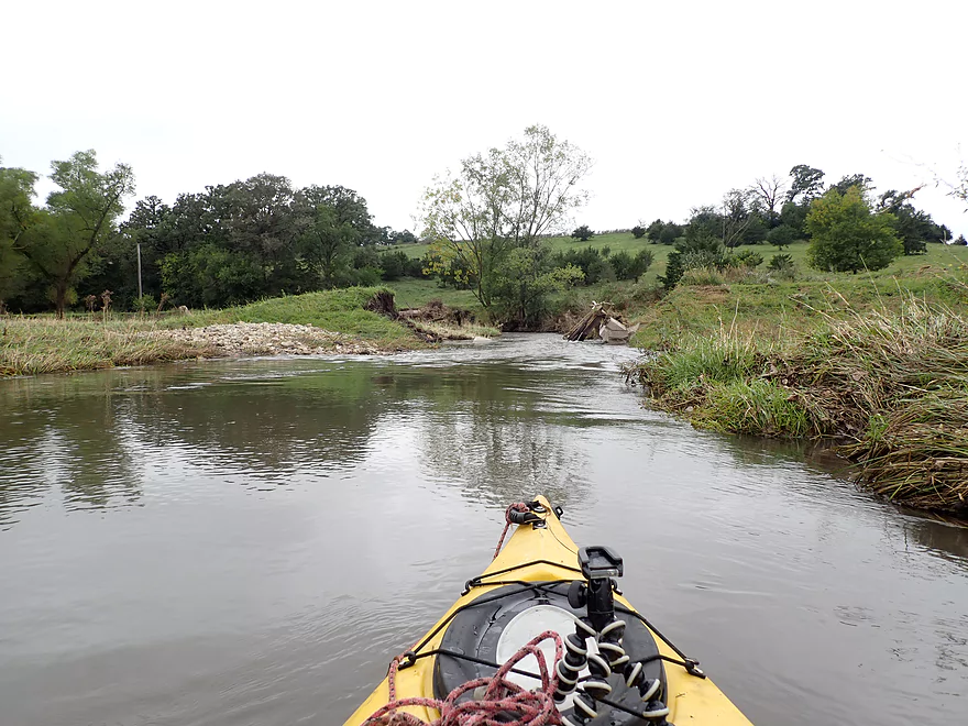
The Grant is very narrow to start
Very fast creek
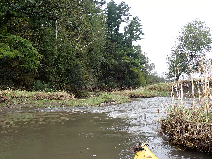
This section is only navigable in high water
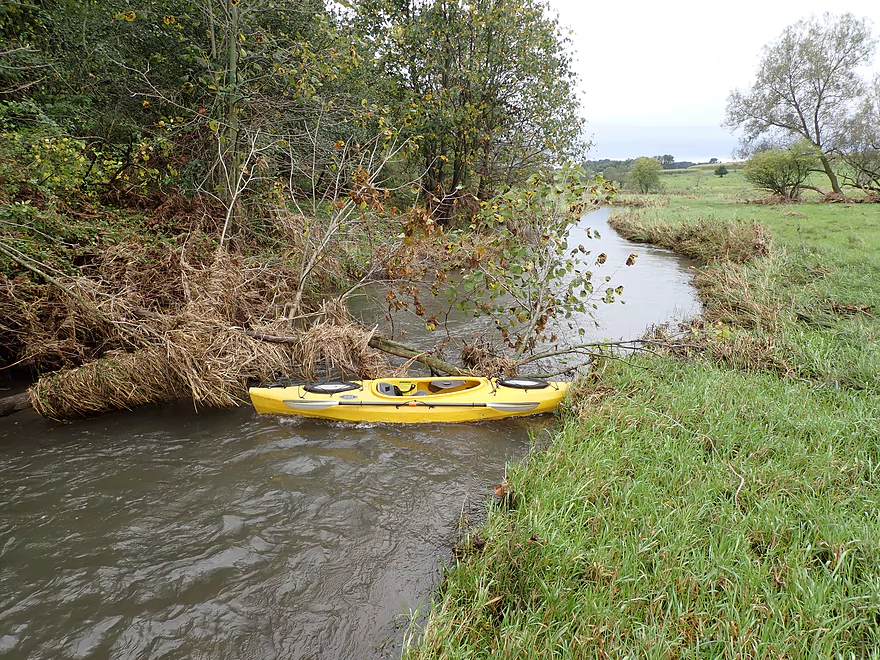
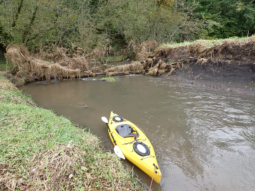
Logjam #1…easy portage
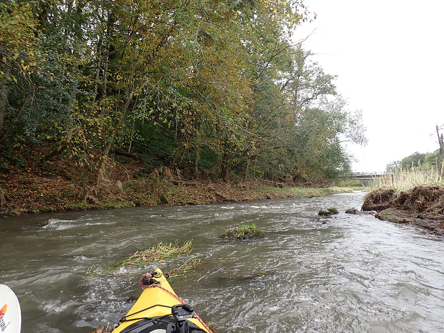
One of countless riffles
Mud banks were an eyesore on this trip
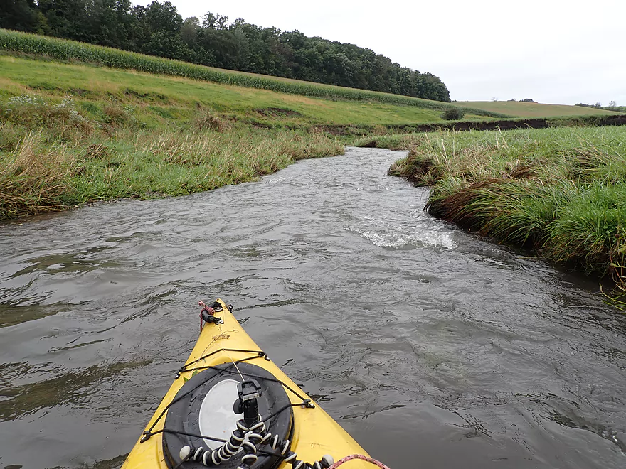
Cornfields start to replace some of the pasture
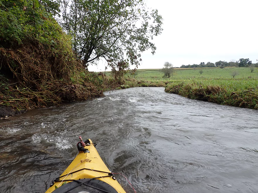
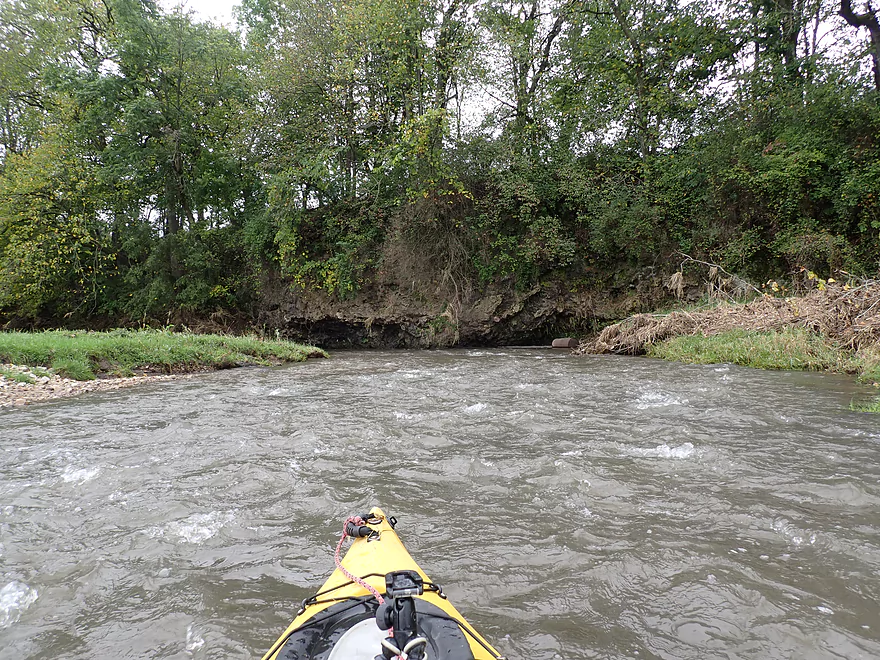
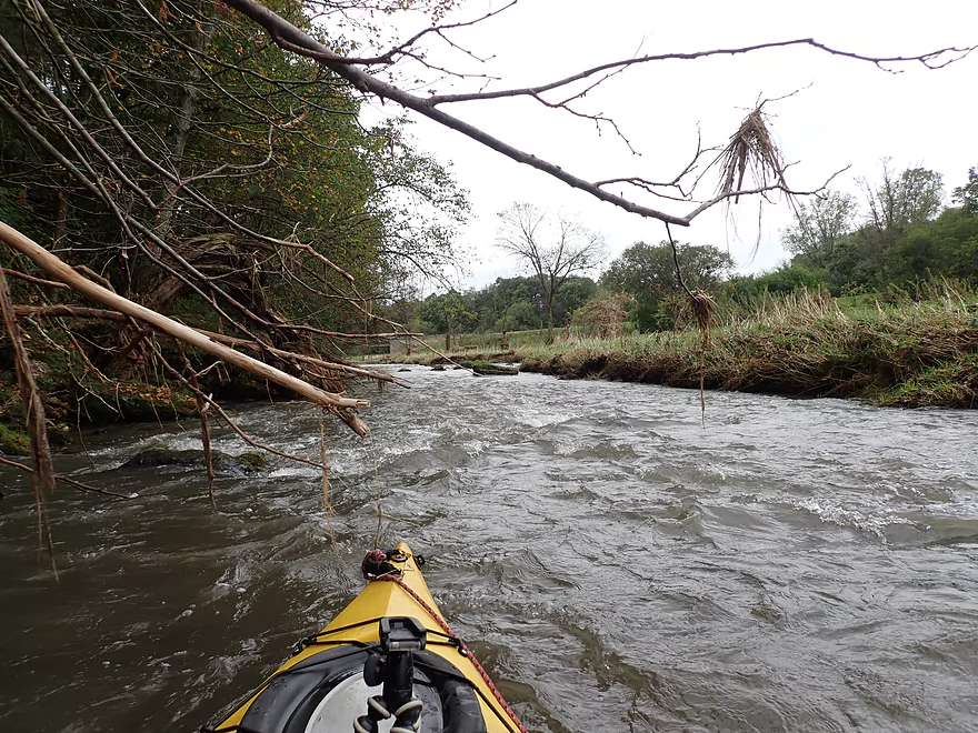
Current stays fast and fun
Some of the strongest rapids on the trip
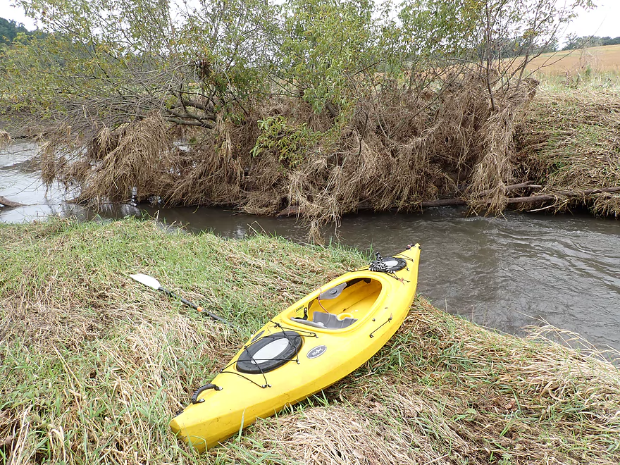
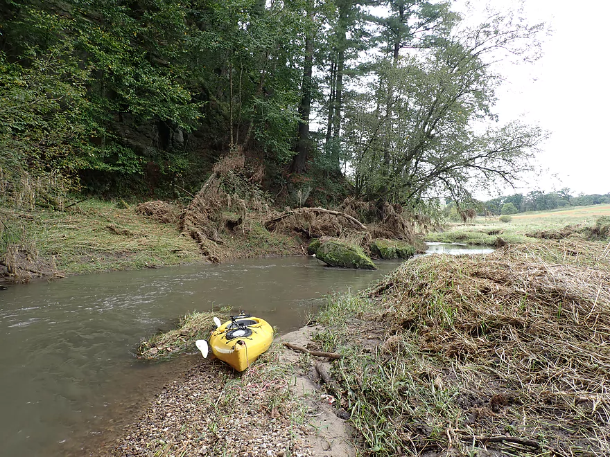
The grass was partly flattened by a previous flood
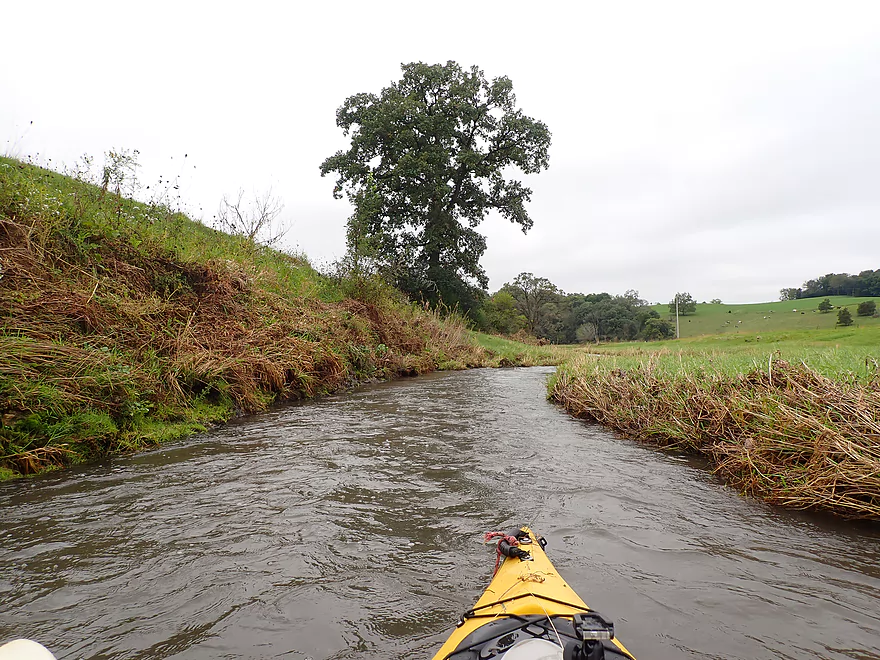
Paddling between green hills
Calendar moment
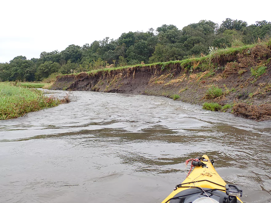
More huge mud banks
Shoreline was a bit beat-up and ratty at times
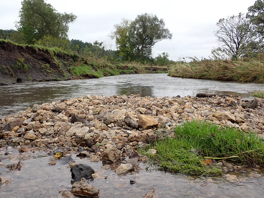
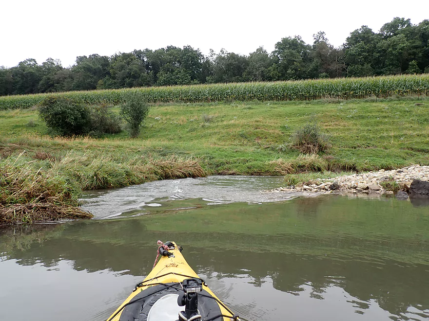
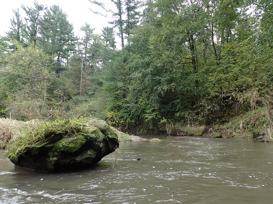
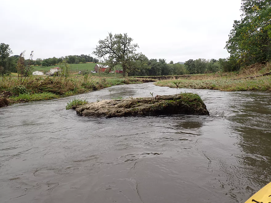
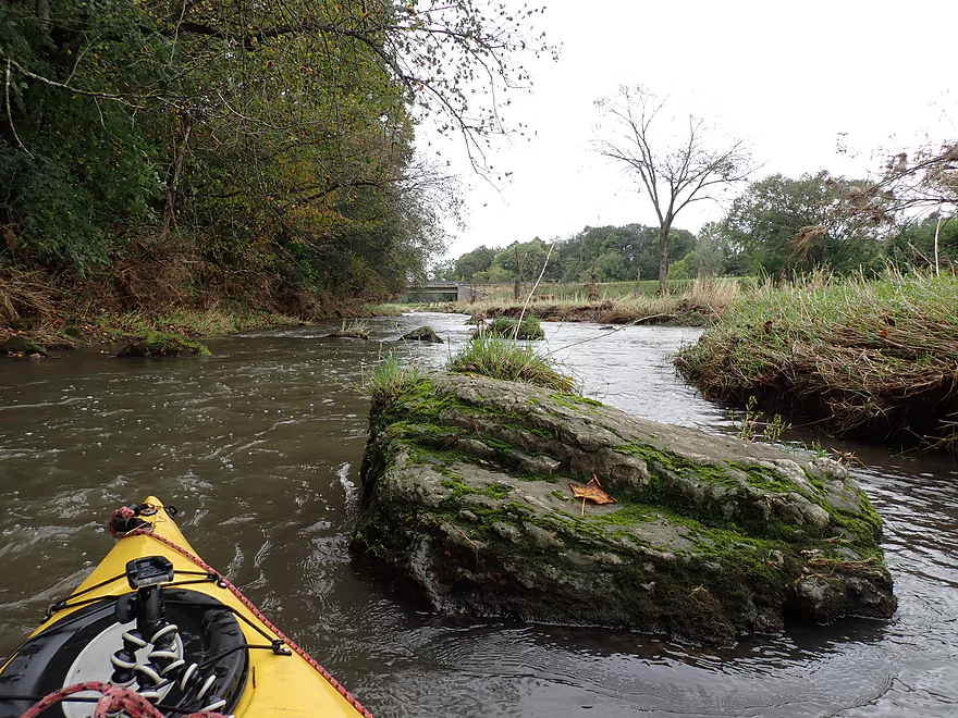
Several gravel bars on the river
Curious onlooker
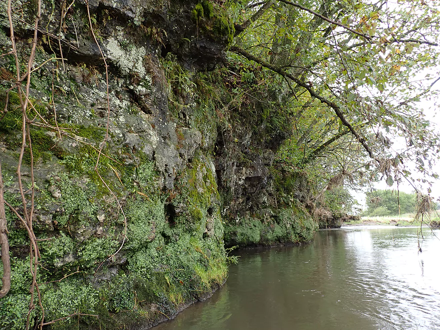
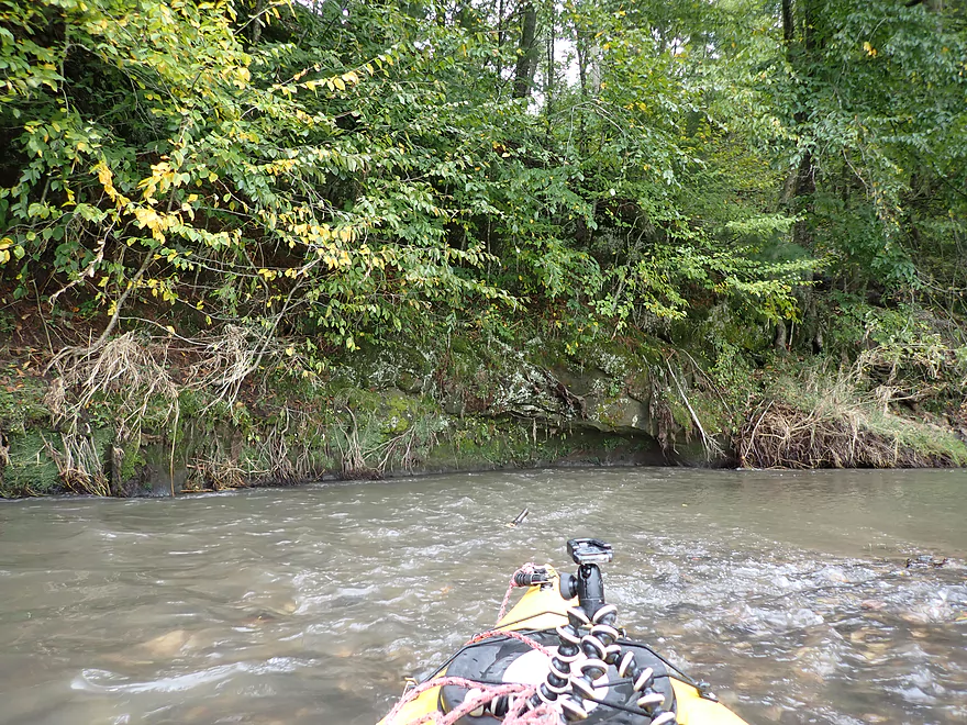
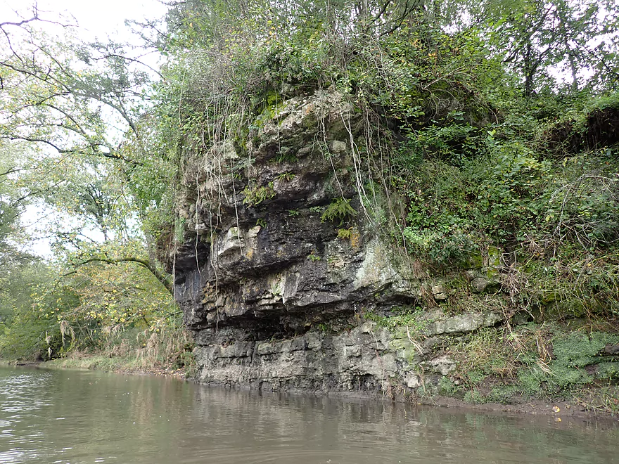
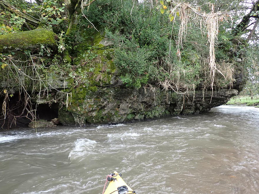
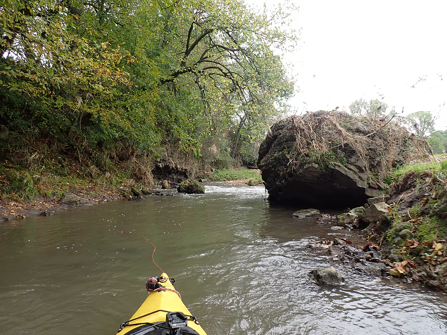
The first of the limestone outcrops
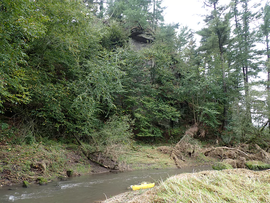
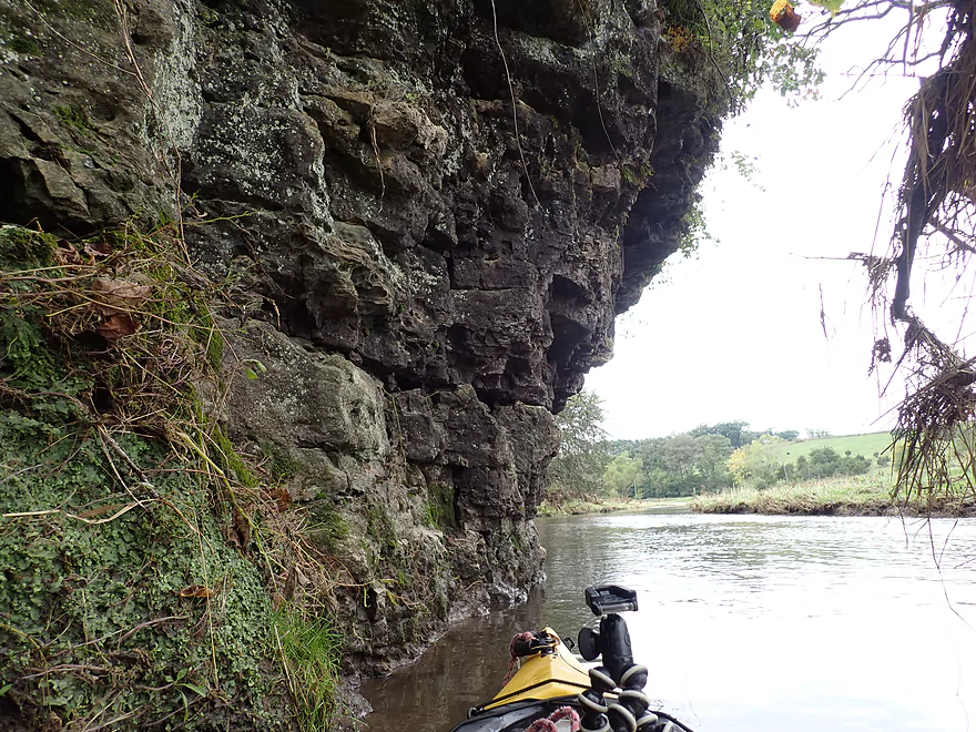
Coming up on a large pine-topped bluff
Drying my boat out after going for a swim by that strainer
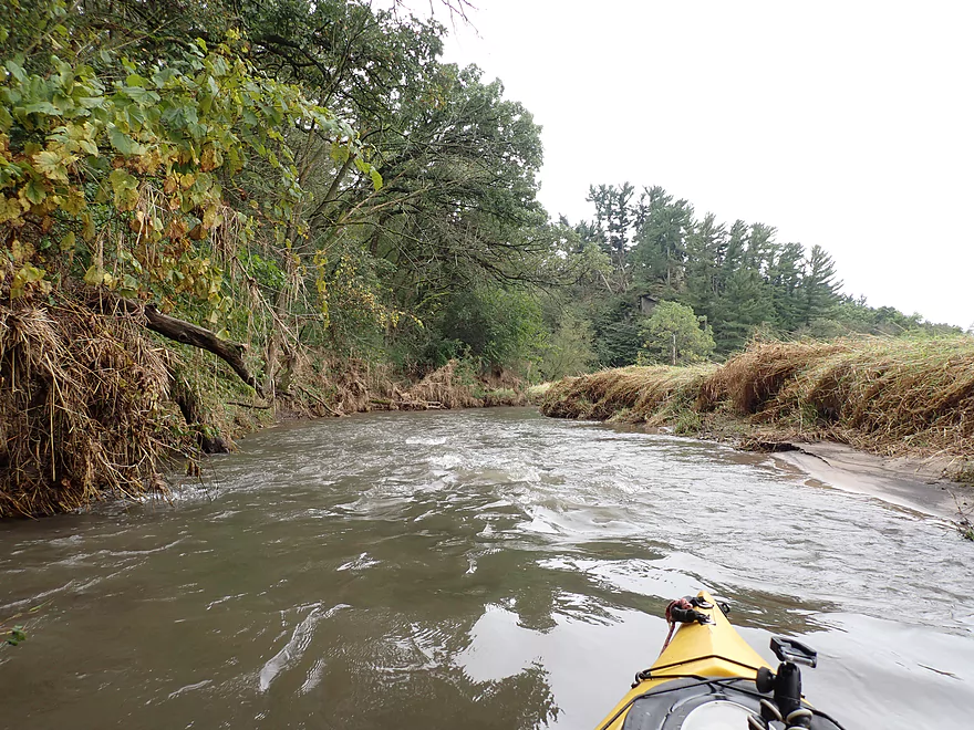
Current stays fast
Logjam #3…medium difficult portage
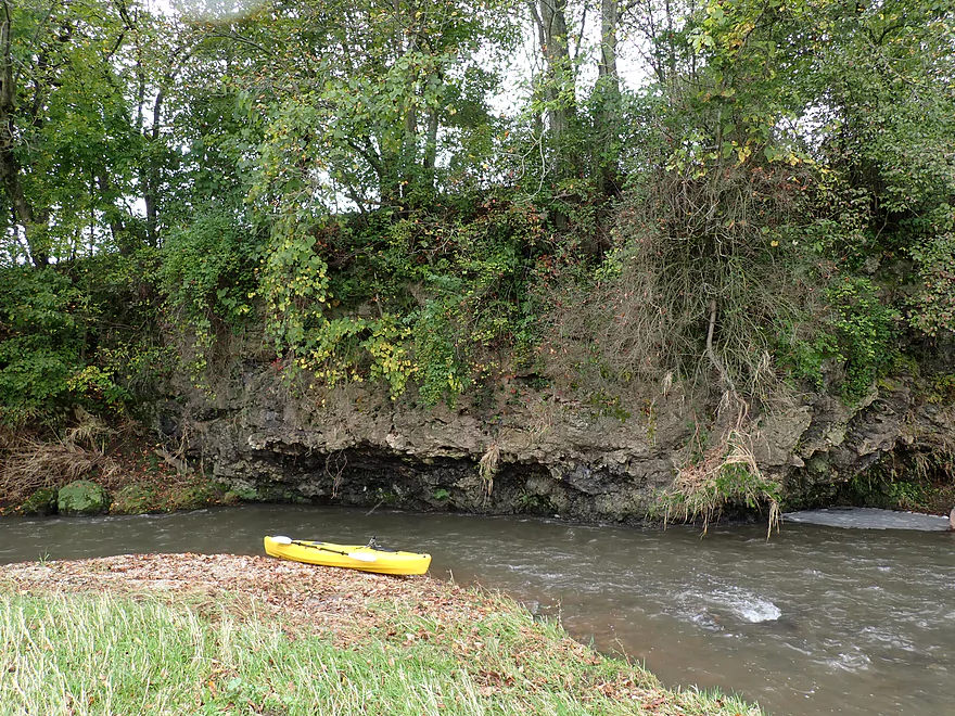
A small outcrop
Overshadowed by a much larger outcrop
Kind of reminded me of Castle Rock Creek
Reverse view
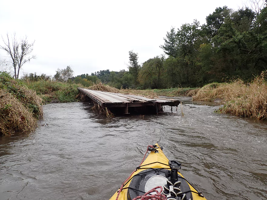
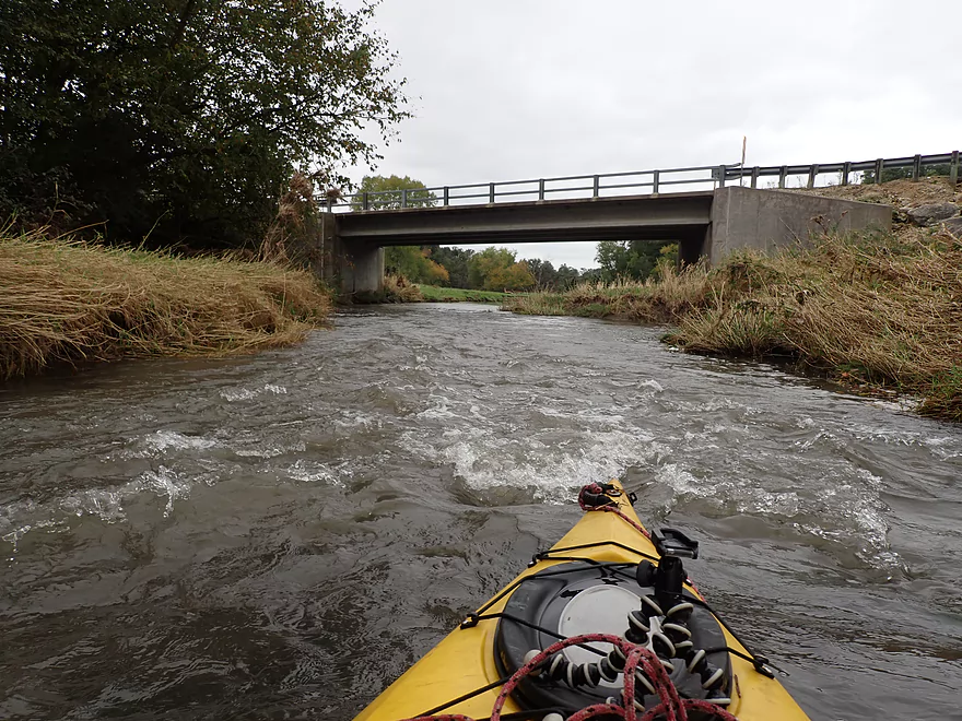
One of two washed-out farm bridges
Another logjam…I was just able to fit under
The side of this bluff was really beat-up
I think a tornado came through here
I had to be careful to avoid the shoreline strainers
Leaving the bluff behind
Still great outcrops
More limestone
Downed bridge #2 (poorly pictured because the current was so fast)
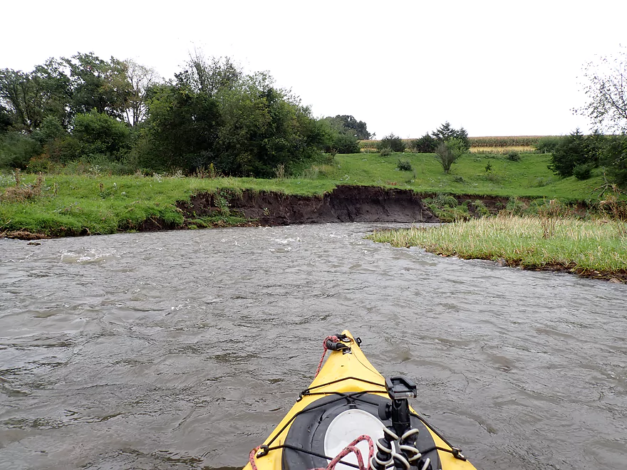
River taking a bite out of the shoreline
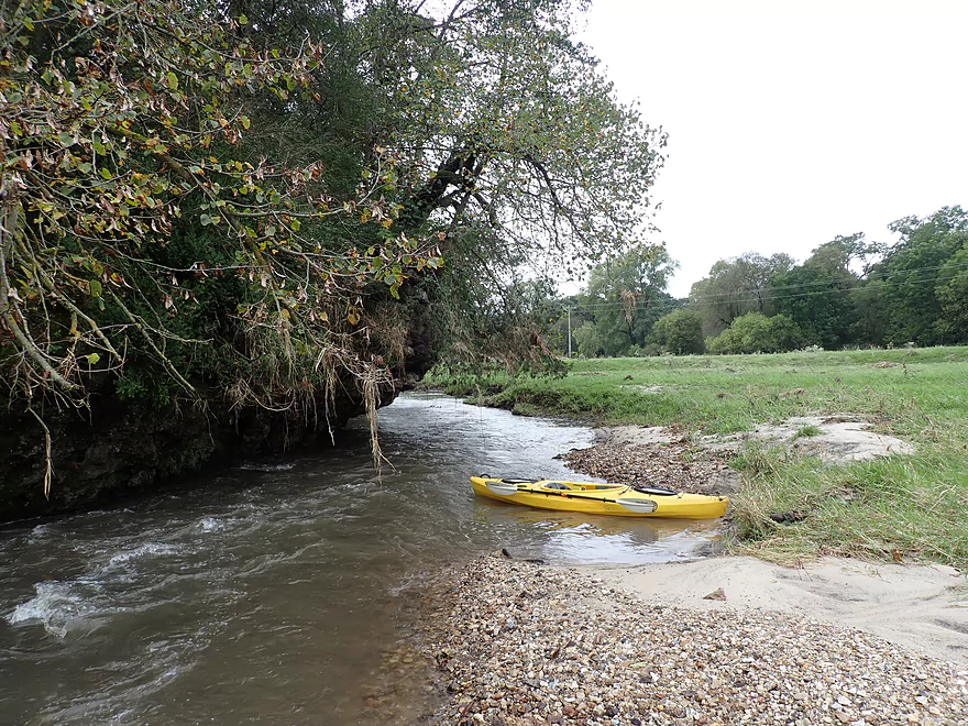
Time to swap batteries on this nice gravel bar
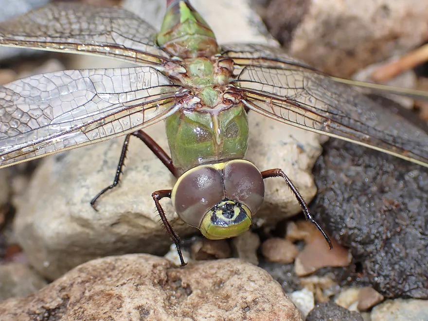
A very wet dragonfly
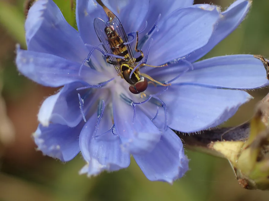
A hoverfly in some chicory
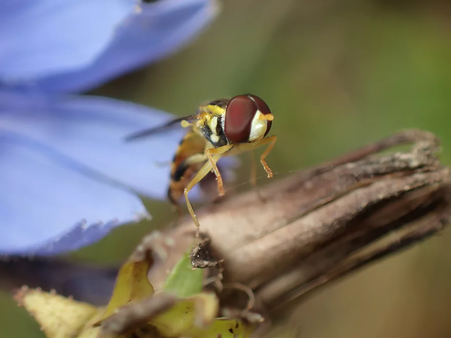
Pretty cool
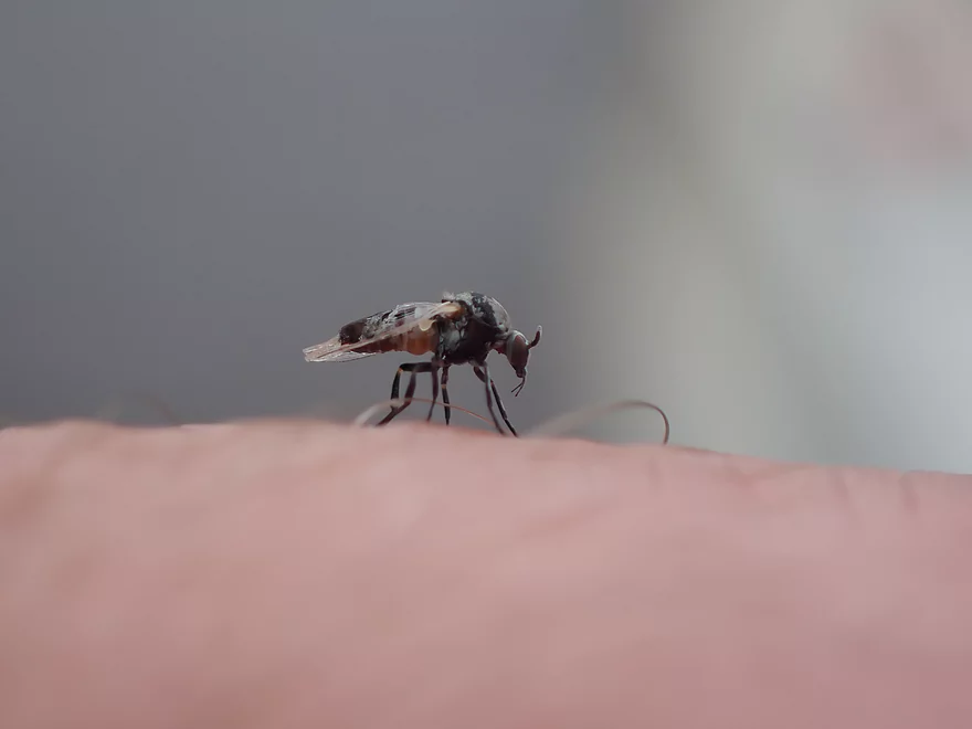
Not so cool…these gnats were biting me right and left
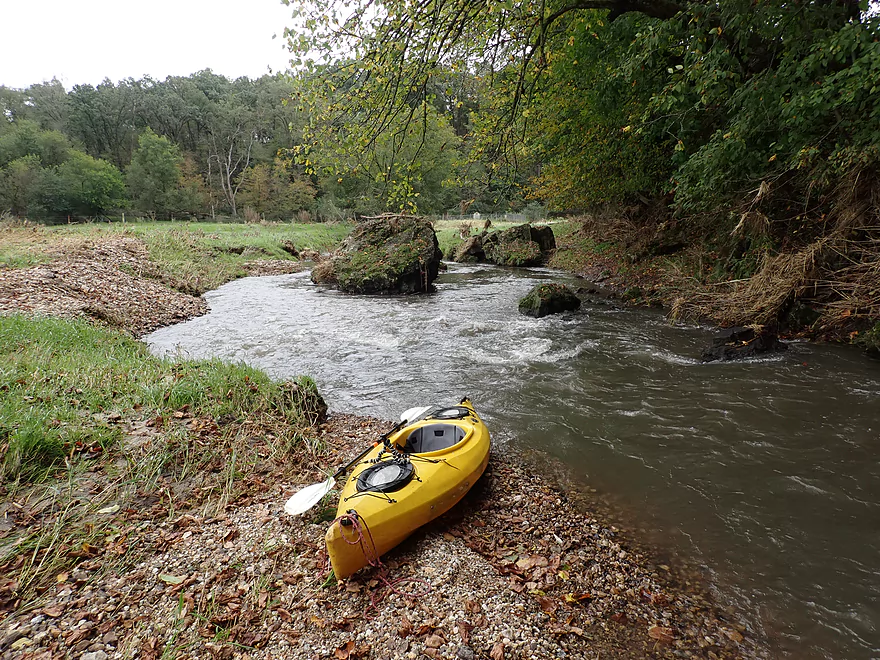
Rapids undercutting the limestone
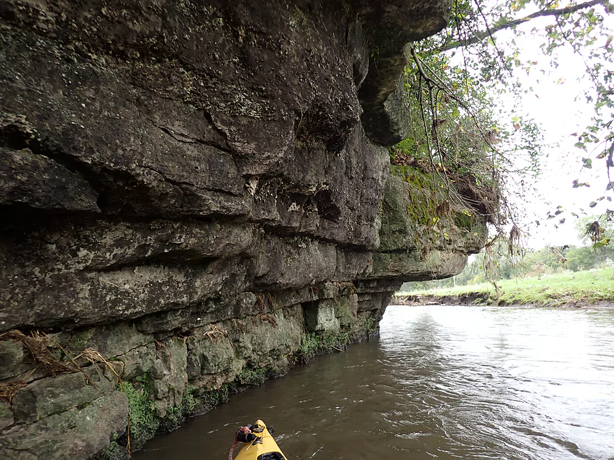
Very scenic…this limestone is likely over 400 million years old
Approaching the most scenic outcrop
Getting out for pictures
This reminded me of the Blue River
Reverse view
A heavily fortified spring pond
The final stretch
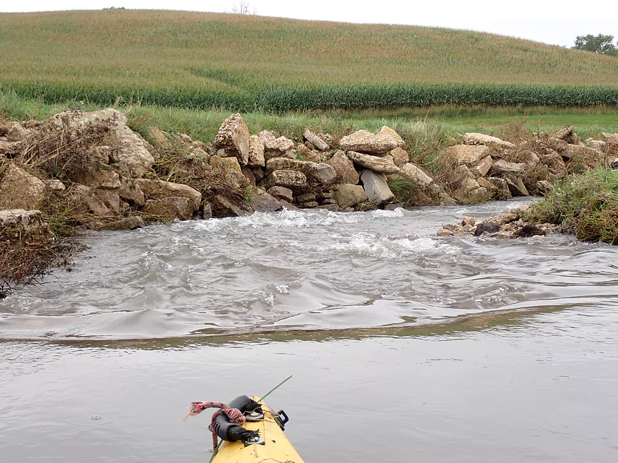
Very rocky section
Some of the longer rapids of the trip
Mt. Ridge Road
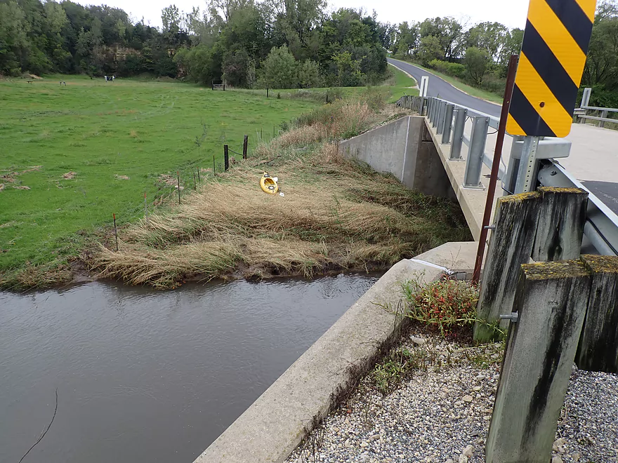
Steep take-out
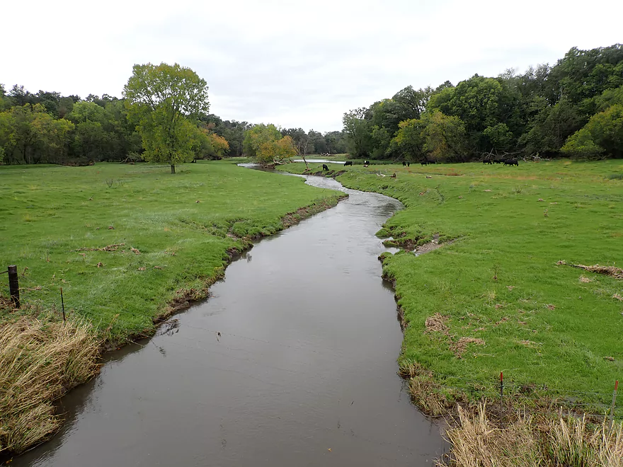
Nice pastoral view from the bridge
Grant River – Jones Branch (Hwy 61)


Last year I paddled a stretch of the Upper Grant known as the “Jones Branch”. This was a surprisingly nice paddle which had me curious about other legs. Map analysis suggested the Upper Jones Branch was small, open, had only a few logjams, and had potential for scenic geology. During one of those “everything else is too high to paddle” weekends (that happen a lot nowadays), I decided to finally check it out.
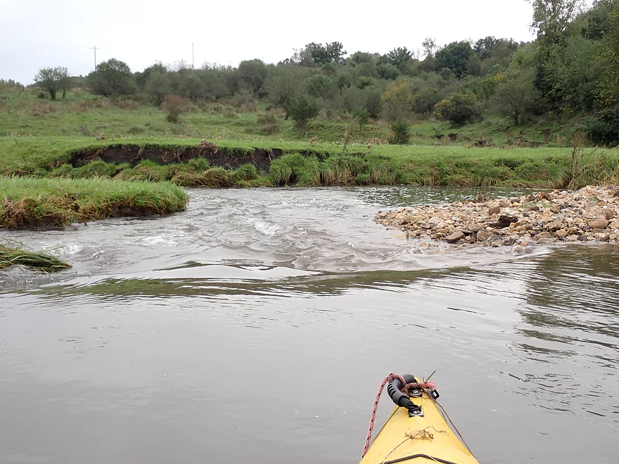
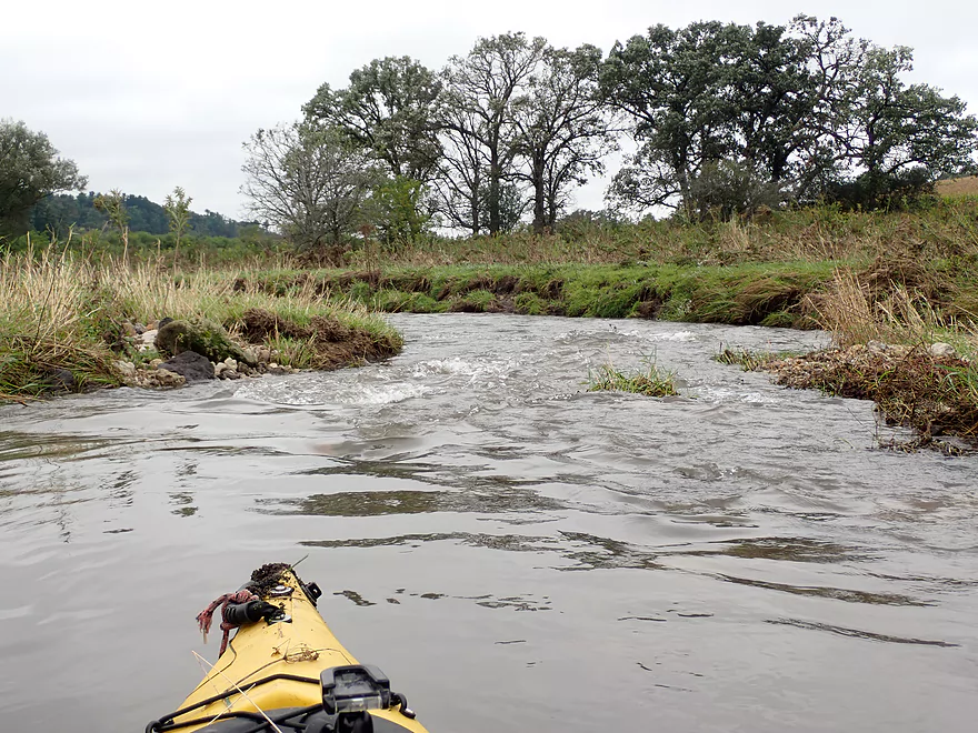
I started the trip at Hwy 61, a location I had scouted multiple times before and each time the river had looked low. But with the Grant River running at a high 800 CFS, it finally looked good for paddling. Some weed wading was required to find a nice launch area amidst the light rapids, but it was all manageable. A gang of curious cows came running over to watch me launch…they kind of reminded me of that viral cow/music video.
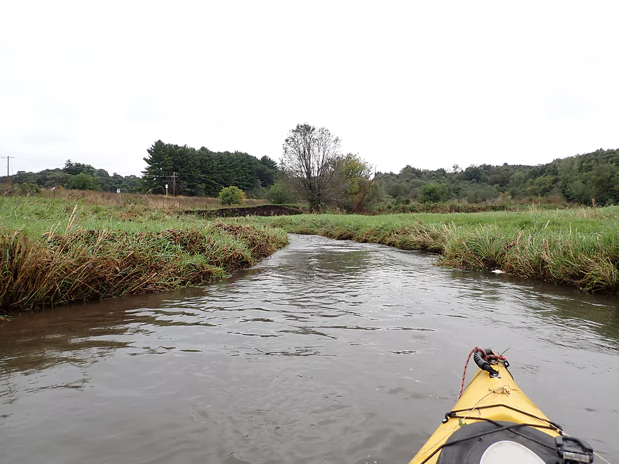
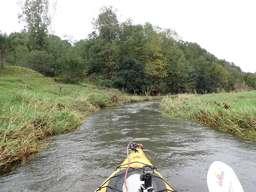
This ‘river’ was no more than a small creek at times less than 5′ wide. I soon encountered my first logjam which was an easy portage. The scenery in the first mile had its moments including some rolling green hills. But for the most part this was a “pasture paddle” with overgrazed shorelines, muddy water, and exposed mud banks. The current was fast with many rapids. Where the river narrowed, fun chutes would sometimes appear which were a lot of fun to run.
About a third into the trip though, I was honestly disappointed. To this point there were no outcrops, the bank quality was a mess, the skies were gloomy and overcast, and the scenery wasn’t nearly as good as my lower Jones Branch trip. Then things got worse… I paddled around a sharp corner and was confronted with a large strainer in fast current. There was a small window to the left, but I didn’t hit it, as the current was too strong. I got pinned sideways against the tree and had to do a wet exit. I was able to drag my then very heavy boat up the bank where I drained it out. Fortunately my valuables were stored in a dry bag sealed in my rear hatch, and my camera was waterproof so no harm done. But it wasn’t a good time to be wet given the cool and windy weather.
The key with strainers is to obviously never get near them. But if you do get close, then do not turn sharply in front of them (as I did). A boat positioned sideways to fast current and pinned by an obstacle will act like a dam and quickly fill with water. Instead ALWAYS keep the boat pointing downstream and paddle vigorously in reverse. By gently angling away from the strainer, you can usually safely zigzag around it.
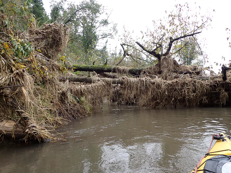
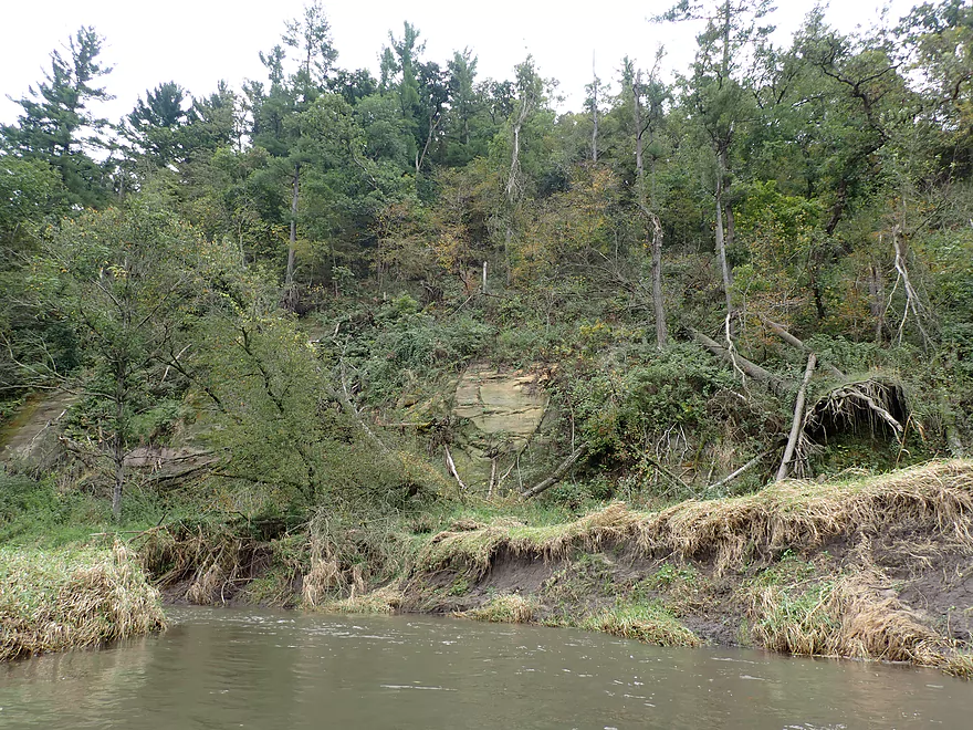
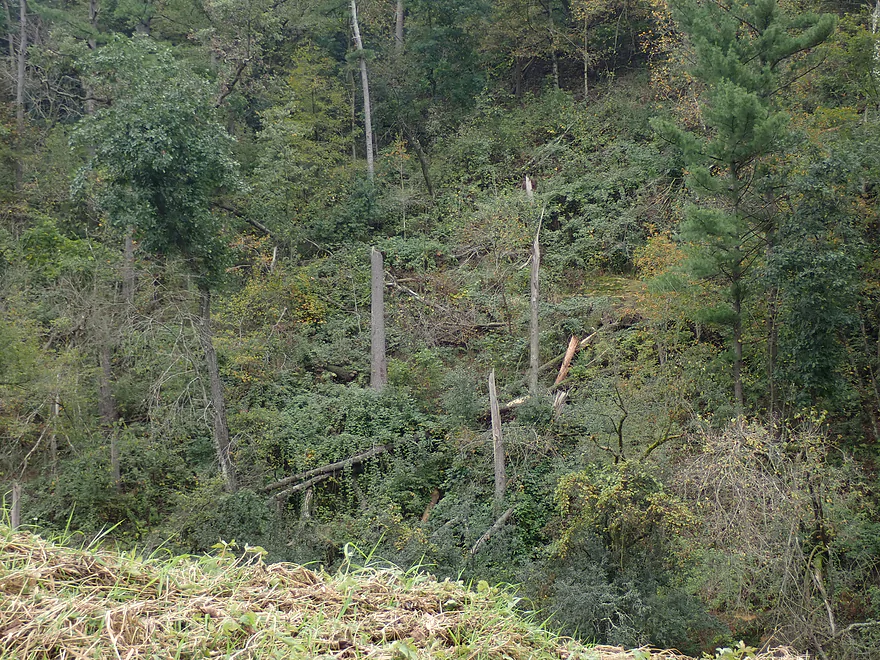
This strainer was soon followed by another logjam which required a muddy portage. I was quickly becoming disillusioned with the trip. But things did start to improve, beginning with the shoreline. Along the east bank were steep bluffs topped with attractive pines and with rock outcrops at the base. This reminded me of the East Branch of the Pecatonica and Castle Rock Creek. The hillside was a mess though at it appeared a tornado had rolled through. Pines were snapped in half and several were in the process of falling down the bluff and into the river. In one case this caused a serious logjam, but I was able thread my way through it.
Despite its small size, the upper Jones Branch can have some serious flooding (far higher than what I paddled). Along the shoreline large swaths of grass were flattened by floodwaters and two farm bridges had been partly washed out. Lying on their sides in fast current they acted like strainers that needed to be carefully avoided. Many of the sharp turns had real strainers which kept me on my toes. Honestly though, these were not too bad, and worried paddlers could always portage any scary looking ones.
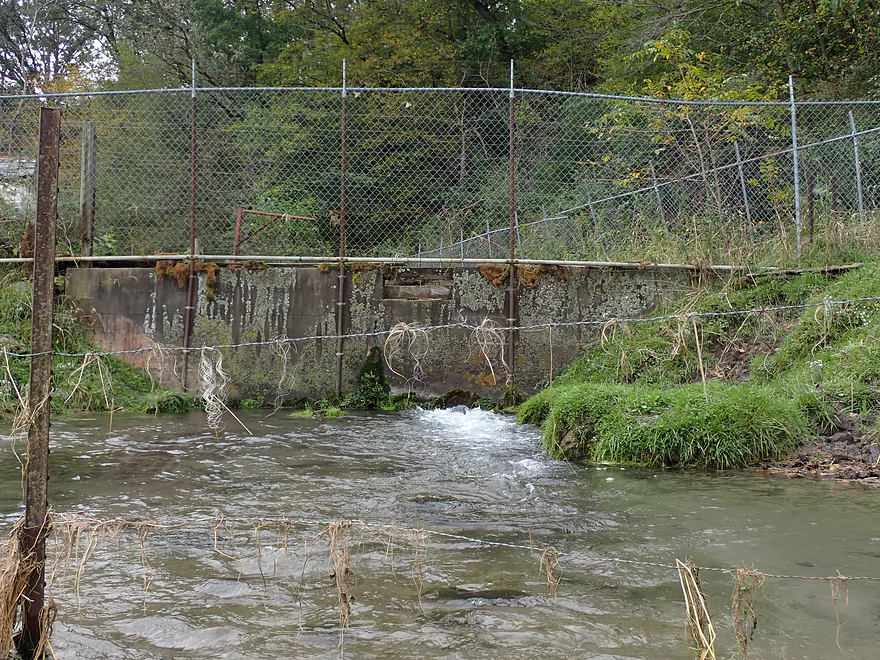
In the final mile, the scenery improved dramatically. The banks weren’t as overgrazed, more outcrops and hills appeared, and I finally started seeing some decent woods. In several cases light rapids undercut limestone walls which were really striking. The final couple hundred yards included a trip highlight: a combination limestone wall, boulder garden and rapids, which was really photogenic. This was followed by a huge spring pond fortified by a concrete wall and two layers of barbed wire fencing. …kind of odd. I ended the trip at Mt. Ridge Road, which was where I had started my trip last year.
In summary, this was yet another water trail that was tough to rank. Your casual paddlers won’t like it…the access points are rugged, the creek is muddy and narrow, and it can only be run during special high water windows. Then there are the occasional strainers and the 3-4 logjams that have to be portaged. But…the rapids were a lot of fun. It’s always a treat to run rapids between a narrow and twisting shoreline, which at times gave this trip an amusement park vibe. The limestone outcrops were also fantastic…whether these are all worth it will depend on your individual taste in water trails.
I started the trip at Hwy 61 which was a mediocre bridge access. This is a busy road with a long guardrail so it was easier to park on Rogers Road. Shortly after launching there is a cow fence spanning the river, but it is very easy to duck under.
I took out at Mt. Ridge Road, which is a scenic part of the river, but is not an ideal take-out because of the steep rocky banks. Because of upstream rapids, it is actually easiest to take out directly under the bridge. This is an otherwise decent access that is occasionally used by trout fishermen.
Adventurous paddlers could continue 2.6 miles to Pine Knob Road. That is a neat four star stretch I did last year.
The bike shuttle is only 4.1 miles but is a bit difficult because of the many hills (299′ of total climbing which is a lot).
Low Bridges: Both of the local farm bridges were washed out, so you don’t have to worry about ducking under them. But now they partly reside in the creek and with the decent current are somewhat of a hazard. Do be careful in paddling around these.
Current: The current was very fast. This was partly because the water levels were so high.
Logjams: This is a very open section of the Grant, but there were some downed trees. These are listed on my map.
- Logjam #1: Shortly after the put-in, a small tree blocks the channel. Super easy portage.
- Logjam #2: About halfway into the trip a downed tree blocks 90% of the channel. The current here is very strong…in fact I took a swim trying to get around it.
- Logjam #3: Located almost directly after #2. This is a medium difficult portage because of the steeper mud banks.
- Logjam #4: This comes up shortly after #2 and is next to a steep sandstone wall. A tree fell from the cliff and is partly hung up by the opposite bank. I barely squeaked under this one.
Rapids: There are countless rapids on this stretch. Most are Class 1. But there are a few Class 2’s. These can be difficult because you’ll need to dodge a rock or limb in fast current and there isn’t a lot of room to maneuver. If in doubt, just get out and portage.
Strainers: Again, this is a fast river and in multiple spots the main channel flowed under a low hanging branch. Treat these carefully and portage them if in doubt.
Cow Fences: There are two barbed wire fences to duck under in the first mile, but these are pretty high up and super easy to duck under.
The following is a very rough guestimate based on a gauge located much further downstream. I did this trip at 800 CFS.
- 0-400 CFS: I suspect this would be too shallow.
- 401-600 CFS: Some of the rapids will be bumpy, but I think this would be a viable trip. My trip last year just downstream from here was done at 586 CFS.
- 601-1000 CFS: A very high depth for the Grant River but a good target range for this trip. The rapids should be adequately padded, but there will be a few pushy areas that paddlers should be vigilant about.
- 1001-1200 CFS: Likely only suitable for experienced paddlers with good boat control.
- 1201+ CFS: The river might be too pushy and dirty to run at this point.
Detailed Overview
- Pine Grove Road to Hwy 61: 2.1 miles. Very small and would need flood-like levels to be navigable. Likely not interesting with several fences, 3-4 logjams, and flowing mostly through cow pasture.
- Hwy 61 to Mt. Ridge: 5.0 miles. A rugged and small paddle that needs high water. Unfortunately there is a lot of mud and pasture to deal with not to mention a few logjams. However, there are many fun rapids and several scenic outcrops.
- Mt. Ridge to Pine Knob Road: 2.6 miles.
- Mt. Ridge to Hwy K: 1.7 miles. Narrow and fast with several rock outcrops. No logjams, but a few tricky strainers.
- Hwy K to Pine Knob Road: 0.9 miles. A neat section with more outcrops, a longer set of Class 2 rapids, and Klondike Springs.
- Pine Knob to Hwy A: 2.7 miles. Likely way too many logjams.
- Hwy A to Grays Mill Road: 0.7 miles. Maybe one downed tree. Mostly a simple farm field paddle.
- Grays Mill Road to University Farm Road: 3.4 miles. Maybe 2-3 downed trees and one set of rock outcrops. River gains significant volume in this stretch from tributaries.
- University Farm Road to Short Cut Road: 3.7 miles.
- University Farm Road to Slab Town Road: 1.5 miles. Very muddy and one noteworthy strainer, but also has a great series of limestone outcrops.
- Slab Town Road to Short Cut Road: 2.0 miles. Less muddy and with several sets of fun rapids, but has only one tiny outcrop and there is a logjam to deal with.
- Short Cut Road to Grant River Road: 5.5 miles. Great section with some attractive outcrops.
- Grant River Road to Hwy U/Blackjack Road: 6.2 miles.
- Grant River Road to Pigeon River Road(1st): 1.4 miles. Great stretch with some of the best outcrops on the river. Grant River Road is a bad access.
- Pigeon River Road(1st) to Hwy U/Blackjack Road: 4.8 miles. A good leg with a mix of sandstone and limestone outcrops. Outcrops aren't as common as other legs, but it's still a nice stretch..
- Hwy U to Camel Ridge Road: 6.0 miles. Good stretch with some nice rock outcrops.
- Camel Ridge Road to Chaffie Hollow Road: 3.2 miles. Very scenic section with good current. Features a waterfall and some nice outcrops. Very popular with tubers.
- Access note – The Chaffie Hollow Road landing is private. Get permission from one of the three liveries like “Y’Allbee Tubin” to use it, or take out under the bridge (the latter is not easy).
- Chaffie Hollow Road to Hwy N/Burton: 3.3 miles. I don’t know much about this section. Likely more open and less interesting…but likely some outcrops and light rapids.
- Access note – The landing at Burton is private. If you take out here, use the bridge instead.
- Hwy N to Great River Road: 8.5 miles. Should be a few nice rock outcrops, but the channel is much larger and muddier. Maybe 3 logjams. Take out at Hwy 133 on SE side…not an ideal launch area.
- Great River Road to Mouth: 1.6 miles.
- Mouth/Mississippi to Potosi Point: 1.2 miles. A short trip on the Mississippi before disembarking at Potosi Point.
Trip Map
Overview Map
Video
Photos Size: