
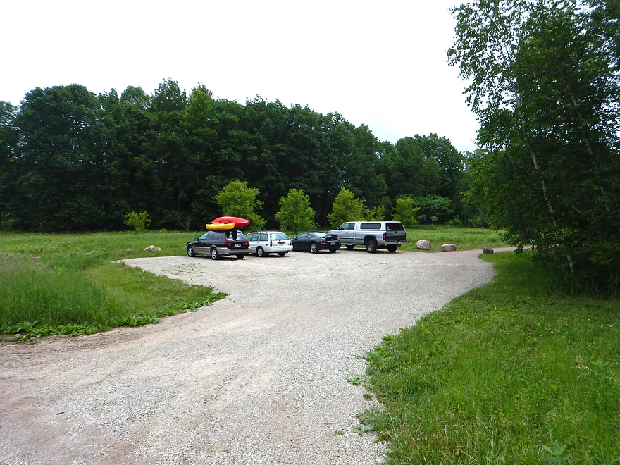
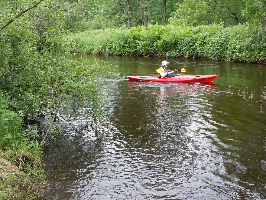
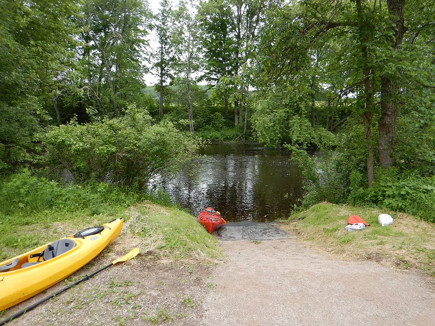
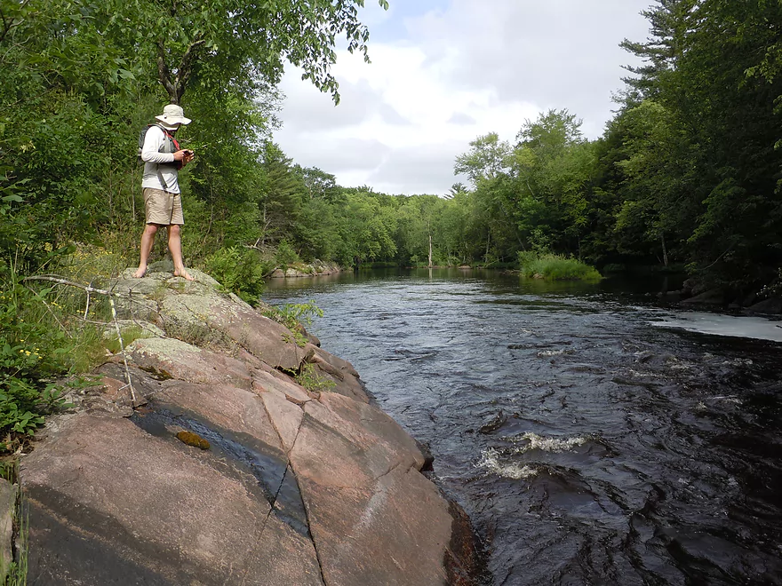
Wolf River Road put-in
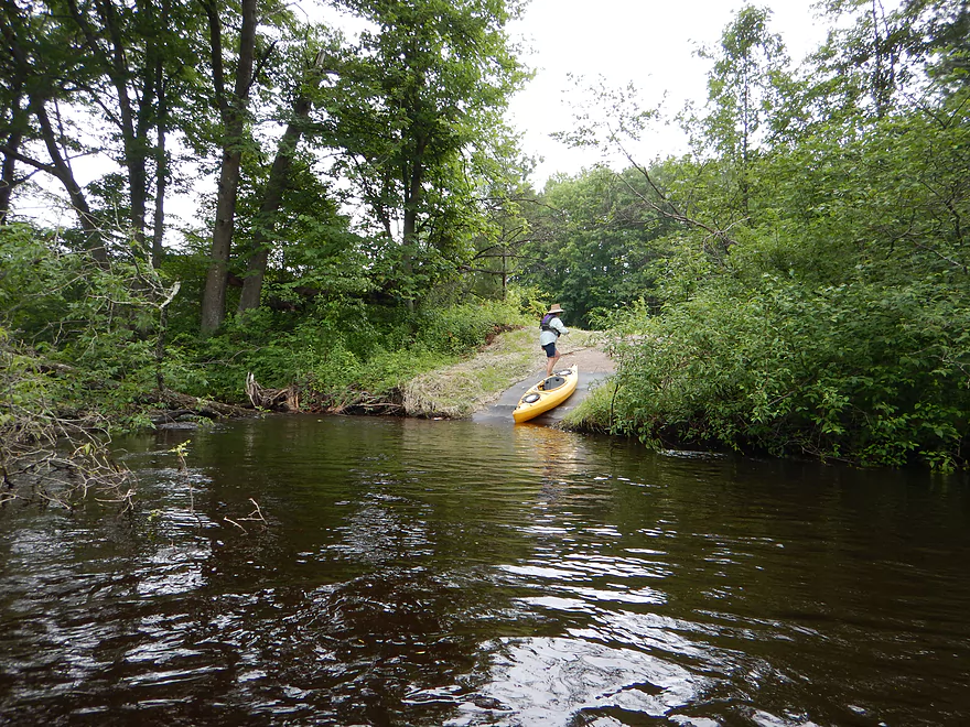
Good access
Just avoid this
And this
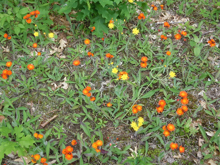
But this is good (yellow & orange hawkweed)
Nice large Ostrich ferns
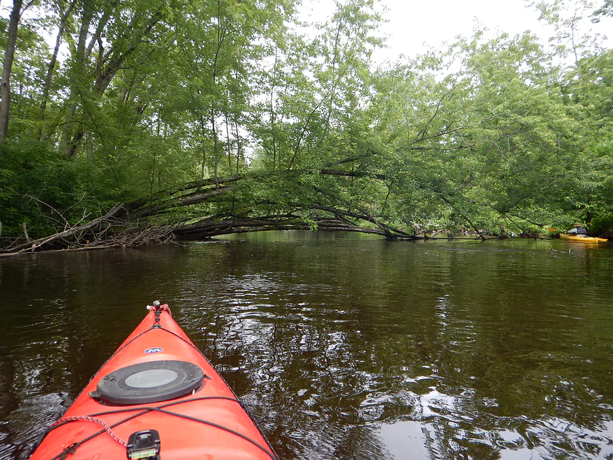
Second log jam near put-in…tight fit
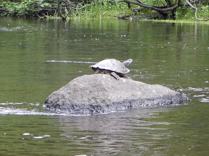
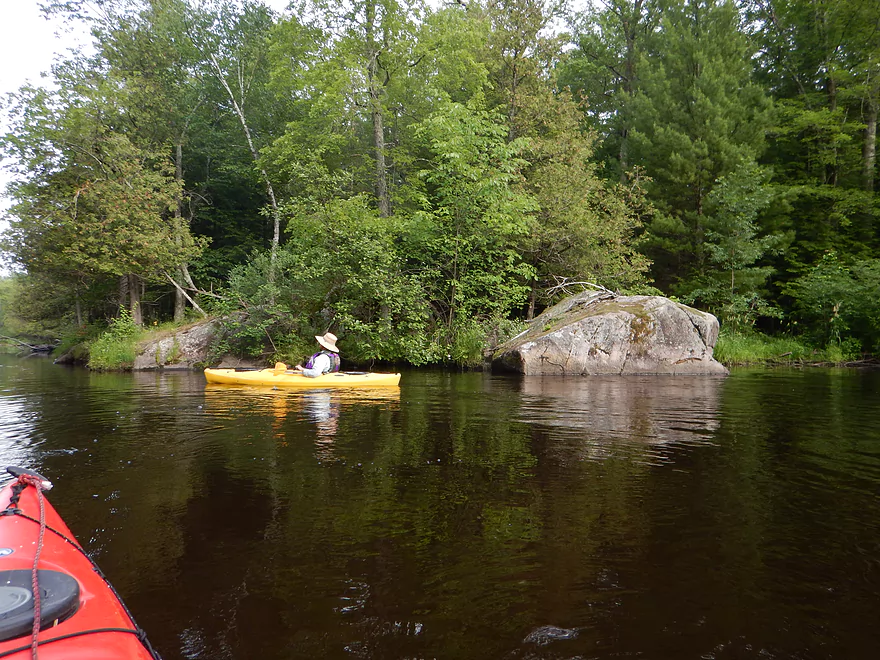
Painted turtle
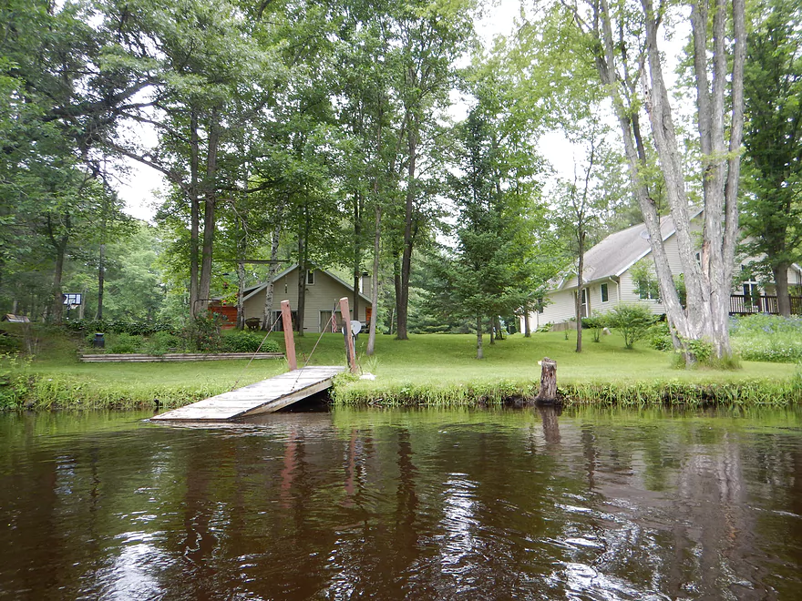
Maybe a dozen homes on the river
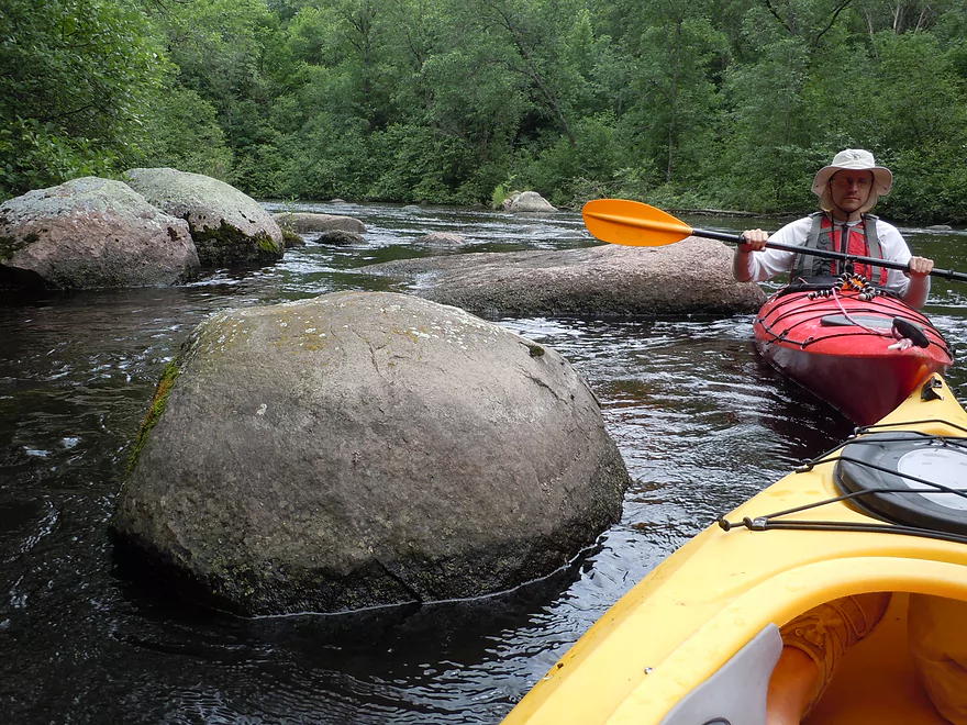
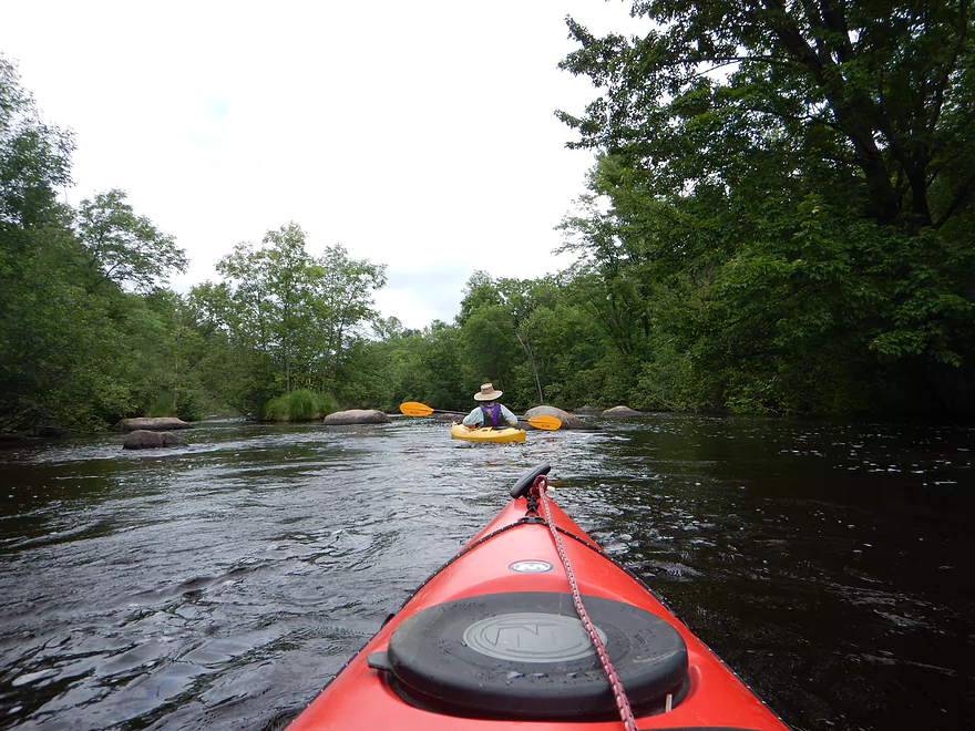
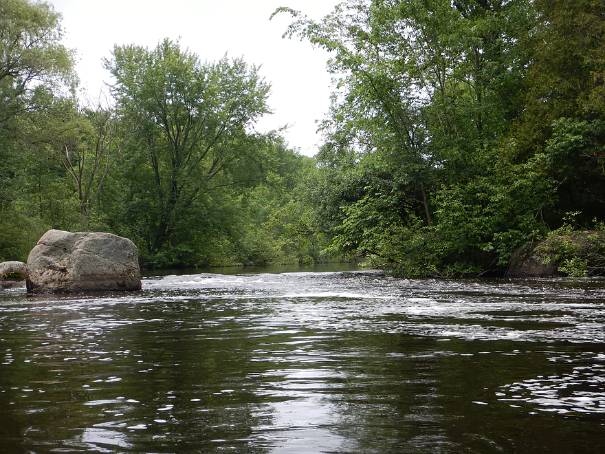
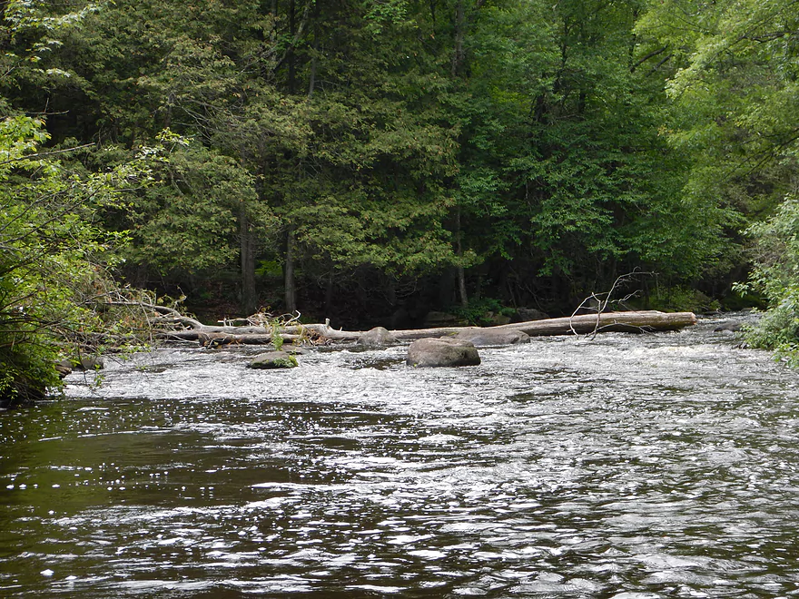
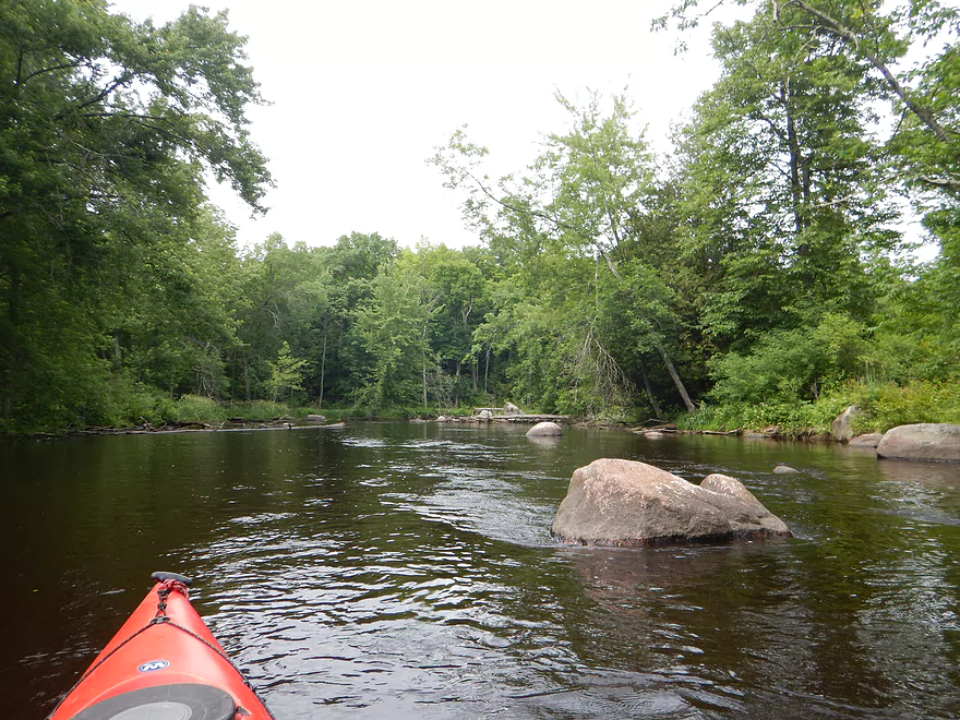
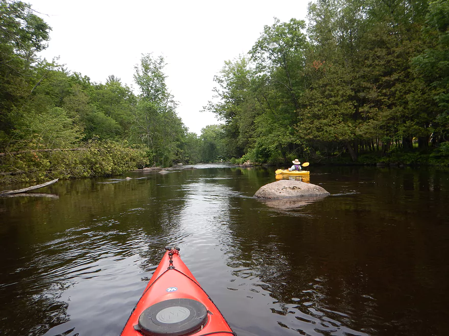
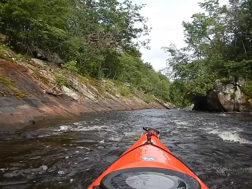
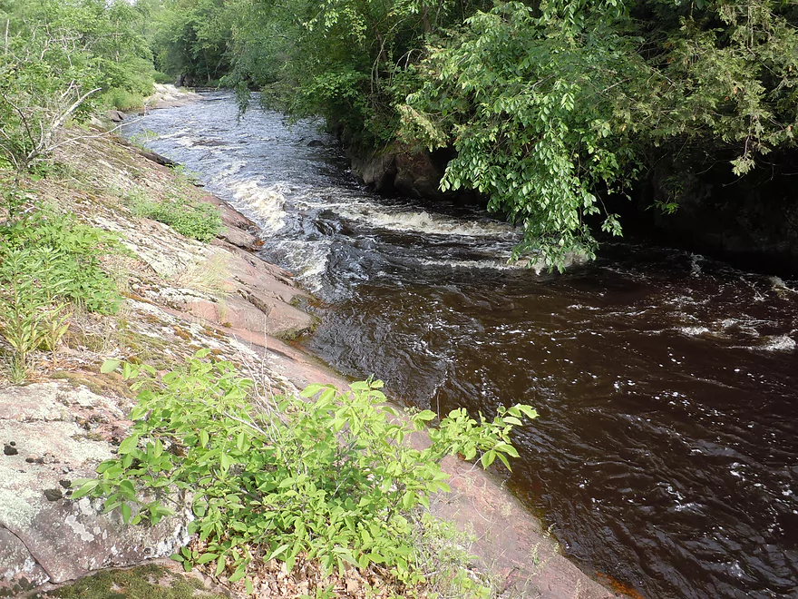
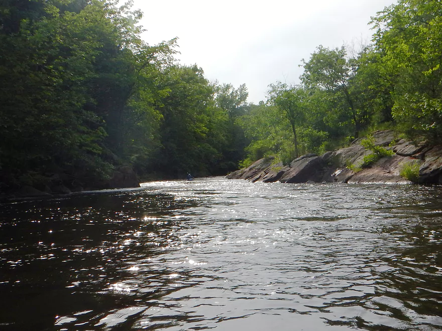
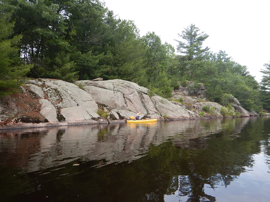
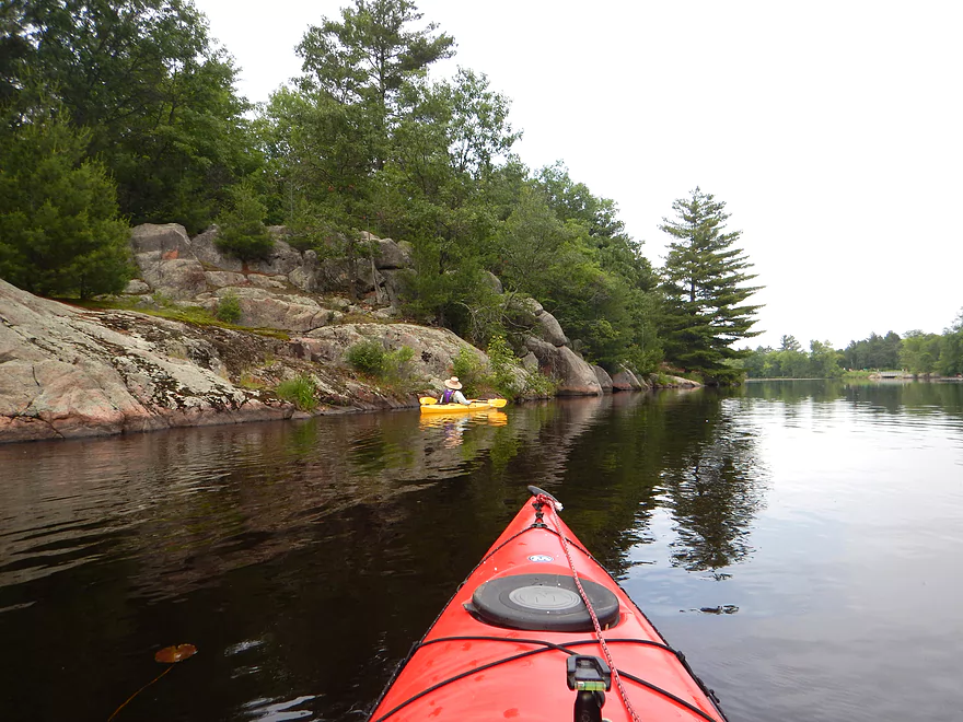
Start of the boulder gardens
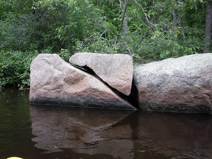
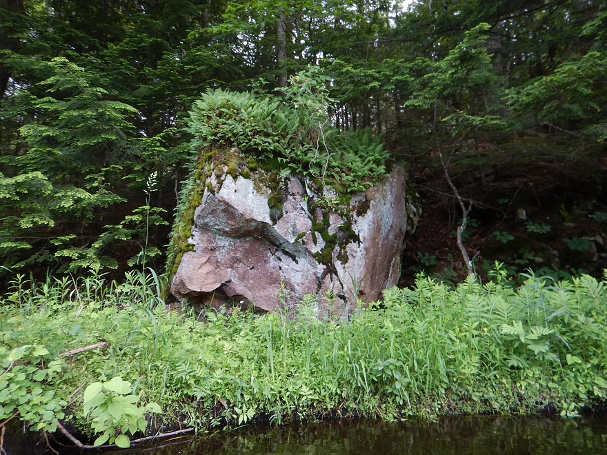
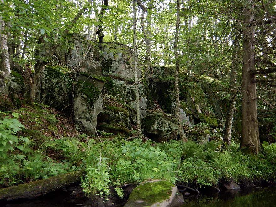
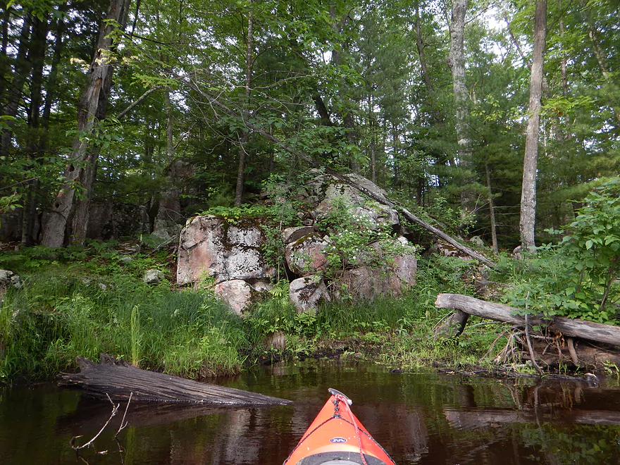
A sliced rock
Easy riffle
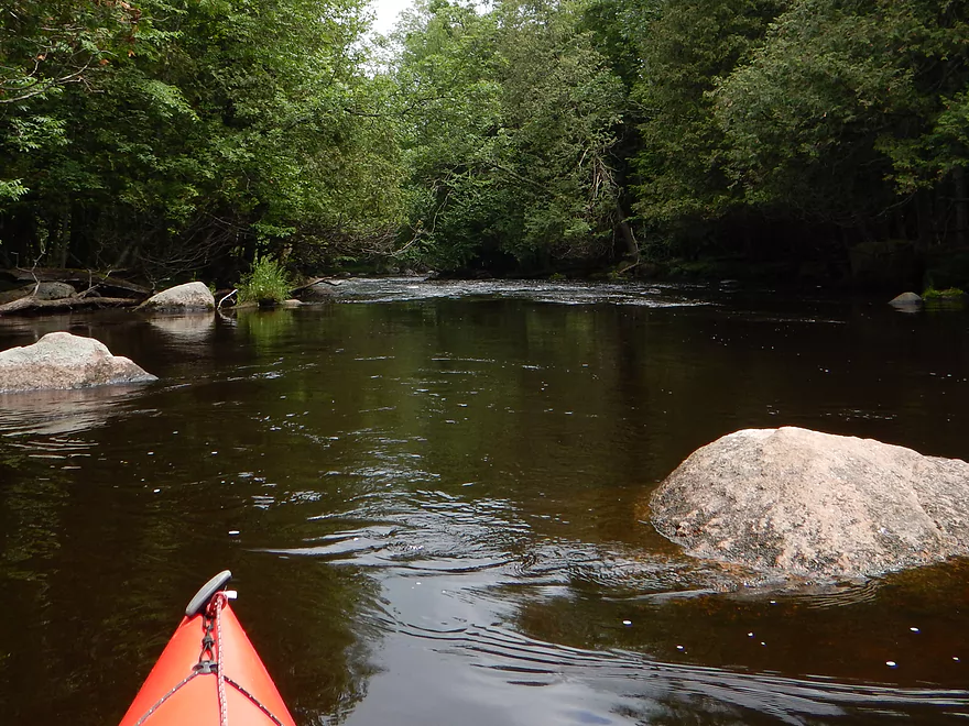
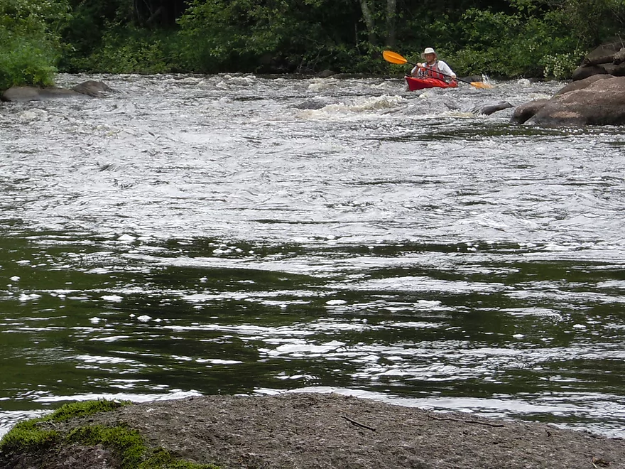
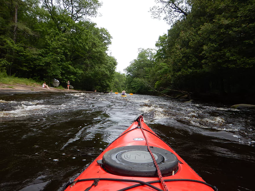
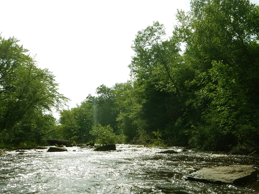
First class 2 rapids
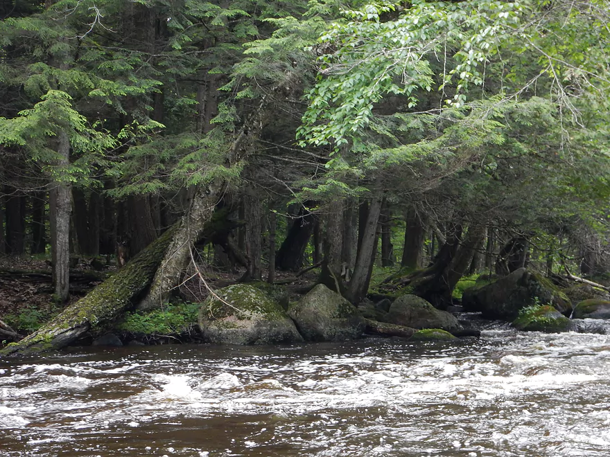
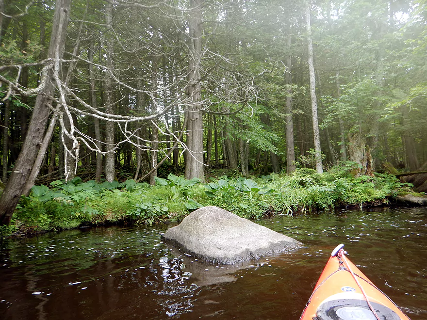
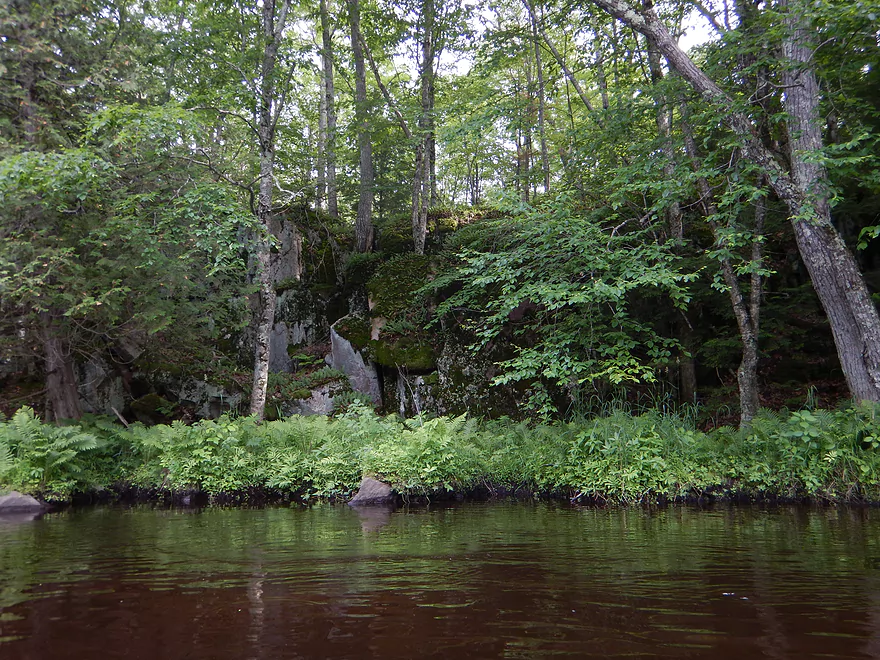
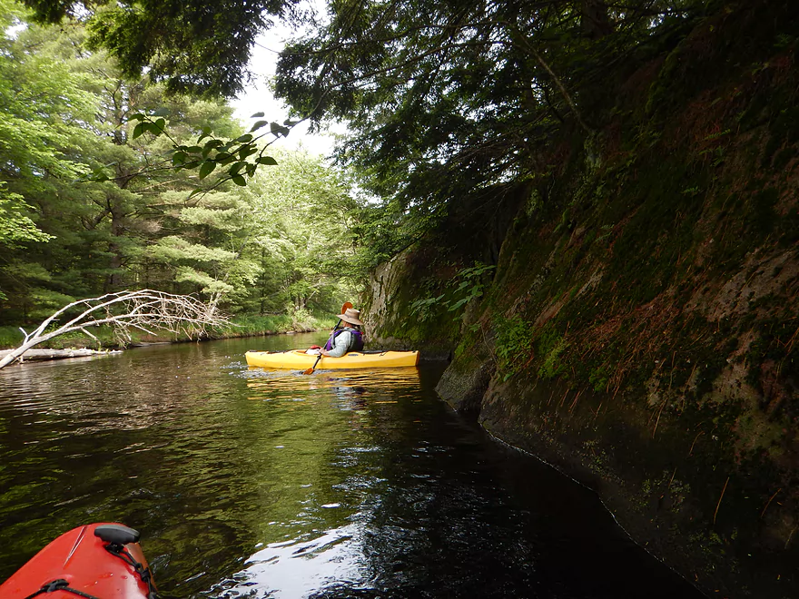
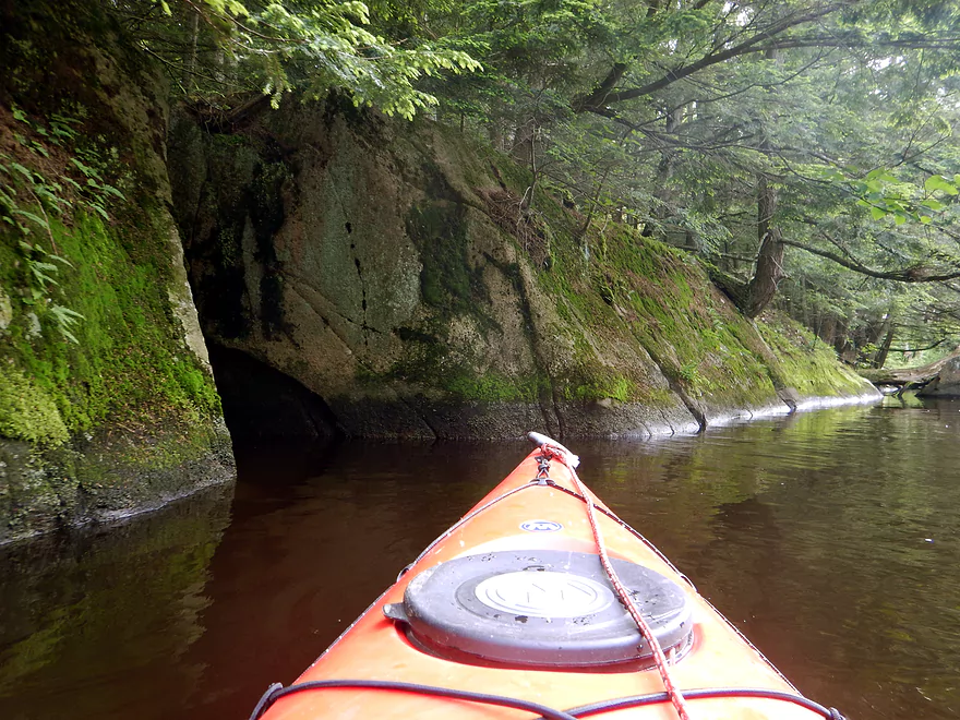
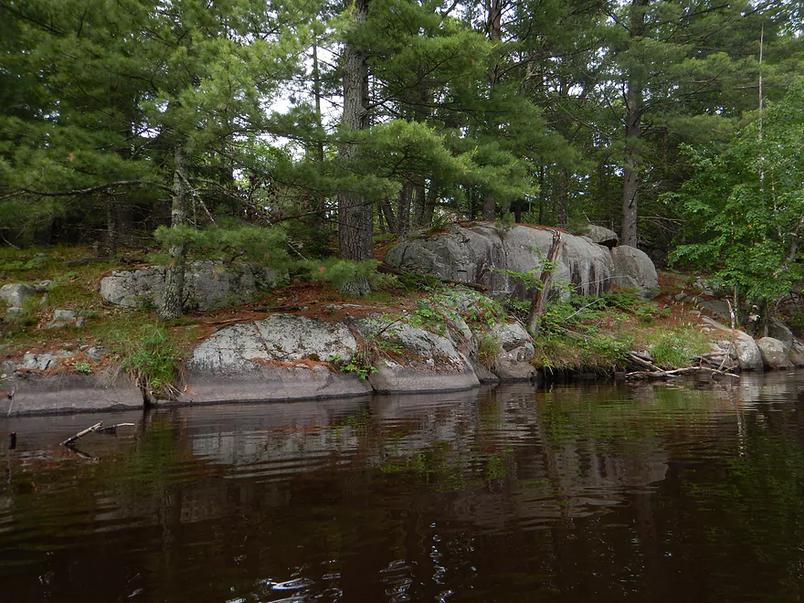
Nice shoreline with hemlock trees
Rapids getting more serious
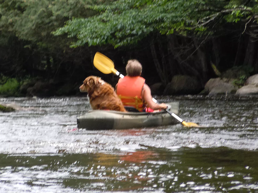
Dog looks nervous
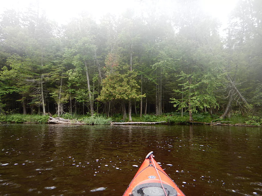
Fog on lens was an issue
Nice leafy green vegetation
Good thing it was shallow here
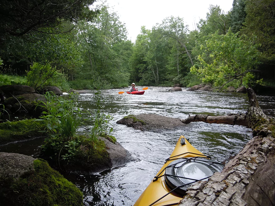
Soon after this boulder & lawn is a tough strainer
Keep left!
Reverse view…small gap on the end…tricky in fast current
The picnic area
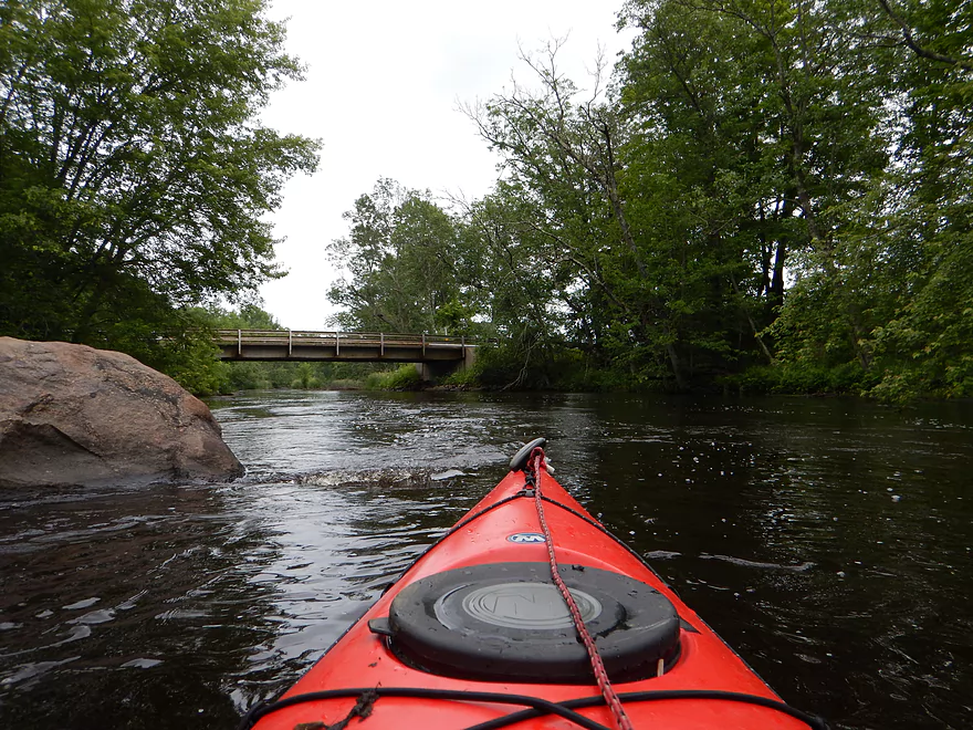
Hwy J
Good take-out option
Perfect time to do this
Kayak launch and no mention of kayaking….
Good parking if you take out or put in here
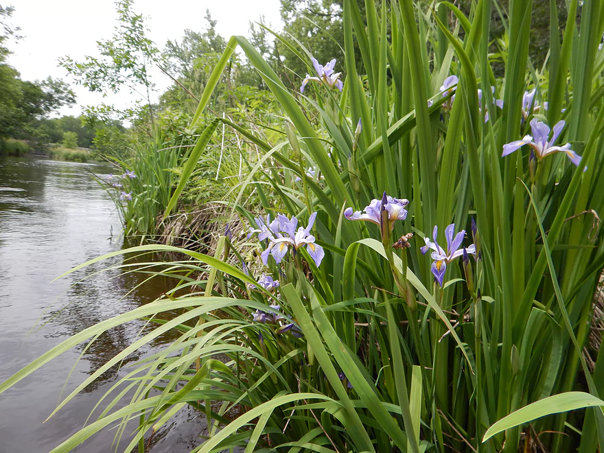
Blue Flag (wild iris)
Tough log jam
Took MANY hops to get over
Another jam
Yet another jam…needed tricky maneuvering to get through
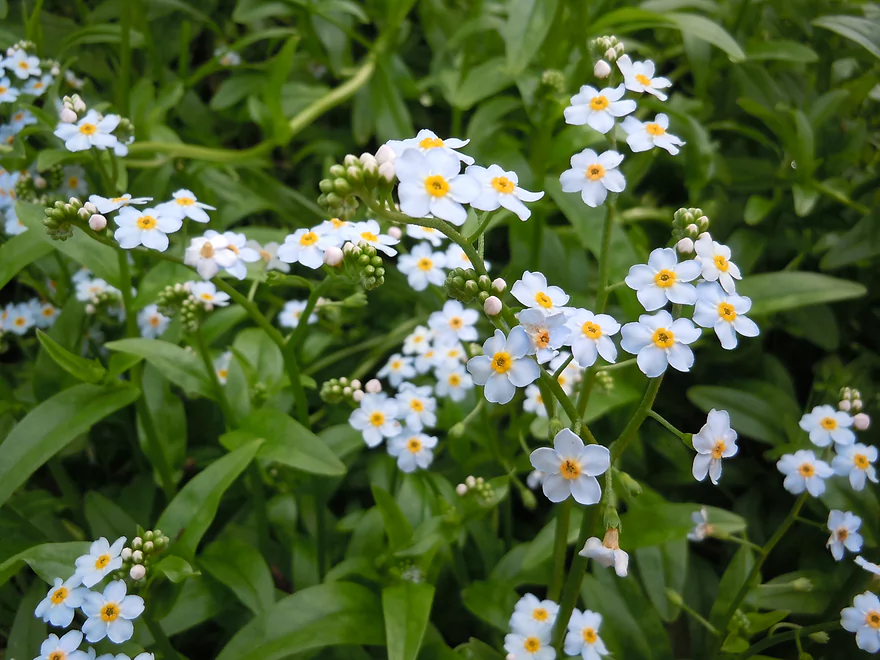
Forget-me-nots
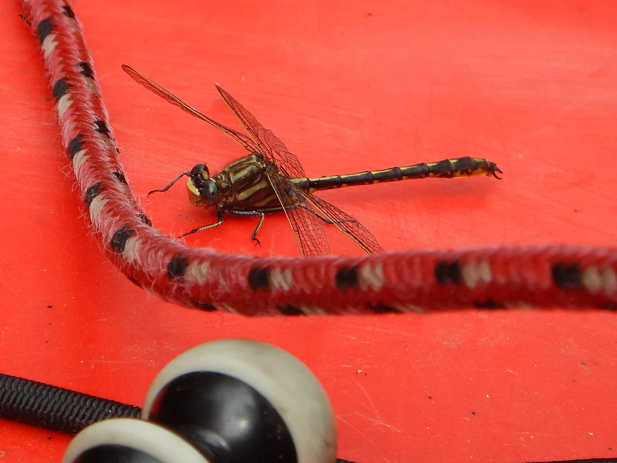
Lot of friendly dragonflies on the river
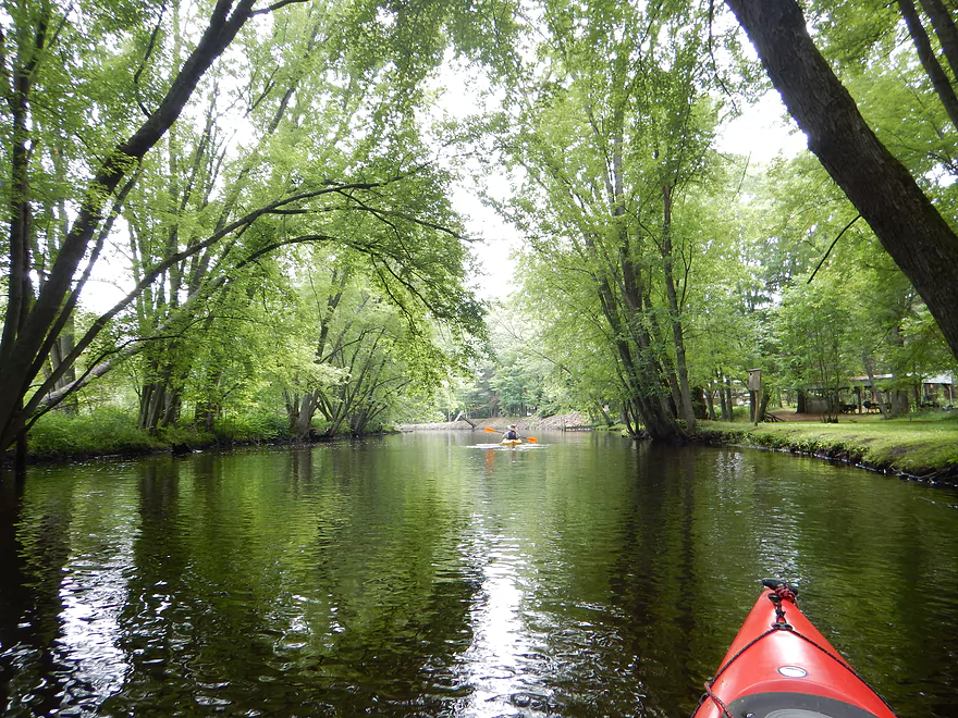
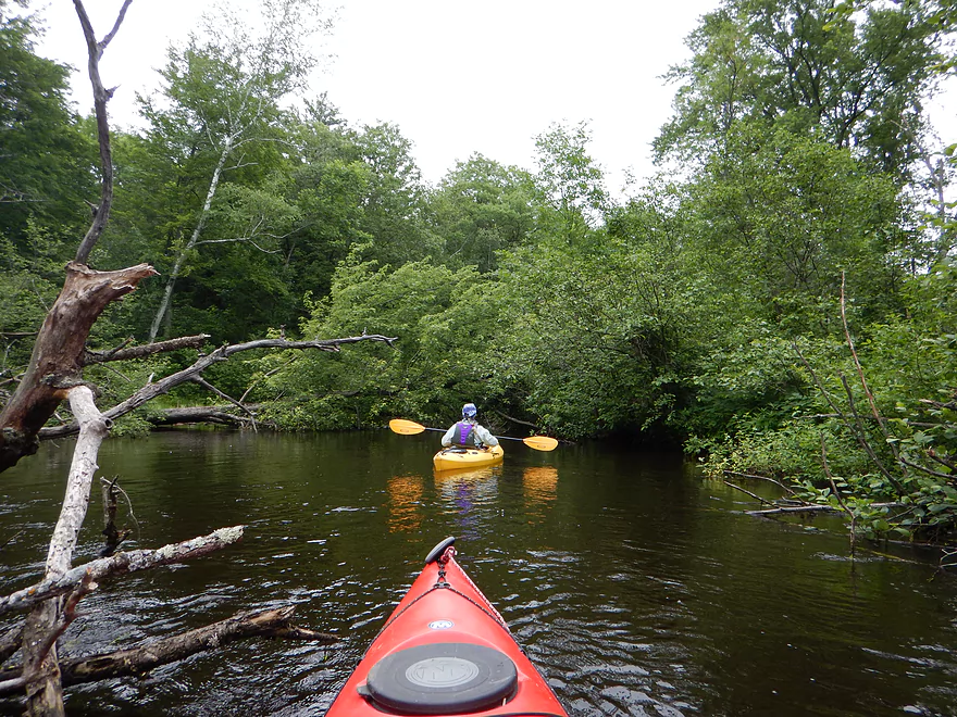
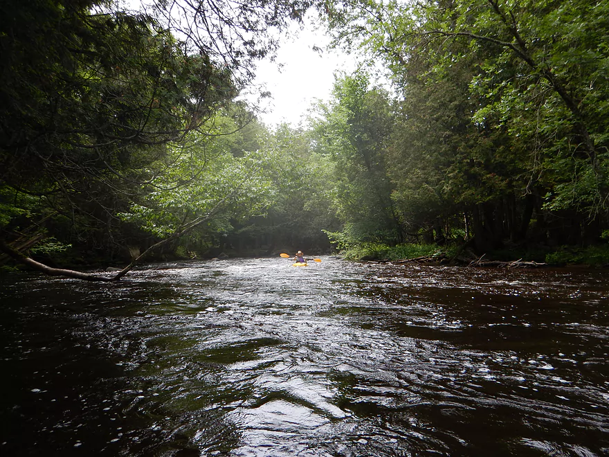
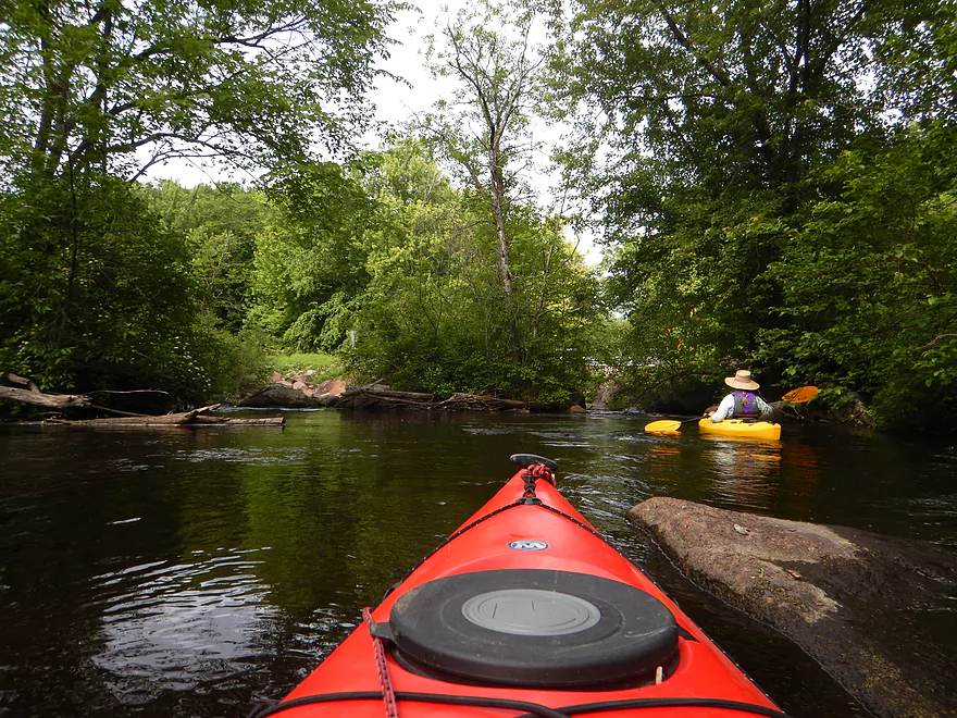
Nice tree canopy
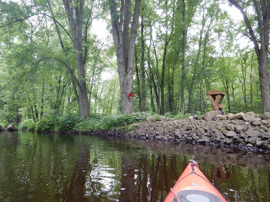
Outdoor nicknacks
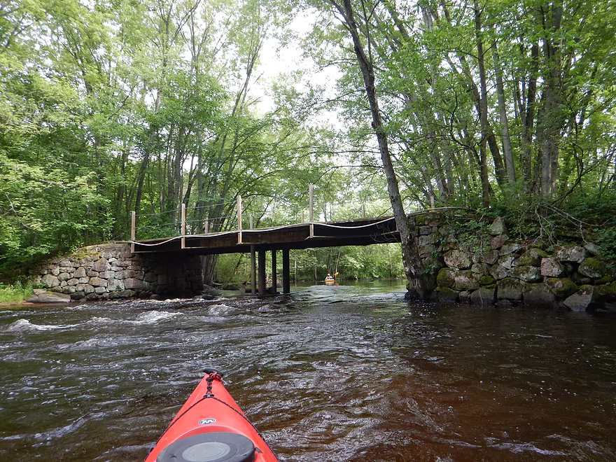
Attractive pedestrian bridge
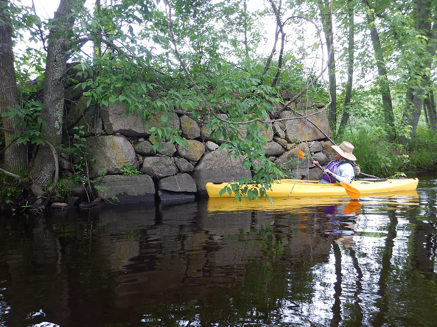
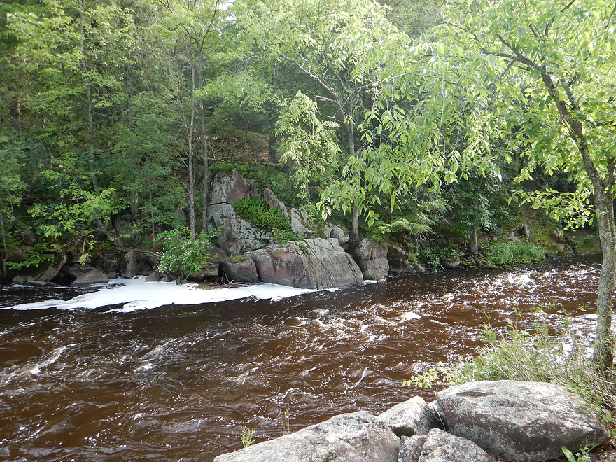
Remnants of an old mill
Serious rapids after the McNinch Road Bridge
Current shoves you through a downed tree
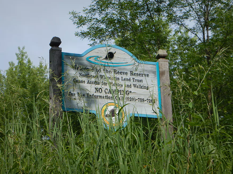
Reeve Reserve (picnic area for paddlers)
Entering the Little Wolf Dells
A small forceful chute
Time for a break to do this
Nice natural rock walkway
Famous Dells chute from above
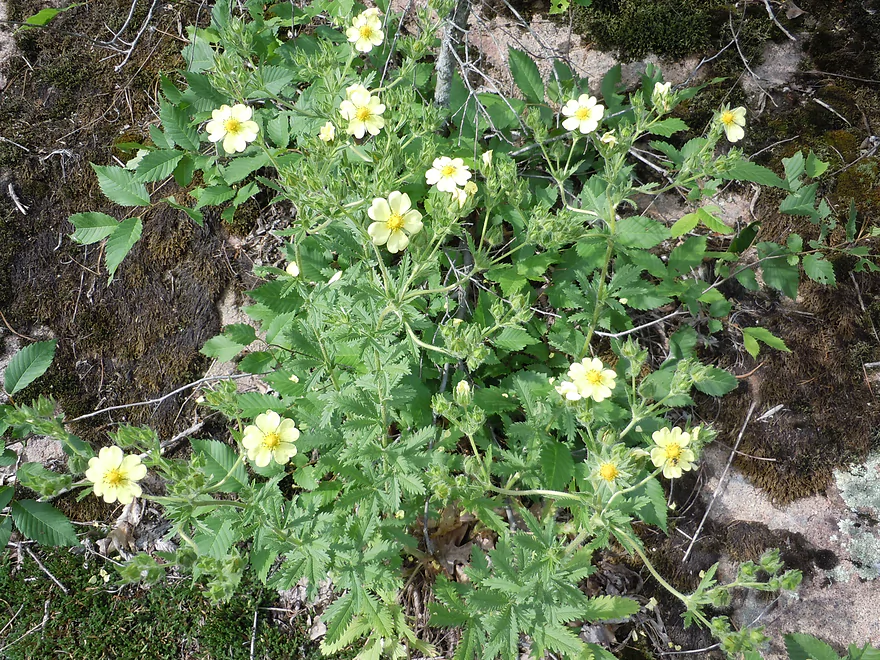
Cinquefoil
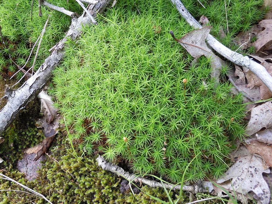
Cools mosses growing on the rocks
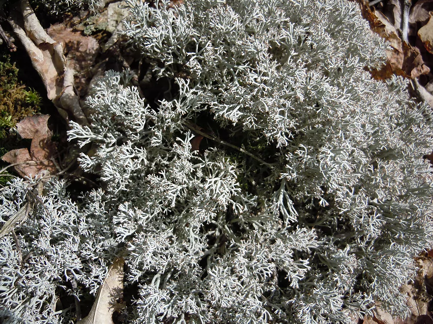
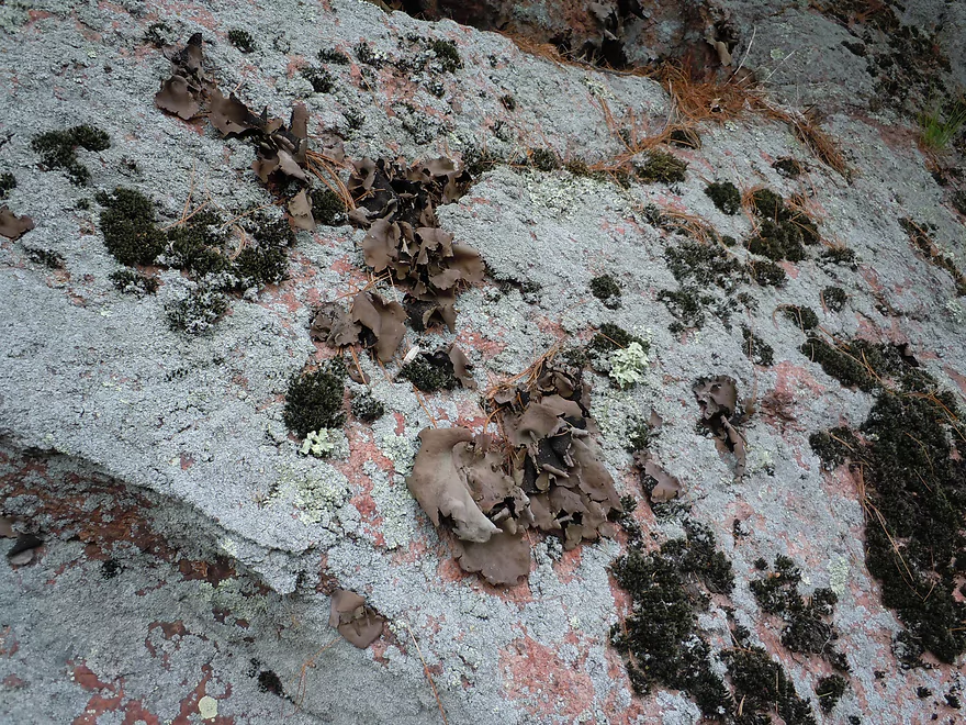
Reindeer Lichen
Looking over the entrance to the Dells
South channel preceding the Dells (avoid!)
Out-wash from the chute
Kayaker tries to paddle up the chute
A stone head with fern hair
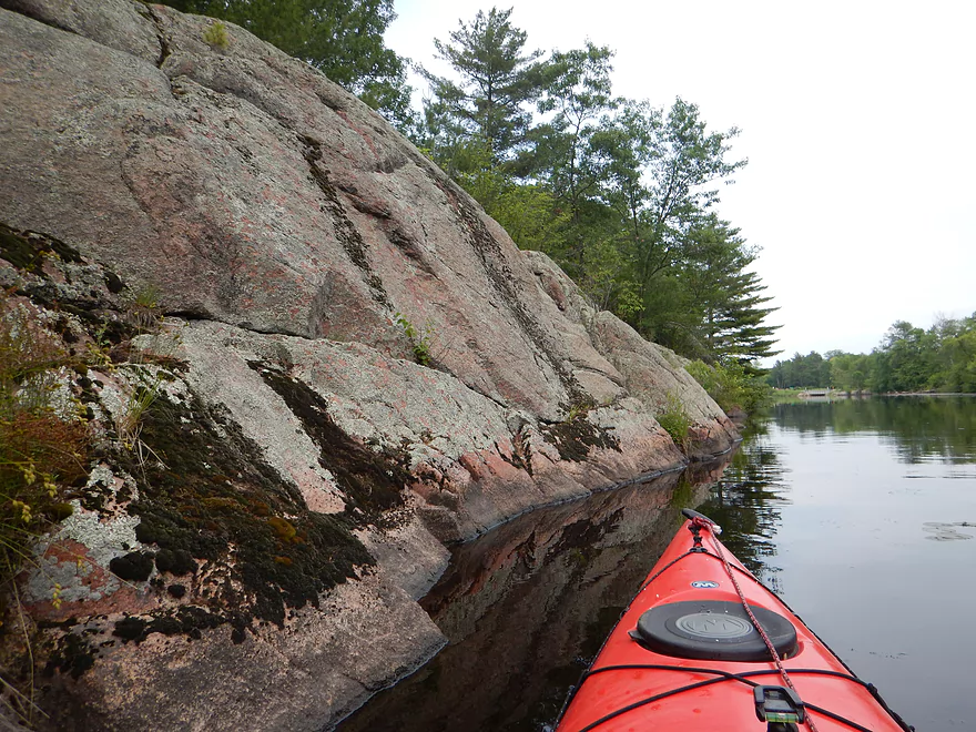
Great granite outcroppings in the last mile
More fern-lined shores
Hidey cave
Entering Big Falls Pond
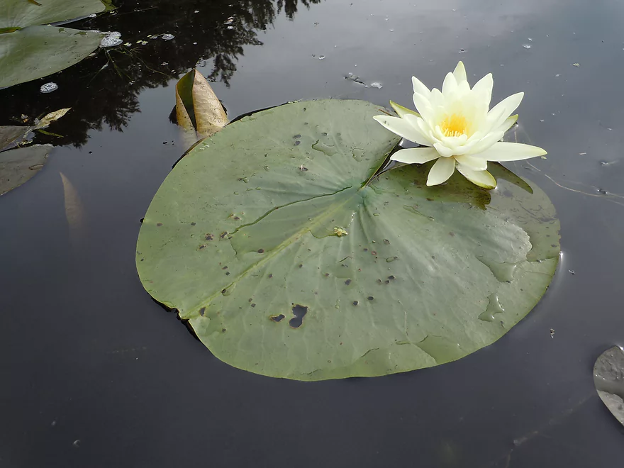
White waterlily
Granite incline
Interesting plant
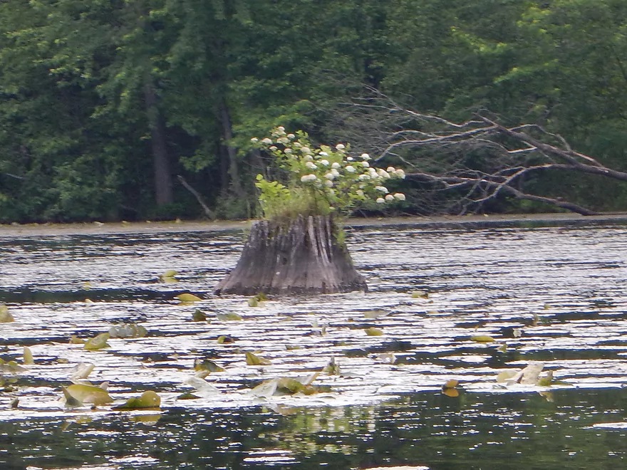
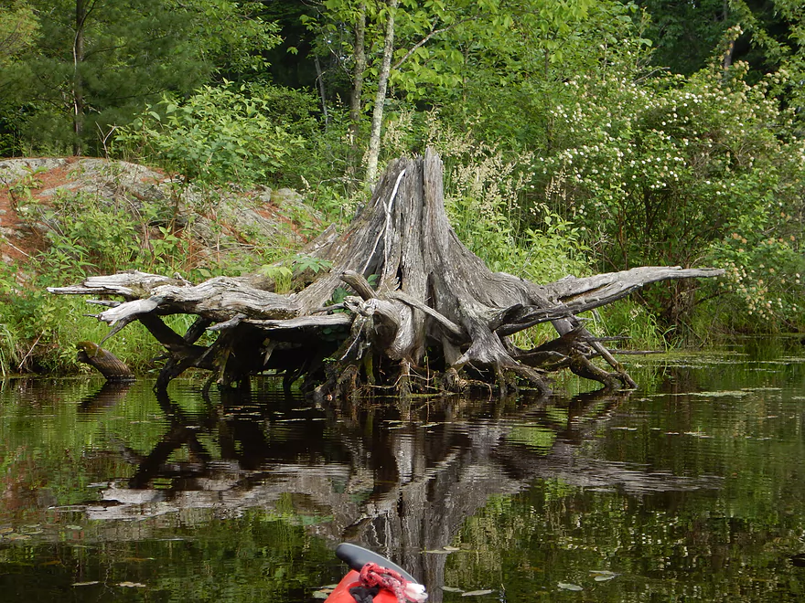
Tree stumps from before this was artificially flooded
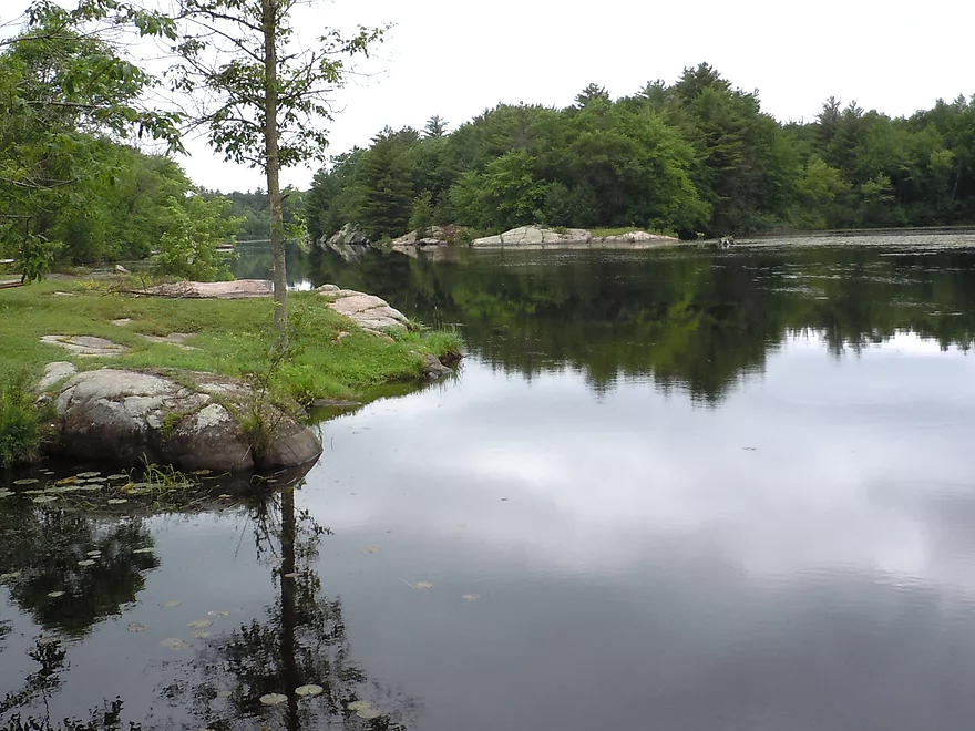
Looking back over the lake
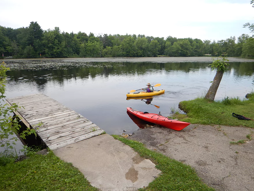
Big Falls public access
Good take-out and parking
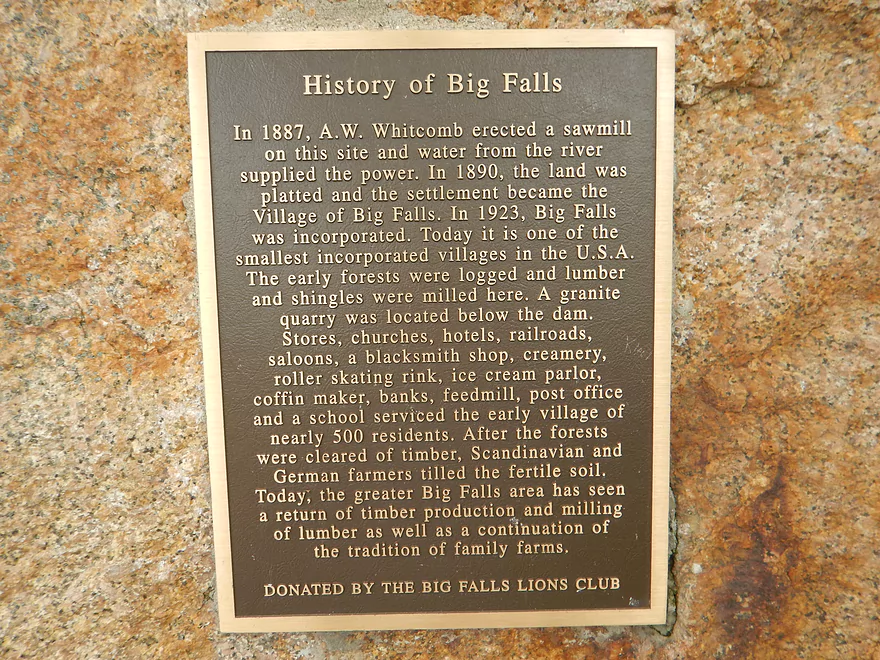
History
You don’t want to paddle over this
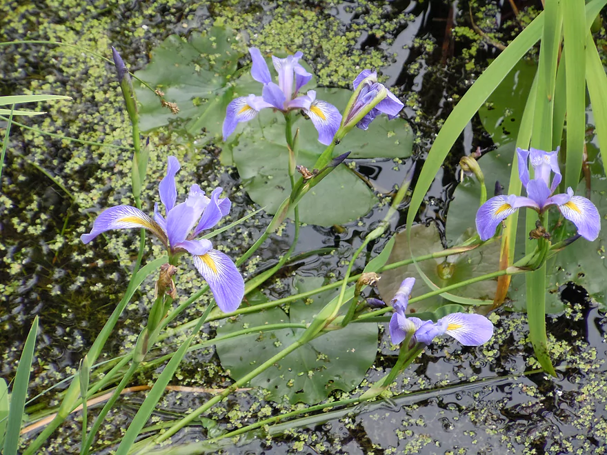
Blue Flag
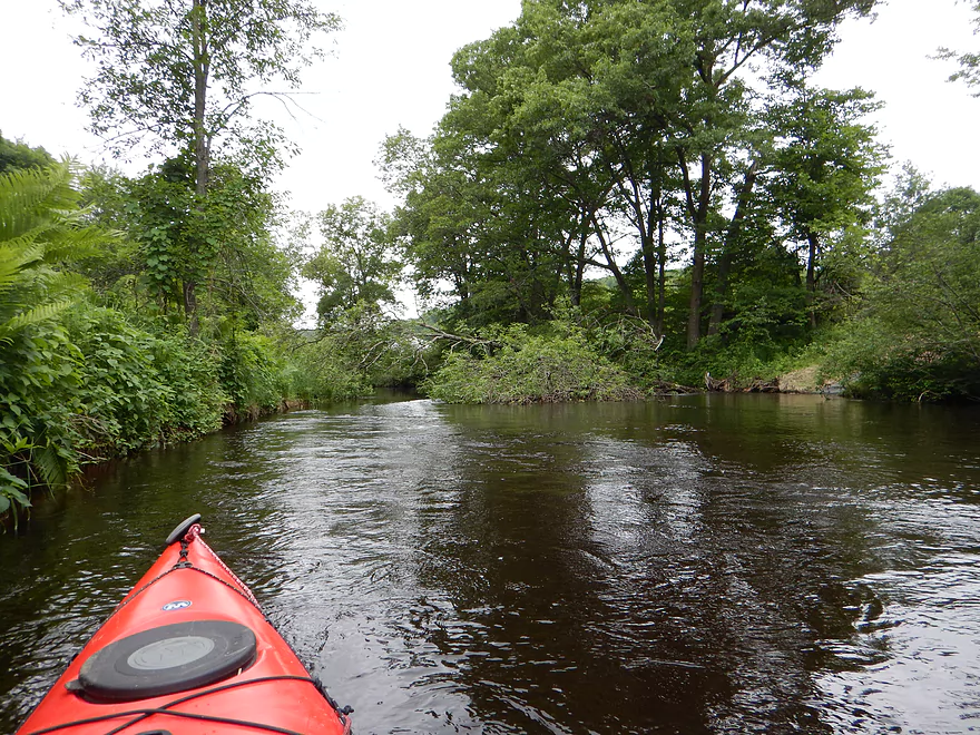
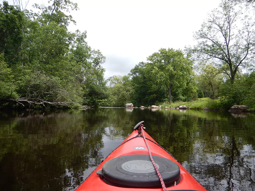
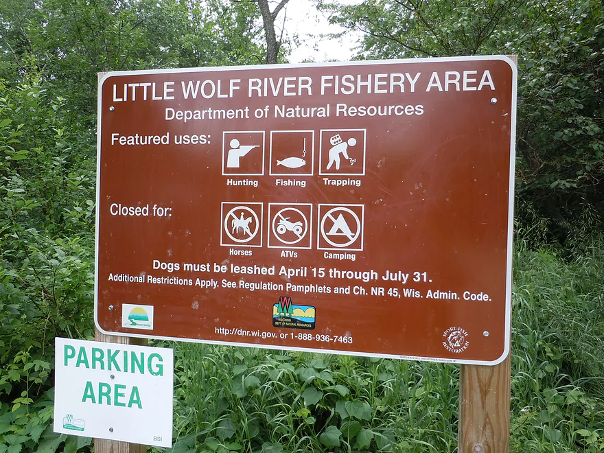
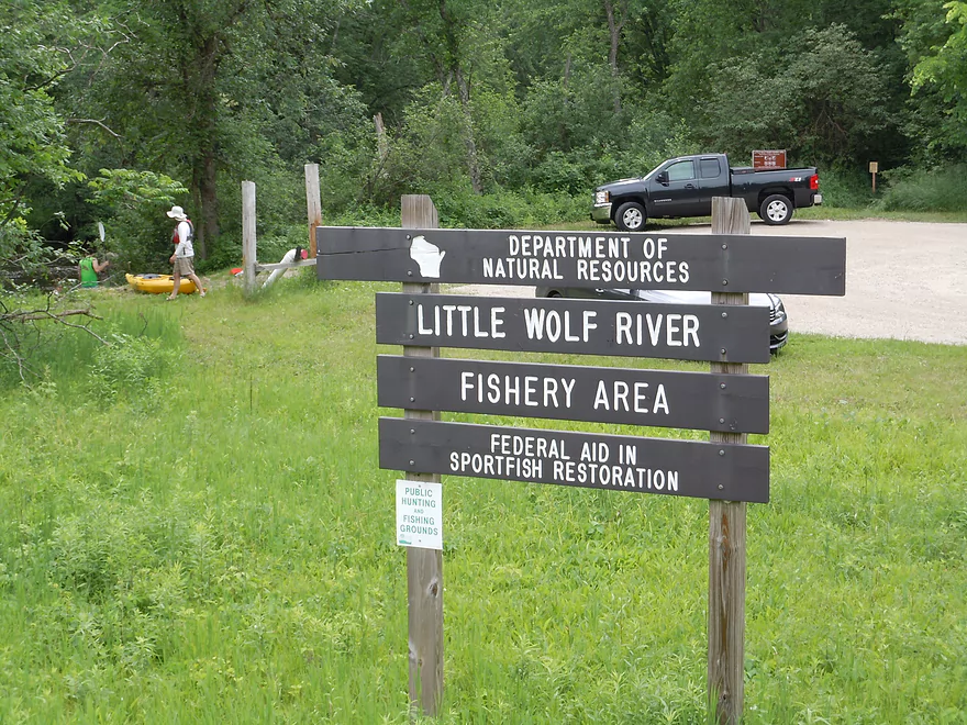
Little Wolf River


This is a nice scenic river in which the whitewater is the highlight (or low-light).
During the weekend of this trip, most rivers in south and central Wisconsin were flooded or too high to paddle (ironically, the Fever River was one of the exceptions). One water trail on my prospect list that caught my eye was the Little Wolf because the gauge, while high (480 CFS), was falling fast and on pace to drop to 400 CFS, which is lower than what my brother had done last year (420 CFS). He’s run the river twice… the first time it was shallow and his kayak hit a lot of rocks. The second time at 420 CFS, the water level was much higher and he didn’t hit nearly as many rocks, which he preferred, so I thought this to be a good target. In a twist, the night before the trip, the depth did a u-turn and climbed sharply to 555 CFS…far from the 400 CFS I expected! Oops. Not a fan of high water, but had already packed for the trip so decided to go for it.
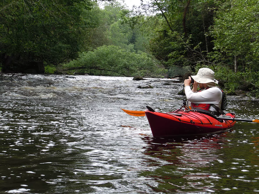
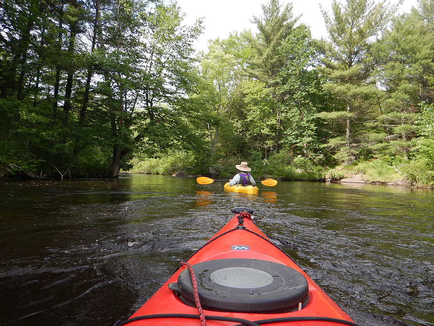
Generally speaking, the Little Wolf (with exceptions) is considered the safer/easier alternative to the Wolf River and is frequently run in non-whitewater boats, which is what we had. The rapids are mostly class 1 to class 2, with some reaching class 3 in high water. Being somewhat nervous about running this segment during 555 CFS (high for rec kayakers but considered too low for whitewater kayakers, interestingly enough), it was an initial relief to see a number of other amateur kayakers on the water with rec boats.
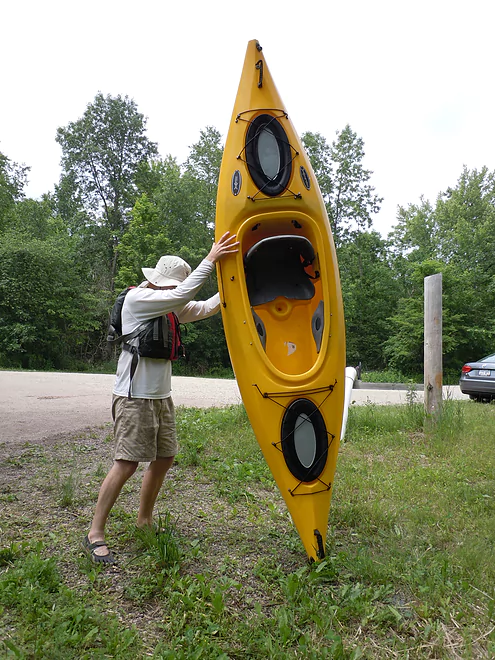
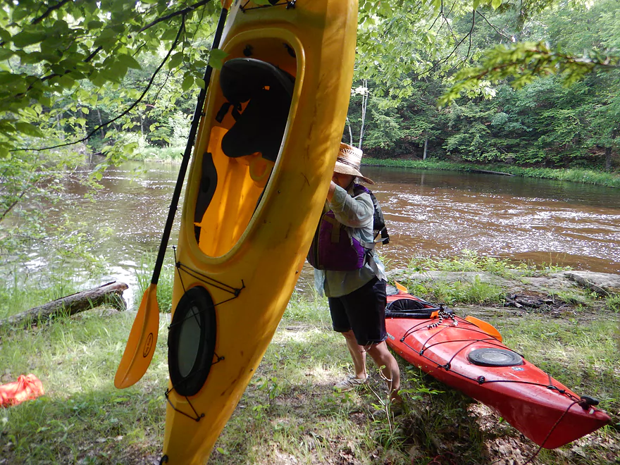
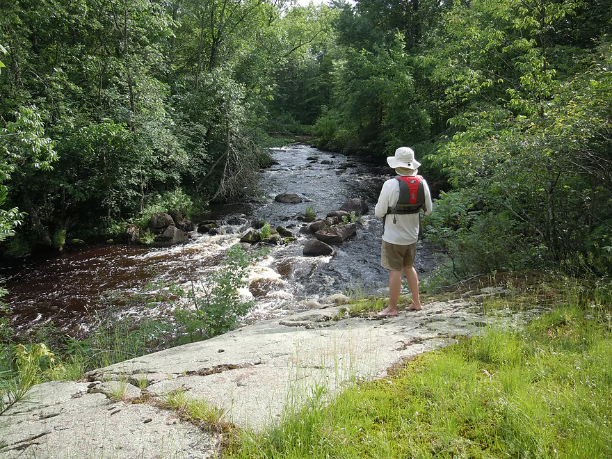
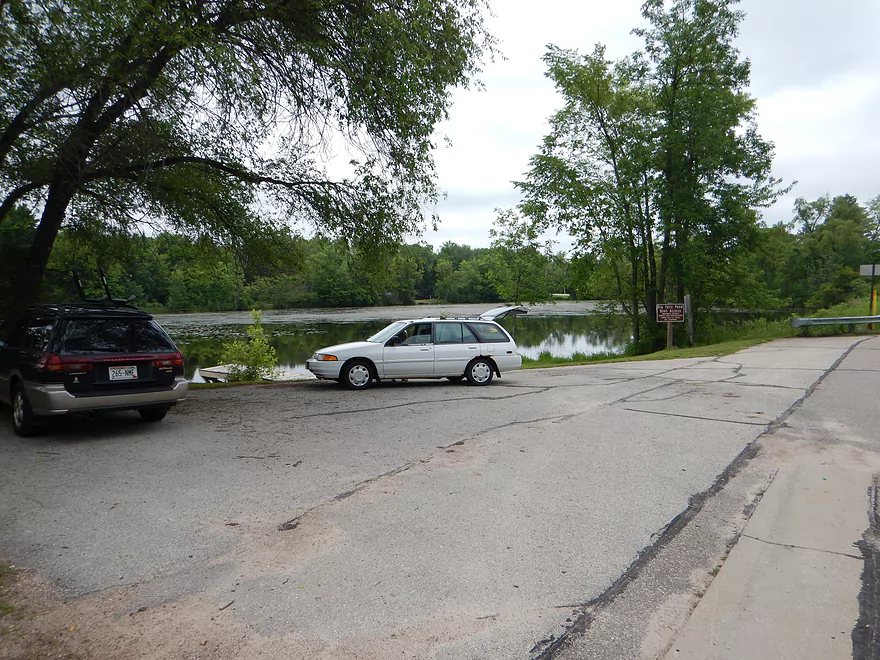
The put-in at Wolf River Road is terrific, with good parking, clearly public access, and two access ramps. No facilities though (neither are there at the take-out). For this trip, I car shuttled, but it would be a good bike shuttle–with mild hills, well paved roads and light traffic. The bike shuttle would be 7 miles though, which is actually on the longer side.
While this website (well, my brother) has already reviewed this segment, it is helpful to rerun segments, as rivers take on completely different personas depending on the latest conditions. This trip was no exception, as the river had changed a lot since the previous year.
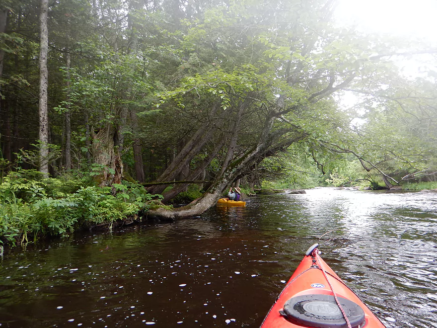
Right off the bat, you’ll see two log jams in the water that were not there last year. The first should be okay to navigate around, but it is just easier to put in at the second ramp to completely avoid this downed tree. The first ramp is steeper and more of a muddy fishing hole anyway, while the second ramp has a nice launching pad that is perfect for yaks. Soon after launching, you’ll encounter jam #2. This was okay to duck under in medium current, but would be a bear in higher conditions.
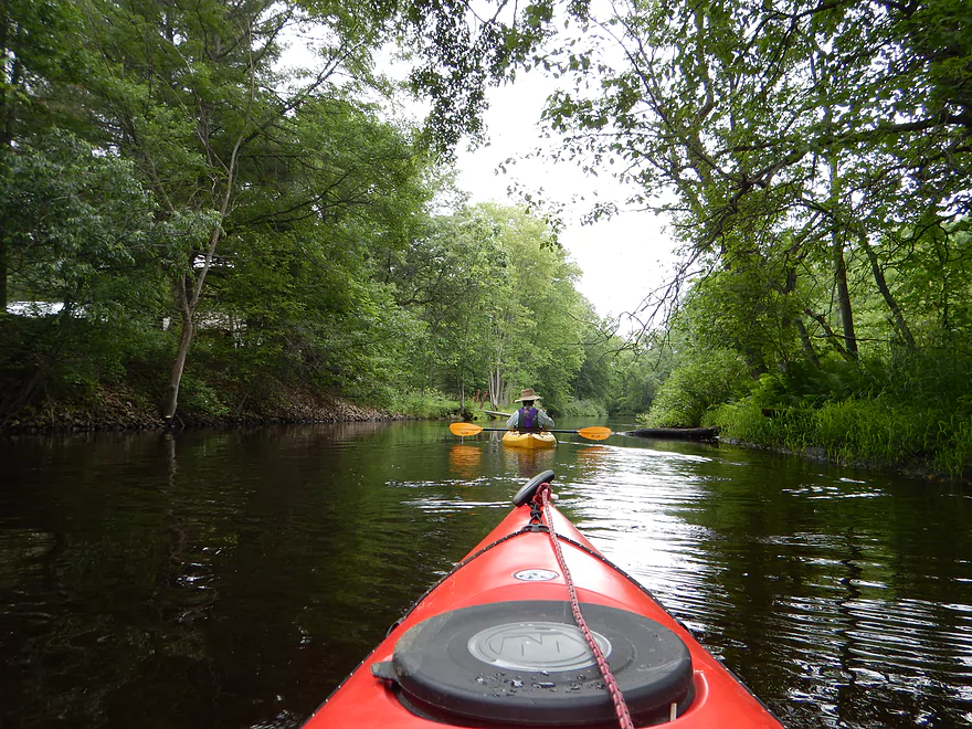
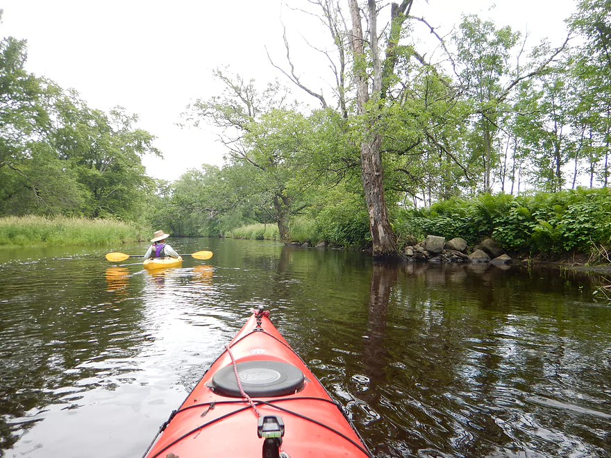
The first mile or so was very mild and had me thinking this wasn’t such a tough river (that would change). The bank quality, to be honest, while kind of nice, was also kind of boring to start with–a lot of scrubby alders and grasses, and the high water was thick and brown and moved like a big conveyor belt. I had heard and hoped for crystal clear water, boulder gardens and a diverse river with character…but the high water was really smothering the character out of the river. It reminded me of a section of the Namekagon I had also run at higher water levels.
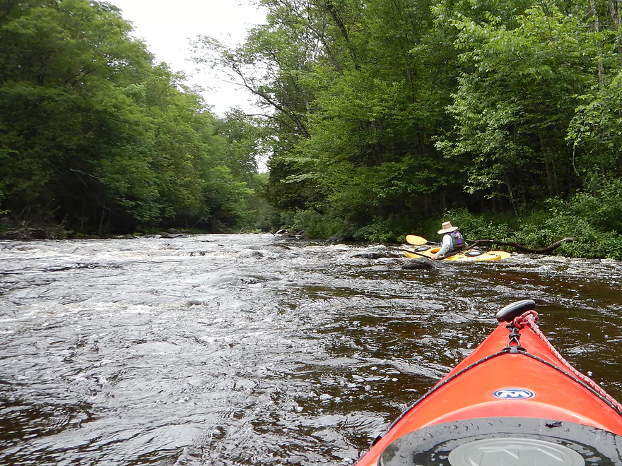
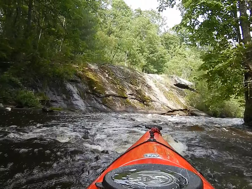
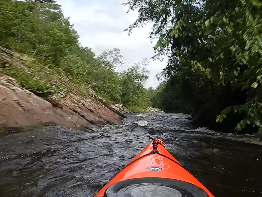
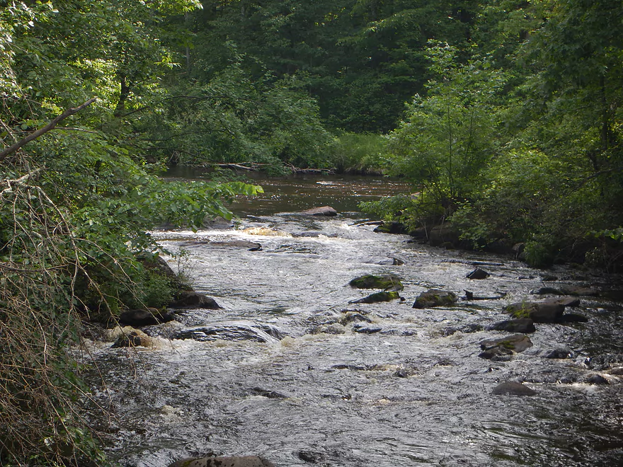
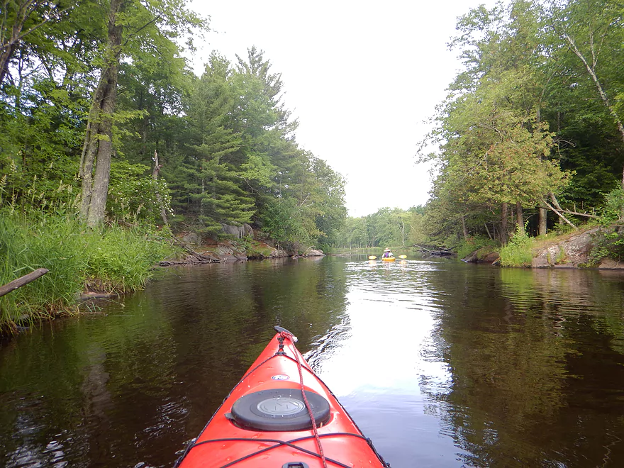
After a while, the tops of boulder gardens appeared in the water and there were some minor class 1 runs. The riffles get progressively more serious after this–to the point where the river is almost continuous class 1 or class 2 rapids for about a mile up to the Cty J bridge. It’s hard to communicate what the rapids were like in words. Pictures are better, but most of my photos taken in this section did not turn out. The first-person video below, however, does do a good job of showing what the river was like and I do recommend watching it (I added chapters to make it more non-linear and more watchable).
To sum it up…IMO, this was too rough. I’m not a whitewater kayaker. This review is intended for rec kayakers, and for them, I can’t recommend the river at this depth. Most kayakers hate bumping rocks, so automatically think that high water is better. And yes…high water does help pad the rocks, but it creates other problems. With many rocks the current flows around the boulders, but in high water the current is able to go over some of the big boulders, which is bad. You are now pulled into tippy situations you wouldn’t have at lower water. The other problem is that the water is so much more pushy at high levels. You will hit rocks and be thrown off balance…and the faster the water, the more apt the current will fish-tail the kayak around and flip your boat. Yes, in low water some rapids will be bumpy escalators…but at least these are safe, and you can wade out of most precarious situations if need be.
Some obligatory safety information, as people inevitably drown on rivers like this. Always wear your life jacket, make sure it is tight (loose jackets are a common cause of drownings), and don’t drink while doing whitewater (you need your reflexes). Generally speaking, you want to always keep your boat pointing downstream when running whitewater. Being turned sideways is often a prelude to flipping. Avoid branches and strainers big time. Get out and scout if you can’t see the bottom of a falls. If your boat does get turned sideways, angle the boat like a fan blade so the water goes under the boat and not over it. NEVER angle a boat under oncoming current. Try to wear a kayak skirt (I wore a half-skirt that suited me well….several paddlers on this river did not wear skirts). Generally speaking, the key to running rapids is spotting and avoiding rocks. If you hit a rock, it can stick the bow, and the current can then push the stern around, which can flip you. Often, smooth water in rapids is actually moving over large rocks. During our trip, the water was black, so rocks were difficult to spot. Sometimes, you can choose a channel…generally speaking the low-volume channel will be better/safer. All things being equal, paddling close to shore in rough sections is not a bad idea, as it is easier to get out this way and is often shallower and safer here.
I like running riffles, but constantly dodging rocks and engaging in balancing acts and counter-thrusts when you inevitably hit them in pushy water was more stressful than fun. Plus, many of these runs didn’t give you a “breather” or a chance to scout the next run, as they were so long and so frequent.
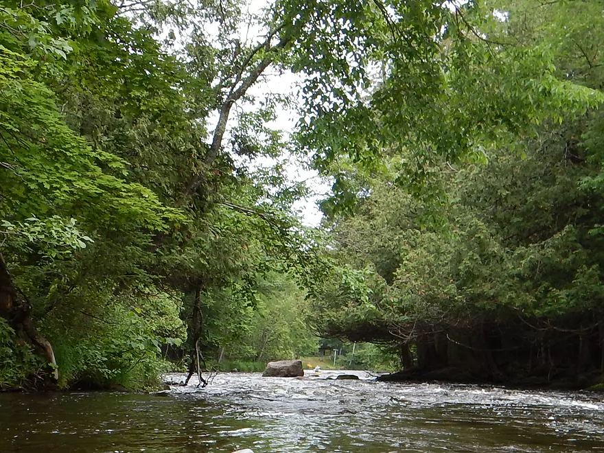
What made these rapids particularly stressful was the deadfall…much of it brand-new. The first such was a low hanging branch over the river close to the start of the “whitewater mile” in which you have to maneuver quickly in class 1 and duck carefully to get through. This would not be fun in high water, even for the whitewater paddlers. There are numerous other odd logs sticking over the rapids that are quite obnoxious…but the worst will come close to the end of the “whitewater mile” and close to the J bridge. Even the American Whitewater site put out a special advisory on this one. Basically, a tree runs almost the entire length of the river at the bottom of a class 2 rapids and you really have to paddle hard to your left to get through. You’ll encounter it shortly after you see a lawn on your left and a boulder in the middle of the river (marked on map, in pictures and in video).
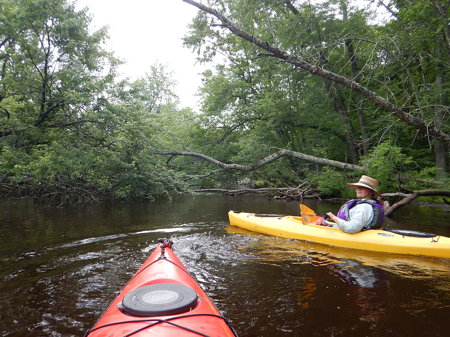
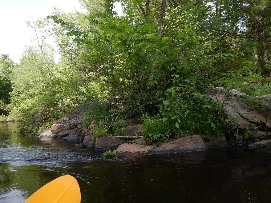
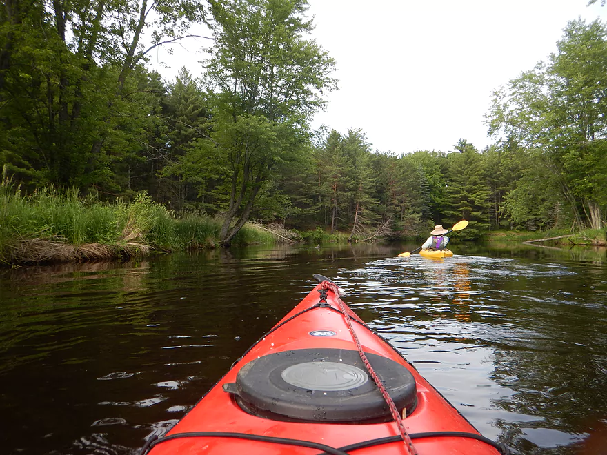
On the plus side, this section of the river with its many rapids is gorgeous. The scrubby alders and grasses are replaced with white cedar, hemlock, ferns and leafy green plants. The shoreline is attractive, clear and rocky–a very sudden and welcome change.
Close to the end of the “whitewater mile” you will see a rock shelf on your left that is a popular picnic spot (saw several waders here in the rapids). Then soon after you come across the Hwy J bridge. This is a good take-out/put-in option and marks the halfway point in the trip (no facilities though). For us it was a chance to drain our boats!
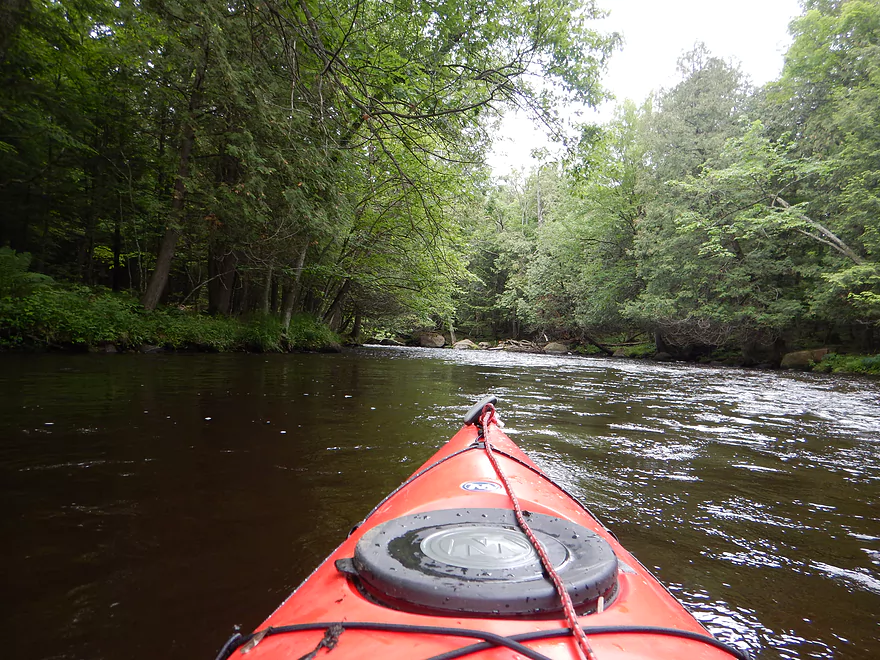
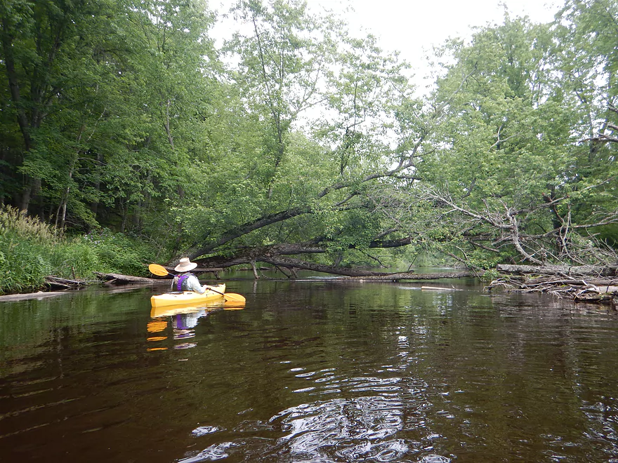
Following the Hwy J bridge, the rapids really die away and this is mostly flatwater paddling–very peaceful, and a nice change of pace. However, the next mile or so is what I termed the “deadfall mile,” as it had a lot of downed trees to dodge. We never had to get out…but there were some serious squeakers that could be impassible in lower/higher water. Reading some of the reports, much of this appears to be new, which is unfortunate.
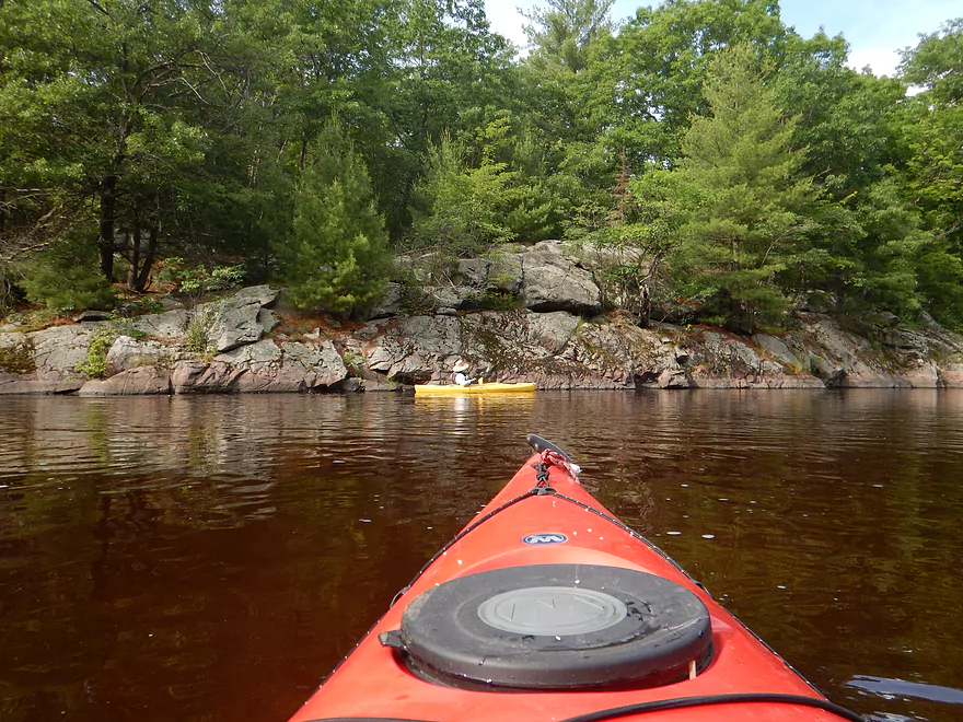
The wildlife wasn’t terrific on this trip, but the dragonflies were frequent and a welcome site. The plant life (ferns, lichens, mosses and wildflowers) was terrific. Not so welcome were the mosquitoes and the tick I found on me. Unfortunately, there is some human “wildlife” on this trip as well–more houses than I expected, some fishermen, a few swimmers, and other kayakers (although those are nice to see).
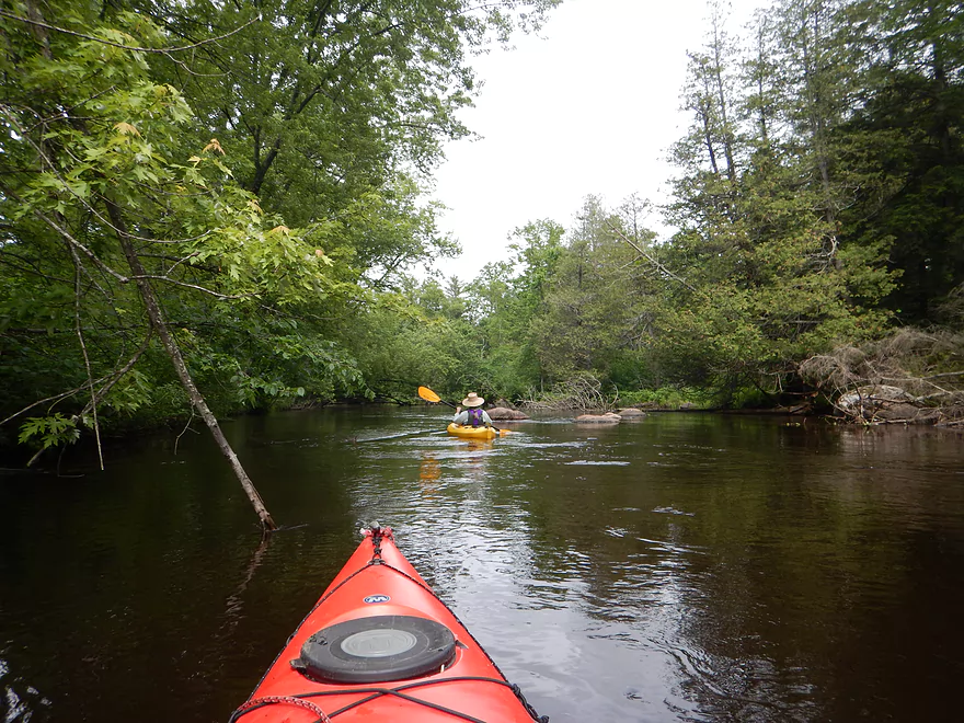
Generally speaking, the second half of the Little Wolf was a pleasant, peaceful paddle, with nice tree canopies and minor riffles that I enjoyed. There are some drops though. Under the McNinch bridge is a serious class 2 that requires some decent boulder dodging to stay afloat. I think I’ve heard of people launching from this bridge, but it didn’t seem feasible from my limited point of view.
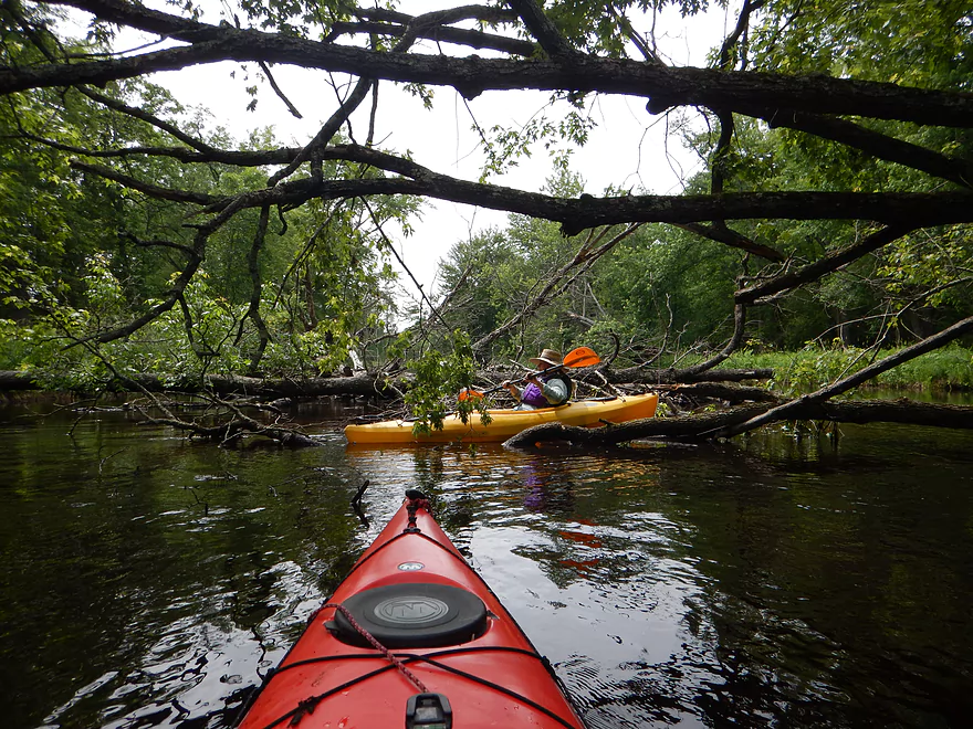
The next run immediately after McNinch is the most serious IMO of the entire ~8 mile trip and might qualify as class 3 with our water levels. Basically, it is a series of perhaps the biggest drops on the trip that require frantic paddling to get through and (the worst part) has a strainer at the end. The current pushes you toward the center and that is where the branches are. Only way around would be to the right and I’m not sure that would be possible in the fast current. So, I did a no-no and ran through the branches, and it turned out okay because there was so much water going through the branches and they were somewhat flexible…but this was not an ideal situation.
You’ll get a little reprieve at this point to catch your breath…then you’ll hear the largest roar of the trip. This is known as “Little Wolf Dells” and is basically where the river is deflected by granite walls into a very narrow and fast chute. Preceding the “Dells” you come to the top of an island with rapids on each side. Go LEFT! Both are whitewater runs, but the right is much more rocky. As you fly around the left channel, dodging rocks in class 2 rapids, you’ll suddenly see an impressive rock wall on your left that will funnel you into the chute. Some sources suggest getting out on the slanted rocks to scout the chute before running it, but the current was too pushy for me to do this, so I shot for the dead middle of the chute, and that worked well. At lower levels, I think there are rocks at the bottom and you’ll want to start center…but then angle right. The standing waves after the chute are impressive and this was where I took on the most water in the trip, despite staying pretty stable (otherwise, the half-skirt did a terrific job). For comparison’s sake, here is a video of my brother (green kayak) and his friends running this chute at 420 CFS. Then here is my video of running it at 555 CFS.
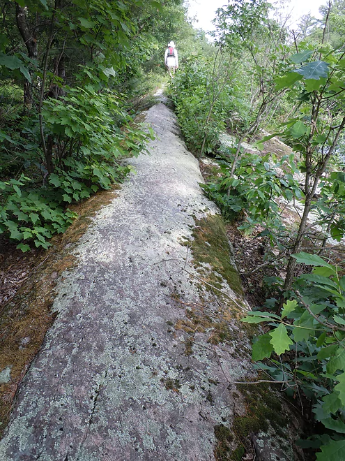
If you paddle hard to your left at the bottom of the chute, there is an area where you can take out and do some exploring. Many kayakers use this area and the trail leading up onto the rock face to run the Dells a second time, but we weren’t feeling that adventurous in 555 CFS (and it’s a long way to drag or carry a boat). However, the trail, which has a unique natural stone “path” at the top, is worth checking out and offers impressive views of the river.
The final mile was my favorite part of the trip–no rapids, but wonderfully attractive granite rock walls and boulders on the shoreline. This section is impounded by the Big Falls dam, so the current isn’t a concern and it is a very peaceful paddle. In fact, you could make a small trip out of just the Dells and flowage by putting in at the Big Falls landing, paddling up to the chute and then back–perhaps a plan B in case the water levels on the upper sections weren’t what you preferred.
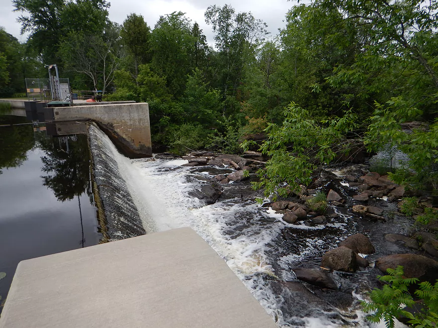
The take-out is on your right and just before the Wall Street Bridge and dam (don’t go over this!). A fine take-out (but again no facilities). I don’t know too much about the sections below the dam, but supposedly there is a class 4 immediately after the dam which is popular with whitewater folk. Further down, there are more popular sections of the Little Wolf to paddle, which I don’t know too much about, but I’ll include links to those who do.
It should be noted that when we were finishing the car shuttle for this run, we met two young guys that had just run the same section in rec kayaks. They had a blast and said they actually prefer to run this river at 1000 CFS. Eep! So, each according to his own. I’ve been kind of sour about the high/pushy water levels, but for some this would be fine. In summary, while I won’t recommend this river at our 555 CFS, it is still a terrific river and I think would be a fine paddle under 400 CFS. Just don’t use your finest kayak as things will get bumpy!
- WisconsinRiverTrips.com review from last year (done at 420 CFS)
- Morrall Films (done at 330 CFS…they also do a downstream segment)
- American Whitewater (their site is not designed for rec kayakers!)
- Mike Svob (he also reviews downstream sections)
Detailed Overview
- Wolf River Road to Ness Road: (3.0 miles) Very narrow, heavily wooded, shallow in spots, and very rocky. Maybe 2 logjams. This is an intriguing prospect on my todo list.
- Ness Road to Wolf River Road: (2.5 miles) A good trip with clear water, boulders, and a few easy rapids.
- Wolf River Road to Big Falls Dam: (7.7 miles)
- Wolf River Road to Hwy J: (3.6 miles) Scenic section with some strong Class 2 whitewater. Good put-in.
- Hwy J to Big Falls: (4.1 miles) Also scenic and with whitewater, with perhaps a Class 3 by the Dells. Good launch by Hwy J.
- Big Falls Dam to Big Falls Powerhouse: (700') This is a steep chute of exposed granite that can create Class 4 rapids when it has sufficient water. But typically the dam penstock robs Big Falls of 99% of its flow. Access to the top of the falls is available from either the east or west shore.
- Big Falls Powerhouse to Kretchner Road: (4.4 miles)
- Big Falls Powerhouse to Little Falls Park: (1.7 miles) This is a good stretch with the highlight being a 2000' stretch of rapids.
- Little Falls Park to Hwy C: (0.3 miles) Features a Class 2 under a bridge, and then a 1500' stretch of boulders and Class 1 rapids. Hwy C isn't a great bridge access.
- Hwy C to Kretchner Road: (2.7 miles) Just below Hwy C is a series of rapids including a Class 3 that runs through a scenic gorge. After that the river slows down and becomes less interesting
- Kretchner Road to Hwy 110: (4.3 miles) A great leg with many scenic boulder gardens. Rapids on this stretch are mild and suitable for beginners. While nice, this leg isn't as terrific as Little Falls or Big Falls legs located upstream.
- Hwy 110 to Hwy 22/Symco: (8.0 miles) Unimproved bridge put-in but should be ok. This section likely has some deadfall issues (not sure how much though).
- Hwy 22/Symco to Manawa Dam: (5.9 miles)
- Hwy 22/Symco to Bridge Road: (2.0 miles) Looks like a nice section with some rapids and boulder gardens near Symco. Good put-in at Symco.
- Bridge Road to Manawa Dam: (3.9 miles) Likely a mediocre section with some flowage paddling at the end. Some of the flowage paddling can be avoided by taking out at Waupaca Park. Bridge Road is a good put-in.
- Manawa Dam to Road Bb: (3.9 miles)
- Manawa Dam to Hwy B: (1.9 miles) Honestly an uninteresting section with slow current and bland flood-bottom woods. Aquatic weeds are an issue (thanks to the Manawa Septic plant). River does get a bit more interesting after the railroad tracks and features a small boulder garden.
- Hwy B to Hwy 110/B: (0.9 miles) A good stretch with some boulder gardens and good clarity. There are Class 2 rapids by the "Rapid View" island.
- Hwy 110/B to Road Bb: (2.1 miles). A great stretch with several impressive boulder gardens and a few minor rapids.
- Road Bb to Hwy X: (7.6 miles)
- Road Bb to Royalton: (3.5 miles) Very good put-in. Nice clarity and boulders until the South Branch joins (almost doubling the river). Very nice boulder garden and rapids 2/3rds in.
- Royalton to Ostrander: (2.7 miles) After the brief rapids under Hwy 54/O, the Little Wolf goes back to sleep, with pleasant but monotonous scenery (the highlight being sporadic boulders). Finally, maybe a half mile prior to Ostrander Road, there is another set of rapids (Class 1) and an attractive boulder garden. Paddlers will have to deal with many tubers.
- Ostrander Road to Hwy X: (1.4 miles) Busiest tubing section probably in the state. Very nice boulder gardens and rapids at end. Public landing NE of Ostrander Road.
- Hwy X to the Mouth (Junction at Wolf River): (2.0 miles) Part of the Mukwa Bottomland Forest SNA
- Mouth to Dey Road/Shaw Road Boat Ramp: (0.8 miles) A short stretch on a now large Wolf River.
Trip Map
View Little Wolf River 2 in a larger map
Overview Map
Video
0:02 - Log jam at launch
0:55 - Start of mile long rapids run
6:57 - Low hanging limbs in rapids
13:15 - Another low hanging limb over rapids
13:41 - Down tree over class 2 rapids
15:10 - Picnic Ledge
16:15 - Final Section of mile long rapids/Hwy J
17:50 - McNinch Road Rapids
18:44 - Toughest rapids with strainer
19:42 - Little Wolf Dells
22:14 - Big Falls Pond flowage & attractive granite
23:27 - Big Falls Dam
Photos Size:
You said you put in at McNinch Road Public Access and traveled 7.8 miles. McNich road is only maybe 1.5 miles of river prior to Big Falls. Is there another access point called McNich that is much farther up?
Ugh…I messed up. The correct put-in is actually Wolf River Road, which I have subsequently updated.
https://www.facebook.com/bigfallskayakrental/
We are open hope to save you the shuttle hassle $2 a mile $10 to wolf river rd.
Thanks for a nice review of the Little Wolf. Your description is for the most part quite good. I agree strongly with you about wearing a life jacket and keeping it fastened snugly. A part of your description that I would disagree with is the rating. You say that the L Wolf has parts that are Class III in high water. There is nothing on the Little Wolf that is class III, even in high water. My wife and I have run it as high as 1200 cfs on the Royalton gauge, and it was still class II. When the river is high (1000+ cfs), then the rapids before the Cty J bridge become about 1.5 mi of continuous class I and mostly class II – which would (as you note), not be recommended for a rec kayak. Even the ‘dells’ near the end is class II at high water. Whitewater boats and skills would be recommended for those levels. Another note on the gauge: As you know that gauge is well downstream, and thus only a good approximation to the water levels on this stretch. We’ve run the river when the gauge said 1000 cfs and actually had more water on this run than another time when the gauge read 1200 cfs.
Thanks for the comment. Class ratings are indeed subjective. I think at the time there was a tricky set of rapids going through a partial logjam that I thought was a Class 3. I assume that is clear now. The other 3 was the Dells. While in most cases high water makes rapids more dangerous in some cases it does reduce their difficulty as they tend to get “filled in”. That could be the case here. I’ll have to do the Little Wolf again in the future and give it a fresh assessment (this review is 6 years old and likely outdated).
We did the trip on 7/28/21,We did Ness Rd to Big Falls, 11 miles it took us 4.5 hours with a 1/2 hour lunch stop and many stops for photos. No blockages or portages and the levels seemed perfect, but unfortunately the USGS gage has be “discontinued” so it is hard to say what the level was. There is a good visual gage at Wolf River Rd bridge, on the upstream side there is a rock in the middle of the river, just the tip was showing when we did this trip (see photo). The parking lot for the put-in is not right on the river but just down the road, but there is room to pull over to unload. There is plenty of room for parking at both parking lots. We car shuttled but I have done it as a bike shuttle, a few hills and a county highway, but the shoulder is OK and there is not much traffic. Probably not a trip for absolute beginners, but I think anyone with decent boat skills would enjoy this trip at this level. I would rate the rapids as mostly class one with a couple of low class ll’s, I was in a open solo canoe with no floatation, and my friend was in crossover kayak without a skirt, I got splashed and he got a couple of lapfulls, but nothing too serious. I used the Relive app to document the trip, here is a link to the video https://www.relive.cc/view/vNOPYn3eYY6
Thanks for all the information. The map/gallery hybrid idea is really cool!