
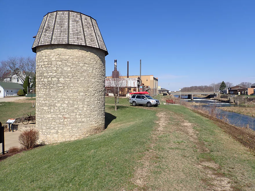
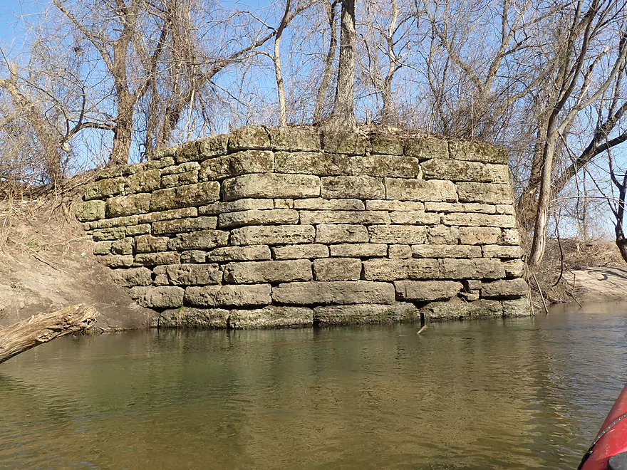
Cascade Historic Limestone Silo
The official launch is downstream from the silo
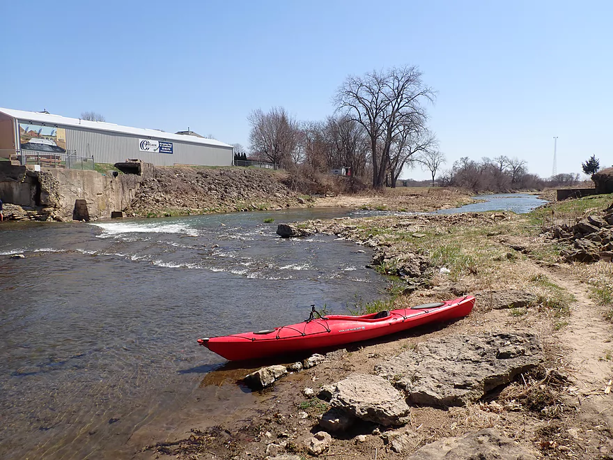
I just launched a bit upstream so I could explore
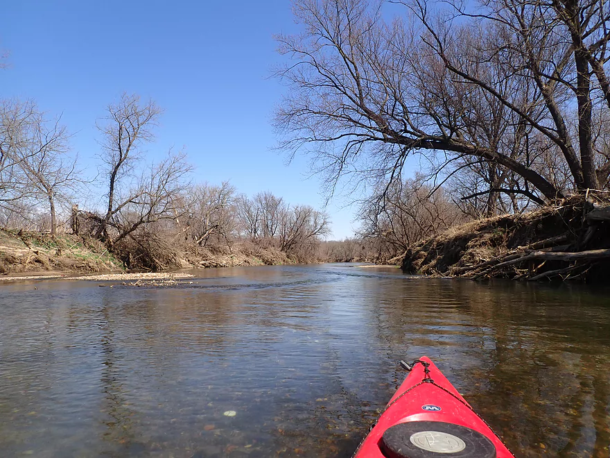
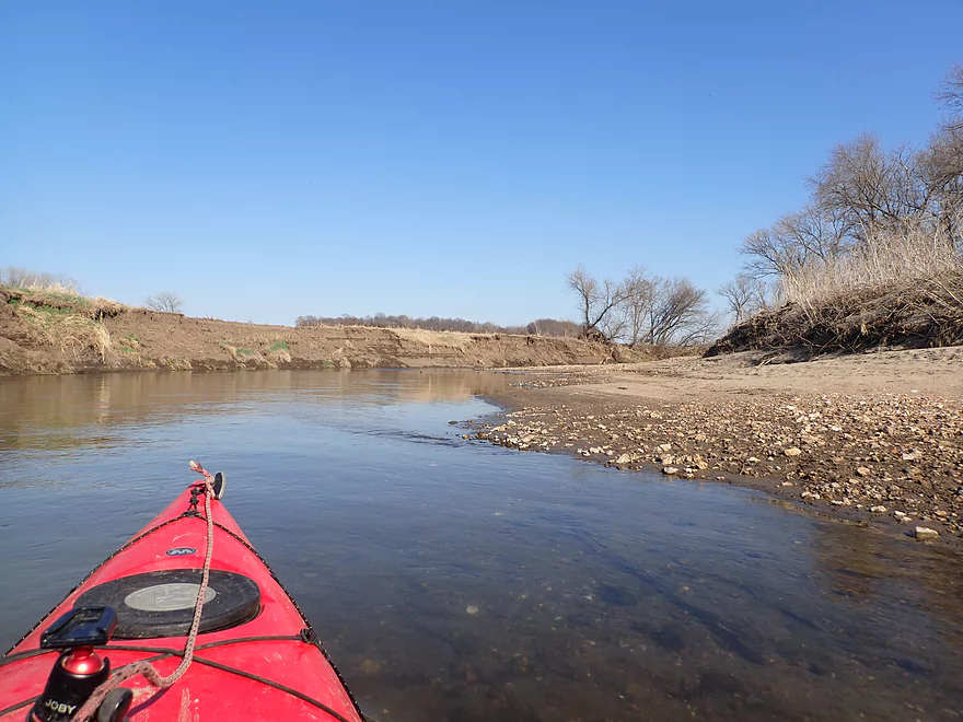
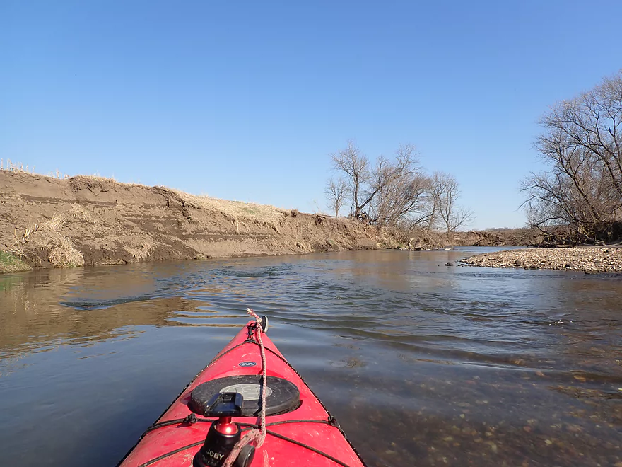
Paddling upriver
Portaging a ledge
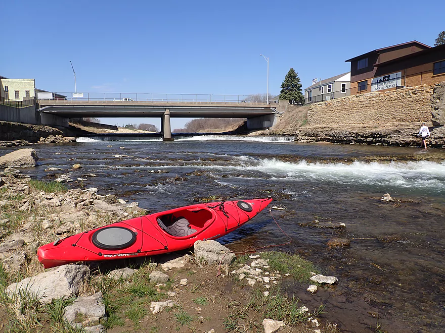
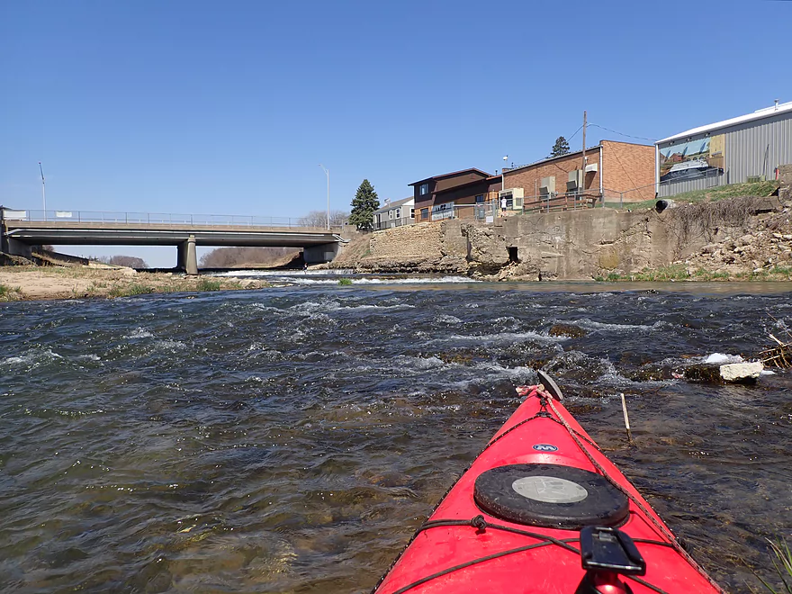
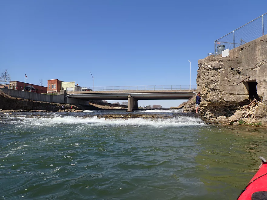
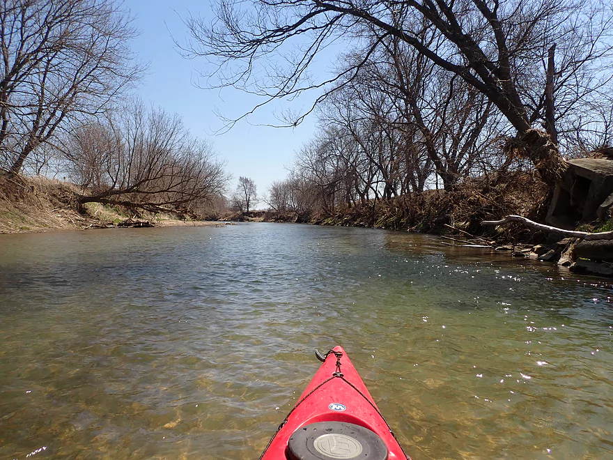
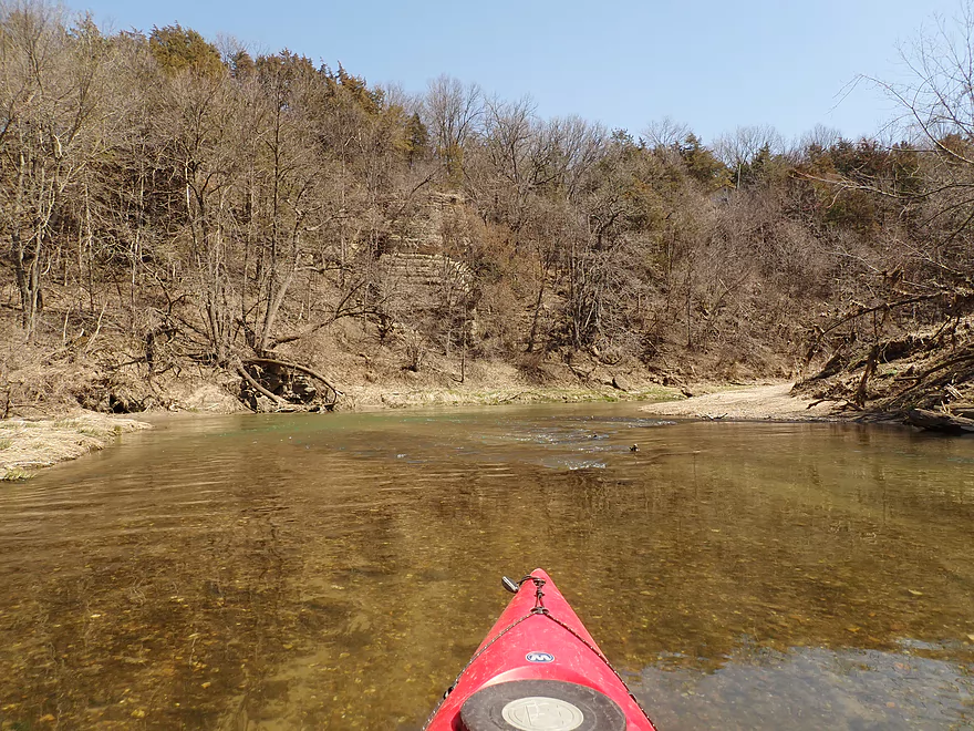
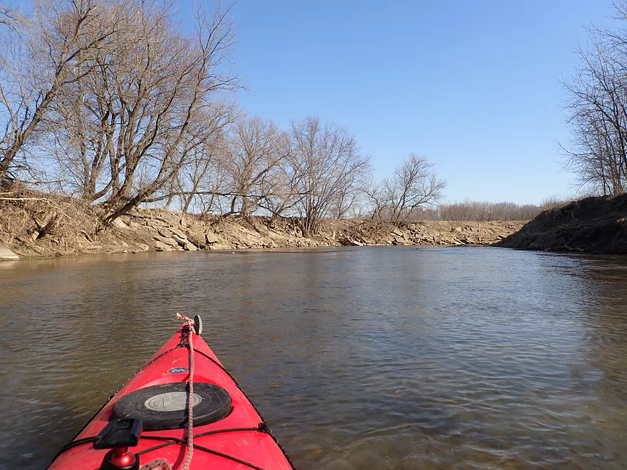
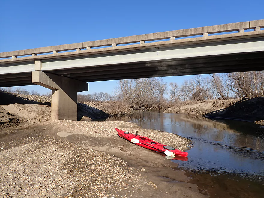
The dam under 1st Ave can be seen in the background
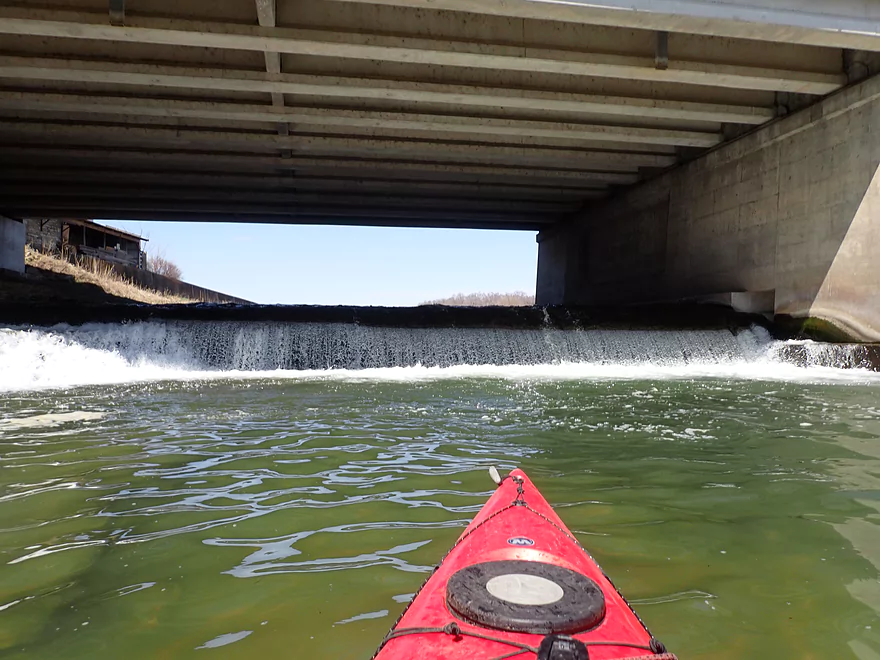
The west end isn’t runnable (dangerous hydraulics)
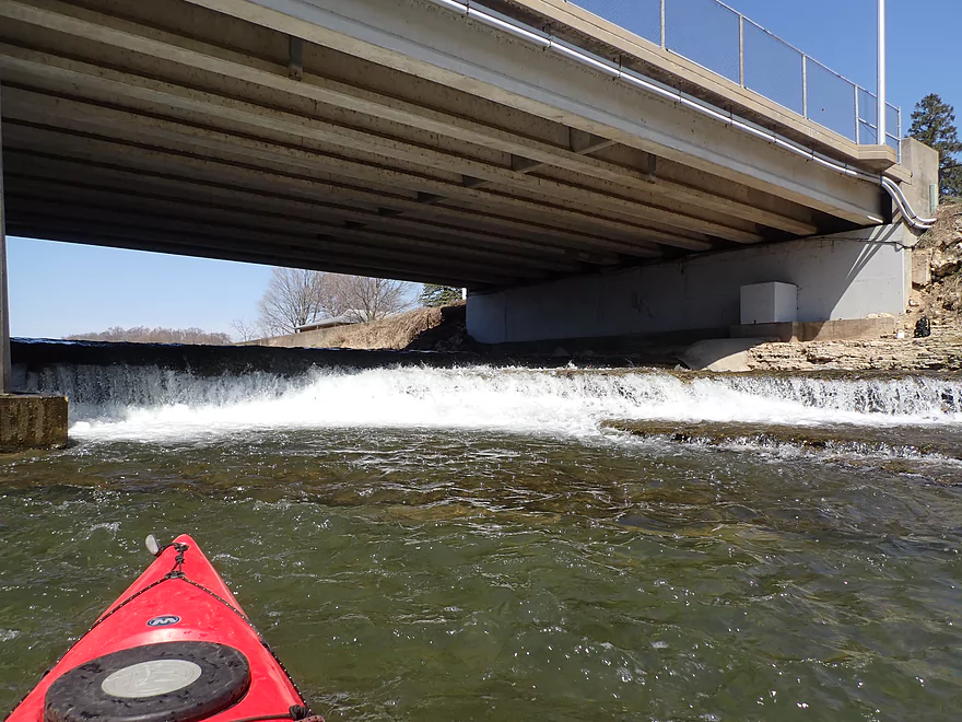
But the east end is runnable for skilled paddlers
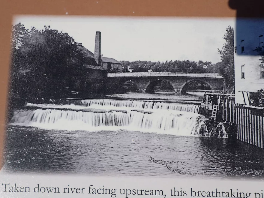
The original 9′ cascade waterfall was destroyed in favor of the dam (for ‘safety reasons’)
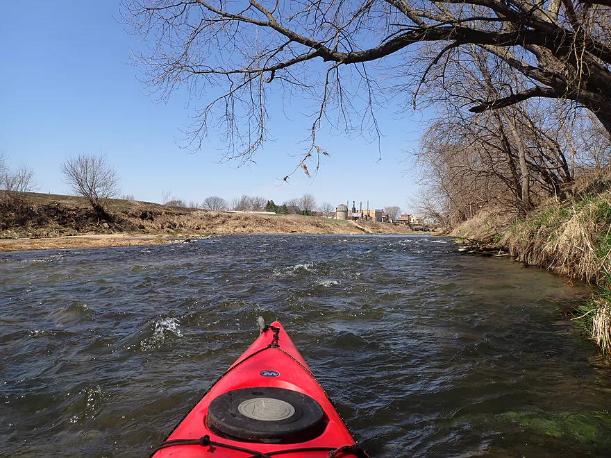
Heading back downstream
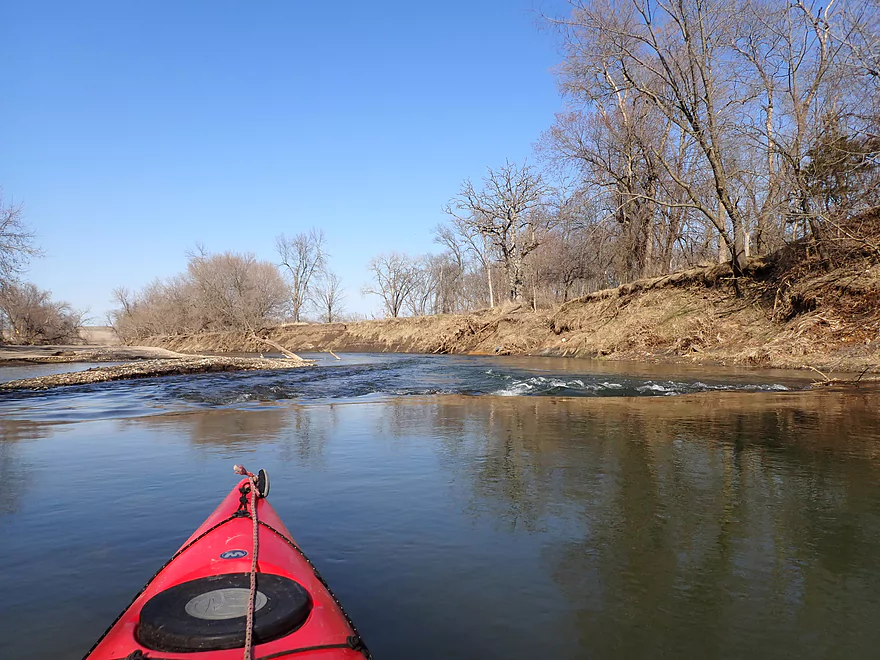
Just ran a one-foot ledge next to an oblivious fisherman
Several more fun rapids below the main pitches
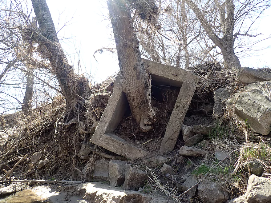
Tree growing through a concrete rectangle
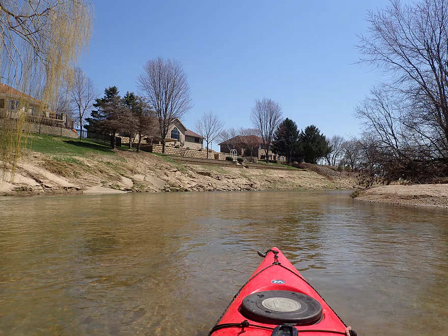
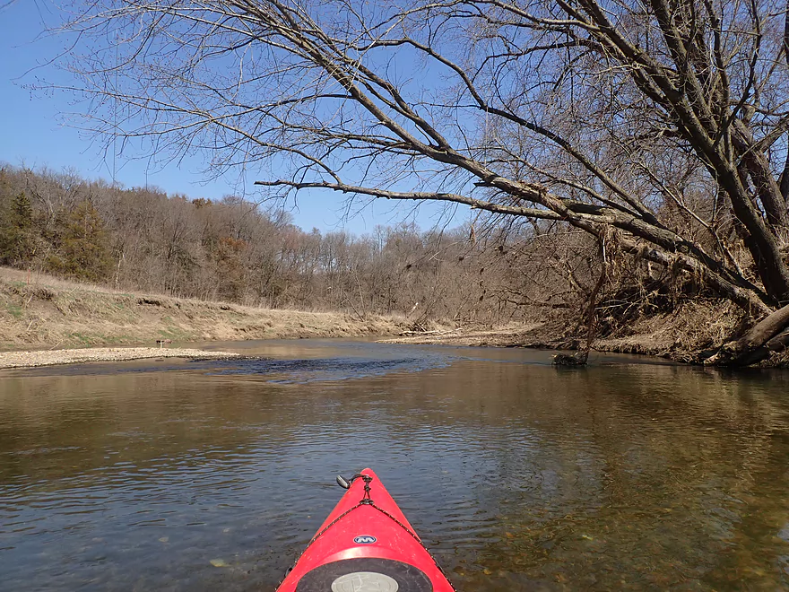
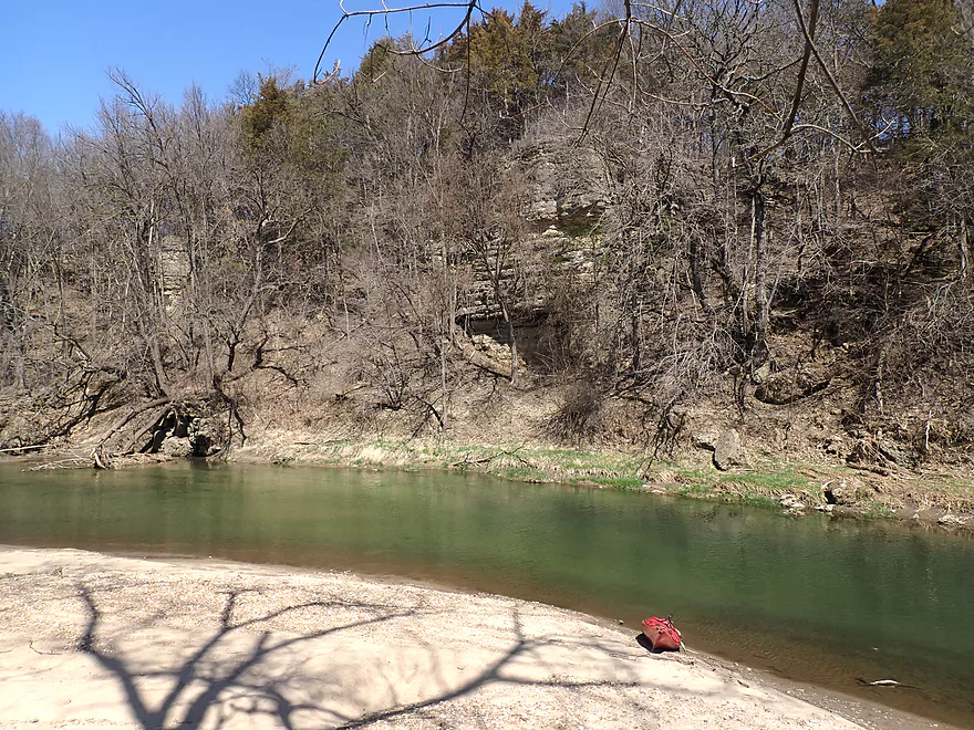
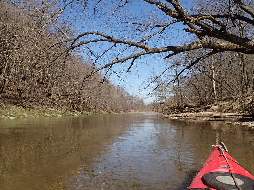
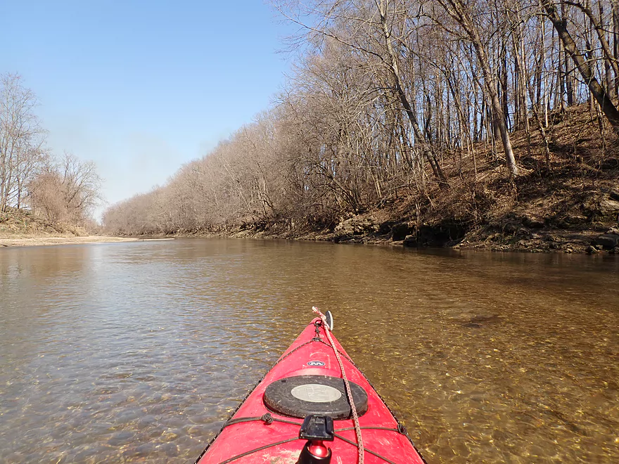
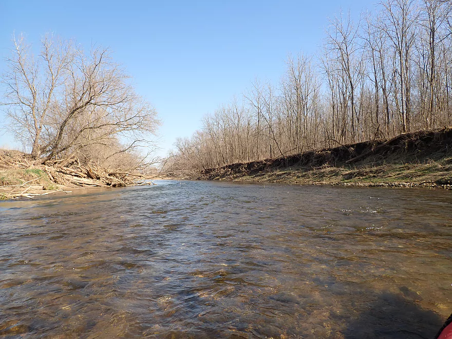
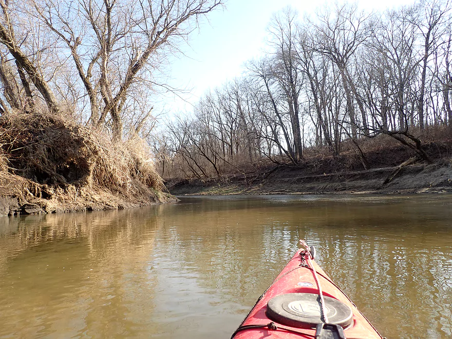
Clarity was really good
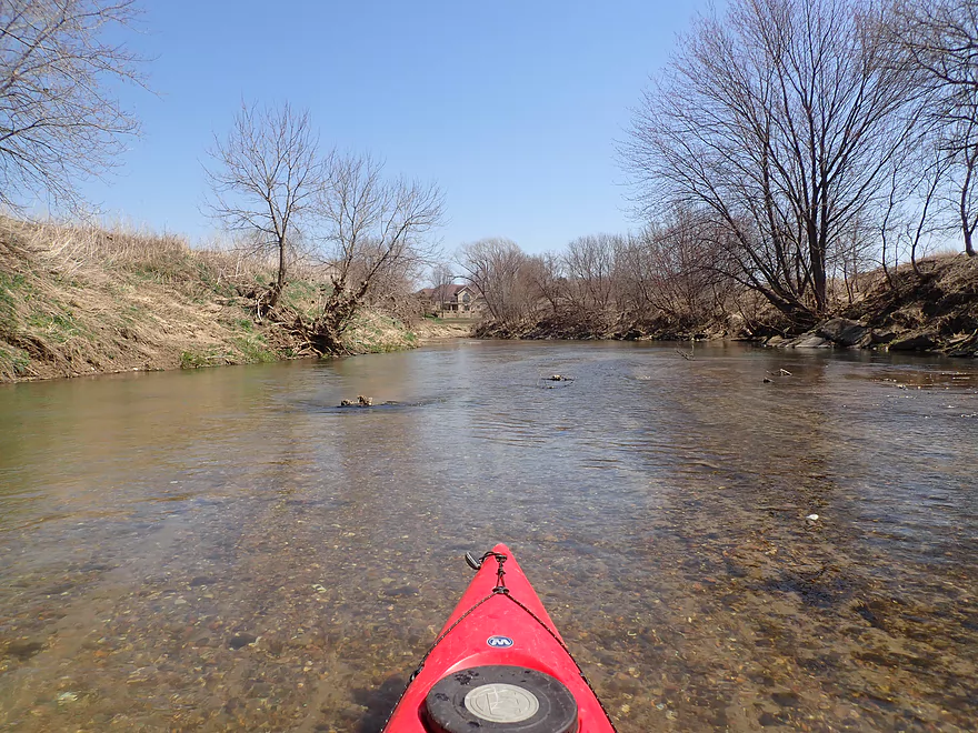
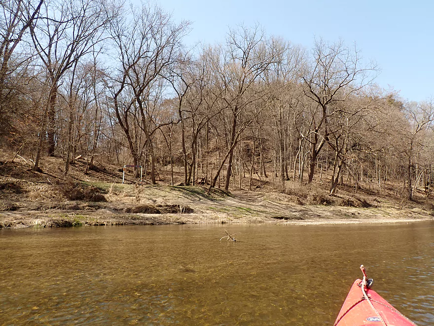
The outskirts of Cascade
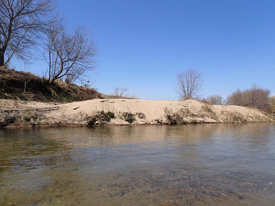
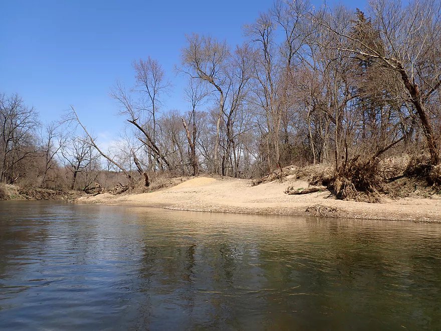
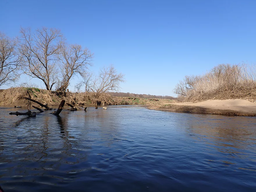
A surprising number of sandbars
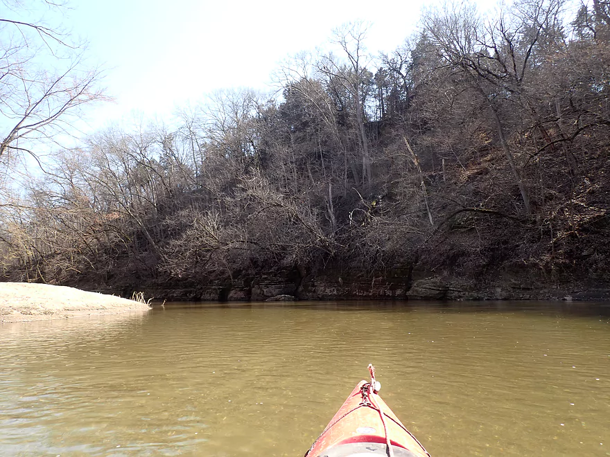
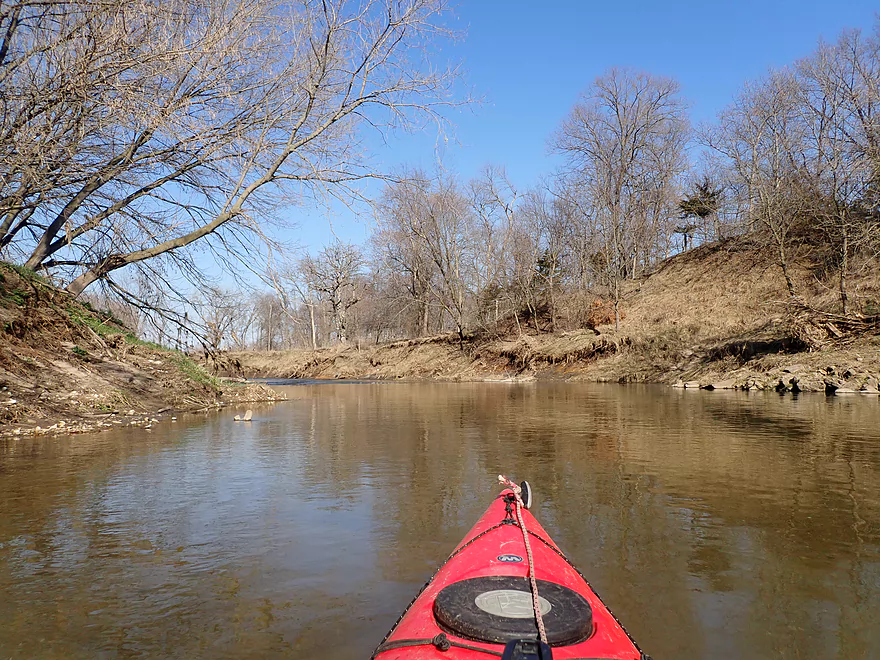
One of countless light rapids
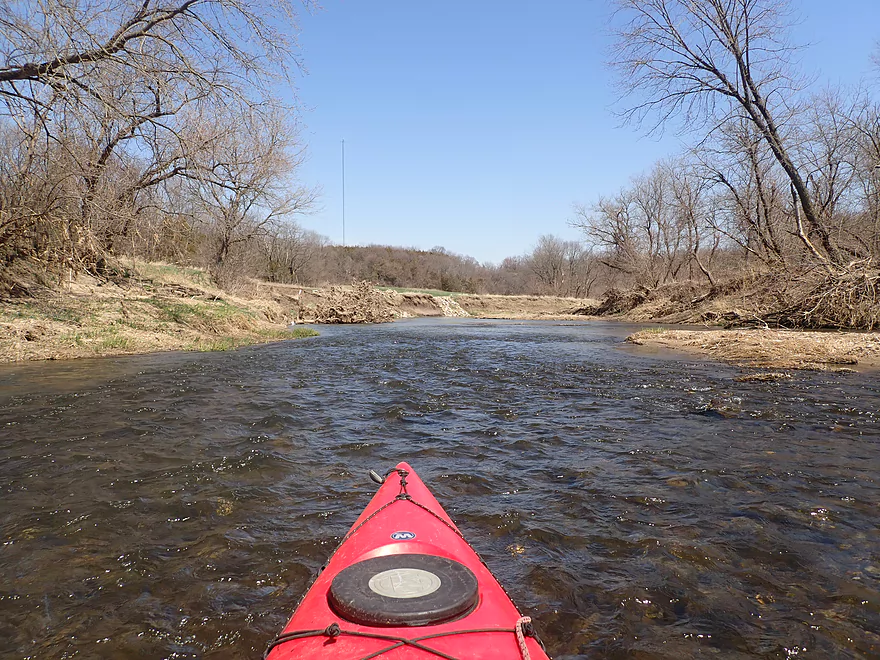
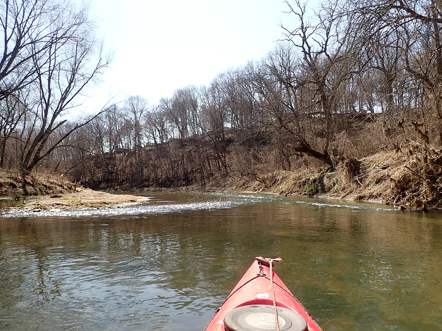
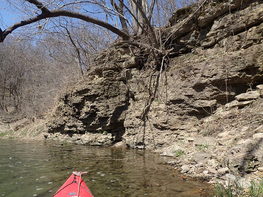
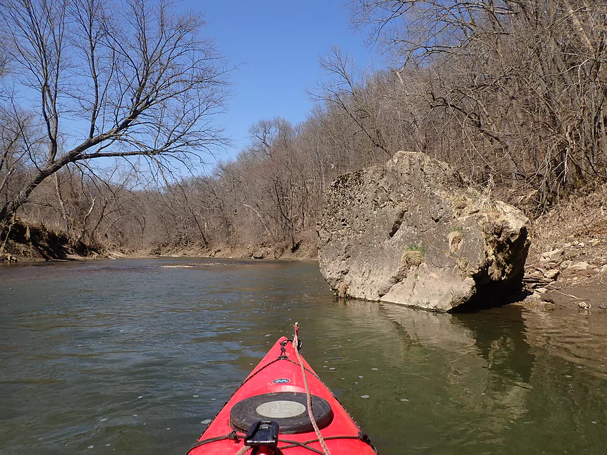
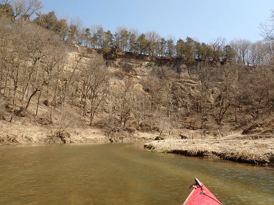
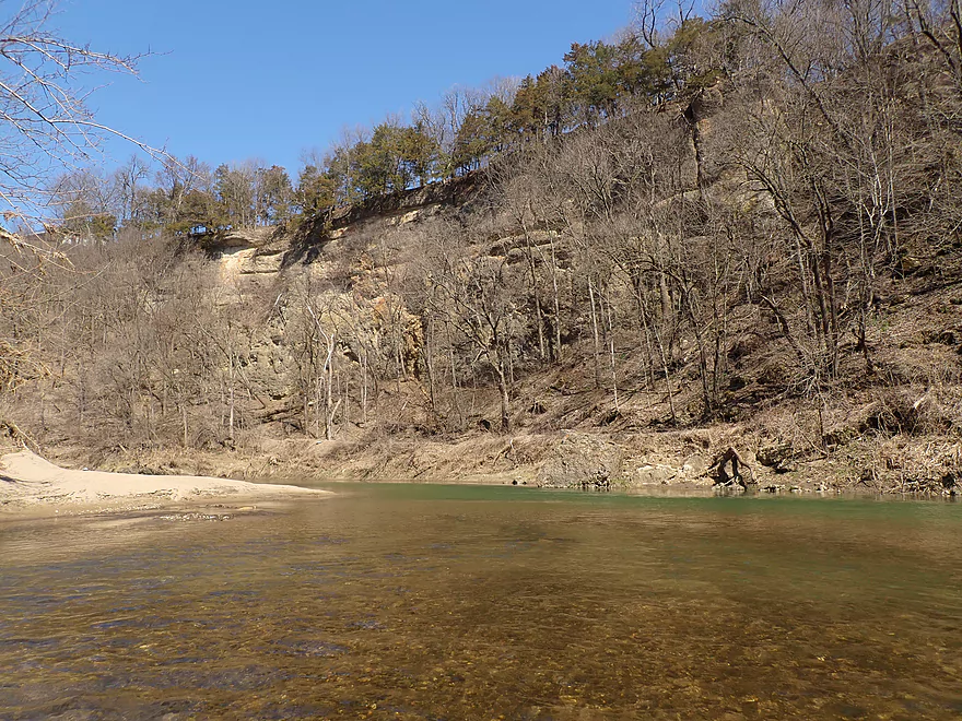
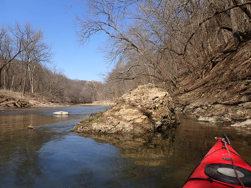
Approaching the first outcrop
Very nice
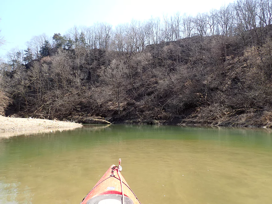
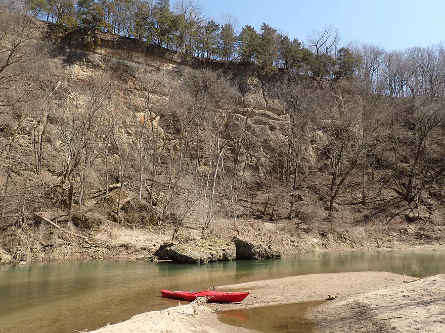
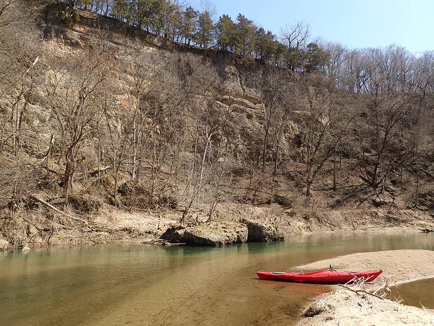
The next few miles had many bluffs
And outcrops
This sandbar is a tempting break area but it has a No Tresspassing sign
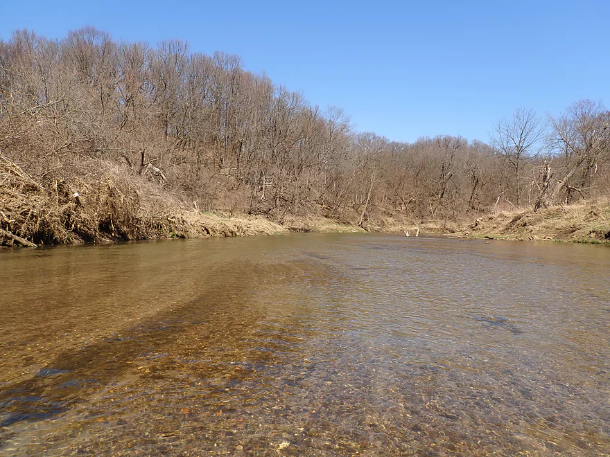
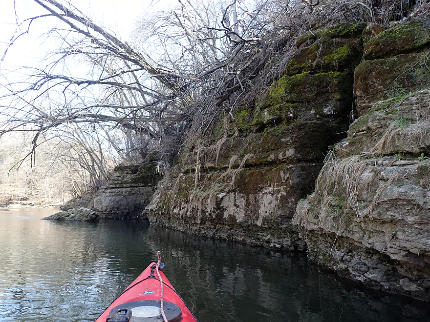
More great clarity
Easy to see where the deep and shallow areas are
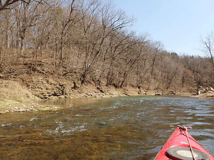
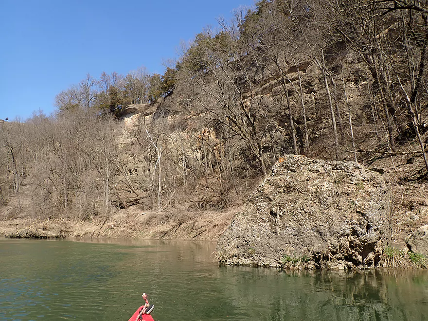
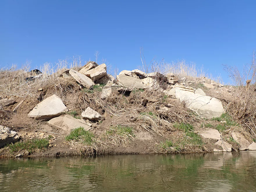
Attractive outcrop
Reverse view
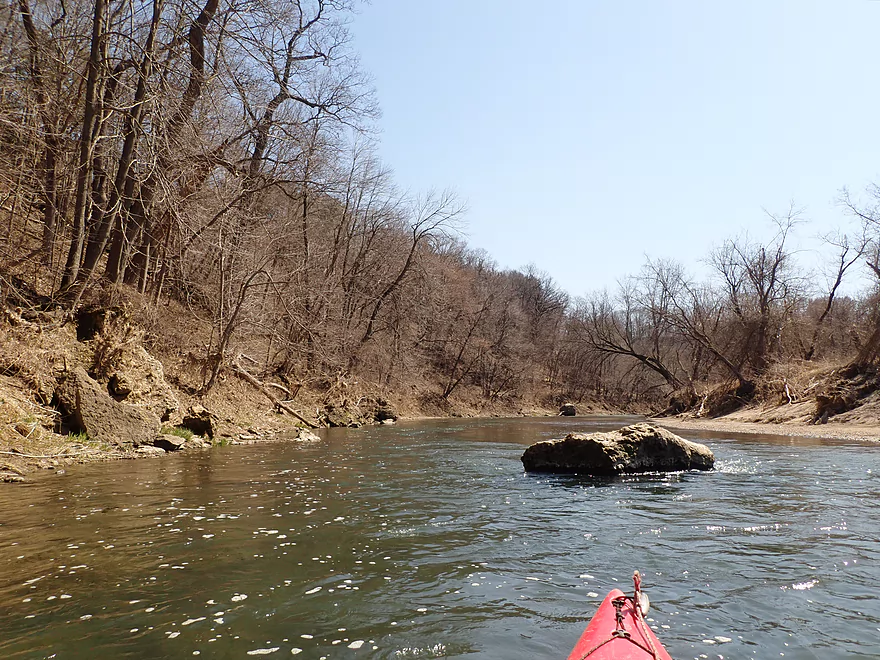
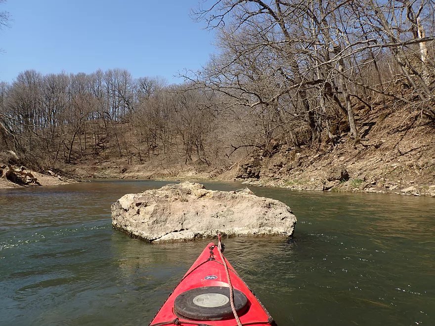
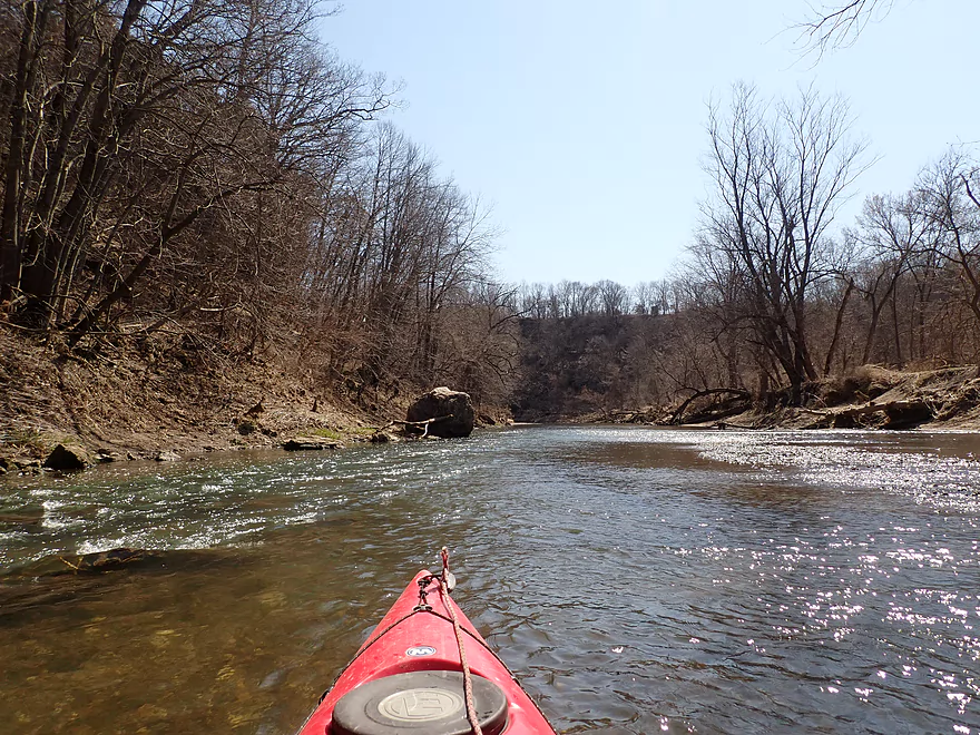
All the boulders in the water reminded me of Whitewater Creek
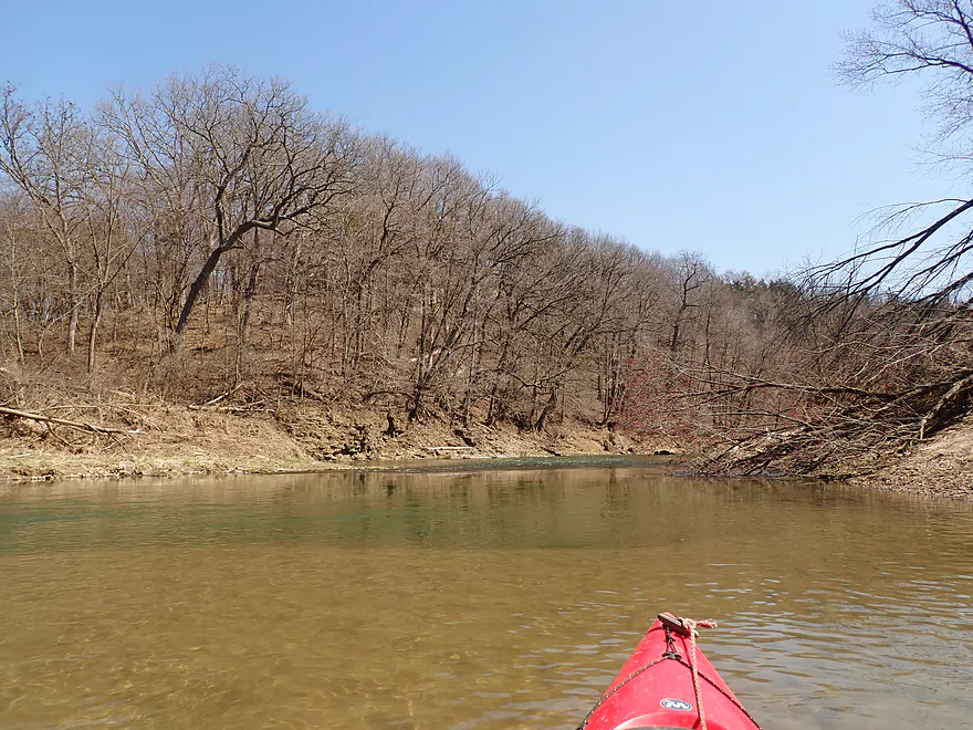
Coming up on the trip highlight
An impressive 100′ high sandstone cliff
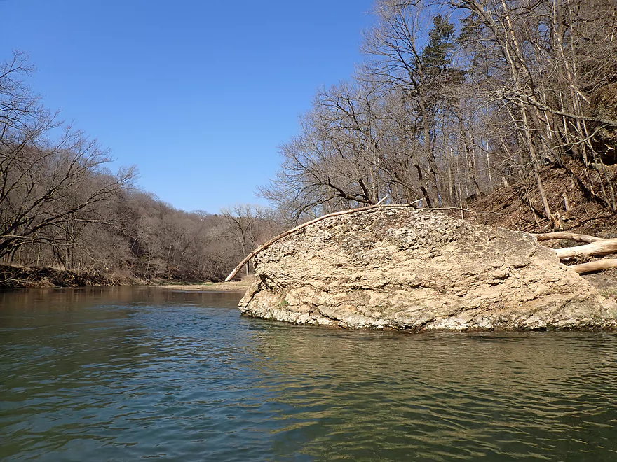
Part of a horseshoe bend
This would be mostly hidden by leaves in the summer
Reverse view
The white posts are where the tubers take out
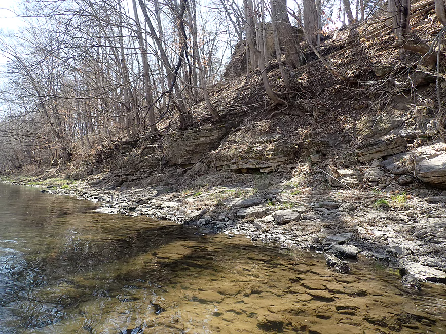
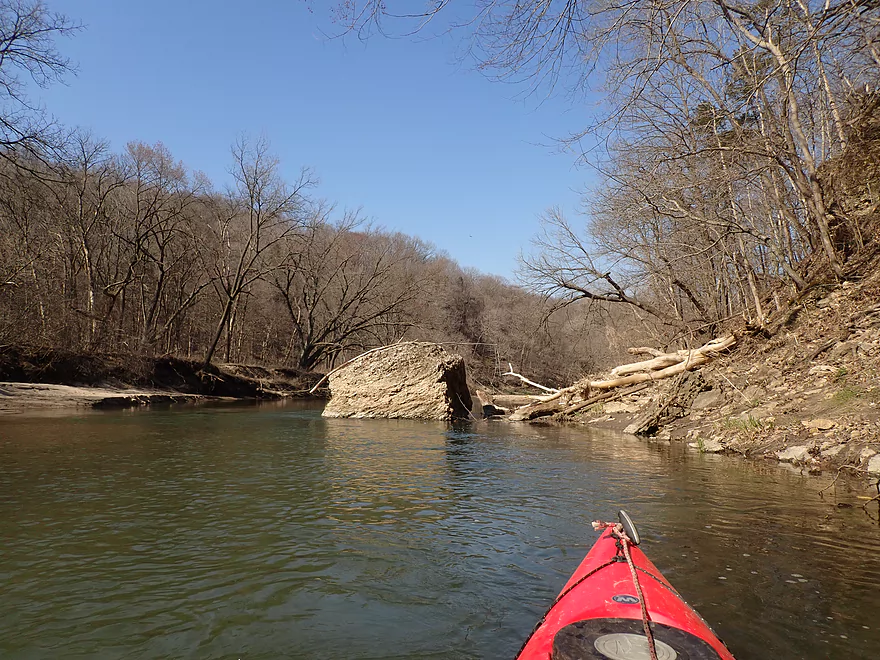
Coming up on a long row of low outcrops
These are limestone
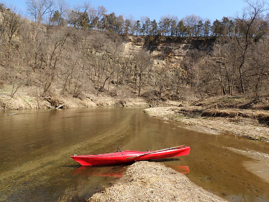
A scenic bend in the river
My second favorite part of the river
More scenic boulders
Leaving bluff country behind
Second half of the trip was flatter and more open
A lot of bank work has been done on the river
Wish they would use nicer fill for the banks
A surprise quarry lake
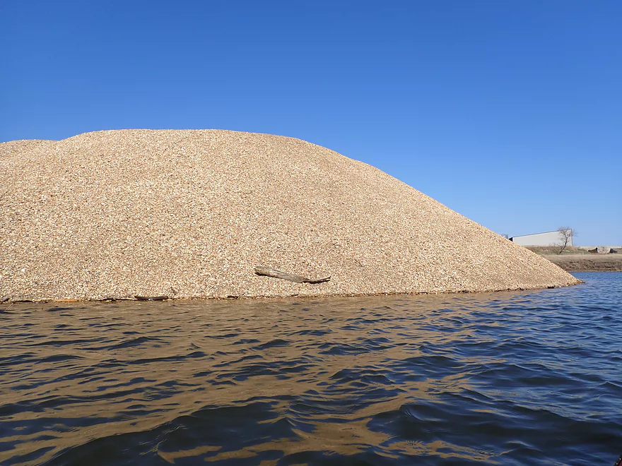
A huge mound of gravel you could paddle up to
Smoke from a massive burn (large flames could be seen leaping over the banks)
Lots of degraded banks on this stretch
Last two miles were a bit nicer though
More fun rapids
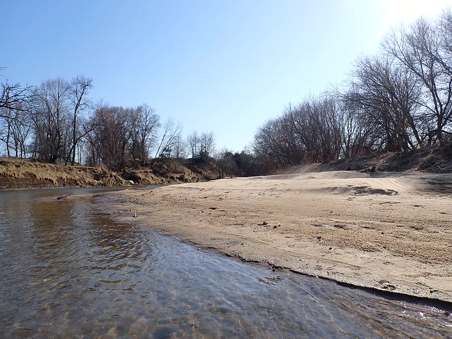
Sandbars are likely the product of upstream cliff erosion
This old bridge abutment is a sign I’m also to Whitewater Creek
Nice to see an outcrop again
The entrance to Whitewater Creek
Paddling upstream on the creek to my takeout was trickier than expected
Taking out at Hwy D61
It’s a muddy but doable bridge access
North Fork Maquoketa River

The North Fork of the Maquoketa River is one of the most scenic and undeveloped rivers in Iowa. But it’s also one of the most overlooked water trails. Part of this is competition from the Main Branch to the south which is popular with kayakers. But the other problem is its remoteness, as suitable bridge access points are often many miles apart.
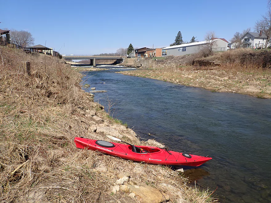
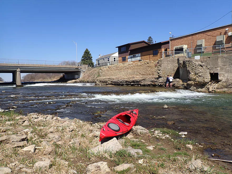
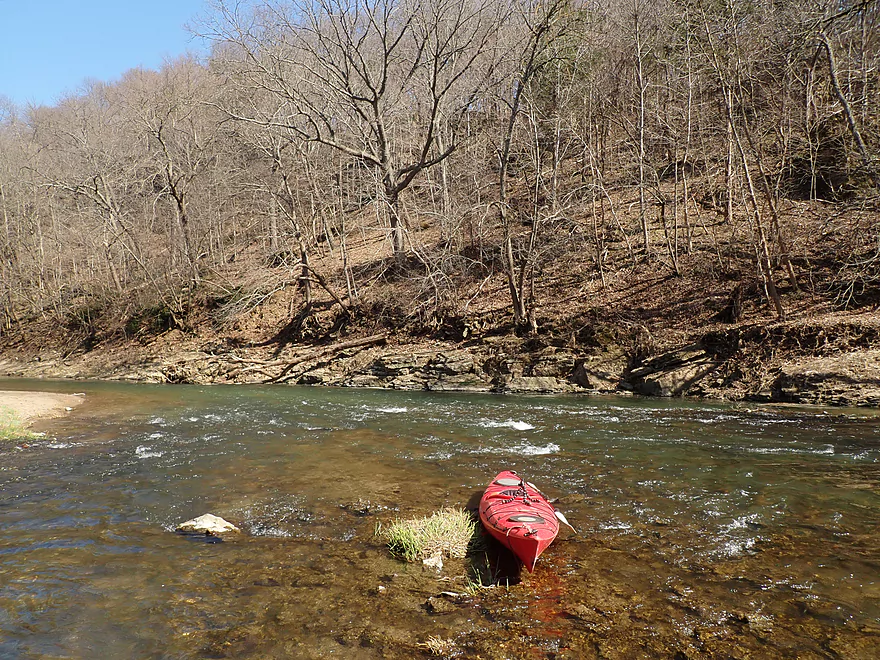
I started my trip at the Cascade Limestone Silo, which is a historical landmark that honors the area’s agricultural past. East of the brick silo is a relatively new concrete ramp that kayakers can use to launch onto the river. I actually ignored the ramp and put in further upstream so I could run the rapids by the dam. These used to be much more impressive and actually consisted of a 9′ high waterfall that descended in two tiers. Tragically the falls were partly destroyed and replaced with a dam for “safety” reasons (per the sign at the park). Hopefully in the future this pointless dam will be removed to reveal what is left of the original “cascades”, but the main ledges are likely gone forever. There are still nice rapids below the dam including a one-foot ledge which is what I ran (0:23 in video). A small crowd watched me run the rapids from the adjacent park which were a lot of fun.
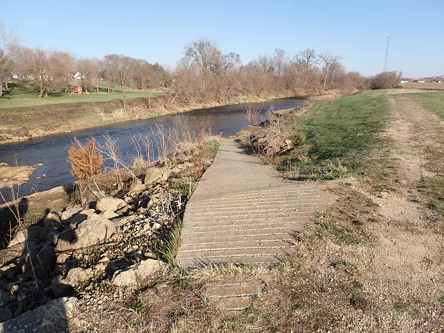
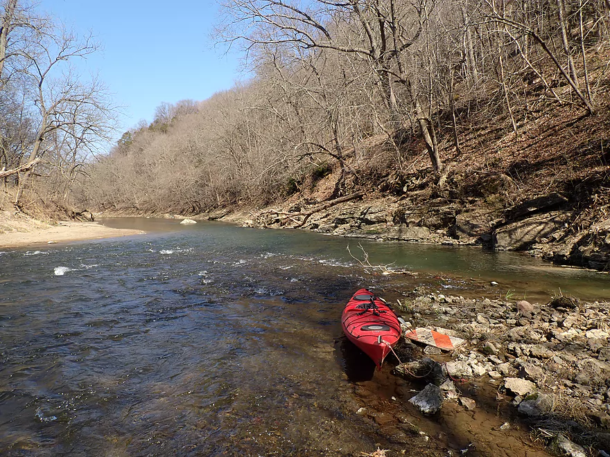
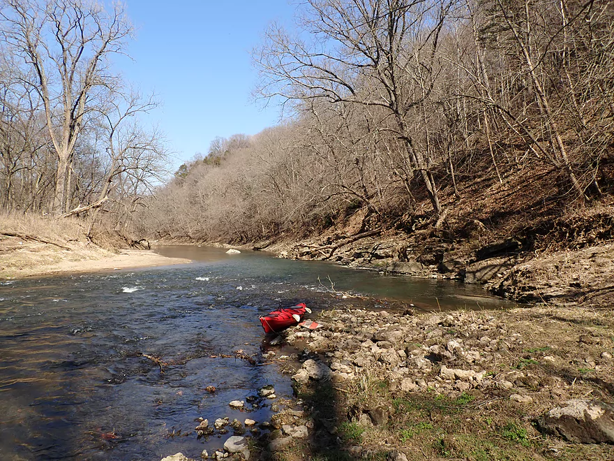
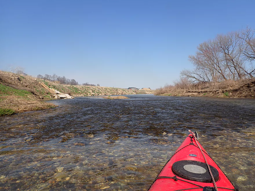
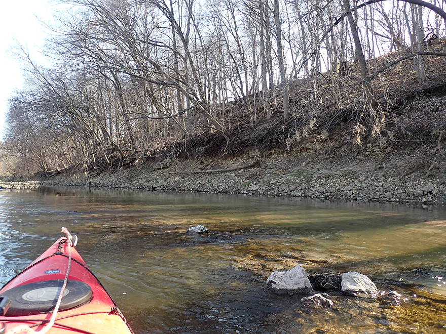
I soon passed the original silo ramp and experienced a few more fun Class 2 rapids. For the next 1.6 miles, the river flowed past the outskirts of Cascade and while there were no bluffs or outcrops, it was a pleasant stretch. The water was surprisingly clear and had a nice blue-green hue to it. The current was fantastic and consistently moved in sheets with many occasional light rapids.
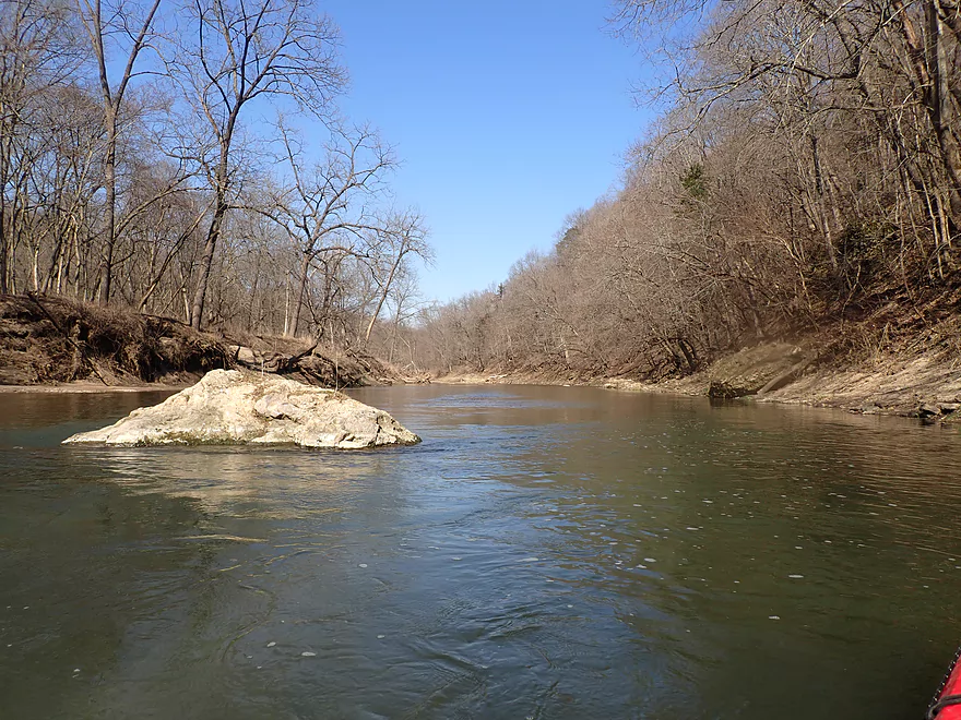
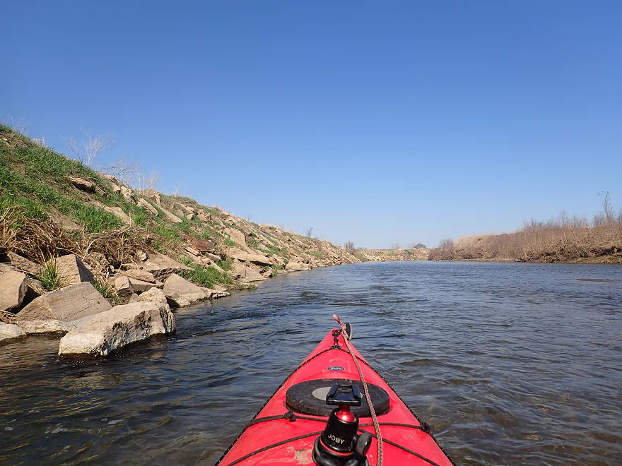
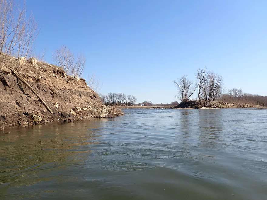
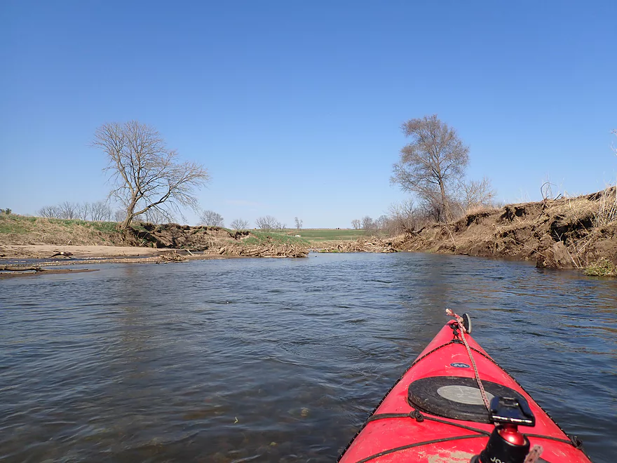
Finally by Riverview Ridge Campgrounds, I encountered my first bluff and cliff. I would learn later that tubers from the nearby campsite put in at this very cliff. It’s a good place to start a trip as the next few miles were very scenic. Although at first I was a little disappointed by the cliffs as they were a bit smaller, more receded, and more obscured by vegetation than I expected. But as I continued through “bluff country” the landscape steadily improved with more exotic scenery, huge boulders in the water, and great limestone cliffs. The highlight of the entire trip was a huge 100′ high cliff that was at the base of a tight horseshoe bend in the river. A large group of eagles and vultures soaring above the cliff was icing on the cake. I was fortunate to experience this in April. I suspect this cliff (like many others on the river) is largely obscured by vegetation from May to September. Early spring or late fall is a great time to paddle this river not only for the cliffs but to avoid the tubers who frequent the bluff stretch from Memorial Day to Labor Day.
I soon passed an obscure PVC sign instructing the Riverview Ridge tubers to get out. Unfortunately for the tubers, a mile of scenic “bluff country” still remains which they miss by taking out here. The take-out was followed by a long but short stretch of limestone cliffs. The river then makes a sharp turn left over some Class 1 rapids backdropped by a small cliff. This was incredibly scenic and my second favorite part of the trip. A few nice boulder gardens remained, and then the bluffs finally petered out and vanished for the rest of the trip.
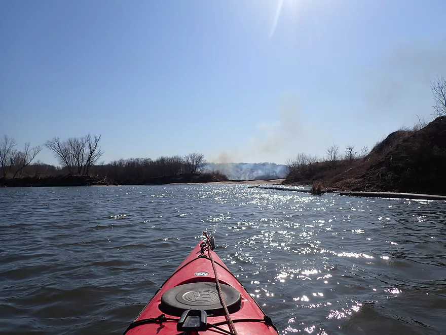
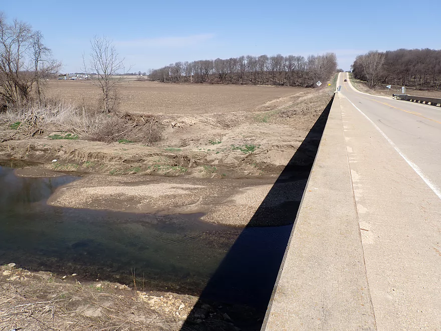
The second half of the trip wasn’t nearly as interesting. The adjacent land was flatter and more open with fewer trees. Huge farms dominated the landscape (much bigger than Wisconsin farms) and tall degraded banks were held up with artificial fill that looked like construction garbage. Huge plums of smoke could be seen in the distance like Saruman’s Orthanc (likely farmers burning trees to make more room for corn which is planted everywhere in Iowa). This last leg wasn’t all bad though as the clarity was still decent and the current was good. Of interest, the river is intersected by two large quarries that have filled in to become small ponds. I checked one out and paddled close to a huge mound of gravel before turning back and resuming my trip on the river.
In the last mile the river became slightly more interesting with a surprising number of sandbars and a bit more woods. A long outcrop on the western shore marked the entrance of Whitewater Creek. I had been concerned about missing this “off-ramp” as the next bridge was 12 miles downstream!
To end the trip I paddled ~2000′ upstream on Whitewater Creek to reach my take-out at Hwy D61. This proved more difficult than I initially planned as the current was stronger than expected. It helped to get out and wade in spots as the creek was shallow and sandy, but it was still a decent workout to get back to the bridge. Fighting Whitewater Creek was better than the alternative (a 20 mile trip from Cascade to 21st Ave).
In summary this was a trip that ended on a bit of a down note, but the first half was still so good it easily earned its five stars. I’m not sure if it will ever become popular with paddlers though because of its longer length and the need to paddle upstream on Whitewater Creek. Although kayakers could get permission from Riverview Ridge Campgrounds to use one of their access points to shorten a trip.
Whitewater Creek is located next door and is also a good water trail that I did a few years back. It’s much smaller and shallower than the North Fork. My advice to those deciding between the two would be to do Whitewater Creek if water levels are high. Otherwise if levels are down and you don’t mind a longer trip, go with the North Fork. Both are incredibly scenic. Whitewater Creek may have more consistent good scenery, but the North Fork likely has better highlights.
Field of Dreams: The movie set for the Field of Dreams is located north of Cascade. It’s been preserved and today is a popular tourist attraction.
Cascade Historic Limestone Silo: You can’t miss this if you launch from Cascade. It is a historical landmark dedicated to Iowa’s early farming pioneers. It’s not super special, but the rustic brick silo is a nice backdrop when launching onto the river.
Northeastern Iowa avoided the most recent glaciers that flattened much of the Upper Midwest. This has left it with some fantastic bluffs, valleys, and cliffs. The rivers and creeks in northeast Iowa are rugged, scenic and fantastic for paddling. Some of its best streams for kayaking include: Upper Iowa River, Maquoketa River, Maquoketa River North Fork, Catfish Creek, Lytle Creek, Yellow River, Volga River, Little Maquoketa River, Turkey River, Little Turkey River, and of course the Mississippi itself. But…it’s a common myth that northeast Iowa and southeast Minnesota are part of the Driftless Area. In reality they got hit by pre-Illinoian glaciers over 500,000 years ago. But because this event was so long ago, northeast Iowa has been able to redevelop some of its rugged character. The actual border for the pre-Illinoian glaciers is roughly along the Mississippi. So only southwest Wisconsin and Jo Daviess County in Illinois are truly part of the Driftless Area. But northeast Iowa is still a unique and wonderful area. Perhaps a more accurate term for the land west of the Mississippi might be “Old Drift”. For a more detailed and academic history of the Driftless Area, I recommend the book ““The Physical Geography and Geology of the Driftless Area”.
Wildlife sightings included:
- Many big fish (mostly carp, but some not)
- One brown mink
- A muskrat I was able to get very close to (see video)
- Clams
- Vultures, red-tails, and many eagles (was shocked to see so many eagles)
- Several fishermen in Cascade
Cascade Historic Limestone Silo: This is an excellent public access located south of the Cascade dam. A long concrete ramp leads down to the river and you can use the parking lot west of the silo. Bathrooms are available north by the amphitheater, but these are seasonally locked.
Alternate Put-ins:
- Cascade Riverview Park & Amphitheater: (460′ upstream from the silo) Between the dam and silo are some fun rapids. To run them you’ll need to paddle upstream from the silo (as I did), or launch from Cascade Riverview Park. Note there is a limestone wall next to the park so getting to the river isn’t super easy from there.
- Cascade Riverfront Trail: (900′ upstream from the silo) If you wish, you can not only run the Class 2 rapids but also the dam by launching just west of the 1st Ave bridge along the bike trail. The dam is dangerous and should only be run by experts who scout it ahead of time and avoid the low-head hydraulics (south end bad, north end somewhat good).
- Riverview Ridge Campgrounds: (1.6 miles downstream from the silo) This is a private campground and you need to get permission from the campsite to launch here. The location though is very ideal as it marks the very start of the bluffs and cliffs.
Hwy D61: This is an adequate bridge access, but a bit muddy. However to reach this, a 0.37 mile upstream paddle on Whitewater Creek is required.
Alternate Take-outs:
- Riverview Ridge Campgrounds Take-out: (4 miles upstream from Whitewater Creek) A sign with white poles on the west bank mark a private take-out used by tubers. To disembark here, you will need permission from Riverview Ridge Campgrounds. But if you get out here, you’ll miss out on about a mile of very scenic bluffs and boulders.
- 21st Ave (12.1 miles downstream from Whitewater Creek) For most paddlers this extension will be too far and too much. But if you’re willing to do a very long trip, you’ll be rewarded as the stretch below Whitewater Creek is nice with many scenic bluffs.
Bike Shuttle – Hwy D61 to Cascade historic Limestone Silo: 5.3 miles with 213′ of ascent. This is a hilly but manageable bike shuttle with thankfully no gravel. D61 has almost no shoulders which is not ideal for biking, but I was impressed with how consistently courteous Iowa drivers were in slowing down and giving me ample space when passing. Coincidentally D61 had yellow share the road bike signs, so maybe that helped.
Rentals/Shuttles – Riverview Ridge Campground: Between Memorial and Labor Day, the campground offers rentals and shuttles to tubers and kayakers. They primarily service a 1.8 mile stretch of the river that flows between the bluffs. I don’t know if they offer shuttles beyond this area. Contact them at 563-543-1258 for more info and options.
Logjams/Fences: None
Rapids: The only major rapids (Class 2+) are located by Cascade and you can simply avoid them by launching downstream of the silo which is easy to do. If you are interested in running the Class 2’s or even the dam itself, see my put-in guide above. After Cascade there are countless Class 1 rapids, but nothing too tricky or dangerous.
Whitewater Creek: To reach the Hwy D61 bridge access will require 0.37 miles of upstream paddling on Whitewater Creek. How difficult this will be likely depends on if the North Fork is high and “dams” Whitewater Creek which would slow the current at the mouth. In my case everything wasn’t high, and it was tricky paddling upstream on the creek because of the occasionally fast current. It helped that I occasionally got out and waded in the shallow sandy areas while pulling my boat with rope. Be careful where you step though as some sand is extremely soft and you can easily sink up to your knees if you’re not careful. I suppose worst case scenario, if you have a tough time paddling up Whitewater Creek, you could simply get out on the adjacent corn field edge and drag your boat along the banks to the bridge.
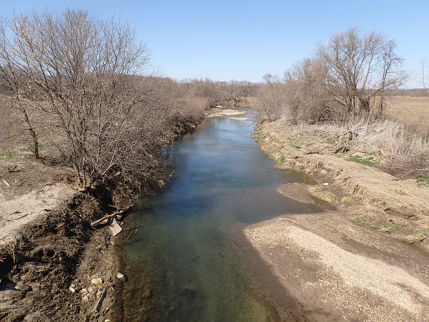
Overshooting Whitewater Creek: Whitewater Creek isn’t hard to miss, but you do want to bring your GPS and study maps ahead of time just to be safe as it’s 12 miles to the next bridge if you miss your “off-ramp”. Whitewater Creek will be located shortly after a washed out bridge, but before a long outcrop.
Closest Gauge: North Fork Maquoketa River @ Fulton, Iowa
Trip Depth: 320 CFS or 3.2′
Navigability Estimates: The following are just rough estimates. Always use your own judgement.
- < 150 CFS: Perhaps too shallow for paddling. Note the river rarely gets this shallow though.
- 151-230 CFS: Very shallow but likely viable for paddling if you have a shallow drafting boat.
- 231-300 CFS: An average depth good for paddling.
- 301-400 CFS: Above average depth but still good for paddling.
- 401-550 CFS: A higher depth that is still acceptable for paddling. Water quality though will likely be poor.
- 551-700 CFS: River is high and likely not attractive for paddling but is probably doable. Paddlers should have adequate experience before attempting fast rivers at high levels.
- 701-1000 CFS: A very high depth. Perhaps only suitable for advanced paddlers.
- 1001+ CFS: Perhaps only suitable for expert paddlers.
- Upstream from Vaske Road: The far upper legs might still be navigable, but little is known about them.
- Vaske Road to New Wine Park: 1.2 miles. This stretch is open and is probably dominated by cattle pasture.
- New Wine Park to Floyd Park: 1.3 miles. A good prospect that flows past wooded New Wine Park.
- Floyd Road to Christoph Road: 1.3 miles. Likely a small creek that isn’t too interesting.
- Christoph Road to Beltline Road: 2.8 miles. A mediocre prospect that is small and partially wooded with perhaps a few logjams. There are significant rapids under the 2nd Street NE bridge…maybe Class 2.
- Beltline Road to Westside Park – Soccer Fields: 0.4 miles. Here the river flows through the north end of Dyersville. This is an urban and channelized paddle, but pleasant with nice views of the buildings and bridges. This can get shallow in late summer.
- Westside Park – Soccer Fields to Candy Cane Park: 0.3 miles. Here the river is channelized with several light rapids. Despite this, it’s a pleasant leg with nice vistas of Dyersville and it parallels a popular public riverwalk .
- Candy Cane Park/Dyersville to Rockville Road: 6.6 miles. A mediocre stretch that is pleasant but not as scenic as downstream legs. The lack of outcrops was disappointing and the bank quality was poor. It’s not a bad leg though.
- Rockville Road to 272nd Street: 2.3 miles. The stretch between Rockville Road and 272nd Street is flat, open and likely boring. I doubt I’ll ever paddle it.
- 272nd Street to 305th Street Corner: 6.3 miles. A fantastic leg and maybe the best on the North Fork. Includes ~5 miles of narrow canyons and steep valley walls with frequent 50′ cliffs (per paddling author Nate Hoogeveen). Note, 305th Street is not a bridge, but a shoulder and is somewhat speculative as an access. I think you should be alright to use it but stay on the DOT easement between the road and the river. Do not trespass on private property. Do not launch on the east oxbow a thousand feet upstream which is clearly fenced and marked as No Trespassing (see map for details). Bike shuttlers beware….this route is hilly, almost all gravel, and the house at 305th Street has two VERY aggressive dogs who will give chase.
- 305th Street Corner to Hwy 136: 11.1 miles. This includes a few more miles of scenic valley paddling but isn’t as good of a prospect as the previous leg and is much more open. The Iowa DNR really needs to add more river access points in this area.
- Hwy 136 to the Cascade Riverfront Trail: 3.1 miles. This stretch includes some rapids, but also some flowage paddling from the Cascade Dam. Paddling author Nate Hoogeveen was not impressed with this leg.
- Cascade Riverfront Trail to Cascade Riverview Park and Amphitheater: 630′. This mini-leg goes over a dam and the remnants of Cascade Falls. These are Class 3 rapids that should only be run by expert paddlers and scouted ahead of time (easy to do by the Amphitheater). The west side of the rapids look like a nasty low-head dam, but the east side descends in smaller ledges and would be runnable by those that know what they’re doing. Note, the Amphitheater is a poor access because of a limestone wall that separates it from the river.
- Cascade Riverview Park to Hwy D61: 7.8 miles.
- Cascade Riverview Park to Cascade Limestone Silo: 677′. A fun whitewater stretch with Class 2 rapids and a foot-high ledge. The Silo is a MUCH better access than Riverview Park.
- Cascade Limestone Silo to Riverview Ridge Campgrounds – North Access: 1.6 miles. A pleasant open stretch through the outskirts of Cascade. Many light rapids and good clarity, but no outcrops. You must get permission from Riverview Ridge Campground to use their access.
- Riverview Ridge Campgrounds – North Access to Riverview Ridge Campgrounds – South Access: 1.8 miles. A fantastic stretch through narrow valleys and by scenic bluffs with frequent outcrops and boulders. Again, you must get permission from Riverview Ridge to use either of their access points (which are usually used by tubers).
- Riverview Ridge Campgrounds – South Access to Whitewater Creek Mouth: 4.0 miles. Includes one mile more of very scenic bluffs, but then opens up and flattens out. The river is still pleasant but no longer elite and large degraded farm banks become a common sight.
- Whitewater Creek Mouth to Hwy D61: 2000′. This is an upstream slog up Whitewater Creek to reach the Hwy D61 access. Depending on water levels, this may be a bit tricky as the current isn’t slow. Wading parts of the creek or even just simply portaging the entire creek via the adjacent cornfield might be recommended.
- Whitewater Creek Mouth to 21st Ave/Ozark Bridge: 12.1 miles. A very good leg with many steep wooded bluffs. The only downside is it is a long stretch with no intermediate take-out options. Some paddlers camp on this stretch and make it a two-day trip. Where you can legally camp and not, I don’t know. Here’s a youtube video of a kayak trip on this leg.
- 21st Ave/185th Street Bridge to 60th Ave: 4.4 miles. A terrific leg through the Ozark Wildlife Area with fantastic steep bluffs and large boulders.
- 60th Ave to Benard Road/Crab Town Bridge: 2.8 miles. A good leg with bluffs, but not as scenic as the previous legs.
- Benard Road/Crab Town Bridge to 109th Ave: 2.5 miles. After Benard Road, the North Fork loses a lot of its charm and scenery. This leg should be ok, but is more open and nothing special.
- 109th Ave to Bridgeport Access: 18.4 miles. The following lower stretches of the North Fork are inferior and not as scenic as the upper stretches.
- 109th Ave to 150th Street: 4.9 miles. A generic open leg that flows by large farm fields. There are nice sandbars on this stretch though.
- 150th Street to Hwy 61: 4.4 miles. A generic stretch.
- Hwy 61 to the Davison Bridge Access/212th Ave: 2.4 miles. Scenic Class 2 rapids are located downstream from Hwy 61. This leg is more wooded and hilly. It may even have a few outcrops.
- 212th Ave to Rockdale Road: 6.3 miles. A generic leg.
- Rockdale Road to Mouth on Maquoketa River: 0.3 miles. This leg passes a massive quarry.
- Maquoketa River to Bridgeport Access: 2.5 miles. The river grows significantly from the confluence of the North Fork and Main branch. This leg likely isn’t special, but does appear to have a few nice sandbars.
Trip Map
Overview Map
Video
Photos Size: