
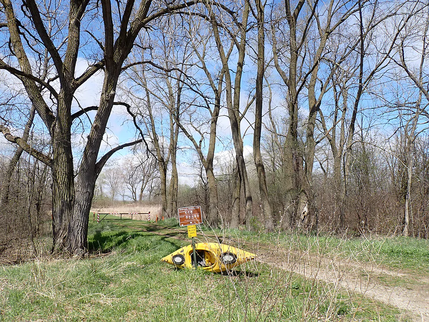
DNR public access off Dike Road
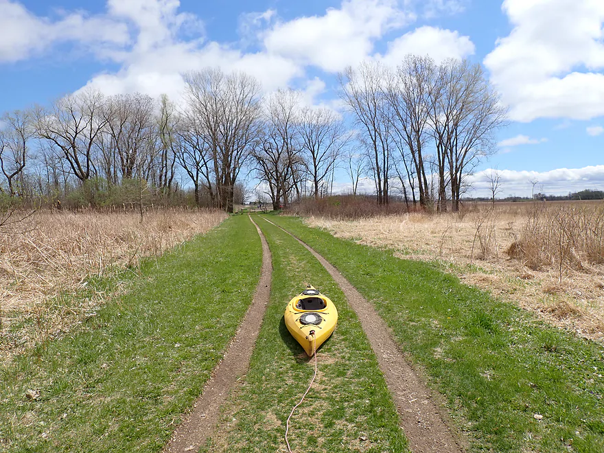
Unfortunately the road to the dam is gated shut…requiring an 1800′ hike
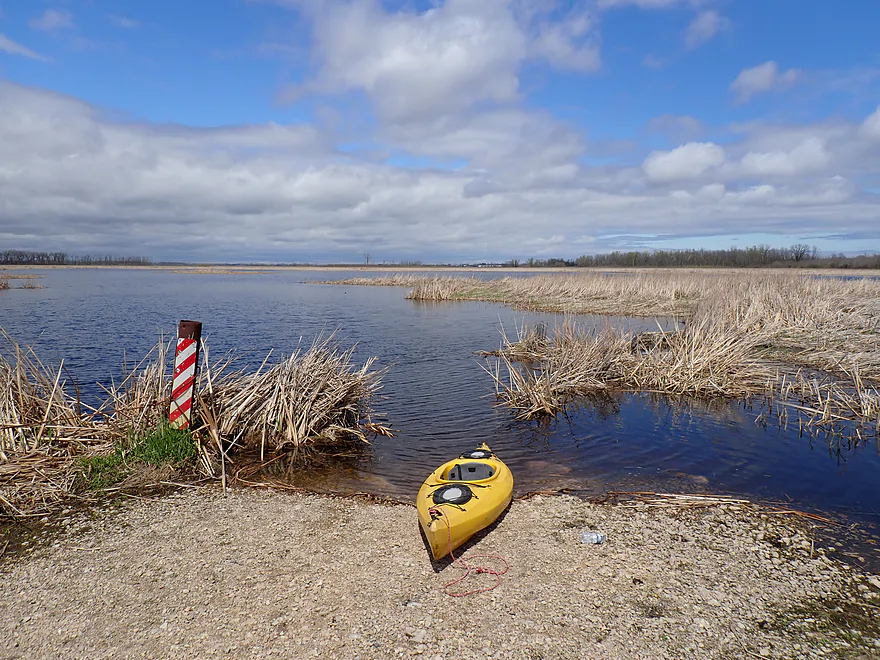
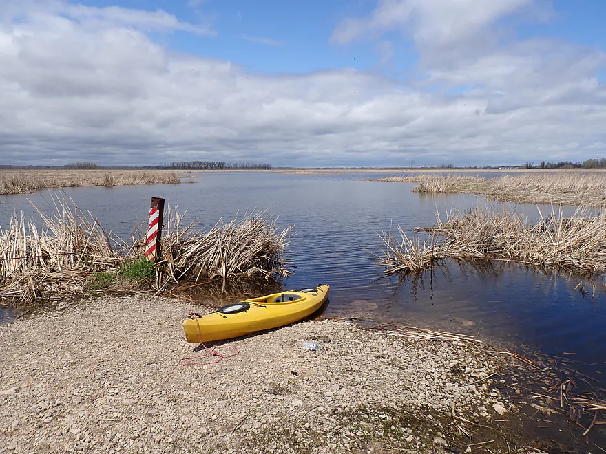
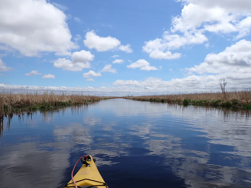
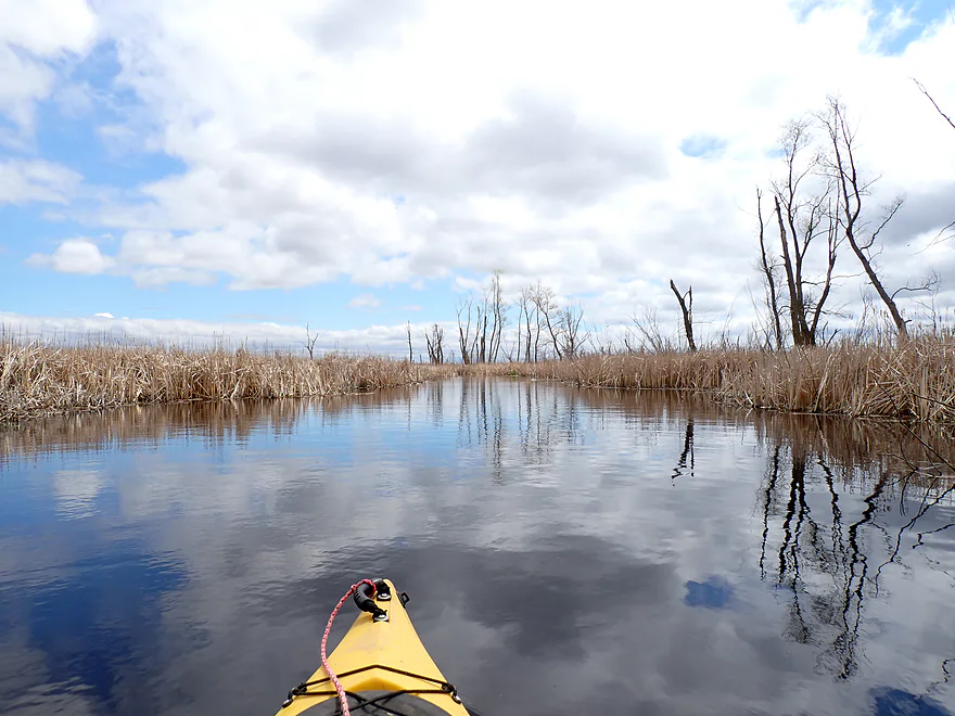
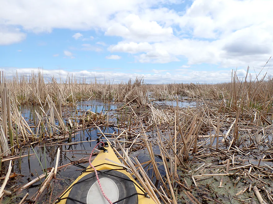
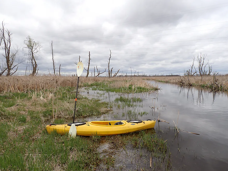
Launching on the dike above the dam
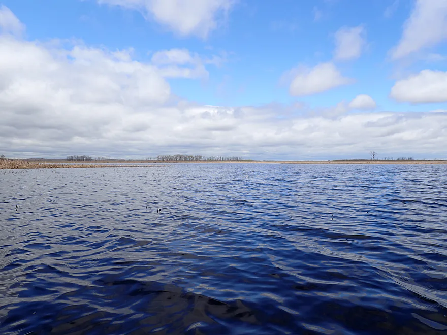
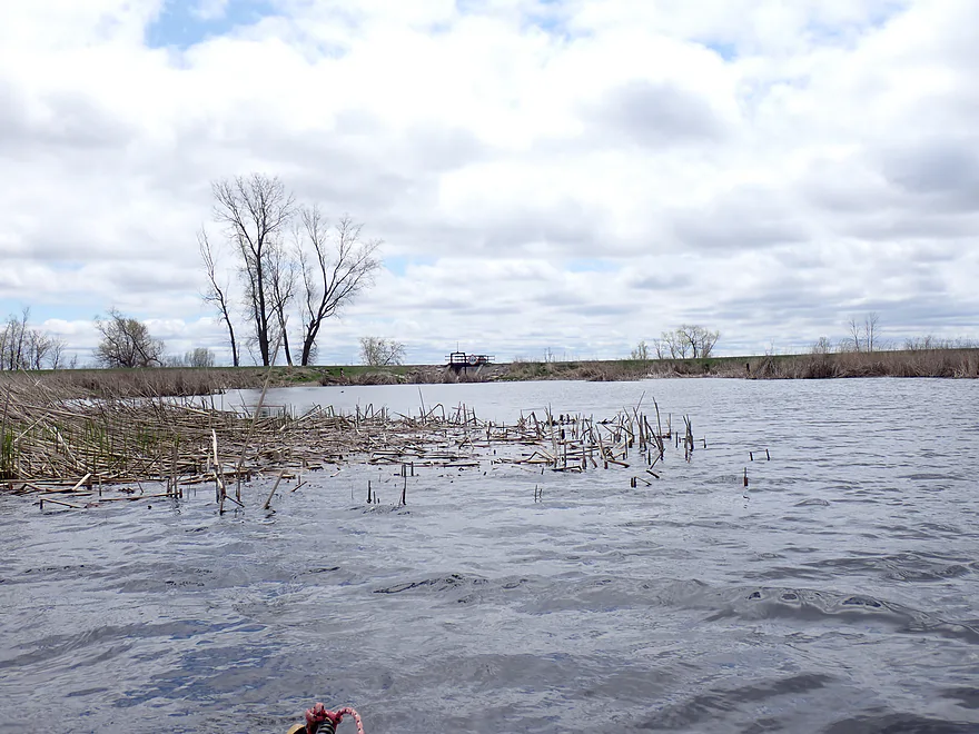
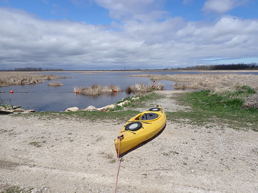
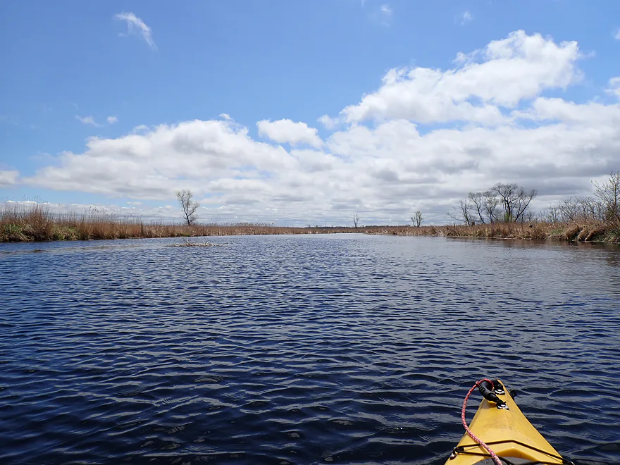
Exploring the lake portion of Eldorado Marsh
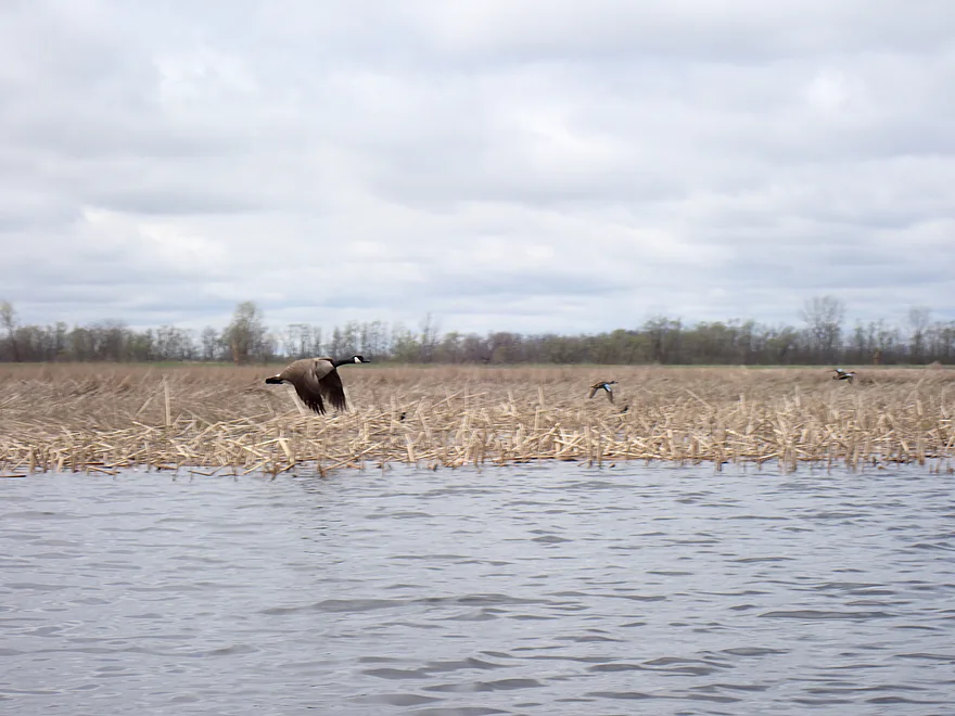
Lots of geese
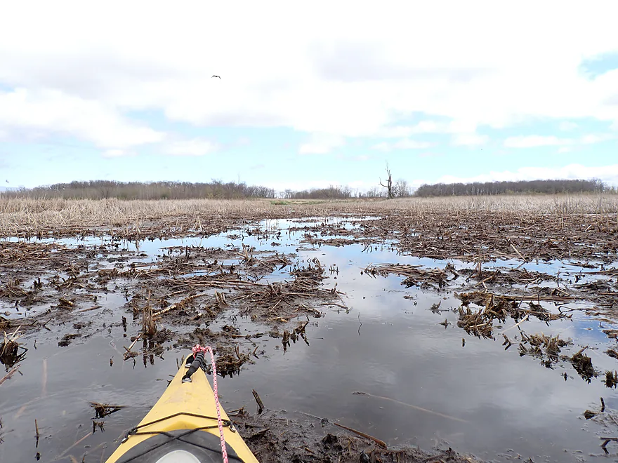
Looking at a second access off Marsh Road…now blocked by cattails
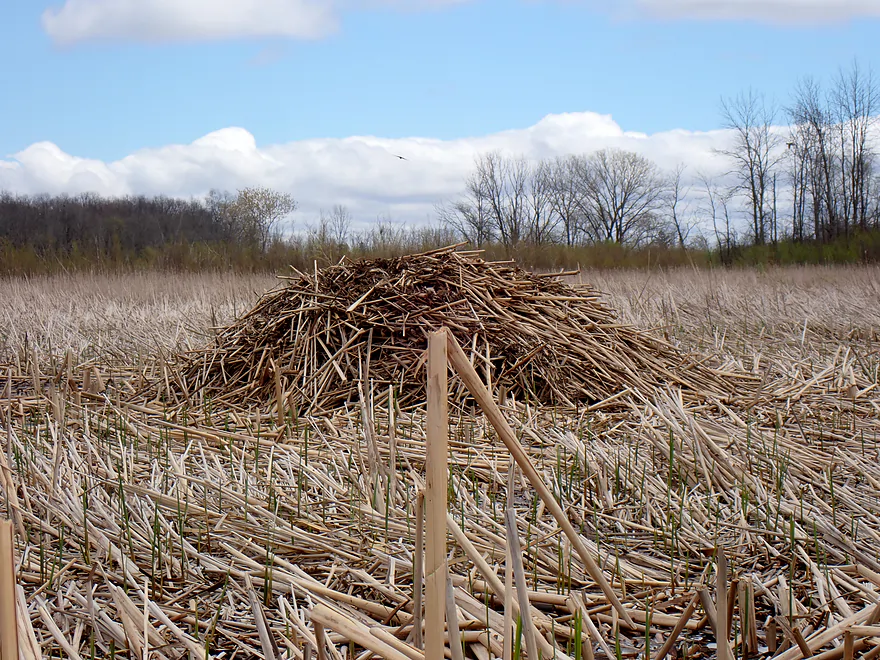
Lots of huge muskrat lodges
Lake paddling was a bit boring…heading back to the dam
A natural ramp
Easy portage
…and reentry
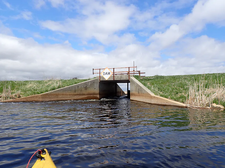
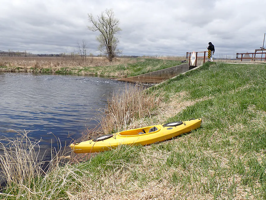
Checking out the dam from the downstream side
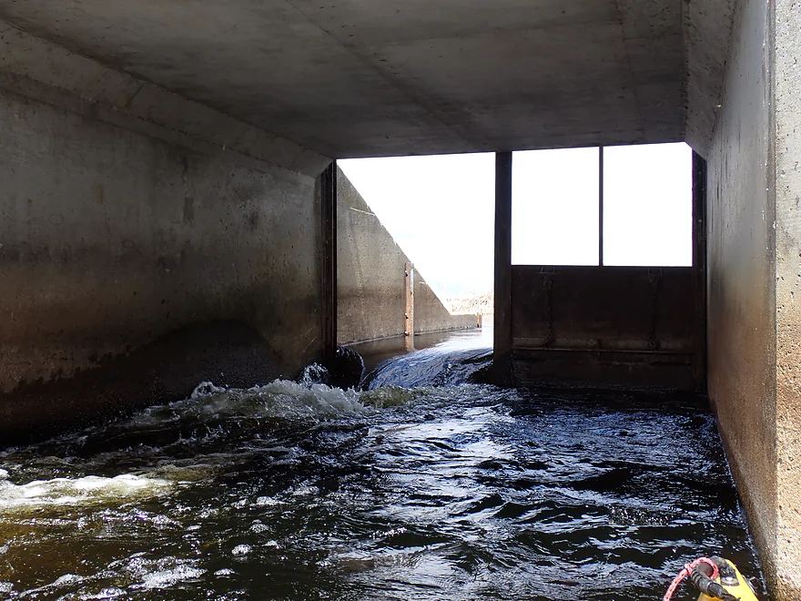
Almost ran it…but it looked rough
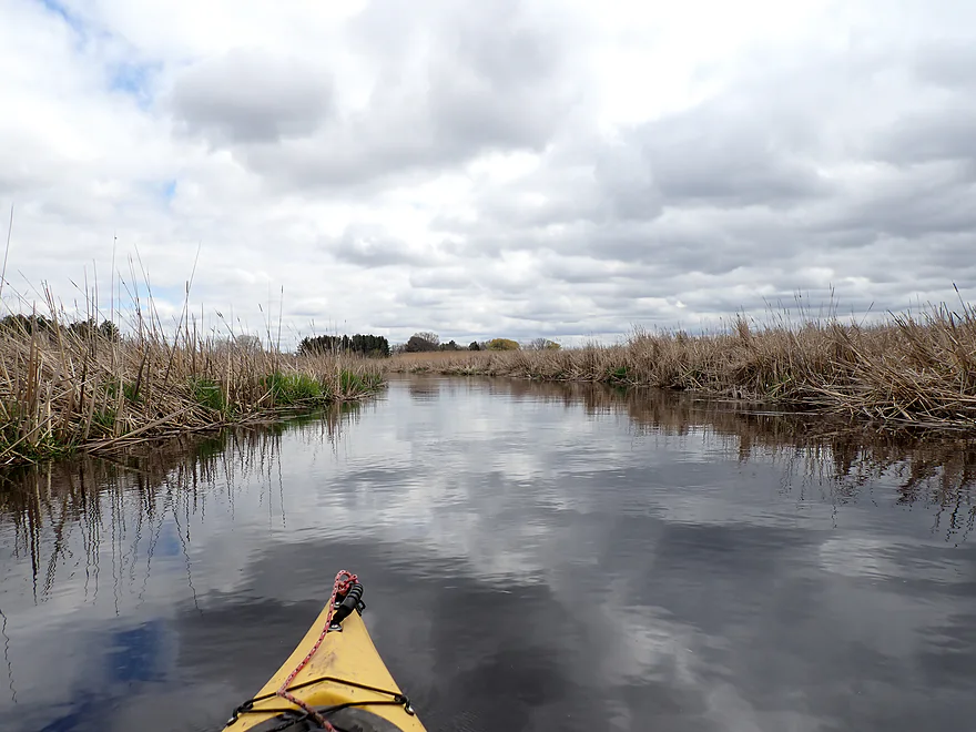
Now on the Fond du Lac River (West Branch)
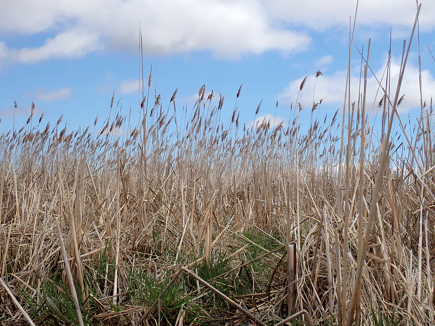
Very tall phragmites (over 10′)
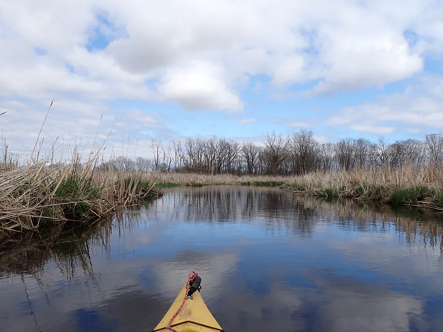
Nice blue skies to start
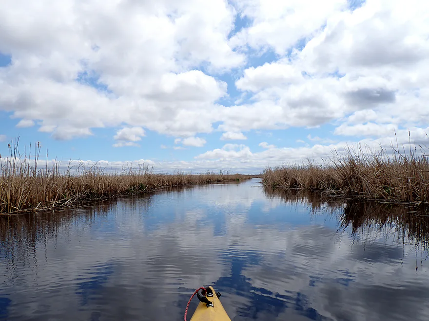
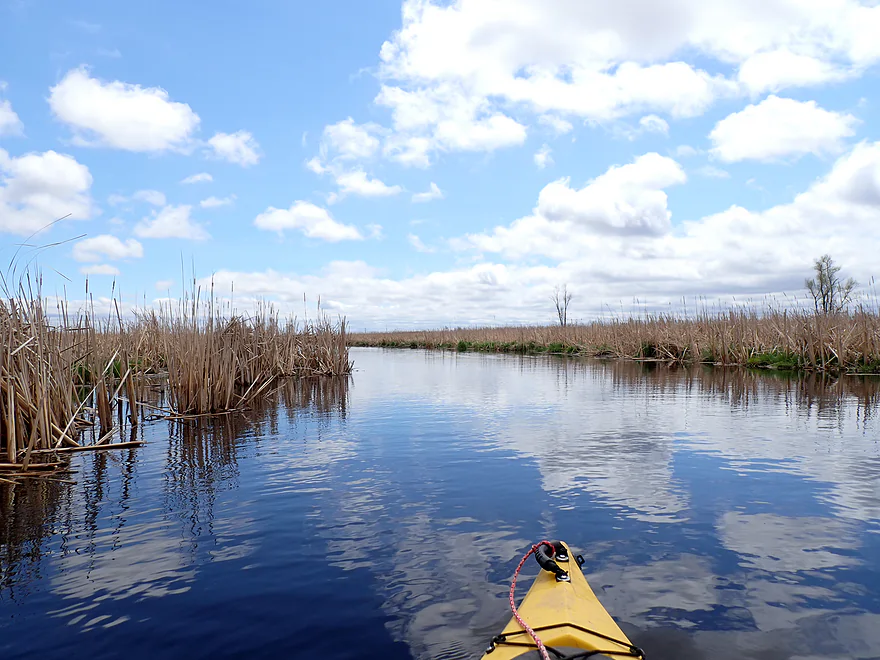
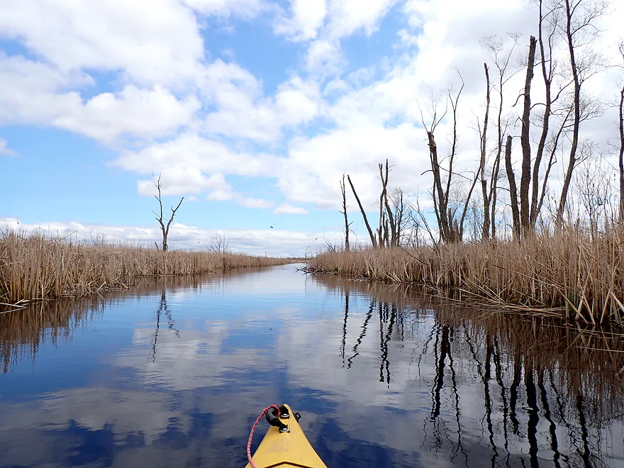
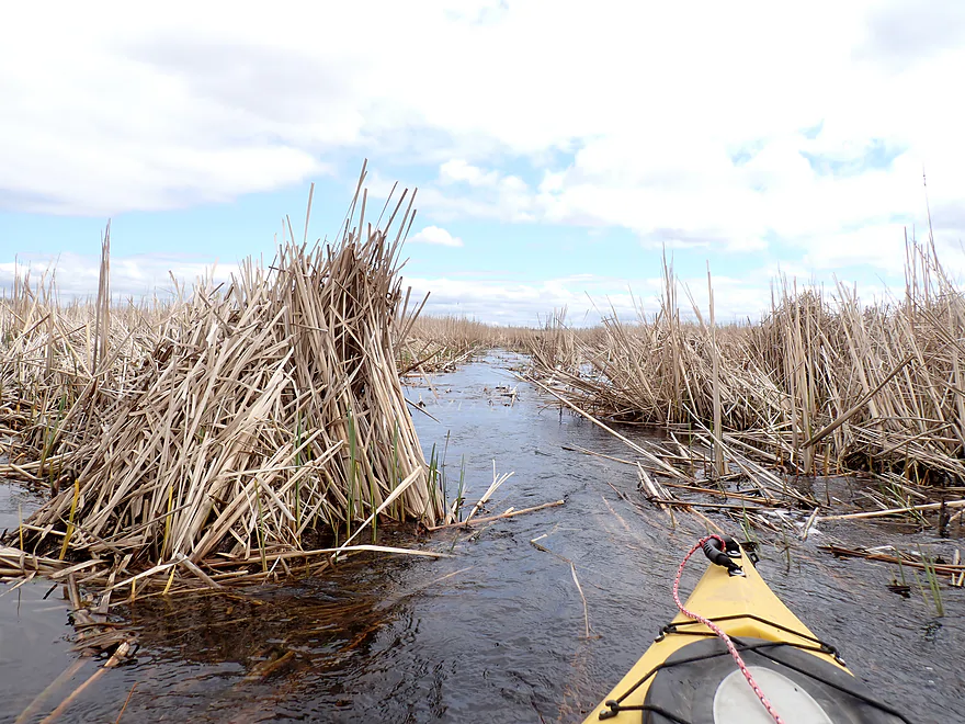
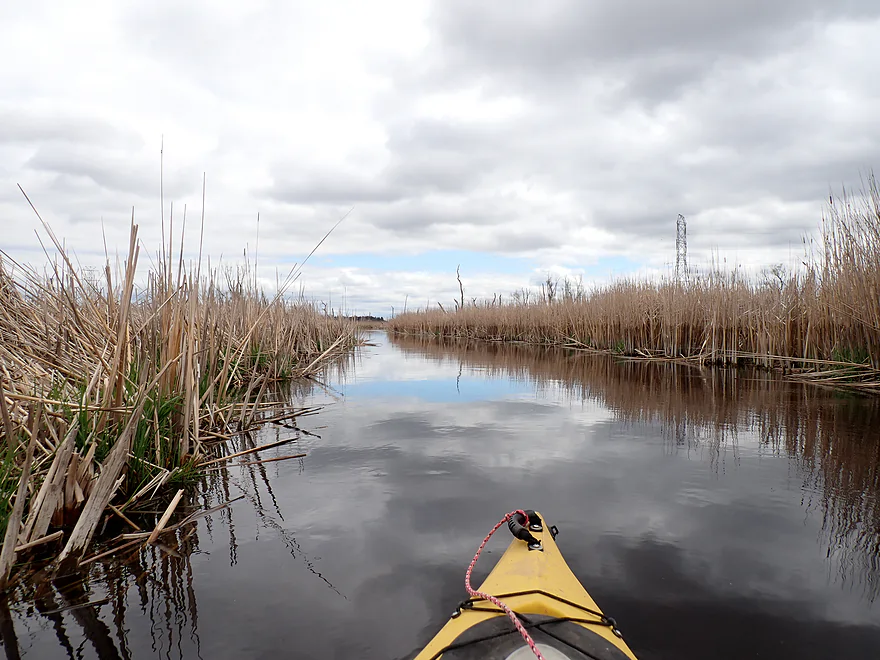
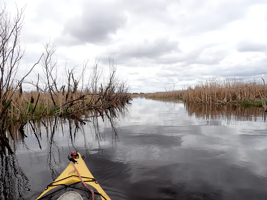
Peaceful channel through a sea of cattails
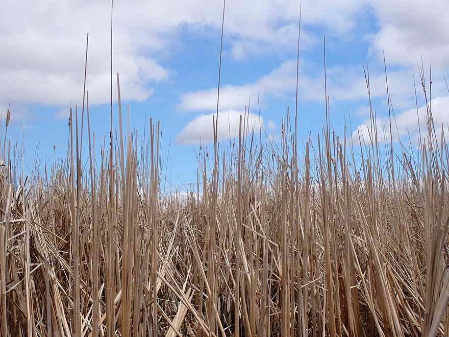
Tidy cattails
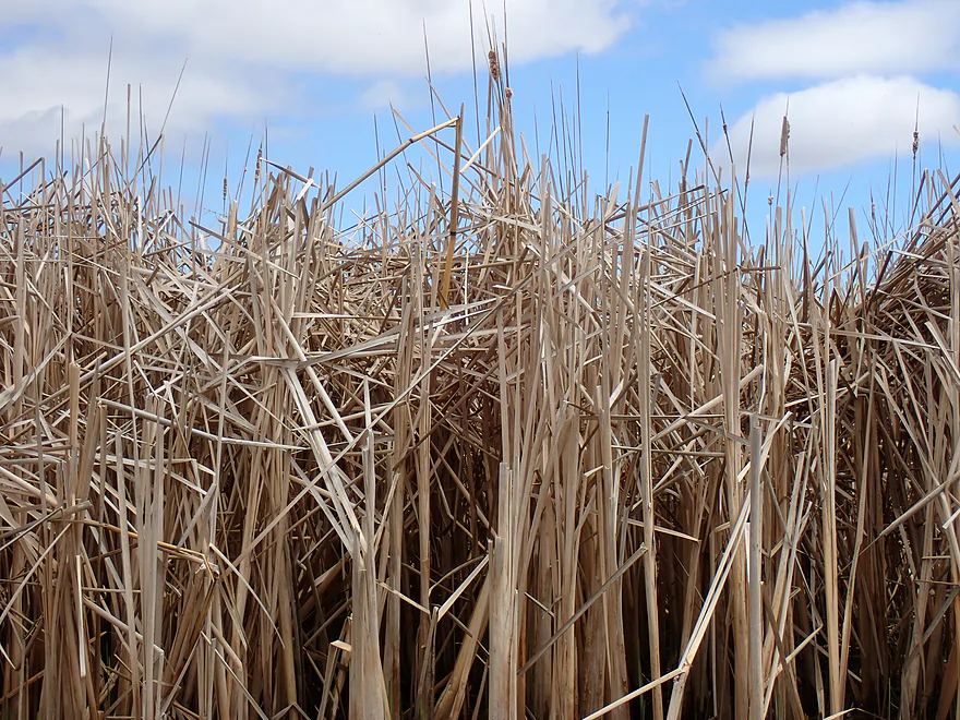
Untidy cattails
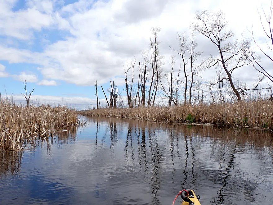
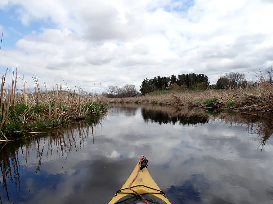
Not many trees, but some
Most were dead
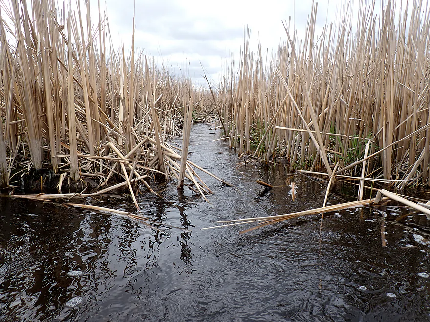
A cattail jam
Fortunately I was able to plow through
A cattail inlet
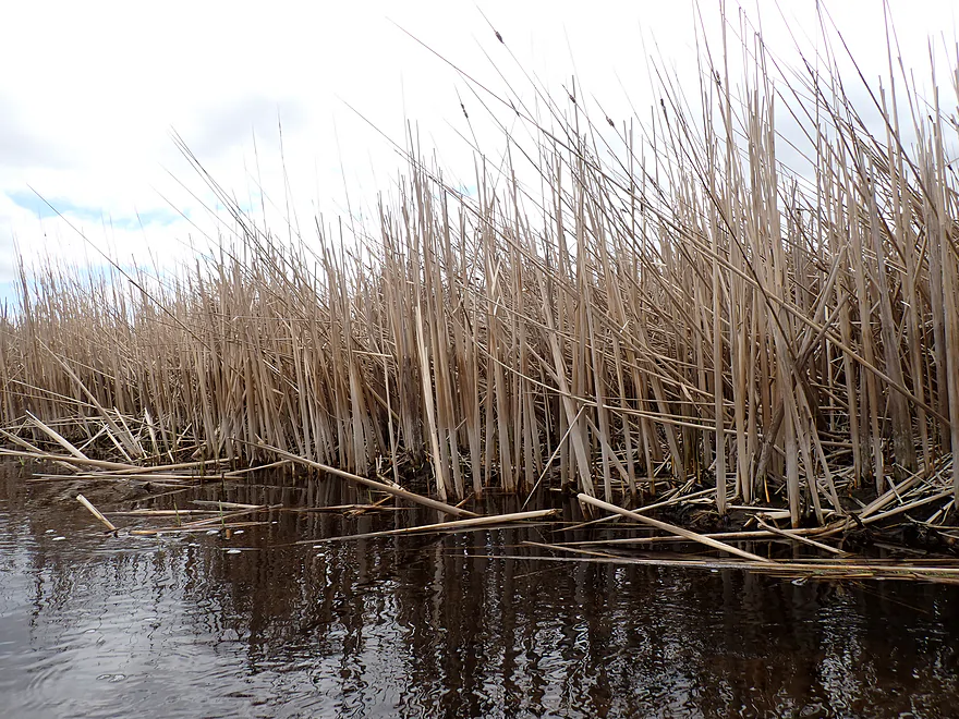
High water line about 2′ up on the plants
And there goes my nice blue sky
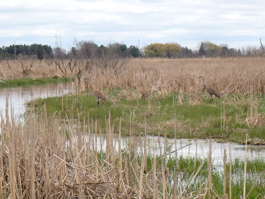
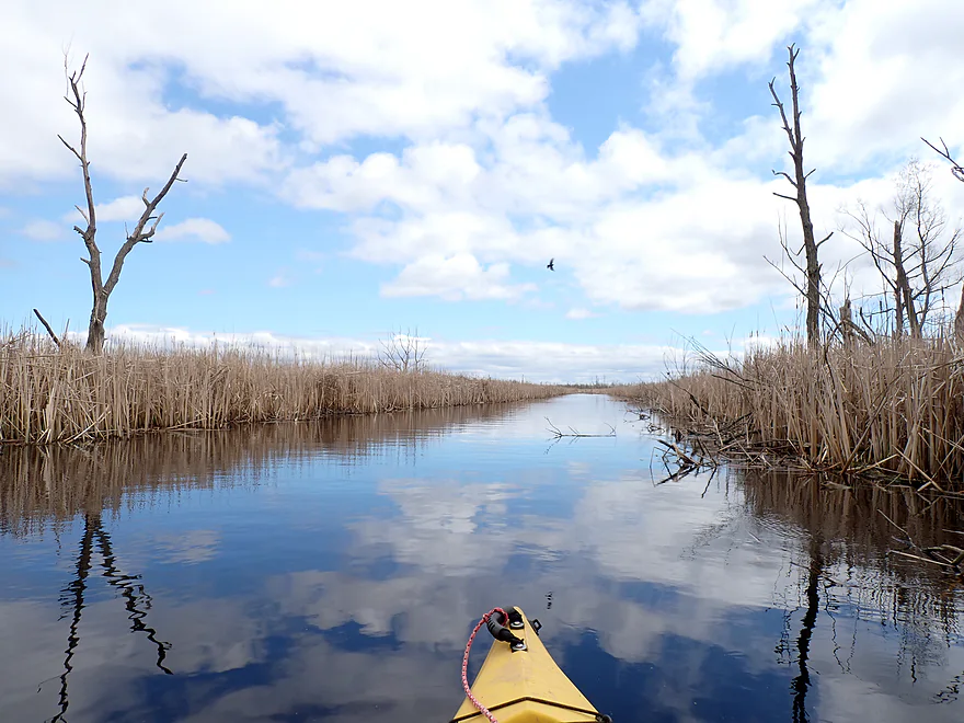
Saw a number of cranes
Getting out for a photo op
The Mascoutin Valley State Trail
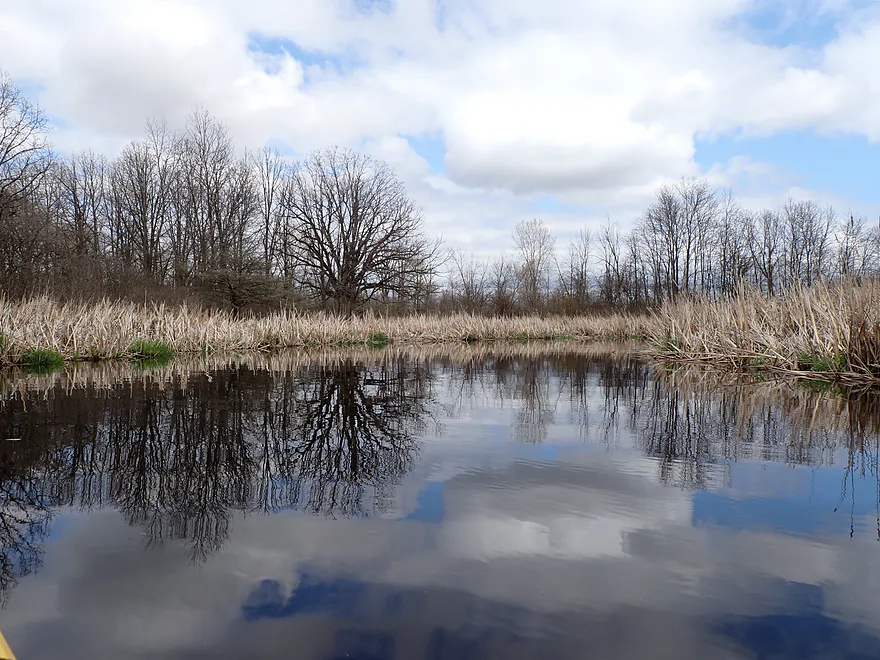
Getting some brooding cloud reflections
Last mile of the trip was more varied and nicer
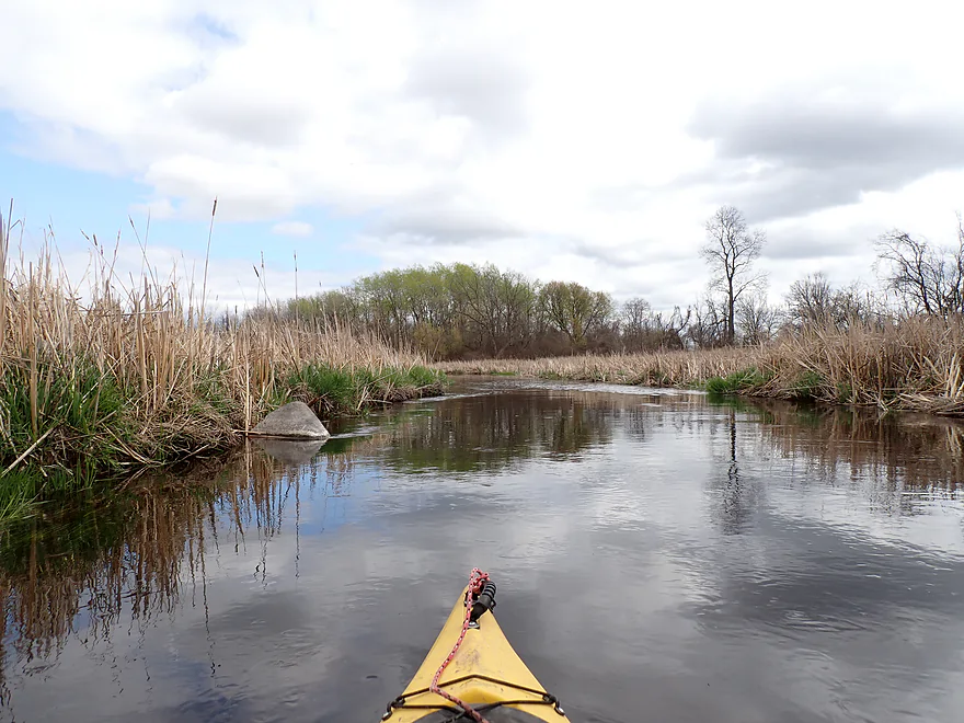
When the river is lower you can see more rocks

Nice reflections
A perfectly shaped cloud indentation
Cool reflections with the dark clouds
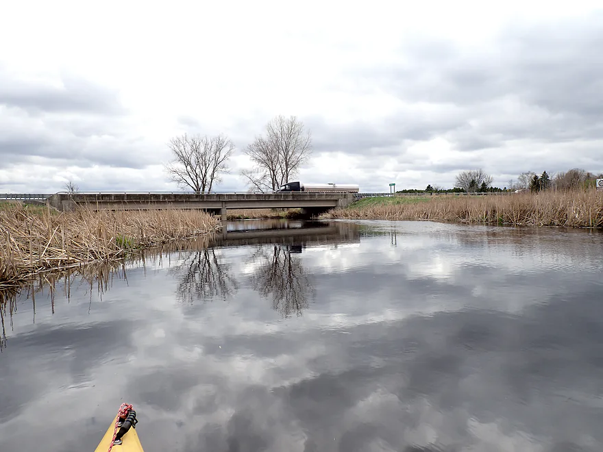
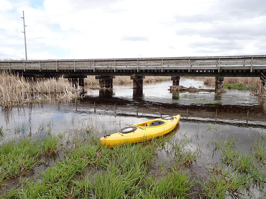
Approaching my take-out, Hwy 23
Good bridge access
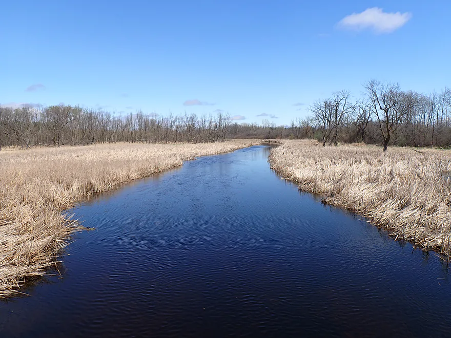
View north from the bridge
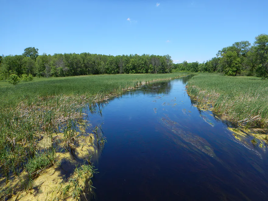
Same view in summer
Eldorado Marsh


The vast Eldorado Marsh was formed 10,000+ years ago by the retreating Green Bay ice sheet which left behind a huge basin. Today the Fond du Lac River (West Branch) flows south through the wetland before it eventually turns north through the city of Fond du Lac and joins Lake Winnebago.
Paddling author Rick Kark referred to the marsh as an “unknown canoeist paradise” and the “Everglades of the North“. However, the access I believe he referenced off Marsh Road has since become sealed in by cattails and is no longer usable. For my trip, I instead used the dam access which the DNR gates shut (why?!), requiring an 1800′ hike to reach the water. This proved to be a drag (literally and figuratively)…one of these days I need to get kayak roller wheels.
During my “dike hike” I was passed by several dog owners (the locals use the marsh as a dog park). One guy was really nice and mentioned he had been to Canoecopia. He warned me that I might face congestion downstream. I didn’t recall seeing too many issues from satellite maps, so I hoped he was wrong.
I finally reached the dam, where there was good access to the lake to the north or the river to the south. Eldorado Marsh didn’t always used to be damned like this. In 1912, efforts were made to drain the marsh for agriculture, but the soil proved too poor for farming. Instead much of the greater basin was set aside for conservation and a long dike and dam were built to (attempt) to restore the marsh.
Before I started my main trip on the river, I decided to first explore the lake north of the dike…which, honestly, proved uninteresting. Unlike most kayakers, I actually like marsh paddles…but only if there are crooks, crannies and cattail tunnels to explore. Wide open marsh lake paddling can be (and usually is) pretty boring.
What was remarkable was how flattened the cattails were…as if somebody had run a large lawn mower over the marsh. Much of Eldorado Marsh has been taken over by invasive cattails and I wonder if the DNR had recently done a controlled burn or applied herbicides to remove them. But…they always come back. The best way to control invasive cattails is to remove the dams as they provide the stable, slow, and deep water cattail roots like. Sadly the DNR isn’t as interested in dam removal as it used to be.
Not all was bleak on the marsh though…there were many huge muskrat lodges. Geese would use these little mountains as nesting spots. These provided nice lookouts (eg, to spot egg-stealing raccoons).
I then returned back to the dam. It was tempting to run the spillway, and the ledge wasn’t too high at ~18, but the outwash looked a bit rough so I opted for the easy portage.
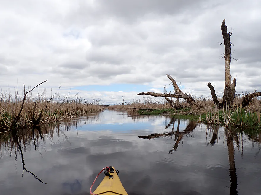
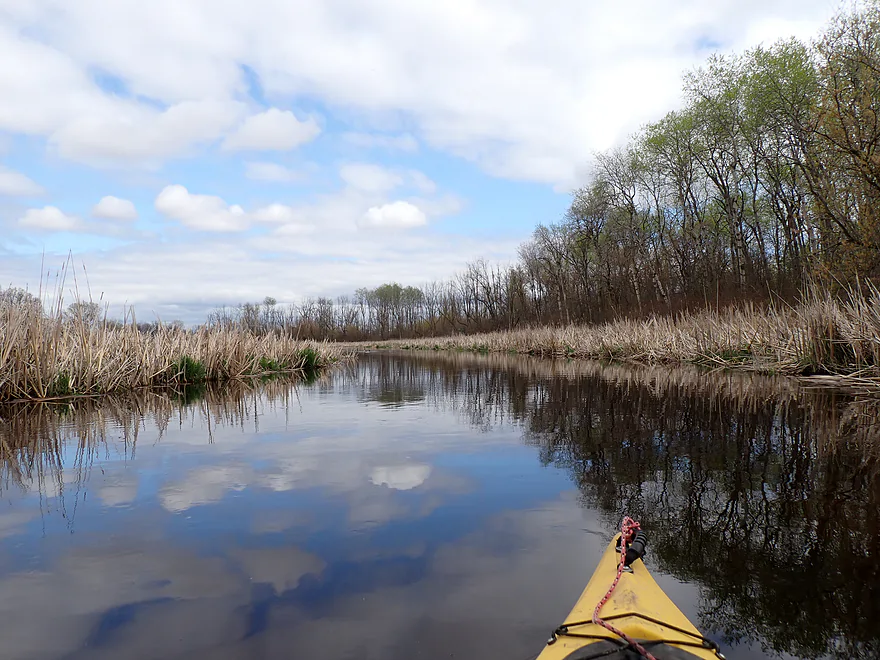
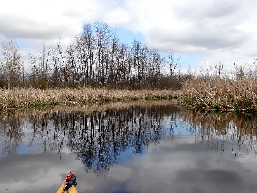
South of the dam I was finally on free-flowing water (technically the Fond du Lac River-West Branch). The channel to start was slow, wide and deep (~4′). It was also suspiciously straight…and I suspect the original terraforming efforts consisted not of digging drainage ditches, but ditching and straightening the Fond du Lac River instead (same effect).
Along both banks was a nearly endless sea of cattails…almost as far as the eye could see. Despite this, I considered the scenery attractive. On occasion huge phragmites (at least 10” tall) would poke themselves over the horizon line.
About halfway into the trip I encountered a “cattail jam”. Thankfully the river at this point was strong enough to prevent the cattails from completely sealing the channel and I was able to hop over some clumps and down some small “cattail riffles” to get through. I had feared there might be more cattail jams, but this proved to be the only one of the trip. It should be noted that this trip was done in early May and cattails can be much worse in late summer.
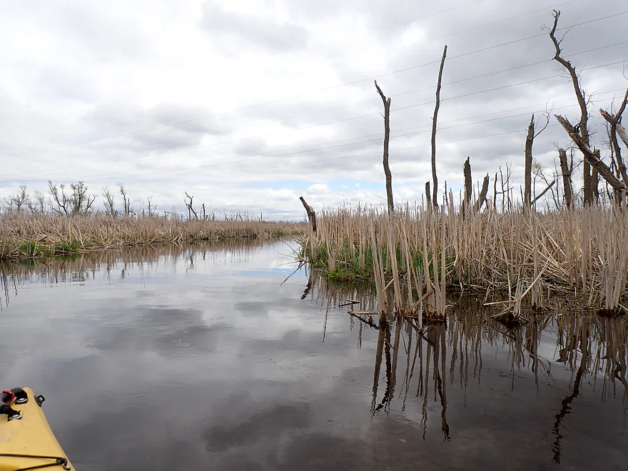
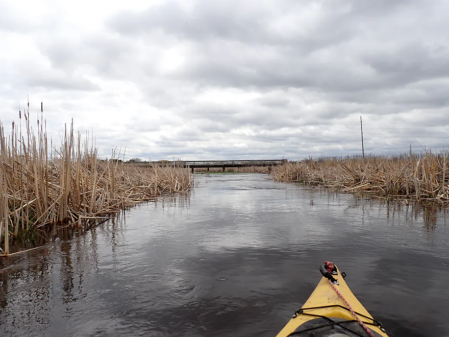
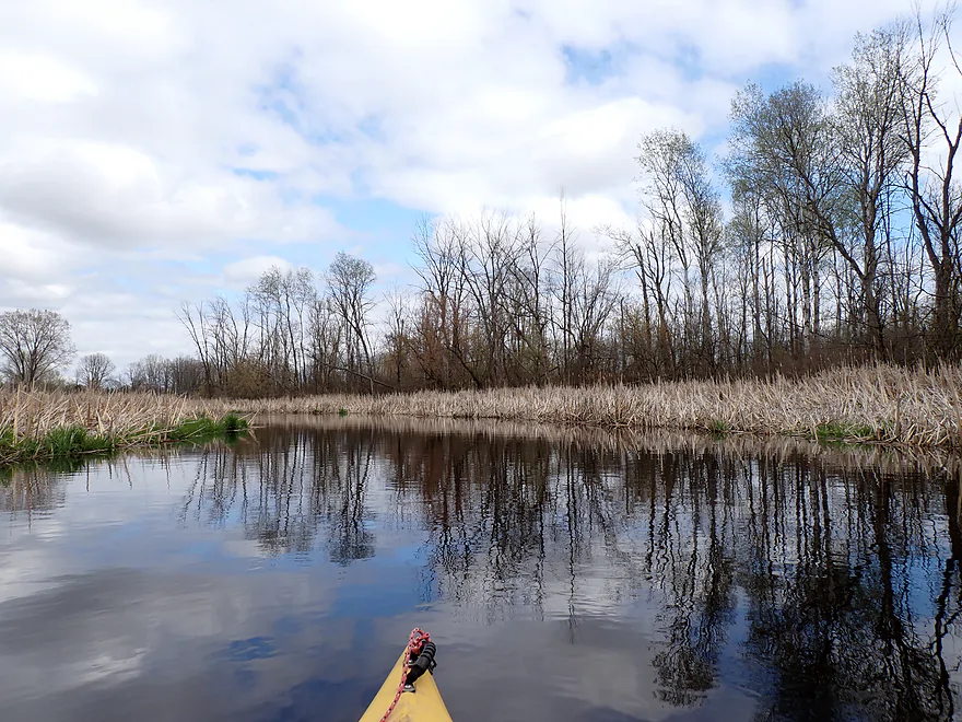
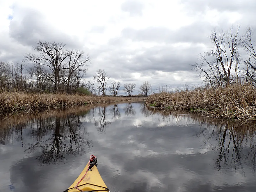
The river then narrowed, sped up, and became more shallow. The scenery remained mostly the same…lots of cattails and a few tree graveyards.
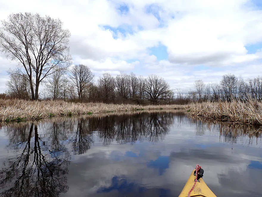
After the Mascoutin Valley Trail bridge, the last portion of the trip really changed. The river started to meander naturally, a few pines and aspen appeared along the banks, clarity was good, and there were even a few rocky stretches. The only downside were the loud, thunderous cracks from the local trap and skeet club, located just east of the river. The gunshots really carried miles over the marsh and I heard them for much of the trip, but they were especially loud as I approached my bridge take-out.
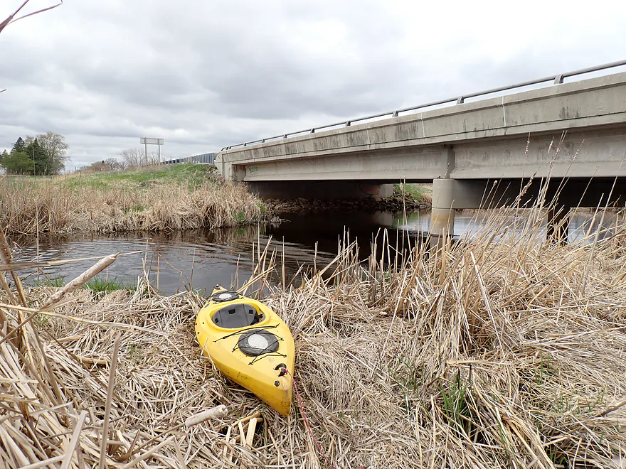
I ended the trip at Hwy 23. Despite being a busy and obnoxious road, it was a doable and good bridge access.
In summary, this was an ok trip. The lake portion (north of the dam) was boring, but the river portion (south of the dam) was pleasant and enjoyable. The two main issues were the cattail jam (not a deal breaker) and the impractical put-in (hopefully the DNR unlocks the dam access road…at least for paddlers). Otherwise this was a nice trip which Fond du Lac locals might enjoy.
Sights included seagulls, singing frogs, egrets, cranes, geese, songbirds, one painted turtle doing turtle yoga, a lot of small snail shells, and a pair of pelicans. The lake portion of the marsh had huge muskrat lodges which geese used for nesting platforms. Eldorado Marsh isn’t likely the safest spot to raise goslings, as I did see a raccoon, a mink, and another large, unknown animal rustling through the cattails. Watch out for ticks near the put-in.
Mascoutin Valley State Trail: This is a public bike trail (former rail line) that cuts through the Eldorado Marsh. I don’t know too much about it, but the surface is crushed limestone and it might have some nice marsh vistas.
Dike Road Dam: There is a DNR access off of Dike Road. It’s a nice public area with a parking lot and is popular with local dog owners. But it requires an 1800′ hike to reach the water…which for many paddlers will be too much (unless you have kayak roller wheels).
Alternate Put-ins:
- None really. There used to be a second DNR marsh access about a half mile north of Dike Road…but that has since become sealed in by cattails and is no longer usable. I also think at one point you could launch from the previous bridge (Hwy C) and paddle downstream to the dam…but satellite images suggest challenging cattail obstructions. If you really want to explore the upper reaches of Eldorado Marsh, you can…but you should start from the dam and then paddle upstream.
Hwy 23: This is a busy and obnoxious road, but as a bridge access it’s actually pretty decent. There is a trampled cattail path where paddlers access the water southeast of the bridge (but mostly to put in and not take out).
Alternate Take-outs:
- Rogersville Road – West Spur (4.3 miles downstream from Hwy 23): This is a really nice stretch of the Fond du Lac River which I reviewed in 2017.
Bike Shuttle – Hwy 23 to Dike Road: 3.7 miles with 23′ of ascent. This was a super easy bike shuttle. Note….you can alternatively bike west of the marsh using the Mascoutin Valley State Trail but that would add about 3 miles to your shuttle.
Hazards, Logjams and Current:
Logjams: None.
Cattail Jams: There is one about halfway into the trip. I didn’t think it was too difficult to get past. But in late summer and/or if water levels were lower it could prove trickier to plow through.
Aquatic Weeds: Not a problem during my trip, but satellite images suggest they might be an issue in late summer.
River Gauge: South Branch – Rock River @ Waupun
River Trip Depth: 83 CFS or 2.84′
River Navigability Estimates: These are just rough guesses.
- < 35 CFS: Shallow depth with great clarity. Mostly navigable, but in late summer aquatic weeds and the one cattail jam may be difficult to get through given the low water.
- 36-50 CFS: Average depth and a good target range.
- 51-100 CFS: High depth, but plenty fine for paddling.
- 101-150 CFS: Very high depth…should still be viable.
- 151+ CFS: Maybe near floodstage…should still be navigable.
Main Branch/West Branch:
- Hwy 26 to Fremont Road: 1.8 miles. Small creek that grows quickly. Heavily channelized.
- Fremont Road to Hwy C: 3.3 miles. Attractive creek with a number of riffles. Maybe 3-4 logjams.
- Hwy C to Eldorado Dam/Dike Road: 3.7 miles. The greater marsh used to be more popular with canoers, but invasive cattails have since assimilated and blocked off the former inlets and bays that were fun to explore. Paddlers can still still explore a small lake north of the dam and paddle a bit upstream on the river.
- Eldorado Dam to Hwy 23: 3.1 miles. A mostly pleasant cattail paddle with good marsh scenery. As of May 2025 there is one cattail jam, but I was able to get past this with little difficulty.
- Hwy 23 to Rogersville Road (East Spur): 7.1 miles.
- Hwy 23 to Forest Ave: 0.6 miles. Nice stretch and the last remnants of the marsh.
- Forest Ave to Townline Road: 1.9 miles. Forest Ave seems like a doable bridge access. Neat riffly section.
- Townline Road to Esterbrook Road: 2.0 miles. Townline is probably doable for an access, but the best access might be over private land. This segment is great…more nice riffles and small boulder gardens.
- Esterbrook Road to Rogersville Road (West Spur): 0.8 miles. Esterbrook is probably not a good access option as it is too close to homes. River starts to open up, but is still very scenic.
- Rogersville Road (West Spur) to Rogersville Road (East Spur): 0.9 miles. The west dead end is likely an access option. This segment is very open and has the best rapids. It runs past the county airport.
- Rogersville Road (East Spur) to Fido Dog Park/Satterlee Street: 3.2 miles. First half is likely nice…narrow and wooded. Second half is likely less interesting…slower, wider, muddier and more industrial.
- Fido Dog Park to Mouth: 1.4 miles. After the east branch joins, the river becomes wide, slow, muddy and less interesting. The backwaters (Adelaide Park and Supple Marsh) might be fun to explore. Many take-out options on Lake Winnebago. Dog Park (not to be confused with Fido Dog Park) is perhaps the best.
East Branch:
The East Branch is also navigable but inferior to the West Branch, as it is more industrial, has more logjams, and much, much more mud. The rapids are also likely stronger.
- Hwy D to River Road: 1.7 miles. The bar by Hwy D has the best access, but you’ll likely need to ask permission to launch there. Some thick woods means there is likely a handful of jams. Some rapids.
- River Road to Hickory Road: 3.4 miles. Not sure if River Road is an ok access option. This segment likely has many logjams.
- Hickory Road to South Street: 7.1 miles. Probably ok to launch south of the Hickory Road bridge. Probably the most interesting section and perhaps some strong rapids. Just not sure about logjams.
- South Street to FIDO Dog Park: 1.6 miles. South Street should have good public access and parking by the trailhead. This section flows through the heart of downtown Fond du Lac and is very industrial and beat-up. Lots of concrete walls and riprap. Quite navigable though. Fido Dog Park marks the confluence with the main branch.
De Neveu Creek:
- Brookfield Park to Lakeside Park Marina: 2.8 miles. Very scenic, super narrow creek with a lot of potential. Requires high water and will have some rapids. Likely some logjams.
Trip Map
Overview Map
Video
Photos Size: