
Attractive access by Evergreen Ave
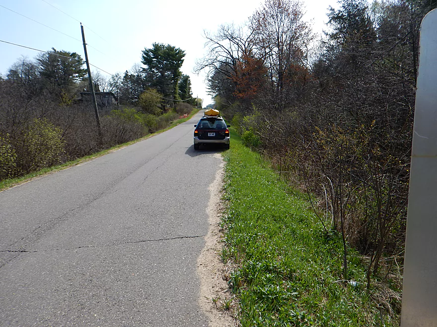
But requires some double parking (minor)
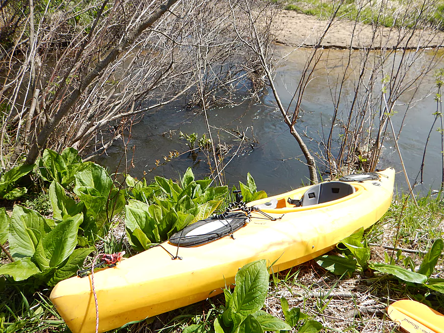
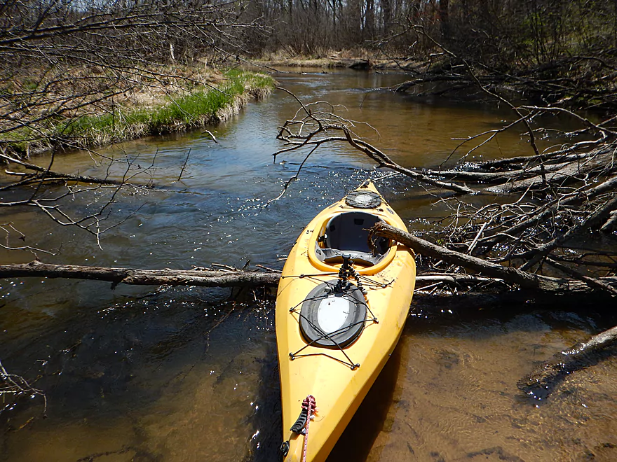
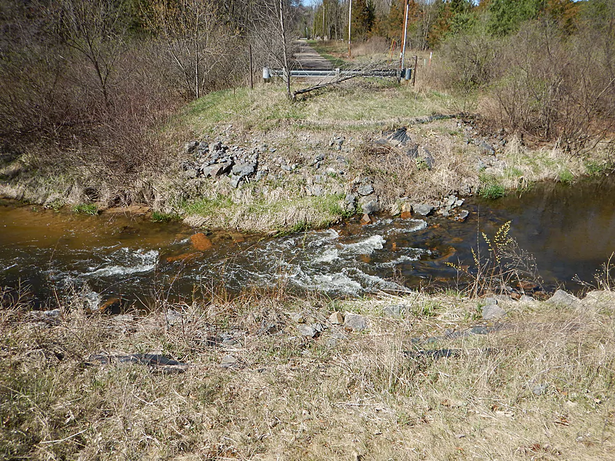
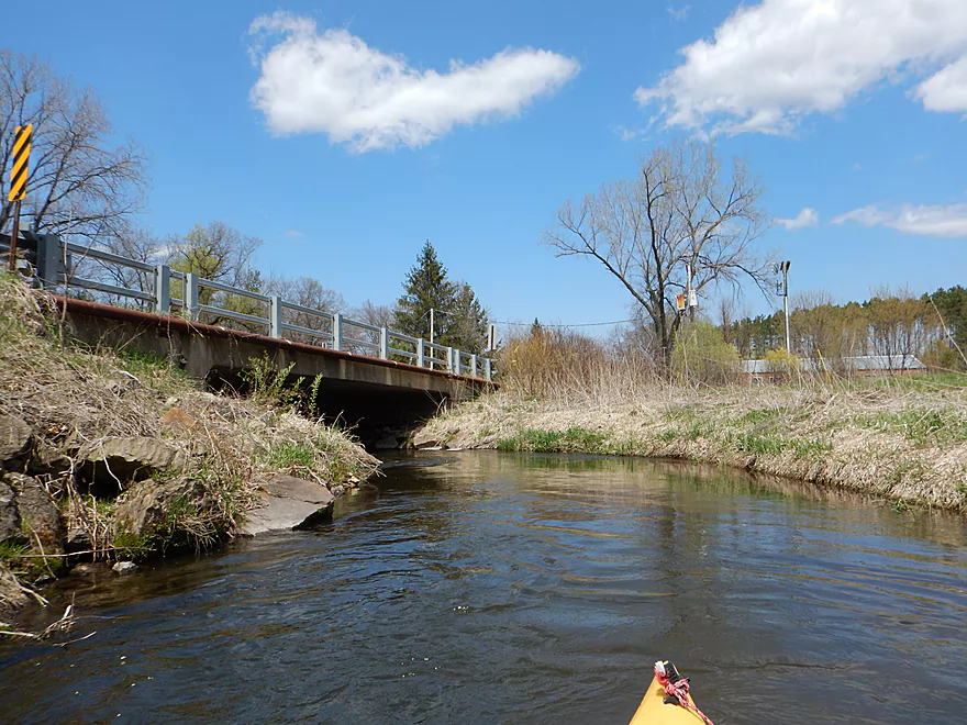
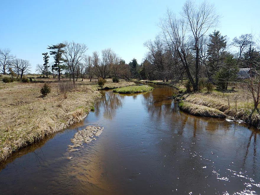
Easy launching by the bridge
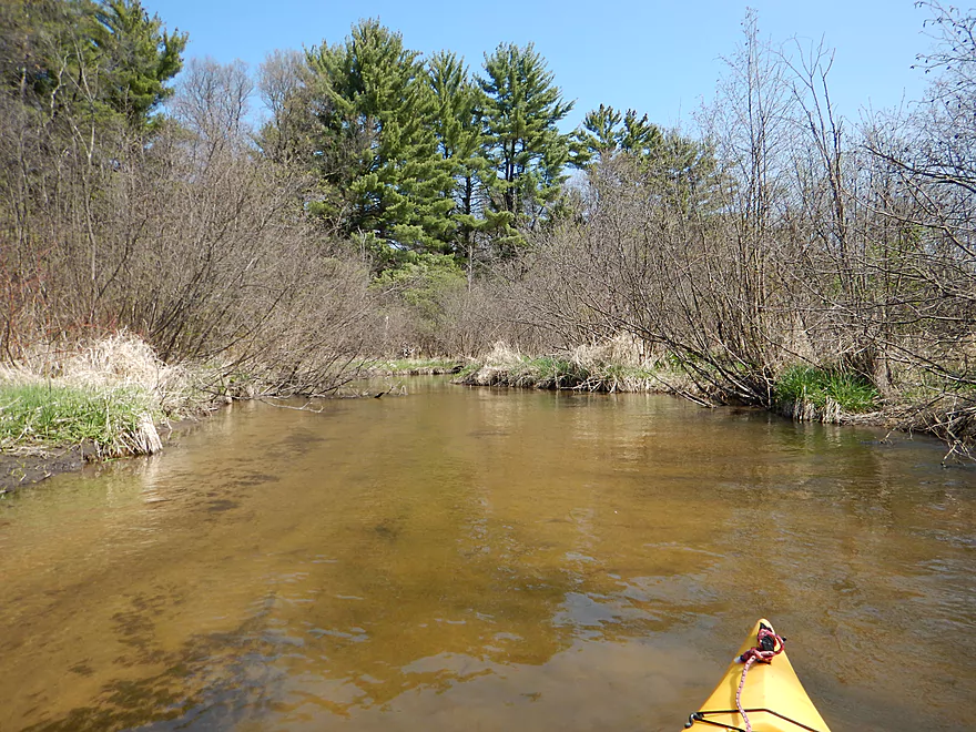
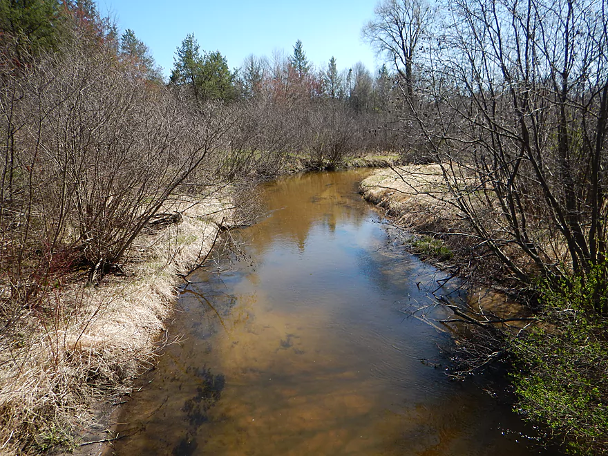
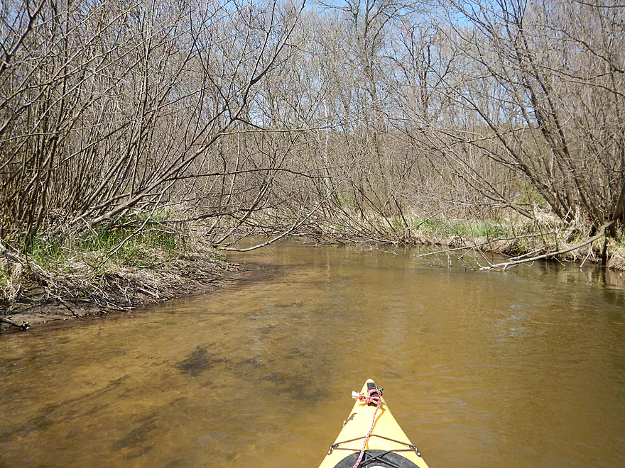
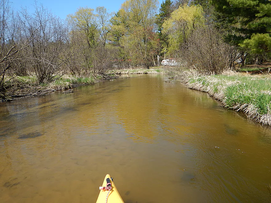
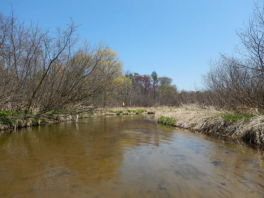
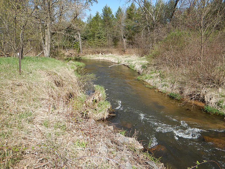
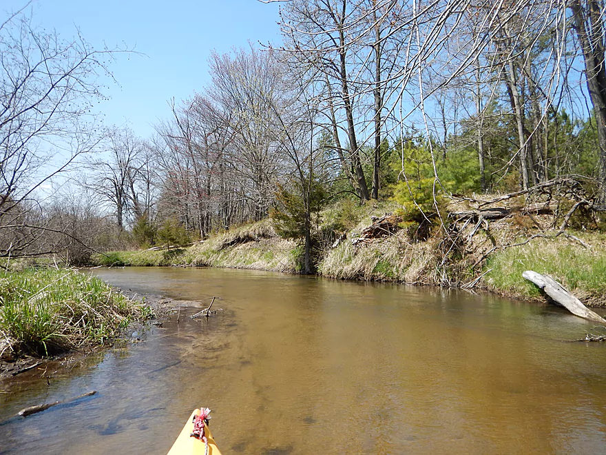
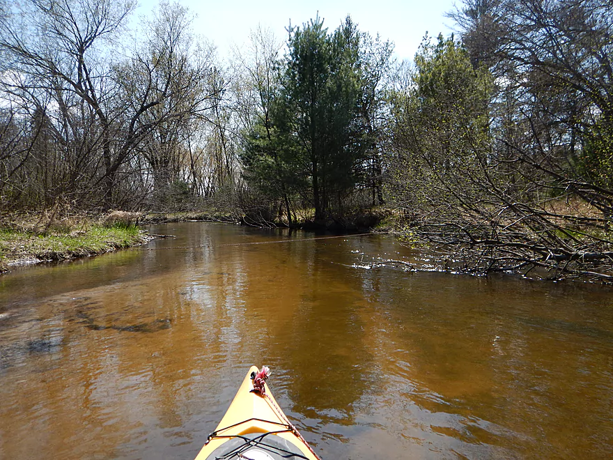
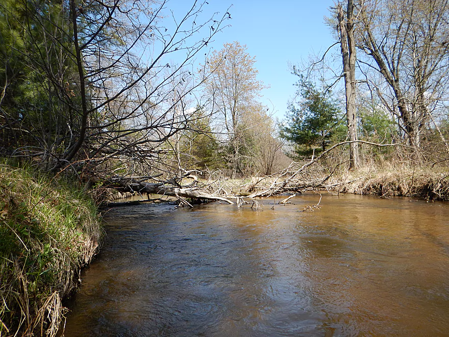
Looking upstream
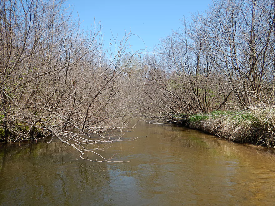
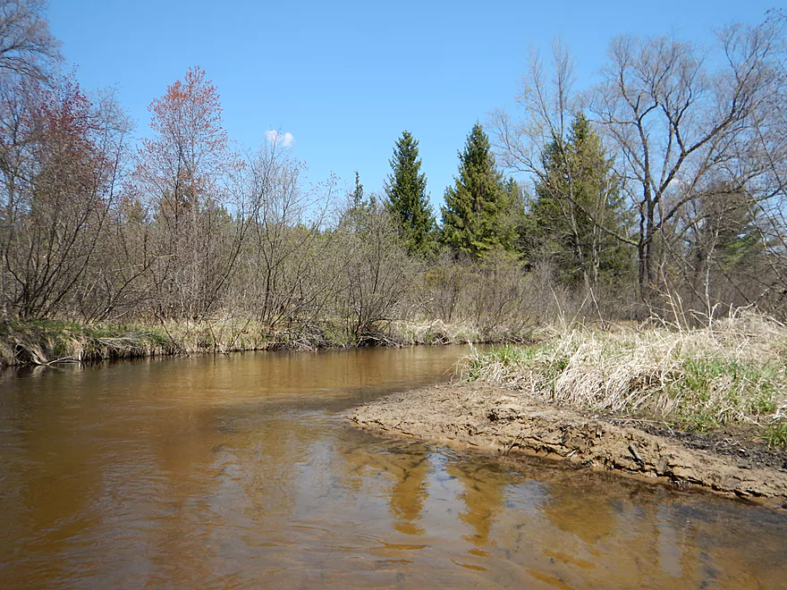
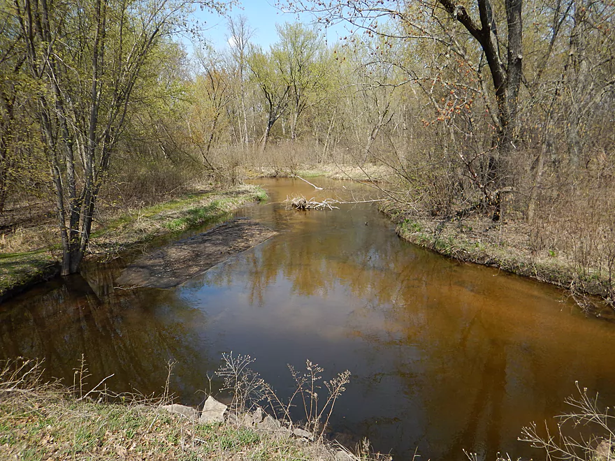
Now looking downstream
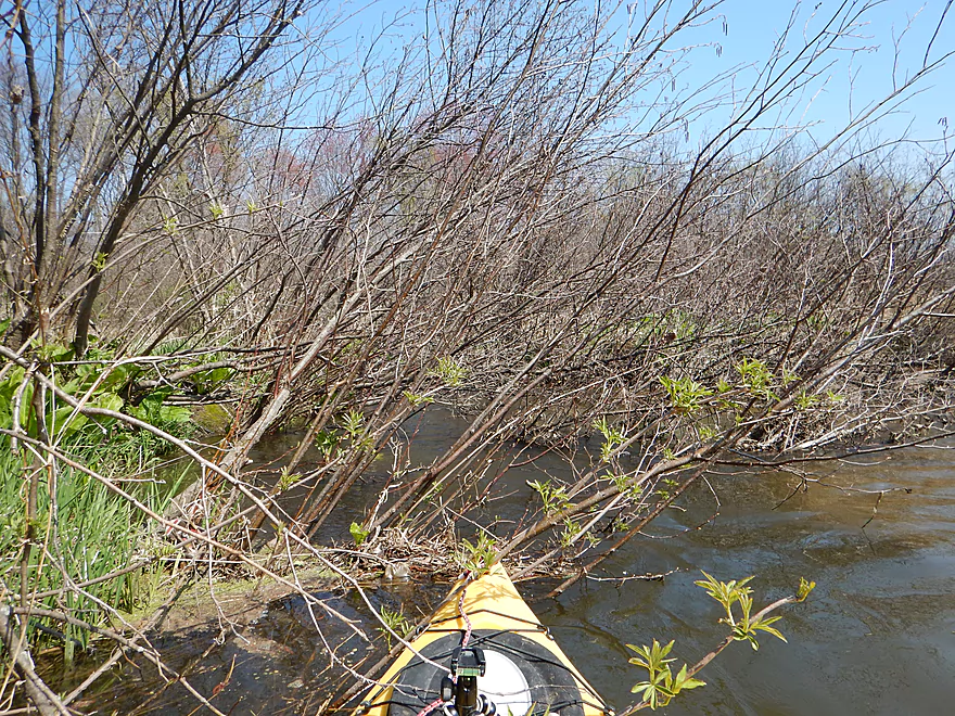
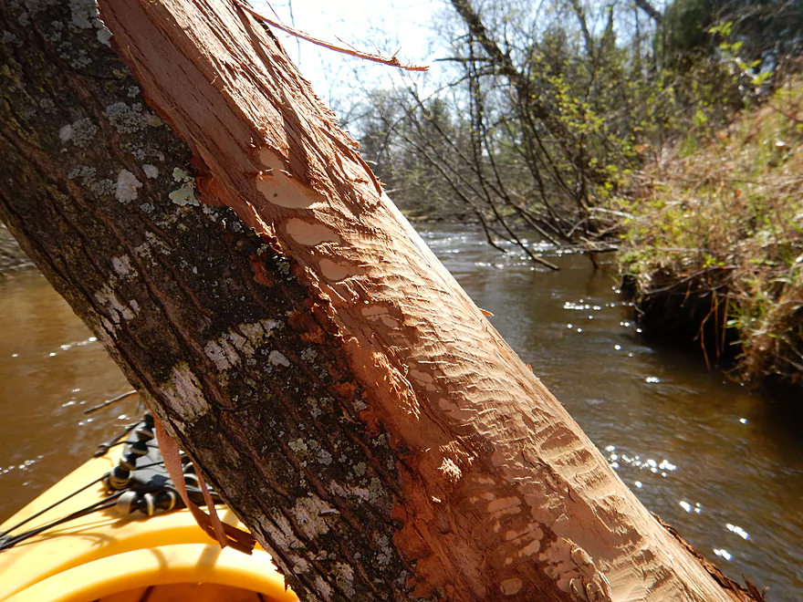
Some mean alders
Portage #1 of 8 over skunk cabbage (easy)
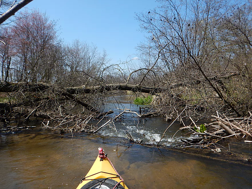
Entering the alder gauntlet
Navigable but distracting
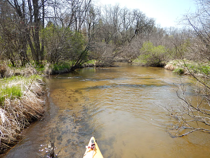
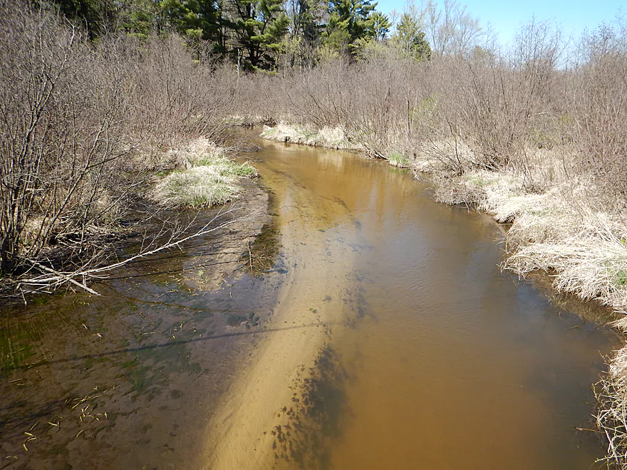
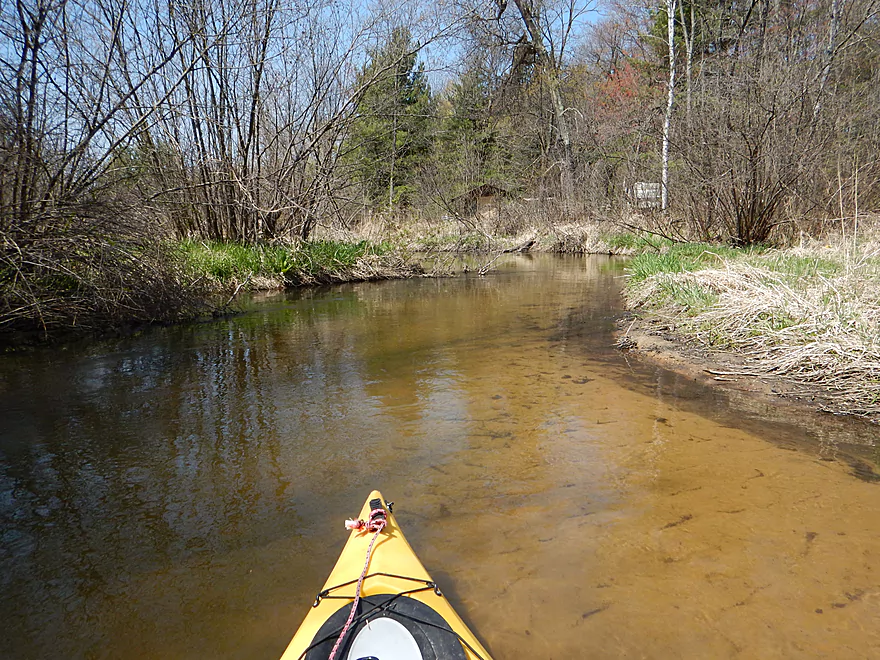
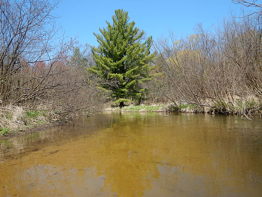
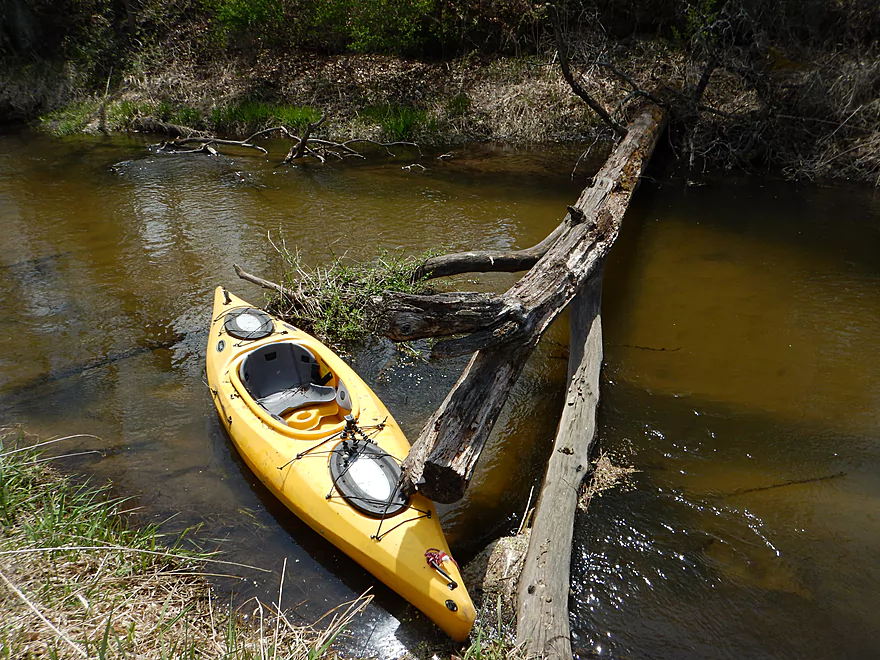
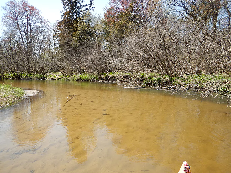
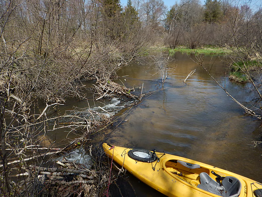
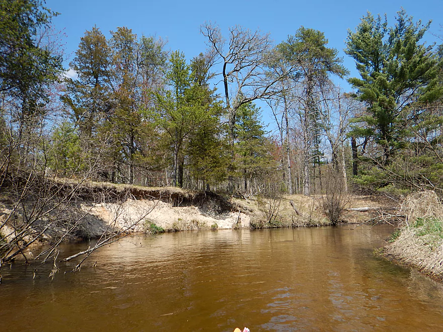
Clean sand + clear water + alders = White Creek
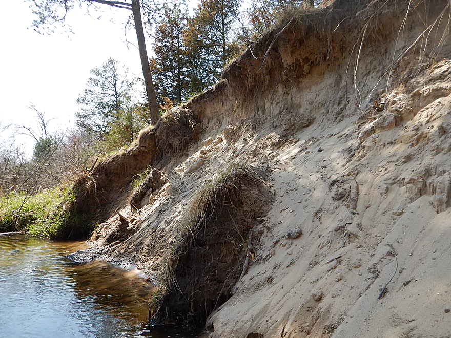
Steep sandy hill next to a creek…what could go wrong?
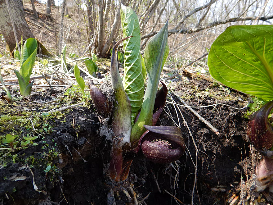
Very tiny spadix flowers inside skunk cabbage
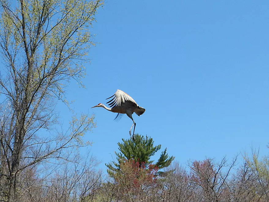
Saw several cranes
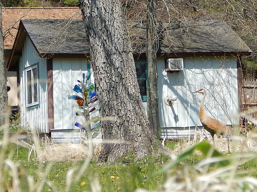
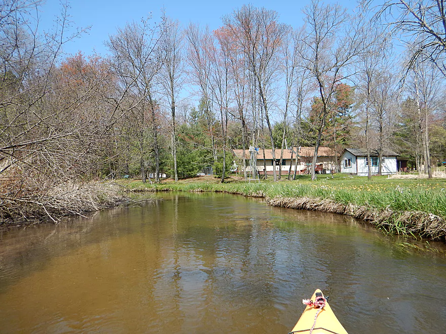
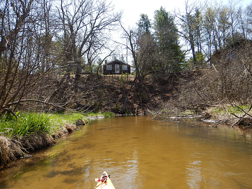
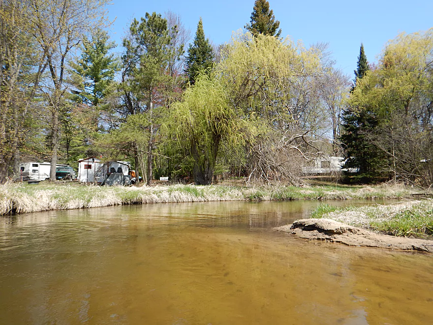
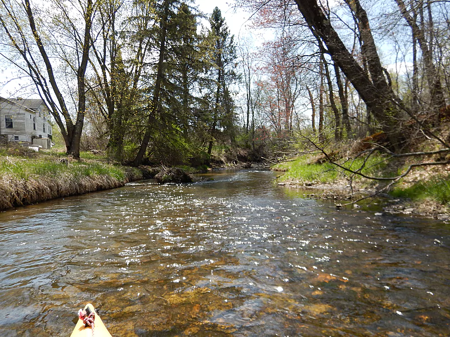
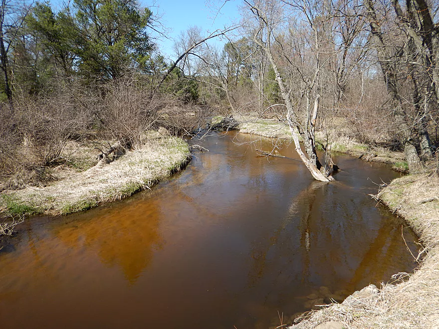
Entering a small residential section
Water was actually clearer, but the camera exaggerates the reflections
Portage #2 of 8 (super easy)
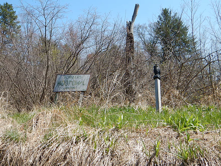
Says Fowlers Hoot Owl Landing…nice touch
But not a public landing
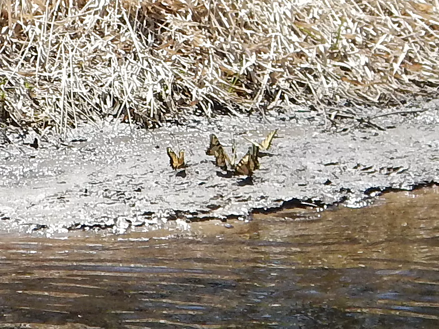
Tiger swallowtail butterflies sucking up mud for the minerals
Portage #3 of 8
An easy wading portage
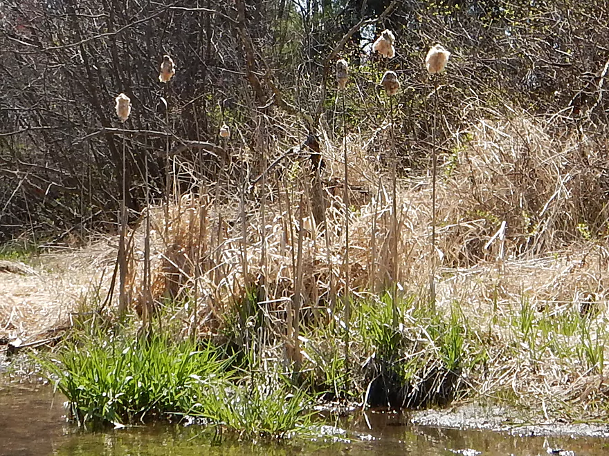
Cattails are shedding now
Not exactly the Kickapoo, but a nice surprise
Portage #4 of 8…medium difficulty but not bad
Some fun rapids
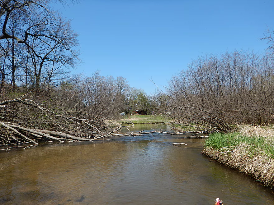
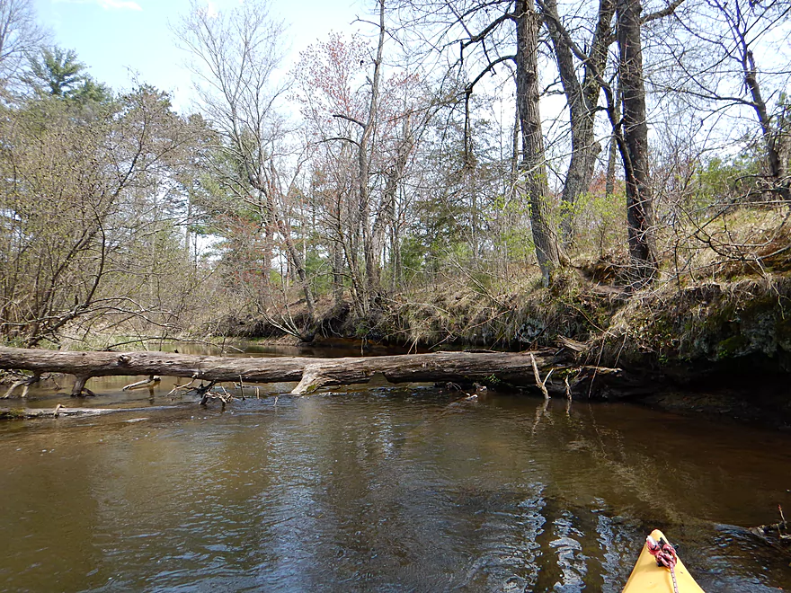
Remnants of a washed out bridge
Not a portage…easy to duck under
But this is. #5 of 8 (easy)
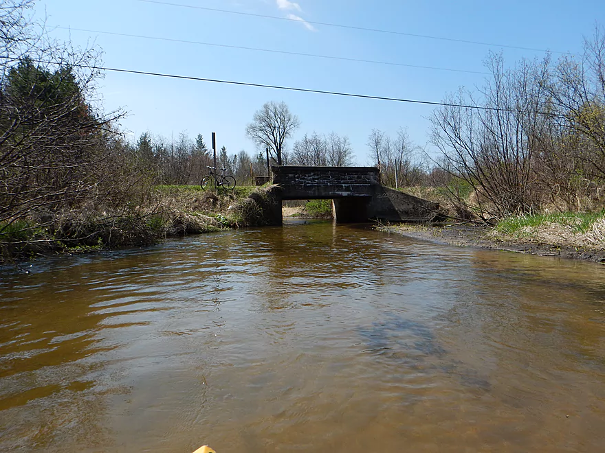
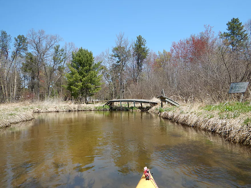
You could use Evergreen Court bridge for launching
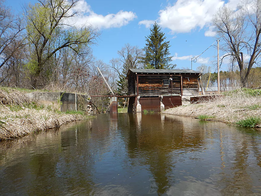
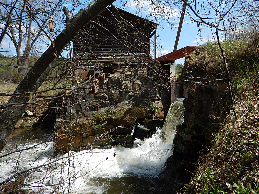
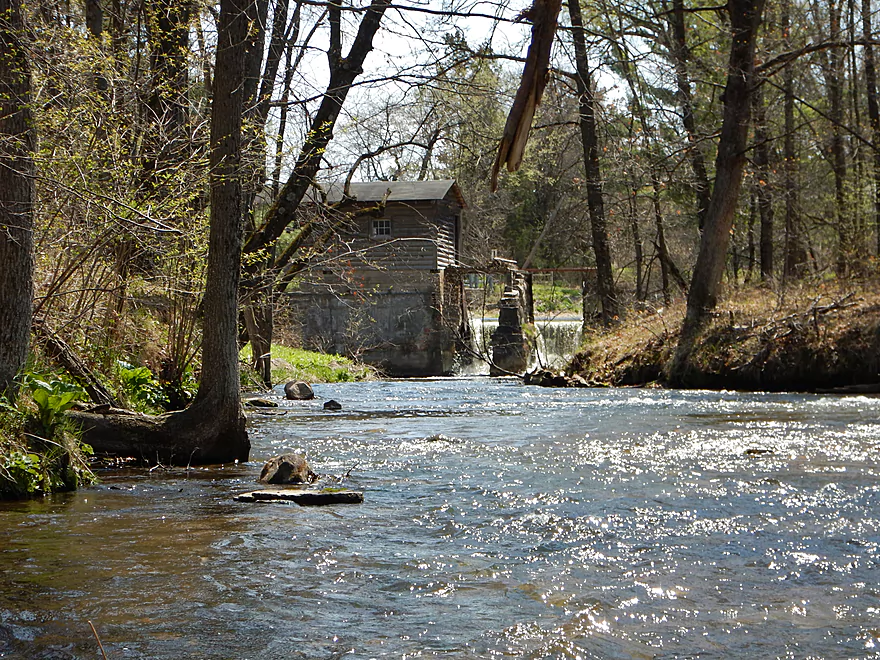
Coming up on the old dam
East (far) bank is a steep portage but is better than the west bank
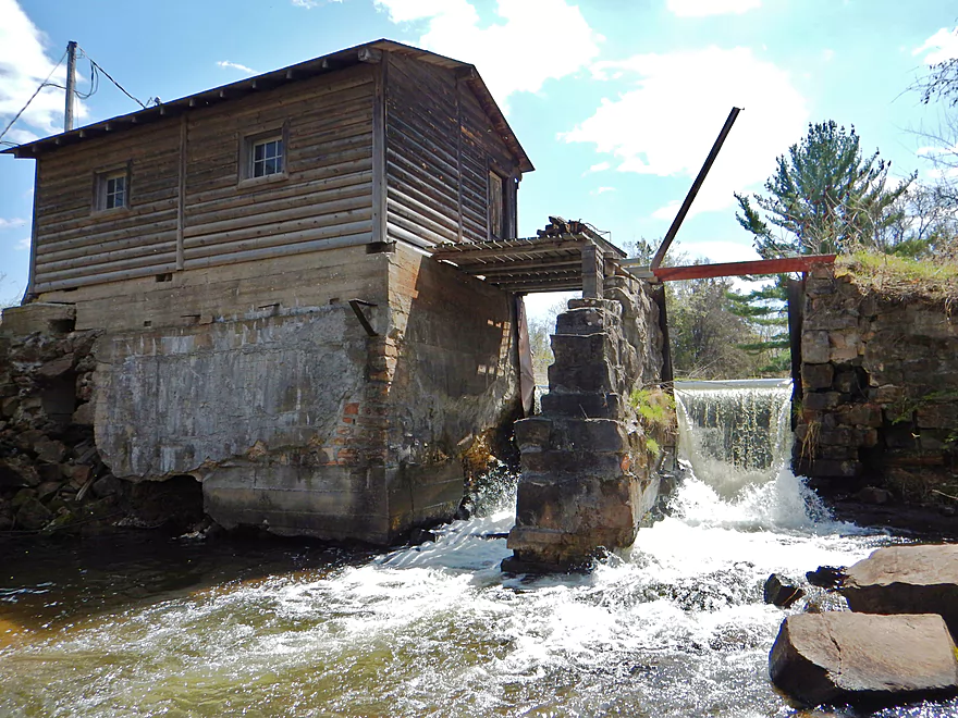
Portage #6 of 8
Nice to know a solid foundation holds up the dam
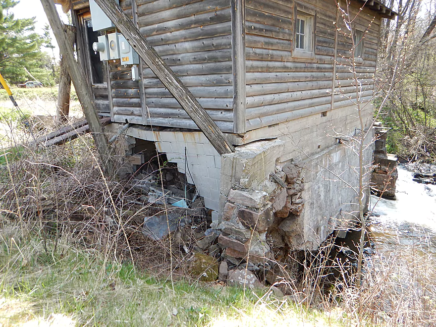
Some pretty flood resistant construction
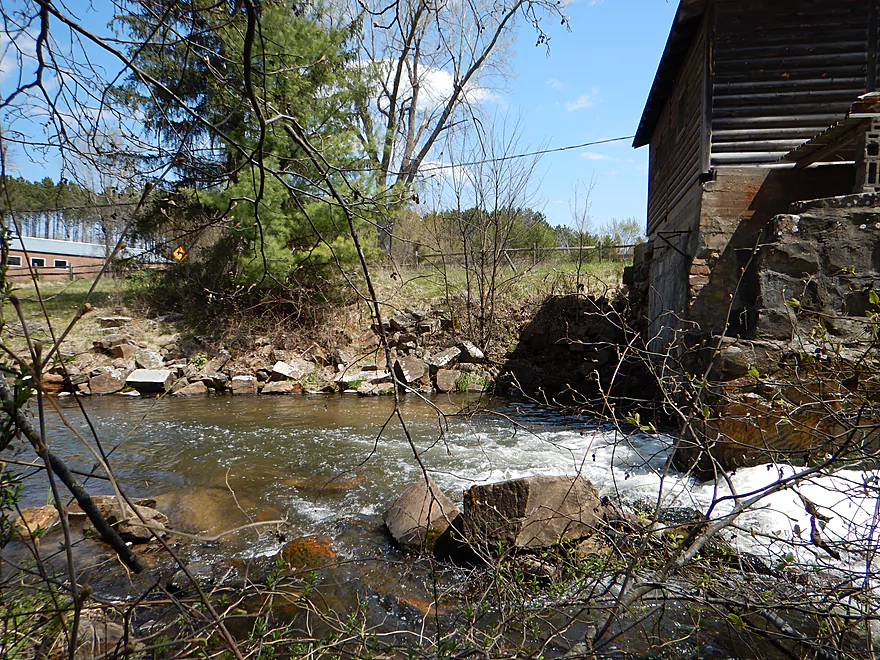
Fun rapids below the dam
Looking back
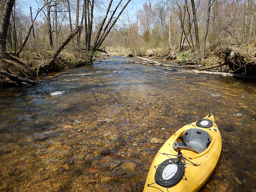
Kind of shallow now, but still nice
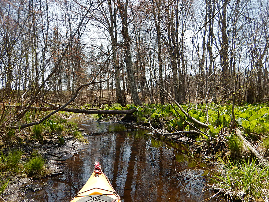
This might be the skunk cabbage capitol creek of Wisconsin
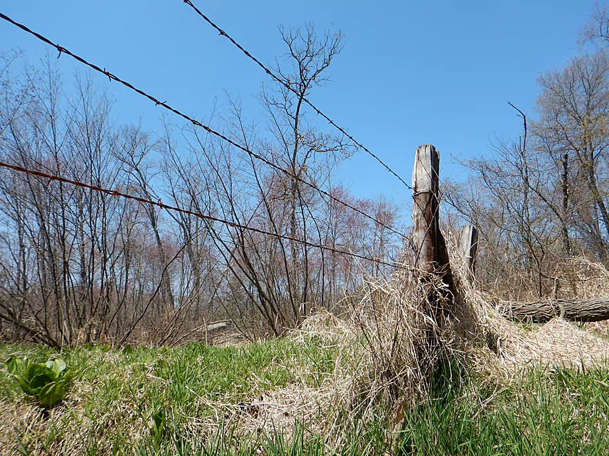
Barbed wire crossing #1 of 2 (easy)
An old beaver dam
Portage #7 of 8 (medium, but not bad)
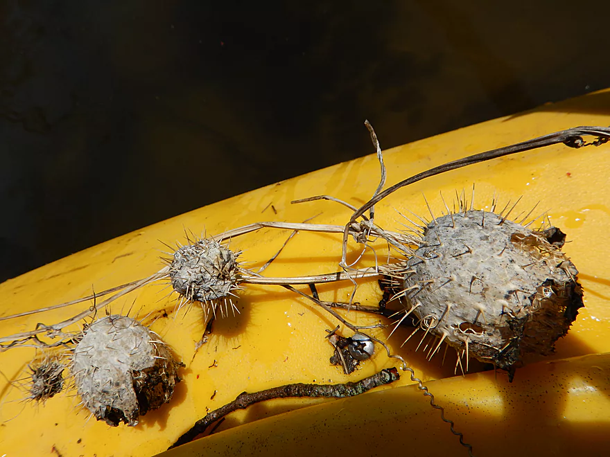
Old wild cucumber pods–looking medieval
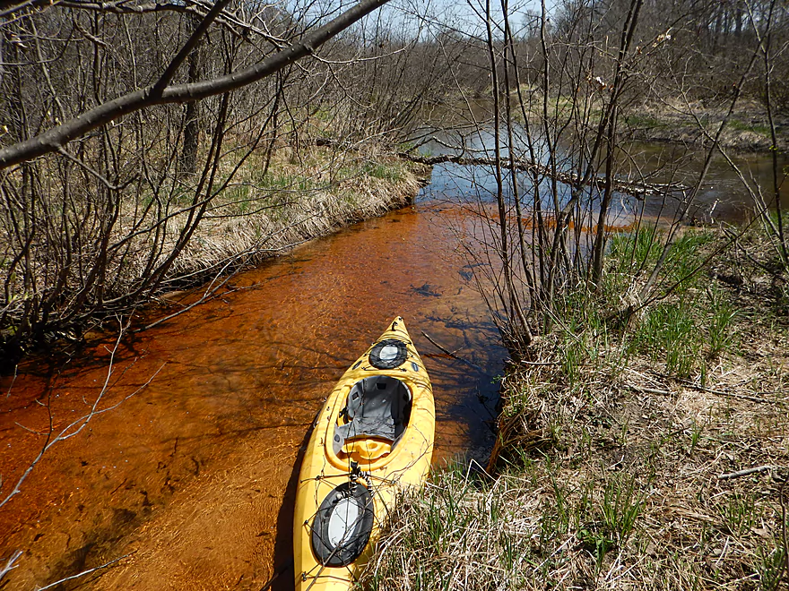
Cool red creek tributary
Very small beaver dam
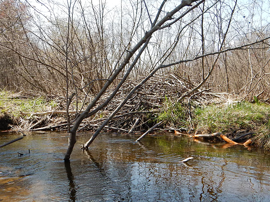
Huge beaver lodge with snacks left by the door
Hypnotoad telling me where to paddle
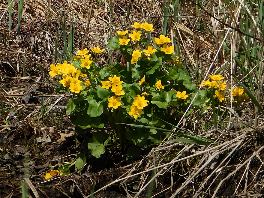
Nice spring flowers (marsh marigolds)
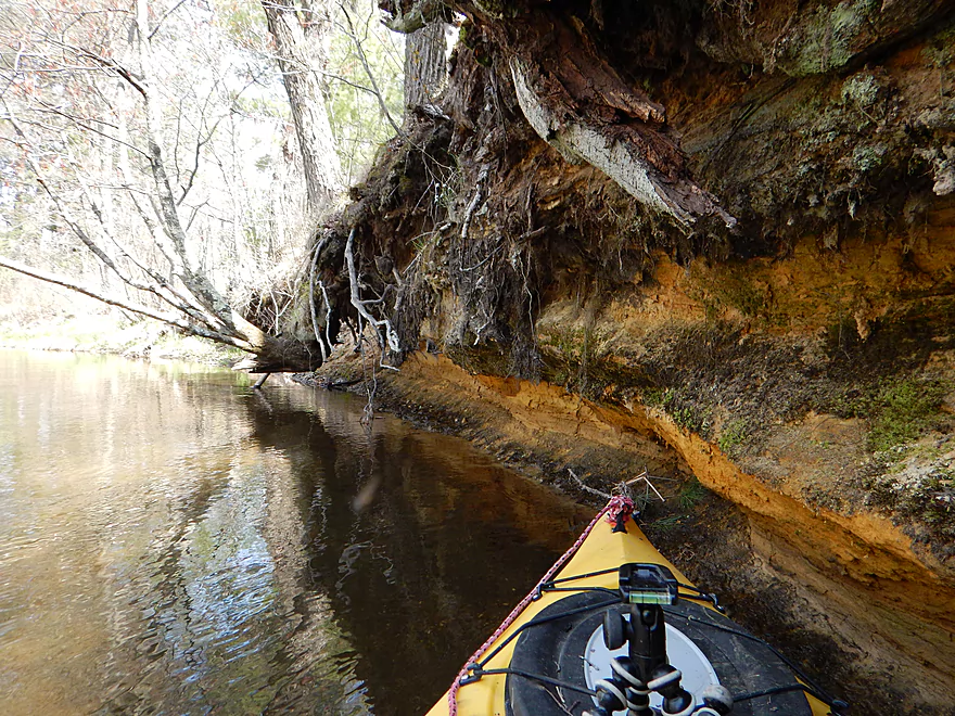
Cool sand bank
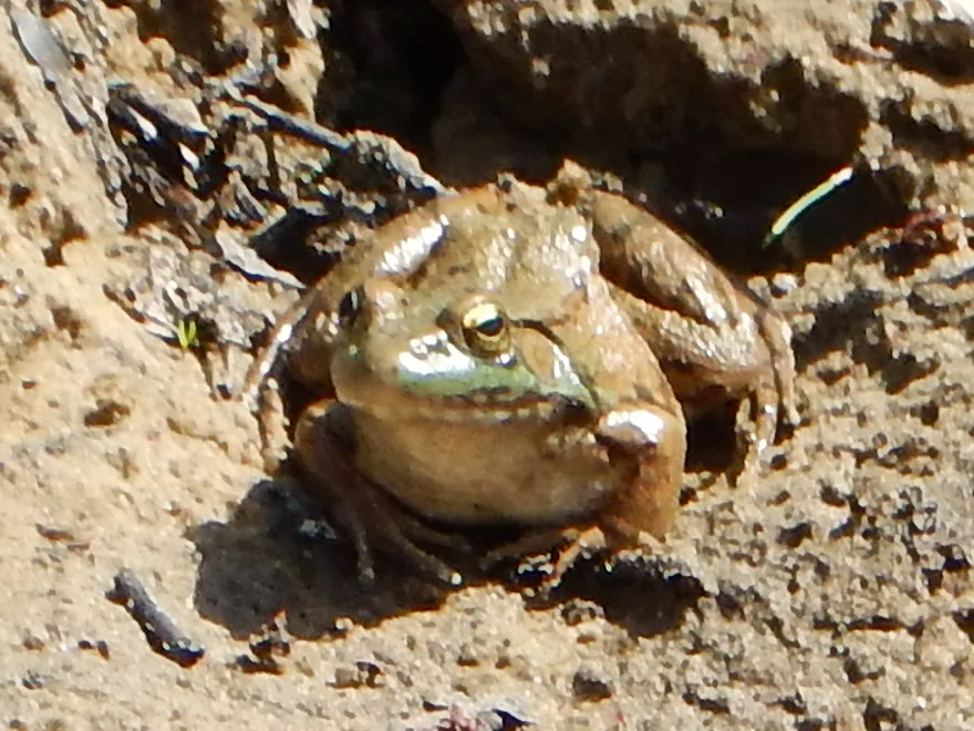
I NEVER did get this guy out of my kayak
Barbed wire #2 of 2 is lower and more taut (duckable, but be careful)
Portage #8 of 8
I was able to hop and duck through it though
Wonder if this creek has beavers…
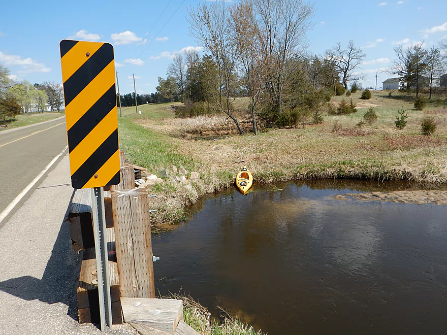
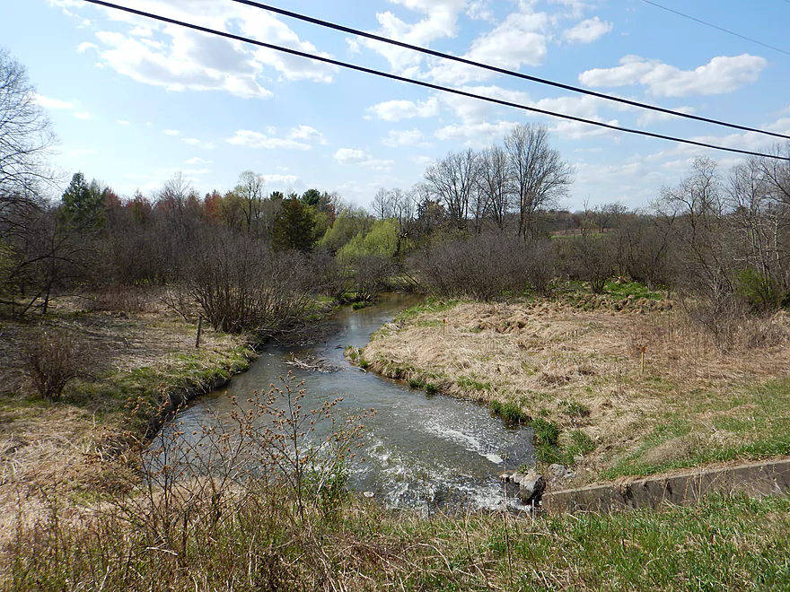
Hwy H is pretty easy for access
Was tempting to go further downstream
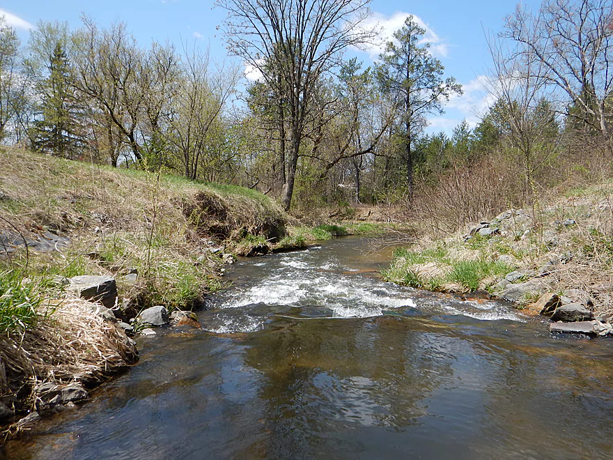
Scouting Hwy Z (looking upstream)
Now looking downstream toward the Wisconsin River
Scouting Hwy Z way upstream (doable, but far from parking)
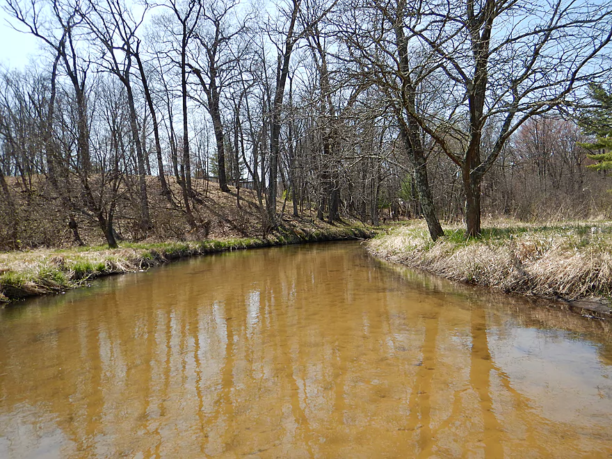
White Creek


Sometimes with mystery creeks you roll the dice and things just don’t work out. This wasn’t one of those cases, as White Creek was a pleasant surprise with great water clarity, some easy rapids and while, yes, some portages – they were easy to deal with.
Evergreen Ave is a one-lane bridge with no shoulders. So I double-parked to get my kayak and gear out (not a huge deal as it is a lightly traveled road). You can park properly on 14th Ave just to the west. Otherwise, this is a good access spot (for a bridge).
Reasonable take-out. There are no trespassing signs in the woods so don’t wander outside of the DOT-owned ditch/embankment. Best parking and access will be southeast of the bridge. Uncomfortably close to houses but you should be ok. Locals use this bridge for creek access too. Lousy locking spots for kayak/bike shuttlers. In fact, I found none so locked my stuff by the put-in (prefer not to do this as I like to save my best energy for fighting log jams and not on the bike fighting hills).
Super easy bike shuttle. Just 2.4 miles and relatively flat. There is a local livery nearby in Point Bluff Resort, which normally services the Wisconsin River, but could probably be convinced to shuttle you to White Creek as well.
It’s all manageable, but you have low-hanging alders, a dam, tree portages and two barbed wire fences. Sounds worse than it is.
The first barbed wire fence is very easy to duck under. The second is lower, more taut and in faster current. But is easy to deal with if you’re patient.
The dam is actually the most difficult portage. Getting out is relatively easy…the trick is getting back in below the dam as the banks on both sides are steep. I suggest leading your boat down with rope, which would make this much easier.
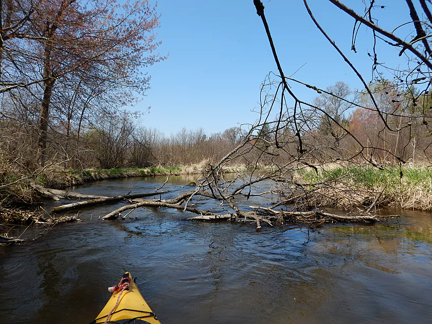
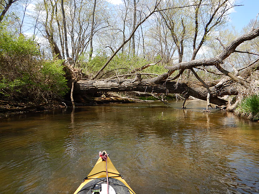
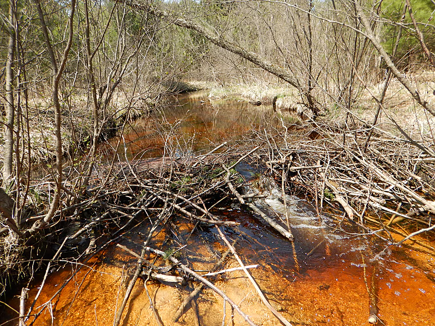
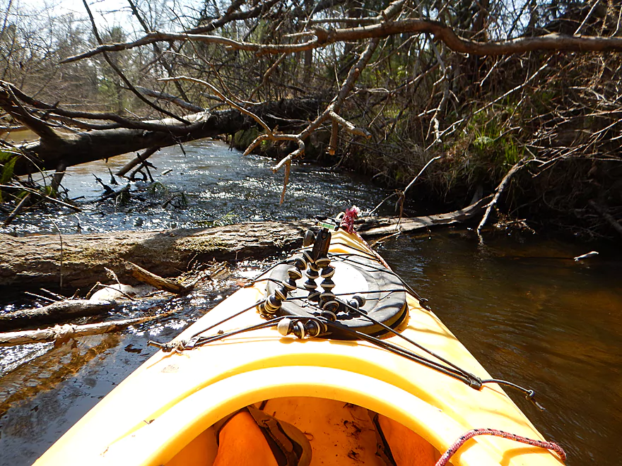
There were six log jams I had to portage. But without mud and steep banks, they were pretty easy to contend with. I took pictures of every one in the photo gallery and marked them on my map so you paddlers (and hopefully future log jam-clearers) will know what is in store.
Decent current at 9′ per mile (although it isn’t that fast because the dam steals a lot of gradient). Through the town of White Creek there are some class 1 rapids above and below the dam. Water depth was fine (except for the rapids below the dam), and this could have been run at lower water levels. With clear creeks like this, you don’t want to run them too high as the high water obscures the clarity.
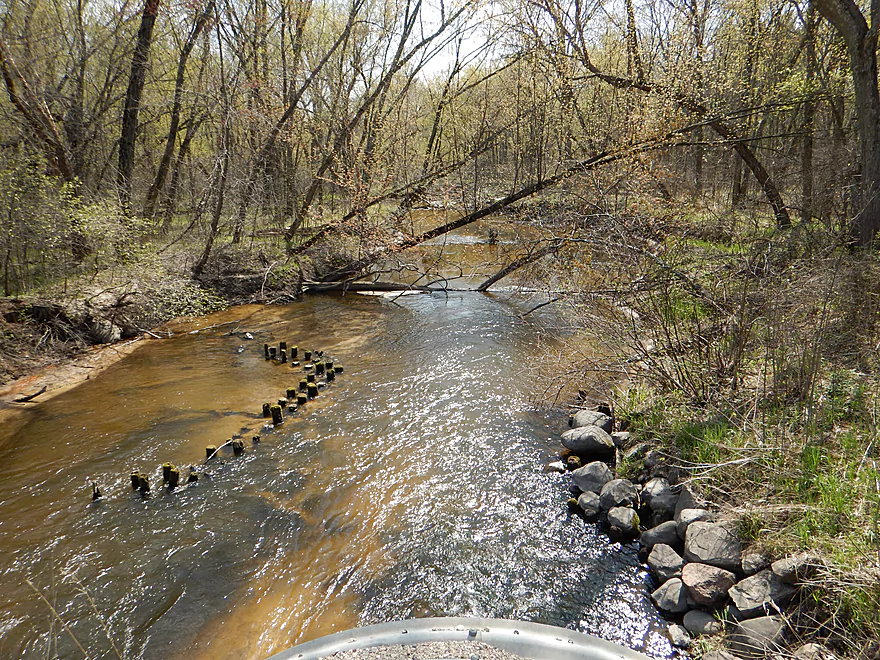
Almost all sand…pretty clean sand at that. Some attractive gravel substrate just above and below the dam by the rapids.
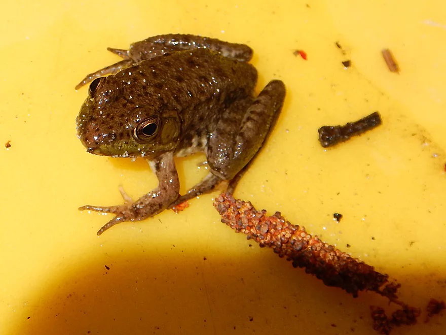
Several cranes, a huge fishing spider, lots of ducks, some turtles, deer, green herons, red-winged blackbirds, cliff swallow nests, frog, toad, lot of beaver evidence and spring wildflowers.
One of the highlights was the sheer amount of skunk cabbage. Another was seeing swallowtail butterflies “eat mud”, which they do to get minerals in their diet.
No fish above the dam (and I would have seen them in the clear water). But below the dam there were a number of schools with some decent-sized specimens. This is a trout creek and I did see some fishermen wading in the waters.
Was a bit nervous about doing the trip as beforehand I had scouted rapids and log jams. I can deal with these, just not at the same time… My other worry was that White Creek would be too shallow because of the lack of rain the past few weeks. Lastly on my mind was that the take-out did not have good locking spots for my bike/kayak while the put-in didn’t have good parking spots. But alas, everything worked out and it was a good trip.
White Creek makes a fine introduction for itself at the put-in with a scenic vista of clear, red water running over sandy substrate and backdropped by attractive pines. Right off the bat, I was relieved the water levels were not as low as feared. But a surprise annoyance was the number of low-hanging alders over the creek. These were mostly tolerable but could be really annoying for paddlers in big boats. The worst of the alder section is maybe just a half mile in length, so it isn’t too bad.
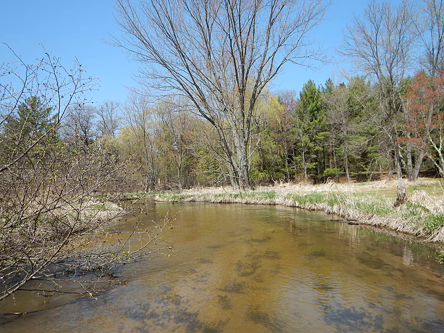
The creek stays very open for much of the trip. It’s not quite a woodland paddle, not quite a wetgrass paddle…more of an “alder paddle” much akin to a VERY similar river maybe 30 miles to the east in the Mecan River.
Haphazard small houses will appear along the shoreline throughout the trip. Adams county is the second poorest county in Wisconsin, and coincidentally one of the worst paddling counties as well. The cause for both is the same…the amount of sand makes agriculture unfeasible. For paddling, the sand creates log jam nightmares on the larger creeks, which mostly just leaves the Wisconsin River below the flowages for paddling opportunities. The county doesn’t believe very seriously in zoning, so you have some relatively high density rural homes and trailers (which should make for some interesting septic/well conflicts). I bring this up because you’ll experience this random real estate phenomena on the creek, which to me was unique. By and large though, this is mostly a wilderness paddle.
While the alders were a disappointment, there were some pleasant surprises. The water was clearer than expected, there were two sections with minor rapids (both above and below the dam), there were some nice sand banks and even a small sandstone outcropping (albeit kind of runty). There were log jams (as expected), but only the dam portage IMO was noteworthy.
The dam is not in good shape. It’s heavily silted in (very shallow close to the gates) and the foundation is crumbling, literally (probably from the pressure of the silt). This is not the easiest portage. I portaged the west bank (away from the road) and this wasn’t ideal because of the steep banks. Portage the east bank (by the road) instead. This is easier to get out of and has a small trail leading down to the water. It is steep though, so I do suggest leading your boat down with rope which would make this much easier.
Directly below the dam are some fun rapids. It was a little low at my flow rate so I had to get out at the end, but I didn’t mind. The locals actually tube from the dam to Hwy H.
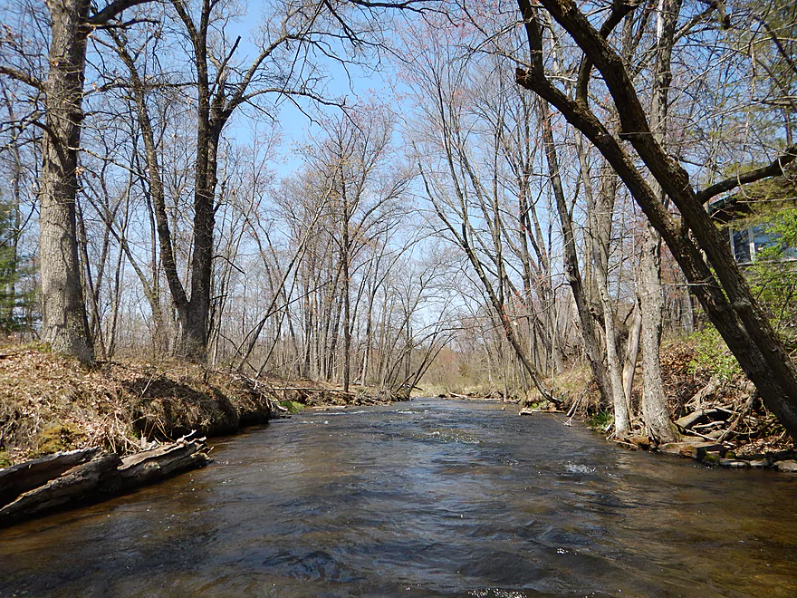
After the dam the creek is very nice, with less obstructions than the upstream sections. Very open, it stays sandy and clear. All in all, very pleasant.
This was only a 3.3 mile trip, but that was intentional as I like to keep my “frontier paddles” short just in case there is trouble. If it was a bit longer and didn’t have quite as many obstructions, I would have given it 4 stars.
Some trash, but not much. Then of course there is the dam in the village of White Creek that is in horrible condition and will probably be condemned when next inspected by the state. It won’t take a major flood to wash it out. What’s curious is that because the upper creek is so silted in, there is hardly any flowage above the dam (which is welcome!).
- Upstream of Easton Lake: Suspect the creek is too congested to run.
- Easton Lake: An artificial flowage that looks navigable but not special. Did not see a single public access point anywhere, but did see many no tresspassing signs.
- Easton Lake Dam to Hwy 13: 0.7 miles. The dam is tricky to access. No trespassing signs everywhere, no shoulders and houses right below the dam by the creek. There is a portage sign on the south side of the dam, so I suppose you could portage the dam on the south side (through somebody’s yard). Legal, but not ideal. If you can launch, the creek is scenic here, but probably has multiple logjams.
- Hwy 13 to Evergreen Ave: 1.6 miles. Hwy 13 is very busy and has guardrails, preventing shoulder pull-offs. You should be able to park SW of the “bridge” and drag your boat a couple hundred feet to the culvert and put in that way. Even if you do this, the chance of log jams downstream are very high. I would not be surprised if you have to portage 10+ times in just this short section based on satellite pictures.
- Evergreen Ave to Hwy H: 3.5 miles. A pleasant trip with great water clarity, some easy rapids and while, yes, some portages – they were easy to deal with.
- Hwy H to Hwy Z: 1.5 miles. A section in hindsight I wished I attempted. Creek looks great down here and runs through more of a wooded section. But satellite pictures indicate that log jams could be an issue. I estimate anywhere from 5-20 log jams between Hwy H and Hwy Z. Not as bad as it sounds as most portages are quite easy. It’s shallow…it’s clean…the banks are flat…there isn’t much mud…and the down trees never get very big because of the sandy soil. But still, this might be a trying section. Wish I had done it though. Hwy Z is next to a house, which isn’t the greatest, so suggest parking down by Fawn Ave.
- Hwy Z to Mouth: 0.3 miles. Looks like it could have a lot of jams too. White Creek empties into a Wisconsin River back channel that runs for a couple of miles and looks interesting, but could be quite shallow if I remember correctly from my Wisconsin River trip a few years ago.
- Wisconsin River Take-out Options:
- Mouth to Point Bluff Resort: 1.9 miles. A simple section on the Wisconsin River. For taking out, there is a private landing at Point Bluff Resort (call 608-253-6181 for options). They do charge even if you don’t use their livery service.
- Point Bluff Resort to Lemonweir River Access: 2.3 miles. A pleasant section and unofficially the start of the Upper Dells.
As for other Adams county prospects, I’ve mostly given up on these. Duck and Klein creeks are too small. Little and Big Roche a Cri Creeks have an INSANE number of log jams. Carter Creek looks amazing but is too small. The massive Castlerock Lake and Petenwell Flowages look boring beyond belief. Fourteen Mile Creek seems to be either a flowage or jammed with logs. Kind of a shame really for Adams County residents that their paddling prospects are so poor.
Trip Map
Overview Map
Video
Photos Size:
I tried 14 mile creek last summer and it has great potential. Unfortunately, the number of large log jams and high flow rate make it fairly dangerous as is. It’s really a shame. Glad to see people are trying the creeks around the area!
Thanks for the comment!
Fantastic review of White Creek. Very in depth.
I found it totally by accident, but read entire thing. Obviously, this is 10 years later, but are you still doing paddling reviews ?
Yep I’m still doing reviews. Newest reviews will appear at the top of the home page.