
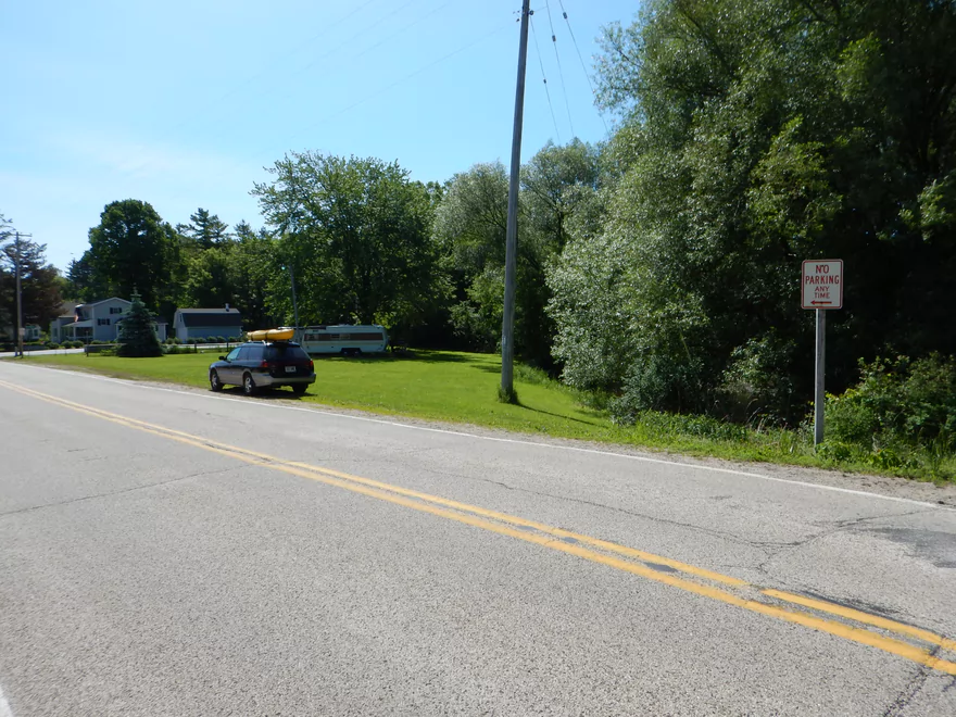
Just poor parking
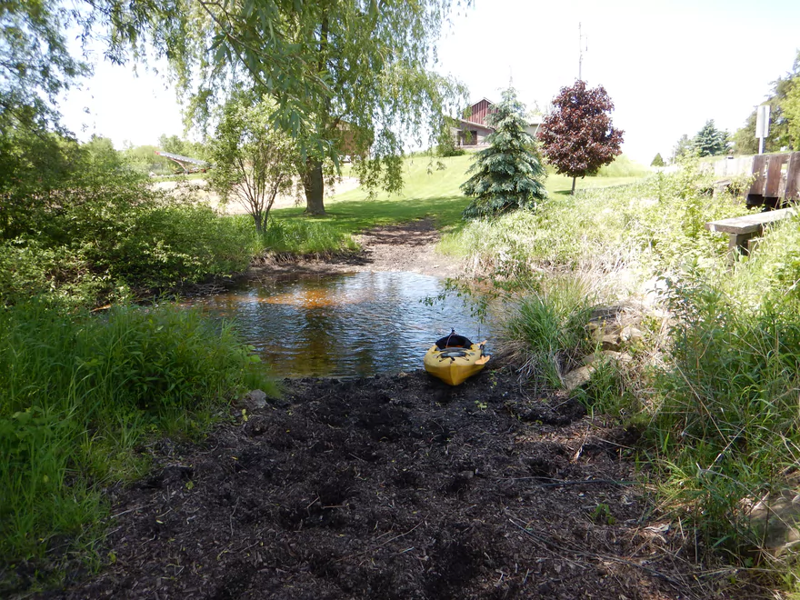
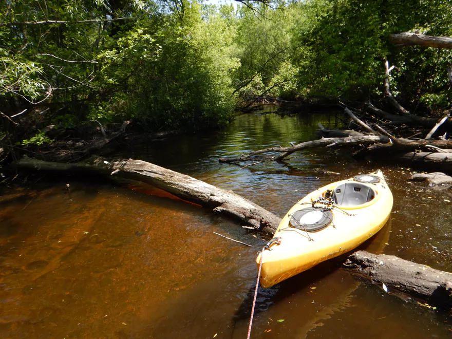
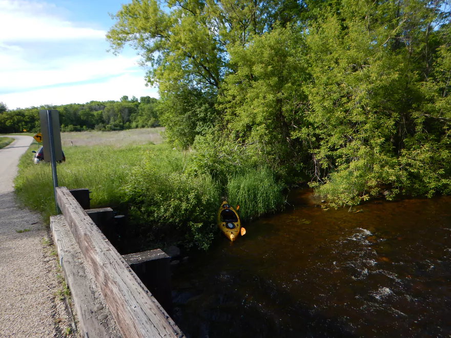
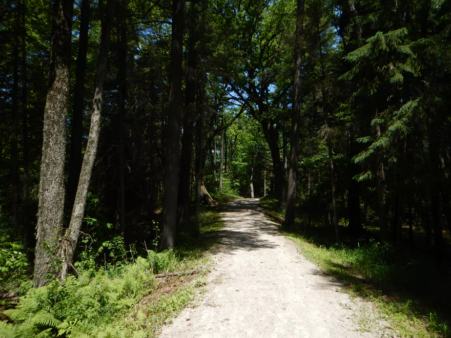
Good put-in off Hwy SS
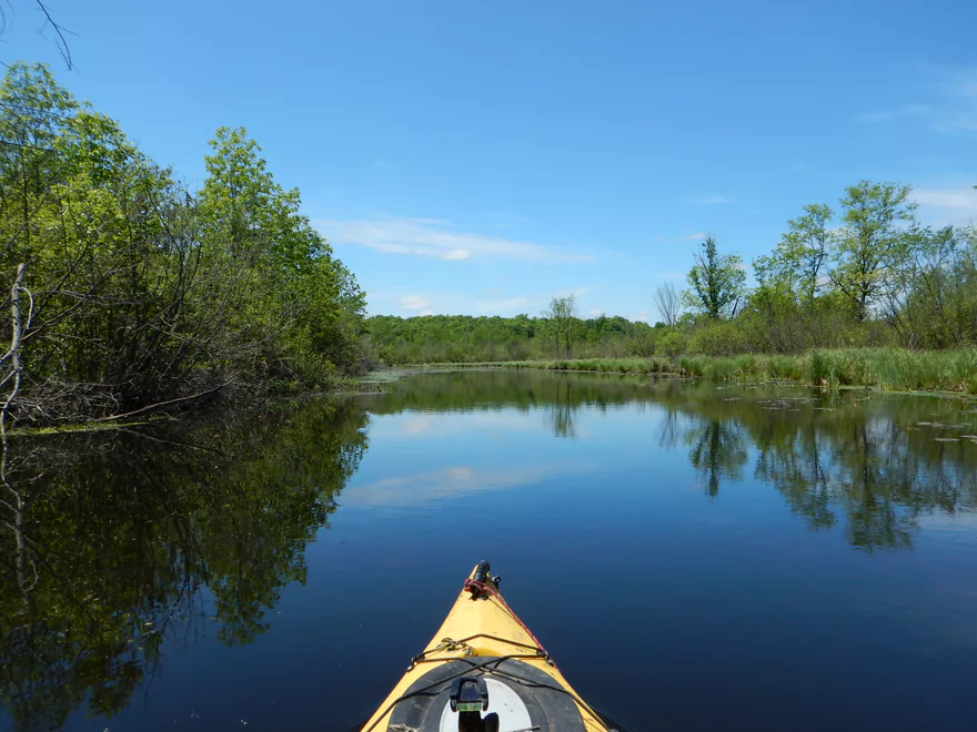
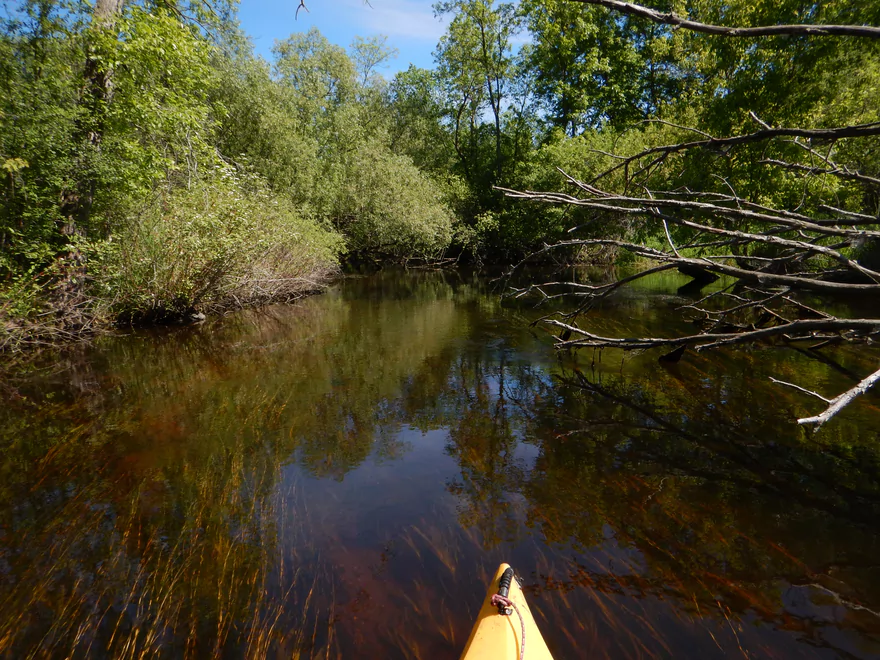
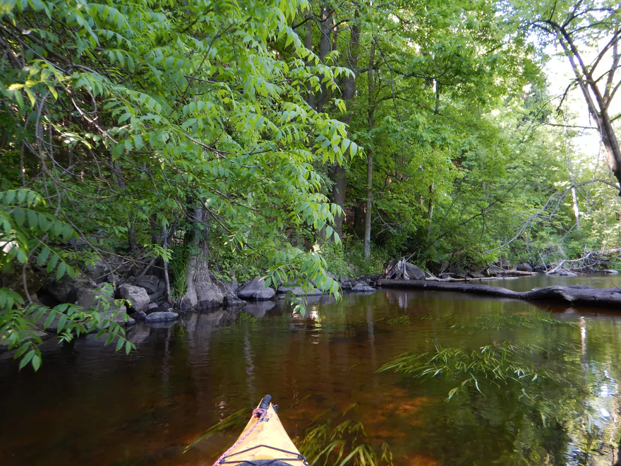
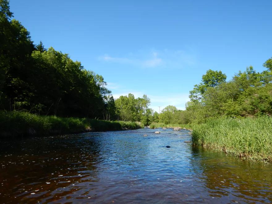
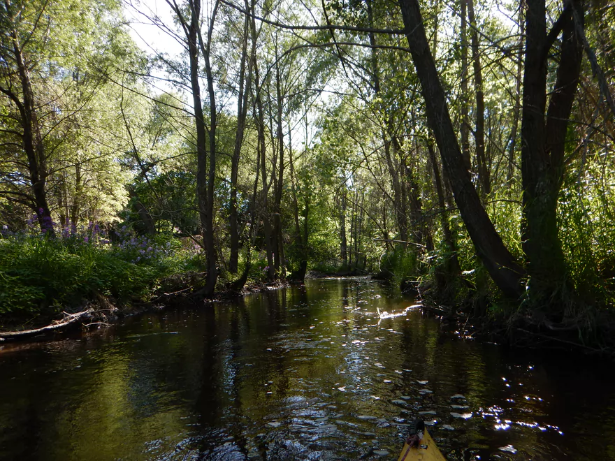
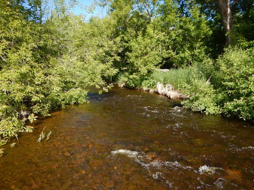
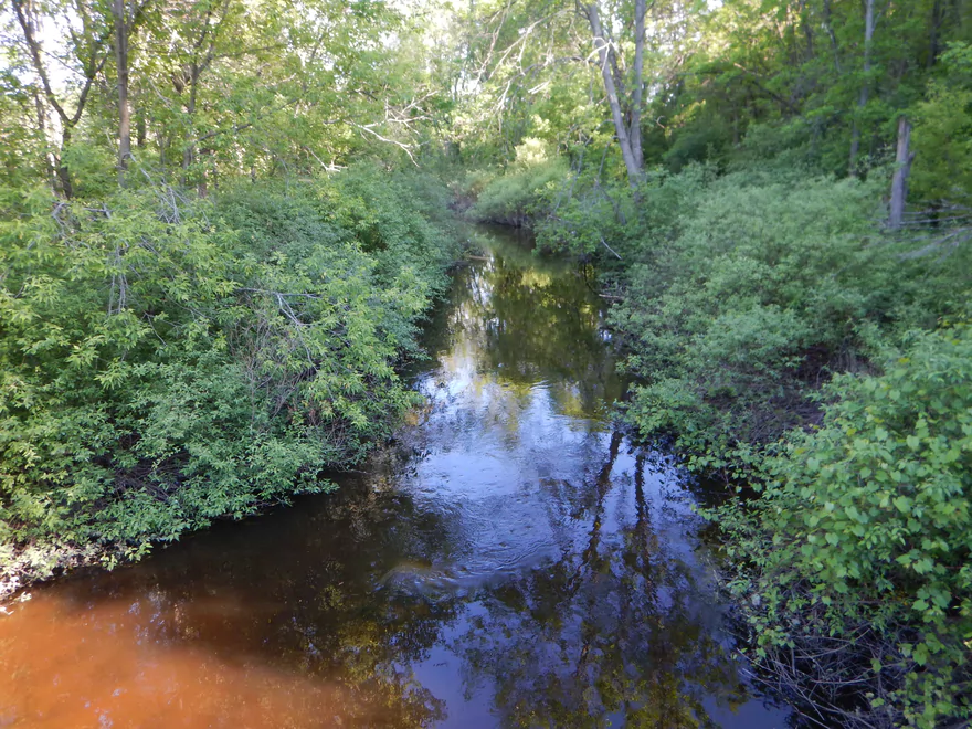
Very attractive
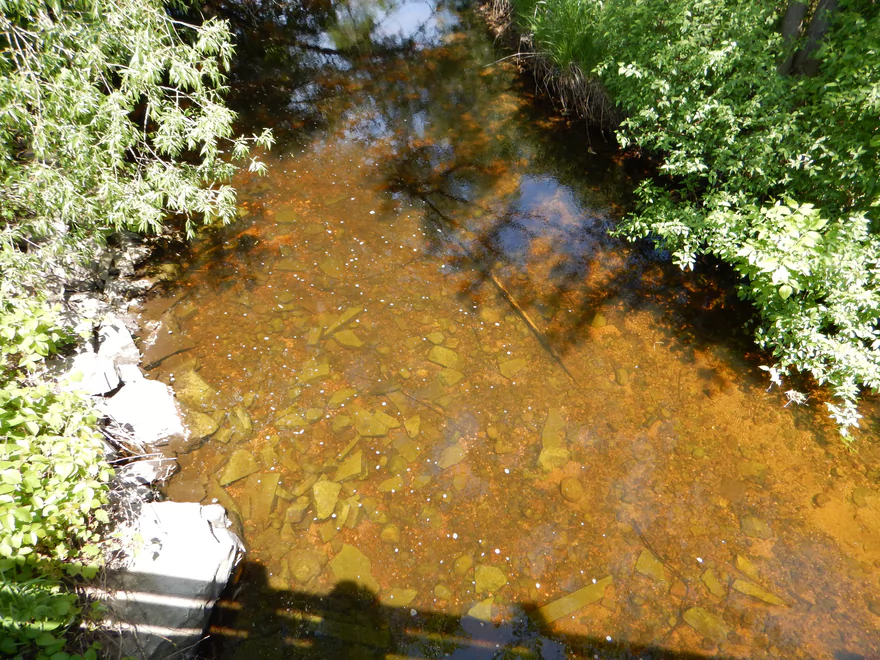
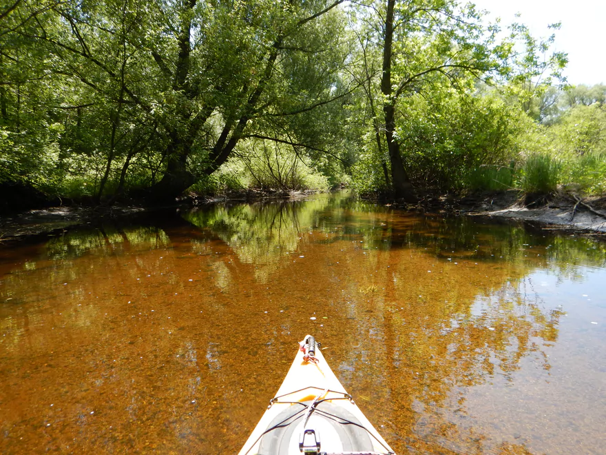
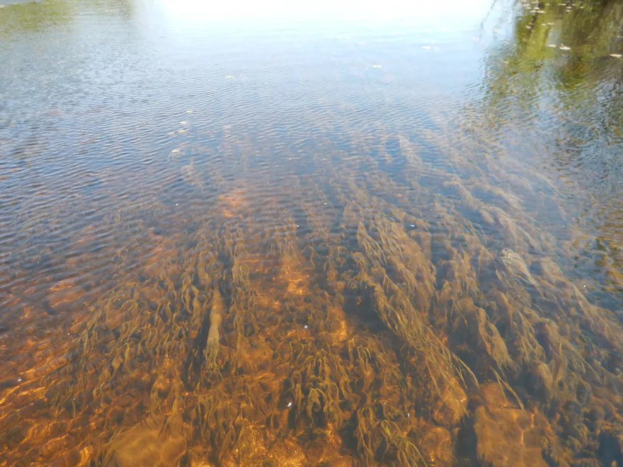
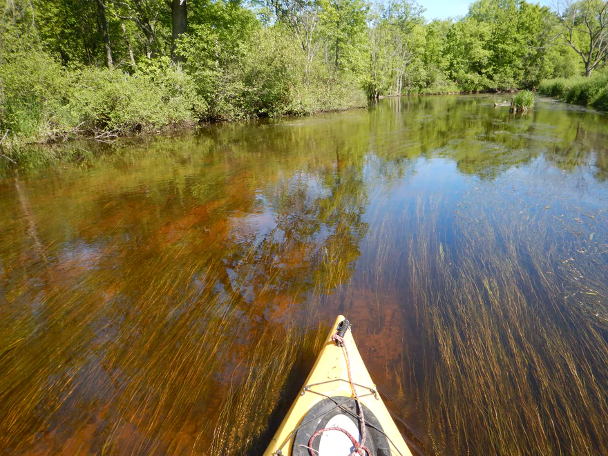
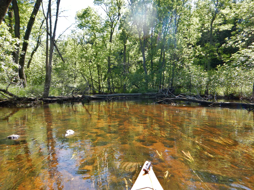
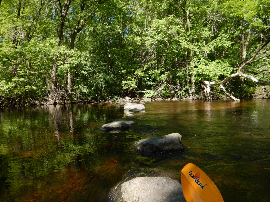
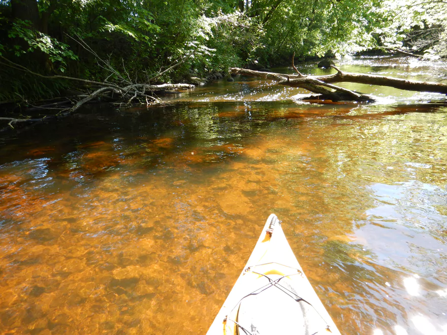
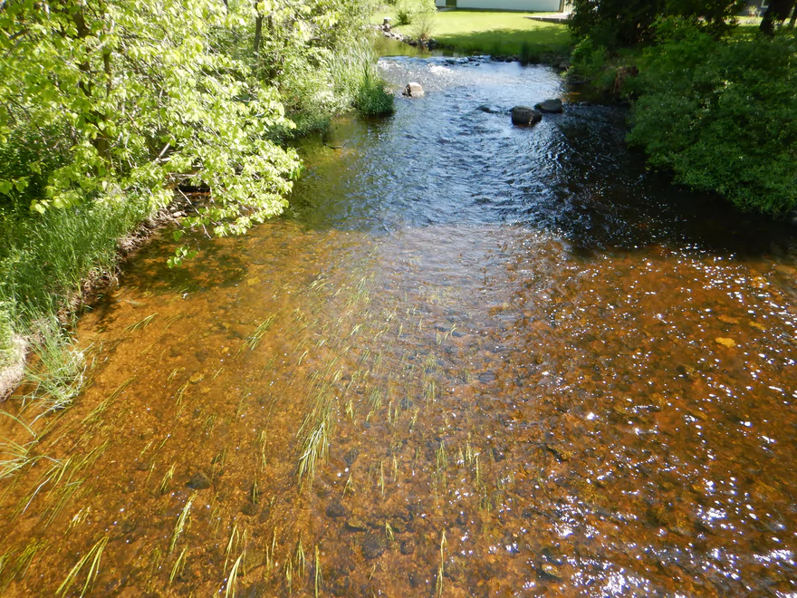
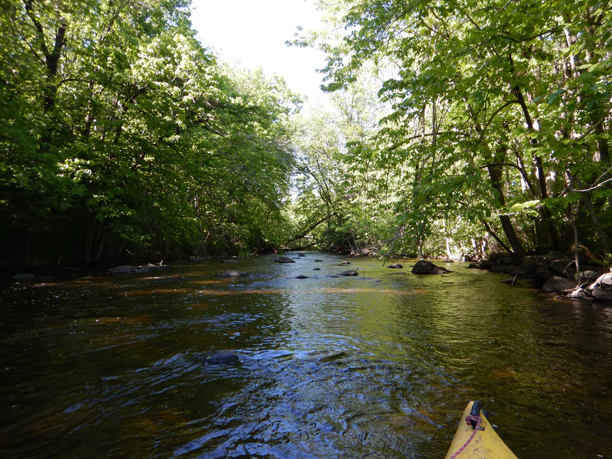
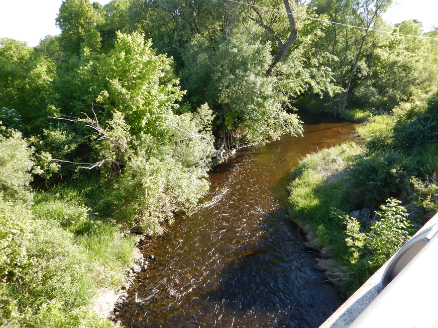
Fantastic red hue and attractive substrate
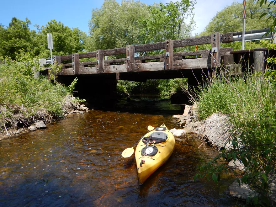
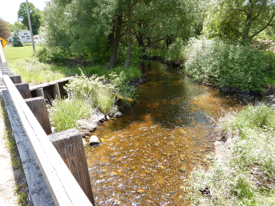
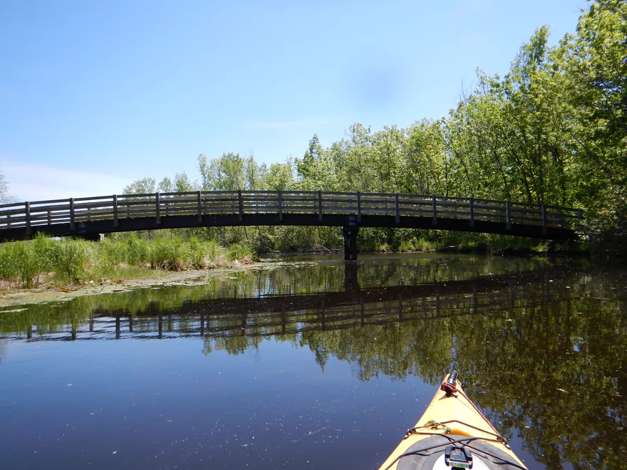
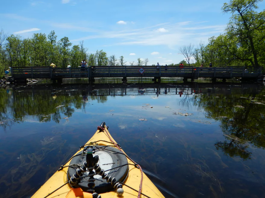
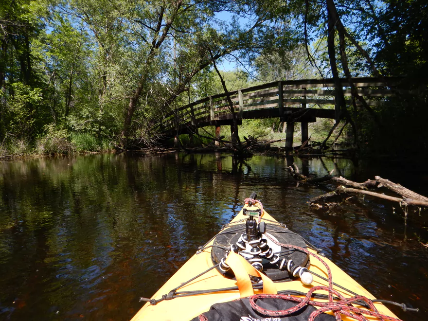
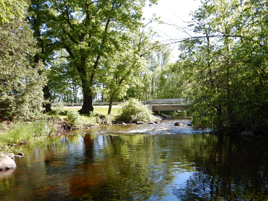
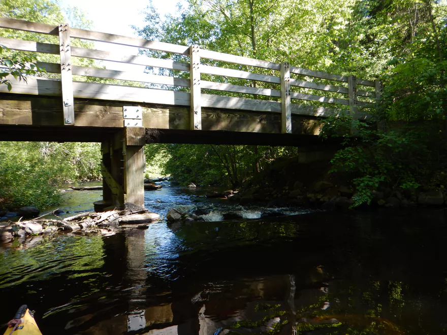
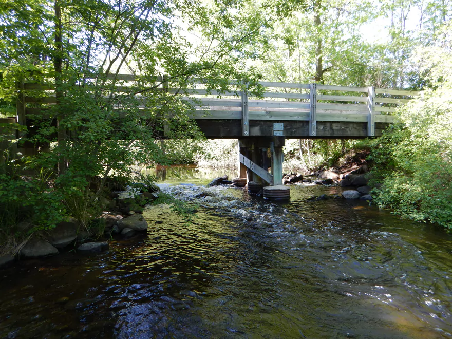
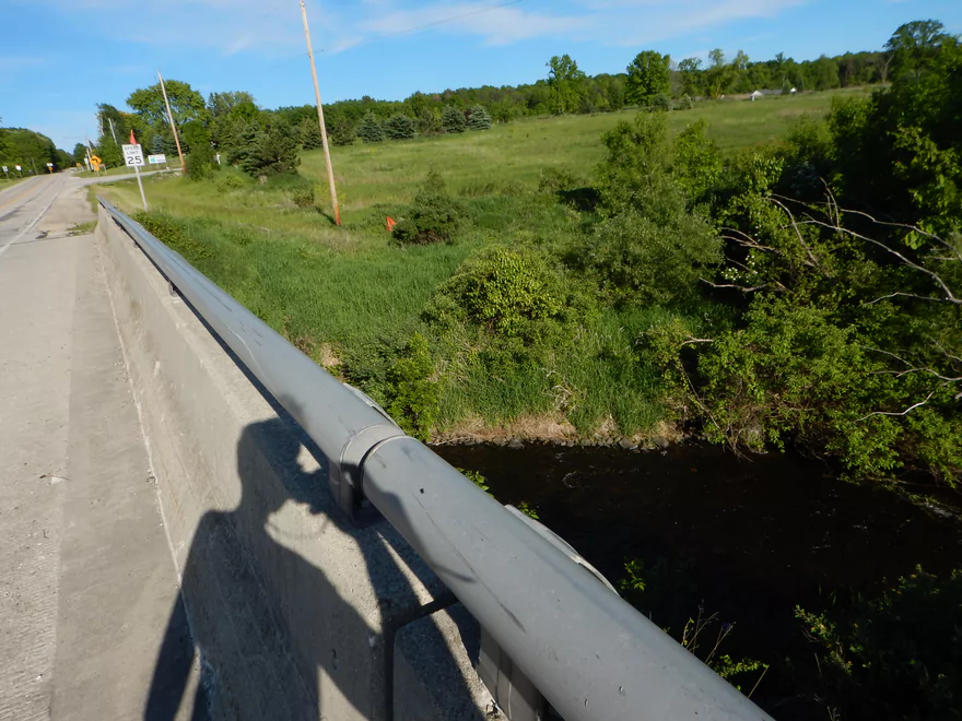
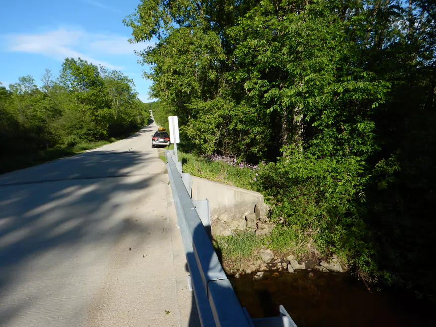
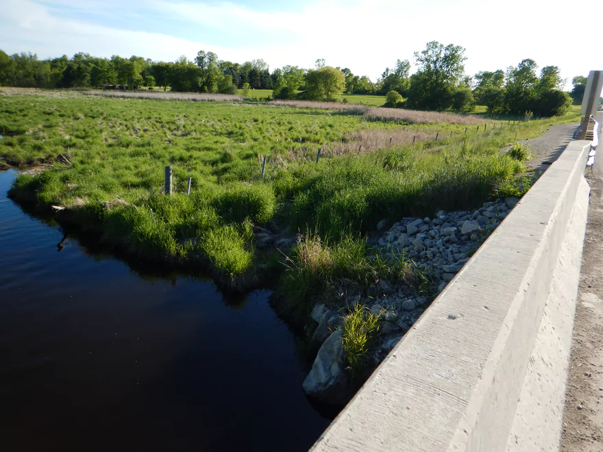
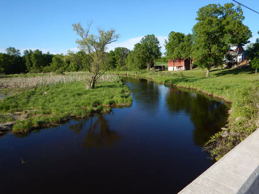
Hwy SS bridge
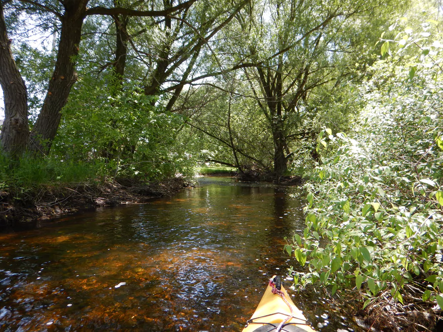
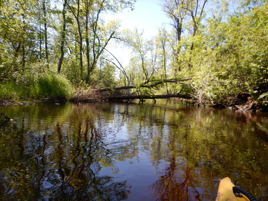
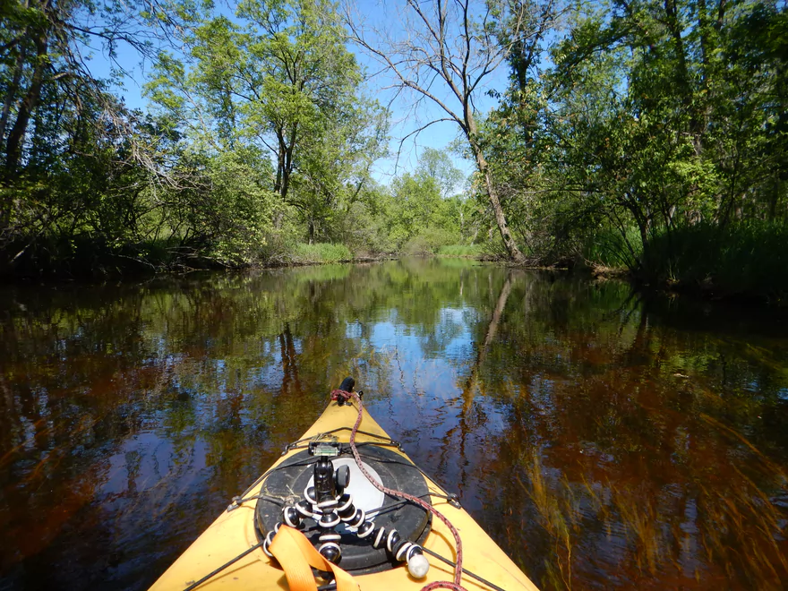
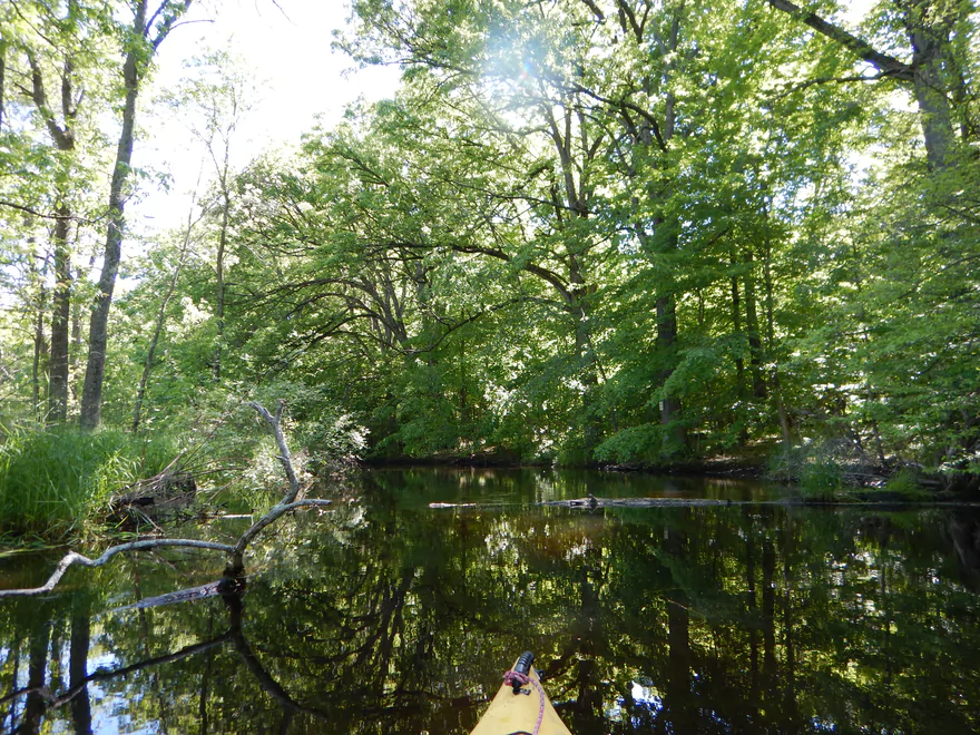
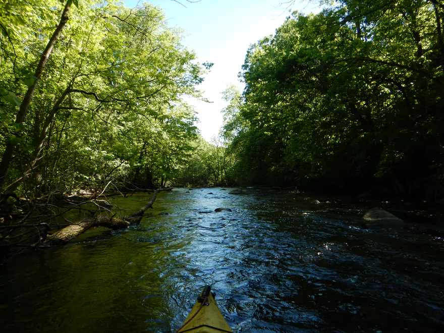
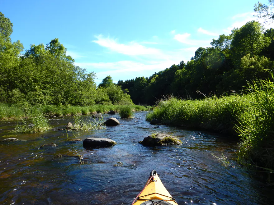
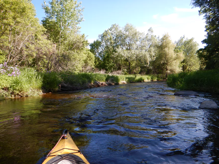
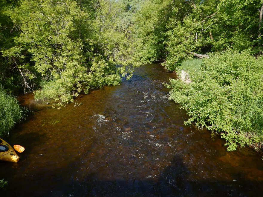
The trip starts so nice!
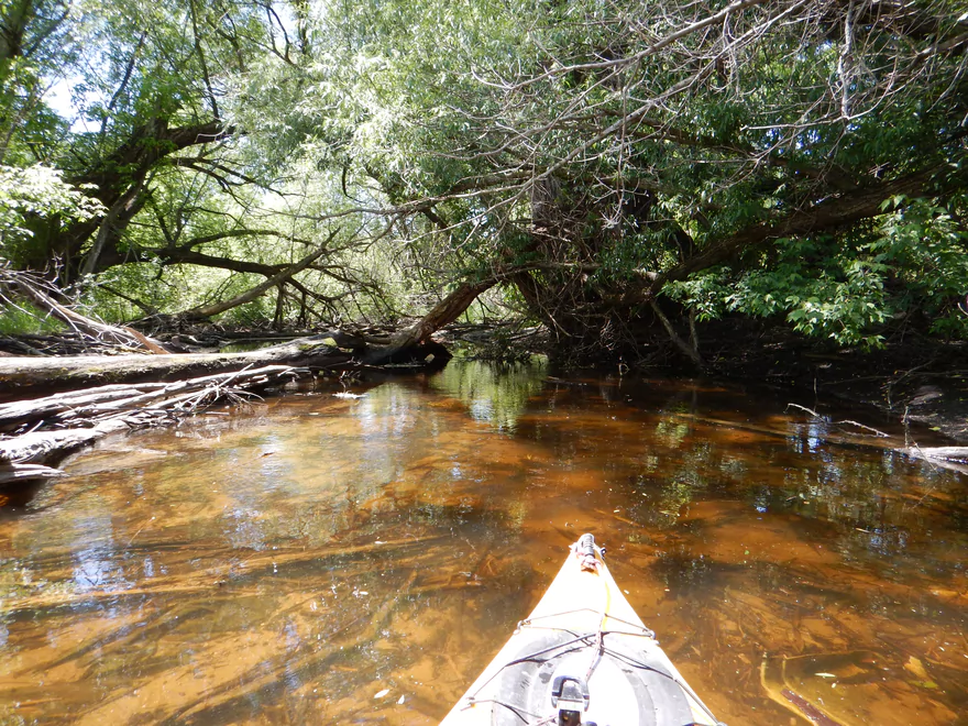
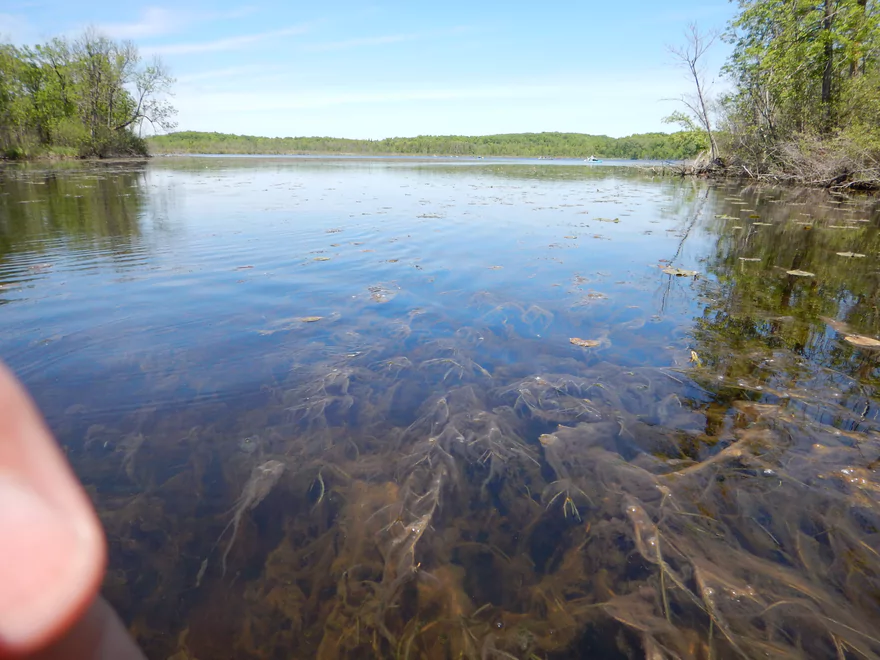
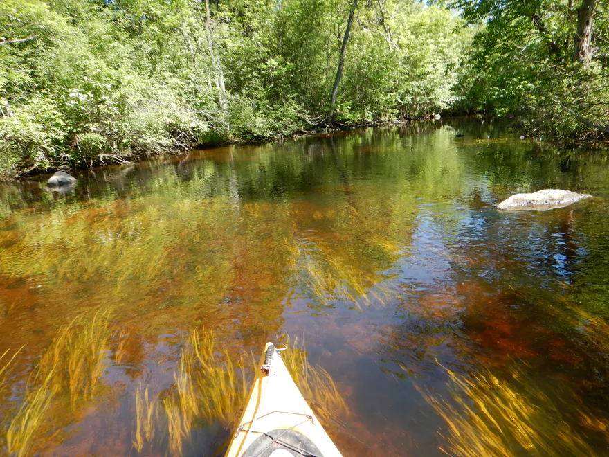
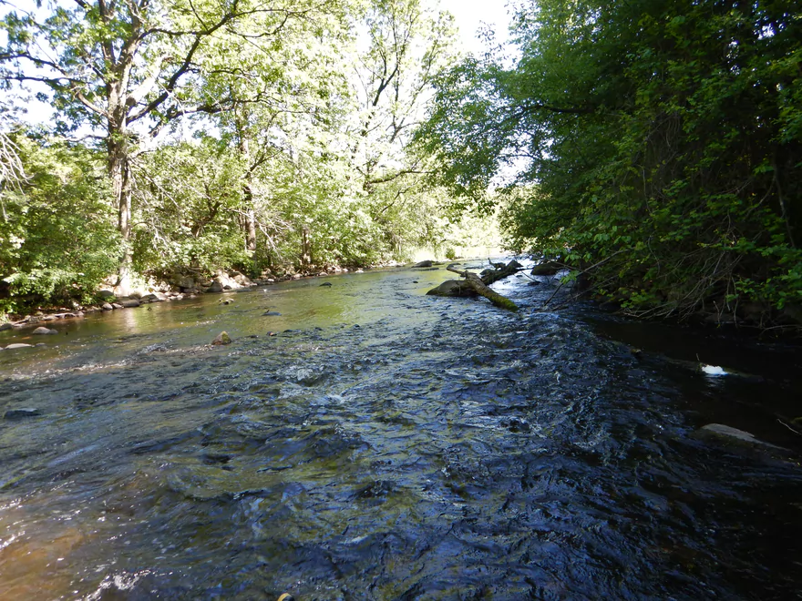
With such attractive water clarity
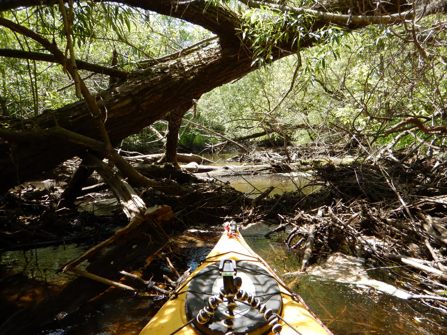
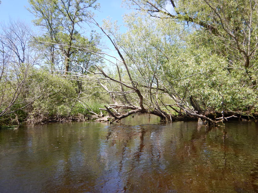
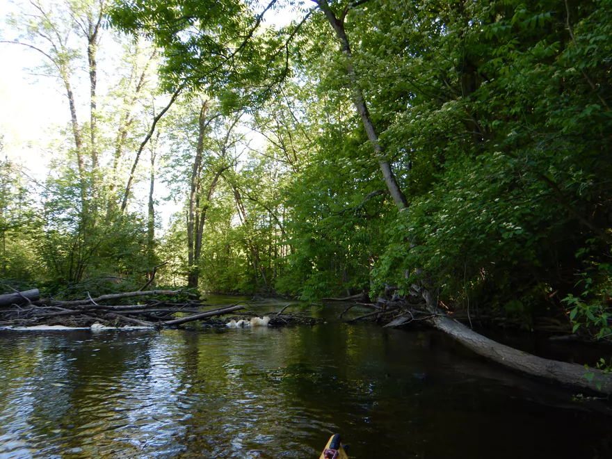
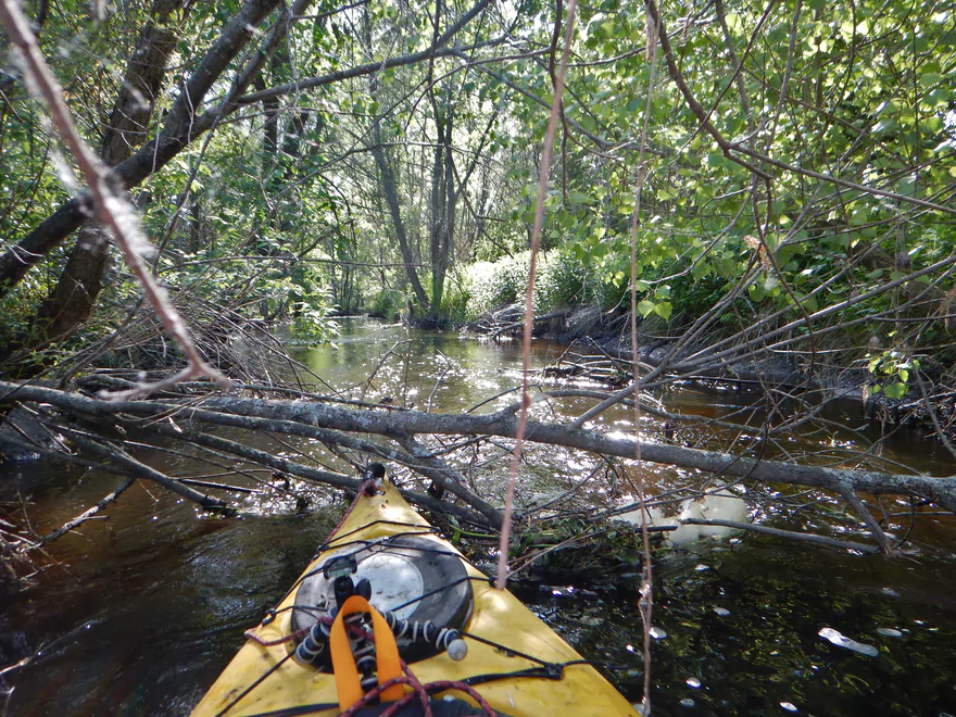
Then this happens
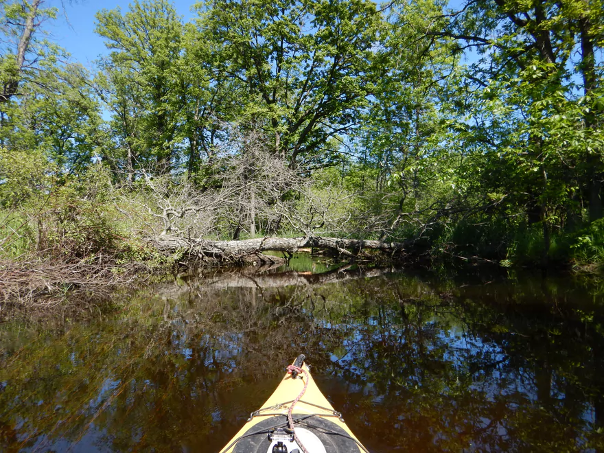
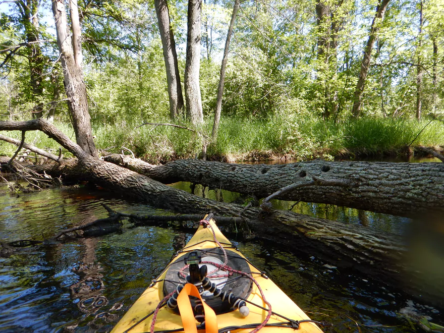
Some were easy portages
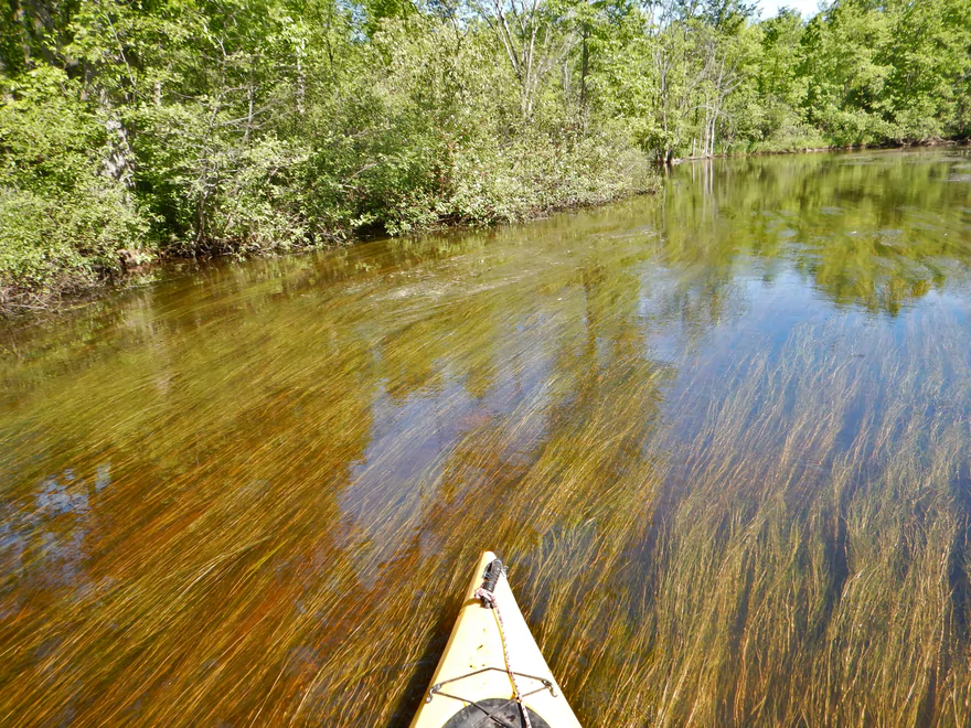
Still some nice water clarity
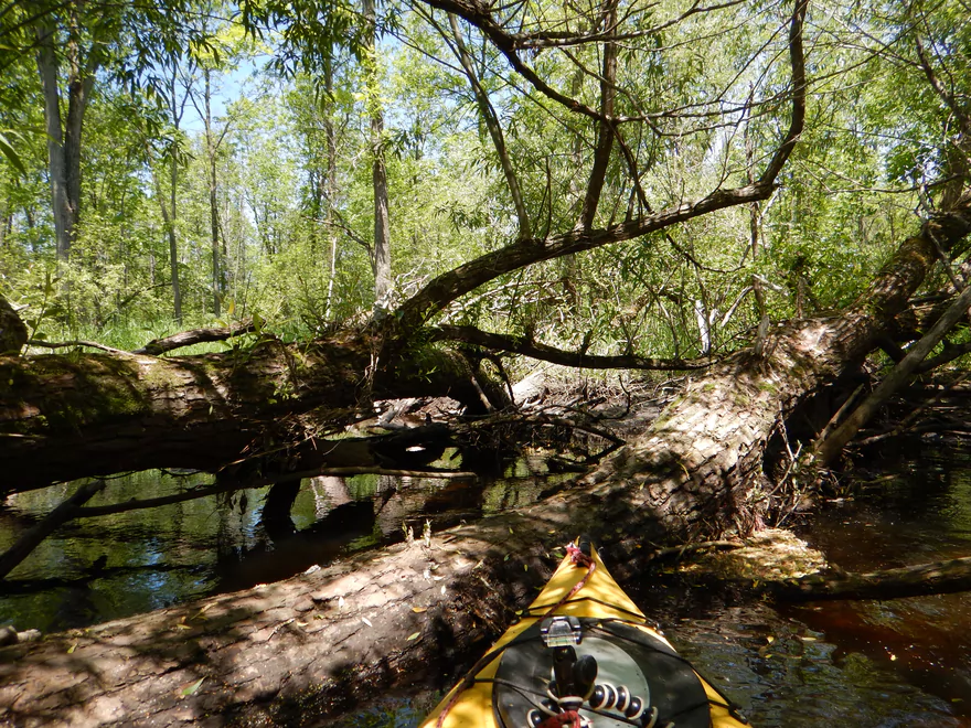
Most were not
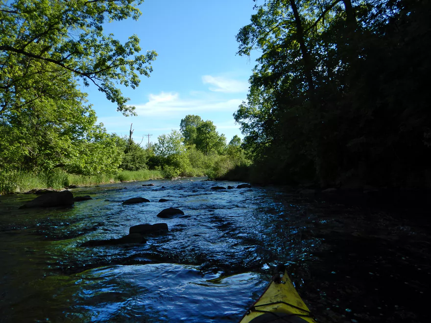
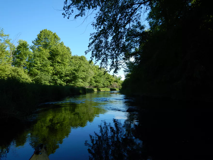
Finally in the clear! Surprised to find other kayakers…
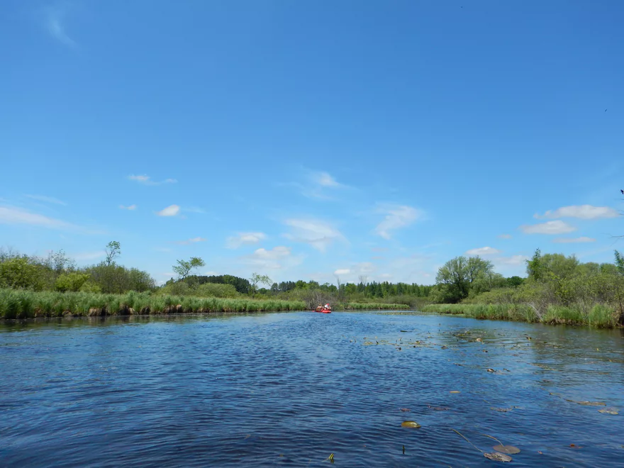
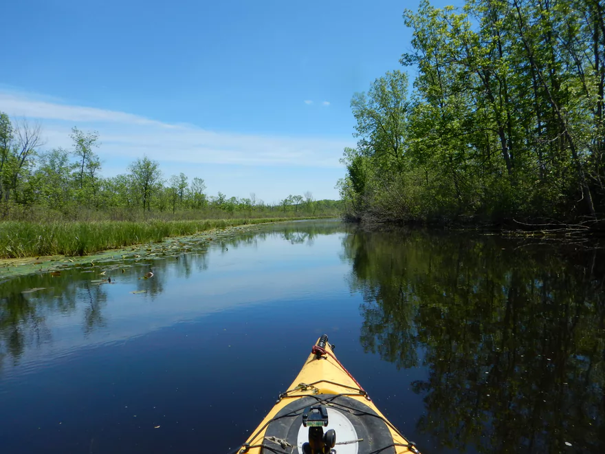
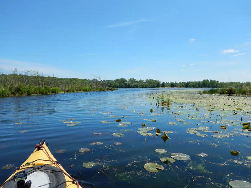
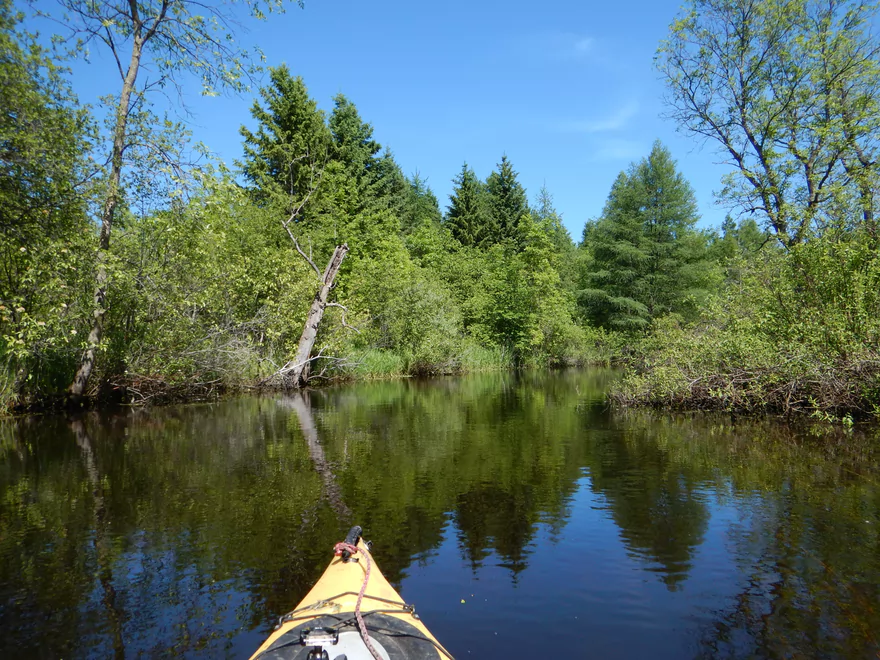
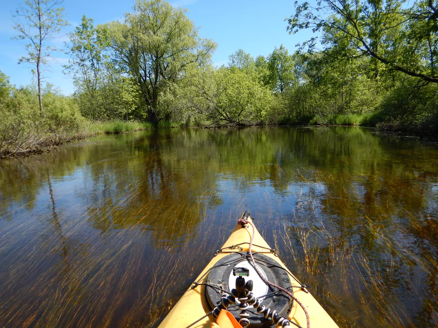
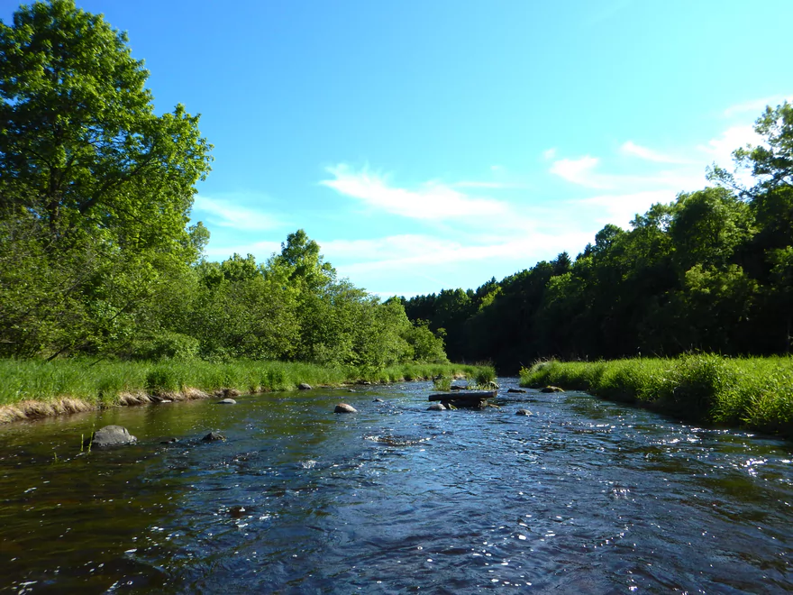
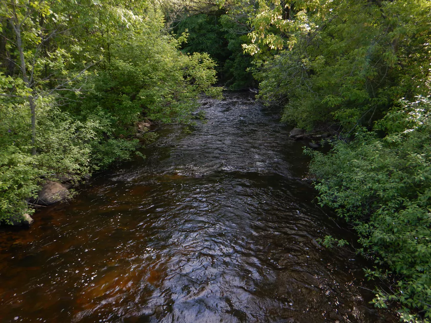
Big and open stretch
Ice Age Trail bridge
Kind of swampy
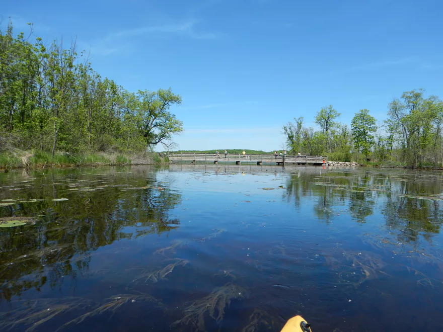
Entering Mauthe Lake
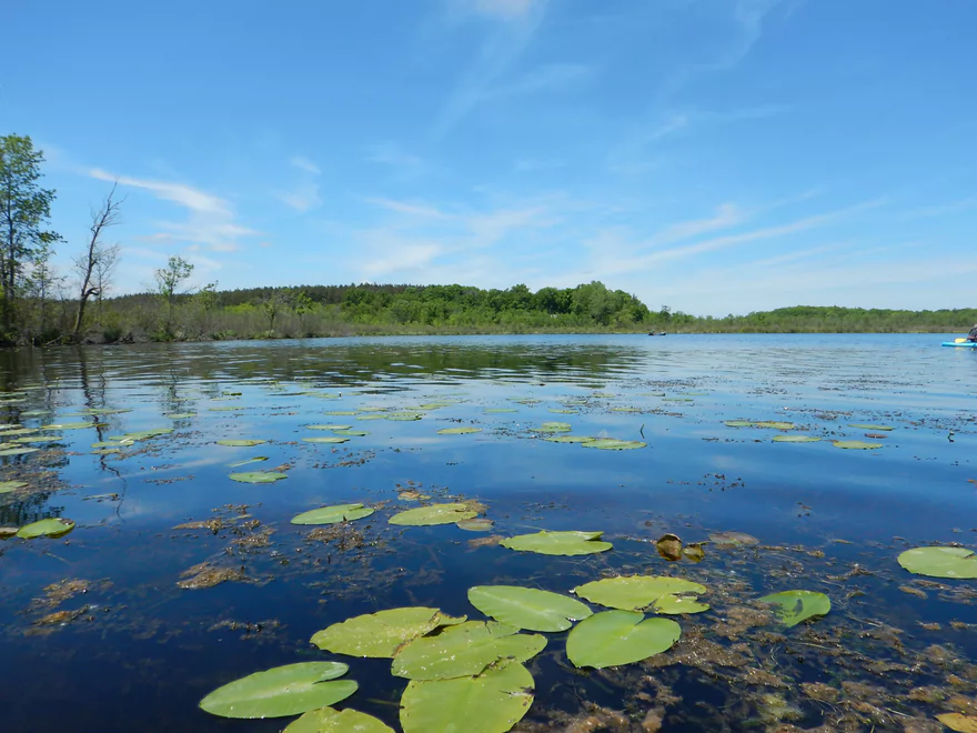
Nice lake with an up-north feel to it
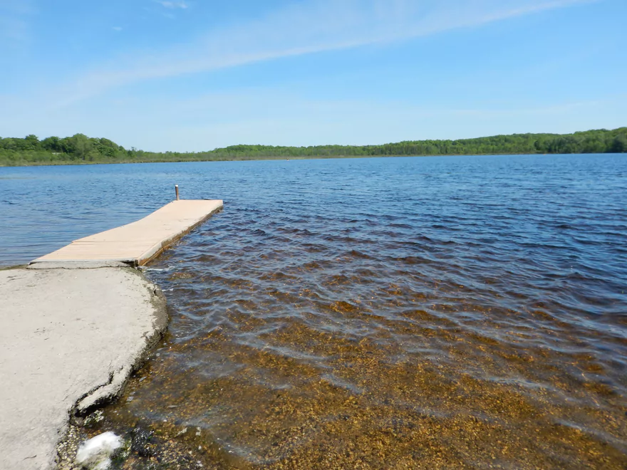
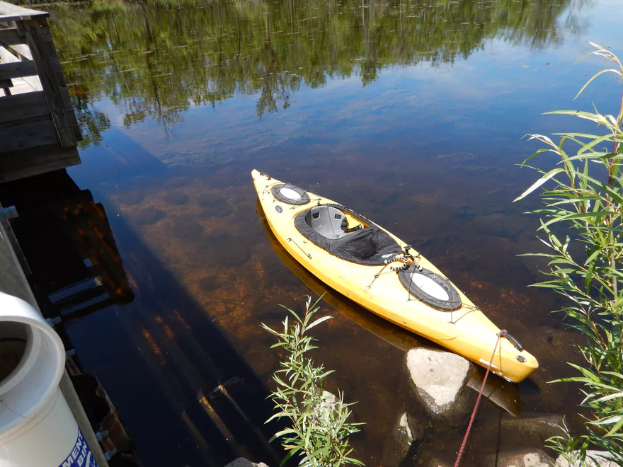
The Mauthe Lake boat ramp is my recommended put-in
Leaving the lake behind
Lake to Lake Bike Trail bridge
I did not fit under
No problem…easy portage
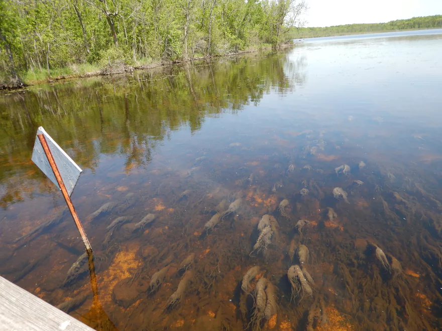
Cool algae
The dam sign is incorrect (maybe there used to be a dam?)
Getting back on the river
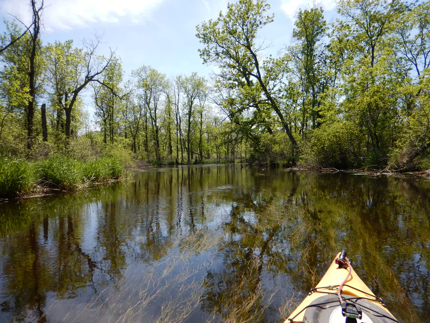
More swampiness
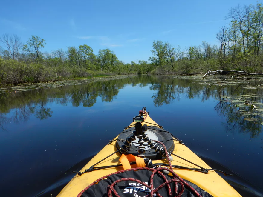
At times big and boring
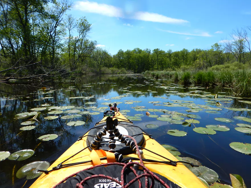
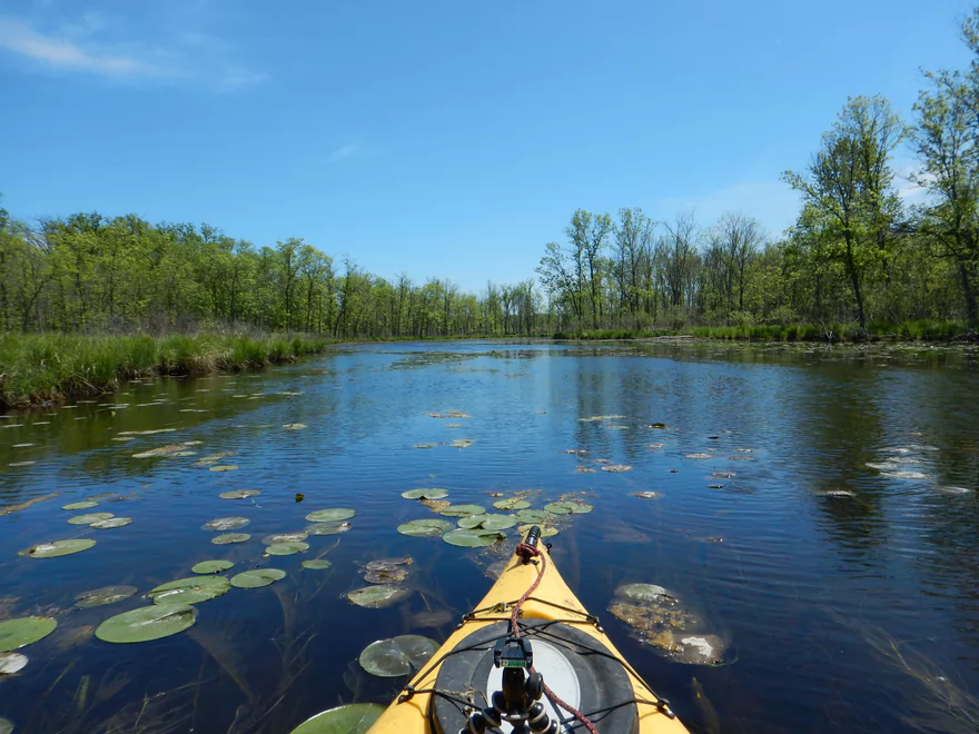
But many nice lily pads
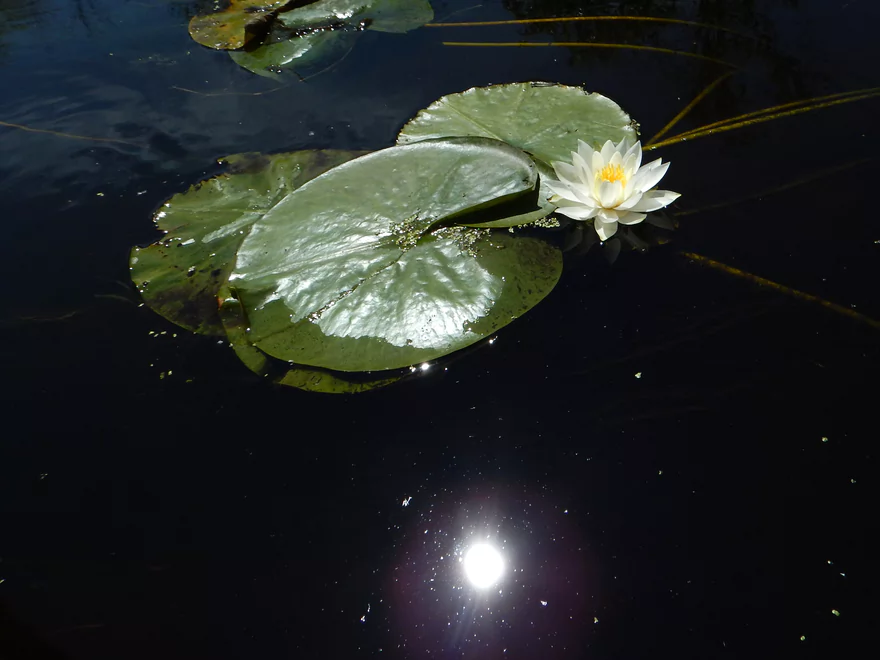
Lily flower over a starry moonlit night
Woods and current start to kick in
Tight duck-under #1
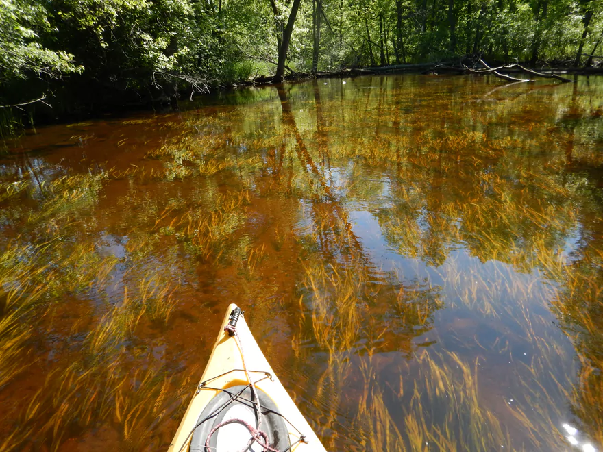
Water depth decreases and clarity improves drastically
This really feels like an up-north river
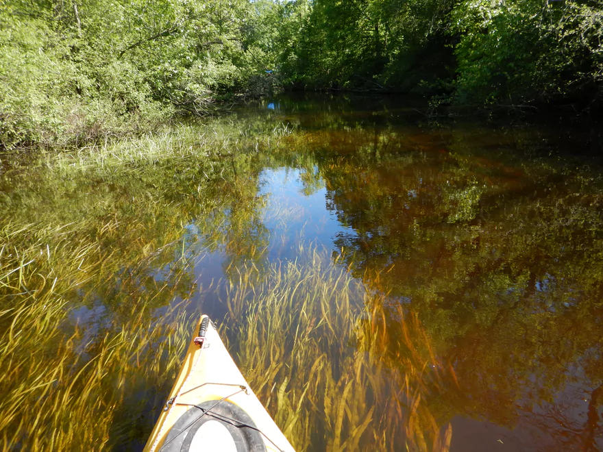
Flowing Potamogeton
Super tight duck-under #2
Tight duck-under #3
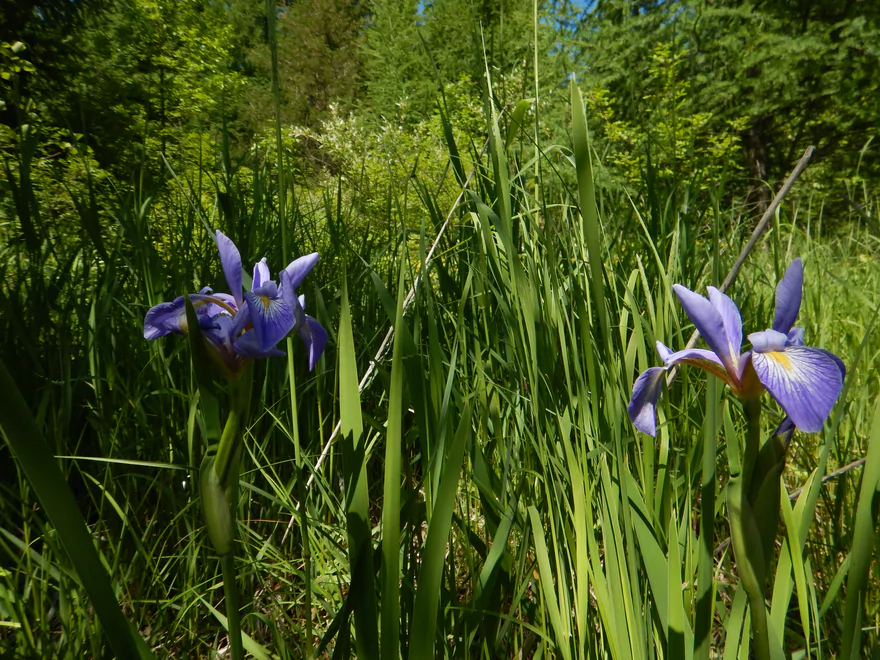
Wild iris
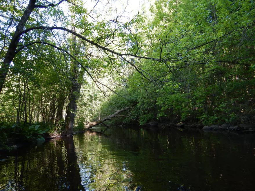
Bank vegetation starts to get cozy
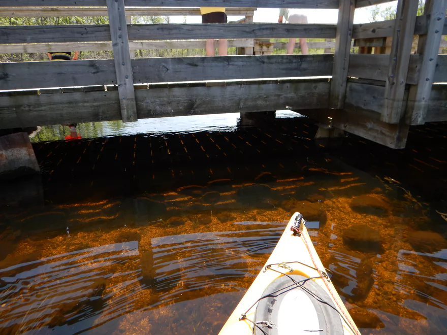
Pedestrian bridges love collecting debris
At times amazing views to the river bottom
Starting to get hairy…
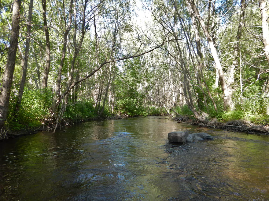
River starts to transform and become more rocky
Only log jam portage I did below Mauthe Lake (easy)
Random boulders start to pop up
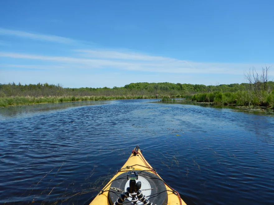
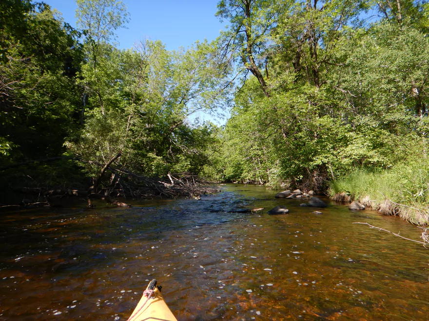
Paddling over a prairie
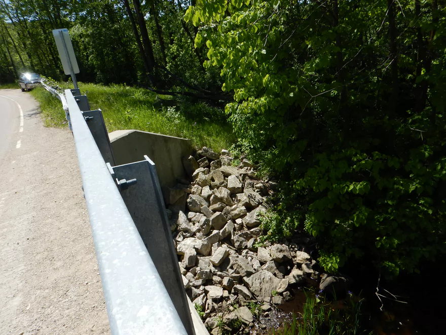
The first of two removed dams
Lot of tree limbs in fast water (doable in small boat)
Approaching Youth Camp Road
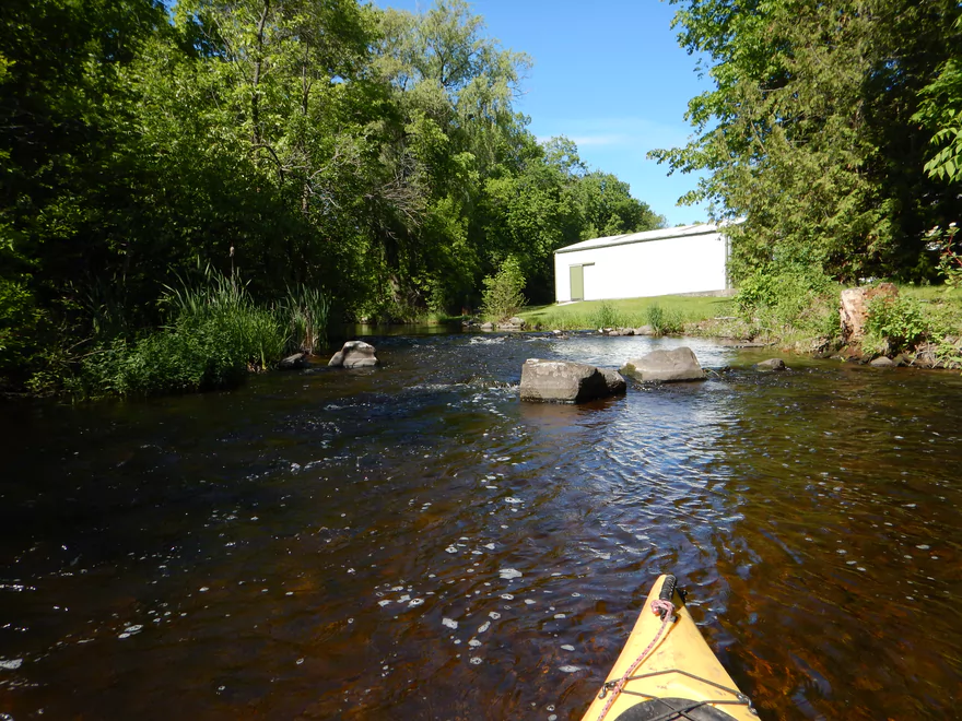
There used to be a Boy Scout camp here
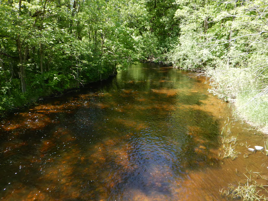
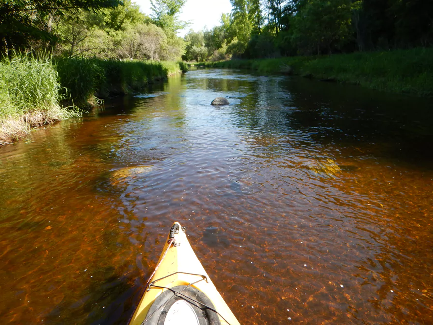
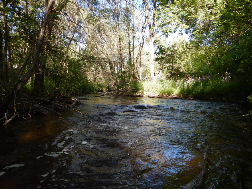
Red color is reminiscent of the Black River
Youth Camp Road is an access option
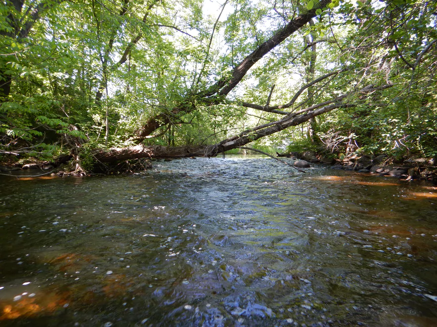
Now for the final and best leg
Another tricky ducker in fast water
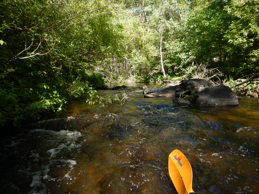
Going through a boulder garden
Reminded me of the Waupaca River
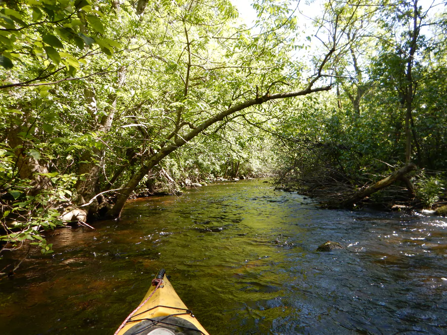
Very intimate section
And scenic
Good bank quality
Another hop-over (easy)
Most serious drop on the river
Maybe class 2?
Try to avoid the deadfall at the bottom
Another nice boulder garden

Pleasant open section
Kind of shallow but I did not have to get out
Scooting along in great current
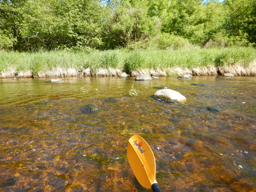
Clean, rocky substrate
Should not have taken so many pictures…starting to lose light
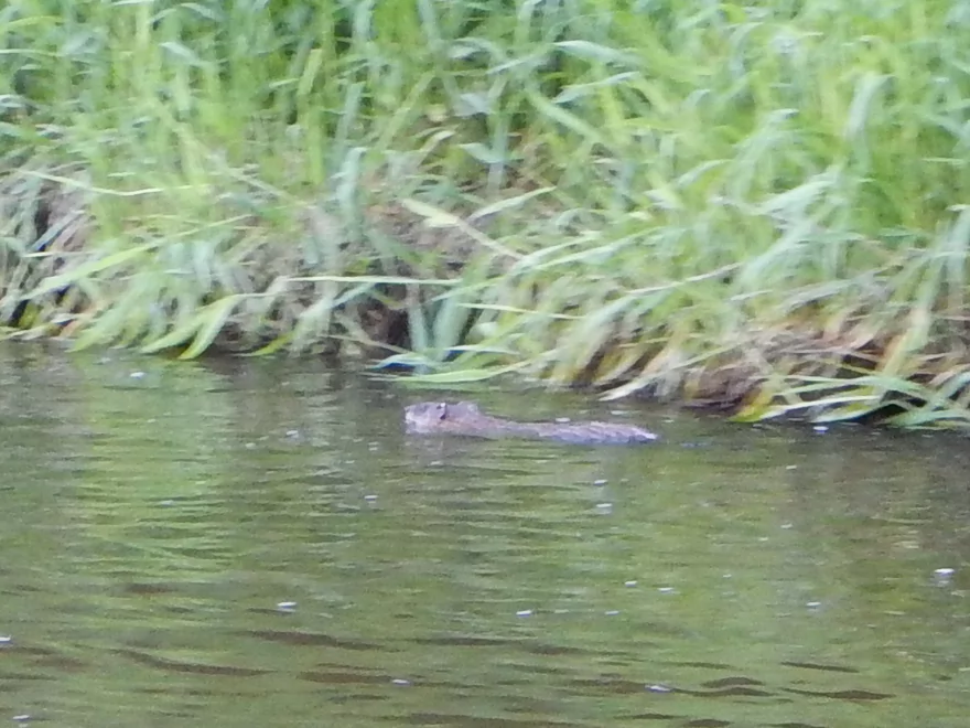
Think this is muskrat #4
I hopped over this (tricky but doable)
Back into the woods
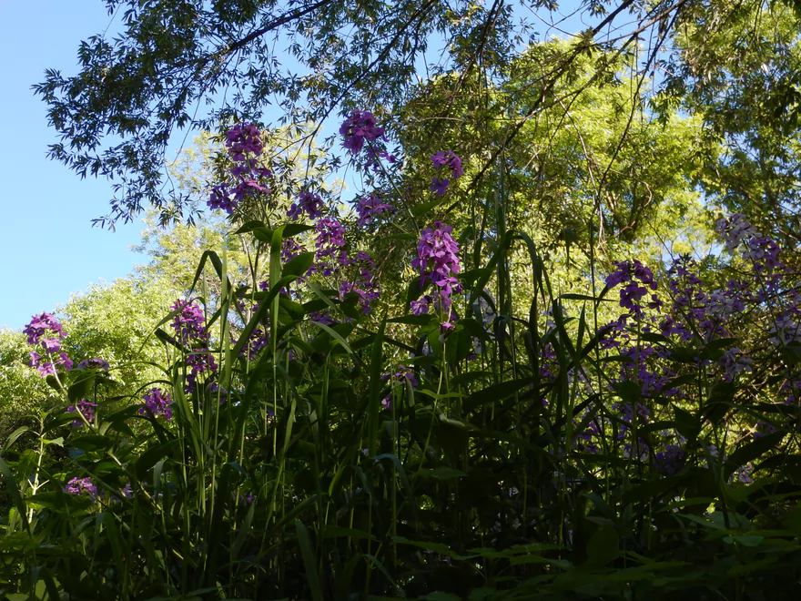
Dame’s rocket
Another hop-over in fast water
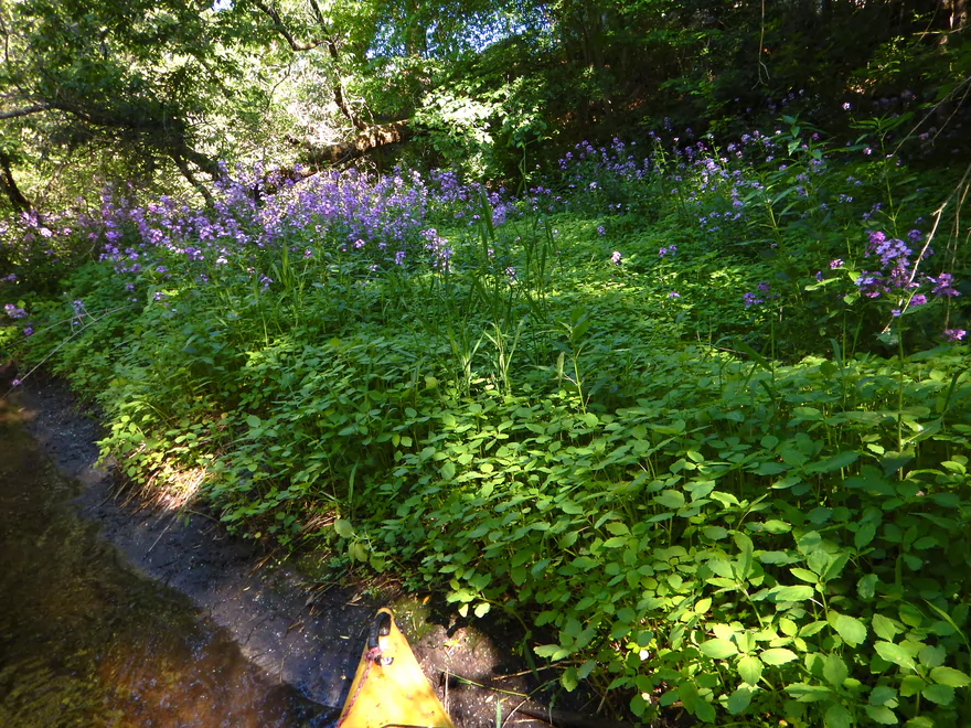
Lavender banks of dame’s rocket
Many attractive little rapids
Final rapids
Marks the take-out at Mill Road
Acceptable access and parking
Looking downstream from the bridge
Cool bike shuttle on local bike trail
Scouting access at Hwy S (ok)
Lot of nice riffles still
Scouting access at E. Moraine Drive (ok but steep parking)
We might have lost most of our rapids by this point though
Scouting access at Hwy 28 (good)
I think this river is now done with rapids
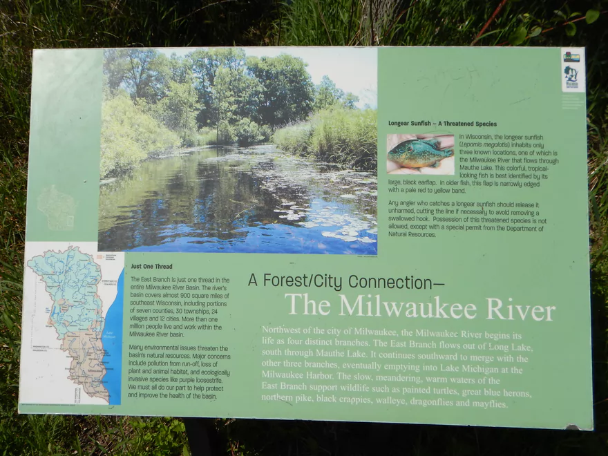
Milwaukee River – East Branch

Trip seemed to start out really well from the put-in off Hwy SS. The great water clarity, cool red hue and attractive gravel bottom made me believe this was the start of a five-star trip.
Then the log jams kicked in. After the first few, I was still optimistic and felt they were the exceptions and not the rule. I was wrong. In the first half mile, I had to portage pretty much every 30 yards. I was going to take pictures and document these on the map for future clearing efforts…but soon gave up as there were too many. Some were easy wading portages. Many were not. Think quick mud, thick brush, complicated combination jams and congestion even on land when you did get out of the water. The trip was on pace for a one-star rating and I contemplated abandoning the trip. Glad I didn’t.
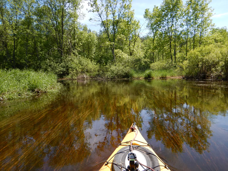
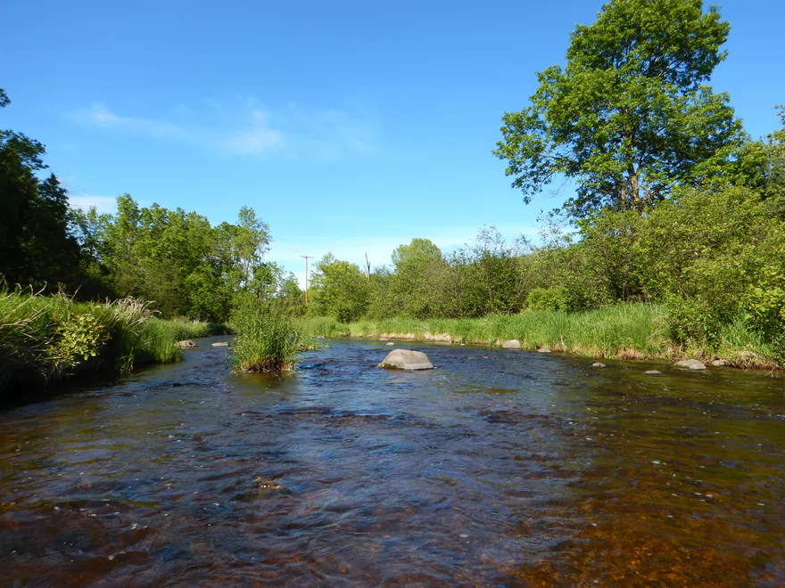
From the half mile marker to Mauthe Lake, the river changes dramatically. The trees go away, the river opens up and turns into a slow wetland paddle. Wetland paddles can be nice and have a certain subtle beauty to them…but I wasn’t in the mood for this after my battles with logjams. I was hoping for rapids (which I saw from Google images). So not a single log jam, but not super interesting. We’ll give this section 2 stars.
Mauthe Lake is pleasant enough, but it is still a lake which doesn’t interest me as much. It did interest the locals though, as there were plenty of paddlers and fishermen enjoying the lake. In hindsight, I should have put in here (there is a great put-in at the south end of the lake). For the nice water clarity, no dam and scenic vistas, we’ll give Mauthe Lake 2.5 stars.
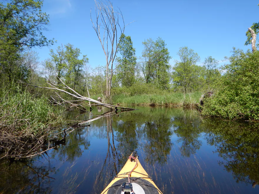
Continuing on, you’ll have to portage the “Lake to Lake Bike Trail” which is easy enough. Despite all the yakkers on the water, I was the only one willing to paddle south of the bridge though. The next two miles are fairly open and more of a swamp paddle. Very up-north feel with scrubby alders, low banks and occasional pines. Nothing too exotic in this section and we’ll give it 2.5 stars.
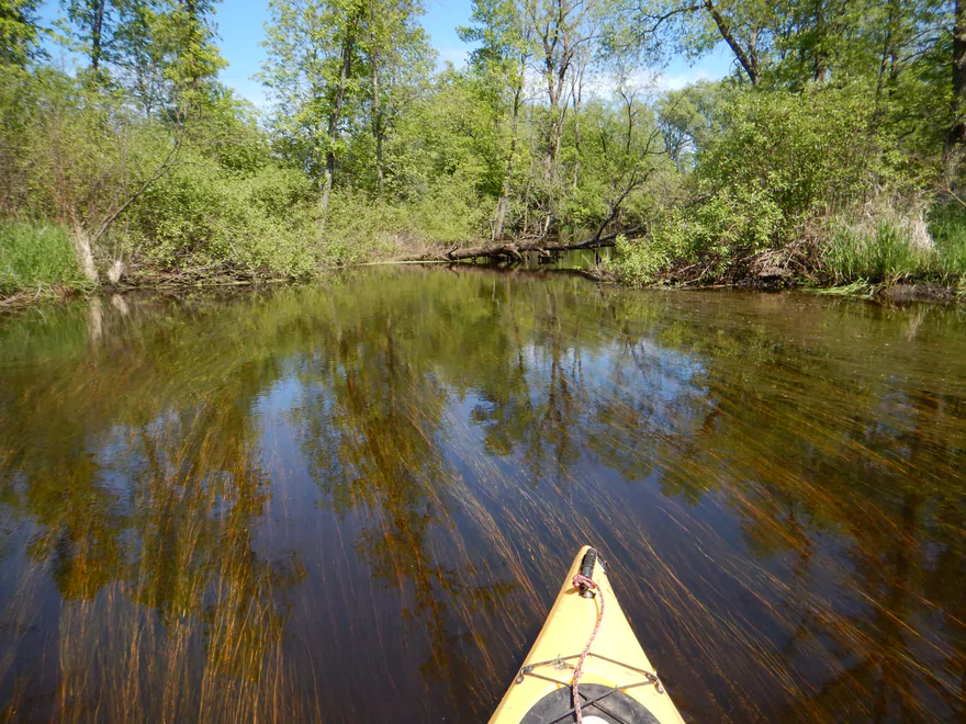
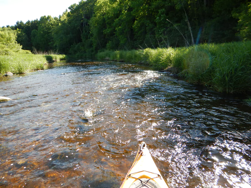
For the next two miles (up to Youth Camp Road), the river changes quite a bit. It narrows dramatically, gets more shallow, nice trees replace scrubby alders and the current picks up. At times the water clarity is fantastic. Really liked this part and this section gets 4 stars. Note, at one point in time there were dams on the river (including by Youth Camp Road), but I came across none, so they must have been removed.
The last mile (from Youth Camp Road to Mill Road) was what I had hoped the entire river was going to be like the entire time. The river really narrows and the current picks up dramatically. You’ll enjoy occasional boulder gardens, intimate tree canopies, clear rocky water and fun class 1 rapids. It kept reminding me of the Waupaca River (which is a good thing!). This is a very picturesque section but unfortunately I was running out of light and many photos did not turn out.
So if you’re keeping score, my star rating went from 5 > 1 > 2.5 > 2.5 > 4 > 5. Learn from my mistakes. Do not put in off Hwy SS (unless it gets cleared) and instead put in off the Mauthe Lake boat ramp. For a trip starting with “countless” jams, in the end I only had to portage once after Mauthe Lake which was an easy wade-over (granted there were also three serious duckers and a tricky strainer to deal with).
Good launch area from Hwy SS. There are no parking signs everywhere though, so you may have to park on the shoulder maybe 300 yards to the west. When I was putting in, two turkeys (a fat male and a skinny female) started stalking me and making loud noises. Thankfully, the nearby owner yelled, “Bad turkey, get back here!” And they did!
The bridge off New Prospect Lane (next door) is another option that is more secluded, but there are no parking signs in the general vicinity, so I just don’t know. All this is a moot issue though, as the immediate jams downstream are too serious and you should put in at Mauthe Lake instead.
Mill Road is a good take-out spot (for a bridge). Somewhat brushy, but easy enough to get through and park.
While there are nearby canoe rentals, I don’t believe there is a local shuttle service. The bike shuttle is an acceptable 6.1 miles with just a few hills. Cool thing about this bike shuttle was that it cuts through the Mauthe Lake Recreation Area (in essence a state park) and one can use the nice “Lake to Lake” bike trail for maybe a mile or two.
For the most part, there was more than plenty for navigation and this river could have been paddled lower. However, after Youth Camp Road it was pretty bumpy going down the rapids and it would have been nice to have a little bit more depth. But not too much…as there are enough low hanging branches in the rapids section that this could be problematic in very high water.
As for current, virtually none until maybe halfway between Mauthe Lake and Youth Camp Road. After that the river picks up and is much nicer. The river starts getting rocky before Youth Camp Road and this marks the start of the rapids which continue on and off until taking out.
A great blue heron, many friendly damselflies, dragonflies, a deer munching on algae, fish, nice wildflowers, clams, snails, small red crayfish and a number of human kayakers. The highlight was the four muskrats, two of which allowed me to get somewhat close to them.
Mostly within the Kettle Moraine State Forest, this is a pretty secluded paddle. You will encounter a lot of paddlers on Mauthe lake, but they’re pretty low impact and aren’t a problem.
- Hwy 67 to Boy Scout Drive: 1.8 miles. An open, marshy creek that might require high water to get through. Not sure Boy Scout Drive is a feasible access option.
- Boy Scout Drive to Dundee Mill Park: 3.5 miles. An open lake paddle through Long Lake with two dams to portage. Alt access at public boat ramp on the SE portion of the lake.
- Dundee Mill Park to Hwy SS: 5.4 miles. An interesting prospect that is part creek, part marsh. There will be several downed trees blocking passage though. Nearby New Prospect Lane is a better access option than Hwy SS.
- Hwy SS to Mill Road: 7.2 miles.
- Hwy SS to Mauthe Lake Landing: 1.9 miles. Too many logjams to recommend. After the creek portion, the river opens up into a wetland and then Mauthe Lake. Nearby New Prospect Lane is a better access option than Hwy SS.
- Mauthe Lake to Hwy DD: 4.4 miles. Nice section as the channel transforms from a marsh to a clear, rocky, woodland river.
- Hwy DD to Mill Road: 0.8 miles. A five star section with fun riffles, good scenery, and small boulder gardens.
- Mill Road to Hwy S: 0.5 miles. A good prospect with more light rapids.
- Hwy S to E. Moraine Dr.: 1.6 miles. Scenic paddle through attractive woods. But many logjams. A report from 2024 said there were 10 in this leg.
- E. Moraine Dr. to Hwy 28: 2.3 miles. Good prospect with some light rapids, but there are logjams to deal with.
- Hwy 28 to Hwy H: 3.0 miles. A good prospect but there are many logjams to deal with. After the mouth on the Milwaukee river, it is just a short distance to the Hwy H take-out.
This trip relied on a write-up from the book “Small River Canoe Adventures of Wisconsin”. This was very helpful, but it is somewhat out-of-date. Both dams referenced are gone and there is no reference to the log jams above Mauthe Lake.
Also an inspiration for the trip was an amazing winter picture of the river from Aaron C. Jors. The guy is an amazing photographer and I recommend checking out his webpage of Wisconsin river photos. This is what kept me going after all the logjams I endured. I never did paddle across that exact scene of his (probably missed it), but saw many similar.
Also thank you to Timothy Bauer for the cleanup work he has done on this river.
Trip Map
Overview Map
Video
Photos Size:
i did this trip but started at HWY S south of Mauthe and took out at HWY H that has a parking spot area. It was intense! so many trees down esp in the “flood plain” section of the Kettle Moraine forest. The scenery in the forest is amazing! saw old blown up dams, bridges, farms, and plenty of wildlife (crawfish galore). It started off shallow rapids, changed to deep water, then ended in the MKE river proper. Very eclectic paddle. at the end i had to portage so much that i lost my shoe in mud and got covered with stinging nettle.
all in all it is worth it. so much adventure.
I can confirm what Ryan’s experience was. I started on the West Branch of the Milwaukee River this past May. That branch joins the mainstem Milwaukee River north of Kewaskum. I continued through town to the confluence of the East Branch and the mainstem, just north of County Rd. H east of Kewaskum. I proceeded upstream on the East Branch and climbed several downed silver maples until I’d had enough. It was lovely back there, but go for the solitude, not the paddling!
Sorry Ryan for the delay in approving the comment. My email notification system hasn’t been working like it should have been. At any rate I’m glad to hear you saw such good scenery. But it’s such a shame there were so many logjams…I still hope to do this lower part in the future. Hopefully somebody will clear up these jams.
The stretch downstream from Mauthe to Youth Camp road is nice until the youth camp. It appears that camp people keep the river clear down to the camp. But the stretch from the camp down to the Youth Camp road has many log jams; most are easy carryovers but some are more difficult. You can see one looking upstream from Youth Camp road. Since there is no public takeout at the youth camp, going downriver from Mauthe Lake involves some work.
Thanks for the update!