
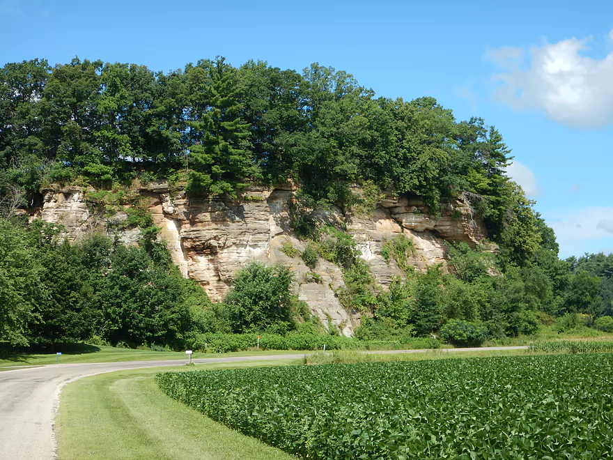
Scenic drive to Dutch Hollow
Scenic parking by put-in
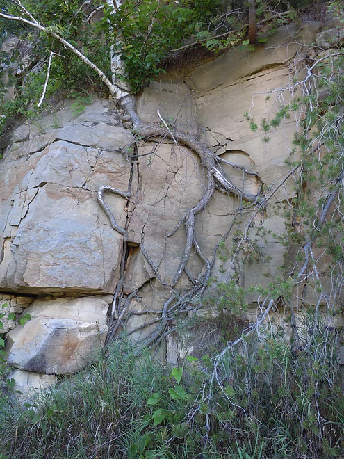
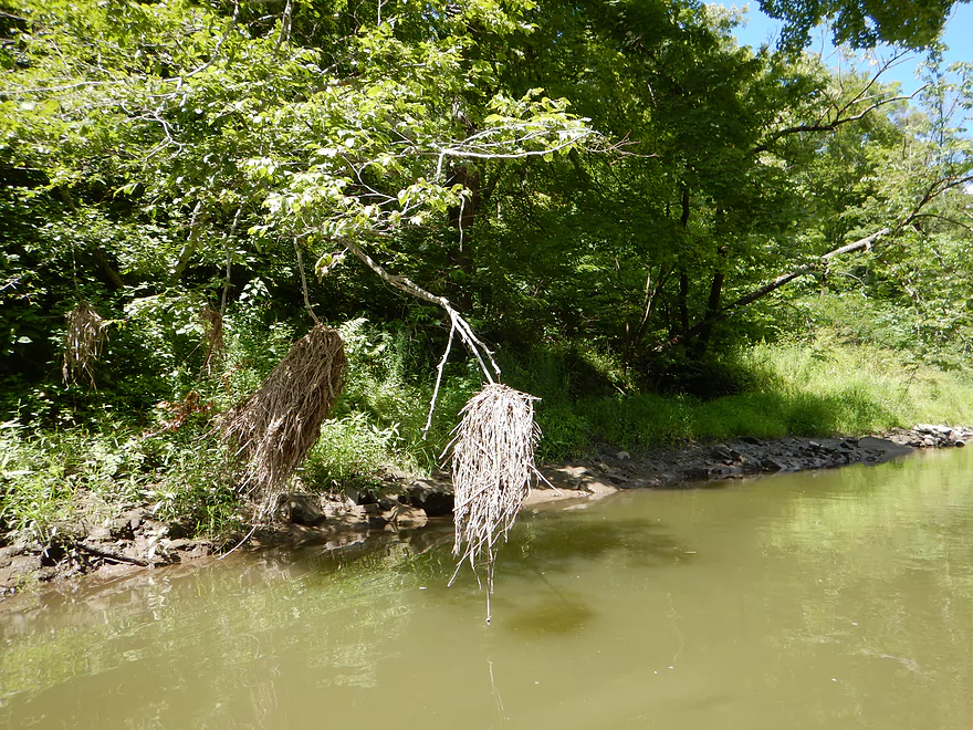
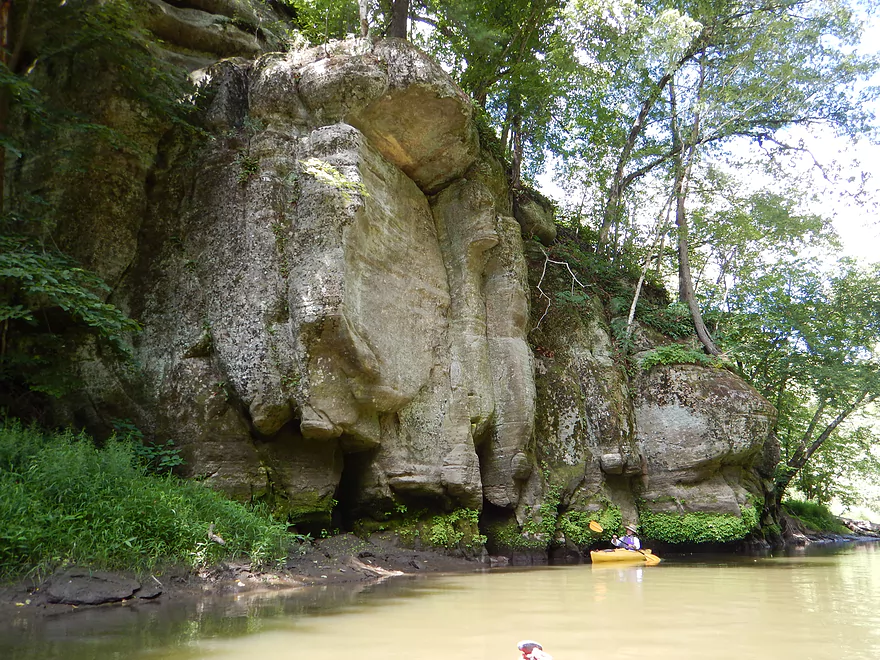
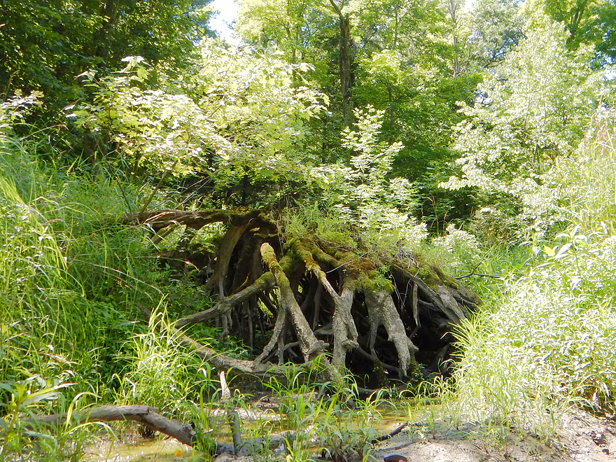
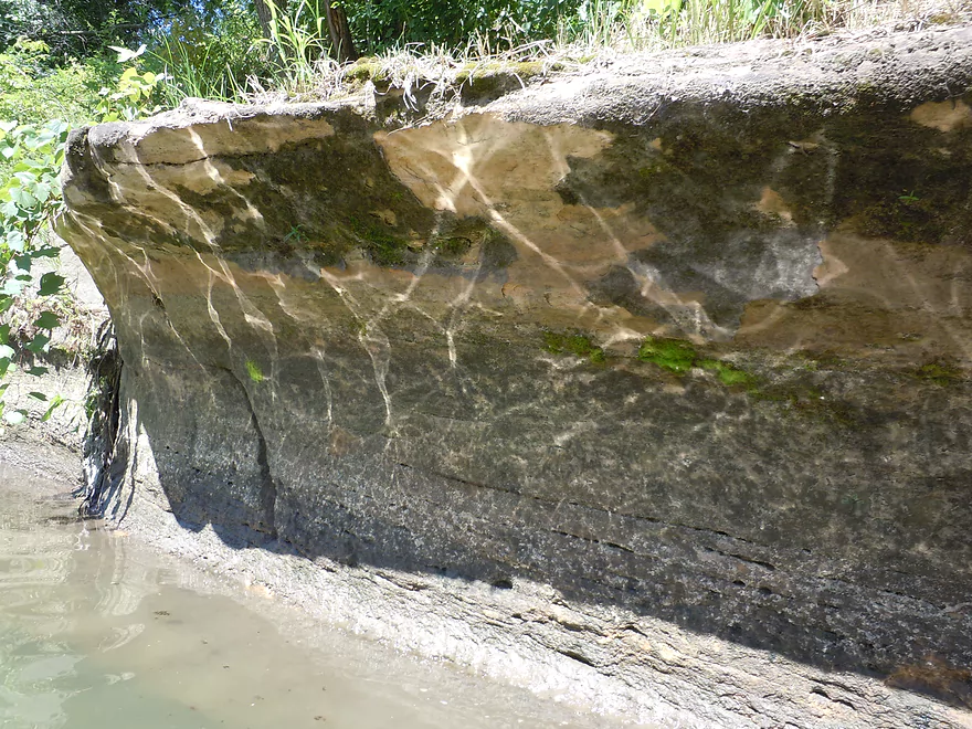
Roots doing a number on the rock face
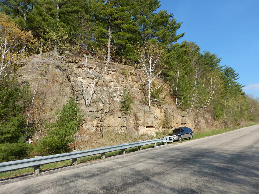
Scenic bike shuttle option next door
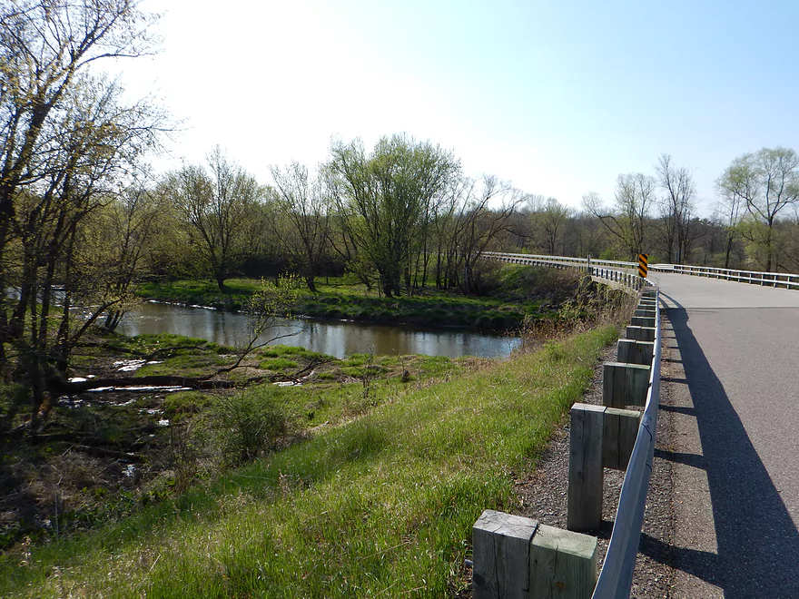
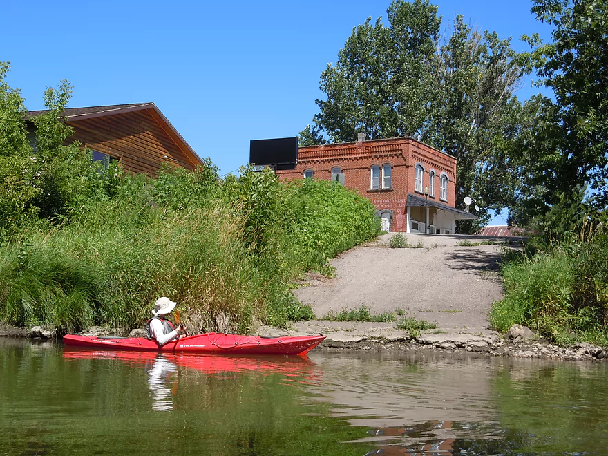
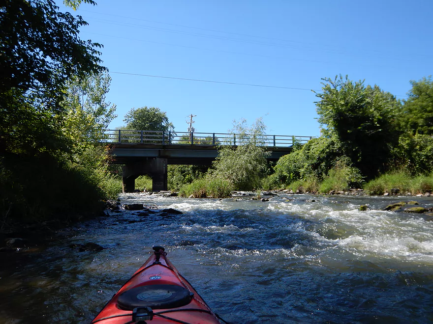
Not so scenic put-in
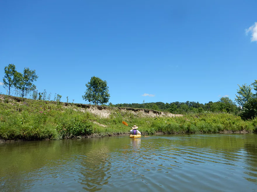
Best access is below the bridge but is muddy
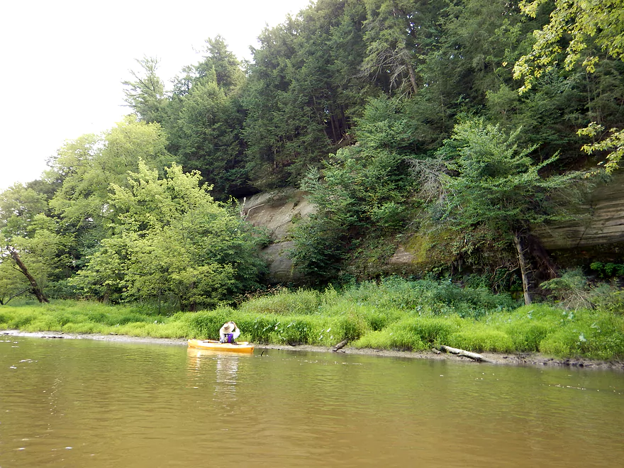
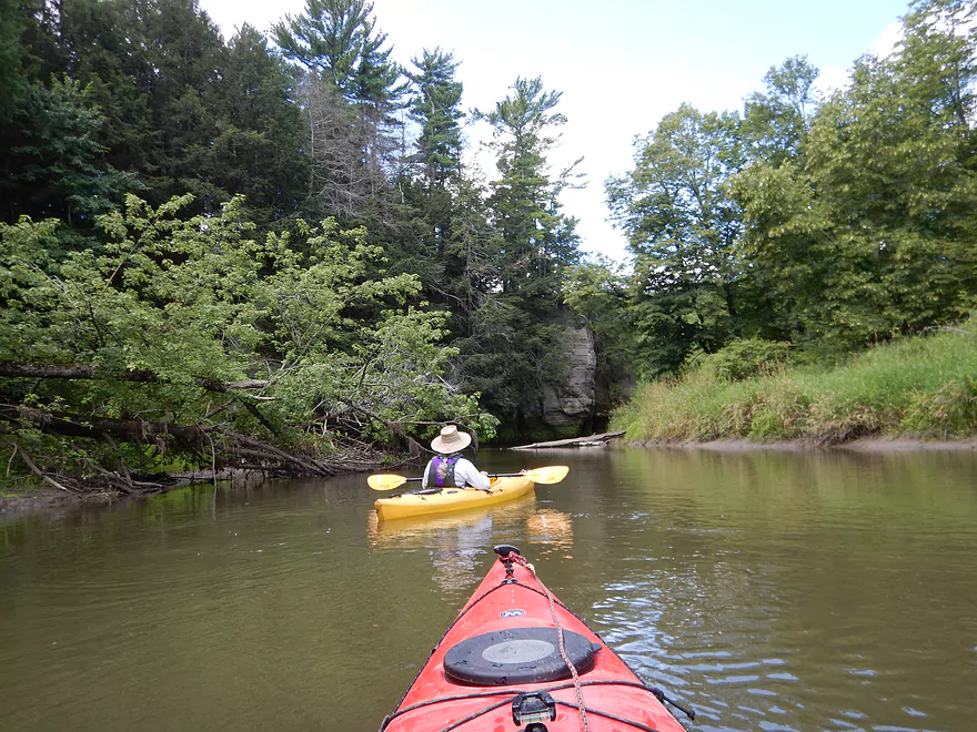
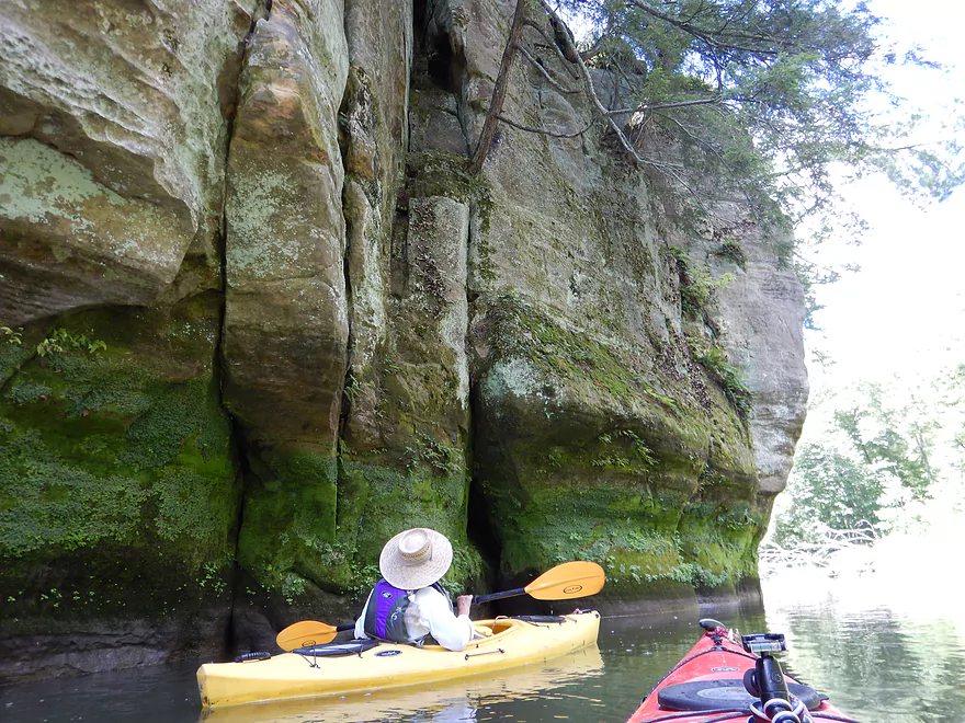
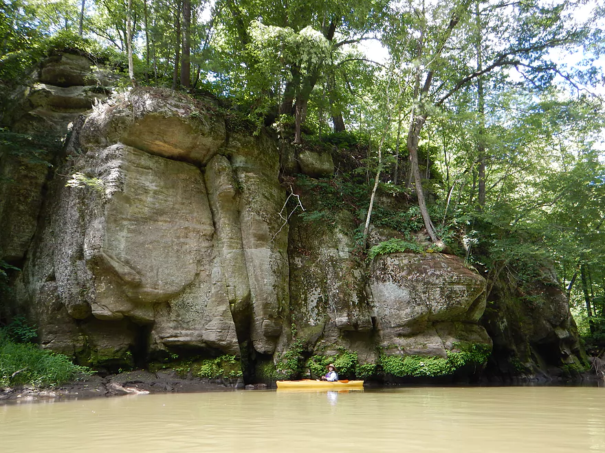
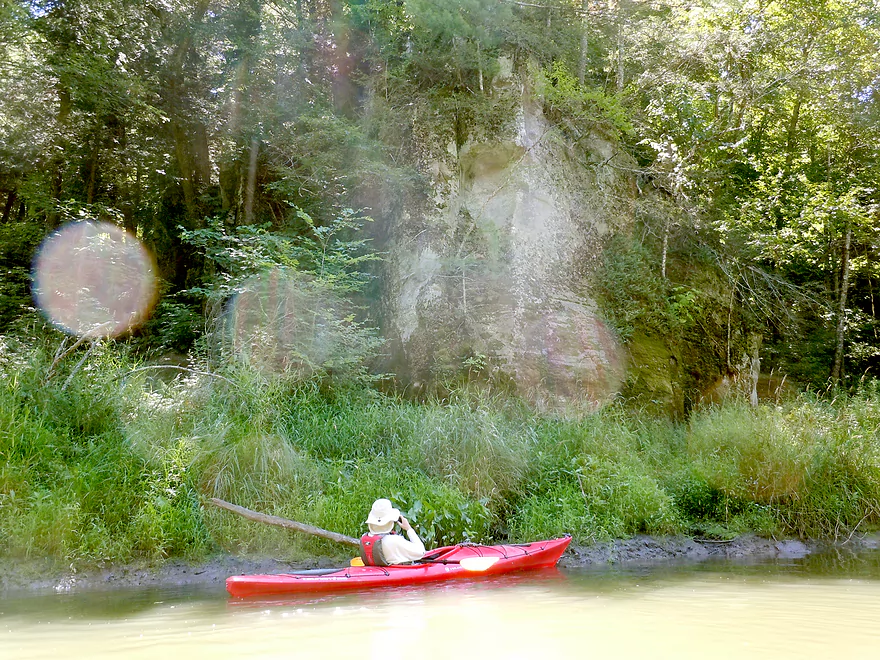
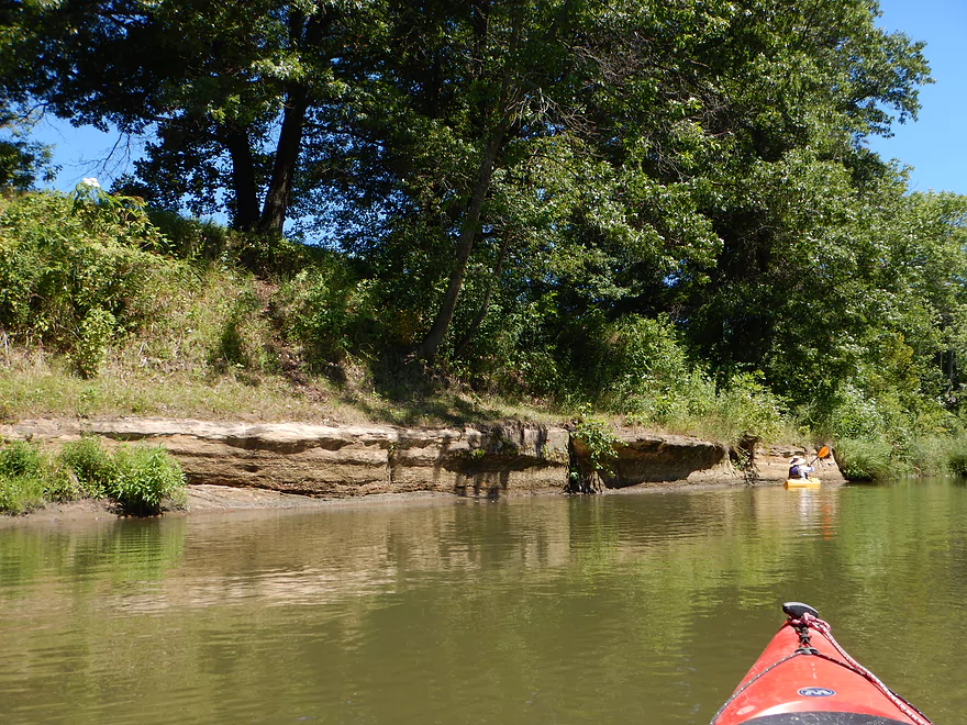
Towering rock bluff next to landing
Worth paddling up the local stream a bit to explore
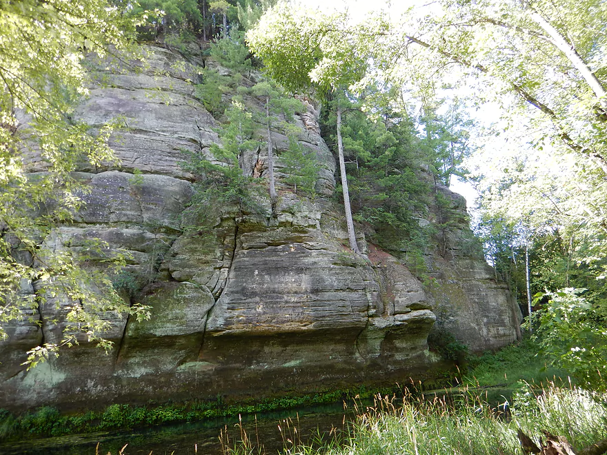
Cool how the trees are growing on the ledges like birthday candles on a cake
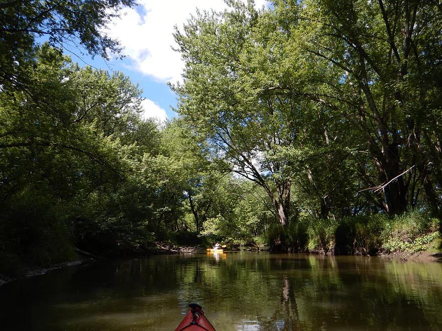
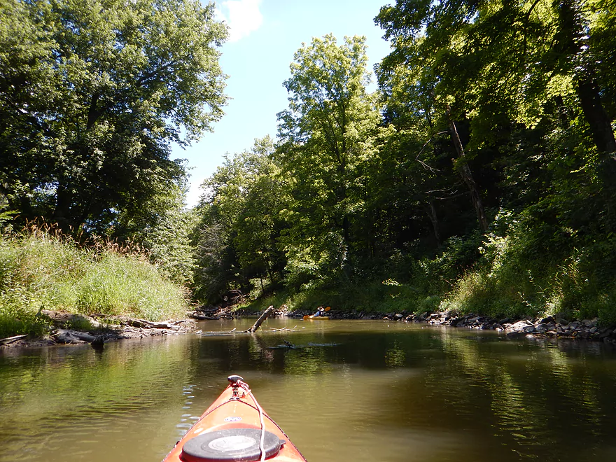
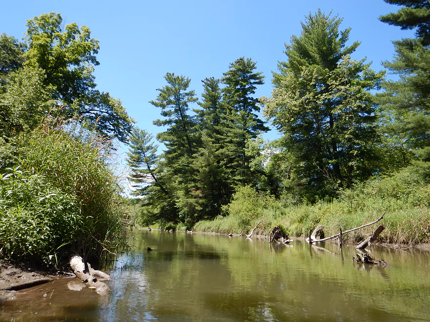
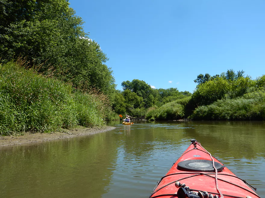
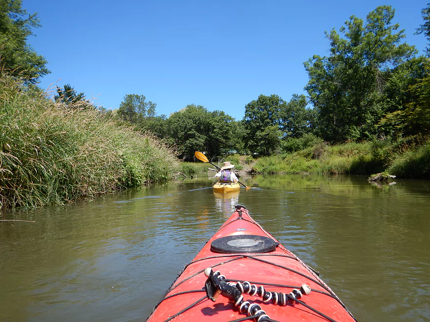
Where the creek empties into the Baraboo River
There is a jam near the put-in but is easy to go over
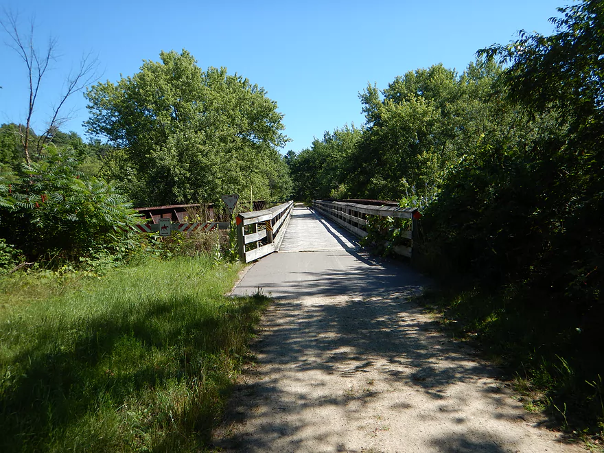
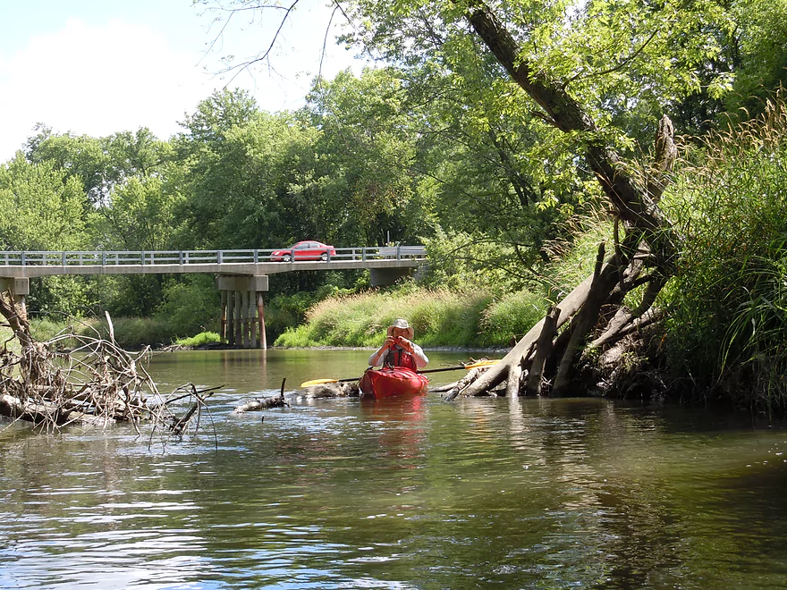
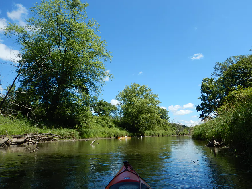
The Old 400 Bike Trail
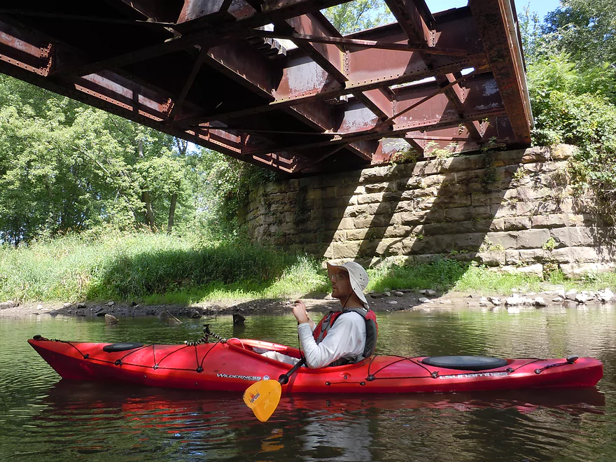
You could hear the bicyclists rumble overhead
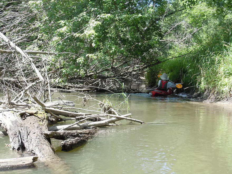
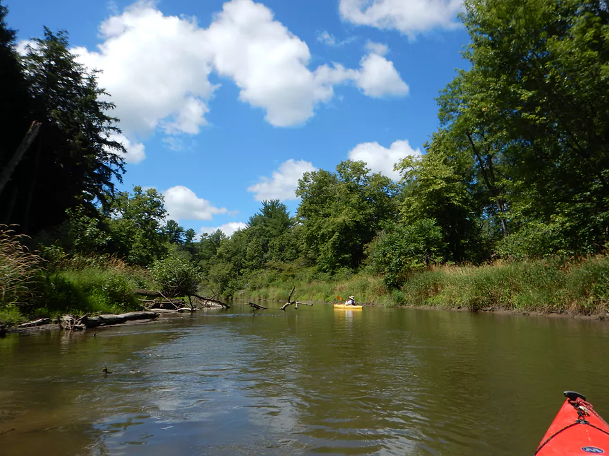
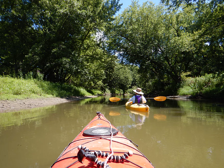
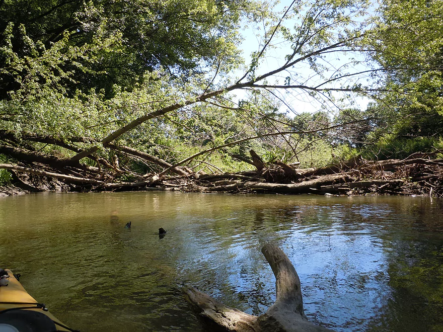
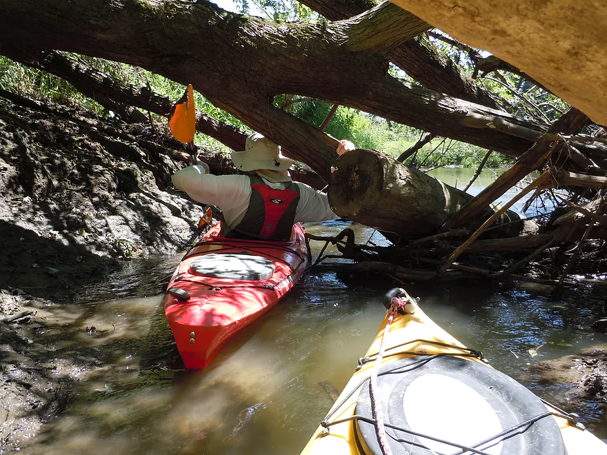
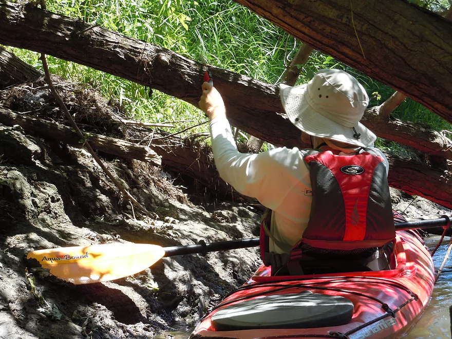
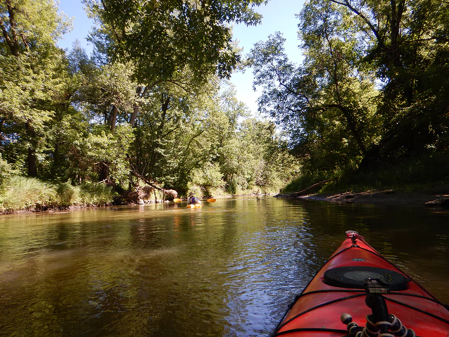
Some log dodging to start the trip
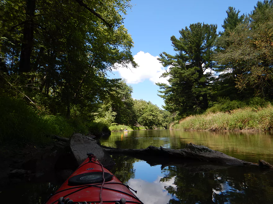
But always a way through
But not always obvous
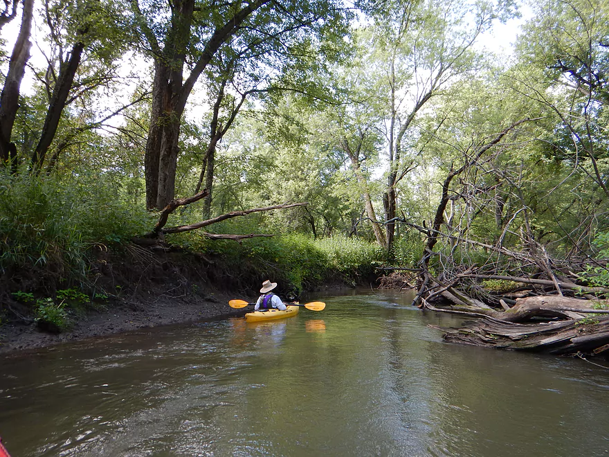
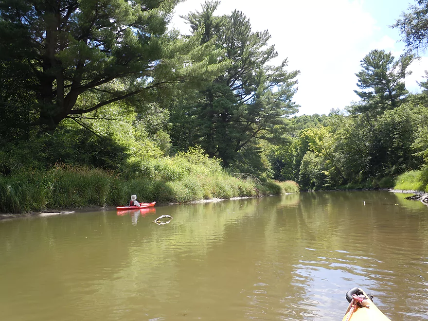
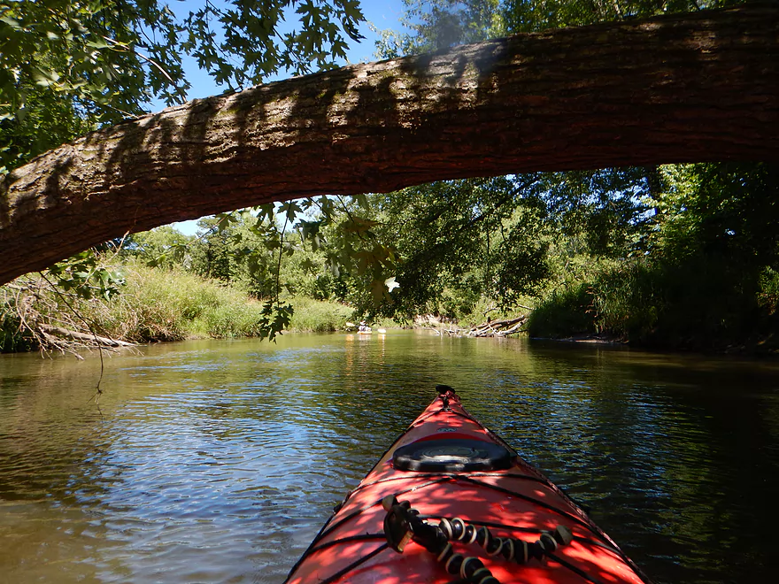
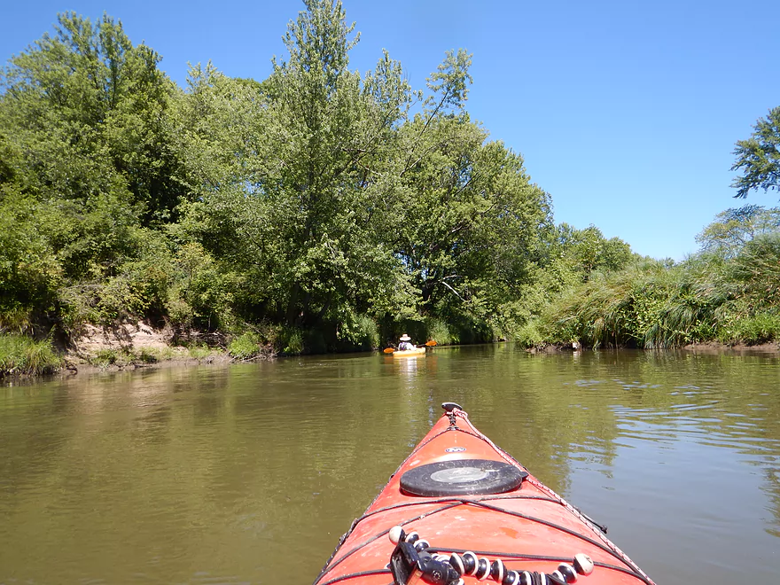
Otherwise, a nice wooded section
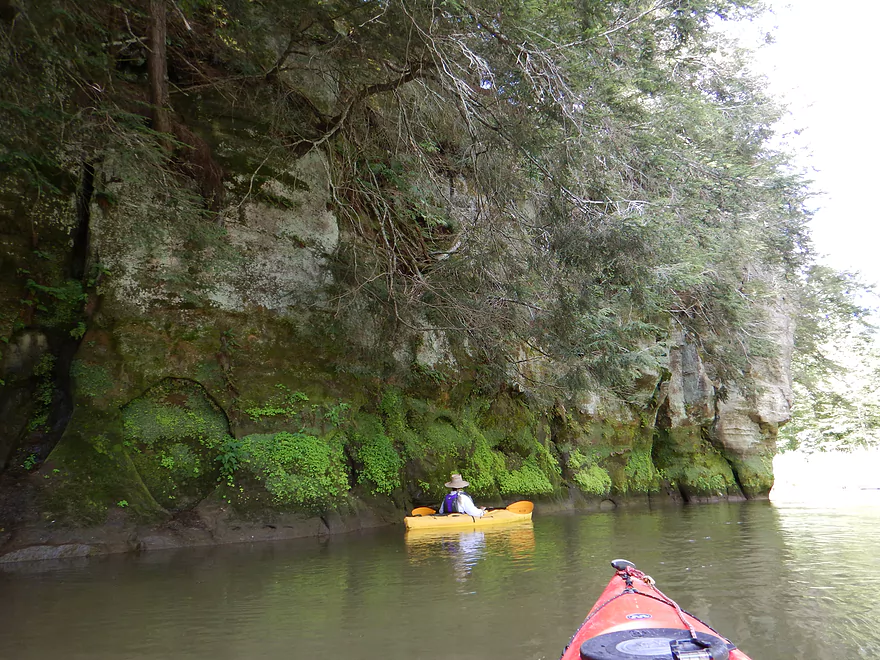
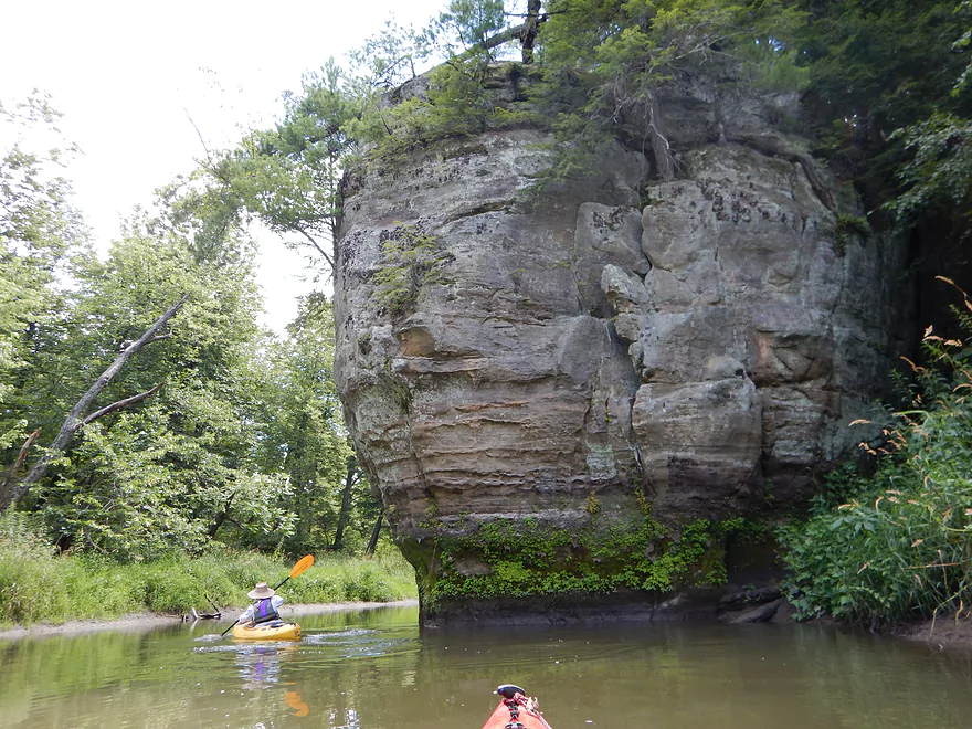
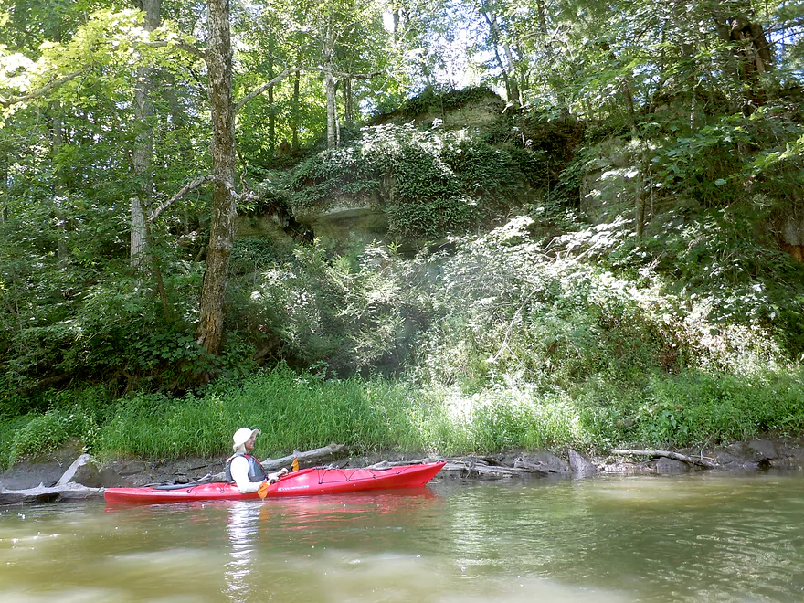
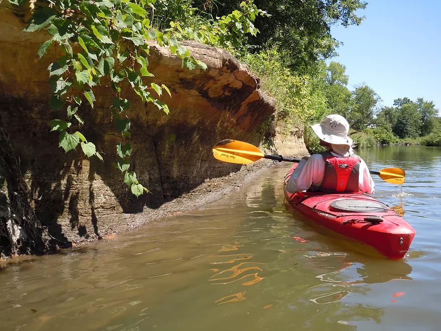
Rock outcrop #2…a long, slanted face of sandstone
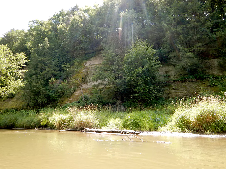
Tough to convey its width
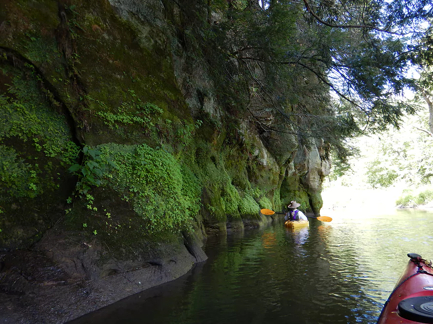
Coming up on rock outcrop #3
Cool arrowhead imprint (on left)
Paddling under hanging hemlocks
Deja Kickapoo
It just keeps going around the corner
Going back for more pictures
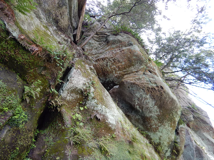
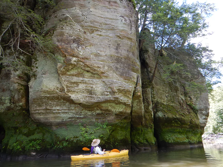
Looking up (interesting rock dimples)
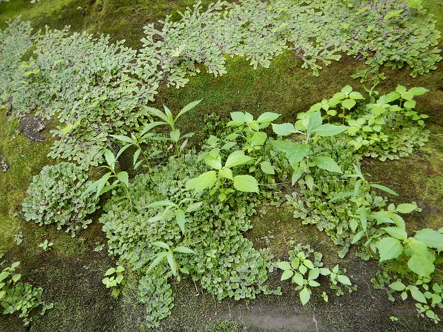
Liverworts spreading like a bacterial growth
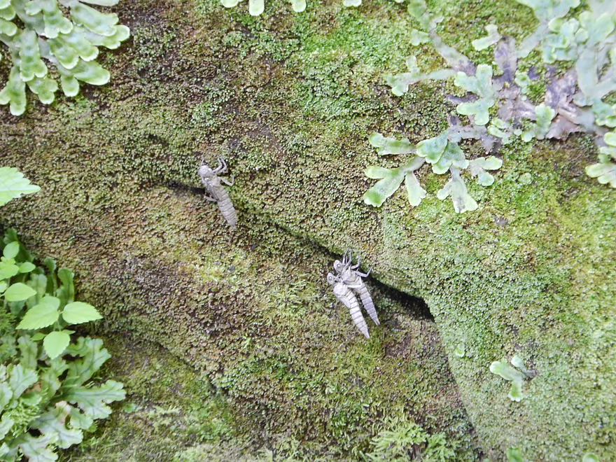
A dragonfly emerged on top of another
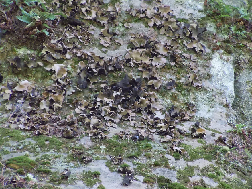
Rock lichens (look like burnt potato chips)
High water mark
Rock outcrop #4
Second best rock bluff on the trip
Entering pine country
Rock outcrop #5
Not sure if the riprap here is natural or man-made
Arrowhead (the non-rock variety)
Rock outcrop #6
A side stream running under an old tree stump
White pines on the Baraboo
River starts to open up and we say goodbye to the pines
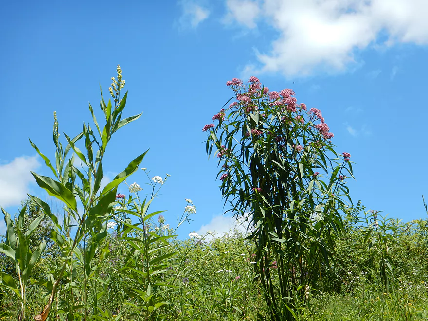
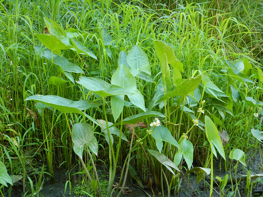
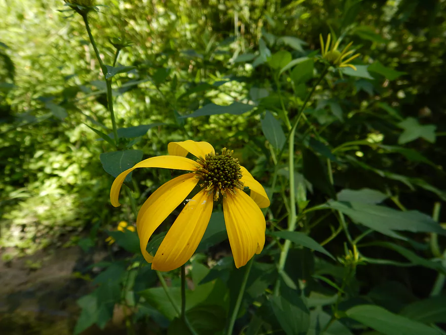
Riverside wildflowers
Unfortunately, some hoofed animals have direct access to the water
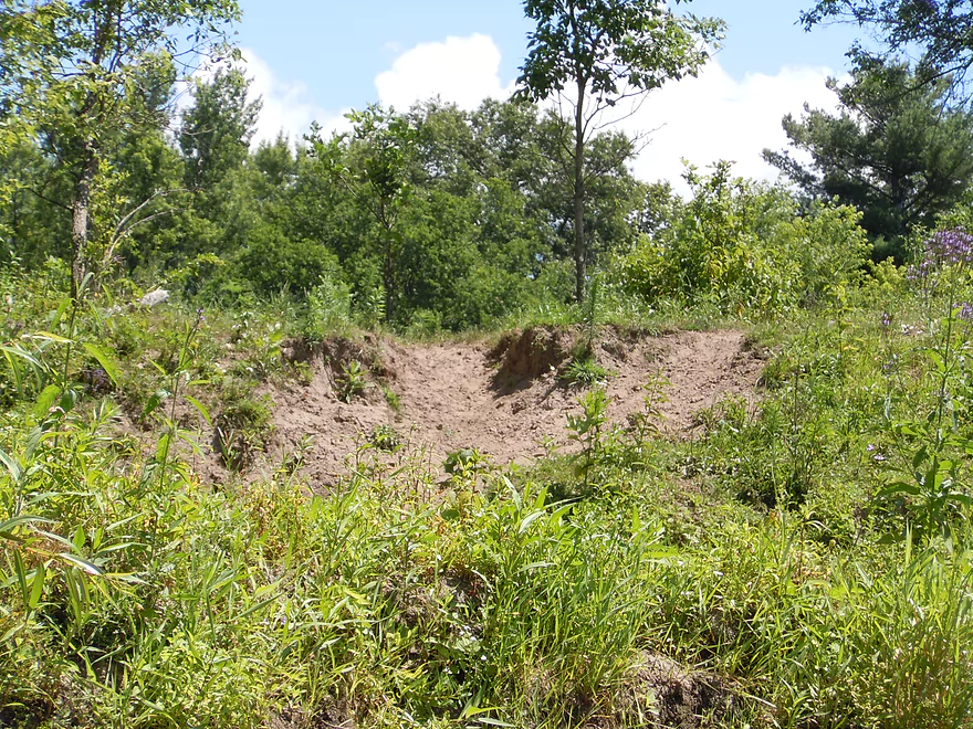
Open dirt banks with disturbed soil species reminded me of the Platte
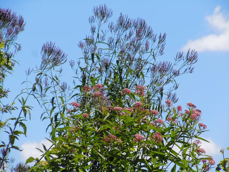
Layers of vervain and joe-pye weed
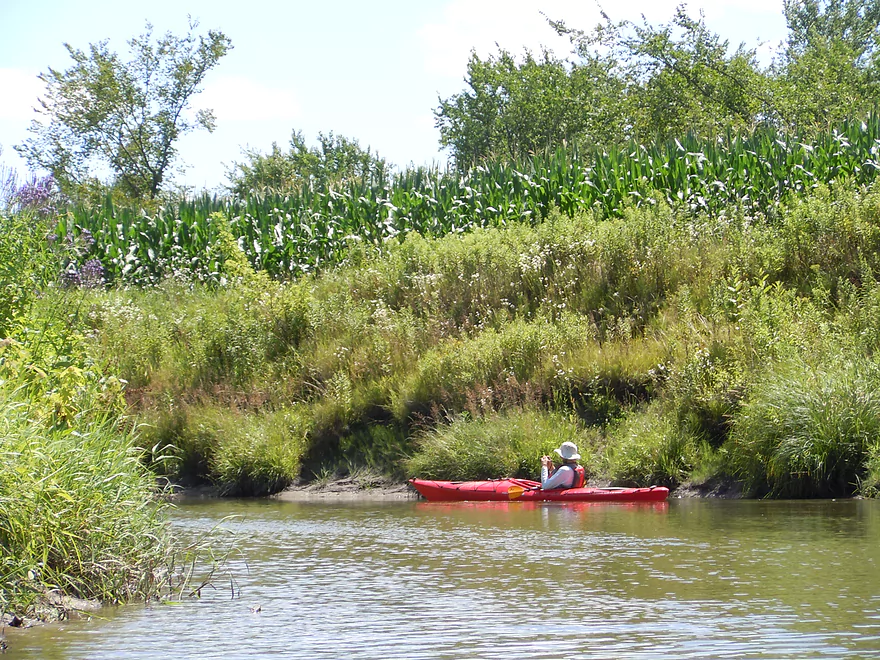
Entering corn country
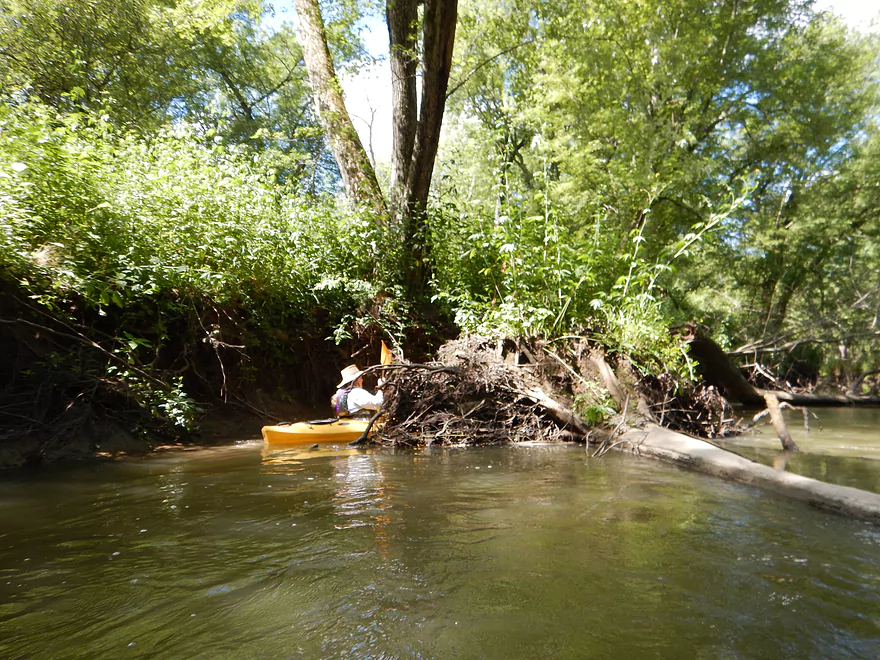
Looks intimidating but easy to get through
Picture shows how bad of a problem erosion has been with the Baraboo River
Back in the woods
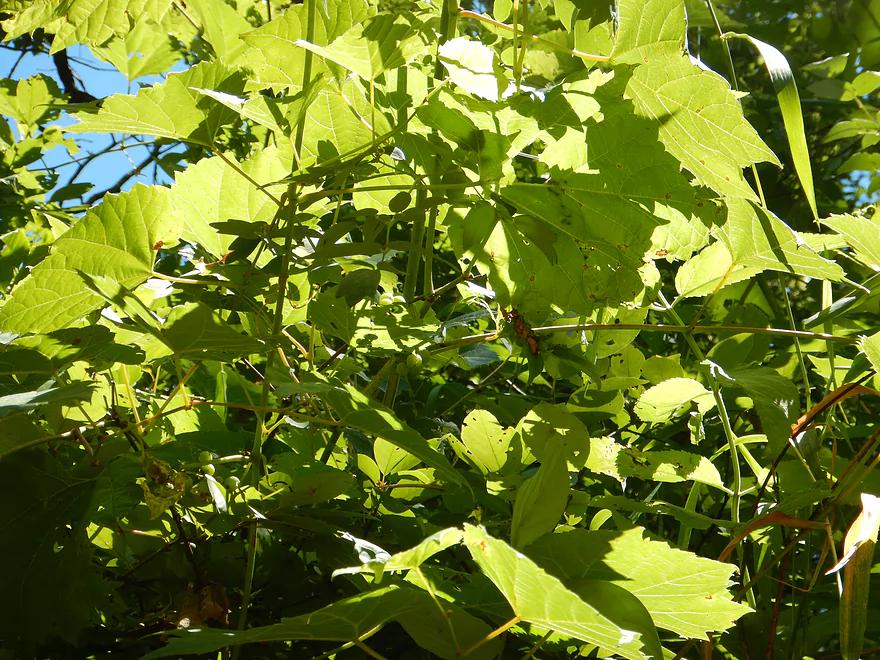
Wild grapes
Hungry beavers that need to be trained to remove log jams
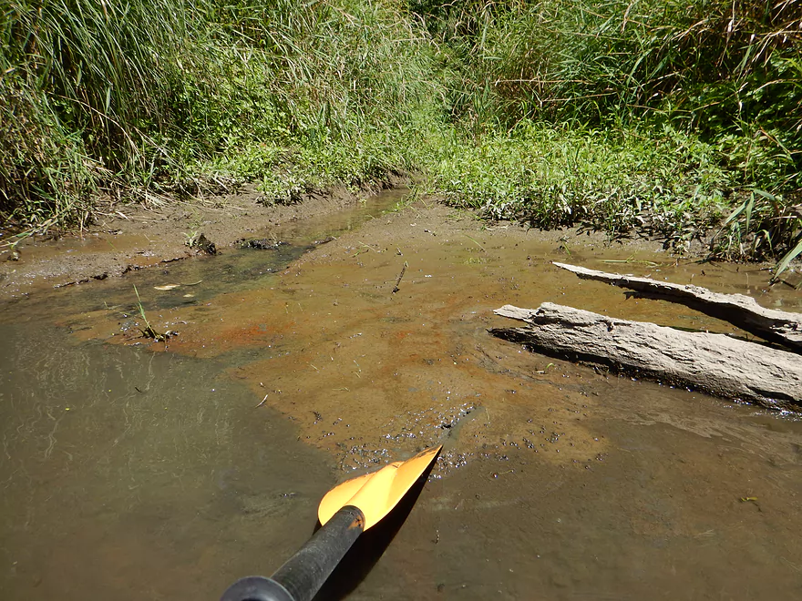
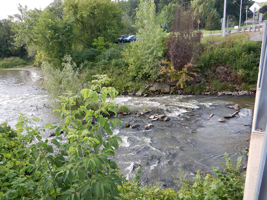
Hemlock Slough emptying into the Baraboo River, but mud deters further exploring
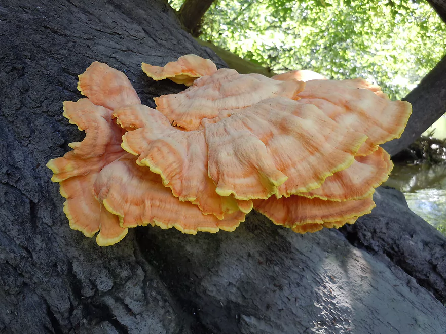
Sulfur Shelf Fungus or Chicken of the Woods
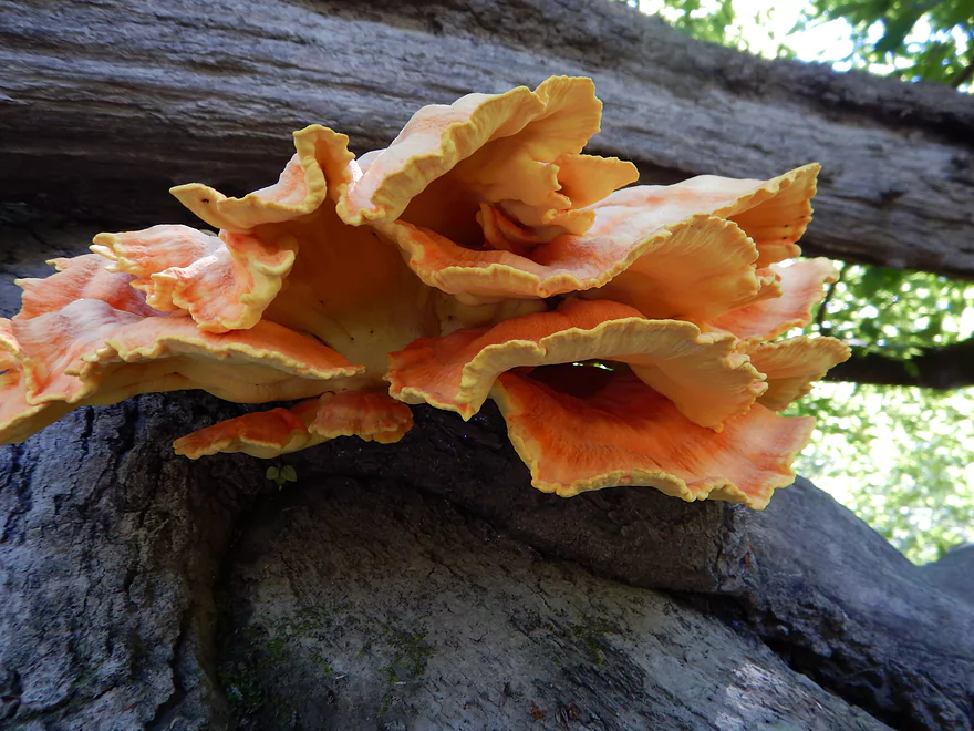
Looks like it belongs in your local coral reef
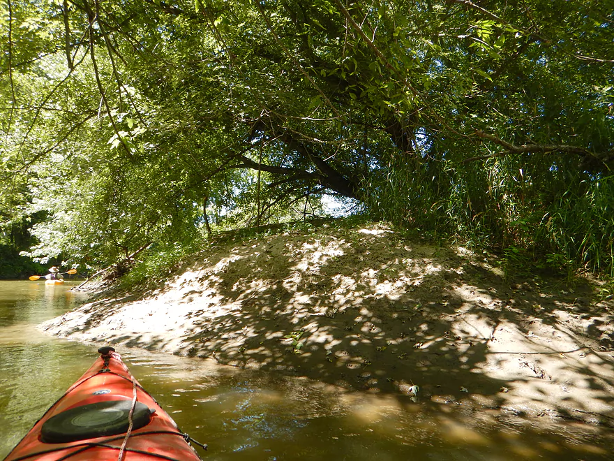
A sandbar on top of a dirtbar!?
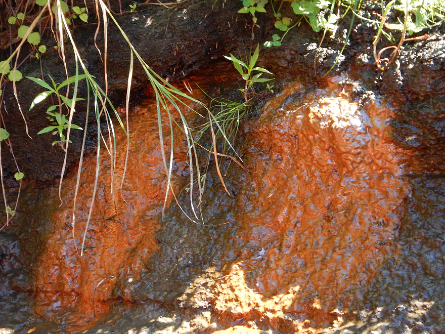
Strange seep perhaps from a chemical or bacterial growth
Only major log jam on the trip
Cutleaf Coneflower (always underexpose and use macro mode for flowers!)
Getting hairy trying to fit through
So time for a haircut
Rock outcrop #7
Cool water reflections
Interesting how the water has undercut the sandstone
You could take out early at the La Valle boat launch
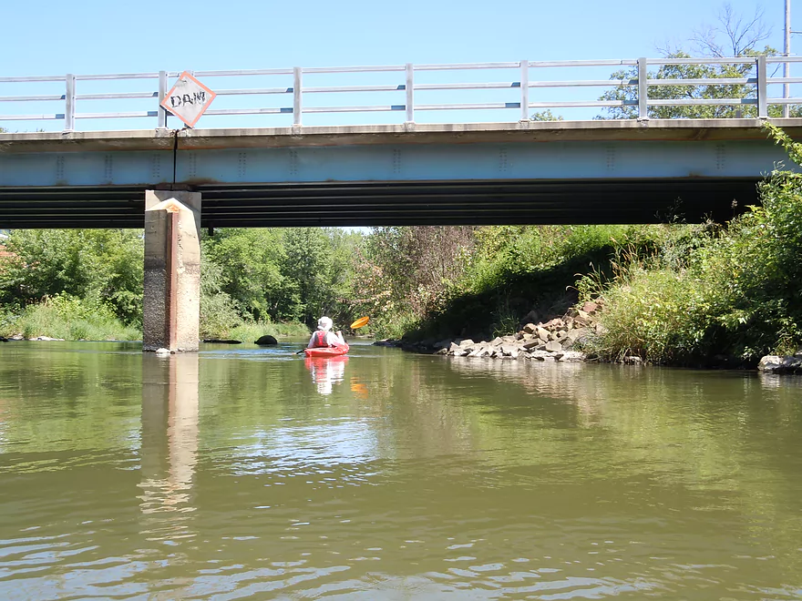
The dam was removed in 2001…but not the sign.
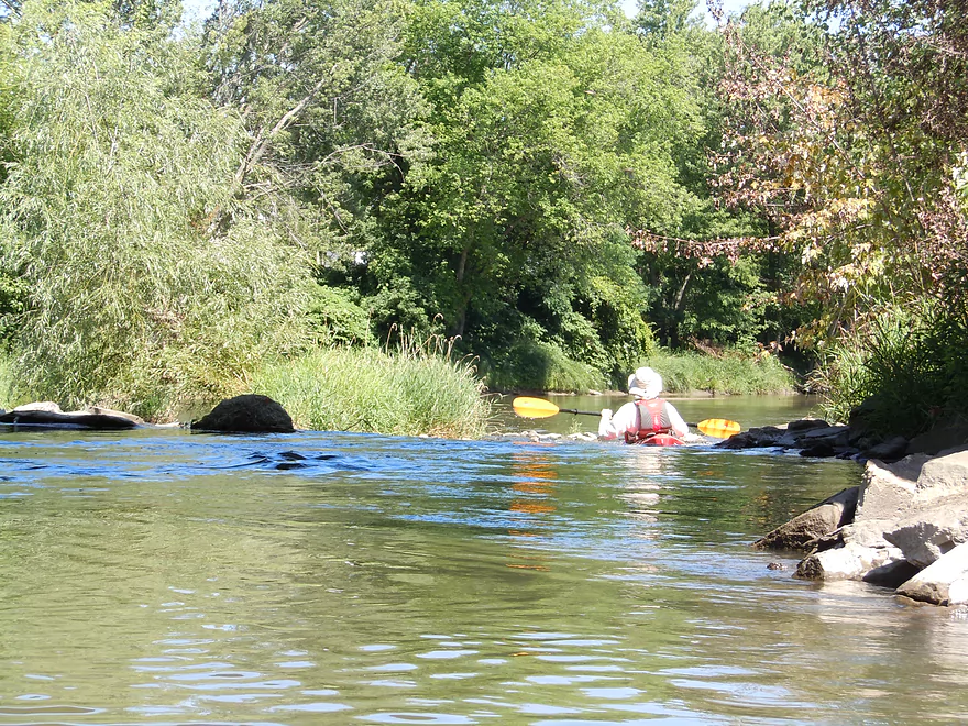
Stay right and avoid the rocks
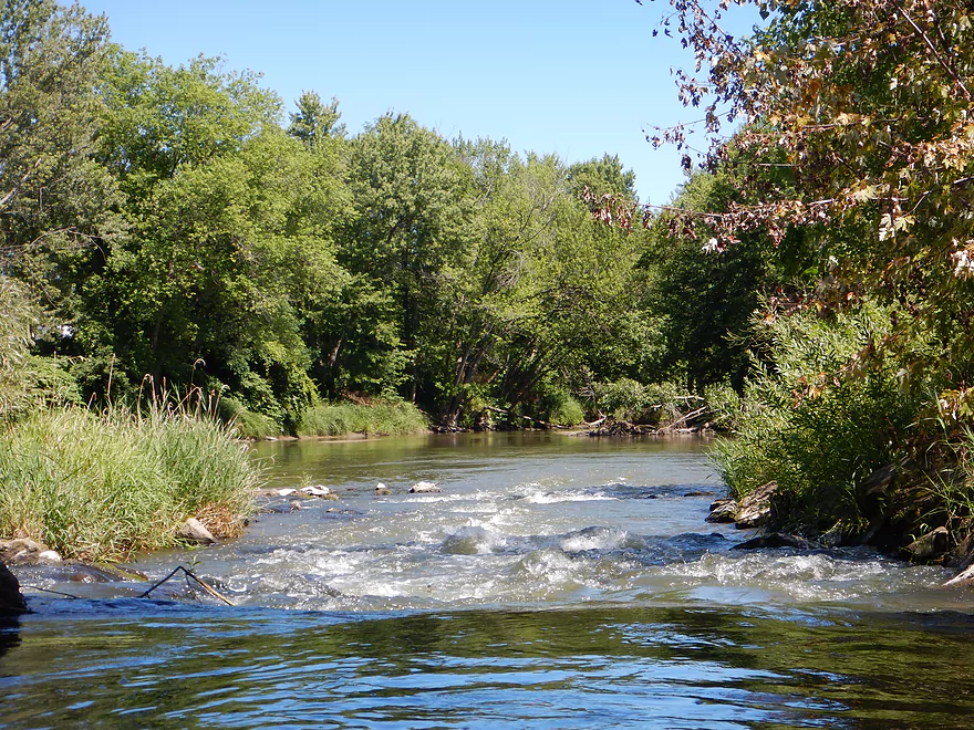
Class 2 rapids are all that remain
Quite fun!
Because it was shallow enough I could walk up and rerun it
Side view of rapids (north end is too rocky to run)
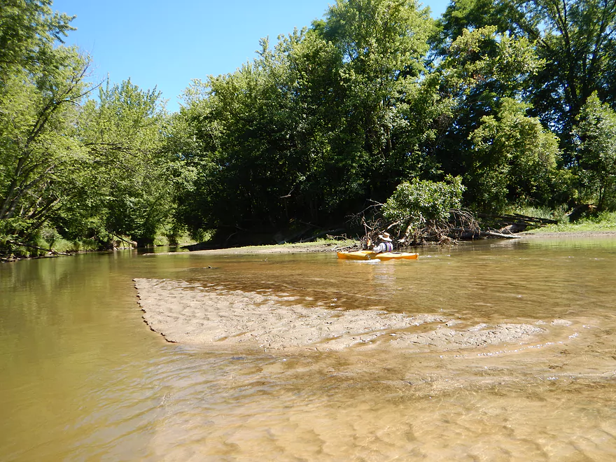
A rare non-muddy clear spot on the Baraboo
Take-out is just after the rapids (river right)
Try to stay out of the mud though
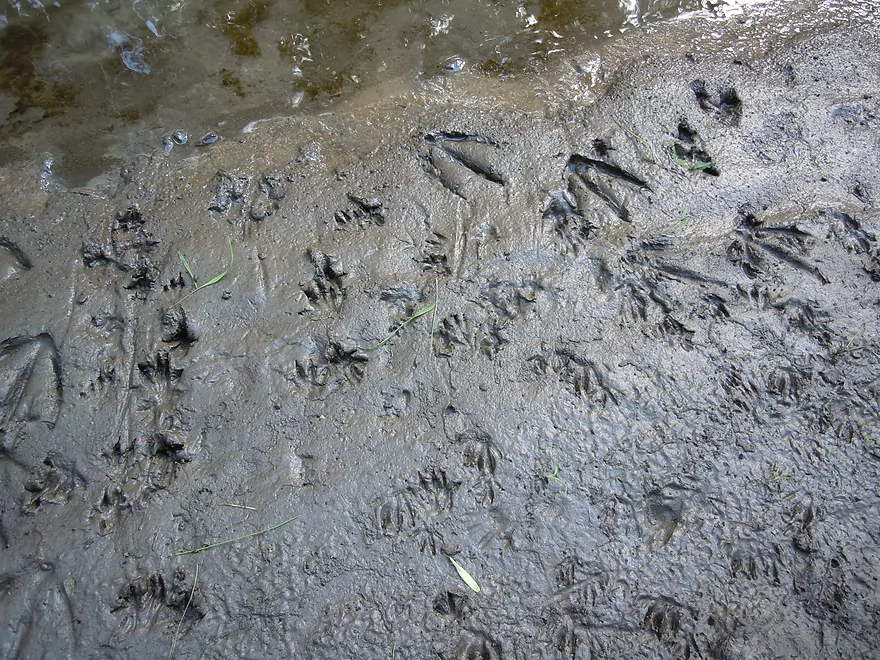
Local wildlife doesn’t mind the mud though…
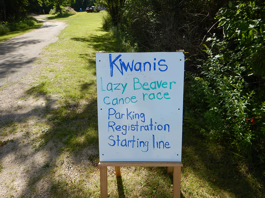
Took out where the Lazy Beaver Race started
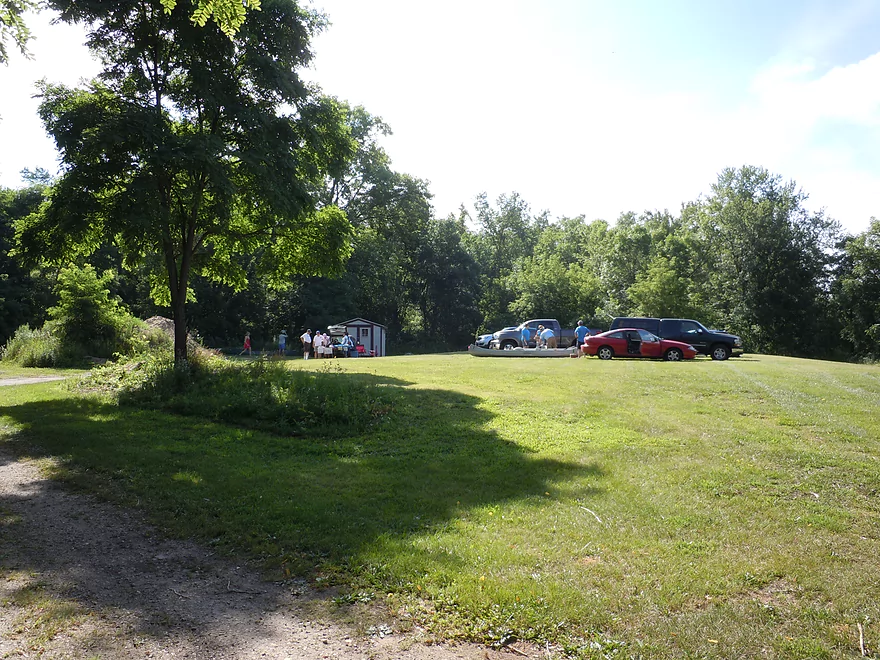
Very good parking at the take-out
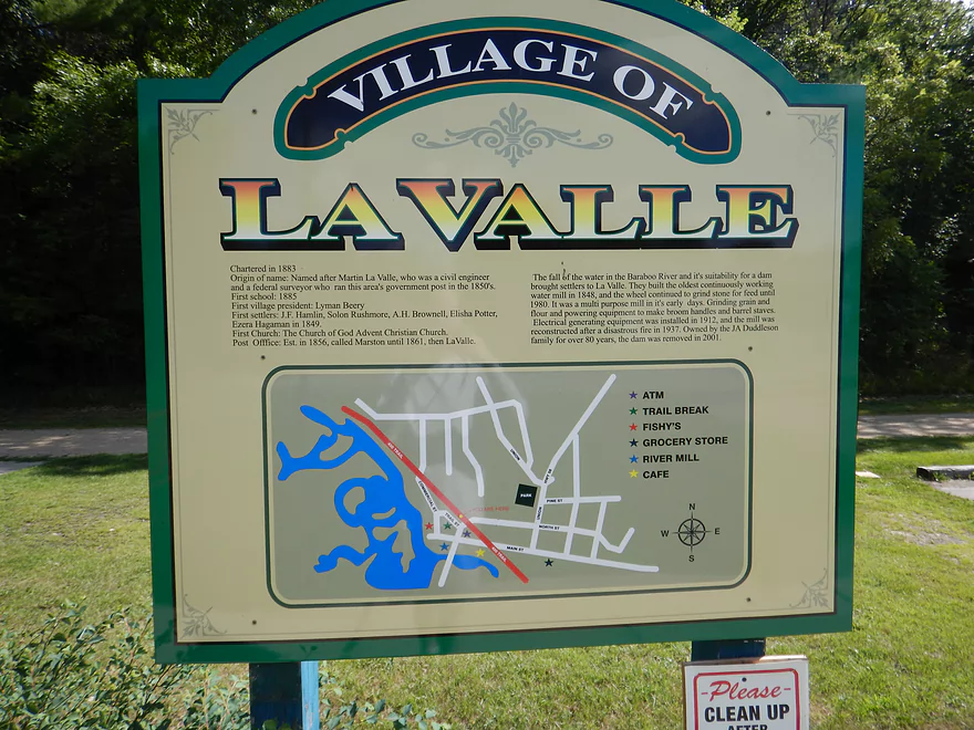
Welcome to La Valle
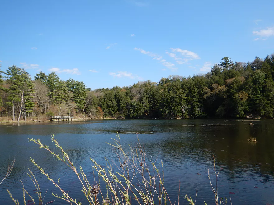
You might consider checking out Hemlock Slough County Park after the trip
Baraboo River – Dutch Hollow

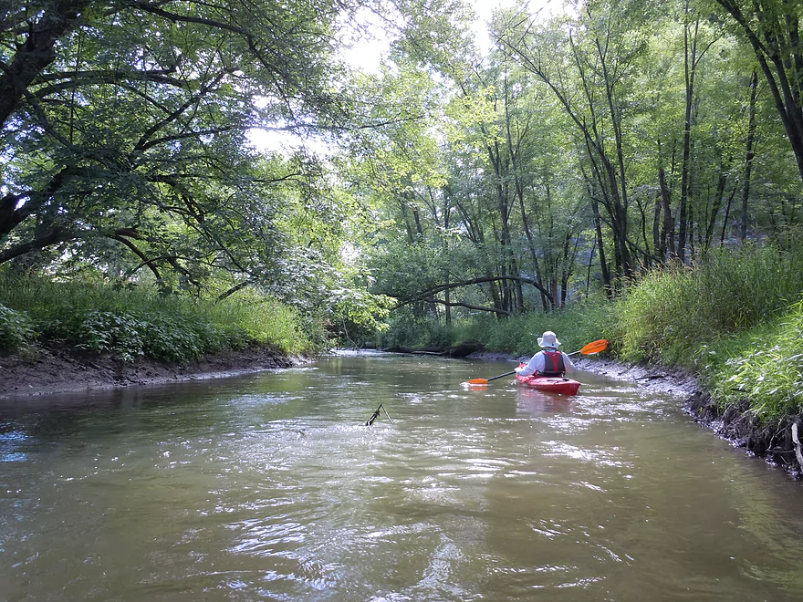
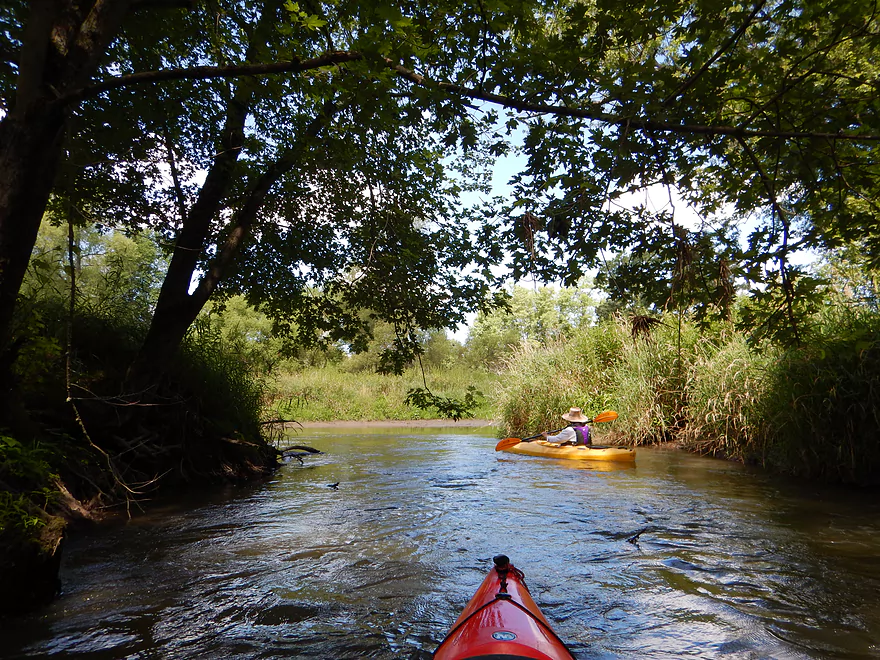
The first half mile is very wooded with a lot of trees down in the water. Again, these are mostly negotiable (if you have a smaller boat). This is a good thing, as the banks were quite muddy and portaging would not have been fun. The current has some zip to it at times, but is mostly pretty tame (relatively speaking).
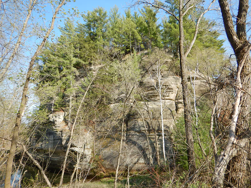
The main reason you want to do this trip is for the 7 scenic rock outcrops (3 of which are super). The best will be maybe a half mile into the trip and will really remind paddlers of the Kickapoo River (which I assume you’ve all done because it is so cool). The only frustrating thing was trying to photograph them (hint…use your flash, use exposure compensation and never shoot into the sun to avoid overpowering shadows). Some of the rock outcrops were hidden by leaves, so waiting until October to run this might be a fun idea.
About halfway into the trip, the river banks really open up and you’ll see evidence of grazing and corn planted VERY close to the river (I could see a plow, tractor or cow falling in). This was unfortunate, but the river still stayed nice, with attractive wildflowers and unique tall dried mud banks. The water quality was always turbid, but this is typical for the Baraboo. It would be great to see an effort to reduce run-off and erosion in the Baraboo watershed.
Maybe three-fourths into the trip you’ll paddle along the Old 400 Trail embankment separating the Baraboo River from Hemlock Slough. I had hoped to paddle up and into the slough (a small lake with fantastic hemlocks) in order to take pictures of the rock outcroppings on the southeast shore, but the only outlet was too small and muddy for access. Hemlock Slough is a county park with a boat landing, so you can still check it out by car after the trip.
Again, when you arrive at La Valle you can take out prior to or after the rapids. I suggest the latter, as, while they are class 2, it is plenty safe as long as you scout them ahead of time and avoid the rocks. Also avoid the left channel, which is too shallow to run. At these low water depths, you’re ok even if you tip over (for reference, I waded upstream over the rapids to rerun them). This spot actually marks where the old mill dam used to be, but even before the dam there was always apparently a rapids here.
The take-out will be on your right shortly after the Hwy 58 rapids. Minus the mud, this was a good access area that coincidentally had a lot of paddlers using it. It turns out I did my trip on the same day the local Lazy Beaver Race was held…which goes from La Valle to Reedsburg. I thought it was amusing that the race was intentionally launched downstream of the rapids instead of upstream (granted, the rapids might be more difficult for canoers).
In summary, a 4-star trip because of the fantastic rock outcrops, lack of portages, nice woods, fun final rapids and in general a pleasant, peaceful float. Note, this is a short paddle, and if you like longer trips I recommend taking out at Lake Redstone instead of La Valle which would double the trip length (to maybe 8 miles total). I review this next Baraboo section here.
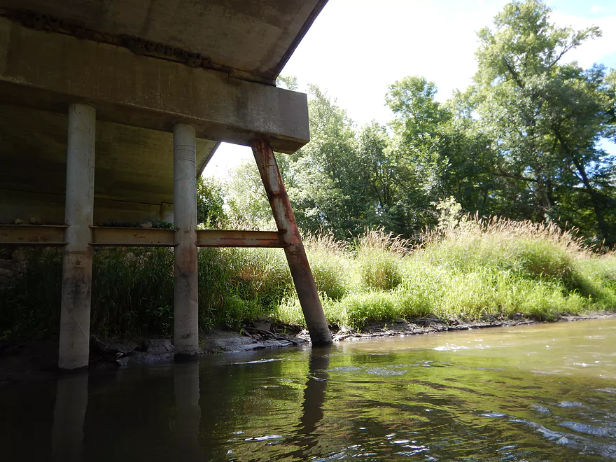
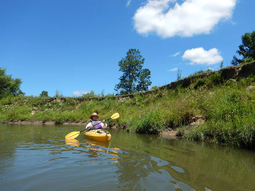
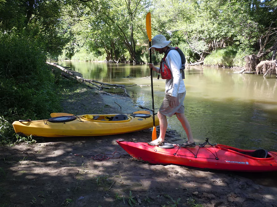
The Dutch Hollow Road bridge is a doable but not ideal launch. You will have to park east/upstream of the bridge (by the scenic rock face), and drag your boat across the road and down the bank (downstream side) which has thick grass and mud at the bottom. Directly under the bridge is best for getting into the water.
There is a superior option for launching in the nearby creek (just upstream of the bridge), but this is probably private. Would be great to see the local government try to buy the land (or at least an easement) here to develop a public launch.
You can either take out upstream of the rapids in La Valle or downstream. The upstream option has a good boat launch off of W. Main Street, with great parking a block to the north and restrooms (intended for bikers on the 400 State Trail, but open to the public).
But really, you should run the rapids and if you do there is a great (but hidey) second landing just downstream of the rapids on the south shore off North River Road. There is a grassy parking area tucked back here with a mowed trail leading to a muddy but otherwise good landing.
The local 400 State Bike Trail is a great shuttle option that is flat, only 1.7 miles and scenic, going through Hemlock Slough, past pine-topped bluffs and over the Baraboo River.
There is a livery in nearby Wonewoc called Beyond Boundaries which might service this route (608-464-7433). I believe they are setting up an expansion in Reedsburg which would be cool if true.
There is a section of class 2 rapids at the end of the trip (more on this later).
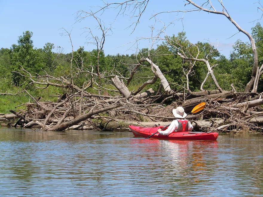
There are numerous down trees you’ll have to dodge, but there is always a way through. The worst jam is maybe a mile prior to the take-out. Paddle blogger Timothy Bauer cut an escape route through this earlier this year, which I’ve enlarged somewhat, but larger boats may still have to portage and it would be great to see somebody properly clear this out (marked on map).
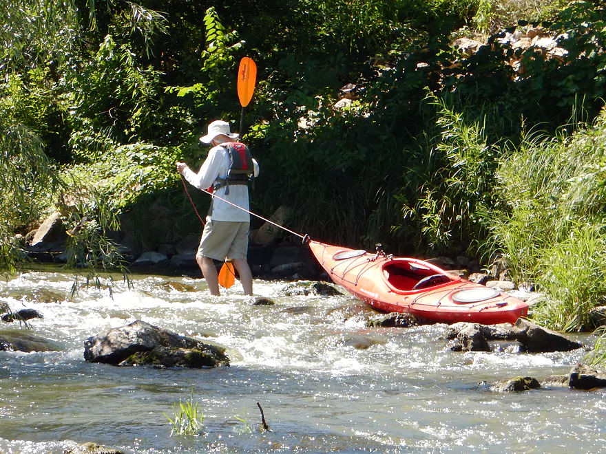
This was paddled at 250 CFS which is considered below average, but honestly, this is when you want to paddle the Boo, as it becomes quite obnoxious (and dangerous) to paddle during high water because of the down trees. The Baraboo spikes quickly after a rain and can get as high as 2000 CFS. My suggestion is to wait until it drops to at most 300 (maybe 400) CFS before running it. Even at 250 CFS, the river was actually relatively deep and I doubt it ever gets too shallow to run.
Nothing too out of the ordinary: several deer, dragonflies (with one exuvia emerging on top of another), clams, what I thought was a swimming otter (there were mud runs leading from the banks to the water), an immature bald eagle, an owl, two water snakes, wood ducks and evidence of beavers.
Lots of silver maple in the woods, but there were also some white pine and hemlock, which were a nice change of pace for a river this far south.
For a fascinating history of the Baraboo River from Glacial Lake Wisconsin to the recent dam removals, I high recommend reading the Baraboo Restoration Story.
Detailed Overview
- Nutmeg Road to Hwy PP: 6.2 miles. Flows by the historic Elroy-Sparta Trail and is mostly open, but there are a few logjams. This is a narrow small stretch that will need very high water to be runnable. There are scenic outcrops on this stretch….maybe 3.
- Hwy PP to 2nd Main Street: 1.6 miles. Maybe 3 logjams.
- 2nd Main Street to Franklin Street: 0.9 miles. Maybe 1-2 logjams. Trip starts at a scenic covered bridge and on Class 1 rapids.
- Franklin Street to Hwy 82(South of Lincoln Street): 0.5 miles. A good stretch that is mostly open and has maybe one outcrop.
- Hwy 82(South of Lincoln Street) to Schultz Park: 0.6 miles. Maybe 2 logjams.
- Schultz Park to Hwy 82(South of Snyder Road): 4.0 miles.
- Schultz Park to Hwy 82(North of Lumsden Road): 0.6 miles. One outcrop, one logjam portage and a few tight fits.
- Hwy 82(North of Lumsden Road) to Hwy 82(South of Snyder Road): 3.4 miles. Three outcrops, three significant logjams and several tight fits. A section with good potential but needs cleanup work.
- Hwy 82(South of Snyder Road) to Hwy W: 1.9 miles. Maybe 2-3 jams…think this is doable though.
- Hwy W to Hwy 82/Union Center: 1.3 miles. Good prospect by the golf course with maybe 2 outcrops. Maybe 1-2 logjams.
- Hwy 82 to Hwy FF Landing/Wonewoc: 7.1 miles. A great section with one of the largest rock outcrops on the river.
- Hwy FF Landing to Wayside Park: 2.9 miles. There used to be a lot of logjams here. I think it might be doable…maybe 2-3 major portages.
- Wayside Park to Kalepp Road: 4.5 miles. An uninteresting part of the river with weedy, muddy banks. But…there are three fantastic sandstone outcrops.
- Kalepp Road to N. Dutch Hollow Road: 5.3 miles. One logjam portage with several “hoppers” and “duckers”. There are some outcrops but most are recessed and away from the river. Mud and downed trees are a bit unsightly, otherwise a pleasant paddle.
- N. Dutch Hollow Road to La Valle: 3.8 miles. Second best section on the entire river with great rock outcrops.
- From La Valle to Lake Redstone: 3.6 miles. One of the more underrated sections of the Boo, which I really liked.
- Lake Redstone to Monument Park/Reedsburg: 9.0 miles. Supposedly kind of boring, but the logjams should be cleared out.
- Monument Park to South Park: 1.4 miles. Spanning the length of Reedsburg, this should be a nice section mostly free of jams.
- South Park to Golf Course Road: 4.7 miles. Maybe 4-5 logjams. Probably one too many. Should be 1-2 small sandstone outcrops. Golf Course Road might not be a good access.
- Golf Course Road to Hwy 136(by Beth Road): 3.6 miles. Maybe a few jams. Likely mostly floodplain paddling and probably uninteresting.
- Hwy 136(by Beth Road) to Hwy 136(by Ableman’s Gorge): 6.0 miles. Maybe some outcrops at the end, but mostly uninteresting paddling I suspect. Likely several serious logjams with difficult portages because of the high muddy banks.
- Hwy 136(by Ableman’s Gorge) to North Freedom Boat Launch: 8.2 miles.
- Hwy 136(by Ableman’s Gorge) to Rock Springs Boat Launch/Firemen’s Park: 1.3 miles. One of the most scenic parts of the entire Baraboo River. Highlights include a steep gorge, riverside boulders and scenic outcrops.
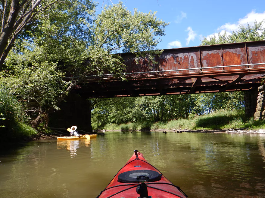
- Rock Springs Boat Launch to North Freedom Boat Launch: 7.1 miles. This is a nice paddle, but with some downed trees to dodge and one to portage. Highlights include historic railroad bridges, scenic outcrops, and seeing the railroad museum from the river.
- North Freedom Boat Launch to Giese Park: 7.4 miles.
- North Freedom Boat Launch to Kohlmeyer Road: 4.3 miles. Stretch starts nice as the river naturally curves and has many shade trees. There is a scenic long outcrop after Seeley Creek. River becomes boring after that except for a scenic railroad bridge and a few rocky banks. Kohlmeyer Road isn't a great bridge access.
- Kohlmeyer Road to Giese Park: 3.1 miles. Some longer and less interesting stretches. There is however a unique large volume artesian well, and a historic railroad tunnel you can wade under.
- Giese Park to Gander Outdoors: 2.9 miles. A pleasant but simple farm country paddle. Highlights include the Skillet Creek bridge, the towering Hwy 12 bridge, and a rock outcrop upstream of Hwy 12.
- Gander Outdoors to Glenville Landing: 4.9 miles. A fantastic stretch through the heart of Baraboo with many light rapids.
- Gander Outdoors to Haskins Park: 0.6 miles. A good stretch with some fantastic rapids upstream of Hwy 136.
- Haskins Park to Maxwell-Potter Conservancy: 3.3 miles. The best section on the entire river with many rapids.
- Maxwell-Potter Conservancy to Glenville Landing/Hwy 113: 1.1 miles. A pleasant stretch, but lacking in rapids.
- Glenville Landing to Luebke Landing: 5.1 miles. A pleasant trip, but a little boring at times. I would rate this as one of the more uninteresting sections of the Baraboo. On the plus side it had no logjams (as of 2023) and remains plenty navigable even during big droughts.
- Luebke Landing to Hwy 33: 3.5 miles. This might be one of the better legs on the Lower Baraboo.
- Hwy 33 to Wayside Park: 8.0 miles. A stretch I’m curious about.
- Wayside Park to Hwy U: 3.9 miles. Simple but pleasant short section flanked by busy interstates.
- From Hwy U to the mouth: 5.3 miles. The final leg running through floodplain forest.
Notable Baraboo River Tributaries:
- West Branch of the Baraboo River: For the most part, too many logjams, but the flowage by Hillsboro is navigable with scenic outcrops by the dam.
- Dutch Hollow Lake: A heavily developed lake and popular with locals. Not as great as Lake Redstone but still nice. Dutch Hollow Creek is likely too shallow to run, but it (and the bike trail) goes past a fantastic and huge exposed rock face.
- Hemlock Slough: A nice little lake paddle with many rock outcrops and attractive hemlocks.
- Little Baraboo River: For the most part too many logjams. However the small flowage by Cazenovia Memorial Park is navigable and there are small outcrops both below the dam and on the northwest corner of Lee Lake.
- Lake Redstone: Definitely a fun paddle with fantastic red rock formations, a swimming beach, and a spillway waterfall.
- Big Creek: You can’t get too far upstream because of logjams, but there is a nice outcrop by Hwy F and this can be combined with a trip on the north side of Lake Redstone.
- Narrows Creek: There is a neat section by Weidman Memorial Park with boulders and light rapids with I believe nearby outcrops downstream. Unfortunately there are likely too many logjams. I did partly paddle a nice downstream portion from the mouth on the Baraboo before I hit a logjam and turned back.
- Seeley Creek:
- Hwy PF to Seeley Lane Boat Landing: 3.6 miles. A mix of creek and flowage paddling. Ok…maybe 2 logjams.
- Seeley Lane Boat Landing to Freedom Road: 1.7 miles. Probably too many logjams on this section.
- Freedom Road to Mouth: Neat stretch of the creek, but some logjams.
- Skillet Creek:
- From Gasser Road to Pewit’s Nest: Gorgeous, but filled with logjams.
- Pewit’s Nest: Stunning scenery, but the ledges are likely too steep and narrow for kayaking. Best experienced as a hike.
- Pewit’s Nest to Hatchery Road: A bit of nice geology, but likely small with several logjams. Neither endpoint is a great access.
- Rowley Creek: A scenic creek, but shallow and with hostile locals.
- Leech Creek: From Hwy U to Tritz Road would be 2.5 miles. Likely open and an easy paddle, but uninteresting because of the artificial channelization.
- Long Lake: A very slow creek that empties into the Boo close to the Wisconsin. There could be serious logjams by the mouth, but the upper sections are plenty navigable and are paddled by locals.
Trip Map
Overview Map
Video
Photos Size:
We attempted this section on 11/16 (620 CFS, 9.2 ft) and a relatively balmy 42 at put-in. with a bike shuttle using the 400 trail. The first mile or so was great but then we encountered an area that was completely covered with ice, we portaged around that but after another 1/4 mile encountered other area covered with ice, that continued as far as we could see, maybe 100 yds. We were less than half way, just a bit upstream from Hemlock Slough, so we decided to bale. Unfortunately, our car was parked at the end, so we decided the best option was to turn around and paddle upstream back to our bikes. Although not a successful trip per se, we still hand a wonderful time, beautiful rock outcroppings,ice waterfalls, many deer, 2 bald eagles, an otter, and even got hot thanks to having to paddle upstream. Certainly a trip I’ll do again anytime of year, but not right after a prolonged cold snap
I’m surprised the Baraboo has frozen this quickly already. It’s definitely too bad to hear about those ice jams…those ice waterfalls sounds really cool though.
River update from ‘Friends of the Baraboo River’: “Loggers spent a week clearing 30+ logjams from LaValle upstream towards Wonewoc. The river is cleared almost to Kalepp Road. Clearing efforts have been temporarily suspended due to high water. The next section to be cleared will be from North Freedom to Rock Springs.” https://www.facebook.com/friendsoftheboo