
White River
This is a small tributary of the Fox River located in central Wisconsin. Much of it is open and relatively marshy. It’s highlight is its incredible water clarity, which gets better the further upstream you go.
Trip Reports
Cottonville Ave to Cottonville Lane
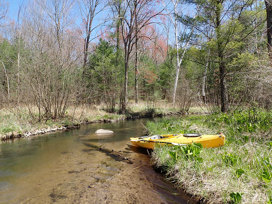
Date Paddled: April 30th, 2021
Distance: 4.8 miles
Time: Expect 2-3 hours
This is a popular central Wisconsin trout stream that is a nice paddle. It's a very clean river with little mud and crystal clear water.
Read More...Wautoma Wetlands Park to Cottonville Lane
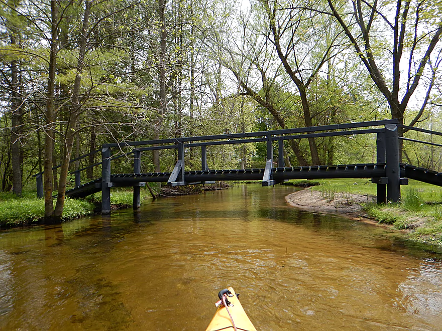
Date Paddled: May 15th, 2016
Distance: 3.89 Miles
Time: 3 hours 16 minutes (Chicago to Cottonville is only an hour though)
A return to the White River to check out its far upper stretches. This is a great paddle with clear water, good current and fastastic groves of skunk cabbage...just be sure to pick the right section or you will face a lot of log jams.
Read More...Neshkoro Dam to 22nd Ave public launch
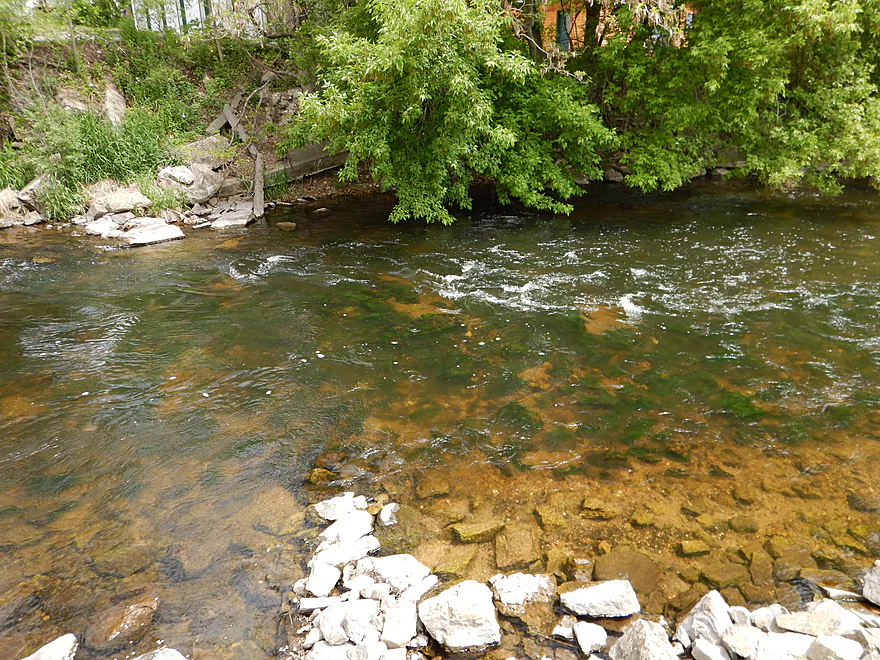
Date Paddled: May 16th, 2015
Distance: 3.43 miles
Time: 2 hours (70-90 minutes would be more typical)
A spontaneous trip due to extenuating circumstances. This was a small pleasant river with terrific clear water, but kind of short at only 3.4 miles.
Read More...22nd Ave Bridge to Hwy D
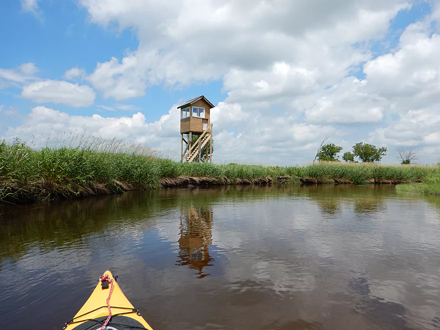
Date Paddled: June 28th, 2014
Distance: 8.3 miles
Time: 3 hours 30 minutes
A river with two identities. The first 90%, you get clear water, sandy substrates and open, grassy vistas. The last 10% goes through woods and, unfortunately, has some deadfall to contend with. To clarify further, there are actually three White Rivers in Wisconsin. This is not the more famous one located by Lake Superior (a […]
Read More...Overview Map
Detailed Overview
Main Branch:
- Swamp Road to Wautoma Library: (1.94 miles) An interesting prospect with a few log jams. Unfortunately this is scheduled to be turned into a flowage in spring of 2017.
- Wautoma Wetlands Park to the Fire Department: (1.19 miles) A super scenic section but too clogged with jams. Reviewed here.
- Fire Department to Chicago Road: (0.8 miles) A good section with two down trees to circumnavigate. Reviewed here.
- Chicago Road to Cottonville Lane: (2.47 miles) A very nice section. Reviewed here.
- Cottonville Lane to Pine View Road Landing: (2.1 miles) Mostly open flowage paddling, which I assume is uninteresting.
- Pine View Landing to Czech Lane: (4.7 miles) A nice prospect on my to-do list, but will have some down trees and a dam to portage.
- Czech Lane to Neshokoro Dam: (2.64 miles) Probably uninteresting as this is mostly flowage paddling.
- Neshkoro Dam to 22nd Ave Canoe Launch: (3.43 miles) A very good prospect I review here.
- 22nd Ave Canoe Launch to Hwy D: (8.3 miles) A good section that I reviewed here. Liked the stretch, but found the log jams frustrating. Have been told that the main obstructions have been recently cleared out though.
- Hwy D to White River Road: (4.2 miles) A good prospect I had written off due to fear of log jams, but per Tim is mostly clear now.
- White River Road to Mouth on Fox River: (2.1 miles) Am unsure of this stretch and if log jams are an issue?
- Fox River Options After White River Mouth
- You can paddle 1.25 miles upstream to the White River Locks which is a great take-out option
- You can paddle 0.7 miles downstream to Huckleberry Lane where there is a small area for taking out (am not sure this is public or private though)
West Branch:
- Upstream of Hwy T: This leg may have too many logjams. A bigger concern is that the upstream bridge (13th Ave) has a very steep embankment so there really isn’t a good put-in option.
- Hwy T to Hwy 21: 2.2 miles. Very scenic leg with perfect clarity and a number of pine trees. On the downside it is a bit small and obstructed at times. Figure 7-8 logjams total, but it might be worth it.
- Hwy 21 to Cottonville Ave: 2.9 miles. Maybe 6 logjams, but a super scenic stretch with many pine trees. On my todo list.
- Cottonville Ave to Cottonville Lane: 5.0 miles.
- Cottonville Ave to Hwy 22: 2.2 miles. Great stretch with clear sandy water and nice pine trees. Two logjams and one log bridge, but manageable portages.
- Hwy 22 to Mouth on White River: 0.4 miles. Great stretch with more crystal clear water.
- Mouth to S. White River Rd: 1.4 miles. Very nice section with clear water. It’s much wider, deeper and more open that upstream legs. No logjams.
- Cottonville Lane to Pine View Rd: 2.1 miles. Mostly open flowage paddling, which I assume is uninteresting.

