
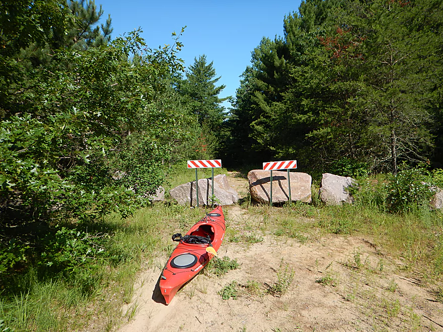
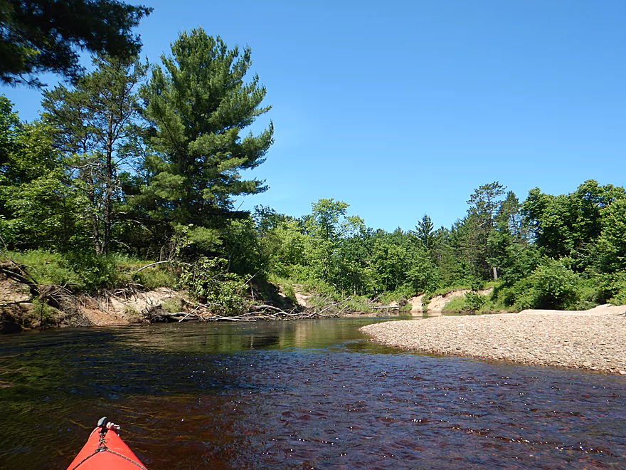
Starting the trip at Koehler Ford Lane
Nice launch area
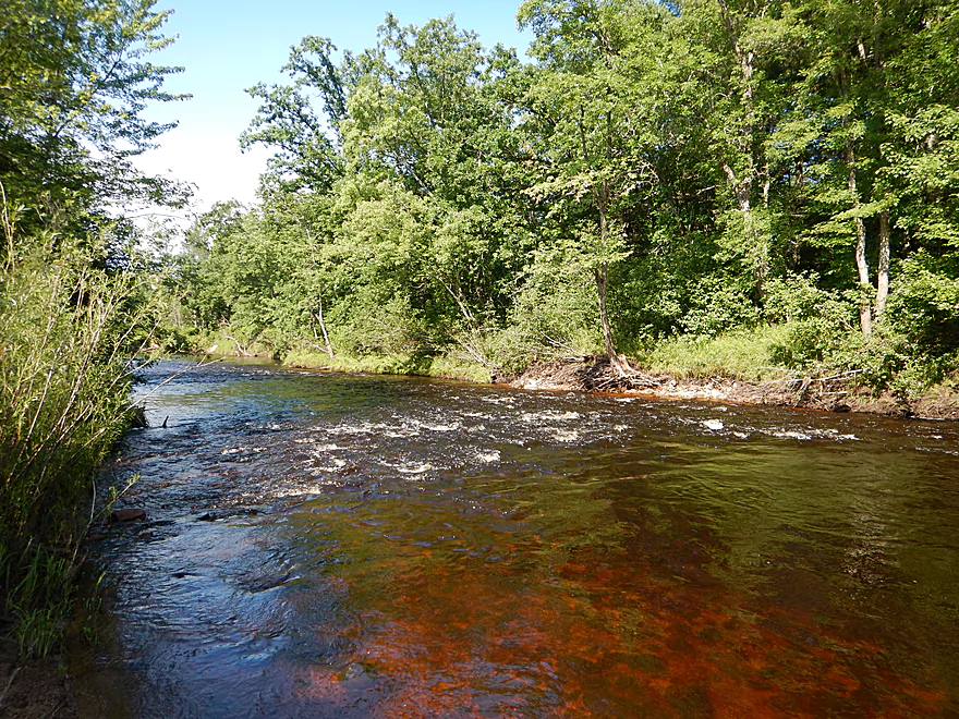
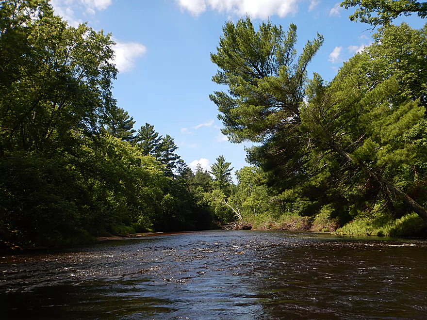
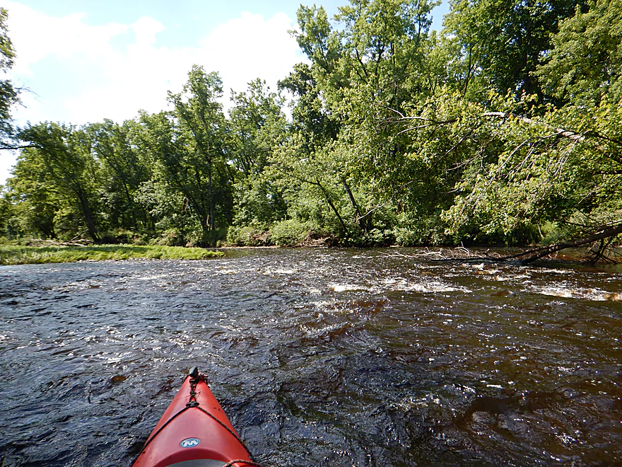
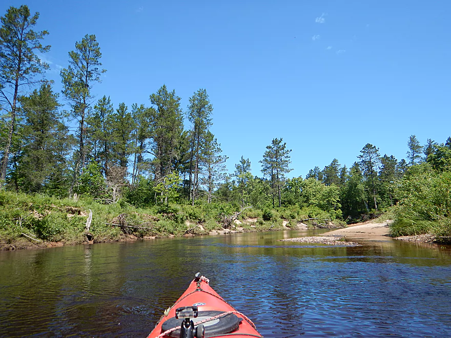
Trip starts with some rapids
That were pretty shallow
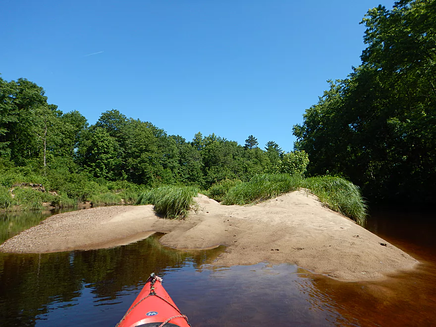
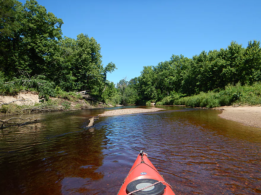
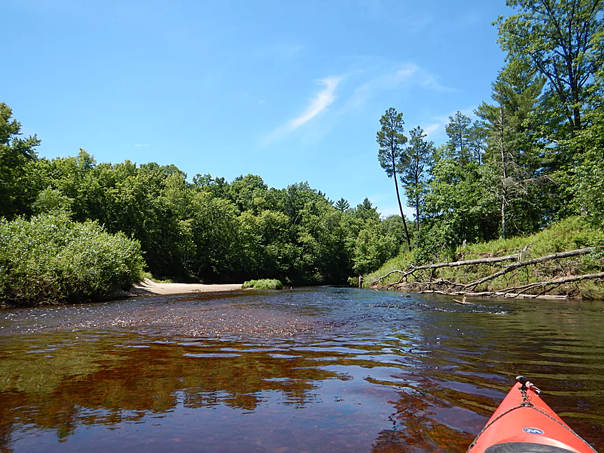
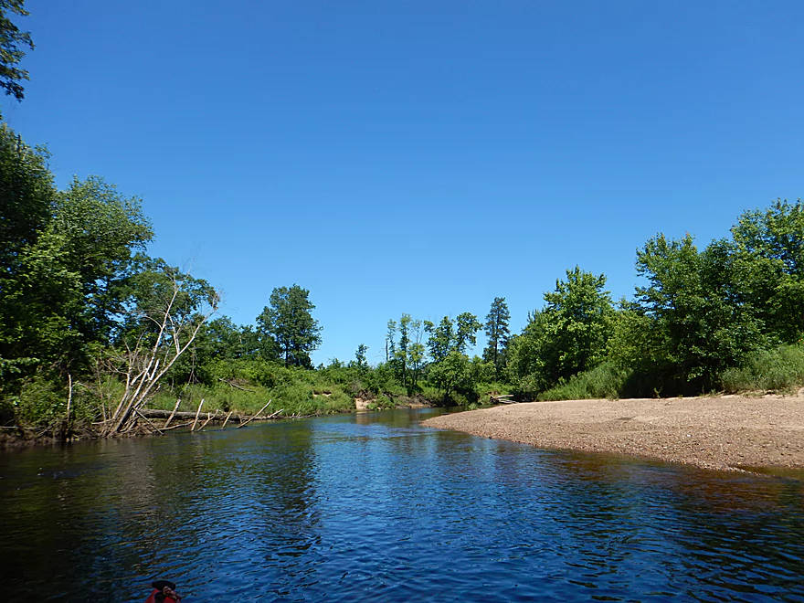
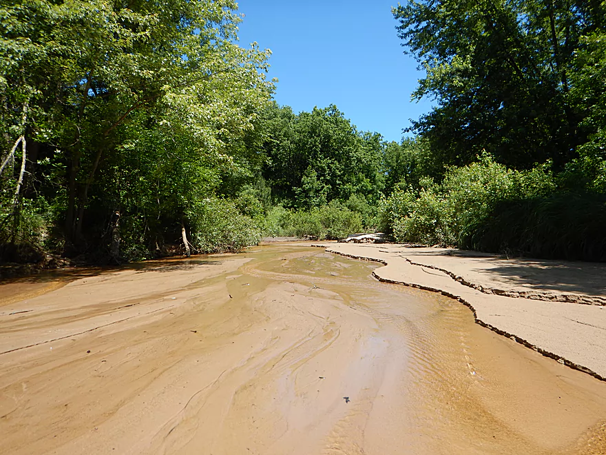
So many sandbars
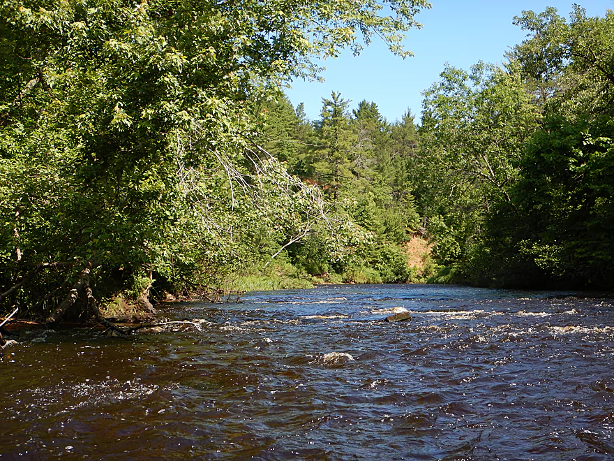
Lot of little riffles…nothing serious
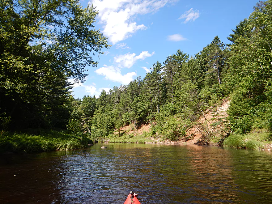
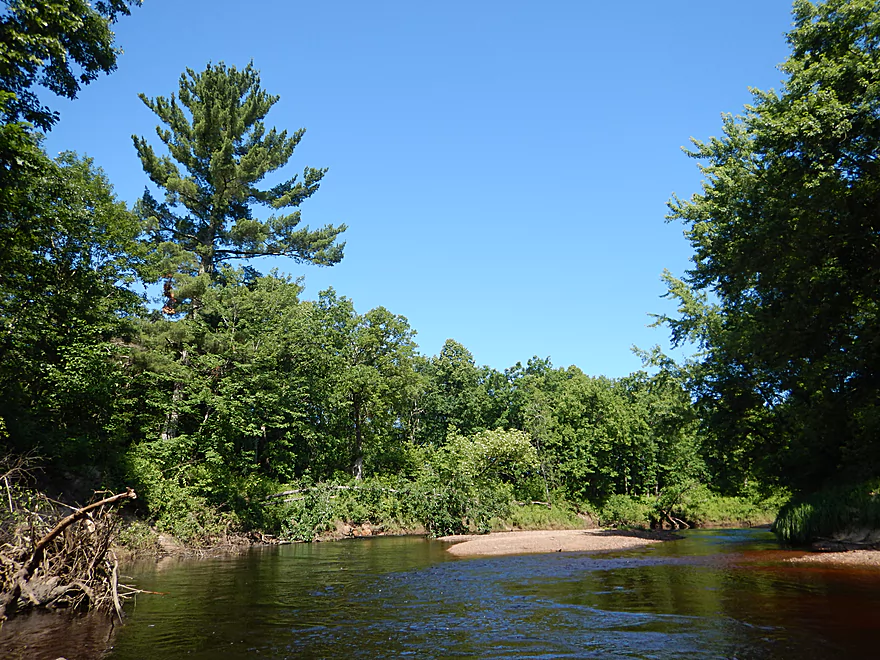
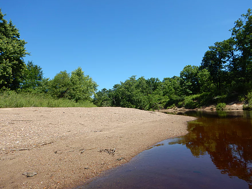
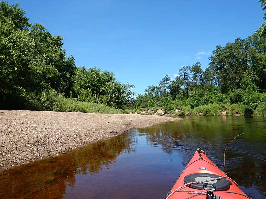
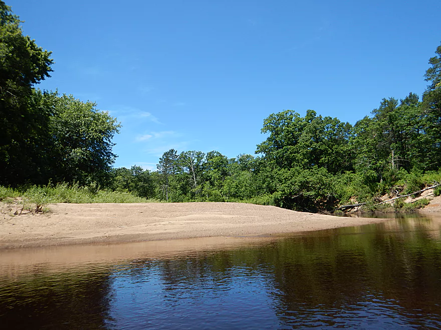
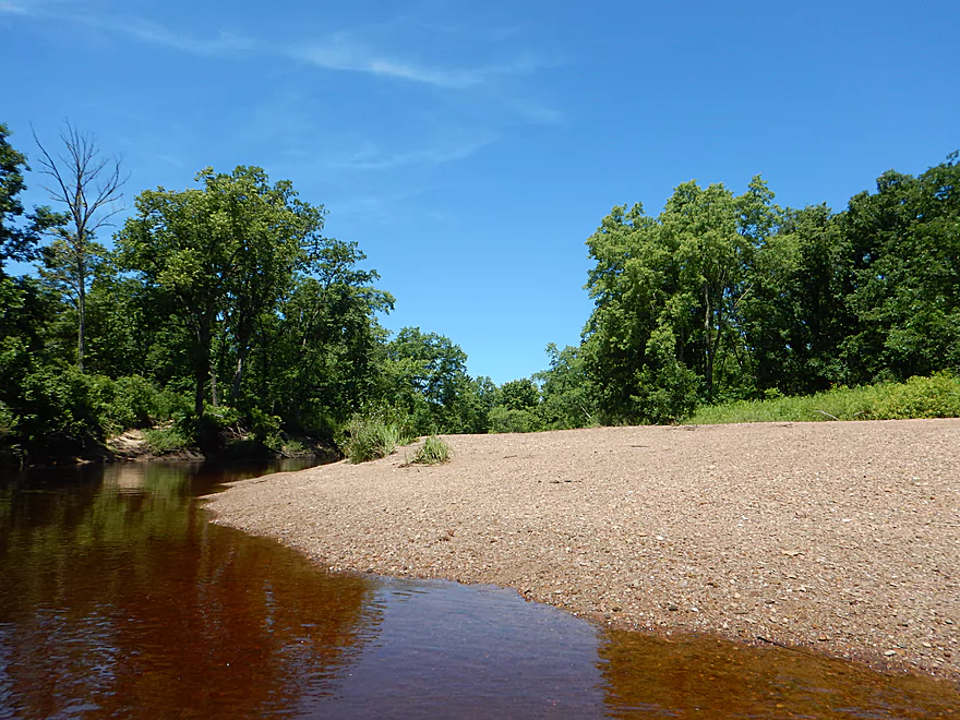
An attractive sand bank
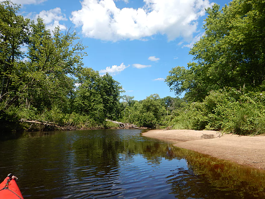
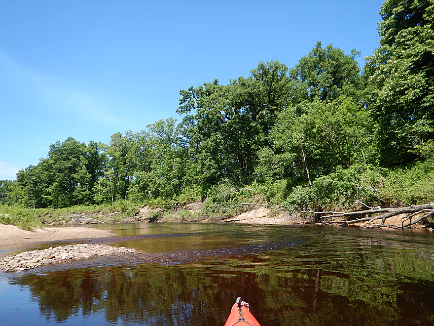
Rare rocky section…river was mostly sand
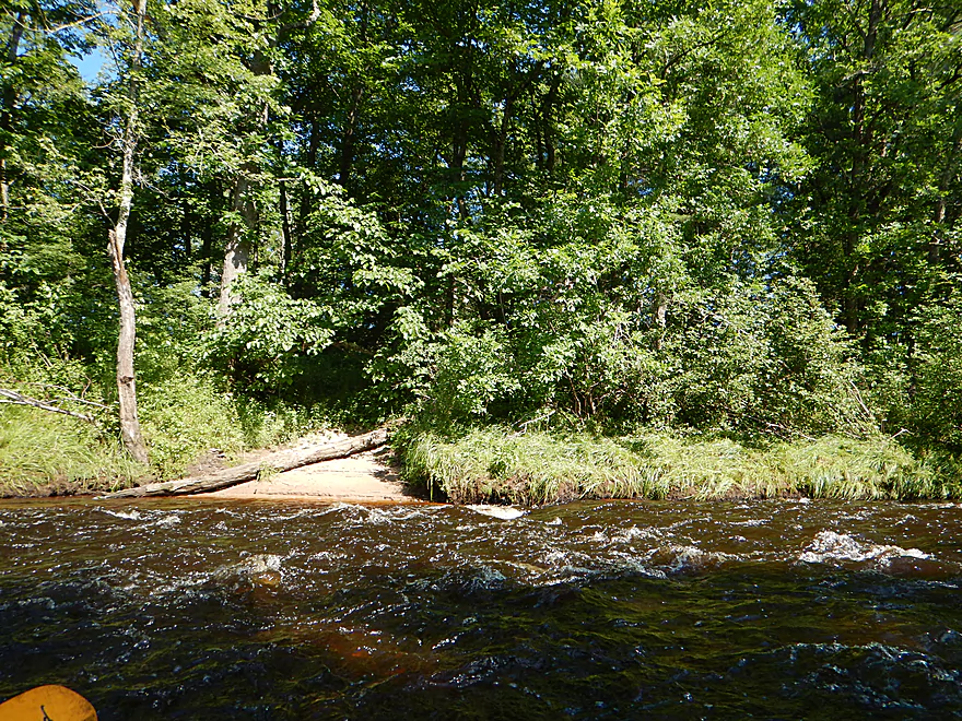
More light rapids
Reverse view
This would be a fantastic camping river
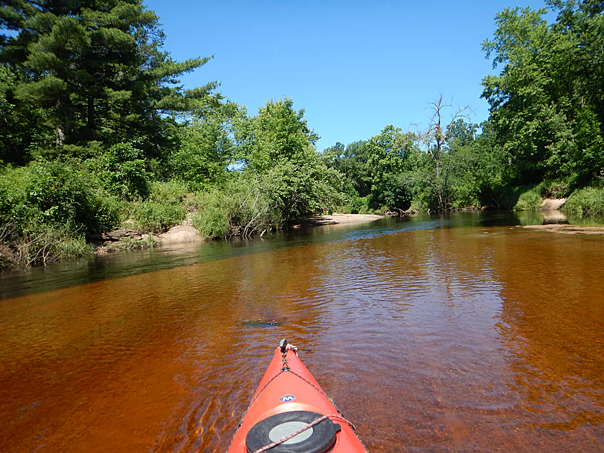
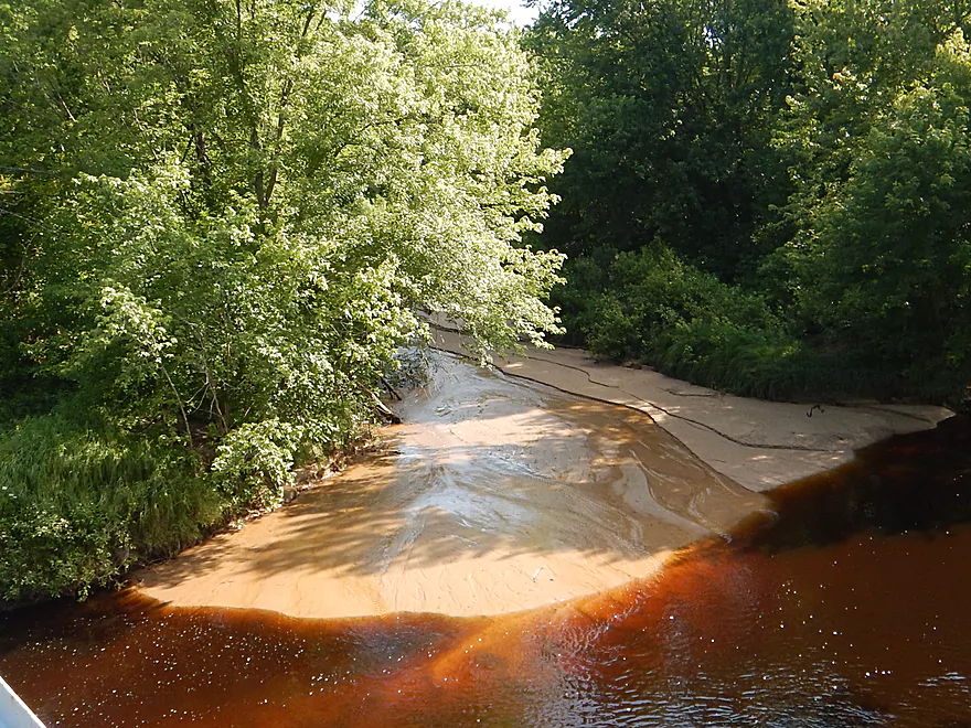
Some root beer colored-water
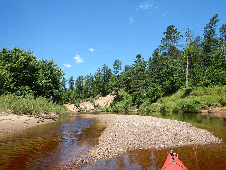
About as many gravel bars as sandbars
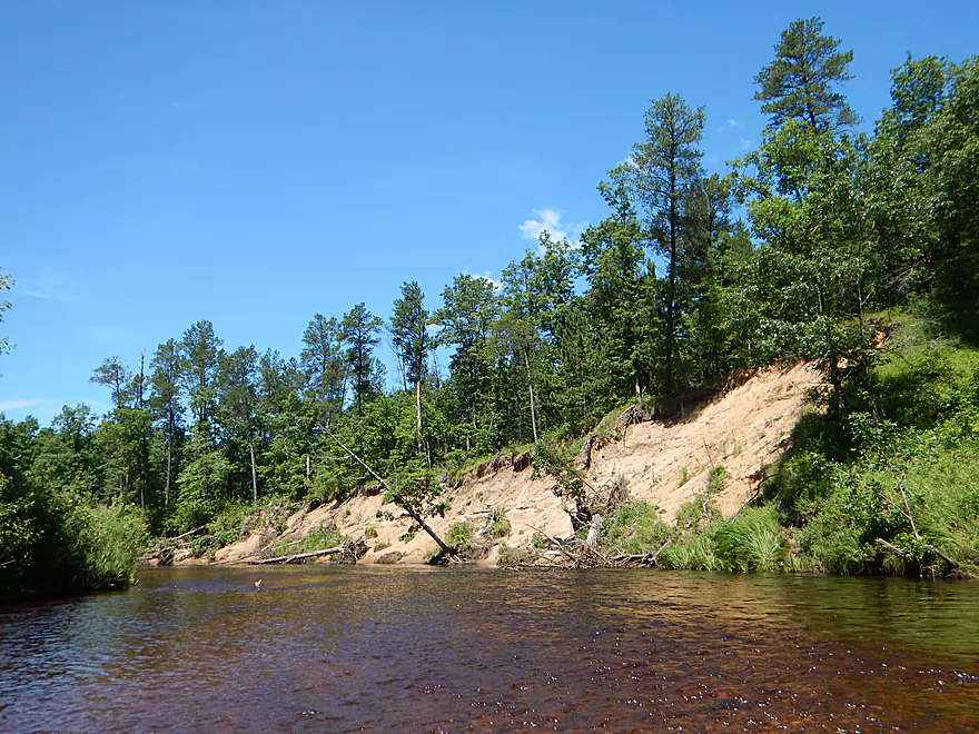
Another nice sandbank
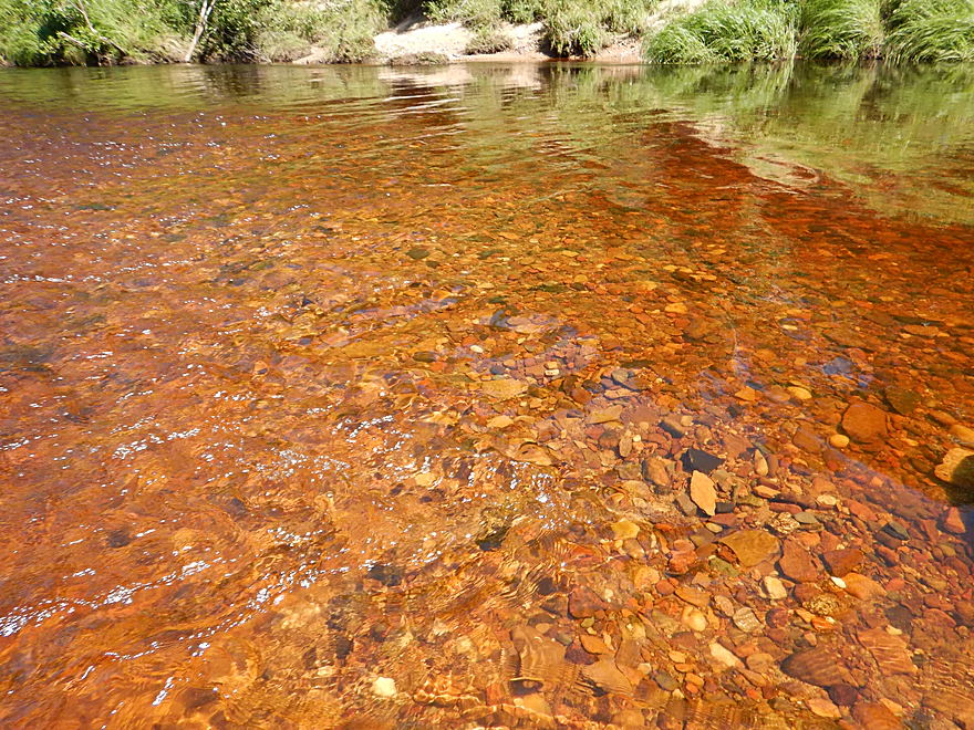
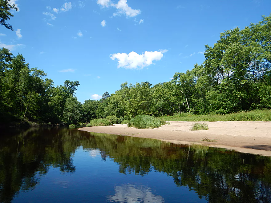
Sometimes really good clarity
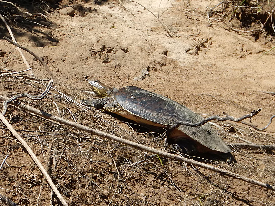
Saw a lot of softshell turtles
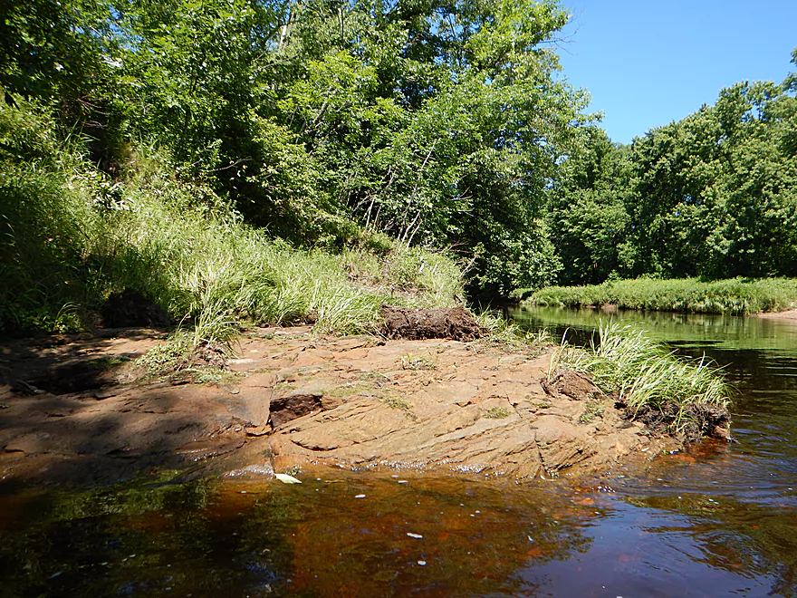
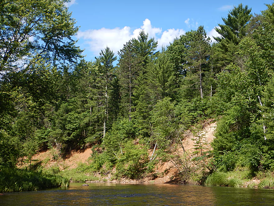
Biggest rock outcrop of the trip…
Barren tree line likely a sign of logging
A large gravel bar likely from glacial outwash
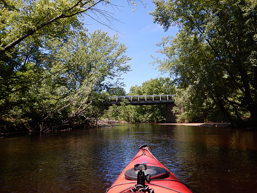
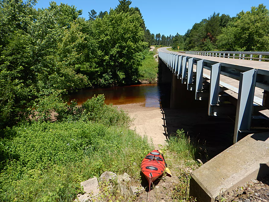
Coming up on Hwy H
A really cool sandbar creek
Crystal clear water
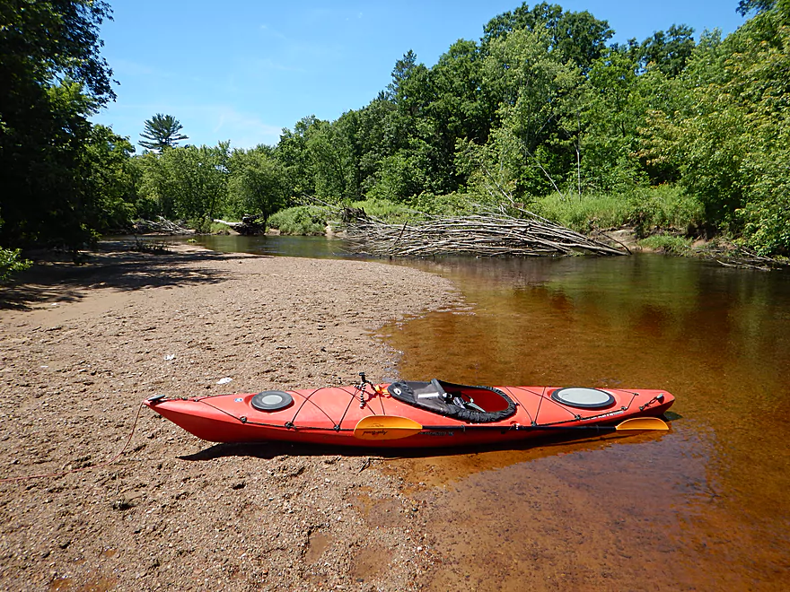
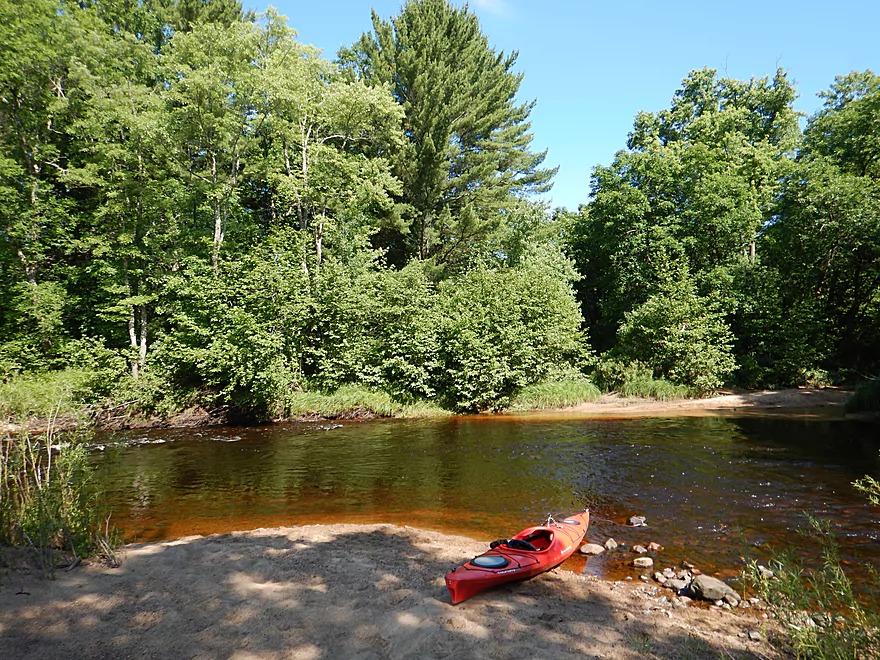
Great sandbar for taking out
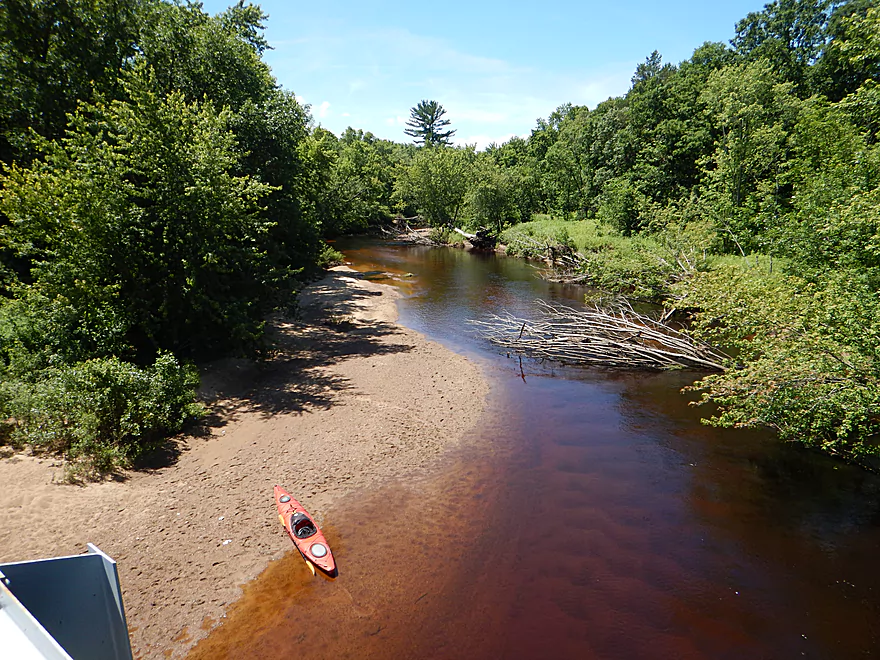
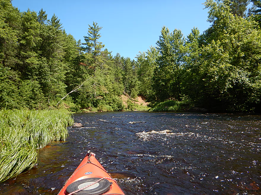
View at 450 CFS
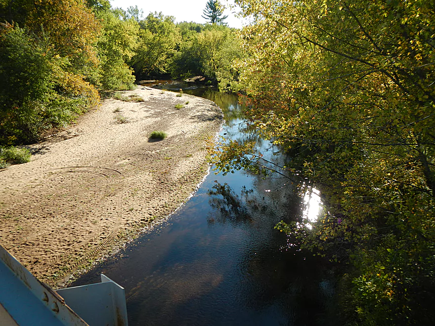
Same view, 70 CFS
Pulling the boat up the steep embankment
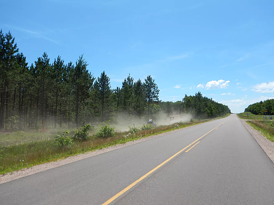
A very dusty shuttle ride
Hay Creek and Rock Dam would have been an interesting alternate put-in
Eau Claire River – South Fork

The Eau Claire River is a popular paddling river that empties into the Chippewa near the city of Eau Claire. Previously I did a stretch below Lake Eau Claire which was really nice and featured epic-sized sandbanks. The best sections of the Eau Claire though are actually upstream of Lake Eau Claire and feature neat geology and fun rapids, but alas can’t be done by bike shuttle. Working our way upstream, the river then splits into a north and south fork, which frequently run a little shallow for paddling, but thankfully this being 2017, this wasn’t a problem.
Honestly, my first impression of the river was a little disappointing. There were no rock outcrops, decent rapids, boulders, hills, nor unique wildlife. The banks were covered by simple grasses and overshadowed by a scrubby, thin layer of hardwoods (logging might have been an issue). In the first mile or so, the channel is simple and somewhat unvaried, reminding me of the East Branch of the Black River or even the Lemonweir. The problem is the glaciers. Eau Claire County is on the border of the driftless zone and while parts of the Eau Claire watershed lie in this unique geological area, the South Branch isn’t among them and got steamrolled into fine sand by the passing glacier.
But later on, the trip started to pick up. This segment has the highest density of sandbars I’ve ever seen and would be a fabulous stretch for canoe camping. These weren’t runty ones either as several were over two feet high and many featured large gravel deposits. There were also a handful of sandbanks, which while not as nice as say the ones on Bridge Creek, did feature a few striking big boys. The water clarity was clean with a root beer tint, but not super translucent. As you near the take-out (and eventually the driftless demarcation) the channel does change as it slaloms past sandbars and through narrow riffly chutes flanked by a thicker and more coniferous woods.
Another nice perk of the trip is there was basically no signs of civilization. No homes, businesses, boaters, farms, pretty much nothing. The exception was the occasional ATV you can hear from miles off (they are much noisier than a car). Hwy H is part of a very busy ATV trail and I witnessed countless riders on my bike shuttle. Honestly, they seemed a bit reckless. The main 2-way ATV trail is quite narrow, sandy and uneven, and some ATV’s were easily going over 50 mph.
In conclusion this was a pleasant trip that started a little simple (maybe 3 stars), but as the scenery improved, so did the rating to 4 stars (barely) to cap off the trip. But really, if you are planning a trip in this area, you want to do the downstream sections first which are better and feature cool geology and real rapids. Bridge Creek, which I did a few weeks ago, is next door and is also a much better trip than this, but this wasn’t bad and was a nice relaxing way to enjoy the 4th of July weekend.
Koehler Ford Lane dead-ends 700′ south of the river and you’ll need to drag your boat down a long trail to reach the water. Else this is a good access option with decent parking, seclusion, and a nice sandbar for launching. Note, if you come from the north, I suggest launching on the north shore (where Koehler Ford Lane also dead ends), and in hindsight this likely is the better option as you can park much closer to the river.
Hwy H is a decent take-out option. There is a faint trail leading to the water from the southwest side of the bridge. While steep, it is not weedy. Parking is a bit tricky SW of the bridge but you can park on a different corner or further down the road. This is a very busy bridge as a lot of ATV traffic gets routed over it.
There are a few liveries for the Eau Claire River, but when I asked they don’t go this far east.
One of the reasons I did the trip was because I thought the 5.1 mile route south of the river was paved and should have made for an easy bike shuttle. Oops…it was mostly gravel. It wasn’t so bad though. I peddled mostly in the tire ruts and this was more like a rails-to-trails crushed limestone path. Shuttle time took 34 minutes.
Though In hindsight, I doubly messed up. Had I launched on North Koehler Ford Road (not South) I could have shuttled north around the river. While also gravel, this would have only been 3.5 miles.
I assume most paddlers wouldn’t take out at H and will continue the 4 additional miles to Eisberner Memorial Park (aka Canoe Forest Landing Road). That is almost impossible to do with a bike shuttle as Canoe Landing Road and E. Channey Forest Road are REALLY bad sandy roads (in fact they are not passable by car when very wet).
Above average current, but not super fast. There are maybe 7-8 riffles and 2-3 Class 1 rapids, but nothing greater than that. There are no logjams to worry about. Really this is a very safe, easy stretch and would be a good segment for canoes.
At the time I did this, the river was a bit above average in depth. I did get hung up in 2-3 spots, but really, most of the river had plenty of padding. My following guestimates are based on the Black River gauge at Neillsville.
- 0-100 CFS: Likely too shallow to run. Scouted at 70 CFS.
- 101-200 CFS: You might have to wade 3-5 spots, else the river should be mostly navigable with good clarity.
- 201-300 CFS: A good target depth. Might have to wade 1-2 sections.
- 301-400 CFS: A fine depth, but clarity won’t be as nice.
- 401-500 CFS: A fine depth. I did the trip at 450 CFS. Clarity was only good in select spots.
- 501-600 CFS: An ok depth. River might lose some character at this point.
- 601-700 CFS: Some of the nicer sandbars might be under water.
- 701+ CFS: River might not be attractive for paddling at this point.
Quite a few clams, some dragonflies, and maybe 6 softshell turtles.
Detailed Overview
North Fork:
- Upstream of Township Memorial Park: I'm not sure if the far upper reaches of the river are navigable.
- Township Memorial Park to Hamilton Falls: 2.9 miles. I think this leg would be sandy with 3-4 major logjams, and maybe one set of Class I rapids.
- Hamilton Falls to Viking Pipeline Access: 1.0 miles. A scenic mostly flat-water stretch with maybe one set of rapids. This part of the river has steeper terrain and more hills than the lower North Fork. Note, if you don't want to run Hamilton Falls (Class 3), you can portage them or launch just from the downstream side.
- Viking Pipeline Access to Beeman Creek Access: 3.5 miles. A nice remote prospect with nice woods, a few rapids and perhaps some rock formations.
- Beeman Creek Access to North/South Fork Confluence: 3.0 miles.
- Beeman Creek Access to Channey Road: 0.4 miles. A terrific stretch with scenic pines, several nice outcrops, boulder gardens and Class I and II rapids. This part of the river can get very shallow in summer.
- Channey Road to North/South Fork Confluence: 2.6 miles. Attractive wooded stretch with mostly lazy current, sandbars, and gravel bars. There are a handful of rapids, with the best and most scenic being closer to Channey Road.
South Fork:
- Upstream of Koehler Ford Lane:
- Dickerson Ave to Koehler Ford Lane (Main Branch): 7.3 miles. Very sandy stretch and likely has a handful of logjams. Probably nothing special about it.
- Rock Dam County Park to Koehler Ford Lane: 4.5 miles. Half this trip is on Hay Creek, which has some neat dells. Launch below the dam. Maybe some logjams but should be easy to portage on adjacent sandbars.
- Koehler Ford Lane to Hwy H: 5.1 miles. A pleasant stretch.
- Hwy H to North/South Confluence: 3.1 miles. A sandy segment I don’t know much about. Likely nice.
Main Channel:
- North/South Fork Confluence to Eisberner Memorial Park: 0.8 miles. Generic leg–not super interesting, but there are a few large sandbars and some minor rapids at the Eisberner access.
- Eisberner Memorial Park to Hwy G: 5.1 miles. Good prospect with nice sandbars, a large exposed sand bank, and maybe 5-6 Class I/II rapids.
- Hwy G to Lake Eau Claire Dam/Lake Eau Claire Park: 6.1 miles. Probably uninteresting flowage paddling. Alt access on the north shore by the county park. Note, the portage past the dam to Hwy 27 would be very difficult.
- Lake Eau Claire Park to Hwy 27: 0.3 miles. A scenic section with rapids and rock formations.
- Hwy 27 Landing to Harstad County Park: 1.7 miles. Launch on a newish landing under Hwy 27. Neat granite outcrops in the area.
- Harstad Park to Hwy D: 8.5 miles. Great section with epic sandbanks.
- Hwy D to Big Falls Park: 6.7 miles
- Hwy D to Hwy K Landing: 5.5 miles. Good section with a number of sandbars and one set of fun Class II rapids.
- Hwy K to Big Falls Park: 1.2 miles. A short stretch with one nice beach by Hwy K. Big Falls Park is very scenic but has some serious whitewater and falls.
- Big Falls Park to QQ Boat Ramp: 6.6 miles.
- Big Falls Park to North Shore Drive Wayside: 5.2 miles. A very sandy stretch with many sandbars and several significant sandbanks. It's an attractive and pleasant paddle, but lacking in the rapids and elite scenery of other sections on the Eau Claire.
- North Shore Drive Wayside to QQ Boat Ramp: 0.9 miles. A generic leg that isn't that interesting. Current really starts to slow down.
- QQ Boat Ramp to Altoona Lake Dam: 4.5 miles. Half of this flows through a broad, sandy channel and half through a flowage lake. There is an alternate take-out at Lake Altoona Park.
- Altoona Lake Dam to Mouth: 3.3 miles. A neat section through downtown Eau Claire with some Class II rapids.
- Eau Claire Mouth to Hobbs Landing: 1.9 miles. A short paddle on the Chippewa through the University of Eau Claire campus before reaching your take-out.
Coon Fork Creek:
This is a wild card prospect referred to me by canoe author Mike Svob and EC Adventures. The main route starts at Coon Fork County Park (by the dam). I checked it out and it actually looked really cool. The area is very rocky and it appears the creek flows partly through rocky dells and canyons before emptying into the Eau Claire (at which point you could take out at G). While shallow looking (when I scouted it), I thought it might be runnable as is (can’t be certain though). Reminds me of perhaps Robinson Creek or Spring Brook in the Dells. RiverDarter.com has a nice video of the creek here.
Bridge Creek:
This is a really cool tributary to the Eau Claire with rocky dells and striking sandbanks. Reviewed here.
Trip Map
Overview Map
Video
Photos Size: