
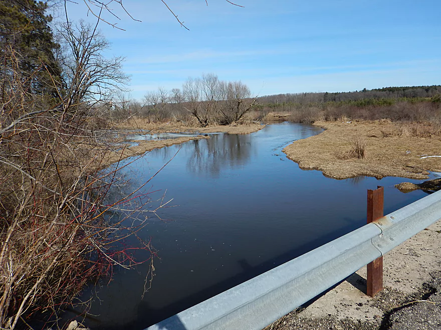
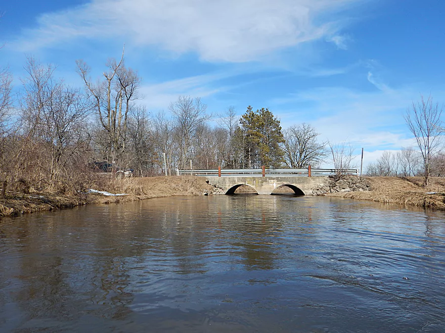
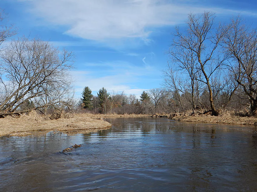
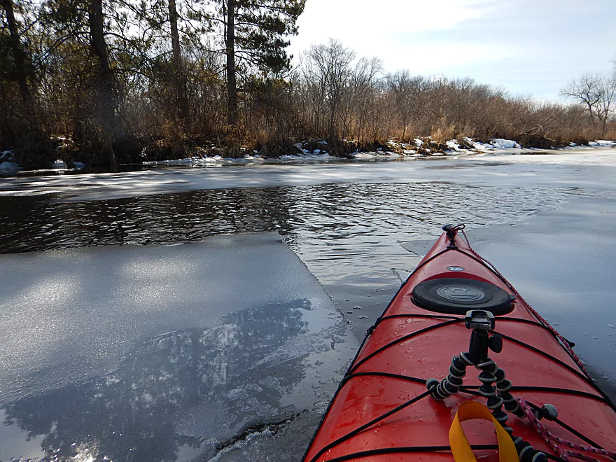
View from Grouse Drive
Good launch area
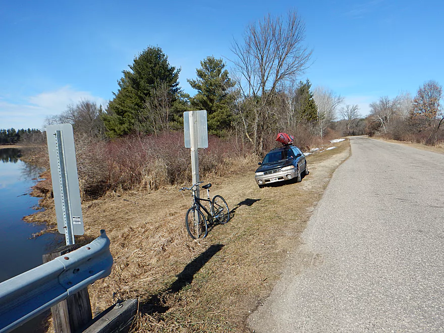
With small pull-off for parking
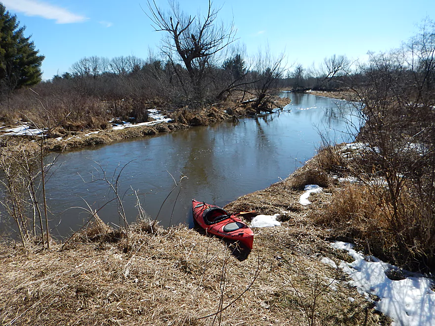
Time to start the 2017 paddling season!
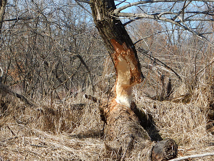
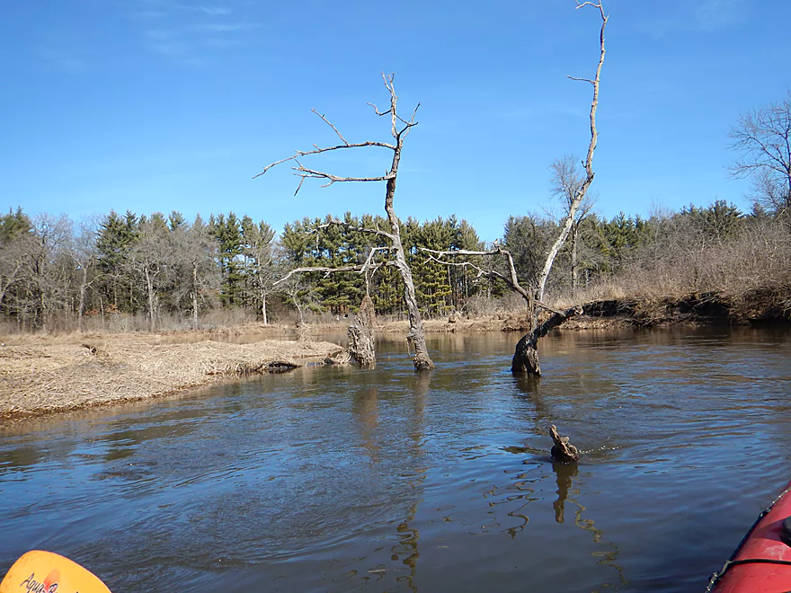
A beaver living dangerously
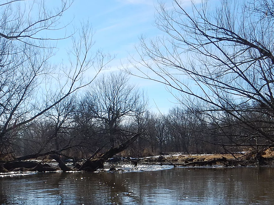
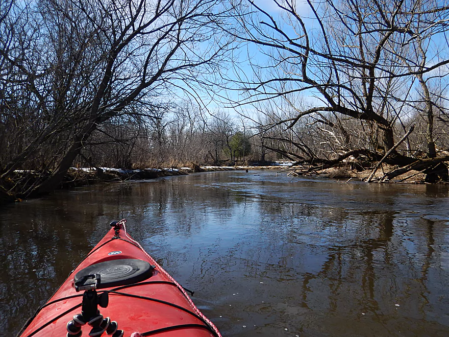
Only snag of the trip (minor)
Big Slough Creek enters Neenah Creek
Creek grows significantly
Trees really recede and the banks open up
Nibbled flat by geese
Very wide and slow
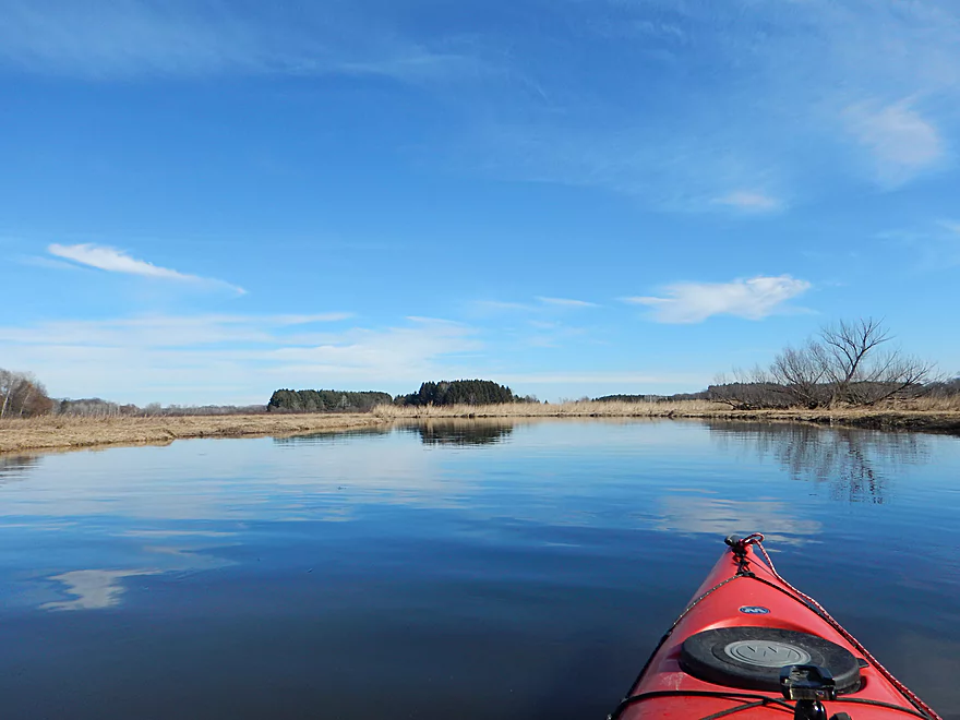
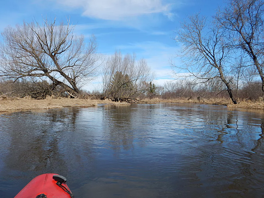
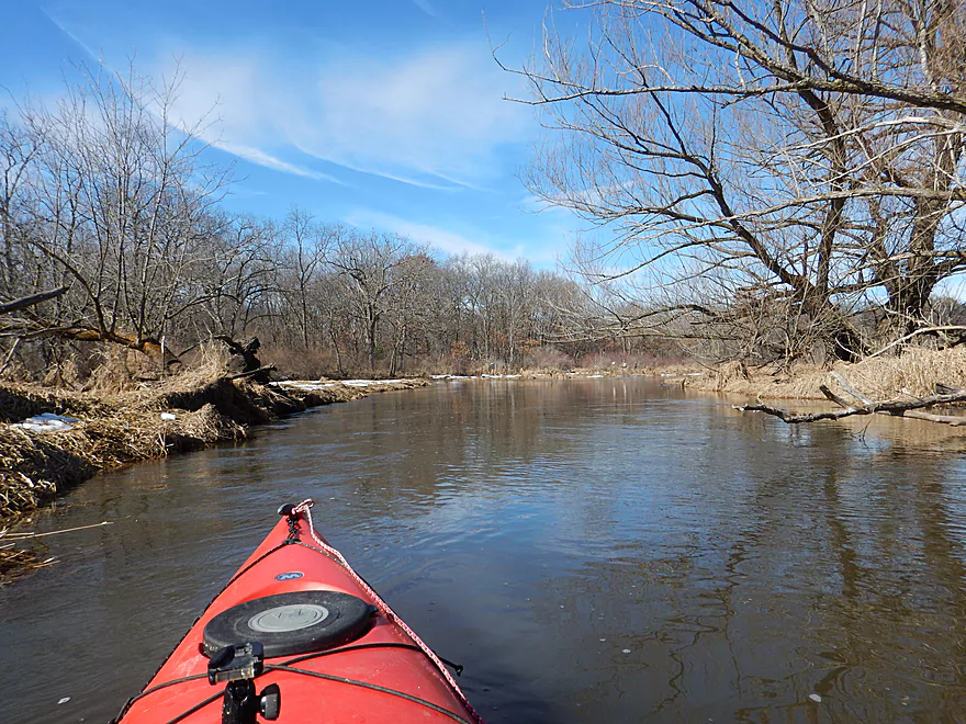
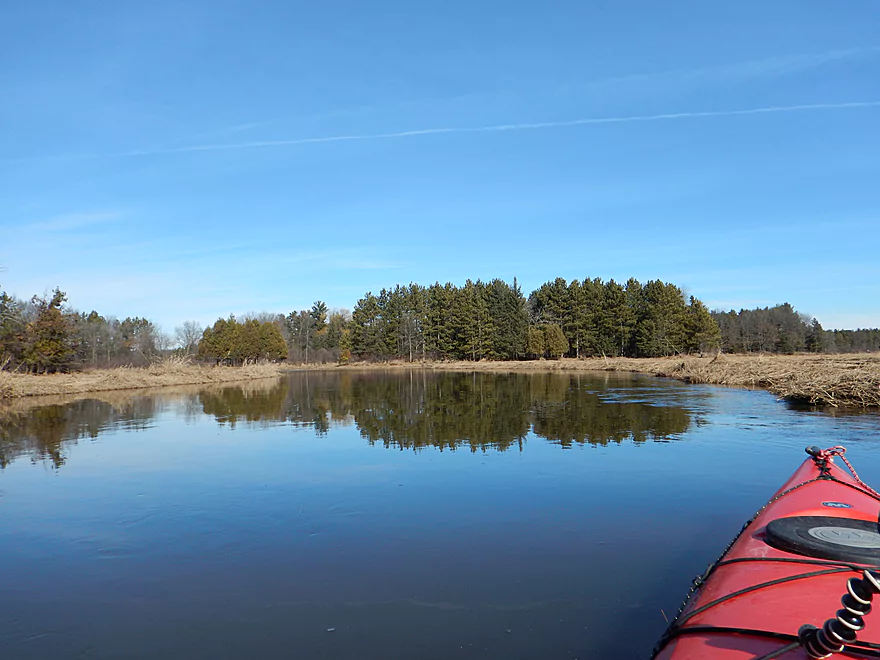
Scenic with the blue sky and calm waters
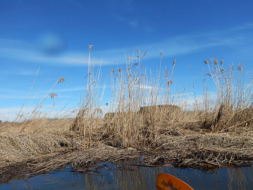
Lot of reed grass
Mouth of Big Slough Creek
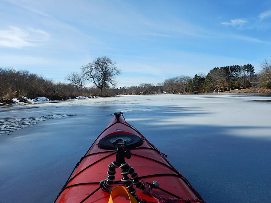
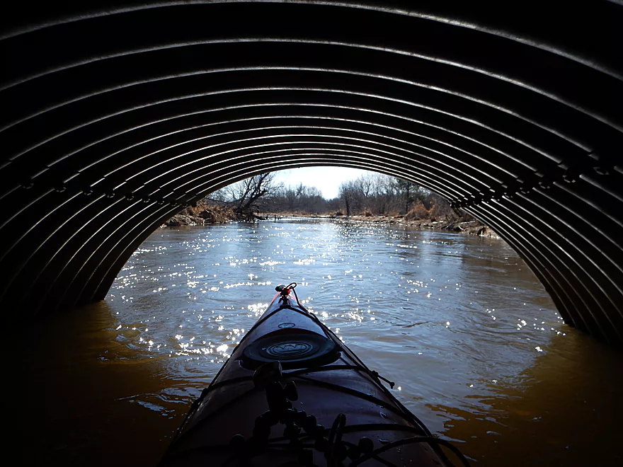
Which entirely iced up
Time to do something about that
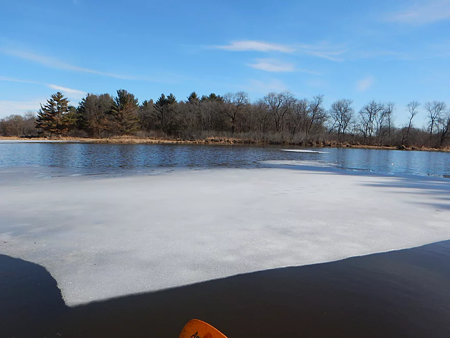
Sending an iceberg down Neenah Creek
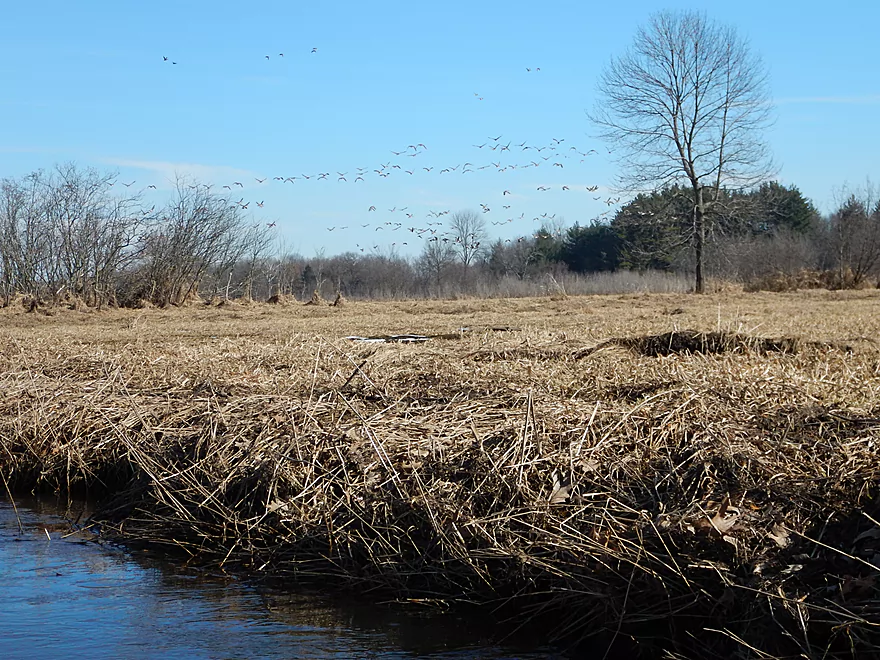
Neenah creek is a hotspot for geese
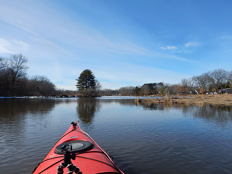
Starting to get more pines
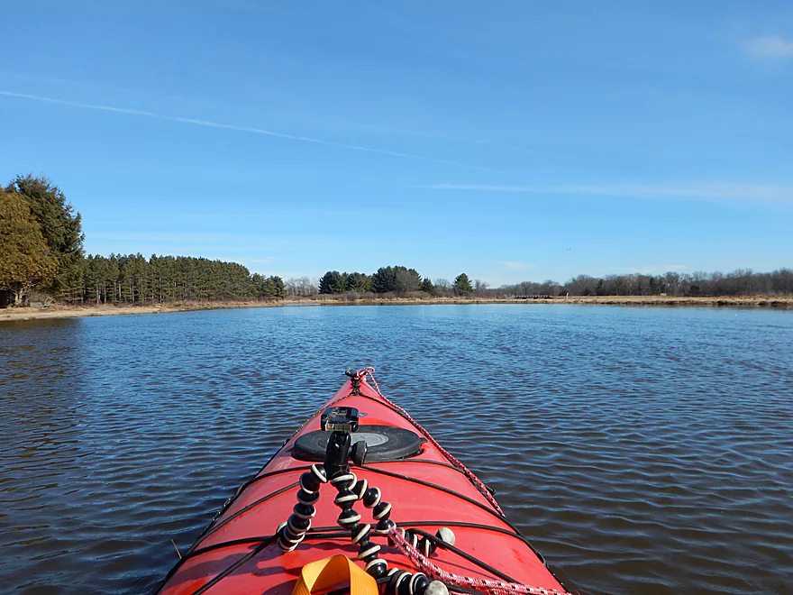
Creek really swells here
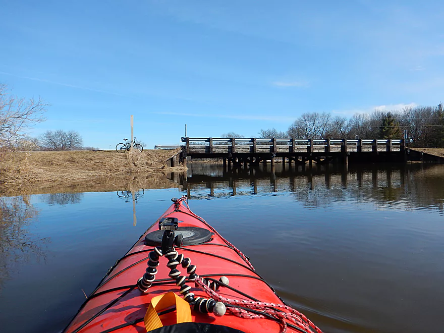
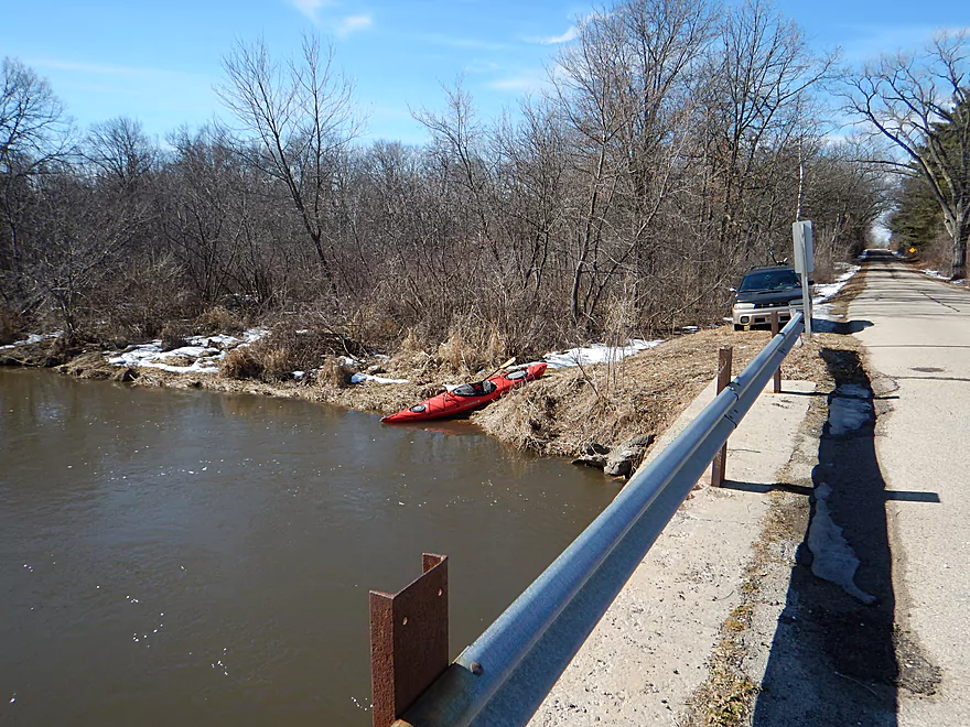
Muskrat Road
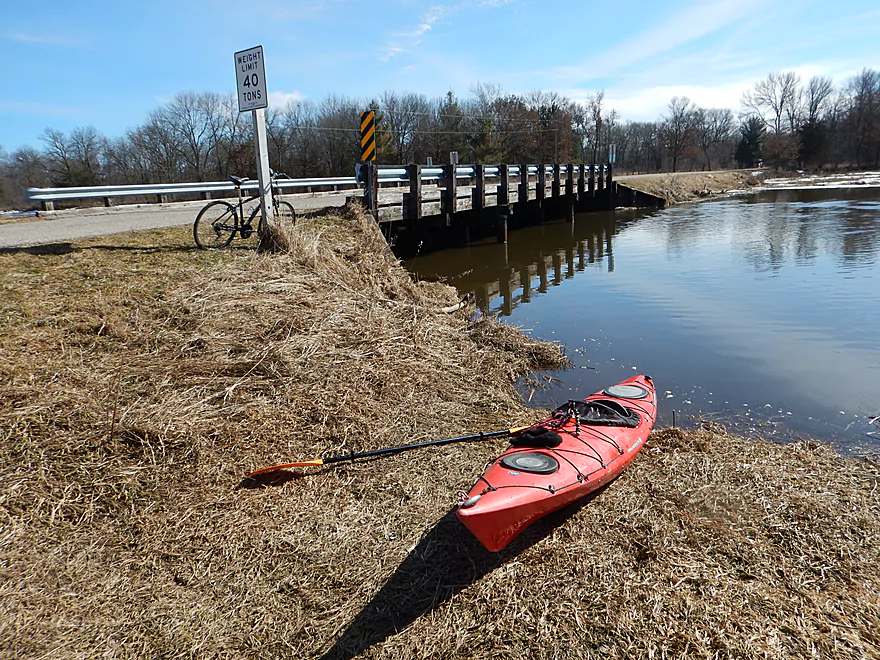
Great take-out
Also nice parking and hitching post for bike shuttlers
Neenah Creek – Grouse Drive


Time for another Neenah Creek review (the 7th if you include tributaries). Located an hour north of Madison, Neenah is a slow, wide creek with flat, open banks and few obstacles. Not too exotic, but not too tricky…perfect for a February paddle. What makes this Grouse Drive section distinct? It’s the halfway point in the creek and marks its transformation from a twisty, narrow creek, to a small slow river.
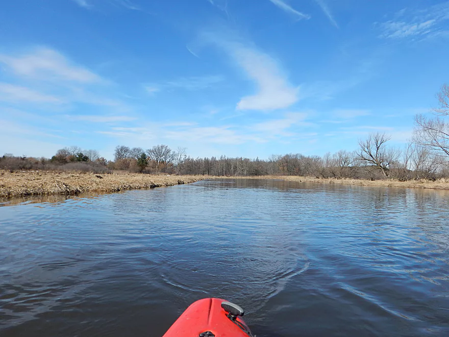
The trip starts at Grouse Drive where there is a small pull-off and a nice grassy area for launching. Thanks to a recent warm spell, the creek had swollen somewhat from spring runoff leaving the water much higher, pushier, and muddier than I was accustomed to seeing. Here the creek is still a creek, with quick, tight turns flanked by mostly wetgrass and some hardwoods.
Soon the South Branch joins the main branch, and the creek immediately doubles in size while the current slows dramatically (as if you were to take your finger off a hose). This is a big transformation that the creek will retain to its mouth on the Fox. If you are curious you can paddle upstream on the South Branch (it’s really slow…pleasant but not super exotic).
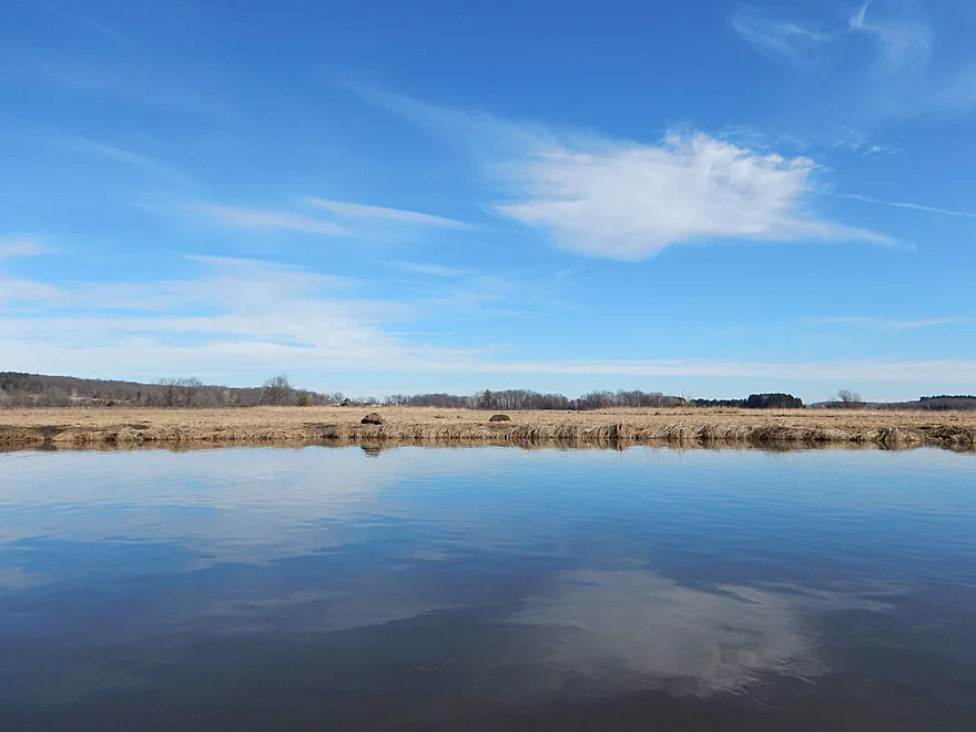
After the confluence, the creek becomes less squiggly, and the trees recede for vast tracts of wetgrass. This is a favorite spot for waterfowl which can gather in large flocks to hang out. Last year in this general area, I witnessed the most cranes I had ever seen. No cranes this time, but there were some large flocks of geese. You can tell this is a favorite area of theirs as large swatches of wetgrass had been nibbled short to the ground as if a large lawn mower had come through.
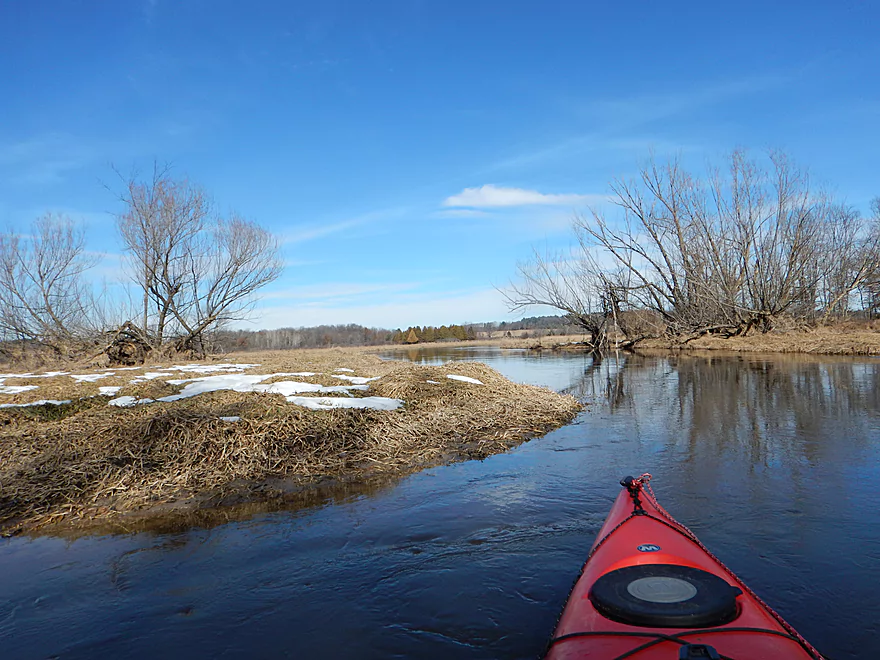
About two-thirds into the trip, Big Slough Creek joins the main branch. Before the Portage dikes were built, the Wisconsin River would occasionally flood, ignore the continental divide, and dump a massive amount of water into Big Slough Creek (and by extension Neenah Creek and the Fox River). Today however, Big Slough Creek was completely frozen over which gave me the opportunity to carve out icebergs from the main sheet with my kayak and send them down the main branch (to the bemusement of nearby onlookers).
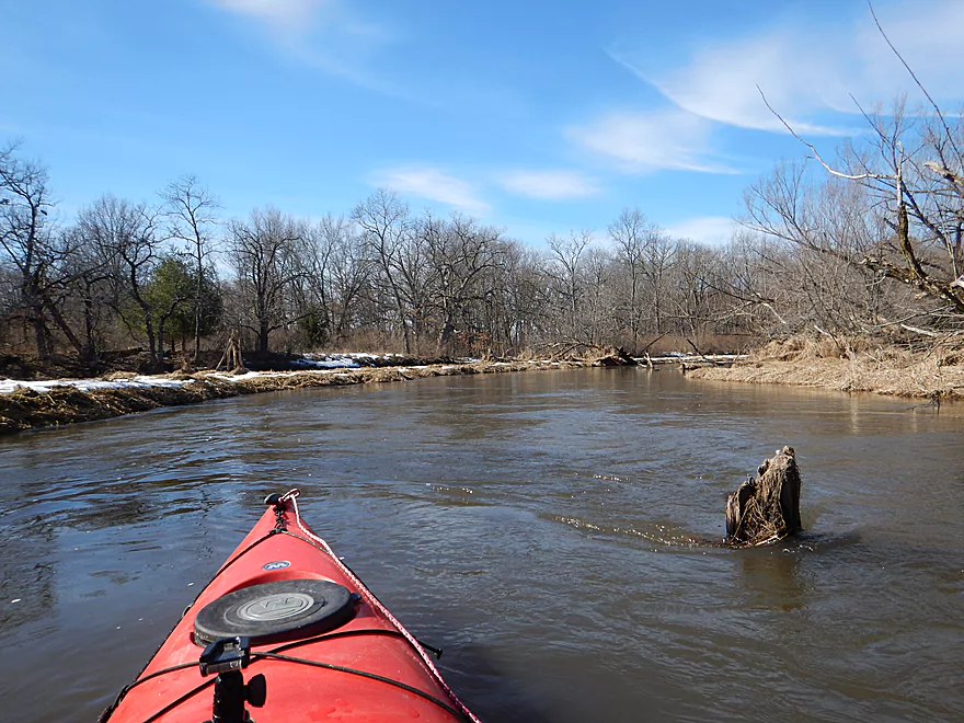
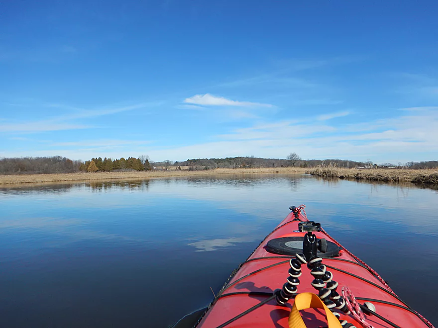
After Big Slough, the banks become more wooded with occasional clusters of white pine. This was a simple but pleasant section with peaceful, mirror-like water that offered attractive reflections of the blue sky.
At Muskrat Road there is a flat, grassy launch area…perfect for paddlers. It’s privately owned (as explained to me by the owner who bumped into me), but paddlers are permitted to use it. The owner had some interesting stories of how the creek has changed over the years. Apparently after the Montello Dam (Buffalo Lake) was built on the Fox, the creek changed in character with several channels moving significantly (you can still see evidence of some of the old channels from satellite view).
In summary, this is a good trip to do if you are looking to see some waterfowl, avoid complications, or are curious about the area. But in some regards it was too simple and peaceful, and most paddlers would probably find other prospects to be more interesting. If you are new to Neenah Creek, I suggest starting on the upstream sections which I consider to be the best and most scenic.
There is a small pull-off by Grouse Drive and nice shallow grassy slope, making this perfect for launching.
Great take-out NW of the Muskrat Road bridge, with good room for parking and a shallow slope for launching. This landing is technically private, but ok for paddlers to use. Please be mindful of this and respectful of the property.
Super easy bike shuttle. 2.4 miles, pretty flat, little traffic and all paved. They rarely get much easier than this.
No logjams to worry about (one minor low branch to duck under but should be easy for most paddlers).
Note, this is an open and exposed part of the creek, so be mindful of the forecasted wind direction and speed.
Also note, this was done in February which technically makes this a winter paddle. Be cognizant that the water can be significantly colder than the air temperature even during warm spells. Also be mindful that even if you see open river at the put-in and take-out, the sections in between can be completely iced up and impassable. As a general rule, small fast creeks tend to thaw first while large, slow rivers and flowages will thaw last (sometimes waiting until April to completely melt).
There is no gauge on Neenah Creek. The Pardeeville gauge on the Fox River is probably the best measure, but it it likely unreliable because of the nearby dam. This trip was done at 7.55′ but felt higher than that. On top of this, the gauge was likely affected by ice, so take this with a grain of salt. Long story short, Neenah is pretty much never too shallow.
- 7.0′-7.5′: Typically the lowest the creek gets in a year. Easily plenty navigable.
- 7.6′ to 7.8′: Probably an average depth. My last trips were done in this range.
- 7.9′ to 8.0′: The creek is on the high side and about to burst its banks.
- 8.1’+: Banks should be overflowing at this point.
Several ducks, deer, eagles, and countless geese.
Detailed Overview
Main Branch: Click here to see an overview map.
- Upstream of Peppermill Creek: I suspect the creek is too congested to run
- 1st Lane (Peppermill Creek) to 1st Court: 1.1 miles. First half is a nice, clear, and open stream but there is congestion after that.
- 1st Court to Seeley Lake Access: 2.8 miles. Amazing clarity, nice riffles and steep hills…but serious logjams issues. Been on my to-do list for a while…
- Seeley Lake Access to West Chauncey Street: 0.6 miles. Mostly pleasant lake paddling with a dam to portage.
- West Chauncey Street to Hwy A: 6.8 miles.
- West Chauncey Street to Fox Road: 1.9 miles. My favorite section with incredible clarity. This stretch is more wooded and hillier than other legs. Logjams can be an issue. Cleanup work has been done, but 2-3 logjams may remain.
- Fox Road to Hwy A: 4.4 miles. Attractive leg with good clarity. Starts wooded, but quickly transforms into an open wetland paddle with many tight turns. There could 1-2 logjams.
- Hwy A to Hwy P: 4.1 miles. My second favorite section. Very nice wetgrass paddle with great clarity and no logjams...best saved for a sunny day.
- Hwy P to Grouse Drive: 6.4 miles.
- Hwy P to Hwy 23: 3.9 miles. A pleasant stretch that starts nice with clear, sandy seeps but becomes less interesting when it flows though the marsh.
- Hwy 23 to Grouse Drive: 2.5 miles. A mediocre stretch...less marshy than before, but still very open.
- Grouse Drive to Muskrat Road: 3.1 miles. Creek slows down and widens significantly.
- Muskrat Road to Hwy CX: 4.6 miles. A big, open, and wide wetgrass paddle...at times pleasant with good water fowl, this is likely my least favorite section.
- Hwy CX to Hwy CM (on Fox): 5.8 miles.
- Hwy CX to Dixon Road: 4.1 miles. This is more varied, narrower, and nicer than the preceding leg. It's mostly open marsh paddling but is attractive with a lot of waterfowl. At the end there is a stretch with a lot of dead trees. Sounds worse then it was...the trees skeletons were attractive and we never had to portage (as of 2024).
- Dixon Road to Mouth on Fox River: 1.1 miles. Final leg of Neenah Creek. Attractive bottom-land paddle with many silver maple. This stretch can have logjams, but as of August 2024, none required a portage.
- Mouth to Hwy CM: 0.7 miles. A short leg on the Fox River to reach the next bridge. There is slow current and unremarkable scenery, but it's not a bad stretch. The highlight is the rustic wooden CM bridge.
Tributaries:
- Big Spring Creek: A small, but neat creek with incredible transparency.
- Neenah Creek – South Branch: A slow, simple but pleasant marsh paddle.
- Big Slough Creek: A very slow, broad creek with a lot of history.
- O’Keefe Creek: Too small to run above Mud Lake, but it is navigable downstream of the lake.
Trip Map
Overview Map
Video
Photos Size: