
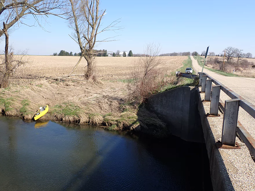
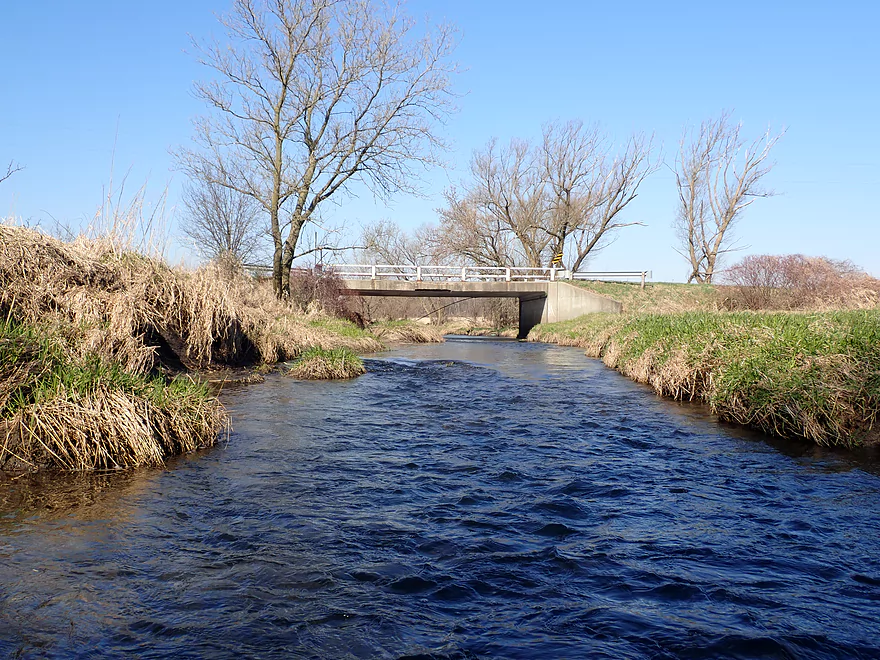
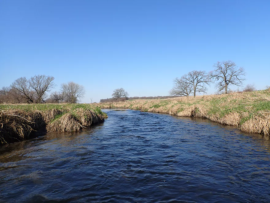
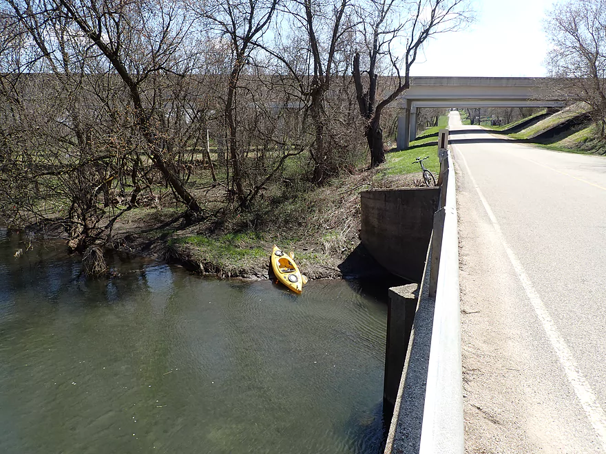
Starting the trip at S. County Line Road
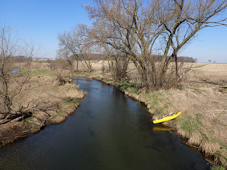
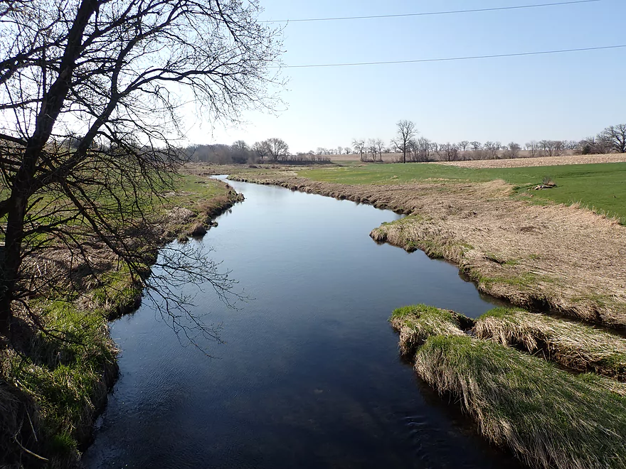
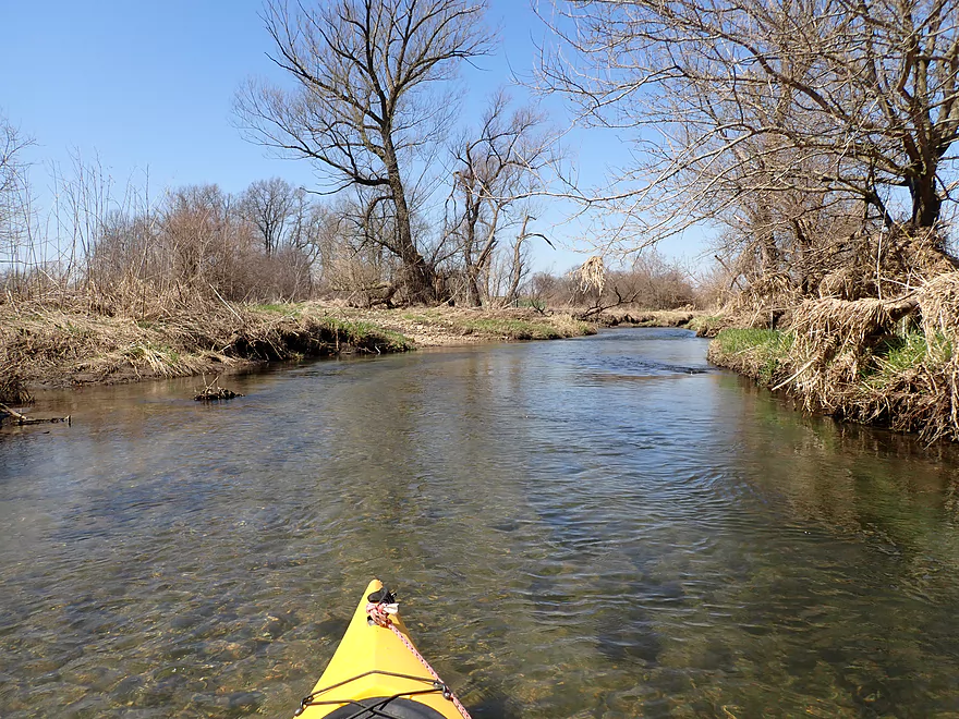
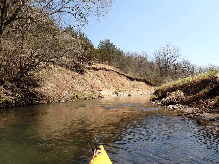
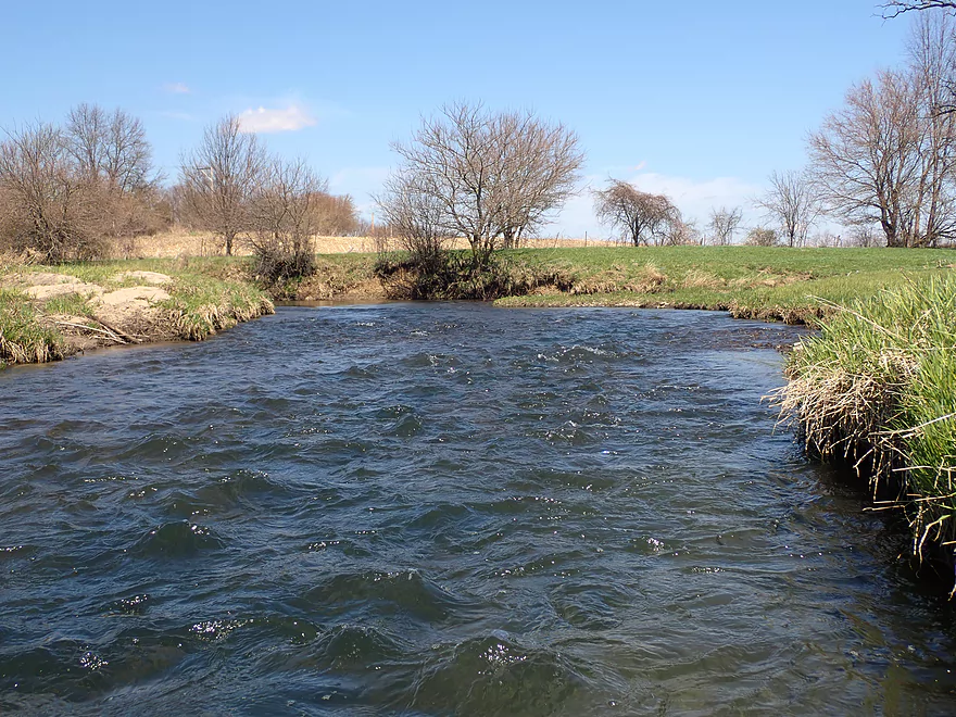
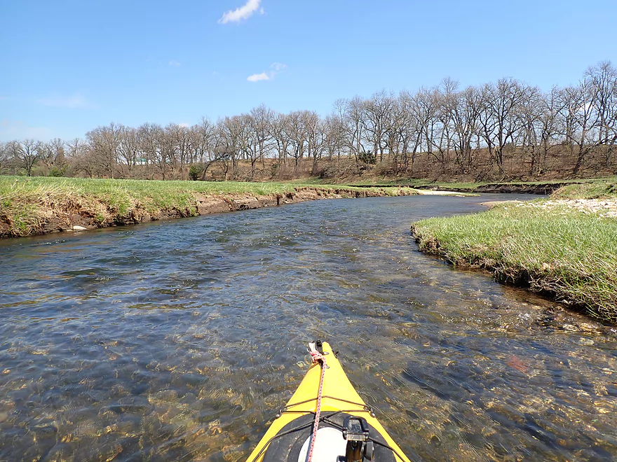
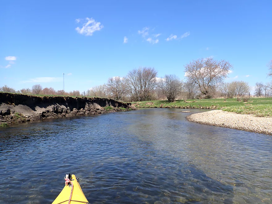
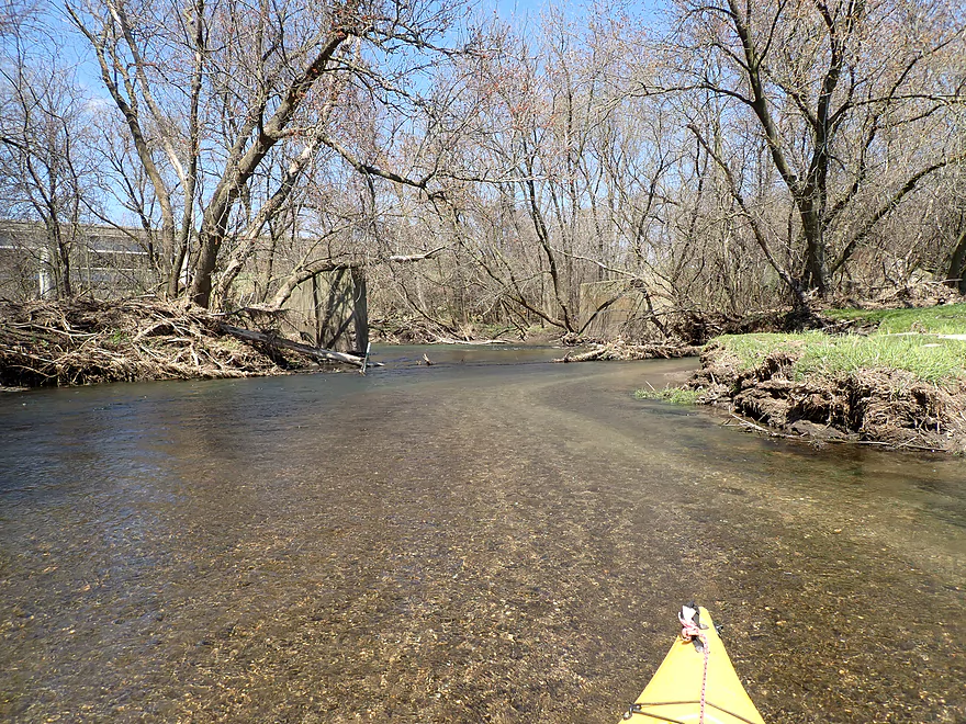
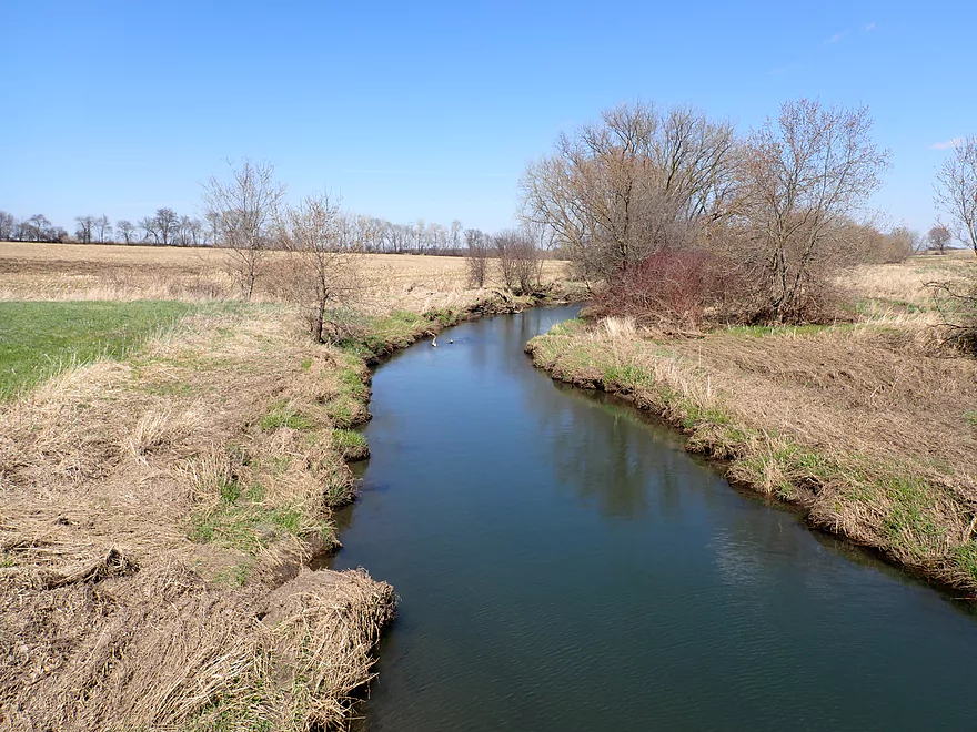
Looking upstream
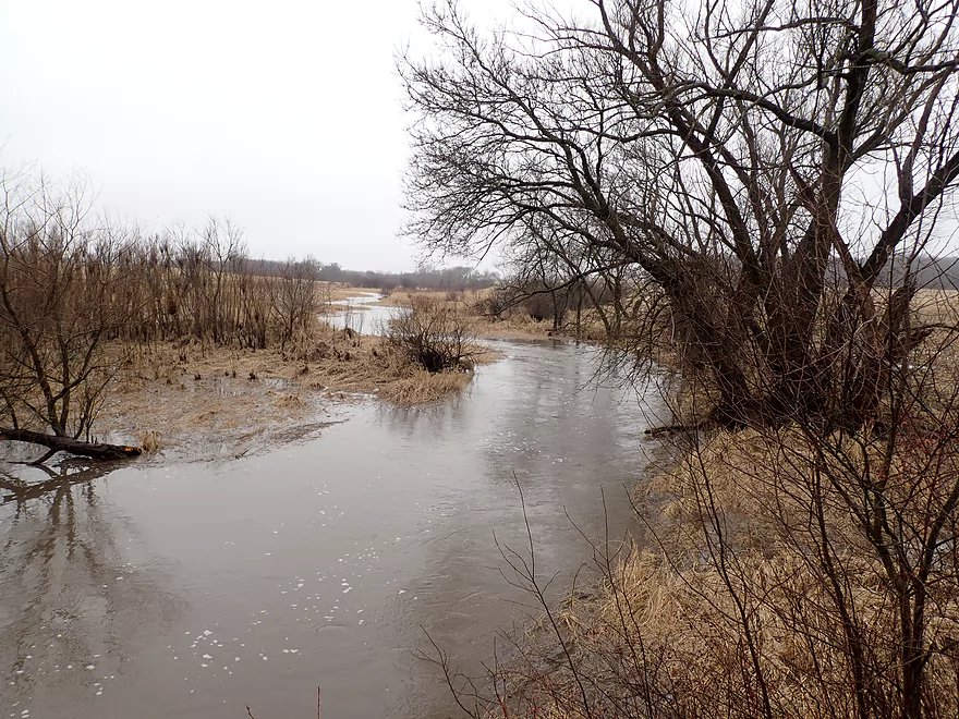
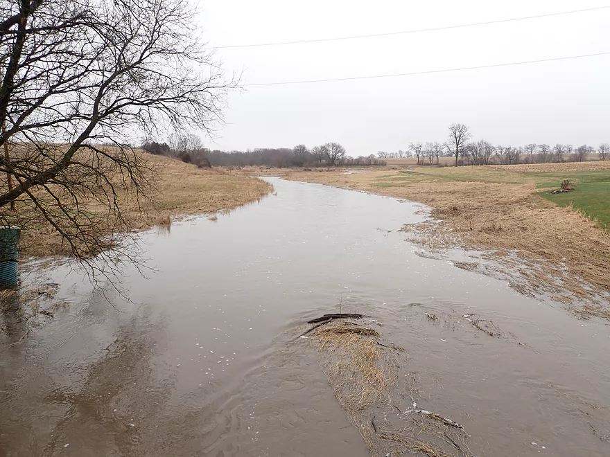
Same view…but during high water
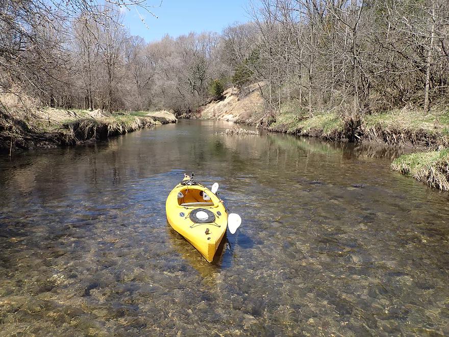
Nice launch area
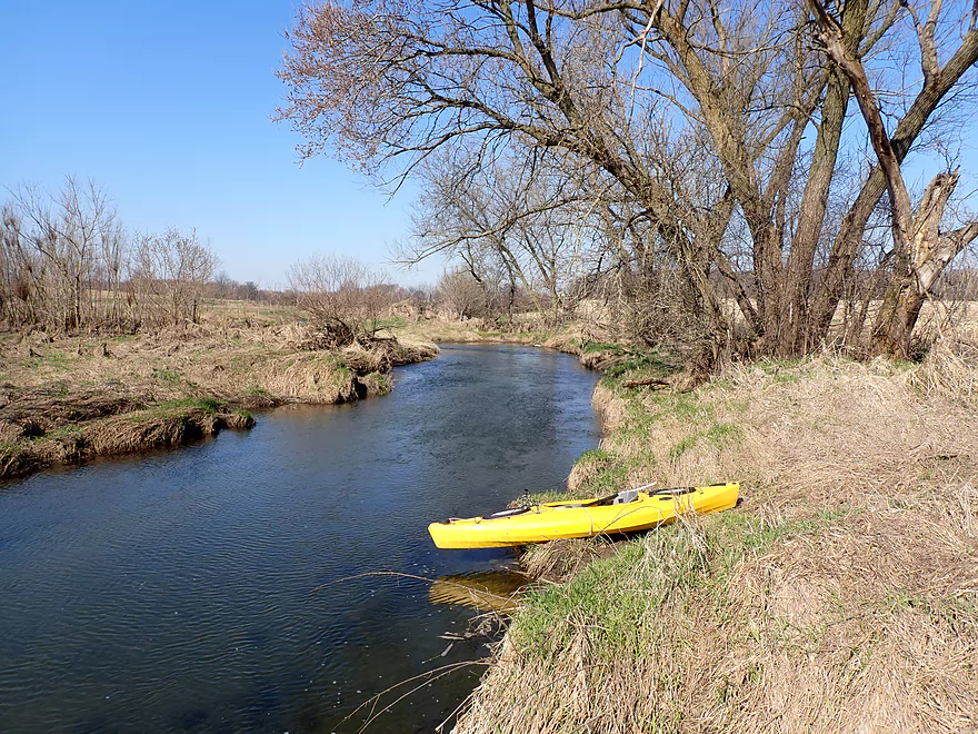
Reverse view of the bridge
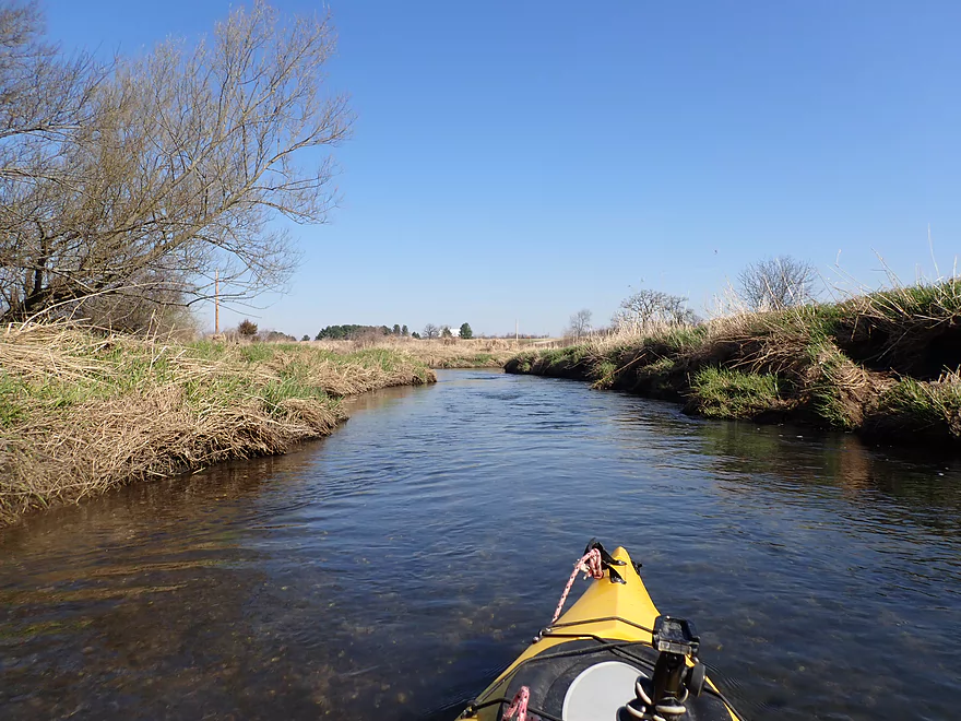
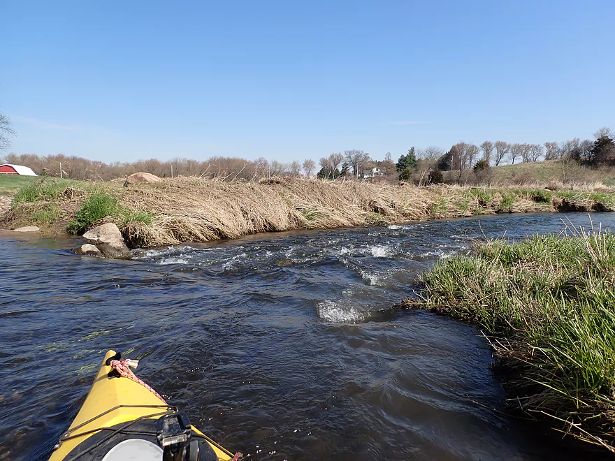
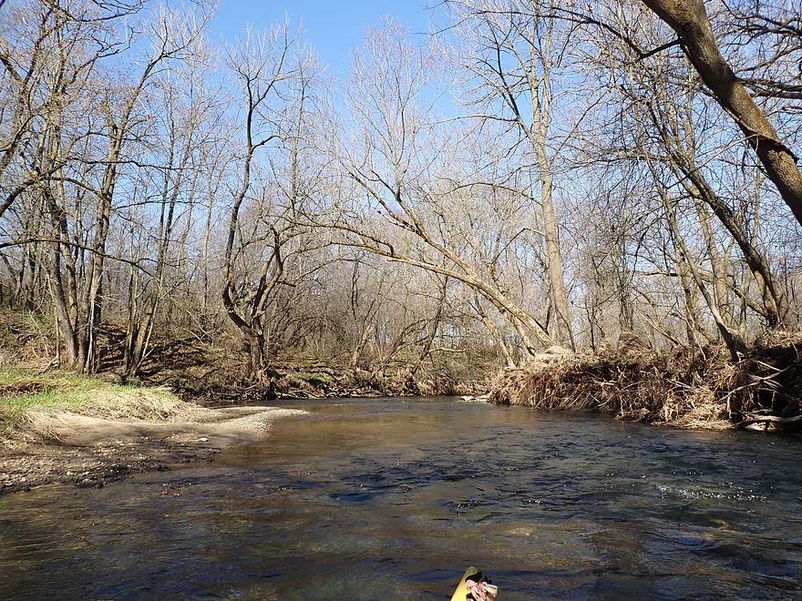
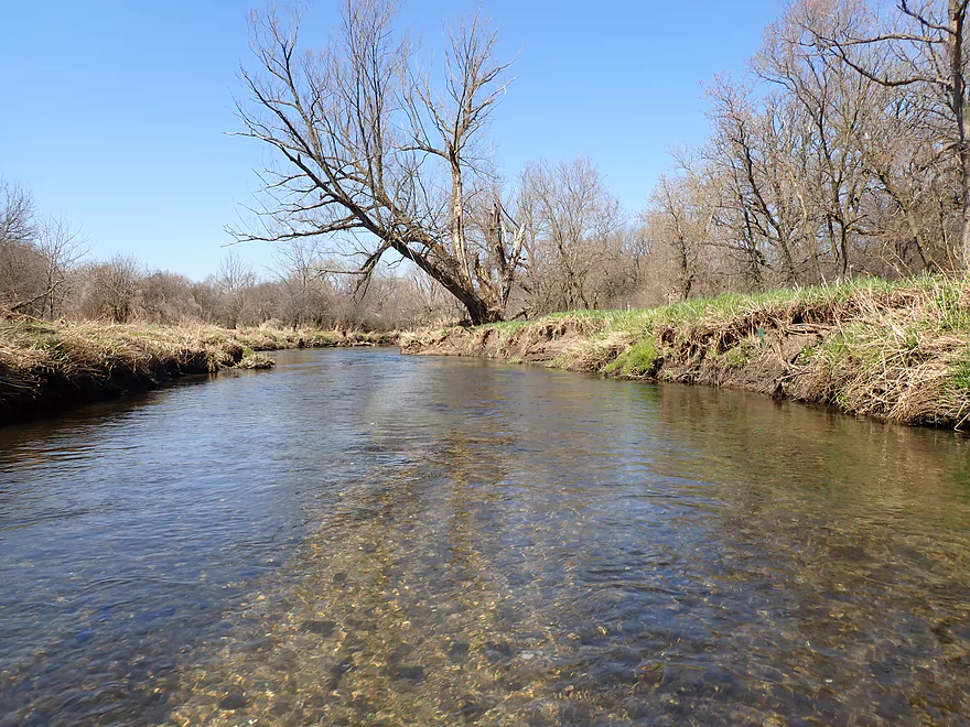
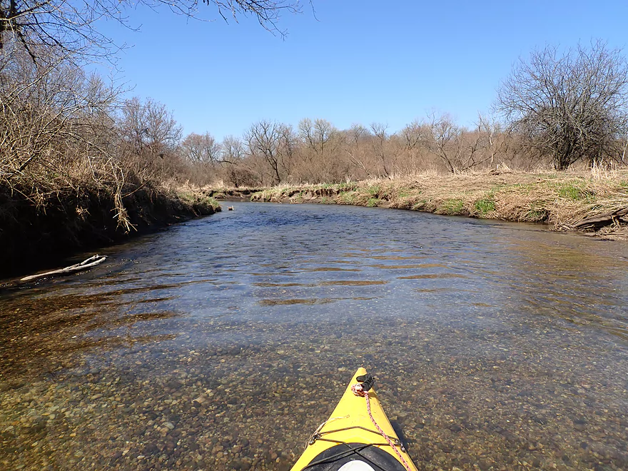
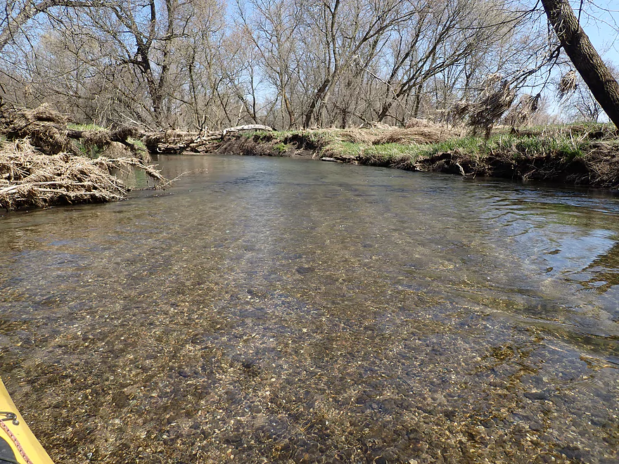
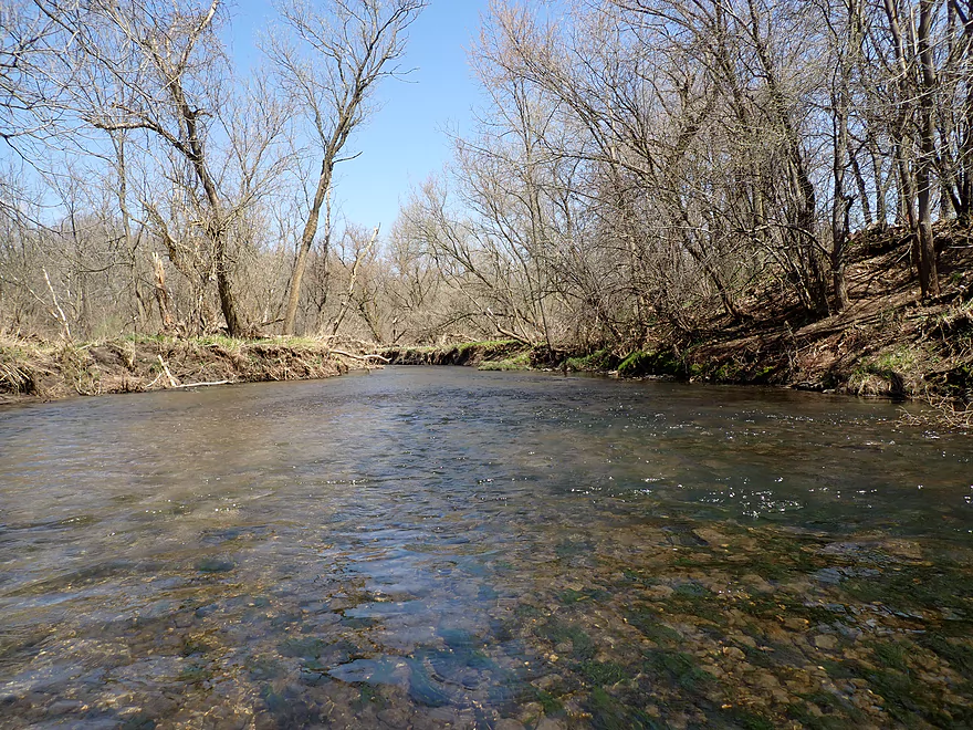
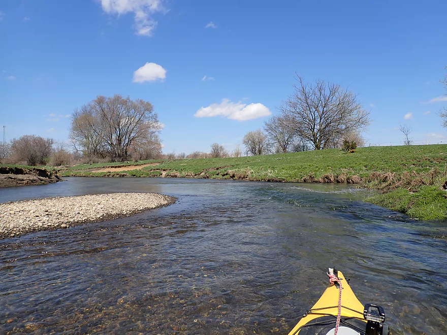
Creek starts like a Driftless trout stream…open, clear and fast
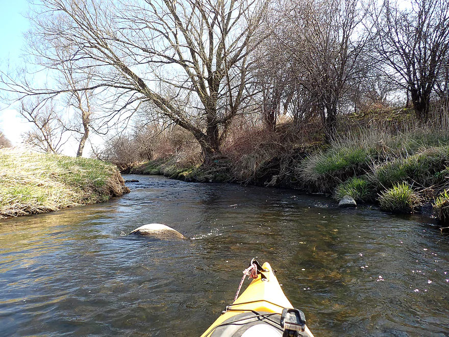
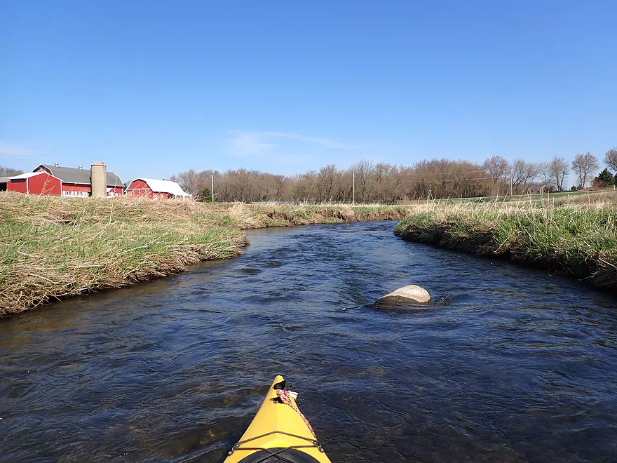
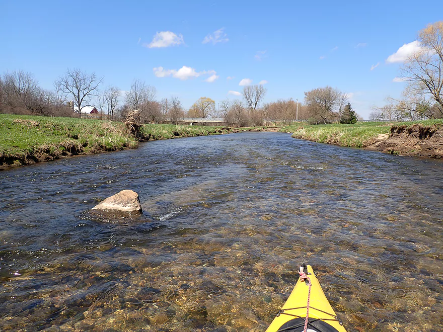
Some glacial erratics
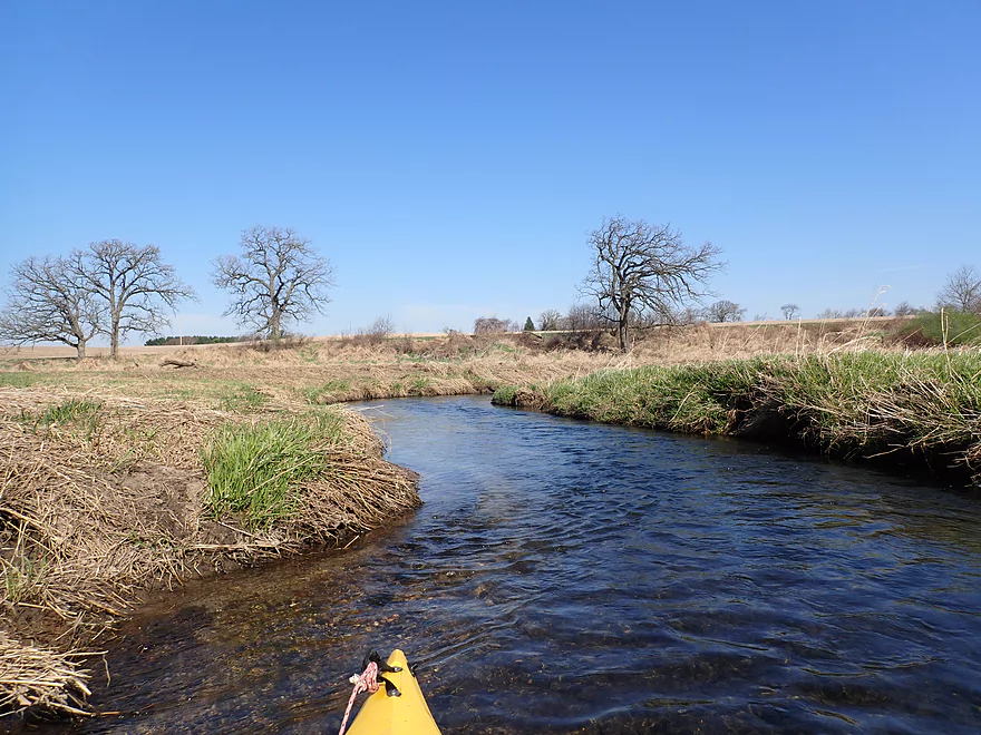
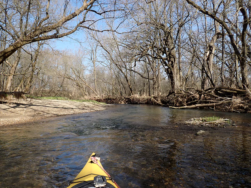
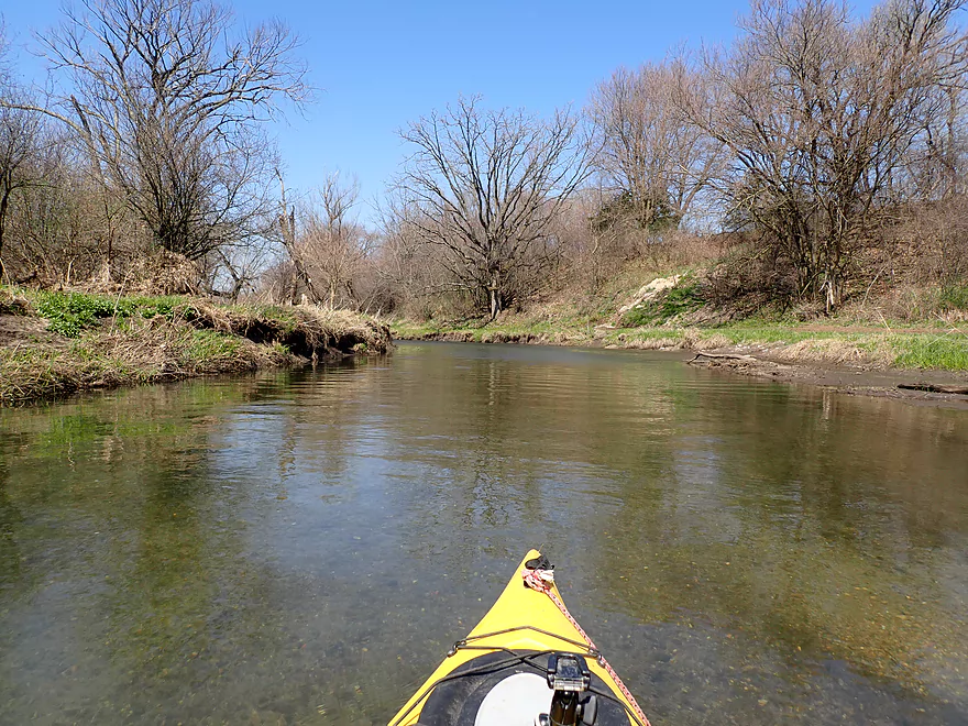
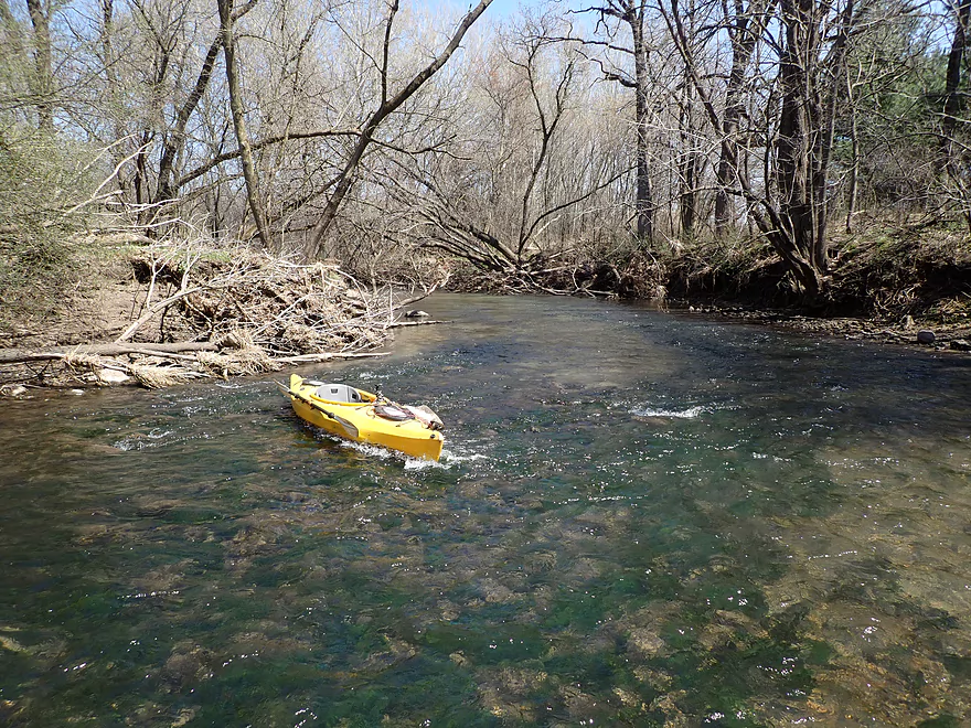
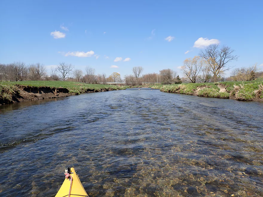
Good current
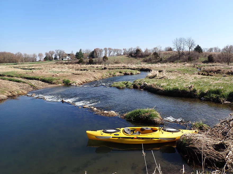
A small rock dam
Easy portage
Followed by some nice rapids
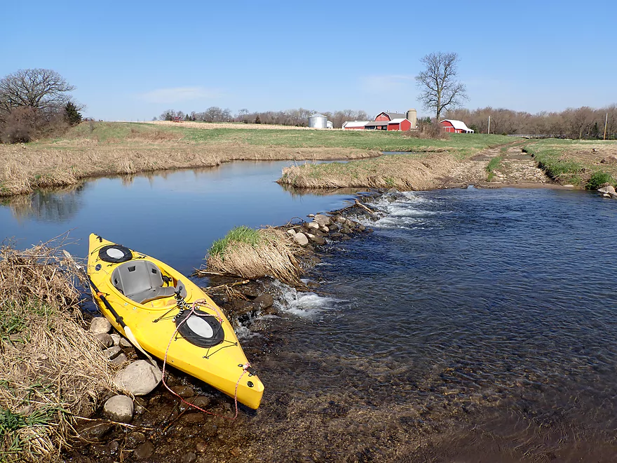
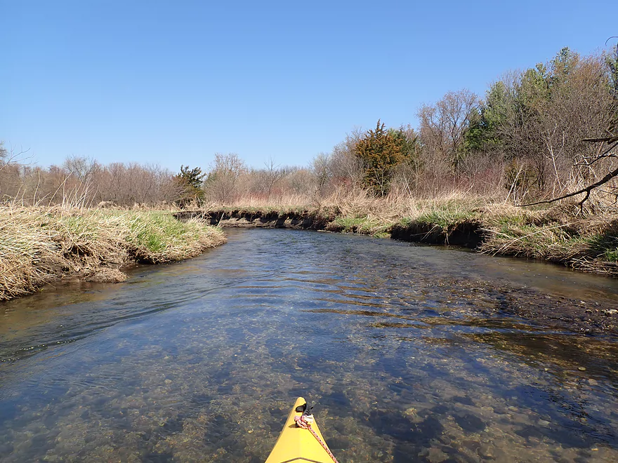
There was a nice buffer between the creek and the nearby farms
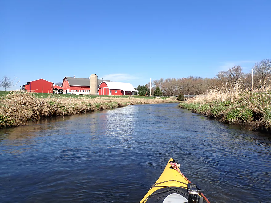
Photogenic barn
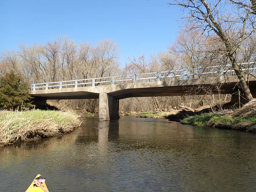
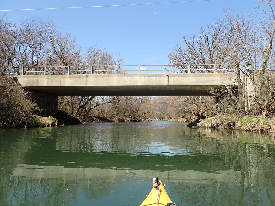
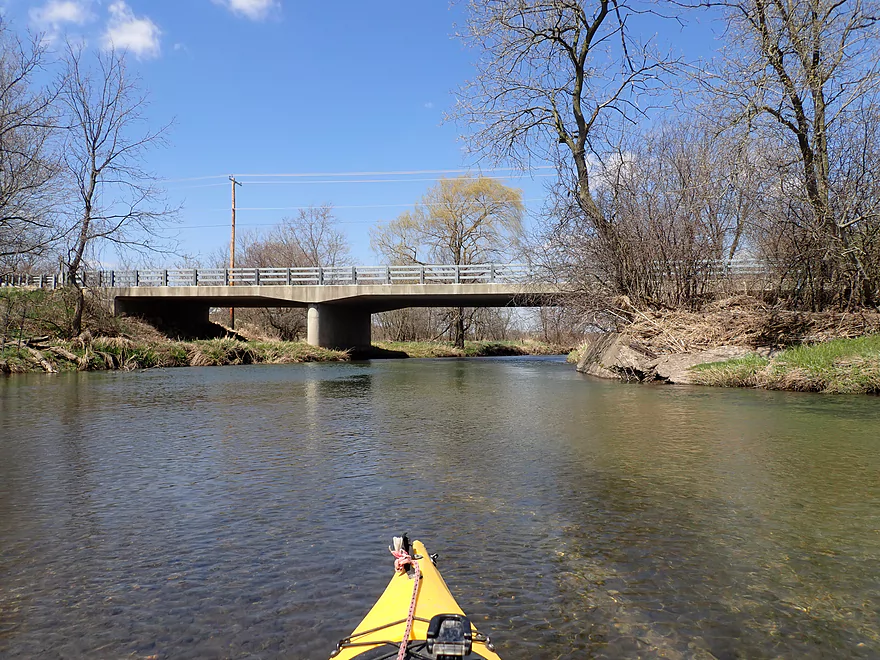
Lake Shore Road
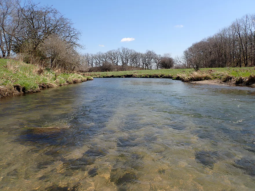
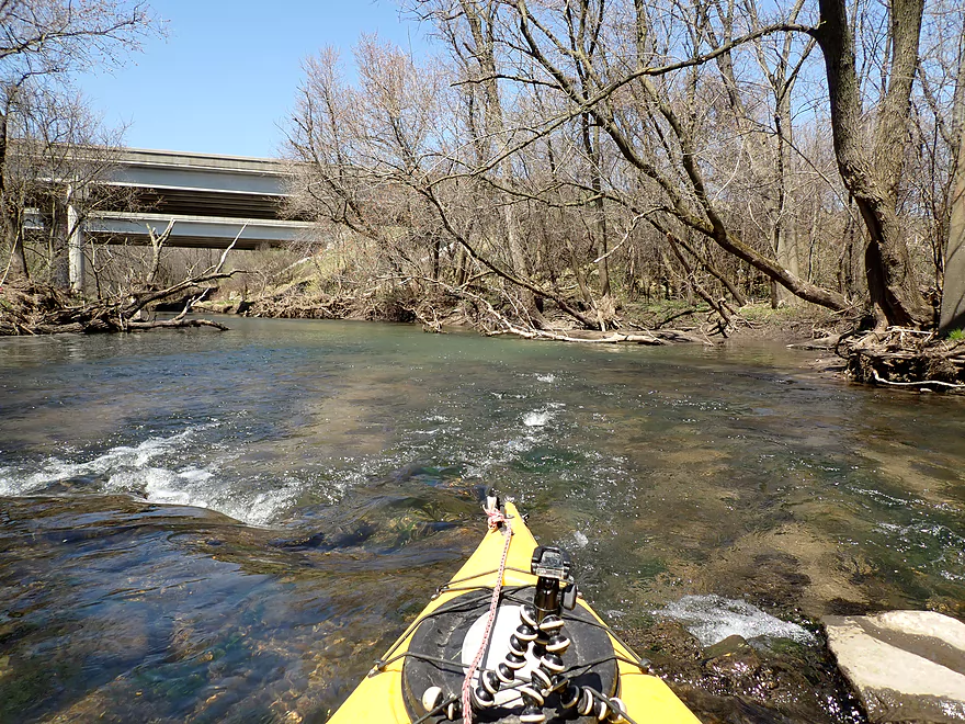
View upstream from bridge
Same view…one month earlier
View downstream from bridge
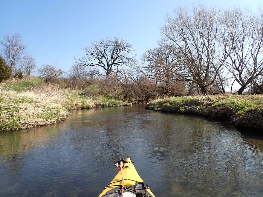
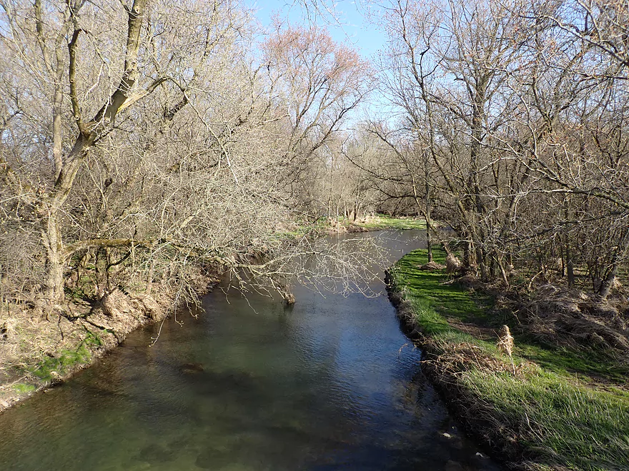
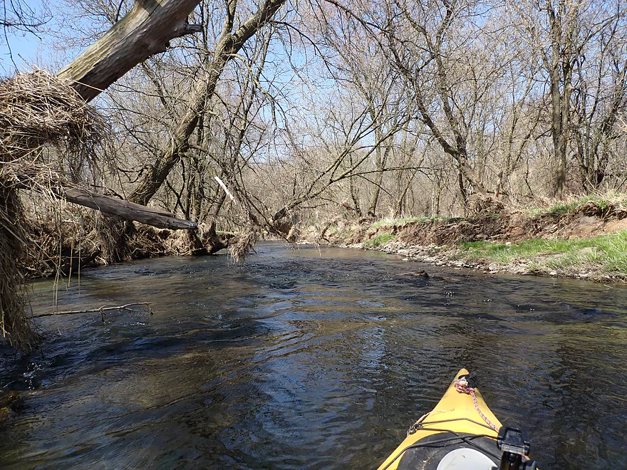
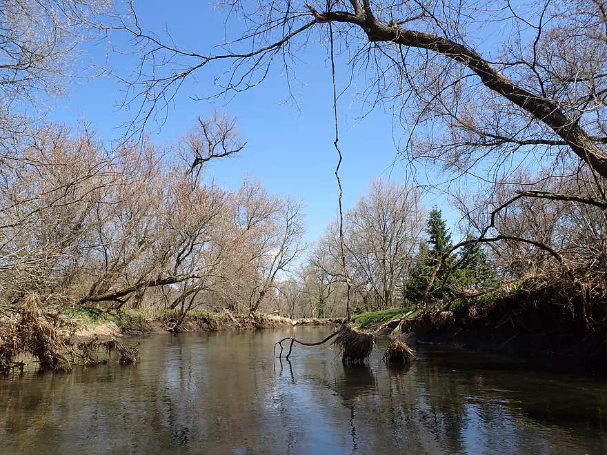
Entering a nice woods
Very much reminded me of Black Earth Creek

Creek starts to open up again
Being passed by a large mink
Current stays fast
Clean substrate
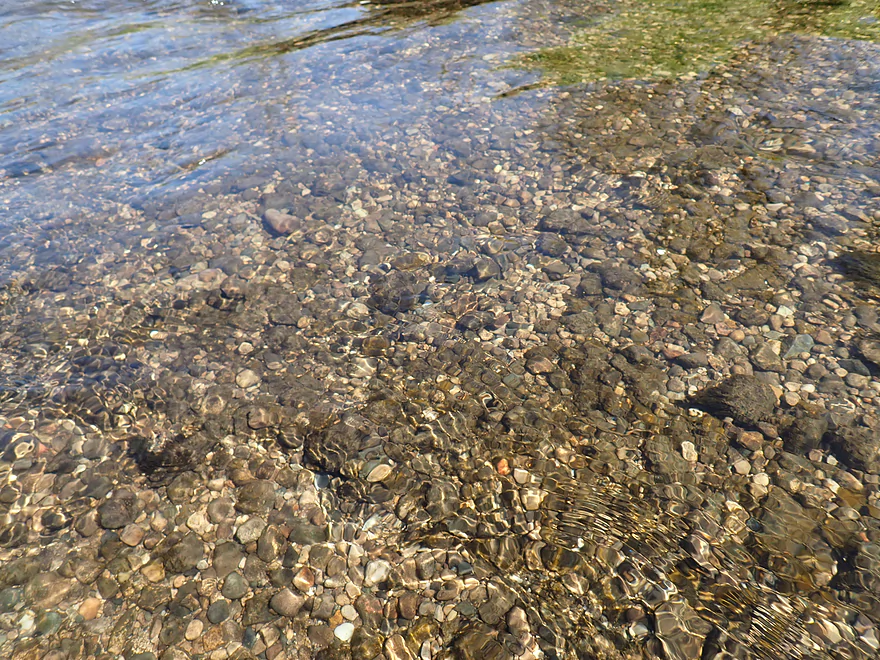
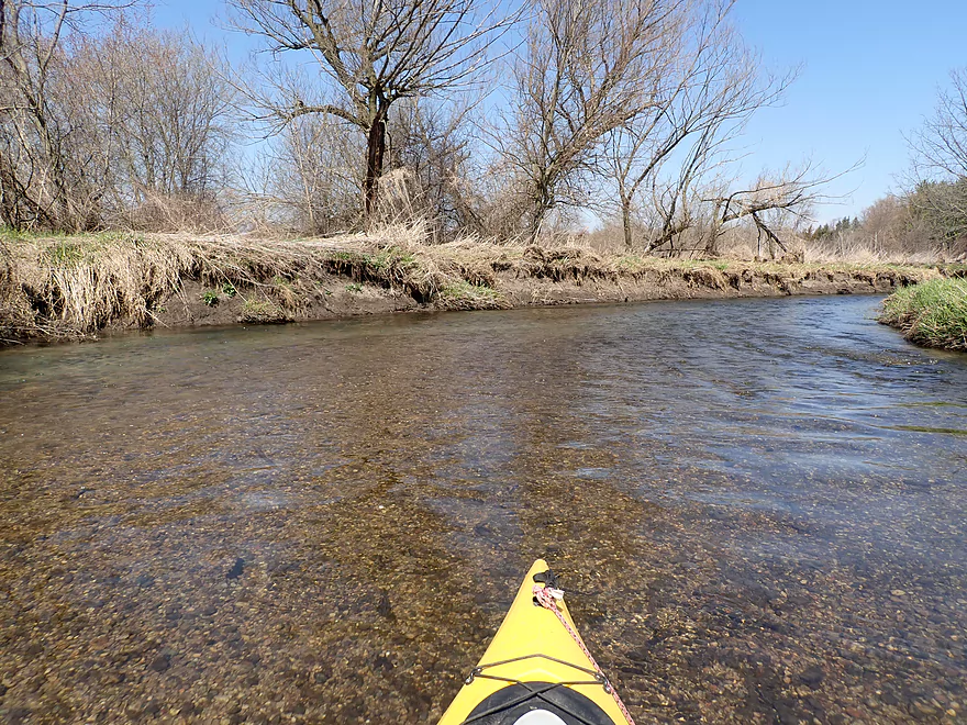
Lots of pebbles on this trip
Grass in the tree marks an earlier high water mark
Some surprise red cedars
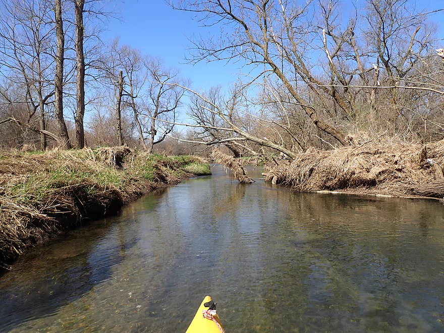
Some low branches, but nothing too difficult
Current creates sediment ribbons in the substrate
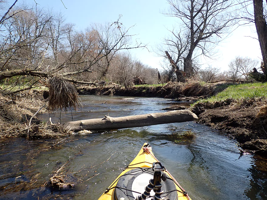
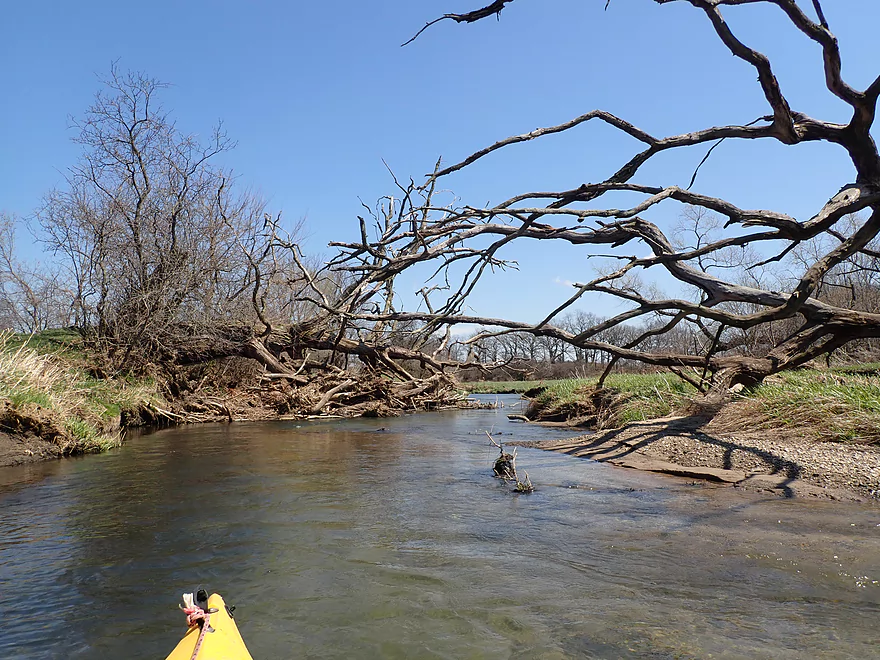
Only logjam…I hopped over the left side…easy portage right side if you prefer
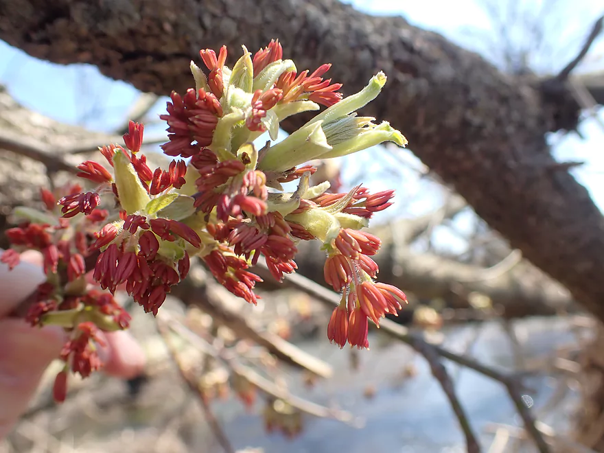
Boxelder flowers
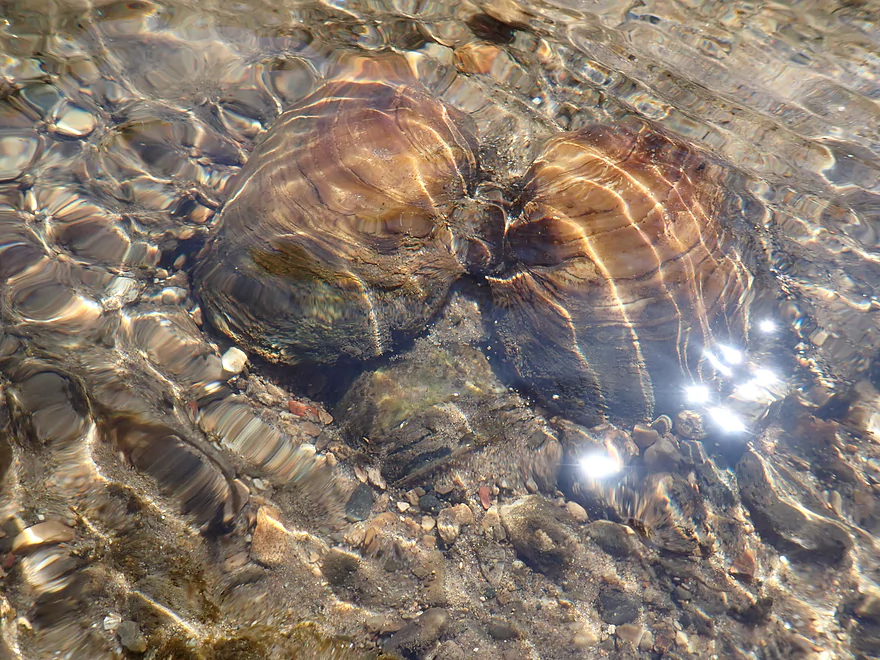
Standard clam
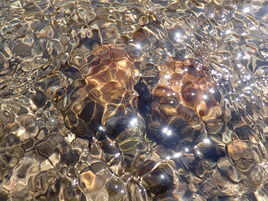
Abstract clam
Entering another small woods
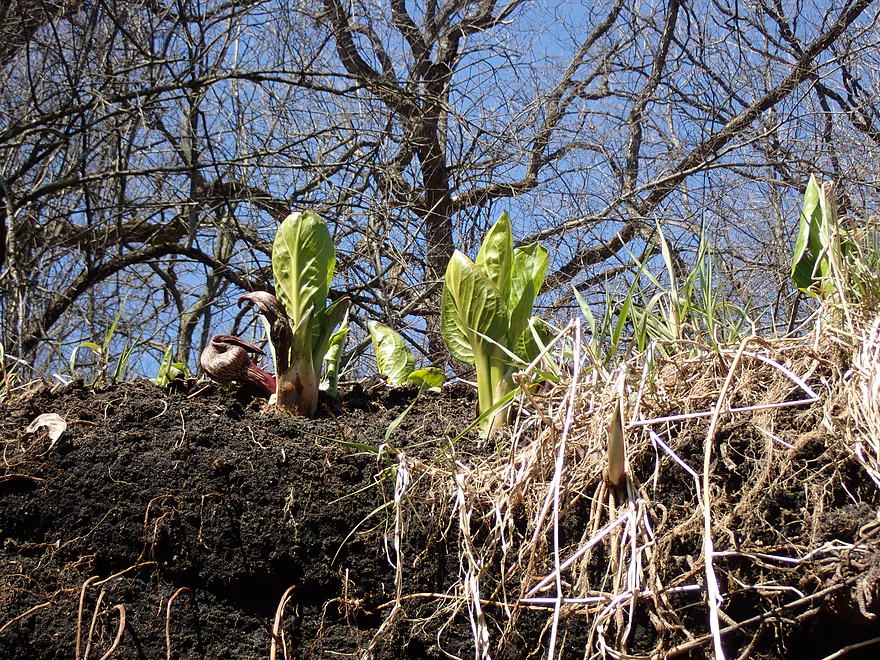
Some skunk cabbage growing near springs
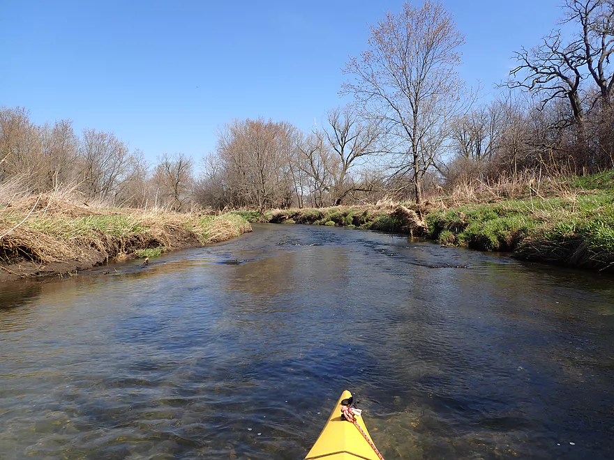
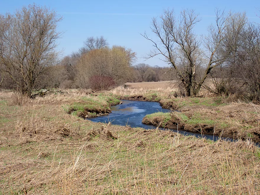
Scenic creek
Quite the vine
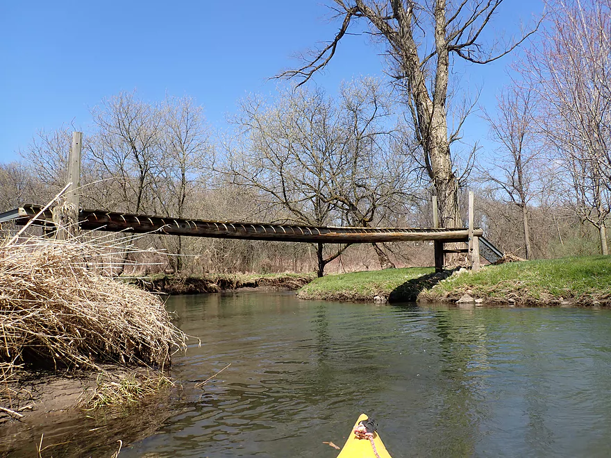
Attractive walkbridge
Some of the nicer rapids

Reverse view
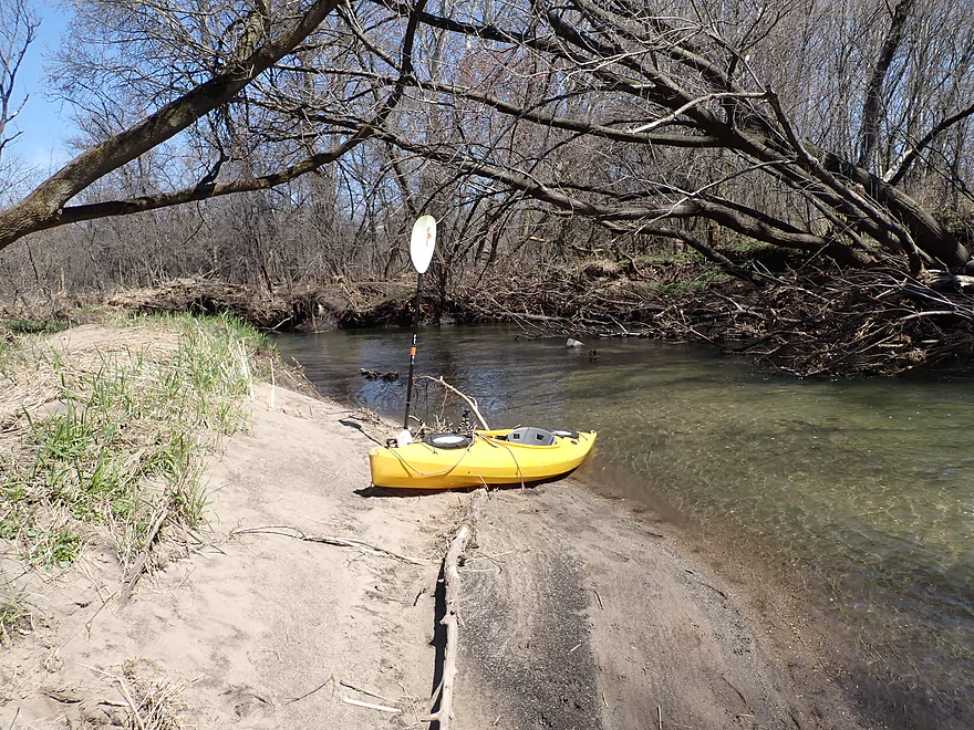
Taking a break on a sandbar
Zipping along
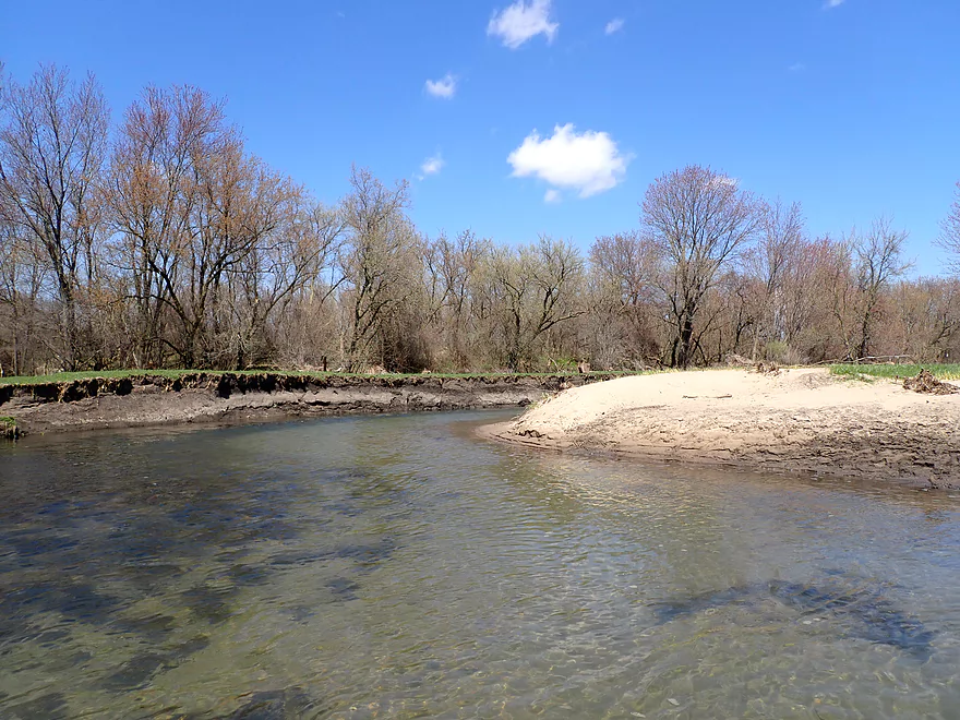
Large sand bank
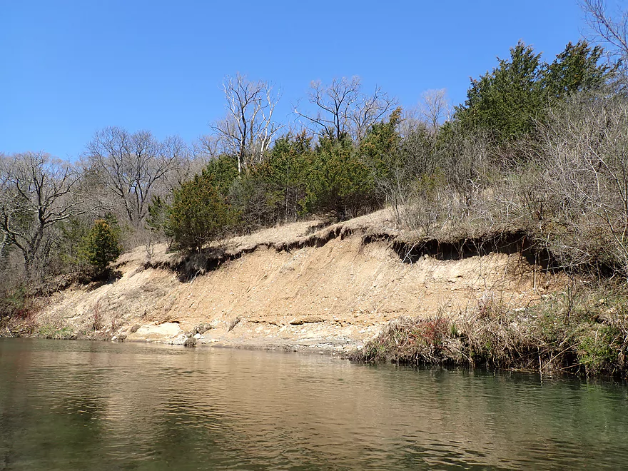
Reverse view (note the red cedars on top)
Attractive stretch
Temperance Trail

Downstream view from bridge
Rapids get a bit more robust
Some snag dodging…nothing serious
Creek really opens up after Temperance Trail
Scenic bluff
Super scenic

A line of bur oaks
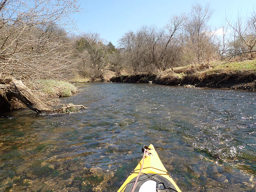
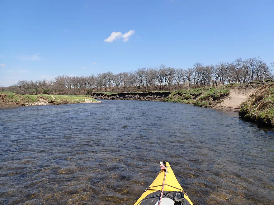
Nearly perfect water clarity
More glacial erratics
Hwy X

A leaning boxelder
One of several gravel bars
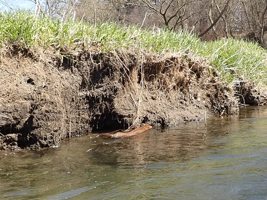
Despite the clean water, there were some mud banks
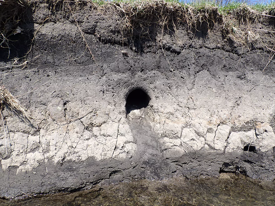
This mud bank is somebody’s home
The best sandbar of the trip
Colorful substrate striations weave with the current
Remnants of an old bridge
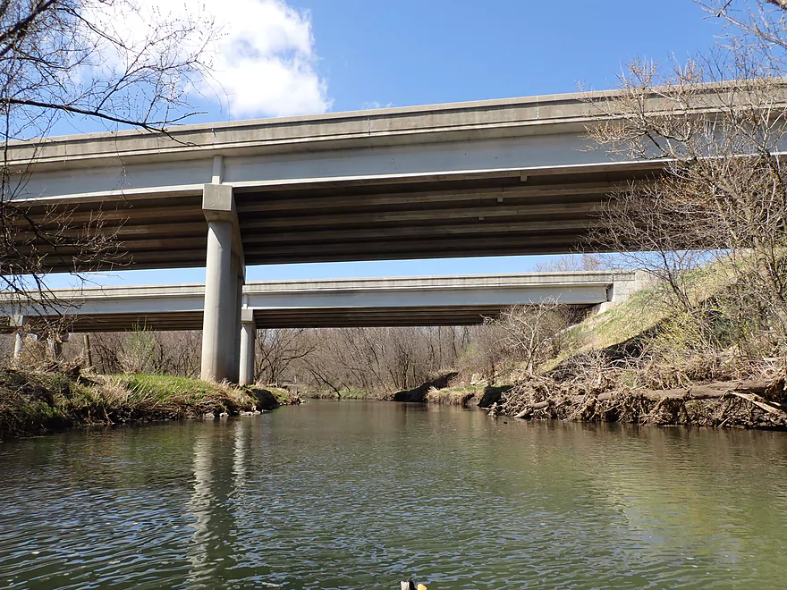
Nearing the take-out…Hwy 43 towers overhead
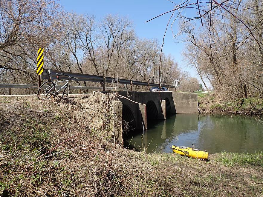
Ending the trip at Hwy N
Bit muddy…but a nice access
Scouting other bridges after the trip…Hwy J looks nice
Summerville Road is another viable access option
Little Turtle Creek

Turtle Creek is a popular paddle trail located just east of Beloit. I’ve paddled it twice before and both times were positive experiences. This winter when map scouting the area, I came across an obscure tributary called Little Turtle Creek which appeared quite tantalizing. Light rapids and good water clarity were clearly visible from satellite imagery, and there didn’t seem to be many logjams. I scouted it in person about a month ago but it was flooded and unappealing. I still had good vibes about the creek though, so when creek levels finally settled down I jumped at the opportunity to paddle it.
My initial plan was to paddle this creek in two parts (J to Lake Shore and later Lake Shore to N). But Lake Shore was a bad bridge access so I scrapped those plans and settled for launching a bit upstream at S. County Line Road. The first mile was very nice…small, fast and open. It was very reminiscent of many of the Driftless trout streams I’ve paddled in the past despite it not being a Driftless paddle. Clarity was good, which provided a nice window to see the clean pebble substrate and occasional fish.
Soon Ladd Creek added good volume to the creek and I would pass under Lake Shore Road (the bridge I initially hoped to start my trip on). The next half mile flowed quickly through an attractive woods that reminded me of Black Earth Creek (another Ice Age paddle). Little Turtle Creek is located just south of the terminal moraine created by the Green Bay Lobe (a massive glacier). At its front, it ground up many rocks into small pebbles and bulldozed them to the front of the terminal moraine. These pebbles and glacial rocks are why “Ice Age paddles” run so uniquely clean and clear.
Despite the creek being in “farm country”, there was a significant buffer that flanked the creek and I rarely saw farm fields which was appreciated. The creek would meet a south-facing hill which I presume was some type of glacial feature. Natural seeps sprung out of the banks and skunk cabbage grew nearby. Along the hill was a large sand bank which was a unique sight for this area of the state.
Following Temperance Trail, the light woods were replaced by flat, open grassland as the creek widened. This sounds uninteresting, but the scenery was surprisingly attractive here with multiple light rapids, colorful pebble bottoms, and nice bluff vistas in the distance. Little Turtle Creek is one of those infrequent Wisconsin rivers that flows north…so on a sunny day this means paddling into vibrant blue skies and bright blue water.
The creek would stay scenic after Hwy X and feature colorful substrate striations that weaved with the current. There was a surprising amount of sand here including several small sandbars. I ended the trip at Hwy N, which despite practically being under busy Hwy 43, was a good access. At the take-out there were some locals including a kayaker who left just as I arrived. So much for me “discovering” this paddle. I talked to another local though who actually was surprised that I had paddled it. He had assumed it would have logjam issues…but I assured him there weren’t (I only had to deal with one jam).
In summary this was a surprisingly nice trip I really enjoyed. It wasn’t perfect in that there were some mud banks and a bit of untidy flood debris here and there. And while I ranked it five stars, I actually liked the other two five star trips I did this year more (Scuppernong Creek and Rattlesnake Creek). But…this was still a special creek with the highlights being a a consistently fast current, good clarity and a beautiful pebble substrate. My only regret was perhaps not putting in further upstream as those legs looked really nice when I scouted them. Perhaps another time. One last note…if you do this trip, save it for a sunny day…otherwise you just won’t be able to appreciate the amazing clarity.
S. County Line Road: This is a relatively good bridge access. There is a decent launch area along the NW corner.
Alternate Put-ins:
- Cty Road J: (2.4 miles upstream from my put-in) Not super private but otherwise not a bad access. In hindsight I wished I had launched here. This stretch is open with maybe 4-5 logjams, but is scenic.
- S. Summerville Road: (2.1 miles upstream from my put-in) This bridge has tight parking but is a doable access. This leg is open with maybe 2-3 logjams.
- Lake Shore Road: (0.8 miles downstream from my put-in) This is a difficult access with little privacy…not recommended.
Hwy N: Despite almost being under a larger interstate overpass, this is actually a nice access option with suitable parking, decent privacy, and a suitable (although a bit muddy) take-out area on the southeast bank. There is additional parking at the Pelishek Nature Trail 300′ to the south if needed.
Alternate Take-outs:
- Temperance Trail: (1.3 miles upstream from my take-out) Unless you’re willing to park in a farmer’s field, there’s nowhere to practically park, making this a poor access.
- Hwy X: (0.6 miles upstream from my take-out) This is a doable access but not recommended as Hwy X is a busy road, there is a long guardrail here, and the banks are steep.
- S. O’Riley Road: (2.3 miles downstream from my take-out) Riley Road is actually on the main ranch of Turtle Creek. This last stretch of the Little Turtle is wooded and nice, but there could be 4-5 logjams.
Hwy N to S. County Line Road: (3.1 miles/141′ of climbing). This isn’t a super long bike shuttle but does have some grueling hills. What made this particularly difficult in my case was pedaling into a headwind with 40+ mph gusts. In hindsight I should have shuttled in the morning before the winds picked up.
There are some dogs on this route. The first house had a pair of nasty pit bulls that ran after me but thankfully they were constrained by a fence…eventually they settled on attacking each other. There was another pair of dogs at the south end of the shuttle who chased me briefly…but once I didn’t give them eye contact they let me pass. NEVER look a dog in the eyes that is chasing you on a bike…they see it as a challenge.
There is a trailhead to the Pelishek-Tiffany Nature Trail by the take-out…but it is not practical for kayak shuttles. If you wish, you could hike it…it’s a grassy trail used by locals (mostly horse riders and those who walk their dogs).
This was a pretty safe and easy trip.
- Logjams: There was only one logjam on the trip located here. I hopped over, but it would also be a straightforward portage if you prefer.
- Rapids: Many riffles and light rapids but nothing really noteworthy. There is a one foot rock dam located here that paddlers can hop over or easily portage.
- Fences: None
Nearest Gauge: Turtle Creek @ Clinton, Wisconsin. This gauge is about 6 miles downstream from my take-out…but does include the much larger Turtle Creek so may not be completely representative.
Recommended Depths:
- 0-150 CFS: This might be too shallow.
- 151-200 CFS: A handful of rapids will be pretty bumpy but I think this will be a viable depth. Clarity will be superb.
- 201-300 CFS: An above average depth, but a good target range. Some rapids will be bumpy but it won’t be too bad. I did the trip at 237 CFS and enjoyed good clarity.
- 301-400 CFS: A high depth but likely navigable. Some clarity but not as much.
- 401-500 CFS: Likely doable but with no good clarity.
- 501+ CFS: Maybe too high for an enjoyable paddle. I scouted the creek on March 28th when it was in the process of rising from 600 CFS to 1900 CFS. At that point the creek had burst its bank and was in flood stage.
- Upstream of Cty Road J: The creek splits into two channels, both of which are small, but likely navigable. There are some logjams to deal with.
- Cty Road J to S. Summerville Road: 0.3 miles. Nice stretch, but maybe 2 logjams.
- Summerville Road to S. County Line Road: 2.1 miles. Small but scenic stretch. Maybe 2-3 logjams.
- S. County Line Road to Hwy N: 6.0 miles.
- S. County Line Road to Lake Shore Road: 0.8 miles. Good stretch that reminded me of a Driftless trout stream.
- Lake Shore Road to Temperance Trail: 3.7 miles. A long and windy stretch with some woods. Highlights include fantastic clarity and an attractive sand/pebble substrate.
- Temperance Trail to Hwy X: 0.8 miles. Very open grassy stretch with many light rapids that is surprisingly scenic.
- Hwy X to Hwy N: 0.5 miles. An open sandy section with top-notch clarity.
- Cty Road N to S. O’ Riley Road: 2.3 miles. The last leg before connecting with Turtle Creek. This is a wooded stretch with perhaps some deadfall to deal with (figure 4-5 logjams).
Trip Map
Overview Map
Video
Photos Size:
Thank you for taking this run and posting this little gem. I had been wanting to run this but had to postpone my scouting because of work. Now that you’ve reviewed it I have high confidence this will be fun. Now, it’s April 29th today and we have been drenched for almost 24 hrs. and more is coming. The weekend looks awesome but running Little Turtle is in question. From your video this thing don’t walk…It RUNS. And if that was the case two weeks ago I bet this thing’s angry right now. Your thoughts?
You know it’s likely too high right now…it might come down somewhat by this weekend but the clarity won’t be that great. If we don’t get any further rain I suspect it will be good to run in two weeks.
Making our run on LTC today. Looking forward to a great row. Will post after finished.
This little gem tricked us. The roads in the area are not well marked and we made a HUGE boo boo. We went in about a mile upstream from your posted put in. REALLY bad idea. There are 7 falls between where we went in and your designated put in place. We saw others put in there so thought we were in the right place. Once past those, the trip was awesome. Flew right over that little dam like water. It was high but not bad. The only issue we had was the barbed wire fence just before the take out. There seems no reason for its existence. But anywho…Was a great trip and your review was true 100%. Thank you and enjoy the season kids.
Hi Eric, can you calculate the exact road name of where you put in? I would like to list this as a warning to other paddlers. Was it J, S. Summerville, or something even further upstream?
Paddled on 5/31 at 218 CFS
Thank you for finding this creek! It was a a very scenic paddle with lots of twists and turns to keep things interesting. However, the barbwire fence at the end really is a problem. We had to portage river right up thru the cattle pasture and over a low section of fence into the woods. This could be a perfect local trip without that obstacle.
That barbed wire fence must have have been put up after my paddle…most unfortunate. Thanks for the feedback.
We paddled as a family on 8/15/20, when CFM was over 350 and the trip was a disaster. Water levels were very low, and we ran aground at least 50 times in the 6 miles we paddled. As the video above shows, it’s a great scenic paddle, but we will save this one for after a spring/fall storm. Like Derek advised from his 6/1/20 post, the barbed wire at the end of the paddle was a real downer–a nasty surprise at the end of our paddle. The takeout was VERY muddy and steep, so be prepared. On a different note, there are some very nice smallmouth waters on this paddle.
Thanks Mike for the update. I suspect the gauge on the Big Turtle doesn’t correlate that great to the Little Turtle. It might be ideal for paddlers to scout the bridges before committing to this trip. Also some boats draft much shallower than others…small boats with v-bottoms needs significantly more depth than bigger boats with flat bottoms.