
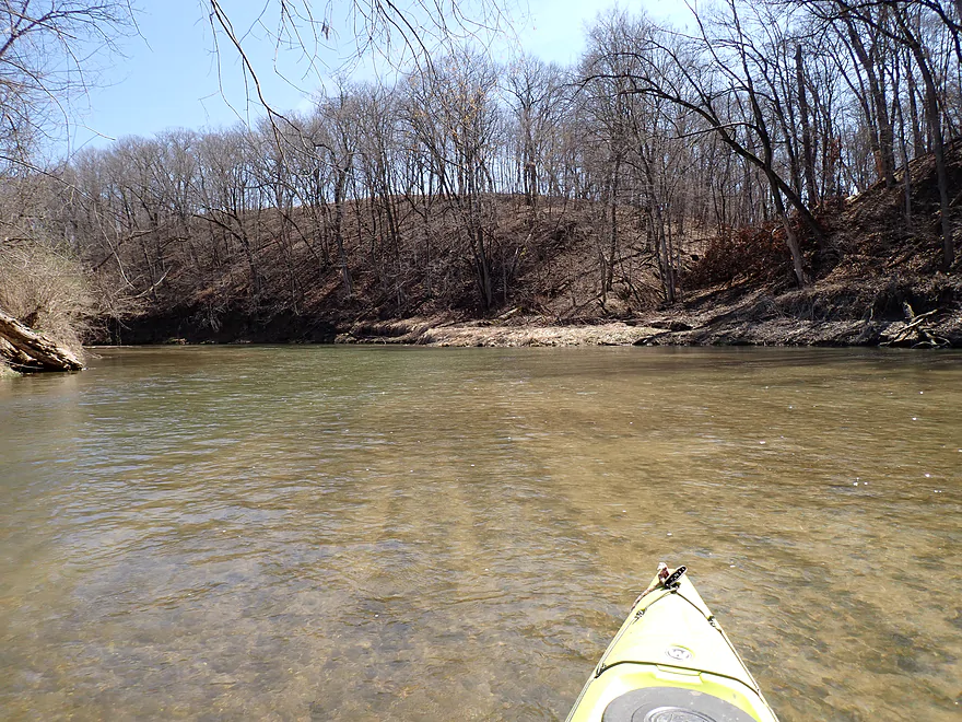
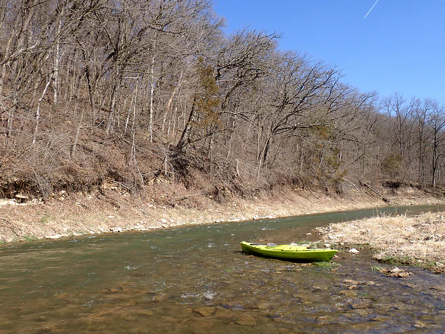
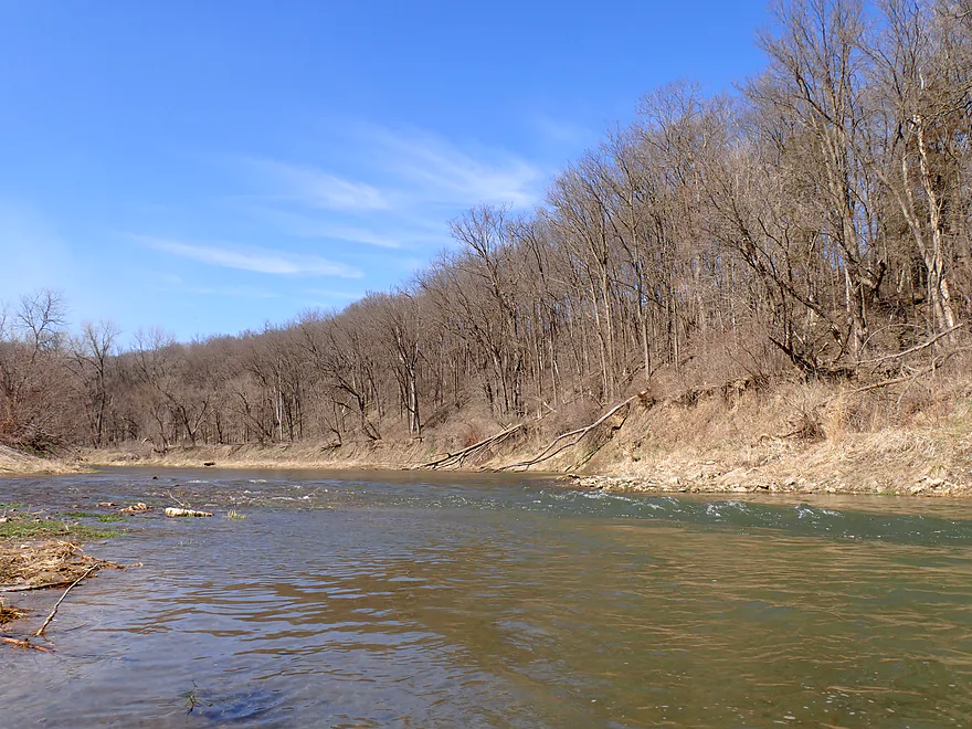
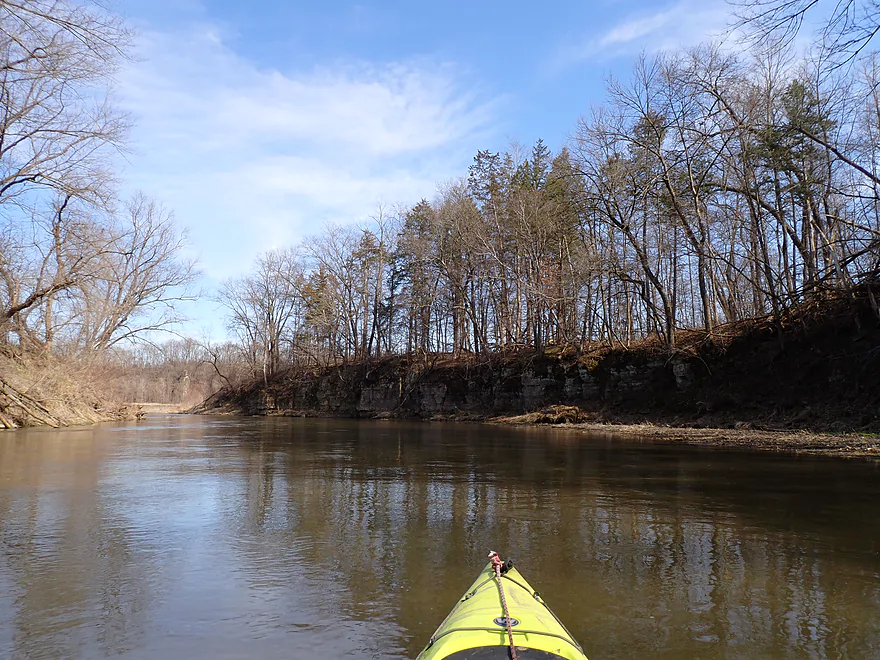
Starting the trip at the Mederville Dells

There is a hidden but really nice landing here
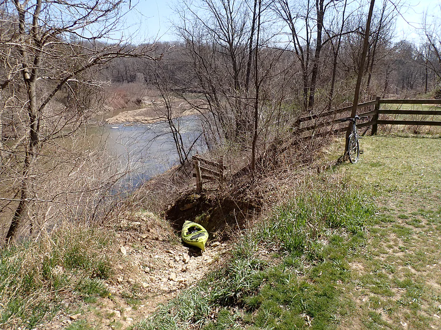
The path to the water is very steep though
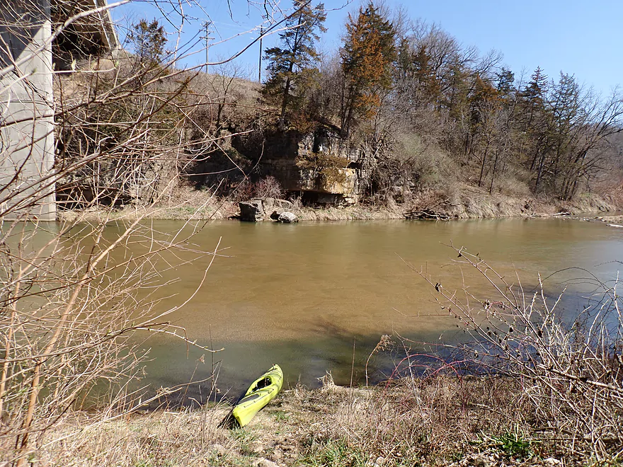
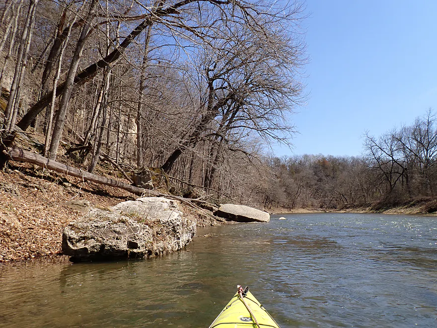
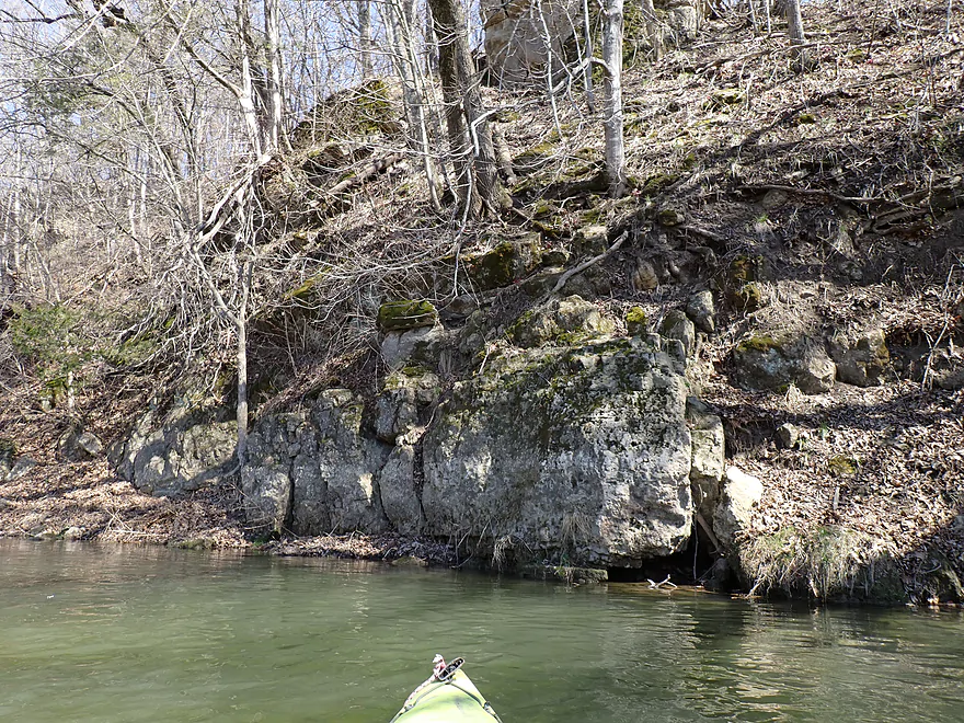
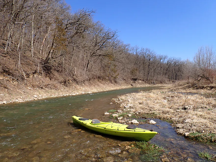
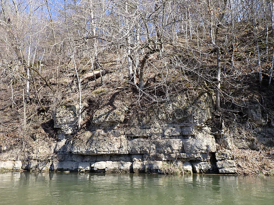
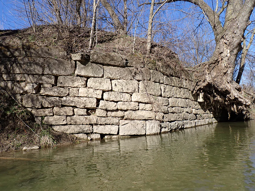
Scenic outcrop on the opposite bank
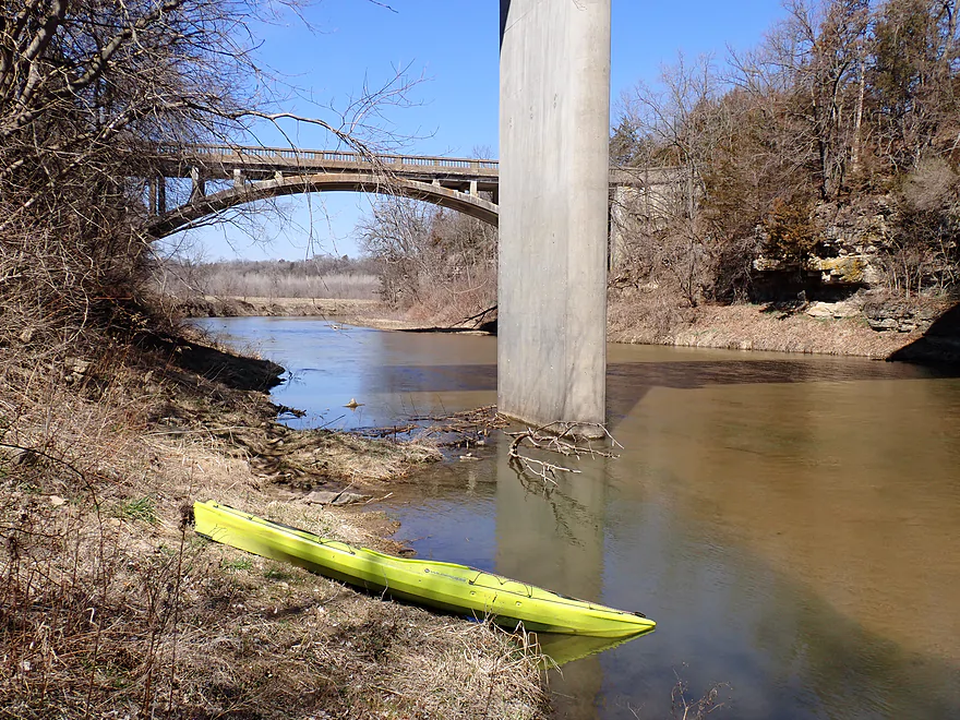
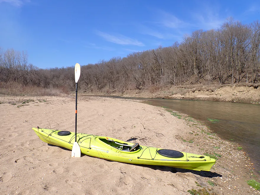
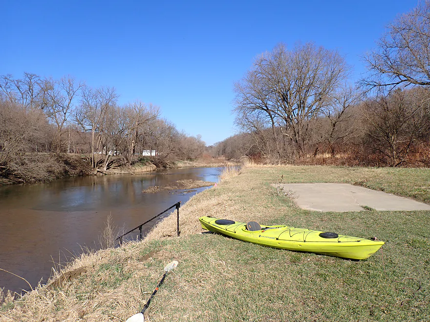
Good launch area
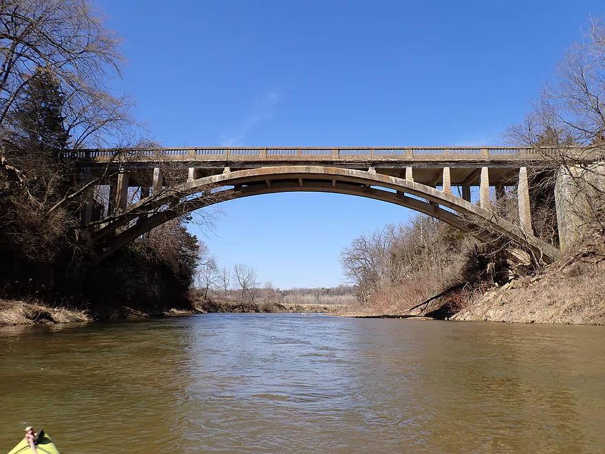
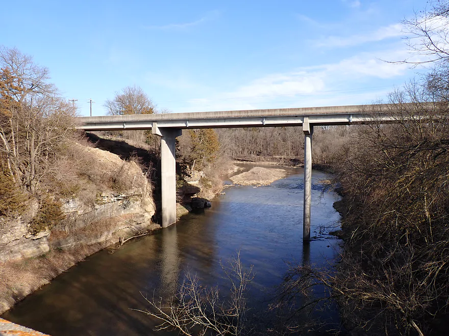
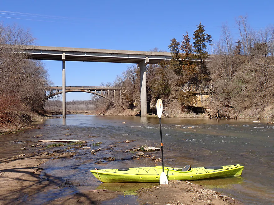
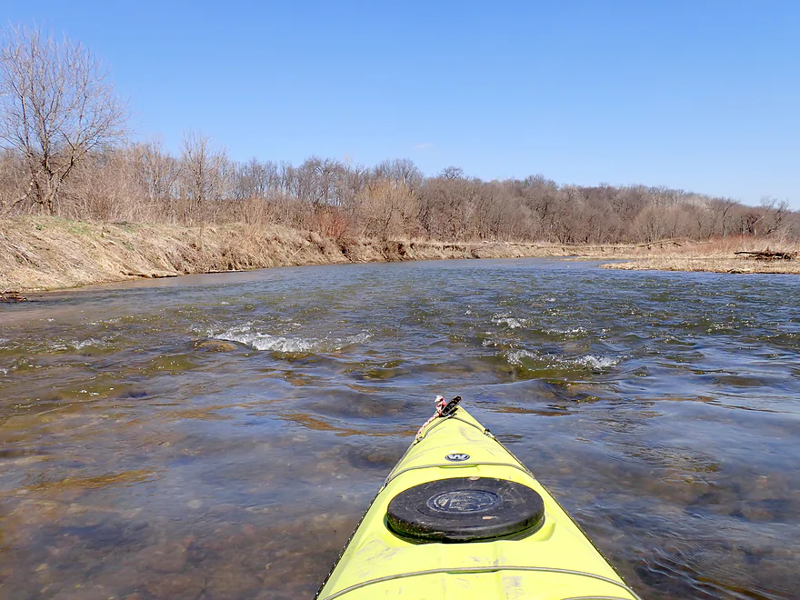
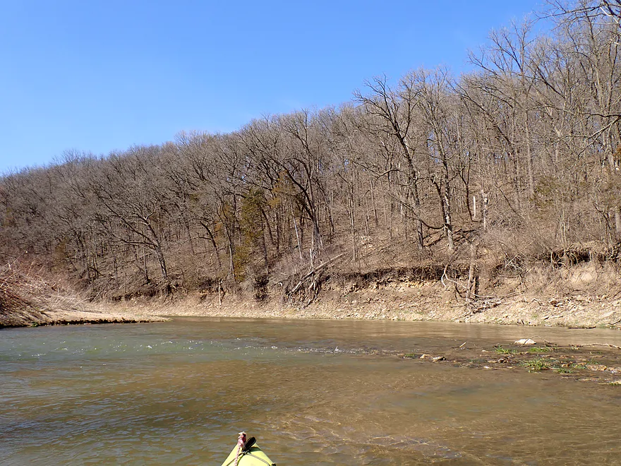
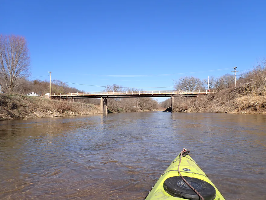
The historic Eclipse Road bridge (aka the Mederville Bridge) is just upstream
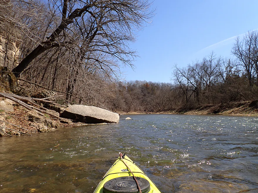
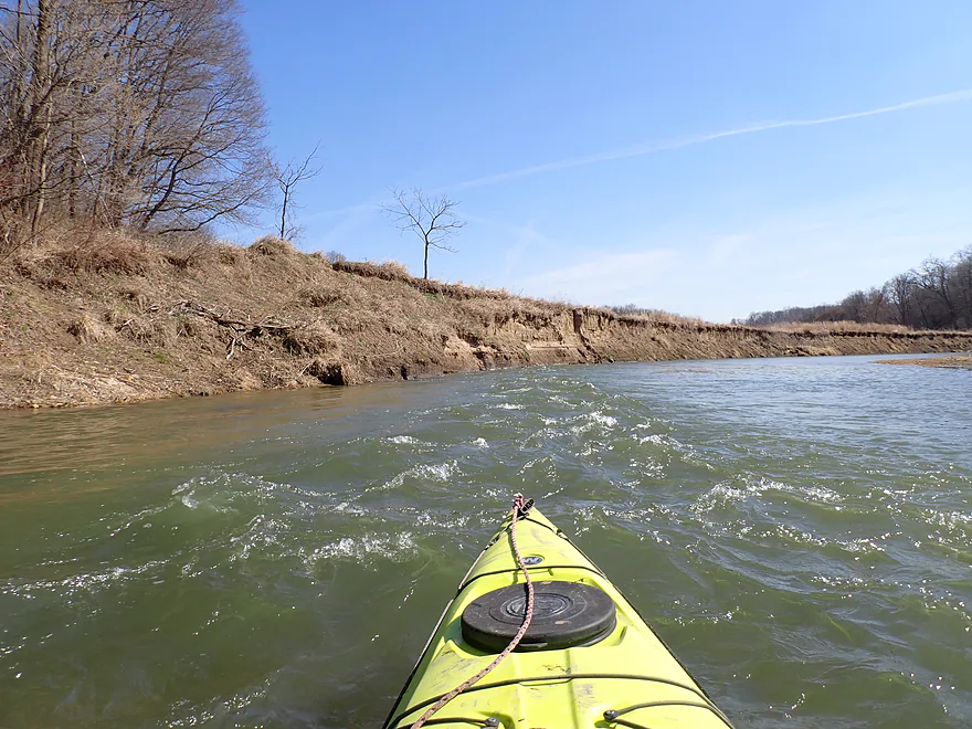
Both bridges are followed by fun rapids
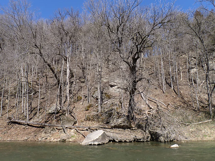
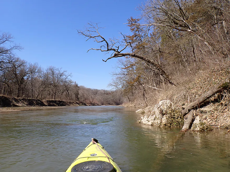
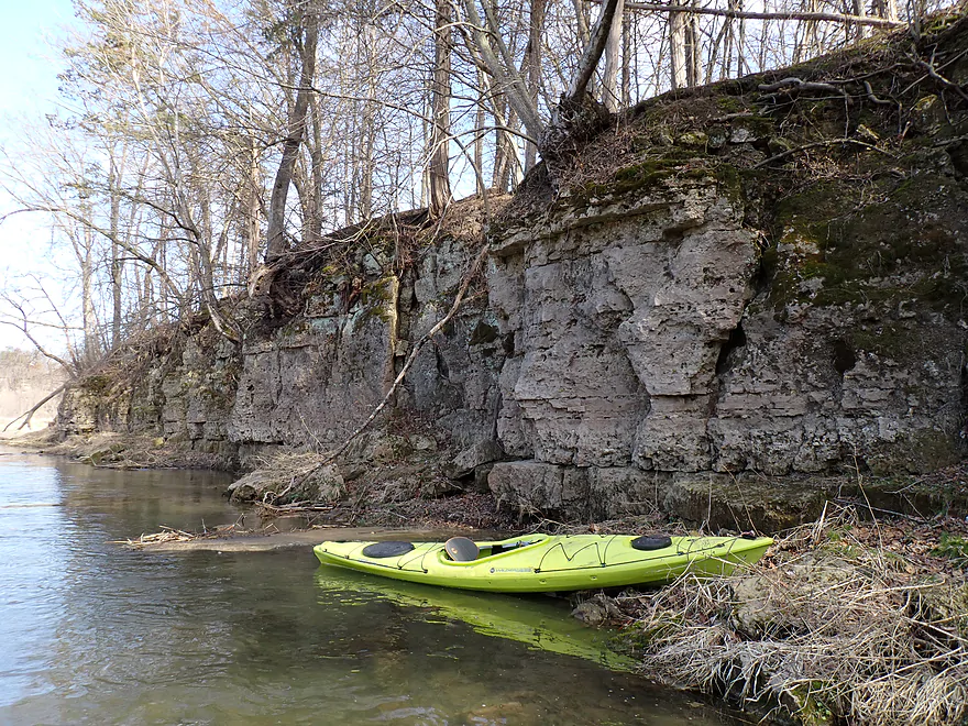
Another set of rapids leads to a steep bluff
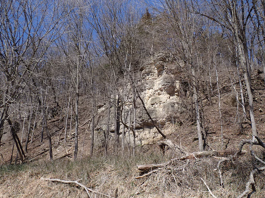
Many Iowa outcrops are located higher up and are partly hidden by trees
Boulders which broke off and tumbled down the bluff
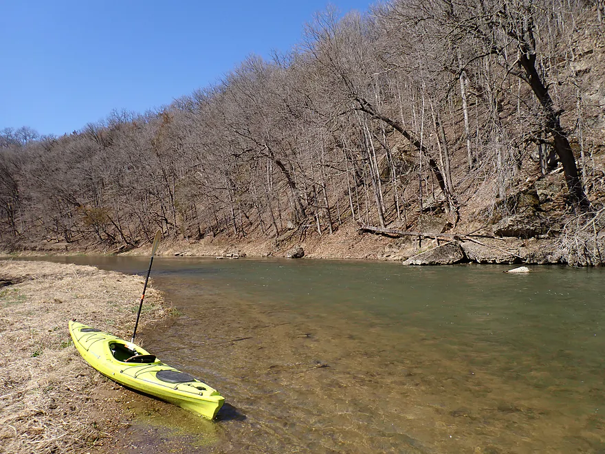
Getting out for pictures
Reverse view
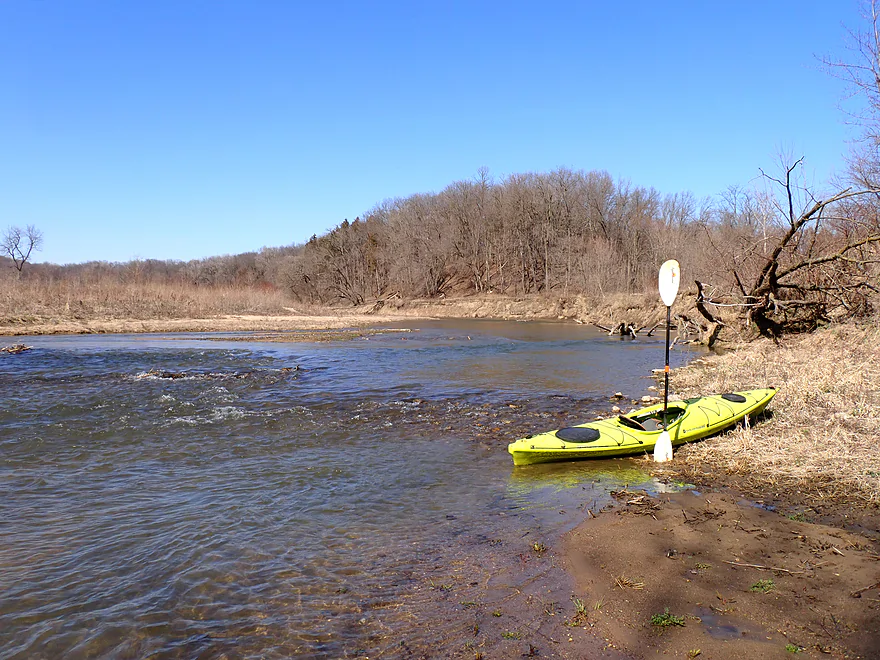
More rapids
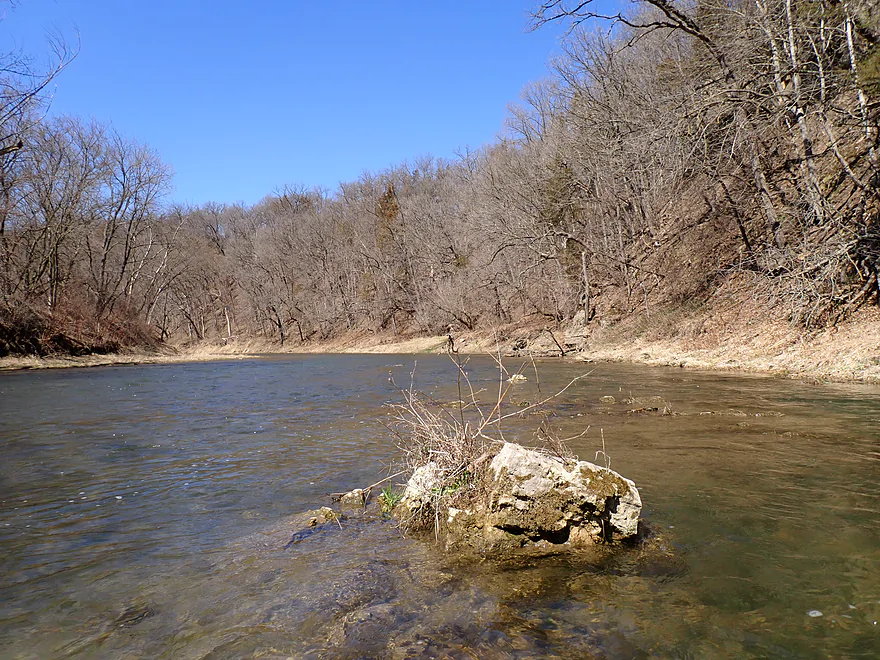
Clarity was decent

Current on this trip was pretty fast
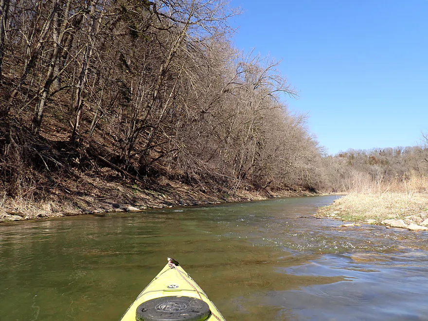
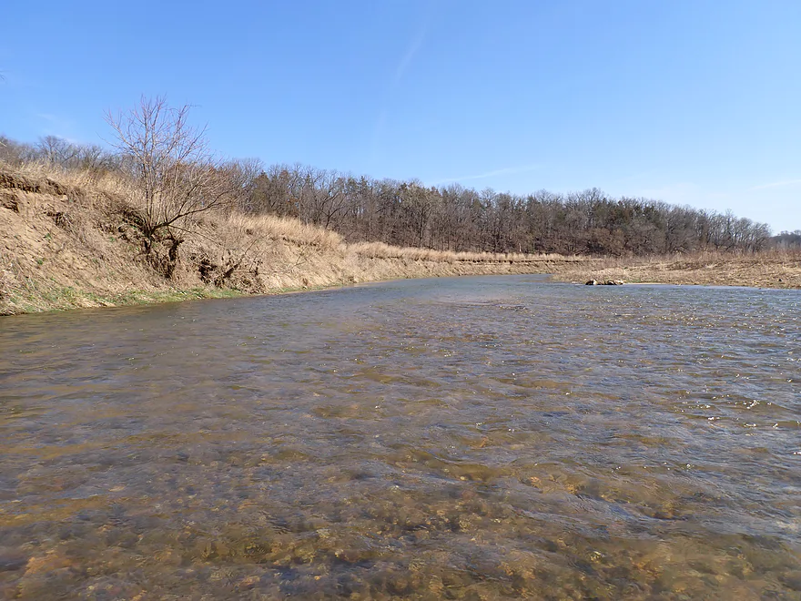
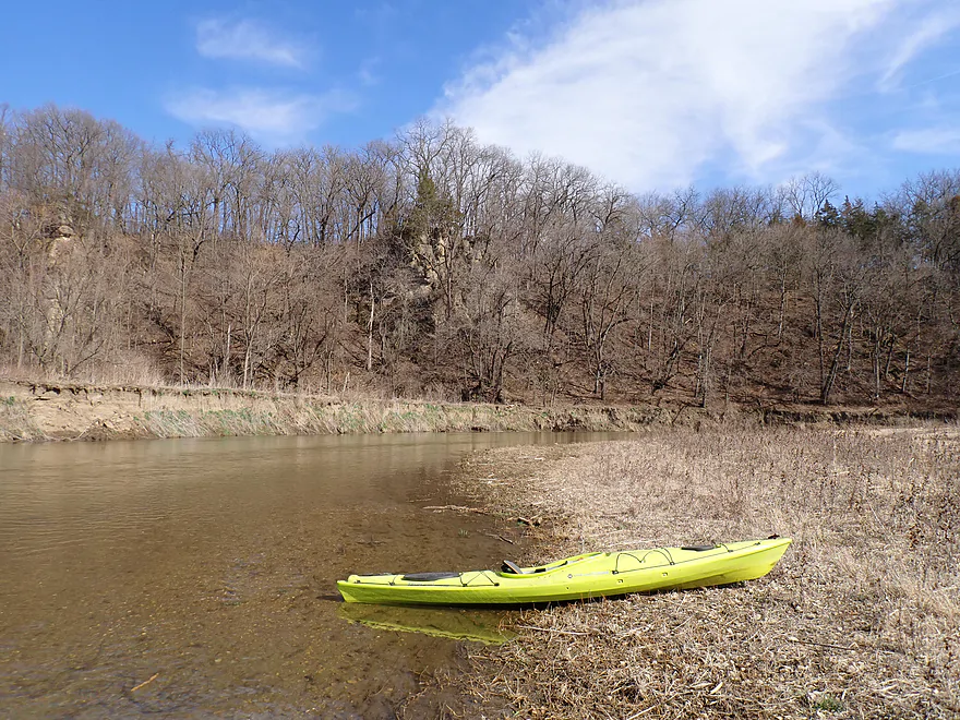
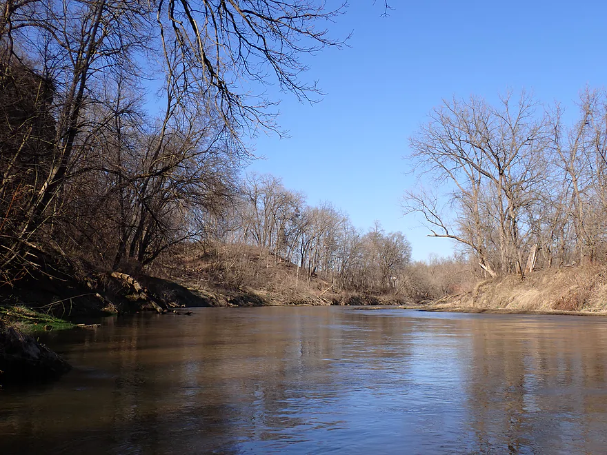
Another cool river bend
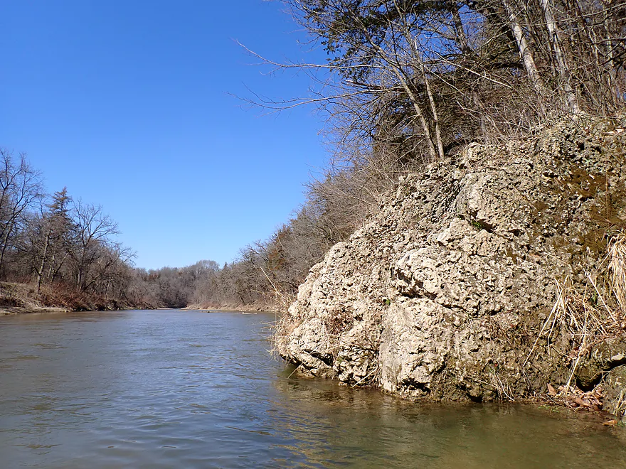
Very gnarly textured limestone boulder
Red cedars dotted the hillsides
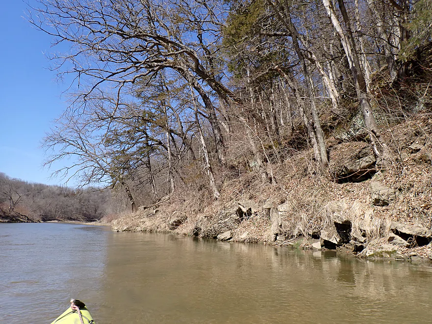
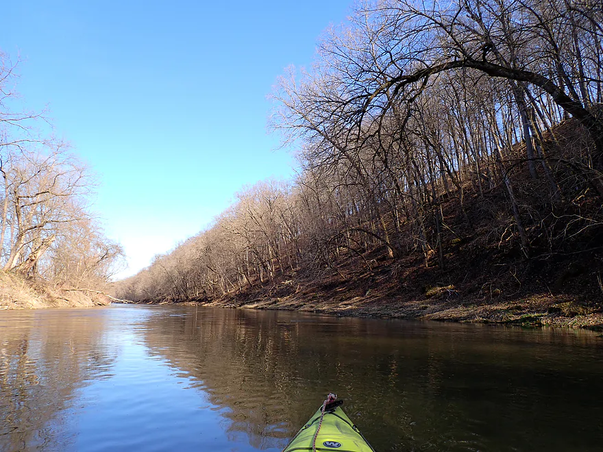
One of of my favorite stretches…a long rapids which is undercutting the rocky bank
Reverse view
Rapids drilling away at the mud banks
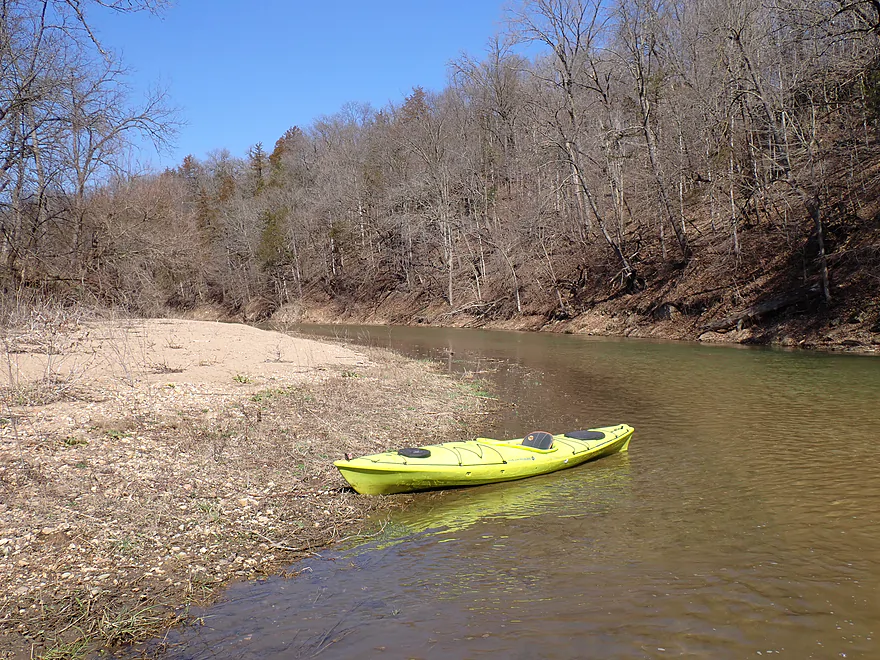
Occasional sandbars…some of these were fantastic
Getting out for pictures…this was actually deeper than it looks
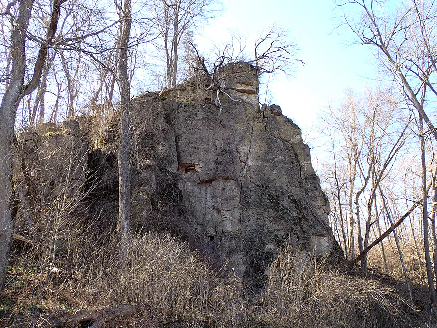
Favorite outcrop of the trip
This is followed by some very tall outcrops
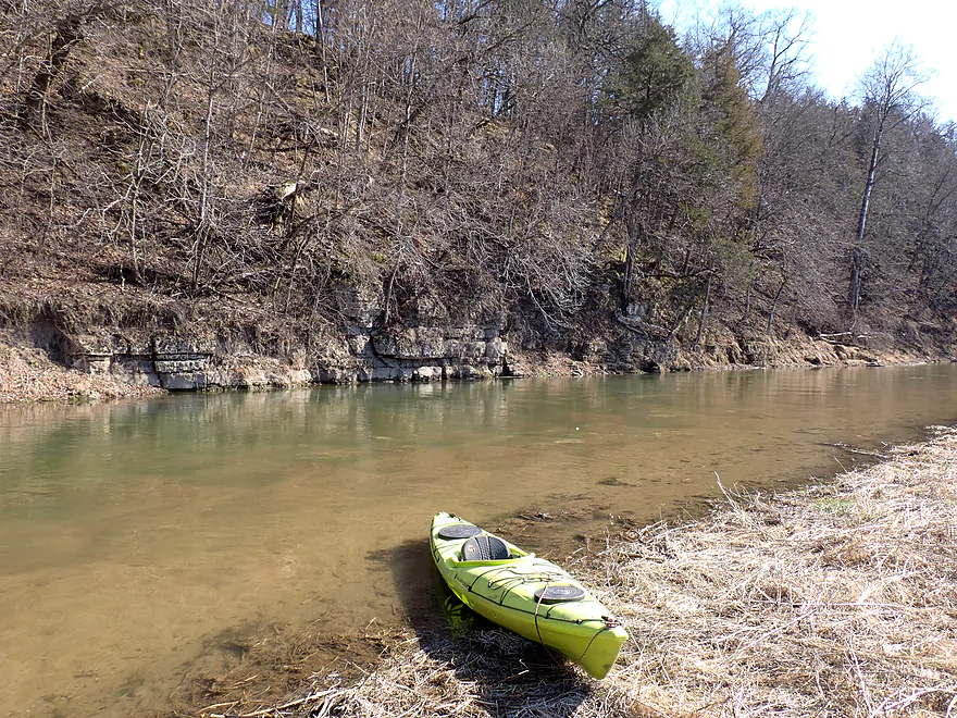
And more little ones
A mini-mountain
Old stone bridge abutment
Final stretch to my take-out at Littleport
Bridge Street
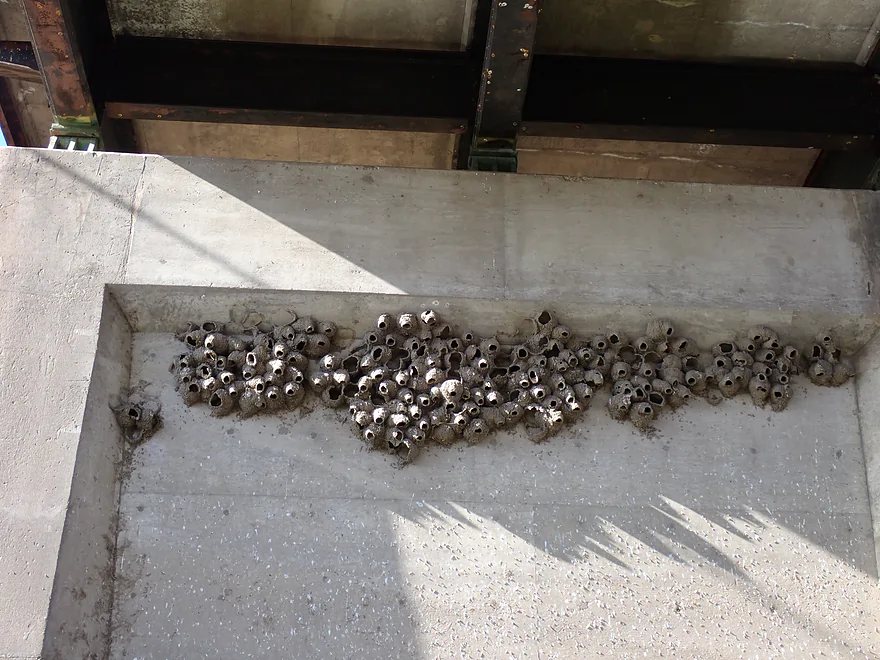
Home to a large cliff swallow colony
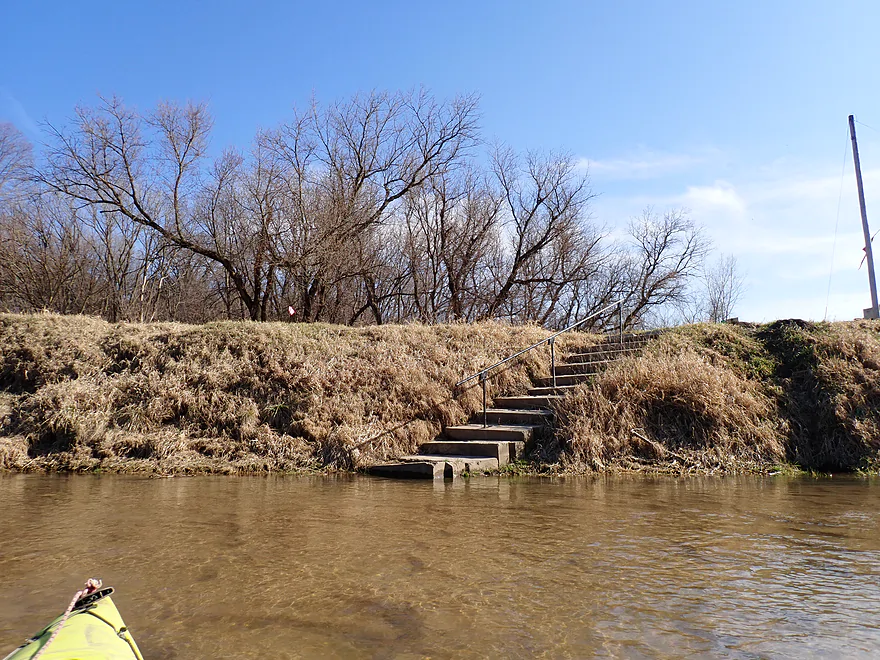
Take-out (just past bridge and to right) has very steep stairs
Otherwise is nice
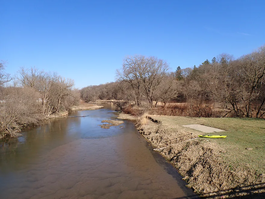
Downstream view from the Bridge Street bridge
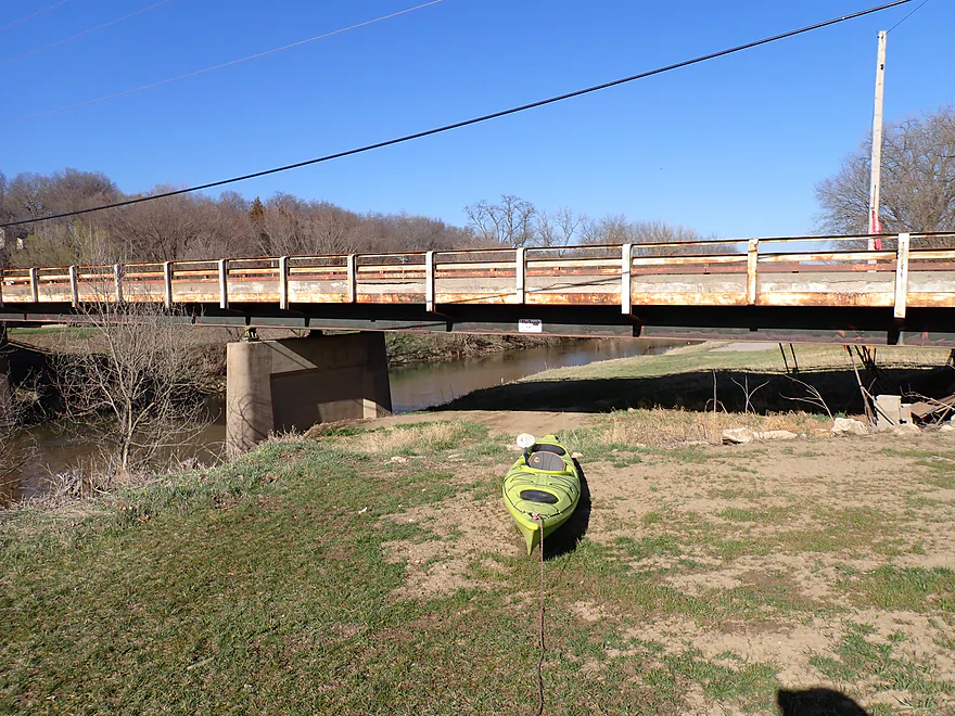
You can’t park on the east side so must pull your boat under the bridge (easy)
Volga River – Mederville IA

The Volga is a relatively popular river located in northeast Iowa (about a half hour southwest of Prairie du Chien). In 2023, I did a trip from Osborne to Mederville which I liked. This time around I wanted to do the next leg (Mederville to Littleport) which I believe gets the most kayak traffic.
The put-in was fairly well hidden under the Evergreen Road bridge, and the path leading to the water extremely steep. All that being, said the access was great and incredibly scenic. A visual highlight of the area is a large arched bridge just upstream from the landing (no longer in use). Also striking are the rock walls located along the south and north shores. Following these “dells”, the river descends down a fun Class 1 pitch of rapids.
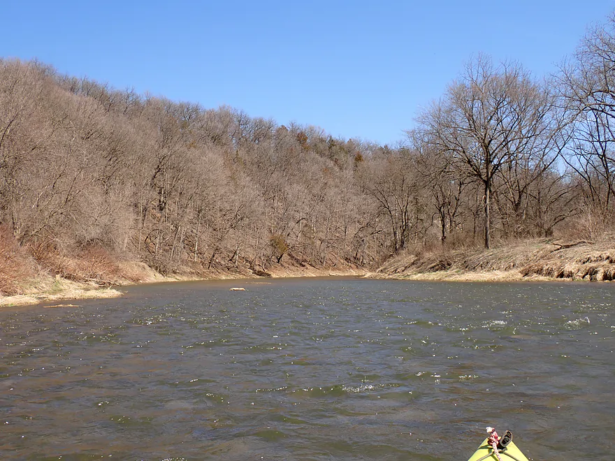
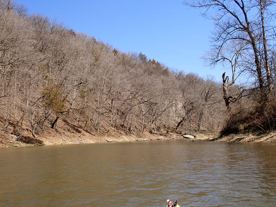
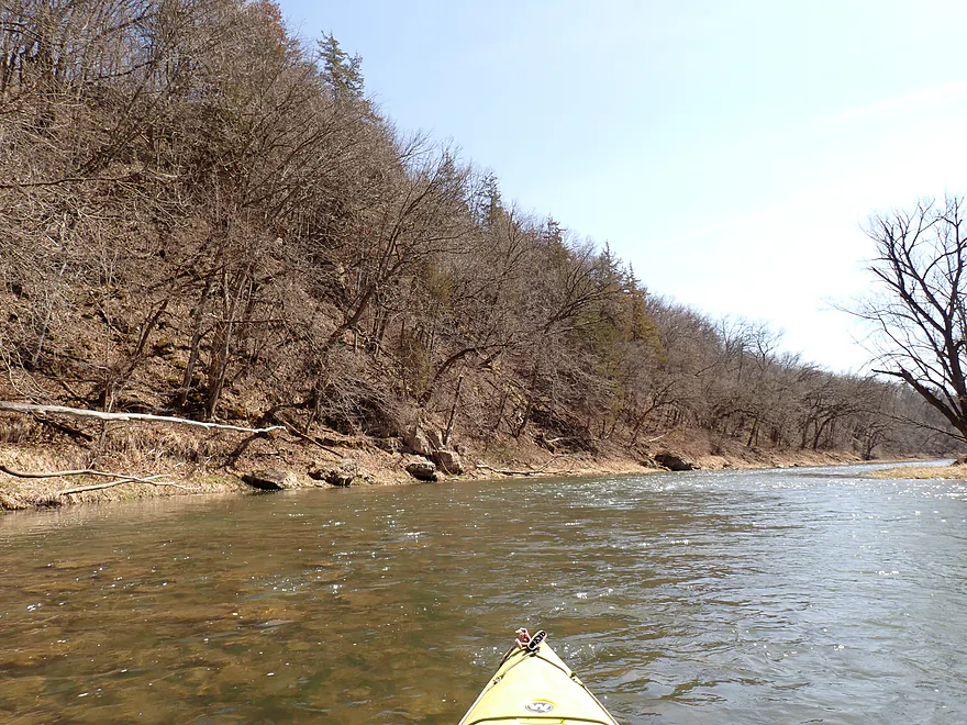
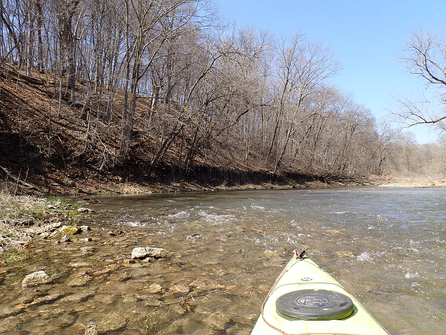
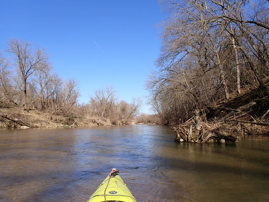
Compared to last year’s trip, I was impressed with how much better the scenery was on this downstream leg. The hills were steeper and much closer to the river, and the current was way faster with about 15 pitches of Class 1 rapids. Water clarity was ok but not top-notch with a few clear spots where you could see the sand and gravel substrate.
The geology on the river is rugged with a number of boulders and exposed outcrops. Most Iowa outcrops (compared to Wisconsin) tend to be partially obstructed by trees, so spring or late fall is a great time to paddle the state. I suspect the fall color on the Volga would be amazing (as it was last year on the neighboring Turkey River). Unfortunately Iowa gets much more sunlight than Wisconsin, which results in tons of weed growth and many Iowa river banks become unsightly and overgrown jungles during the summer.
The shoreline was relatively wooded and pleasantly undeveloped. Typically I equate an Iowa paddle with lots of cornfield scenery…but not this trip though. An unexpected surprise were the sandbars…several were really nice, and I’m sure they are packed in the summer. I wonder if you can camp on them though?
Some of the nicer outcrops were located near the end of the trip. In several spots I got out and used my kayak to show scale in photos…had I know I would be doing this, I would have brought my red boat instead (it’s a better model).
I ended the trip in Littleport and took out at yet another hidden landing. It’s funny that three landings in a row on the Volga (Osborne, Mederville, Littleport) are so well hidden and difficult to find.
All in all this was a great trip that I can recommend (much better than last year’s trip). Most paddlers that do this route actually don’t launch from Mederville but instead from Osborne, which is a longer trip (11 instead of 6 miles). Up to you where you start. The current spring drought that Iowa (and Wisconsin) is enduring has me nervous that some rivers like the Volga may “dry up” by late summer, so now is actually a great time to paddle them. While this is the most popular section, it is actually NOT the best section on the Volga. The award for that goes to the far upstream leg by Fayette, which has long been on my todo list, but it is shallow and you need to wait for a big rain before it is runnable.
Sights included geese, eagles, deer and a few minnows. There was a large cliff swallow nest cluster under the Littleport bridge. Not much else.
Chicken Ridge Scenic Overlook: This is located just north of the Volga River off of Hwy 13. It’s situated atop a tall hill that separates the Turkey River and Volga River watersheds and offers a nice vista of the area’s rolling hills. Honestly though, it’s not super elite as far as overlooks go and if you miss it, I wouldn’t lose sleep over it.
Osborne Nature Center and Park: This is a public park located near the Volga River. It appears to be popular with locals. Highlights include a nature center, trails, and a small replica 1800s village. The park also includes a public river access, but it can be difficult to find.
Mederville Canoe Access: This is an extremely well hidden access…it’s situated directly under Evergreen Road bridge and to get to it you have to turn on Eclipse Road. When you get to the dead-end arched bridge, take a right. There is a trail by the fence that leads to the river. Warning the trail is extremely steep. Rope is recommended…you don’t want your boat running away from you and scooting into the river. All that said, this is a really nice access…super scenic, secluded, and good parking.
Alternate Put-ins:
- Osborne Park Landing (4.8 miles upstream from Mederville): This is a pleasant stretch, but is much slower, less hilly, and less scenic than the downstream leg. Most actually start their trip here (not Mederville) and opt for the longer trip.
Littleport Canoe Access: The main access/stairs are located along the southeast corner of the bridge. But because of a guardrail, you must drag your boat under the bridge to reach your car. This sounds worse than it is, and it’s not too bad. What is a bit tricky is despite the stairs, the landing is deceptively steep. Rope and/or a second person would be helpful. Parking is available along the shoulder (Main Littleport Street).
Alternate Take-outs:
- X3C (9.3 miles downstream from Littleport). This would be a long add-on, but would be an option. I don’t see a formal access (streetview), but I would presume it would be a doable bridge access. This leg is likely less scenic and less hilly than the previous leg, but still should be decent.
Bike Shuttle – Littleport to Mederville: 4.6 miles with 348′ of ascent. Most of the shuttle route is along a gravel road, which is never ideal. Usually though I could find a worn path in between the bigger chunks of gravel. Bikes shuttlers should perhaps avoid this road immediately after a rain (too soft), or after a long dry spell (too dusty). There is also one extremely steep hill. The first half of the shuttle is one long “Everest” climb and the second half a downhill carnival ride. Three houses had aggressive unleashed dogs, and several homes were burning garbage (smelled toxic). All that said…it wasn’t an impractical shuttle and in parts was actually scenic.
Liveries/Rentals:
- Turkey River Rentals – 563-245-3802. These guys normally do the Turkey River, but because the Volga is so close by they might service that too. Call in advance to ensure availability.
- Bigfoot Canoe Rental – 319-238-2064. The owner mostly services the Yellow River, but he did tell me he occasionally services the Turkey and Volga Rivers too.
Logjams/Fences: None.
Strainers: Very few. In several spots there were low branches over faster current, but they were super easy to avoid. This might be a bit trickier during high water when the current would become pushier.
Current/Rapids: The current moved at a good clip with a number of light rapids (~15 pitches…none greater than Class 1). This stretch is suitable for beginner paddlers.
Closest Gauge: Volga River at Littleport
Trip Depth: 161 CFS or 4.73′
Navigability Estimates: The following are very rough estimates. Always use your own judgement.
- < 4.1′: This is likely too shallow.
- 4.2′-4.3′: This might be too shallow.
- 4.4′-4.6′. A shallow depth but should be fine for paddling.
- 4.7′: Average depth…good target range.
- 4.8′-4.9′: Above average. Should be ok for paddling but clarity won’t be as good.
- 5.0′-5.3′: A high-ish depth. I think the river should be navigable, but might be pushy in spots.
- 5.4’-5.8′: High level. Perhaps only suitable for experienced paddlers.
- 5.9′-6.2’+: Very high levels. Only suitable for expert paddlers.
- Upstream from Twin Bridges Park: Two branches join here. Both may be navigable, but I don’t know. There is an impounded lake on the Little Volga at Maynard that is likely somewhat kayak friendly.
- Twin Bridges Park to M Ave: 3.6 miles. Diverse trip with woods, savannas, riffles and pools. Likely needs high water to run.
- M Ave to Klocks Island Park Campground: 4.5 miles. Scenic trip with outcrops, bluffs, and rapids (Class 1+). Paddling author Nate Hoogeveen says this stretch contains a “breathtaking set of cliffs”.
- Klocks Island Park Campground to Old Highway 150: 1.1 miles. Includes riffles and one nice limestone bluff.
- Old Highway 150 to Langeman’s Ford: 2.5 miles. Stretch includes multiple light rapids and a few small limestone outcrops.
- Langeman’s Ford to Heron Road Landing: 8.0 miles. This is likely the best stretch of the river. The Volga flows through a state park (Volga River State Recreation Area) and features many steep bluffs and cliffs.
- Langeman’s Ford to 146 Street Landing: 1.4 miles. Scenic stretch with steep bluffs, springs, boxy limestone formations, and 30′ cliffs.
- 146 Street Landing to Hill Road – West Landing (Albany Bridge): 3.9 miles. Maybe the best leg on the river with many steep bluffs, cliffs, swift current and large boulders.
- Hill Road – West Landing (Albany Bridge) to Hill Road – East Landing: 1.0 miles. Features a nice trestle bridge and one steep bluff.
- Hill Road – East Landing to Hill Road – North Landing: 0.4 miles. A flatter section but there should still be some nice big boulders and good scenery.
- Hill Road – North Landing to Heron Road Landing: 1.3 miles. Last leg of the park. This stretch is flatter with far fewer hills but does have some nice gravel bars and a historic iron trestle bridge.
- Heron Road Landing to Fox Road: 4.2 miles. Probably a less interesting leg with more lowlands and fewer hills.
- Fox Road to Grannis Creek Landing: 0.3 miles. Likely a generic stretch.
- Grannis Creek Landing to W51: 3.3 miles. Narrow wooded valley. There may be some logjams on this leg.
- W51/Wadena to Acorn Road: 2.9 miles. A more open stretch with large sandbars. W51 may not be a suitable access point…instead the wastewater plant to the east may be a better launch option.
- Acorn Road to Birch Road Shoulder: 5.9 miles. A more obscure leg with little written about it. It likely is more open with fewer bluffs/cliffs (if any). However there should be some absolutely huge sandbars and gravel bars which should be cool. Note the put-in and take-out are speculative and may not be suitable.
- Birch Road Shoulder to Volga/C2W Bridge: 3.5 miles. Paddling author Nate Hoogeveen says this stretch has some nice pines, a long stretch of cliffs and rapids where the dam was removed. Note the Birch Road shoulder is a speculative access and may not be suitable.
- Volga/C2W Bridge to Hwy 13: 9.0 miles. Starts more open and likely less interesting, but there should be a few stretches with decent bluffs and cliffs.
- Hwy 13 to Mederville Canoe Access: 5.3 miles.
- Hwy 13 to Osborne Park Landing: 0.5 miles. An ok stretch with clear water, wooded banks, and a small set of rapids by Hwy 13. Warning neither access point is correctly labeled by Google Maps.
- Osborne Park Landing to Mederville Canoe Access: 4.8 miles. A pleasant stretch with good water clarity, large sandbars/gravel bars, and wooded hills. There is a scenic arched bridge and gorge with outcrops near the end at Mederville. Warning: both the put-in and take-out, despite being public landings, are difficult to find.
- Mederville Canoe Access to Littleport Canoe Access: 5.7 miles. This is a terrific leg and likely the most popular on the Volga River. Highlights include mostly undeveloped banks, fun Class 1 rapids, exposed outcrops, and phenomenal bluffs. Note the trees do obscure many of the rock faces, so this might be a trip best done in late fall or early spring.
- Littleport Park to Grandview Road: 9.3 miles. Some cliffs and bluffs, but likely not as good as the previous legs.
- Grandview Road to Mouth on Turkey River: 0.5 miles. Likely a generic stretch.
- Mouth to X41 Landing: 1.3 miles. Short stretch on the Turkey River to reach a proper landing. Likely not an elite stretch but there should be one nice bluff.
- For more information on the Turkey River, see my Turkey River Overview Map.
Trip Map
Overview Map
Video
Photos Size:
Thanks for these descriptions and pictures. I want to do many Volga stretches soon!