
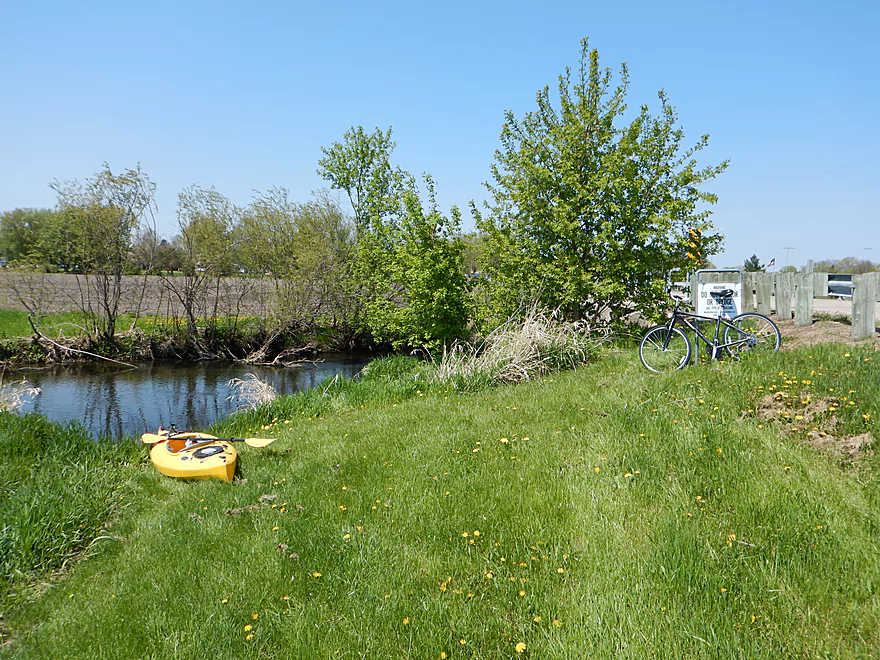
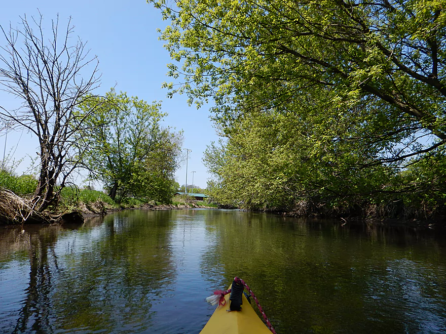
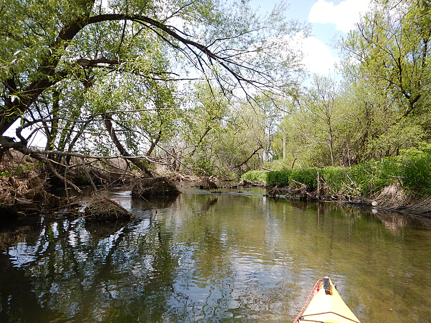
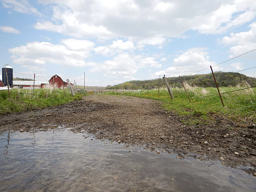
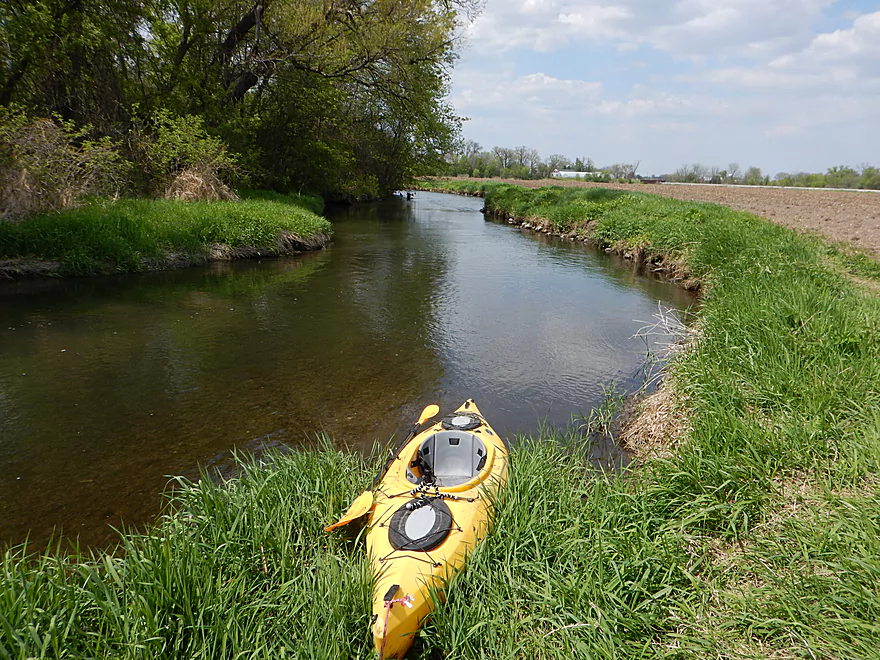
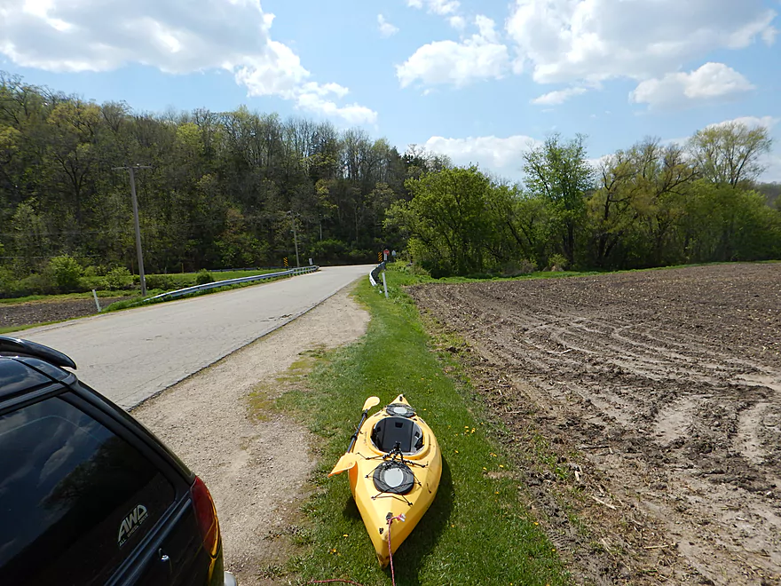
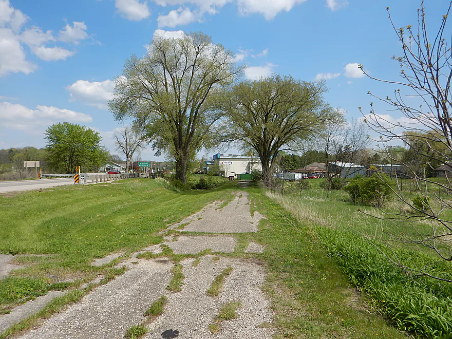
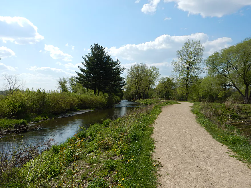
Black Earth Community Park
Nice parking
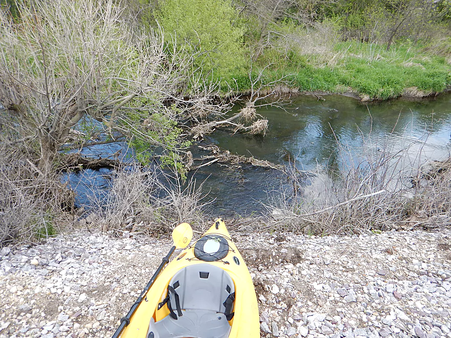
Ok launch
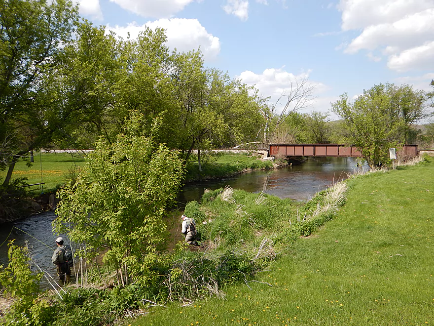
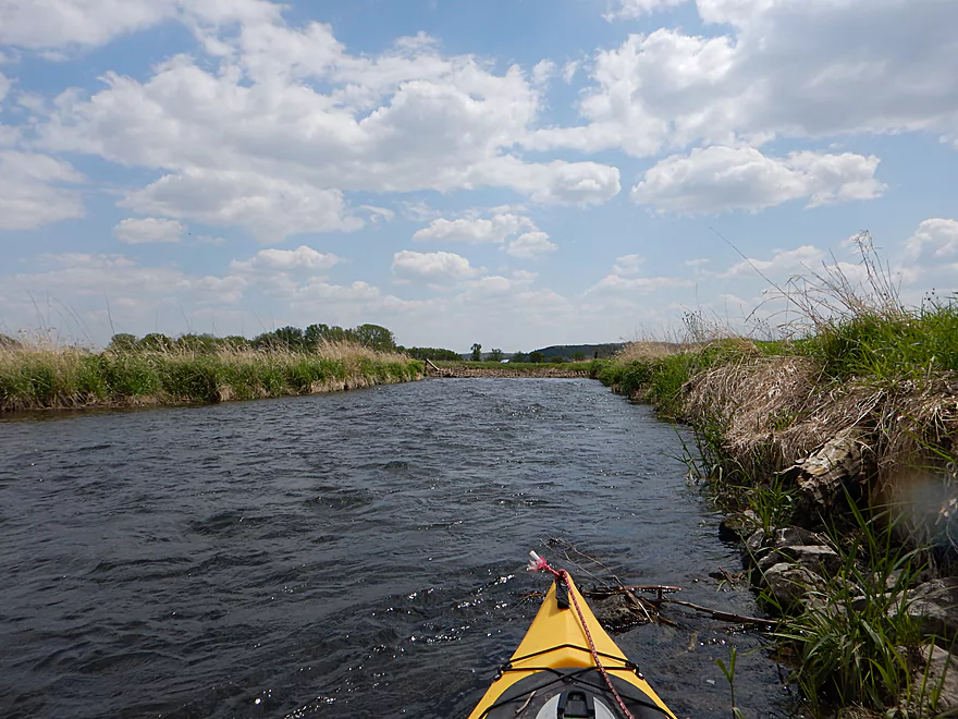
You’ll see a lot of fishermen on this trip
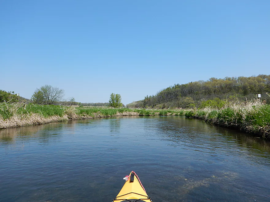
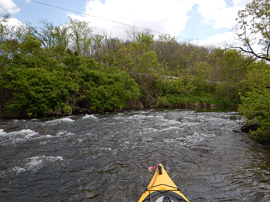
Class 1 riffle to start the trip
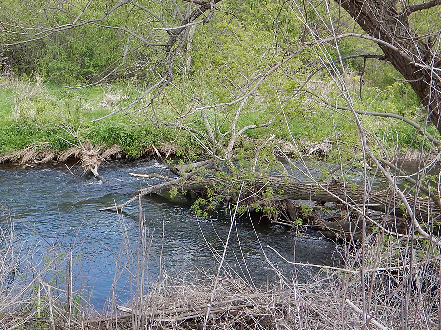
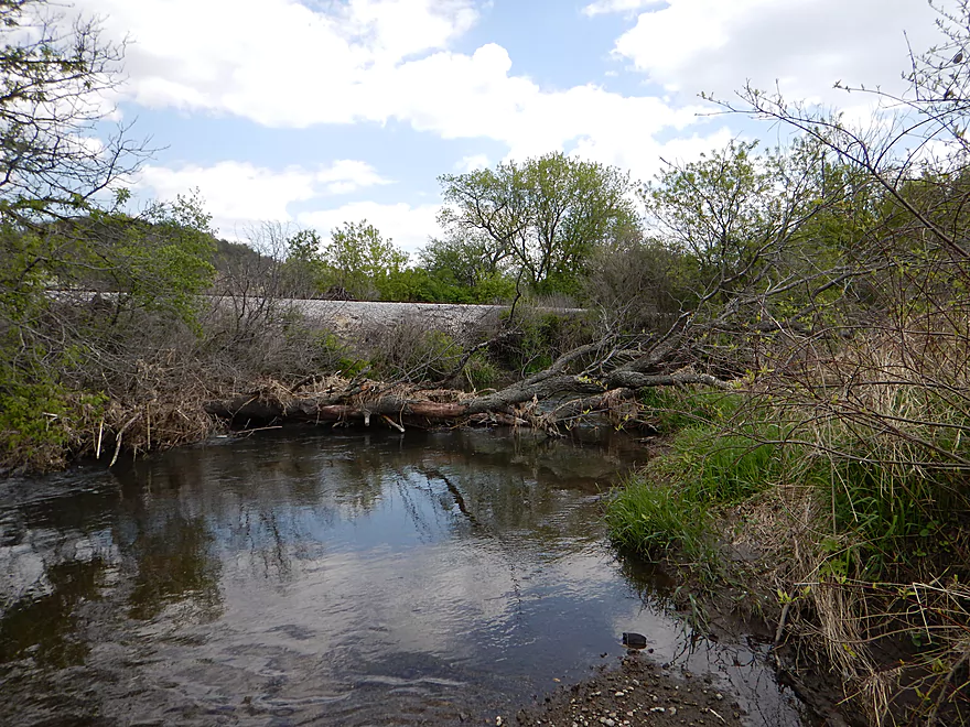
Minor log obstacles
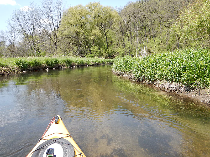
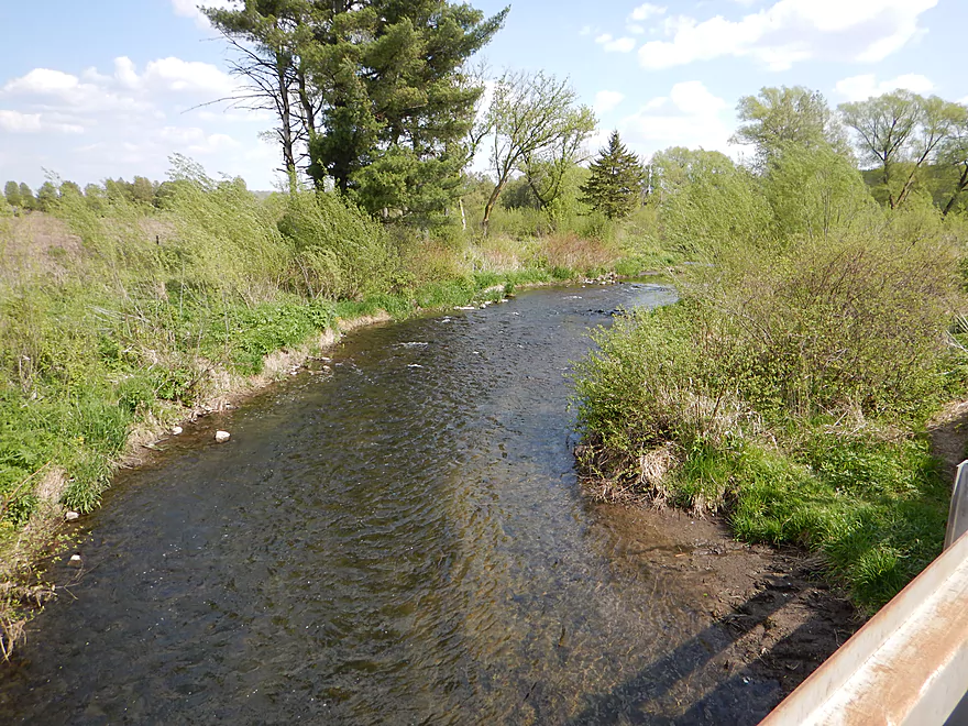
Very clean water
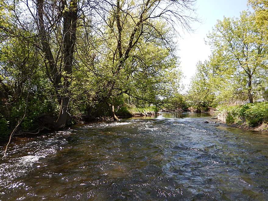
One of many class 1 riffles
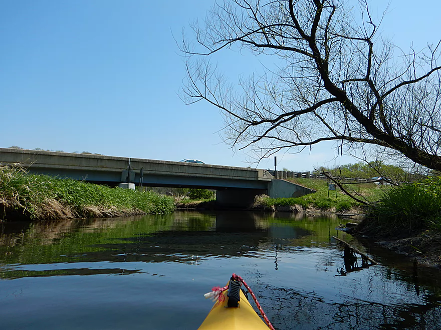
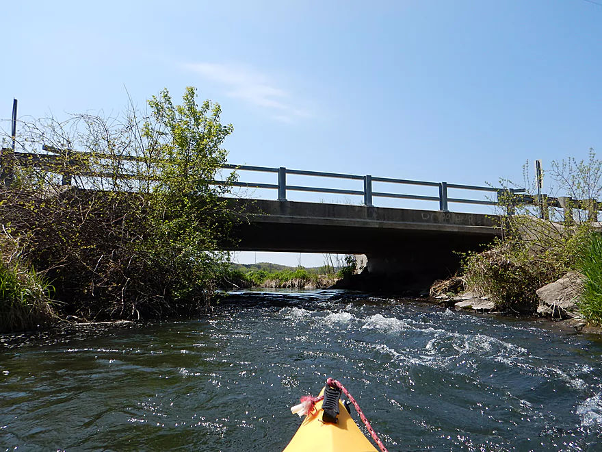
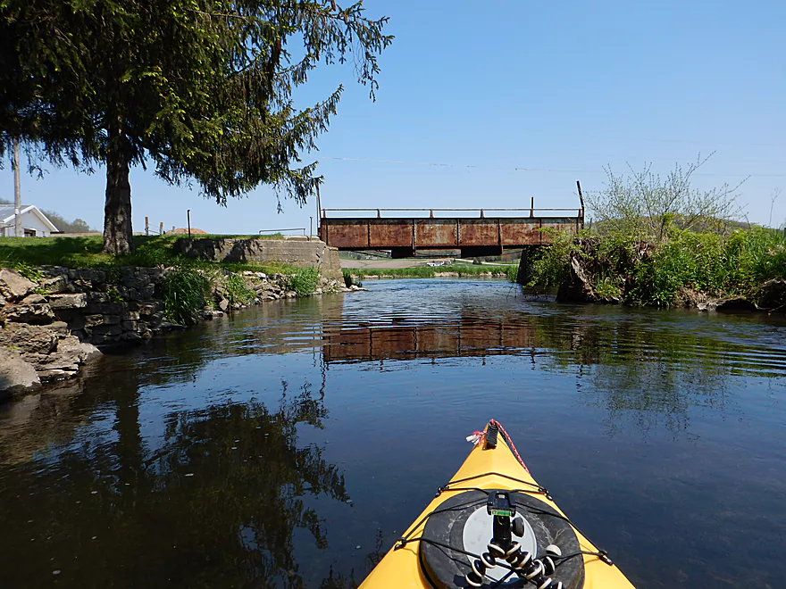
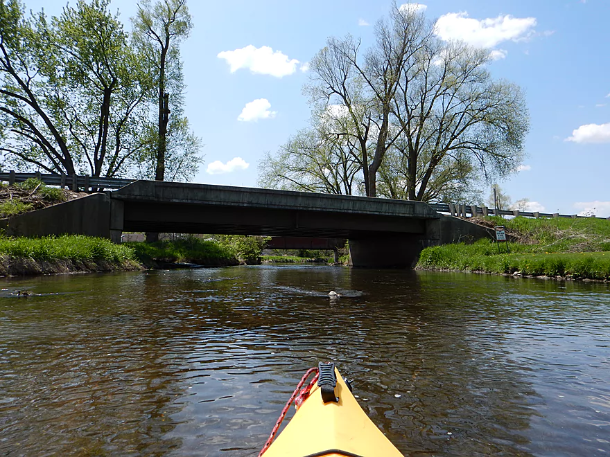
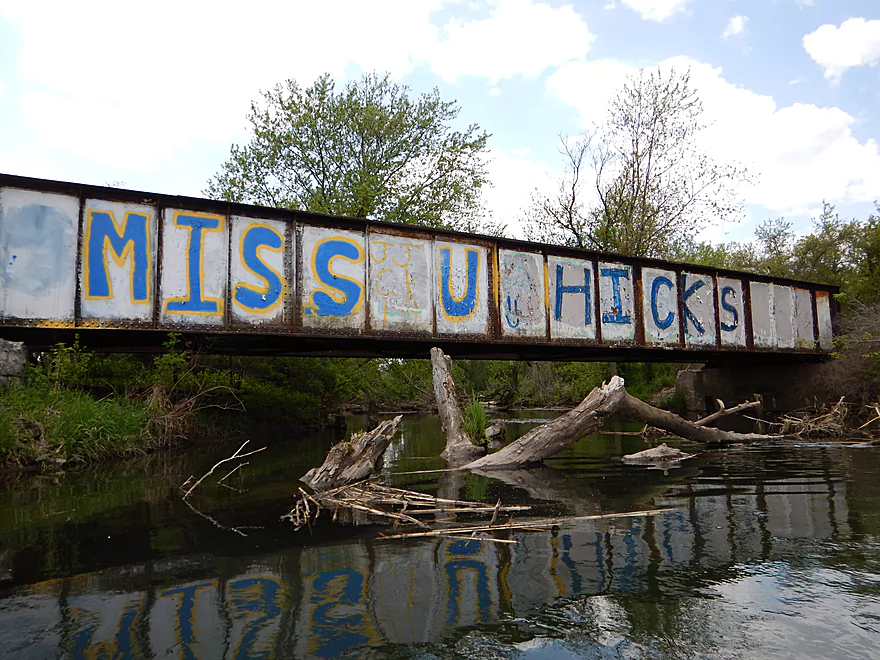
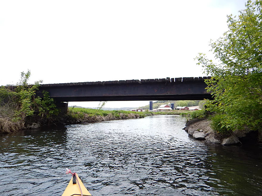
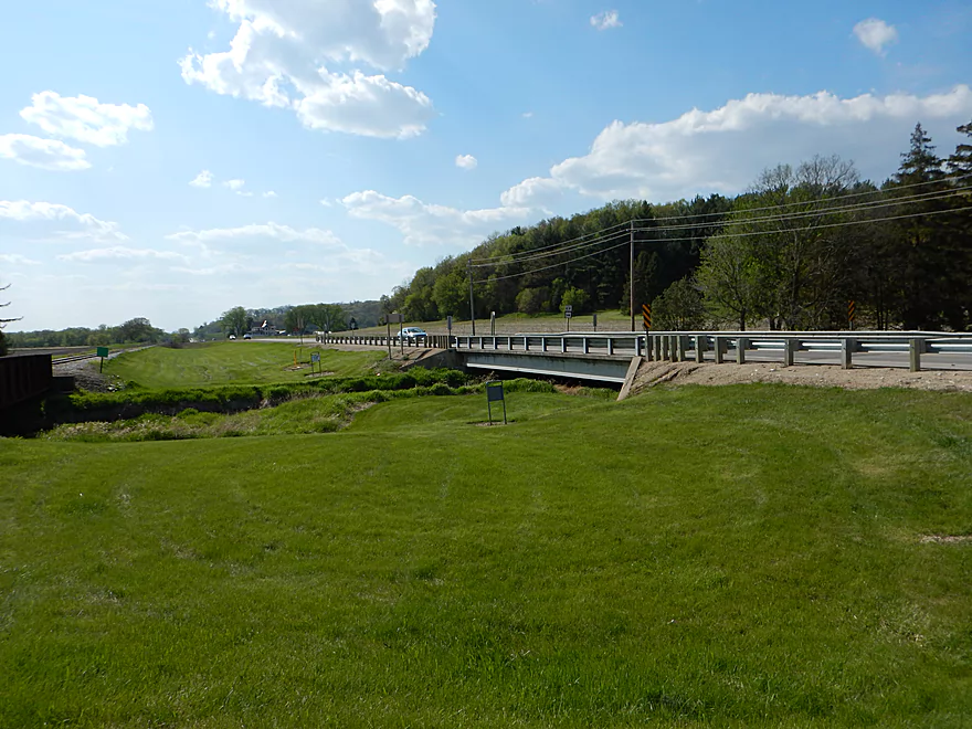
Hwy 14 Bridge
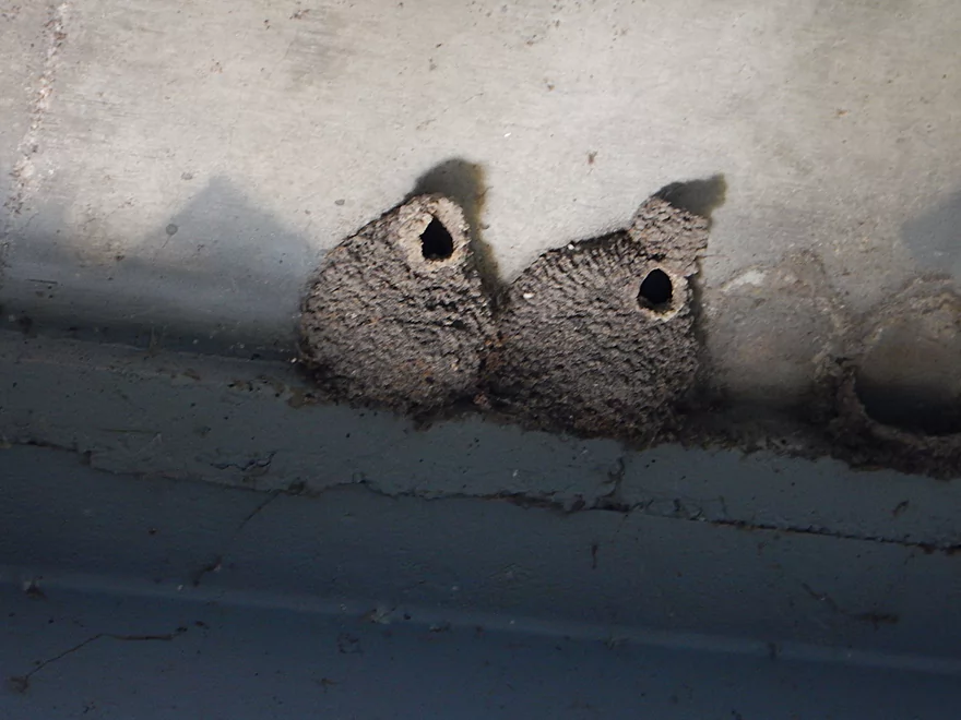
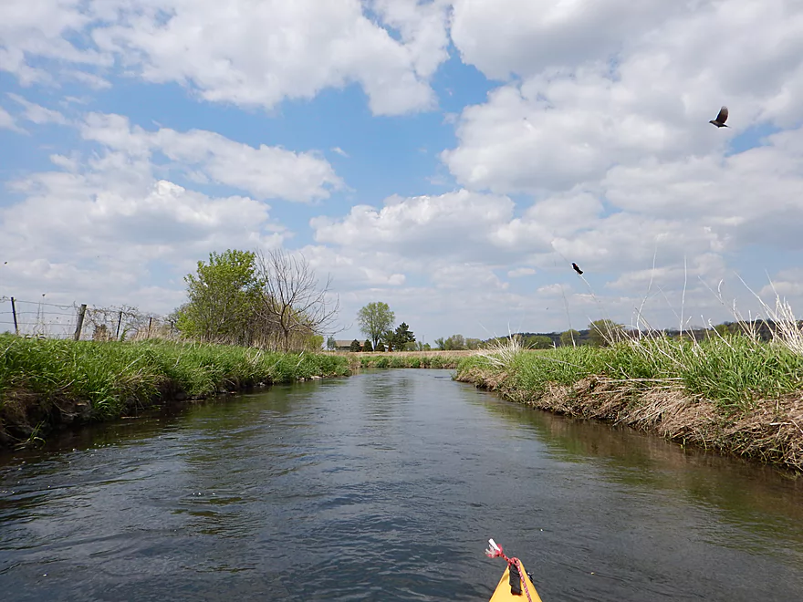
Cliff Swallows
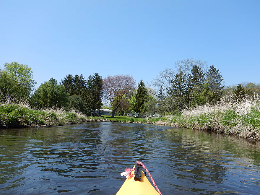
More clear water
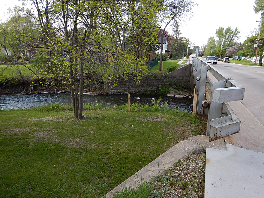
Main Street Bridge
Public access on the right, private to the left
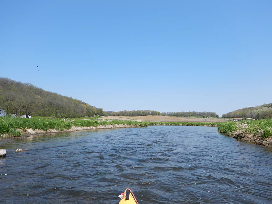
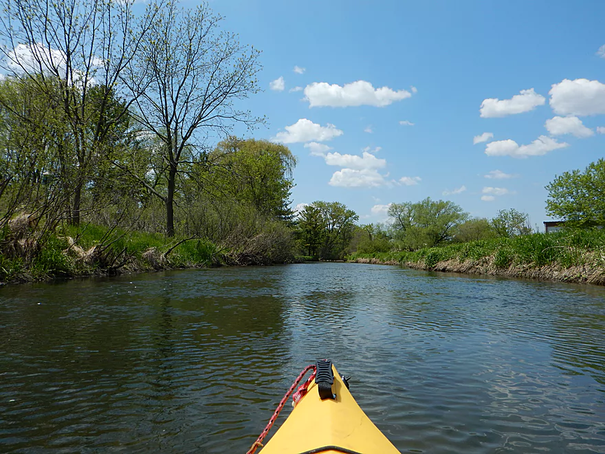
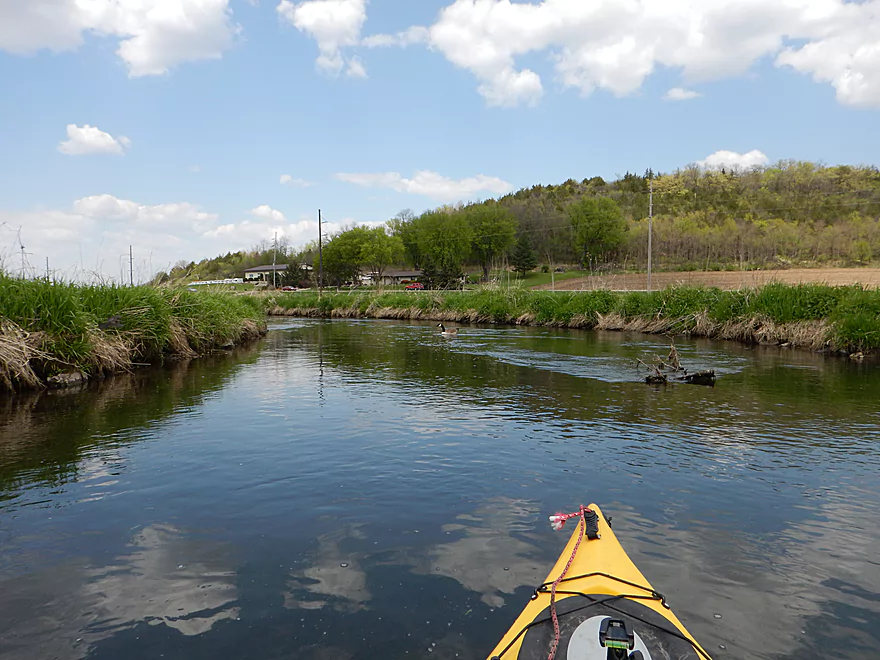
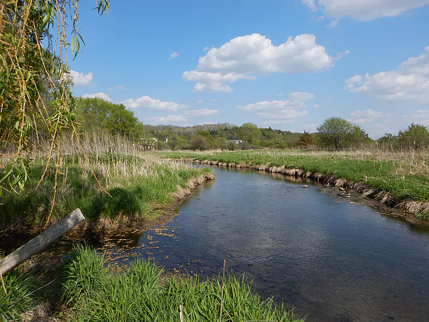
Nice hilly vistas
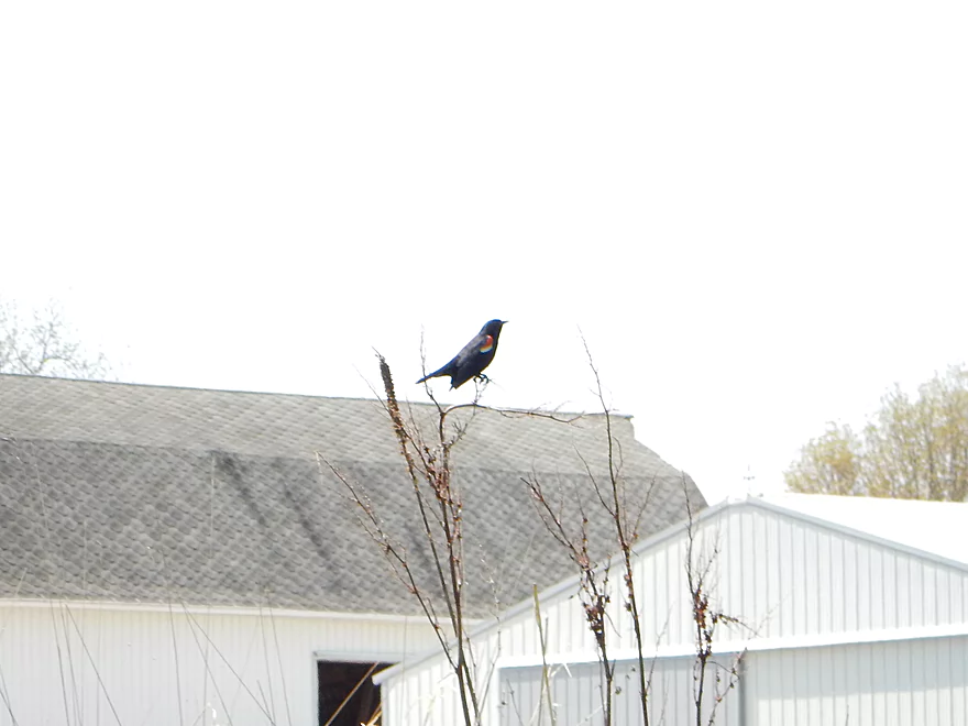
Red-winged blackbird
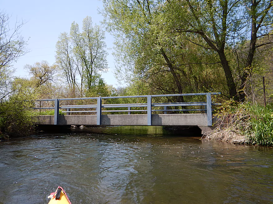
Private drive bridge, must portage
Might be able to duck under in lower water
Medium portage…tough retaining wall to drag your yak over
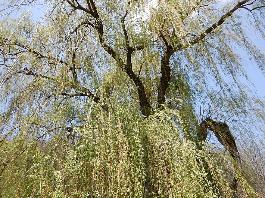
Weeping willow
More terrific clear water
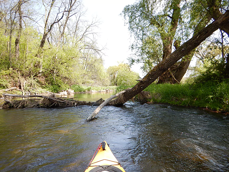
Not a jam, but a tight fit
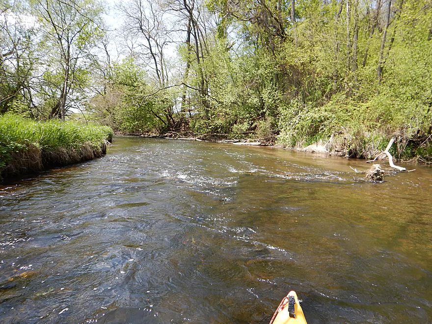
Another example riffle
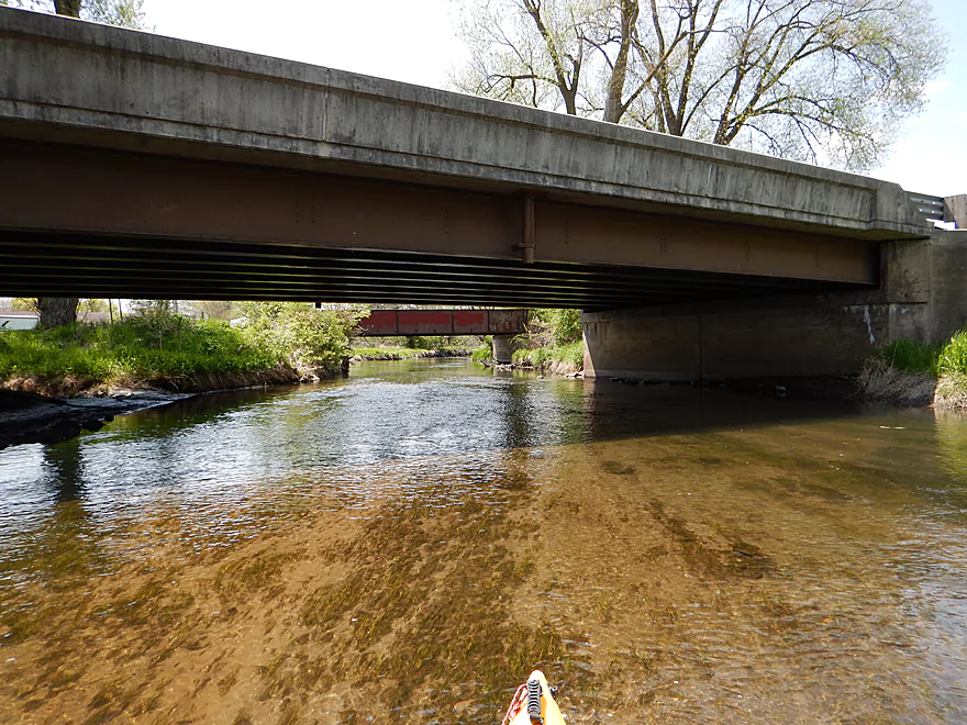
Hwy 14 again
Fine public access on southwest corner of the bridge
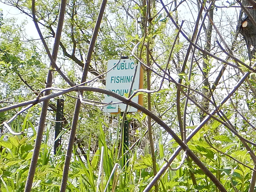
Lot of public access signs visible from the water
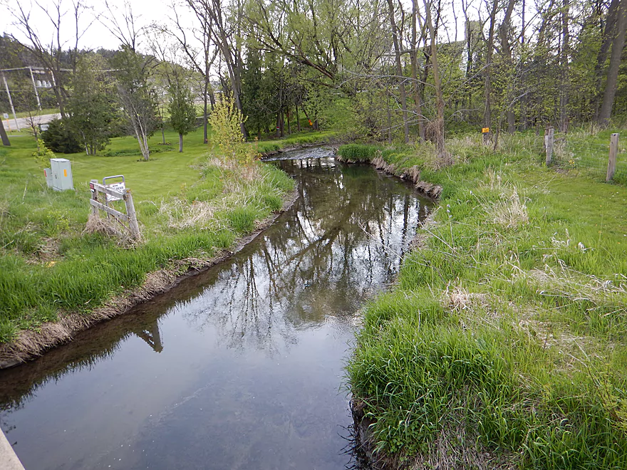
Vermont Creek
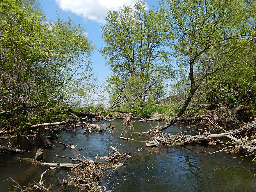
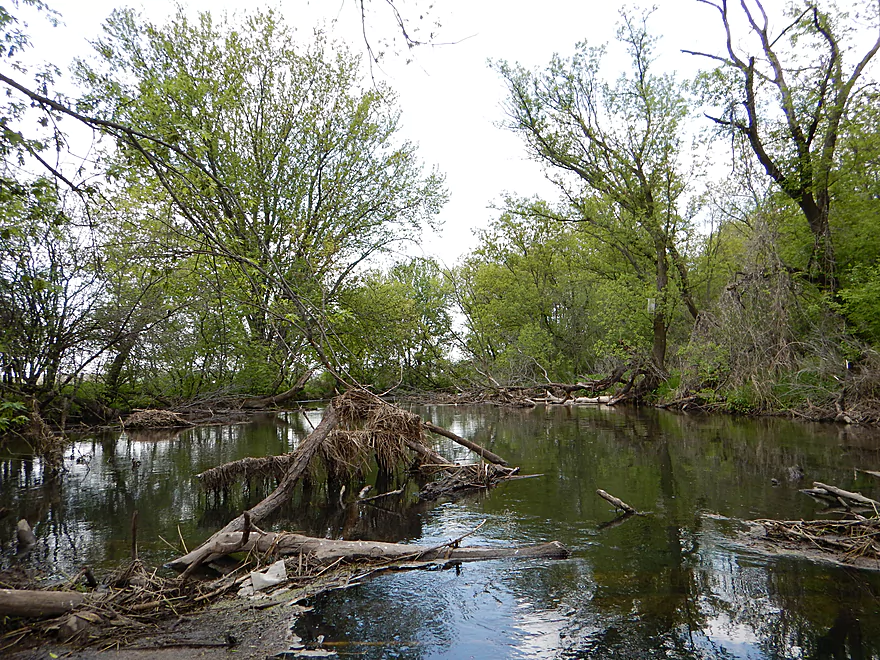
First real log jam
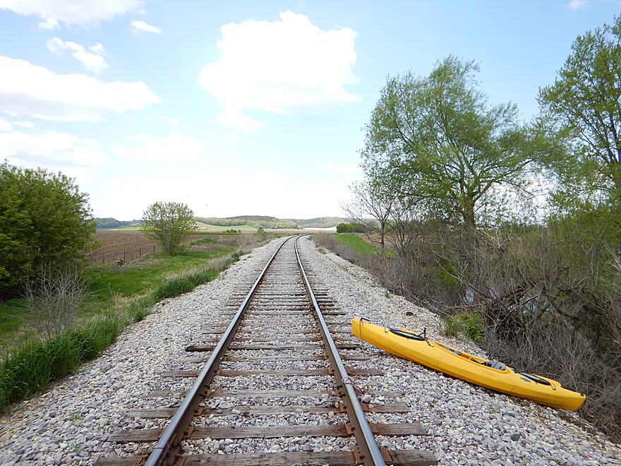
I portaged south over the railroad tracks (tough!)
Portage the north bank instead
Rapids + log jam = bad combo
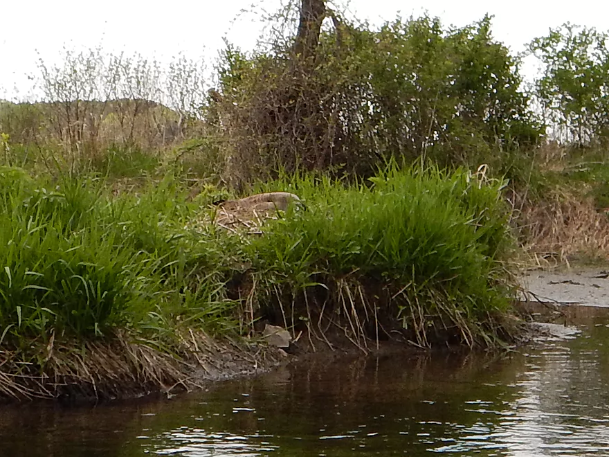
Where’s Waldo – Goose Edition
Most serious rapids…might be class 2
The previous goose’s mate led me on a “goose chase” away from their nest
How classy…
Debris section…stay on your toes
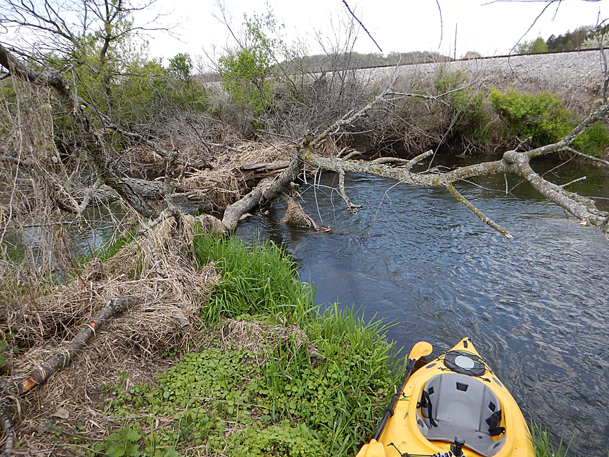
Log jam #2…this is a very easy portage though
Reverse view
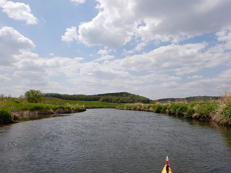
More nice hilly vistas
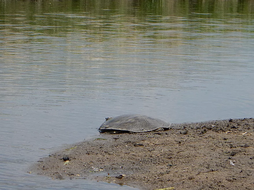
HUGE softshell turtle
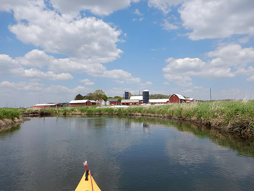
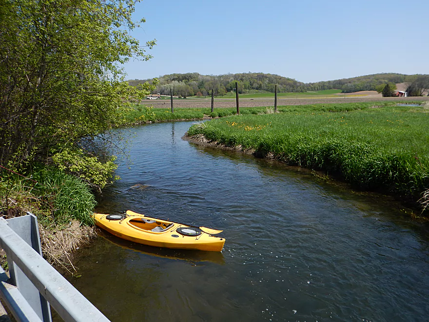
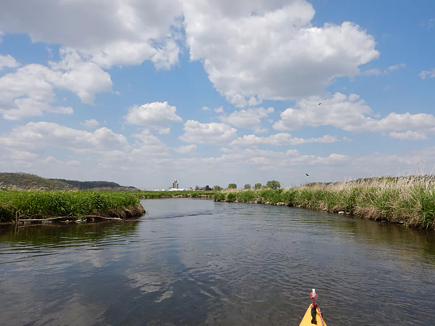
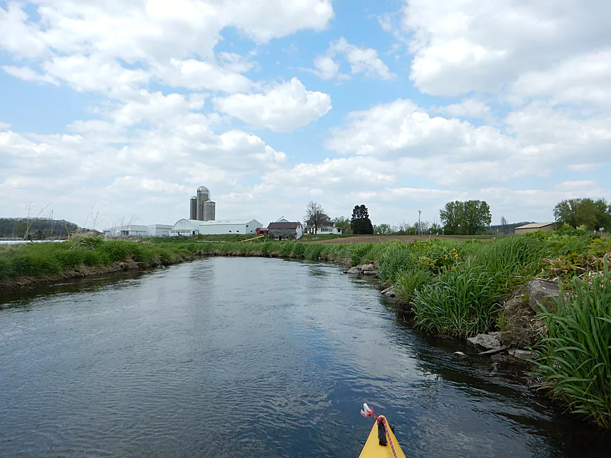
We’re in farm country now
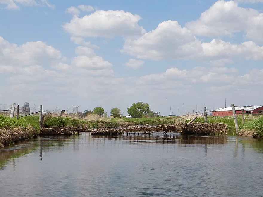
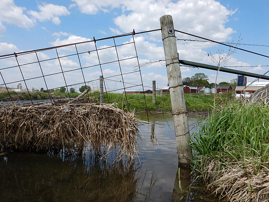
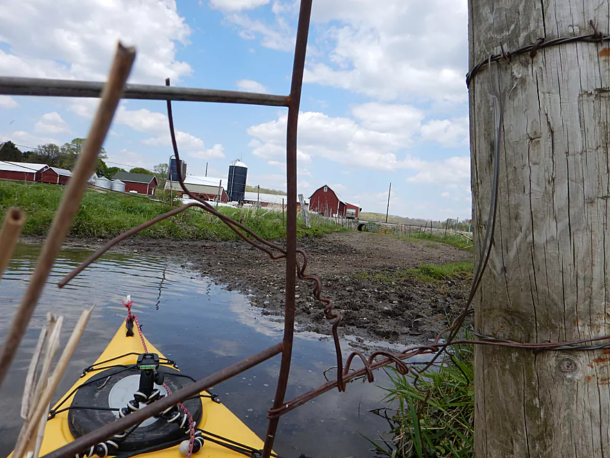
Very evil cow fence blocking the river (twice)
Had to take off my life jacket to fit under (just recently raised)
Lowlight of the trip
Not healthy for the creek
Riffles created from the cow traffic
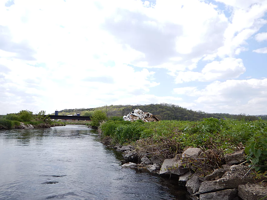
Unattractive garbage heap
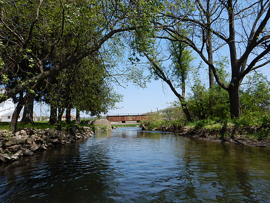
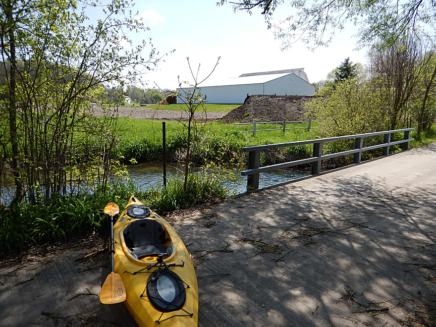
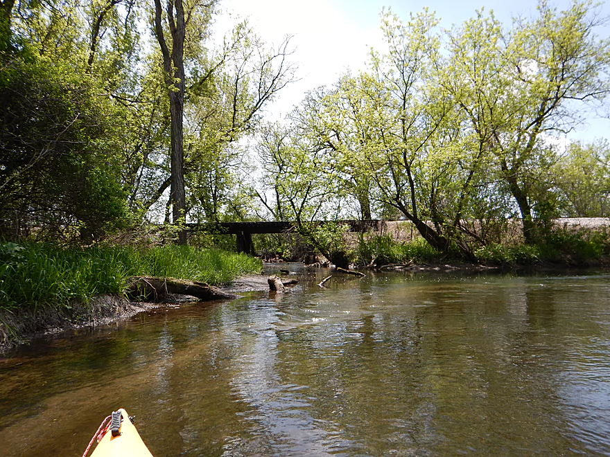
A proper farm bridge
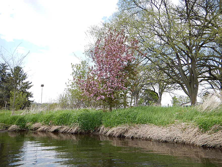
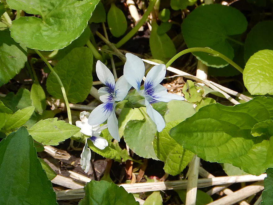
Apple tree in blossom
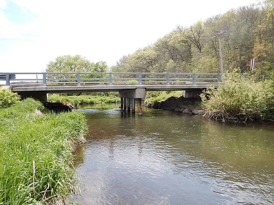
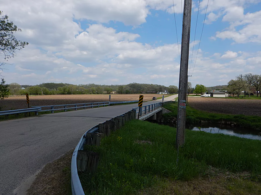
Olson Road Bridge
Good take-out for a bridge
Bit of a drag to the road (south bank is better)
Good parking
But guard rails mean you have to drag you kayak a bit
Saw 5 of these on my bike shuttle! (~2 mile stretch)
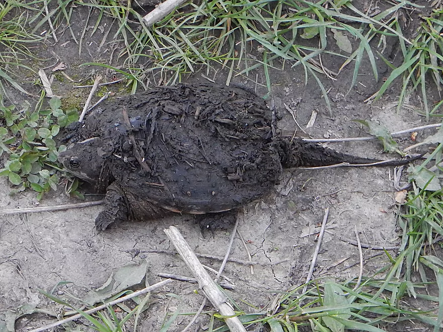
Snapping turtle
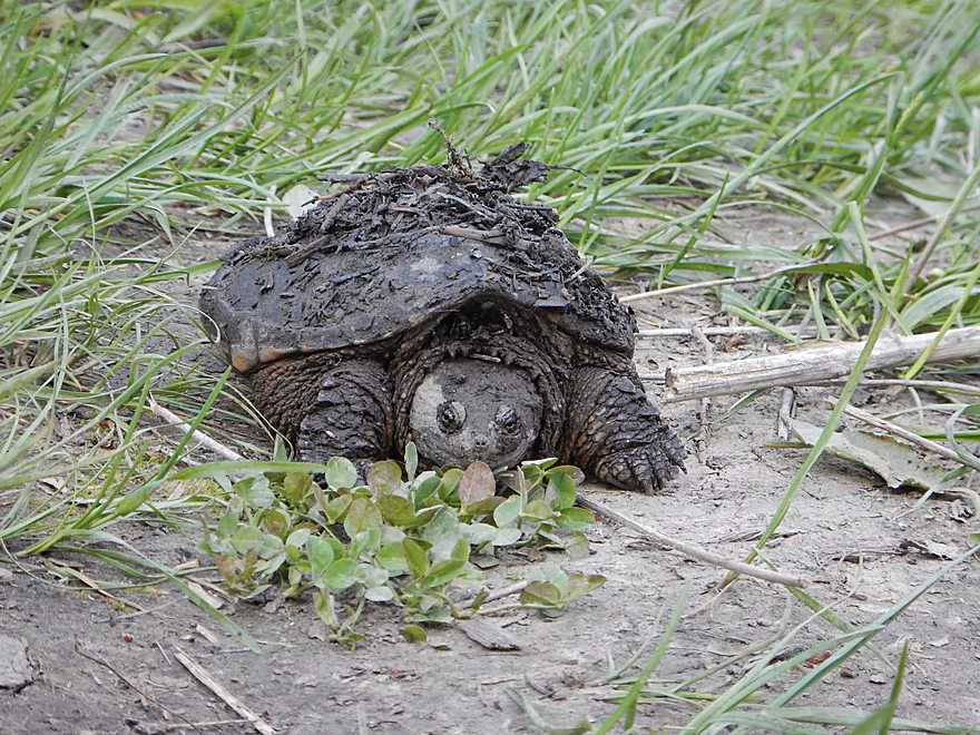
Quite filthy
Rest of pictures are of Alt-access. This is Hwy 78 by BP (good)
Scherbel Road (very good)
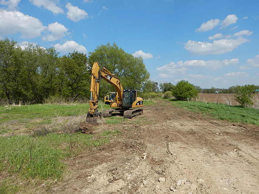
Lot of trout stream “construction” going on
Salmo Pond Park (very good access)
Hwy 14 (by KP). Might be private.
KP ok. One bank is ‘private’ (probably county property)…parking questionable.
East Street Trail (Ice Age Trail access areas are better)
Hudson Street, not ideal, but probably one of the better Mazo bridges
Looks inviting…who knows about jams though
N State Street (good access)
N State Street Access – Downstream left part has been acquired by the county for public access
Black Earth Creek – Black Earth to Mazomanie


This is a very nice, clear, fast creek that runs from the Middleton Airport all the way to the Wisconsin River near Arena. On occasion, paddlers will run Blynn Road (the last bridge) to the mouth, and this is considered a good prospect that recently was cleaned up in 2011 of log jams by “Capitol Water Trails” (editors update…but has since filled in..another editors update…but sounds like it has been cleared up again!) . Upstream of Blynn Road, there is very little public information in regards to navigability. It’s certainly not an obscure creek. Ranked one of the top 100 trout streams in the country, this creek is very popular with anglers. The DNR and local volunteers are very active in maintaining and improving the stream for fish habitat and you’ll see evidence of creek re-routing, narrowing, clearing, and gravel beds along a good deal of this waterway.
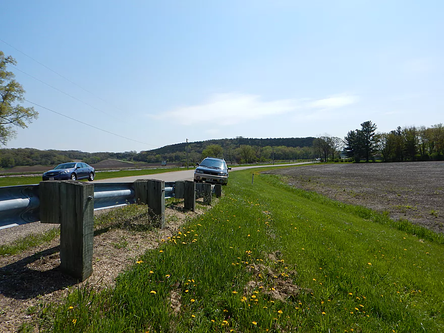
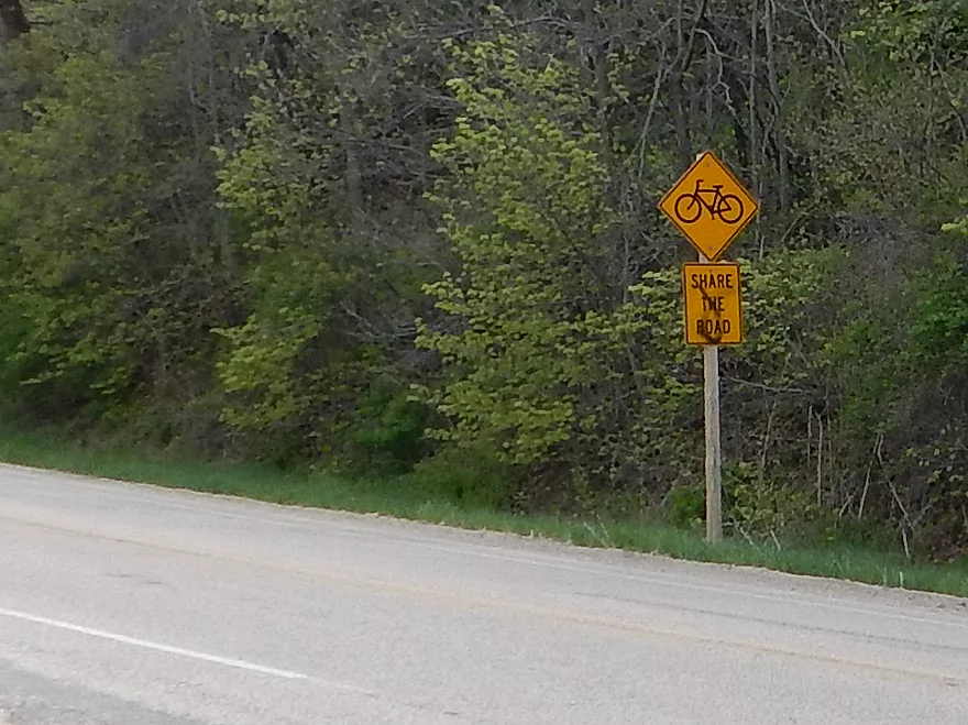
Encouraged by the lack of forest cover and by rumors of riffles by Black Earth, I decided to roll the “log jam dice” and take a chance on a section from just east of Black Earth running almost to Mazomanie. The nice thing about this section is that it made for a good bike shuttle. Hwy 14 runs the length of the creek and is very busy and fast…going 55 is a licence to be tailgated on this road. Shoulders are okay, but it’s still a tad unnerving to bike on and would feel like the video game Frogger. Hwy KP is a convenient (albeit a tad longer) option that I would recommend–very bike friendly and only 2.7 miles (I spotted a lot of other bicyclists on the road and counted over 5 “share the road” signs!)
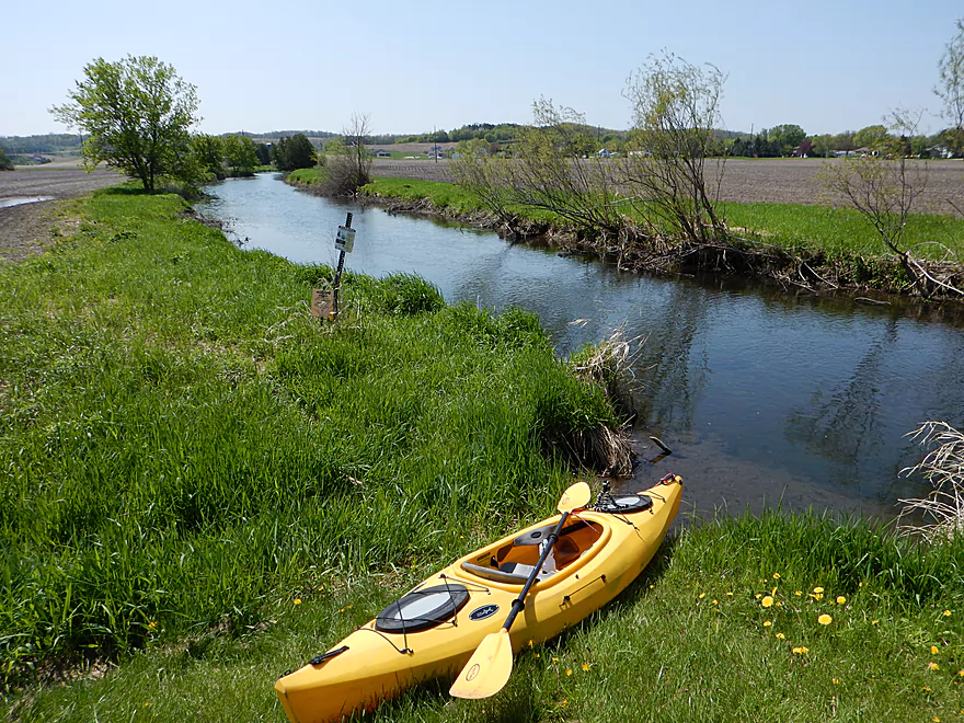
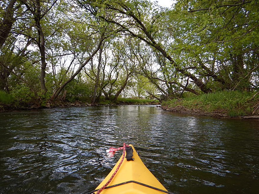
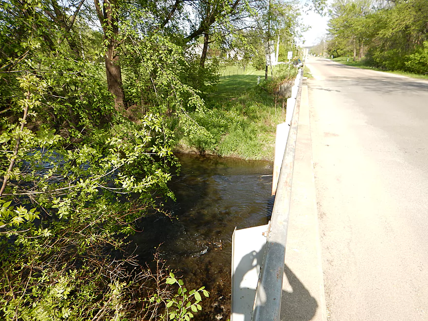
You’ll put in at “Black Earth Community Park” on the east side of the town of Black Earth. This is a great access area, with bathrooms, good parking, a post to lock your kayak/bike to, and a good launch area. Riffles run under the bridge…so you’ll want to put in on the upstream side! You’ll no doubt see your share of trout fishermen on this trip and the ones I encountered were initially befuddled (and stared a bit long), but were friendly and told me boating the creek looked like fun. When I went, the water was a tad on the high side, which was fine. I never had any serious shallow water issues and think this creek could be run at lower depths. I do not know, but don’t think this creeks gets too low to navigate in the summer (perhaps by Cross Plains…don’t quote me on this).
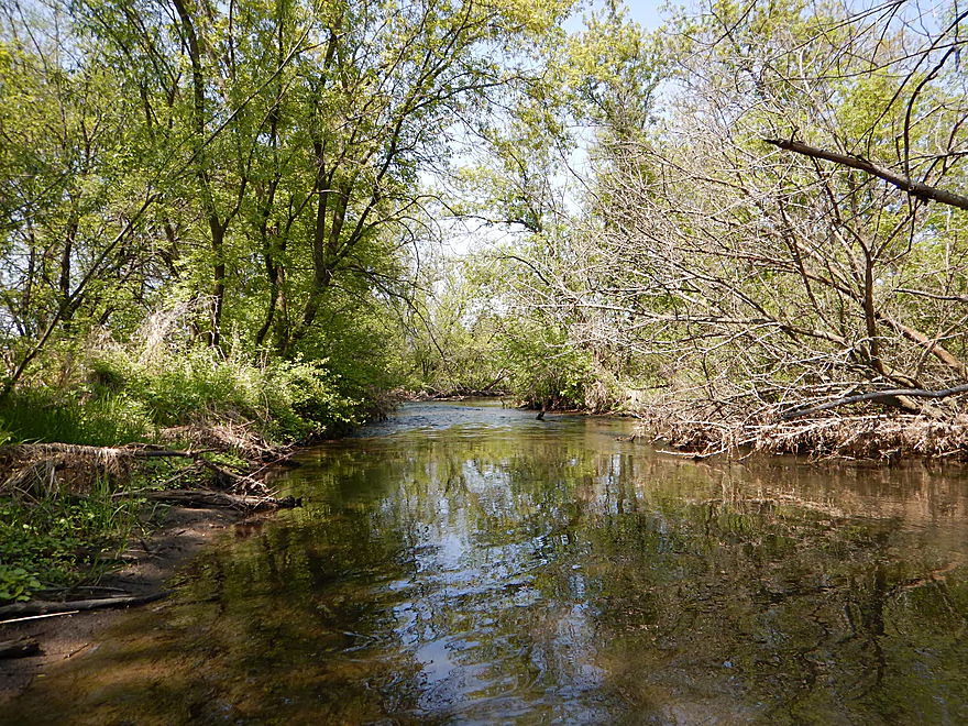
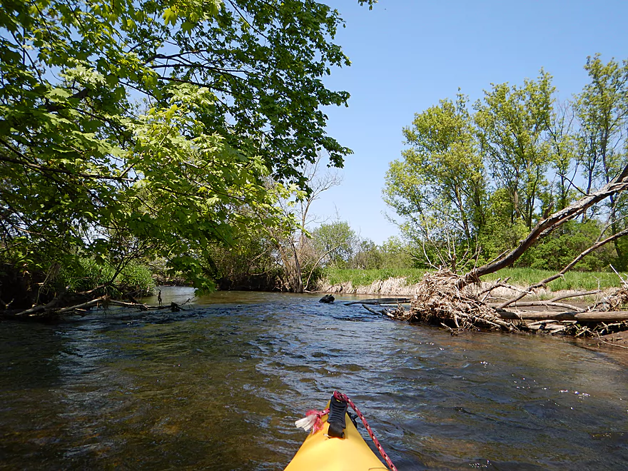
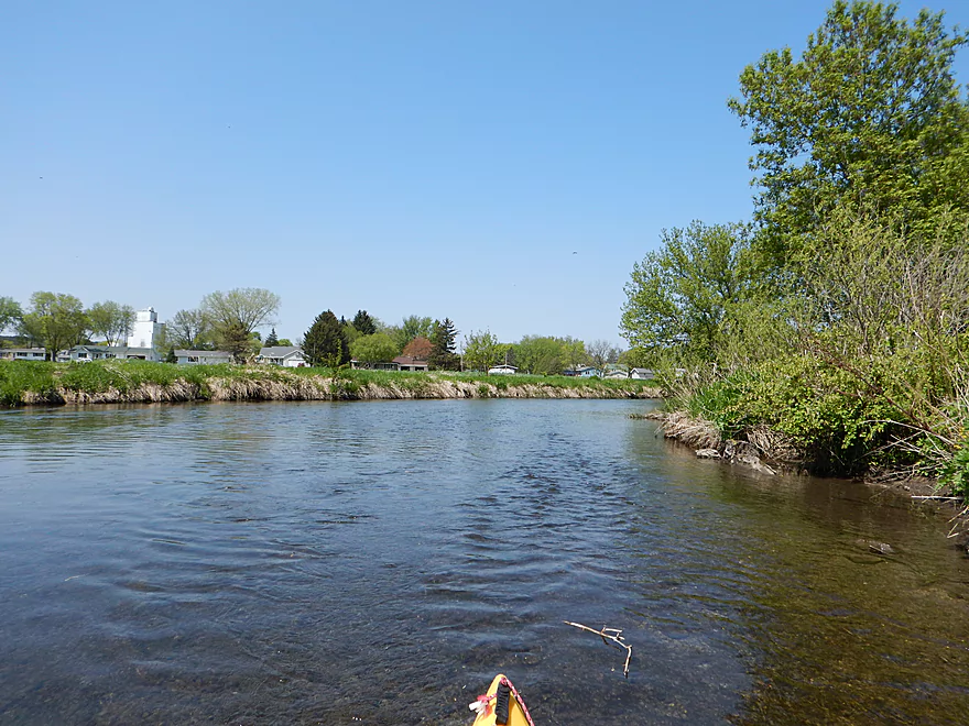
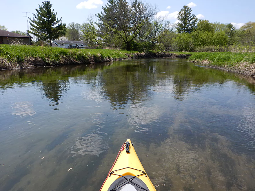
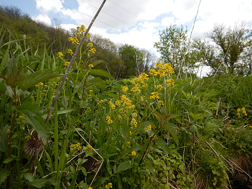
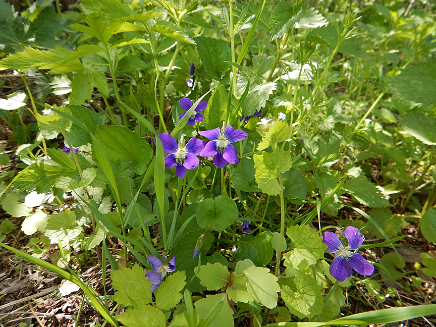
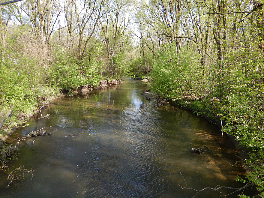
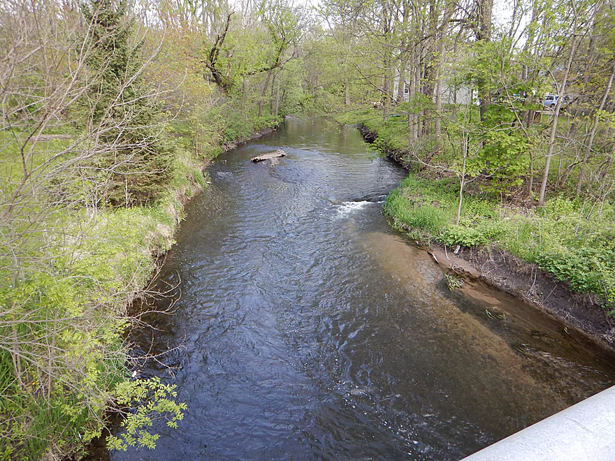
The first mile or two of the creek forms a large upside down “U” that circumnavigates the city of Black Earth. This was my favorite section. Water was terrifically clear, bank quality was good, you could see trout in the water, and there were a number of riffles to run. These were fun and not the pushy, obnoxious types you have on some rivers (could be different in higher water though). There is some tree cover, which adds a nice touch to the creek, but no real log jams in the first mile or so of the trip (notice I didn’t say on this trip). There is some debris to dodge and two “hoppers” that might be jams in lower water and a squeaker that might be tough for bigger boats than my 10′ yak. The lack of log jams is due in part to the work of volunteers who clean up the creek to keep the water running fast, cold and oxygen rich for the trout (not kayakers).
The first real obstacle comes after the Main Street Bridge, where there is a private drive bridge set way too low and this necessitates a portage. Maybe in lower water you could go under…but the current is fast here and this could be tricky. The portage is okay, but it is a bit of an effort to hoist your kayak over the retaining wall by the bridge. Definitely bring rope and amphibious shoes for a trip like this, as it will make your life much easier.
Soon after, you’ll paddle under Hwy 14 (a second time) and see the famous Black Earth Shoebox store on your left. On the right is an obscure drive/access by the BP gas station for fishermen that would work as a public put-in (Black Earth Community Park is much nicer though). In regards to access, all of this (and more) is detailed on the map below.
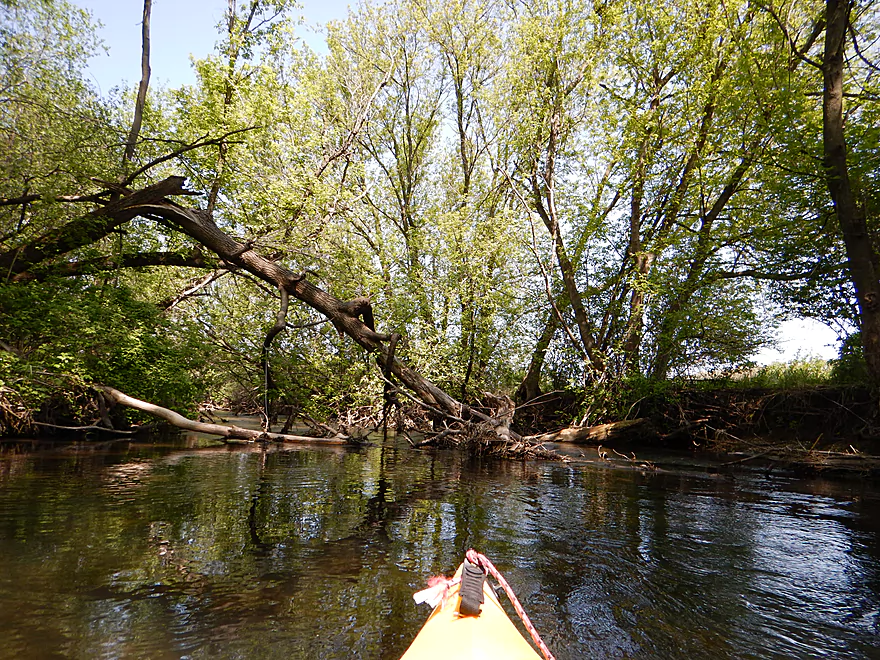
Right after Vermont Creek enters, I encountered major problem #2–a serious log jam with riffles running underneath. I carefully got out plenty early and made my way up the steep railroad bank to get around the jam. This was not easy, even with rope…as this was a steep, high railroad bank with loose footing. When I got to the top (nice view), I realized the mistake I had made, and should have portaged the north shore instead. If you do this, this shouldn’t be too bad.
After this point, the few trees start to fall back and the channel gets larger. The most serious rapids are ahead and hug Hwy 14. This is perhaps a class 2 run and requires active dodging of the boulders. Fun…but if you have a longer kayak or canoe, you may want to portage.
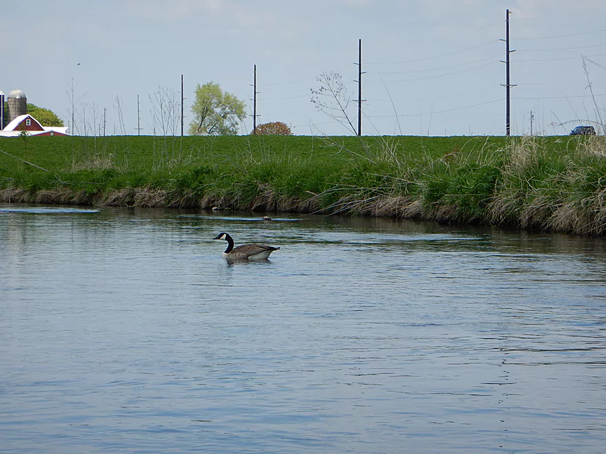
Wildlife was very good on this trip, with songbirds being the highlight (lots of red-winged blackbirds). After the “Hwy 14” rapids, I spotted a goose on her nest. I patronized her woeful hiding attempt of just lowering her neck in thin grass by quietly giving her a wide berth. Soon after, I encountered what I presumed was her mate. Even though he could have easily flown off, he led me on a proverbial “goose chase” away from the nest and down the creek for a half mile. Not a very thrilling race, as neither of us was moving very fast…but it seemed clear to me what his intent was. As I “followed” this goose under a graffiti-riddled railroad bridge, the tree clutter started to pick up, as did the current. Be on your toes here….it’s okay, but not a section to take for granted, especially if you have a longer boat. The creek wraps around to tag the railroad again and this time there is a serious log jam blocking the water…and even the goose got out to fly away. This is a very easy portage though.
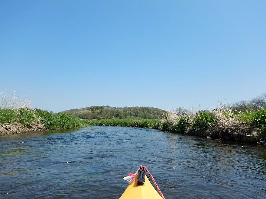
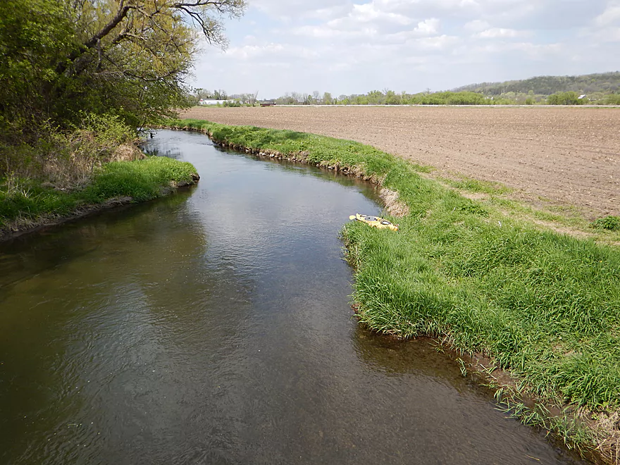
After this section, the creek remains very open. Water quality, while still good, starts to degrade, with more fine silt floating in the water and muddier “farm banks”. To an extent, this reminded me of the Platte River, with the clear, riffly sections and nice scenic hilly vistas in the background…then the beat-up farm sections. I didn’t see as many big birds on this trip relative to the trips I’ve done earlier this year, but saw my share of ducks, geese, and a blue heron. Saw two MASSIVE soft-shelled turtles. The first I missed for a picture…but the second I was able to sneak behind and photo (picture lacks scale though). After I got out, I also saw and photoed a terrific (and filthy) snapping turtle, which was a treat, as well as a chubby groundhog.
Major obstacle #4 would not be a log jam, believe it or not, but a low hanging cattle fence. Two in fact…as the fences formed a path for the cattle to cross the water. The water was riffling through here fast and a portage (over two sets of cow fences) looked difficult. I moved to the right where the current was slow and was BARELY able to duck under both sections (had to take off my lifejacket to fit under, if that gives you an idea of how tight this was). This might be easier to run in lower water…could be a huge issue in higher water. The debris trapped by the fences rained down on my then clean kayak, leaving it filthy, adding insult to injury. This is the last obstacle though and it’s clear sailing to the finish line at Olson Road. Editors update…the fence has been raised to let paddlers under! Thanks to the farmer and volunteers involved in this effort. Again, this is more of a farm country section…still a number of riffles, but more open and a tad more polluted. One farmer just piled a massive amount of sileage wraps by the creek for burning, which was a bit of an eyesore.
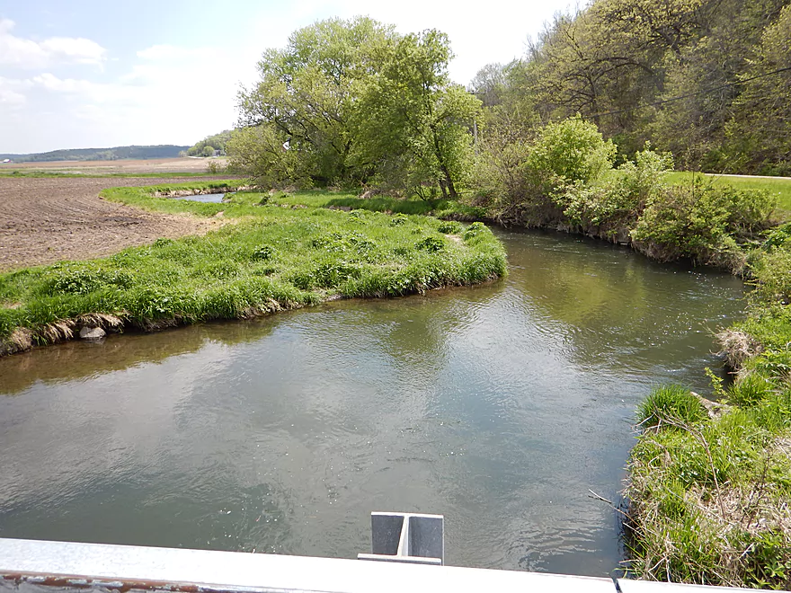
Take-out at Olson is pretty good. Parking is great and clearly public and its a low trafficked road. The pull-off area is, unfortunately, not next to the launch area due to a poorly placed guard rail, so there is a little hiking/kayak dragging involved. If you double park, and are willing to hoist your boat over the guardrail, this might be much easier. The upstream side is much easier to take out on than the downstream side.
All in all, this was a creek I really enjoyed paddling and would recommend to other kayakers. Just come prepared for the portages and you’ll have a nice trip. (editor’s note…the jams are scheduled to be cleared in the future which is good news)
If you’re curious about learning more about Black Earth Creek, check out these links:
- Black Earth Creek Watershed Association – Terrific non-profit organization that works to protect and conserve the creek. Great info in their online newsletter section.
- Capitolwatertrails.org – Nice clean-up effort on the creek and the webmaster is knowledgeable about the area
- Seekingtrout.com – Nice local trout blog with great pictures. They have a lot of great info on the most recent restoration efforts on the Creek.
- National Heritage Trust – Good info about the creek and a nice map of the new Wolf Run Trail
- Wolfruntrail.net – Brand new website dedicated to promoting the new Wolf Run Trail
—
Webmaster’s Update – A new free kayak shuttle for Black Earth Creek has been formed. Click here for more information.
Detailed Overview
- Upstream from N. Birch Trail: The creek is small, but might be surprisingly navigable during high water.
- N. Birch Trail to Stagecoach Rd: 0.5 miles. Creek here is small and wooded with possible congestion and a few jams.
- Stagecoach Rd to Cross Plains: 2.0 miles. An intriguing prospect that may now be viable because Black Earth Creek has grown in size. Starts narrow, rocky and wooded then opens up. Maybe 2-3 logjams. Stagecoach Rd may not be a good access as a "No Tresspassing" sign is on one side of the bridge.
- Cross Plains to Salmo Pond: 4.3 miles. Nice stretch. Half of this leg flows by the community of Cross Plains. One fence and one logjam to deal with but not major.
- Salmo Pond to Black Earth Community Park: 4.2 miles. Several fences to deal with, but all in all, one of the more underrated legs on the creek.
- Black Earth Community Park to Olson Road: 4.5 miles.
- Black Earth Community Park to The Shoe Box Landing: 1.5 miles. Nice stretch that passes through the outskirts of Black Earth. Might be a few minor logjams to sneak past.
- The Shoe Box Landing to Olson Road: 2.9 miles. Pleasant open stretch. This is a common "add-on" leg for those wanting to do the popular Mazo trip, but as a longer trip.
- Olson Road to Walking Iron Park: 3.7 miles. The best and most popular leg on the creek. Much of it flows around the outskirts of Mazomanie and though a nice woods.
- Walking Iron Park to W. Hudson Road: 1.1 miles. A small but great section that is recommended as an add-on to an Olson Road trip. This doesn't receive as much upkeep so paddlers may encounter a logjam or two.
- W. Hudson Road to Blynn Road: 4.4 miles. An ok section but nothing special. This leg while once clear, may now have a few surprise logjams.
- Blynn Road to Mouth at Arena: 6.8 miles. Technically now Blue Mounds Creek, this is the weakest section.
Trip Map
Overview Map
Video
Photos Size:
1.The field on the west side of the Shoe Box looks like a good spot to park the car, unload off the street and launch. I have not yet talked to owner Steve.
2.We are working on the problem of the fences across the creek.
3.Olson Road bridge is a great launch site. Park and launch on the east side.
4.Two Bridges with shelter, trail head and porta potty is a good stopping point below bridge on left.
5.We are working on railroad bridge debris just downstream from Two Bridges.
6.State street below bridge on left is mowed county land sold by Schumann to county, mowed to creek by Schumann for a great downtown landing and launch and they approve use.
7.At walking Iron Park 200 yards downstream from the small trail bridge I mowed a trail into a good landing/launch site north of the rest room and pumping station.
Thanks John for the update!
Putting in at the above listed spot near the park is not suggested. The culvert bridge to go under and potential trees that are there are not worth the effort. There is a new landing at the Shoe Box which avoids all of this.
However, at present we are asking folks to put in at Olson Rd. My husband, myself, and other locals are trying to come up with a way to make the cattle fence obstacle less challenging. Kayakers have to know that we are working on it along with the farmer and other locals. The stream (which no one ever use to paddle) has become exponentially popular so that the old techniques of getting through the fence is not working anymore…especially when folks do not rehook the latches. There are young calves crossing the stream now who are curious and last year one of their ‘moms’ got out on hi-way 14….so we want to come up with a solution that makes both farmer and kayers (like myself) happy. stay tuned…we are working on it. and we thank you for your patience. .
We got the cattle gate up and running on Sunday June 24th. The prototype
hangs more vertical but the newer model is a little bit more angled because
it has a longer swing arm for me to push aside when I come through with a
boat. We used chains too, so we can go back and adjust the height and the
swing arm if we want to. The other fence just has a latch attached with
pvc pipes. We kept both openings narrow. Also you can see how the fence is
about ‘shot’. The farmer says he hopes to put in a new fence next year.
My husband and I have used a chainsaw on previous big trees that have gotten
hung up on the fence….so we know that the fence has seen lots of abuse in
its 25 years of service. The farmer will go look at the gate this week and
if he likes it…then it stays put…if he doesn’t then he will have to
figure out plan B. If you don’t hear from me again for awhile…that means
that he likes our kayak gate. Also we put a sign up at the shoe box saying
there is a cattle fence up ahead that will require paddlers to get out at
river right and push/pull through. Then about 100′ before the fence we have
a sign saying to pull out river right. The famer might mow the bank there
so folks can get out easier because the long grass/weeds are hanging out so
far now that it is tough to see that there even is a bank next to the fence.
However, some of us did weed whack some of the tall grass on Sunday. Folks
should realize that the creek there is shallow but fast.
Gaila
Say…paddled from shoe box to john’s landing yesterday on the black earth creek. The cattle fence is easy to negotiate (but you have to get out to do it) cuz even tho the second strand has disappeared the first strand of barb wire is still hanging in there but it is covered with junk and sitting low in the water. But it was easy to pull into a newly developed inlet on river right just in front of the first strand…then pull one’s boat over the debris and jump in. From Olson Road…there has been quite a bit of river traffic…play boats actually for the drops up to two bridges (wolf run trail head). After two bridges…creek is do-able (with one narrows and downed tree to skim through or do the easy portage on river left…we sawed/snipped branches off for you yesterday) up to Pearl’s landing on hwy Y = state street. After that there is a huge- huge jam…from the banks eroding and trees sliding in. we did manage (not easily with my 12’ kayak) to go completely river left, scoot under a fallen tree and then pull ourselves through a 40’ narrows that has developed between the bank and tree roots. But just ahead is another smaller jam. It has become semi-do-able after we sawed/snipped branches from river left. But remember…some of these obstacles may not be do-able depending on water level. A fast current with a longer boat could be a problem because it might slam you into the jams. Then it was down to John’s landing.
I might do this trip with some friends again on Thursday….but for now, Pearl’s landing seems like a nice place to pull out. Those jams and steep banks (for potential portages??) are iffy for folks who don’t know how to control their boats in a faster current.
Thanks as always for the updates Gaila
https://www.wisconsinrivertrips.com/segments/black-earth-creek-mazomanie
07/15/2020 via Mad City Paddlers discussion forum:
“The annoying cattle fence, which is about 1 1/2 miles downstream from the Shoebox put in, has now been improved for paddlers to easily navigate over, thanks to money donated by philanthropist John Wick for this much needed update. Per Gaila Olsen, Black Earth Creek steward, the strands of barbed wire with sharp edges have now been replaced with two simple non-electric cables that swoop down across the creek like the Golden Gate Bridge. 95% of the time you can just slip over them. If the creek ever became super low (which does not occur hardly at all any more) you can possibly skim under on the right hand side or just get out and push yourself under on the right hand side. There is also now a sign about 100 feet before the cable saying cattle fence ahead and a sign at the Shoebox now says cattle fence ahead 1.5 mile non-electric cable. This cattle fence improvement will now make the paddle from the Shoebox to John’s Landing a pleasant, fun outing! A special thank you to both John and Gaila for making this happen!”
Appreciate the update as always Jon. John Wick and Gaila Olson have done fantastic work for the creek.
We started from Black Earth Community Park. In hindsight, I think we made a mistake—it would have been much better to start near the Shoe Box. The reasons for this are several blockages and a very low private bridge. Despite the friendliness of the owners (many thanks to them!), we don’t want to disturb anyone’s peace or privacy.
Further along, the river is delightful. There are some amusing rapids, and occasionally you might bump into rocks with your bottom, but there are no major obstacles.
Thanks to everyone who cares for the river and shares information about this beautiful place!
Thanks for the comment and the helpful warning about the logjams!