
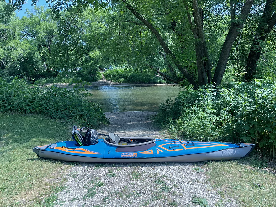
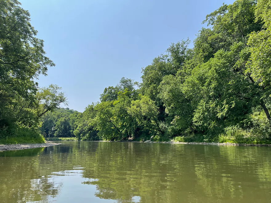
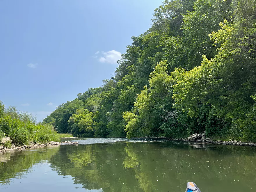
Put in at Kendallville Landing
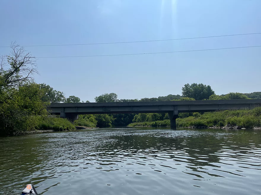
Hwy 139
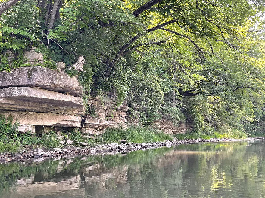
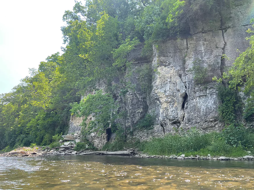
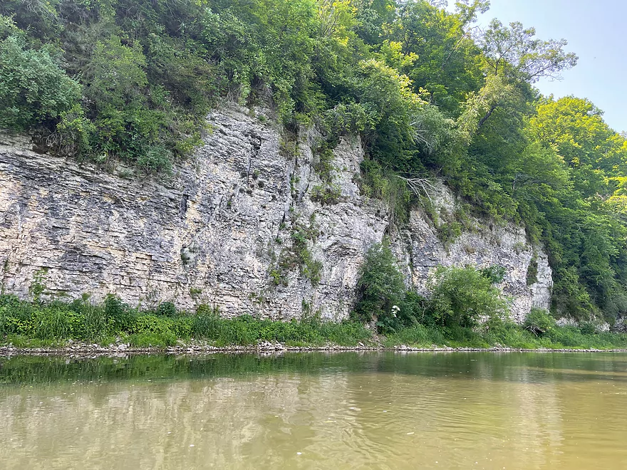
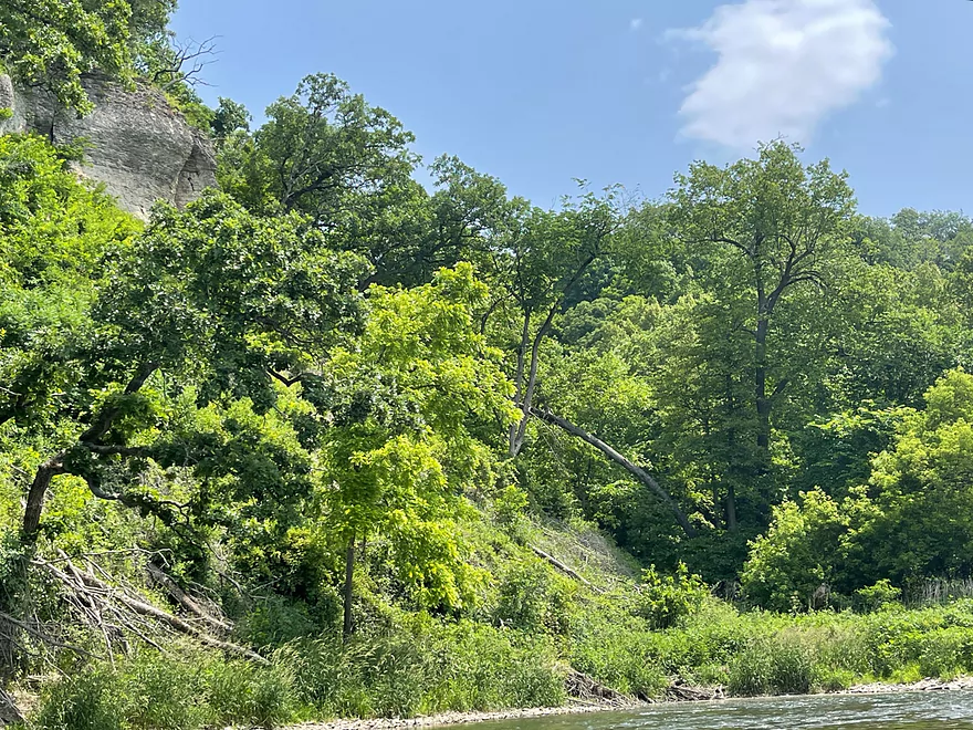
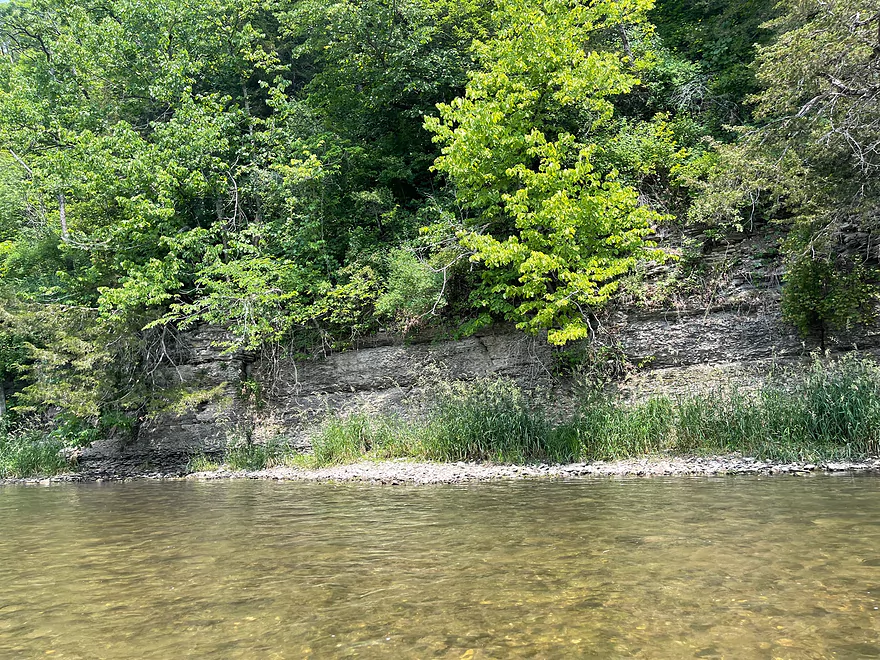
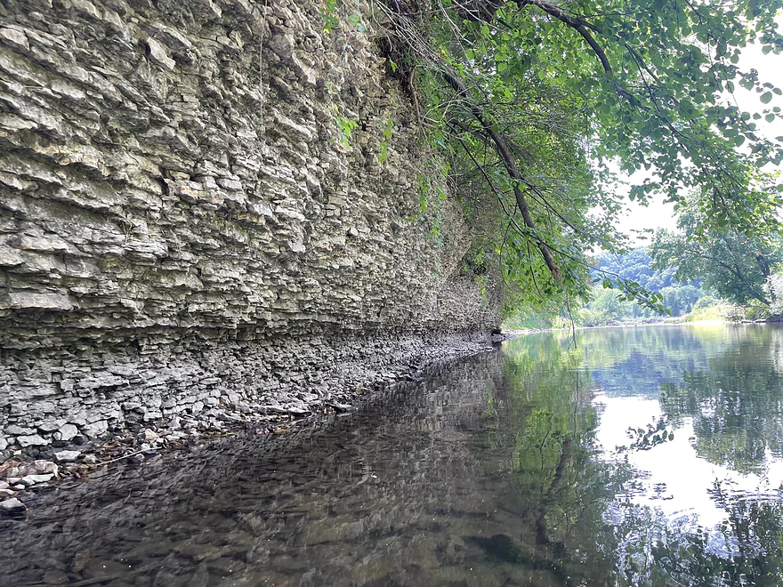
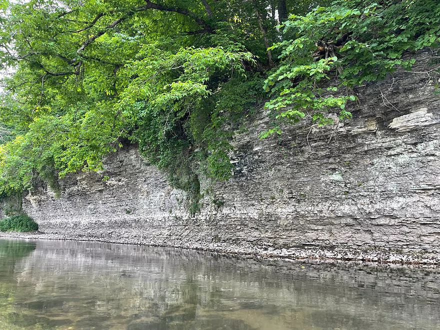
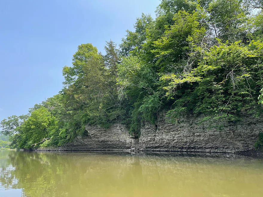
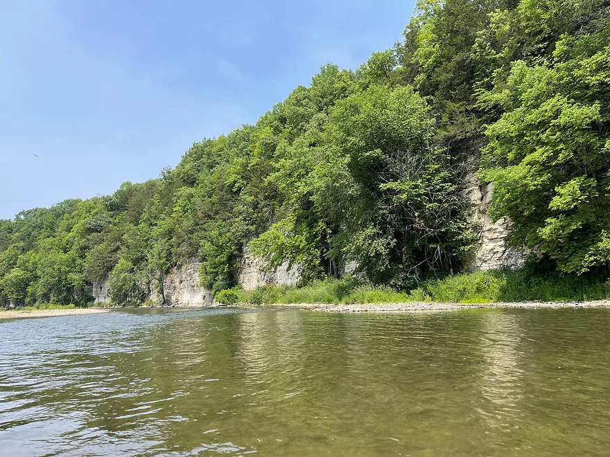
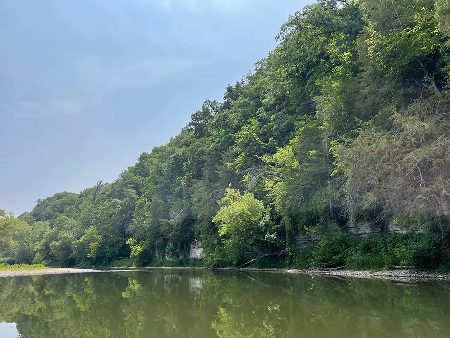
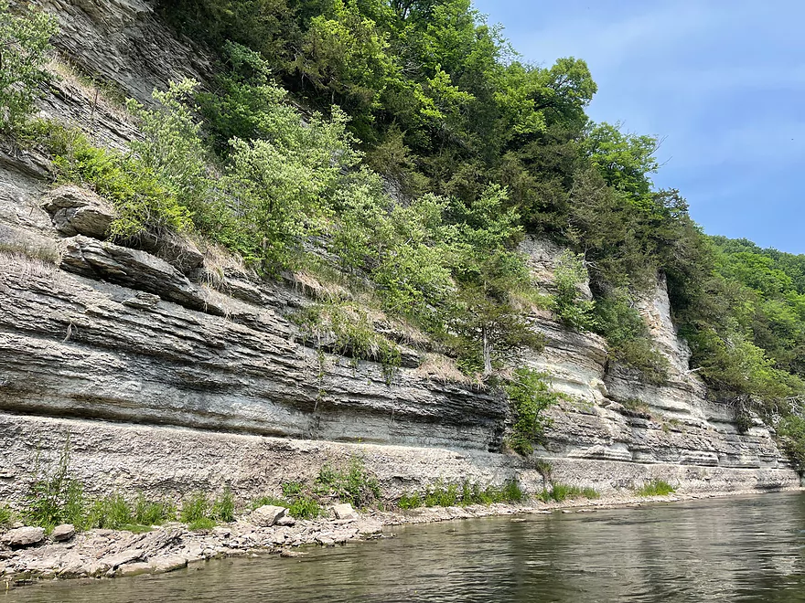
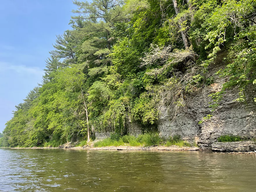
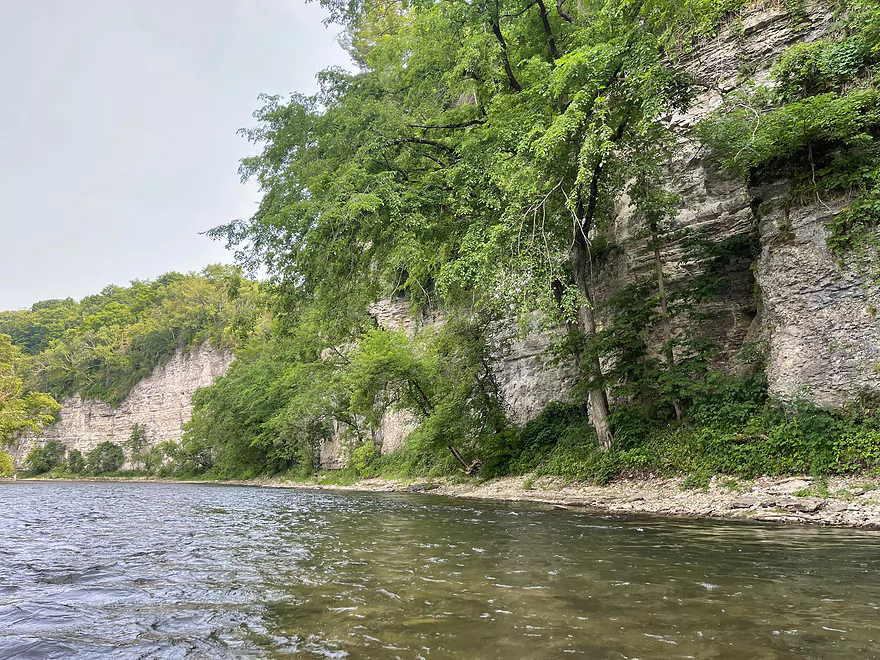
First outcrop of the trip
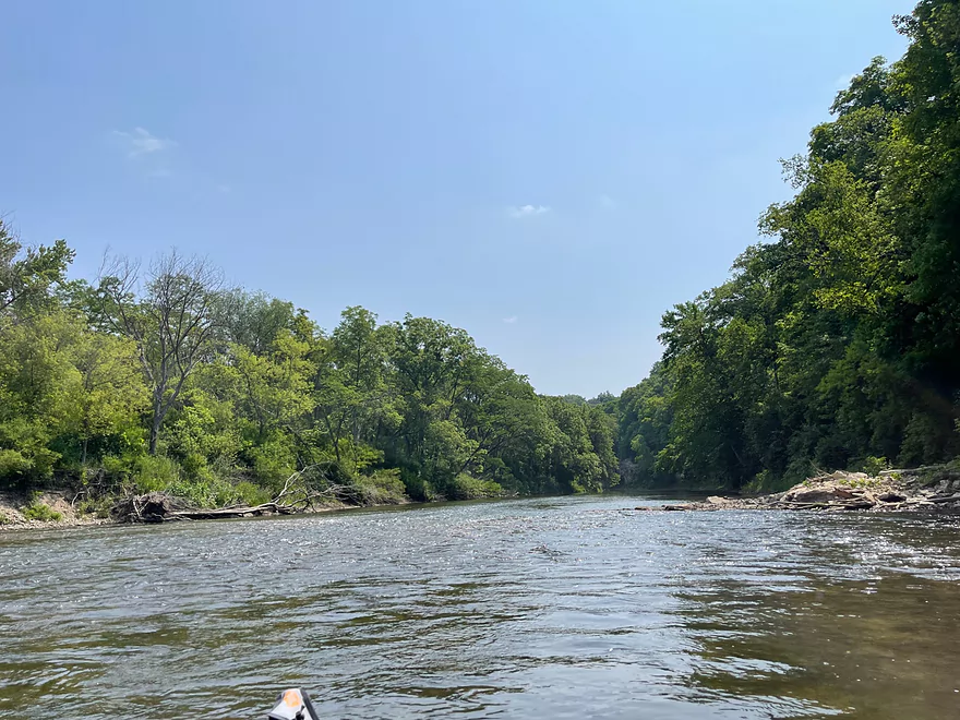
Followed by some riffles
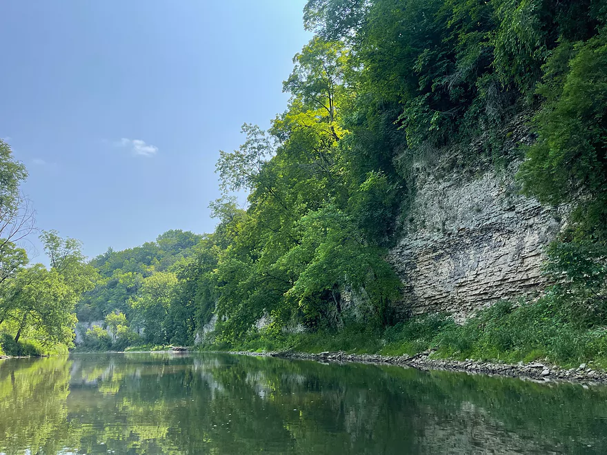
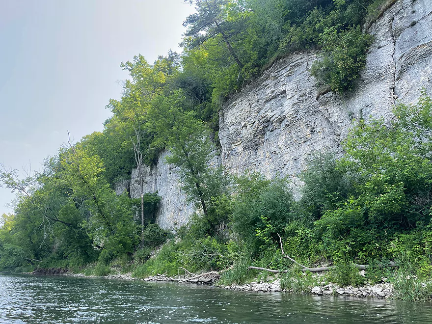
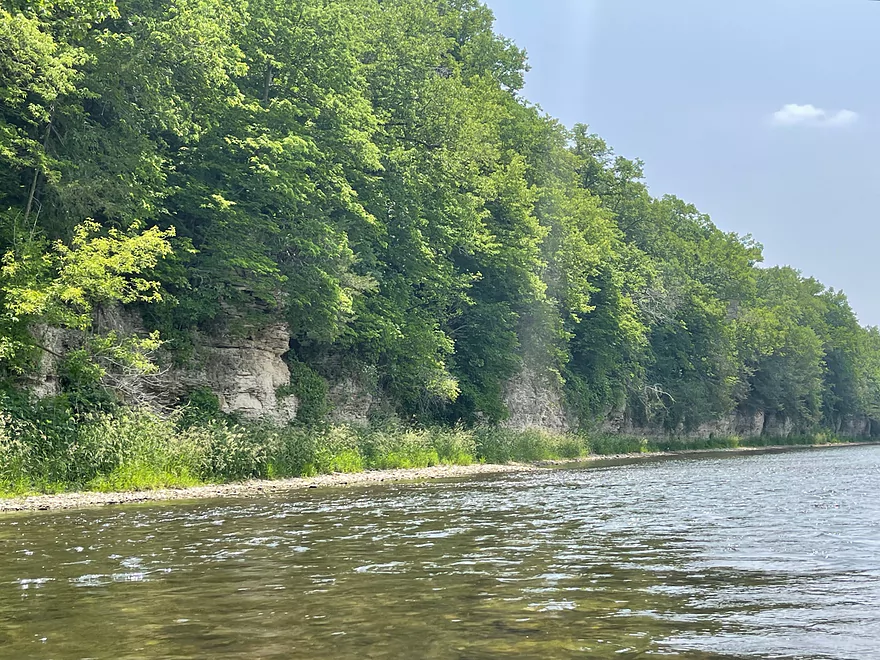
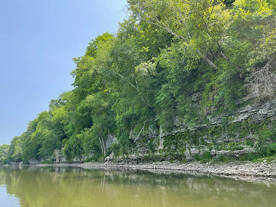
Another outcrop and some minor rapids
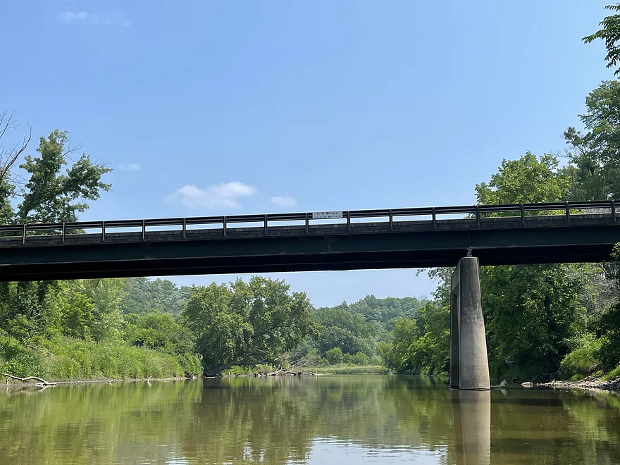
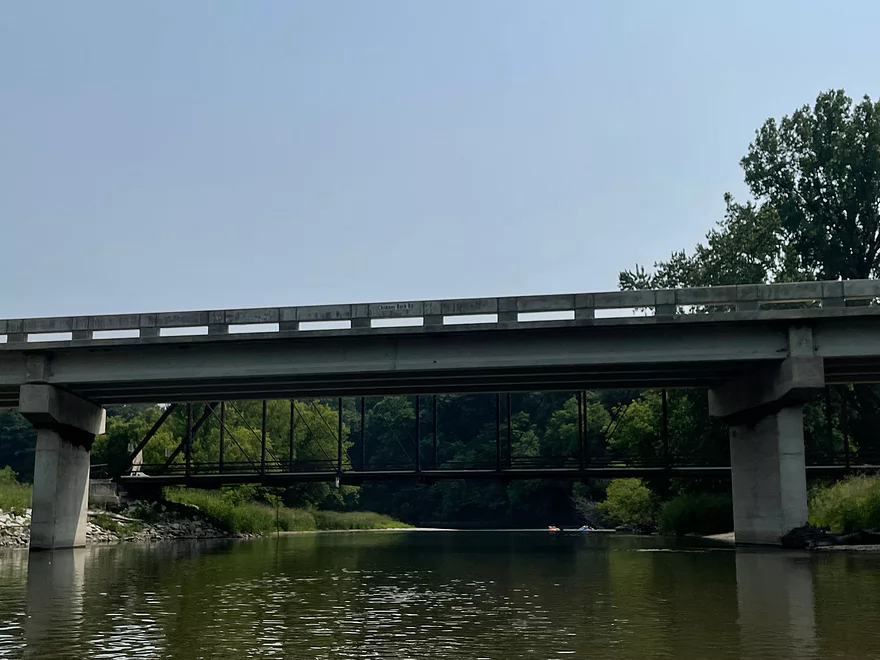
County W14 Bridge
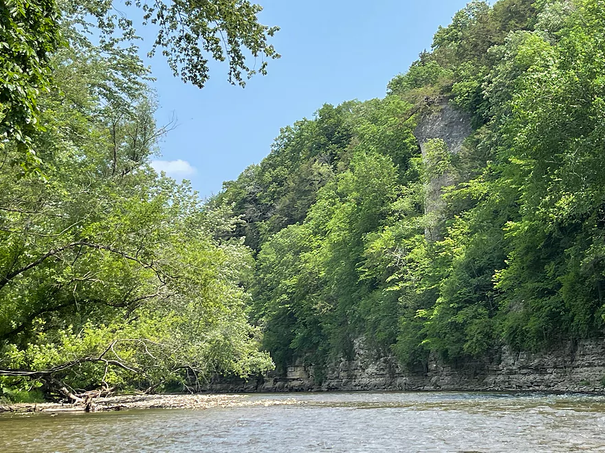
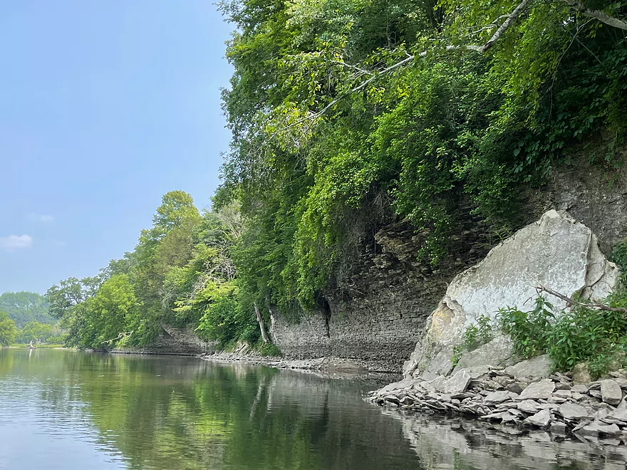
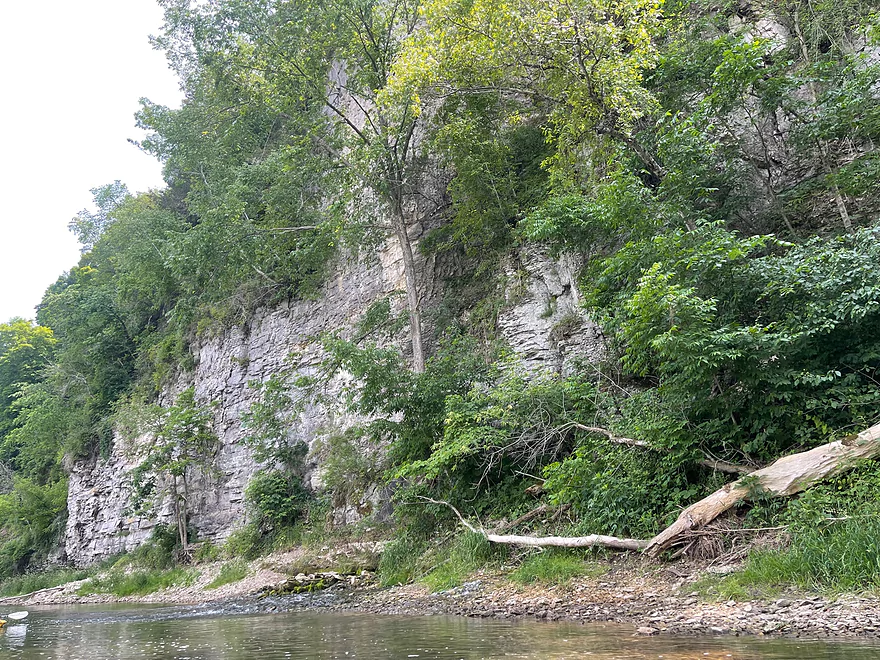
Plymouth Rock
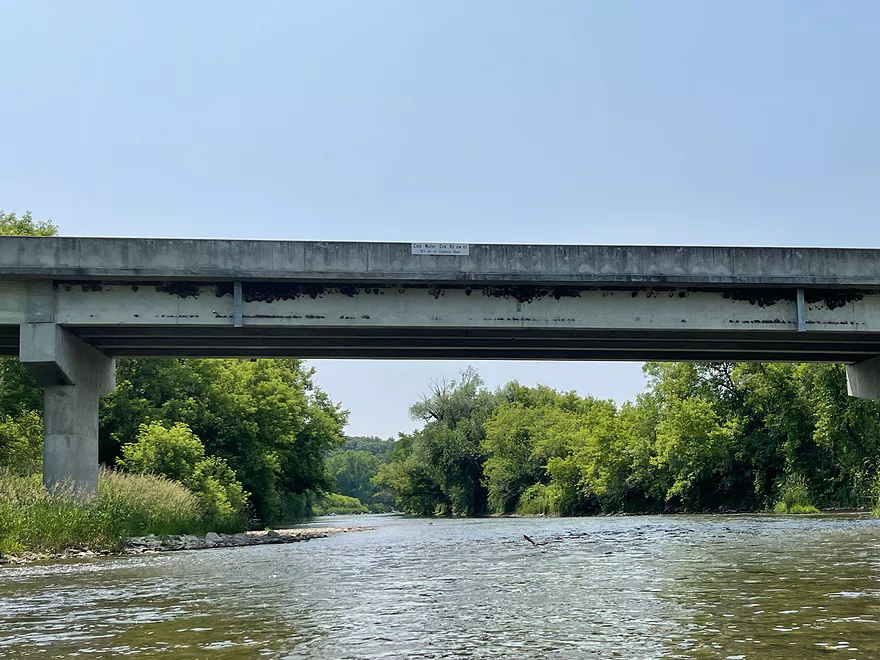
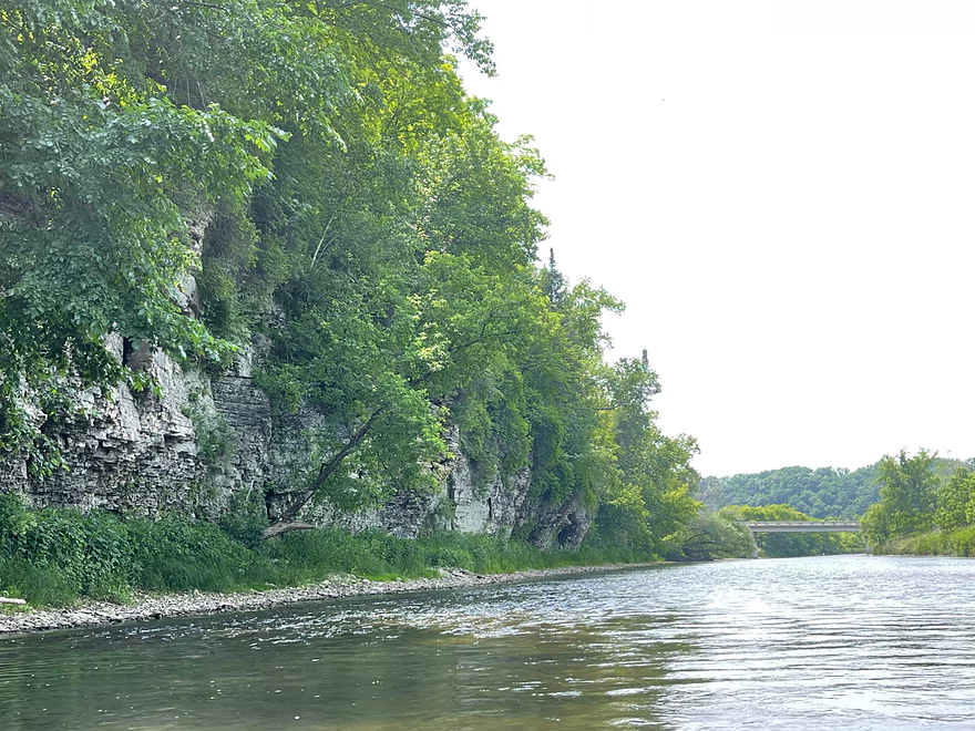
Cold Water Creek Bridge
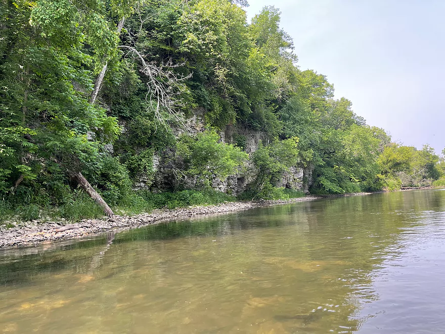
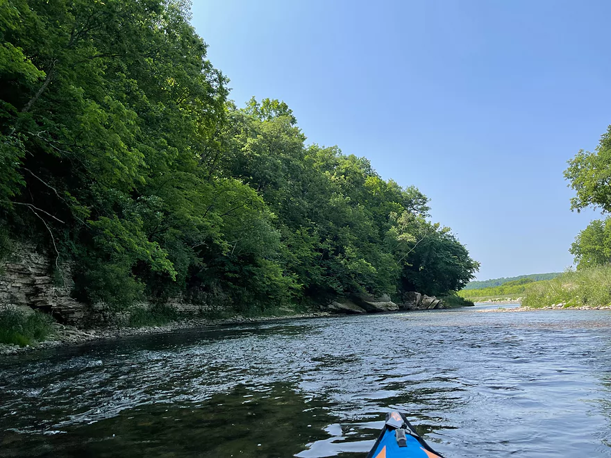
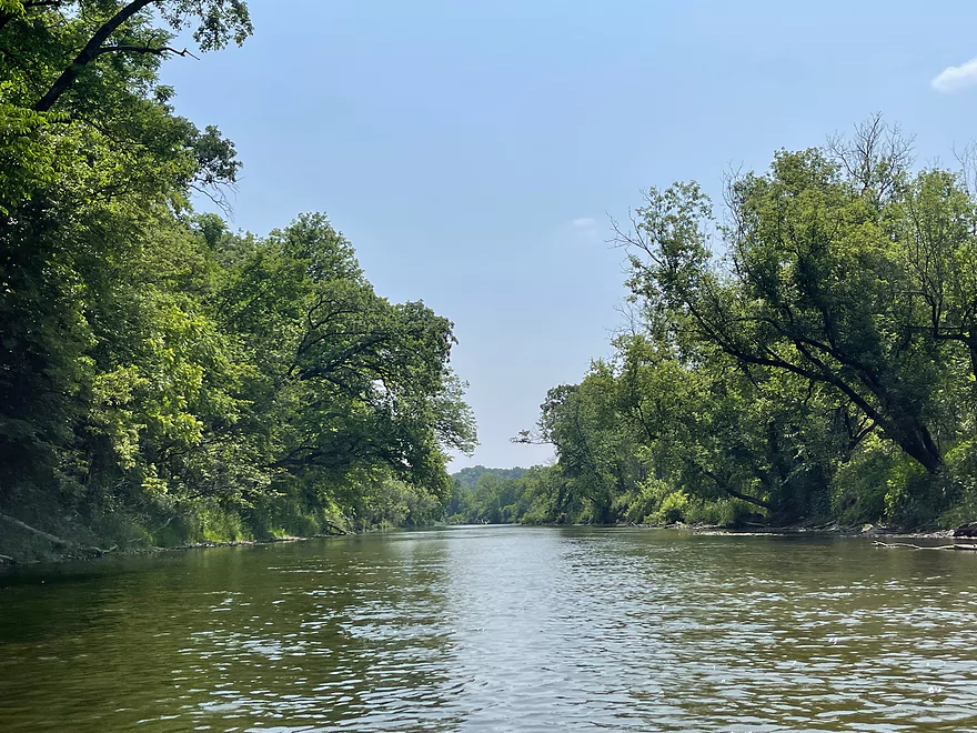
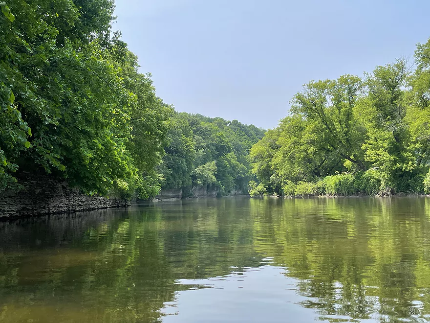
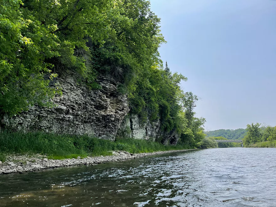
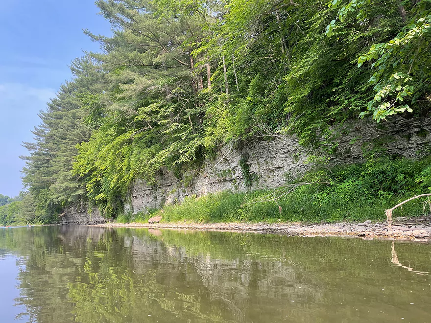
Looking upstream
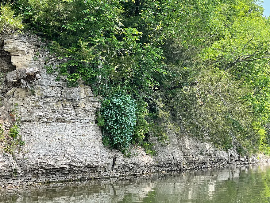
Interesting bush
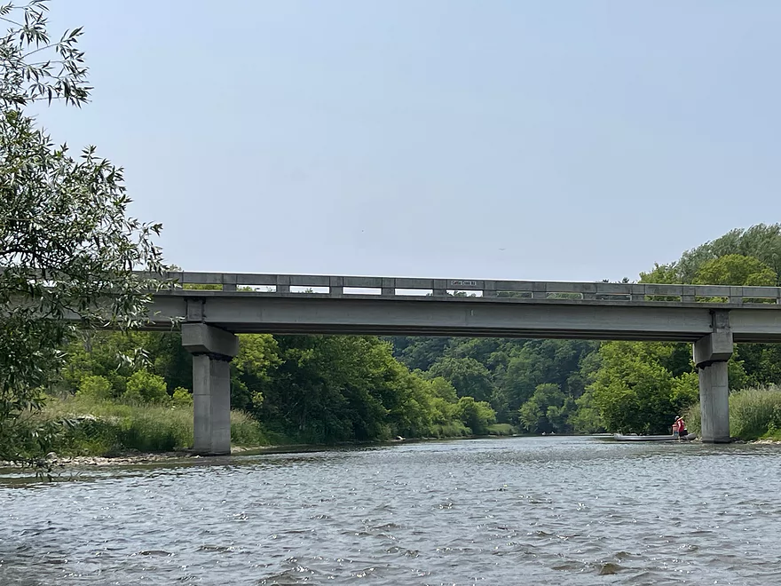
Cattle Creek Road (Daley Bridge)
Approaching multiple springs on the 2nd bend after Cattle Creek Road
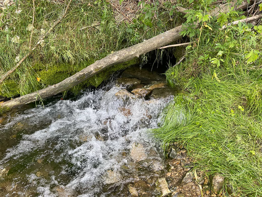
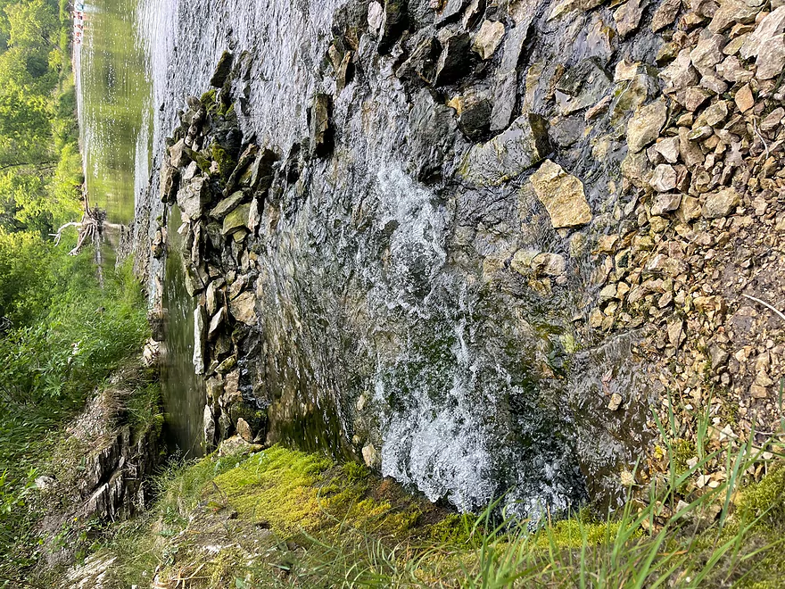
Water rushing out of the spring
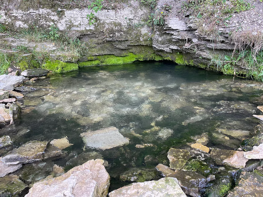
Spring pool of very cold water
Overlook of the springs
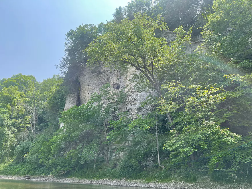
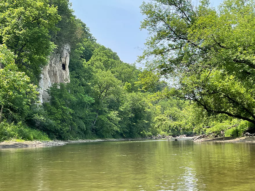
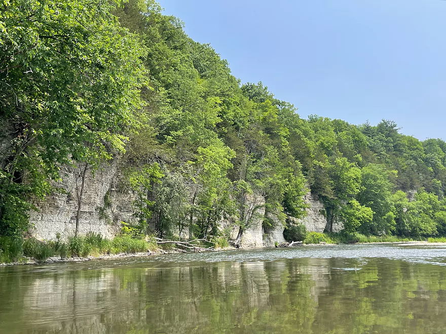
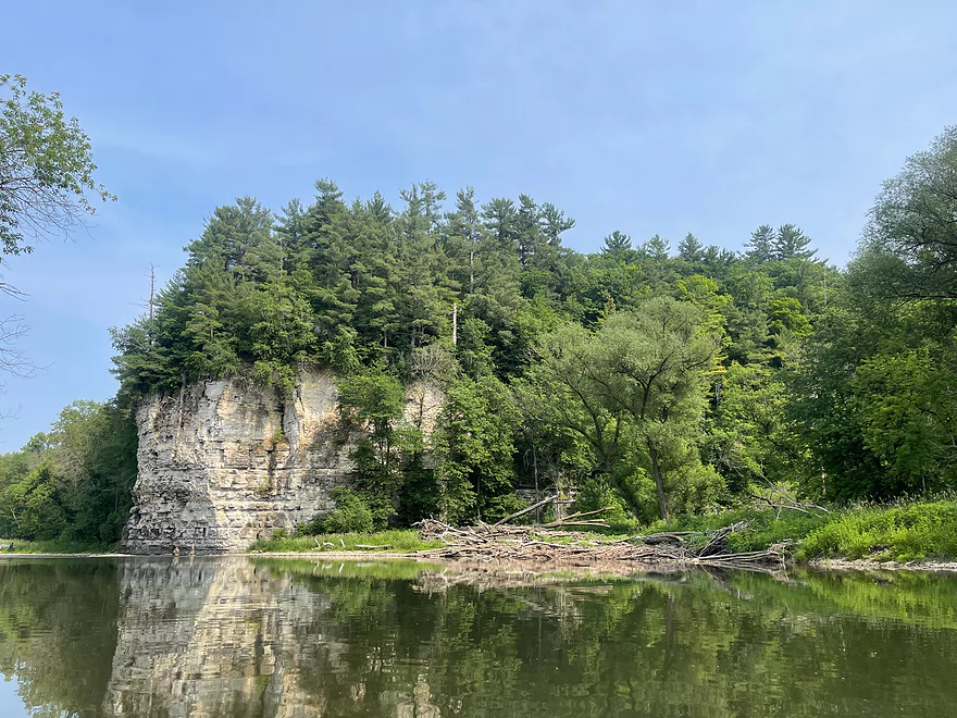
Chimney Rock
Chimney Rock Road
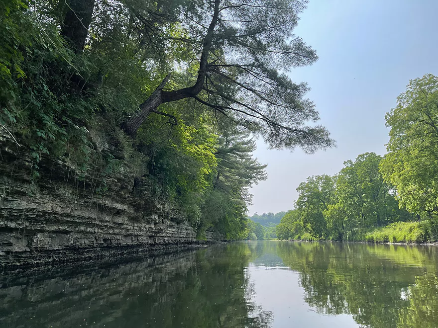
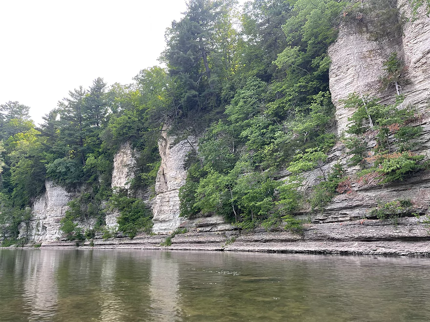
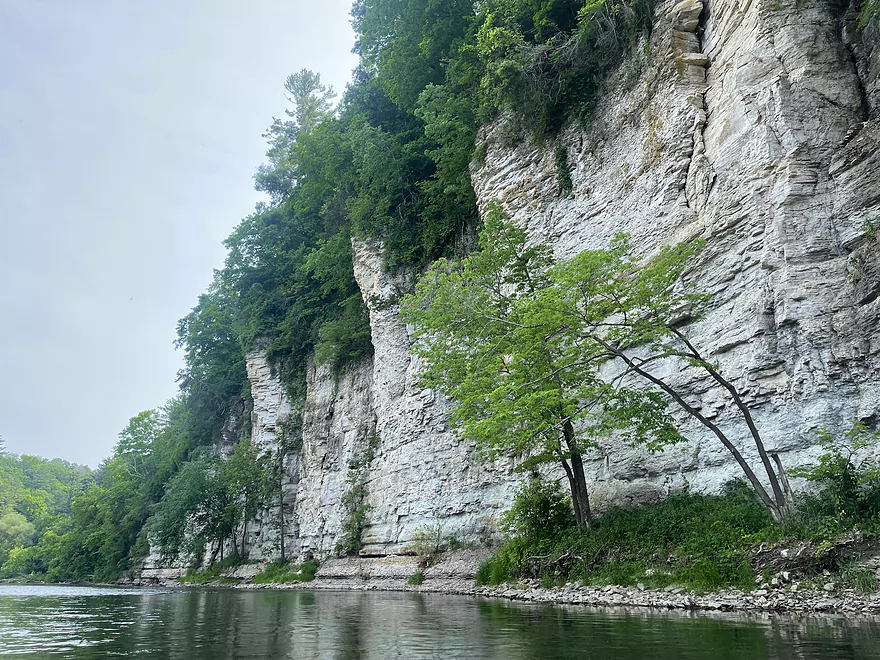
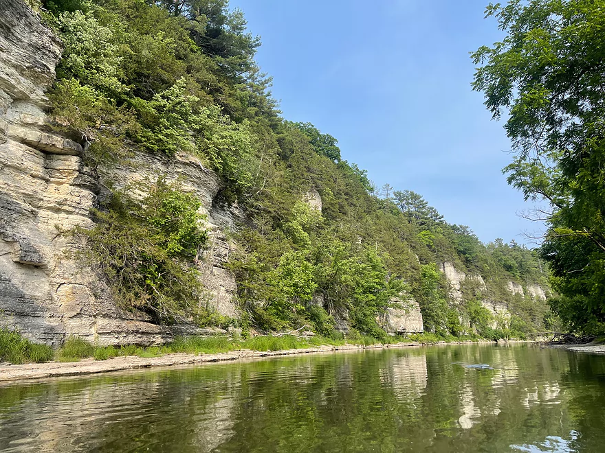
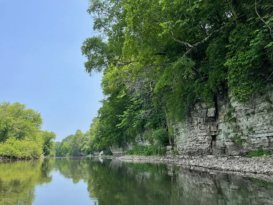
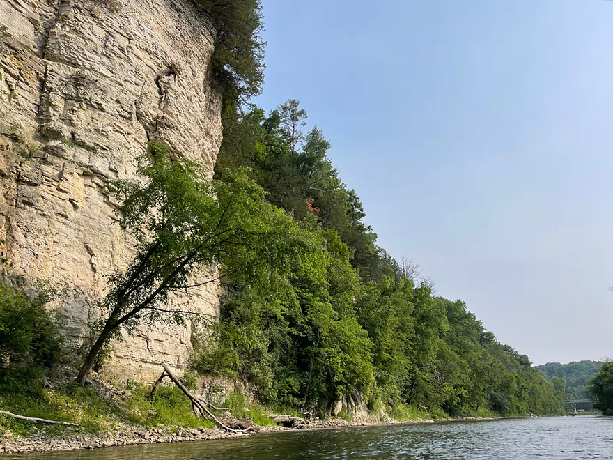
Approaching the famous Palisades
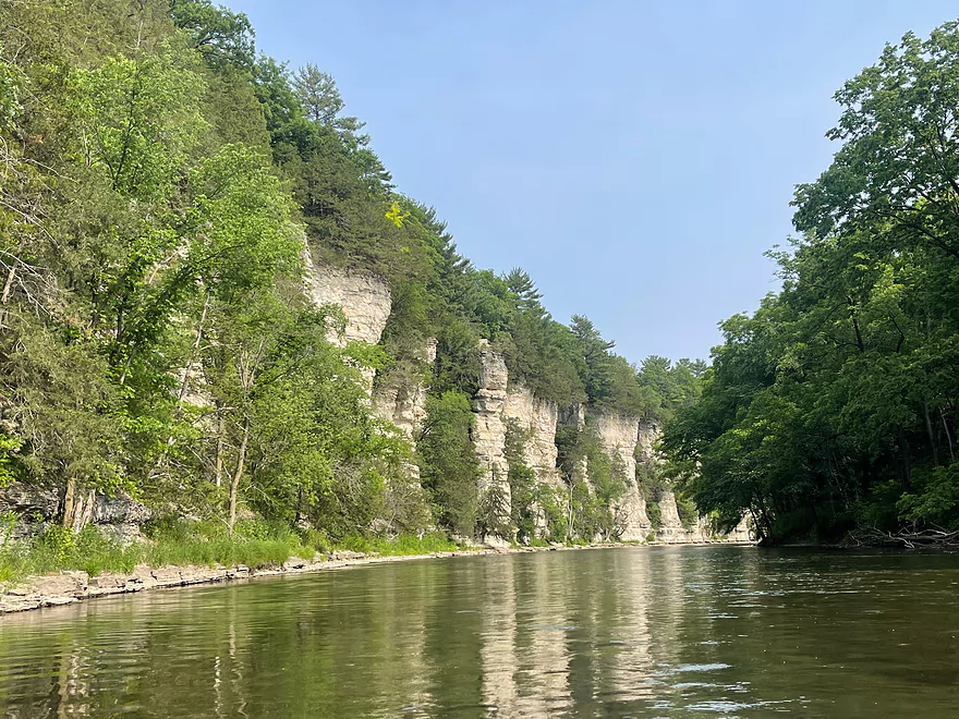
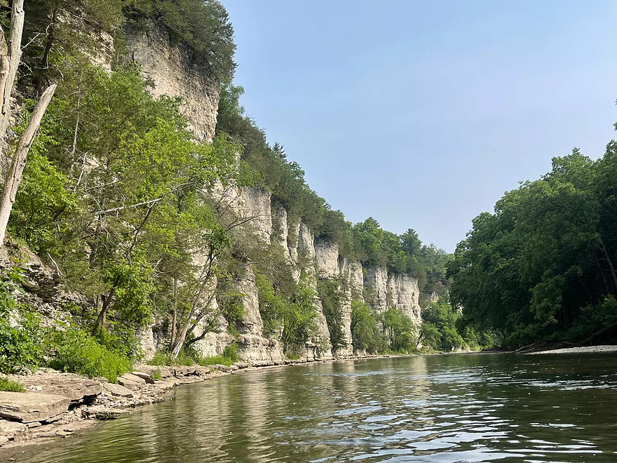
The highlight of the trip
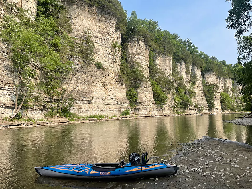
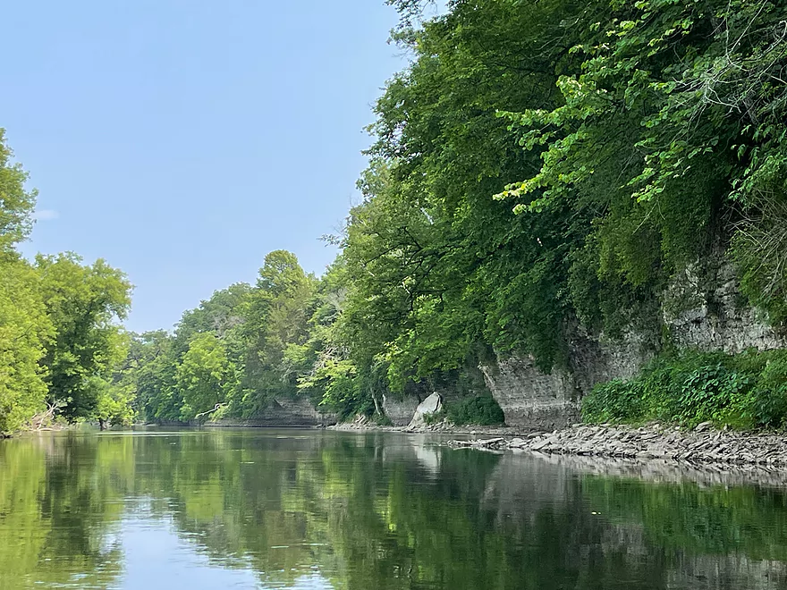
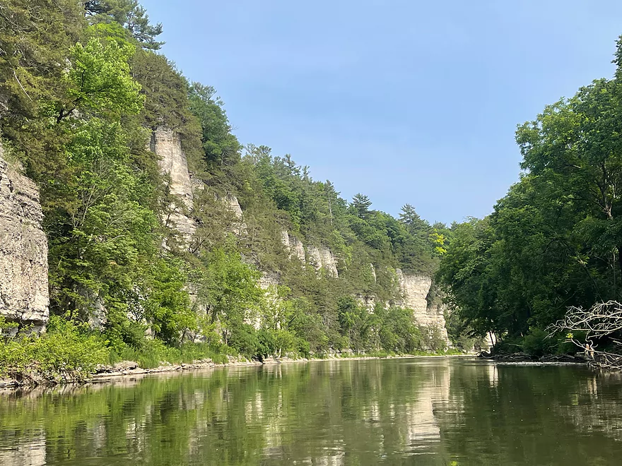
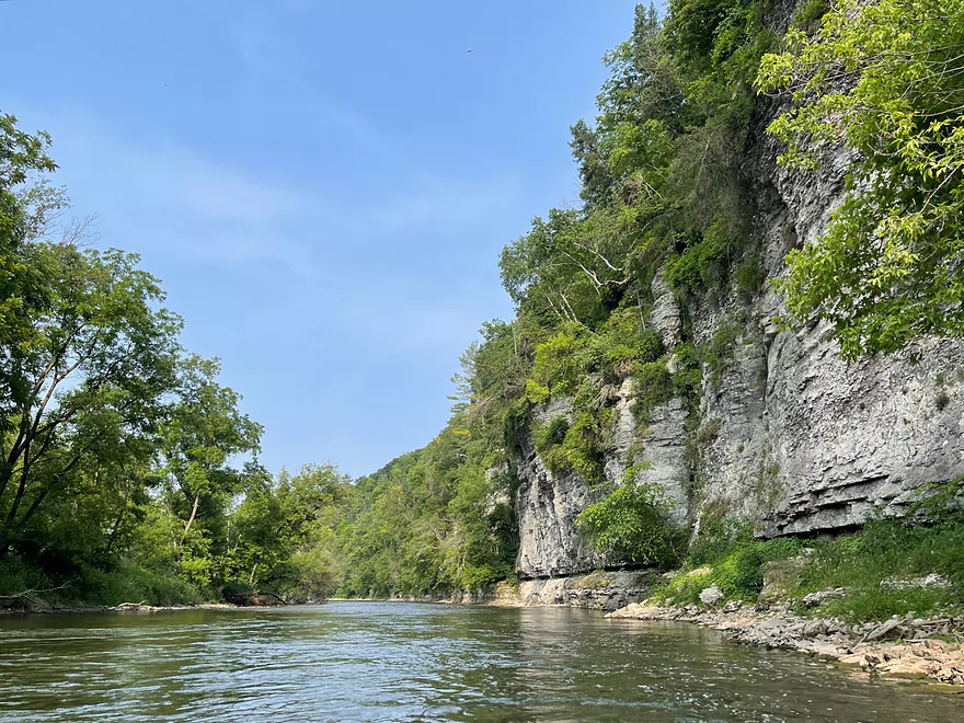
Stopping at the Palisades

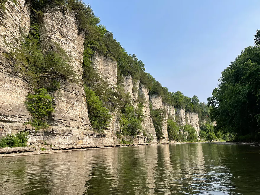
Looking upstream
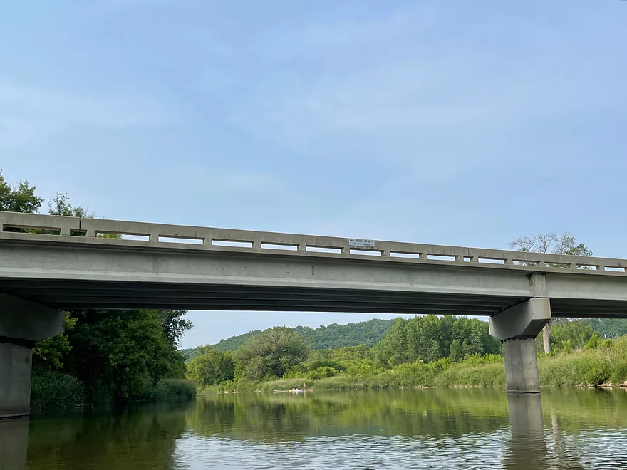
Bluffton Road bridge with take-out straight ahead
Upper Iowa River – Kendallville to Bluffton Road

The Upper Iowa River is a premiere Driftless kayaking experience. This trip has everything that you would want in a trip. Crystal clear water, the shore lined with outcrops, multiple springs, breathtaking scenery, and the famous Palisades of the Bluffton Bluffs.
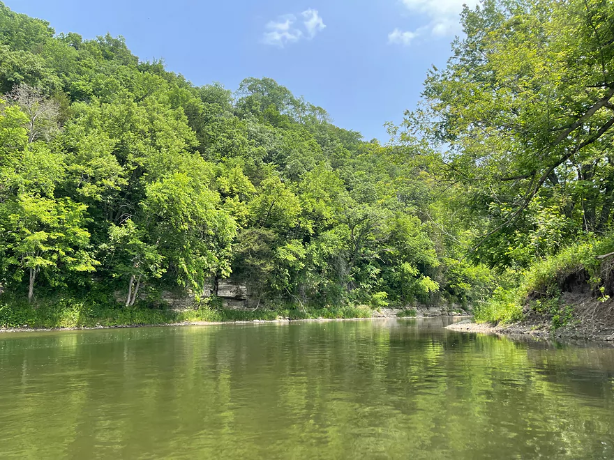
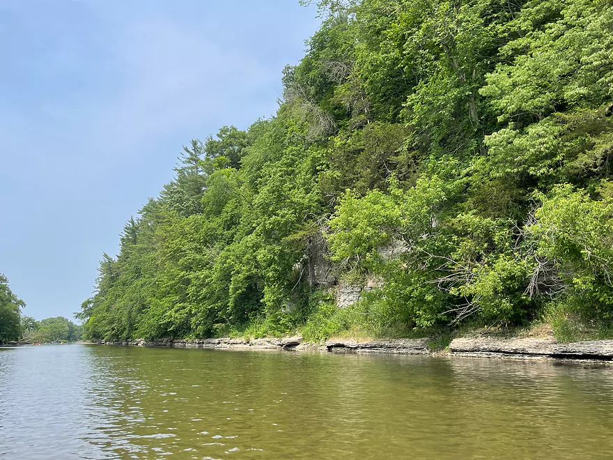
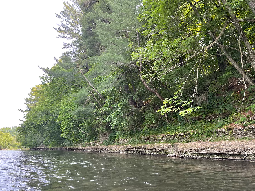
The trip started in Kendallville. The opening stretch did not have many kayakers and was the most peaceful stretch of the trip. The water has great clarity and there are many outcrops along the shore.
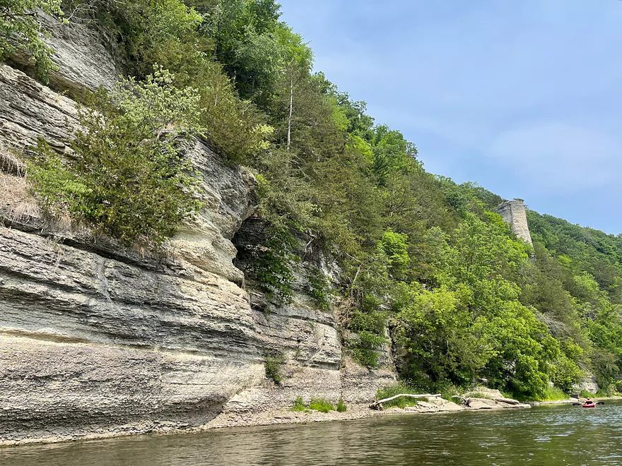
The first bridge is County W14, which is just before Plymouth Rock. Plymouth Rock will appear on the left after the bridge. Shortly after is Plymouth Rock Landing, which is a very popular put in. From this point forward the river is very busy on summer Saturday afternoons. The outcrops become more numerous.
The next bridge is Cattle Creek Rd (Daley Bridge) which is another popular put-in. After the 2nd bend there are multiple springs along the side of the bluffs that feed directly into the river.
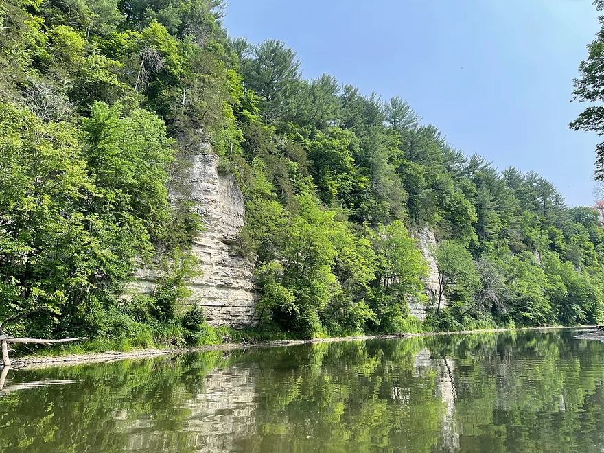
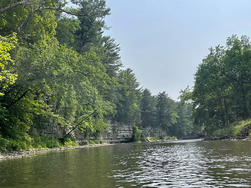
A couple miles after the springs Chimney Rock will appear on the left. Shortly after is Chimney Rock Road and the start of the most scenic stretch of the trip.
After the bridge the bluffs and outcrops gradually become taller and more dramatic. They increase in size and peak at the Palisades of Bluffton Bluffs, which are the tallest bluffs of the trip. This is the most photographed part of the trip and the main attraction when kayaking the Upper Iowa.
After Bluffton Bluffs, there is a bridge, the small community of Bluffton, and campgrounds that line the river until the next bend. There’s another high bluff before the river parallels Bluffton Road. After about a half mile Bluffton Road will cross over the river and the landing will be shortly after on the right.
The Upper Iowa River does have a lot of people during the summer especially on Saturdays. Despite the amount of people it’s still a great trip. The unmatched scenery is why the Upper Iowa is such a popular river for kayakers.
Thanks Peter for the review! WisconsinRiverTrips.com is always very appreciative of guest reviews, and if you the reader is ever interested in submitting one, you can use this online form.
Starting upstream and working downstream, here is a segment guide to the Upper Iowa River. Thanks to the Book “Paddling Iowa” and the website Northeast Iowa RC&D for much of this information.
- Chester/River Street to Lidke Park: 7.5 miles. Pleasant paddle. Navigation could be difficult during low water. Maybe some logjams and snags.
- Lidke Park to Florence/Victory Ave: 14.8 miles. Few paddle this section. Will be some minor bluffs. Perhaps some electric fences to deal with.
- Florence to Hwy 30 Wayside: 1.7 miles. Some riffles. Odessa Springs is located near the take-out.
- Hwy 30 to A14: 5.8 miles. It looks like there are some decent bluffs on this stretch.
- A14 to 370th Street: 1.0 miles. Mostly a straight section with some larger sandbars.
- 370th Street to Kendallville Park: 5.6 miles. Likely good bluffs. I believe this stretch is serviced by “Harvest Farm”.
- Kendallville to Cattle Creek Road: 8.4 miles.
- Kendallville Park to Plymouth Rock Access: 4.2 miles. Start of the famous Kendallville to Bluffton stretch. Good part of the river with scenic bluffs.
- Plymouth Rock Access to Cattle Creek Road: 4.2 miles. Good stretch with scenic bluffs.
- Cattle Creek Road to Bluffton Fir Stand Access: 9.8 miles.
- Cattle Creek Road to Chimney Rock Access: 4.5 miles. Great section with several nice bluffs with the best being Chimney Rock.
- Chimney Rock Access to Bluffton Bluff Access: 4.0 miles. The most popular and most scenic section perhaps on the entire river. The best bluffs and palisades are located here.
- Bluffton Bluff Access to Bluffton Fir Stand Access: 1.3 miles. One final nice bluff followed by a pleasant open section.
- Bluffton Fir Stand Access to Malanaphy Springs: 8.7 miles. Good current and riffles, but not as many of the nice bluffs.
- Malanaphy Springs to Will Baker Park in Decorah: 6.1 miles. Pleasant with good riffles and some bluffs. Several intermediate access options.
- Will Baker Park to Freeport access: 6.1 miles. A pleasant paddle through the city of Decorah with good views of the bluffs.
- Freeport Access to River Road: 4.1 miles. Considered scenic.
- River Road to Upper Dam: 3.0 miles. Considered scenic, but with some flowage paddling.
- Upper Dam to Lower Dam: 4.9 miles. Not as popular a segment. Some flowage paddling.
- Lower Dam to Ferris Mill Road: 4.8 miles. Starts with some nice wooded sections before widening out.
- Ferris Mill Road to Ellingson Bridge Drive: 4.5 miles. Possibly a decent stretch for sandbars and gravel bars.
- Ellingson Bridge Drive to Hwy 76: 13.5 miles.
- Ellingson Bridge Drive to Red Bud Drive: 0.8 miles. Short stretch that goes around a large island.
- Red Bud Drive to Iverson Bottoms Access: 5.0 miles. Some nice hillsides but lacking in cliffs.
- Iverson Bottoms Access to Iverson Bridge Access: 1.2 miles. Short stretch that includes part of Iverson Bottoms Wildlife Area.
- Iverson Bridge Access to Hwy 76: 6.3 miles. Decent, but not a spectacular stretch.
- Hwy 76 to Kumpf Access/Upper Iowa Access: 3.5 miles. Probably a generic stretch.
- Upper Iowa Access to Iowa River Drive: 4.0 miles. Likely a generic section.
- Iowa River Drive to Ray’s Landing/Morgan Bridge: 5.7 miles. Likely a generic section.
- Ray’s Landing to Black Hawk Point: 2.2 miles. Likely slow and channelized.
- Black Hawk Point to Mouth on Mississippi: 3.2 miles. Mostly channelized floodbottom.
- Mouth to Blackhawk County Park: 0.6 miles. Trip across the Mississippi to reach a take-out in Wisconsin.
Trip Map
Overview Map
Photos Size: