
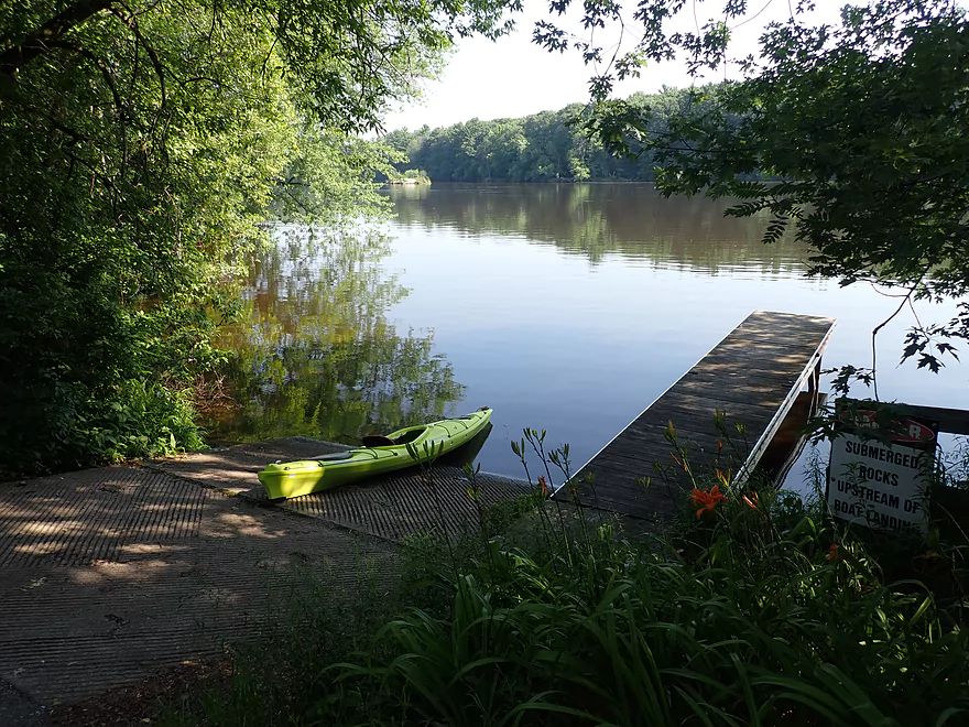
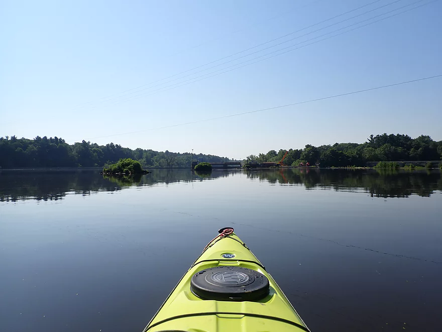
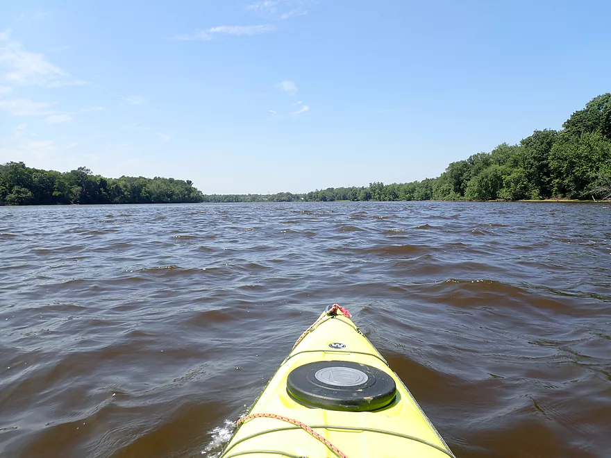
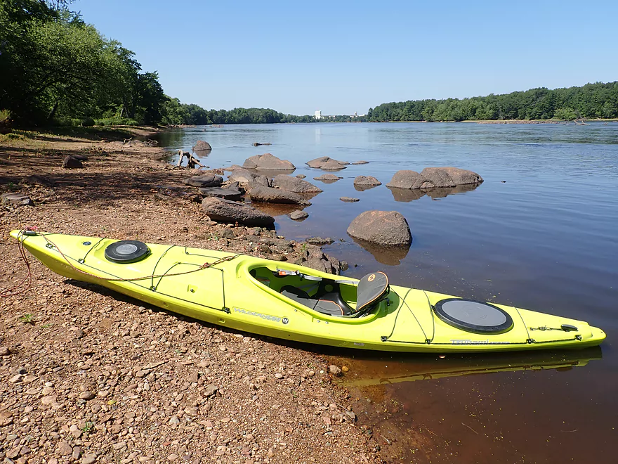
Starting the trip at the Wisconsin River Dr Landing in Port Edwards
Nice Launch
Exploring the Port Edwards pool
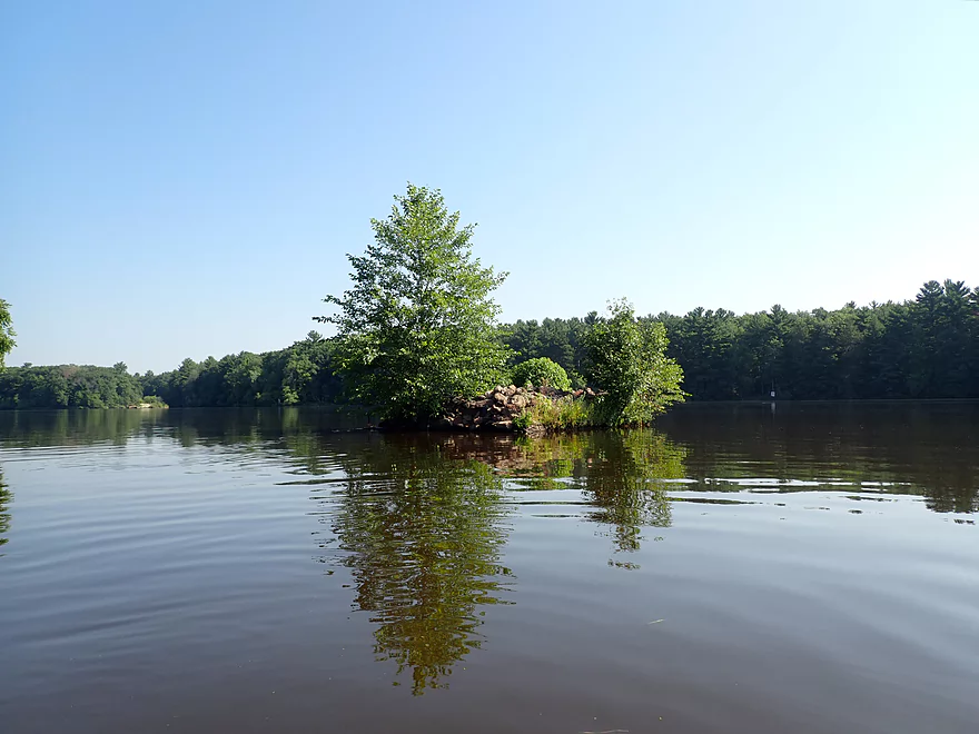
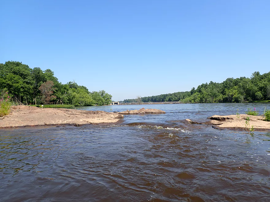
This area has several islands
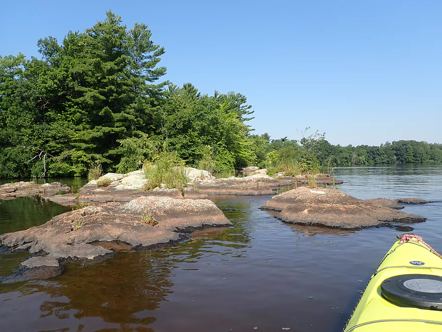
They’re actually much larger but are mostly submerged by the dam
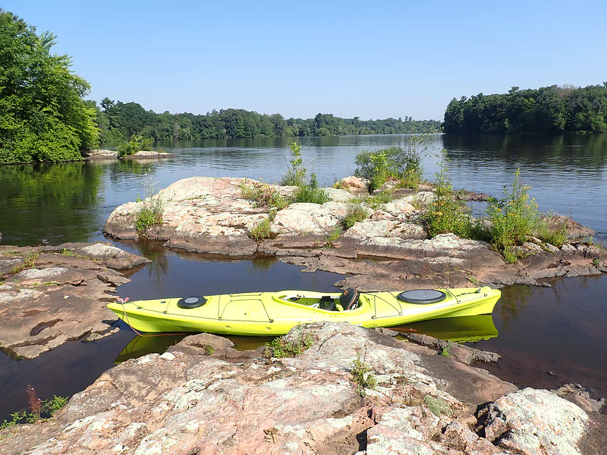
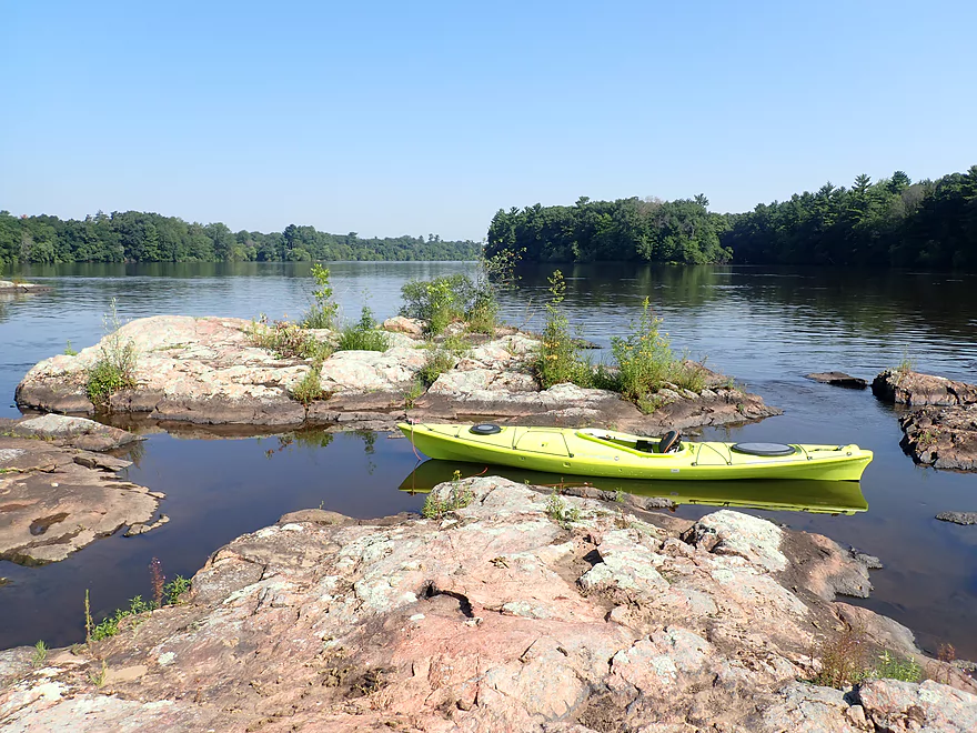
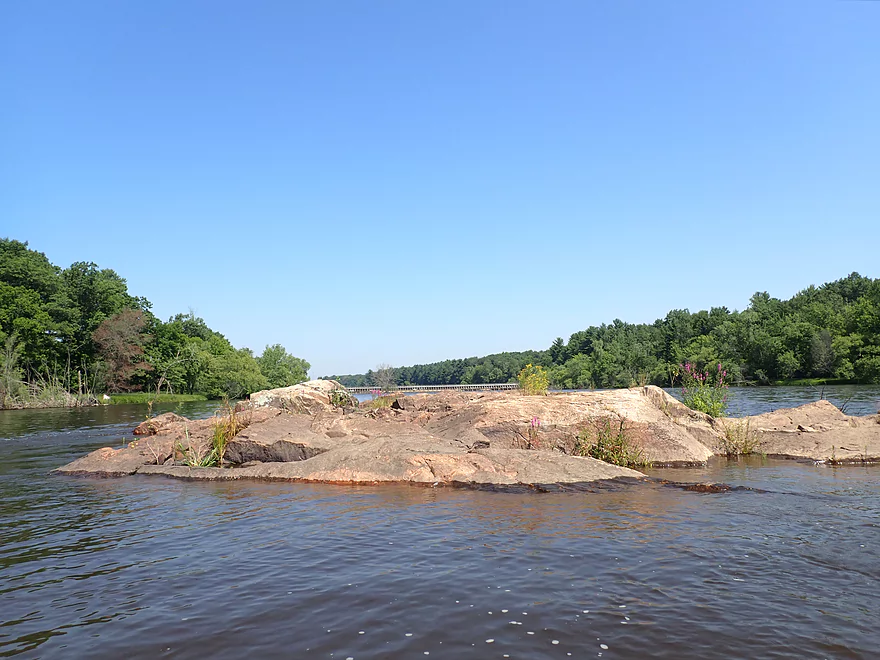
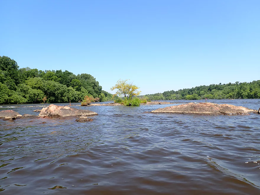
One of the nicer islands
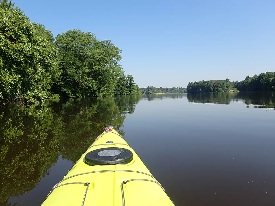
Taking a kayak selfie
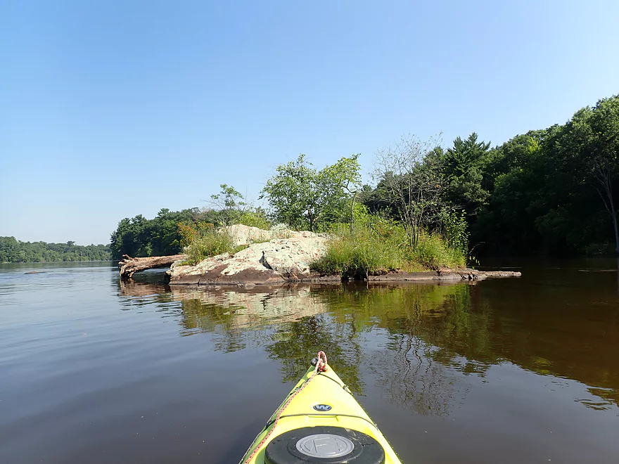
Another granite island
Heading downstream toward the dam
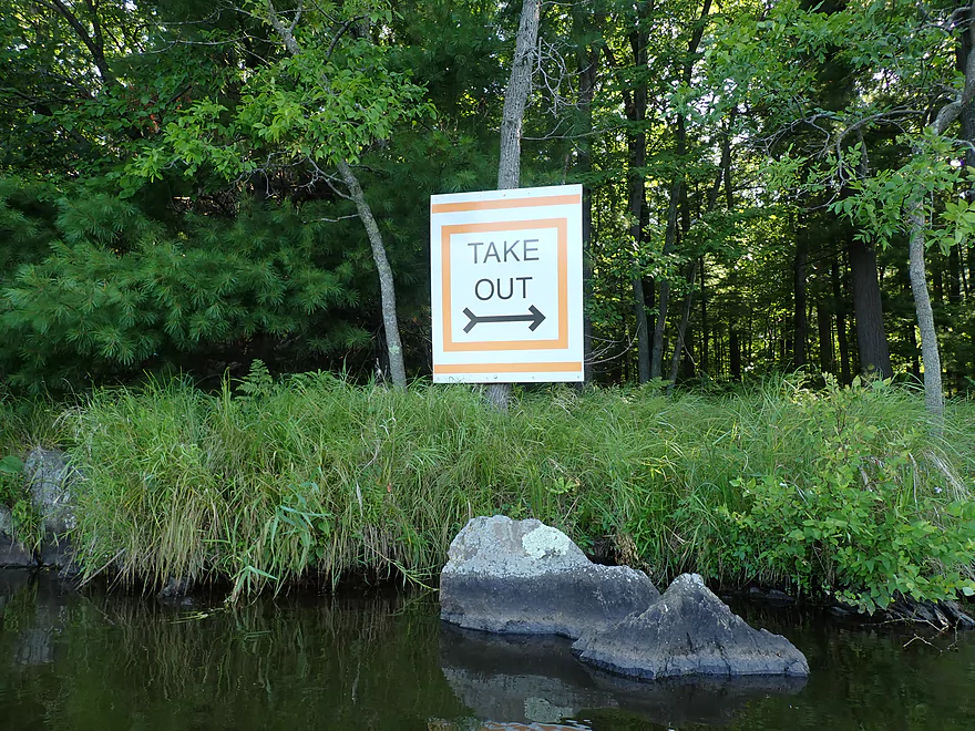
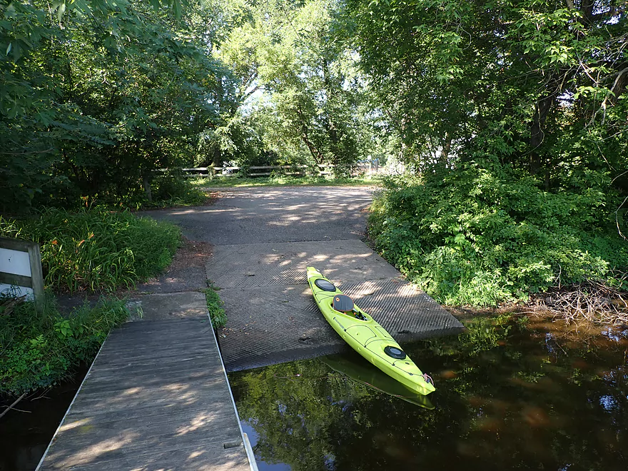
Signs clearly point to the portage take-out
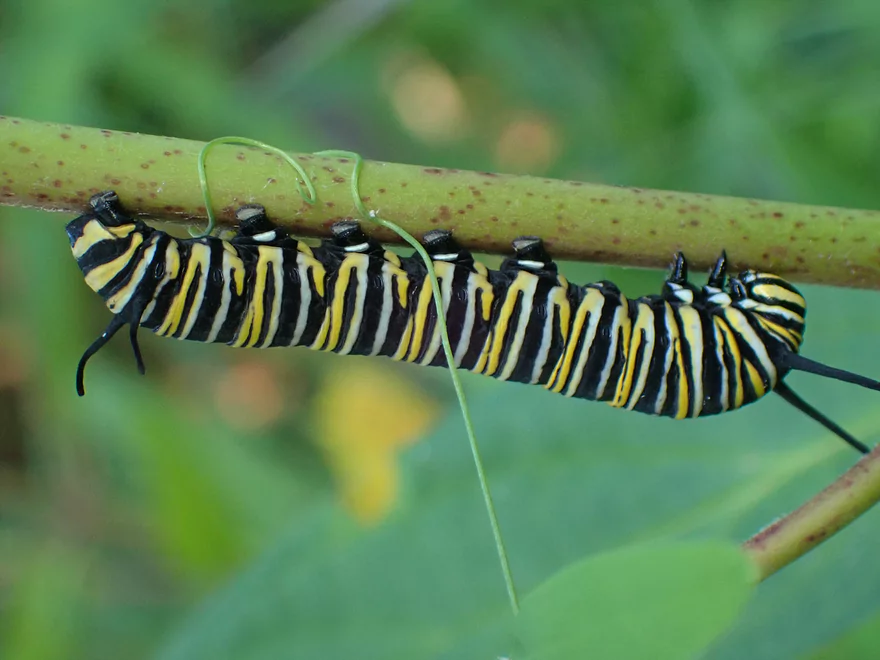
Colorful caterpillar
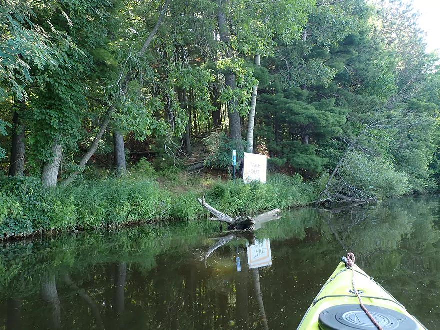
Official portage take-out
In hindsight I could have taken out closer to the dam, but this worked
Portaging up a short, steep hill
Then a long but easy half mile hike along a trail
Portage re-entry by flooded banks
View below the dam–most of the spillway gates are quiet
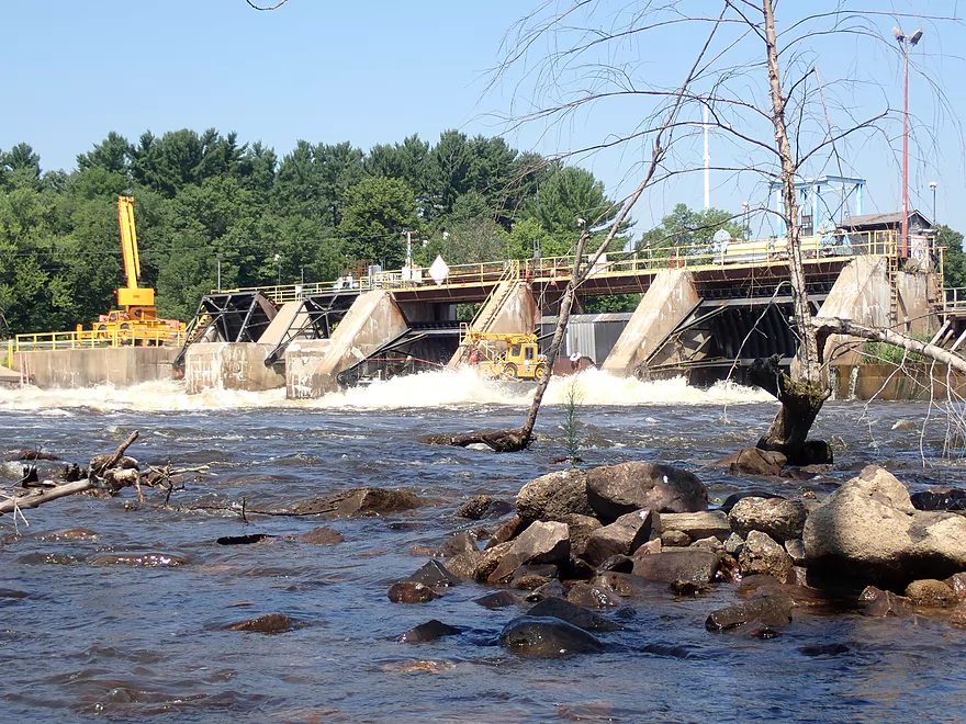
But the main gates are wide open
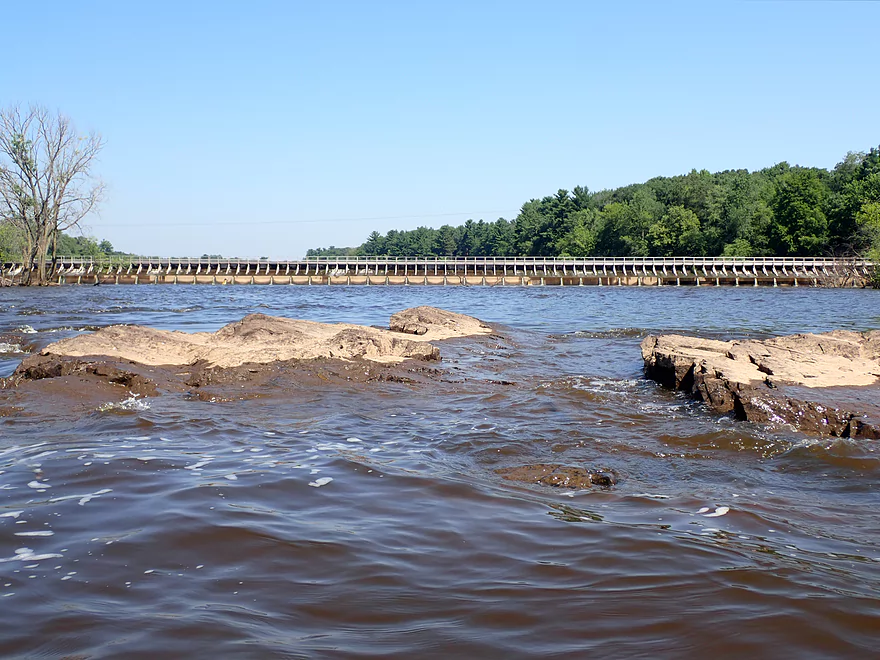
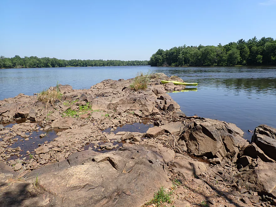
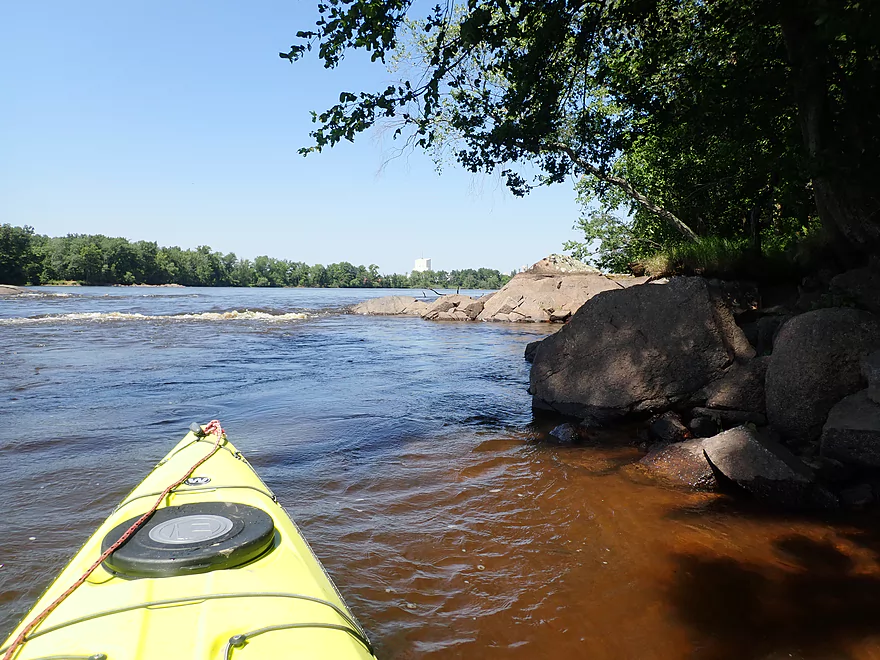
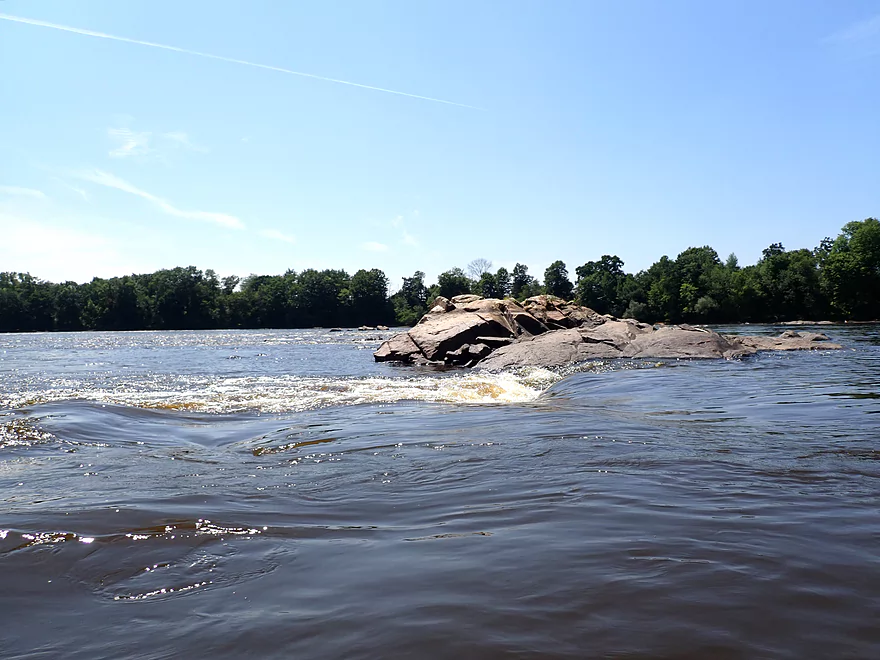
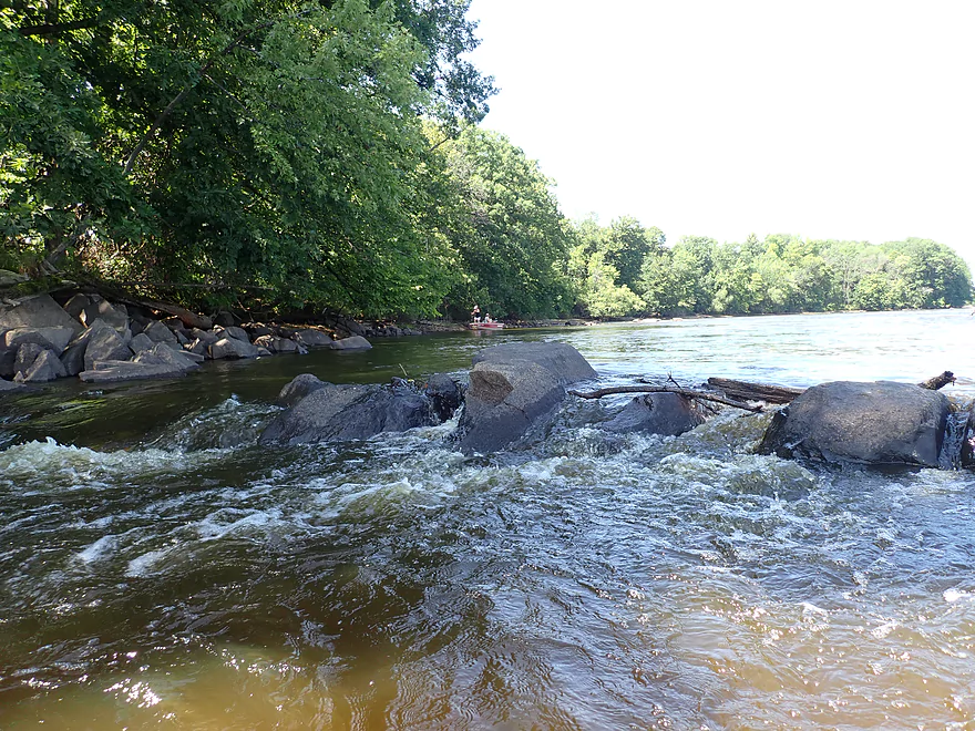
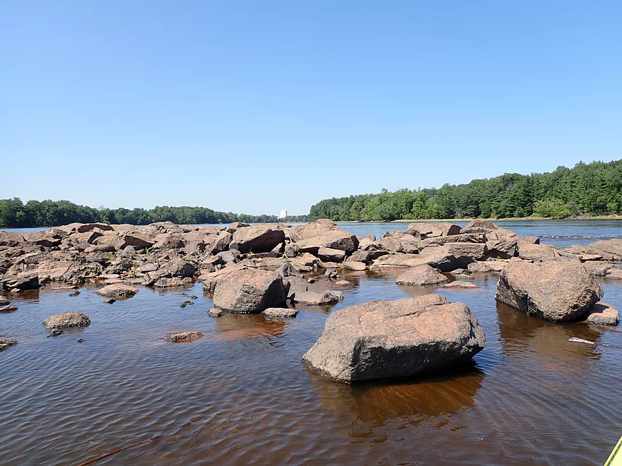
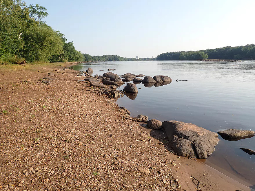
There is a neat rocky area below the Port Edwards dam
Because of the release, most of it was hidden by the water
A serious ledge
Getting out to scout
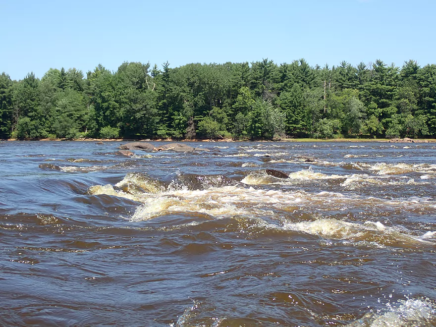
Class 2-3 rapids with a tricky hole
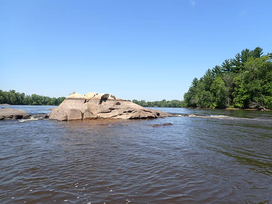
The rapids on the other side of the island looked safer
Reverse view
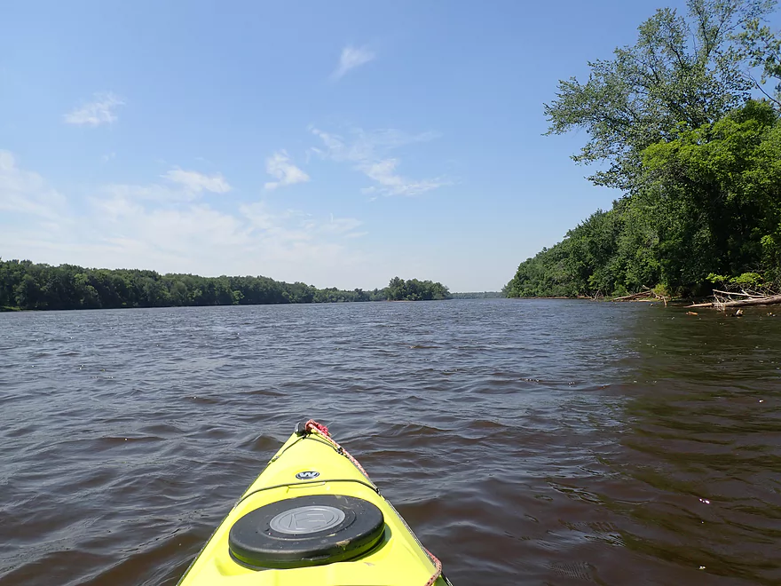
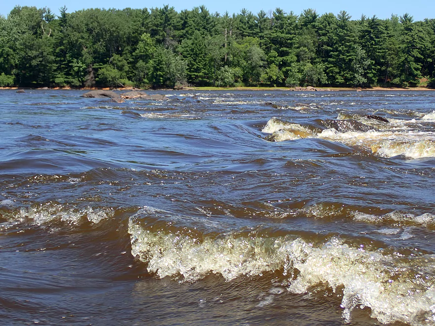
The river was wide enough you could simply go around many of the rapids
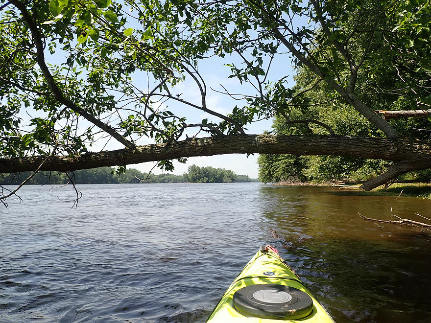
Be careful not to get too close to the tree strainers in high water
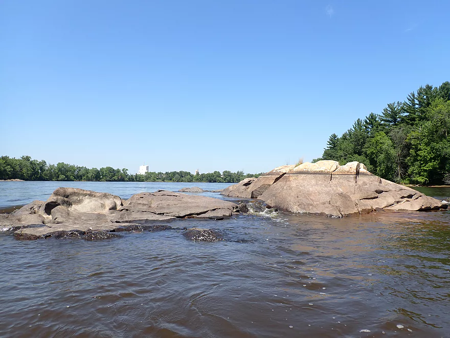
Reverse view
More boulder gardens
One last pitch
Reverse view
Really reminded me of the Upper Black River
River slows after this
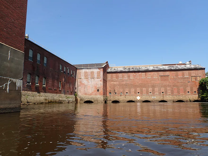
The Port Edwards powerhouse, which is on a side channel routed off from the Port Edwards dam.
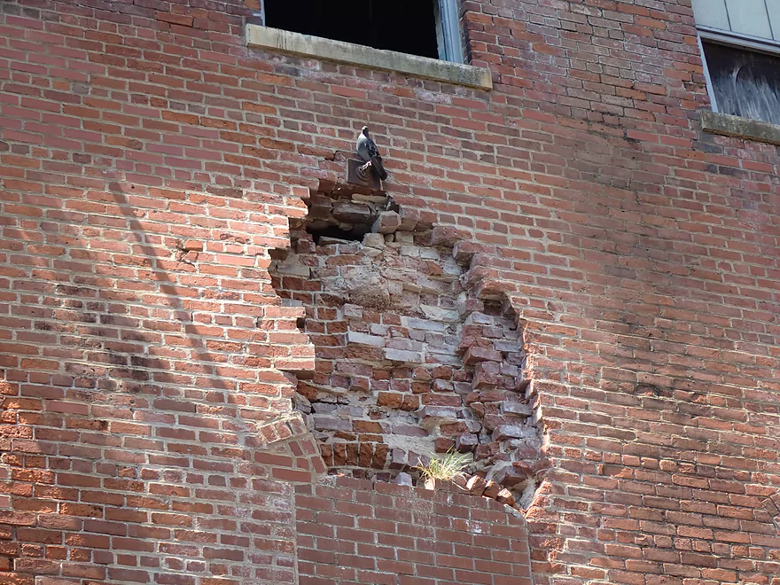
Guilty-looking pigeon
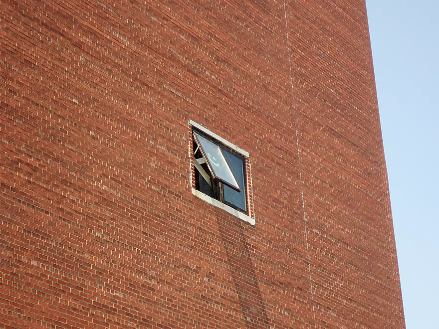
Someone actually drew that from the outside
Part of the Port Edwards paper mill…now shut down
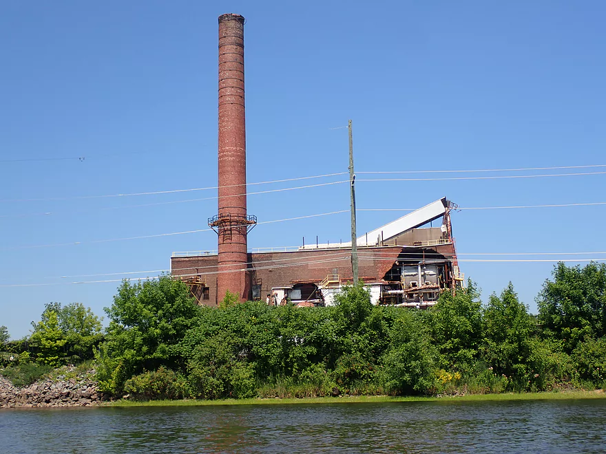
There is a long crack in the chimney and a gaping hole in the outside wall
A less interesting part of the river
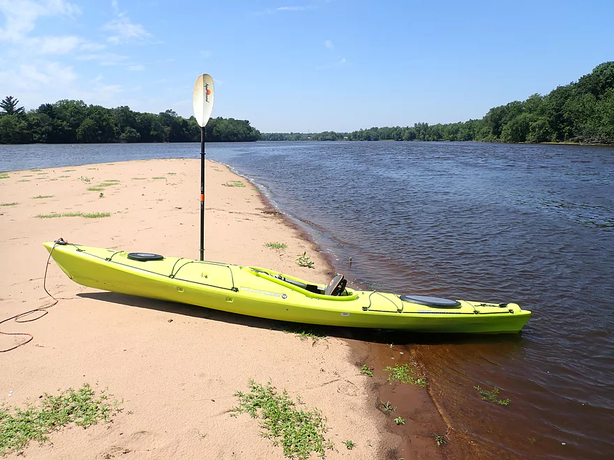
Nice sandbar
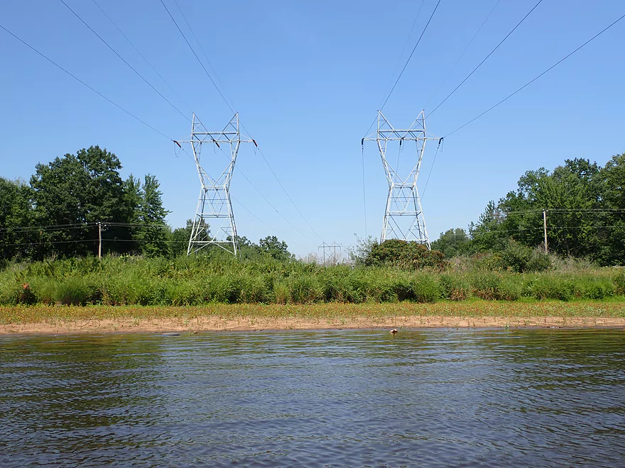
A number of large powerlines cross the river
Ripple Creek is a bit small to kayak
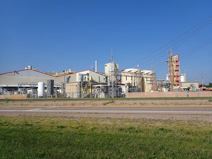
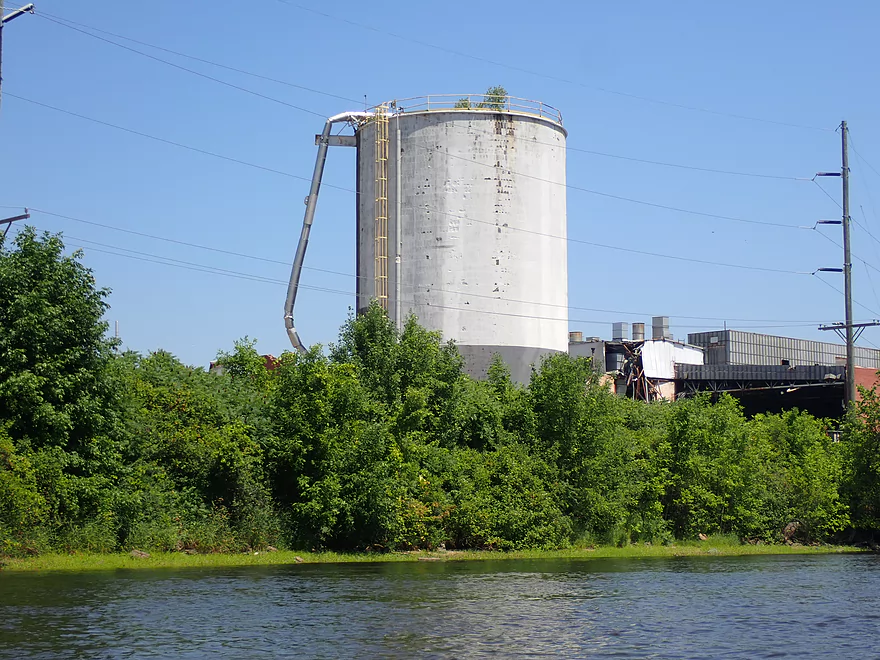
Just above it is ERCO (a large chemical factory)
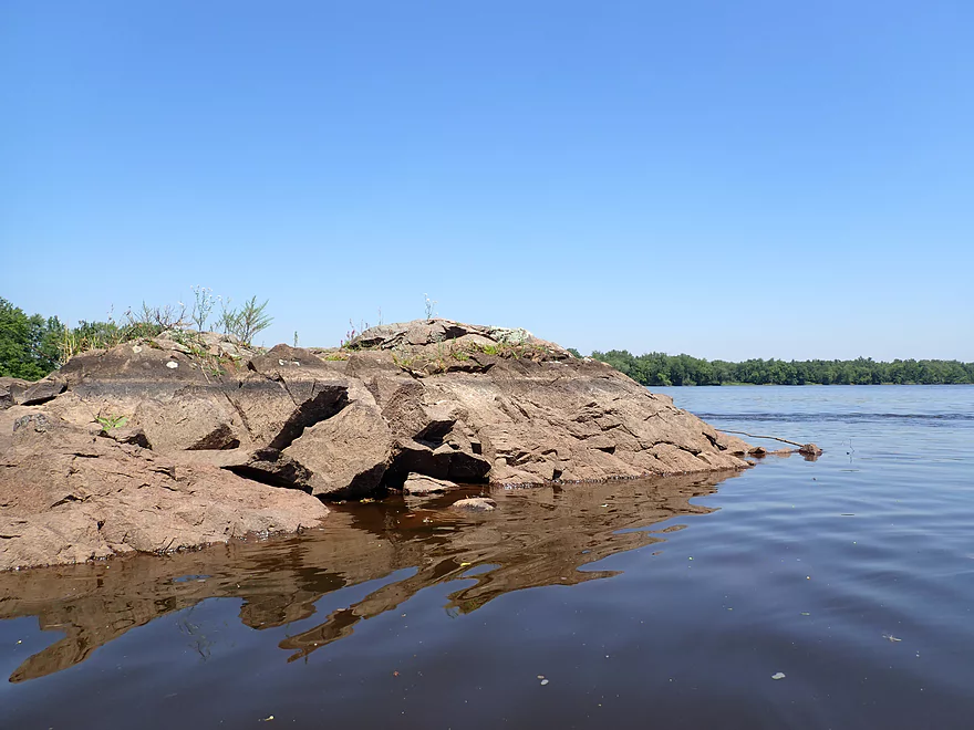
A scenic granite peninsula (now seeing the effects of the downstream dam drawdown)
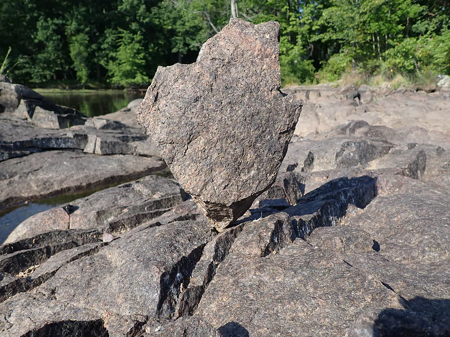
Cool balance job
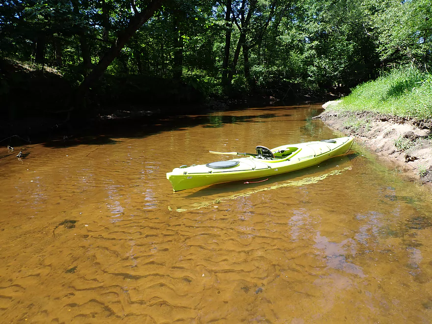
Exploring Moccasin Creek…super clear
Back on the Wisconsin River, with river levels up to 5′ lower than normal
Start of more rapids
These used to be called Whitney’s Rapids
The white top, I think, represents the normal flowage water level
A rare chance to see some original Wisconsin River rapids
Scenic area
Huge boulders and a large gravel bar (in the back) are normally submerged
Very wide line of rapids
This fisherman braved them to get to his spot
Some of the stronger rapids of the trip
Close view
One of several granite islands
The boat landing is partly above water
Paddling by Riverside Park
Taking out at the south end of the park
This entire shoreline was exposed by the drawdown
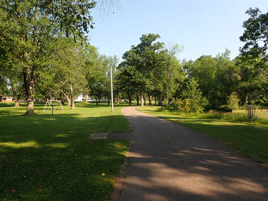
Great bike trail made for an enjoyable shuttle
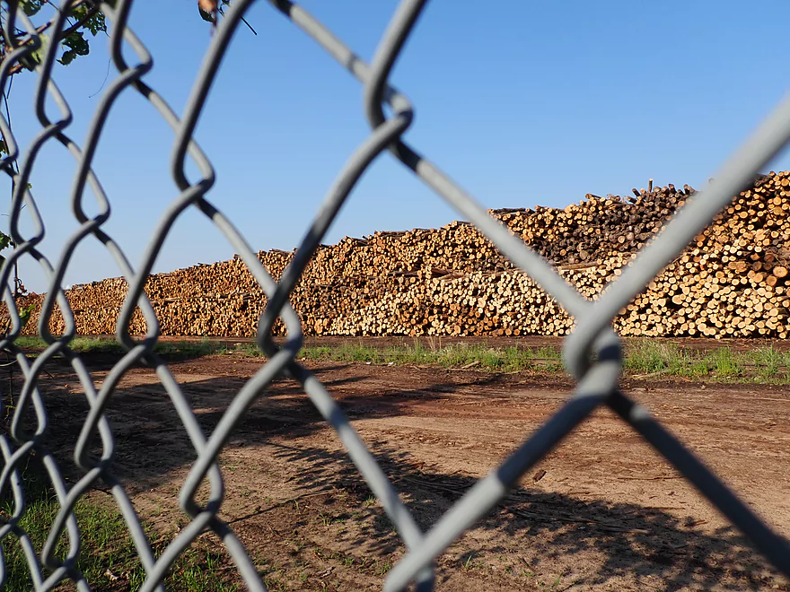
So many logs prepped to be turned into fast food wrappers, receipts, sugar pouches and more…
Wisconsin River – Port Edwards

This trip was part of a larger plan to paddle and document the central Wisconsin River for kayaking (from Wausau to Lake Petenwell). Despite its many dams (some of which have difficult portages) it’s still a unique and rewarding stretch to explore.
My trip started on an interesting note. As I was biking back to the put-in, I discovered an obscure landing at the mouth of Moccasin Creek which I explored. Here a 100′ rocky peninsula of exposed granite bedrock jutted out onto the Wisconsin River. Below this, I was surprised to see and hear rapids on the river. A nearby fisherman remarked that while it was scenic, it was significantly more so a few days back. Then a huge boulder field had been revealed and he was actually able to walk out onto the middle of the river.
It turns out the Nekoosa flowage is being partially drawn down (June 2021 to roughly September 1, 2021) to repair the Nekoosa dam. The head level by the dam dropped from roughly 15-17′ to 10-12′ (they didn’t drop it further out of concern the polluted water would become too smelly). This has significantly shortened the Nekoosa Pool and exposed some (but not all) of Whitney’s Rapids (the original boulder fields and rapids by Nekoosa).
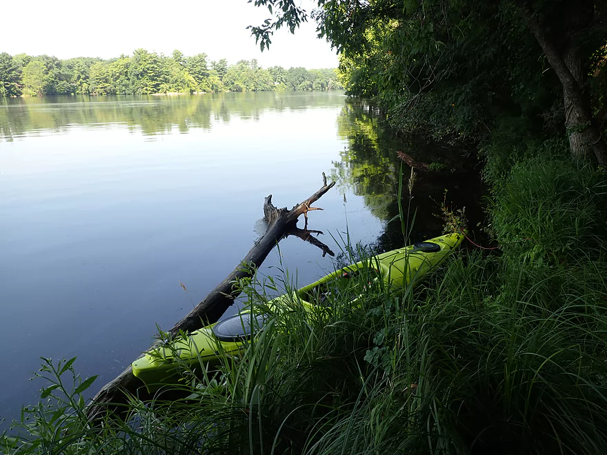
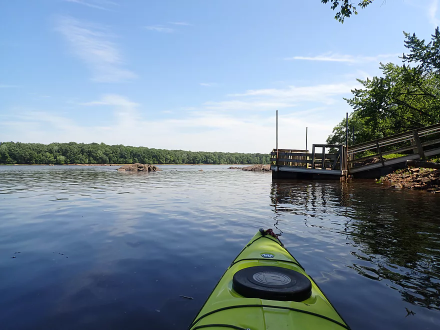
Looking forward to a trip of epic boulder gardens because of the low water, I hurried back to the put-in just above the Port Edwards dam. Yes, this trip started ABOVE a dam, which I normally don’t like to do as it means a portage, but in this case it didn’t seem avoidable. After launching, I explored the Port Edwards flowage a bit. There were several small but scenic rock islands…but these were just the “mountain tops” of much larger boulders, rock formations, and perhaps even waterfalls that had long ago been buried by the Port Edwards dam.
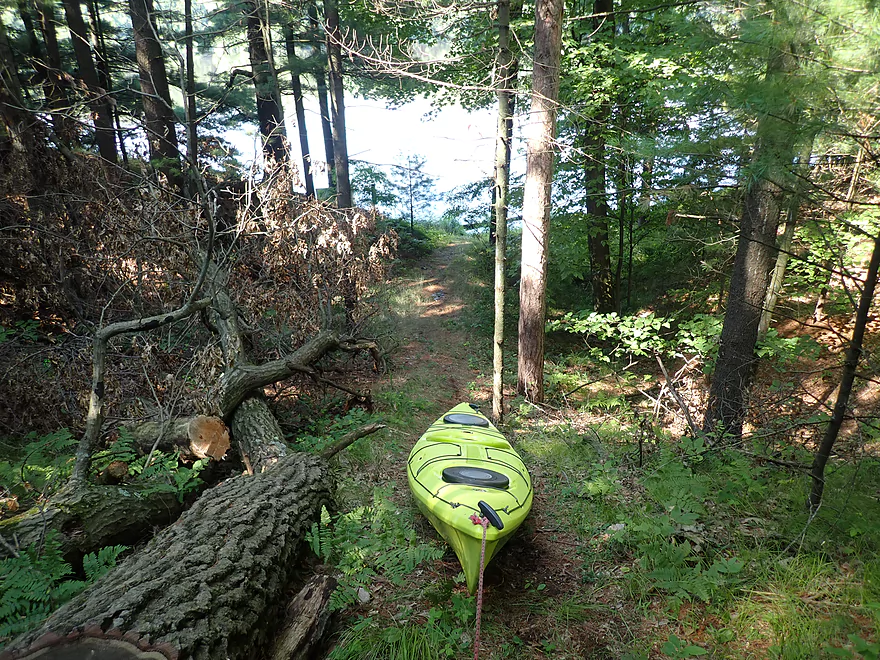
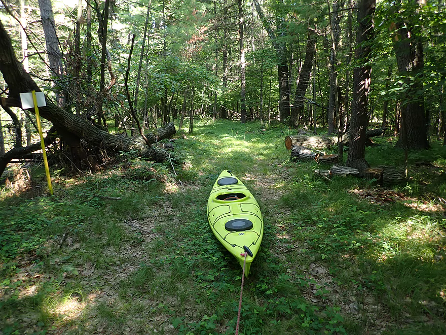
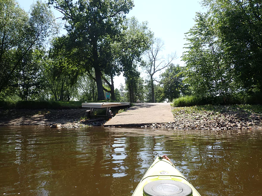
The portage for the Port Edwards dam was well marked by multiple signs along the east bank. Unfortunately the portage take-out is located far upstream (unnecessarily so) of the actual dam which means a long portage (figure a half mile). The well marked trail first climbed up a steep 30′ high hill, but then ran flat over a simple trail. The portage route wasn’t as bad as I feared and I actually kind of enjoyed it as it was scenic and ran through thick woods. The bottom of the path mostly had soft leaves and needles which made it easy to drag my boat behind me. Close to the dam I checked and sure enough, I could have gotten out much later and significantly reduced my portage route. Oh well. Perhaps the dam owner thought it would be a safety thing to have paddlers take out so early…but if the eastern spillway gates aren’t open, then that isn’t an issue. Re-entry was down a steep wooded hill and pretty easy.
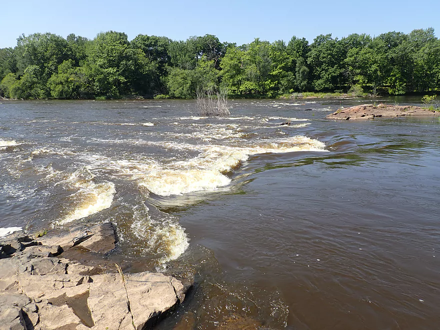
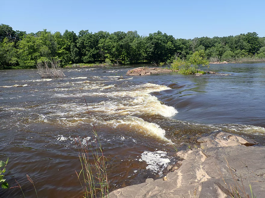
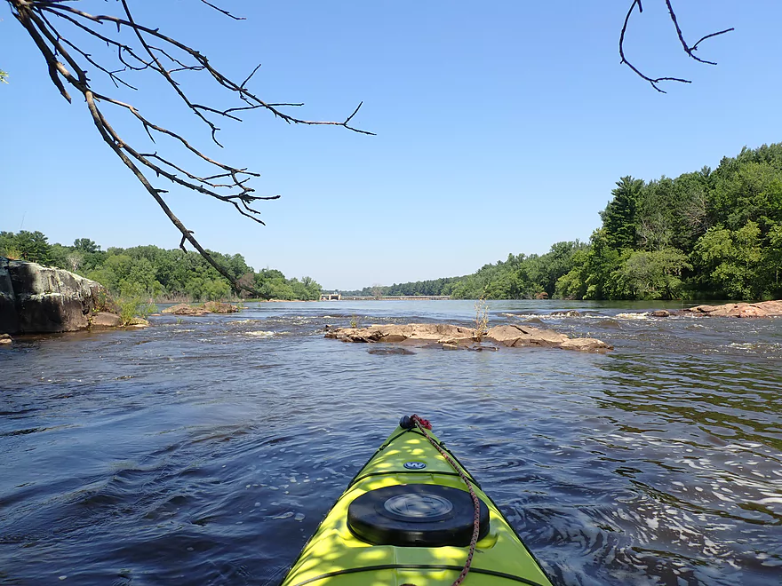
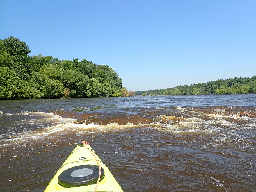
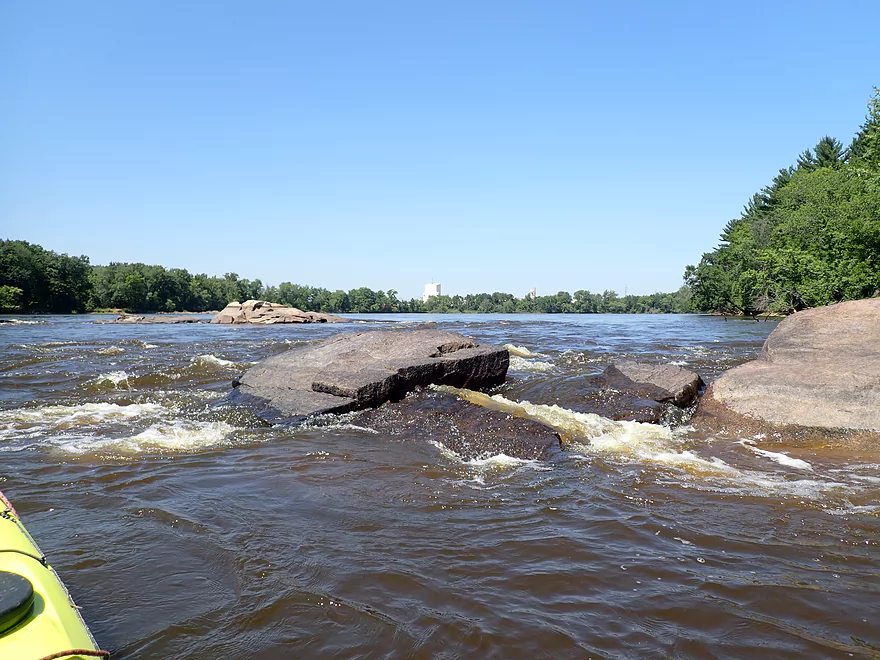
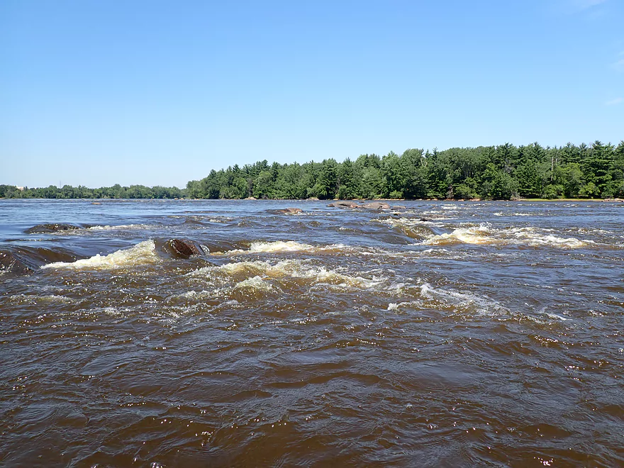
My heart sank though when I got below the Port Edwards dam and finally had a clear view of the river. The main boulder field below the dam (the main reason I did this trip) was NOT exposed by the Nekoosa dam drawdown but instead was quite submerged. Not only that, but both of the main gates were wide open creating a huge outflow and causing minor flooding along the shoreline. I cursed my timing, but decided to make the best of a bad situation by photographing what I could of the few boulder gardens that remained (99% of the boulder field was likely under water).
The other surprise was the number and strength of rapids below the dam which I didn’t expect (I wasn’t using my whitewater boat nor did I have my tripod used for whitewater video). When I had scouted the Google satellite images none of this was evident and when I had checked the Wisconsin Rapids gauge the day before it was quite low. What I overlooked was that northern Wisconsin experienced a sudden and intense downpour of rain that I didn’t know about. This caused the dam operator to do a surprise release which suddenly switched the river from almost drought-like conditions to near flood conditions in just 24 hours.
I paddled as close to the dam as I dared, which wasn’t very because of the strong rapids, standing waves, and brutal current coming out from under the gates. On the concrete platforms, I could see two heavy machines used to work on dam repair. Yes while the Nekoosa dam was undergoing the major repair work, the Port Edwards dam also appeared to be undergoing some minor work of its own. One of the large trucks was secured by four massive chains, and while it was in no danger of being washed downstream, it was occasionally getting splashed by the strong outflows.
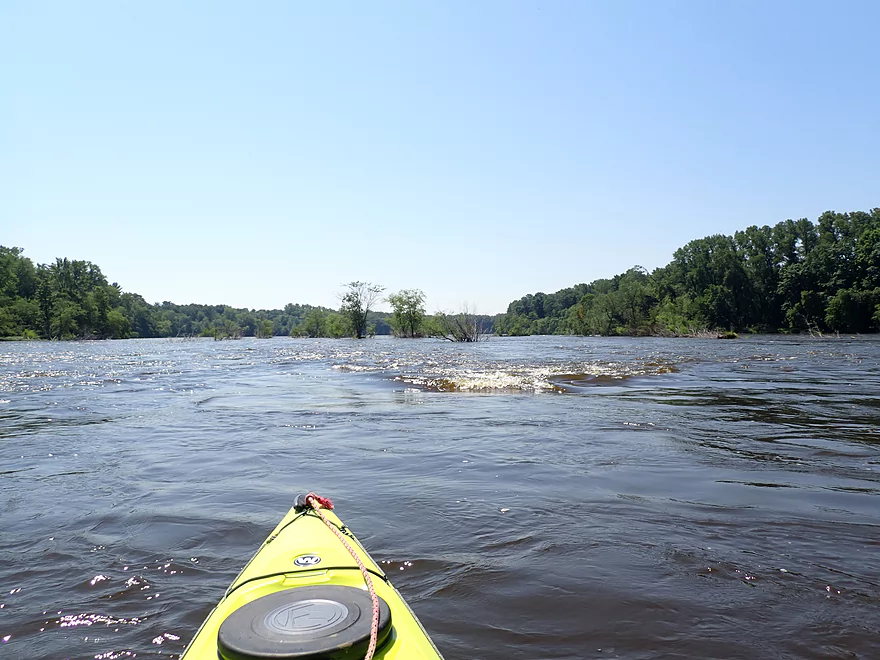
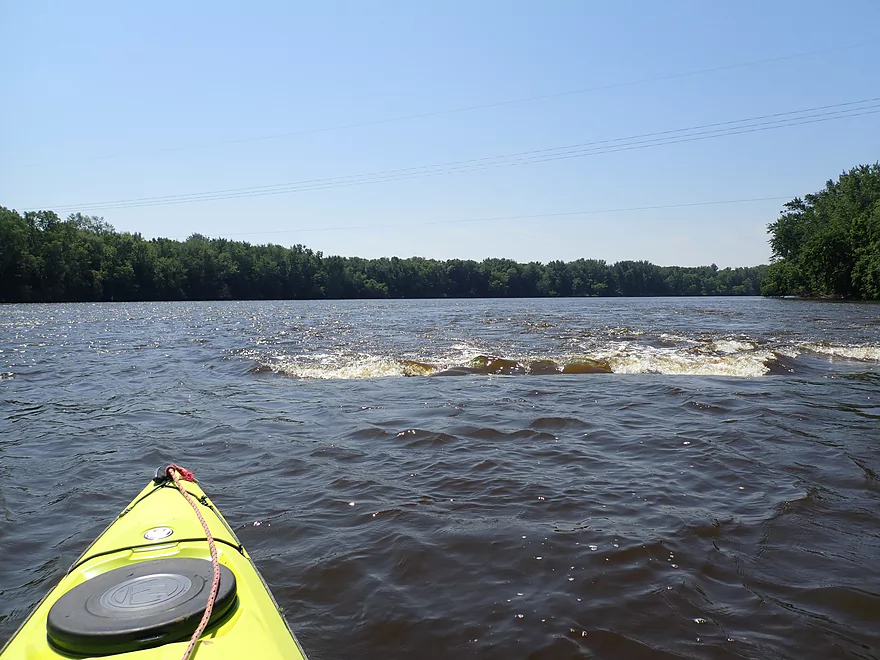
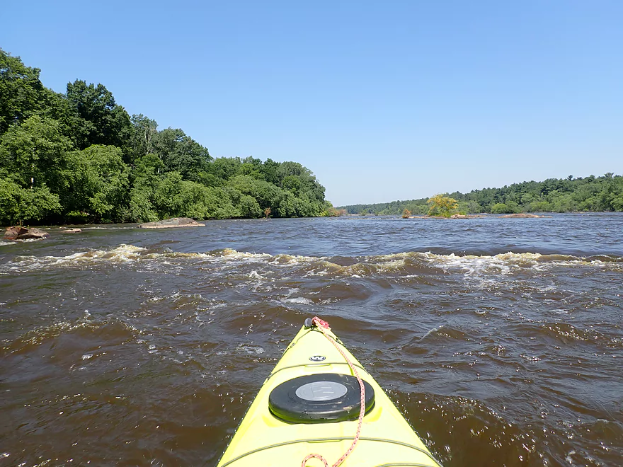
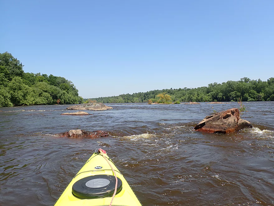
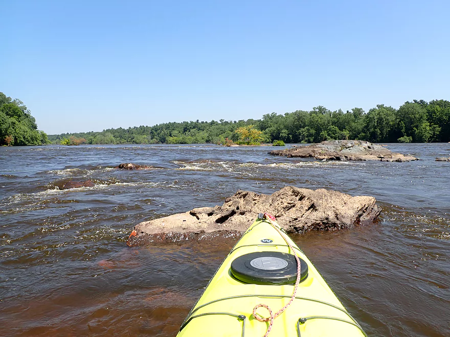
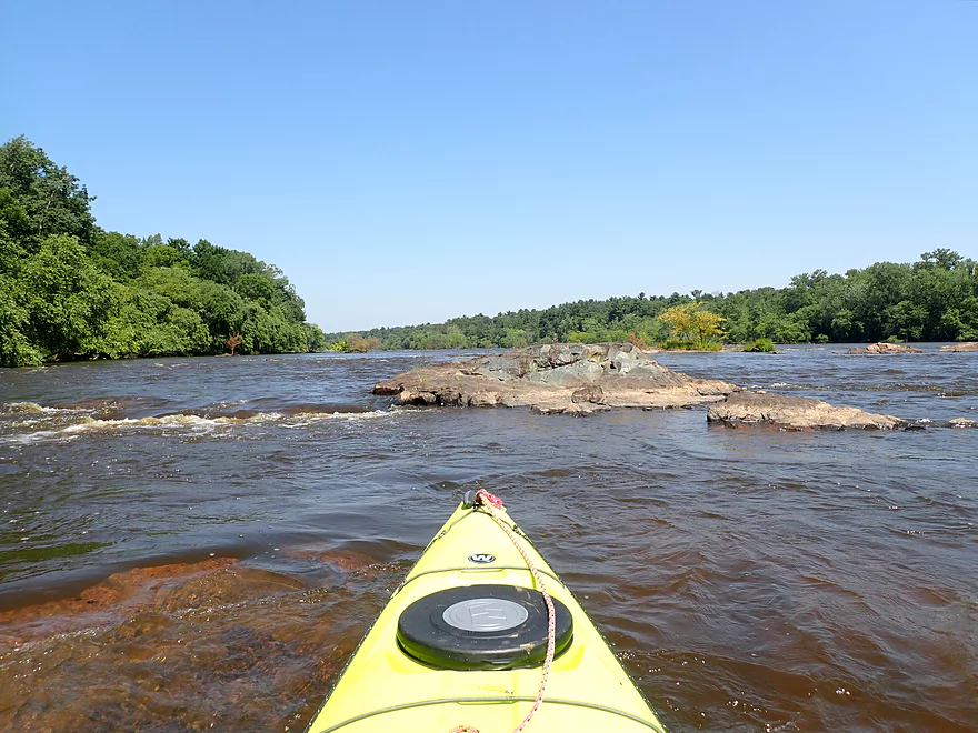
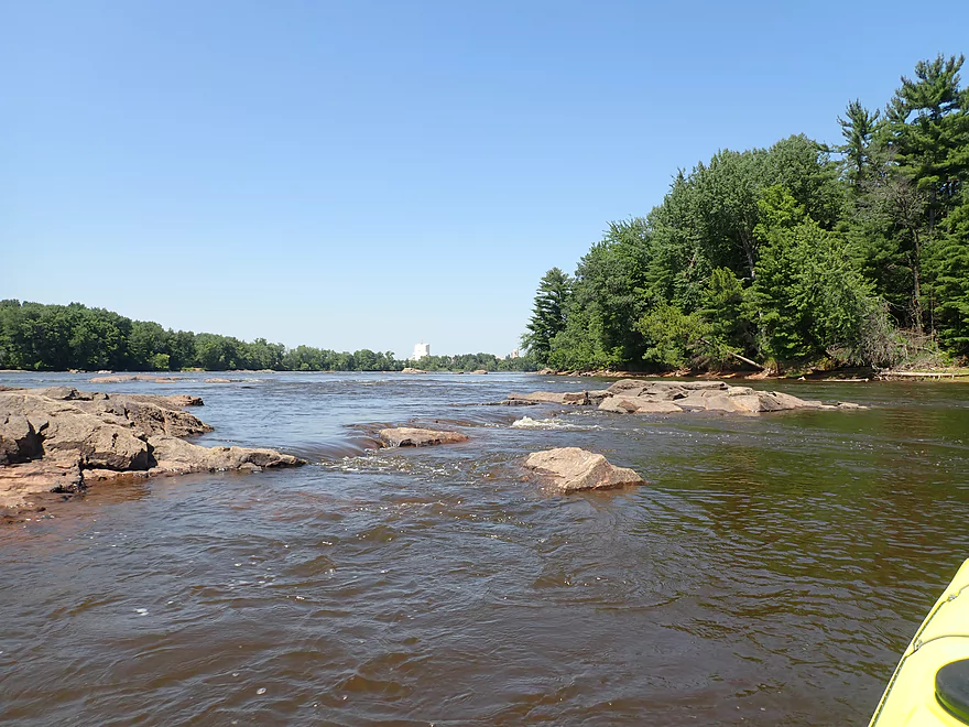
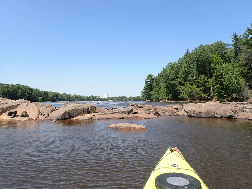
These rapids below the Port Edwards dam (called Grignon’s Rapids) and the sporadic boulders lasted for over a half mile and were a unique experience. There were many Class 2’s and a few Class 3’s…some rough and unforgiving. Had I known the river was going to be this high, I wouldn’t have done the trip. There were even occasional standing waves that whitewater kayakers would have loved to surf. In most cases the rapids weren’t a big problem because the river was so wide. You could (usually) just avoid the worst ones by going around them. All in all, it was quite the experience to paddle so much Wisconsin River whitewater…which is typically an oxymoron.
At the base of a long island, the millrace joined the main channel and things would settle down for the next 1.5 miles. I did paddle a bit upstream on the millrace though to take pictures of the powerhouse. It had a beat-up and neglected feel to it with large chunks of bricks missing from the building. Adjacent to the powerhouse was a large paper mill that was shut down in 2007 due to high costs. Much of the paper mill (like the powerhouse) looked derelict and in poor condition. A long crack ran up one of the main chimneys and the building below it had a huge gaping hole in the wall.
After the powerhouse, the river became more simplistic and uninteresting with mostly generic wooded banks and slow current. There was though a surprisingly nice sandbar which provided a nice break area.
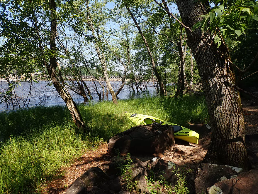
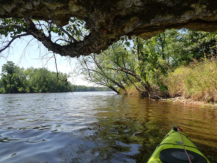
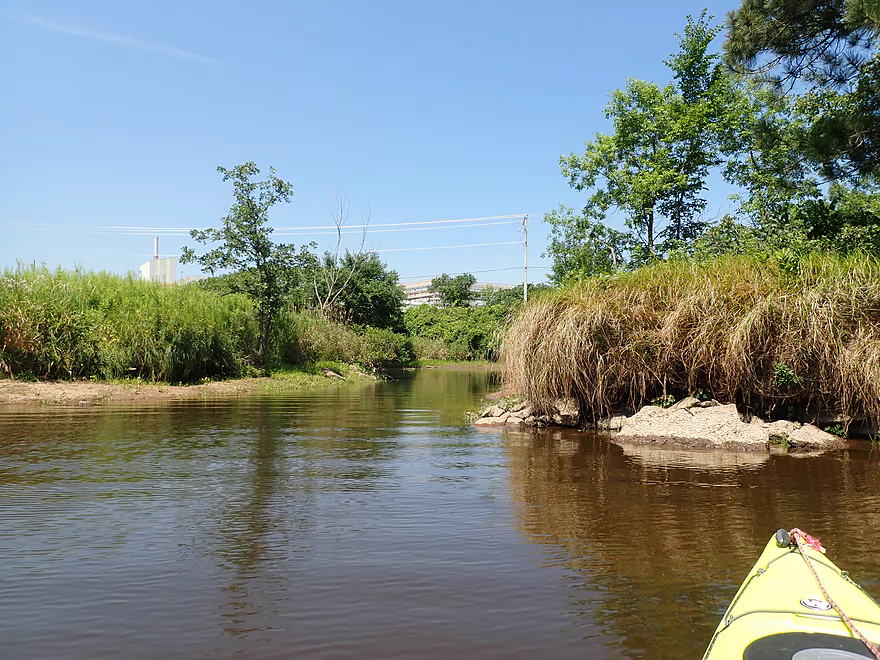
The river soon took a sharp turn left by the large ERCO Chemical Plant (they produce caustic soda used by the paper mills). It was roughly in this area that I started to smell a burnt garbage/sulfur smell, that I don’t understand how the locals tolerate. On the right was the mouth of Moccasin Creek (which I had scouted earlier). I paddled as far upstream as I could. It’s actually a super cool creek….ferns grow on the banks and it flows through dense woods. The bottom is sandy and the water incredibly clear.
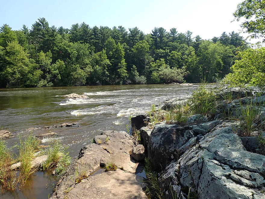
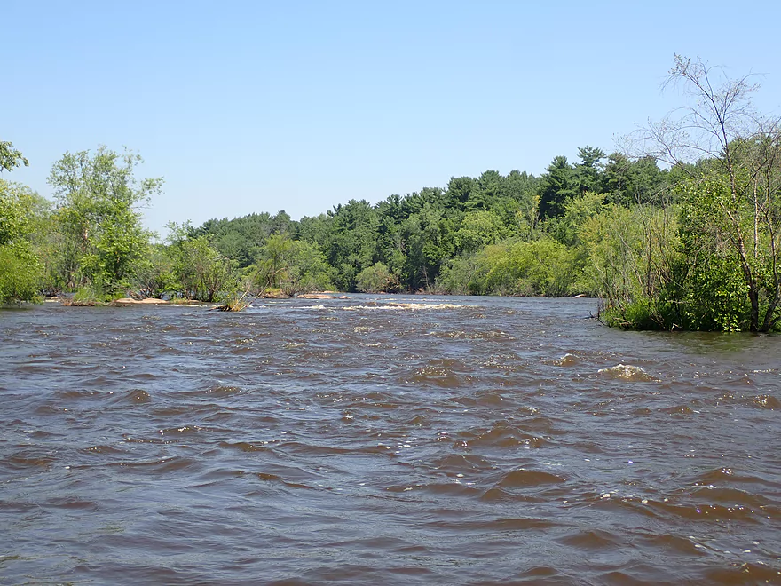
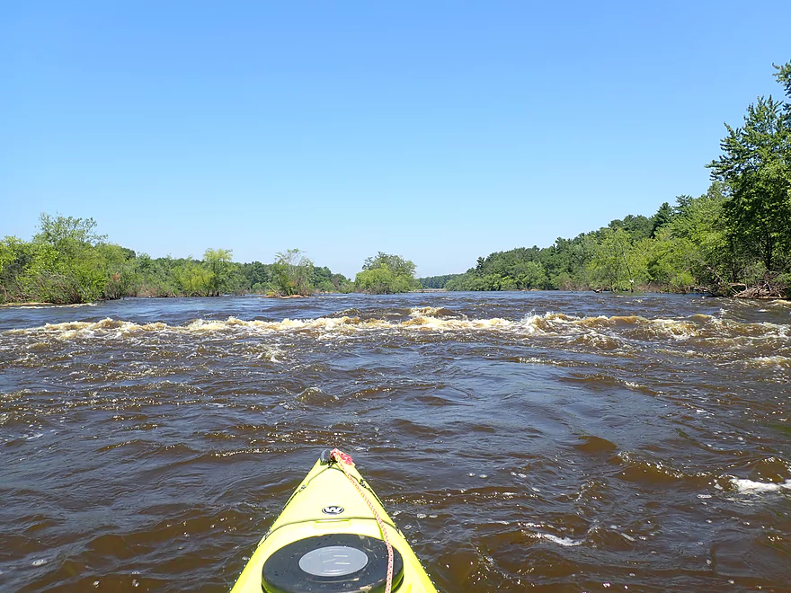
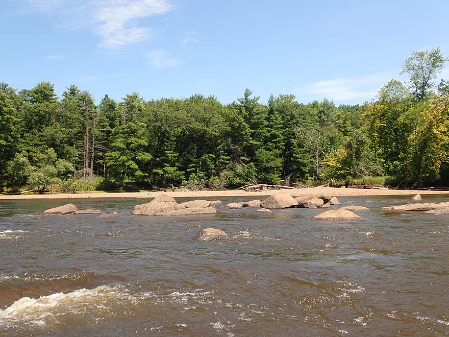
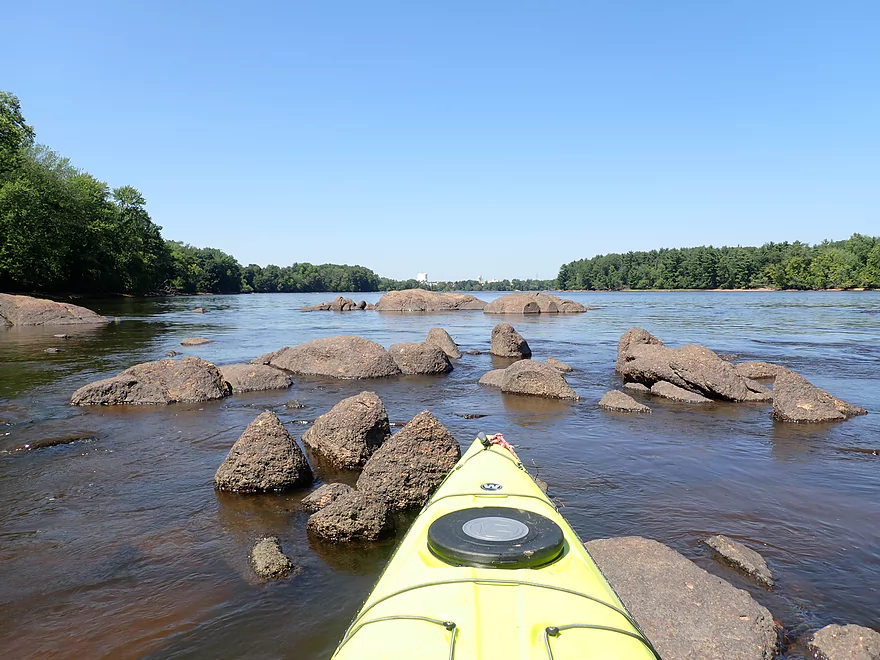
Back on the Wisconsin River things got interesting for the next mile until the take-out. Thanks to the partial drawdown by the Nekoosa dam combined with a full release upstream from the Port Edwards dam, I was able to do what kayakers rarely are able to do…and that is to paddle historic Whitney’s Rapids (at least part of it). This was a mile-long stretch of rapids that drops 23′ in a mile (from Moccasin Creek to Hwy 73). Typically these are submerged beneath the Nekoosa Pool and many locals likely don’t even know they exist. But because levels were down ~5′, the first portion of these rapids were exposed and runnable (80% of the rapids were likely still underwater though). In a sense I was traveling back in time to see what the river used to look like before the dams. It was really cool and reminded me of the Upper Black River. Had the dams never been built on this stretch of the river, it would IMO have become a major tourist attraction with fantastic gravel bars, boulder fields, rapids, sandbars, maybe waterfalls, and even large cliffs (which are partially visible at the Nekoosa dam today).
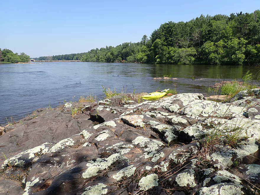
While I could have ended the trip at the Riverside Park boat ramp, I decided to continue downstream to the main picnic area and take out there instead. Here there was a rocky shoreline that was exposed by the drawdown and made for a good take-out area.
In summary this was a trip full of surprises. While I wish levels had been lower for taking pictures, things turned out alright in the end and I was able to do what few have or will ever do, and that is to paddle Whitney’s Rapids. I will likely return when water levels are low to take pictures of the boulder field below the Port Edwards dam. At the time this review will be published, the Nekoosa drawdown will still likely be in effect. Paddlers will still have a few more weeks to see parts of historic Whitney’s Rapids before the Nekoosa pool is completely refilled in September. Grignon’s Rapids (below Port Edwards) are not dependent on Nekoosa levels and can be experienced any time the river is high…although low levels IMO are best so you can see the huge chunks of exposed granite bedrock.
Sights included a few clams, eagles, and quite a few flopping fish. I suspect the fish were stressed by the radical changes in water depth. A fisherman told me there are large muskies in the Nekoosa pool.
Before the dams were constructed, the Wisconsin River used to descend quite steeply through the Wisconsin Rapids area. For a 10-mile stretch (Wisconsin Rapids to Nekoosa) the river dropped an impressive 60 feet. Here there were strong rapids, huge boulder gardens, and perhaps even small waterfalls. Sadly four dams were built that submerged almost all of this.
- Wisconsin Rapids Dam: This submerged “Grand Rapids” which were over a mile long and had a 27 foot drop.
- Centralia Dam: This dam submerged rapids whose name is lost to history. There is speculation they were called White Bull Falls or Barker Rapids.
- Port Edwards Dam: Upstream from the dam was either White Bull Falls or Barker Rapids. Downstream from the dam is Grignon’s Rapids which you can still experience today during releases.
- Nekoosa Dam: Starting from Moccasin Creek (Nekoosa Junction) and extending to Hwy 73 used to be Whitney’s Rapids. These extended a mile and consisted of five pitches dropping over 23′. During the partial drawdown of 2021, a small portion (maybe 20%) of Whitney’s Rapids were exposed.
The name “Nekoosa” means “Swift Water” and comes from the Chippewa who made their campground on high Swallow Rock overlooking the rapids. To learn more fascinating history about the Wisconsin River’s lost rapids, I highly recommend this free ebook.
In the summer of 2021, the Nekoosa flowage was partly drawn down from ~15-17′ to ~10-12′ to aid in repair of the Port Edwards dam (I think the middle gate was previously damaged). This partly exposed the upper end of Whitney Rapids. This is a special occasion and for a brief period of time, paddlers can see some of the original boulder fields and rapids that haven’t been witnessed since the days of the Chippewa.
Perhaps in the future some of these dams will be removed, but it is doubtful. There is little interest in dam removal from the DNR or sadly even environmental groups. What’s interesting though is many of these dams and paper mills are aging, and their parent corporations may not want to foot the bill to keep them running. Already two local paper mills have been closed because of high costs (Port Edwards and Wisconsin Rapids). The current Nekoosa mill produces many items (receipts, bacon board, fast food wrap, sugar pouches, etc), but I suspect these could be produced elsewhere. I would love to see a “Restore the Wisconsin River” movement to advocate for dam removal (especially in the Wisconsin Rapids to Nekoosa area). IMO a permanently drawn-down river would become a major tourist attraction resembling the Upper Black River.
Port Edwards Landing: Just upstream (northwest) of the Port Edwards dam is a small obscure boat landing that is a good access. The parking lot is free to use, but there is no outhouse.
Alternate Put-ins:
- Ben Hansen Park: (1.8 miles upstream of Port Edwards) This is a nice add-on leg, but does require portaging the Centralia Dam (not too difficult through the golf course).
- Demitz Park: (3.0 miles upstream from Port Edwards) Above plus a stretch with some large islands.
- Veteran’s Memorial Park: (3.8 miles upstream from Port Edwards) The above plus a good leg through the outskirts of Wisconsin Rapids.
Riverside Park: This was a nice public park located at the north end of Nekoosa. I took out by the picnic area, but one could also take out at the boat ramp instead. There are outhouses in the park and I don’t believe any parking restrictions/fees. Note when the Nekoosa flowage is refilled, the current will slow and you could do small round trips based from this park.
Alternate Take-outs:
- Moccasin Creek Landing: (0.5 miles upstream from Riverside Park) If you wanted to, I suppose you could end a trip here. But there is limited parking, no outhouses, and the drive into the landing is in bad shape. Also the half mile stretch between Moccasin Creek and Riverside Landing features nice rapids/boulder fields (at least during the drawdown).
- Hwy 73: (0.8 miles downstream from Riverside Park) This is not a good access, but would be doable for the determined. The east side has a large bank and it would require some dragging to get past the guardrail to suitable shoulder parking on Church Ave. The west side is likely mostly private. Although if you can get permission from the Nekoosa United Church of Christ, that might be a decent option.
- Downstream from Hwy 73: Sadly, this would require portaging the Nekoosa dam. This is one of the most difficult portages in the entire state with an official portage route 1.5 miles long running through downtown Nekoosa.
To access the rapids/boulder fields below the Port Edwards dam, you must portage that dam.
- Western Shore Portage: (236′) This is not an official portage route, but I think it would be doable and easier than the eastern shore. If the main gates are open stay well clear of them and hug the shore by the millrace. Then at the last second turn east before you go under the millrace bridge. You can likely get out just east of the bridge or a bit north on the concrete platform where there are rocks you can stand on. You can put in on the rocky area just below the dam…you may need to walk a bit downstream when the gates are open to escape the strong outflows.
- Eastern Shore Portage: (0.5 miles) This is the official portage route and is well marked by signs. The take-out is at the base of a 30′ hill which you need to climb up (rope helps). After that a well marked path parallels the river and leads to the portage re-entry point. The ground has good leaf/needle cover which makes dragging a boat with rope pretty easy. If the eastern spillway gates aren’t open, you can actually get much closer to the dam before taking out (see map). But this does require paddling past the warning buoys.
Bike Shuttle – Riverside Park to Port Edwards: 3.4 miles with 23′ of ascent. This is a fantastic urban bike shuttle that is mostly along dedicated bike paths. It’s scenic, mostly set aside from traffic, and has good cover from the wind. Note, Google may suggest shuttling on “Old Wisconsin 73” close to the river, but I believe this road has since been privatized and isn’t available to the public.
Port Edwards Dam:
- Upstream Side: The dam is split with the main gates being on the west and the smaller overflow gates on the east. If the east gates are open, you don’t want to be close to them (the main portage route is WELL upstream of the gates). For the main gates, they usually release the water so it goes under the gates, but I have to wonder if that would create minor whirlpools during high water events. Stay well clear of the big gates when they’re open.
- Downstream Side: The eastern overflow gates aren’t so bad, but the main gates will produce strong chutes of water and rapids that you don’t want to be close to when open.
Rapids:
- Grignon’s Rapids: Below the Port Edwards dam there is a terrific boulder field over a half mile long. This is quite tame at low levels with almost no rapids. But during big releases, strong rapids occur. During my trip there were multiple Class 2’s and a few Class 3’s. What makes these tricky is how deep, powerful, and fast the current is even if the ledges aren’t super steep. This makes them very unforgiving. In a couple of areas there were holes, which whitewater surfers would love to surf, but these should be avoided by rec paddlers. The river is so wide you usually can simply paddle around the worst chutes no problem, but stay vigilant. When the river is high several of the wooded islands will be partly submerged which will create tricky strainers by the trees. Stay well clear of those.
- Whitney’s Rapids: Located by Riverside Park, these rapids typically aren’t visible but were during my trip because of the partial drawdown from the Nekoosa dam. This exposed maybe 20% of the original mile-long stretch of rapids. These were pretty fun and mostly tamer than Grignon’s Rapids. They had a very similar vibe to the Upper Black River rapids with mostly Class 1’s and some Class 2’s. You can paddle around most of the worst rapids because the river is so wide. A few weeks ago when water levels were lower, this was just a huge (and scenic) boulder field. Sadly the scenic boulders and rapids will likely vanish by September 2021, when DOMTAR is scheduled to refill the Nekoosa Pool. August 2021 will be a rare window to see and experience some of the original rapids harkening back to the days of the Chippewa.
Wisconsin River @ Wisconsin Rapids: 9100 CFS or 4.05′
- 0-3000 CFS: A rare low depth. The river should mostly ok for paddling, but there could be shallow areas below Port Edwards. Huge boulder fields and exposed granite bedrock will be visible below the Port Edwards dam which will be scenic.
- 3001-5000 CFS: An average depth and a good target range. The boulder field below Port Edwards may be only 60% exposed.
- 5001-7000 CFS: Grignon’s Rapids will awaken below the Port Edwards dam (Class 1-2) and much of the boulder field will be under water.
- 7001-9000 CFS: A high depth with multiple Class 2’s below the dam.
- 9001+ CFS: Perhaps too high for most rec paddlers. Grignon’s Rapids will have multiple Class 2’s and some Class 3’s. The current will be strong and unforgiving. Whitewater paddlers may enjoy these depths though.
Note, the Wisconsin River can rise or fall sharply. It often isn’t enough to know what the current depth is, but you should know what it will be when you do your trip. NOAA provides fantastic forecast graphs for this here. Just open up the Wisconsin Rapids graph and find the purple line…that will give you a good idea of what the depth will be.
Quick Overview
- Upstream of Stevens Point: I don't have information yet on these stretches.
- Stevens Point to Lake Petenwell: ~42 miles. This stretch in Central Wisconsin used to have many natural rapids, but most have been buried under 8 dams, some of which are now difficult portages. Despite this there is still some good paddling to be had in this region.
- Lake Petenwell: 14.9 miles. This is a large flowage lake that is challenging for paddlers because of frequent strong winds and big waves.
- Castle Rock Lake: 14.5 miles. Another large flowage lake that is likely too big for enjoyable paddling.
- Castle Rock Lake Dam to Lemonweir River: 9.4 miles. This pre-Dells leg isn't elite, but is a pleasant stretch.
- Lemonweir River to Indian Trails Landing: 21.7 miles. This includes the famous Upper Dells and Lower Dells which feature many scenic sandstone outcrops.
- Indian Trails Landing to Portage: 16 miles. This is an overlooked section sandwiched between the Dells and Portage. While the scenery isn't top-notch, it does have many sandbars and few people, which is a nice combination.
- Portage to Lake Wisconsin: 14.3 miles. This is a neat stretch of the river with many sandbars and cliffs, but the shoreline is very developed and motorboat traffic can be heavy on weekends.
- Lake Wisconsin: 14.5 miles. This is a challenging lake for paddling because of the huge and frequent waves created by motorboats.
- Prairie du Sac Dam to Port Andrews: 57 miles. This is the first half of the famous Lower Wisconsin Riverway. This is a super popular stretch for paddlers with the highlights being large sandbars, big bluffs, occasional cliffs, and fun side sloughs to explore.
- Port Andrews to Wyalusing: 40 miles. This is the second half of the Lower Wisconsin Riverway which has far fewer paddlers and sandbars. But the bluffs and sloughs are larger and more interesting.
Detailed Overview
- Upstream of Merrill: I don't have enough information yet on these legs to comment.
- Merrill Dam to Riverside Park: 0.5 miles. Might include some light rapids below the dam.
- Riverside Park in Merrill to Wisconsin River Forest Landing: 8.6 miles. A good prospect.
- Wisconsin River Forest Landing to Brokaw Boat Landing: 5.7 miles.
- Wisconsin River Forest Landing to Jesse Park: 1.4 miles. A terrific stretch with small boulder gardens, one set of Class 1-2 rapids, gravel bars and a nice sand bank.
- Jesse Park to Brokaw Boat Landing: 4.3 miles. A good stretch with scenic wooded banks and occasional gravel bars.
- Brokaw Boat Landing to Gilbert Park: 5.1 miles. River slows down and becomes hillier. This stretch is an ok prospect and goes past the old Brokaw paper plant that has been shut down. Paddlers must navigate Class 1 rapids and a 2' drop where the old Brokaw dam used to be.
- Gilbert Park to Wausau Boat Dock: 1.5 miles. An impounded stretch through Wausau. There are numerous alternate access options to choose from.
- Wausau Boat Dock to Oak Island Boat Ramp: 1.2 miles. A nice stretch that includes Barkers Island and Isle of Ferns Park. But the Wausau dam does require a portage. This stretch parallels the famous Wausau Whitewater Park.
- Oak Island Boat Ramp to Rothschild Dam Access: 5.8 miles. Likely mostly uninteresting flowage paddling. There are many alternate access options to choose from.
- Rothschild Dam Access to Zimpro Park: 1.0 miles. This might be a nice stretch.
- Zimpro Park to River Road Boat Landing: 7.6 miles. The first half of this leg is likely nice river paddling, but the second leg is probably just an uninteresting flowage.
- Chucks Landing/Mosinee Dam to Bean's Eddy Boat Landing: 2.8 miles. Likely a nice leg. You might be able to launch by the dam where there should be some nice rapids and boulders.
- Bean's Eddy Boat Landing to Seagull Boat Landing: 5.1 miles. Mostly uninteresting flowage paddling. Although there might be some nice sand banks on the eastern shore.
- Seagull Boat Landing to Dubay Dam Access: 5.3 miles. Mostly uninteresting flowage paddling.
- Dubay Dam Access to River Road Landing: 5.5 miles. This could be a nice stretch of river.
- River Road Landing to Old US 10 Landing: 2.3 miles. Likely an ok leg.
- Old US 10 Landing to Stevens Point Dam: 5.6 miles. Probably uninteresting flowage paddling. Many alternate access options closer to Stevens Point.
- Stevens Point Dam to Blue Heron Boat Landing: 4.2 miles.
- Steven Point Dam to Whiting Dam: 2.6 miles. Starts slow and uninteresting, but the river becomes very scenic after the Hwy HH bridge. The rock formations below both dams are very striking. Many alt access points.
- Whiting Dam to Kimberly Clark Dam/Al Tech Park: 0.6 miles. Incredible scenery with exposed bedrock and boulder gardens below the Whiting Dam. Some rapids, but nothing major. The Kimberly Clark Dam is a dangerous low-head dam and should be treated carefully.
- Kimberly Clark Dam to Blue Heron Landing: 1.0 miles. Class 2 rapids below the dam, but after that the river slows dramatically and splits into many sub-channels and islands. Round trips on this leg are possible. I chose the far western channel where there were some nice rocky stretches.
- Blue Heron Landing to Mill Creek Landing: 4.1 miles. Likely a mediocre paddle with nothing special. Galecke Park is an alternate access.
- Mill Creek Landing to Biron Dam North Gate: 7.6 miles. Mostly uninteresting flowage paddling. Several alternate access options on route.
- Biron Dam North Gate to Veteran's Memorial Park: 4.5 miles.
- Biron Dam North Gate to Biron Landing: 1.0 miles. Super scenic stretch by two islands with many granite boulders.
- Biron Landing to Legion Park: 3.0 miles. A nice stretch by Big Island. The west channel is more undeveloped...but the east channel has several scenic granite islands.
- Portage through Legion Park: 680'. A steep wall separates the park from the river but in two locations the wall is short enough to get over (see map). Paddlers may want to consider a longer portage to bypass some of the shallow rocky stretches by Legion Park.
- Legion Park to Veteran's Memorial Park: 0.4 miles. A scenic stretch that features a large boulder field and the powerhouse for a large paper mill.
- Veteran's Memorial Park to Port Edwards Landing: 3.8 miles
- Veteran's Memorial Park to Demitz Park: 0.8 miles. A pleasant stretch that includes Belle Island.
- Demitz Park to Ben Hansen Park: 1.2 miles. This leg goes by Garrison Island and Edwards Island. Lyon Park is located across the river from Demitz Park and is another access option.
- Ben Hansen Park to Port Edwards Landing: 1.8 miles. Above the Centralia dam there are several small but nice islands. Portage the dam on the left bank (follow the 1000' trail through the golf course). Below the dam there are scenic rock formations. Close to the Port Edwards dam are a few more scenic islands you can explore.
- Port Edwards Landing to Nekoosa/Riverside Park: 3.6 miles.
- Port Edwards Landing to Port Edwards Powerhouse: 1.3 miles. A half-mile portage is required (east bank). A very scenic boulder field is located below the dam. At high levels, the rocks are submerged and produce a half-mile stretch of rapids (some strong).
- Powerhouse to Moccasin Creek Landing: 1.8 miles. A generic wooded stretch that isn't super interesting.
- Moccasin Creek Landing to Riverside Park: 0.5 miles. During the Nekoosa dam drawdown, this stretch had nice boulder fields and rapids.
- Riverside Park to Hwy 73: 0.8 miles. An ok stretch of the river. There are scenic cliffs south of Hwy 73, but these are past the dam warning line. Hwy 73 is not a good access option.
- Hwy 73 to Point Basse Ave (Portage of the Nekoosa Dam): 1.5 miles. A difficult 1.5 mile portage through downtown Nekoosa. Don't try to portage the south bank. There is a steep hill, cliffs, and large Domtar paper mill fences to deal with.
- Point Basse Ave to Jim Freeman Memorial Boat Landing: 0.8 miles. A generic stretch going by historic Point Basse. If you're willing to backtrack to the dam, you can see scenic boulder fields (during low flows) and a few cliffs. Point Basse Ave is a somewhat speculative access, but it seems public and doable for launching.
- Jim Freeman Memorial Boat Landing to Plank Hill Small Boat Access: 2.0 miles. A generic stretch.
- Plank Hill Small Boat Access to 19th Drive Landing: 5.3 miles. Features two epic sand banks. The main channel has some minor sandbars. Several of the side sloughs can provide fun side adventures.
- 19th Drive to the Petenwell Dam: 14.9 miles. This is Lake Petenwell which is a large and challenging lake for paddling. Waves and strong winds are frequently an issue. But when calm there are nice sandbanks on the northwest shore, hidden sloughs, and large islands to explore. See the overview map for more info.
- Petenwell Dam to Ganter Lane Landing: 3.8 miles. This stretch isn't too impacted by dams and may have nice sandbars at low levels.
- Ganter Lane Landing to Castle Rock Lake Dam: 10.7 miles. Castle Rock Lake is likely too big (wind/waves) for enjoyable paddling. There are many alternate launch options along the shore.
- Castle Rock Lake to the Lemonweir River: 10 miles. An ok section.
- Lemonweir River Mouth to River Bay Landing: 7 miles. The first half of the classic Upper Dells.
- River Bay Landing to Blackhawk Island: 6.5 miles. Second half of the classic Upper Dells, known for its fantastic outcrops. Note, the Blackhawk Island landing is no longer accessible without special permission from the Upham Woods Outdoor Learning Center.
- Black Hawk Island to Wisconsin Dells Dam: 2.0 miles. More nice sandstone outcrops. You can take out at a public ramp off Indiana Ave or portage the dam and take out SW of the dam by a launch off Wisconsin Dells Pkwy/Hwy 12.
- Dells Dam to Indian Trails Landing: 6.2 miles.
- Dells Dam to Newport Park: 2.2 miles. This is the heart of the famous Lower Dells with many scenic outcrops. Unfortunately jet boats are a serious plague on this stretch.
- Newport Park to Indian Trails Landing: 4.0 miles. Features the famous "Sugar Bowl" formation and four super cool caves. The outcrops soon disappear and this stretch is mostly uneventful (but peaceful) big river paddling.
- Indian Trails Landing to Pine Island Boat Ramp: 9.8 miles. Few paddle this stretch as it isn't as interesting. But...it does have a good concentration of sandbars and few competing paddlers for them.
- Pine Island Boat Ramp to Portage/Hwy 33 Access: 6.0 miles. Not an elite section that is lacking in cliffs and bluffs. It does have good sandbars though.
- Portage to Dekorra Park: 7.7 miles
- Portage to Baraboo River/Thunderbird Road: 5.2 miles. A good section with great sandbars. Close to Portage there are few motorboats.
- Baraboo River to Dekorra Park: 2.5 miles. River splits around massive Lib Cross Island. West channel has nice sandbars. St Lawrence Bluff has scenic sandstone outcrops and includes a cave you can paddle into.
- Dekorra Park to James Whalen Memorial Park: 6.6 miles.
- Dekorra Park to Camp Rest Park: 5.1 miles. A terrific section with rock outcrops, large island deltas, hidden sloughs, and nice sandbars. Unfortunately this part of the river is popular with motorboats and jet skis which can be a plague. Multiple alternate access options.
- Camp Rest Park to James Whalen Memorial Park: 1.5 miles. Not a great section because of the open water paddling, powerboats and big waves. The west shore though does have nice outcrops.
- James Whalen Memorial Park to Merrimac Memorial Park: 4.4 miles. River turns into "Lake Wisconsin". Generally speaking this isn't ideal for kayaking as motorboat traffic can be heavy and waves can be surprisingly big. The most direct route is the north shore which has a few bluffs, but generally speaking isn't that interesting.
- Merrimac Memorial Park to Veterans Memorial Park/Prairie du Sac: 9.6 miles.
- Merrimac Memorial Park to Moon Valley Landing: 3.3 miles. Includes a lot of developed shoreline. The ferry, railroad bridge, and Moon Bay are highlights.
- Moon Valley Landing to Veterans Memorial Park/Prairie du Sac: 6.3 miles. Other than Moon Bay and the dam, this is a boring stretch. There are numerous alt access options on this route.
- Prairie du Sac to Mazomanie: 8 miles. An ok section of the Wisconsin but lacking in sandbars.
- Mazomanie to Arena: 9.7 miles. A great section with nice sandbars and scenic bluffs.
- Arena to Hwy 14: 8.0 miles. Good section with a high concentration of sandbars. One of the more popular legs on the Lower Wisconsin.
- Hwy 14 to Hwy 23/Spring Green: 2.2 miles. Neat mini-section with sandstone outcrops. Very popular in the summer.
- Spring Green to Lone Rock: 7.4 miles. Another fine sandbar/bluff section with some nice rock outcrops too.
- Lone Rock to Gotham: 8 miles. This stretch has super impressive rock outcrops and sand banks.
- Gotham to Muscoda: 7.6 miles. This leg includes more large sandbars and great outcrops. Bonus highlights include fast current and not seeing as many people.
- Muscoda to Port Andrew: 7 miles. A good stretch with many islands and sandbars.
- Port Andrew to Boscobel: 9 miles. Wooded islands start to get massive.
- Boscobel to Woodman/Big Green River: 9 miles and start of the less paddled stretch of the Lower Wisconsin. Far fewer sandbars from here to the mouth, but good bluffs and side sloughs to explore.
- Woodman to Millville: 7.7 miles. A good stretch with large bluffs and sandbars.
- Millville to Bridgeport: 5.3 miles. Huge islands, bluffs and sandbars are the highlight on this second-to-last leg on the Wisconsin River.
Bridgeport to Wyalusing (the mouth): 9 miles.
Trip Map
Overview Map
Video
Photos Size: