
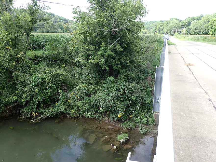
Weedy but doable bridge access at Buckhill Road
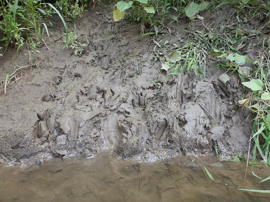
Some mud to deal with
Don’t launch from the adjacent gravel launch–it’s 100% private
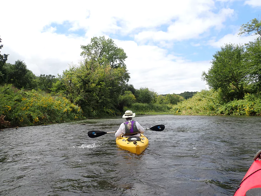
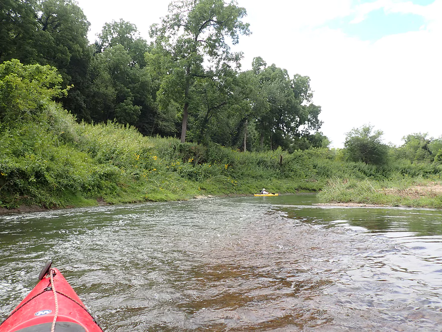
Fun light rapids to start the trip
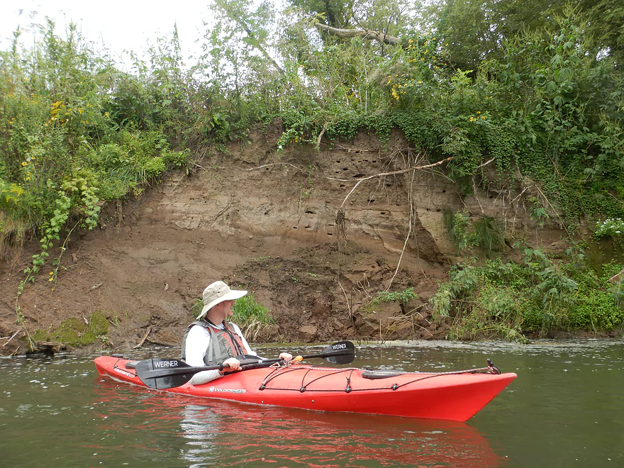
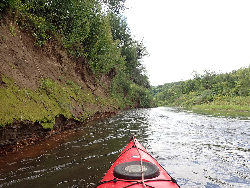
One of many large dirt banks–the result of 200 years of hillside erosion
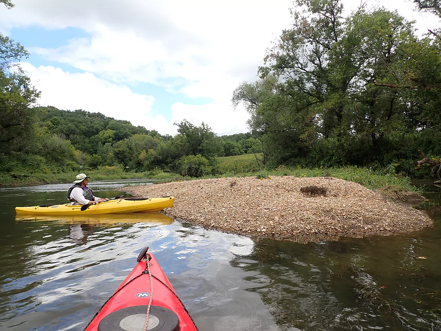
A large gravel bar
More minor rapids
Giant ragweed was common on the banks
One of only a few shallow spots (most of the river was fairly deep)
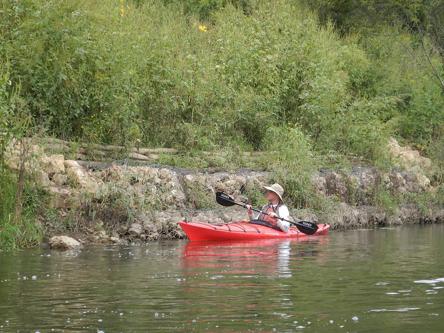
Kind of a scruffy section–the banks weren’t very attractive.
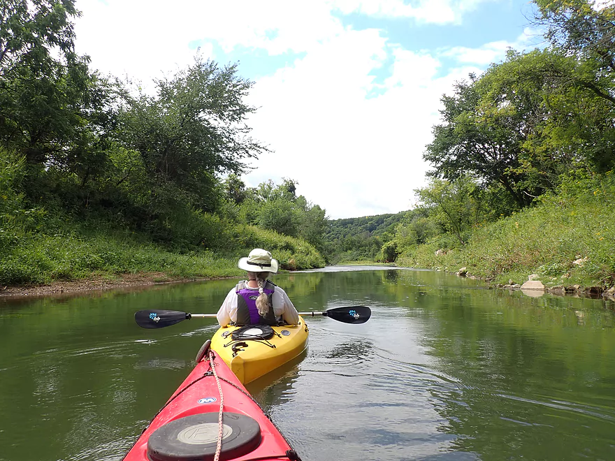
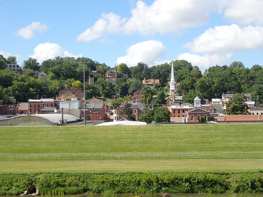
The trip had occasional nice vistas of the Driftless Area bluffs
A terrific stretch of wildflowers
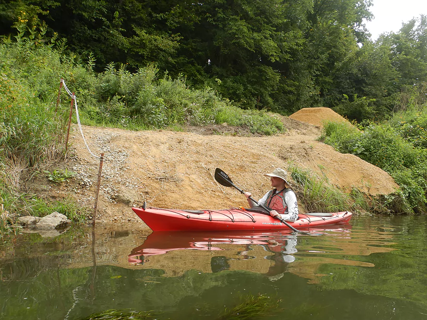
Some stream restoration work
The last of the rapids–the rest of the river is flat all the way to the Mississippi
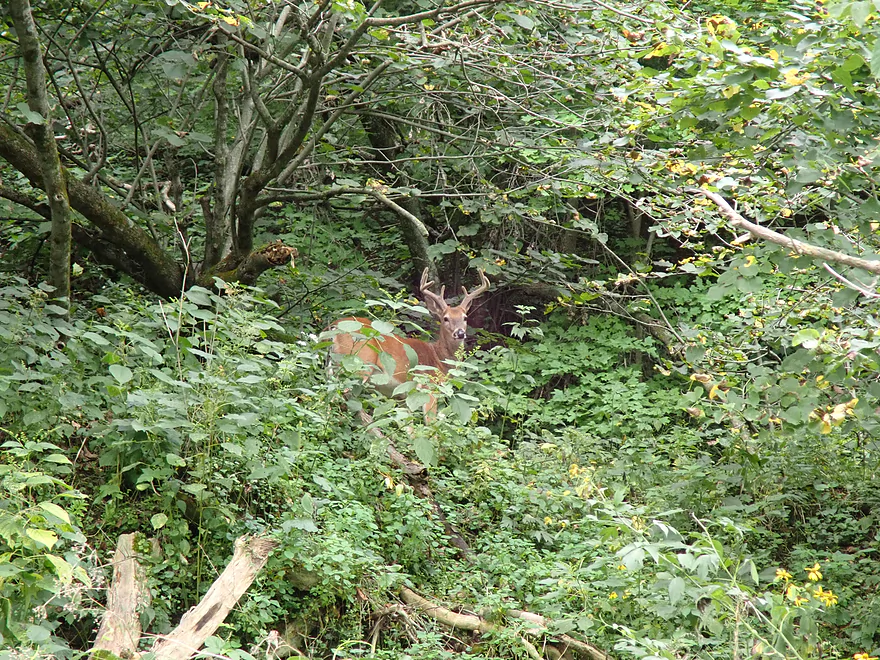
A great rack
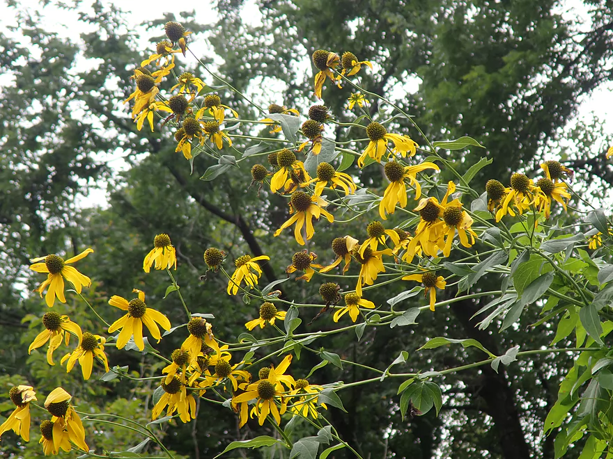
Coneflowers
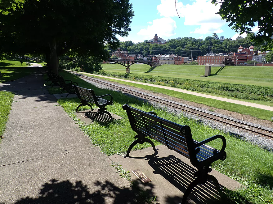
Much of the river parallels a railroad track
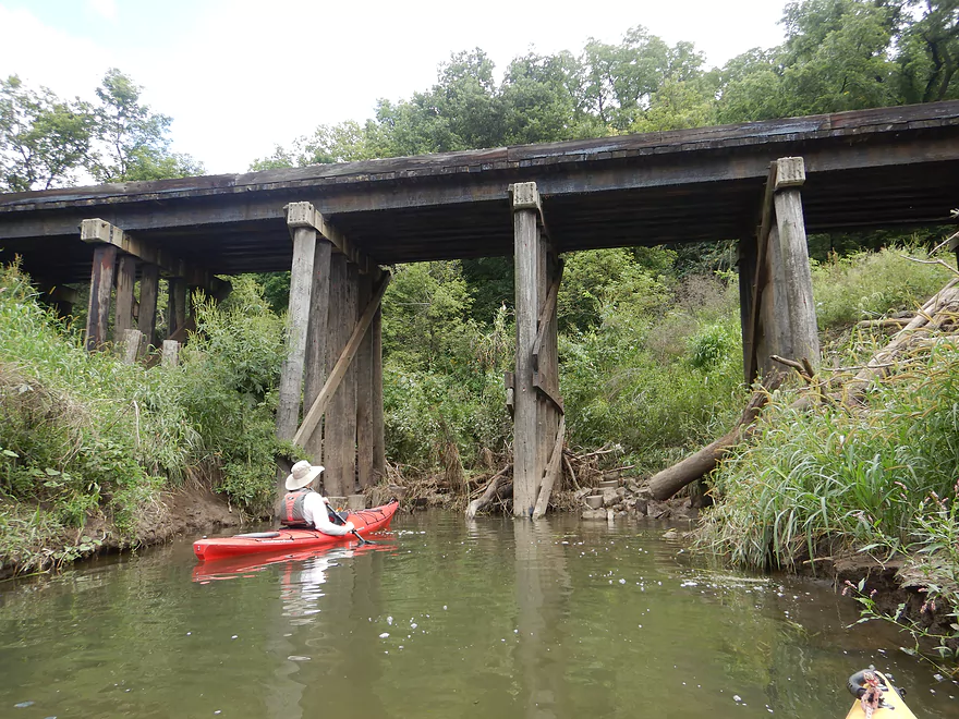
Attractive trestle
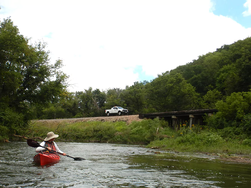
There is no road there…the truck has special wheels for driving on the rails
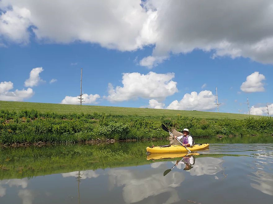
River really slows after that
Channel here is quite wide…it might have been dredged back in the day
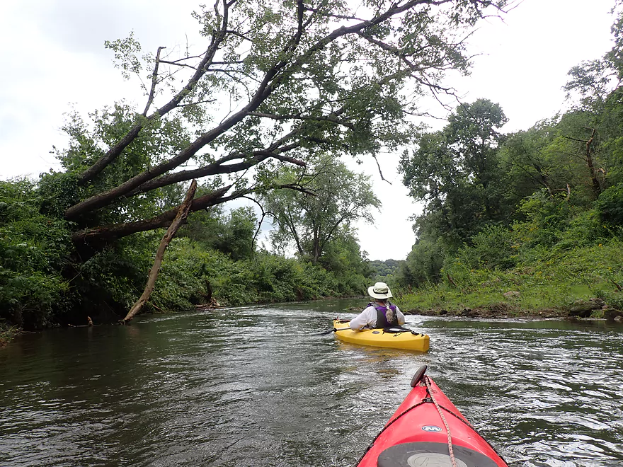
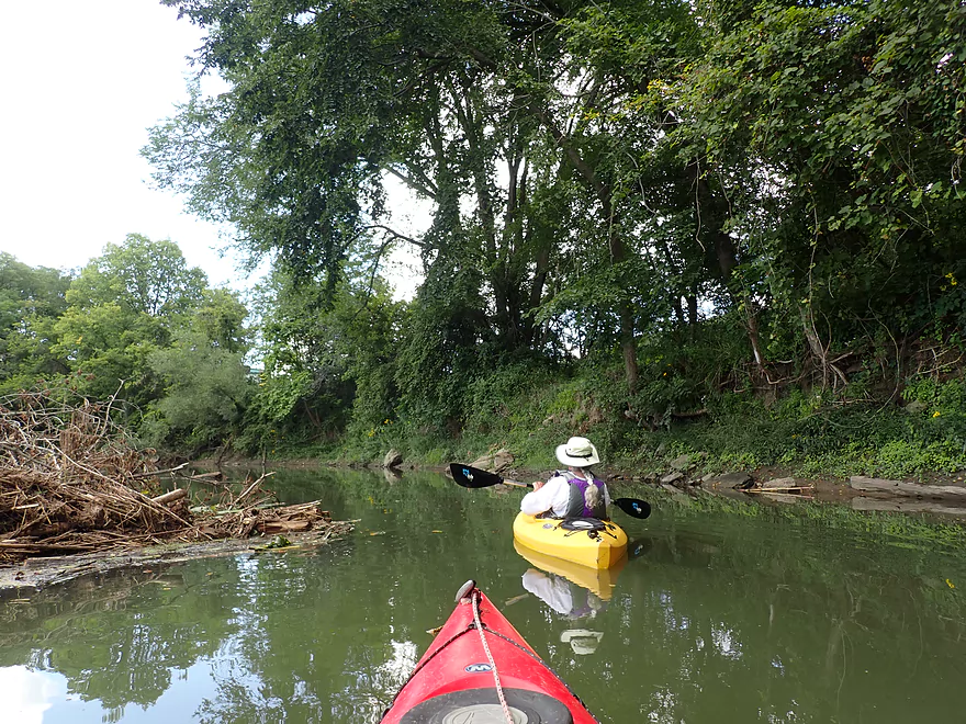
There was occasional deadfall on this stretch, but it was never a problem.
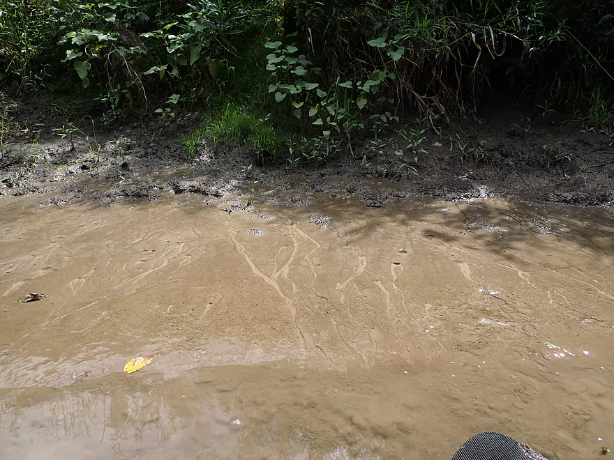
Trickles of spring water create neat patterns in the mud
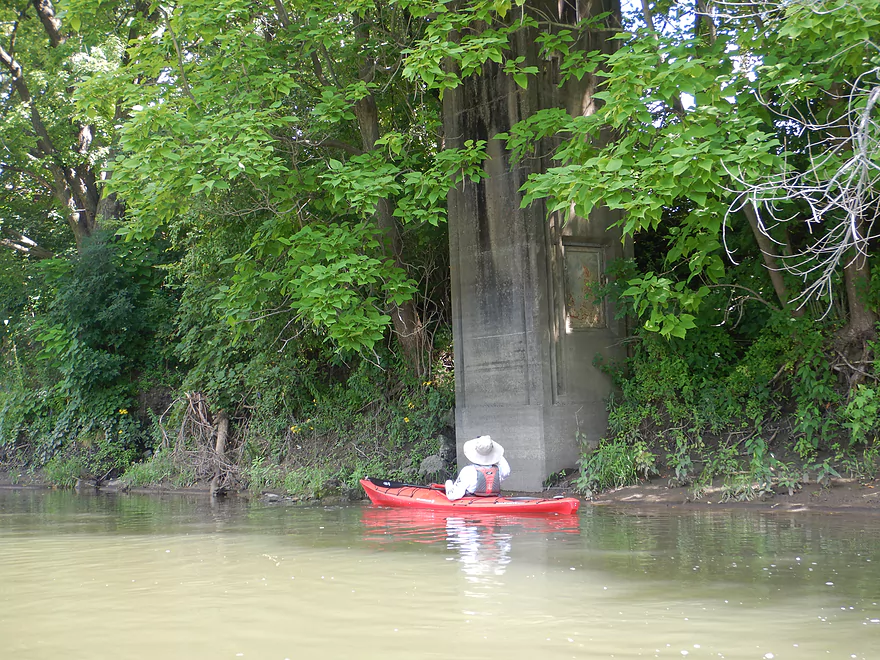
An old bridge foundation
Beaver tracks
Stagecoach Trail (aka the Burton bridge) is not a viable access
The river was very straight and slow after this–almost like a canal
The property on the left is part of the Buehler Preserve
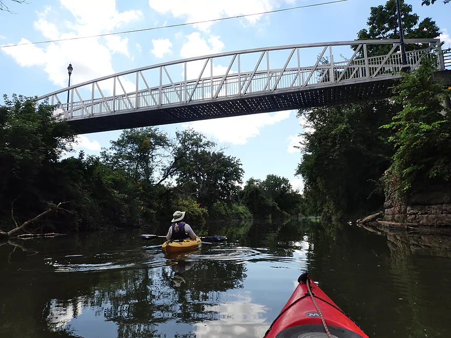
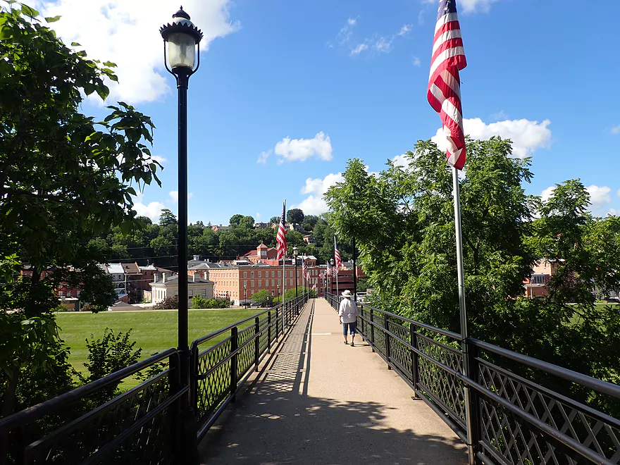
The Meeker Street walk bridge…our entryway to the city of Galena
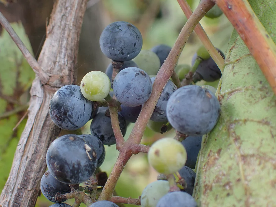
Wild grapes growing beside the river
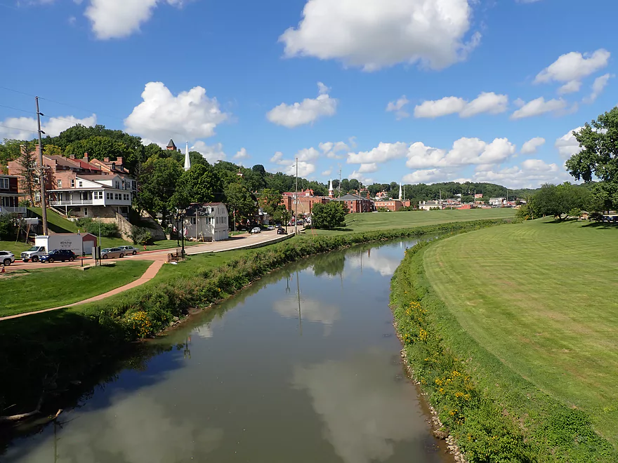
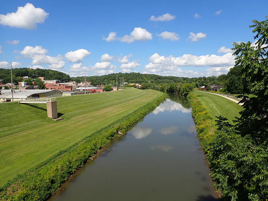
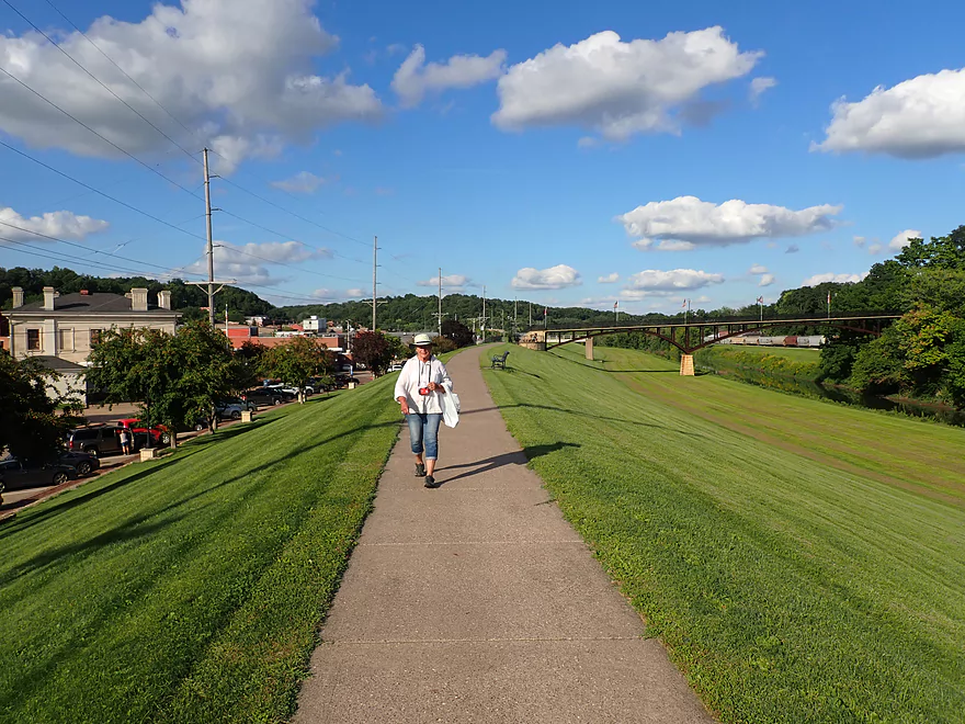
A huge levee along the west shore protects the downtown from floodwaters
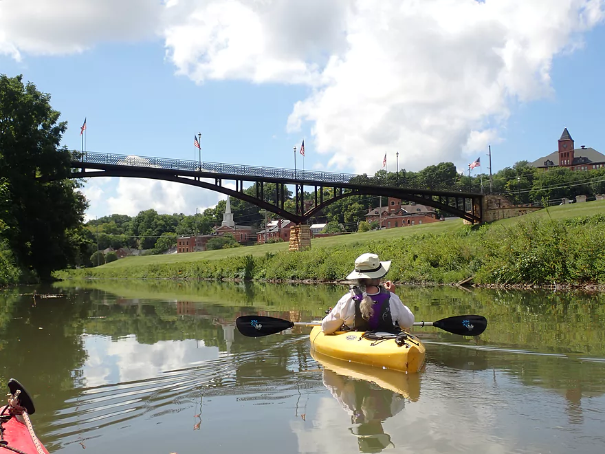
Approaching a second walk bridge–this one connects the downtown with Grant Park
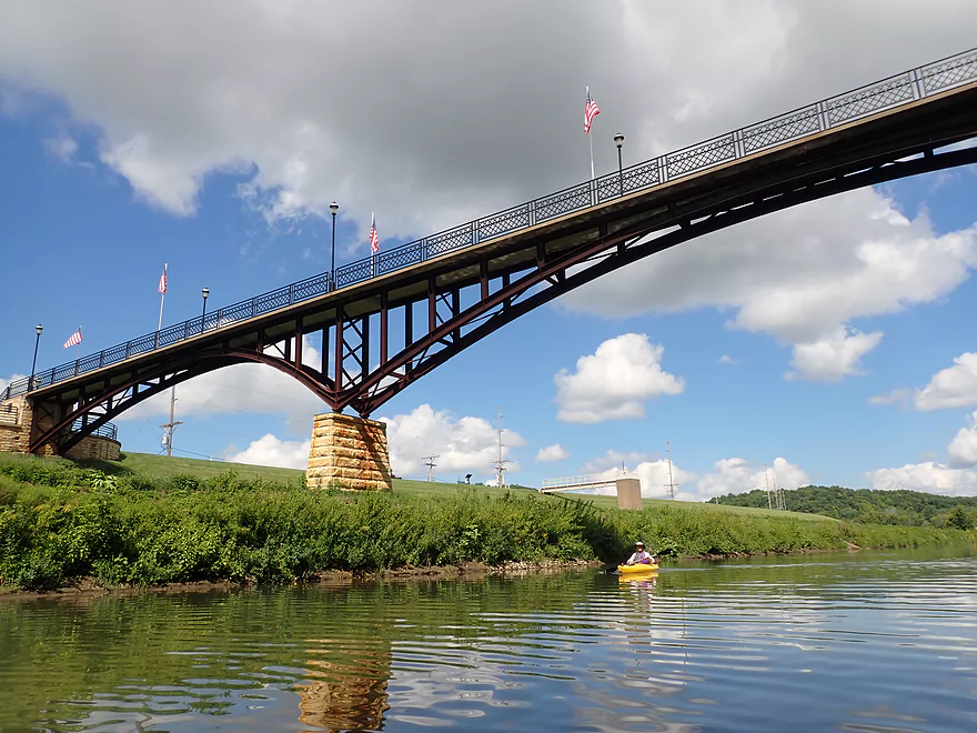
This is very scenic and an iconic landmark
This “ancient pillar” is actually part of a pump system for city flood control
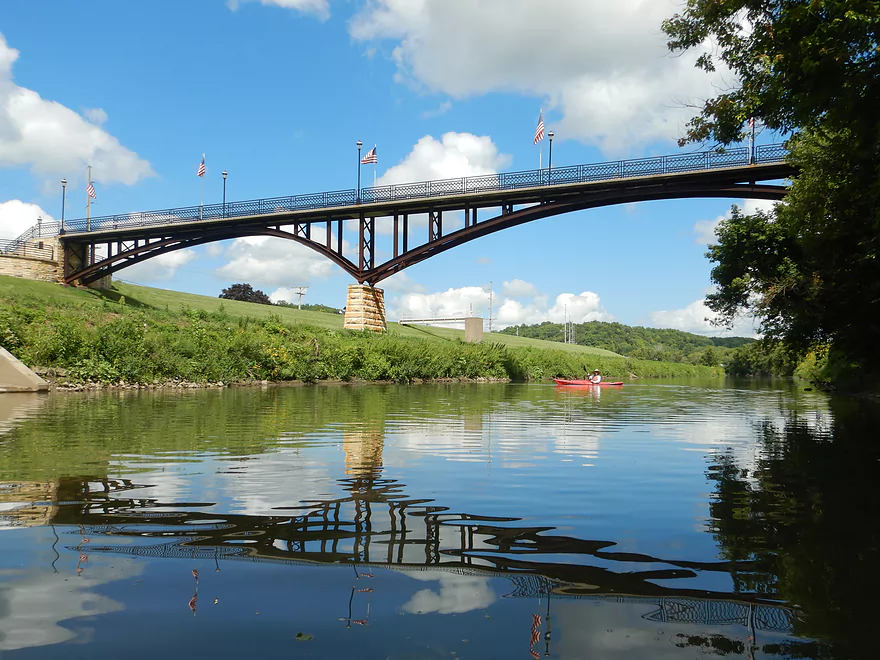
Reverse view of the bridge–gorgeous!
Only the taller buildings are visible above the levee
Taking out at Depot Park by the Hwy 20 bridge
Where there is a nice kayak launch
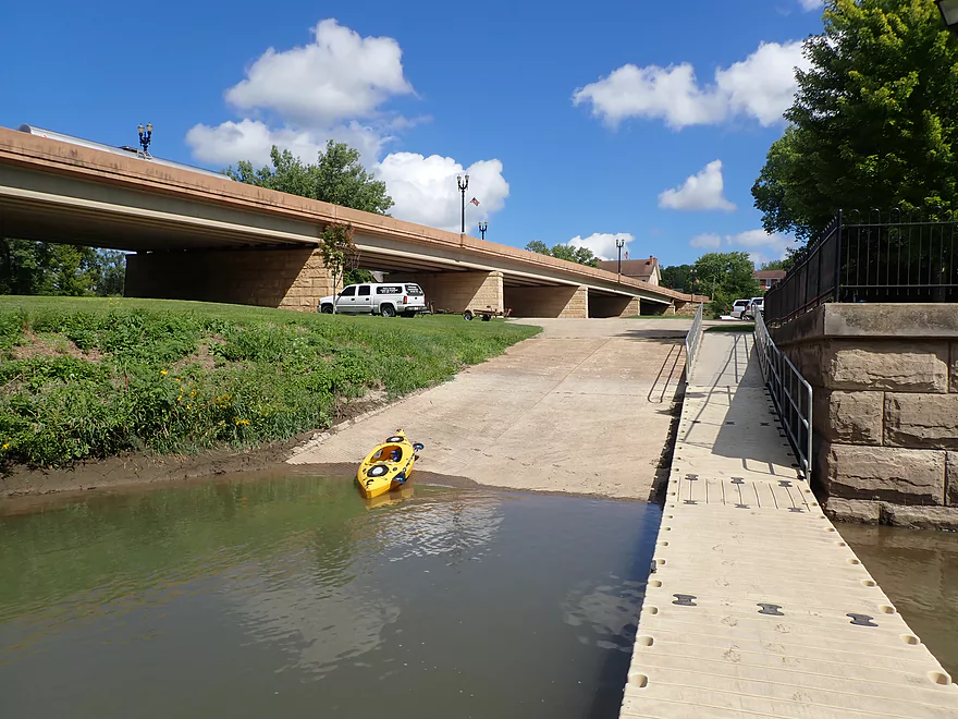
You can also take out on the ramp, or at a public canoe/kayak landing on the other side of the river.
Great view of the city from the Hwy 20 bridge
Heading north (on foot) from Depot Park to Grant Park
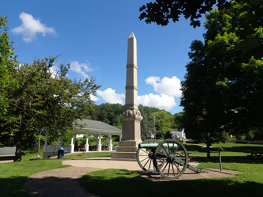
This is a really nice park that is worth checking out
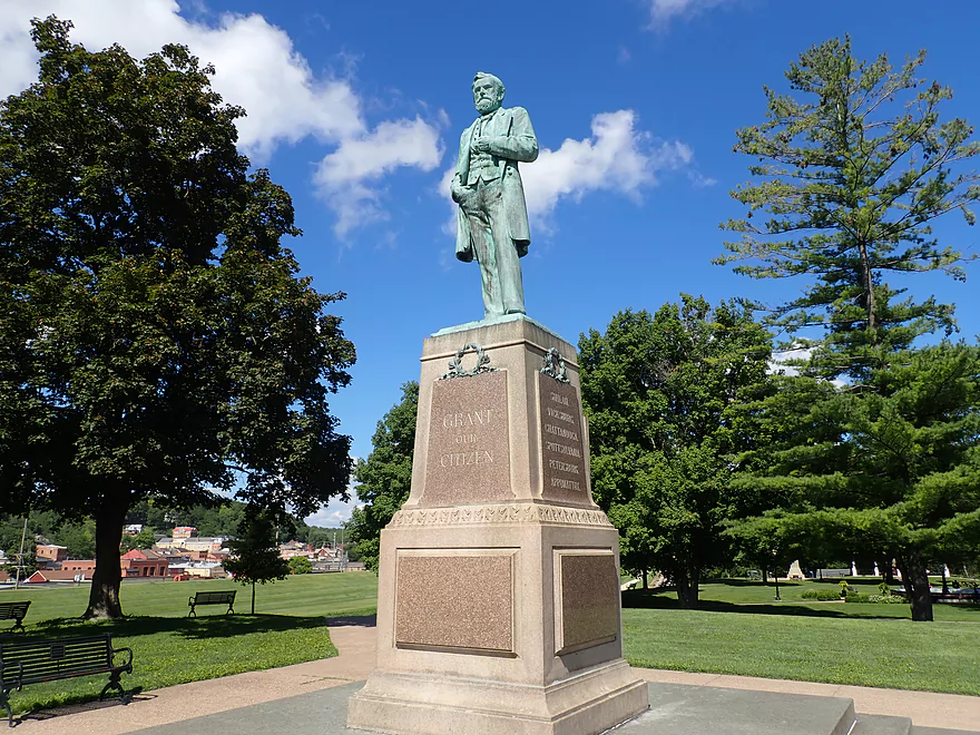
A statue of Grant
Walking over the same bridge that we paddled under earlier
View from the bridge looking upriver
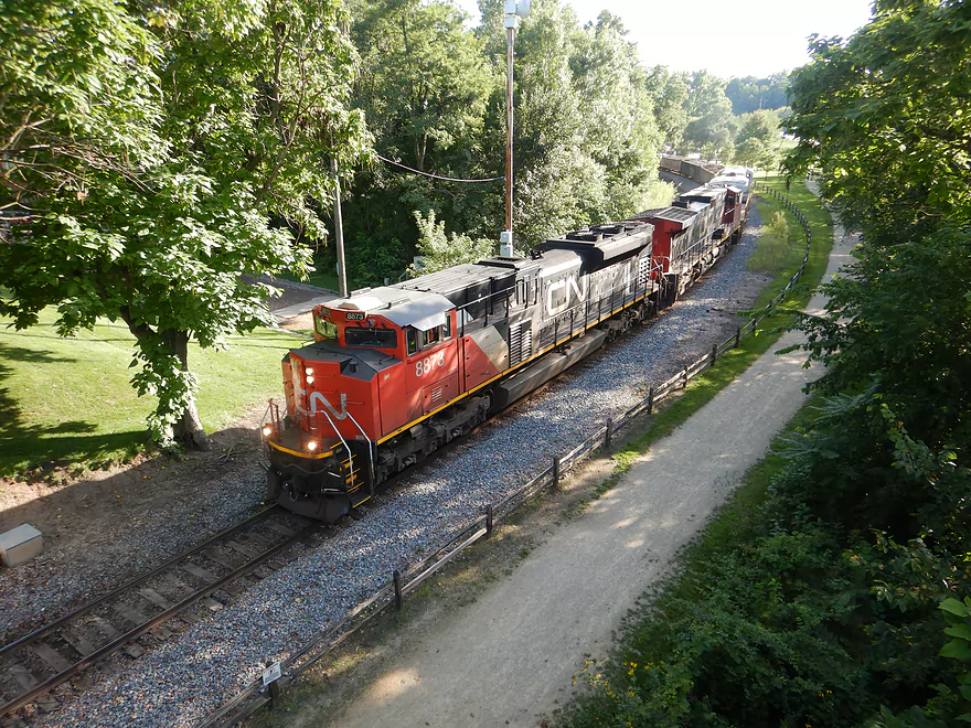
A train passing underneith
View looking west
You can cross the bridge and walk along the top of the levee
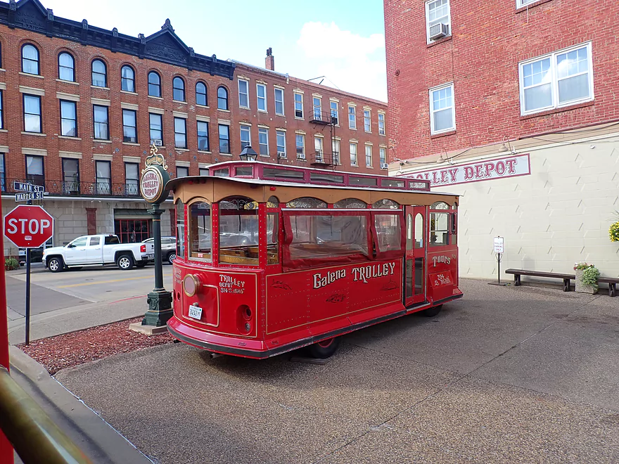
We decided to take a trolley tour
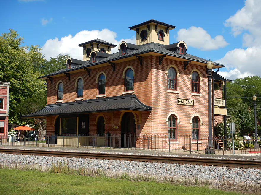
Sights included historic buildings like this old train station (now a visitor center)
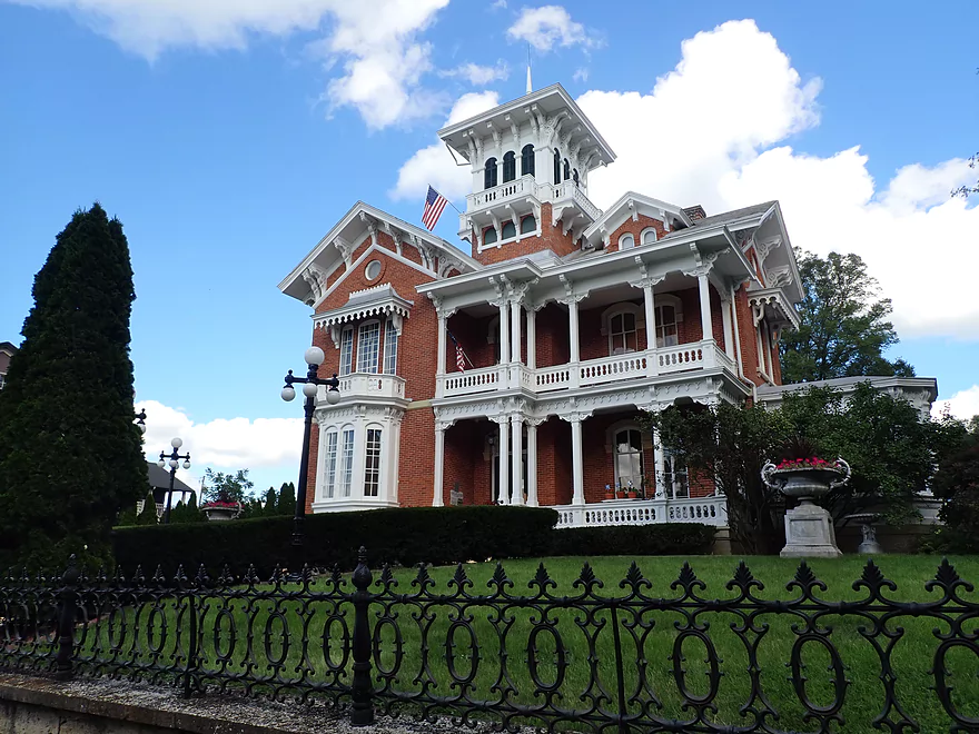
The Belvedere Mansion–one of many historic homes we saw on the tour
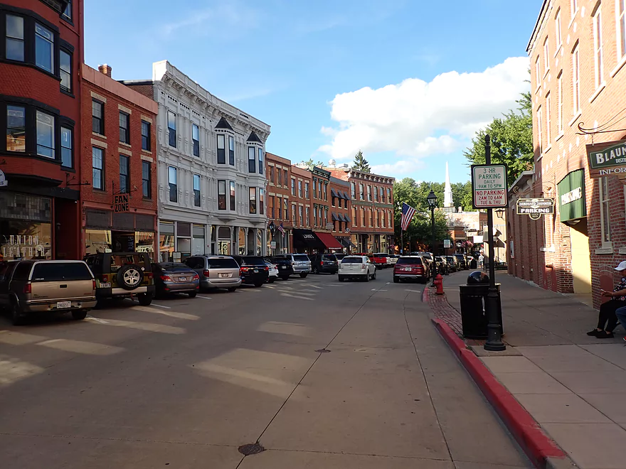
Galena’s historic Main Street (85% of the buildings are on the National Register of Historic Places)
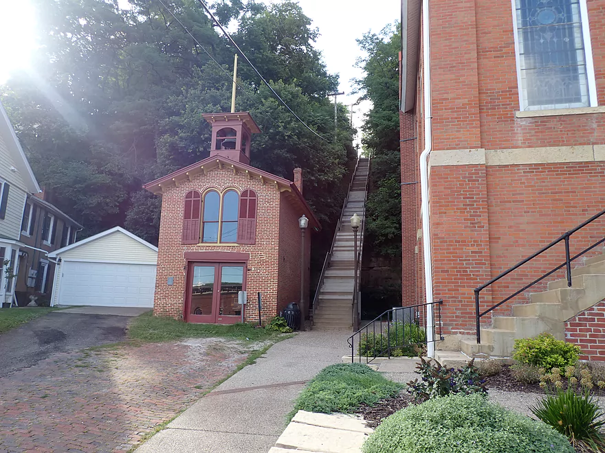
Galena is famously hilly…steep stairs connect the streets
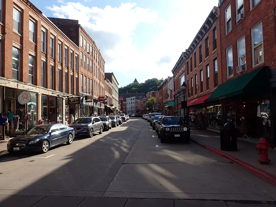
Downtown Galena has lots of unique shops and tons of tourists
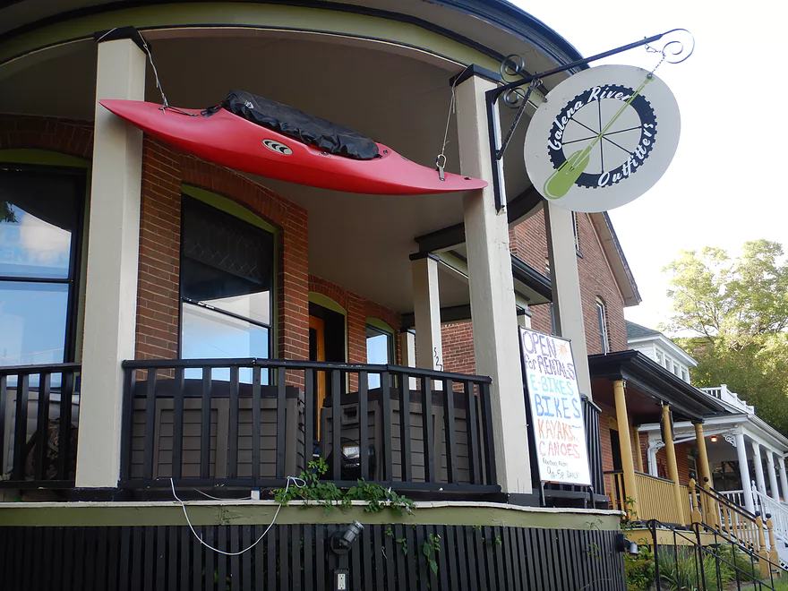
One of two different outfitters in town that rent out canoes and kayaks
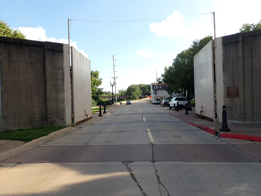
Large flood gates (mostly) protect the downtown during high water
Fever River – Galena

The Galena River begins in Wisconsin just east of Platteville and enters the Mississippi River south of the city of Galena in far northwestern Illinois. Even though the river leaves Wisconsin, it does not leave the Driftless Area—Jo Daviess County is one of the few counties in Illinois that escaped all the terrain-flattening glaciers that pretty much leveled the rest of the state.
The Galena River was originally known as the Fever River, but the name may have had less to do with disease than with beans. An early visitor to the area recounted: An old Canadian voyageur informed me that the name of the stream was “Rivière aux Fèves,” or “Bean River,” owing to the large amount of wild beans growing along its banks, from which it was corrupted to Fever River.
In 1854, in an apparent move to improve the river’s image, its name was changed to Galena after the name of the lead ore that was mined in the region. Many Wisconsin residents, however, continued to use the name Fever and successfully lobbied in the 1990s to have it officially changed back…at least in Wisconsin. The river is still known as the Galena in Illinois.
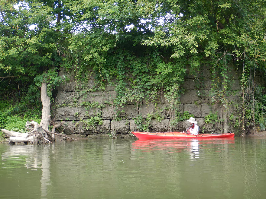
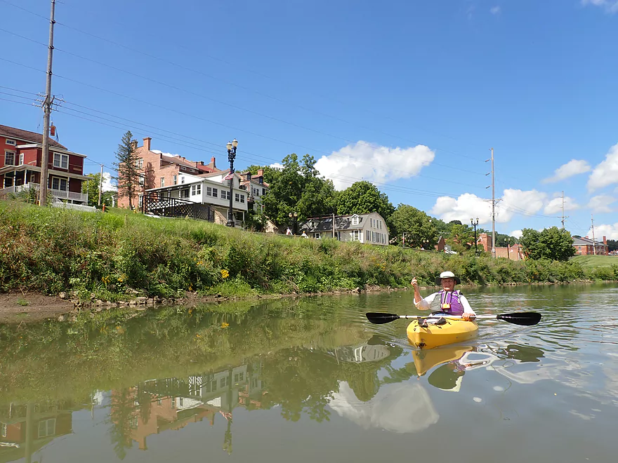
Our put-in was at W. Buckhill Road, a winding and secluded road located a few miles northeast of Galena. The house just east of the river is owned by a guy from Chicago, which isn’t all that unusual. Many Chicagoans have fallen in love with the Galena area and bought second homes here.
There is a crude gravel launch 200 ft. upstream from the Buckhill bridge, but this is private and the access is apparently rented from the landowner by two Galena outfitters. Paddlers can instead use the bridge embankment which provides a relatively easy (although somewhat muddy) alternative put-in.
A word here on Illinois river access: In Wisconsin, all waterways are public. In Illinois, paddlers can only use waterways that are deemed “commercially navigable.” That’s kind of vague. It’s also archaic, since the law was written long before paddling sports exploded in popularity. Only about 20 rivers and almost no creeks have been given this designation which is a joke. A recent Illinois case did challenge the law and lost, but there is growing awareness that the law does need to be changed.
A local told us that paddlers do, however, put in at the Buckhill bridge “all the time,” and the outfitters are launching boats even further upstream, so that’s a pretty good indication you are probably fine putting in here. It is, however, a gray area and paddlers need to be mindful of the situation and stay very respectful of neighboring property.
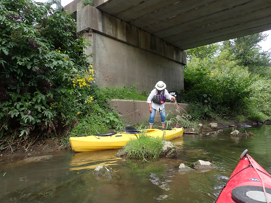
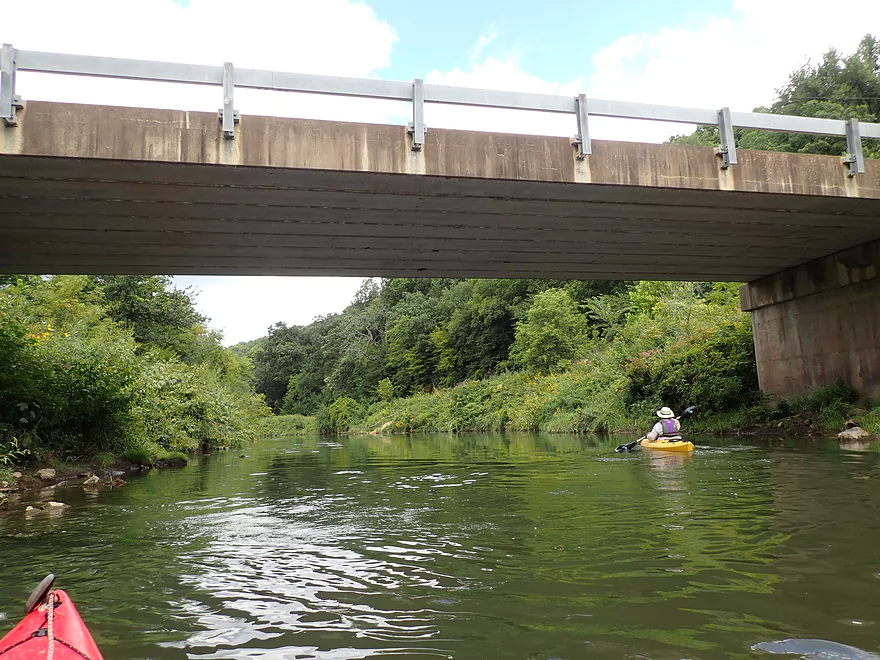
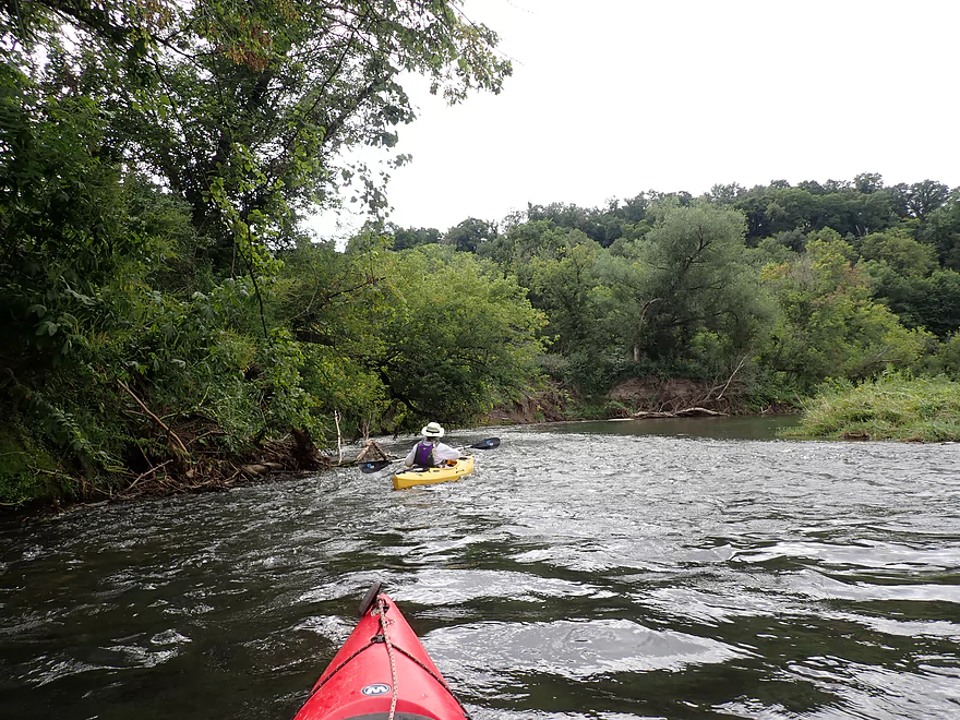
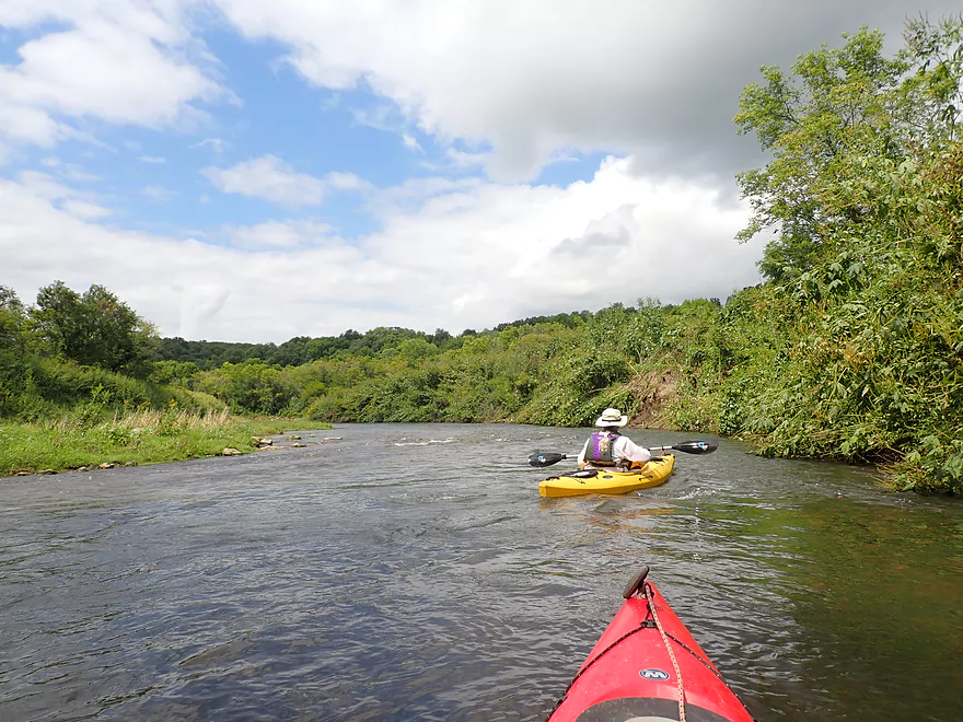
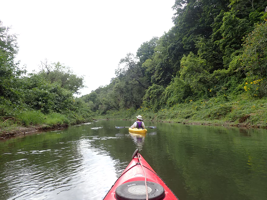
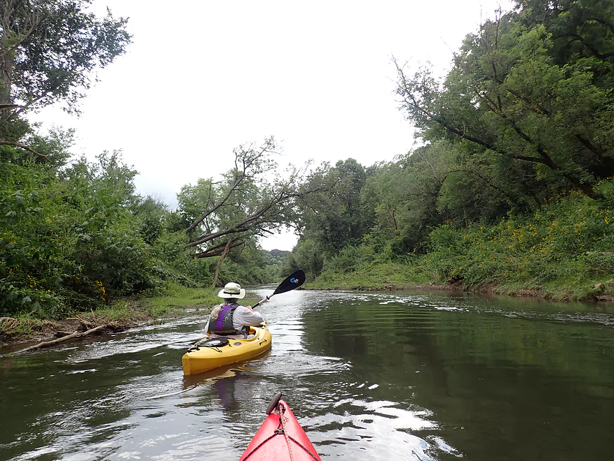
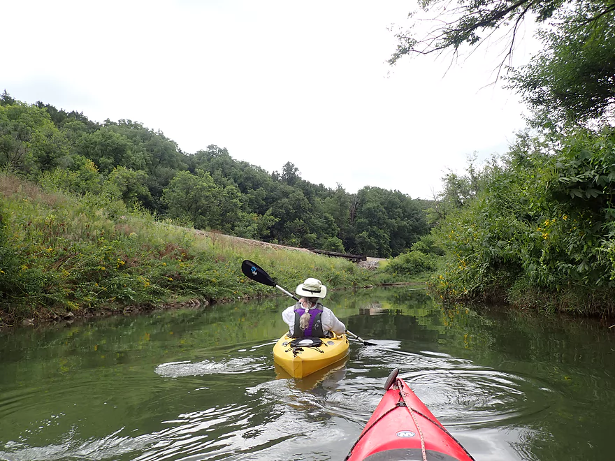
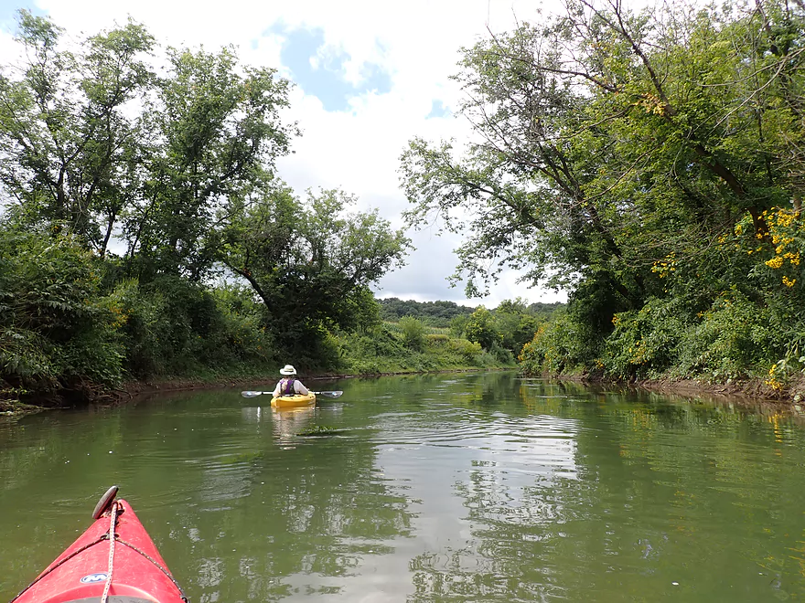
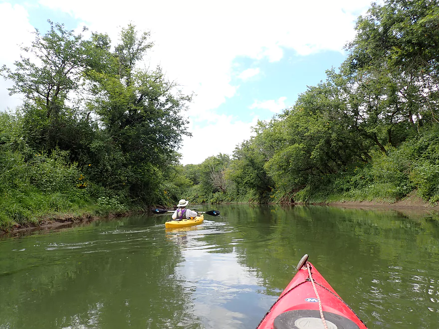
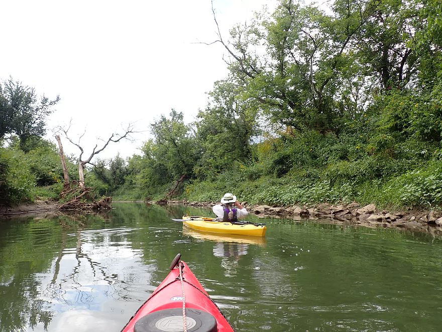
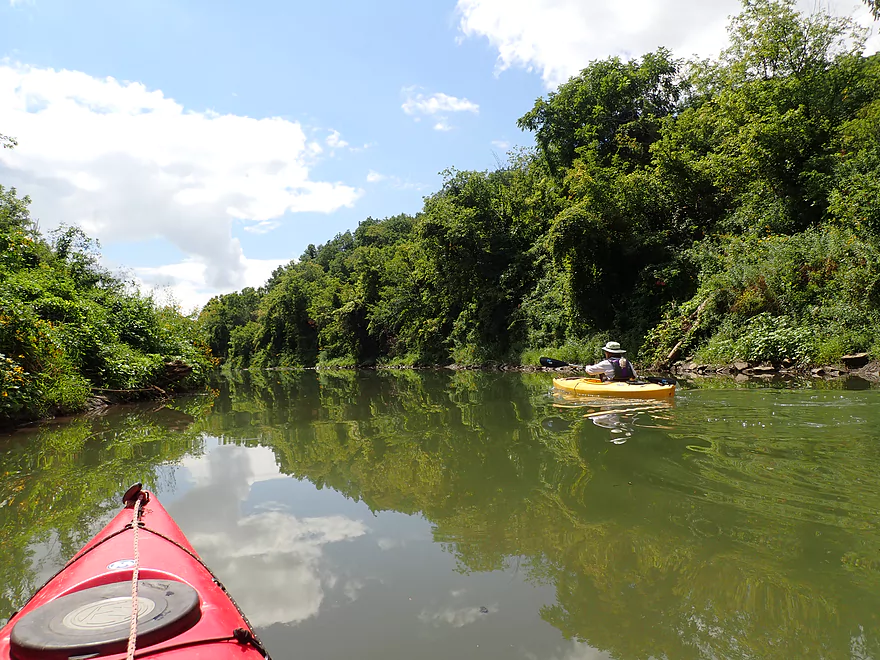
Right after the Buckhill bridge, the East Fork of the Galena River joins the main river from the left. This is followed by a series of fun and easy Class 1 riffles which we were able to mostly do without bumping. This section of the river reminded us very much of the Platte: scenic, shallow, fast, and with a few gravel bars. It was a promising start.
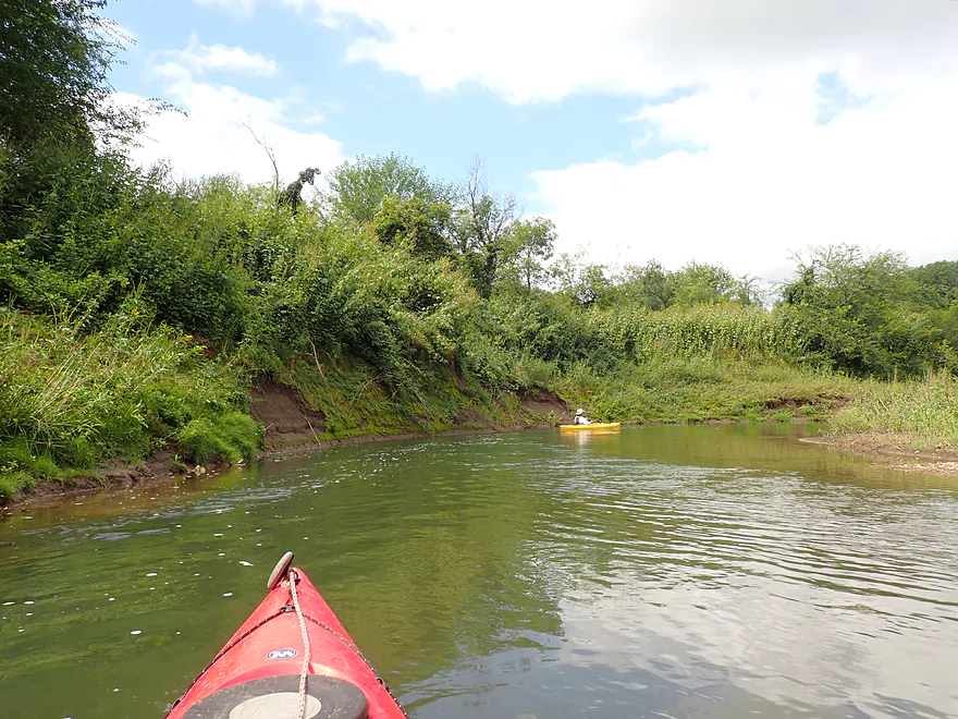
But then things slowed down. The channel got straighter, it lost most of its riffles, and a railroad appeared to our left (railroads and straight channels seem to always go together). Although the rail line would continue to parallel the river, it was visible in only a few places. A “hi-rail” repair truck scooted by at one point, but we never saw a train (not yet, anyway).
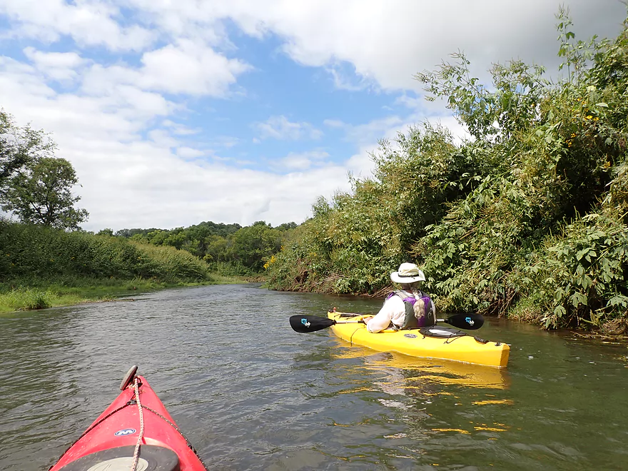
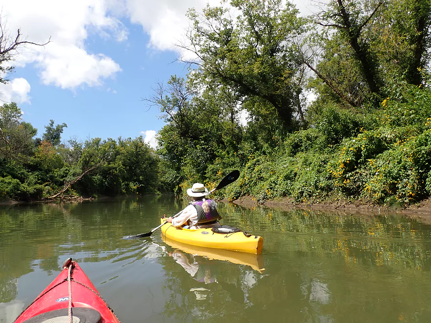
The banks were very high along this stretch of the river and covered with giant ragweed. On the more attractive side, late summer flowers added brushes of gold to the banks and their reflections. We did see a couple of deer here and frequent beaver sign along the river’s muddy edges.
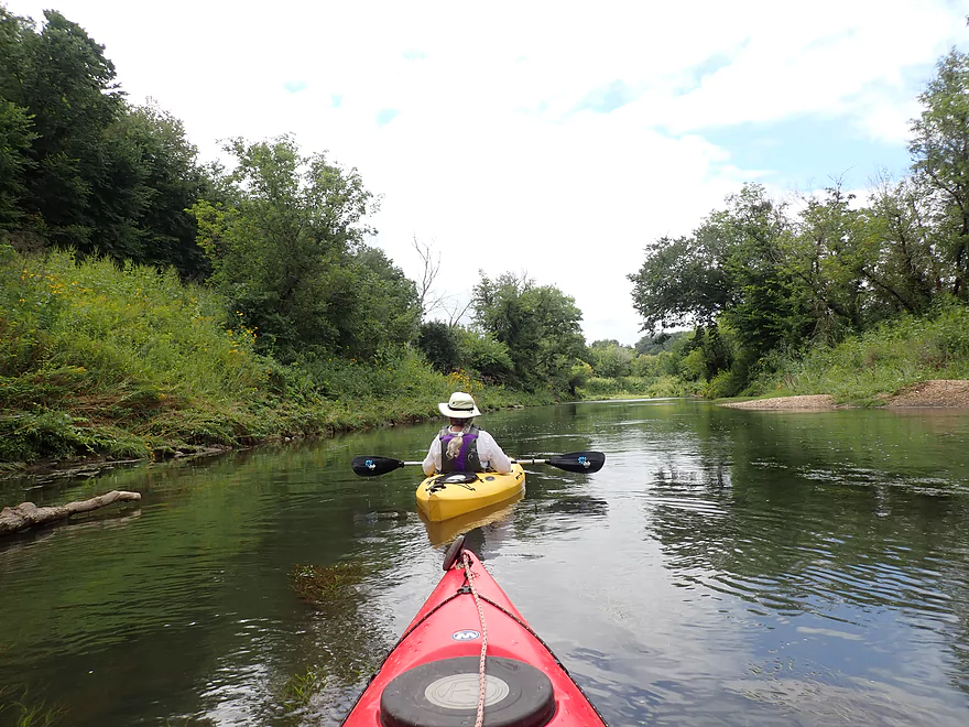
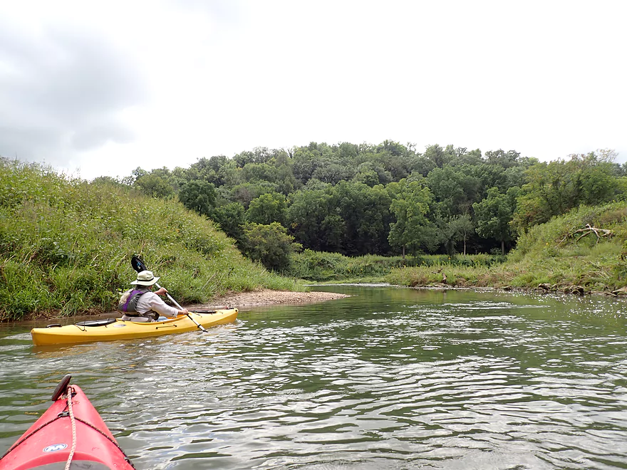
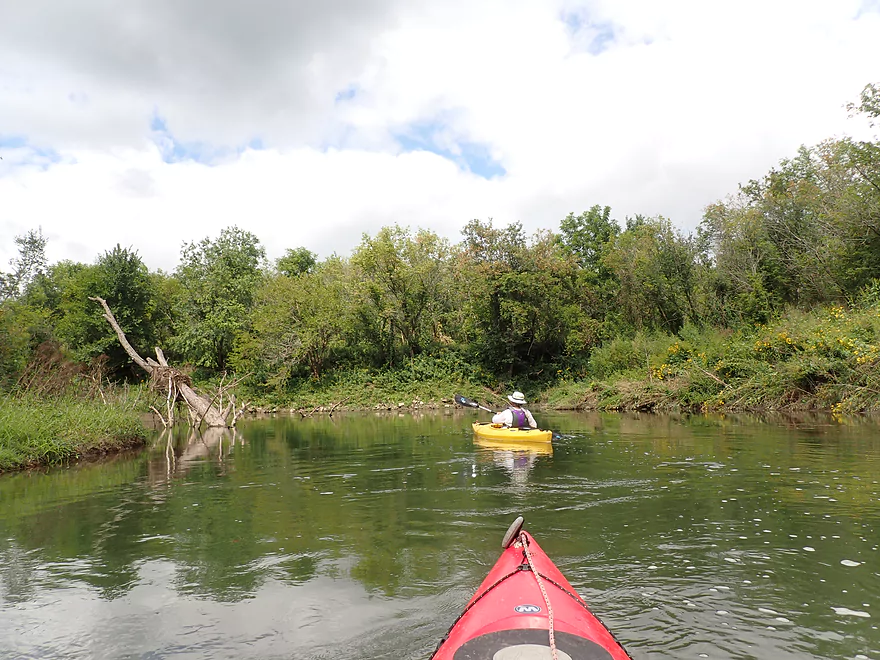
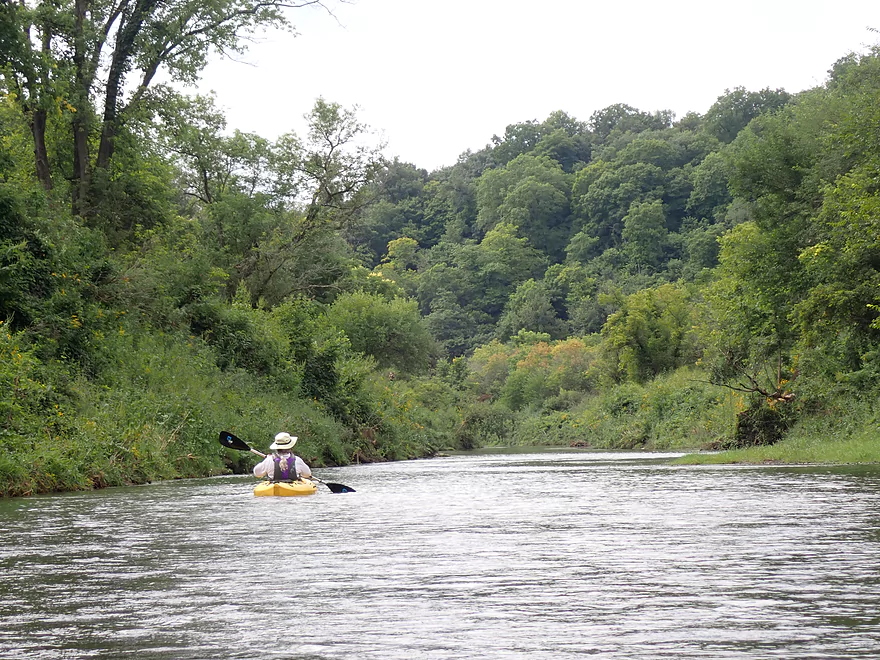
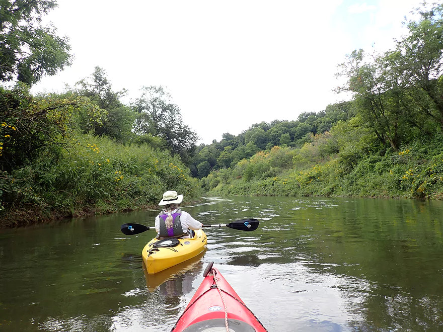
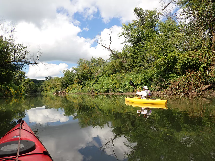
After a while we lost even more of our current and the river became very wide and straight, and even a bit scruffy. There was some deadfall along the edges, but nothing to restrict our paddling. This was the most uninteresting part of the trip. Occasional glimpses of Driftless hills (always beautiful) could still be seen through windows in the tree line.
Our second bridge, very close to Galena, was for a road called W. Stagecoach Trail—named after the historic Chicago to Galena stagecoach route that it follows. According to the Illinois DNR, this bridge technically marks the beginning of “navigable waters” on the Galena River. However, the bridge was very long and high and not a promising candidate for an access.
Just before Galena the river got a little more scenic, but lost almost all its current. It sometimes felt like paddling on a canal. The local outfitters advertise an out-and-back trip from the Hwy 20 bridge in town and now it is easy to see why. There isn’t much difference between paddling upstream or downstream.
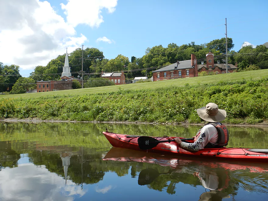
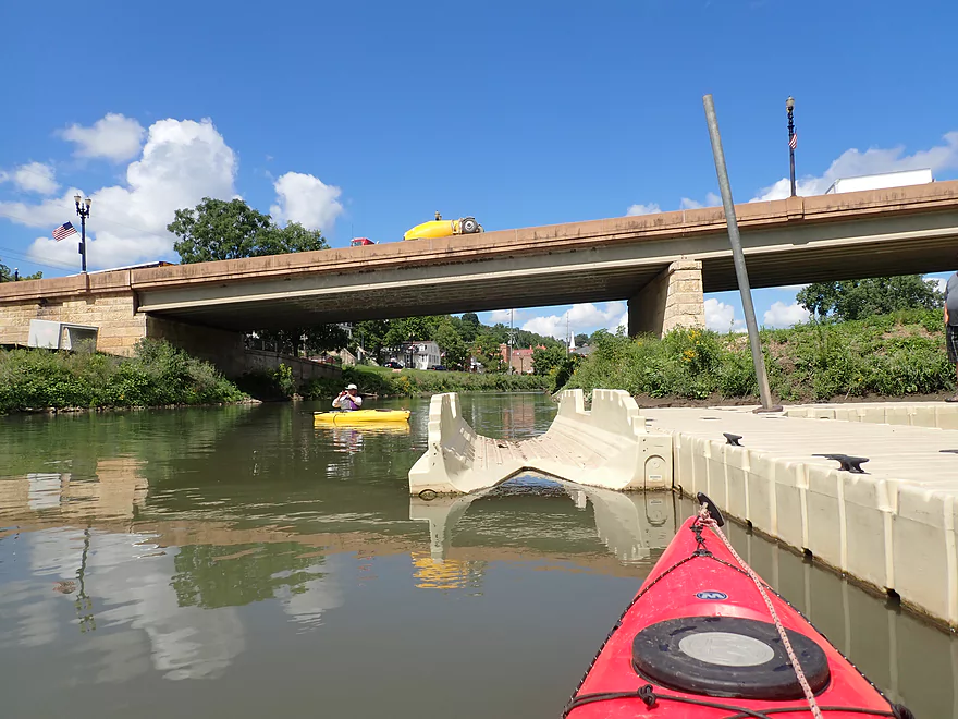
An attractive white walk bridge marked our entry into the city of Galena. A second, higher walk bridge soon followed–its iconic arched supports framing the picturesque town which climbs an almost vertical hillside. A white church steeple is especially prominent, along with the former high school building (now a condo) that overlooks the river from the very top of the hill.
A large levee also begins here and extends along the west side of the river for the entire length of the town. Large steel floodgates can be shut at the south end of Main St. (just prior to Hwy 20) to (mostly) keep floodwaters from entering the downtown.
At one time the Galena River was much larger in the city and spanned the entire river bottom. Steamboats came up from the Mississippi three miles away to load lead. Galena was a hopping trade center that rivaled Chicago. Historic accounts from the 1850s describe up to 15 steamboats docked along Water Street.
But then the area’s reckless land use practices began to take their toll. In addition to cutting trees to clear land and build and heat homes, whole hillsides were clear-cut to provide fuel for the lead smelters and steamboats. Great quantities of soil were washed into the river and gradually filled in the channel.
Yearly dredging was done and a lock and dam were eventually built at the mouth of the river, but they would never quite stay ahead of the silt. When the railroad came to town in 1855, it marked the end of the steamboat era. The lead era was also winding down as Galena ore became more and more scarce. The tourist era would not begin until the 1970s, 120 years later.
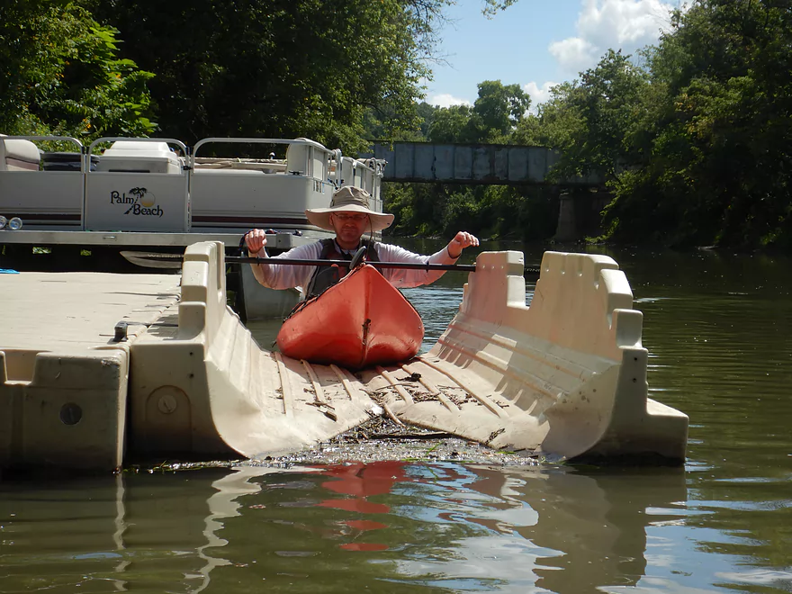
We took out just below the Hwy 20 bridge at an east-side public boat landing. It had both a concrete ramp and a canoe and kayak launch. It was a pretty easy take-out and there is nearby parking for your car. There is also a canoe and kayak landing on the west side of the river with both a concrete ramp and steps. This is used by the town’s two outfitters, but is public and can be used by anyone.
Our trip didn’t take as long as we expected, so we had time left to do some Galena exploring. The city is extremely scenic and full of history. The entire downtown is established as a historic district, with 85% of the buildings on the national Register of Historic Places.
We checked out Grant Park first, which is on the east bluff overlooking the river. It is named after General and President Ulysses S. Grant and is connected to the downtown by the very same walk bridge that we had paddled under earlier. The park offers one of the best (and most photographed) views of the city.
We also hiked a sidewalk on top of the levee, and then doubled back over the walk bridge to watch a train pass underneath. We then walked up Galena’s historic Main Street, which is lined with unique shops and restaurants. No gaudy signs or fast food chains here–they are both prohibited! The buildings figuratively take you back in time.
On impulse we decided to go on a trolley tour of the town. We rode past one beautiful historic home after another—most of them perched on ridiculously steep hillsides . Two very long stairs climb the hill from Main Street to the top of the city—the longest being 252 steps. This is how Grant got to work from his pre-Civil War home, and for years how hundreds of kids got to school.
The tour featured a lot of unique trivia: Like, Galena once had 14,000 people (they now have 3300). And nine Civil War generals came from Galena. And during Galena’s worst flood ever (before the levee was built) steamboats actually paddled up Main Street.
So, if you do the lower Galena River, plan to make it a day. Spend the morning on the river and the afternoon exploring the city. That way you get the best of both. You might also consider just continuing your paddle down to the Mississippi, but that’s another adventure.
Sights included a couple of deer, signs of beaver, a groundhog, an eagle, one great blue heron, and a few large fish.
City of Galena: You could spend a week here, but be sure to hike Grant Park, the walk bridge, and the downtown–the city is very walk-friendly. A trolley tour is an easy way to catch all the historic and city highlights.
Galena River Trail: A popular 8-mile trail that begins in Galena, follows the Galena River to its mouth on the Mississippi River, and then continues another 2.1 miles along the Mississippi.
W. Buckhill Road: This is a mediocre bridge access. I suggest hugging the southwest corner and launching almost directly under the bridge. Illinois has poor public access laws and launching here is kind of a gray area, but many people do it. Do not be tempted to use the adjacent gravel/dirt launches (located about 200′ upstream and downstream from the bridge) as those are absolutely private.
Alternate Put-ins:
- West Council Hill Road (4.7 miles upstream from Buckhill): This leg is likely not a five star stretch, but should be pleasant with some riffles and bluffs. Note, I can’t vouch for West Council Hill Road, but the commercial liveries launch from here so that is a good sign.
Galena Boat Landing/Depot Park: This is a very good public access with a boat ramp, kayak launcher, public parking and an outhouse.
Alternate Take-outs:
- Galena Canoe/Kayak Landing: This is on the west side of the river opposite the boat landing and has both a ramp and steps for launching canoes and kayaks. The city’s outfitters put in here.
- Gear’s Ferry Landing (5.5 miles downstream from Galena): This is the final leg of the river. It’s likely not as interesting, but it would be novel to take out on the mouth on the Mississippi River.
Bike Shuttle: Depot Park to W. Buckhill Road – 4.4 miles with 256′ of ascent. This would be a hilly and difficult bike shuttle, although there is no gravel to deal with. Be mindful that Dewey Ave is a one-way road with two-way traffic, so you may be passed by cars with little room to spare.
Commercial Shuttles/Rentals:
- Galena River Outfitters – (815) 281-2773: This is the largest operation that provides shuttles and rentals. You can do free-style round-trips from Galena (where the current is slowest) or launch from Buckhill, Council Hill, or New Diggings. Lastly, they do offer a trip from Galena to the Mississippi.
- Nuts Outdoors – (815) 238-0023: They are open 7 days a week and also offer free-style round trips based out of Galena, and feature one-way trips starting from Buckhill, Council Hill, and New Diggings.
Logjams: None.
Current/Rapids: The river starts fast and riffly but soon slows down to almost a halt. None of the rapids are significant.
Trip Depth: 2.88′ per the Buncombe Drive gauge. The first mile of this trip is somewhat shallow, but the rest is plenty deep. The lower Fever/Galena can be paddled at a wide range of depths. The following is a very rough depth guide for the Lower Galena River:
- < 2.7′: Maybe too shallow.
- 2.7-2.8′: Some bumps in the first mile, otherwise plenty deep.
- 2.9-3.3′: An average depth and good target range.
- 3.4-3.6′: River is above average, but should be fine for paddling.
- 3.7-4.0′: River is very high, muddy, and dirty. Maybe navigable, but not as pleasant.
- 4.1’+: This might be too high for enjoyable paddling.
Detailed Overview
- Upstream from Knee Deep Road: The creek is likely too small to run. Peter noted that Hwy H doesn't have a good access option.
- Knee Deep Road to Bean Street: 6.4 miles.
- Knee Deep Road to Twin Bridge Road: 1.3 miles. Creek is small and a bit congested. There will be 1-2 logjams, but also some outcrops.
- Twin Bridge Road to Bean Street: 5.1 miles. River widens noticeably after Twin Bridge Road. This is a shallow trip with good geology and many Class 1 rapids. There may be cow fences to deal with.
- Bean Street to Hwy W: 8.0 miles. Great section with limestone outcrops and many light rapids.
- Bean Street to Horse Shoe Bend: 2.2 miles. A five star section with open oak savannas, fun rapids including a one-foot ledge and a wonderful limestone wall north of Hwy 11. One fence to duck under which is low but manageable.
- Horse Shoe Bend to Bennett Road: 4.1 miles. You should be able to launch at Horse Shoe Bend no problem (public fishing area). This segment is not as interesting and a bit weedy and overgrown, but still fast and with a few really nice outcrops. One tricky fence to get under.
- Bennett Road to Hwy W: 1.8 miles. Bennett Road should be doable as a put-in (another fishing access). River really opens up after this bridge and is quite nice with more rapids and a few limestone outcrops.
- Hwy W to Buncombe Road Fishing Pull-off: 5.8 miles. A great section on the Fever with some cool tunnels.
- Buncombe Road to W. Council Hill Road: 5.5 miles.
- Buncombe Road to N. Birkbeck Road: 3.0 miles.
- N. Birkbeck Road to W. Council Hill Road: 2.5 miles. Put-in and take-out are likely very brushy and somewhat difficult (but think they are doable). Parking at W. Council Hill Road is a challenge.
- W. Council Hill Road to W. Buckhill Road: 4.4 miles. Both put-in and take-out are brushy with W. Buckhill being more feasible.
- W. Buckhill Road to Galena/Depot Park: 5.0 miles. This stretch starts interesting with good driftless scenery and riffles. Then it becomes slower and less interesting. The last part through historic Galena is very pleasant.
- Galena/Depot Park to Mouth/Gear's Ferry Landing on Mississippi River: 5.6 miles. On the Mississippi veer right and paddle upstream to reach the boat ramp. Motorboat traffic might be an issue.
Trip Map
Overview Map
Video
Photos Size:
Your post on Fever River was an accidental discovery and it was wonderful to savor your kayak adventure and learn about the city. Lovely photos. Makes me want to visit. Thank you for sharing!!