
Putting in at Wayside Park on the Popple River
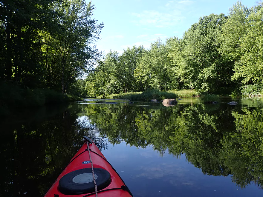
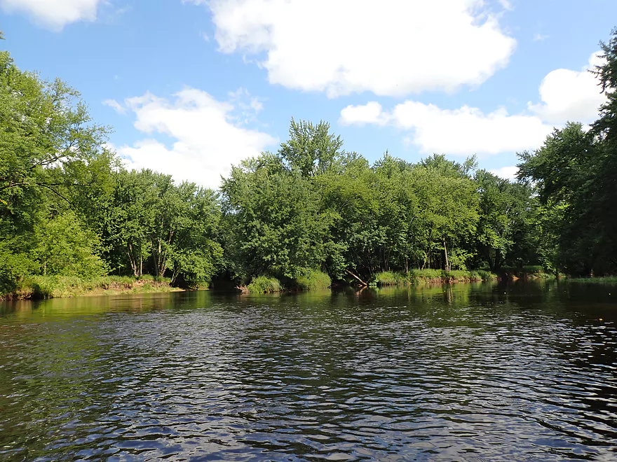
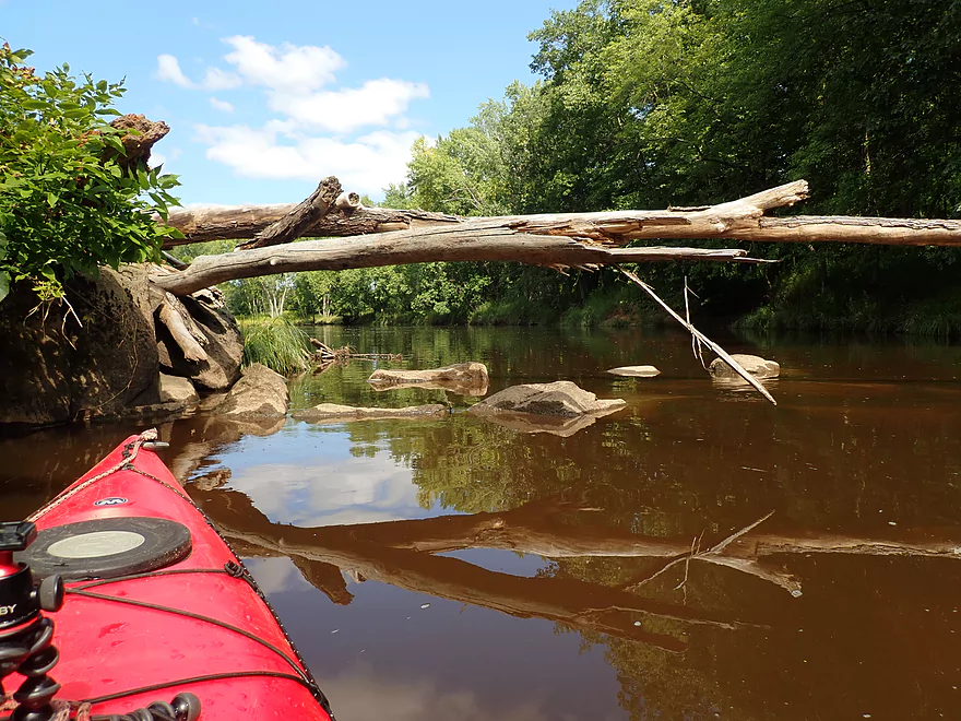
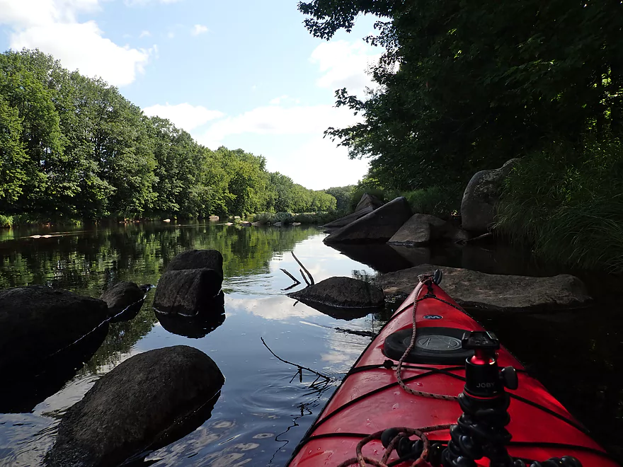
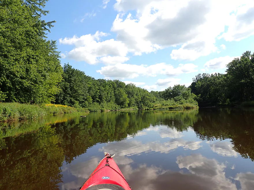
Cool reflections
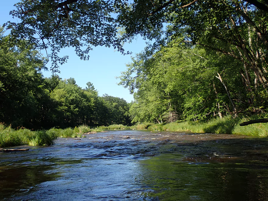
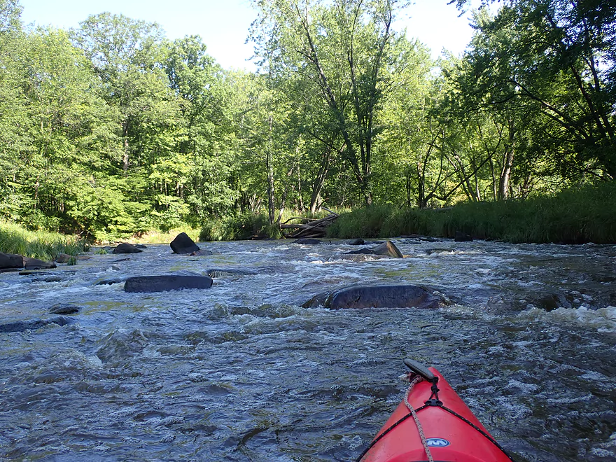
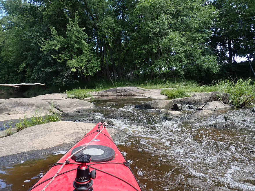
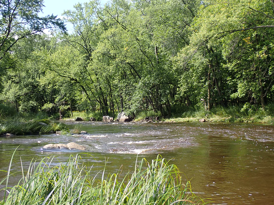
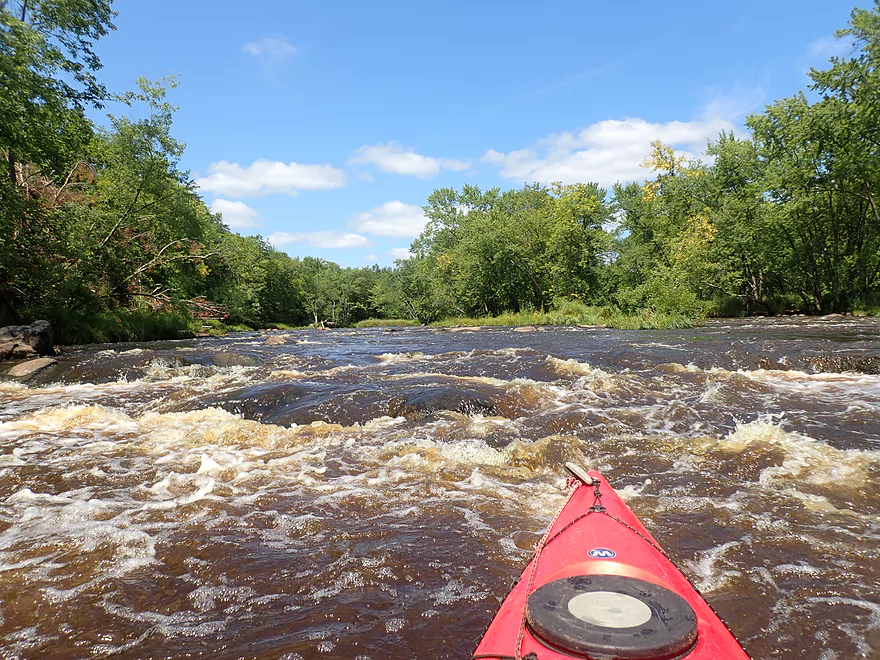
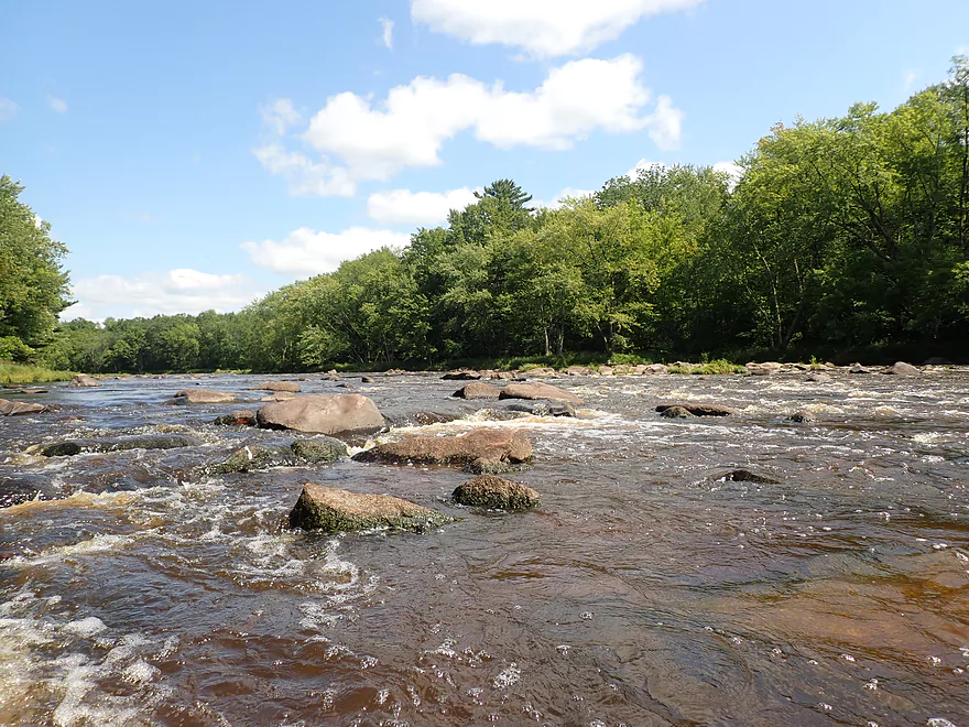
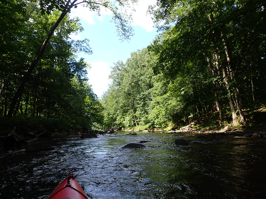
One of many rapids
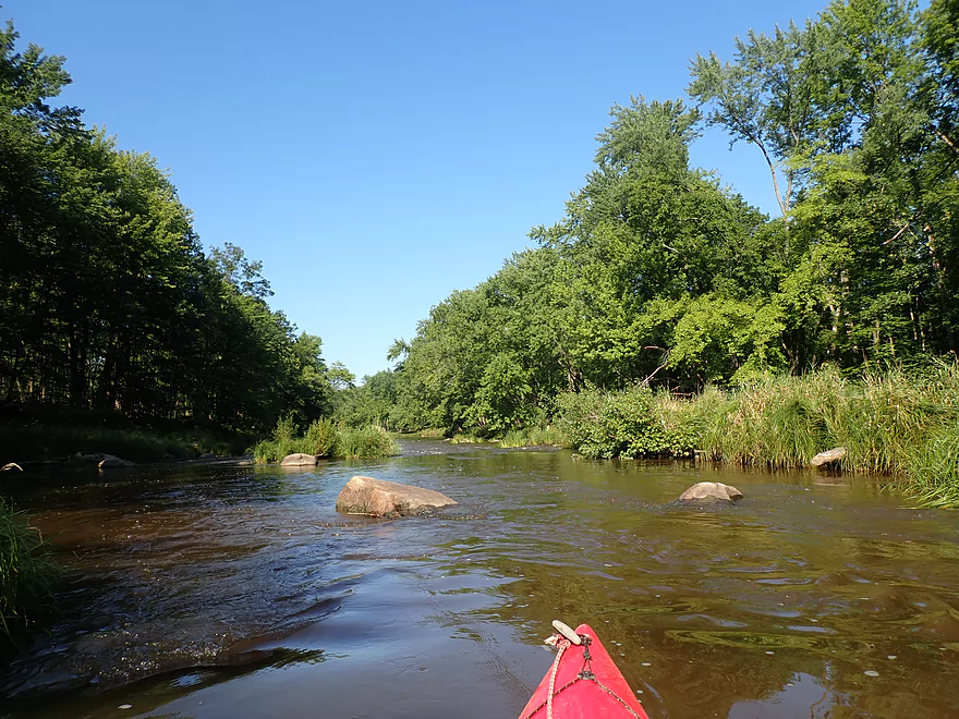
More rapids…by my count I went over 29 Class 1 rapids in the trip
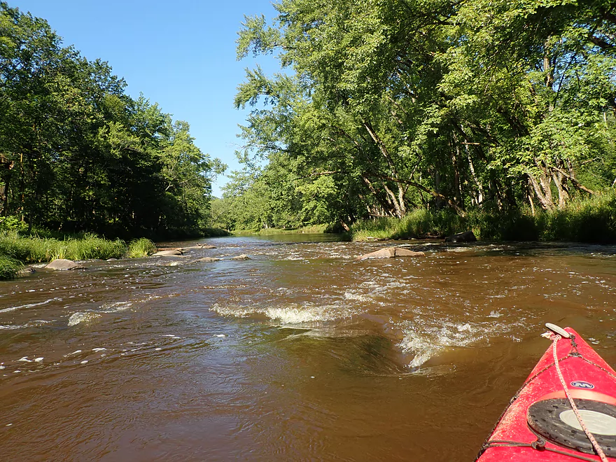
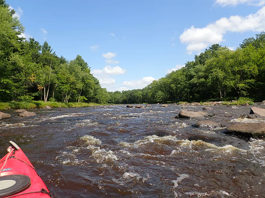
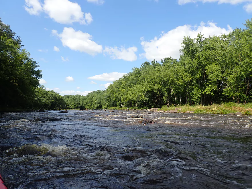
The strongest rapids on this leg of the Popple (Class 2)
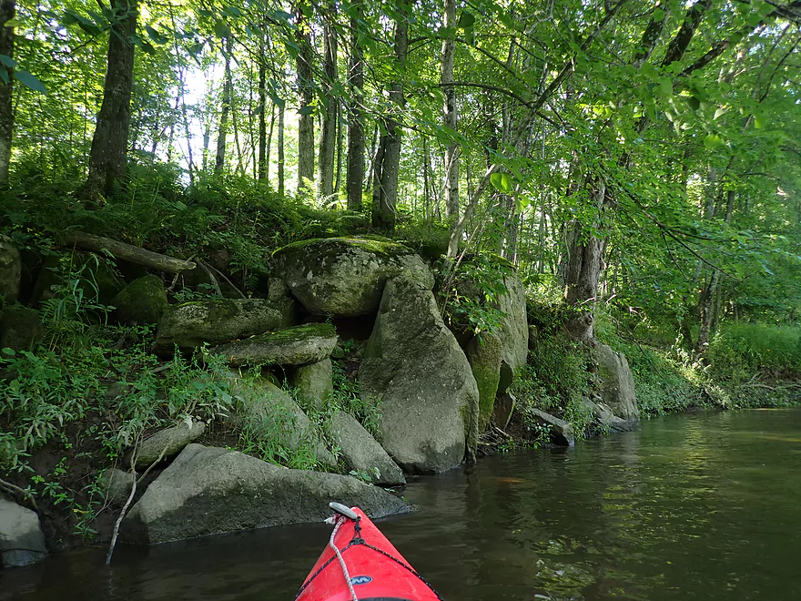
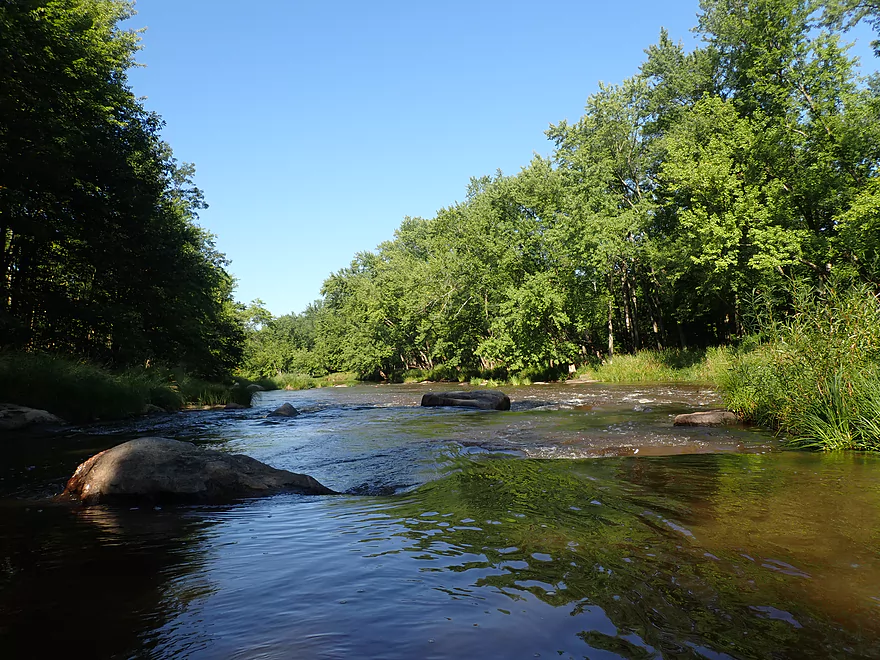
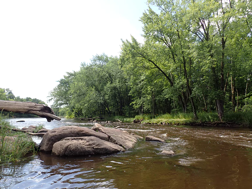
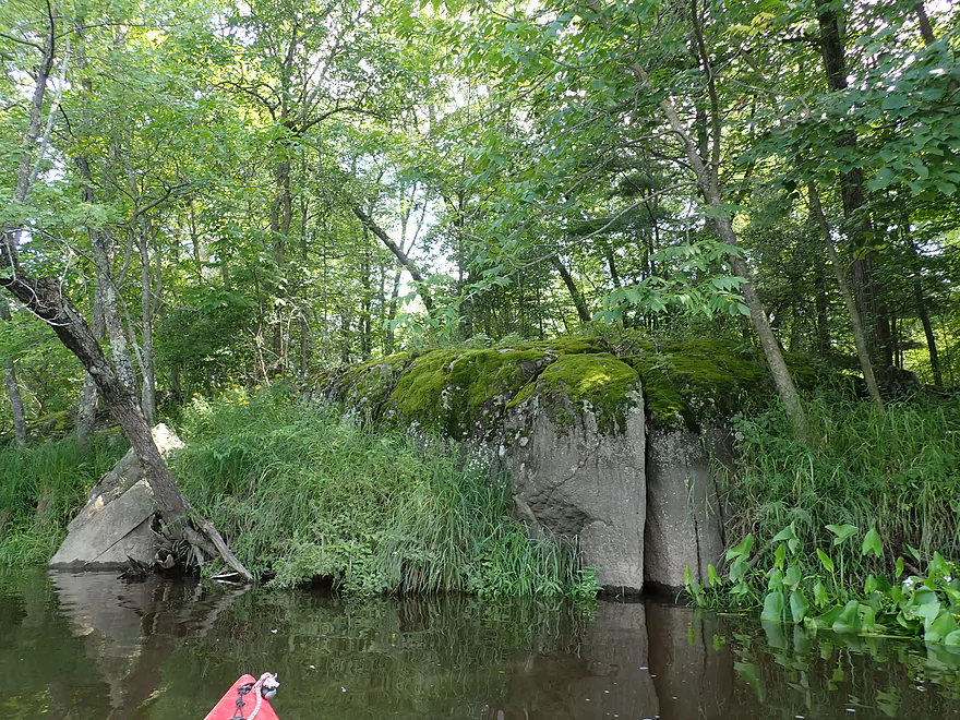
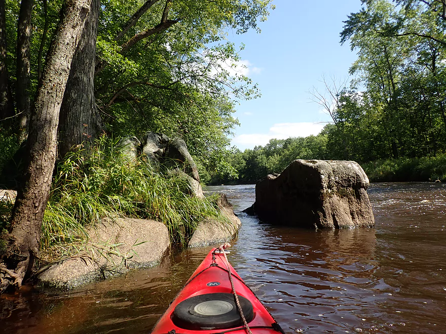
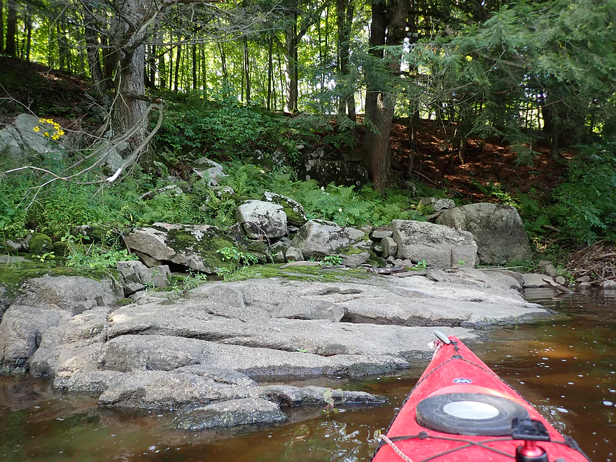
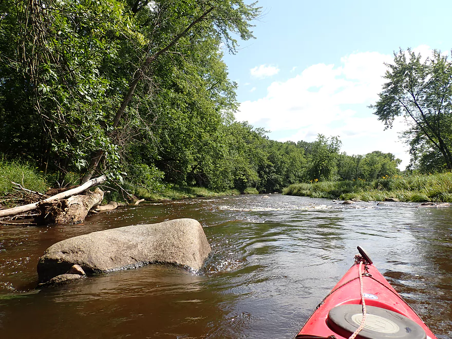
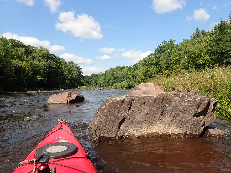
Nice outcrop on the Popple
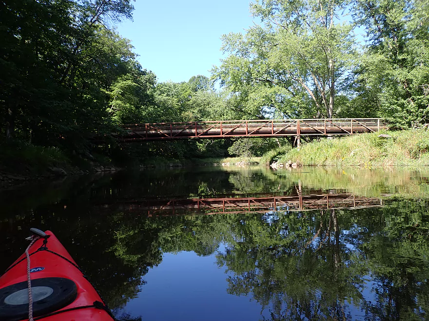
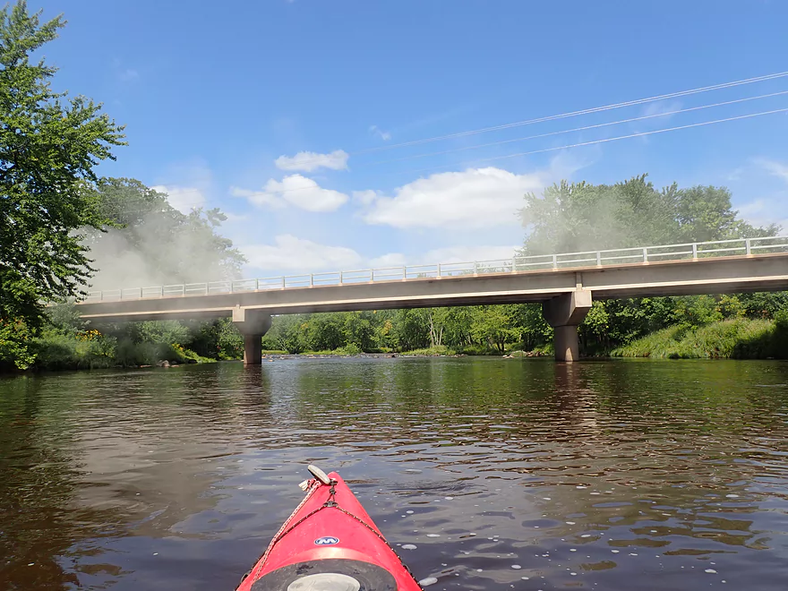
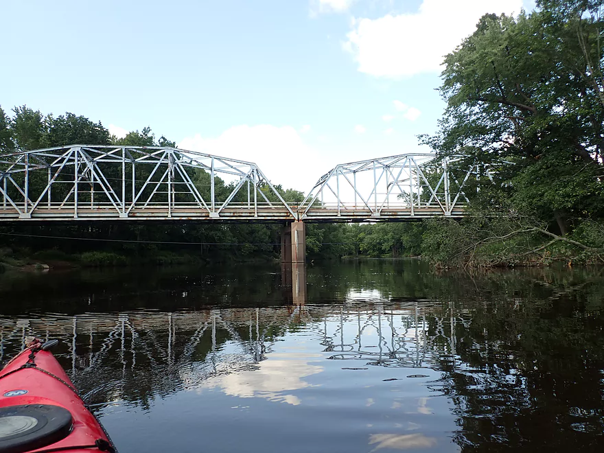
Trail bridge
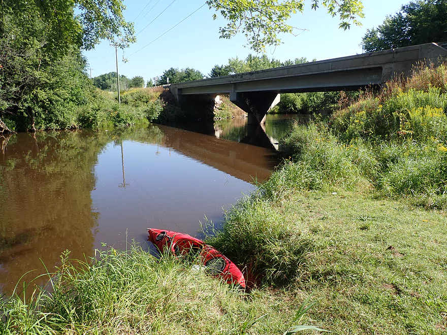
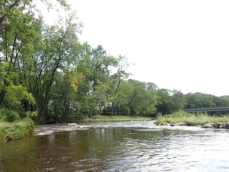
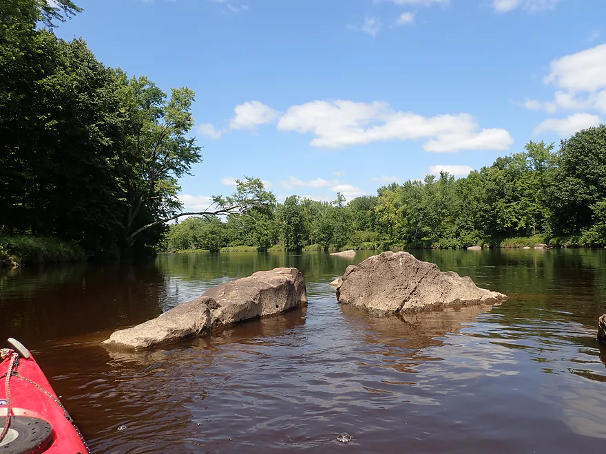
The Popple (right) meets the Black River (left)
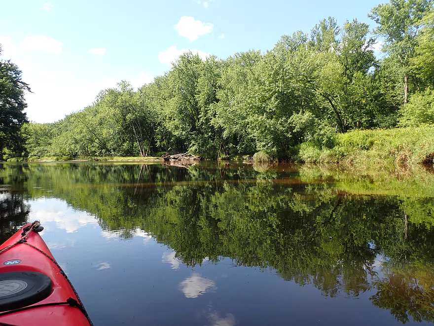
Little wind = great reflections
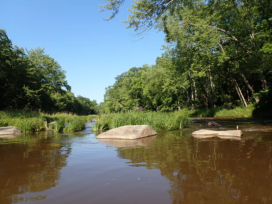
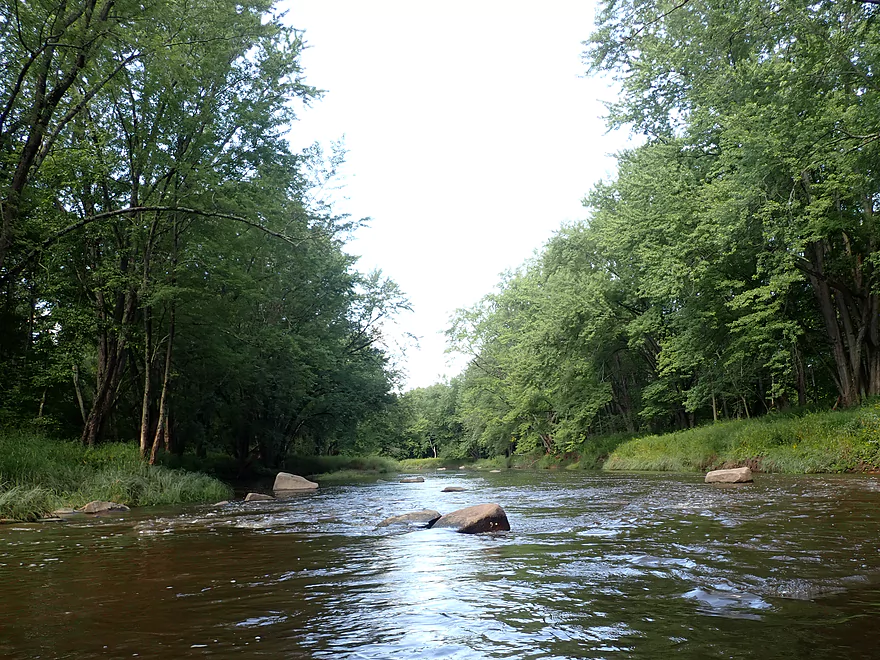
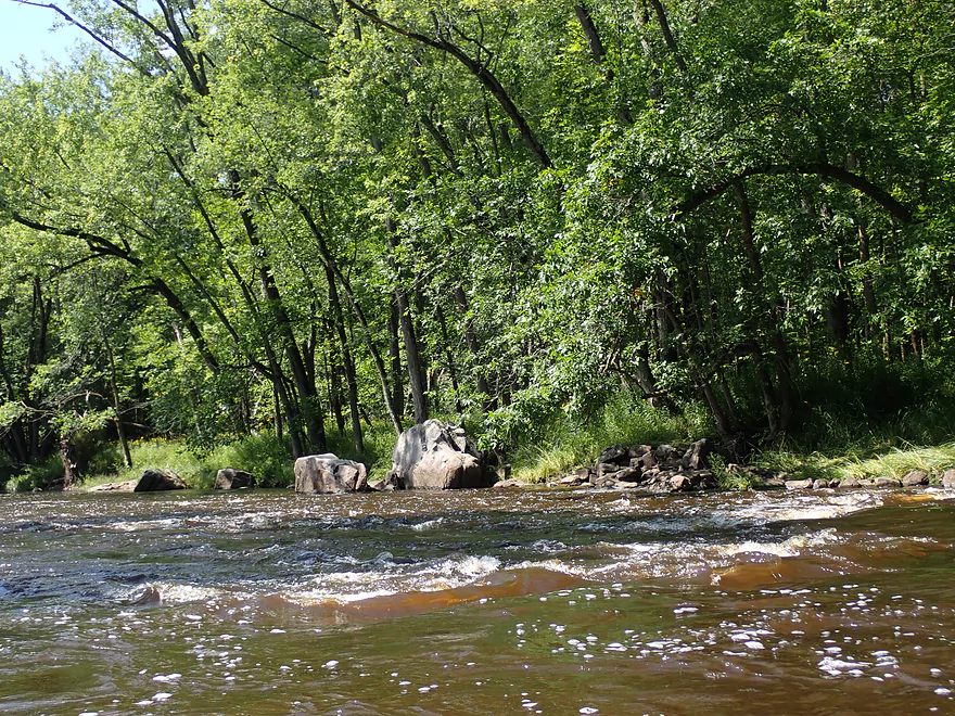
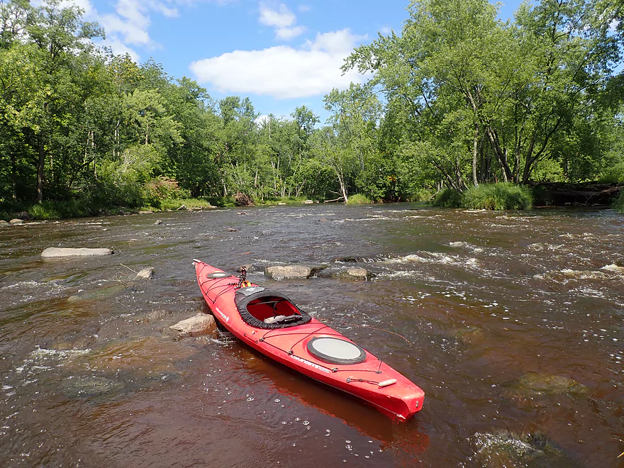
Some minor rapids
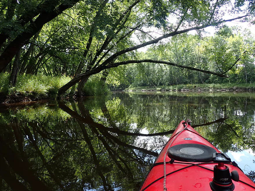
Scenic side channel
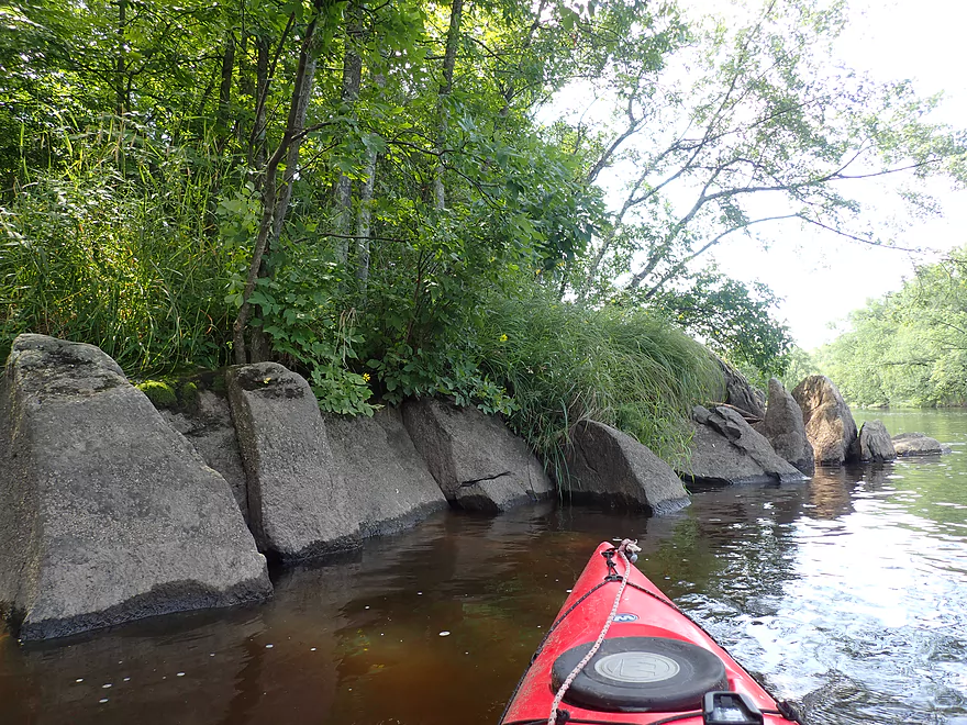
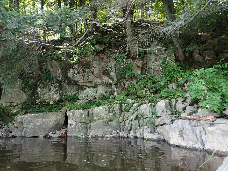
Small outcrops on the Black
These are all granite
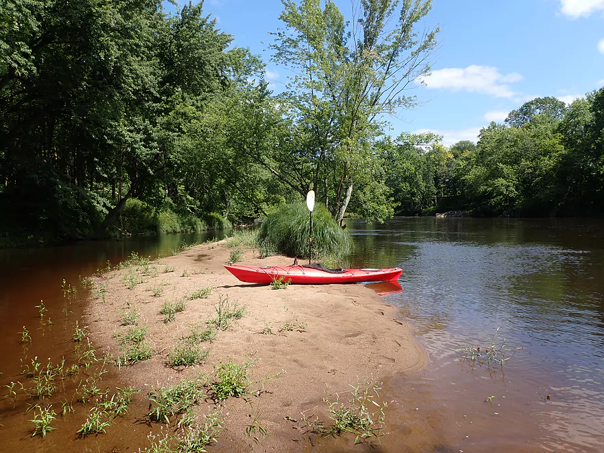
Only sandbar of the trip
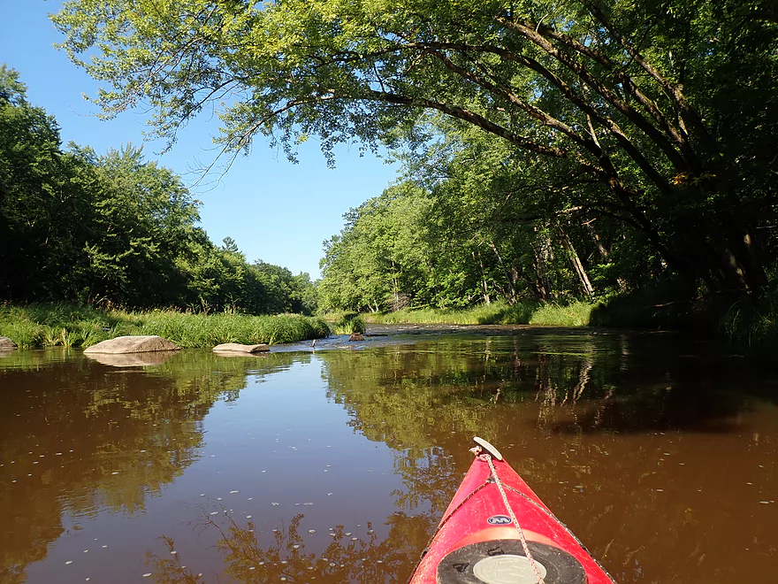
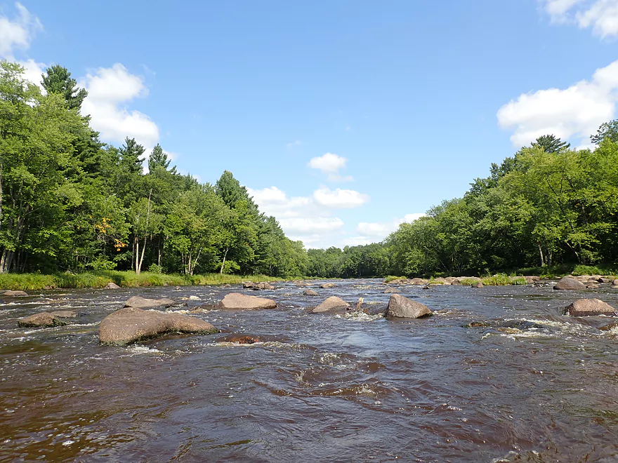
Nice stretch
Reverse view
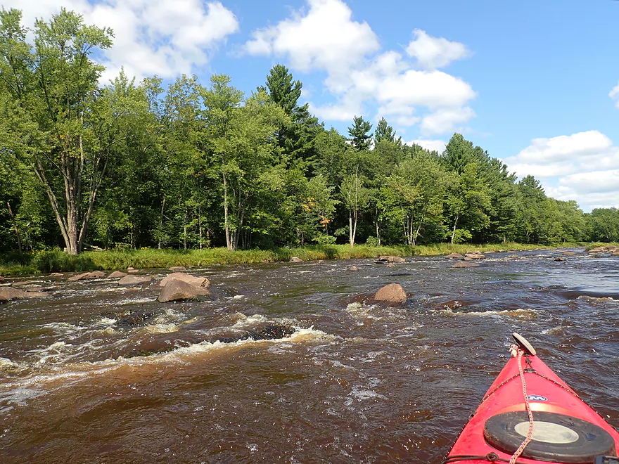
Another nice pitch
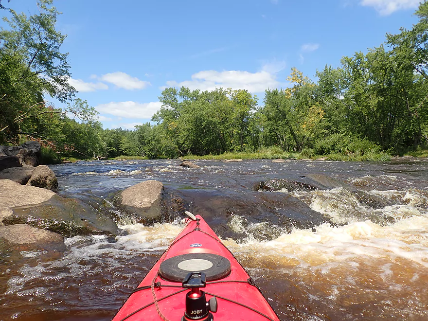
Coming up on Hemlock Rapids
Reverse view
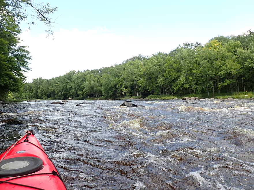
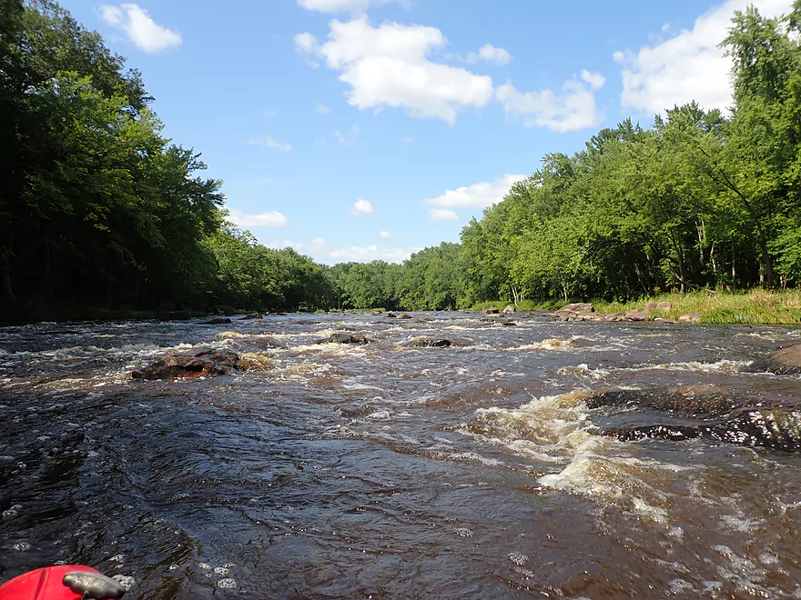
These were Class 3–lots of fun!
Warner Drive is a very dusty road
More Class 1 rapids
Exposed bedrock
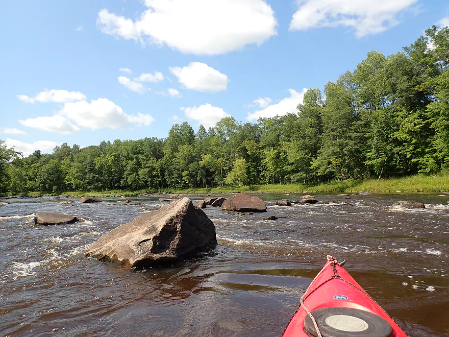
A really cool outcrop
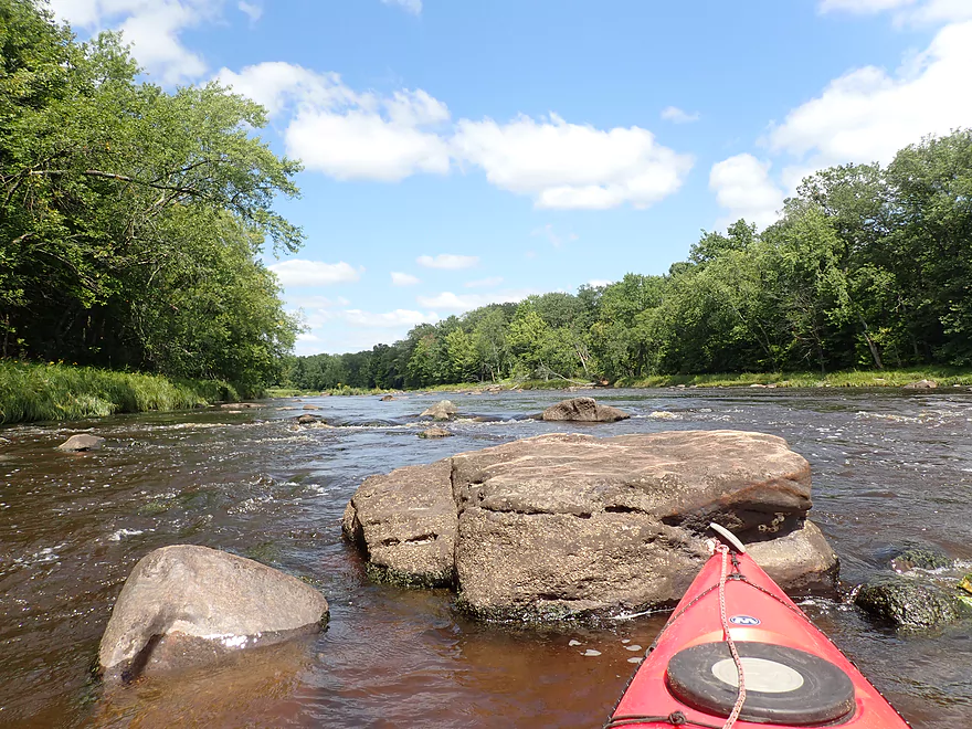
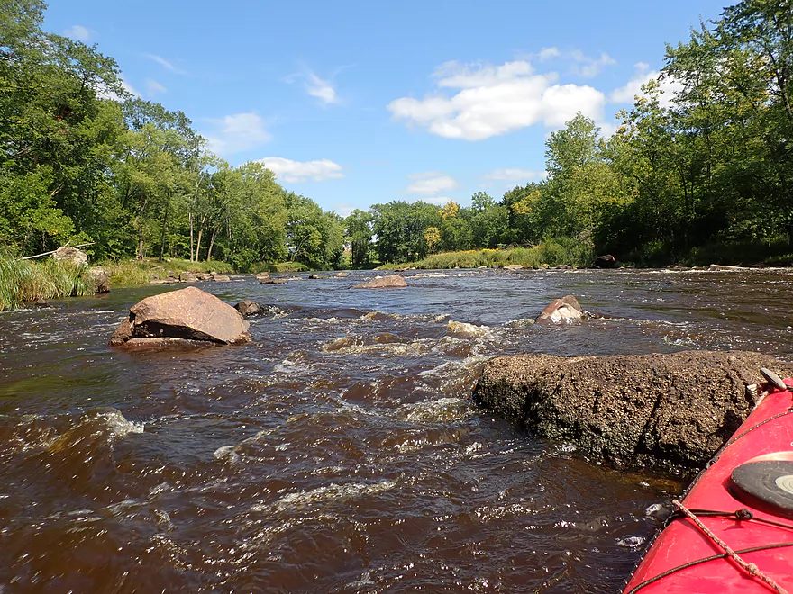
Coming up on Giles Rapids
This contains 3 pitches of Class 2 rapids
Pretty easy and scenic
Last of the major rapids
Exploring a side channel
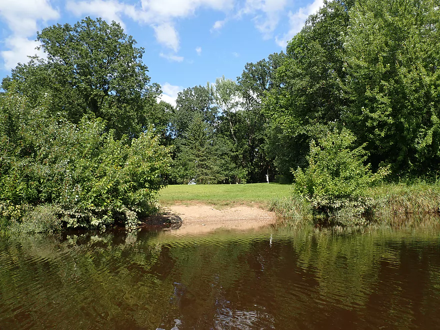
Greenwood County Park is an access option
More mirror shots
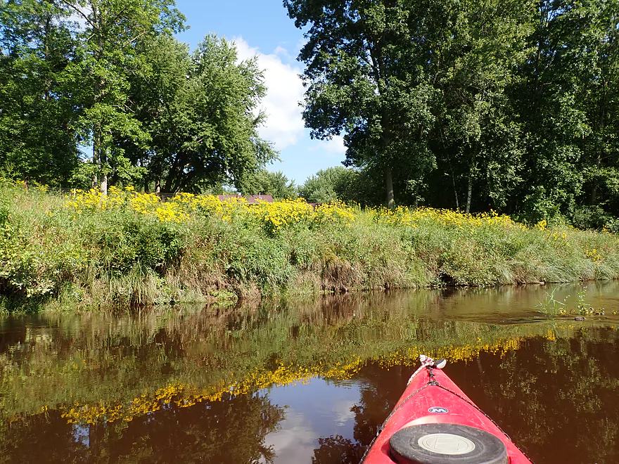
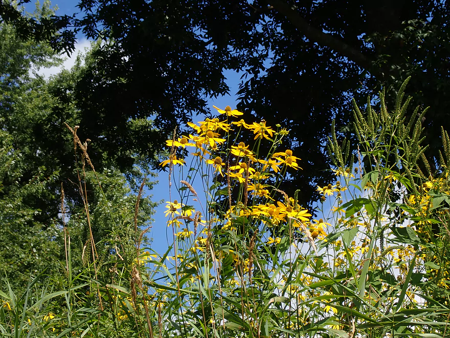
August is a great time for streamside wildflowers
Last of the rapids
Begley Street
Take-out is located just downstream from the bridge
Black River – Wayside Park

The Black is my favorite paddling river in the state and it’s always a treat to return for another leg. For this year’s trip, I wanted to paddle the furthest upstream I’ve ever gone (up by Greenwood) and at the same time include parts of the Popple River.
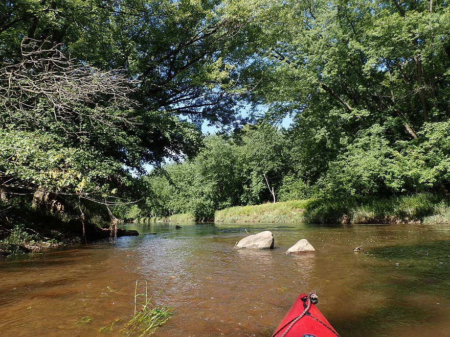
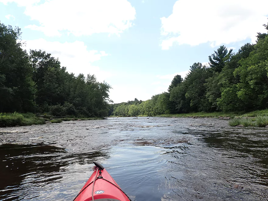
I started the trip at Wayside Park, which is a nice park and a good access option. It was here I ended a 2017 trip on the Popple River. The first half mile of the Popple was fast and contained a number of rapids. Most were easy, but the Popple is rocky and not super large. Sometimes fitting through the rocks wasn’t easy and I did have to do some “bouncing”. The best rapids were located at a sharp south-facing bend in the river, but these weren’t too bad. I’m glad I didn’t run the lower Popple at lower levels. I did my previous Popple trip at 301 CFS (Neillsville gauge) and was shocked how much higher the river was now at 500 CFS. Despite this, the Lower Popple rapids didn’t have much padding.
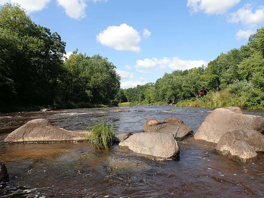
The second half of my short Popple trip was mostly slow and less interesting. I soon reached the mouth on the Black River. There was an interesting contrast between the two rivers at the confluence. The Upper Black is definitely cleaner yet significantly darker. The Popple was actually also wider (at the confluence), yet the Black has the higher volume because of its faster current. The mouth is a significant point on the Upper Black. Upstream from the Popple, rapids and boulders are relatively scarce, while below it they are quite common.
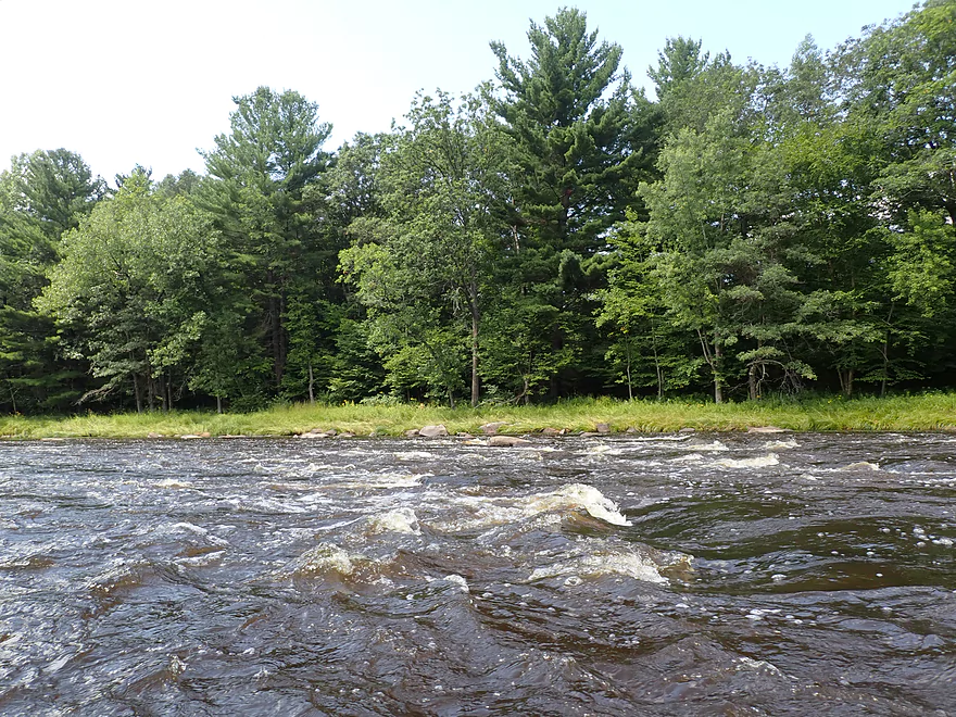
The one mile leg from the mouth to Warner Drive was definitely slower and less interesting, despite a few Class 1 rapids. I actually thought to myself that this might be the first Upper Black trip I do that doesn’t get five stars. The highlight of the first mile is “Hemlock Rapids” which is a Class 3 pitch located just upstream from the Warner Drive bridge. These were a lot of fun but should be treated carefully.
You could launch from the Warner Drive bridge (an apparent access option was located on the west end), but it was a dusty gravel road. Every time a vehicle went over the bridge, big dust clouds kicked up over the bridge and settled into the river. For bike shuttlers it’s bad enough biking over large gravel, but then you have to contend with dirt/dust getting into the chains which can be difficult to clean out.
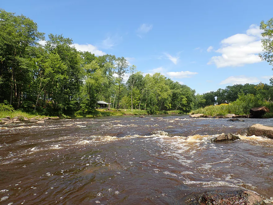
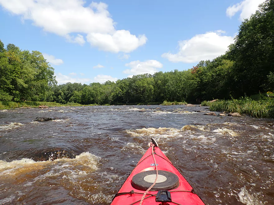
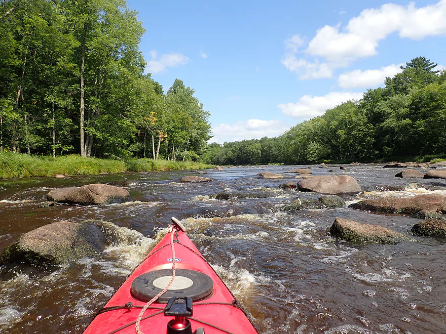
The next 3.4 miles (Warner Drive to Greenwood Park) was a lot of fun and included over 17 Class 1 rapids and 3 Class 2’s! There were also a few small but nice rock outcrops along the shore. The highlight of this stretch is Giles Rapids, located just downstream from Giles Creek. This was a series of 3 pitches which while some sources considered Class 2, but I didn’t think were too bad. Much of this trip (like much of the Upper Black) was almost straight south into the blinding sun. Often to see (and photograph) the best vistas I would have to turn around to look behind me. Most land in Clark County is farmland, so it was nice on this trip to see much of the shoreline wooded and undeveloped.
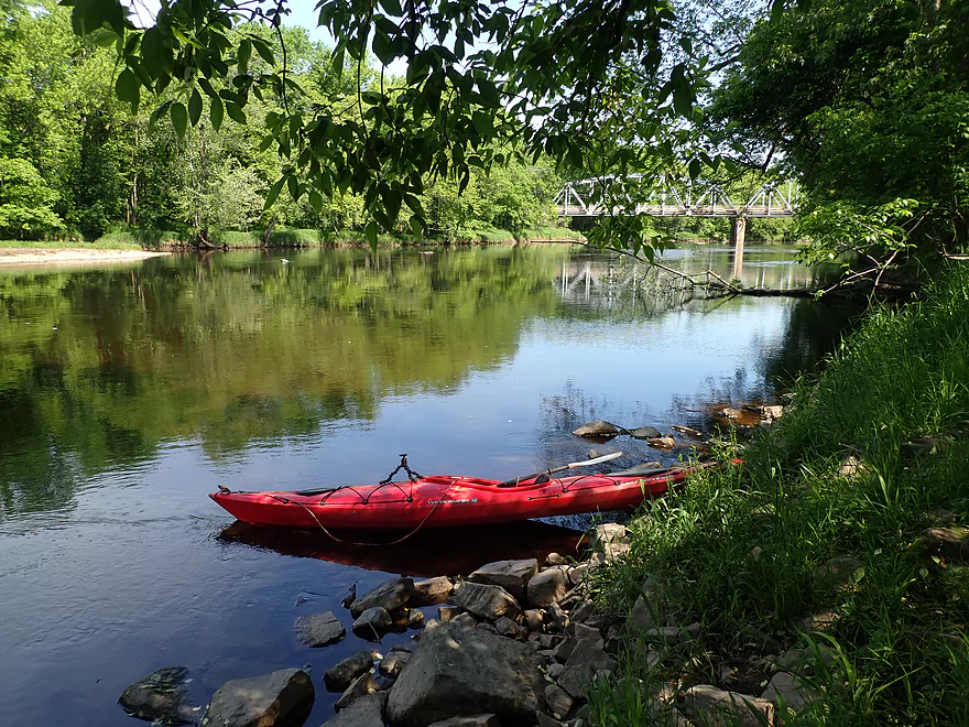
The last mile (Greenwood Park to Reese Ave) was slower and less interesting with just a few rapids. It was here I passed through the outskirts of the Greenwood community and under a scenic iron trestle bridge. I ended the trip at Reese Ave where there is a hidden and obscure canoe launch. It was here that you could barely hear the roar of Greenwood Rapids located a half mile downstream. Paddlers wanting to experience those could easily extend their trip.
In summary this was a trip that started slow and a bit disappointing, but it regained its anticipated five star status by the end because of the sheer number of rapids. This trip was done at slightly higher flows (500 CFS) than what I typically do. There are pros and cons to this. The pro was that the Black River rapids were terrifically padded, and other than a few spots (and the Popple River) getting over the pitches was fairly easy. On the downside the water was not as clean/clear as it typically is and some scenic boulder gardens were submerged and hidden because of the higher water. If you’re into camping, Greenwood Park might be a terrific option to consider as it has a landing at the south end.
Sights included a hawk, some clams, dragonflies, a softshell turtle, and ducks.
Wayside Park: This is a very nice public access.
Alternate Put-ins:
- Hwy N (5.2 miles upstream from Wayside Park): This would include the heart of the Popple River which while shallow and rocky, is scenic. You can read more about this stretch here.
- Longwood Park (7.5 miles upstream from Popple Mouth): This would not include the Popple River. The Black between Longwood and the Popple mouth is nice, but doesn’t include that many rapids.
- Warner Drive (~1 mile downstream from the Popple Mouth): This is a good access and I almost launched here, but didn’t as Warner Drive is a gravel road (I didn’t want dust on my bike chain), and I wouldn’t have been able to run Hemlock Rapids.
Reese Ave: This is the main launch in Greenwood and is located west of Reese Ave and south of the Hwy G bridge. A somewhat hidden 390′ public trail leads to the water. This is a decent launch option, but there is poison ivy in a few spots. You should be fine to park on the Reese Ave shoulder.
Alternate Take-outs:
- Greenwood County Park (1 mile upstream from Reese Ave): This isn’t a bad access and I could see many paddlers using this instead of Reese Ave. The actual launch is a bit hidden and located at the far southwest edge of the mowed area in the park. The downside to this access, you would have to drag your boat 280′ up a grassy hill to reach the parking lot.
- Sladich Road (0.8 miles downstream from Reese Ave): This is a simple wayside access, but might be a very good option for paddlers as this would allow you to run Greenwood Rapids. These are scenic and fun (but also Class 3 so you should know what you’re doing).
- Willard Road (2.4 miles downstream from Reese Ave). This is a nice public access. The river upstream from this spot isn’t super interesting, but does include a 400′ stretch of Class 1 rapids.
Reese Ave to Wayside Park: 5.0 miles with 82′ of ascent. This is a straight forward, but relatively hilly bike shuttle. If you’re in shape, you should be fine. At 5 miles, you could also just walk the hills. This entire route is paved, which for this part of the state is a big deal. As a general rule roads east of the Upper Black tend to be paved, while those to the west tend to be gravel.
Logjams: None.
Current: This is a pool and riffle river…long slow stretches interrupted by multiple rapids.
Wind: Much of this river is in the open so be mindful of the forecasted wind speed/direction.
Rapids: By my count there were 30 Class 1’s, 4 Class 2’s, and 1 Class 3. See my video and trip map for locations of rapids and more detailed information.
The first half mile of the Popple River has a number of Class 1’s and a Class 2 where the river takes a sharp turn south. These are mostly not bad, but because the river isn’t super wide it can be sometimes tricky to fit through the rocks.
From the Popple River mouth to Warner Drive there were four Class 1’s that were mostly pretty easy. The exception was “Hemlock Rapids” which is a Class 3 located just upstream from Warner Drive. This is easy to scout from the Warner Drive bridge prior to a trip. Portaging it would not be difficult.
This final stretch contains many Class 1’s. Giles Rapids per other sources is a Class 2, but is not super difficult.
Neillsville Gauge on the Black River: 500 CFS or 4.2′.
Often the Upper Black is too low or too high for safe paddling…so make sure to carefully monitor the Neillsville gauge.
- 0-100 CFS: Too shallow (unless you are ok with wading most of the rapids).
- 101-200 CFS: Likely too shallow.
- 201-300 CFS: On the low end, but IMO doable for shallow-drafting kayaks.
- 301-405 CFS: Some bumps here and there but mostly not bad. A good target range for rec paddlers.
- 451-550 CFS: All rapids should have good padding at this level, but a few could start to get pushy.
- 551-750 CFS: Rapids will be much stronger, pushier and less forgiving. You should know what you’re doing before going out at this depth. Also many of the scenic boulder gardens will be submerged at this depth.
- 751-1200 CFS: Perhaps only suitable for whitewater paddlers.
- 1201+ CFS: Definitely only appropriate for expert whitewater paddlers.
Quick Overview
Black River:
- Upstream of Hwy 73: Obscure sections of the Black with little known about them. Some legs will have logjam issues.
- Hwy 73 to Lake Arbutus: 48 miles. Good legs with a mix of rapids, boulder gardens and undeveloped banks. Only reason these legs don't receive more paddling traffic is because they're located away from population centers.
- Lake Arbutus: 3 miles. A scenic but challenging lake because of the waves.
- Hatfield Dam to Halls Creek Landing: 7 miles. Some of the best and most fun whitewater on the Black River.
- Halls Creek Landing to Black River Falls Dam: 6 miles. An impounded part of the river, but nice with cool cliffs.
- Black River Falls Dam to North Bend: 37 miles. This is the heart of the Lower Black and sees the most paddling traffic. No major rapids, but there are many scenic cliffs and creek inlets.
- North Bend to Mouth: 30 miles. This is the second half of the Lower Black. While not as scenic, there are still cool sandbars and sandbanks. Few paddle these stretches.
Noteworthy Tributaries:
- Robinson Creek: One of the best paddles in all of Wisconsin.
- Halls Creek: Also one of the best and with amazing sandstone walls.
- Morrison Creek: Very scenic creek with some fun whitewater.
- Wedges Creek: Great paddle with amazing boulder gardens.
- East Fork of the Black River: Some fun riffles and unique granite geology.
- Perry Creek: Shallow but a super scenic creek.
- Dickey Creek: A wonderfully scenic creek with fantastic sandstone…but too many logjams.
- Beaver Creek: Some fun rapids and amazing sandstone in Galesville, but logjams on the downstream portions.
- Popple River: A shallow whitewater river that is very nice.
- Arnold Creek: A pleasant tributary to Lake Arbutus with really nice reflections.
- Rock Creek: Many scenic boulder gardens, but usually this creek is too shallow to run.
- Roaring Creek: Very scenic creek with a great waterfall at the mouth, but might be a challenge to paddle.
- Vismal Creek: Super scenic but has a lot of logjams and is shallow. Requires very high water conditions.
- Plus countless small creeks that are too small to paddle but quite fun to explore by foot. If you know of viable paddling options, let me know! Am very curious to know more about Douglas Creek, Levis Creek, O’Neal Creek, and Crawley Creek.
Detailed Overview
Headwaters to Neillsville:
- Upstream of Division Drive: Likely too many logjams to be navigable.
- Division Drive to Sawyer Ave: (6.5 miles) Rocky and a few light rapids. Maybe 4 logjams.
- Sawyer Ave to Hwy 64: (2.5 miles) Rocky and a few light rapids.
- Hwy 64 to Bridge Road: (14.4 miles) Solid prospect reviewed by Mike Svob. Some Class 1 rapids and nice gravel bars. Intermediate access points at Bahnkes Ave and Hwy AT.
- Bridge Road to Hwy X: (6.0 miles) Little is known of this section…likely pretty simple.
- Hwy X to Colby Factory Road: (6.0 miles) Little is known about this section…likely some rapids and outcrops. Intermediate alt access points at Hwy 29 and Hwy N.
- Colby Factory Road to Popple River Mouth: (7.9 miles) This stretch has far fewer rapids than downstream legs with only a few minor rapids. It should still be pleasant though.
- Popple River Mouth to Reese Ave: (5.3 miles)
- Popple River Mouth to Warner Drive: (1.0 miles) This is a slower and less interesting stretch, but does include 4 Class 1's and scenic Hemlock Rapids which are Class 3.
- Warner Drive to Greenwood Park: (3.4 miles) A good leg with many rapids (3 Class 2's and 17 Class 1's).
- Greenwood Park to Reese Ave: (0.9 miles) A slower stretch with just 2 Class 1's. Part of this passes through the community of Greenwood.
- Reese Ave to Twenty Six Rd: (5.1 miles)
- Reese Ave to Sladich Rd: (0.7 miles) A mostly nondescript wooded stretch. The exception is Greenwood Rapids where an island splits the river. The right side is scenic, but the left side has fun Class 3 rapids.
- Sladich Rd to Willard Rd: (1.6 miles) A somewhat slow and relatively uninteresting leg. Highlights include one nice outcrop, a few gravel bars and a 400' stretch of Class 1 rapids.
- Willard Rd to Twenty Six Rd: (2.8 miles) A great leg with 10 Class 1's and 2 Class 2's. Highlights also include scenic boulder gardens and a few outcrops.
- Twenty Six Road to Hwy H: (5.0 miles) Multiple Class 1 & 2 rapids.
- Hwy H to Grand Ave/Hill Road: (8.0 miles) A great trip with several Class 2 rapids and scenic granite outcrops.
Note, for more details on the Upper Black, I highly recommend “Indian Head Rivers” by Michael Duncanson.
Alternate Black River Trips – Neillsville to Black River Falls:
- Grand Ave/Hill Road to Opelt Road Landing: (6.7 miles)
- Grand Ave/Hill Road to Hwy 10: (2.2 miles) Nice section with a handful of rapids. These are mostly Class 1 at lower depths, but strengthen to Class 2 during high flow rates.
- Hwy 10 to River Road Landing: (4.3 miles) Fantastic whitewater section. Maybe six Class 2’s and two class 3’s. Scenic boulder gardens and a few outcrops.
- Opelt Road Landing to Bryan Ave Bridge: (1.1 miles) Not sure there is anything special about this stretch.
- Opelt Ave Bridge to Hwy 95: (4.4 miles) Ok…nothing special.
- Hwy 95 to West Arbutus County Ramp/Hatfield Dam: (4.8 miles)
- Hwy 95 to North Arbutus Boat Landing: (2.4 miles) Includes a scenic gorge, boulder gardens and rapids including the Class 3 Red Granite Rapids. River slows after rapids.
- North Arbutus Boat Ramp to West Arbutus County Ramp: (2.4 miles) A large open water paddle on Lake Arbutus that can feature challenging waves on summer afternoons.
- Hatfield Dam to West/East Channel Confluence: 0.2 or 0.3 miles.
- West Dam to West/East Channel Confluence: 0.3 miles. There is a large boulder field and Class 2 rapids below the west dam. At the outlet of the west channel is a Class 4 drop. This is easy to scout and portage.
- East Dam to West/East Channel Confluence: 0.2 miles. Perhaps the most extraordinary rapids in the state with Class 4/5+ rapids. The action starts below the dam where steep granite banks narrow the river significantly and force it down deep chutes. The gorge starts with Class 2-3 rapids but ends with two significant drops. American Whitewater warns “between the dam and this point lie some serious drops which contain near inescapable boiling cauldrons at moderate to high flows”.
- Hatfield Dam Confluence/West Clay School Road to Powerhouse Road Landing: (3.1 miles)
- Hatfield Dam Confluence to Hwy K: (0.3 miles) One of the most scenic paddling areas in the state with massive granite outcrops. There is one set of Class 2 rapids.
- Hwy K to Powerhouse Road Landing: (2.8 miles) The first half mile by Hwy K is very scenic and contains one Class 3. The second mile is mostly flatwater. The third mile is almost continuous rapids and features one Class 3.
- Powerhouse Road Landing to Halls Creek Landing: (4.0 miles) Scenic section with a few Class 2 rapids and a steep ledge.
- Halls Creek Landing to Black River Falls Dam: (6.2 miles) Wonderful sandstone cliffs.
Alternate Black River Trips – Black River Falls to Mouth:
- Black River Falls Dam to Mason’s Landing: (4.7 miles) A great little section.
- Mason’s Landing to Irving Landing: (9 miles) A good section.
- Irving Landing to Lost Falls Campground (2.3 miles) A popular stretch. Highlights include a few small outcrops, two tiny waterfalls, several impressive sandbars, and one large sandbank. A side hike to Roaring Falls can be arranged. Note Lost Falls Campground is private and you must purchase a pass from them to use their access.
- Lost Falls Campground to Grinde Landing: (6.4 miles) A popular section with some nice outcrops and a waterfall by Roaring Creek. Wolf Creek may also have a cool slot canyon. The river splinters into multiple channels, some of which may be quite shallow in later summer. As of 2023, Grinde Landing is closed because somebody stole the owner's deer stand.
- Grinde Landing to Melrose Landing: (3.9 miles) A shorter section but with a really nice rock outcrop before Melrose Landing. As of 2023, Grinde Landing is closed because somebody stole the owner's deer stand.
- Melrose to North Bend: (10.1 miles) Likely the most popular stretch with the best sandbars on the river, three sets of outcrops, and a few waterfalls.
- North Bend to Hwy 53: (13.3 miles) Likely a nice paddle with sandbars, large sandbanks and maybe a few outcrops. Unfortunately it is very long.
- Hwy 53 to Hwy 35: (8 miles) A nice section with epic sand banks.
- Hwy 35 to Lytle Road: (4.0 miles) Goes through the Van Loon Floodplain Forest. This can be a shallow trip but features many nice sandbars.
- Lytle Road to Fred Funk Boat Landing (Mississippi): (5.0 miles) Multiple options because of the river delta.
Trip Map
Overview Map
Video
Photos Size: