
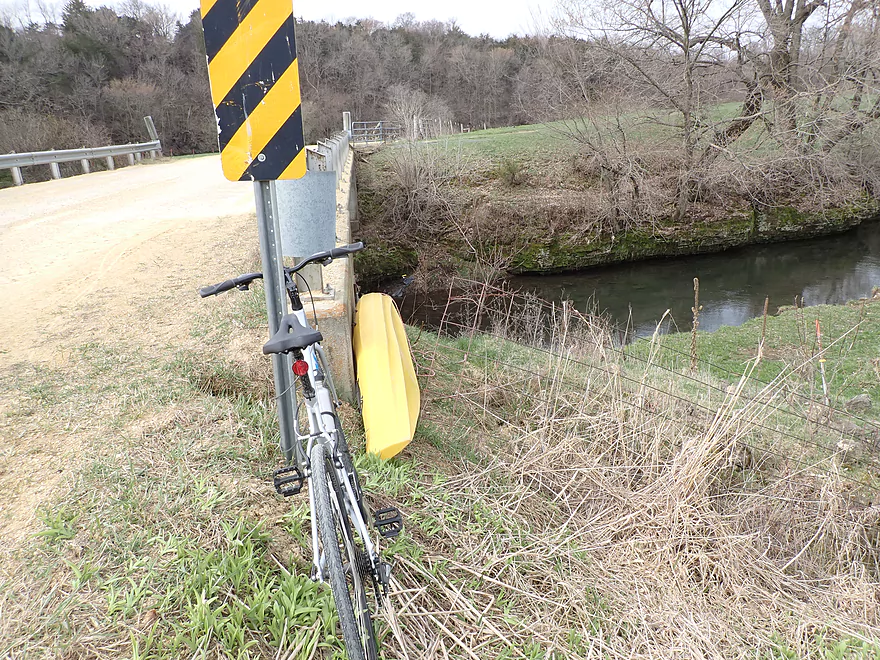
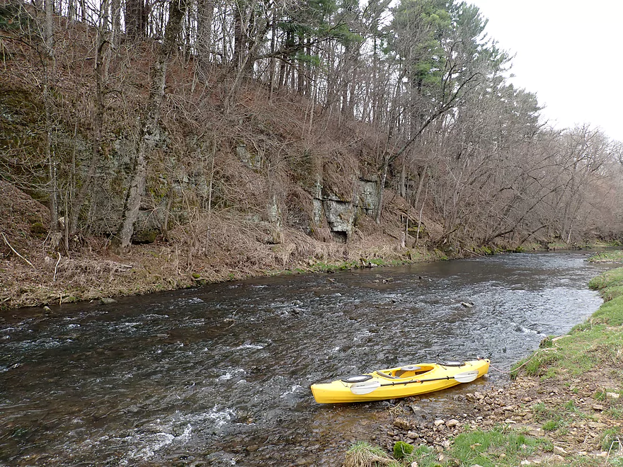
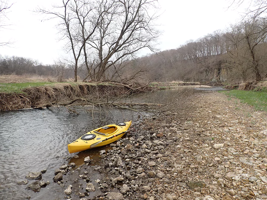
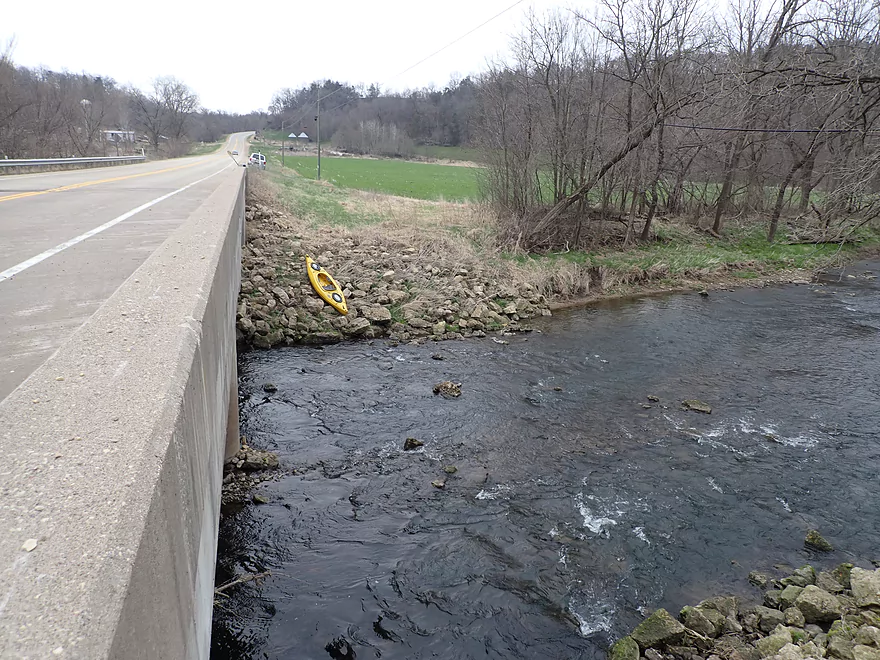
Starting the trip at Muscallounge Road (which has an annoying fence)
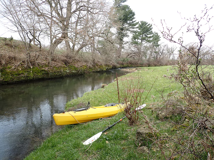
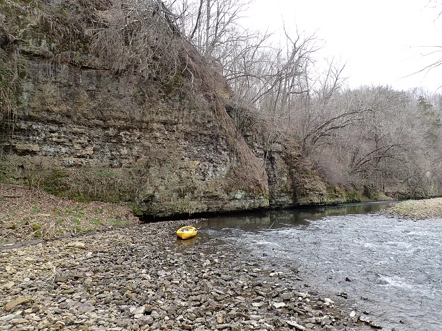
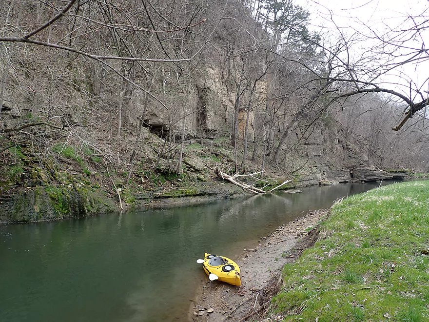
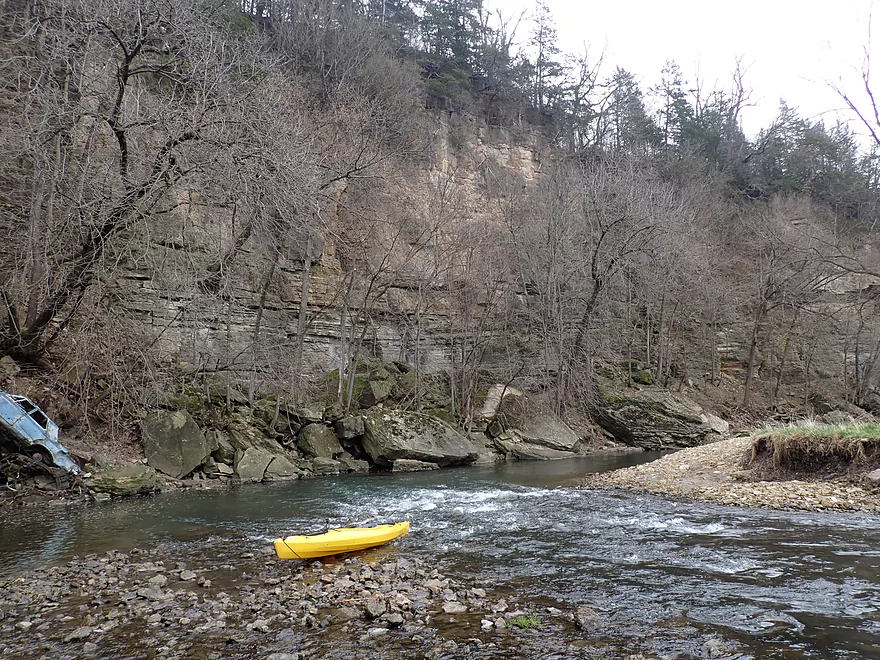
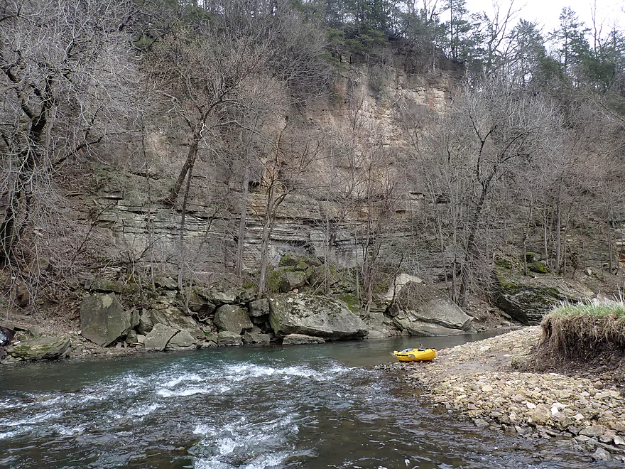
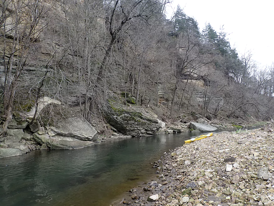
Nice launch area at the bottom
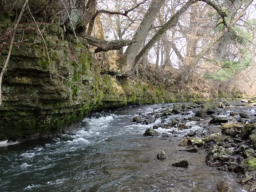
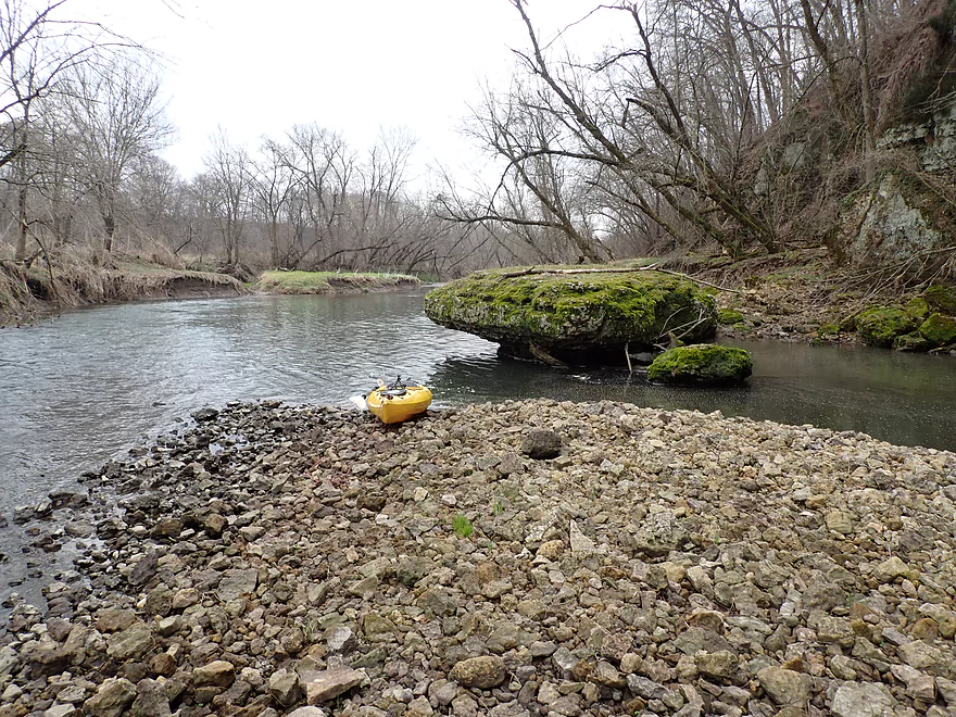
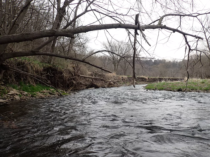
A limestone strainer upstream of the put-in
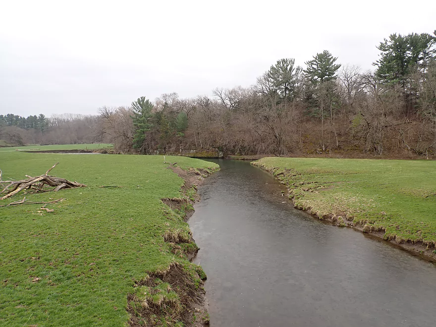
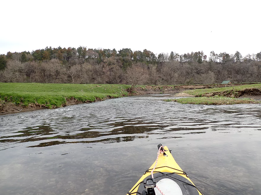
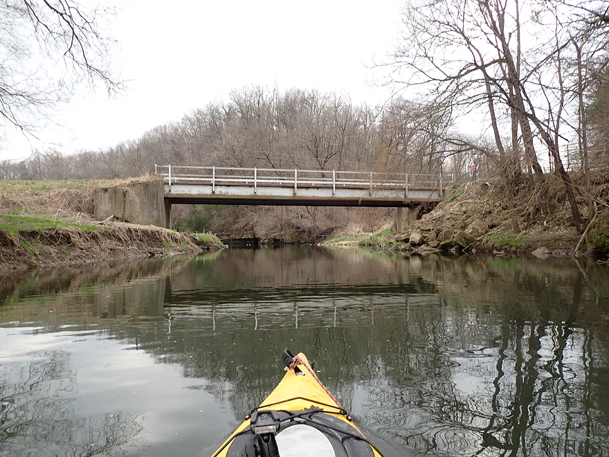
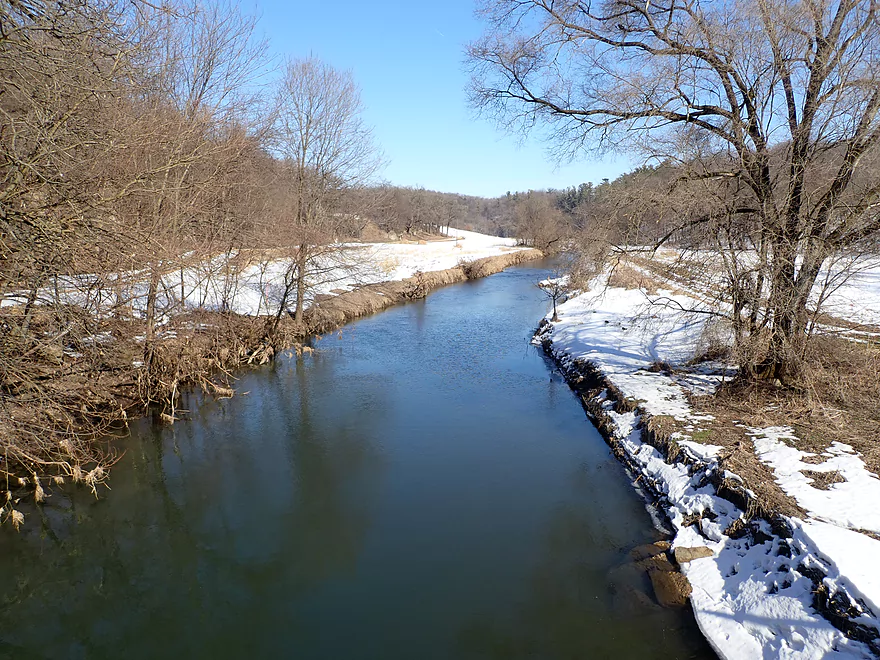
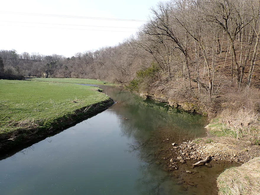
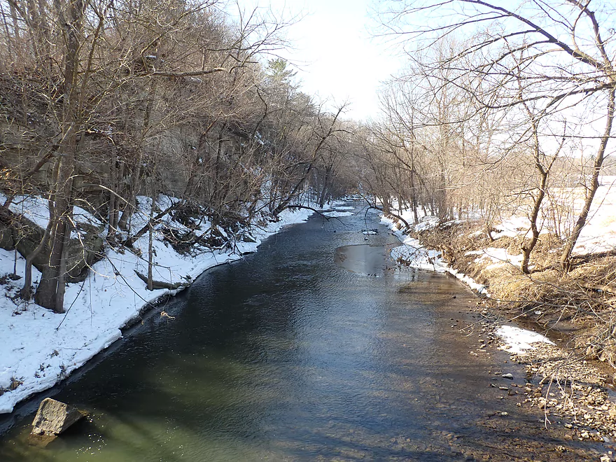
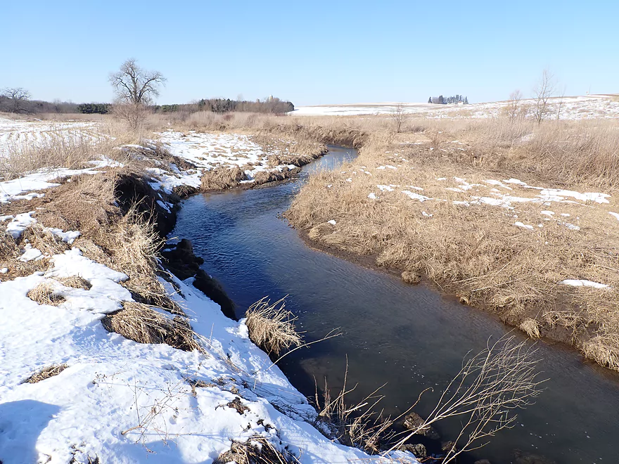
Downstream view from bridge
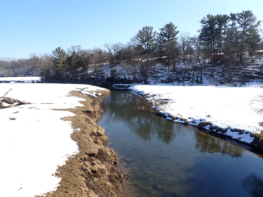
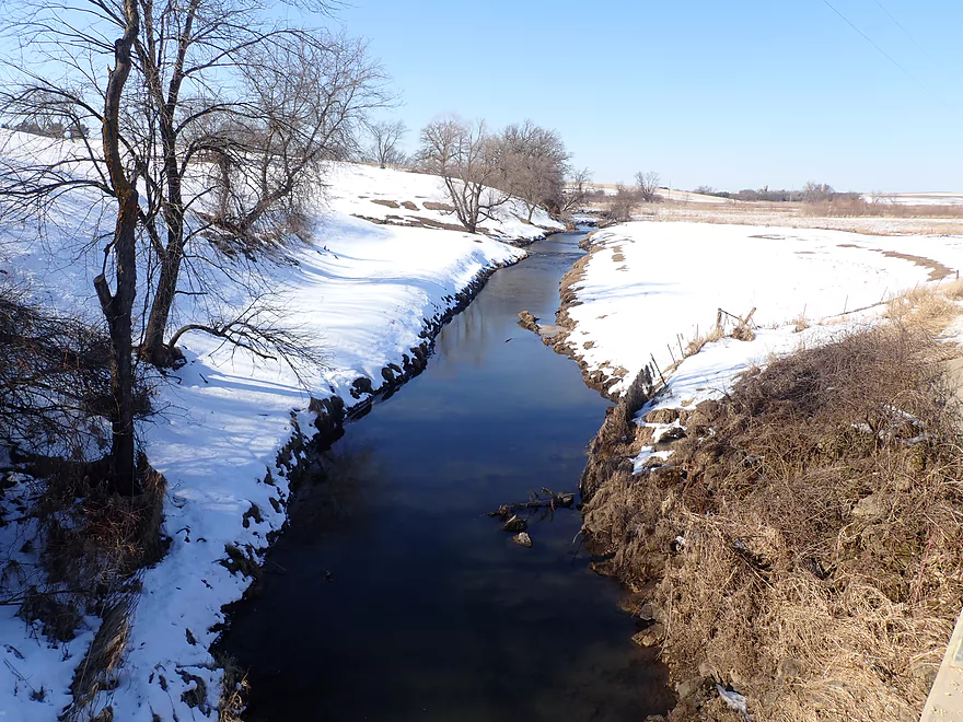
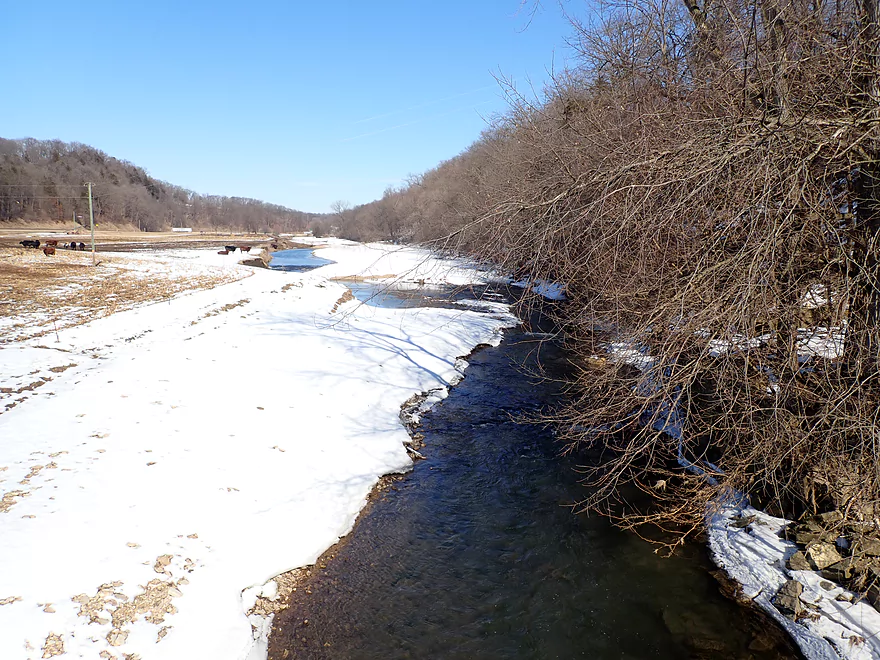
Same view…but winter
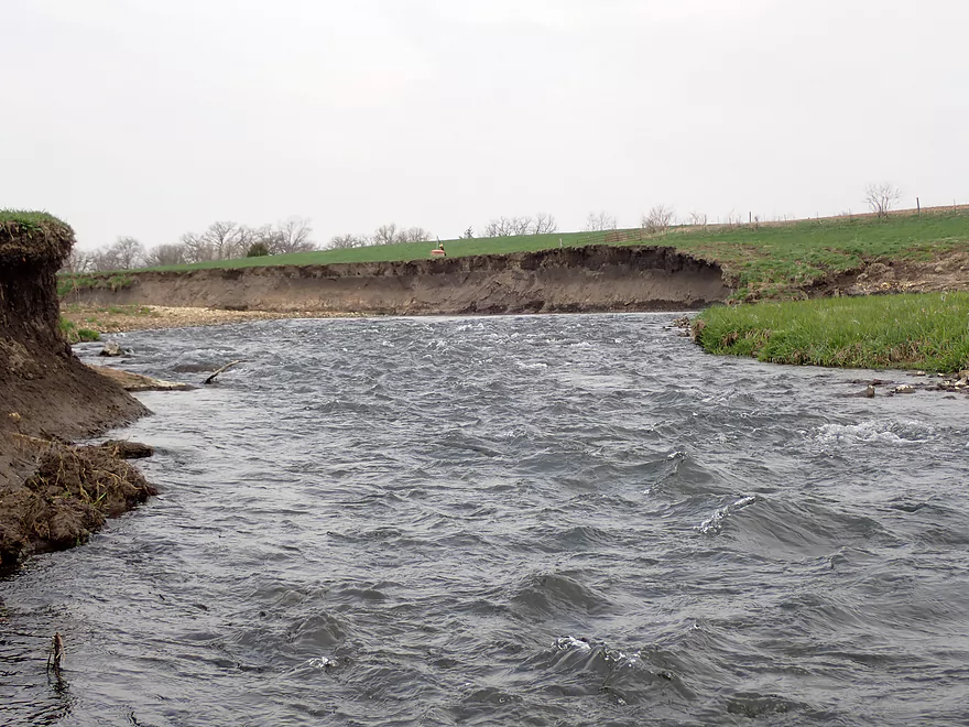
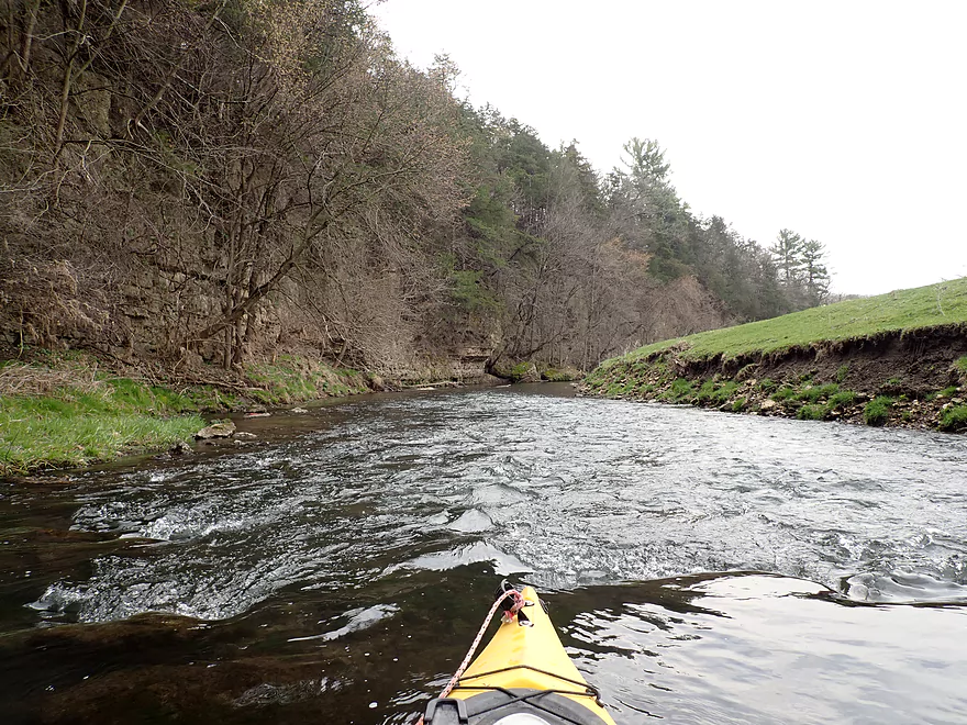
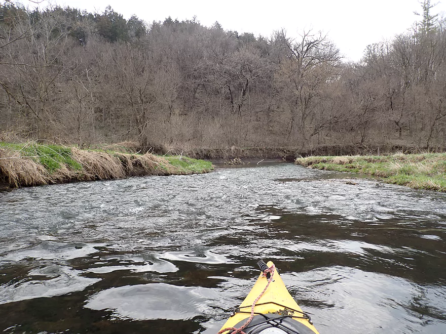
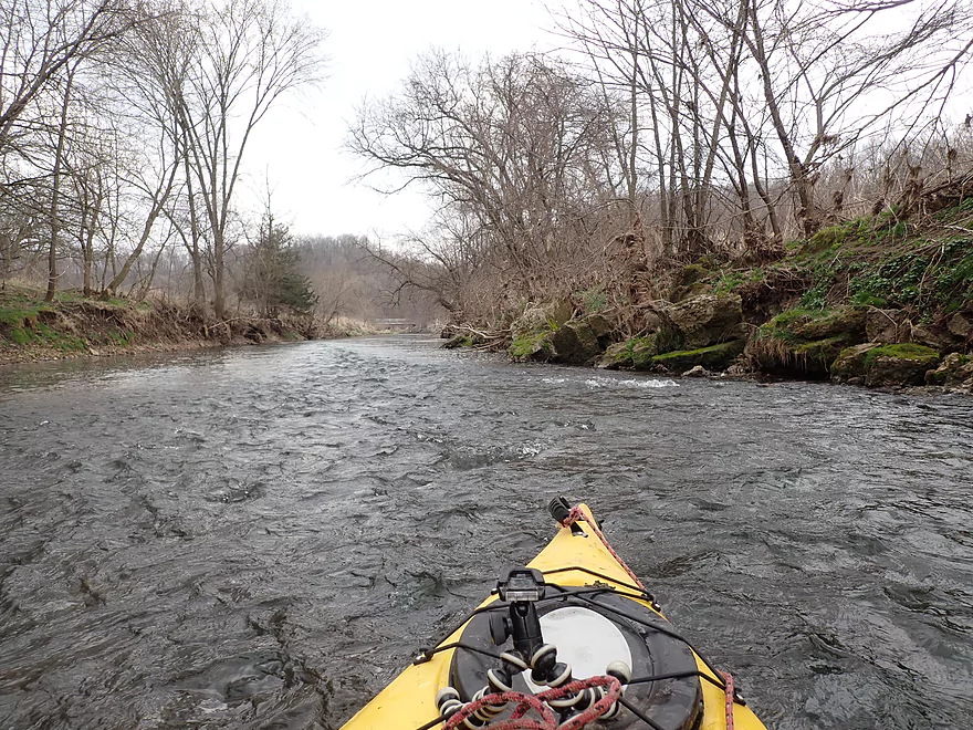
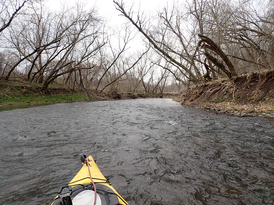
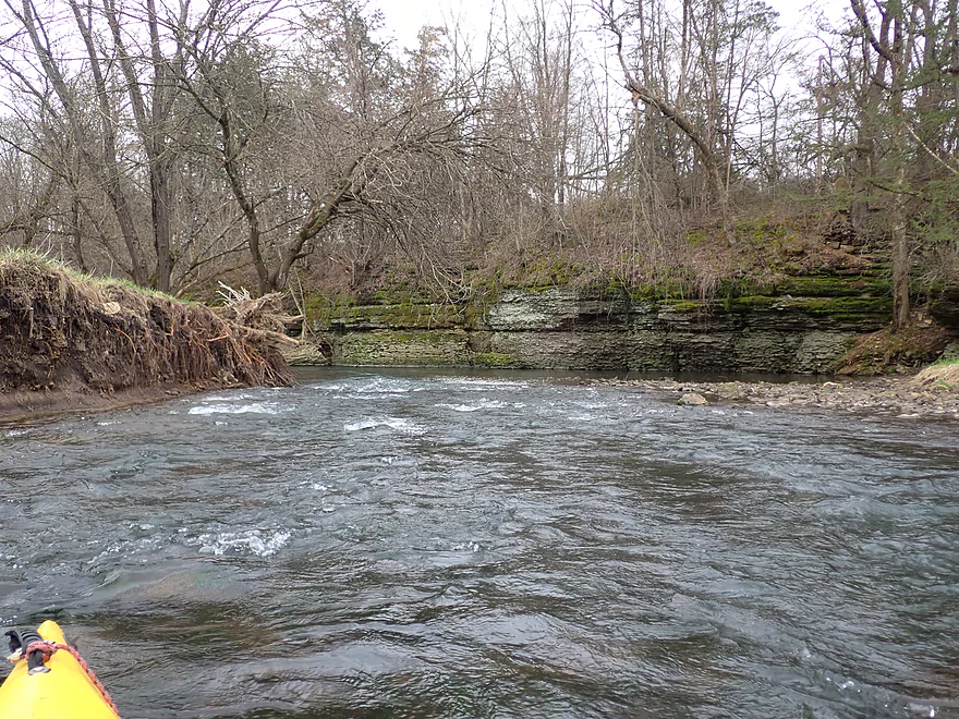
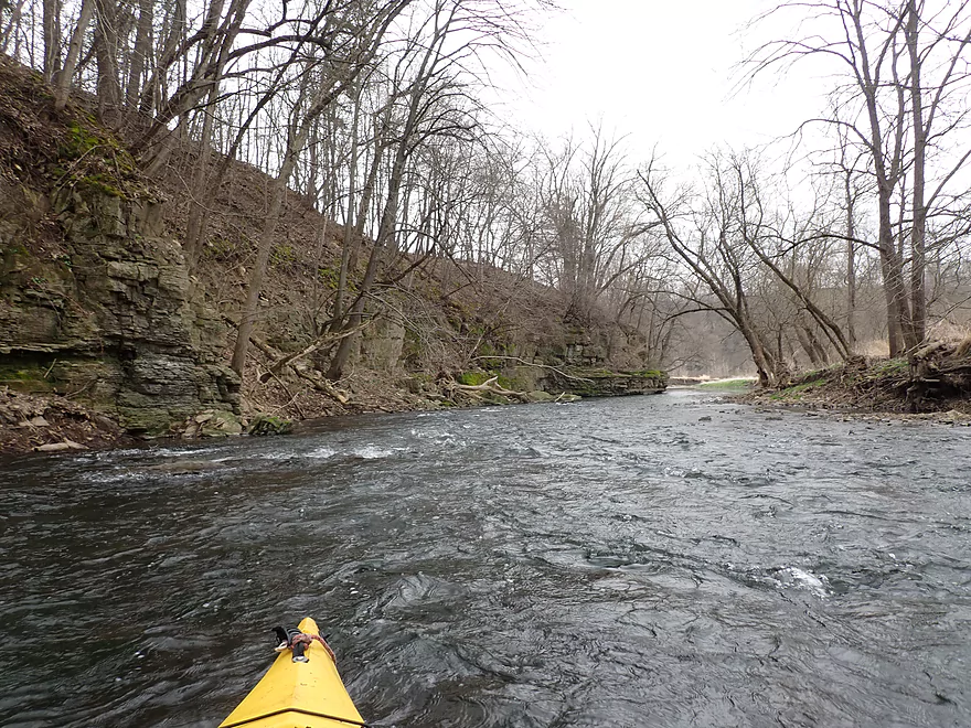
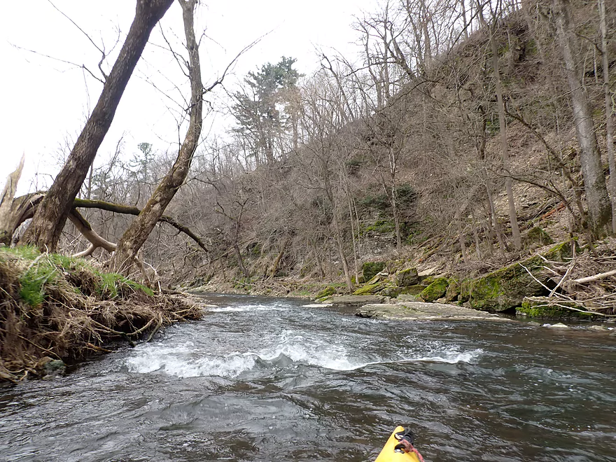
Lot of light rapids and eroded mud banks
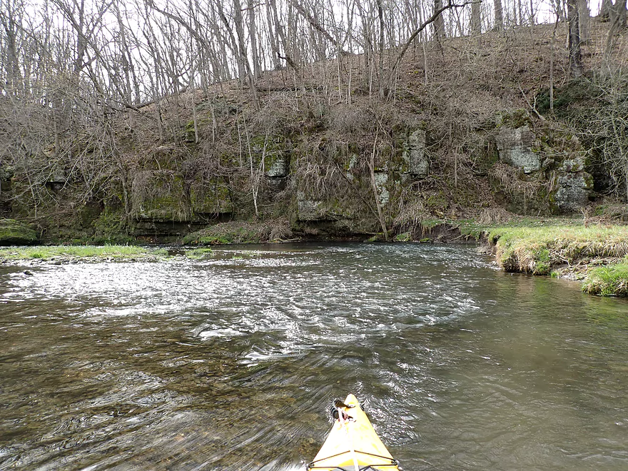
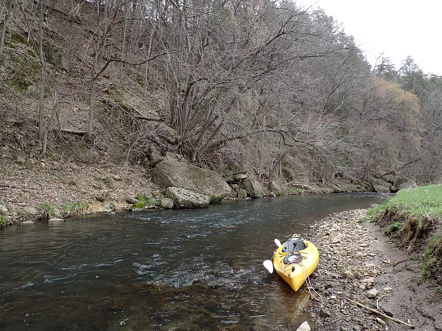
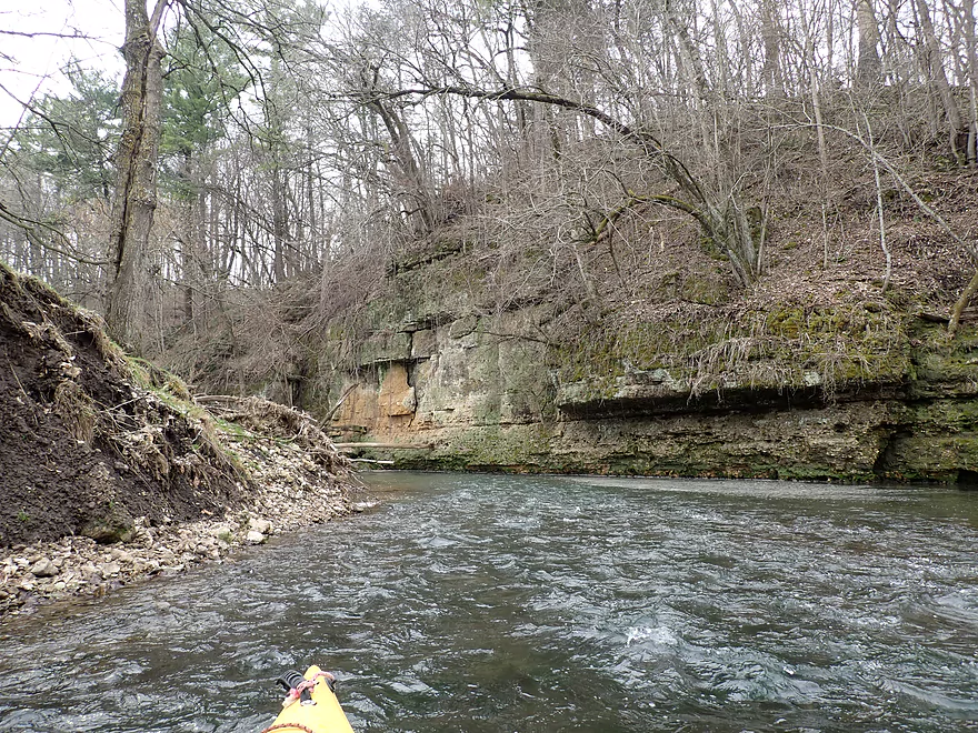
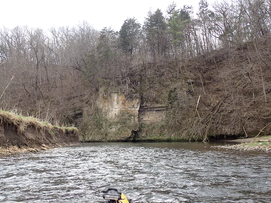
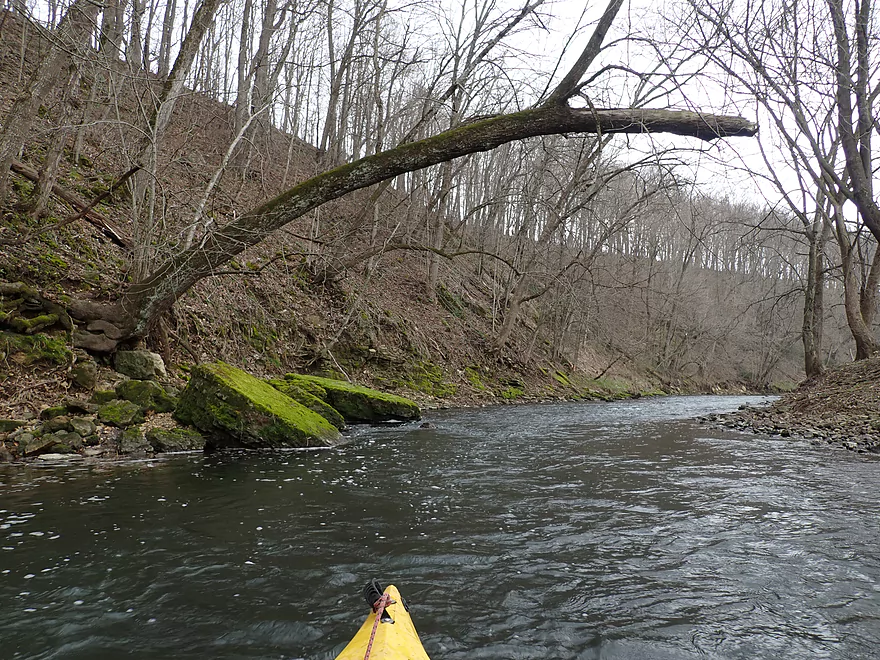
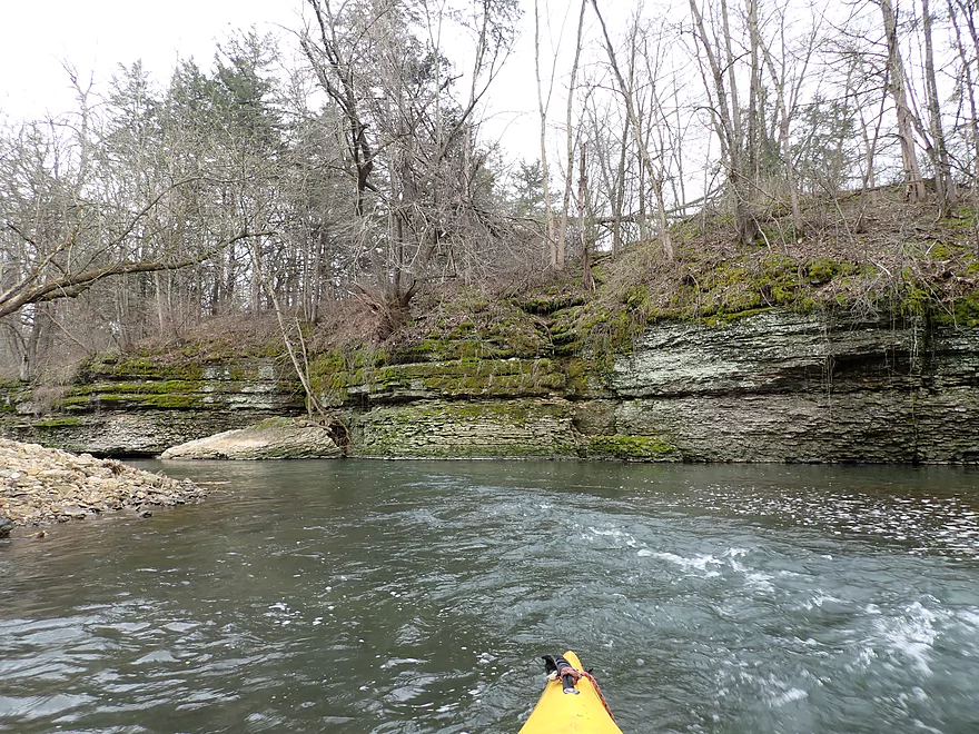
The first significant outcrop
Only fence of the trip…not super difficult to get under
Neat scene
Most of the lowland was pasture
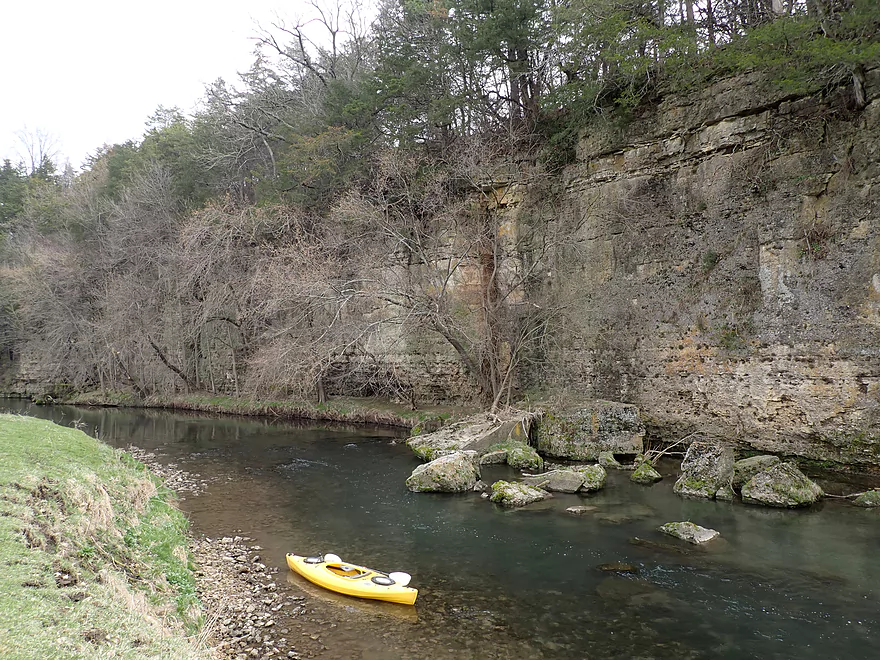
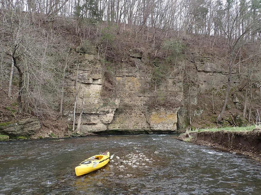
Second major bluff of the trip
Super photogenic
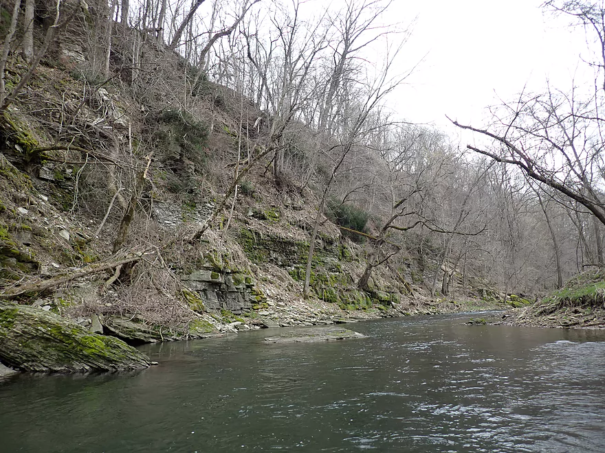
This bluff is about a third of a mile long
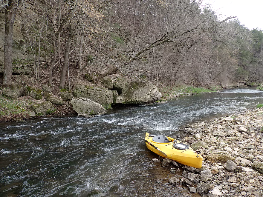
Cool cliff
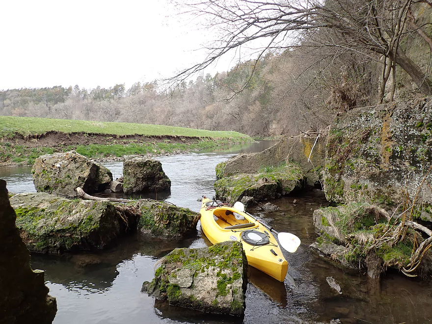
Boulders kind of reminded me of Snow Bottom SNA
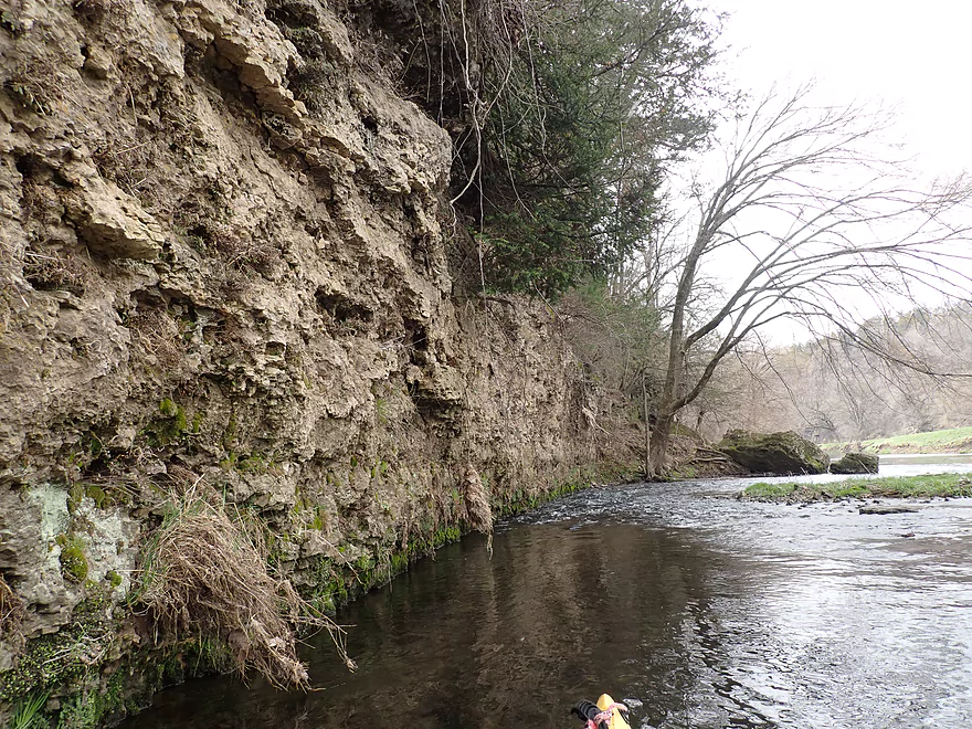
The deepest channel was often closest to the cliffs
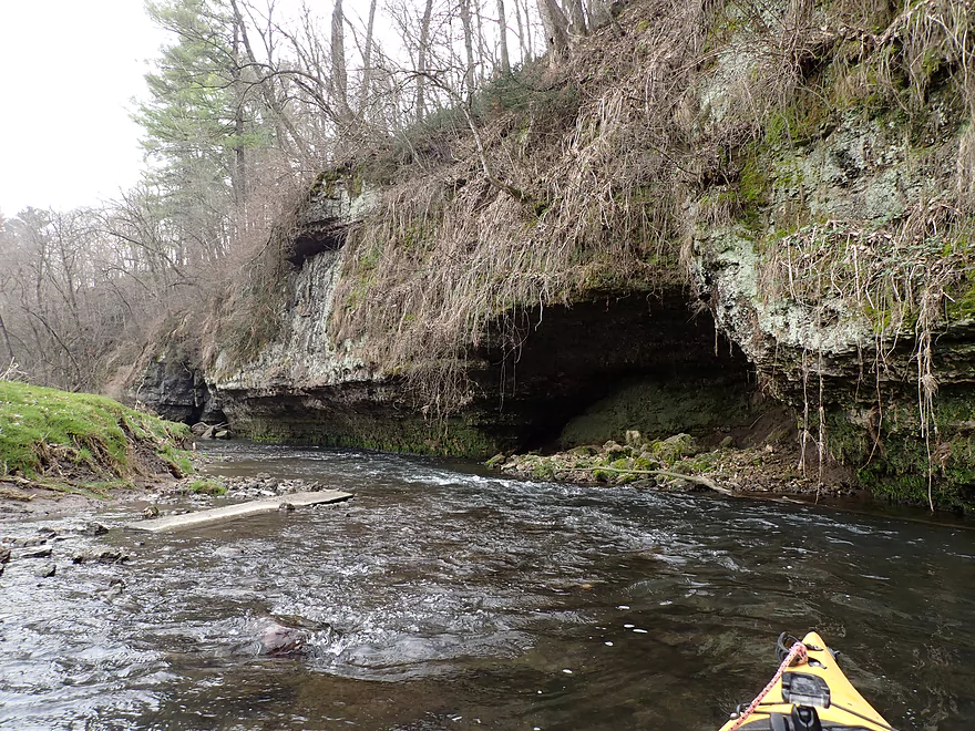
Approaching a north-facing set of bluffs
On the right is an island…I chose the channel by the cliffs
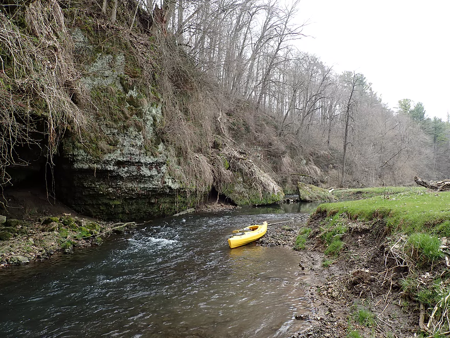
A cave in the making
Rock face being seriously undercut
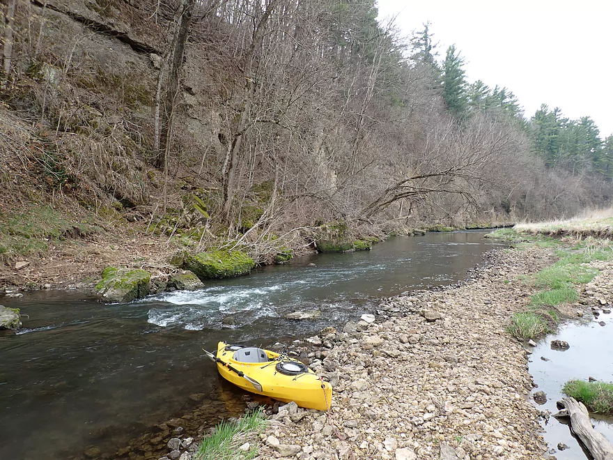
More rapids
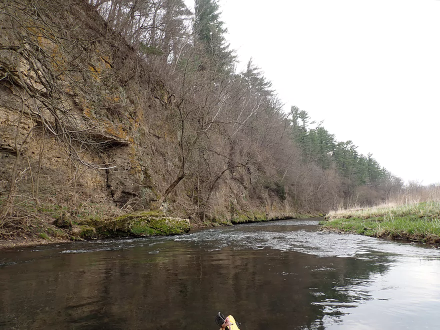
Another nice cliff
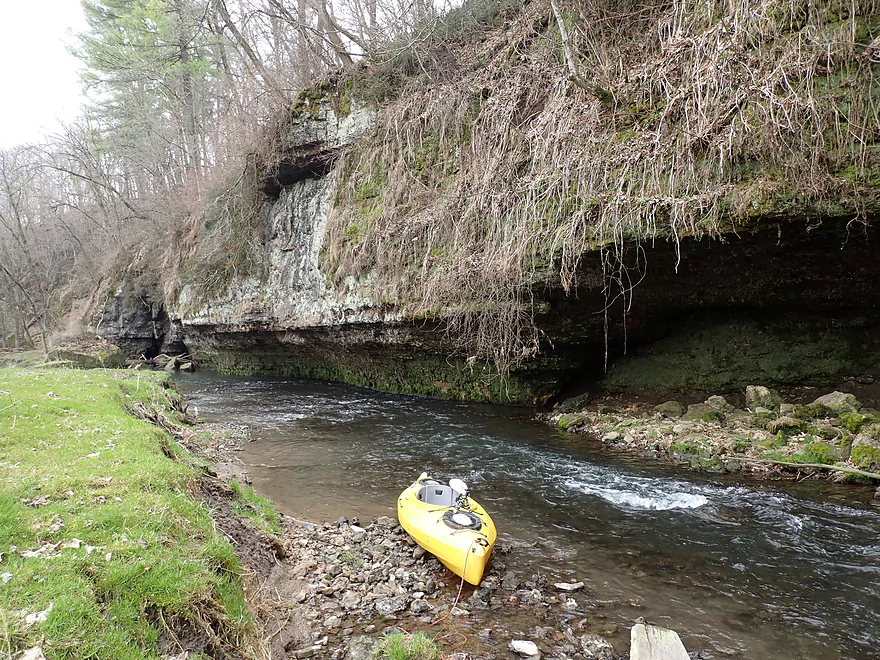
Using my boat for scale
There were a surprising number of white pines on the trip
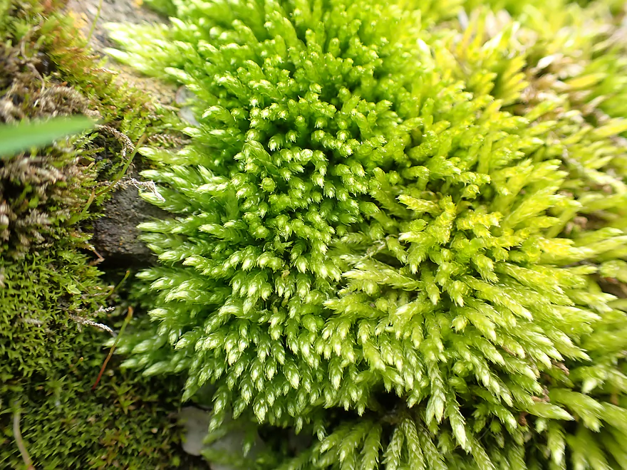
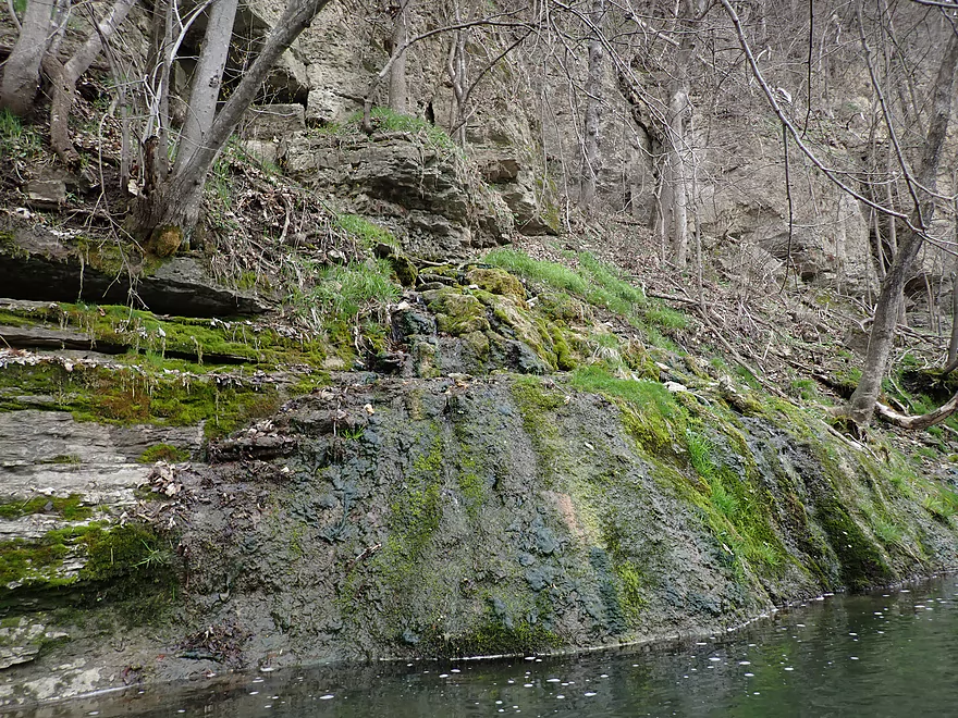
Lot of moss growing on the rocks
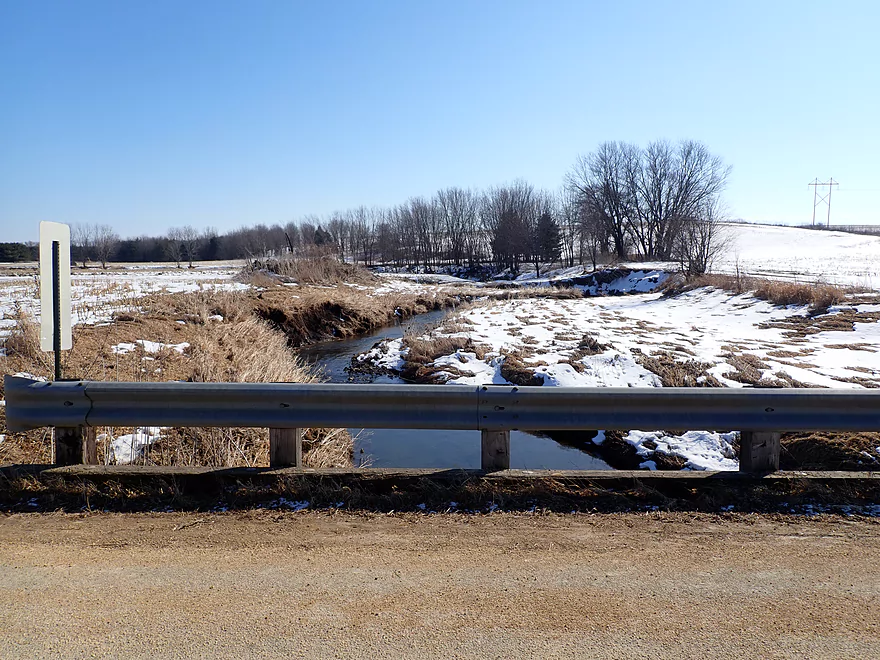
Atkinson Road is an access option
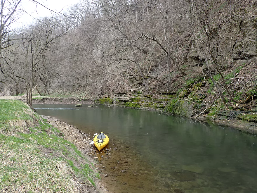
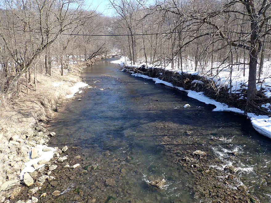
View upstream (take two months ago)
View downstream
My first cows
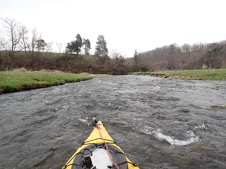
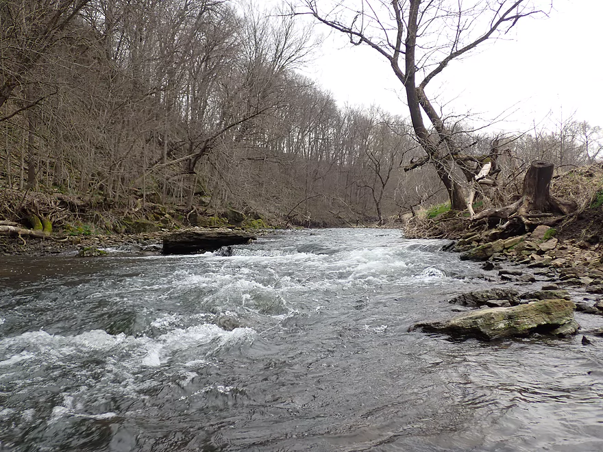
Rapids get rougher after Atkinson
Another major outcrop
This one has a nice gravel bar
And table-like boulder
This will look dramatically different in the summer
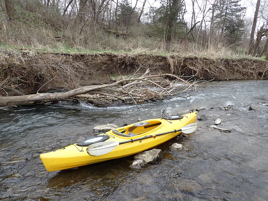
The current is going directly under the tree…first logjam portage
Which is quickly followed by logjam portage #2 (easy)
Yet another nice bluff
Reminded me a bit of Otter Creek
Neat scene
Poorly pictured…but these are wildflowers growing on the hillside
Paddling in the rain
Another major outcrop
Water was clear here and had a slightly green mineral hue
A natural spring cascades into the river
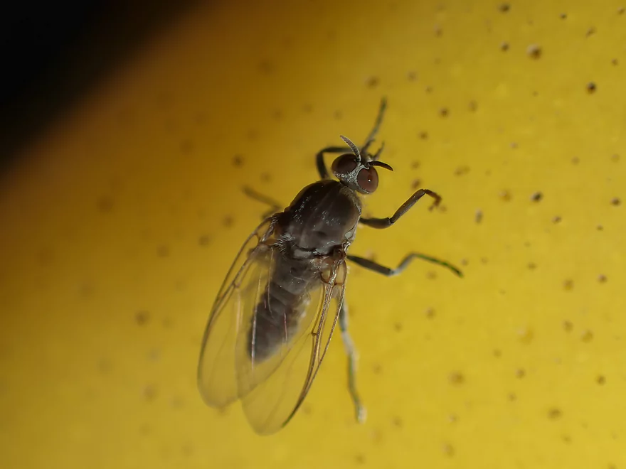
A pesky fly
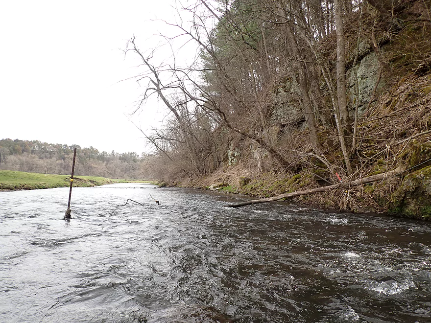
An example of a tricky strainer…current goes left under the tree
Another north-facing cliff
These tend to have more mosses
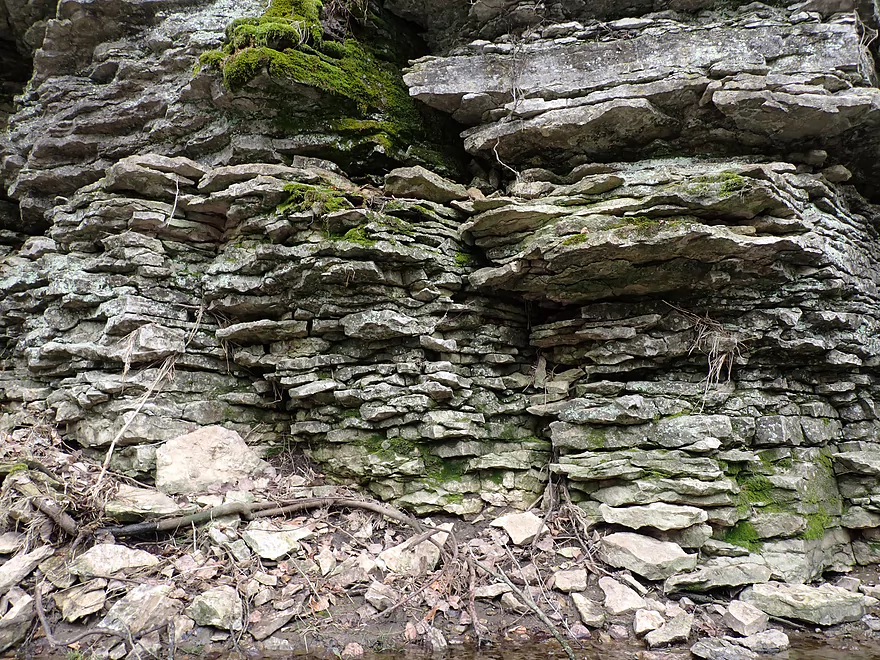
And more exquisite textures
My favorite part of the trip
I wondered if somebody drove off the cliff
Massive boulders
Part of a hairpin turn
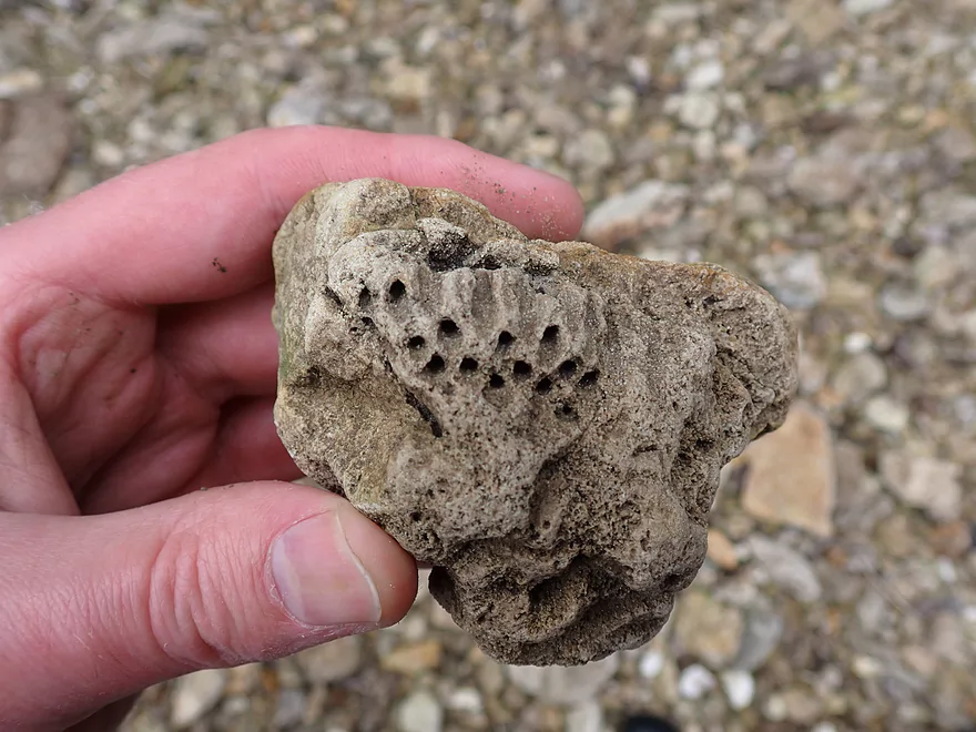
A honeycomb coral fossil I believe
Exiting the bluff
Example of another tricky strainer (easy portage if you wish)
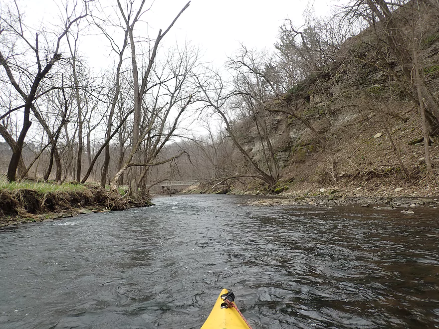
Entering the home stretch
The biggest ledge…I got a lap full of water here
Terrifically rugged hillsides
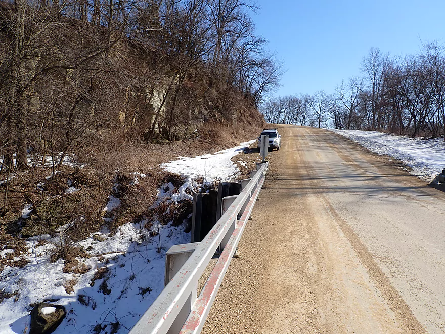
Coming up on Hwy 81
Best access/parking is on the downstream/north side
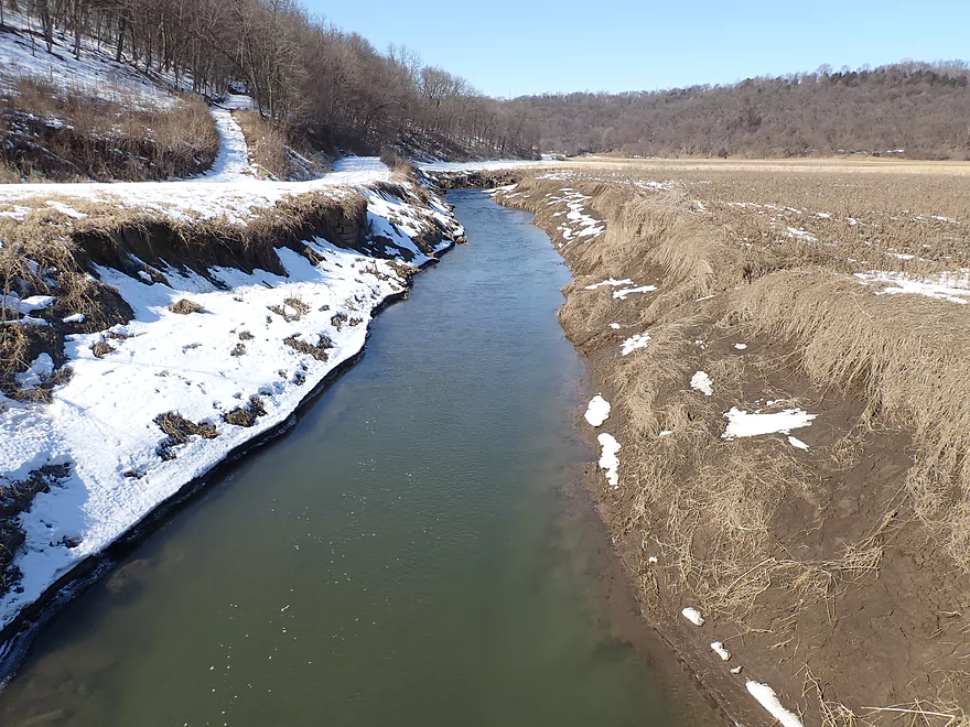
View upstream from the bridge
View downstream
Scouting time…this is Maple Road…ok access
Dodge Road…looks nice but is a bad access
Main Road…good access
Hwy 133 has a low fence on the upstream side
Downstream side looks nice though
Rattlesnake Road view is scenic
But a horrible access because of the steep terrain
Glassmaker Road…note the huge mud banks…doable access though
Rattlesnake Creek

The southwest corner of the state is a unique and special area known for its rugged hills and rocky terrain. The water trails here tend to be rocky, fast, filled with scenic limestone outcrops, and top-notch. Seven of my five star paddles have come from Grant County alone, and I always like to return to the area. Back in February I scouted several tributaries to the Grant River looking for new ideas. While most of my prospects didn’t pan out, one did catch my eye from the Hwy 81 bridge and that was Rattlesnake Creek. While I had never heard of anybody paddling it, the satellite maps suggested extremely intriguing rapids and outcrops…yet few logjams.
With showers forecasted in the afternoon, I didn’t have a huge window to explore the creek, so settled for a 4.9-mile stretch starting from Muscallounge Road that appeared to have the best potential. The day started a bit on a down note though… I got a later start than I planned, I got a bit lost on my bike shuttle, and the put-in had an annoying fence to deal with. Just upstream from the bridge, shallow rapids seriously undercut a rock wall creating a “limestone strainer” . While scenic, it didn’t look runnable and I was worried this was a bad omen for the rest of my trip.
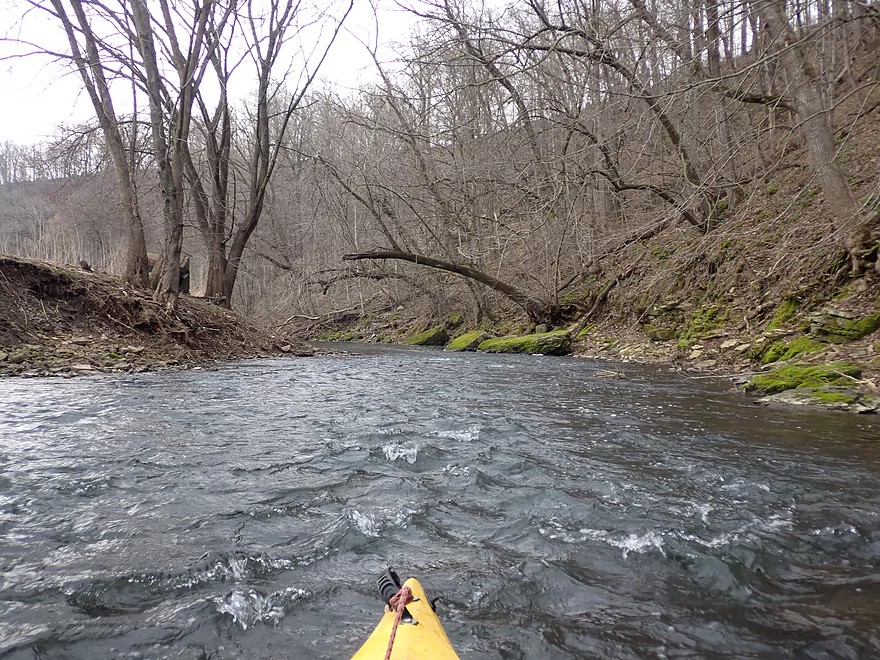
The first third of a mile wasn’t too exciting…I would bump my way down shallow rapids and past badly eroded cow pastures with unsightly mud banks. Thankfully Kunester Creek and then later Muskellunge Creek would provide some welcome volume and padding to the creek.
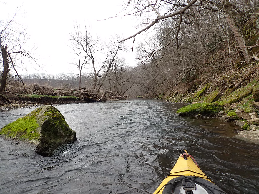
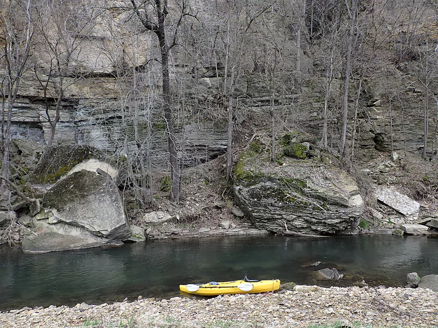
There were countless outcrops on the trip…too many to completely list or count. Most of them were limestone, but there were a few sandstone cliffs. At first the outcrops were a bit runty and disappointing…but soon that all changed. About a half mile into the trip, I spotted a 50-60′ cliff topped with white pines. It was a gorgeous “island” that stood out in stark contrast to the beat-up pasture that surrounded it. I like to take a lot of pictures on my trips, but it is quite difficult to photograph cliffs without a sense of scale. On several occasions I got out of my kayak and waded into the creek to get some unique shots using my boat as a “model”. Unfortunately I was wearing pants instead of shorts and had to constantly roll them up, which drove me crazy. Eventually I gave up and just waded around in wet pants…
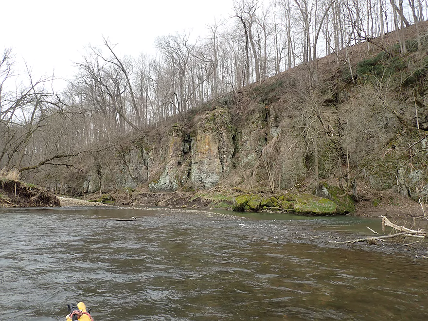
This outcrop which I’ll dub “Super Cliff 1” was soon followed by another much nicer and longer outcrop “Super Cliff 2”. This was very much reminiscent of the Upper Iowa River. Paddling alongside the cliff face and among the huge boulders was a real treat.
The river then swung to a north facing bluff “Super Cliff 3” which had a very different character. Protected from the sun, attractive mosses and fungi grew on the exotic limestone texture. On the right bank there was even a shallow cave. The creek was split by several islands with divergent paths to choose from. I would recommend always going right to stay close to the cliffs and to avoid the logjams in the left channels. Although there were several light rapids that actively undercut the rocks, and in several cases I did have to be careful not to get pinned by a “limestone strainer” (which wasn’t too difficult).
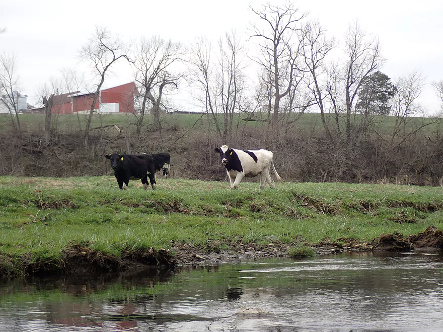
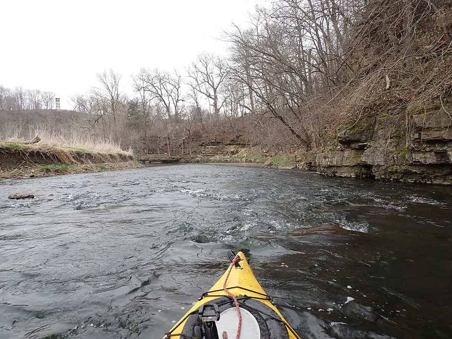
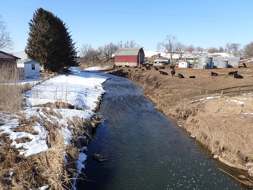
The location of the cliffs was never a secret…it was always where an abrupt turn occurred in the creek and where white pines grew. I would pass yet another 60′ cliff (“Super Cliff 4”) and then reach Atkinson Road, which I had initially considered as an access option. Atkinson marked a significant demarcation in the trip. From then on the creek would be a bit more untidy, the mud banks larger, and the rapids stronger…but on the plus side the channel was significantly deeper which smoothed out some of the rapids. Shortly after the bridge I would spot my first cows of the trip who seemed friendly but were prime culprits for all the eroded mud bank crime scenes I had witnessed.
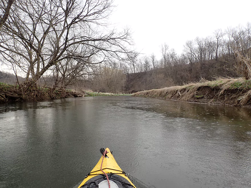
Soon the forecasted rain started and I regretted not setting my alarm to get an earlier start. Although as long as there isn’t wind/lightning/downpours/cold temperatures….paddling in the rain can actually be somewhat fun. It creates a cool, foggy vibe, it provides unique photo opportunities, and the sounds/ripples that rain drops make when they hit the water is quite soothing. Definitely consider it if you’ve never done it before.
After the cows was “Super Cliff 5” — yet another cliff/rapids combination. This was made unique by a spectacular gravel bar and huge boulder islands located in the middle of the channel.
I would finally encounter my first logjam, which was immediately followed by my second logjam. While I had to portage both, this was super easy to do because of an adjacent gravel bar.
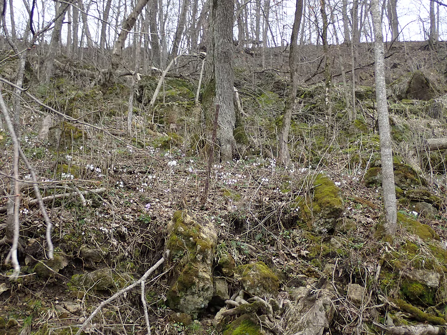
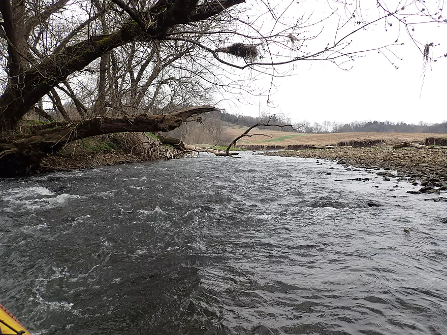
The creek then flowed by a steep bluff which didn’t have cliff walls per say, but was incredibly scenic with boulders on the hillside, wildflowers growing between the boulders, trees arching over the channel, and light rapids under it all. This could be a cool paddle in the summer when the trees would more completely engulf the channel.
Once the creek left the bluff, the bank quality started to deteriorate. It was nothing like the massive 20’+ mud banks located much further downstream by the Grant…but they were getting annoying.
Soon I came upon “Super Cliff 6” which was the second best creek-side cliff of the trip. Here natural seeps bubbled out of the rocks and poured out over thick moss onto the creek below. The water quality overall was somewhat hit and miss…sometimes turbid…sometimes clear…but here it was fantastically clear with a slight green mineral hue that was quite cool. Overhead towered an 80′ cliff which was quite striking.
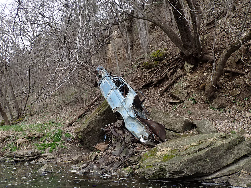
“Super Cliff 6” was soon followed by “Super Cliff 7″…and THAT was my favorite of the entire trip. Here the river was stopped by a sheer 70′ cliff and was forced to make a drastic turn to the right along light rapids. It was a dramatic scene and one you would expect to see out west…not in Wisconsin. Along the west bank a rusted car sat awkwardly at the base of the cliff. I had to wonder if somebody had accidentally driven off the cliff and suffered an awful fate.
Following yet another nice bluff, I ended the trip at Hwy 81 with impeccable timing as the rain picked up in earnest the moment I got out of my boat.
This isn’t a trip for a casual or newbie paddler. The put-in is bad, there are some strainers, and Class 2 rapids. The water levels are also quite fickle…too low and you’ll bump down the rapids, and if too high you’ll be pushed around into things you don’t want to be pushed into. But…if you are experienced and have a small boat suitable for conditions like this, I do highly recommend Rattlesnake Creek. Yes the pasture portion wasn’t super interesting…but this might be one of the most rugged and cliff-lined creeks I’ve ever done which made it all worthwhile.
Muscallounge Road: This is not a good bridge access. Only one corner is accessible and that is partly blocked by a fence. There is room to shove your kayak through but it’s never ideal to deal with somebody’s fence. I was within the DOT’s right-of-way so that was ok, but it would have been awkward had the farmer driven by at that moment. Parking is pretty tight…but if you’re willing to leave your car a bit further away from the bridge, you’ll find a flat shoulder.
At the bottom is an old electric fence that wasn’t active (I checked). Either way, it’s not a big deal as it’s well upstream of the launch area and you could get under it if coming from an upstream put-in.
Note, Kuenster Creek is right next to the Rattlesnake Creek bridge…don’t confuse the two! Although I suppose you could launch on Kuenster Creek as it is a better bridge access, goes by some cool outcrops, and it soon joins Rattlesnake…but it is much smaller than Rattlesnake and could be bumpy.
Alternate Put-ins:
- MC’s Sports Bar: (2.7 miles upstream of Muscallounge Road) Best access is at a private bar…make sure to get their permission before launching. Ok launch area downstream of low fences. The creek here is very small but is rugged with many outcrops. Maybe a few logjams…otherwise an interesting prospect.
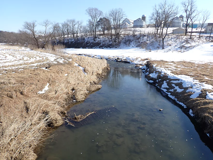
- Atkinson Road: (2.3 miles downstream of Muscallounge Road) There is a minor fence to deal with, otherwise this is a relatively good bridge access. Note, if you put in here, you miss out on a nice stretch of the creek.
Hwy 81: This is a relatively good bridge access (and scenic). The best spot is on the downstream/north corner where you do have to drag your boat over some rocks and past a guardrail, but I didn’t think this was too bad.
Alternate Take-outs:
- Atkinson Road: (2.6 miles upstream of Hwy 81) There is a minor fence to deal with, otherwise this is a relatively good bridge access. Note, if you take out here, you miss out on a nice stretch of the creek.
- Rattlesnake Road: (1.0 miles downstream of Hwy 81) Neat prospect…rocky and runs along a steep bluff. River opens up into pasture at the end. But the access is bad…very steep and mostly fenced in with little privacy. I suppose it would be possible to take out here but it isn’t recommended.
- Glassmaker Road: (5.6 miles downstream of Hwy 81) Rattlesnake starts to lose its magic and develop some huge mud banks. Still likely some outcrops though. Glassmaker Road is a viable bridge access but is pretty muddy.
Hwy 81 to Muscallounge Road: (3.7 miles/200′ of climbing) Like most Driftless bike shuttles this was annoyingly hilly and I walked several of the steeper hills. It’s all manageable though and not a super long shuttle. Muscallounge Road has rough gravel…but you only have to spend 0.6 miles on it and it is mostly downhill.
- Logjams: There were just two and they were by gravel bars, making them easy portages.
- Tree Strainers: There are a few and I made it through ok…but if you are not comfortable running them just portage (which is pretty easy).
- Rock Strainers: In several cases the creek undercuts the limestone. If you’re not careful the current could push you under a ledge. If you pay attention you should be ok…you could also always portage these if need be (very easily).
- Rapids: I would rate all rapids upstream of Atkinson Road as Class 1 and pretty easy. Downstream from Atkinson there are some bigger ledges and a few rapid/strainer combos that I would rate as Class 2. If you’re experienced paddling you shouldn’t have an issue…just stay vigilant and portage what you’re not comfortable with.
- Cows: The creek does run through several pastures. I didn’t see any cows upstream of Atkinson but did see evidence they were there. Downstream of Atkinson, I did see some cows who appeared relatively friendly. Cows and steers are fine…it’s bulls that are a problem. I kept an eye out but didn’t see any.
- Fences: There was a fence at the put-in (inactive electric fence) but it was upstream of the launch area. It was also easy to get under. There was only one fence on the main trip (located here). It’s positioned over shallow rapids but I was able to get under it with little difficulty. It’s a single strand of wire which usually indicates it’s electric, but I didn’t think it was active.
Nearest Gauge: Grant River @ Burton, Wisconsin. This gauge is much further downstream on the watershed though so may not be completely representative. Note the stretch below Atkinson Road is much deeper than the stretch above it.
Recommended Depths:
- 0-200 CFS: Perhaps too shallow.
- 201-320 CFS: On the shallow side and some rapids might have to be waded but doable.
- 321-500 CFS: A slightly above average flow rate. The rapids way upstream will be pretty bumpy, but I consider this doable. I did the trip at 412 CFS.
- 501-700 CFS: A high flow rate and likely a good target rate. The current will be more pushy at these levels though…be warey of strainers and undercut rocks…portage what you’re not comfortable running.
- 701-900 CFS: Likely a very high flow rate only suitable for experienced paddlers in agile boats. The rapids should be well padded but there will be some push spots.
- 901+ CFS: Perhaps too high? I’m just guessing.
For detailed notes on bridge access options, see my overview map here.
- Maple Road to Dodge Road: 1.0 miles. Very small small leg that needs high water. Open and pleasant but likely no outcrops. Dodge Road is a bad access.
- Dodge Road to Maine Road: 0.4 miles. Very narrow leg, but open and likely free of logjams. I doubt there are outcrops on this leg.
- Main Road to Hwy 133/MC’s Sports Bar: 2.4 miles. An open section with a number of rocky riffles. Good potential but shallow with maybe two logjams and several fences that could be difficult to get past.
- Hwy 133/MC’s Sports Bar to Muscallounge Road: 2.7 miles. Small, shallow stream with 3-4 logjams. Good potential for rock outcrops. Some light rapids.
- Muscallounge Road to Hwy 81: 4.9 miles.
- Muscallounge Road to Atkinson Road: 2.3 miles. Great leg with fantastic outcrops. A number of light rapids but nothing over Class 1. One low fence but not difficult to get under.
- Atkinson Road to Hwy 81: 2.6 miles. An excellent leg with terrific outcrops. Rapids are stronger than the upstream leg with some Class 2s. Two logjams to portage but easy.
- Hwy 81 to Rattlesnake Road: 1.0 miles. Neat prospect…rocky and runs along a steep bluff. River opens up into pasture at the end. Rattlesnake Road is an awful access.
- Rattlesnake Road to Glassmaker Road: 4.6 miles. While mostly open, there are maybe 3 logjams and ginormous and unsightly mud banks. Rattlesnake Road is an awful access.
- Downstream options on the Grant River: Glassmaker Road is very near to the mouth on the Grant River. Click here for a map of paddling options on the Grant River.
Trip Map
Overview Map
Video
Photos Size: