
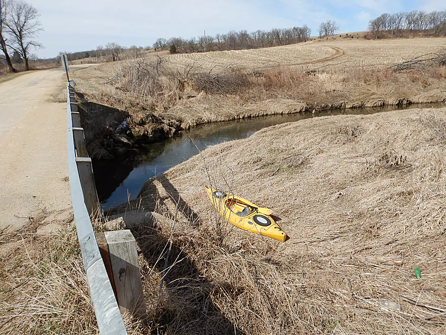
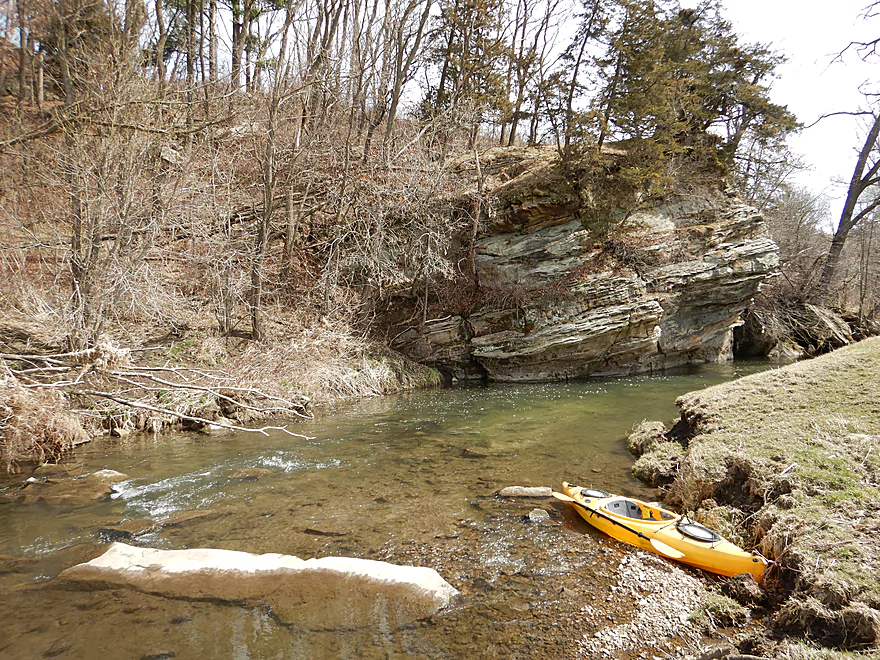
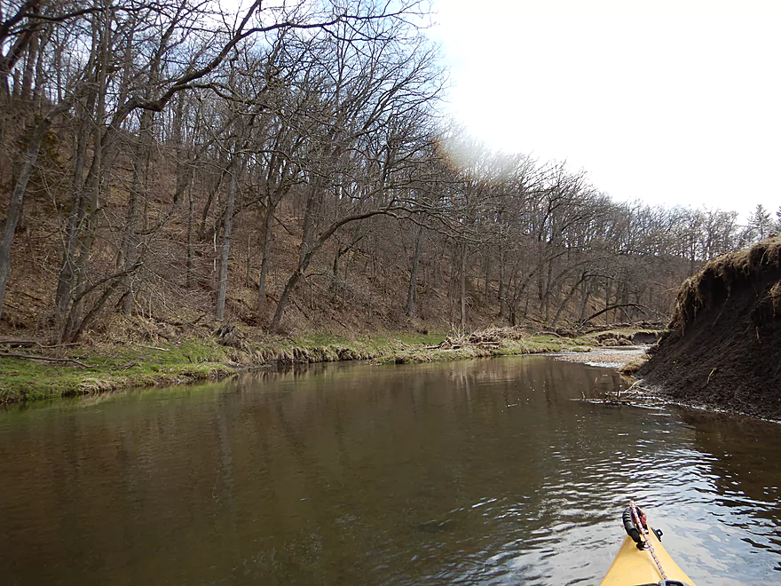
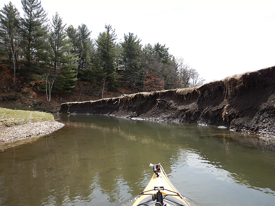
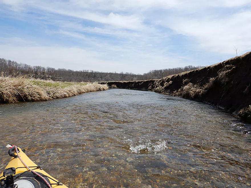
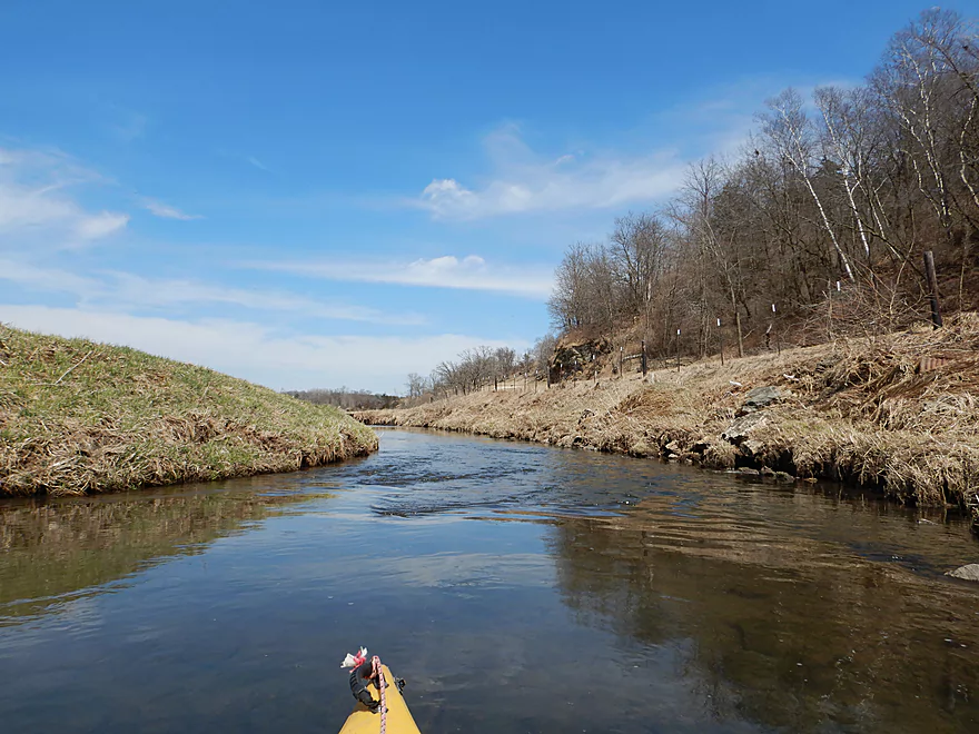
Putting in at Sunny Ridge Road
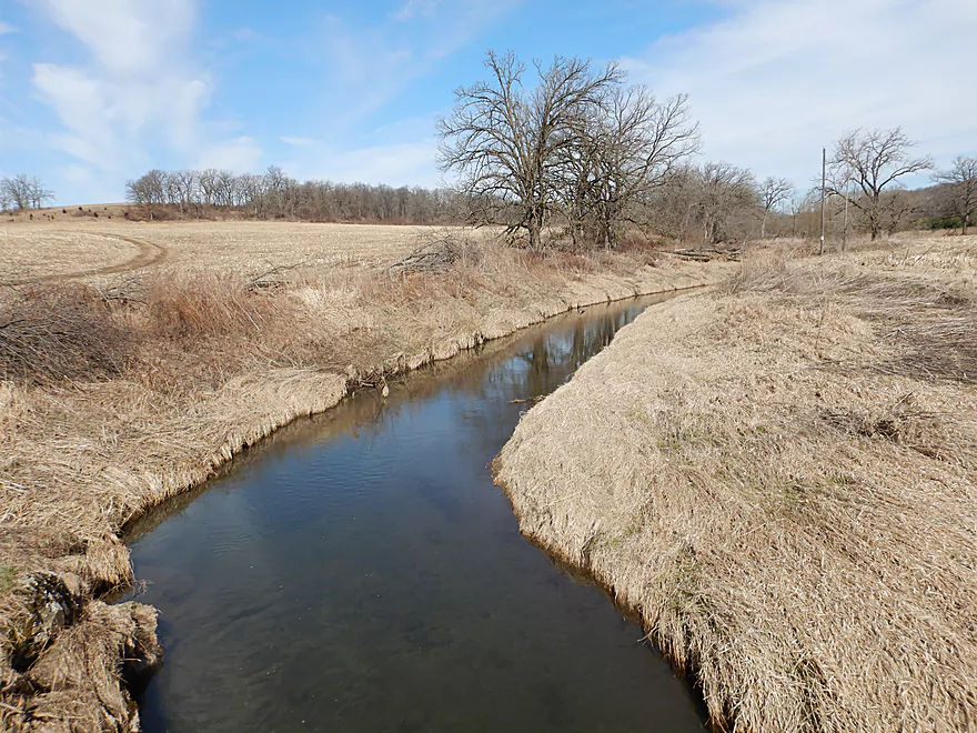
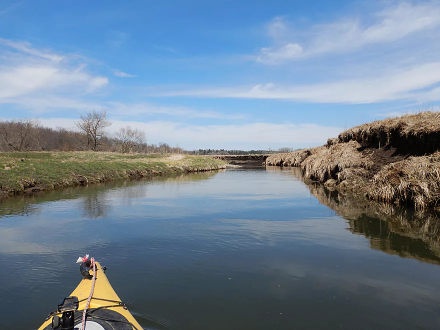
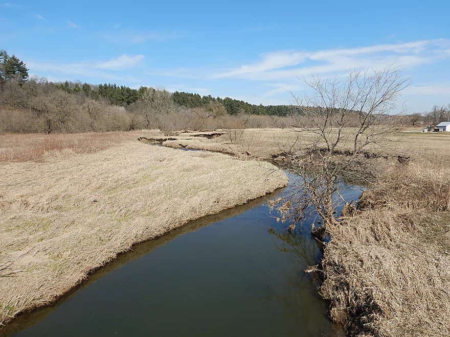
View upstream
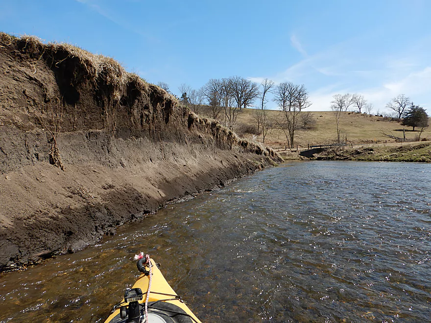
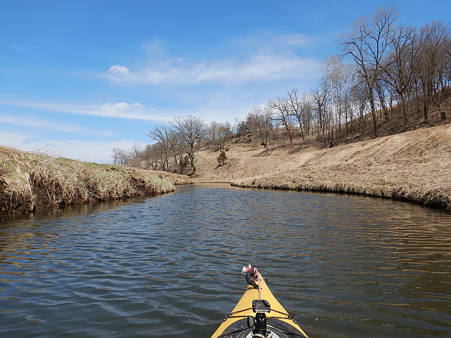
Flanked by treeless hills
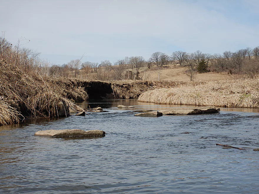
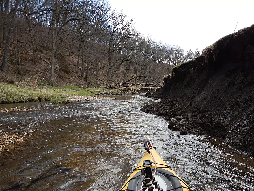
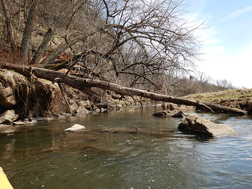
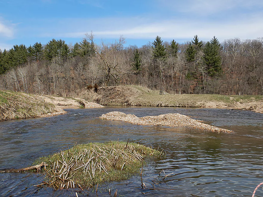
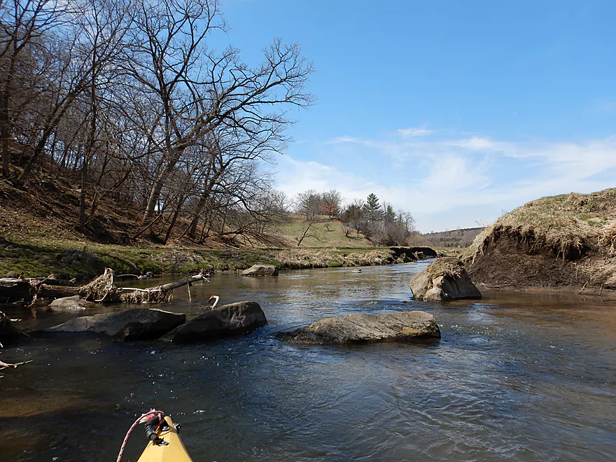
Surprise boulder garden
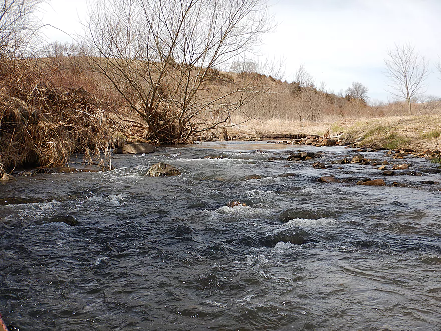
Surprise rapids
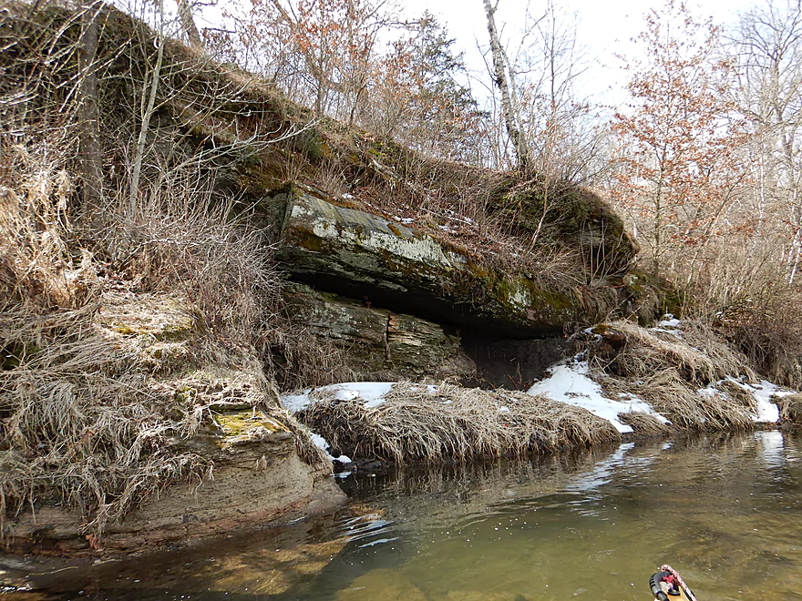
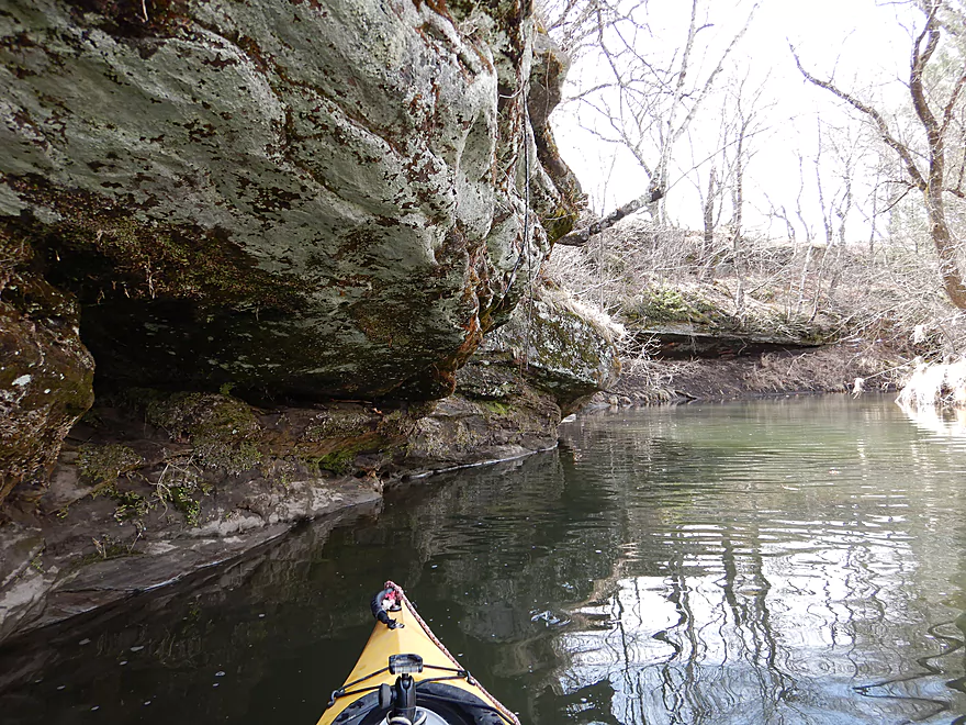
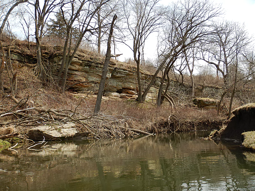
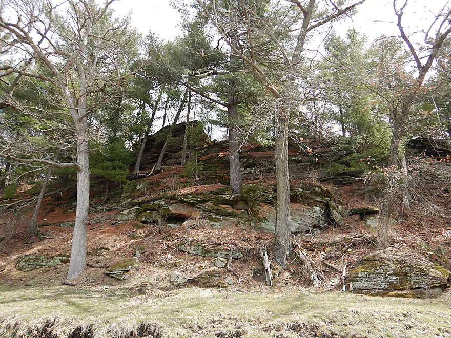
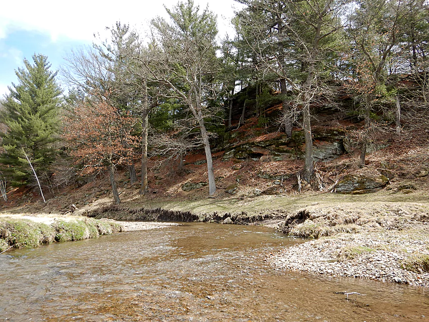
Surprise outcrops
Part of a cluster of three outcrops
Looking back
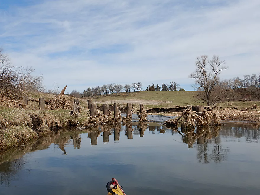
Looks like a washed out bridge
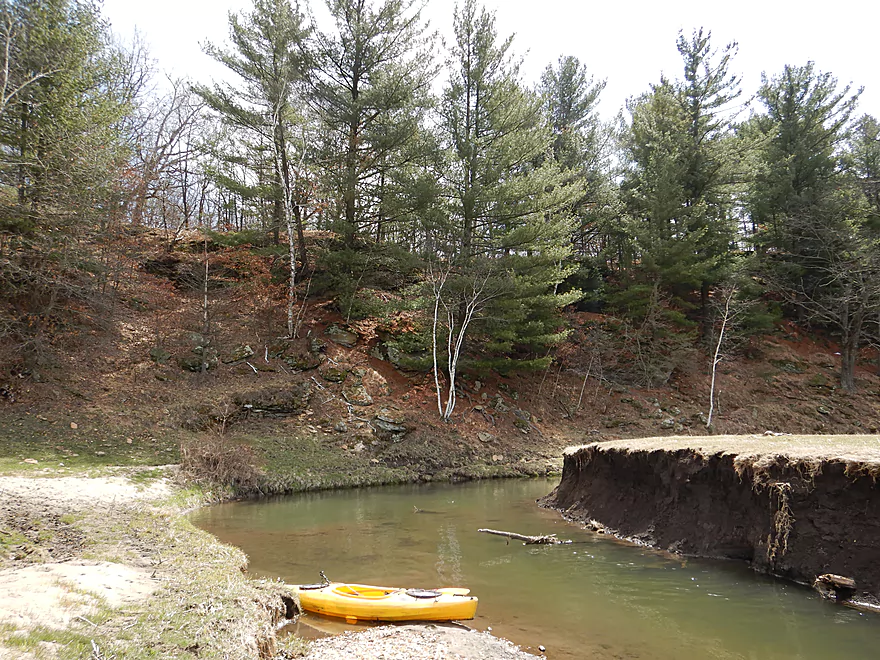
Entering an open pasture
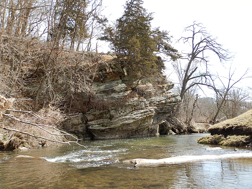
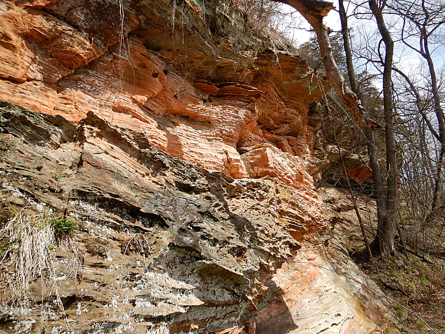
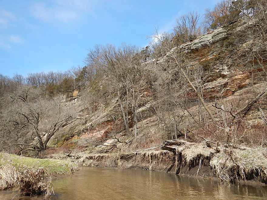
A really cool outcrop
Slanted sedimentary layers (signifies geologic upheaval)
Reverse view
One of several smaller outcrops
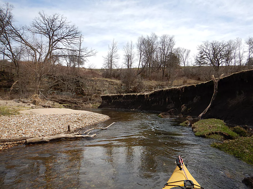
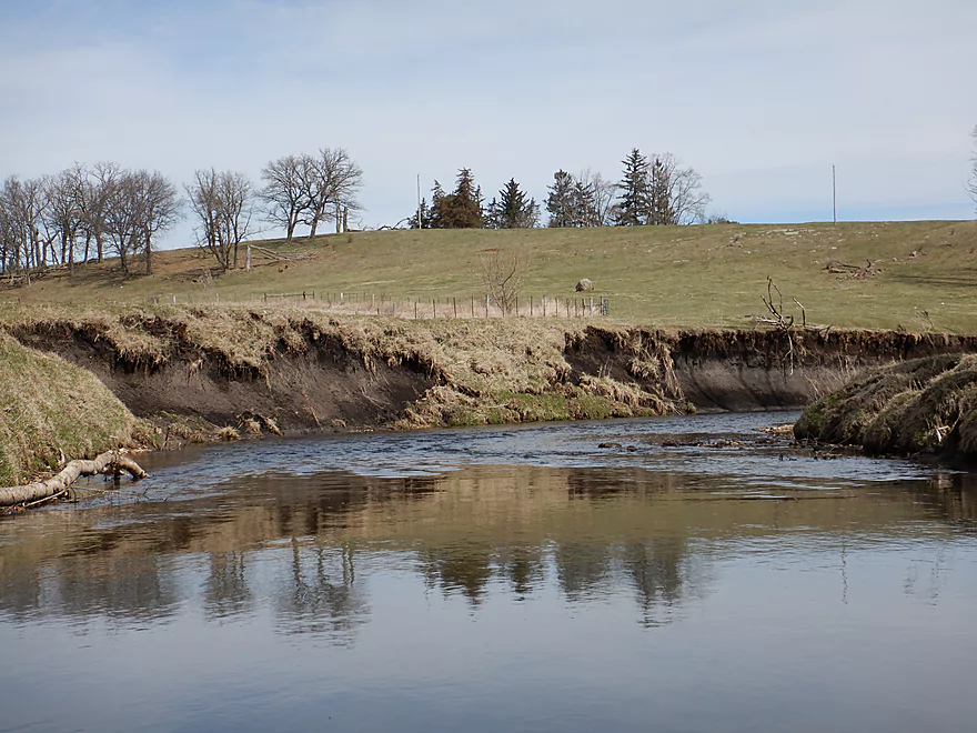
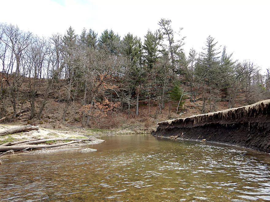
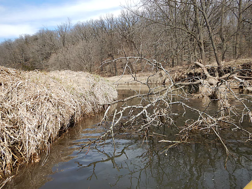
Many tall mud banks
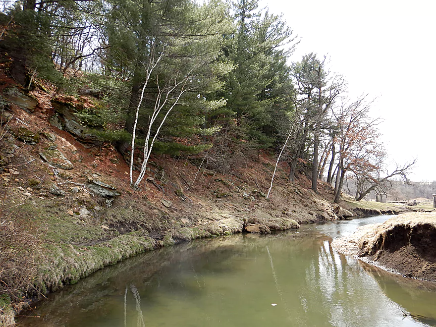
On the left is a mile-long ridge which the river follows
In the distance are trees that floods have cleared from the channel
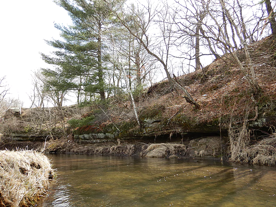
Another nice outcrop
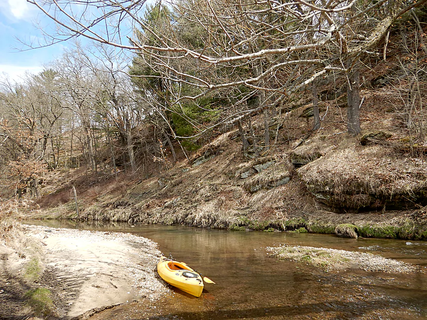
With a beautiful pine needle carpet
Right side of the river is not as scenic as the left
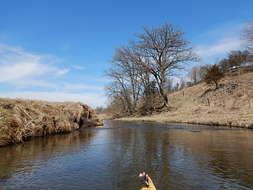
Another nice scene
Not something you typically equate with southern Wisconsin
deja Gordon Creek
Reverse view
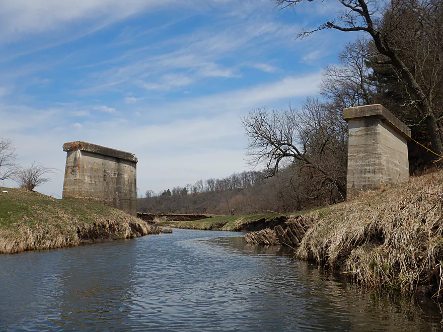
A ghost bridge
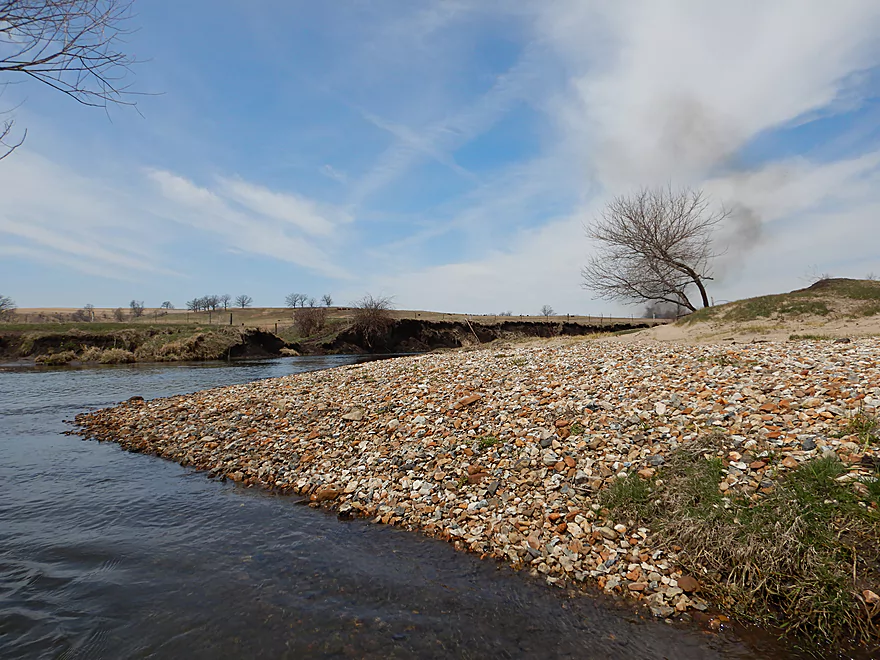
One of many beautiful gravel bars
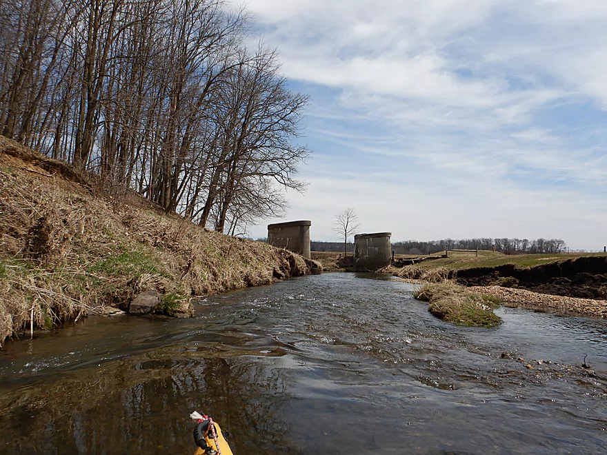
Yet another ghost bridge
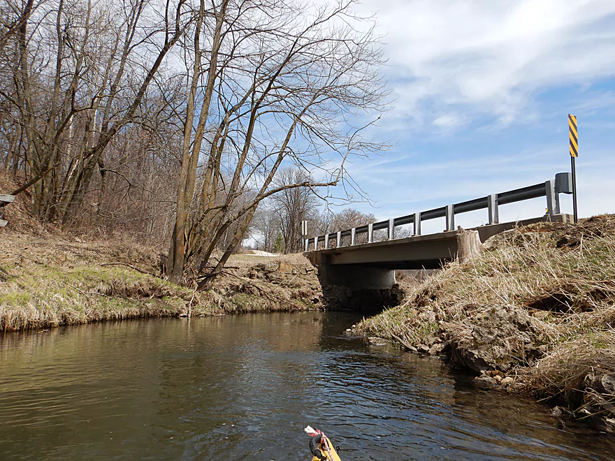
Finally a real bridge (Twin Bridge Road)
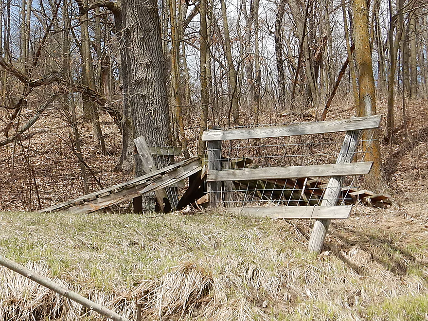
Fancy fence ramp for snowmobiles
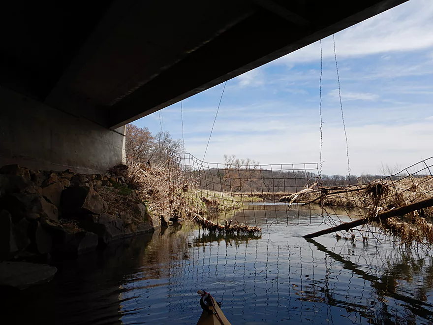
Easy to get under the swing gate (far left)
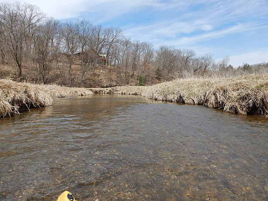
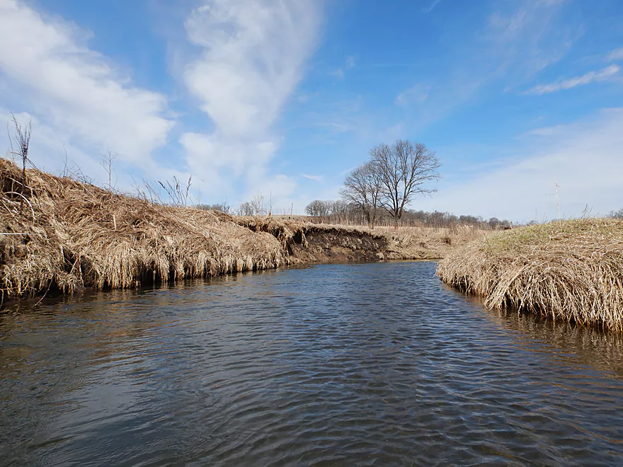
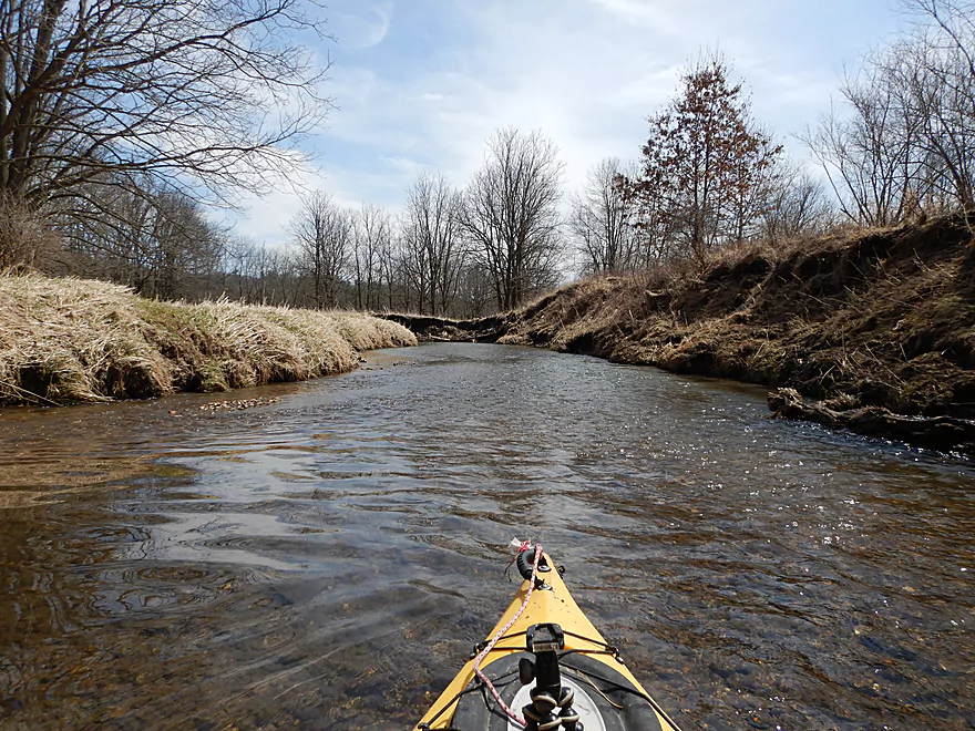
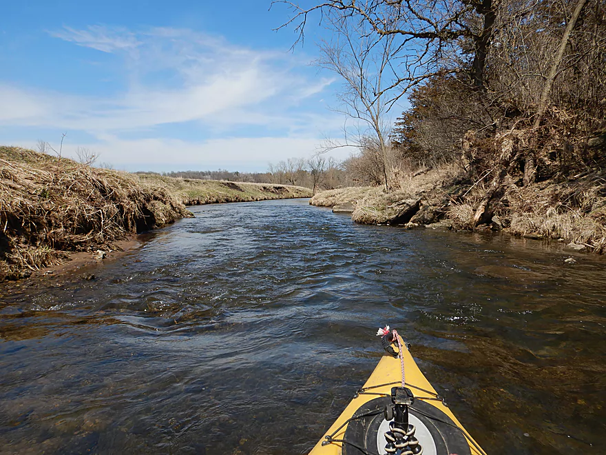
Paddling an open stretch
Still fast and riffly
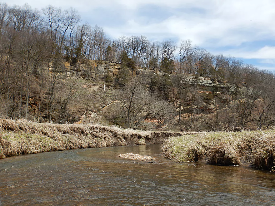
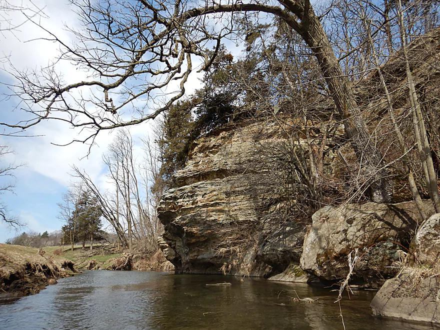
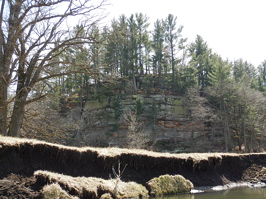
Coming up on an impressive sight
A very tall sandstone cliff
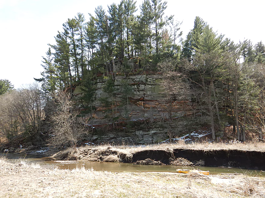
With striking geology
Logjams were never an issue
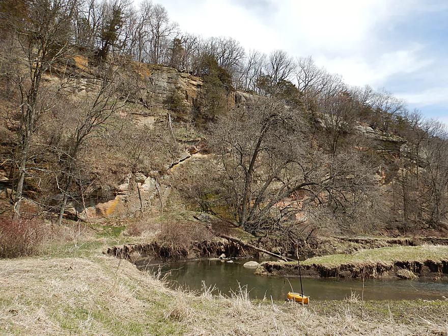
Reverse view of cliff
Just able to squeak by on the edge
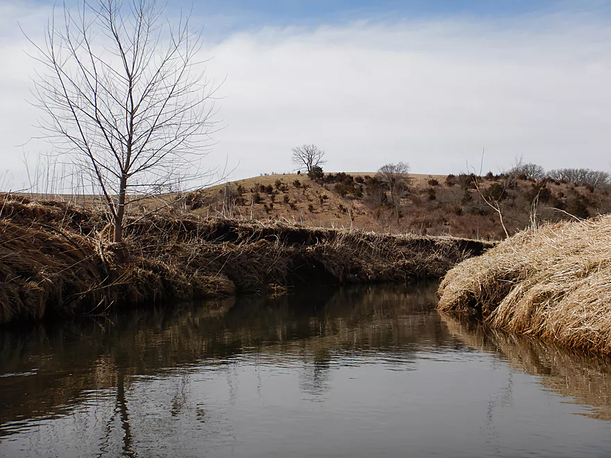
Another surprise peaking over the horizon
Reminded me of Willow Creek
This reminded me of the Blue River (a neighbor to the northwest)
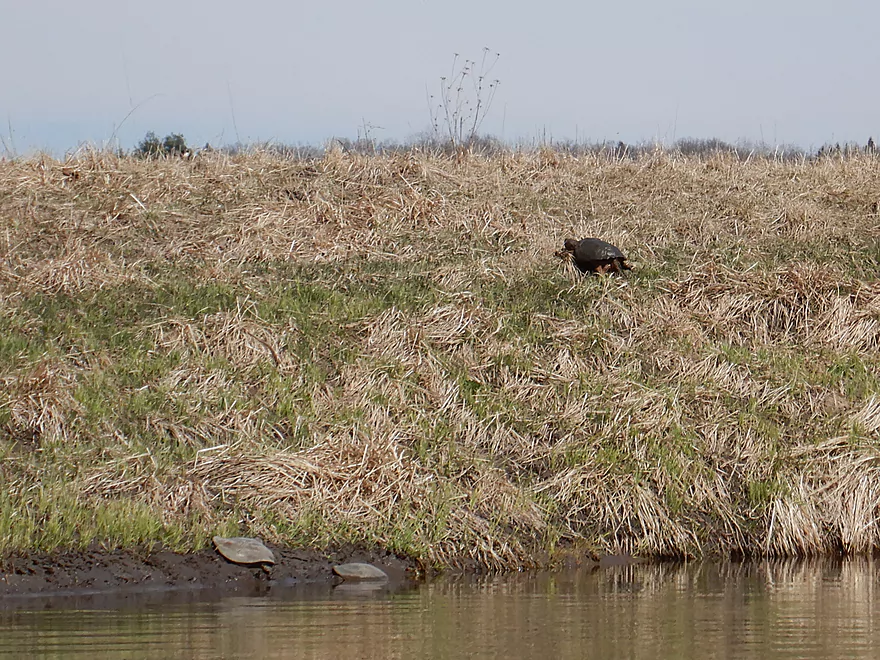
A snapper stalking geese with softshells looking on
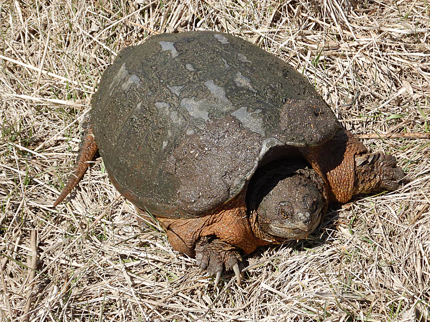
What a plumper
I always love paddling under blue skies
I think this is why the stocked trout do not survive
A pretty section along Birch Lake Road
Shallowest part of the trip
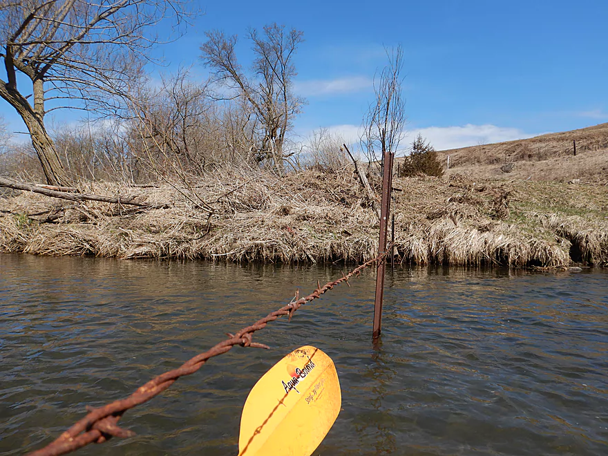
A low barbed wire fence
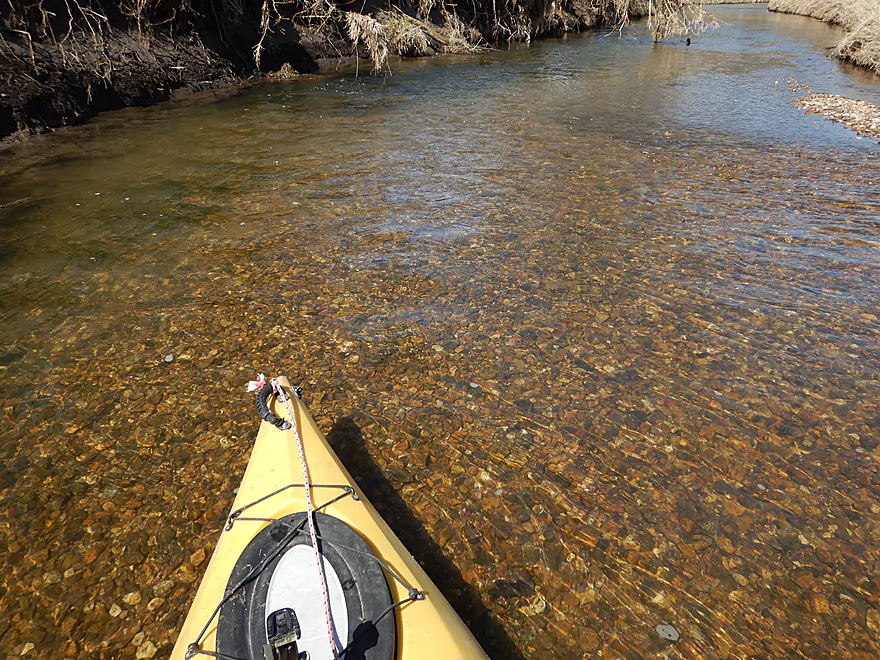
Surprisingly good clarity
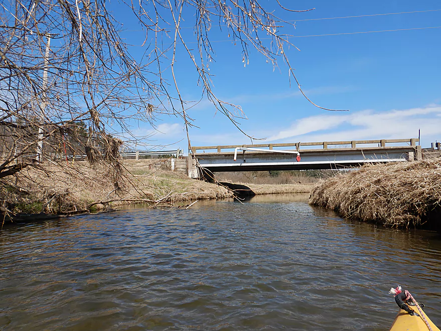
Hwy W
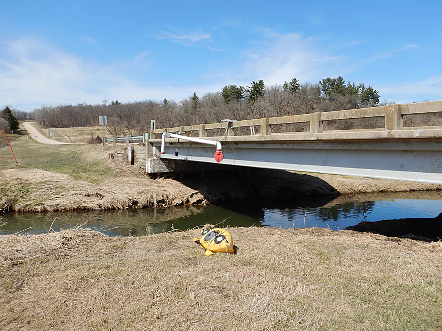
Decent take-out option
Looking downstream toward a fantastic pine ridge and a future trip
Pecatonica River – Dodge Branch


The Pecatonica River is a large watershed in southwest Wisconsin with many branches and opportunities for paddling. The Dodge Branch of the river starts in Dodgeville (literally..at the effluent plant) and flows southeast before joining the East Branch near the community of Hollandale. At one point it was classified as a Class 2 trout stream, but restocking efforts were abandoned because of low survivability rates (likely due to streambank erosion). Streambank erosion is a big deal and kudos to everyone who attended the WCC hearing earlier this month and voted for proposal #42 to require a five foot protective buffer around streams (which won 4060 to 1127).
After launching from Sunny Ridge Road, my first impression of the river was a bit mixed. The surrounding driftless hills were scenic and the water clear…but the bottom was covered in silt and steep mud banks flanked the channel. My impression quickly improved after I paddled over a small boulder garden and set of rapids (very un-Pecatonica’ish). This was followed by a series of three small but scenic sandstone outcrops.
The river valley then opened up into a pasture and I saw a few cows. This was a surprisingly quick section with countless riffles, but unfortunately most were shallow and bumpy. This spring has not only been surprisingly cold but also dry, and the Pec was down 100 CFS relative to my last trip about 12 months ago. I should have waited for higher water, but it all worked out.
As the river arched north, I came across my next pleasant surprise in a much larger sandstone outcrop flanking some tiny rapids in the channel. Unlike the previous outcrops that were hidden in the shade, this beautifully reflected the sunlight and was a sight to behold. The entire outcrop was rotated and slanted, which had me wondering what geologic force made this happen.
This was followed by a mile-long ridge along the east bank with many recessed sandstone outcrops and white pines growing on the top. Not something a paddler typically equates with the Pecatonica.
After the river turned north, I saw a curious sight in four large cement supports but no bridge. Following this ghost bridge, I saw a real bridge in Twin Bridge Road which would be a suitable access option for paddlers if desired.
The river does change a bit after Twin Bridge…the channel grows to be much bigger, as do the mud banks. The unique thing about this leg was that for over a half mile away, I could see this huge sandstone outcrop across the valley. It kept poking its head over the mud banks, which had me wondering if the channel, in its crazy meandering would work its way over there…and sure enough it did. At the northernmost end of the valley, I came across a massive sandstone cliff (roughly 150′ high and 500′ wide) which was the highlight of the trip.
Following the cliff, the banks flattened as the river bounced from the north side of the valley to the south side, but it was still pleasant with many large gravel bars and pines along the north bank. Once the river reached the south side of the valley, I came across another nice outcrop, which with its white pines on top, looked like a giant birthday cake with candles (deja Willow Creek).
The final mile to the finish line was less eventful, with no other noteworthy outcrops and was mostly a simple pasture paddle, but pleasant and riffly. Had the water been deeper this could have been a lot of fun. As I approached the community of Jonesdale and my take-out, I was approached by two locals who wanted to ask me about my trip. It turns out they had been curious about running the river for a while but didn’t know if it was feasible. I told them it was and a great trip…but just to wait for higher water. According to one of the guys there used to be a Jonesdale boat landing just upstream of the bridge but it had long ago been abandoned, which made me suspect there used to be a flowage here.
In summary this was a great trip with fantastic outcrops and no logjams. It very much reminded me of the Blue and Platte Rivers nearby with the open driftless valleys, riffly current and cool geology. I almost gave this five stars, but the mud banks were a bit of a downer. I’m now very much curious about the next segment which runs from Hwy W to Banner Road. You can see from the road a massive south facing ridge topped with white pines that parallels the river and it seems like it could be very scenic with many sandstone outcrops. Definitely a future paddle idea, but this leg likely has at least some logjams.
Sunny Ridge Road is a good bridge access option with room to park on the shoulder.
For a shorter trip, you could launch 1.9 miles downstream at Twin Bridge Road. That would also be a good launch option, but I’m not sure why you would do this as you would miss out on a nice section of the river.
The Highway W bridge, located near the small community of Jonesdale, was a very good bridge access and had a pull-off area for public parking. Signs mark a public easement for fishermen, but I doubt many fish here. Getting out in tippy kayaks could be a bit tricky because of the steep muddy banks, but if you disembark directly under the bridge this shouldn’t be too bad.
Adventurous paddlers can continue 3.9 miles further to Banner Road, which is an ok access option. This bonus section would include a long bluff topped with white pines and likely many scenic outcrops. …But there could be a few logjams.
The bike shuttle was VERY hilly…427′ ascent and 387′ descent. On the plus side it was relatively short at only 3.7 miles, and there was no gravel or major traffic to worry about.
Remarkably and miraculously there wasn’t a single logjam.
There was a fence directly under Twin Bridge Road, but that was a swing gate which I thought was easy to get under.
There was a second fence close to the end of the trip which required a low limbo to get under, but I didn’t think it was too bad. That fence was not electric and consisted of only a single barbed wire strand. In higher water you could simply portage it on the right bank.
The current was surprisingly zippy. Maybe one set of Class 1 rapids and countless riffles. Nothing dangerous though.
There is no local gauge on the Dodge Branch, but it should correlate somewhat with the Darlington gauge on the main branch. I did the trip at 169 CFS which was low. Most of the river was navigable and I had a good time…but I suspect most paddlers would prefer higher water. For historic context, the Pecatonica never got below 200 CFS for 2016 & 2017 (except during winter). Below is an estimated depth guide.
- 0-150 CFS: Likely too shallow.
- 151-200 CFS: Doable but many bumpy spots. You’ll probably want to wait for higher flow rates.
- 201-300 CFS: I suspect a good target range. V-bottom kayaks (as opposed to the flat-bottom variety) might aim for a higher floor of say 250 CFS.
- 301-400 CFS: Conditions would likely be turbid, but fun whitewater could develop.
- 401-600 CFS: Very high conditions. Likely only suitable for experienced paddlers in agile boats.
- 601+ CFS+: Perhaps too high to be enjoyable.
Some cows, several wood ducks, one clam, three softshell turtles, no trout (despite this being a trout stream), and a large snapping turtle that appeared to be stalking some geese. The highlight came halfway into the trip where I heard a loud noise approaching as if an airplane were about to pass directly overhead. Instead it turned out to be a pair of eagles who buzzed my kayak going very low and extremely fast. One seemed to be chasing the other and trying to grab its talons. Either it was trying to steal some food or it was trying to mate. All in all very impressive…I’ve never seen eagles fly that fast.
Governor Dodge State Park is relatively nearby and is worth a visit if you’ve never been there before. There are two lakes in the park with Twin Valley Lake likely being the better paddling prospect, but Cox Hollow Lake has a really cool sandstone outcrop. The highlight of the park are its many trails with my favorites being the Lost Canyon and Stephens Falls Trails, which feature a small waterfall and a journey through Lost Canyon.
Ridgeway Pine Relict State Natural Area is nearby and might be a neat hiking experience as well.
- Blotz Road #1 (by Hwy 191) to Blotz Road #2: 2.8 miles. Very small section that likely needs very high water to be runnable. Mostly open to start, but some woods near the end. Rocky with maybe 2-5 logjams. Some fantastic ribbed outcrops half-way through this segment.
- Blotz Road #2 to Hwy Y: 1.5 miles. Small open paddle with a few light riffles. Nice pastoral scenery with hills in the distance. I doubt this has logjams, but maybe has a fence or two.
- Hwy Y to Sunny Ridge Road: 2.3 miles. An interesting prospect that I suspect is like the Blue River with open but narrow valleys and a lot of rocks. This may require high water to run. Estimate 2-6 logjams. Hwy Y is not a good access because of its proximity to a home and fences along the road.
- Sunny Ridge Road to Hwy W: 5.4 miles. A great stretch with good scenery and no logjams. Reviewed Apr 2018.
- Sunny Ridge Road to Twin Bridge Road: 1.9 miles. Great stretch with one cluster of small outcrops, one cool slanted outcrop and then a scenic white pine topped ridge.
- Twin Bridge Road to Hwy W: 3.6 miles. Another great leg with a 150′ high cliff and a large birthday cake outcrop. One low fence but manageable.
- Hwy W to Banner Road: 3.9 miles. A great prospect with likely multiple outcrops under a long pine topped ridge. Some logjams…maybe 2-6.
- Banner Road to Hwy 191: 4.8 miles. Maybe 18 logjams. Too many.
- Hwy 191 to Hwy 39 (mouth on the East Branch): 2.3 miles. Nothing special and likely not a good prospect. Maybe 12 logjams.
For additional trip ideas on the East Branch click here.
Trip Map
Overview Map
Video
Photos Size:
2018.07.08. Great paddle. I assume higher water since everything else is high. This is a great hi water run. Put in easy, take out a muddy mess (under bridge because banks were very steep/high) so bring water to wash off mud at vehicle: only negative of the trip. Bike trip hilly – took 20 minutes and a few polite words. Water was surprising clear. Lots of ripples and tight turns around things… good for paddle skills workout. Trip description was dead-on, accept an electric wire was added 15 minutes above the barbed wire (40 minutes from the end). easy to get over, unless you stare at the yellow control too long (yup – did that). Can walk right over barbed wire. Lots of wildlife because we were later in the day. Paddle time matched expected. Actual bottom is mostly pebbles; whenever you have to get up for shallow areas (none this time) you’re on good ground – silt in the slow areas.
So you did the trip at 200 CFS which was likely a great depth. I’m glad you had a great time. I do look forward to returning to this some day.
I paddled this river yesterday and loved it! Thanks for the excellent review that persuaded us to make the drive out. There is a huge tree down right below the cliff. We had to portage but it was a piece of cake. I think it’s worth mentioning that much of this trip flanks pasture land so there were a ton of pesky flies on account of all the cow patties. Might be a better trip in spring or fall for this reason.
Thanks for the update. Spring is actually not a bad time for paddles…no mosquitoes, flies, ticks, and many stinging plants have died back.
Paddled today with my 22-year-old son. The Sunny Ridge Road put in this time of year was too overgrown so we put in at Twin Bridge Road. There were a couple of tree falls that we had to portage. Otherwise, a smooth and lovely ride, until we encountered a wall of cattle blocking the river near at the bend near the intersection of W and Ley Road. We pulled out our kayaks and dragged them about 200 yards across a pasture, taking a wide berth around the cattle. One of cows started trotting towards us, but luckily stopped. We could see a bull was in herd, but luckily he didn’t react to our alien presence in his pasture. All of which to raise a question: what is the best way to handle encounters with cattle in a river? We are beginners at river paddling and this experience was unnerving, particularly after I’ve researched how dangerous bulls and even cows, especially those with calves, can be. Give you’ve done so may trips, what advice do you have. Thanks again for this fantastic site!
Thanks for the update. It’s too bad to hear about sections of the creek being overgrown and now having some logjam portages. For cattle…cows and steers usually aren’t a problem. Usually you wait for them to cross….sometimes if you clap your hands they will hurry on their way. Bulls are another matter. You want to stay as far away from them as possible and appear as non-threatening as possible. Are you sure you saw a bull and not a steer? If there was a bull that is a problem.
I love all your information on streams in the state! I am an avid trout fisherman and your information is very helpful. However, why do you think that a mud bank is a problem for trout? I’ve fished countless streams that have mud banks along them, and although besides being a bother for access to the stream doesn’t have any noticeable effect on the fish population. It’s the natural course of the stream, not all streams are cut directly through rock. Farmland is important, and I have found there is no problem with trout thriving in streams surrounded by it.
Mud banks mean there is a lot of eroded dirt being deposited into the stream. This hurts water quality and will cause the stream to meander which results in a cycle of degradation.
Dodgeville Branch: this was more of a hike than a float (lots of fording because of low water levels; and portaging because of several fallen trees).
Put-in: Sunny Ridge Road
Take-out: Hwy W
The first half of the trip was nice, but the second half was difficult / unpleasant. Would advise waiting until we get more rain or until next season.
Thanks for the valuable input.
The start of my family’s farm is the “Another surprise peaking over the horizon” photo. I have caught a trout on this stream, but it was probably 10+ years ago. Our family recently completed a several-year stream restoration project with the NRCS. During a year with plenty of rain, the float is very enjoyable! Please know we and the neighbors use an electric fence in the last two property changes to ensure cattle stay put. I was fortunate to grow up with this body of water on our family’s farm.
Do you know what the current state of logjams on the Dodge Branch is? Do you know if W to Banner Road is viable?