
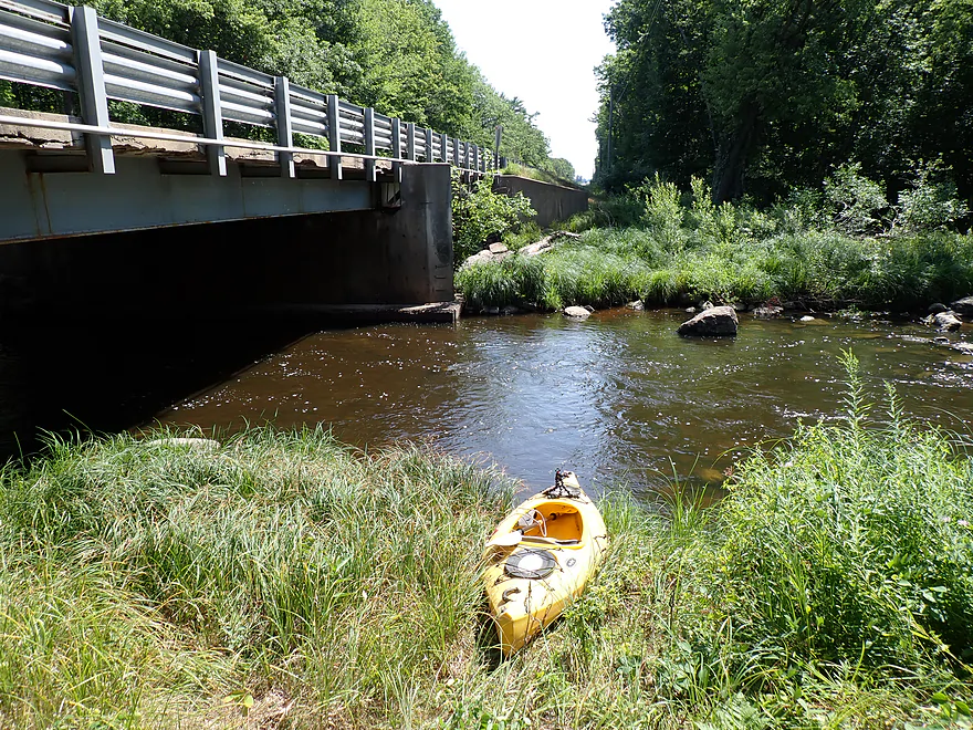
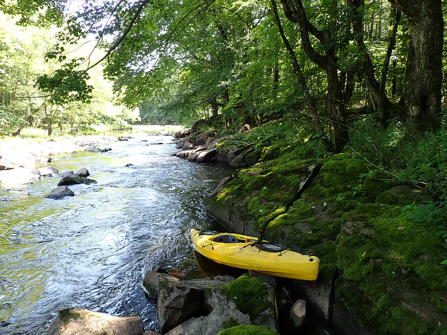
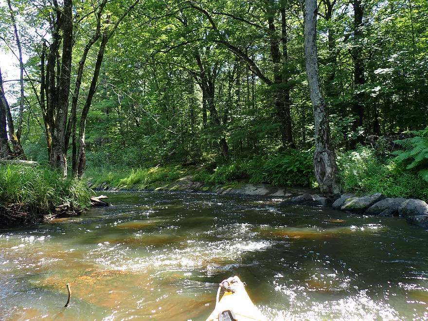
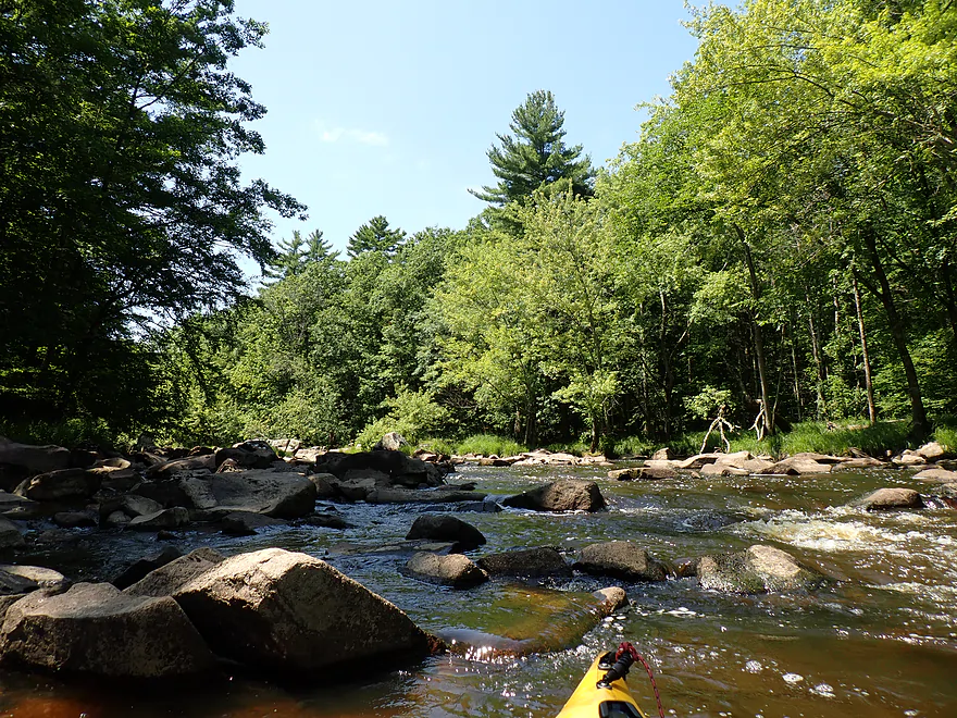
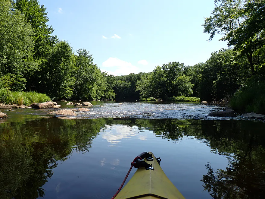
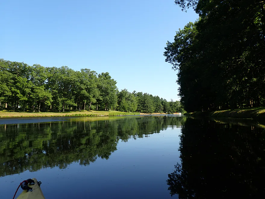
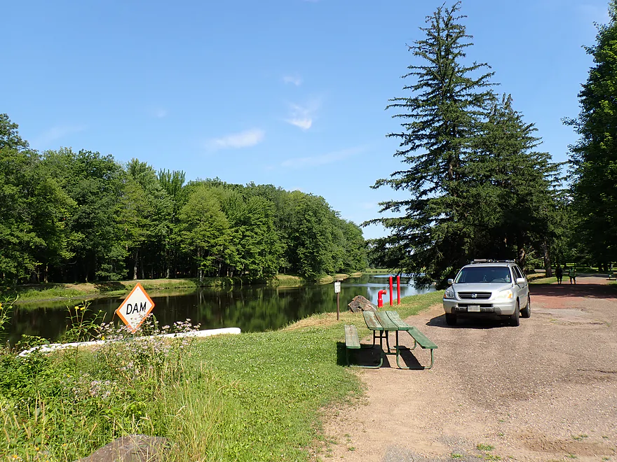
Starting the trip at Hwy N
Rapids right off the bat
Approaching an island
Little congested…should have went the other way around
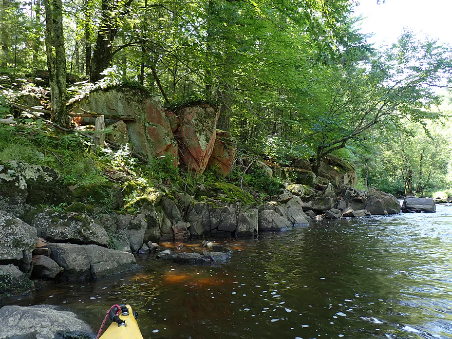
Cool exposed bedrock
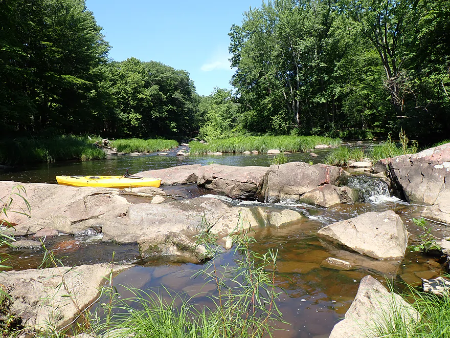
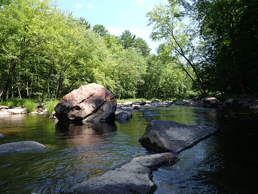
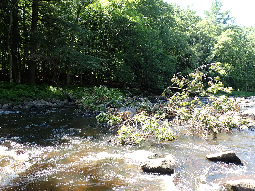
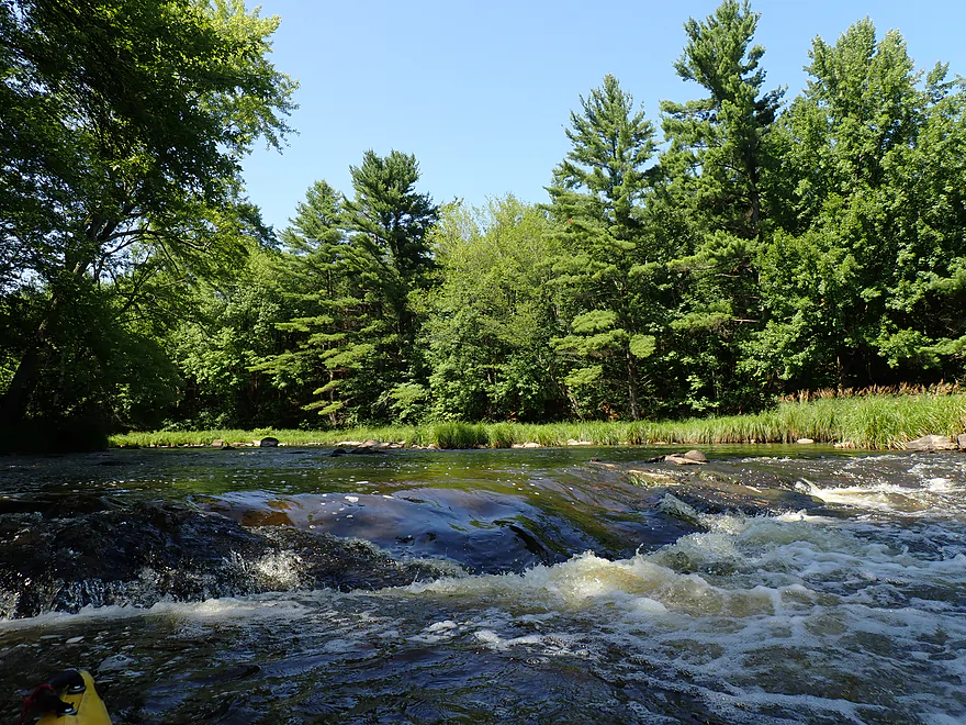
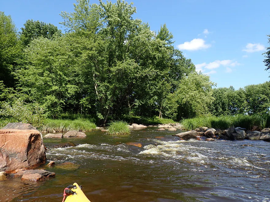
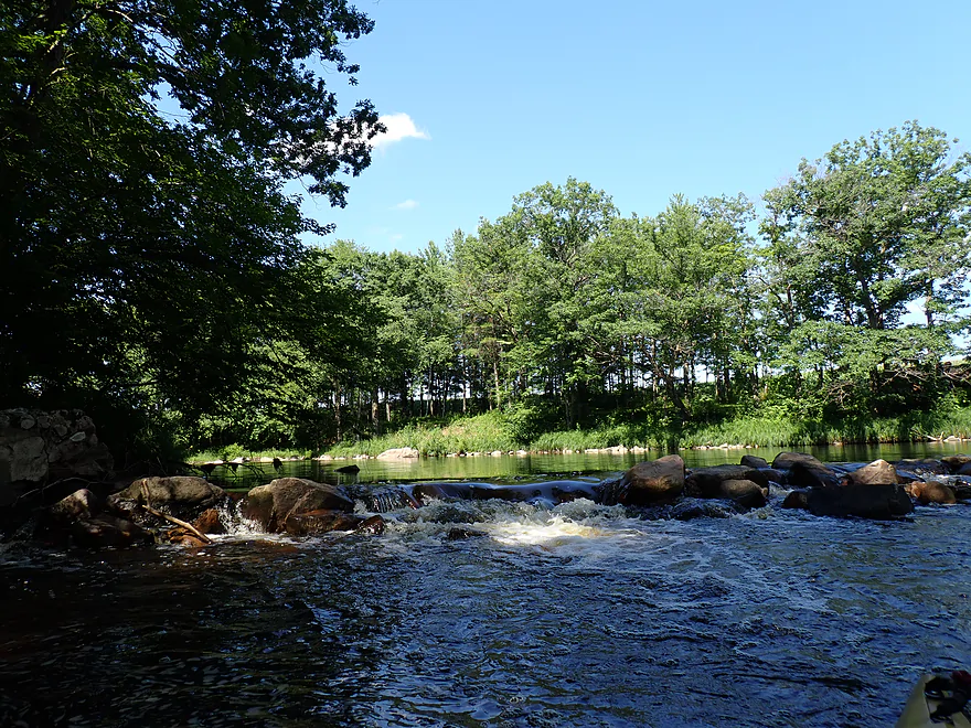
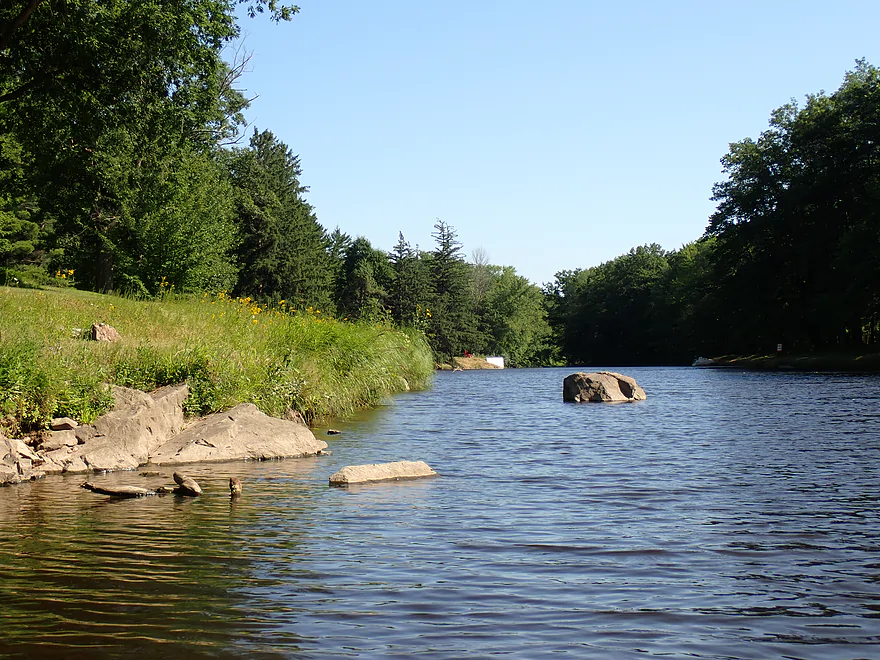
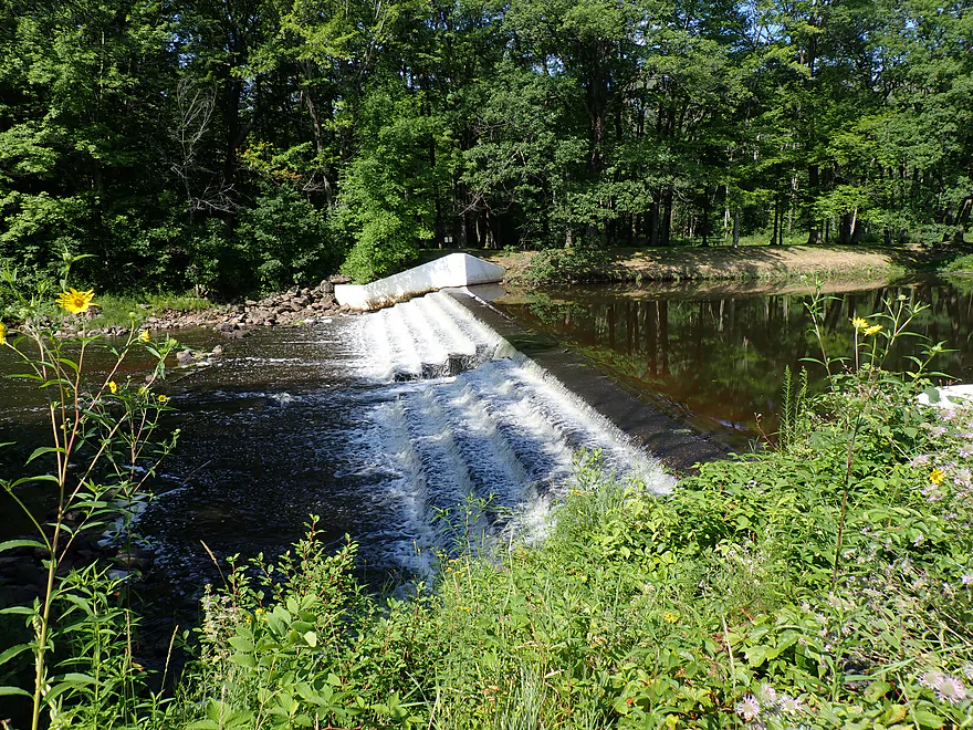
A natural dam
Class 3 chute on the left
Panned out view of the “dam” and chute
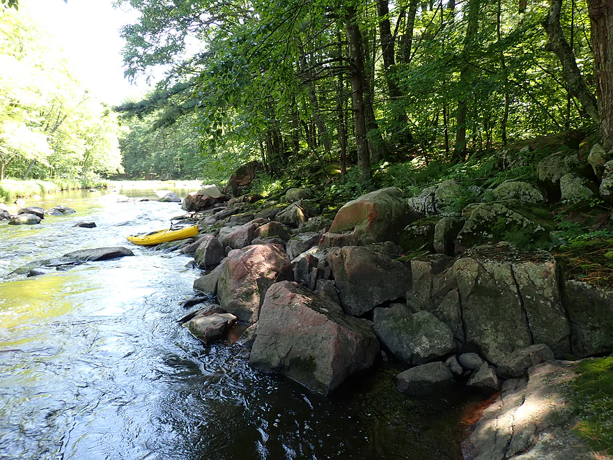
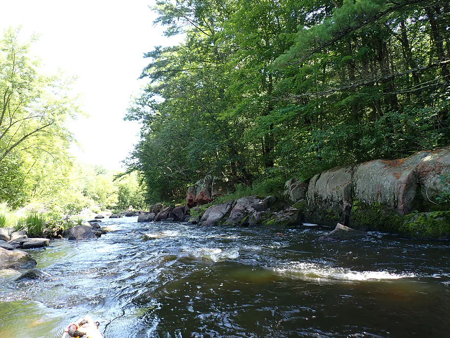
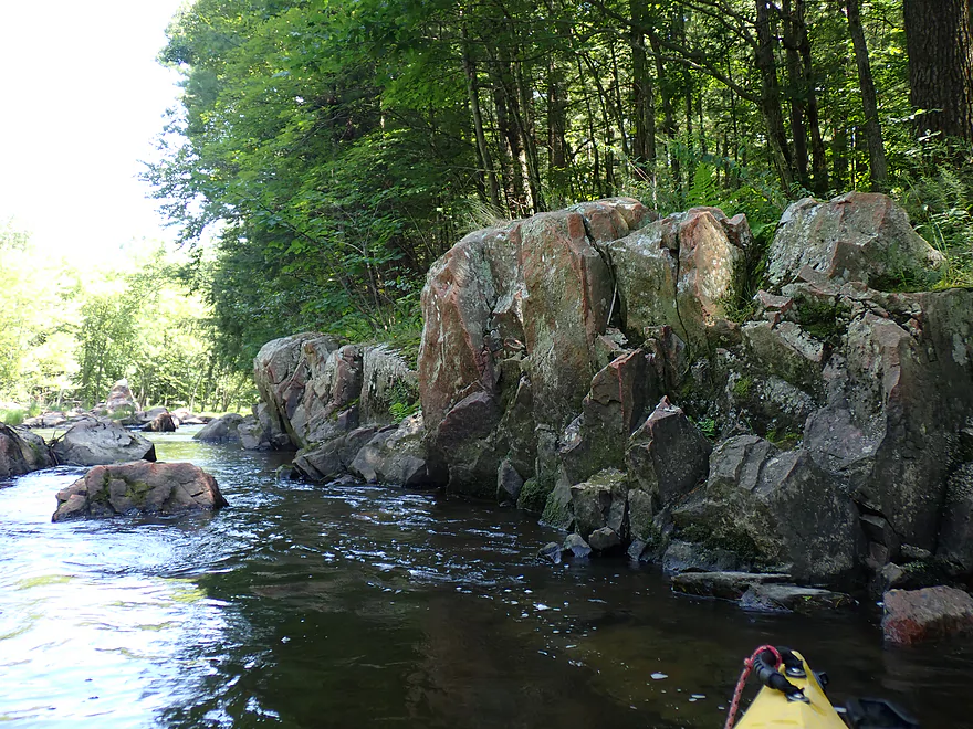
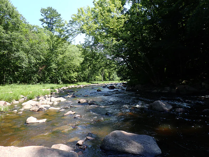
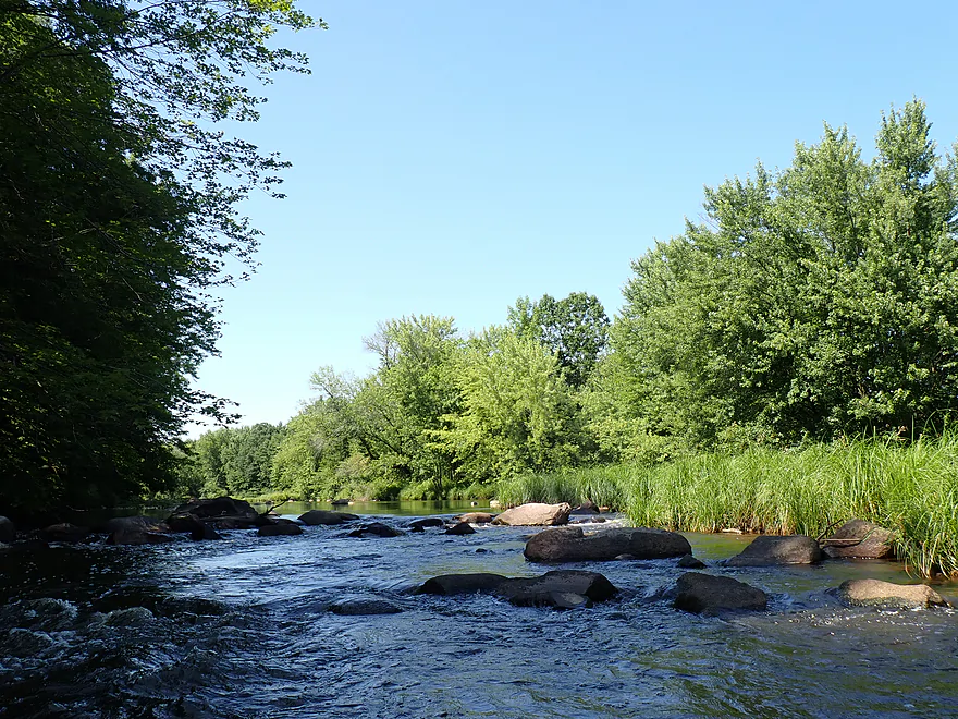
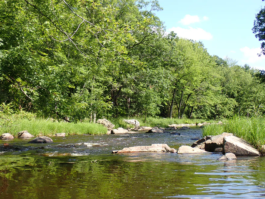
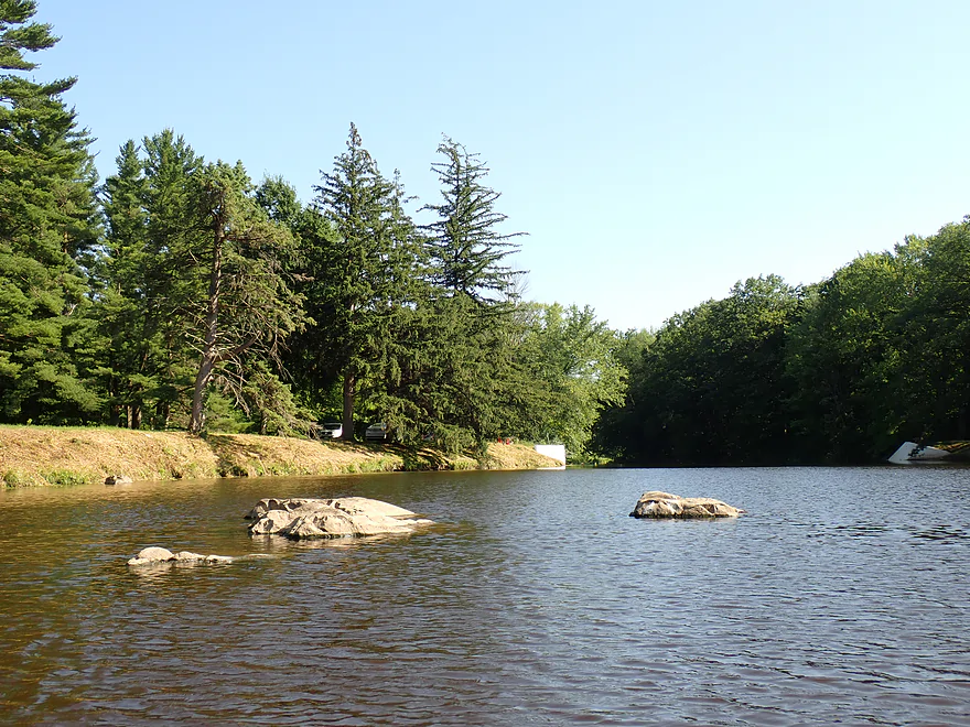
Nice rocky shoreline (part of the “dells”)
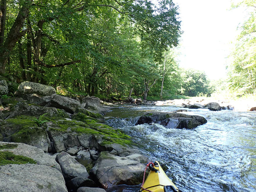
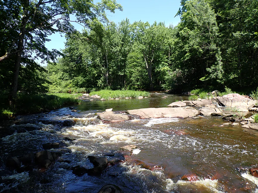
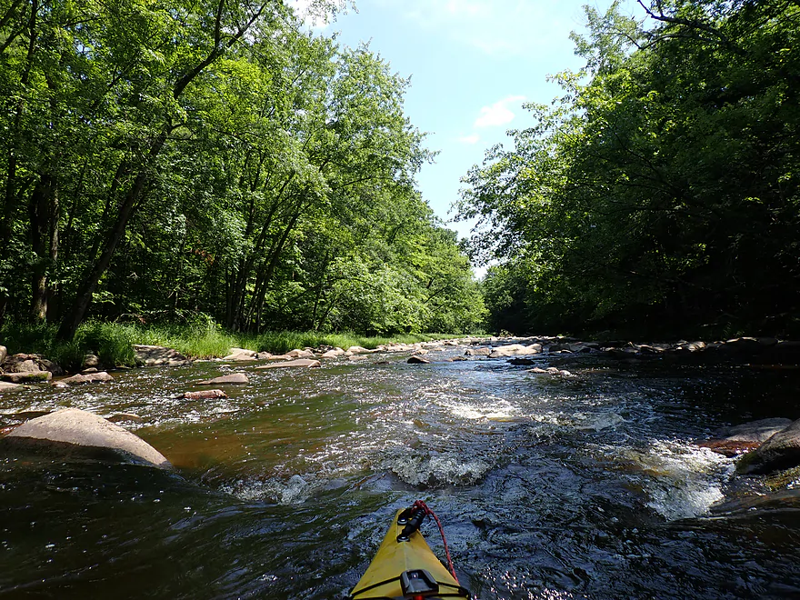
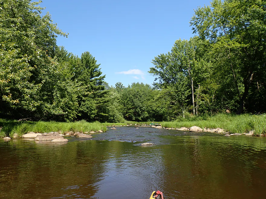
More rapids
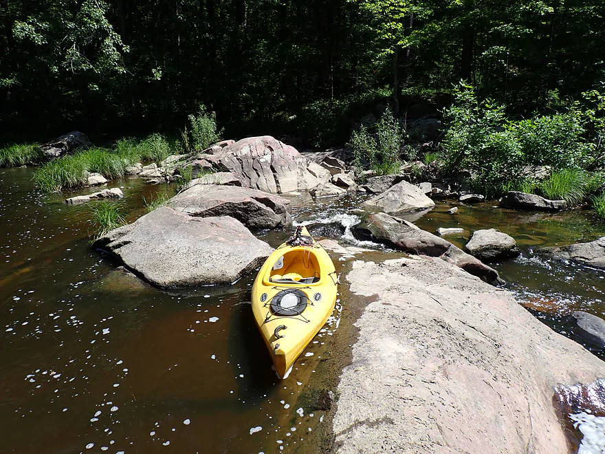
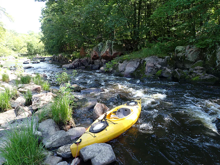
Getting out for pictures
A surprise is hiding around the corner…
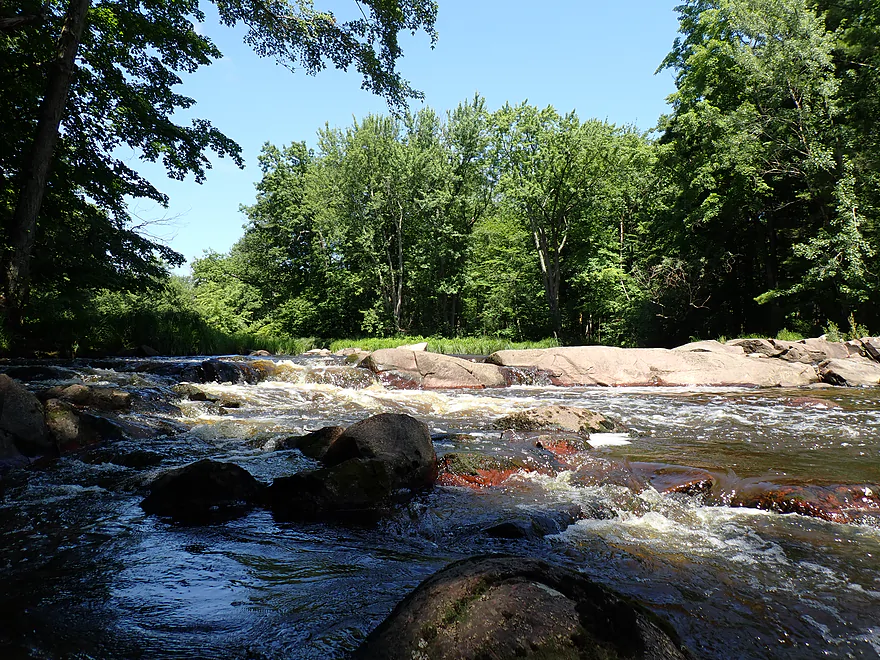
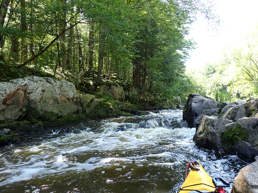
Another scenic pitch of rapids
These were easier (Class 2)
Reverse view
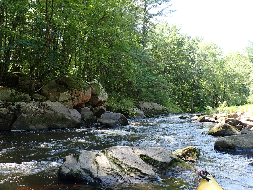
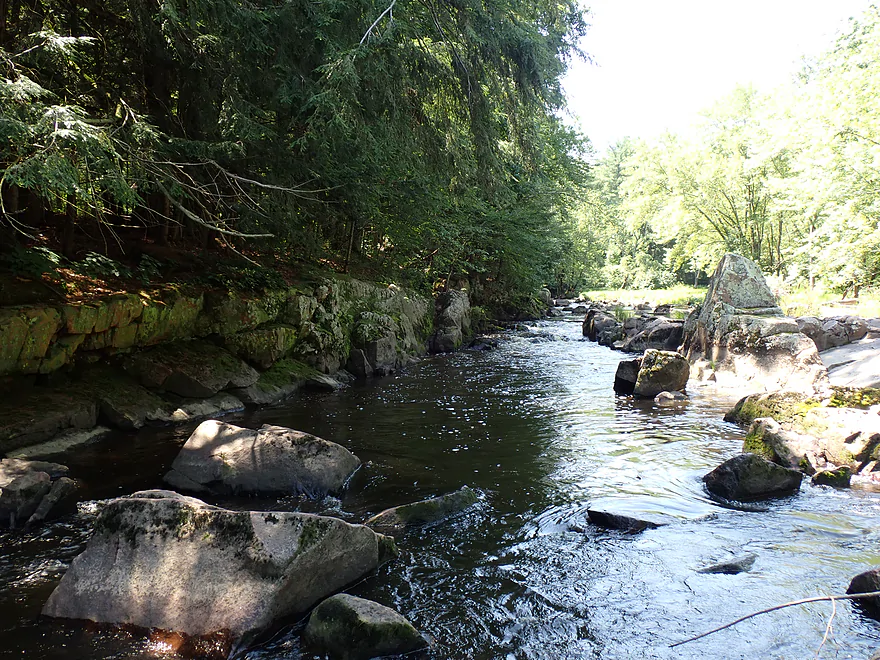
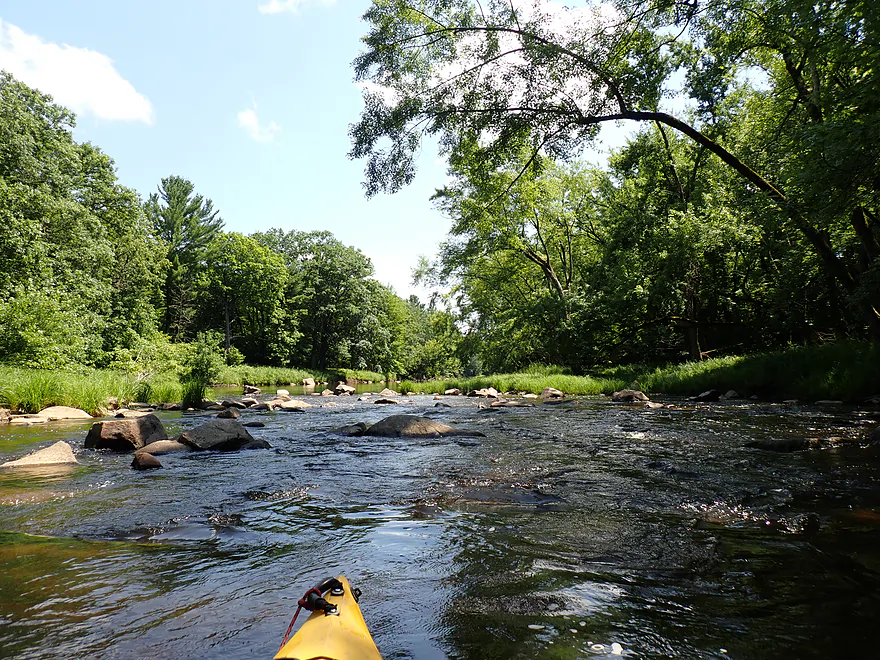
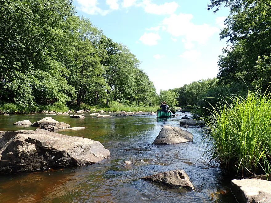
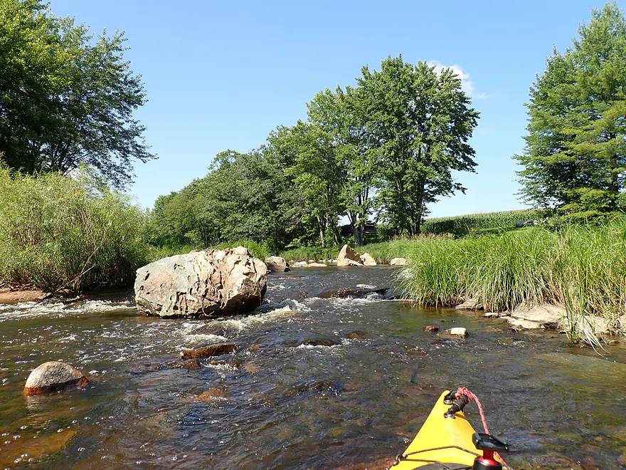
Cool boulders
Paddling between the boulders
The third and most scenic pitch of the “dells”
Likely a Class 3 because of the lack of room to maneuver
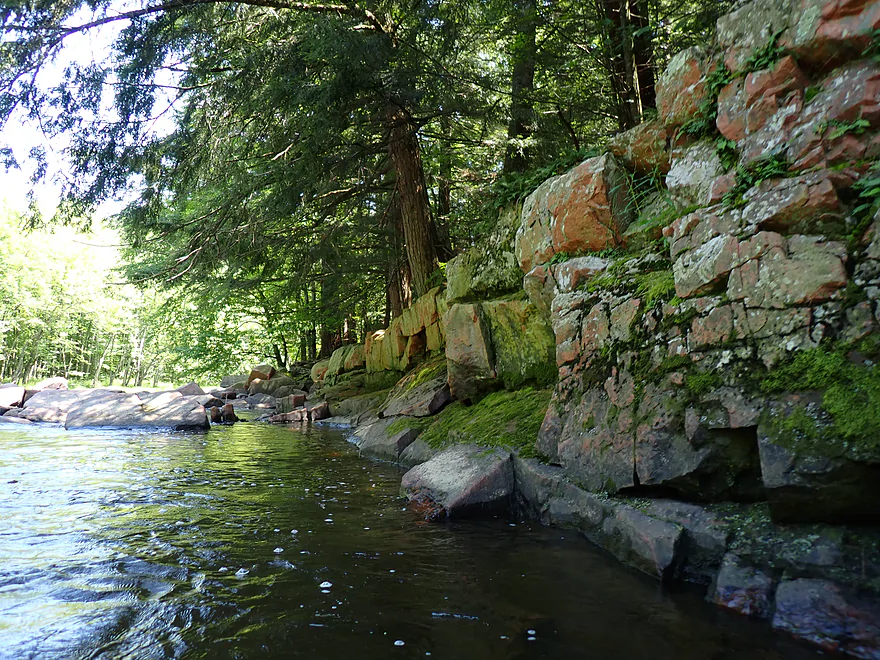
Granite wall
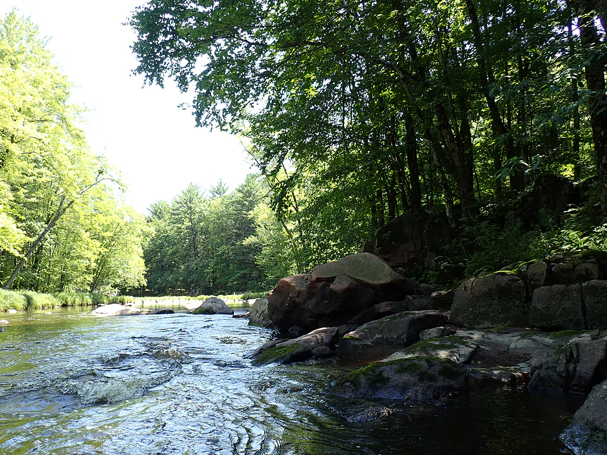
Reverse view of the dells corridor
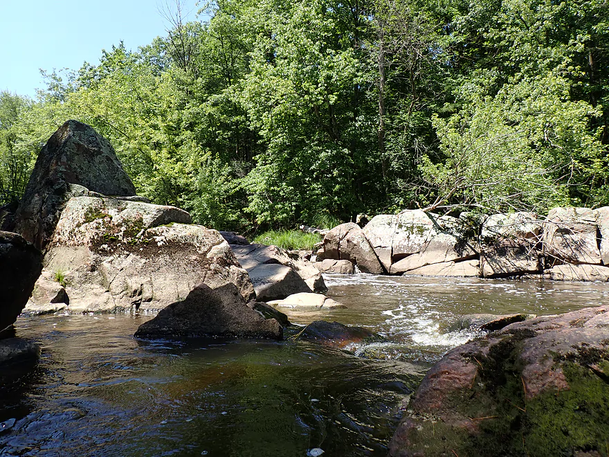
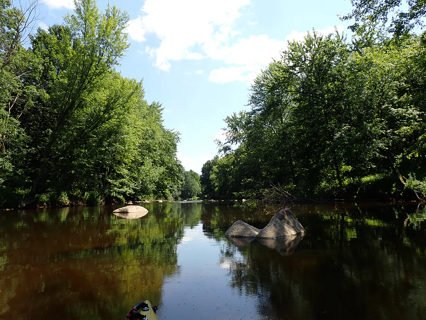
Turning into a rocky bay
Zoomed out view
Some huge boulders
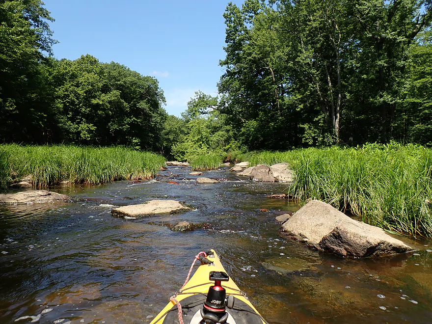
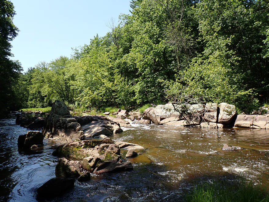
Start of a very long boulder field
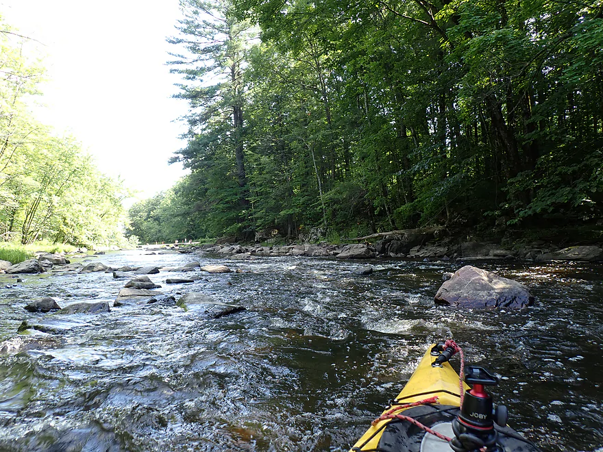
Lot of rapids
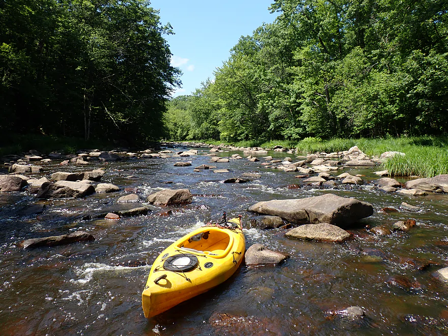
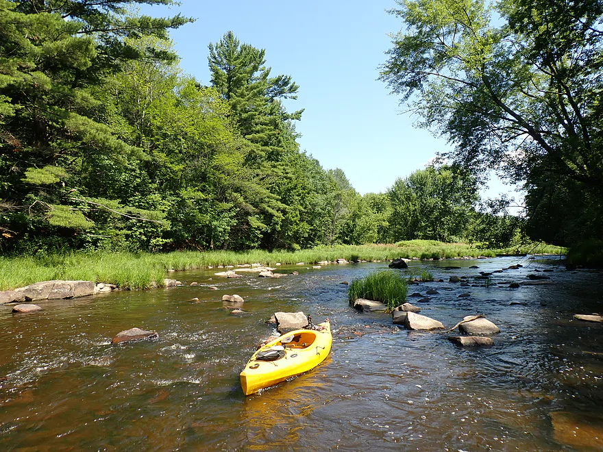
These were shallow…some had to be waded
A tricky strainer at the base of the boulder field
Last part of the boulder field
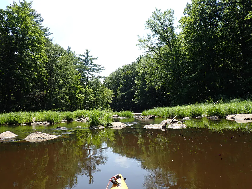
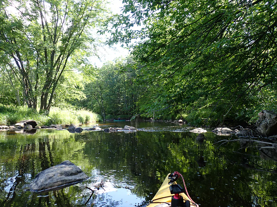
River calms down for once
Taking a sandbar break
Great scenery
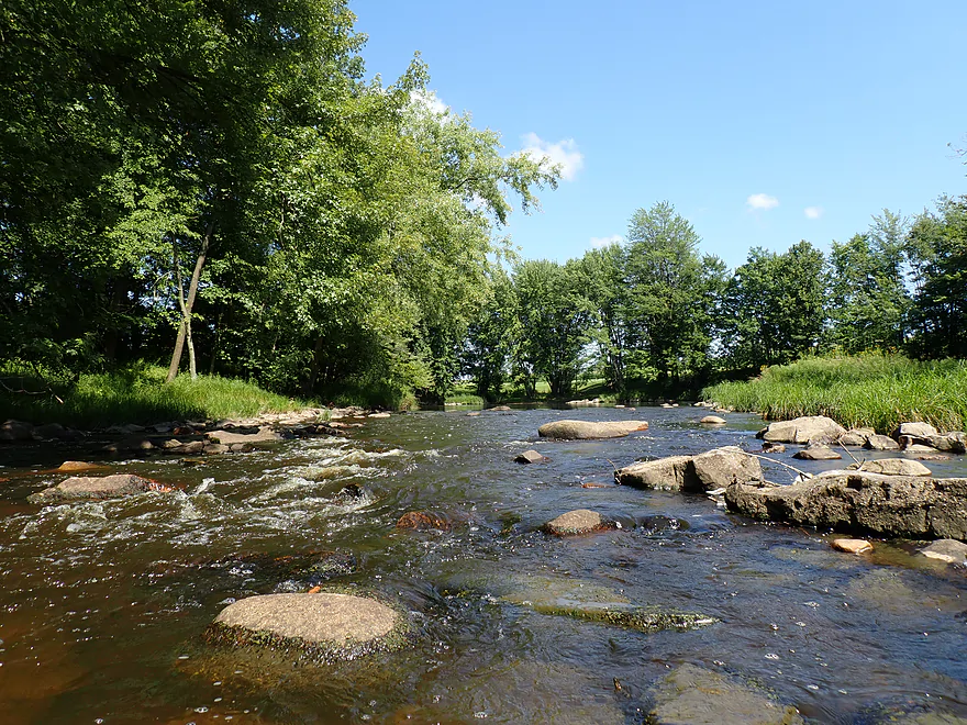
Another shallow spot
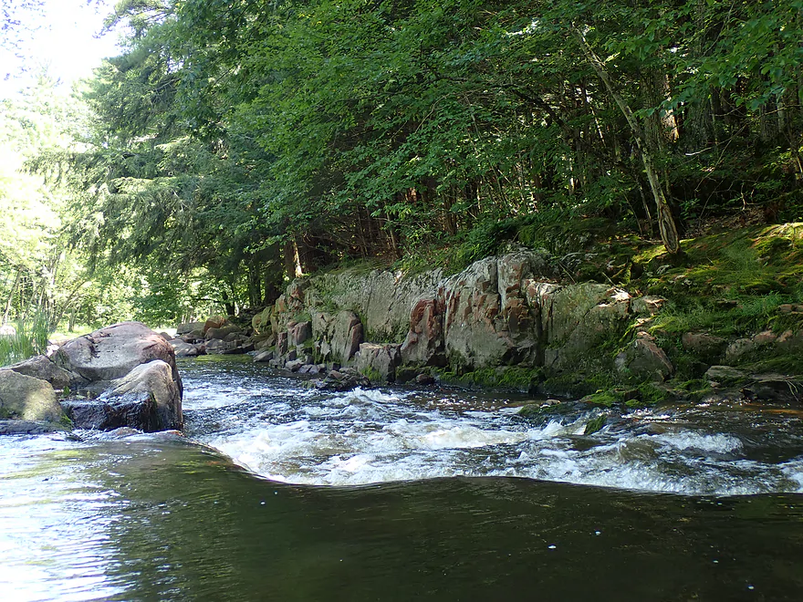
Another natural bedrock dam
I did not fit through this boulder field
Last two miles were mostly pool and riffle
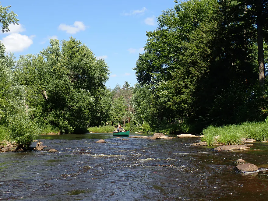
A fellow paddler on the river
Another rock dam
This ones seems suspcious
Other side of the island is rockier and shallow
Portaging an artificial dam (built on a line of boulders)
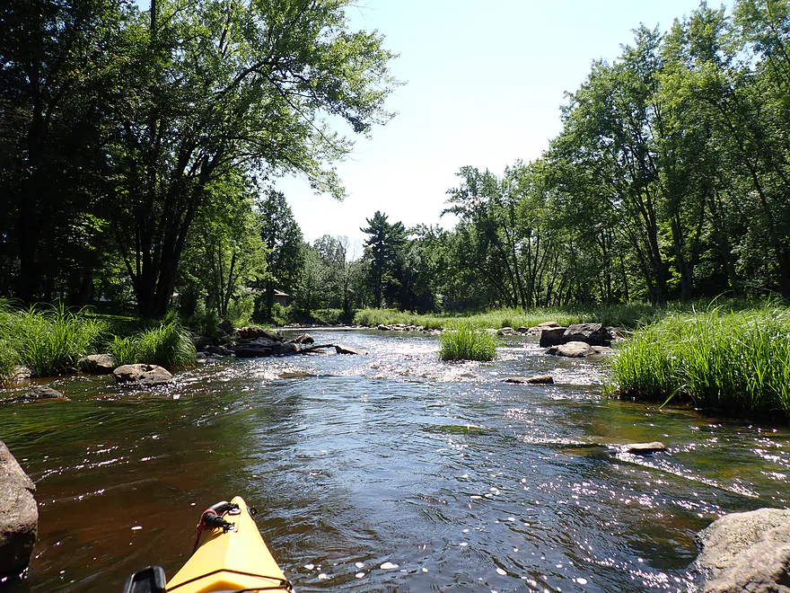
Entering North Wood Park (terrific pines)
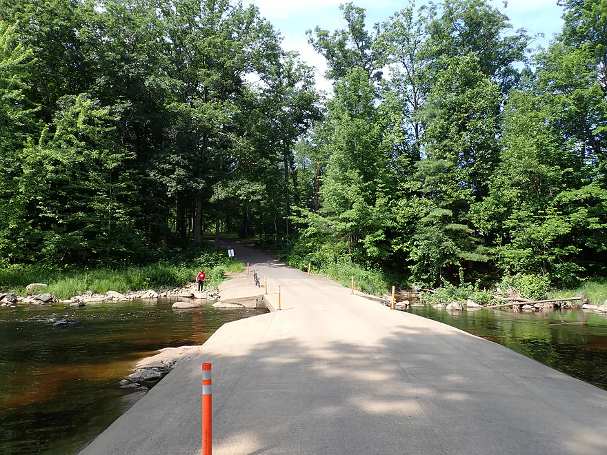
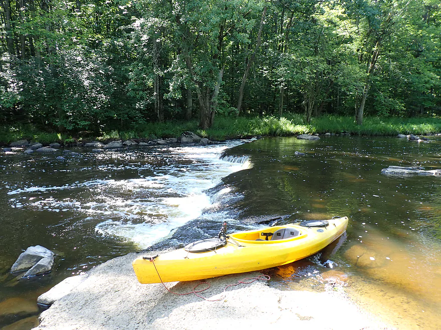
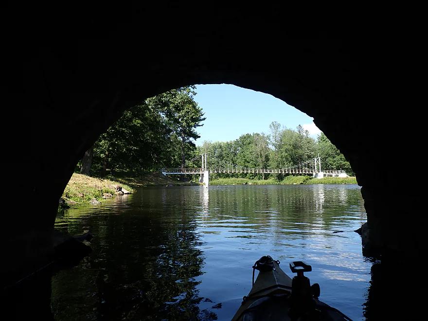
A low bridge that had to be portaged (this goes to the park’s campground)
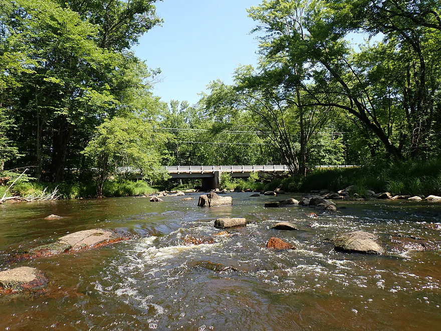
View upstream from bridge
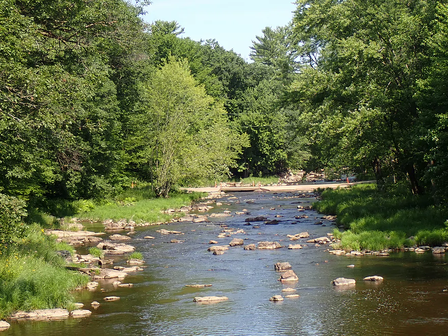
Final rapids
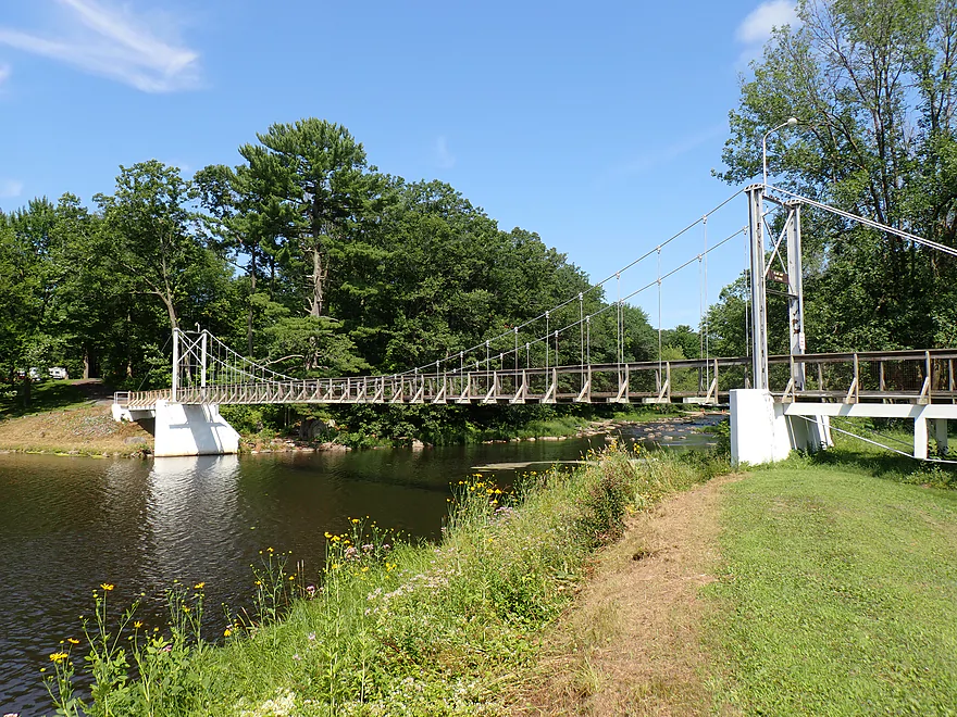
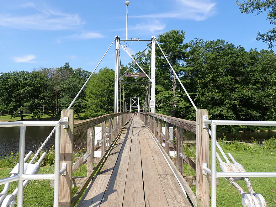
The park’s iconic suspension bridge (also known as the “Swinging Bridge”)
Sign says not to jump…kids (far end) jumped anyway
View upstream from suspension bridge
Another nice trail bridge
Looking upstream at the suspension bridge
Lake Kaunewinne is pretty small
Portaging the Lake Kaunewinne Dam
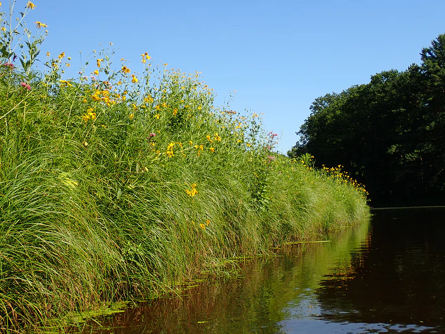
Late summer is a great time for wildflowers
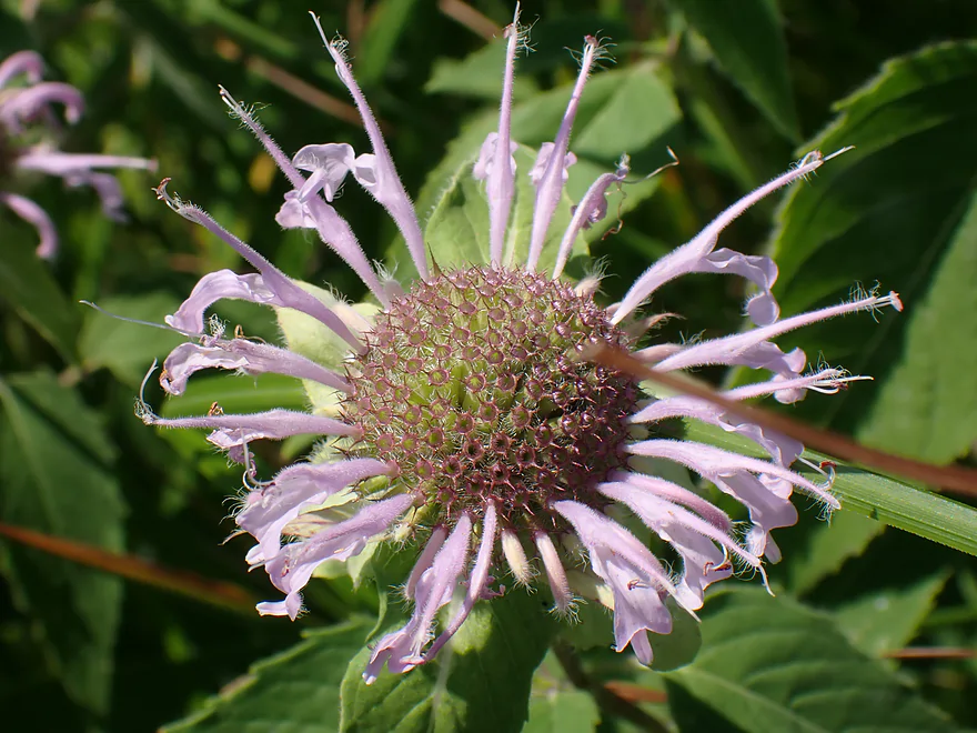
A bergamot flower
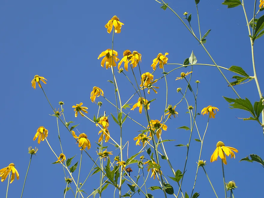
Cutleaf coneflowers
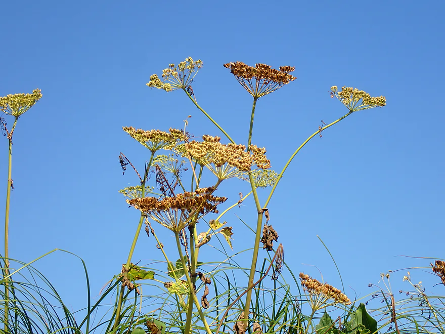
Wild parsnip going to seed (stay away from this–it causes a rash)
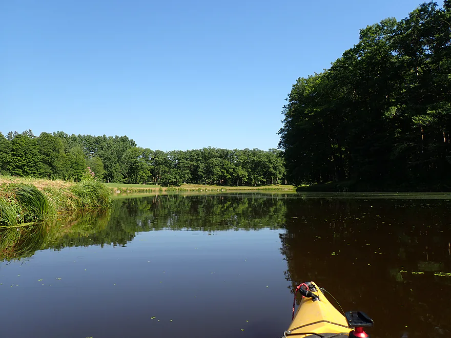
Now on Lake Manakiki
This is the nicer of the two lakes
Tips of what used to be a much larger boulder field before the dam
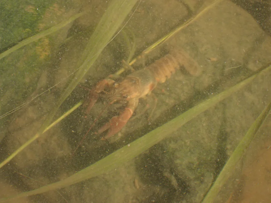
Tons of crayfish in the river
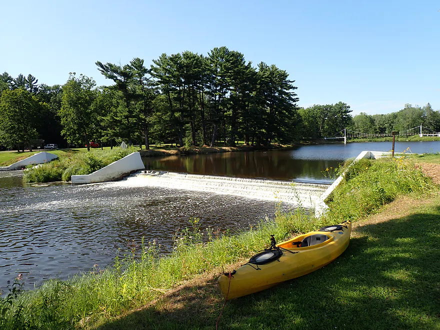
Taking out at the Manakiki Dam (I didn’t leave the car by the fire hydrant)
The Manakiki Dam
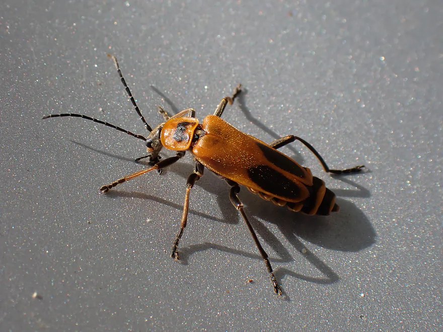
A soldier beetle, hanging out by the dam
Yellow River – Hwy N

Another week and another Yellow River review. This time we’re in Wood County in Central Wisconsin (literally, as the “official” center of the state marker is located in nearby Pittsville). This Yellow is my favorite because of its terrific scenery (mostly between Marshfield and Pittsville).
For this trip I gambled on water levels and decided to float the stretch upstream of North Wood County Park, which has some of the roughest rapids on the river. It’s a Goldilocks stretch…too high and you put yourself in danger. Too low and you hit a lot of rocks. This trip would be more of the latter, which I kind of expected. But IMO it is important to err on the shallow side, as I knew some paddlers in the past had wiped out on this very section.
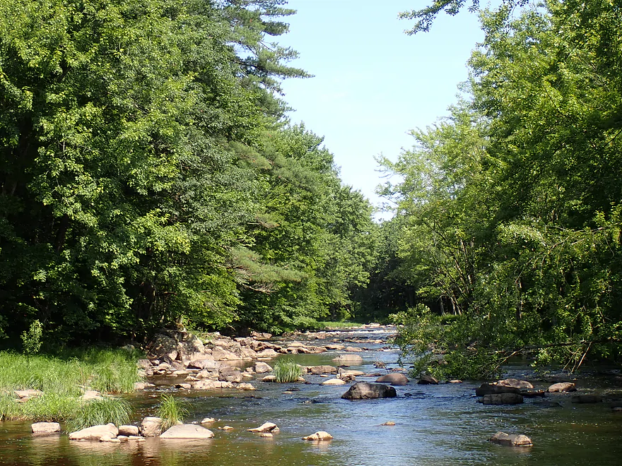
I started the trip at Hwy N, which was scenic with a nice boulder field (the first of many). After the river turned sharply east, I encountered the Yellow River’s famous “dells”. It actually has three pitches, with the first being an exposed stretch of bedrock acting like a natural dam. I hopped down the Class 3 chute (about 2 ft. high), which was fun, but I did have to do a tricky maneuver to get around a rock at the bottom.
The second dells’ pitch had an easier Class 2 chute that was backdropped by some scenic boulders. The third pitch was the most scenic. Here an island split the channel, with the main flow going to the right. This side channel was constricted between a flat bedrock wall on the right and a tall flattened boulder on the left…really cool. There wasn’t much room to maneuver through this “rock corridor” but I made it through (a Class 3 IMO).
Following the dells, the river turned 90 degrees south and I started down a long (quarter mile) stretch of boulders and Class 2 rapids. Most of the rapids weren’t too difficult, but because of the shallow water, I did have to do a lot of “scooching”.
The subsequent mile was mostly peaceful flatwater, which was a nice change of pace as most of the trip prior had been nearly nonstop rapids and boulders. As I was taking a break on a small sandbar, I was surprised to be passed by a canoer. He mentioned that he was part of a larger party, but they had taken out at Hwy N and he planned to continue downstream to Pittsville. I warned him that would be a long trek and would involve some strong rapids (like Little Bull Falls). With this in mind he decided he would abort his trip at North Wood County Park (also my take-out). I was surprised that anybody would run the upper Yellow in a two-man canoe. My small 10′ kayak was too big to navigate through some of the shallow boulder fields…I’m not sure how he managed.
The final river mile was pleasant…mostly a mix of pools and riffles with some nice “up-north” scenery. There were still some shallow ground-outs and a few small ledges to deal with. Some of the ledges seemed like natural bedrock “dams”, but others appeared a bit more artificial. Most I was able to slide over without needing to portage. The final boulder field was at the north end of North Wood County Park .
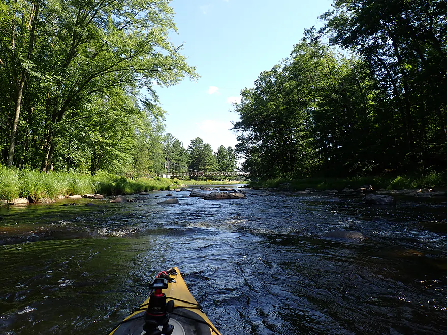
Following some fun Class 2’s and attractive pine trees I was stopped by a low park bridge that had to be portaged. When the river is high, it will overtop this bridge and become a dangerous low-head dam. Daredevil campers will still drive over the bridge to reach their campsite (not recommended as there is an alternative emergency escape route for the campsite).
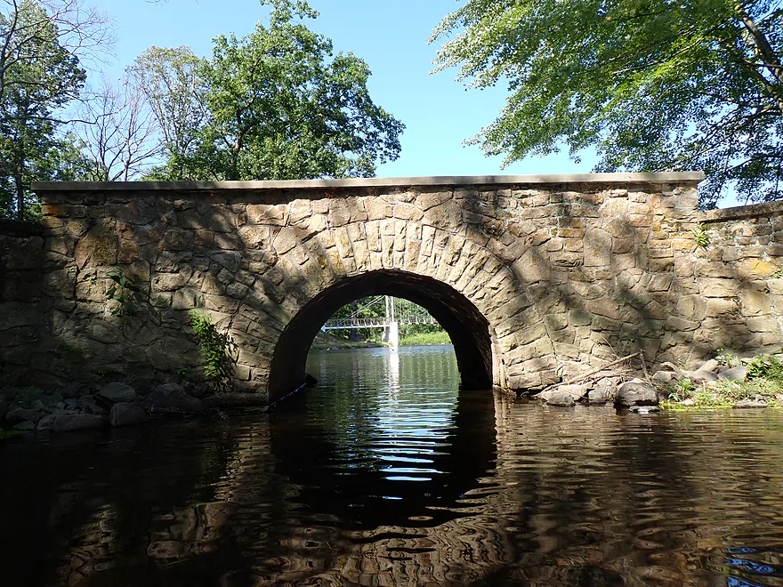
A scenic suspension bridge marked the entrance to Lake Kaunewinne (Kaunewinne is the Chippewa word for Yellow River). It’s a simple lake, but not too bad, and there is a little stone bridge you can paddle under on the west side. I portaged the dam on the official east shore portage path. This proved trickier than expected because of the steep banks and in hindsight I should have portaged the west side. The dam itself had a unique stairstep ramp I almost debated running (but I was already pushing my luck).
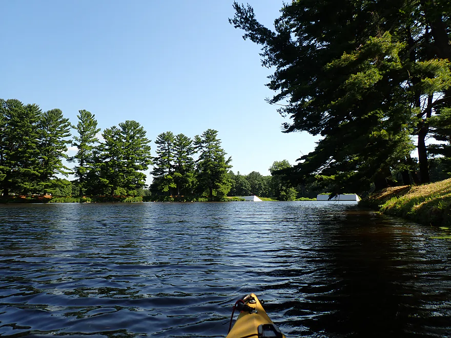
Lake Kaunewinne is immediately followed by Lake Manakiki (the Chippewa word for maple forest). Both are artificial lakes that likely were built over some scenic rapids and maybe even waterfalls. Manakiki is the nicer and larger of the two and it’s not unusual to see kayakers paddling it. If you want, you can paddle upstream on “Puff Creek” which has a few small boulder fields. I ended the trip at the Lake Manakiki dam, which was a decent take-out option.
In summary, this was a scenic and fun trip I enjoyed. But it won’t be for everyone. It’s a challenging stretch because of the boulder fields, which, in shallow water, most kayaks won’t fit through that well…and in high water will become dangerous. My advice is to only do this trip if you have a good boat, Class 2-3 whitewater experience, and water levels that aren’t too high. Going when the river is shallow isn’t the end of the world as it is a safer way to see the scenery (but bring wading shoes as you’ll have to get out in a number of spots).
2026-06-17 Update – A commenter (see bottom of page) did this trip during high water (6.3′ per the Pittsville Gauge) and noted “Probably the scariest thing I’ve ever done”. This section can be VERY dangerous and should NOT be attempted when water levels are high.
Sights included damselflies, deer, a few minnows, a clamshell (not too many clams around anymore), and a porcupine crossing the road. The highlight were the many crayfish. Be sure to keep an eye out for white deer, since there is a population around Pittsville.
North Wood County Park & Campground: This is an underrated county park located along the banks of the Yellow and three of its dams. The main facilities are on the east shore, while the west shore features a large campground. A very low bridge connects the two banks and this often floods, which can strand campers (although there is an emergency exit to the west). Park highlights include an attractive 225 ft. suspension bridge, a local trail system, nice up-north scenery, and, of course, the Yellow River itself. The two lakes (Kaunewinne and Manakiki) are artificial but popular with paddlers (although both lakes are fairly silted in). As nice as the lakes are, I’m sure the original river was much more interesting and would have featured terrific boulders and exotic rapids given the 30′ per mile grade of the lakes.
Jurustic Park: This is a very popular and creative metal sculpture park located just west of Marshfield.
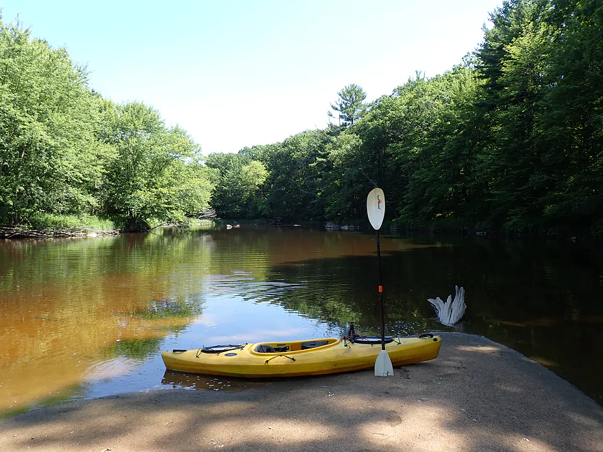
Hwy N: This was a decent bridge access, although the banks were a bit steep and weedy.
Alternative Put-ins:
- Hwy 80 (3.4 miles upstream from Hwy N): There is a pull-off you can use to access the river, but you will have to drag your boat through thick grass to reach the water. The section between 80 and N is much less interesting than the downstream legs with far fewer rock gardens/rapids…but it is much easier and safer.
North Wood County Park – Manakiki Dam: Just east of the dam is a public road and space to park. It’s not difficult to disembark just northeast of the dam.
Alternative Take-outs:
- Park Roads (0.7 miles upstream from the Manakiki Dam): There is a low bridge here where it would be easy to get out. You could also disembark by the suspension bridge just a bit downstream for better parking. Paddlers who want to avoid the small lakes could end their trips here.
- Hwy C (2.8 miles downstream from Manakiki): A doable bridge access but with tight shoulder parking. This bonus leg is scenic with nice boulder gardens and rapids…but just upstream from Hwy C is “Jenny Falls”–a Class 3 which can be dangerous in high water.
- Little Bull Falls (4.0 miles downstream from Manakiki): The eastern shore is owned by a private bar and you need permission to get out here. This section has lots of rapids and boulder gardens. The most significant is Little Bull Falls, which is a dangerous Class 4 and is preceded by a tricky Class 3.
Bike Shuttle – Manakiki Dam to Hwy N: 3.1 miles with 72′ of ascent. This was a very easy bike shuttle.
Hazards are listed here in river order and with map/video links. In general this is a Goldilocks river. It will usually be too shallow/rocky or too high/dangerous. Rarely will it be just right.
- The Dells – This is the most scenic part located just downstream from the put-in at N.
- Pitch #1 (map | video): This starts with a Class 2 sub-pitch around an island. Go left for a “gentler” descent. Exposed granite bedrock then creates a scenic natural dam which forms the second sub-pitch. The main chute is a Class 3 drop (~2′) with some tricky rocks at the bottom. The third sub-pitch is a series of class 1+ rapids that parallel a scenic rocky bank. This is all easy to scout/portage if need be.
- Pitch #2 (map | video): After a short break, you turn left and paddle through a Class 2 river constriction created by large scenic boulders. In low water getting through is a bit tricky and this should actually be easier in high water. Easy to scout/portage.
- Pitch #3 (map | video): The most scenic pitch of the dells. The river is split by an island with the main channel on the right flowing between two flat rock walls. This is a Class 3 as there isn’t much room to maneuver. This is followed by a Class 2+ turn to your left to enter a small rock bay…then you’re done with the dells. This one is trickier to scout/portage.
- Quarter Mile Boulder Field (map | video): Located just after “The Dells”, this is a 1300′ dense boulder field with almost non-stop rapids. In shallow water, this was bumpy and a bit difficult to get through. In high water, this would likely be mostly Class 2’s with maybe a few tricky spots. There is a strainer near the end of the boulder field.
- Pine Ledge (map | video): The bedrock creates a natural mini-dam and a 1-2′ ledge. This was a Class 1, but could be a Class 2 at higher levels.
- Boulder Constriction (map | video): A short but dense series of boulders I just couldn’t fit through (you will have to wade or portage). In high water this might be a Class 2.
- Island Dam (map | video): It appears the locals created an artificial rock dam which results in a simple Class 2 ledge.
- Cement Slab Dam (map | video): Easy to scout/portage on the left bank…best path will be the left channel (about a 1′ Class 2 drop).
- Pine Rapids (map | video): These are Class 2’s that are easy to scout before the trip from the park trail (east bank). There is a strainer above the bridge.
- Park Roads Bridge (map | video): In low water this is an easy portage. In high water dangerous rapids can overtop the bridge and create a low-head dam hazard for paddlers.
- Lake Kaunewinne Dam (map | video): The official portage signs say to portage on the east bank, but this is difficult because of the steep shoreline. Portage on the west shoreline, which is much easier. The dam descends down “stairs” so perhaps with the right boat and right conditions you could run it (but I wouldn’t risk it).
- Lake Manakiki Dam (map | video): This is another “stair dam”. I got out on the east bank. A portage, if need be for longer trips, wouldn’t be difficult.
For a different perspective, read the AmericanWhitewater.org review of the same stretch. Warning: they did this leg at a much higher (thus more dangerous) level. The people who write on AW tend to be professional whitewater paddlers who use special gear and equipment. Much of their advice is not applicable to rec paddlers.
2026-06-17 Update – A commenter (see bottom of page) did this trip during high water (6.3′ per the Pittsville Gauge) and noted “Probably the scariest thing I’ve ever done”. This section can be VERY dangerous and should NOT be attempted when water levels are high.
Trip Depth – Yellow River @ Pittsville: 4.5′
Depth Guide: Note, the gauge at Pittsville does not provide consistent readings so may not be reliable. I debated referencing the gauge by Babcock (it was 87 CFS), but that isn’t trustworthy either because of erratic Lake Dexter dam releases. Always use your own judgement and have a plan B if in-person water levels don’t look right.
- 0-4.3′: Too shallow.
- 4.4-4.5′: First mile will be very bumpy and you will have to get out in a few spots to get past the rocks. Wetshoes are recommended. Most paddlers will not have the patience to deal with this shallow depth, but it is a safe way to see and experience the incredible scenery.
- 4.6-4.7′: Above average depth. Maybe a good target range. You will need good boat control to get through a few of the chutes and rapids…this is not a stretch for beginners.
- 4.8-5.0′: A higher depth. Professional whitewater paddlers might target this as a floor depth…but at this point the river could start to get a bit strong and rough for rec paddlers.
- 5.1-5.3′: A very high depth only suitable for skilled whitewater paddlers.
- 5.4’+: Maybe too high for any type of kayaking.
Detailed Overview
- Eagle Road to Yellow River Road: 4.3 miles. Background provided by WisconsinRiverTrips.com contributor Daniel Akin.
- Eagle Road to Hwy HH: 2.2 miles. This is a dangerous section with Class 3 and 4 rapids. There’s also a wire fence across the river to deal with.
- Hwy HH to Yellow River Road: 2.1 miles. A more wooded stretch that I don’t know much about. Nice street view image.
- Yellow River Road to Hwy 10: 4.3 miles.
- Yellow River Road to Hwy BB: 1.3 miles. A nice wooded stretch with no major rapids.
- Hwy BB to Robin Road: 0.8 miles. A scenic stretch of the river. The South Branch joins up by the BB bridge and adds significant volume.
- Robin Road to Hwy 10: 2.1 miles. A great stretch featuring several fun rapids and small outcrops. Much of this flows by a large golf course which can be scenic in the fall because of all the maple trees.
- Hwy 10 to Hwy 80: 4.0 miles.
- Hwy 10 to Lincoln Ave: 2.2 miles. Very narrow and wooded. At times little light reaches the river, which is really cool. Neat boulder gardens and a great stretch, but there are two logjams.
- Lincoln Ave to Hwy 80: 1.7 miles. Good stretch with a number of scenic boulder gardens and one nice outcrop.
- Hwy 80 to Hwy N: 3.4 miles. Starts slow, but ends with nice boulder gardens and rapids.
- Hwy N to North Wood County Park (2nd Dam): 2.9 miles. A rocky stretch with some rough whitewater, including a Class 3 near the put-in by the “dells”.
- North Wood County Park (2nd Dam) to Little Bull Falls Grill: 4.2 miles.
- North Wood County Park (2nd Dam) to Hwy C: 2.8 miles. Scenic stretch with many boulder gardens and rapids. The most serious rapids are near Hwy C and include Jenny Falls, which is a Class 3.
- Hwy C to Little Bull Falls: 1.2 miles. More rapids and boulder gardens. There is a logjam shortly after Hwy C. Little Bull Falls is a Class 4 and is preceded by a Class 3.
- Little Bull Falls to Dexter Park: 7.5 miles.
- Little Bull Falls to Hwy 73: 1.6 miles. Many rapids on this stretch with some nice rock outcrops. Launch below the falls and at a private access.
- Hwy 73 to Riverside Park: 1.7 miles. More rapids and the biggest and best outcrops. Hwy 73 is a weedy but doable access option.
- Riverside Park to Dexter Park: 4.2 miles. Far fewer outcrops and rapids, but a nice wooded section. Two miles in the flowage kicks in which is less interesting.
- Hwy 54 (Dexter Park) to Hwy 80 (Babcock): 9.7 miles. While you could launch by the park, your best bet will be to launch SW of the dam off Hwy 54. Paddling author Frank Piraino liked this section and said it had no logjams, but I think it has since filled in...could have 10+ logjams. Can be pushy when high and only for adventurers. Not too many sandbars.
- Hwy 80 to Hwy F: 10.6 miles. Good sandbars. Am not sure about jams....maybe 6.
- Hwy F to 9th Street: 8.3 miles. A nice stretch with good sandbars. 2024 update...this stretch now has many logjams (~8?) because of recent storms.
- 9th Street to the dam (Necedah): 16 miles. A lot less sandy and many oxbows. Jams are a question mark. I suspect this is a weak section.
- Necedah to Yellow River Bay: A nice stretch with good sandbars.
- Castle Rock Lake: Blah. A big , open and dangerous flowage (3rd largest in the state).
- Buckhorn State Park: You can explore the back channels and they seem nice, with interpretive signs…but with no current and only 1.5 miles. Here is a map of the official water trail in the park.
Trip Map
Overview Map
Video
Photos Size:
This is welcomed review of a section that few people have done. We usually take out at N Bridge but we went through to the park about five years ago. It was crazy fast with high water and we had to dump out water three times. One of my friends lost his car keys in this section. Haven’t been on this section since. It looks way different with high water. Thanks for all the pics and videos. It’s
the first time we’ve seen this section with pics
Your previous warnings were why I wanted to do this when low! Appreciate this and the other comments you’ve provided over the years.
One definitely needs a skirt to keep water out of boat, I’m not sure if I feel confident in going down this section again. Im glad you posted a sturn warning in the beginning of your post!
We just survived this section after 4 in of rain within the week. Not for beginners. We got otut and walked the shore to save our lives. Do not take children. It could be a lot of fun on a raft and it is very beautiful when your not trying to dislodge your kayak from boulders. If you are a novice kayaker plan to lose things, paddles, kayak, shoes etc.
Thanks Aaron for the warning. Testimonials like this are very helpful for other paddlers. For reference you did the trip on June 13th when the Pittsville gauge was roughly at 6.3′ – https://water.noaa.gov/gauges/pitw3 . My recommendation was for paddlers to stay under 5′ and even the low 5s were would be fairly strong for professional whitewater paddlers. This is a deceptively challenging stretch…at high flows those rapids might have been Class IV’s.