
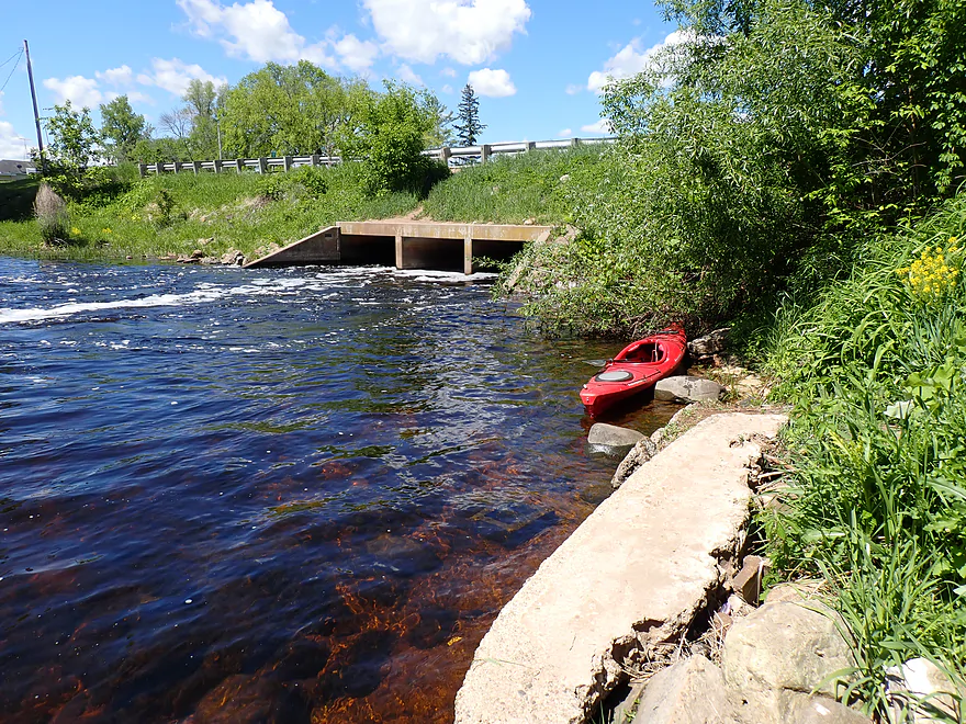
Launching below the Auroraville dam by Hwy 49
Paddling through the outskirts of Auroraville
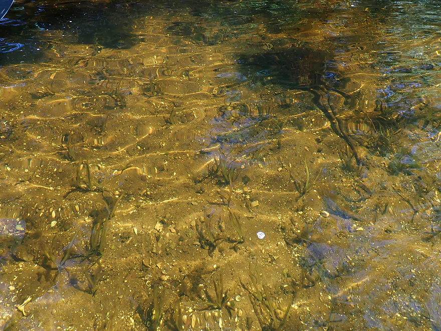
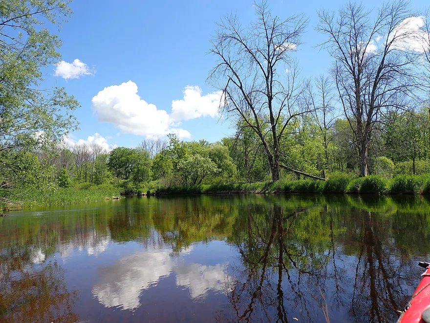
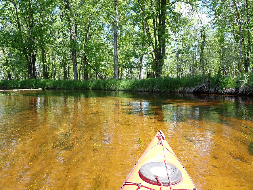
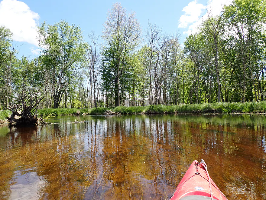
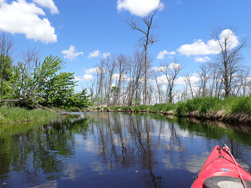
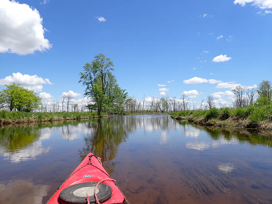
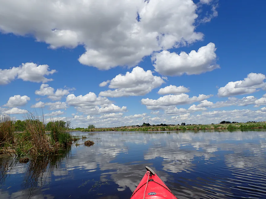
Great clarity!
Residual foam from the dam
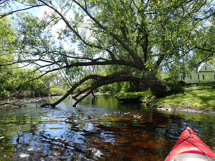
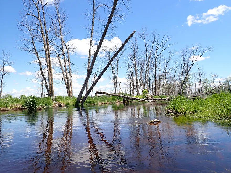
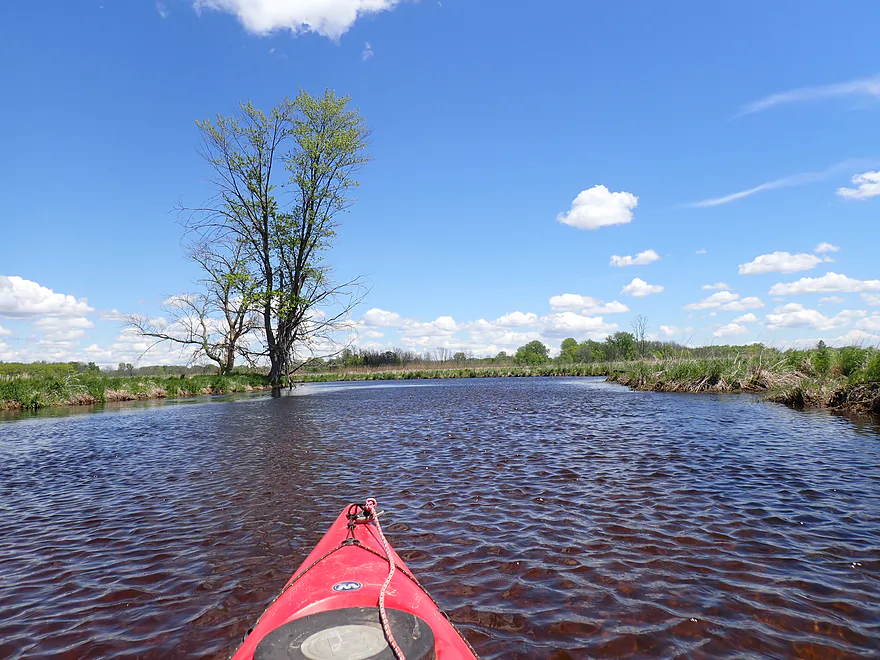
Paddling through a thin wooded section
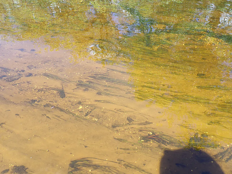
Nice sandy substrate
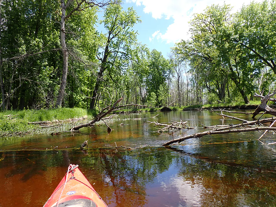
Some deadfall, but always easy to get around
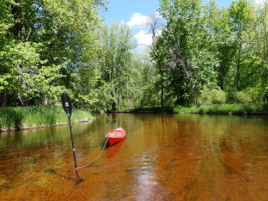
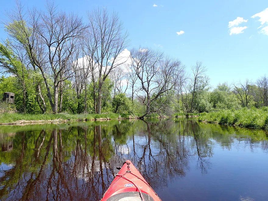
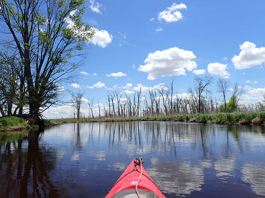
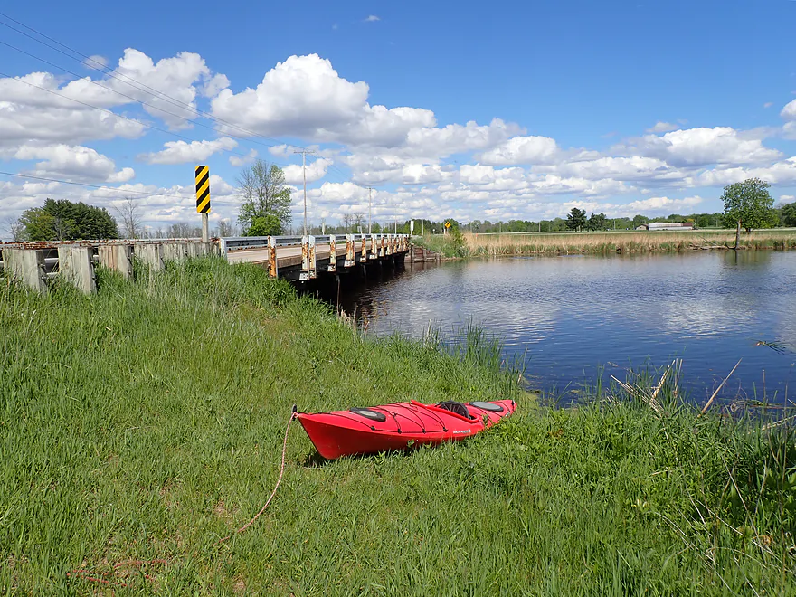
Getting out to photo my red kayak on the red river
Trip was very clean to start
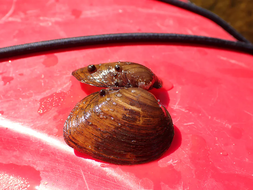
Some clam shells
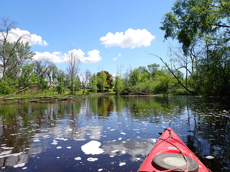
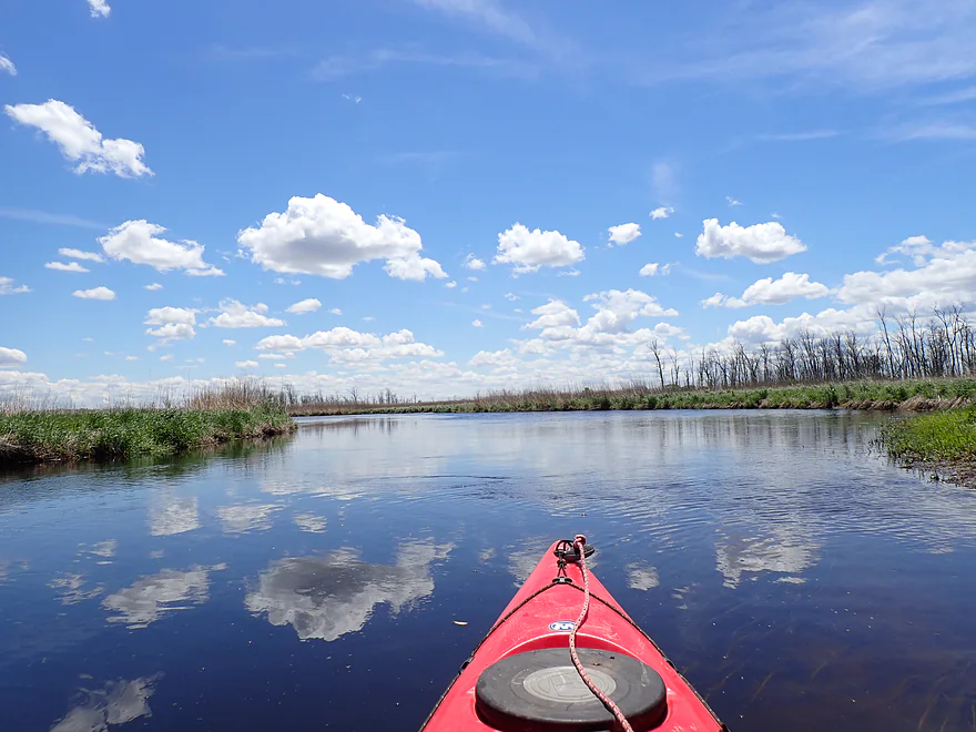
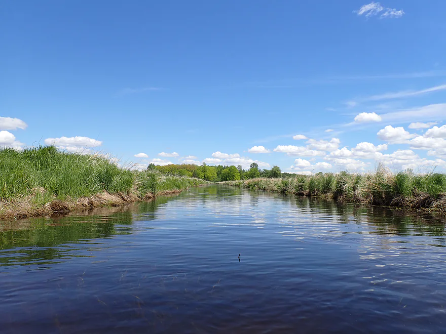
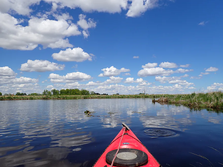
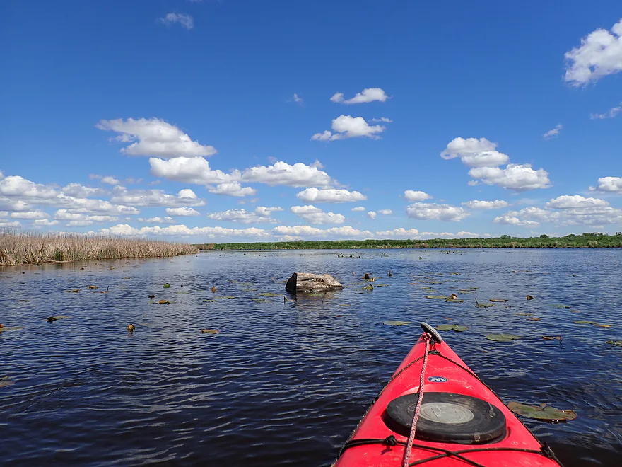
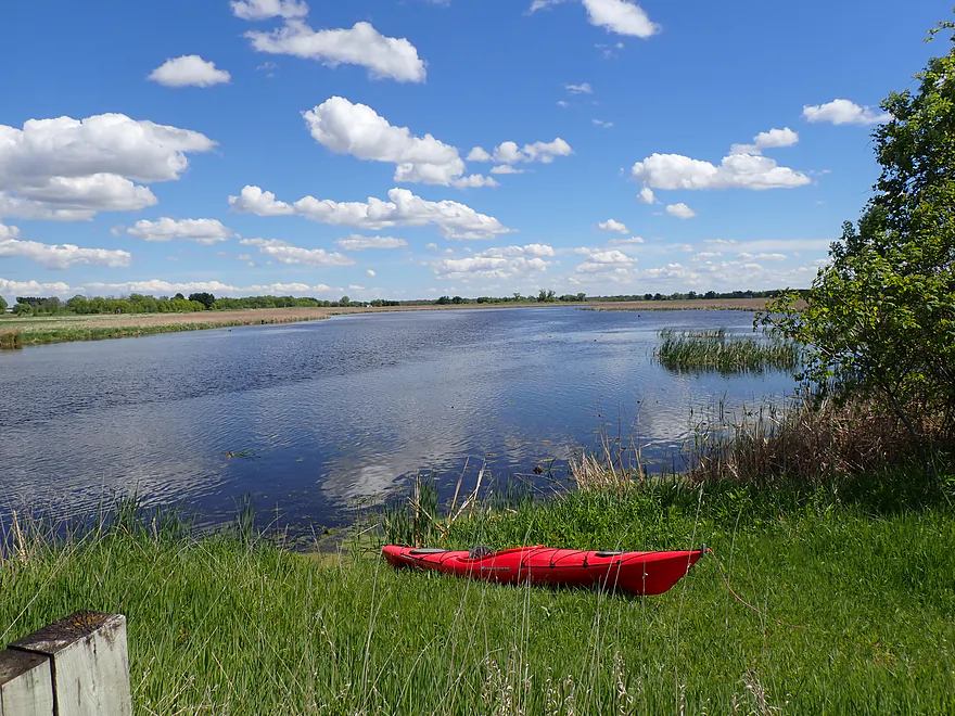
River starts to open up
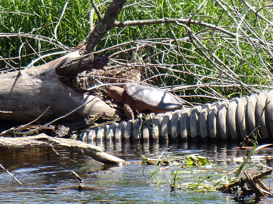
A large snapper
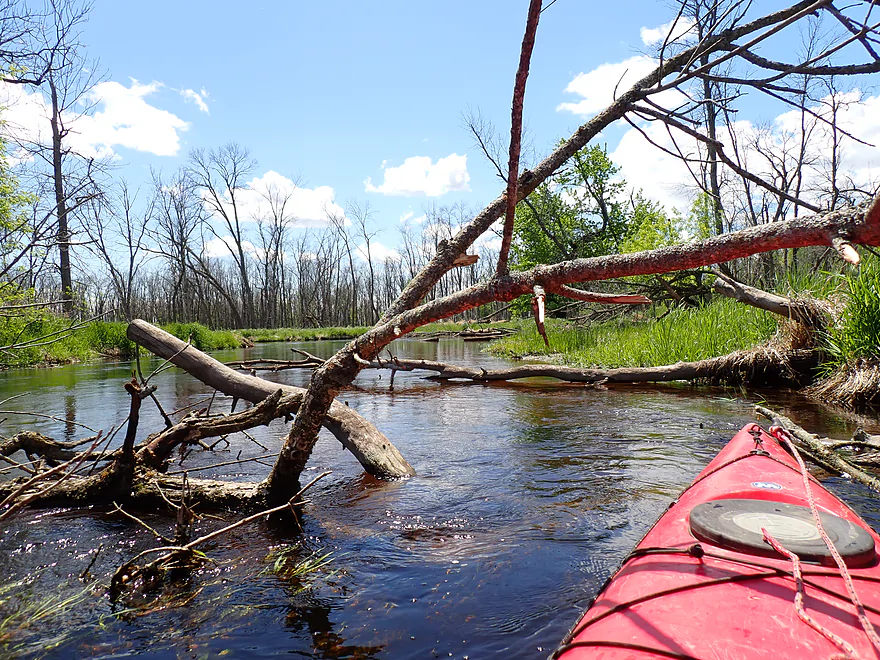
Some local cleanup work allowed me to get through this snag
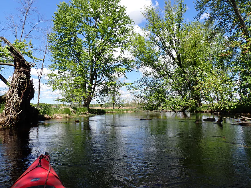
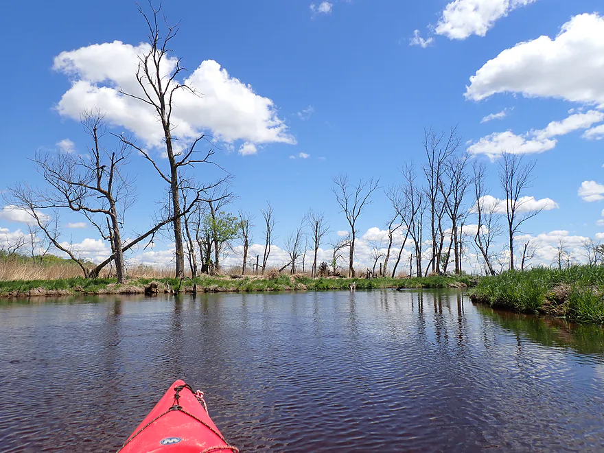
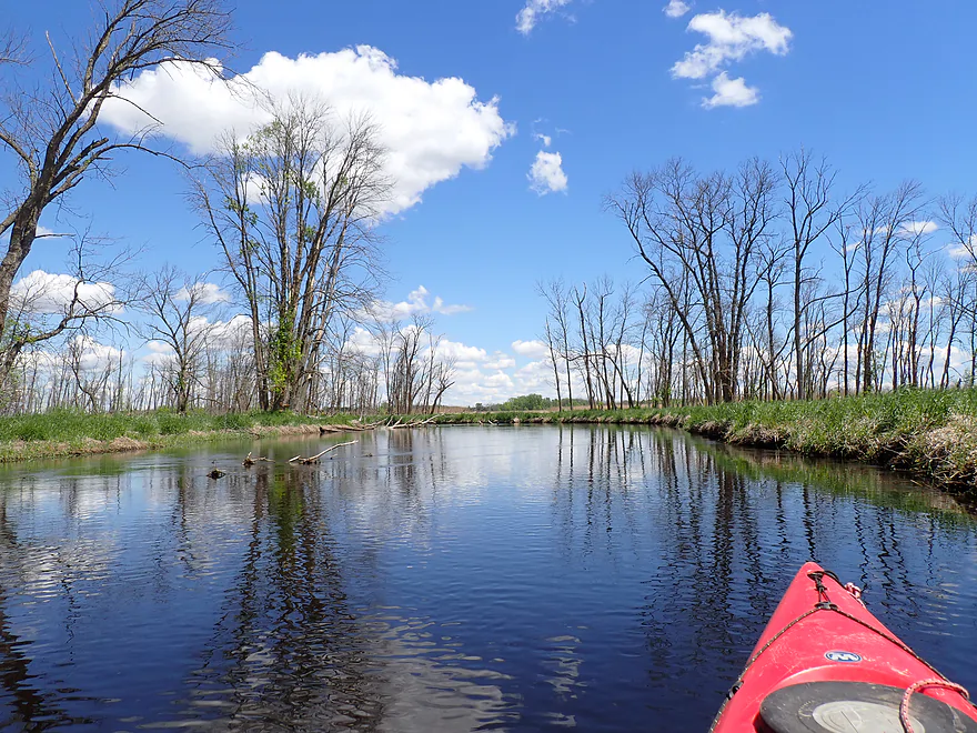
Paddling through a large tree graveyard
I assume most of these were killed by floods
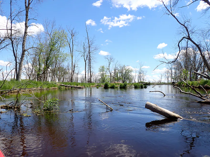
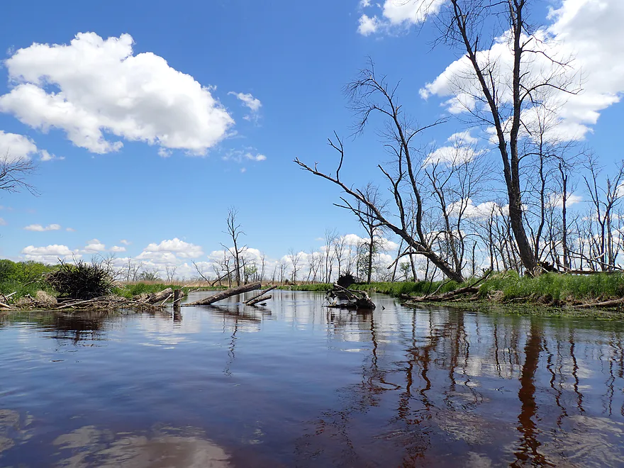
The dead trees were photogenic against the blue sky
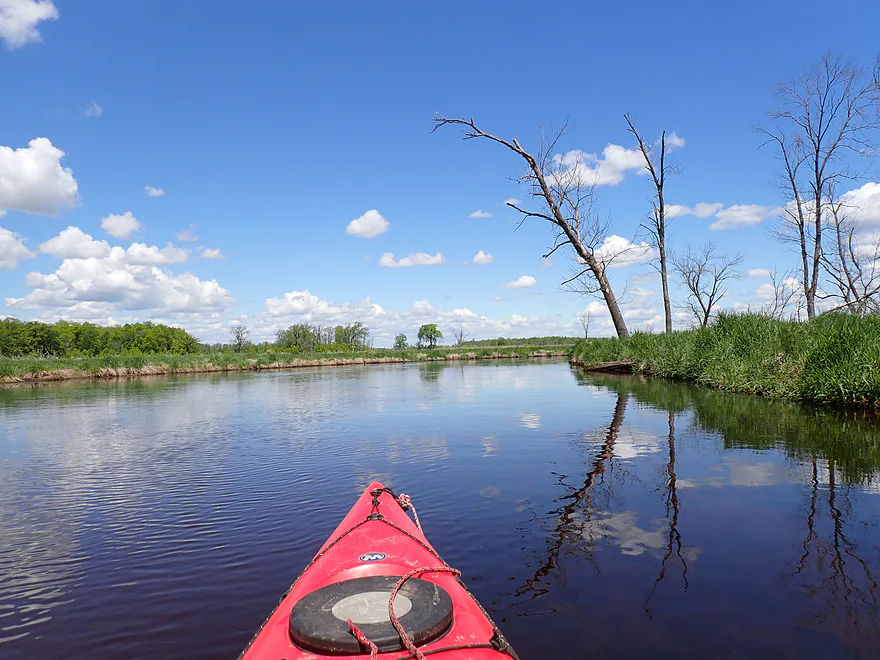
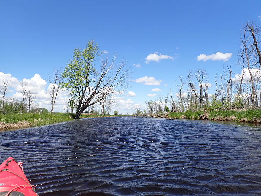
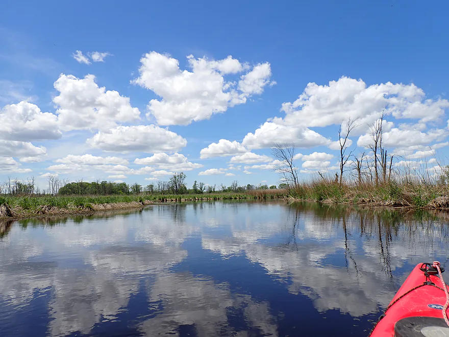
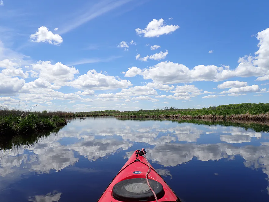
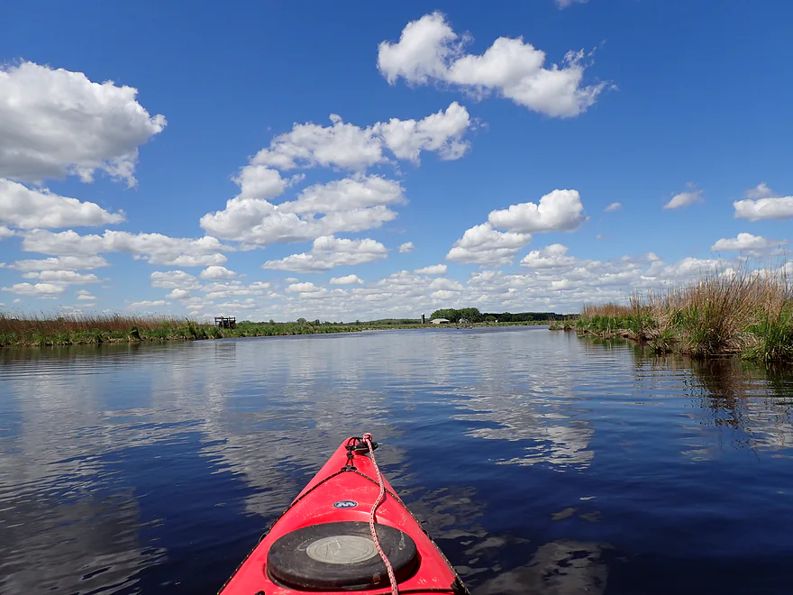
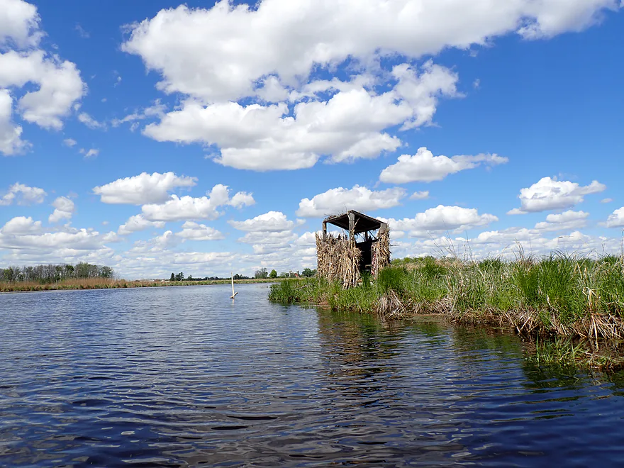
It was a great “white puffy cloud” day
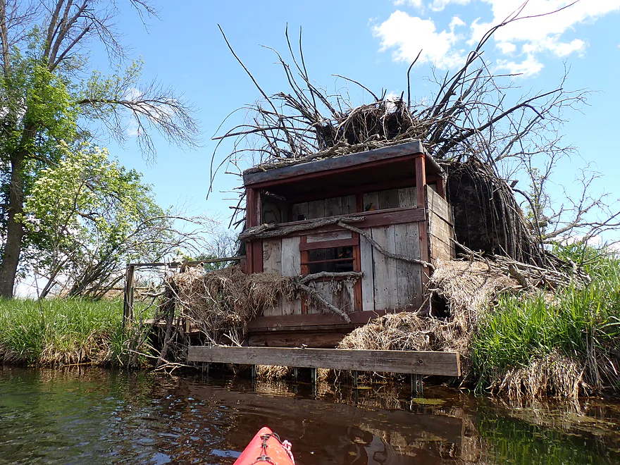
Cool how the duck blind incorporated tree roots
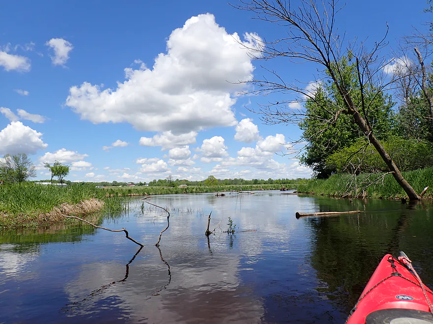
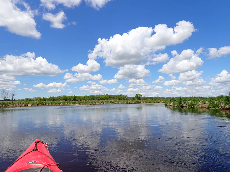
River starts to slow and widen
Still some trees but not many for the rest of the trip
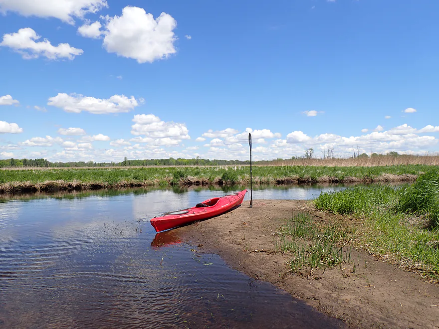
Taking a sandbar break
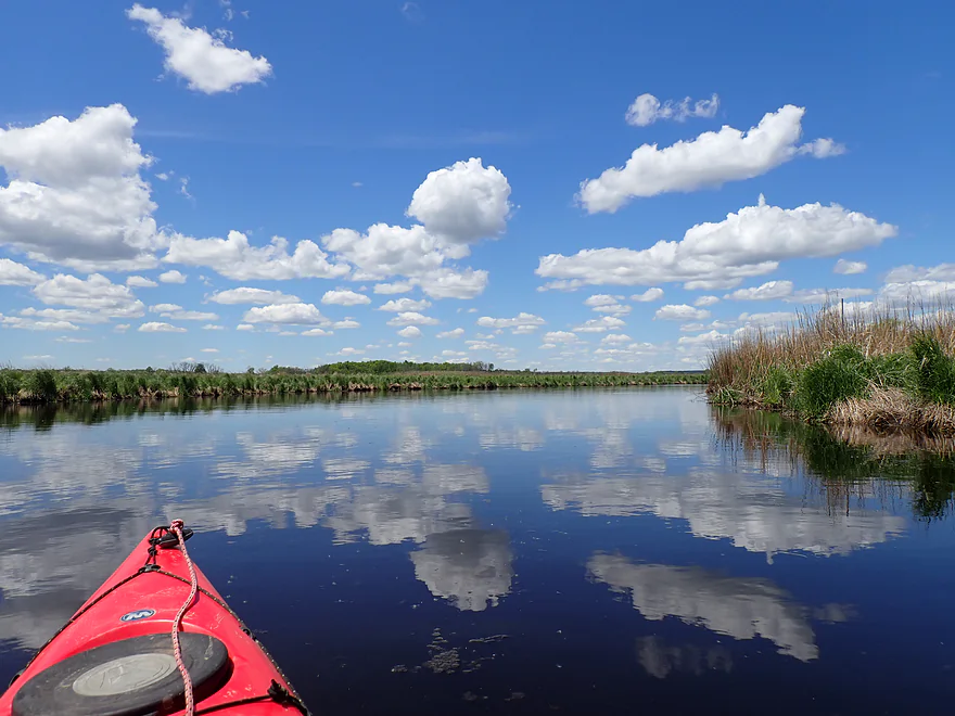
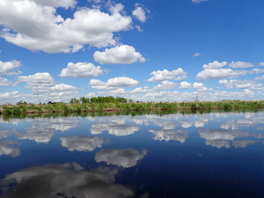
When the wind calmed, nice cloud mirrors appeared
More wetgrass scenery…nice, but it got a bit repetitive
Several large drainage ditches feed this section of the creek
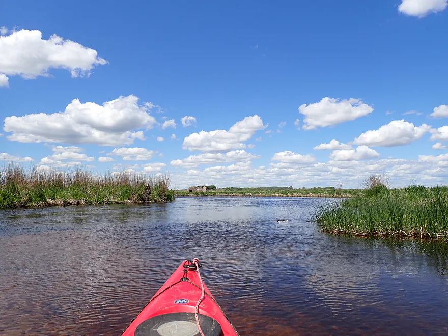
River really starts to widen
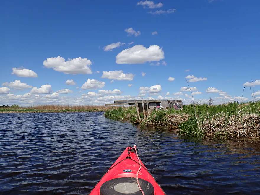
A lot of duck blinds were on their sides…maybe blown over by a storm
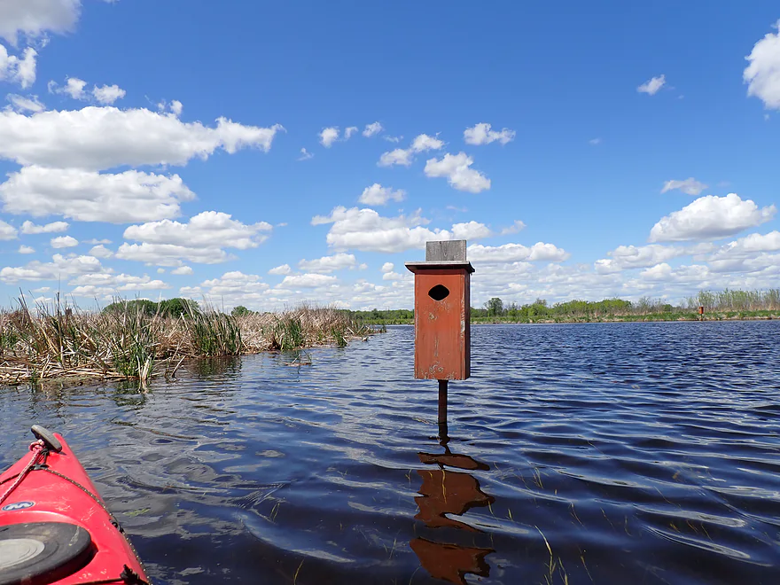
Countless wood duck houses
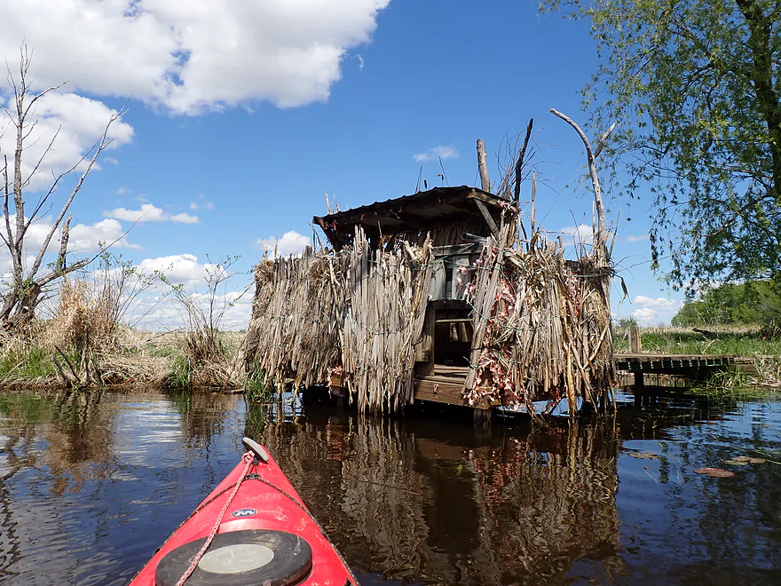
Great camouflage
There were probably 15+ duck blinds on the trip
Some shallow spots…river was pretty navigable though
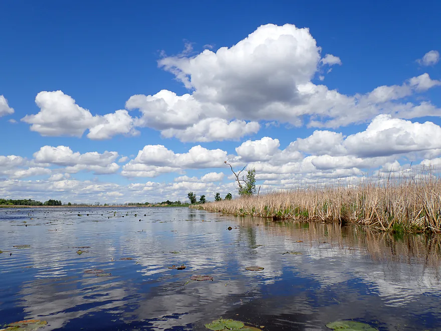
Cattails start to replace the wetgrass
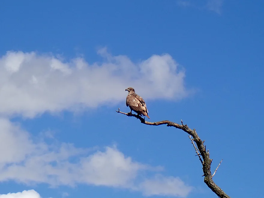
An eagle spying the carp
Ending the trip at Hwy D
There is a better public launch two miles downstream…but this worked fine
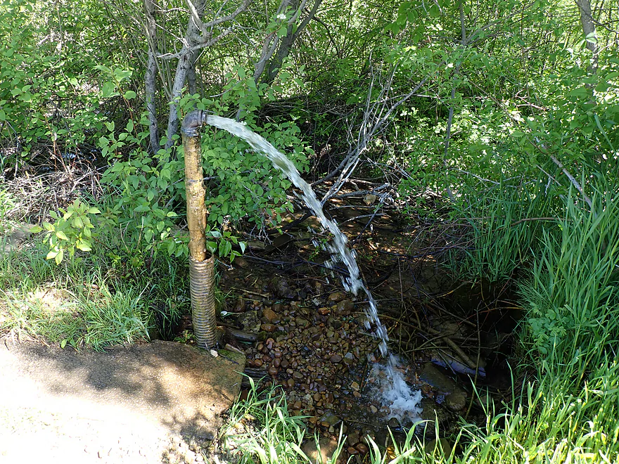
Stopping on my bike shuttle to check out an artesian well
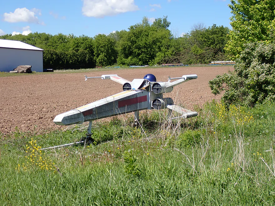
Passed this X-wing on my bike shuttle (complete with an R2 unit!)
Saying goodbye to Auroraville
Willow Creek – Auroraville

Willow Creek is a small river that feeds into Lake Poygan west of Oshkosh. I’ve paddled the upper parts several times and they are nice, but logjams are an issue in spots. This time around I wanted to do a more “reputable” section (free of logjams). Paddle authors Rick Kark and Frank Piraino both positively recommended the leg below Auroraville, so I decided to check it out.
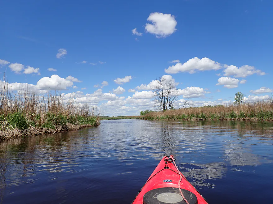
I began the trip below the Auroraville dam, where there is a steep but manageable fishing access. Right away I was impressed with the water clarity. The substrate consisted of a nice gravel bottom with countless snail shells and a few clam shells. This is one of the few perks of a dam…they act as a sediment trap and often a river just downstream from them can be very clean. But in general dams aren’t worth it as they block species (like clams and fish) from migrating and create a lot of stagnant, unhealthy water behind the dam.
The first two miles of the trip were the best. Highlights included good current, a winding channel cutting through intermittent woods, sandy substrate, and more clear water (but with a red tint). The nearby Pine River suffered a recent storm which created a lot of logjams, but deadfall proved to never be a problem on this trip. The few times a tree fell into the channel, you could simply go around, or through via a path cut by a local.
The current slowed for the next few miles as the scenery started to open up. Many of the trees were now dead (likely killed by previous floods). These tree skeleton graveyards actually looked really cool against the blue sky and clouds.
About halfway into the trip, everything really changed…and not for the better. The current started to die as the channel widened significantly. I stopped seeing most trees (dead or living) and scenery was nothing more than a vast, flat wetgrass marsh. It wasn’t bad per say…but it got repetitive after a few miles. This is one of the rare Wisconsin paddles that faces north. Because you will be looking away from the sun, colors will be more vibrant. It was a “white puffy cloud” day, which proved very photogenic.
Large drainage ditches joined up with the creek, which had me disoriented at times, as telltale current was largely lacking by that point. Bringing a GPS with isn’t a bad idea. For the long marshy portions, a small outboard motor might be recommended as well…
The final mile was the low point of the trip. A headwind started to pick up, the channel widened to about 450′, and the water became murkier as the current died its final death. There were countless duck houses and duck blinds…this must be the duck hunting capital of Wisconsin. Carp were extremely common and were thrashing about in the shallows (it was peak spawning season). The eagles nearby were eyeing them up…but I believe most were too big for an eagle to attack. Some of these carp were gigantic and among the largest I’ve ever seen.
I ended the trip at Cty Road D which was a doable bridge access. In summary this trip was a mixed bag. It started fantastic and was on pace to be a four star trip. But then it dragged on…like a nice movie you see, but has that final scene that just drags on and on and on forever. All in all it’s not a bad trip, and I think locals will enjoy it. But it is on the long side, which paddlers should be mentally prepared for. I was just a few miles from the mouth on Lake Poygan (the state’s 5th largest inland lake) and that might be a future trip.
Sights included muskrats, eagles, countless carp (some huge), ducks, clam shells, many snail shells, some crayfish, and two leeches.
Auroraville Springs: The local area is famous for its artesian wells. There is one south of the Auroraville dam and another on County Road D. I saw somebody filling up a water container at the Cty Road D location and decided to check it out on my shuttle, but thought it had too much iron. Both well locations are clearly marked on findaspring.org.
Hwy 49: Northeast of the Auroraville Dam there is a small public fishing access. The bank is a bit steep, but a trail leads to the water and it’s a decent access option.
Alternate Put-ins: None really. I mean you could launch upstream by 29th Lane, but that would mean a long (and likely uninteresting) mill pond paddle plus a dam portage over a busy road. Doable…but likely not that interesting.
Cty Road D: This is a decent bridge access…the best take-out spot will be southwest of the bridge. Be careful that you don’t block the local farmer from accessing his field.
Alternate Take-outs:
- 35th Lane Access (1.5 miles downstream from my take-out): This is a good public paddling access located just downstream from Cty Road D. It’s a better landing than Cty Road D…but would mean a longer trip for what is already a long trip.
- Cty Road D – Pumpkinseed Creek Bridge (5.6 miles downstream from my take-out): You can paddle 3 miles to the mouth of Lake Poygan and then 2 miles back upstream on Pumpkinseed Creek. This likely isn’t very scenic, but it would be a novel way to see the mouth and Lake Poygan.
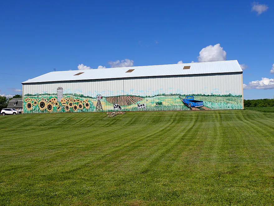
Bike Shuttle – Willow Creek Park to Cty Hwy S: 5.7 miles with 49′ of ascent. This was a pretty easy bike shuttle. Take 33rd Ave as a scenic shortcut to avoid traffic. Sights along the shuttle include an artesian well, a barn mural, and an x-wing fighter.
Logjams/Fences/Rapids: None.
Current: This moves at an ok clip for the first few miles after the dam. But the further downstream you go, the more the current slows…by the time you get to the take-out there is hardly any left.
Getting Lost: There are a few significant islands and side channels in the second half of the trip. Typically you can follow the current to know where to go but in a few cases it can be tricky. Bringing GPS for a trip like this might be a good idea.
Wind: The second half of the trip was very flat and open, thus is suspectable to wind. I wouldn’t do a trip like this when strong headwinds are forecasted.
River Trip Depth: 36 CFS or 8.68′
River Navigability Estimates: These are just rough guesses and the Tomorrow River likely isn’t a good analog gauge. Regardless, this leg is flexible and can be paddled when high or low.
- 0-20 CFS: Very low depth. Should be fine for paddling though.
- 21-35 CFS: Low depth, but good clarity.
- 36-45 CFS: Average depth and a good target.
- 46-55 CFS: High depth with likely poor clarity.
- 56+ CFS: Very high depth. Should still be fine for paddling.
- Upstream of Cty Road W/Nordic Mountain: The creek is still largely navigable in its far upstream reaches, but I suspect logjams might be a problem. I could be wrong.
- Cty Road W to Blackhawk Road: 3.8 miles. An intriguing prospect, but maybe 4 major logjams and one alder gauntlet.
- Blackhawk Road to Brown Deer Ave: 1.7 miles. Maybe 4 major logjams. Access by Blackhawk Road is intimidating because of a nearby house and No Trespassing signs.
- Brown Deer Ave to Chicago Ave: 4.1 miles.
- Brown Deer Ave to Cty Road S: 3.2 miles. A pleasant section with very clear water but nothing super special. There are three easy logjams to portage.
- Cty Road S to Chicago Ave: 0.9 miles. A pleasant section with no logjams.
- Chicago Ave to Cty Road S: 2.1 miles. An interesting prospect with a number of pine trees. Maybe two logjams.
- Cty Road S to Redgranite’s Willow Creek Park: 4.1 miles. A nice leg with clear water and some scenic pine trees. Mostly open, but there are four major logjams and several minor logjams that require tight maneuvers.
- Redgranite’s Willow Creek Park to Pine River Street: 0.3 miles. Short but scenic stretch. Maybe 1-2 logjams.
- Pine River Street to 28th Road: 3.8 miles. Maybe 7-8 major logjams. Otherwise looks nice.
- 28th Road to 29th Lane: 2.5 miles. Congested woods in the first half (maybe 4 logjams) and a more broad, open channel in the second half.
- 29th Lane to Hwy 49/Dam: 2.0 miles. Mostly open flowage.
- Hwy 49 to Hwy D: 9.6 miles. Starts really nice with attractive clear water and good current. The later parts of the trip slow down and flow through a vast wetgrass marsh that is not as interesting.
- Cty Road D to the 35th Lane Access: 1.5 miles. A slow, wide channel…not a great prospect.
- Cty Road D to Lake Poygan: 2.1 miles. Likely not interesting, although it would be novel to paddle to the mouth and see Lake Poygan.
- Lake Poygan Mouth to Pumkinseed Creek/Cty Road D: 2.0 miles. The mouth of Willow Creek and Pumpkinseed Creek are next to each other, so you could paddle up slow Pumpkinseed Creek and get out at Cty Road D. This is viable, but likely not super interesting.
Special thanks to Adam Kiernicki for providing information on Willow Creek.
Trip Map
Overview Map
Video
Photos Size: