
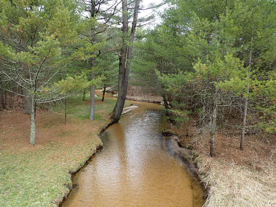
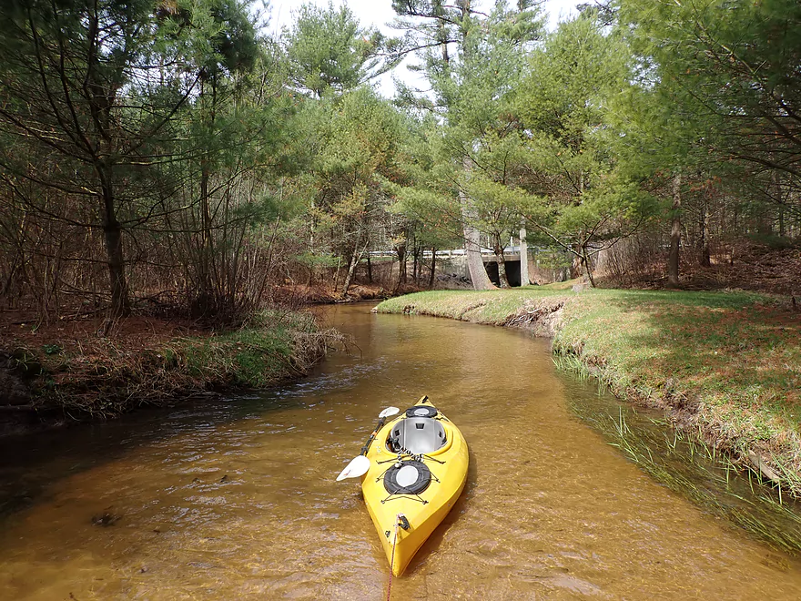
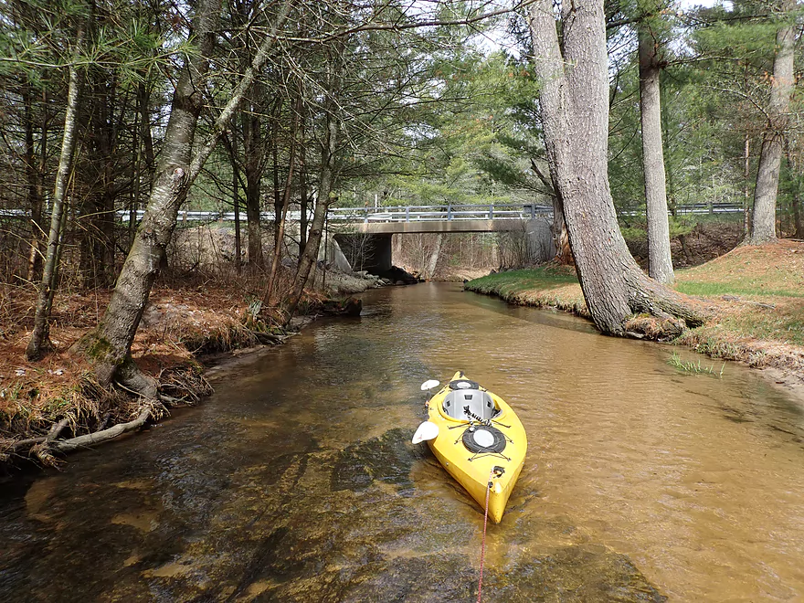
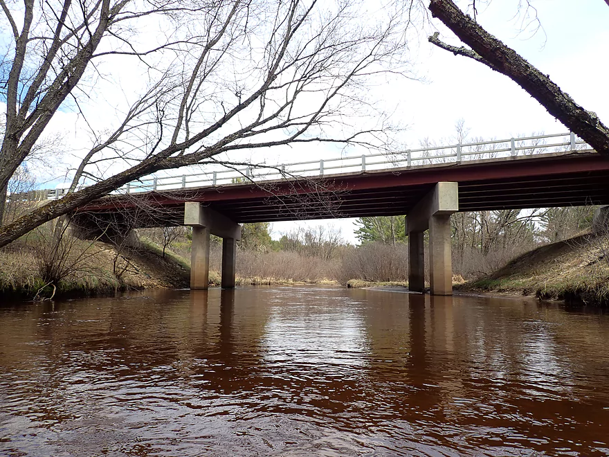
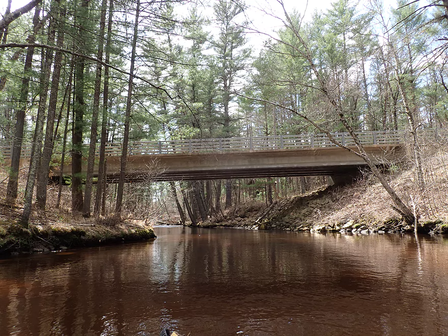
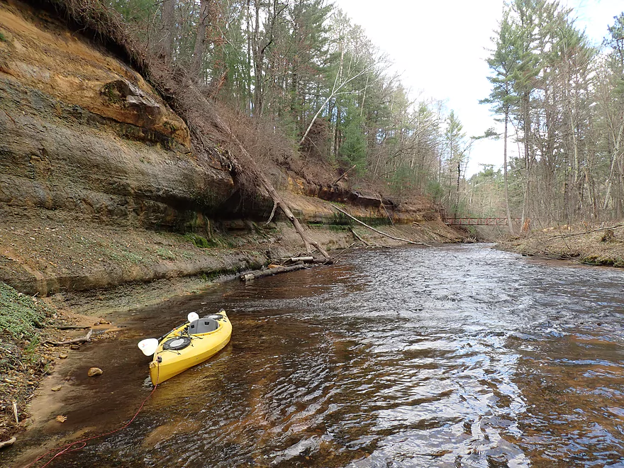
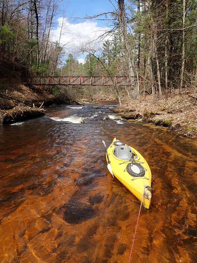
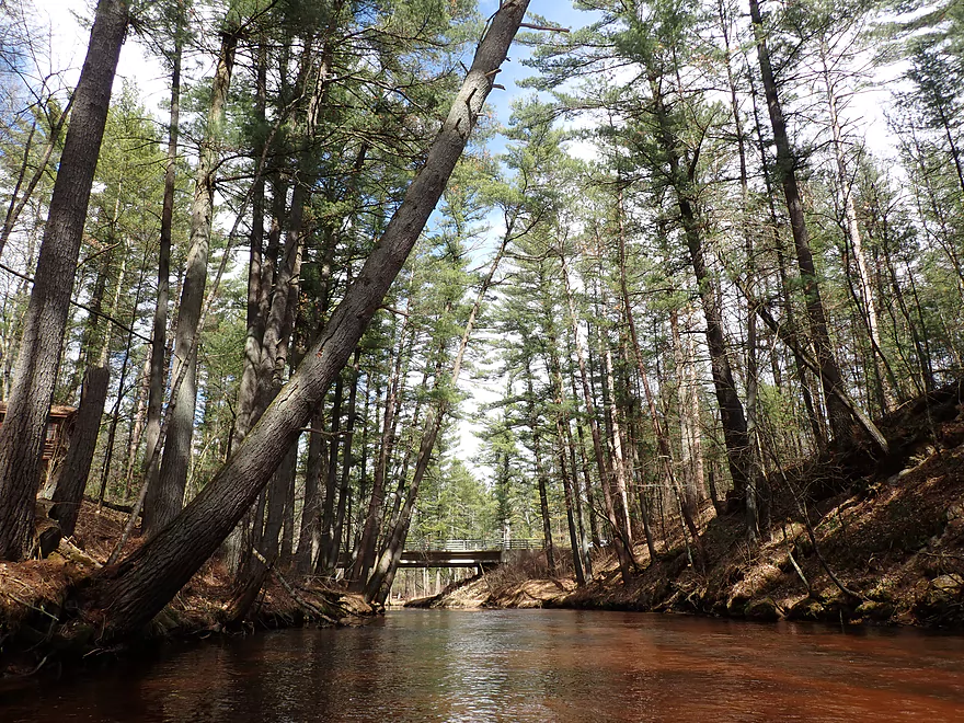
Starting the trip on Stony Creek at the Kelly Road bridge
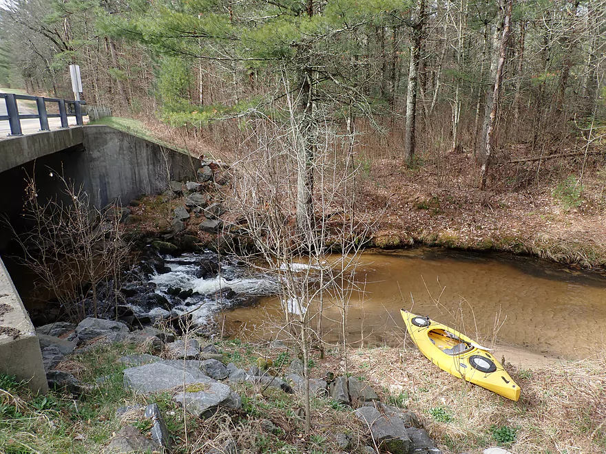
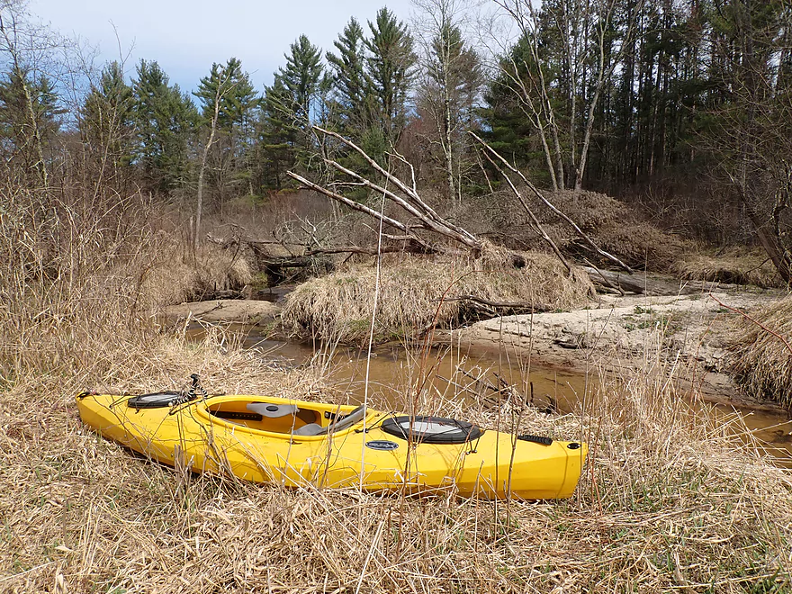
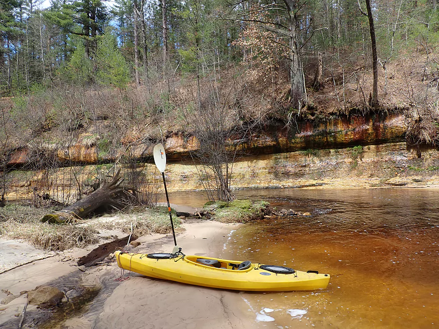
Ok put-in area
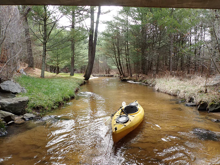
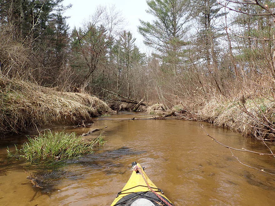
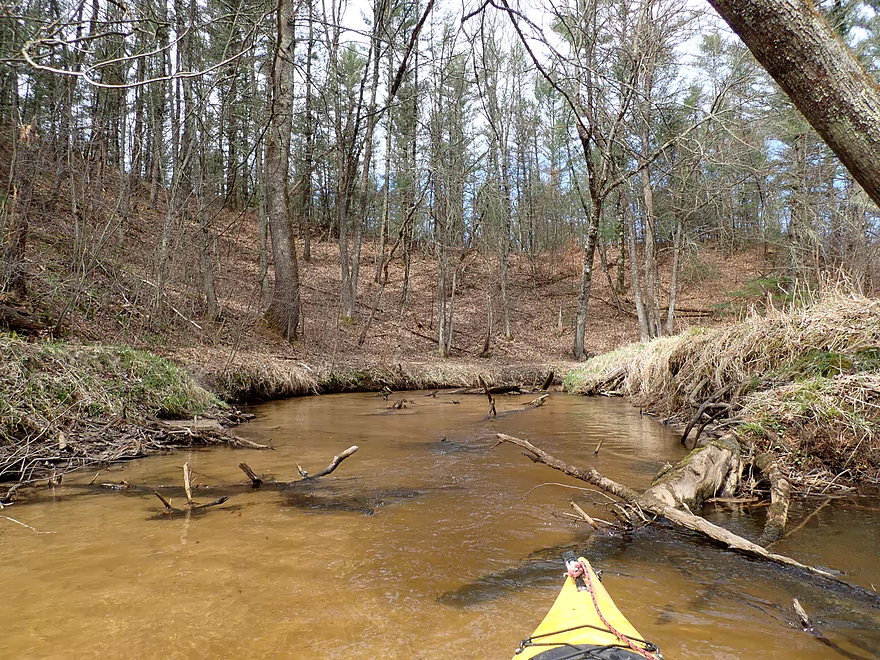
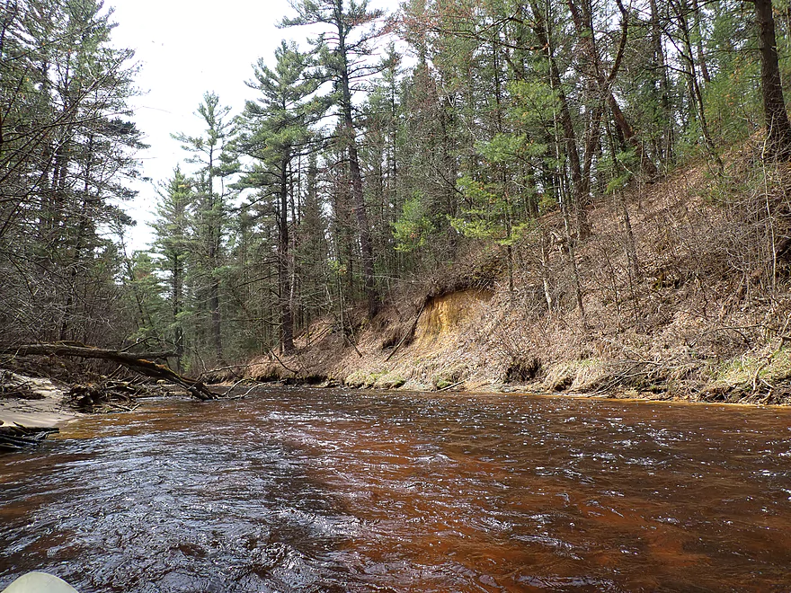
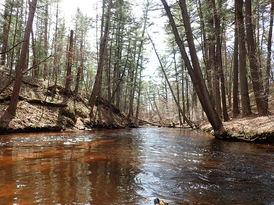
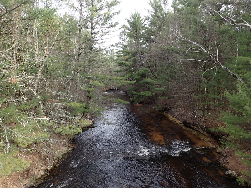
Super scenic creek
Wading upstream to explore
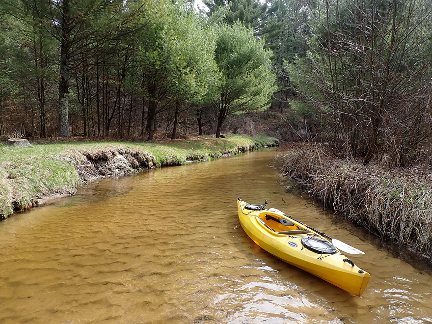
Very tidy (well here at least)
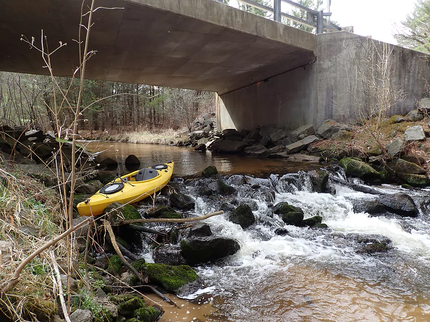
Portaging a small ledge…it’s not runnable
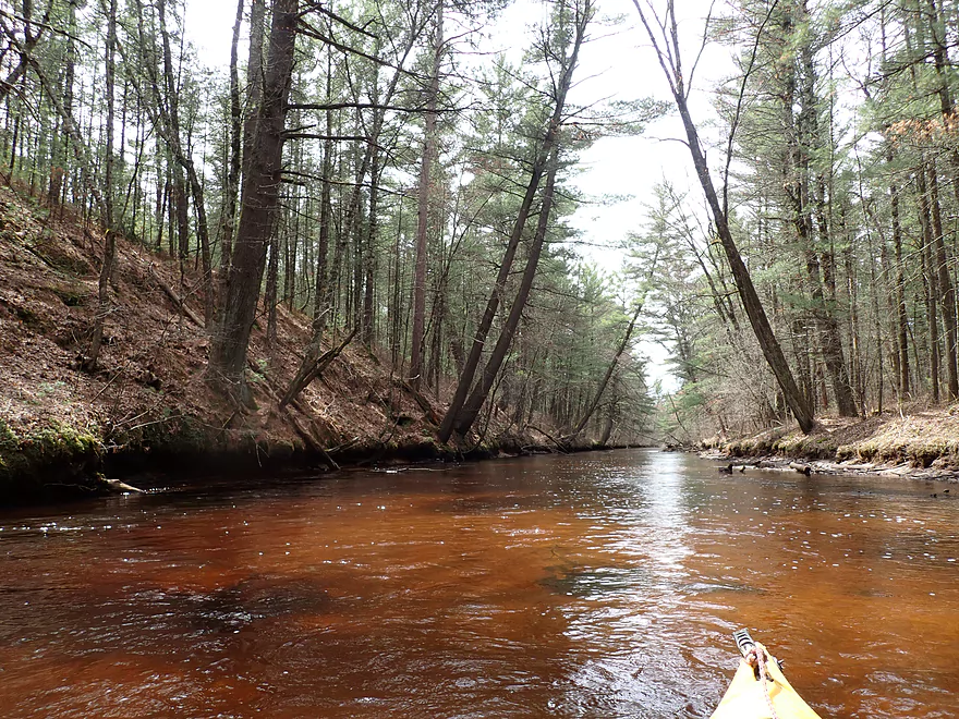
Zipping along over exposed bedrock
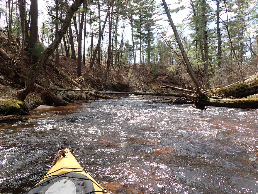
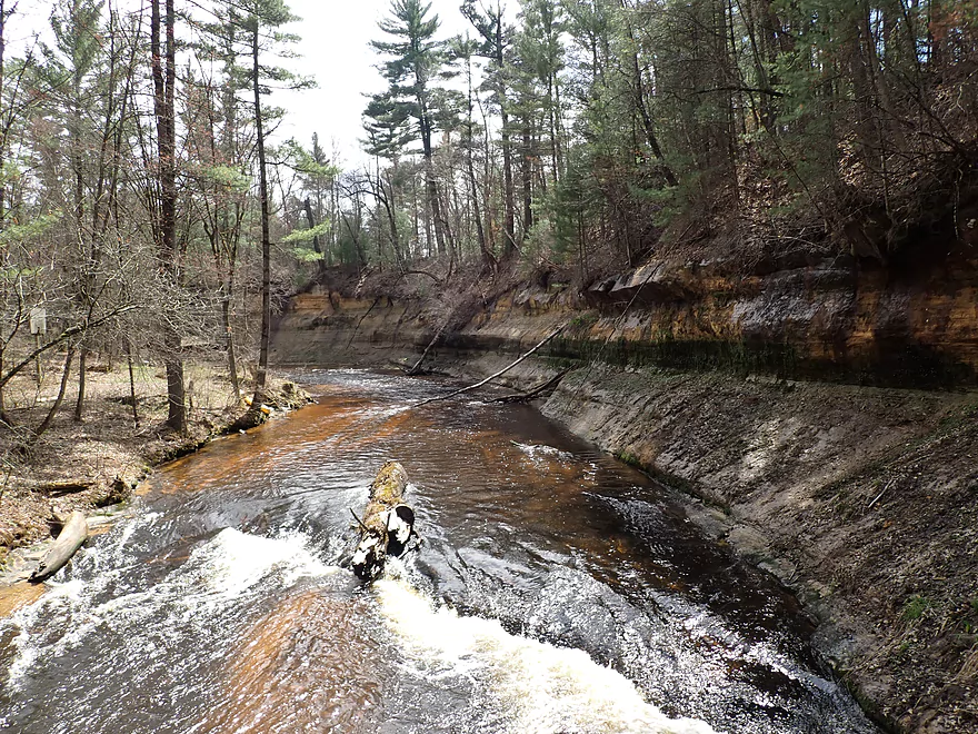
And then it starts…
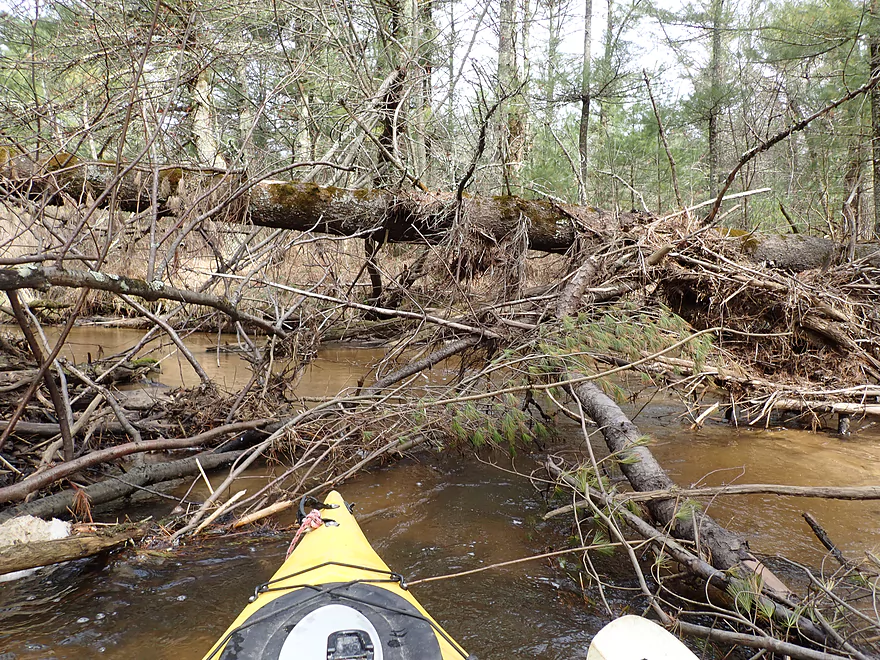
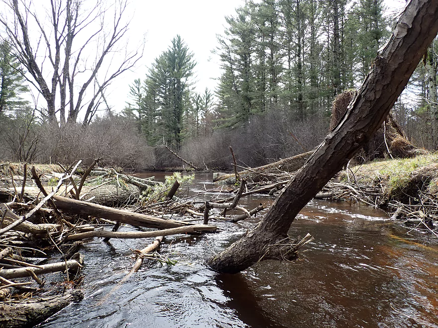
Stony Creek loses its rocks and its appeal
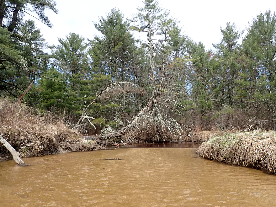
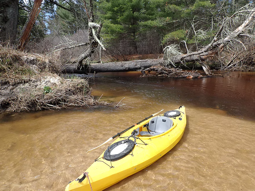
One of several serious portages
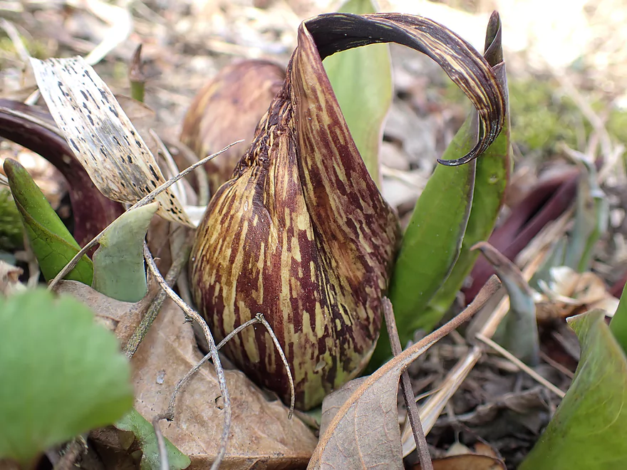
Cool skunk cabbage flower
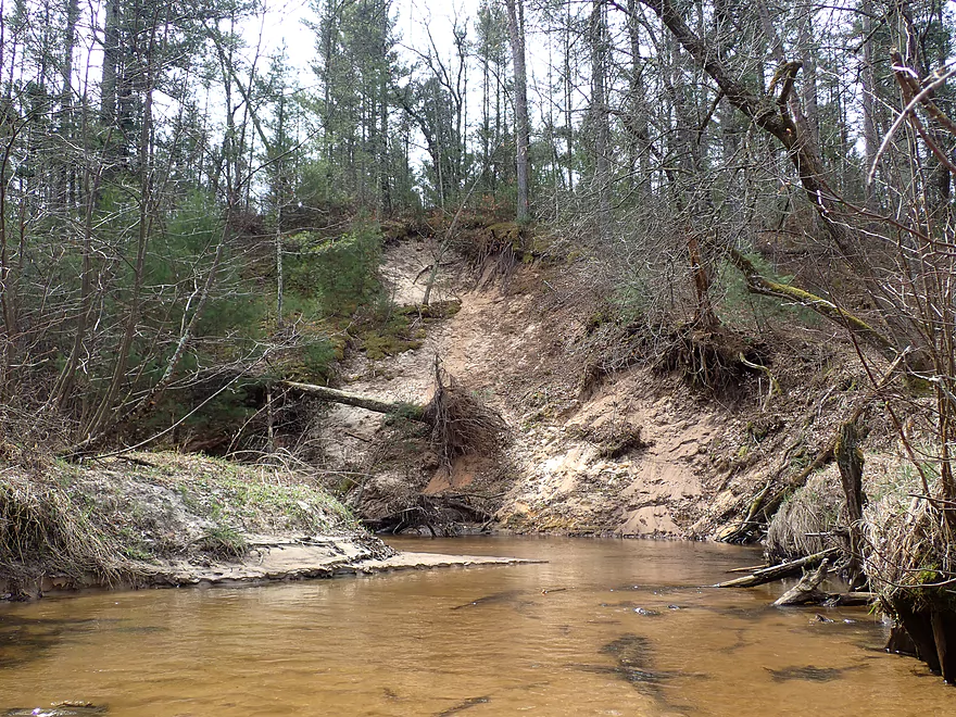
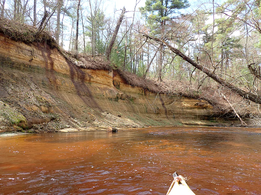
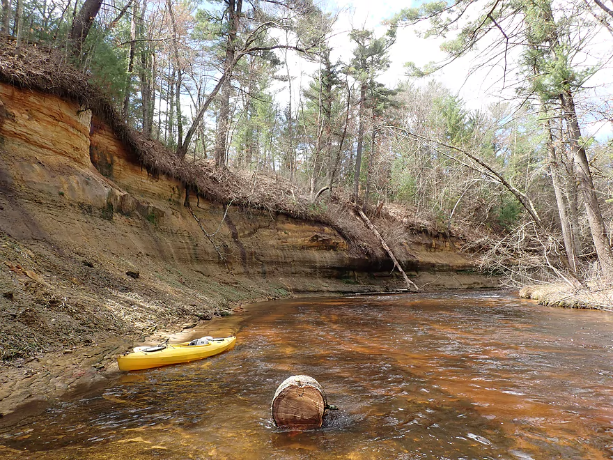
One of two large sand banks
Still some nice parts
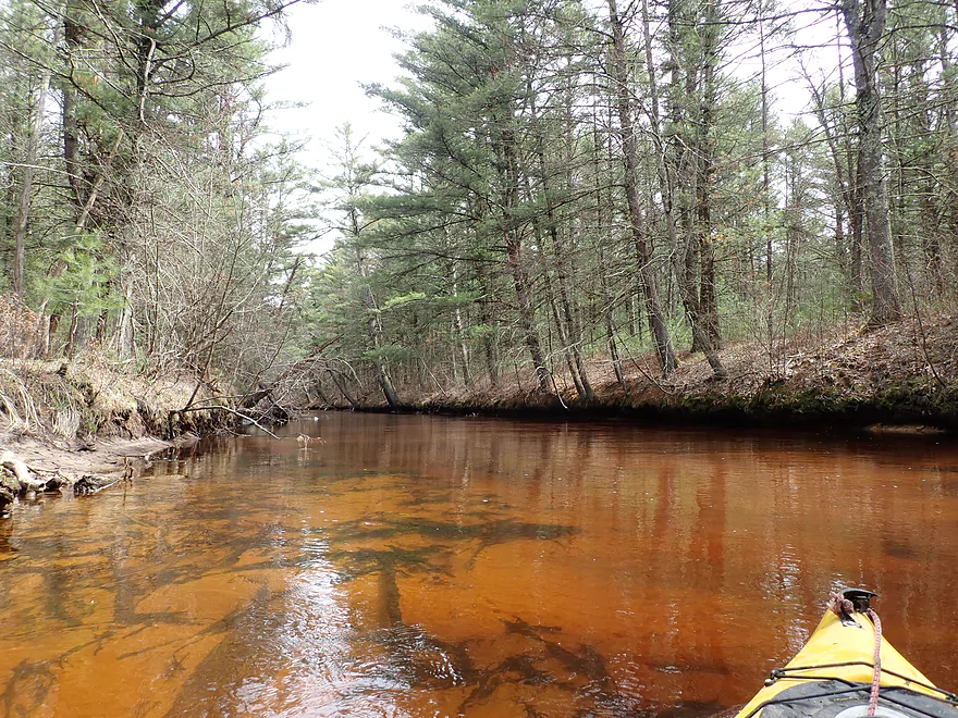
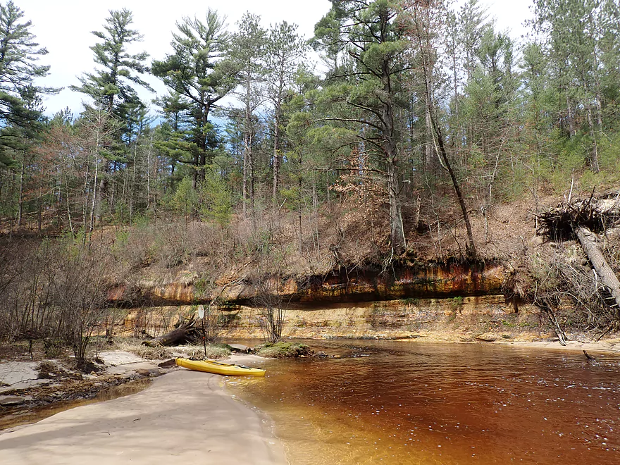
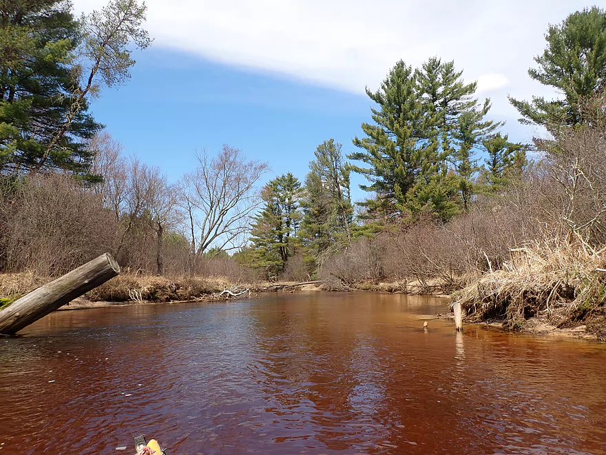
Stony Creek empties into Robinson Creek
Robinson is so much redder
Heading upstream on Robinson to explore
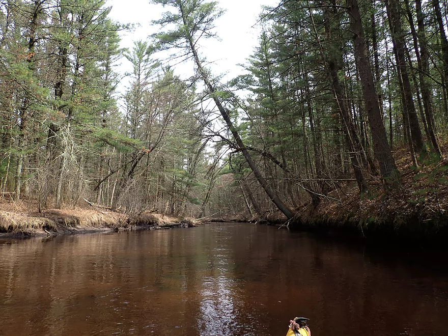
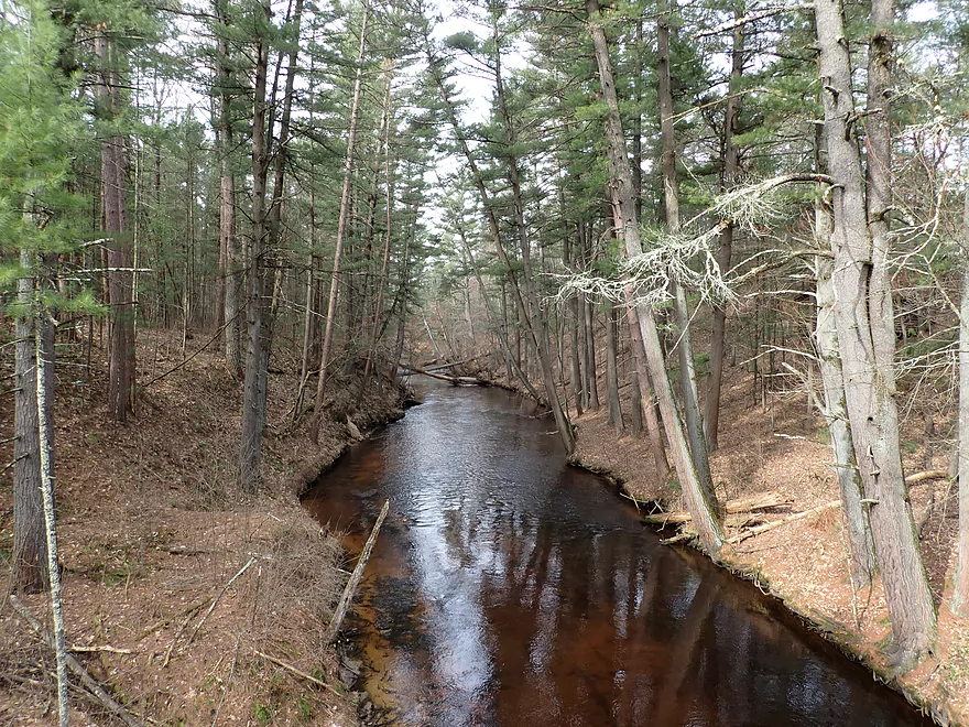
Entering a nice stretch of white pines
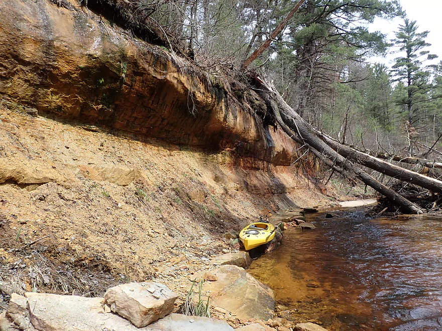
A concave sandstone outcrop
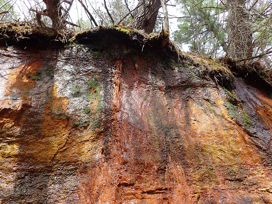
Colorful mineral stains decorate this rock face
A cool little bay
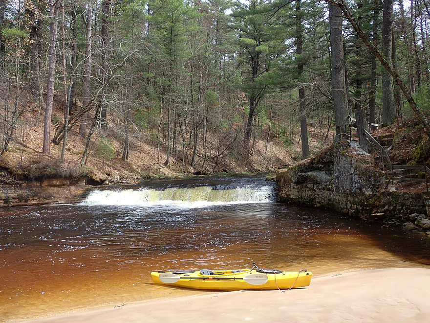
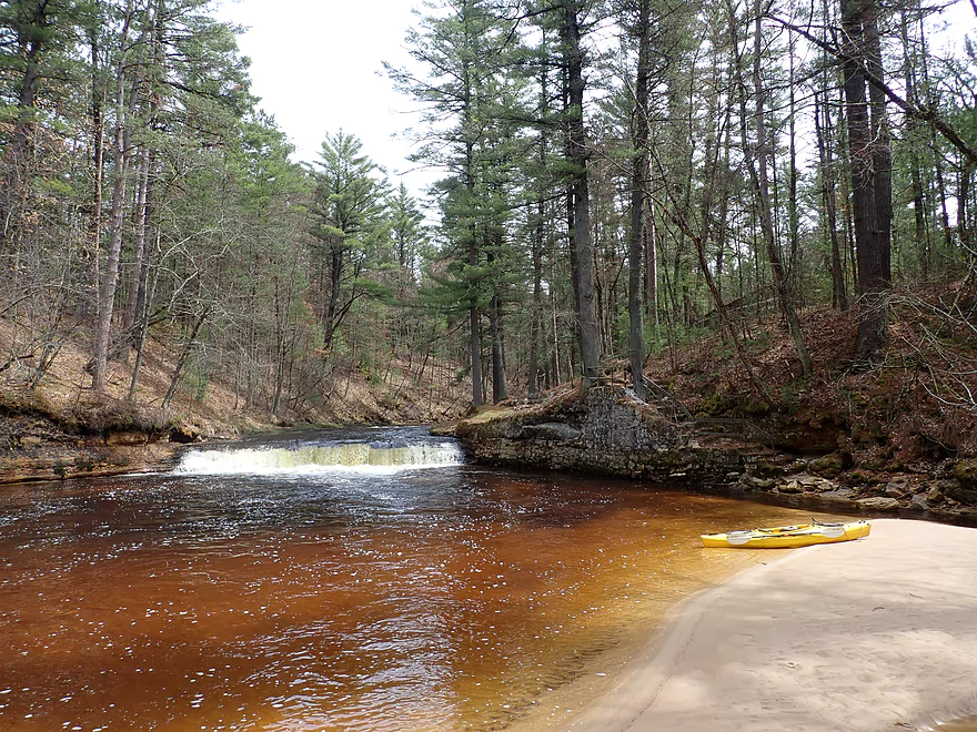
Polly Falls
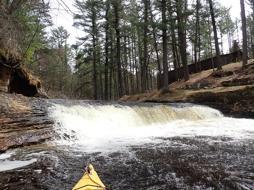
People have been killed by the backrollers at the bottom (center part is the worst)
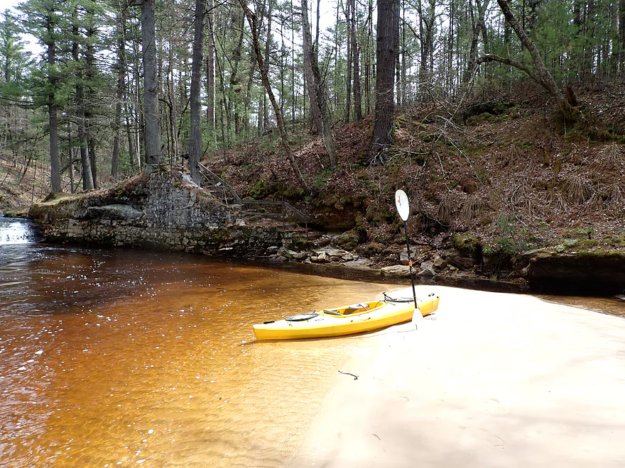
There is a portage path around the falls (be considerate as it is private property)
Nice sandbar
A bowl-shaped cliff
Heading back downstream
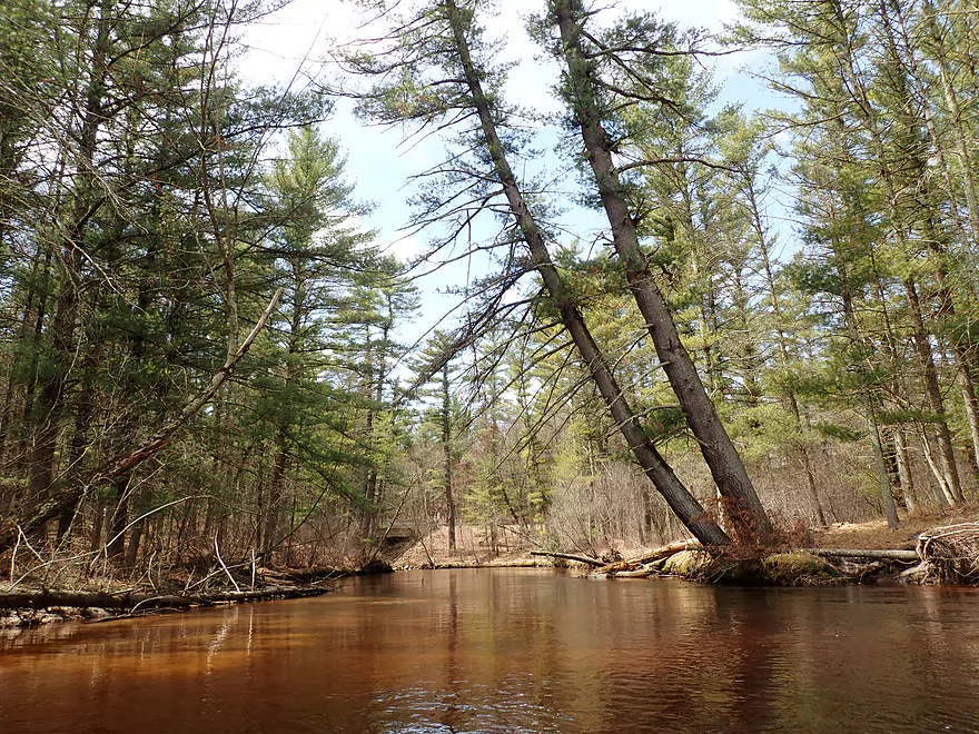
Cool how the pines lean over the creek
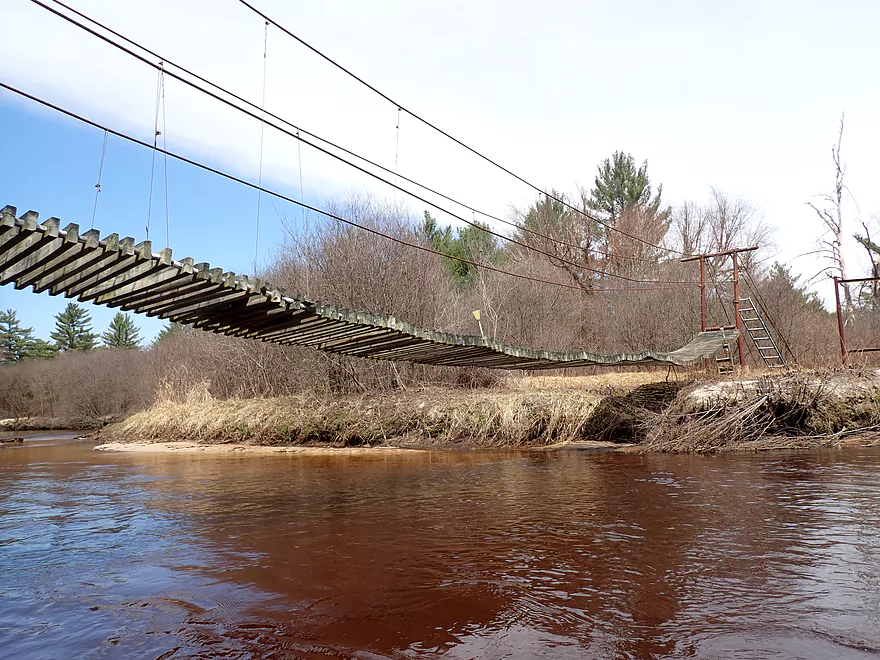
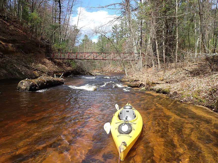
A shaky-looking suspension bridg
Entering an open part of the trip
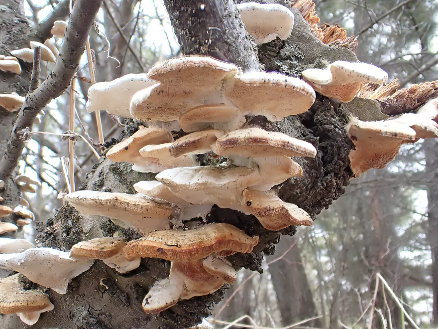
An early spring growth of shelf fungi
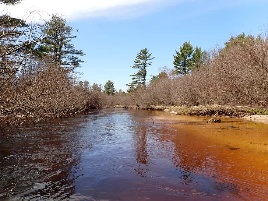
Red water and blue skies create a nice purple hue
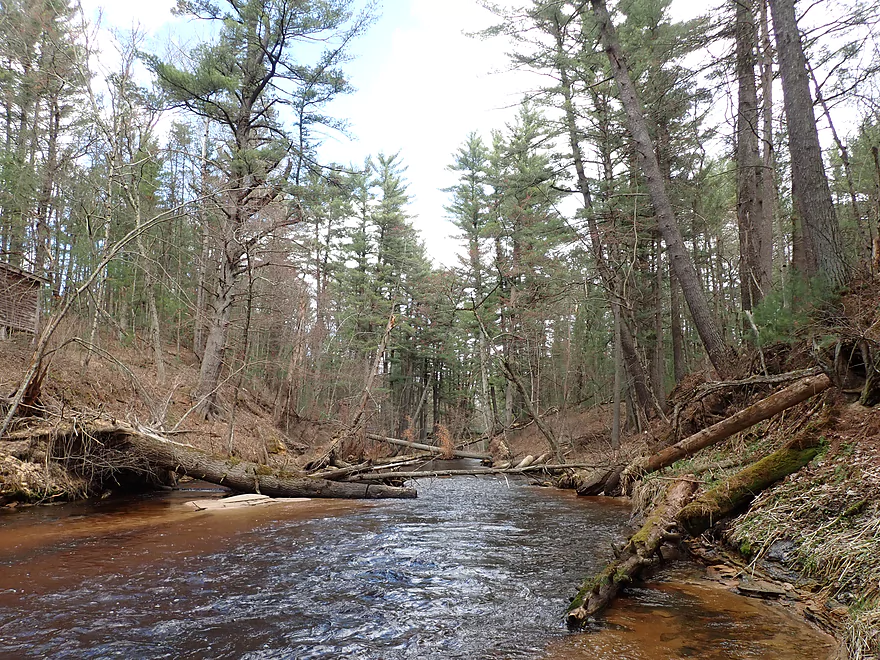
There’s been great cleanup work on this stretch
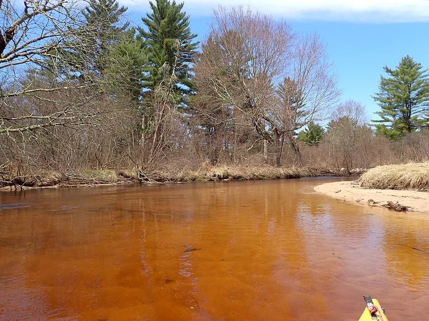
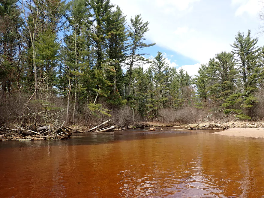
Fabulous red-tinted water
Much of this sand is from Stony Creek
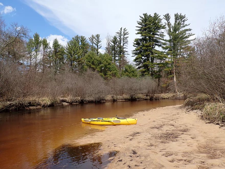
Taking a break on a sandbar
Hwy 27 isn’t a good access option…but is doable in a pinch
A big mess…but a path has been chainsawed through
Robinson starts to get more wooded again
Why Lower Robinson has so much deadfall
Fall Hall Road is my take-out, but…
I want to do some downstream exploring first
A low limbo over fast current
Best outcrop of the trip
Steep cliff forces the creek sharply to the right
Best part of the trip
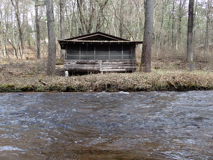
Part of WCYC (a summer camp for kids)
Paddling over lava
A vertical view
Some Class 2 rapids and a WCYC bridge are followed by…
An impressive Class 3 ledge
This isn’t as dangerous as Polly Falls, but does have some backrollers
Heading back upstream
Really cool scenery
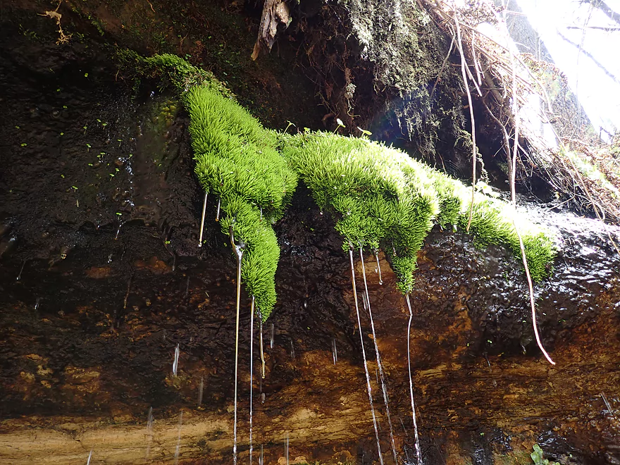
A motor-oil like fluid oozed out of these mosses
The current was too strong to paddle against, so I waded
Some of the tallest white pines I’ve ever seen
Fall Hall Road is a bit steep…but not bad
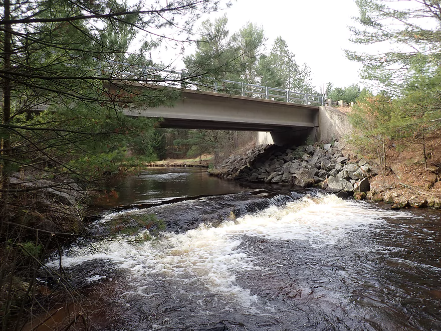
View downstream from the bridge
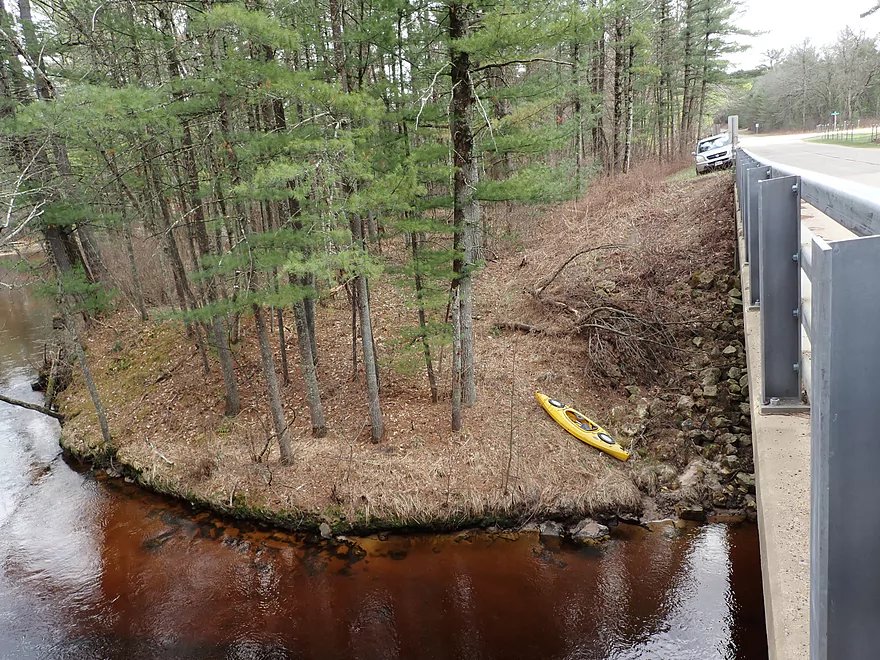
Robinson Creek at Kelly Road (a preferred put-in)
I missed out on a nice section of Robinson by not launching here
Stony Creek and Robinson Creek

I’ve done many paddles…and to date my all-time favorite has been Upper Robinson Creek. While looking for new adventures in the area, I came across a scenic street view image of Stony Creek at Kelly Road. Intrigued, I scouted the creek in person but was disappointed to discover the upstream bridge at Hwy O wasn’t viable (too small, too congested). If I was to do a trip on Stony Creek it would be short, as it was only a half mile from Kelly Road to the mouth on Robinson Creek.
Then I had an epiphany…why not combine Stony Creek with a trip on Lower Robinson Creek? I had been avoiding lower Robinson Creek for a while….simply put, it has dangerous rapids and I’m not an uber whitewater paddler. But by launching from Stony Creek and taking out three miles downstream on Robinson at Fall Hall Road, I could simply avoid all the problematic ledges on the creek. This would be a proverbial “northwest passage” for non-whitewater paddlers through Lower Robinson Creek.
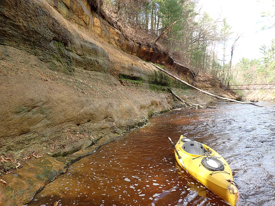
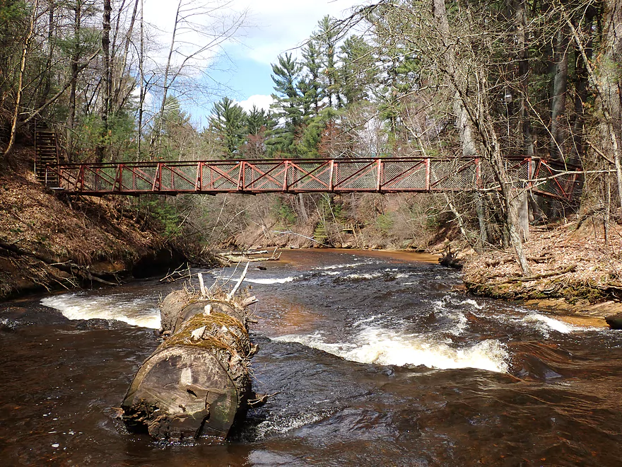
So I started the trip on Stony Creek at the Kelly Road bridge, which wasn’t a bad put-in. Just below the bridge was a 1-2′ ledge that was too irregular to run. Curious, I portaged the ledge and waded upstream to explore a bit. The scenery by the bridge was stunning. White pines towered over tidy banks blanketed with pine needles. The creek itself ran clear and swiftly over raised bedrock filled in with “frac quality” sand. It was really cool.
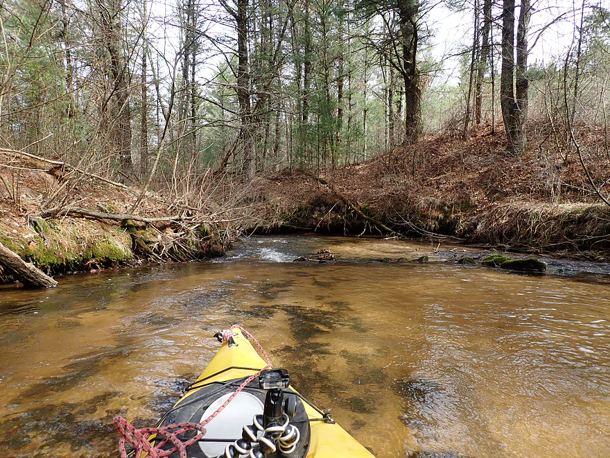
Downstream from Kelly Road there was more exposed bedrock and several small but fun chutes. But about 200′ after the bridge, Stony Creek transformed dramatically and lost its magic. The problem with the creek was simple…there’s too much sand. The tree roots can’t grip the shore so many fall into and obstruct the main channel. I portaged and waded around a large number…too many to count. It might have been worth it if there were nice rock formations or exposed bedrock, but all of that vanished after Kelly Road. At best there were two decent-sized sandbanks, but they were littered with dead trees. I had based my whole trip idea on what I scouted at Kelly Road with the assumption that the entire creek would be like that…instead I was treated to a paddling bait-and-switch. Now granted, most portages weren’t super difficult and the logjams weren’t “Dickey Creek bad” (a neighbor to the north), but there were enough that I just can’t recommend this creek as a viable water trail.
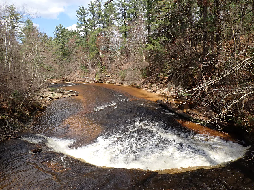
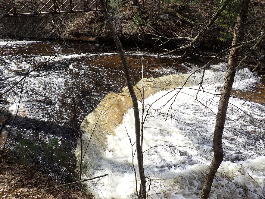
To my great relief I finally reached Robinson Creek. The demarcation between the two creeks was quite dramatic…Robinson was significantly larger, faster, and had a strong red hue. Instead of heading downstream though, I decided to paddle 0.3 miles upstream to see the famous Polly Falls. The idea being that it was unlikely that I was ever going to paddle over them, so this was going to be the next best thing. Unfortunately I wasn’t in a fast boat and paddling upstream in fast flowing Robinson wasn’t easy. I was starting to get disillusioned with my upstream paddling idea when I finally encountered a concave rock face and heard the roar of Polly Falls.
Polly Falls is located in an incredibly scenic area of the creek. Below the falls Robinson forms a small pool with a sandbar and sandstone wall on the downstream side. Upstream of the falls, Robinson flows through a gorge under scenic white pines. Unfortunately these falls are quite deadly and people have drowned here. For all practical purposes, Polly Falls is a natural low-head dam and the recirculating current at the base can easily trap kayakers who do not correctly traverse the falls. For more information on running this ledge see my “Hazards and Concerns” section below. If you are coming from the upstream side, I do recommend scouting/portaging along the south bank where there is a decent portage path. But note, this is private property so be considerate.
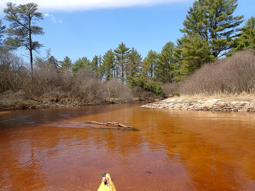
After taking countless pictures of Polly Falls, I turned around and headed back downstream. Past the Stony Creek mouth, the scenery started to change, and honestly became somewhat disappointing. Lower Robinson is not entirely like Upper Robinson. Yes there are a few really cool hot spots where the creek flows by hills. But most of it was a lowland paddle with no rapids, no outcrops, no ferns, and no exposed bedrock. While there were still some nice white pines, they were mostly replaced by scrubbier species and alders
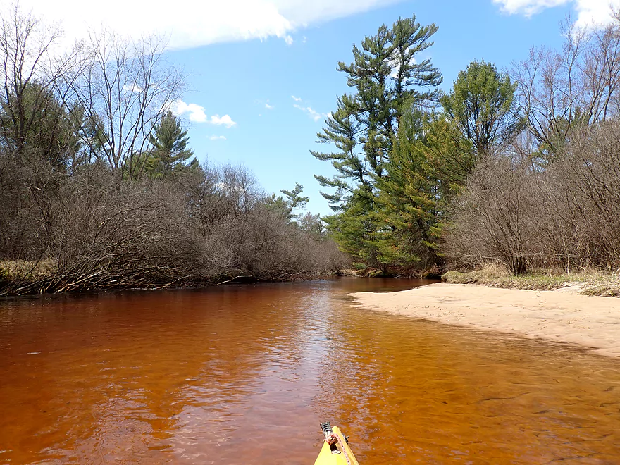
One thing that Lower Robinson had in abundance was sand, much of it likely coming from Stony Creek. This resulted in many small sandbars and downed trees. Fortunately the locals have done a herculean job in cleaning up the logjams, and I never had to portage Robinson. There were a few strainers to dodge in the fast current, but it wasn’t too bad. I was a bit bummed about not seeing “classic Robinson geology” on the trip so far (outside of Polly Falls). But this bottomland paddle still had its moments. In select areas, with shallow sand and the sun coming in at the right angle, the creek would explode with vibrant blues and reds which was quite spectacular.
Following Hwy 27, the creek became more wooded and the bluffs finally returned. I had parked my car at Fall Hall Road where I would take out. But I was curious to see the rapids just downstream of the bridge so I intentionally overshot my take-out with the idea/hope that I could paddle back upstream against the current if need be. The current did indeed pick up significantly with several light rapids that were fun. The scenery here was top-notch…some of the tallest white pines I’ve ever seen grew on the banks and the substrate consisted of raised bedrock that glowed red like lava. The scenery would get even more impressive as the creek became hemmed in by a large sandstone cliff and was forced to take a sudden 90 degree turn north. Along the face of the cliff mosses grew and seeps trickled into the creek.
Along the east bank was a rustic summer camp for Christian Youth (WCYC) that looked quite nice. Up ahead I heard the roar of a Class 3 ledge and waded as close as I dared. This ledge should definitely be respected by kayakers. It’s soon followed by a second Class 3 ledge just a bit further downstream…neither of which I ran. If you do consider running these, read my “Hazards and Concerns” section below. Neither of these ledges is an easy portage because of the steep banks, but by using the adjacent camp trails you can make do. While Wisconsin law does legally provide the right to portage obstructions like dangerous rapids, be considerate, as the trail system is part of a private camp. Here’s a video of campers playing on the first ledge and another of them playing on the second ledge. Note while they did this at low flow rates, they were somewhat perilously close to the holes. Kayakers should practice more discretion.
After that, I headed back upstream to Fall Hall Road where my car was parked. Paddling against the rapids was a bit difficult so I did have to wade in a few spots, but it wasn’t too bad.
This is a tough trip to judge in hindsight. It was filled with contradicting surprises, both good and bad. Stony Creek, outside of the spectacular put-in area, was a disappointment. My idea of a “northwest passage” to bypass Lower Robinson’s rough parts just didn’t work. In fact those rough parts actually contain Lower Robinson’s best scenery and bypassing them would be a loss.
What I ultimately recommend is to do Upper Robinson Creek first and foremost if you’re new to the area. It’s safer and more scenic. If you’ve already done the upper section and are comfortable with your paddling skills then you can move onto Lower Robinson. Start at Kelly Road and take out at W. Pine Hills Road. Less experienced paddlers should wait for lower flow rates when the creek is less pushy, and they should portage all ledges they are not comfortable running.
Fall Hall Road: This wasn’t a bad bridge take-out. There is good shoulder parking, it’s somewhat secluded, and it’s not too difficult to disembark along the bank. The only downside is the embankment is a bit steep.
Alternate Take-outs:
- Hwy 27 (0.7 miles upstream of take-out): Because of a long guardrail this isn’t a good access. If determined I suppose you could take out here along the south shore, but it would require a 500′ hike to reach your car.
- W. Pine Hill Road (2.6 miles downstream of take-out): The first half mile is incredibly rugged and scenic, but does contain two Class 3 ledges that should be treated carefully. After the gorge, the creek flattens out into a lowland mess and isn’t as interesting.
- Irving Landing (6.8 miles downstream of take-out): Same as above, except an additional mile of Robinson Creek likely filled with downed trees. This would be followed by a pleasant 3 mile stretch on the Black River before you reach Irving Landing.
Fall Hall Road to Kelly Road: 2.2 miles. A short and very easy bike shuttle. Scenic too.
Stony Creek Hazards:
- Logjams: Too many.
- Rapids: Some Class 1 rapids near the put-in. There is also a ledge by the bridge, but it was too irregular to run.
Lower Robinson Creek:
- Strainers: Lower Robinson is a fast creek and there are many partly submerged logs that can catch napping paddlers by surprise. Experienced paddlers should be ok.
- Rapids:
- Kelly Road to Stony Creek Mouth:
- There is a Class 2 ledge just downstream of Kelly Road that is easy to scout and portage. This ledge has some recirculating current but doesn’t seem too bad.
- Following Kelly Road there will be a handful of Class 1 Rapids with a few Class 2’s…these should be manageable especially at low flow rates.
- Once Robinson Creek turns west, there will be a Class 2+ ledge to deal with. You should be able to scout or portage this along the shore.
- About a mile downstream from Kelly Road is Polly Falls. This is an extremely dangerous Class 3 ledge that has claimed lives because of the backroller at the base (it’s in essence a natural lowhead dam). You can portage/scout along the south bank but be considerate as this is private property. If you absolutely insist on running the falls, then scout first, do NOT go over the middle (the worst hole is there), keep your nose up, make sure you maintain escape velocity, absolutely don’t tip over, and try to aim for the right side of the falls.
- Stony Creek Mouth to Fall Hall Road: There are no rapids on this stretch, but there are some minor strainers to deal with.
- Fall Hall Road to W. Pine Hill Road:
- Immediately following Fall Hall Road is a low limbo branch over fast current. I fit ok, but for some this might be too tight a fit. During low flows, you can simply wade past this obstacle because of the nice bedrock here.
- 800′ downstream from Fall Hall Road are several Class 1 and Class 2 rapids that precede the big Class 3 ledge. The 1’s and 2’s aren’t too bad, but can affect your approach for the Class 3 ledge.
- 1000′ downstream from Fall Hall Road is a large Class 3 ledge. There is a bit of a backroller at the base but it’s not as bad as Polly Falls. Scout before running. A portage would be tricky because of the steep banks. To portage you’ll likely need to use the local camp trail which could entail a 400′ long hike. While this is legal to do under Wisconsin law, be considerate as this is a private camp.
- 1400′ downstream from Fall Hall Road is a second Class 3 ledge. While the local campers tube over the falls when low, there are holes and this irregular ledge can be dangerous for paddlers. This too can be legally portaged using the local camp trails but again be considerate as this is a private camp.
- After that…the rapids pretty much die off and Robinson Creek turns into a lowland paddle until it’s mouth on the Black River.
- Kelly Road to Stony Creek Mouth:
Nearest Gauge: La Crosse River @ Sparta, Wisconsin. Unfortunately there is no gauge on Robinson Creek. The best analogue IMO is the La Crosse River 17 miles to the south and it’s not a good one. Take the following estimates with many grains of salt.
Recommended Depths:
- 0-100 CFS: A shallow level.
- 101-200 CFS: An average depth with good clarity.
- 201-250 CFS: Slightly above average depth. I did the trip at 203 CFS (great depth).
- 251-300 CFS: Clarity will not be as good. Current will be faster and stronger.
- 301-400 CFS: A very high depth, only suitable for experienced paddlers.
- 401-550 CFS: Creek will be very pushy. Only suitable for serious whitewater paddlers.
- 551+ CFS: Perhaps too high?
For more information on bridge access points see the overview map.
- Hwy 12 to N. Old Country Road: 5.2 miles. This could be scenic, but the creek splinters into small branches that have a high likelihood of logjams.
- N. Old Country Road to Kelly Road: 6.4 miles. The most popular and scenic stretch on the creek. This leg is my favorite water trail in the entire state.
- Kelly Road to Stony Creek Mouth: 1.2 miles. A fast and super scenic stretch with multiple outcrops and Class 2-3 rapids. This is a tricky section that should only be attempted by skilled paddlers. The biggest hazard is a 5-6 foot ledge called Polly Falls that has claimed lives in the past. See overview map for more details. Note, as of 2023 there are many downed trees in this stretch.
- Stony Creek Mouth to Fall Hall Road: 2.6 miles. Note, as of 2023 there are many downed trees in this stretch.
- Stony Creek Mouth to Hwy 27: 1.9 miles. A very open and sandy stretch with no outcrops. By Robinson standards, disappointing…but still nice with clear red water and several small sandbars.
- Hwy 27 to Fall Hall Road: 0.7 miles. No outcrops on this section, but it’s still pleasant with tall white pines and clear sandy water. A bit more wooded than the leg upstream of Hwy 27.
- Fall Hall Road to W. Pine Hill Road: 2.6 miles. The first half mile is incredibly rugged and scenic with exposed bedrock and impressive sandstone cliffs. There are several light rapids but also 2 very serious Class 3 ledges that should be treated with respect. After the gorge, the creek gets a bit messy and becomes much less interesting. See overview map for more details.
- W. Pine Hill Road to Mouth on Black River: 1.2 miles. I don’t know too much about this stretch…it’s likely sandy with many downed trees and logjams.
- Mouth to Irving Landing: 3.0 miles. A pleasant stretch on the Black River with one scenic outcrop.
Robinson Creek Tributary – Stony Creek:
- Kelly Road to Stony Creek Mouth: 0.6 miles. A clear and sandy creek with exceptional scenery by Kelly Road. Unfortunately there are too many logjams on this creek for it to be recommended.
Trip Map
Overview Map
Video
Photos Size:
All the praise-singing for Robinson Creek is well deserved. But paddlers, beware: Between Kelly Road and Fall Hall Road, my paddling partner and I (both in kayaks) encountered innumerable snags, deadfalls and strainers — our rough count was upwards of 20. A few we easily passed through; a few more, we cut and plowed our way through; and we had to portage 7-8 times.
This issue is “congenital” with Robinson Creek, with stately but unhealth old white pines along the bank, all-sand soil which doesn’t hold roots well, and — early this spring — a wet, heavy snowfall that brought down a lot of trees (which in turn brought some of their neighbors).
There had been some cutting and trimming between Old County Road I and Kelly Road and that was excellent and passable. I would suggest waiting for a couple of months for the local river angels to clear some of those snags.
We still had an excellent run — another batch of stories to tell!
Yikes…that is awful news. Thanks for the warning which should help other paddlers.
“Robinson Creek Preservation Association” is warning: “The Robinson Creek Extremely High and Dangerous – do not paddle. There are many trees reported down.”
I advice waiting for the water to subside for the logjams to get cleared out.