
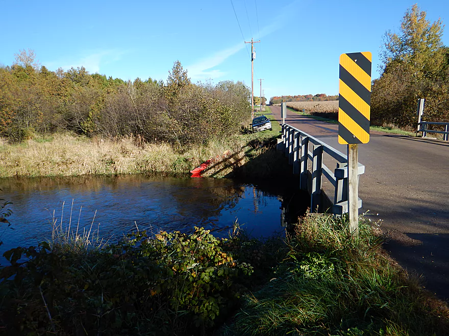
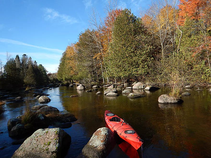
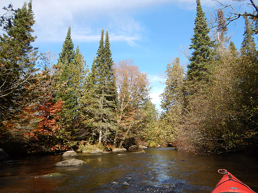
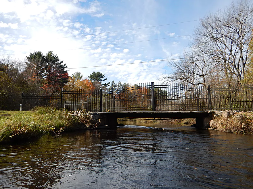
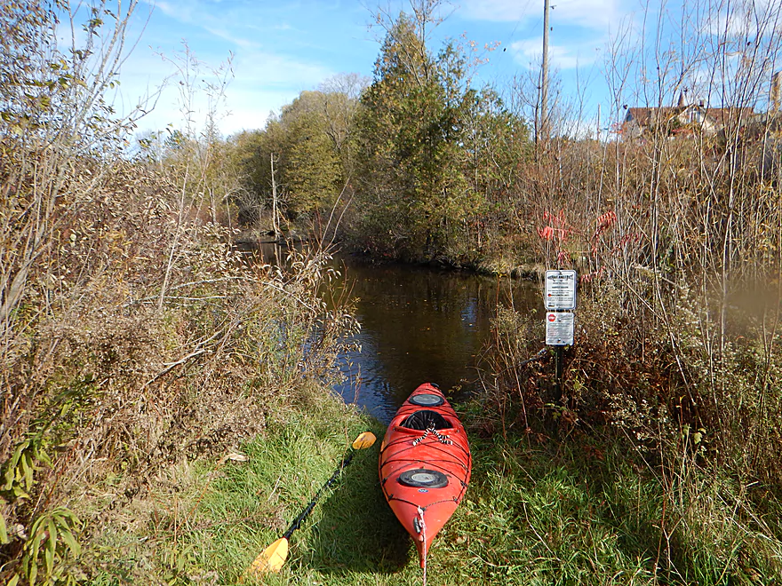
Putting in at Esker Road
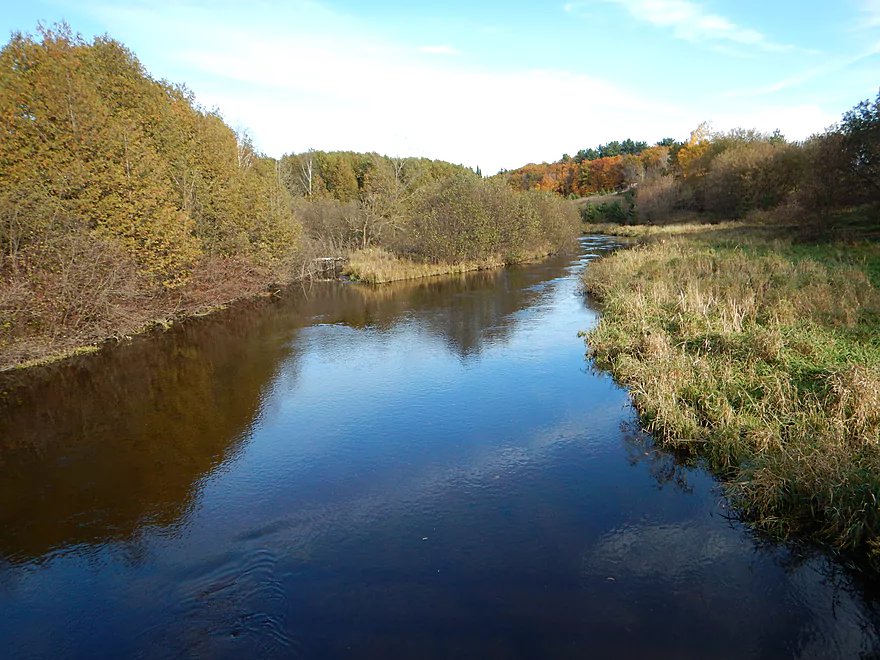
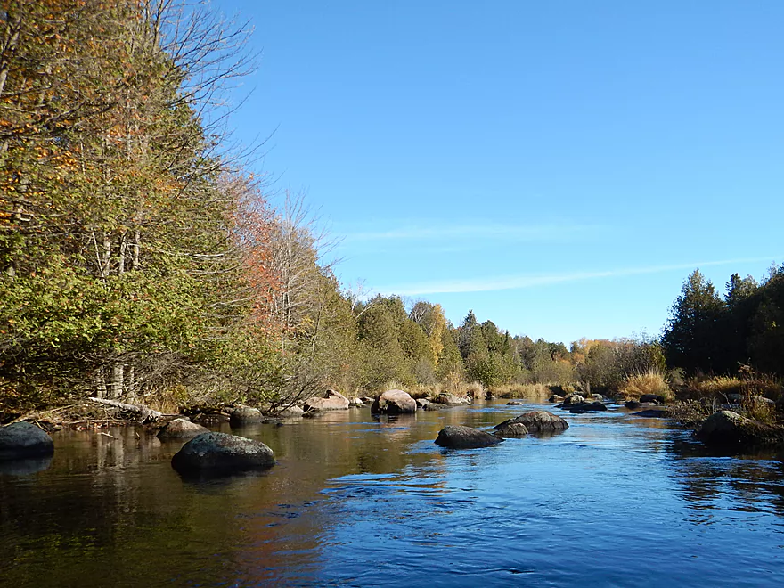
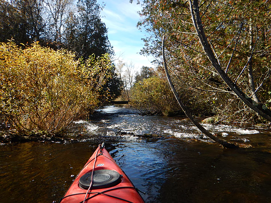
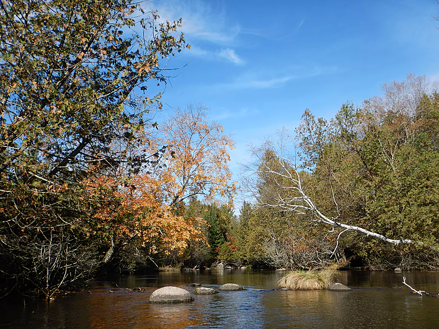
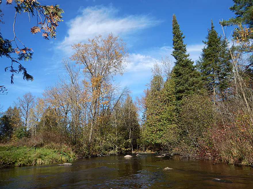
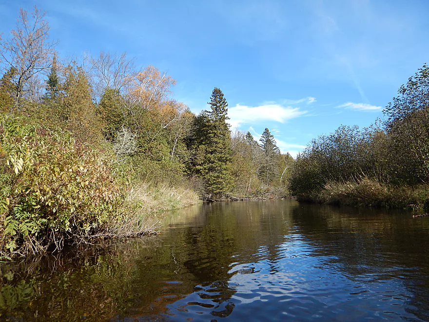
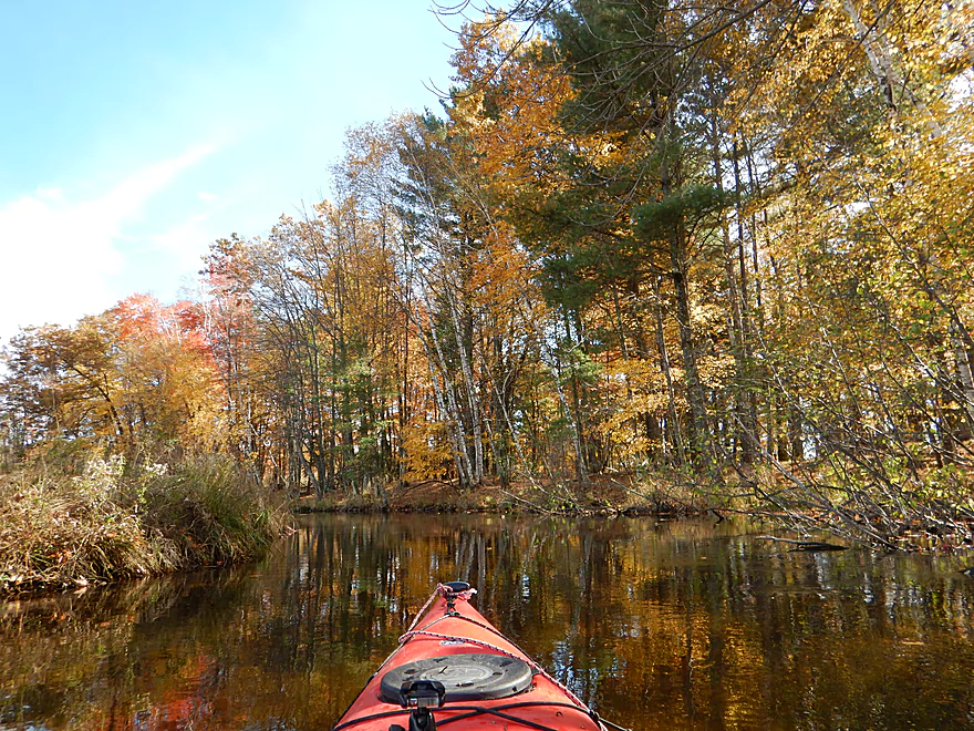
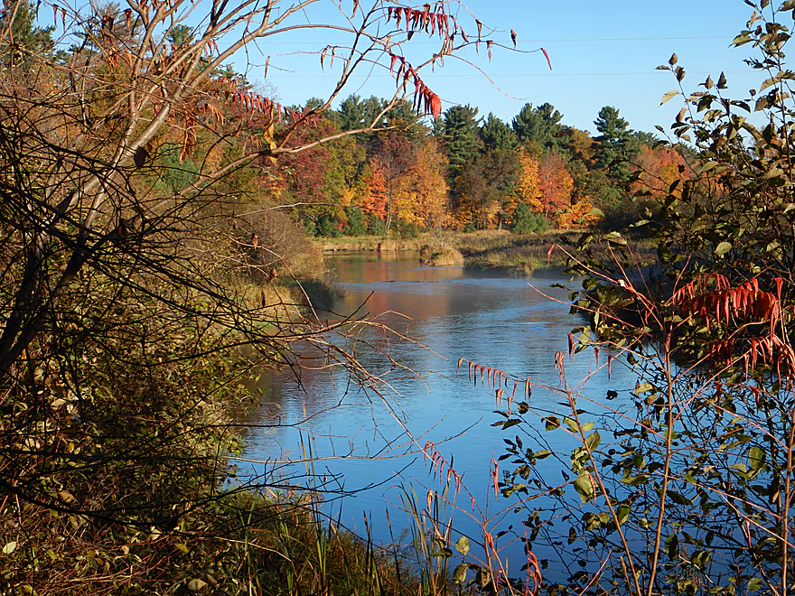
View upstream
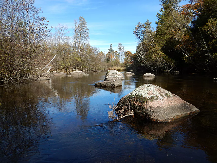
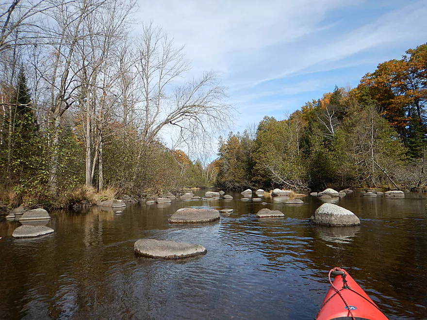
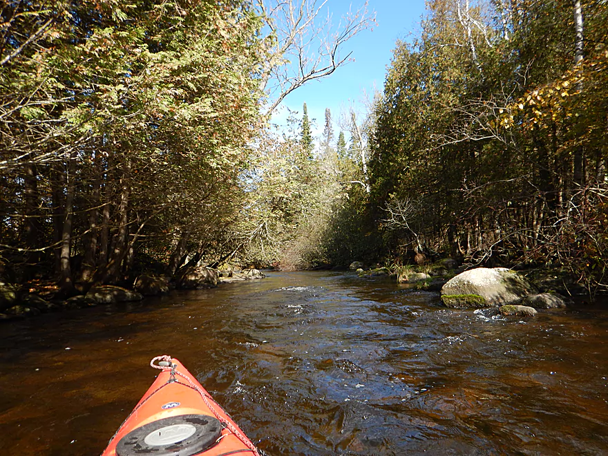
The stillness is very striking
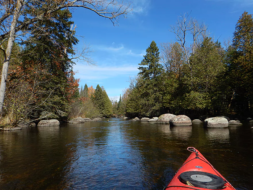
One of several long islands
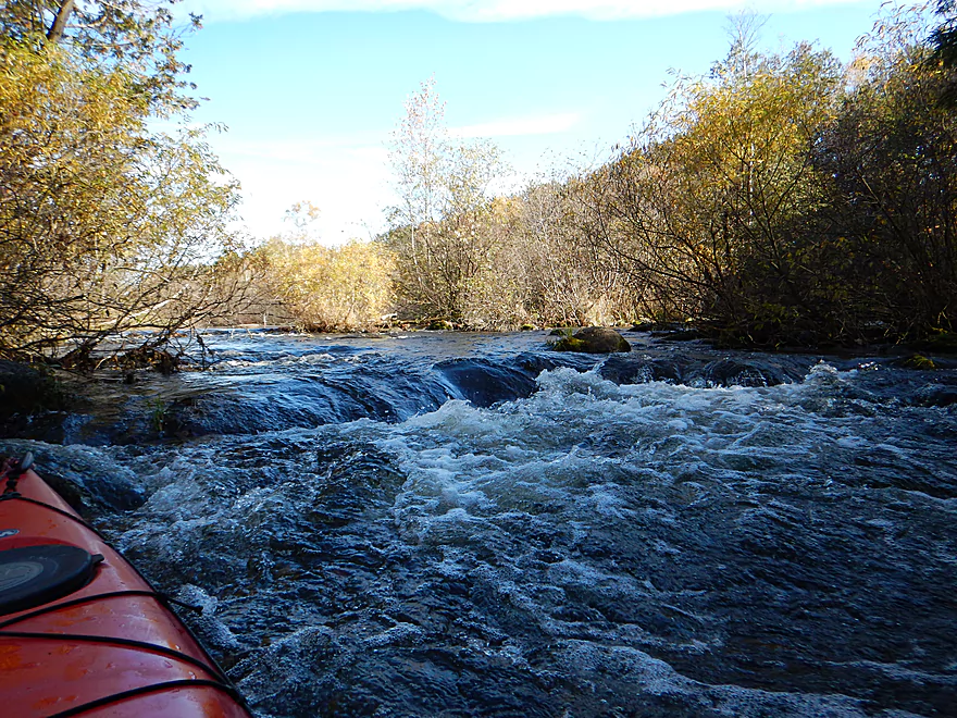
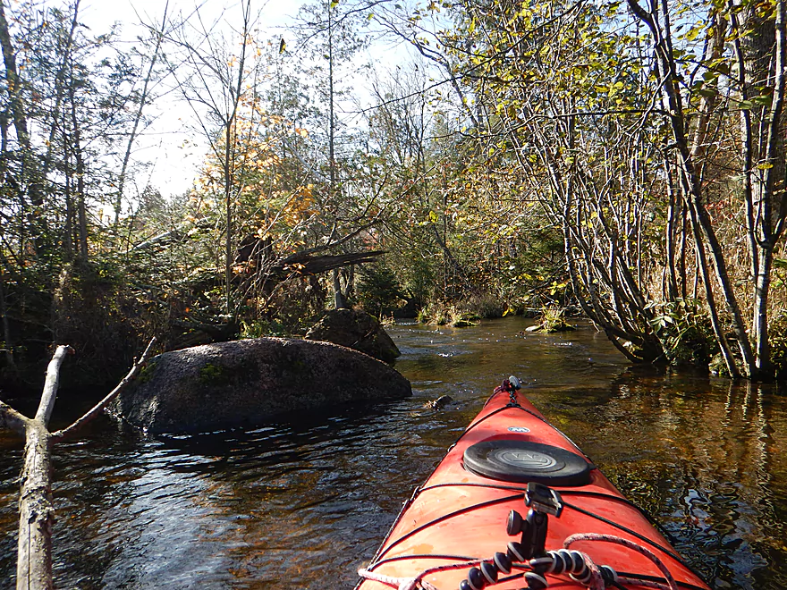
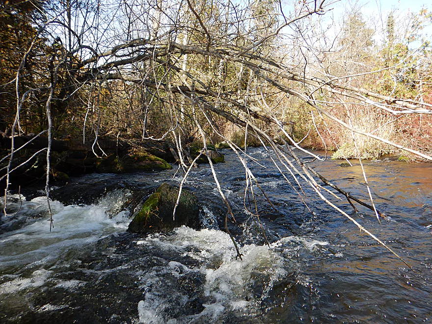
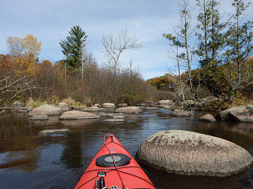
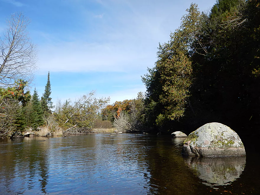
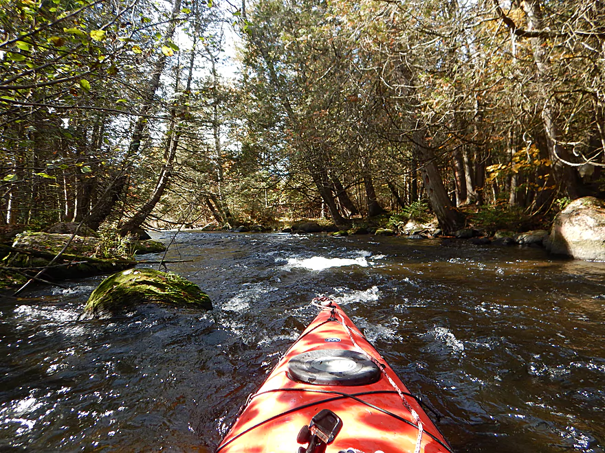
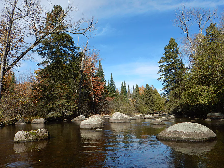
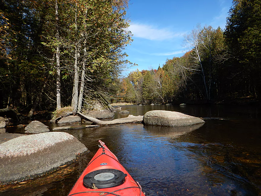
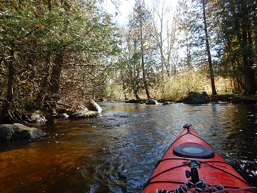
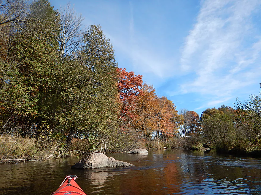
Scenic boulder garden
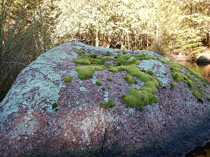
Lot of granite on the river
Reverse view
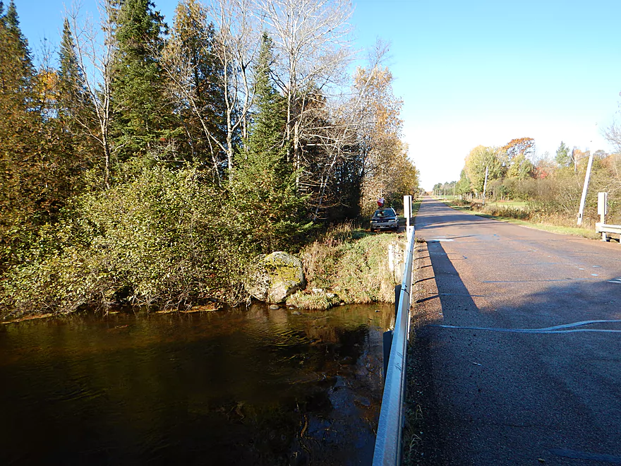
Plover River Road is an access option
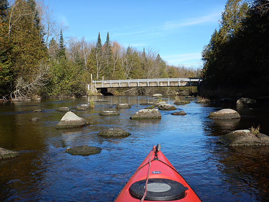
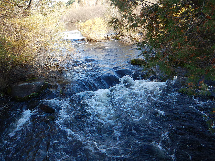
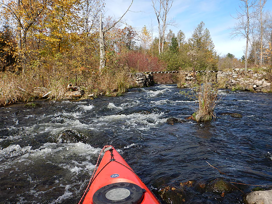
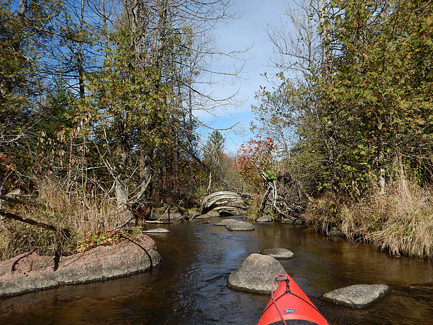
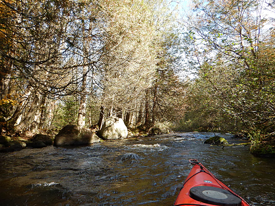
Scenic boulder garden downstream of bridge
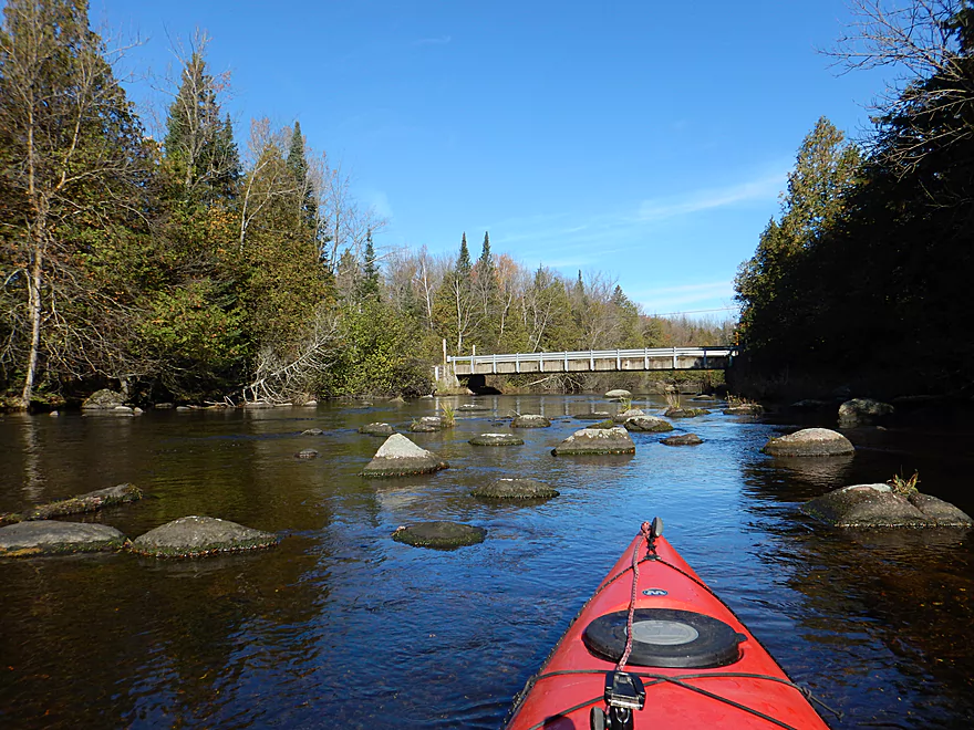
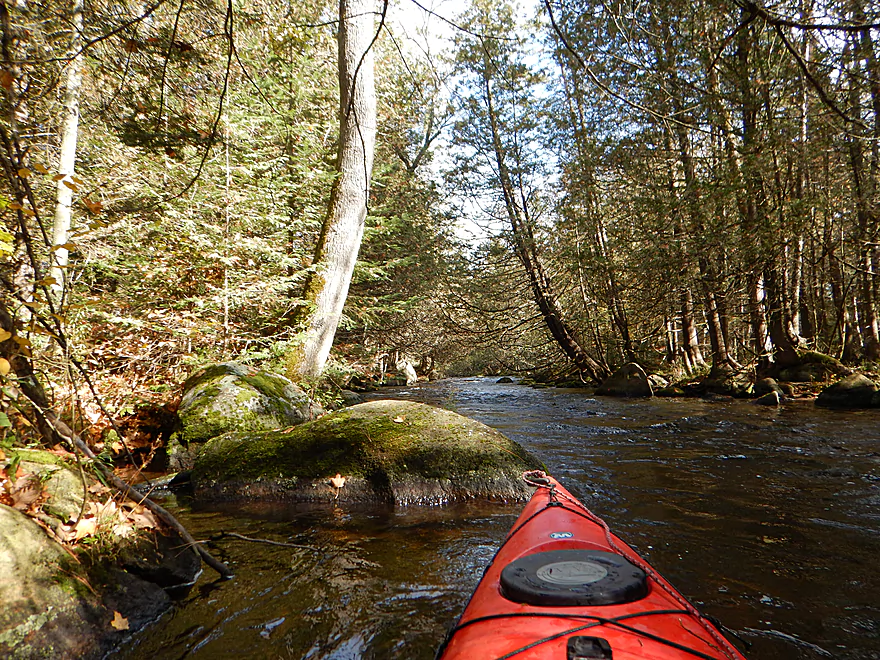
One of my favorites…so you get two photos
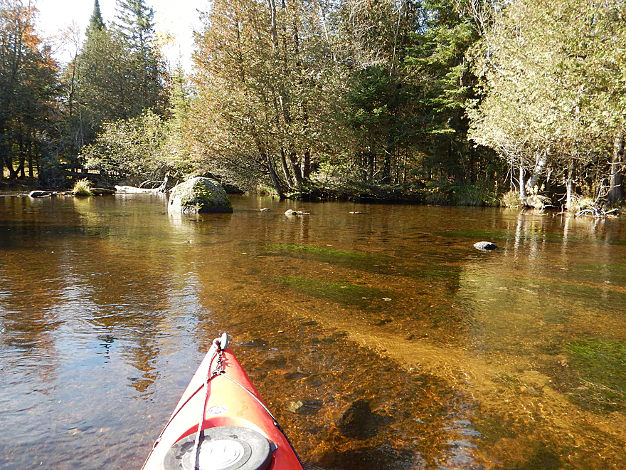
Mostly a deep river, but a rare shallow section
Looking back toward the bridge
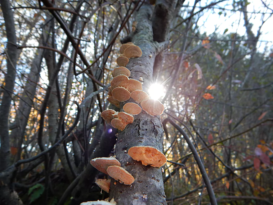
Backlit fungi
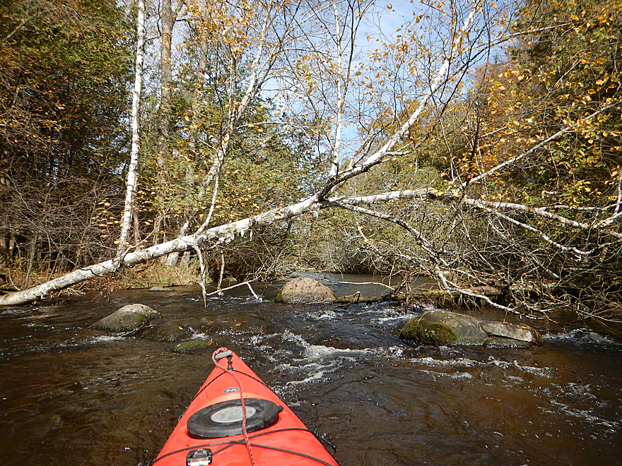
I removed a logjam here
The first Class 2
Would be tricky to portage
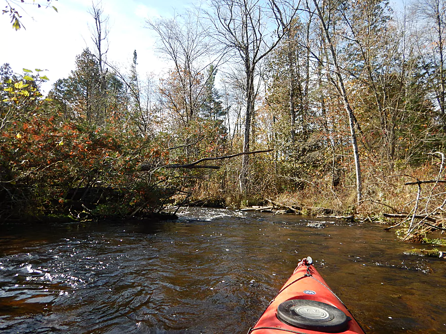
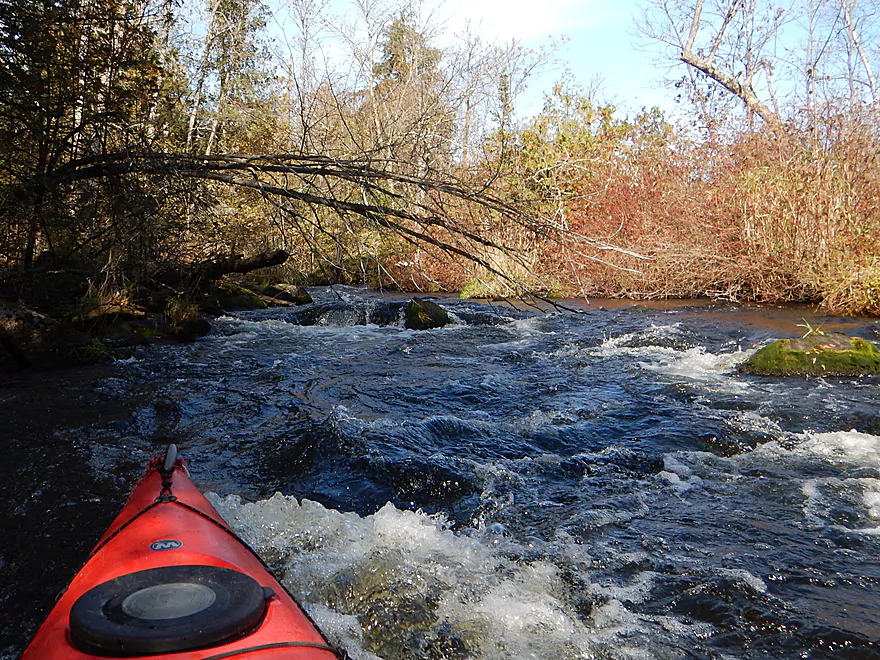
Entering the badlands
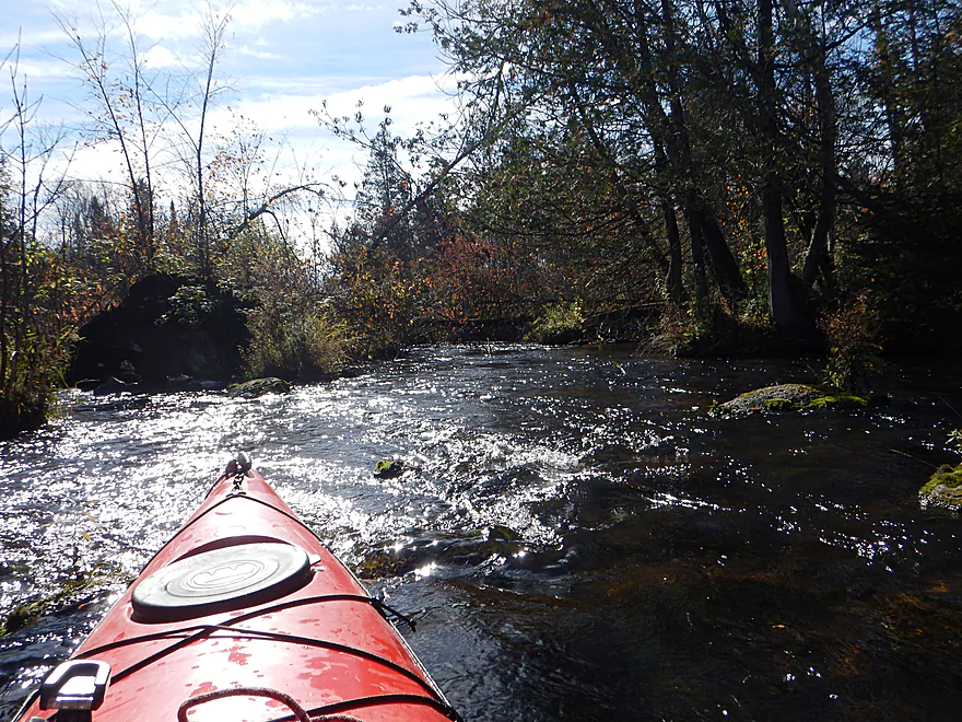
Fast current and several tricky islands
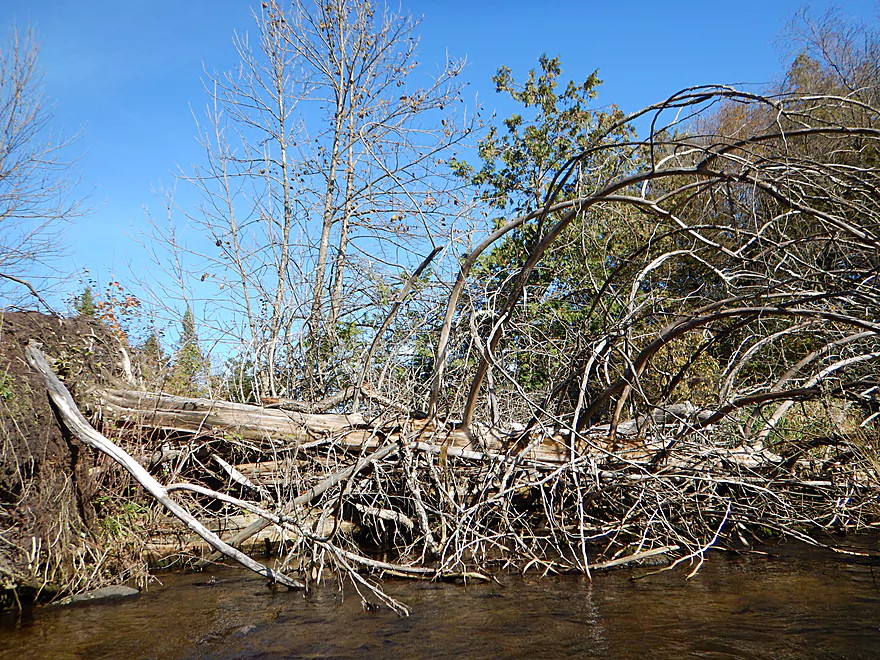
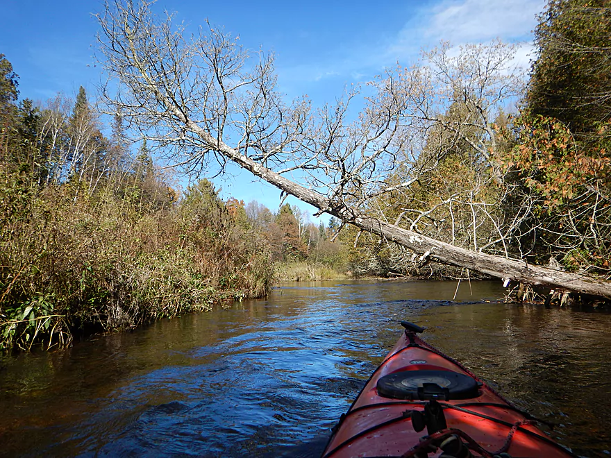
Some channels blocked by downed trees
A big surprise around the corner…
Ugh…Class 2 rapids & strainer
Not easy to paddle around
Panned out view
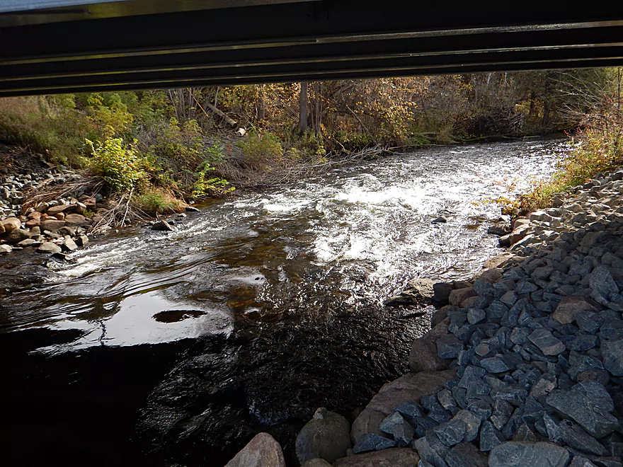
I hear a big noise under this driveway…
The third Class 2
Very scenic (so you get 2 photos)
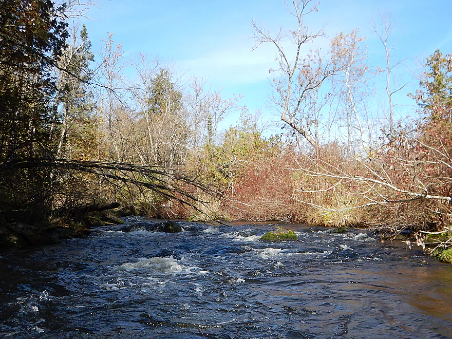
Lot of great boulder gardens after the rapids
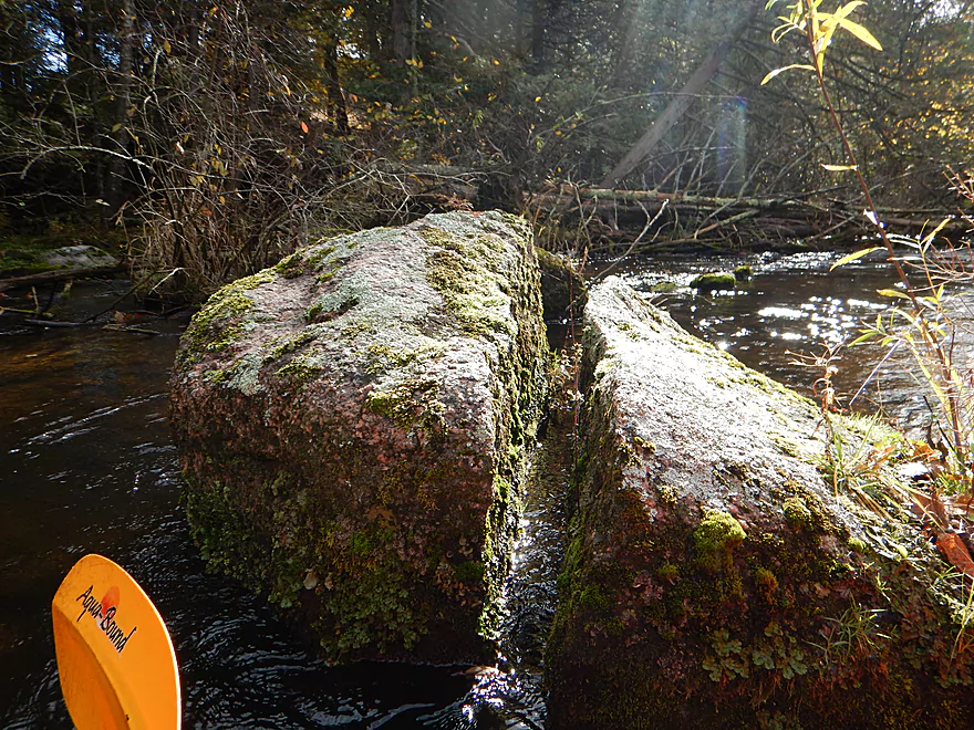
Sliced granite
I never had to portage a logjam
Boulder gardens getting bigger
…and better
Some great cleanup work by locals
One of many interesting side nooks
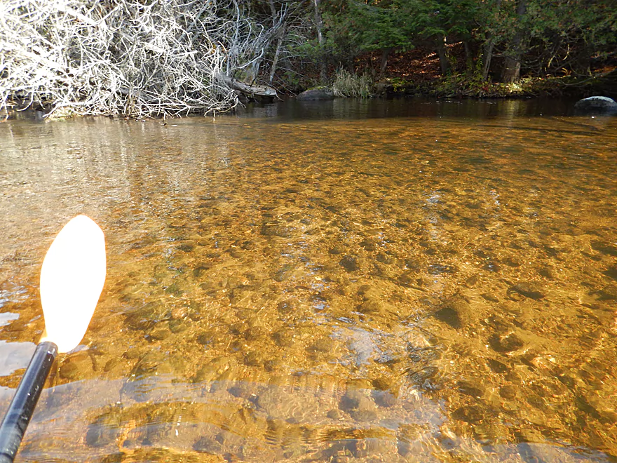
Great water clarity
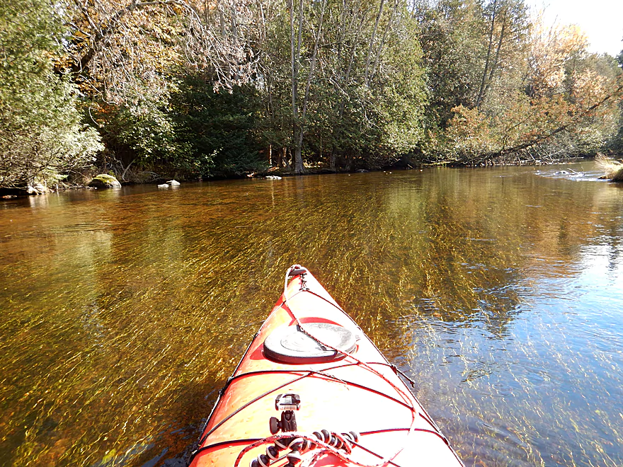
Streaming pondweeds
Very photogenic river
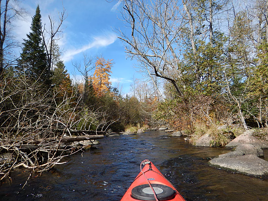
Fun rapids under a cedar & fir corridor
Reverse view
Very difficult to photo in the fast rapids
Spires of balsam fir
Last of the great boulder gardens
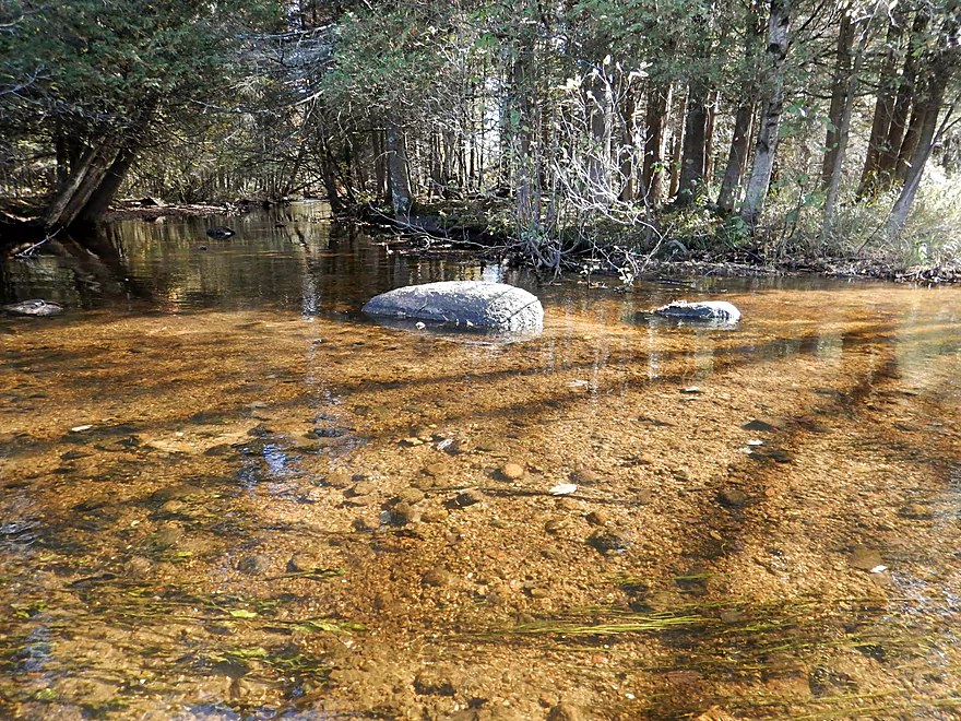
Almost looks drinkable
Locals like to launch at Kristof Road
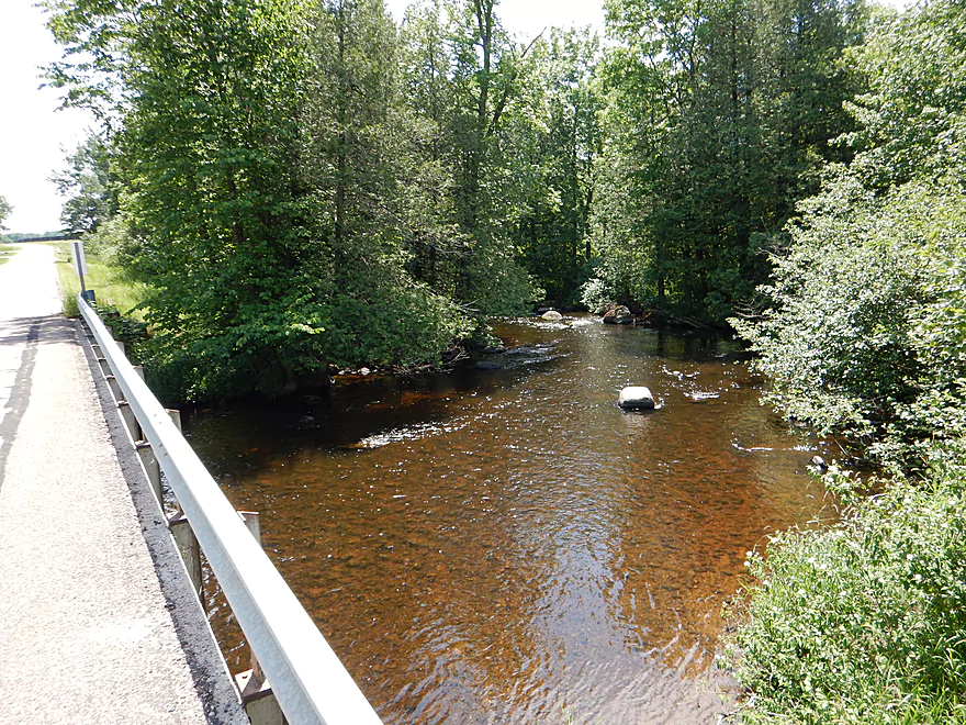
View from bridge
The last cedar & fir corridor
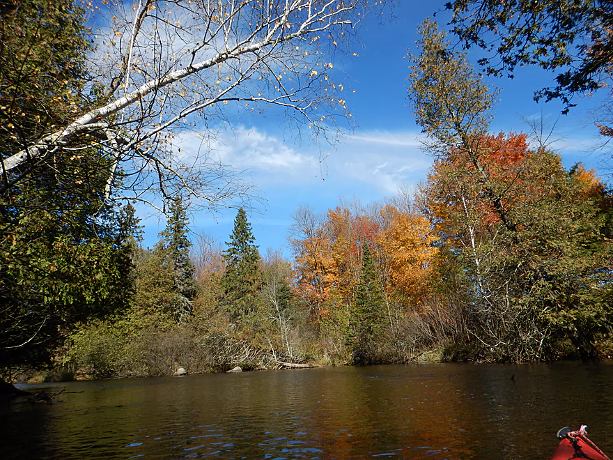
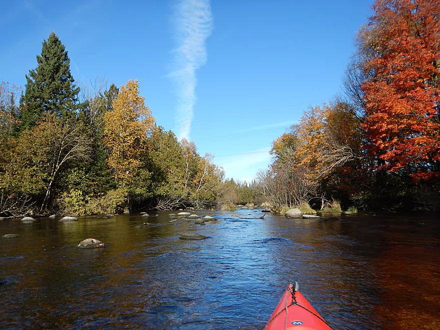
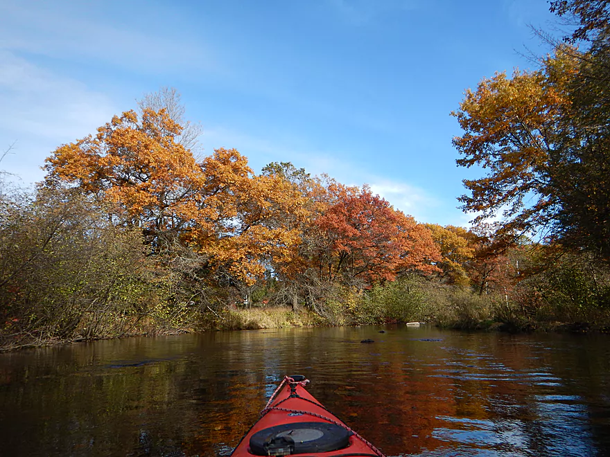
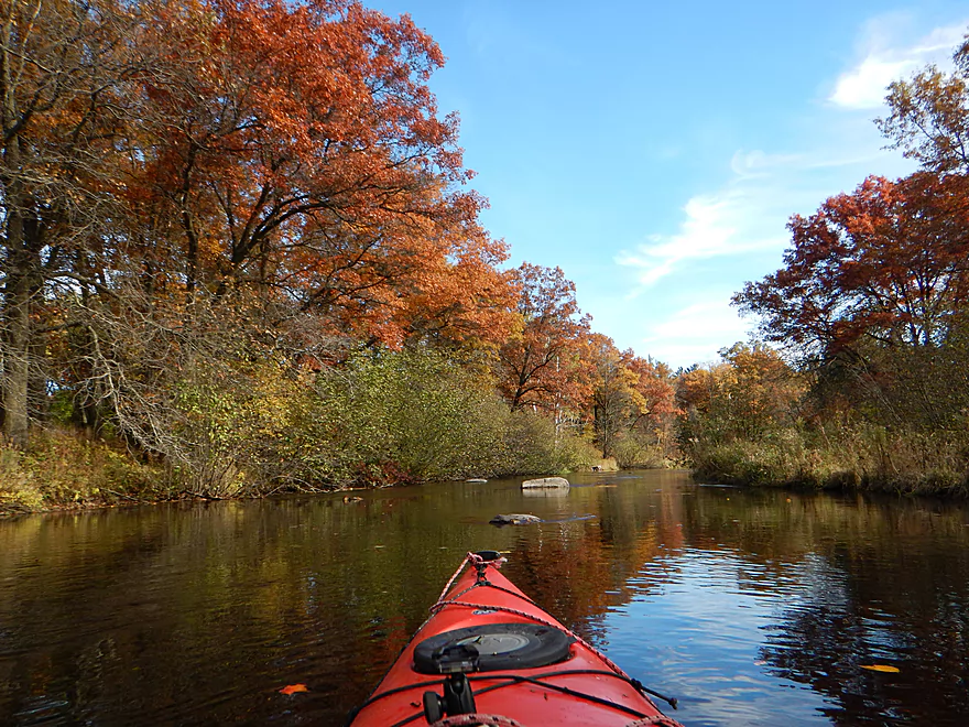
Really good fall color on the trip
A kayak trap…
River really slows down in the last few miles
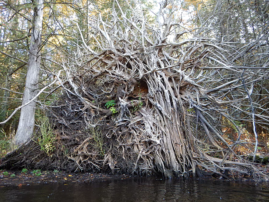
A tree x-ray
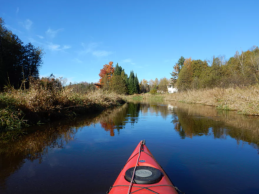
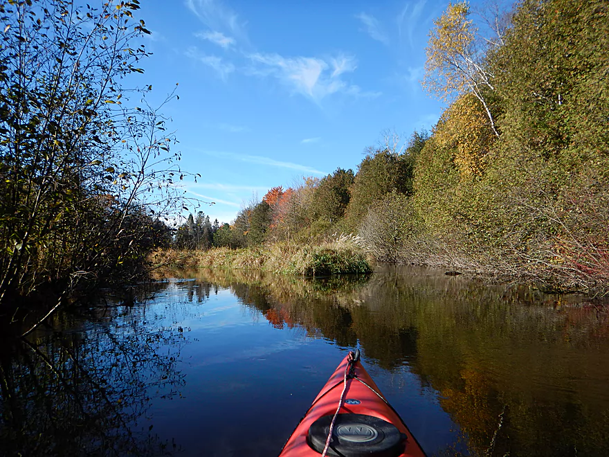
Very peaceful
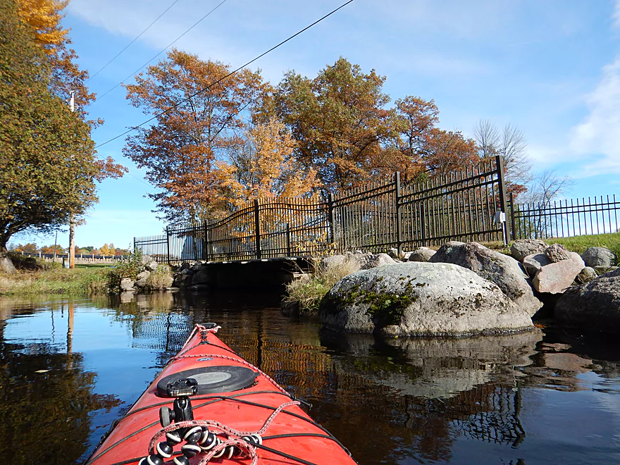
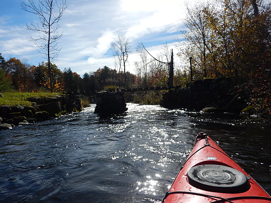
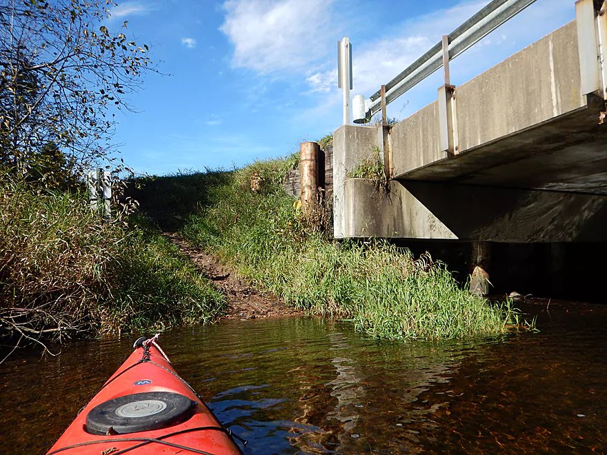
Somebody constructed a VERY low driveway bridge
Tough to get under…portaging would be easy
Some of the better fall color moments
Taking out by Hwy 153
If you continue further there are more rapids to enjoy
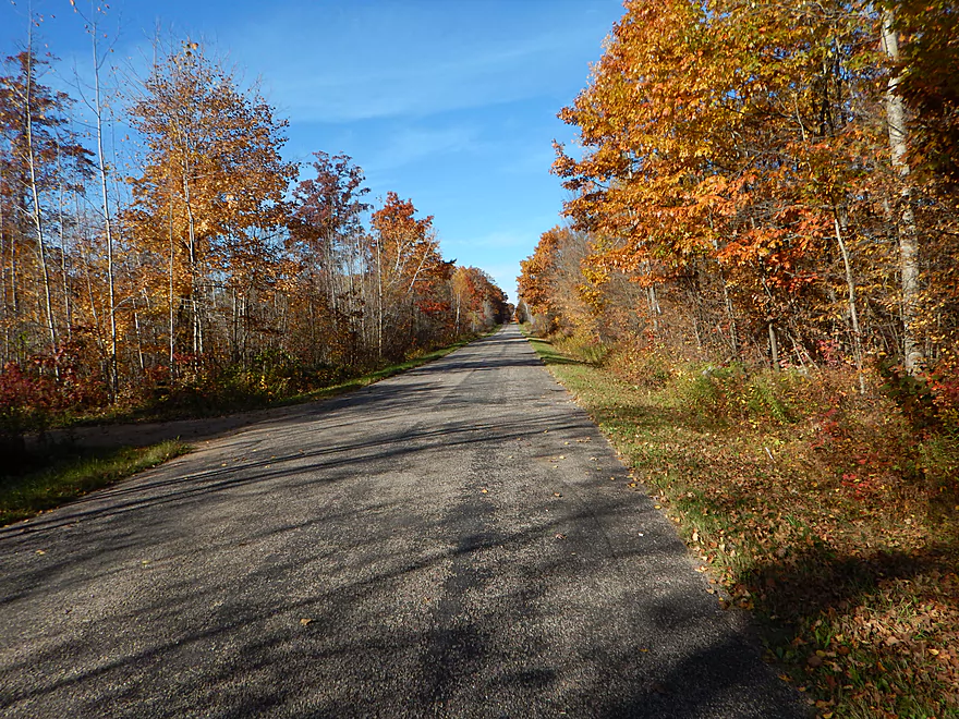
Scenic bike shuttle
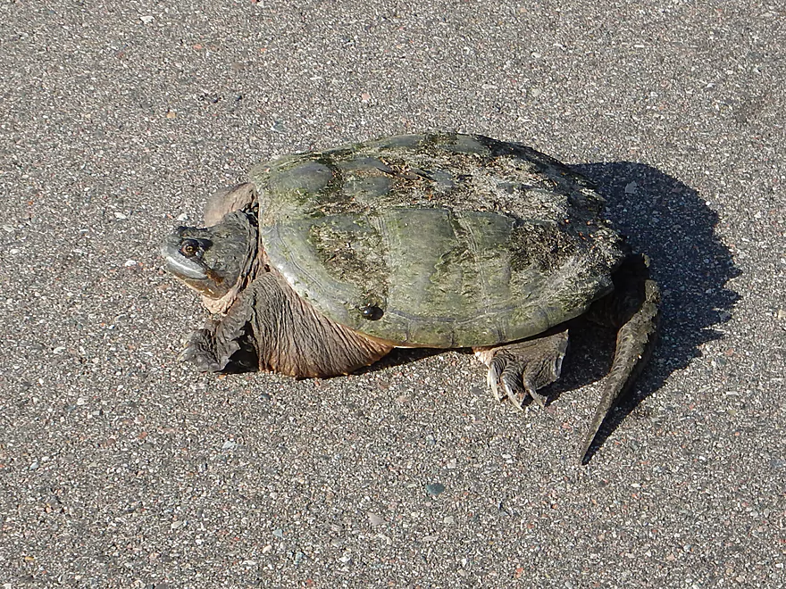
…with a plump surprise
Plenty more of the Plover to explore in the future
Plover River – Esker

So a few months ago, I had done a trip on the Upper Plover starting from Bevent (aka Hwy 153), which was a very positive experience. After the trip, I chanced upon some locals who gave me a tip that the previous upstream section was really good and free of logjams. On top of this one guy told me he had immediate plans to clear the far upstream section from Plover Road to Kristof Road. Two months later and with plenty of time to clear out the jams…I decided it was time to return to check out the largely unexplored far Upper Plover.
The first leg of the trip is Esker Road to Plover Road (1.5 miles). This is a very simple but pleasant leg with good current and a mix of grasses, shrubs, and firs. The water clarity was fantastic, despite the channel’s surprising deep depth (~2-3′ on average), and afforded nice views of the gravel and dirty sand below. What was remarkable was how flat and still the water was despite the current. The highlight on this section was a fantastic boulder garden located a half mile downstream from the put-in.
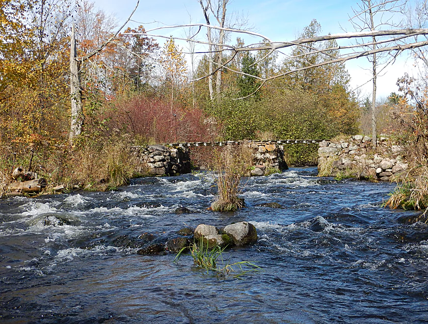
The second leg runs from Plover Road to Kristof Road (2.65 miles). You could easily launch from Plover Road if you wish. The character of the river changes soon after the bridge as the shrubs and grasses give way to hardwoods and firs. The channel narrows and picks up speed (as in a lot). There are still some great boulder gardens, with the first being just downstream from the Plover River bridge. The channel does slow down and widen a bit before…surprise…a Class 2 ledge just prior to a snowmobile bridge. I did not expect any Class 2 rapids on this trip, and little did I know this would be the easiest Class 2 of the trip. So that was a fun surprise, and I did clear out some deadfall to make it easier for future paddlers to run this.
One of the more striking aspects of this section are the many, many granite boulders sprinkled throughout the channel…some of which are decent-sized. Just a warning, but granite (unlike, say, sandstone) is very hard. When (not if) your kayak hits these rocks, you will likely incur scratches and dents (ok price of doing business in my book, but maybe not for others with high-end boats).
While many of the logjams were cleared out by the locals (very much appreciated), there are still some areas of concern. In particular, there is a section (I’ll refer to as the badlands) in which there are multiple downed trees around several islands with light rapids. Not all paths are open, so make sure to pick the correct island channel. What is tricky is that hiding around one bend is another Class 2 ledge…but the frustrating thing here is that low branches hanging over the ledge are tough to duck. See video/pictures…hopefully these get cleared out in the future (Webmaster’s Update…they were cleared out!). Soon after there are more rapids and the third and final Class 2 that runs under a pedestrian bridge.
The other striking thing about this middle stretch were the occasional “fir corridors”–basically narrow, fast sections of the river that ran under overhanging fir and white cedar canopies and through attractive boulder gardens. One of the nicer chutes runs up to and past Kristof Road bridge, which you can see from the road.
The third and final stretch goes from Kristof Road to Hwy 153 (2.25 miles). In any other context this would be a great stretch, but to me felt like some serious downshifting. The channel widens and slows, the shrubs and grasses return, and there are no major rapids nor major boulder gardens. The current is still decent and scenery good, with mostly undeveloped shoreline, and there are still occasional granite boulders popping up, but it did feel very different. Of note, there is a low driveway/bridge over fast water which you will want to portage if your limbo skills are not up-to-speed.
All in all, this was a great trip, with the “star” of the trip being the middle section from Plover Road to Kristof Road. This is probably the best part of the entire Plover River watershed, and IMO trumps many neighboring paddling prospects (like the Tomorrow, Waupaca, and Lower Eau Claire…although the Upper Eau Claire is still the area’s best).
Good bridge access by Esker Road. Ok shoulder parking northwest of the bridge and a good grassy launch area. This is an obscure access spot that is probably more often used by trout fishermen than paddlers.
Good alternate put-ins include Plover River Road and Kristof Road. I suspect all the upstream bridges are used by trout fishermen and would also be quite suitable as alternate put-ins.
There is a private canoe landing northwest of Hwy 153 that is apparently completely open to the public. Be careful where you park, so you don’t block farm machinery. There is no nearby outhouse.
I actually recommend to continue paddling 2.7 miles further to the next bridge, as this mini-section is probably the 2nd best on the Plover. You can then take out northeast of the Bevent Drive bridge.
Nature Treks in Stevens Point does do shuttles and rentals on the lower Plover, but I’m not sure they would be willing to go this far upstream. You can call them at 715-254-0247.
This is not a bad bike shuttle. It is all paved, 5.9 miles, has only a few hills, and lasted 45 minutes.
Moderate current with occasional pools and riffles. There are three Class 2 rapids you will want to be mindful of (all between Plover River Road and Kristof Road and marked on the map).
- The first is just prior to a snowmobile bridge and would be a pain to portage, but is straight forward to run in the middle. There was a downed log blocking part of the entrance which I cleared out.
- Soon after, there is a maze of downed trees that you can get through, but you have to carefully pick the right channel in fast current. After going sharply right there is a surprise Class 2 drop to your left. The problem is there is a low branch blocking your path. I immediately went hard left and only barely got by…hopefully this gets cleared out in the future.
- Soon after is a small bridge with a Class 2 immediately following. This would be easy to portage, but is straight forward to run. Make sure to turn around at the end as it is very scenic.
The locals have cleared out the rest of the logjams. The only downed tree to be concerned about is the one over the second Class 2.
Webmaster’s update…the logjams have been mostly cleared out and this section should be clear sailing now.
The following is a very rough guide based on the nearby Eau Claire gauge.
- Up to 74 CFS: Very rarely does the river get this low. While doable, you would probably be walking several sections.
- 75 to 109 CFS: Most of the river is easily navigable at this depth. The rapids might be a bit bumpy through. Water clarity should be very good.
- 110 to 175 CFS: Probably a good target range. You shouldn’t get hung up at this depth and the water shouldn’t be too high. This trip was done at 140 CFS, which is above average but a good depth for the rapids. My previous downstream trip was at 125 CFS (also a bit above average).
- 176 to 250 CFS: Probably doable, but some of the rapids might be obnoxious and the scenic boulder gardens could get buried.
- 251+ CFS: I suspect this would not be an ideal depth.
An eagle, fish (trout?), several great blue herons, many snails, and ducks. The highlight was seeing a very fat snapping turtle trying to cross the road on my bike shuttle. He didn’t move very fast and would bite and hiss at passing cars. The woods were also relatively unique for this paddle with a number of balsam firs, white cedar, and spruce.
- Paddlingtheplover.wordpress.com: An informative blog about the Plover River.
- Paddling Southern Wisconsin by Mike Svob: A good guide book in general, but specifically a good resource for upper part of the Plover River.
Detailed Overview
- Legion Memory Park to Konkol Road: (1.8 miles) Scenic, narrow, shallow creek with perhaps a few logjams.
- Konkol Road to Townline Road: (1.3 miles) Probably a mediocre but doable prospect.
- Townline Road to Bridge Road: (1.4 miles) A creek prospect that should have scenic woods and a few boulder gardens. Townline Road should be ok for access.
- Bridge Road to Esker Road: (0.7 miles) Narrow, wooded and rocky, this is a good prospect. Probably some rapids and a few logjams. Should be ok put-in access.
- Esker Road to Hwy 153: (6.4 miles) A fantastic trip reviewed in Oct 2016.
- Esker Road to Plover Road: (1.5 miles) Pleasant section with a nice boulder garden.
- Plover River Road to Kristof Road: (2.7 miles) Best section on the entire river. Very scenic, with 3 Class 2s and many boulder gardens.
- Kristof Road to Hwy 153: (2.3 miles) Good section with no noteworthy rapids, but pleasant and scenic.
- Hwy 153 to Pinery Road: (5.0 miles) A great trip reviewed in June 2016.
- Hwy 153 to Bevent Drive: (2.7 miles) Five star segment and 2nd best leg on the entire river. Scenic with several small rapids.
- Bevent Drive to Pinery Road: (2.3 miles) Pleasant section but not as scenic as upstream parts.
- Pinery Road to Shantytown Drive: (4.9 miles) A medium trip reviewed May 2018.
- Pinery Road to Hwy J: (2.8 miles) Starts wide and uninteresting but gets better with narrow corridors of firs, white cedars and white pines. Section includes a small boulder garden and several low farm bridges.
- Hwy J to Shantytown Drive: (2.2 miles) A peaceful section with many conifers relatively undeveloped banks and good current.
- Shantytown Drive to Hwy Y: (5.2 miles) The river slows and widens here, with maybe a third of the trip being a flowage/marsh (looks pleasant). Shantytown Drive is a good launch option.
- Hwy Y to Bentley Road: (1.3 miles) A tweener section between the flowage and river that includes a dam portage. Hwy Y is a poor launch option with difficult parking.
- Bentley Road to Hwy K: (3.4 miles) The river narrows here and this is a popular section. Good shoulder parking at Bentley Road (lot of cars park here).
- Hwy K to Jordan County Park: (5.3 miles) Ok prospect reviewed Jul 2017.
- Hwy K to Sharonwood Lane: (4.7 miles) A less traveled, narrow, wooded section on the upper part and an open grassland paddle in the second part where the old flowage was. Be careful about running the old dam remnants. There are nice boulder gardens above and below Sharonwood Lane. Hwy K is an ok launch, but has very poor parking (most cars were literally parking more on the road than on the shoulder).
- Sharonwood Lane to Jordan County Park: (1.0 miles) Gorgeous boulder garden below Sharonwood and perhaps an abandoned whitewater slalom course. Most of this is lake paddling though Jordan Pond. Sharonwood Lane is small but ok for access.
- Jordan County Park to Jordan Dam/Jordan Park: (0.5 miles) Paddle west of the lake, then portage under the Hwy 66 tunnel. You then have to drag your boat 600+ feet to get past the pipeline and into the water. Not recommended.
- Jordan Park to Iverson Park: (8.0 miles) A good prospect previously reviewed July 2014.
- Iverson Park to Lower Whiting Park: (2.5 miles) Mostly open flowage paddling that is probably uninteresting.
- Lower Whiting Park to the Wisconsin River: (1.2 miles) Mostly big flowages. Probably not a good prospect.
Trip Map
Overview Map
Video
Photos Size:
I did Esker Rd to Bevent Rd 5/23 with a bike shuttle, trip took about 2 1/2 hours and the bike shuttle took about 25 mins. The bolder gardens in the first half are fantastic, there are a couple of fun rapids that require some control and a nice 1-2 ft drop that is easy/fun but could be a bit scary for novice paddlers. I was solo and water was high and fast, so I choose to portage the low driveway bridge on river left. The water had a slight brown hue but the clarity was great for the entire trip. Great trip, hope to do it at least once a year
Link to some of my photos from the trip https://1drv.ms/a/s!AjC8S6n5i35VgXQK2JaWce6BcaRD
Eric, do you recall the level on June 10, 2020? I’m hoping to go mid Sept but a 5 hr drive so want to be sure it’s worth it. Thanks.
Hi Tim…I’ll forward your message to Eric. In the meantime I will say that current levels are just about at (although a bit below) the levels I did it at. If you watch my video you’ll get a feel for how shallow this is.
Thanks for the update!