
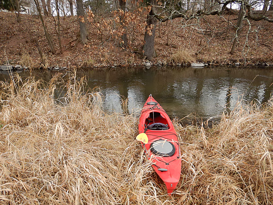
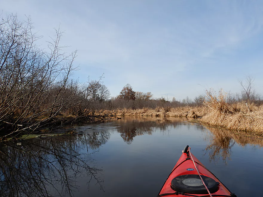
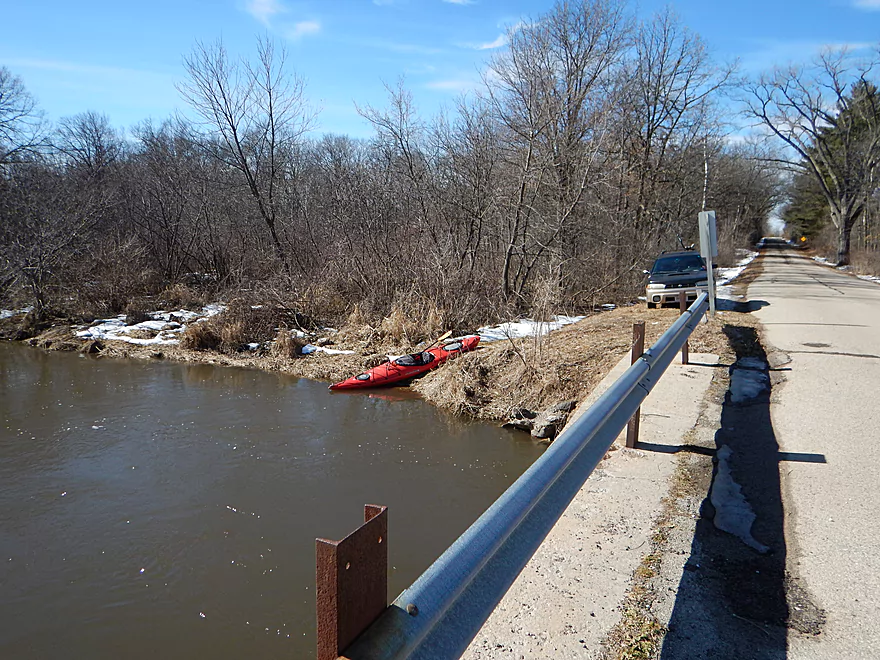
Starting the trip at Hwy P
Nice launch area
Swift current under the bridge
Scenic start to the creek
Much appreciated
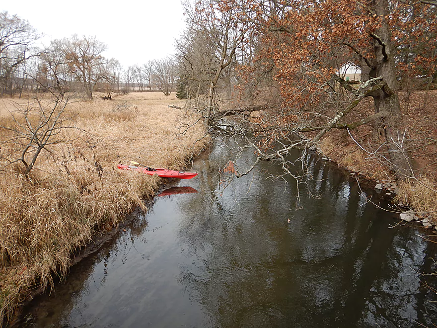
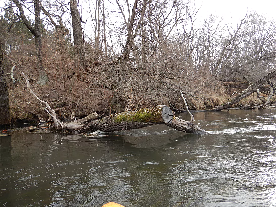
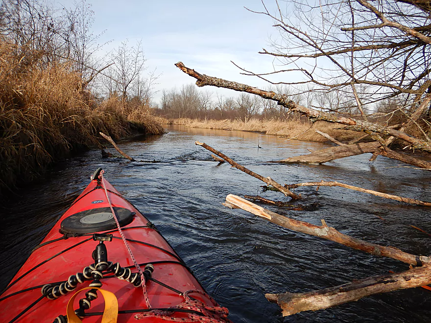
The only logjam of the trip
Easy portage
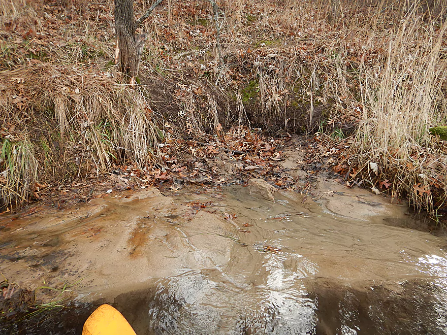
One of several sand springs
Peaceful and pleasant
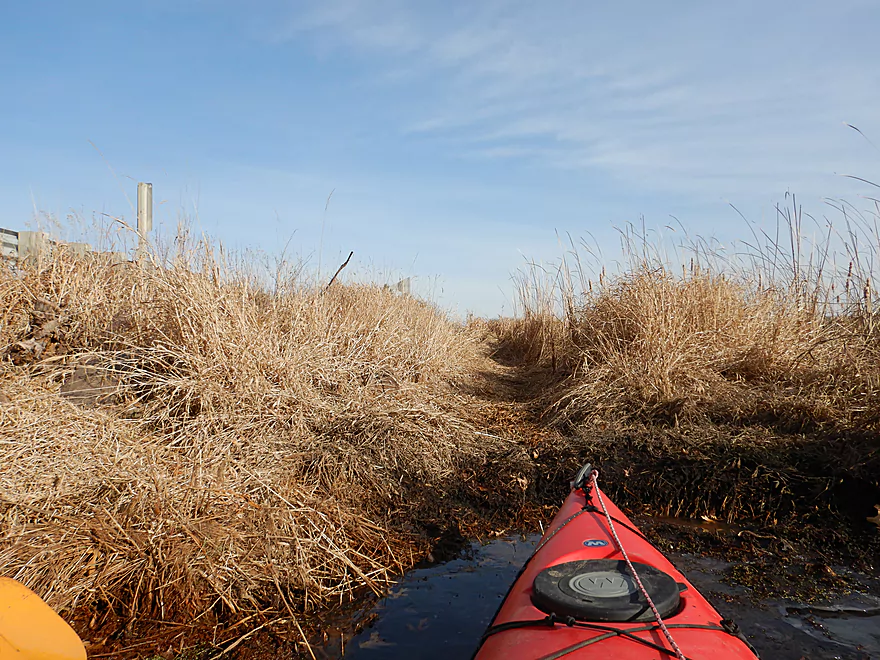
For the next two miles the creek opens up into a marsh
Some parts were shallow
OKeefe Creek joins Neenah Creek
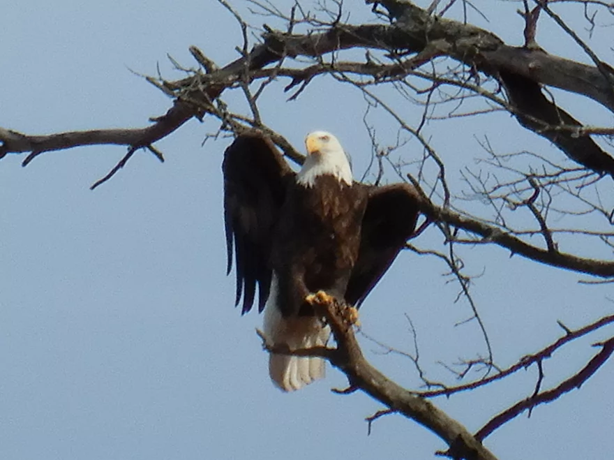
Doing his Federal Reserve pose
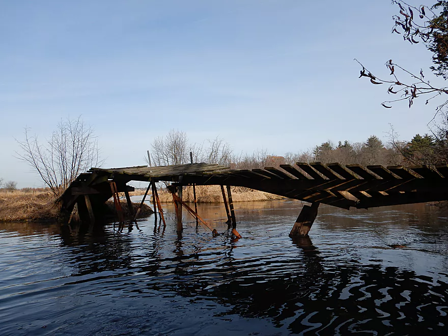
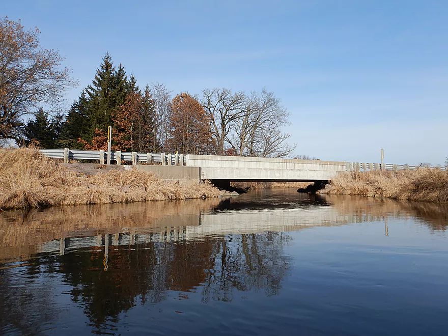
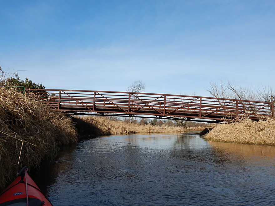
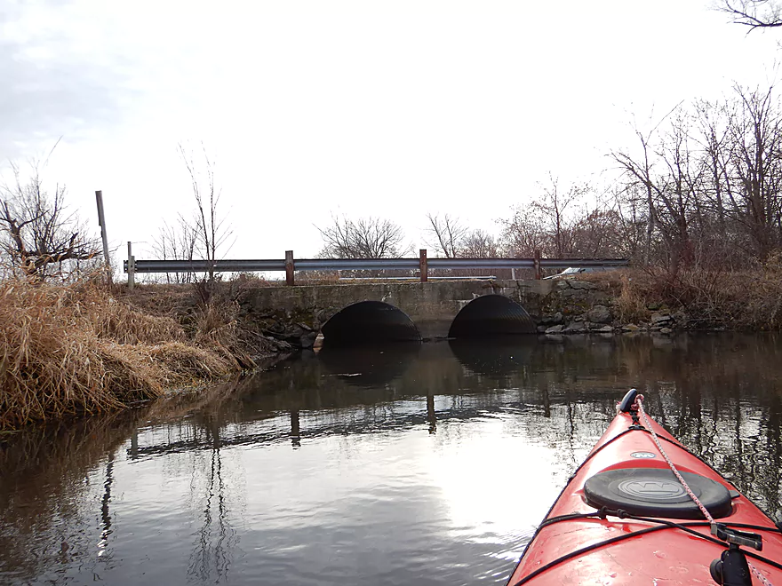
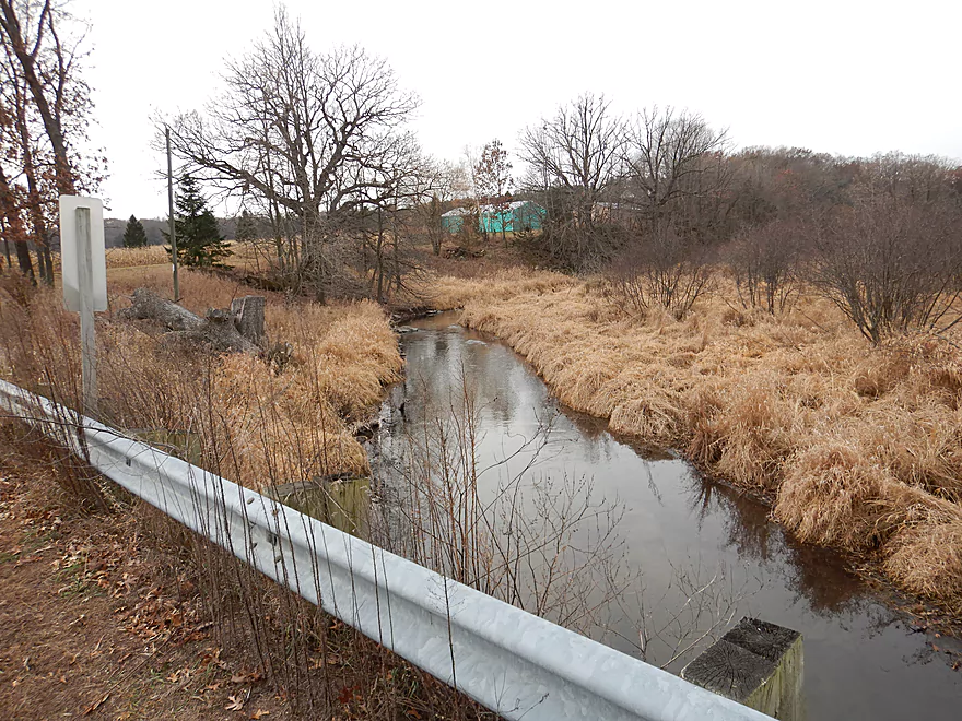
Interesting bridge…
Finally done with the marsh
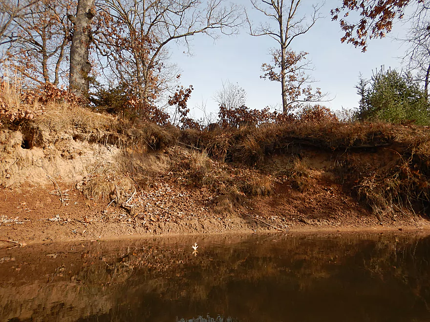
Some large clay banks
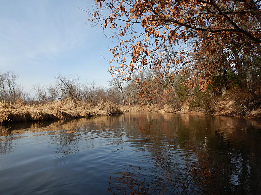
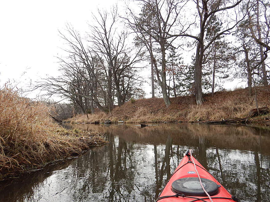
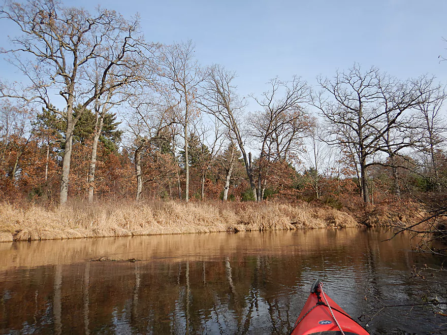
Another nice little section
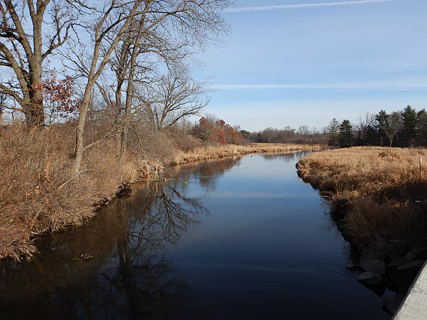
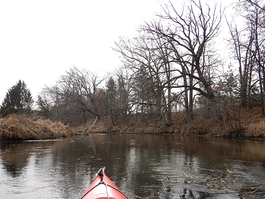
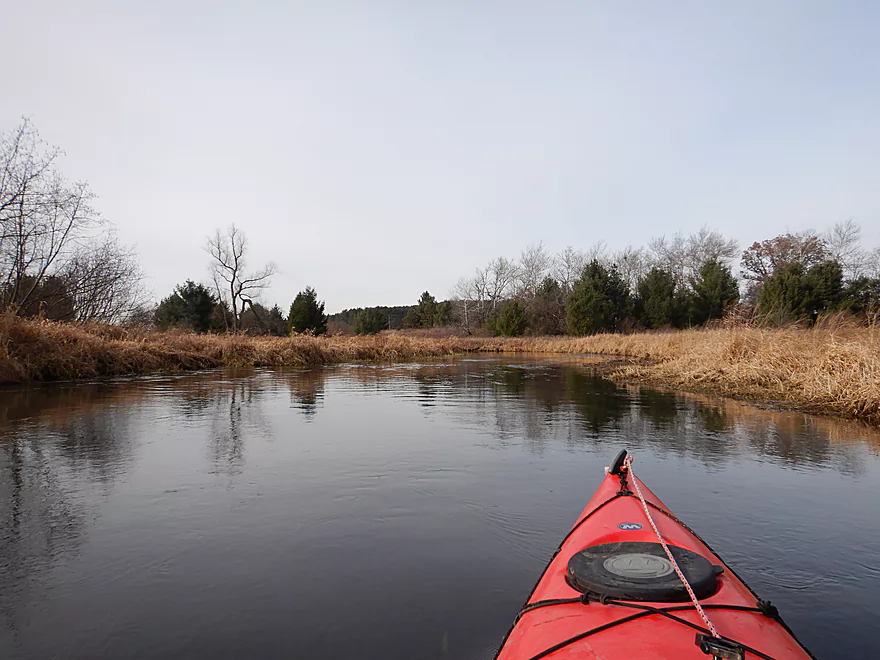
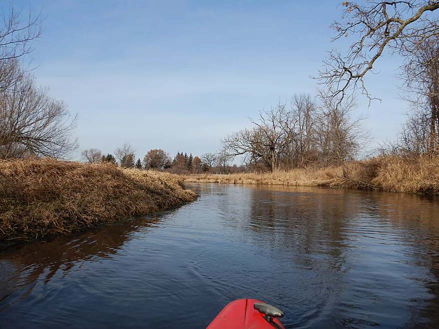
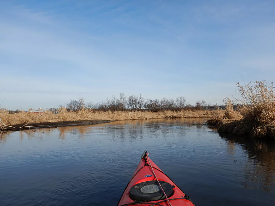
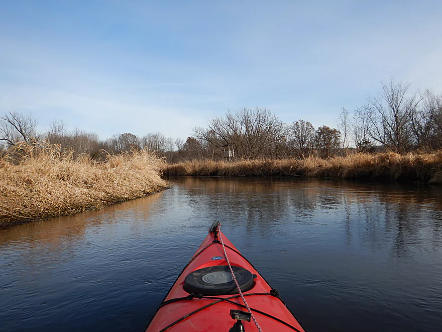
View upstream
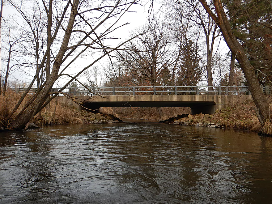
Passing under Hwy 23
Looks like it gets some paddling traffic
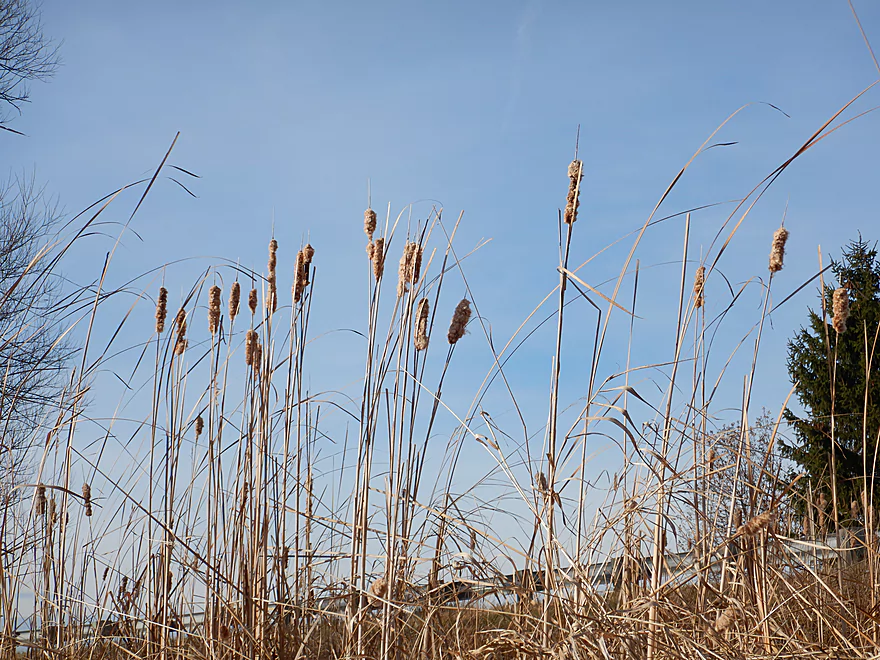
Scenic cattails
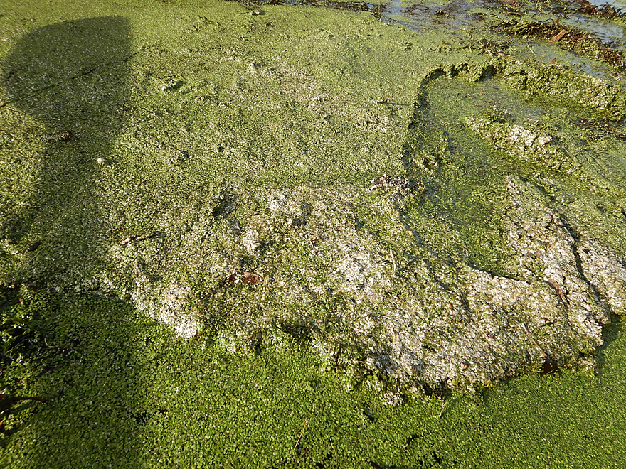
That is a duckweed iceberg
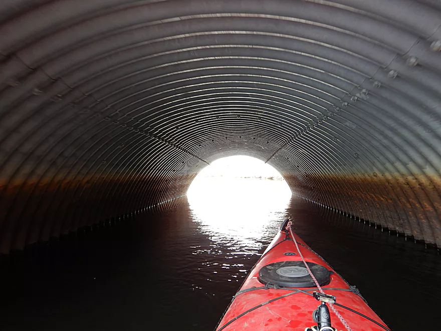
At first I thought this was for paddlers
But is for snowmobiles
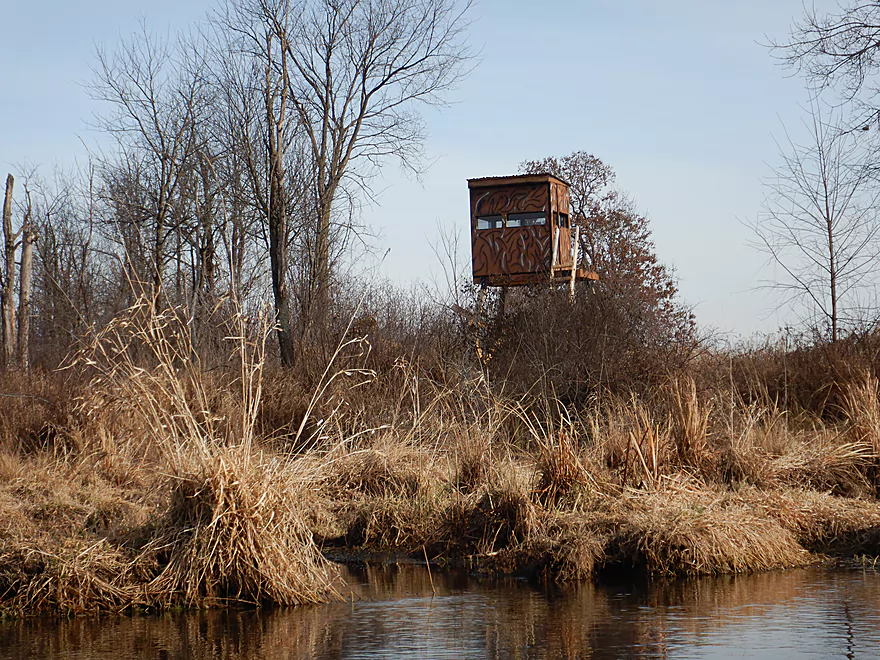
Lot of blinds…this one looks like an AT-ST
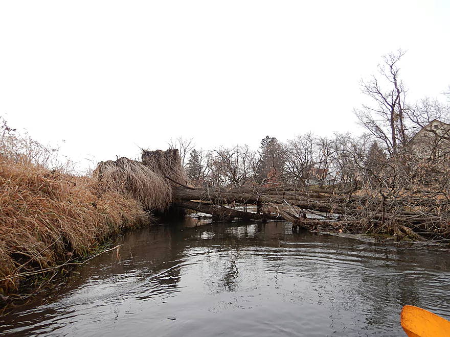
Some debris dodging, but nothing serious
Coming up on Grouse Road
Nice take-out
Room for one to park
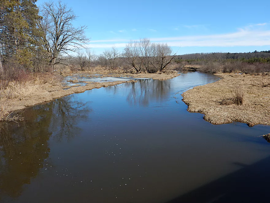
View upstream
Scouting OKeefe Creek at Hwy A (looks nice)
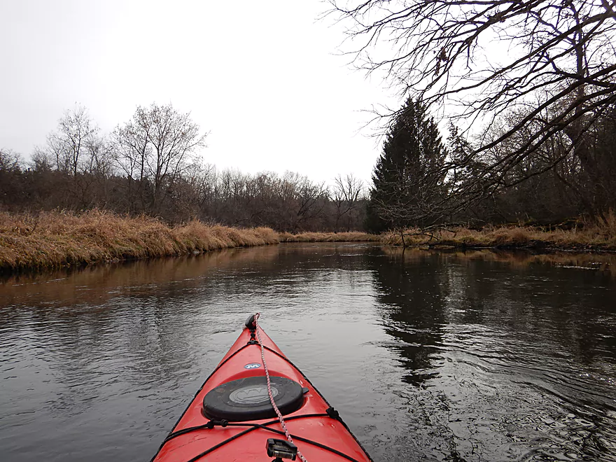
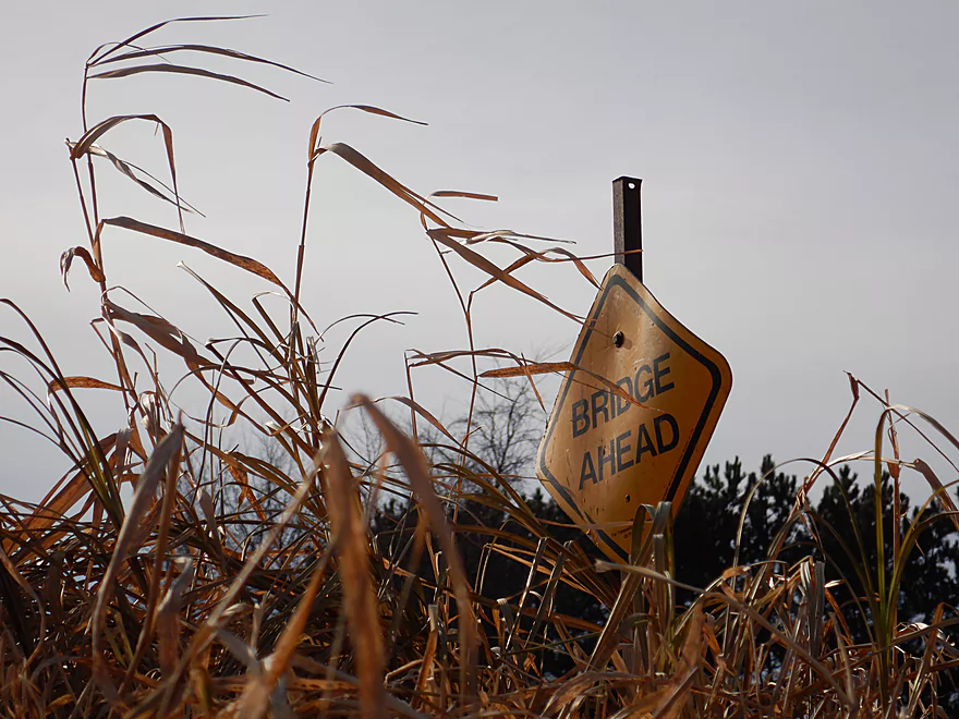
Neenah Creek – Hwy P


Neenah Creek is a large tributary of the Fox River near Portage that gets occasional paddling traffic. This is a quintessentially mediocre prospect that is attractive for its simplicity and lack of hazards…but at times uninteresting for the same reasons. Astute readers will note that I’ve reviewed this creek and its tributaries before (in fact many times). This particular section is the last of what I consider the upper part. Downstream from this leg, tributaries slow the creek and swell it to a small river, giving it a very different character.
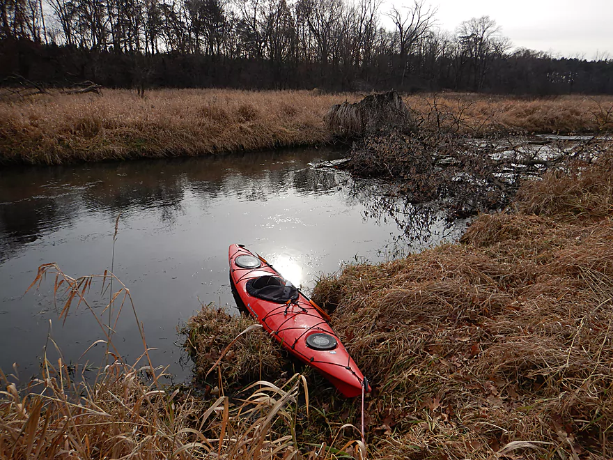
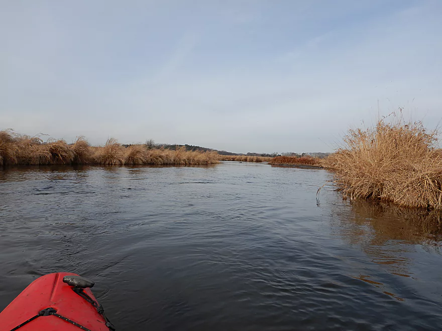
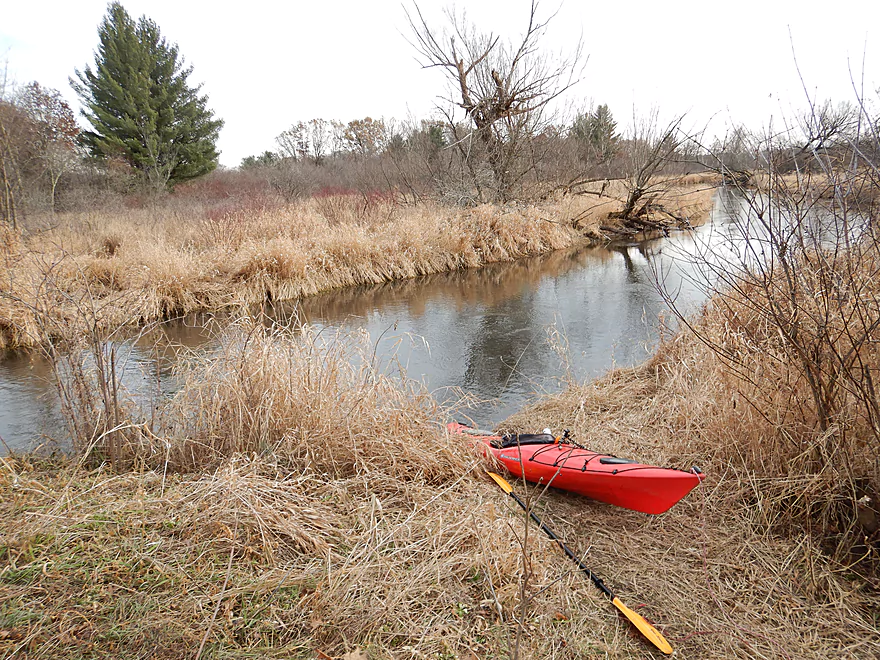
This trip started at the Hwy P bridge, where there is an attractive scene with clear water, a few rocks, and a small hill. The first mile was quite pleasant with uptempo current flowing over a surprisingly sandy substrate. Occasionally I saw a few sandy spring seeps contribute their little bit to the creek. The banks are a mixture of wetgrass and thinly spaced woods with a few pine plantations. This first part was one of the nicer parts of the trip, but there was one logjam to deal with (it was an easy portage).
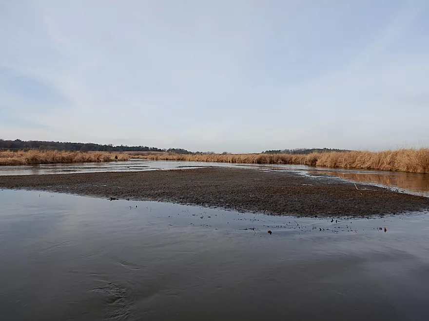
Soon the creek opens up into a large wetgrass marsh and the current slows. This was somewhat windy and repetitive…and the trip lost a half star at this point. This CAN be a neat area during fall and spring waterfowl migrations, but I only saw a handful of ducks during my trip. O’Keefe Creek joins Neenah Creek here, and I suppose if you really wanted to you could start your trip on this creek instead. It would be a smaller version of Neenah Creek and logjams shouldn’t be much of an issue with Hwy A being the best launch point.
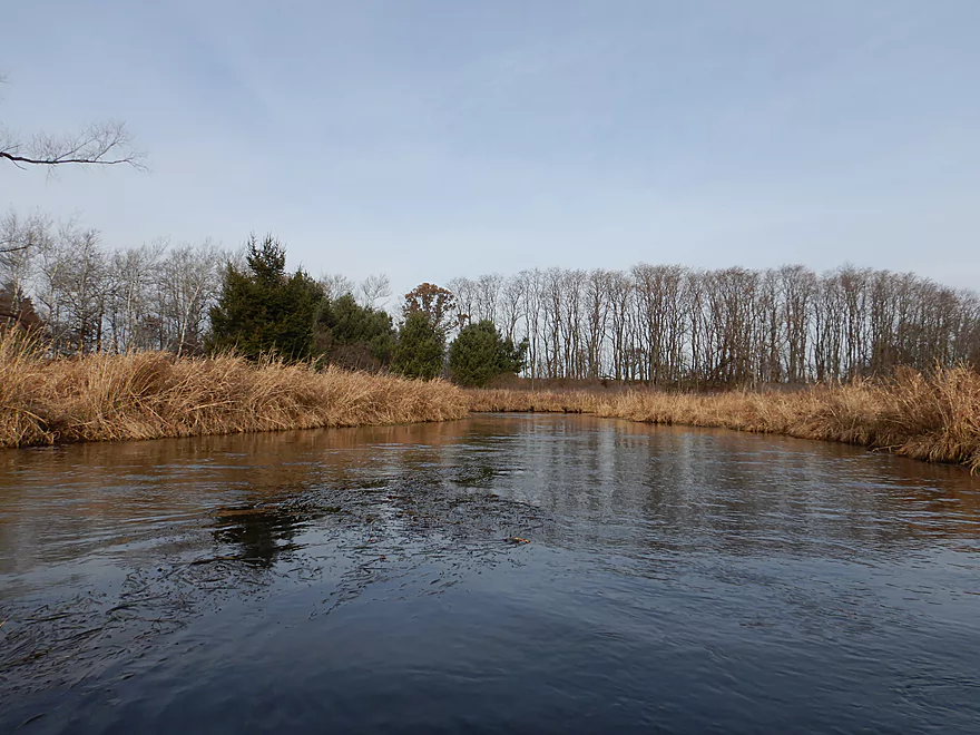
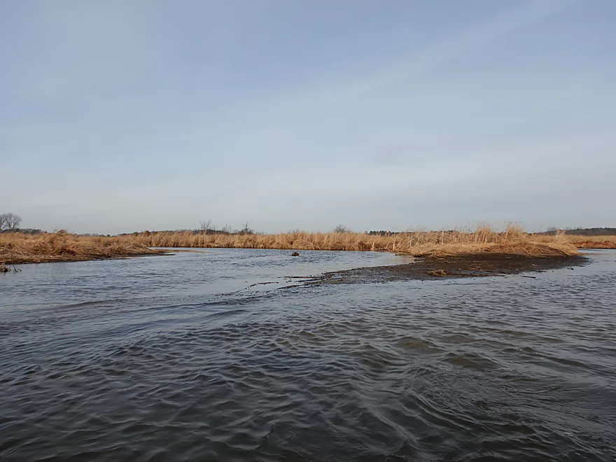
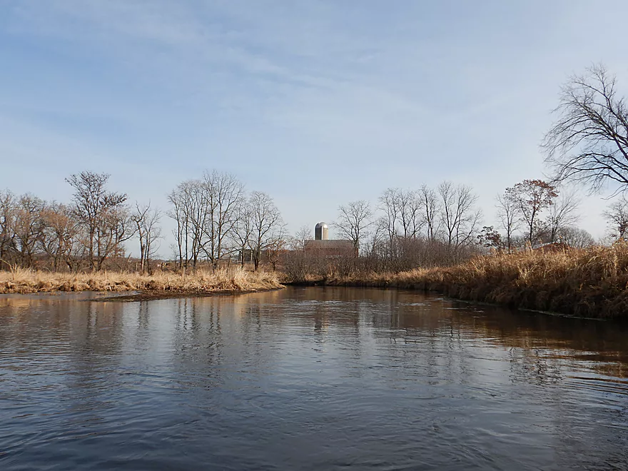
As Neenah Creek approaches Hwy 23, the marsh recedes and the trees come back. This was another nice section and along several of the banks you could see large deposits of clay…would be a great source if you were into pottery. Hwy 23 itself is a viable take-out and marks maybe the two thirds point into the trip.
The final two miles flow by more farmland and a thin layer of woods. Normally this would be quite nice, but the sun went behind the clouds and it was starting to get cold…so I wasn’t in the mood to appreciate it. I had hoped this would be a very photogenic trip (the upstream leg from Hwy A was), but the conditions were dastardly (too overcast)…and unfortunately many of my photos didn’t turn out (unless you consider high contrast, brown and white photos to be artistic).
The trip concluded at Grouse Drive, which was a very nice take-out. It was at Grouse Drive that I started the 2017 season, so it was fitting that I ended the last trip of the year here. For those following the blog, I did (errantly) write a season-end wrap-up two trips ago on the Blue River which you may want to check out. Otherwise, see you next year!
Hwy P is a popular access option with paddlers that has good shoulder parking and a doable launch area upstream of the bridge.
Grouse Drive is another good bridge access option where there is narrow parking and a small trail southwest of the bridge. Do note, the channel is relatively deep here and if you prefer not to do a dock style dismount, you can instead take out upstream of the bridge where it is much shallower.
The bike shuttle is only 4.3 miles, relatively flat, scenic, has little traffic, and only very minor hills.
This is a pretty safe creek. The current is a bit quicker near the bridges, but generally speaking is a slow trip. Be wary of wind coming from the south as this is an open paddle. There is one logjam to deal with (just south of Hwy P), but that was easy to portage because of the flat banks. Otherwise, locals have done a pretty good job cleaning up the creek, and this creek is well suited to bigger boats including canoes.
Note, this was a December paddle and I do want to share some cold weather paddling tips with readers.
- Be mindful that the days end very soon in December and you lose a significant amount of light by 4:00 (sooner if overcast). Do not get trapped paddling a creek or river when it is dark (not a bad idea to bring a backup light or headlamp).
- Be wary of ice. Just because the put-in and take-out don’t have ice doesn’t mean this isn’t an issue. Generally speaking ice forms soonest on the slowest and widest flowing sections.
- Air temperature doesn’t correlate with water temperature. Even if unseasonably warm out, the water can be dangerously cold. You should wear special gear that will keep you warm even if wet.
- Small creeks are more forgiving than big rivers. Not only will smaller creeks freeze later, but it is much easier to get ashore on a creek if you get dumped.
- Understand weather forecasts. Closer to winter, high temperatures don’t last as long. Sunlight is worth a lot…(a sunny 50 degree day is roughly equal to an overcast 56 degree day). Wind of course is a big problem and greatly magnifies how cold it feels.
While there is no gauge on Neenah Creek, there is a gauge on the Fox River near Pardeeville which probably correlates close enough. This trip was done at 7.35′ which is a typical late fall depth. I ran aground in a few spots, but generally speaking the creek was plenty deep. Here is a rough overview:
- 7.0′-7.5′: Typically the lowest the creek gets in a year. Might be a couple of shallow spots in the marsh, but nothing too serious or to be concerned about.
- 7.6′ to 7.8′: Probably an average depth. My previous trips were done in this range.
- 7.9′ to 8.0′: The creek is on the high side and about to burst its banks.
- 8.1’+: Banks should be overflowing at this point. The creek would be navigable, but a different experience with little to no clarity.
An eagle, some minnows and several flocks of ducks. The highlight was the many muskrats I saw (counted 10!).
Detailed Overview
Main Branch: Click here to see an overview map.
- Upstream of Peppermill Creek: I suspect the creek is too congested to run
- 1st Lane (Peppermill Creek) to 1st Court: 1.1 miles. First half is a nice, clear, and open stream but there is congestion after that.
- 1st Court to Seeley Lake Access: 2.8 miles. Amazing clarity, nice riffles and steep hills…but serious logjams issues. Been on my to-do list for a while…
- Seeley Lake Access to West Chauncey Street: 0.6 miles. Mostly pleasant lake paddling with a dam to portage.
- West Chauncey Street to Hwy A: 6.8 miles.
- West Chauncey Street to Fox Road: 1.9 miles. My favorite section with incredible clarity. This stretch is more wooded and hillier than other legs. Logjams can be an issue. Cleanup work has been done, but 2-3 logjams may remain.
- Fox Road to Hwy A: 4.4 miles. Attractive leg with good clarity. Starts wooded, but quickly transforms into an open wetland paddle with many tight turns. There could 1-2 logjams.
- Hwy A to Hwy P: 4.1 miles. My second favorite section. Very nice wetgrass paddle with great clarity and no logjams...best saved for a sunny day.
- Hwy P to Grouse Drive: 6.4 miles.
- Hwy P to Hwy 23: 3.9 miles. A pleasant stretch that starts nice with clear, sandy seeps but becomes less interesting when it flows though the marsh.
- Hwy 23 to Grouse Drive: 2.5 miles. A mediocre stretch...less marshy than before, but still very open.
- Grouse Drive to Muskrat Road: 3.1 miles. Creek slows down and widens significantly.
- Muskrat Road to Hwy CX: 4.6 miles. A big, open, and wide wetgrass paddle...at times pleasant with good water fowl, this is likely my least favorite section.
- Hwy CX to Hwy CM (on Fox): 5.8 miles.
- Hwy CX to Dixon Road: 4.1 miles. This is more varied, narrower, and nicer than the preceding leg. It's mostly open marsh paddling but is attractive with a lot of waterfowl. At the end there is a stretch with a lot of dead trees. Sounds worse then it was...the trees skeletons were attractive and we never had to portage (as of 2024).
- Dixon Road to Mouth on Fox River: 1.1 miles. Final leg of Neenah Creek. Attractive bottom-land paddle with many silver maple. This stretch can have logjams, but as of August 2024, none required a portage.
- Mouth to Hwy CM: 0.7 miles. A short leg on the Fox River to reach the next bridge. There is slow current and unremarkable scenery, but it's not a bad stretch. The highlight is the rustic wooden CM bridge.
Tributaries:
- Big Spring Creek: A small, but neat creek with incredible transparency.
- Neenah Creek – South Branch: A slow, simple but pleasant marsh paddle.
- Big Slough Creek: A very slow, broad creek with a lot of history.
- O’Keefe Creek: Too small to run above Mud Lake, but it is navigable downstream of the lake.
Trip Map
Overview Map
Video
Photos Size: