
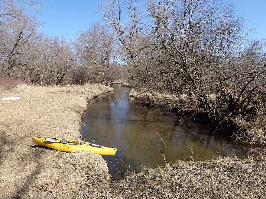
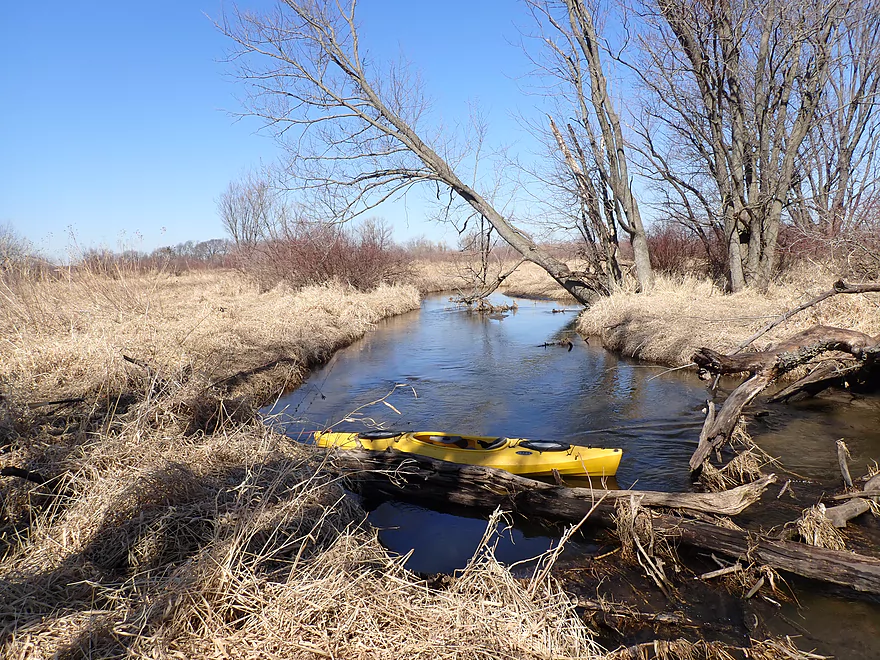
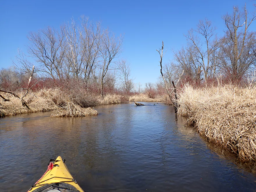
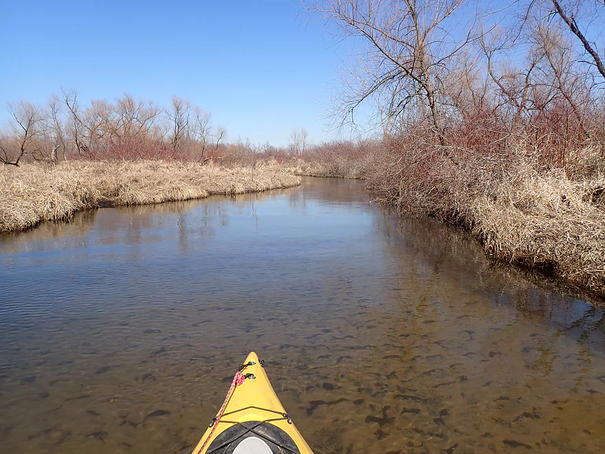
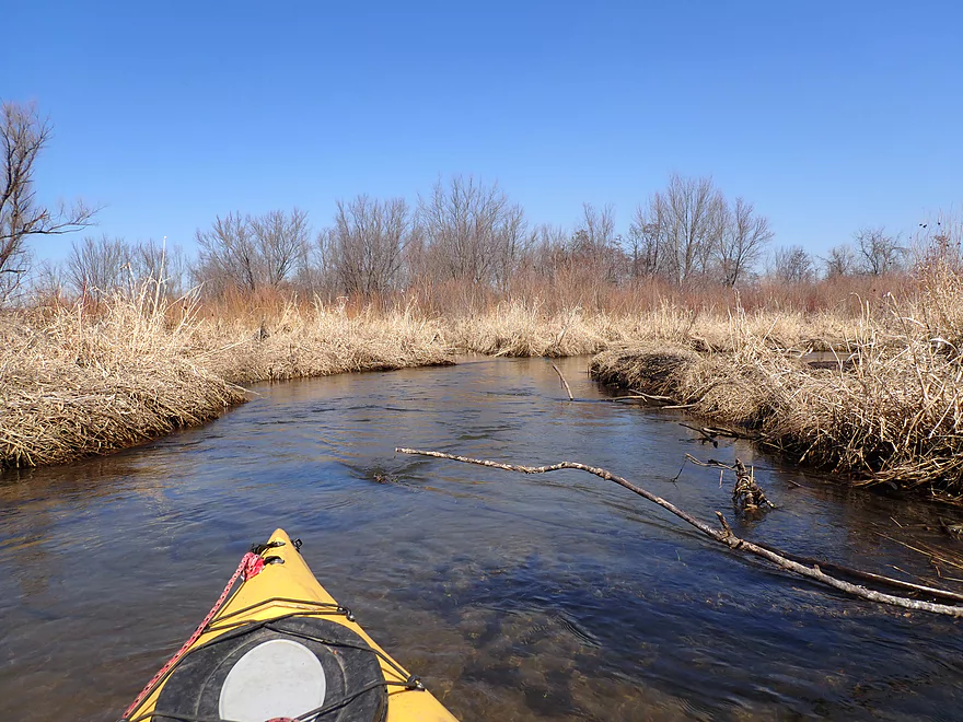
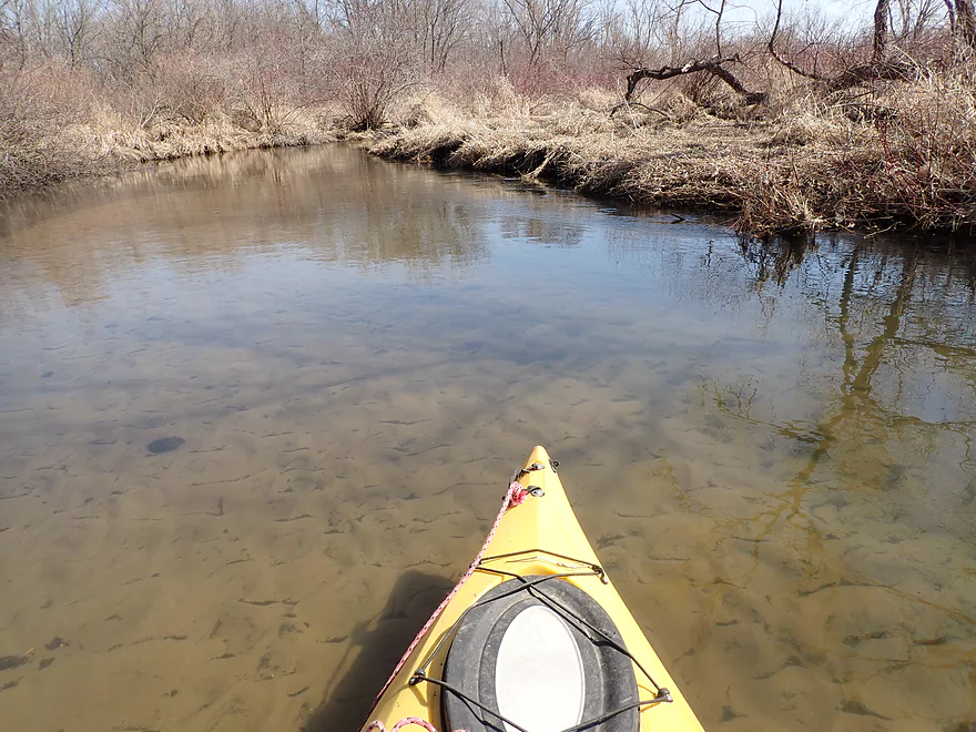
Starting the trip by W. Church Rd
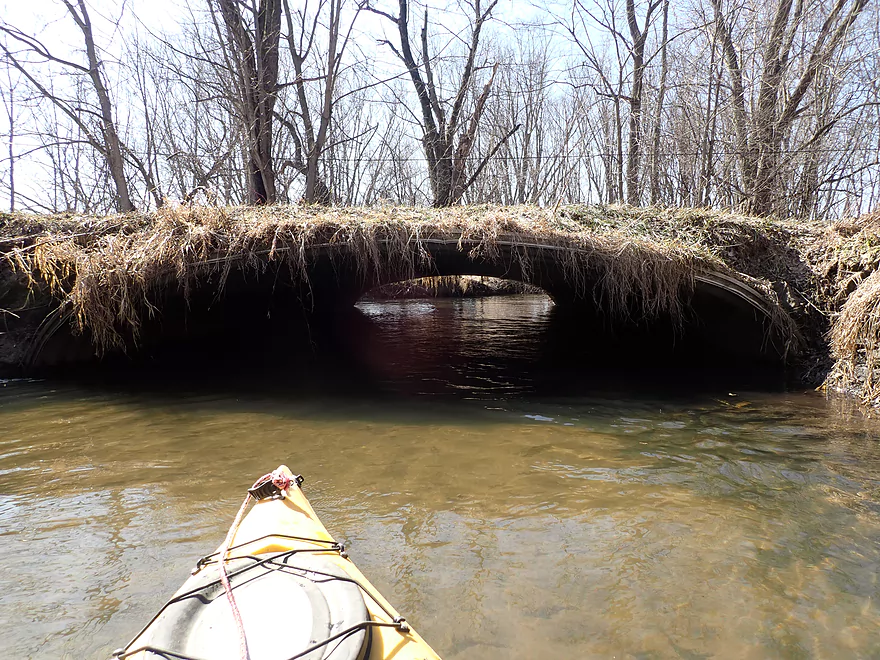
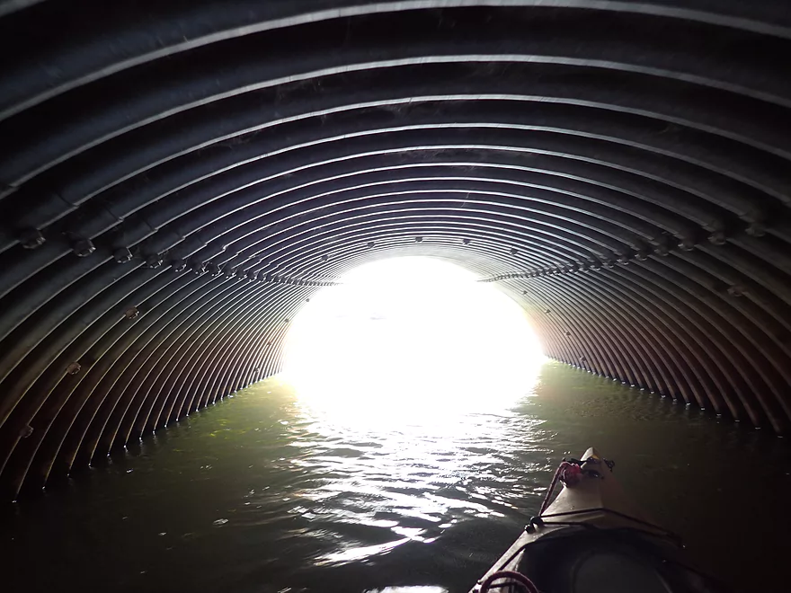
This culvert needs a haircut
A lot of silver maples
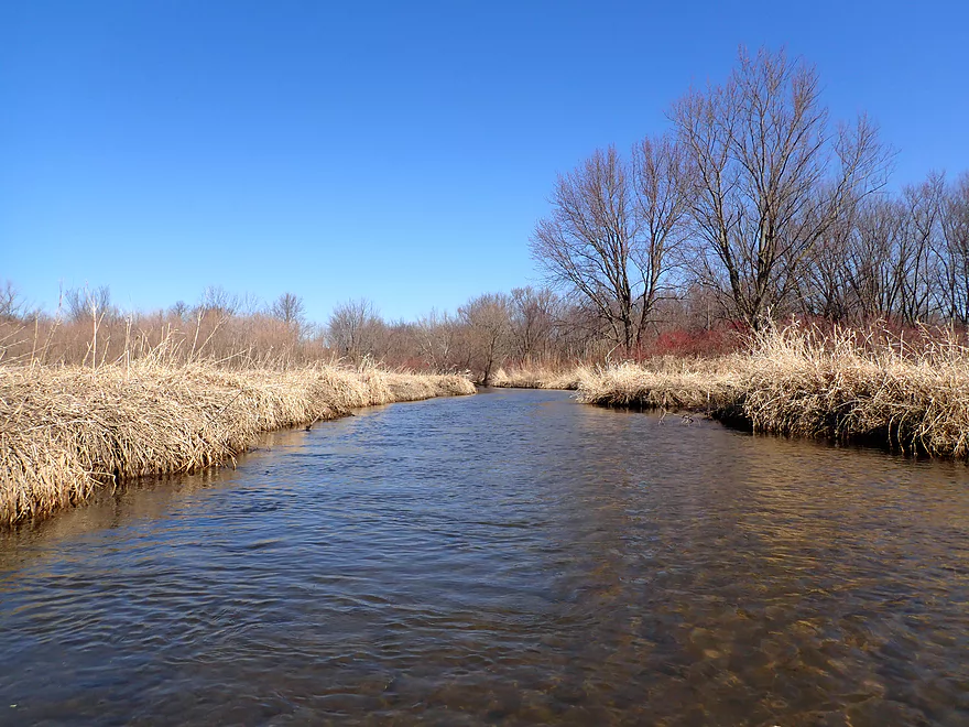
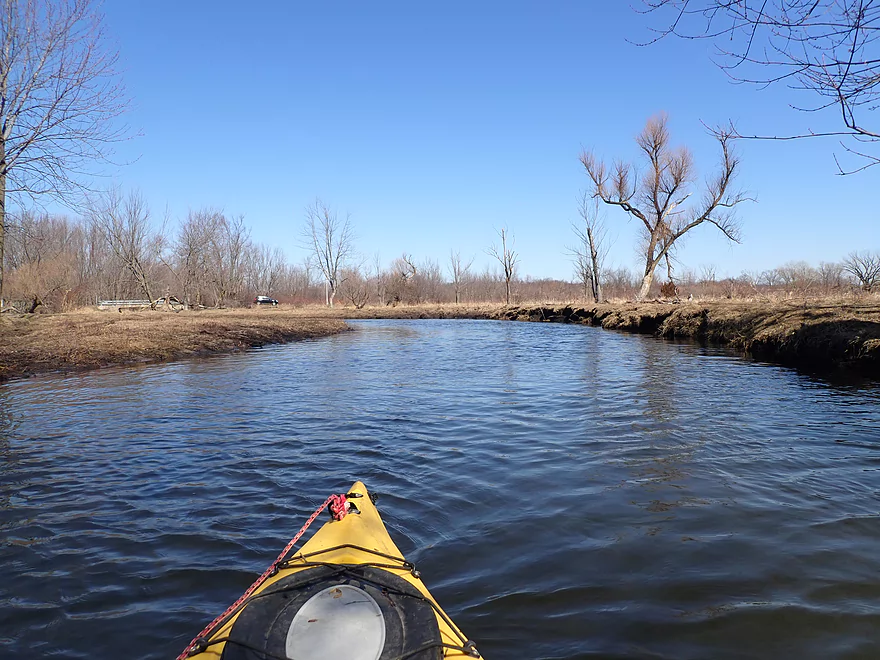
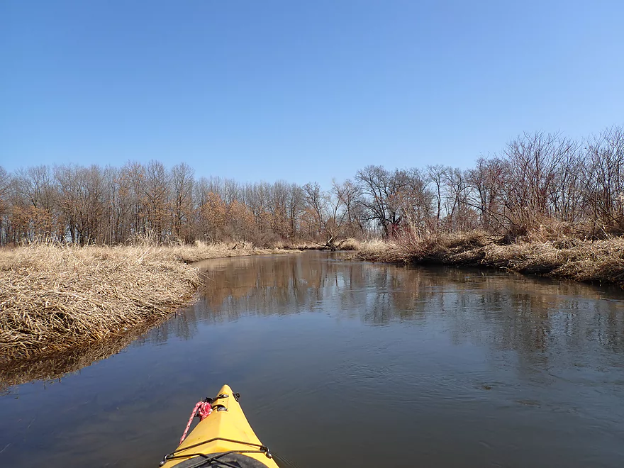
First half mile was very straight and open
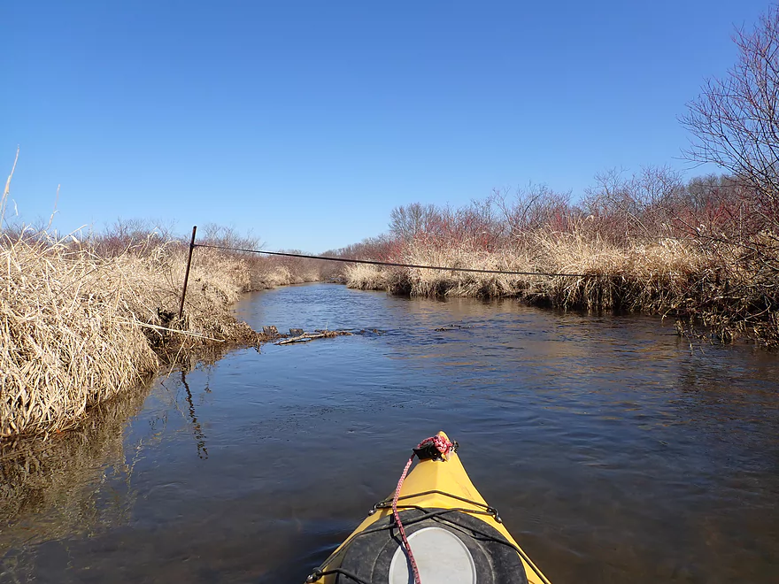
Some type of fence…easy to duck under
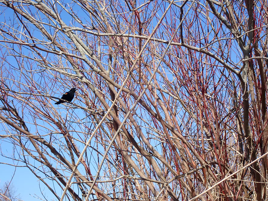
A lot of singing red-winged blackbirds on this trip
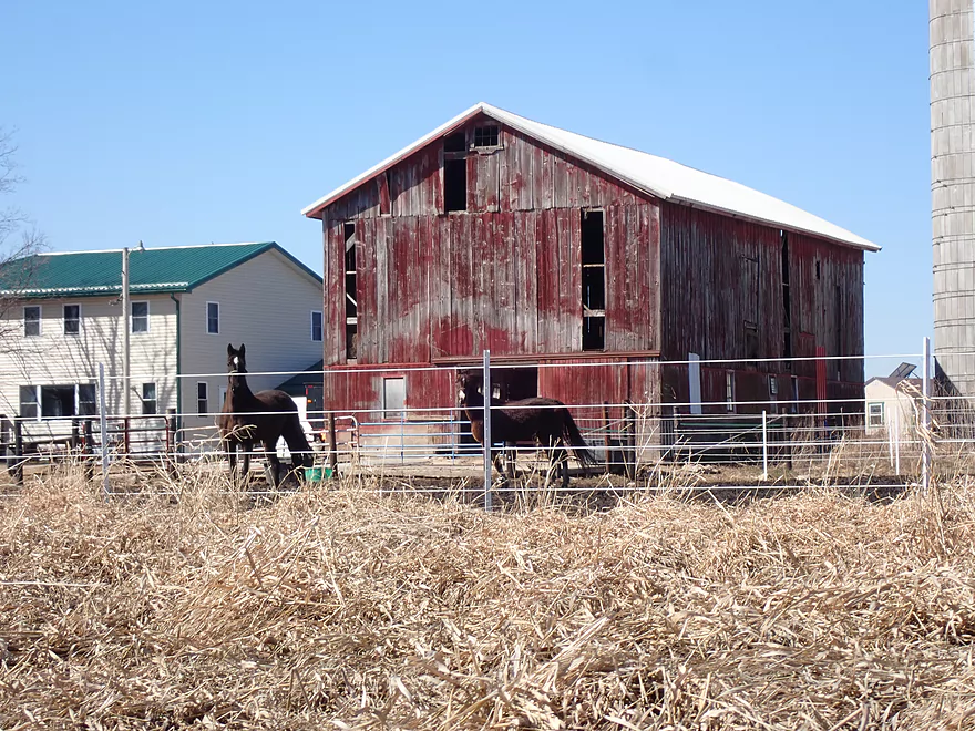
Amish horses watching me drift by
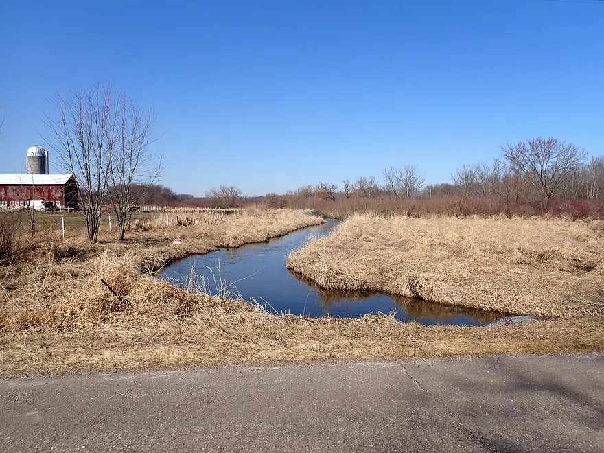
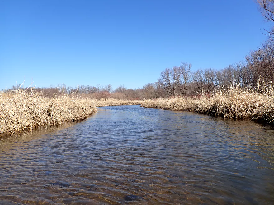
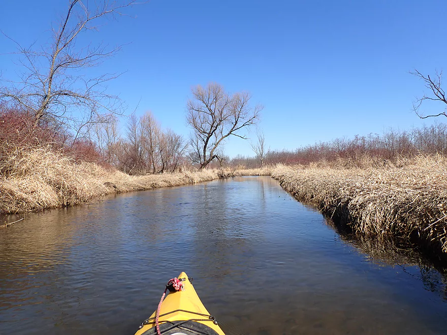
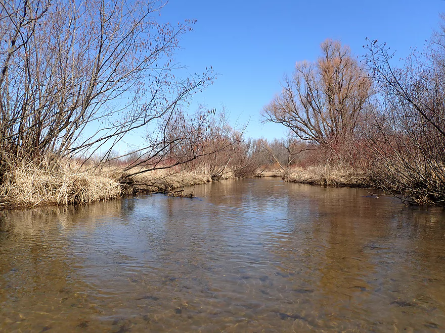
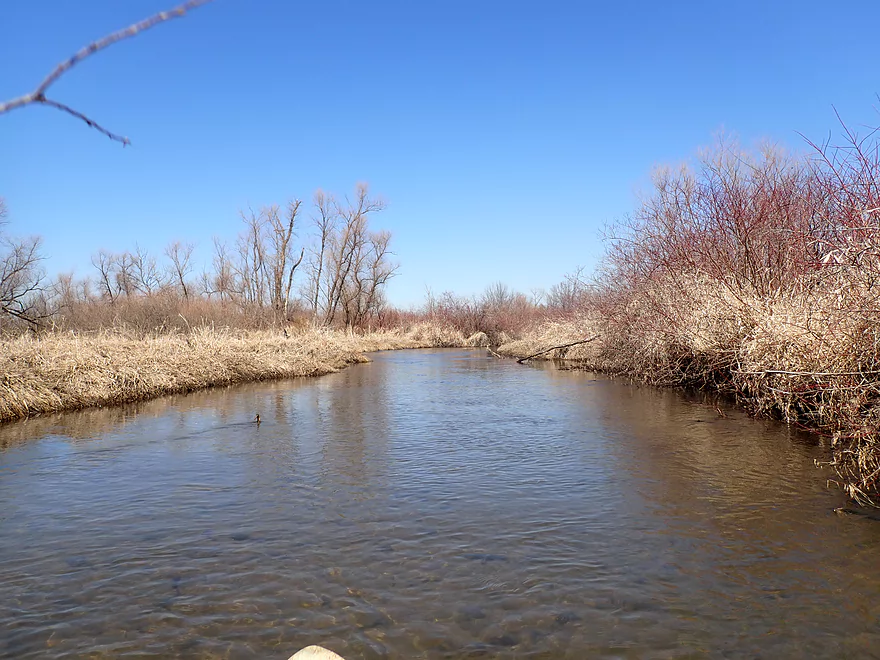
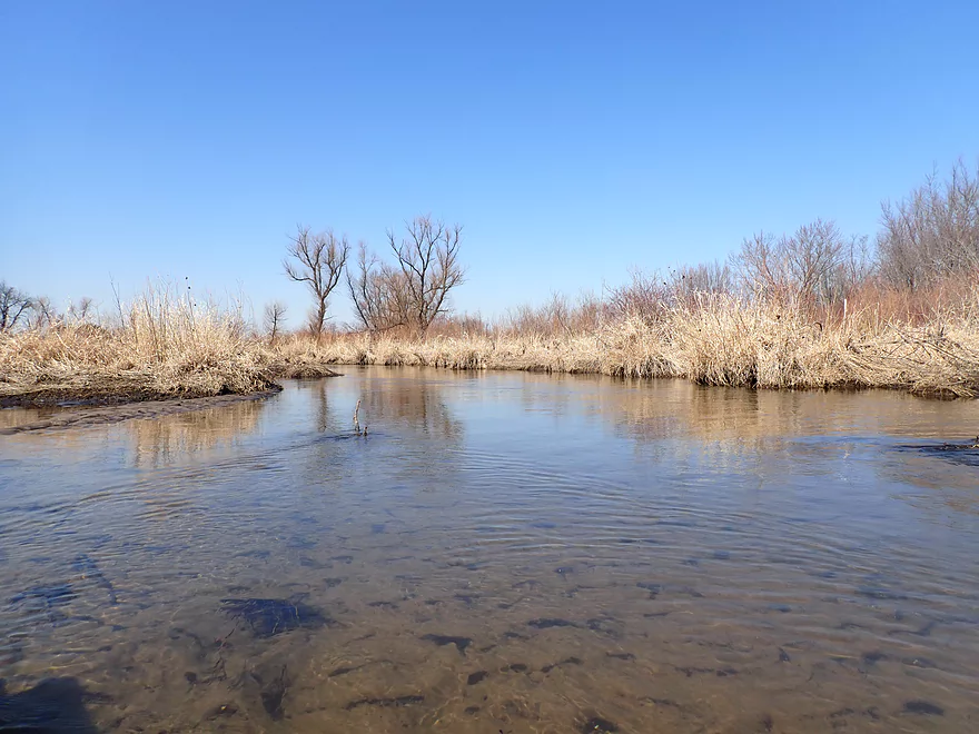
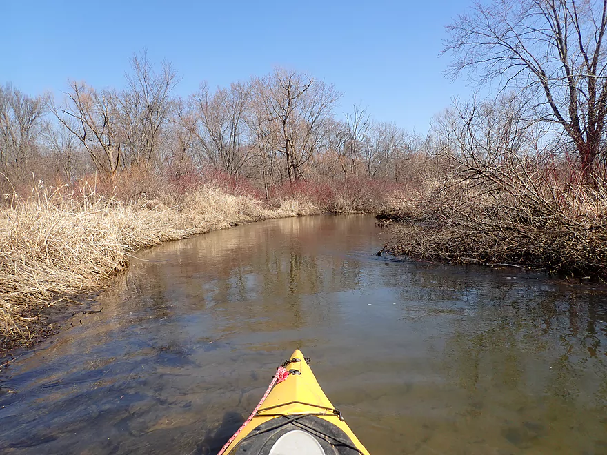
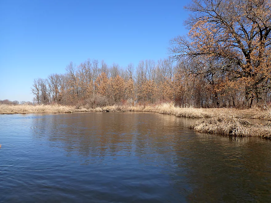
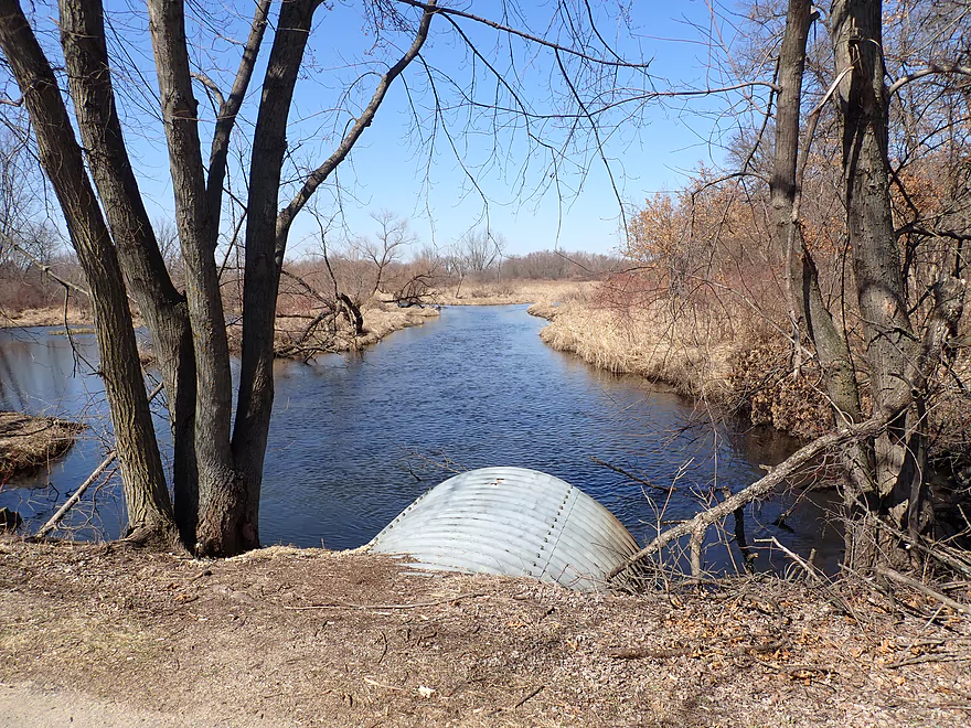
View from W. Hafeman Rd
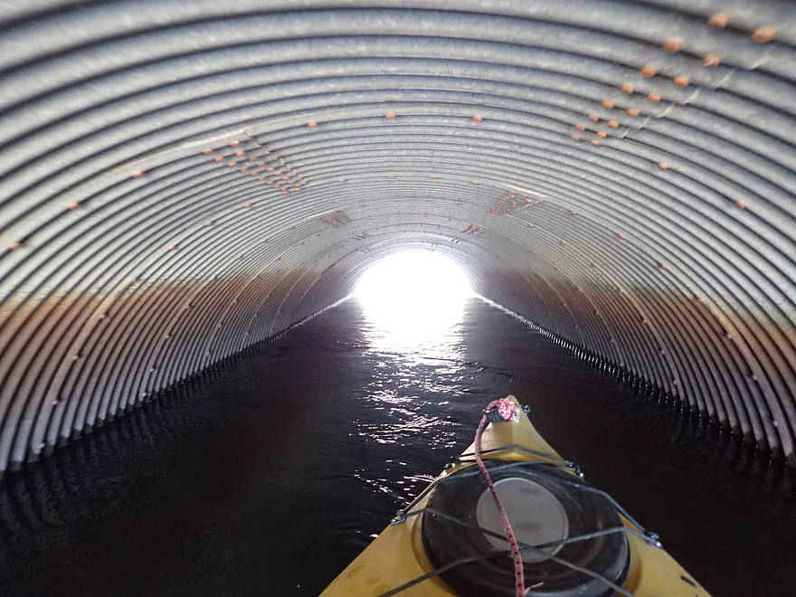
The east tunnel got a little short at the end
I can’t help but think this will be neck high with reed canary grass in another month
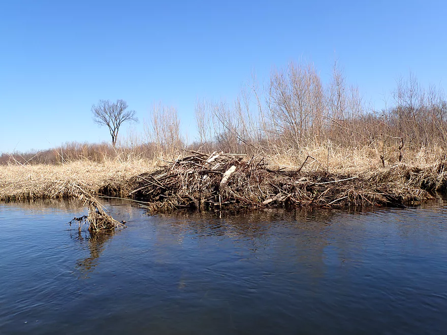
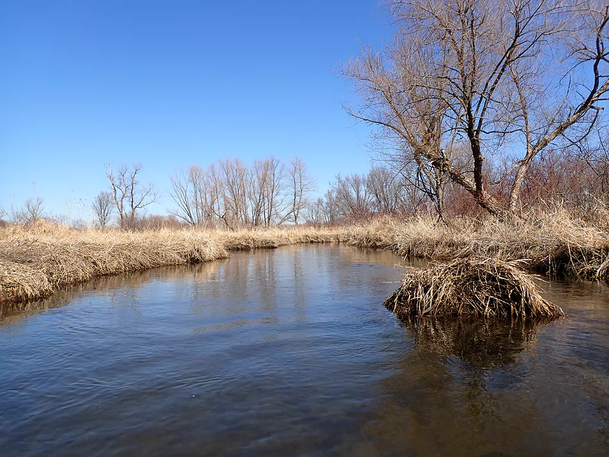
A beaver lodge
Remnants of a beaver dam
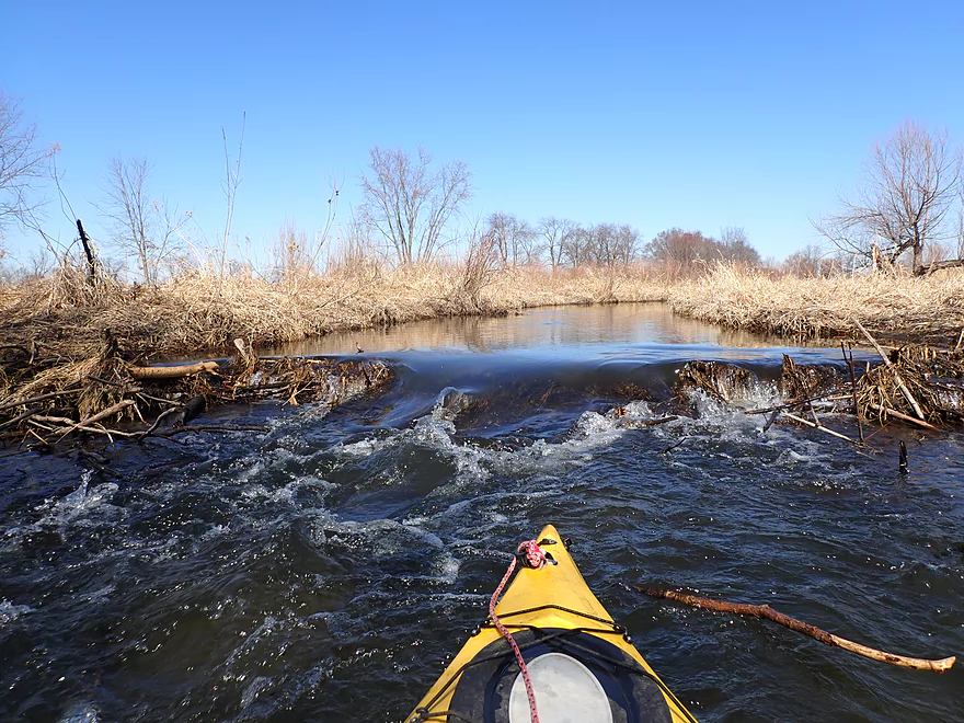
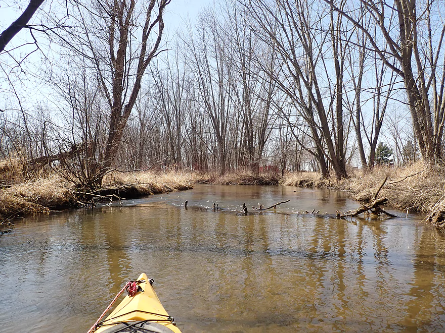
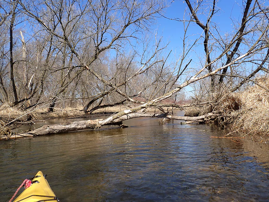
First logjam of the trip…easy portage
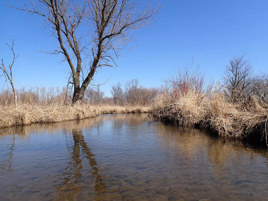
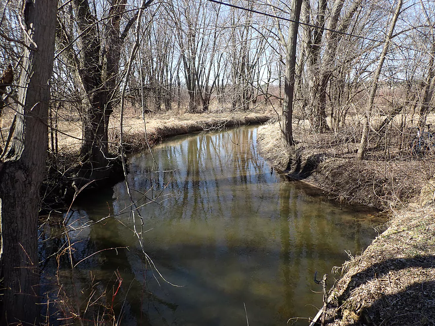
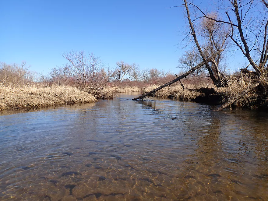
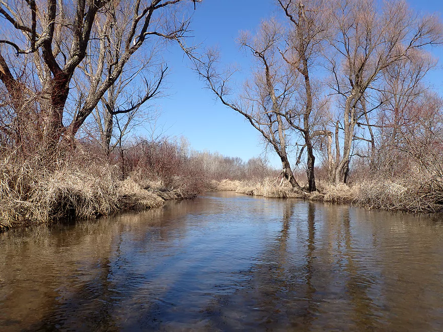
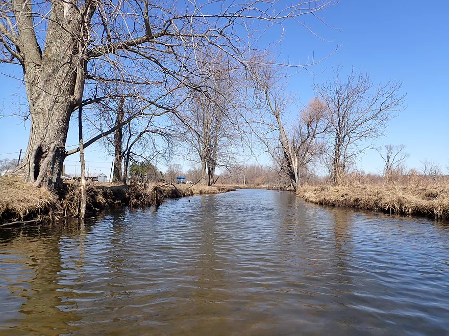
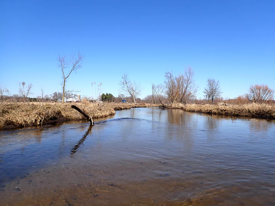
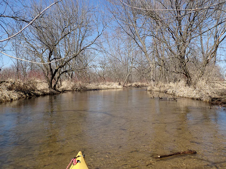
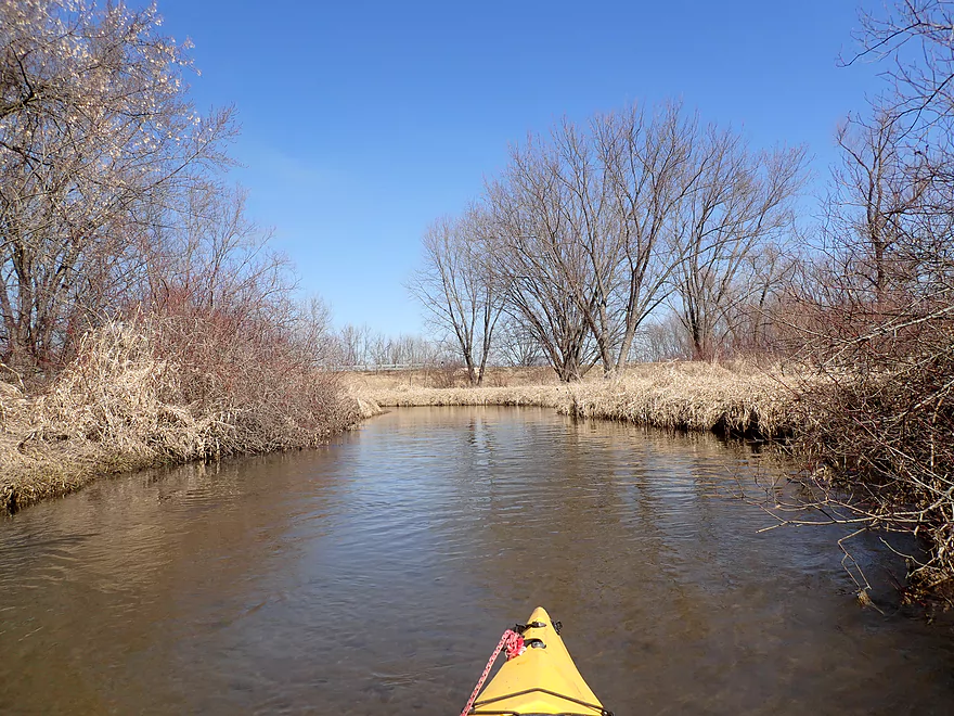
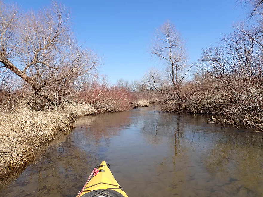
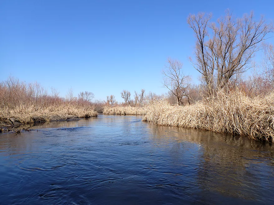
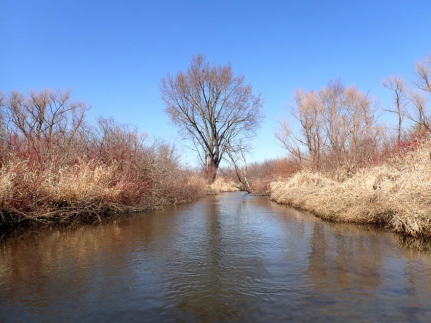
Very scenic creek
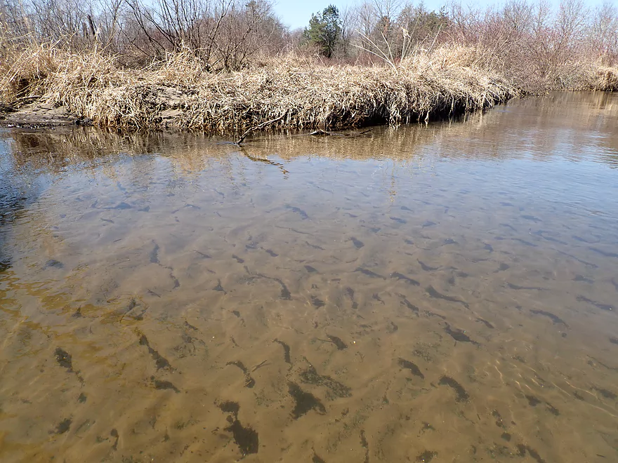
Great clarity
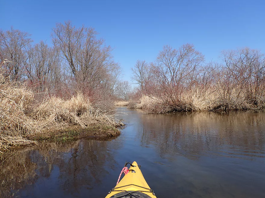
Entering a brief woods
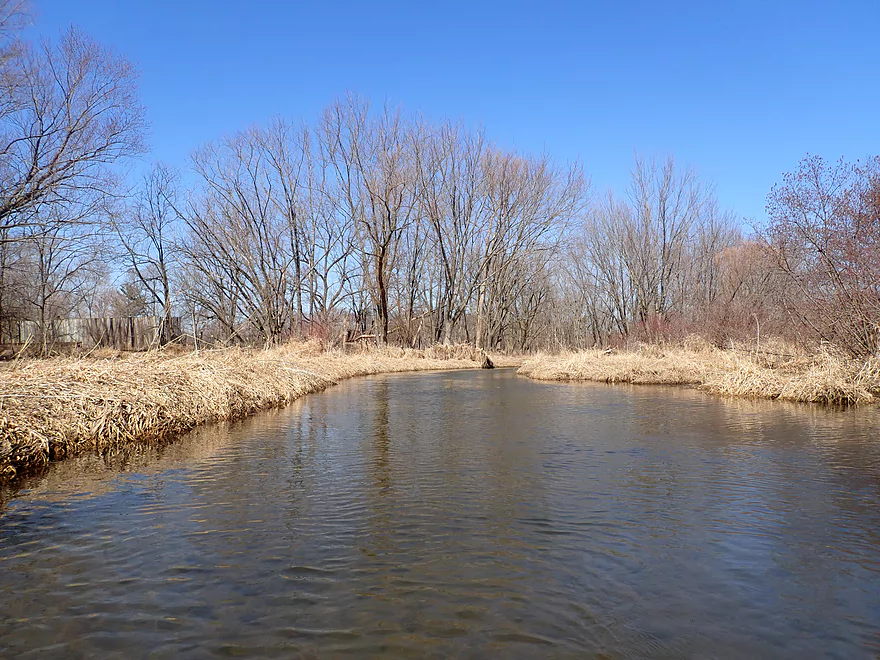
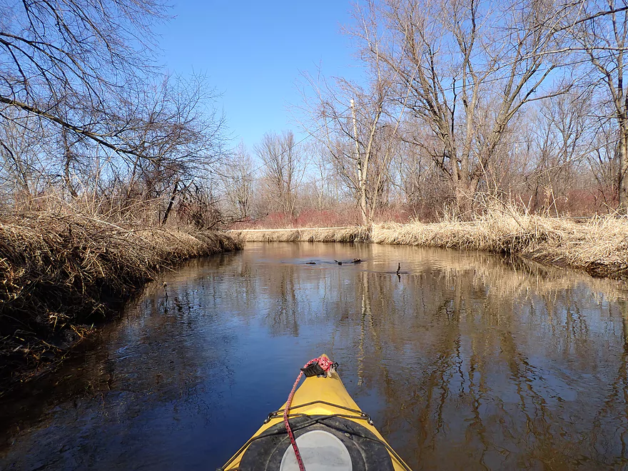
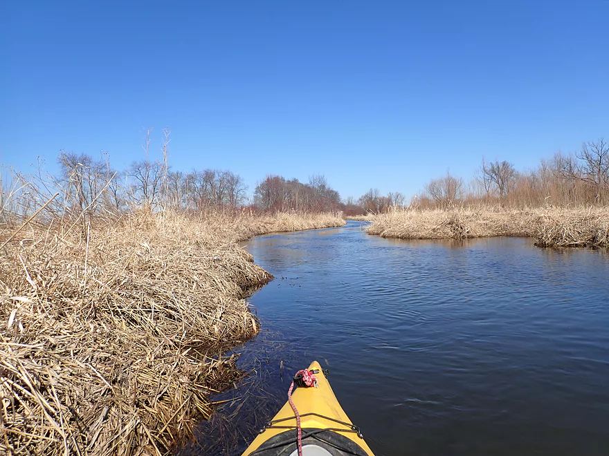
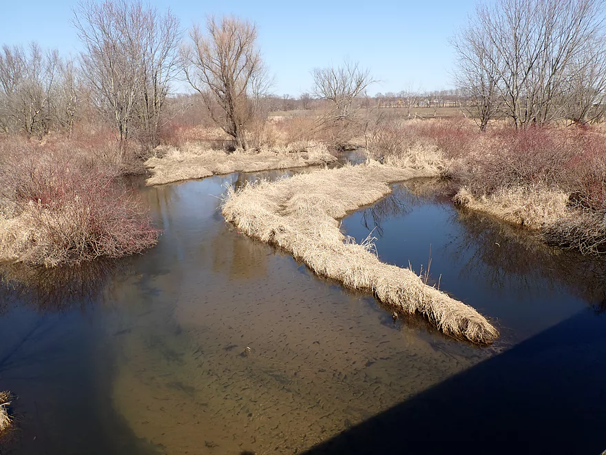
View from W. Avon North bridge
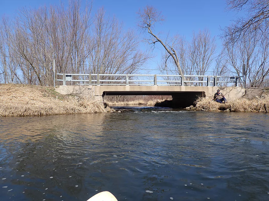
Fun riffles under the bridge
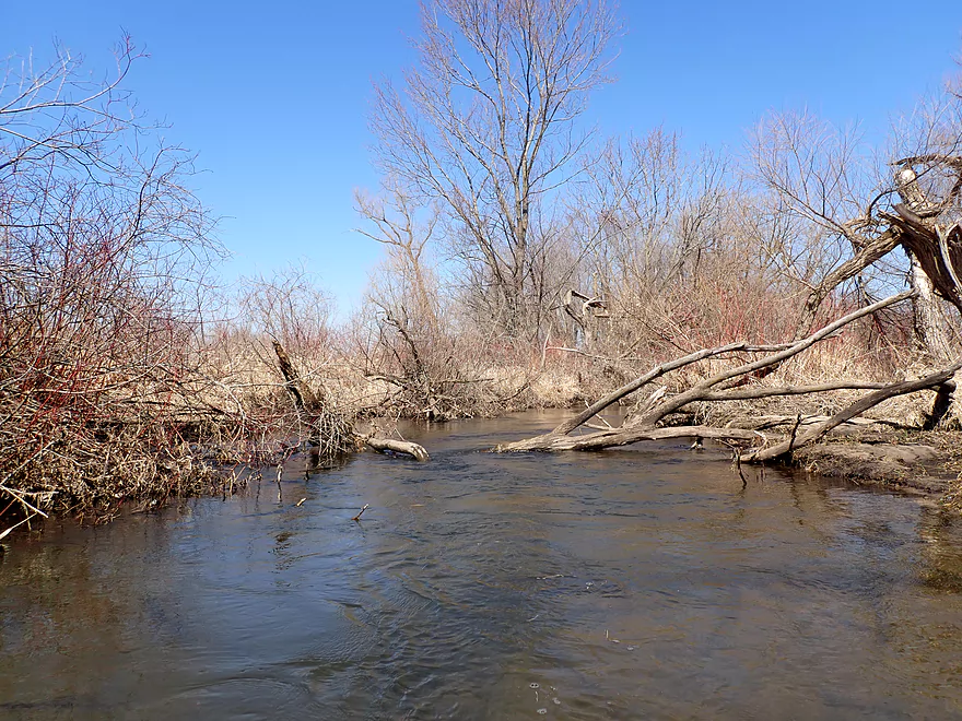
This stretch flowed through pasture and suffered from erosion
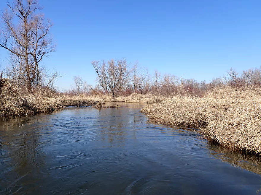
Still nice
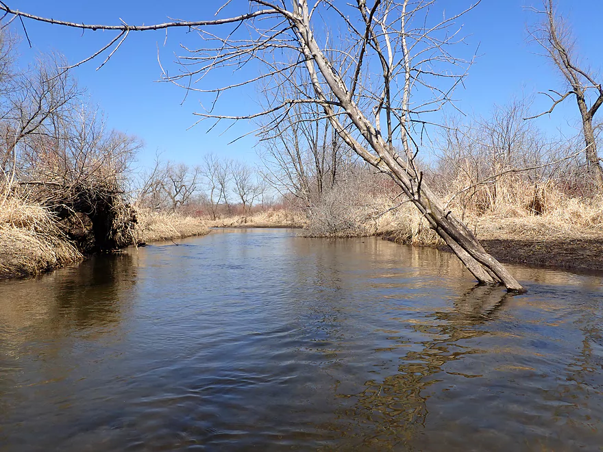
Entering another brief woods
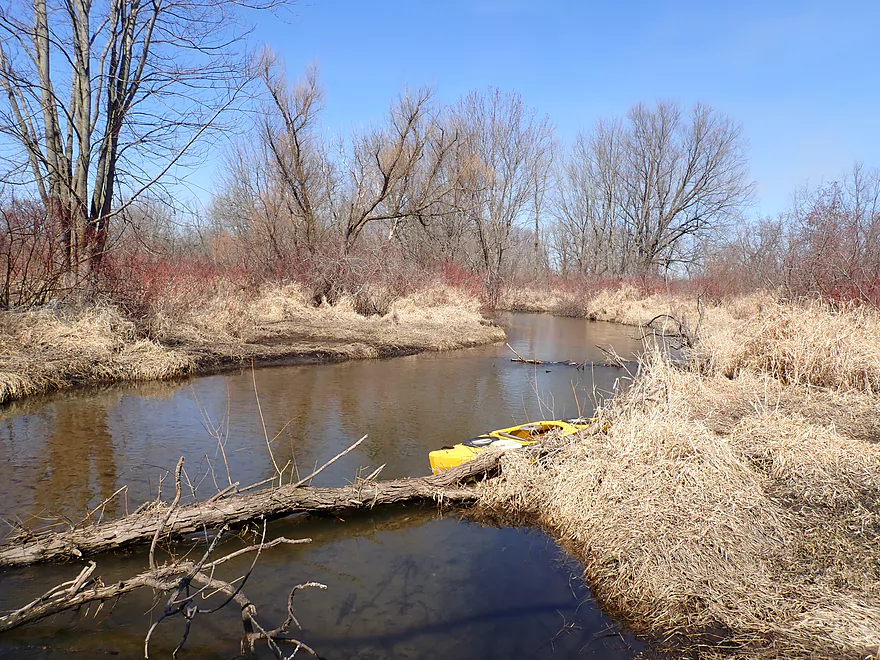
Second portage of the trip (easy)
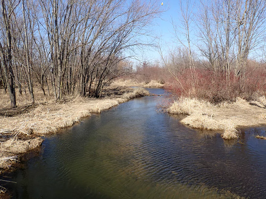
View from Hwy 81 bridge
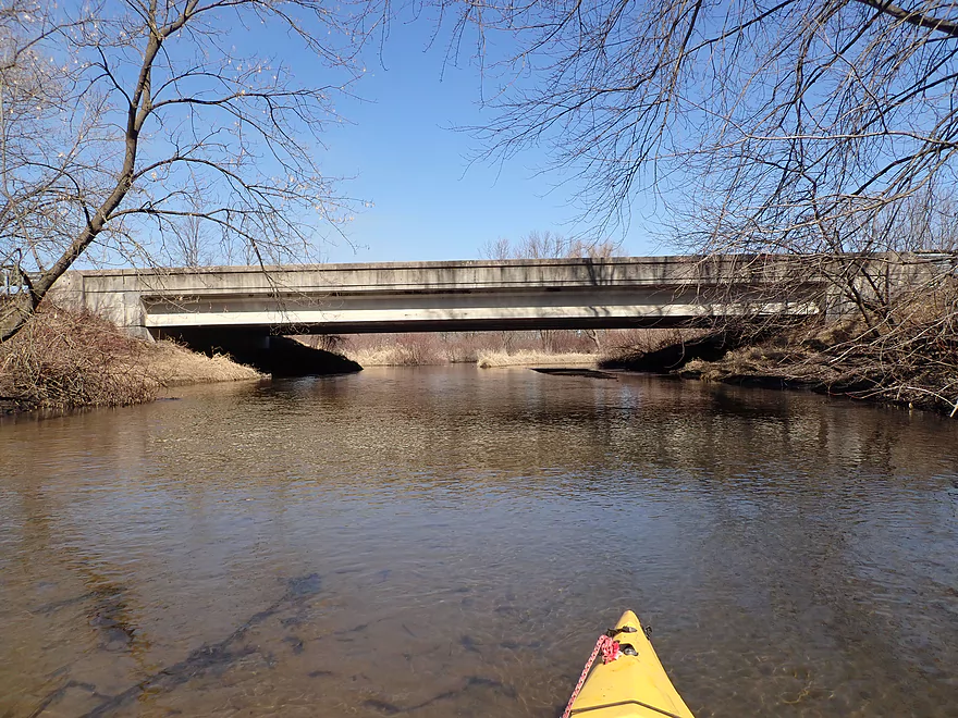
It’s a busy road but it is a viable access
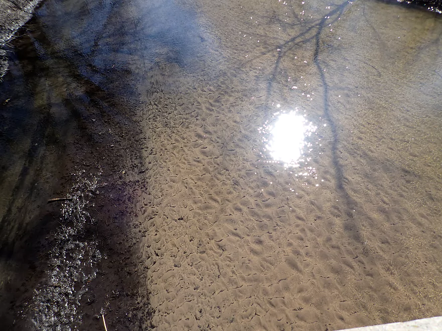
More good clarity
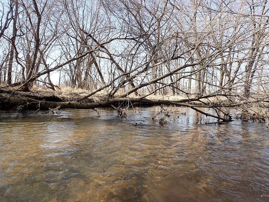
There were several snags downstream from 81
Another snag
And another
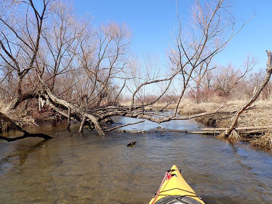
The creek opens up after this snag
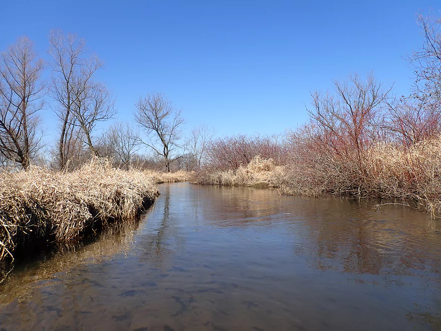
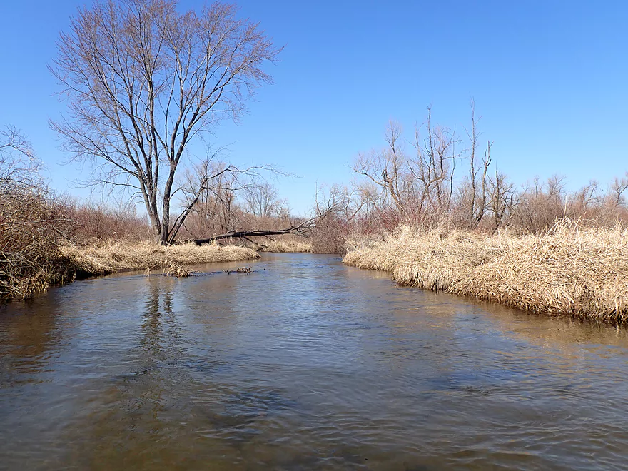
Scenic stretch
When shallow, it was easy to see the bottom
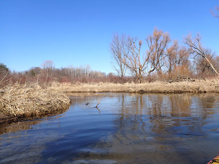
Willow Creek joins Taylor
A nice stretch of oaks
Paddling under W. Smith Rd
Good take-out
View from bridge
Taylor Creek

Taylor Creek is a small tributary to the Sugar River located close to the Illinois border and the community of Brodhead. Not much is known about this creek, but it seemed intriguing based on satellite images, so I decided to check it out.
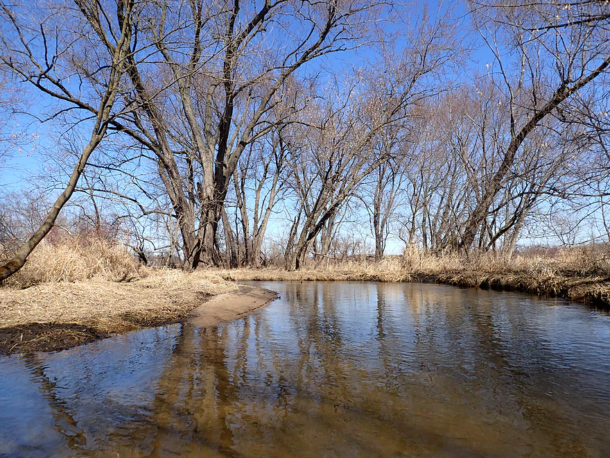
I started the trip at W. Church Rd, which was a decent bridge access and practically as far upstream as one could launch. The first half mile flowed straight through an open wetgrass area. In fact so straight I suspect local farmers at one time artificially straightened this section. One of my more striking impressions of the creek was how incredibly clear it was. The creek bottom was a light-colored sand which helped reflect light up and through the water.
I soon passed an Amish farm, which wasn’t the most cheerful sight. A No Trespassing sign was positioned on the bank and nearby horses looked a little malnourished with exposed ribs and were being kept in a very dirty pen that hadn’t been cleaned in a while.
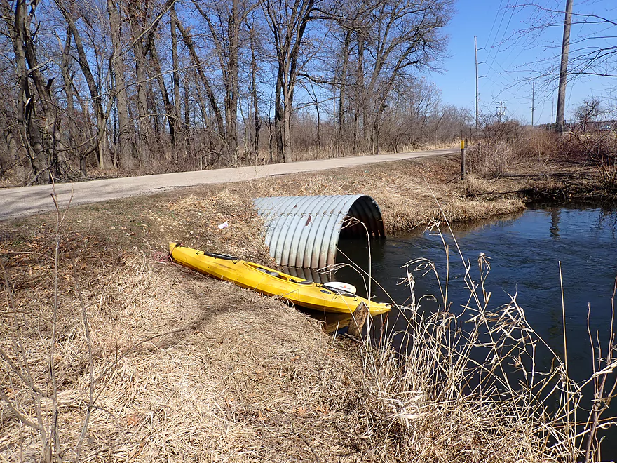
W. Hafeman Rd has two culverts and I made the mistake of going under the east one. This culvert tapers at the end and is shorter on the downstream side which forced me to get low to get through. In hindsight I should have taken the west culvert which was much taller and likely wouldn’t have been an issue. If you do this trip, just simply scout the culverts and portage if you’re not comfortable with what you see (easy portage).
Following this bridge, the creek started to meander a bit but still stayed open and clear. One of the trip highlights was a beaver lodge followed by a beaver dam. The dam however was partially destroyed…by floods, the DNR, or farmers I don’t know…but what remained was a ledge that was fun to scoot over.
Following W. Avon North Townline Rd, the creek flowed through open pasture and suffered from bank erosion. Following a farm, the creek entered a brief woods where there were a few snags to dodge.
After the Hwy 81 bridge, I started to encounter some serious logjams and it was here that the trip started to lose some of its magic. After about a half mile though, things opened up and it was mostly clear sailing to W. Smith Rd. I could have continued a few more miles after W. Smith Rd to the Sugar River, but I knew from previous satellite map analysis that logjams were a likely issue close to the mouth. It could be an interesting trip though as Hwy 81 marks the start of the Avon Bottoms Wildlife Area.
In summary this was a very nice trip for its incredible clarity and good current. If you do this trip, definitely wait for a sunny day to see the best clarity. The only downer were the logjams (mostly clustered near Hwy 81) and hopefully locals clear these out in the future.
Sights included geese, cranes, turkey vultures, an eagle, red-winged blackbirds, a few muskrats, and a painted turtle. The highlight was the beaver lodge which was soon followed by a partially-destroyed beaver dam.
The Half-Way Tree: At one time Taylor Creek and the Sugar River to the west were on a well-worn footpath that led from Lake Michigan to the Mississippi River. A stately bur oak, called the Half-Way Tree, was believed by Native Americans to be the halfway point on this trail–a fact that was later verified by U.S. surveyors. The tree is located just three-quarters mile west of Taylor Creek on Half-Way Tree Road.
W. Church Road: This was a decent bridge access. Note, a small tributary joins Taylor Creek just west of the main creek. Don’t launch from the wrong bridge!
Alt Put-ins: Really, W. Church Rd is your best put-in. Upstream the creek looks intriguing, but likely has too much deadfall. Downstream, W. Haferman Rd lacks privacy and has a No Trespassing sign north of the bridge.
W. Smith Road: This was a very good bridge access. Everything south of the road is part of a state natural area. Shoulder parking is a bit tight but doable. There is a public parking lot about a quarter mile to the west if you want a nicer spot to leave your car.
Alt Take-outs:
- Hwy 81 (2.0 miles upstream): Taking out early by Hwy 81 would avoid several snags located downstream from the bridge.
- Avon Bottoms Boat Ramp (2.2 miles downstream): While it would be novel to end the trip on the Sugar River where this is a great access, this leg likely has too many jams (maybe 6).
W. Smith Rd to Church Rd: 3.9 miles with 26′ of ascent. All in all, this was a mostly flat and easy bike shuttle. The only downside is that Hwy T is a busy road with narrow shoulders.
Current: Brisk, but never too pushy.
Fences: There were two, but they were super easy to get under.
Logjams: Generally speaking the shore is mostly flat so portaging where needed isn’t an issue.
- W. Church Rd to W. Hafeman Rd: All clear.
- W. Hafeman Rd to W. Avon North Townline Road: Fairly clear…just one logjam that was an easy portage.
- W. Avon North Townline Road to Hwy 81: Close to Hwy 81 there are a few snags. I was able to hop/duck through them no problem. The exception was a logjam just upstream of Hwy 81 that required a full portage (very easy).
- Hwy 81 to W. Smith Rd: The half mile after 81 is the most congested part of the trip. Figure 3 logjams that will require portages and 2-3 noteworthy jams that will require tricks to get through.
Rapids: Mostly none. A partially-destroyed beaver dam forms a 6-12″ ledge which I would rate as a Class 1. This was easy to get over.
Low Bridges: The east culvert of W. Hafeman Rd is lower on the downstream side and can be a tight fit. I highly recommend the west culvert or just simply portaging.
Closest Gauge: Sugar River @ Verona
Trip Depth: 73 CFS or 3.27′
- 0-40 CFS: A low depth but should be navigable. Clarity should be excellent at these depths.
- 41-60 CFS: An average depth with good clarity.
- 61-80 CFS: Above average depth with ok clarity.
- 81-100 CFS: A high depth with some clarity in spots.
- 101-140 CFS: A very high depth. Banks will burst at roughly 130 CFS.
- 141+: This might be flood stage and too high for enjoyable paddling.
Click here to see the overview map.
- W. Keesey Rd to W. Church Rd: 1.9 miles. Likely a nice stretch, but there could be 4-6 logjams.
- W. Church Rd to W. Smith Rd: 4.4 miles.
- W. Church Rd to W. Hafeman Rd: 0.6 miles. A great part of the creek. Very open, straight and clear.
- W. Hafeman Rd to W. Avon North Townline Rd: 1.3 miles. A very good stretch that has good clarity and is very open. There is one logjam (easy portage) and an old beaver dam to deal with.
- W. Avon North Townline Rd to Hwy 81: 0.5 miles. The first quarter mile is through open pasture and suffers from erosion. The second quarter mile flows through a woods and is nice, but there are a few snags to sneak through.
- Hwy 81 to W. Smith Rd: 2.0 miles. After Hwy 81 the creek loses some of its magic. The first half mile is congested with several jams to deal with. After that things open up and it’s a pleasant paddle.
- W. Smith Rd to W. Beloit Neward Rd: 2.2 miles. A flood-bottom section with what I believe are many logjams (maybe 6).
Willow Creek: Note, this is a noteworthy tributary that may be a viable water trail in its own right.
- S. Avon Store Rd to Hwy 81: 1.8 miles. Maybe 6-7 logjams. Willow Creek is smaller and more rugged than Taylor Creek.
- Hwy 81 to W. Smith Rd: 1.8 miles. Very sandy stretch. Maybe 2 logjams. W. Smith Rd is roughly located at the confluence of Taylor Creek and Willow Creek.
Trip Map
Overview Map
Video
Photos Size:
Hi Aaron—will be paddling on Sunday, only going fro Smith Road to the Sugar River landing @ Avon. I think that using the Sugar River gauge @ Brodhead is a more accurate correlate as it’s way closer than Verona. I’ll let you know how it goes. BTW I did this run many years ago, but upstream in the dark. Yes.
Yikes! I think that stretch has a lot of logjams…good luck! As far as gauges go, I guess I don’t know. Generally speaking we’re in a dry period relatively speaking, so I assume levels will be down regardless of the gauge you use. If you still do this trip, I would be very curious to see how it turns out.
Yesterday we paddled down Taylor Creek from Highway 81 into the Sugar River. The first half of the trip up until Smith Road was not too bad, we had to fight over under or around some log jams, but it seemed worthwhile.
Downstream of Smith Road, things got ugly. I lost count of the number of problems we encountered, at least 14. I would not recommend this stretch to anyone because of this. It is too bad because it is nice country that you’re going through, but if you’re always looking ahead to the next problem, it kind of ruins it.
Luckily we had a group that had a good attitude, otherwise we might have had a mutiny! So there you have it…