
Time to put this to the test
Overlooking the old Wautoma Flowage
Buildings and the old dam block access here
So you have to put in south of Hwy 73
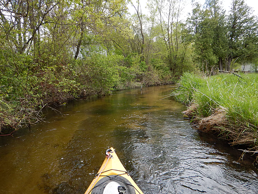
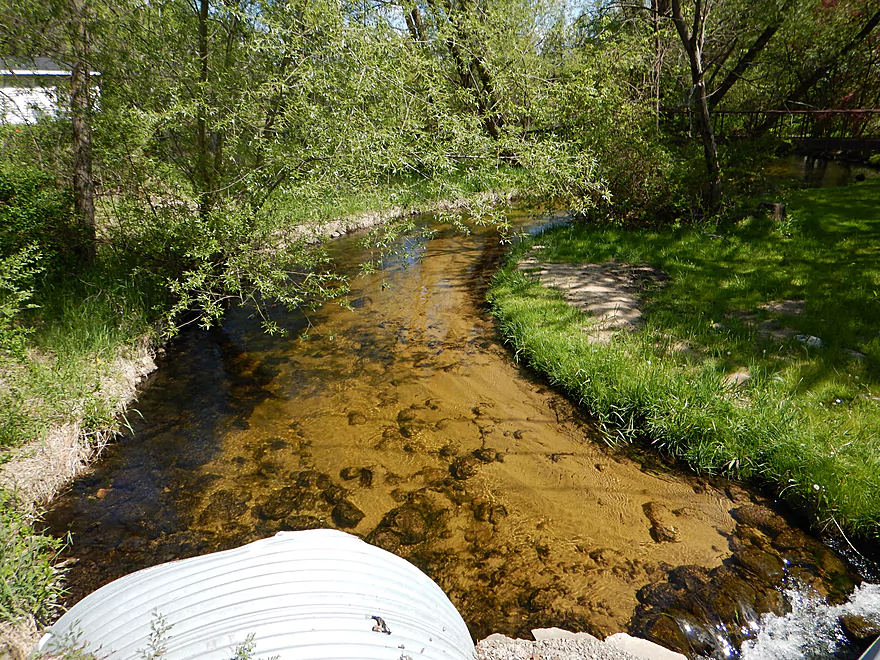
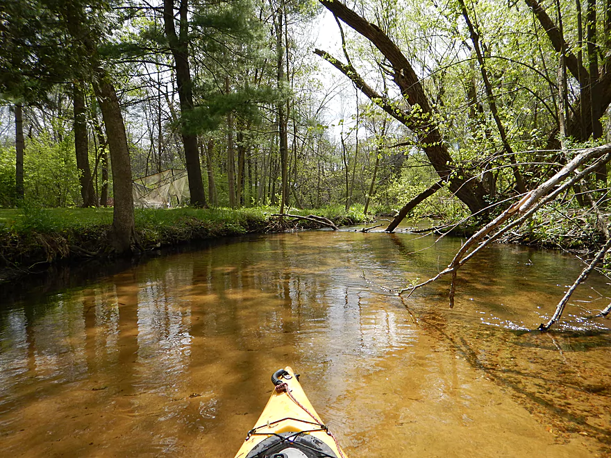
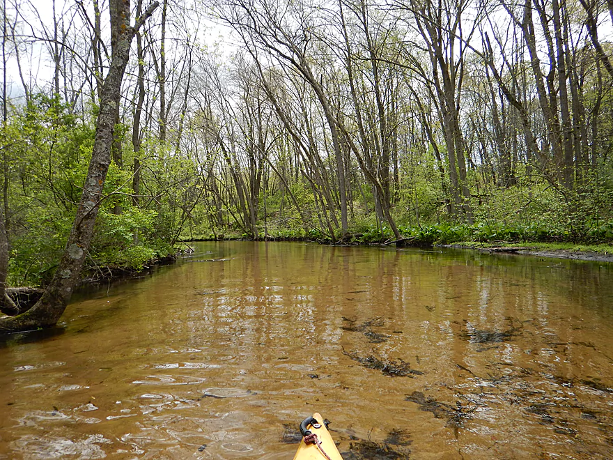
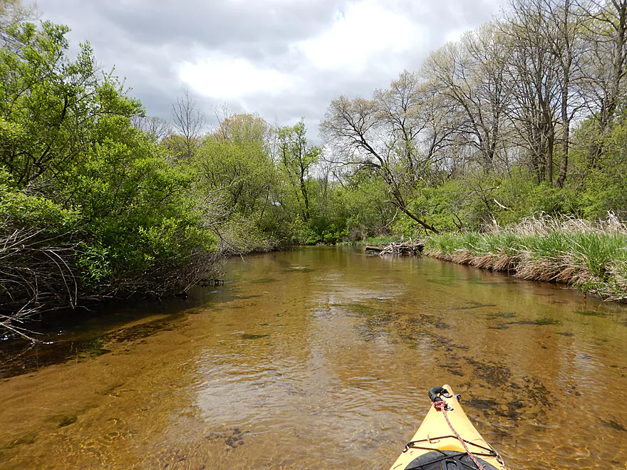
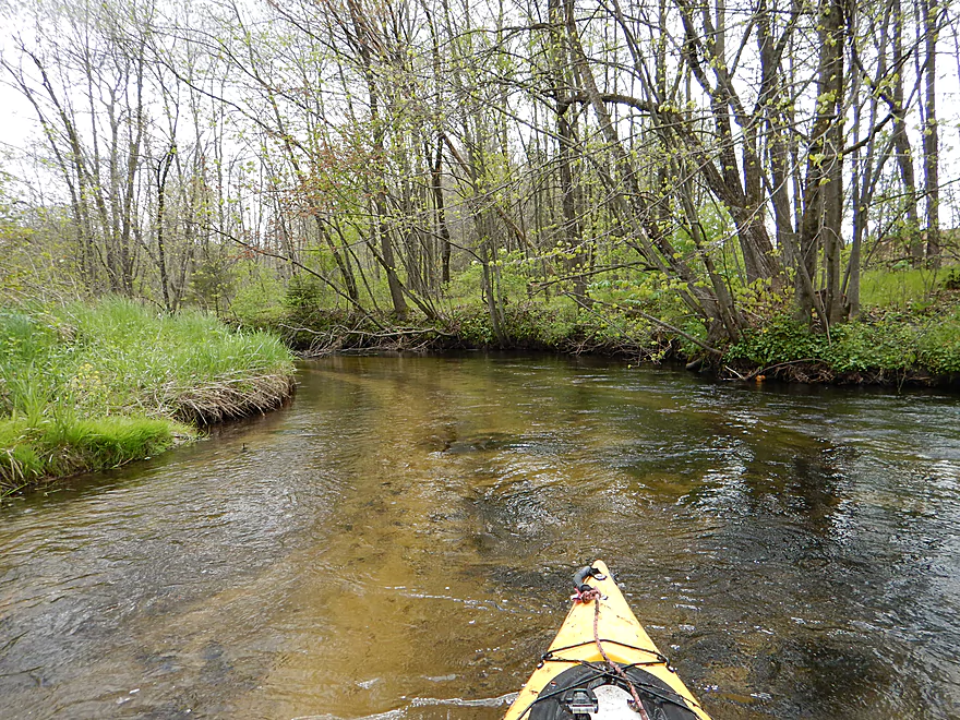
Small zippy river
Very clear water
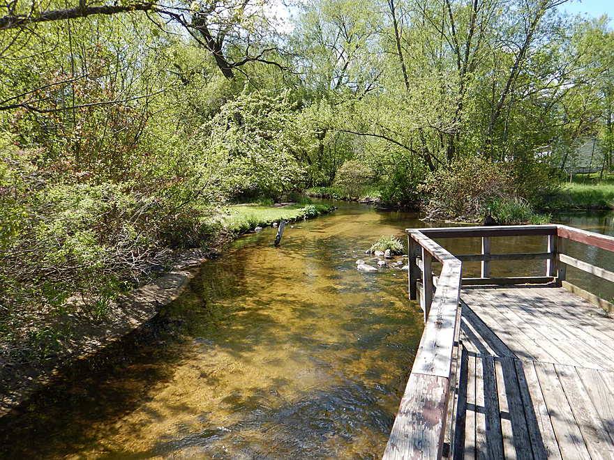
Boardwalk is part of the local nature trail
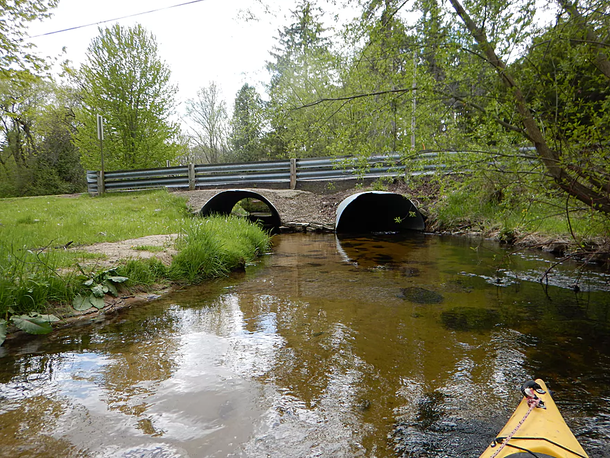
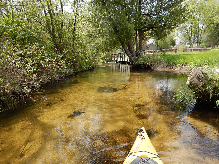
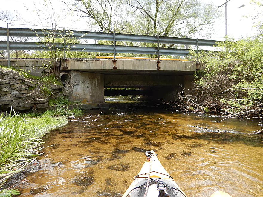
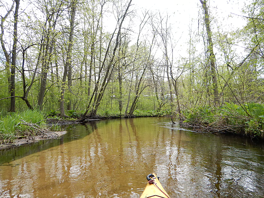
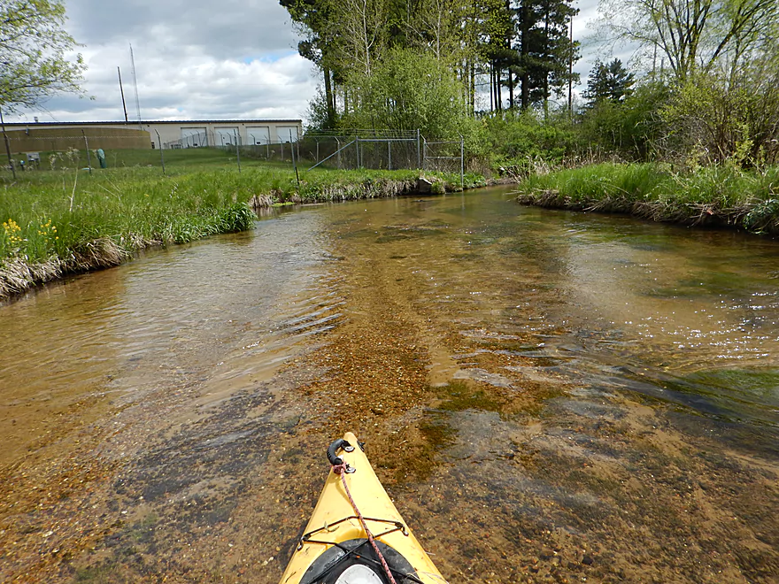
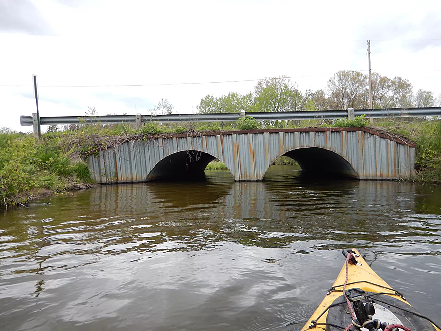
Coming up on W. Elm Street
Which you have to portage…
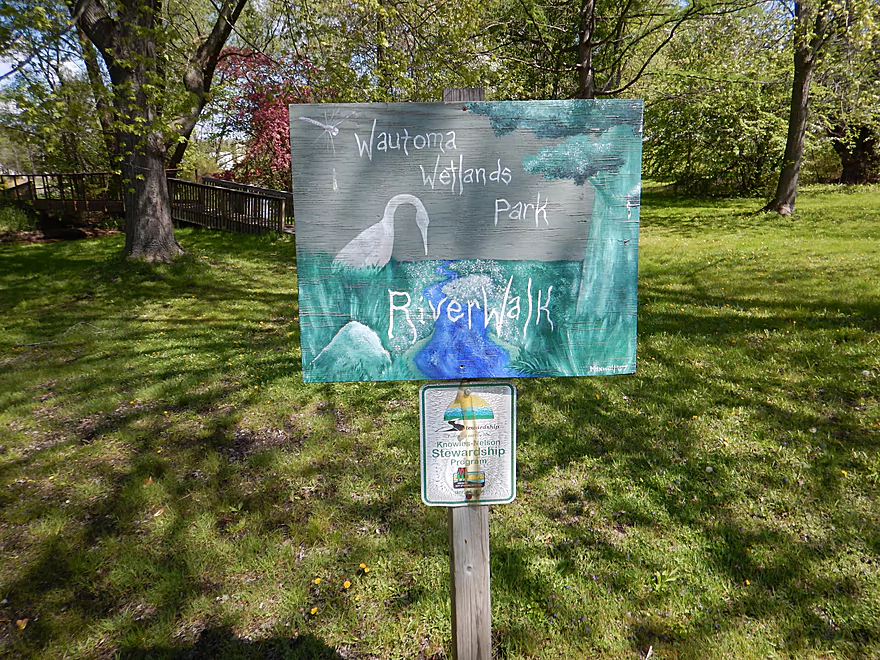
Still part of Wautoma Wetlands Park
Trying to launch on the rapids
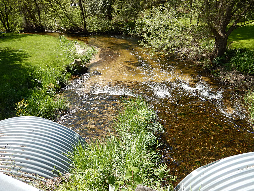
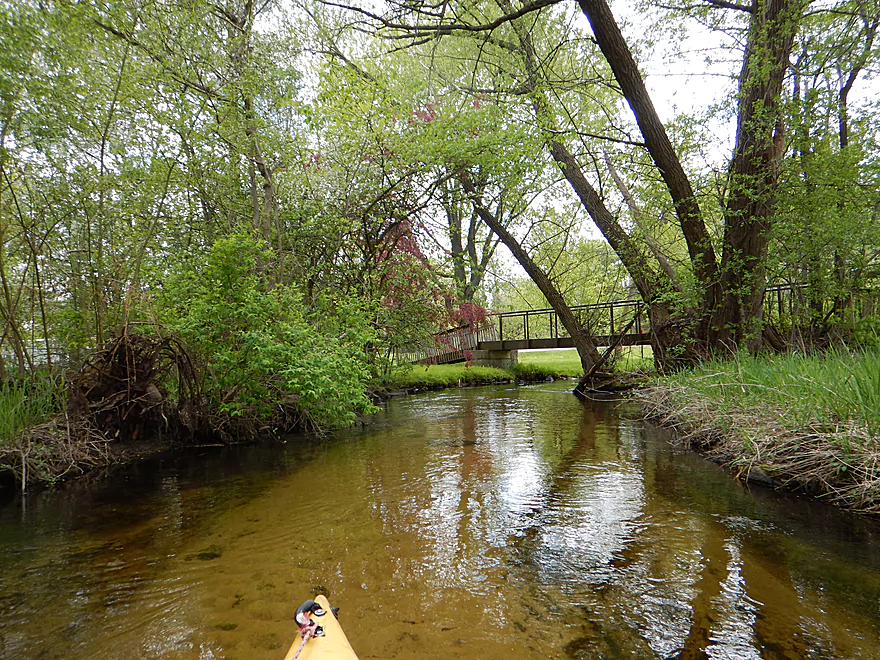
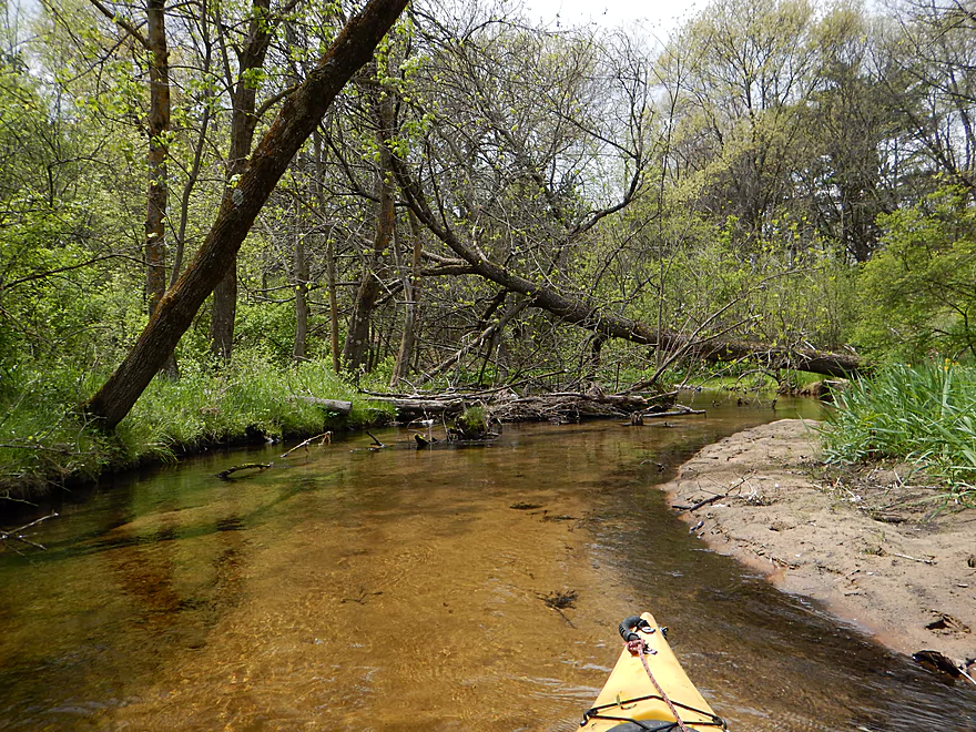
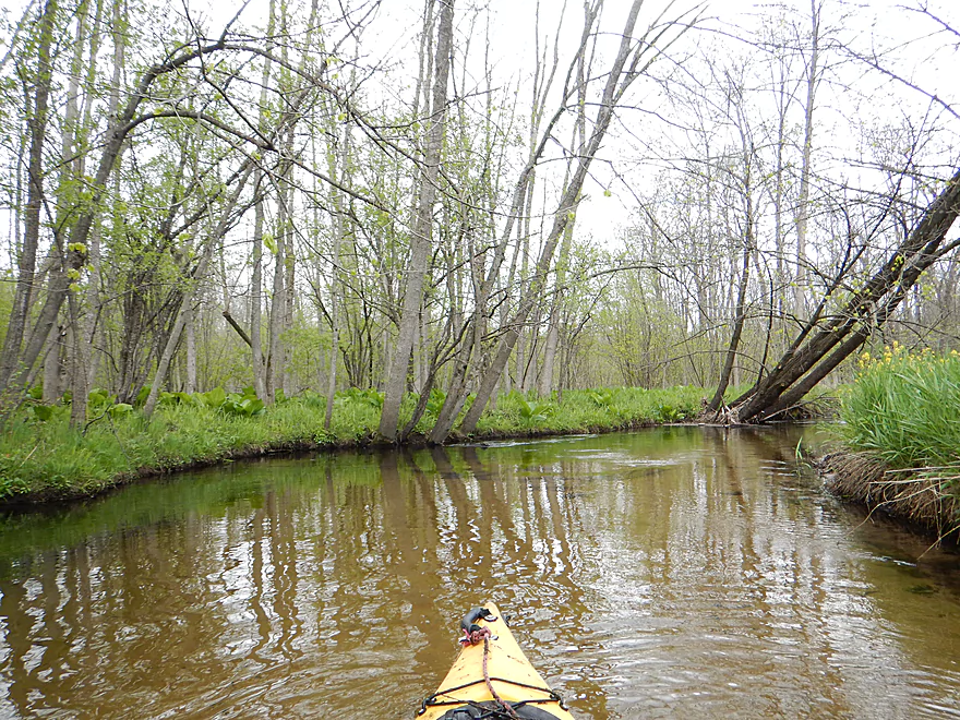
Nice scenic stretch through town
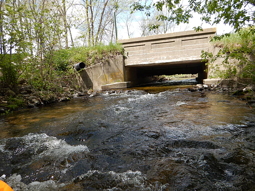
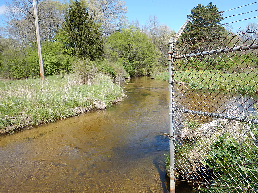
W. River Street is impassable
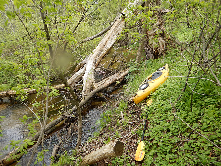
So time for a portage (not easy)
Putting back in
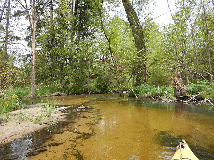
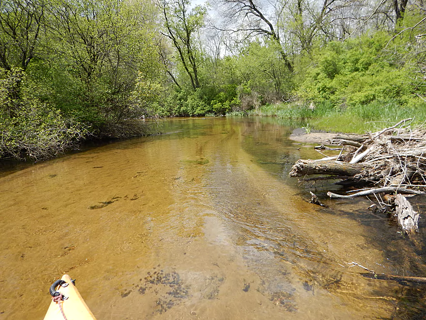
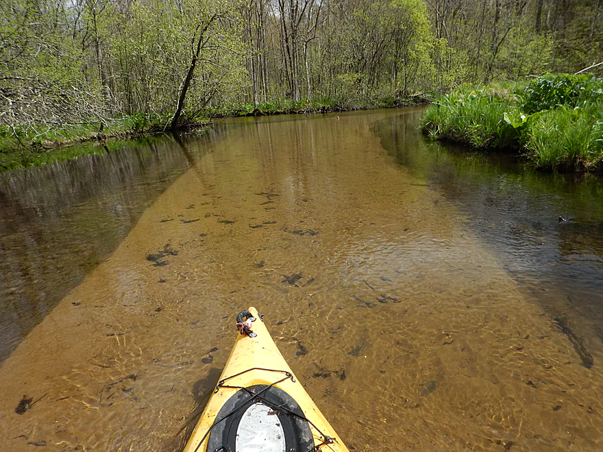
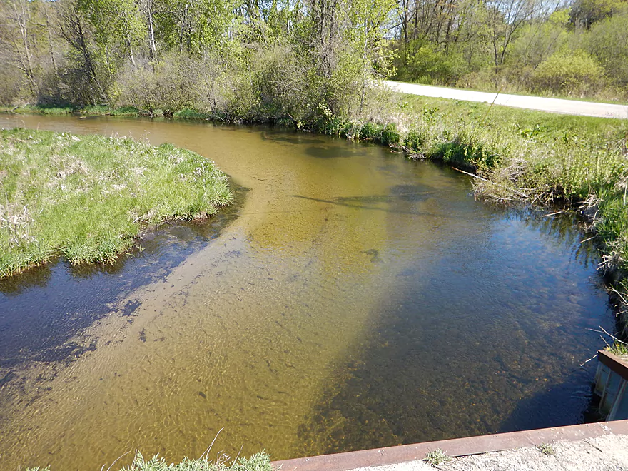
Very sandy river
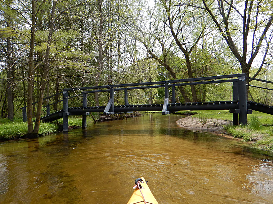
Quaint bridge
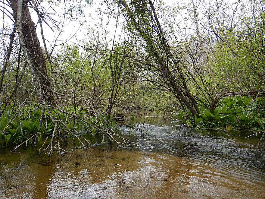
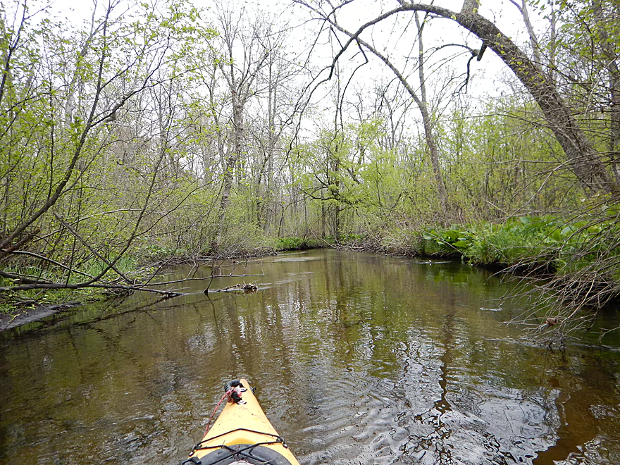
Then this starts happening
And again…
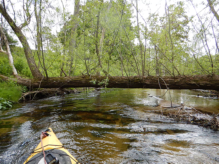
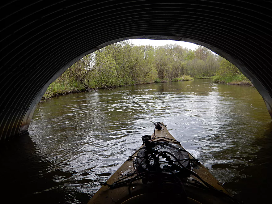
Duck low to get under Division Street
Rapids make ducking difficult
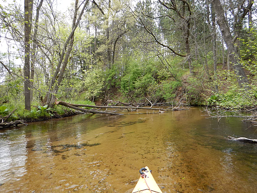
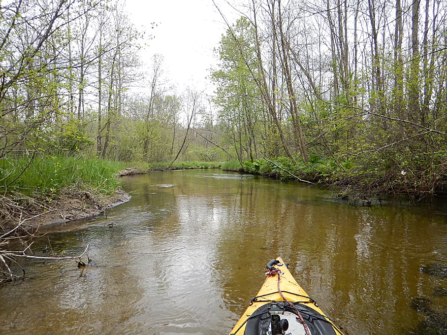
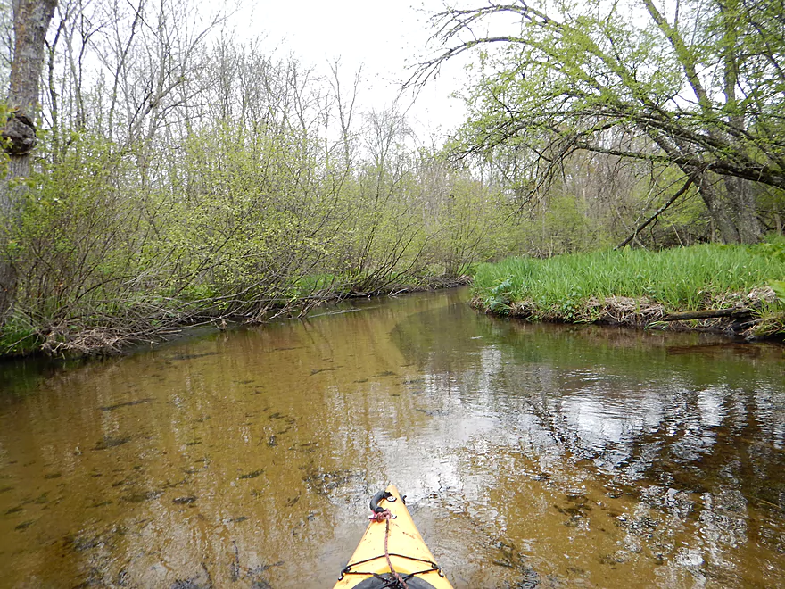
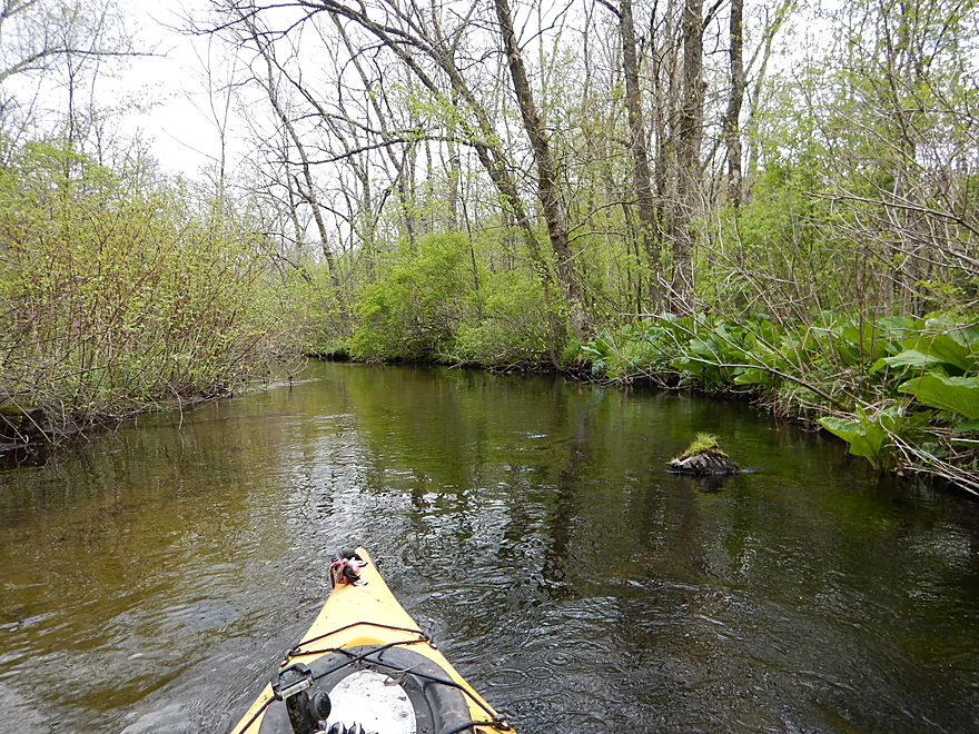
Lots more of this
Still scenic
Normally the banks were very small…an exception
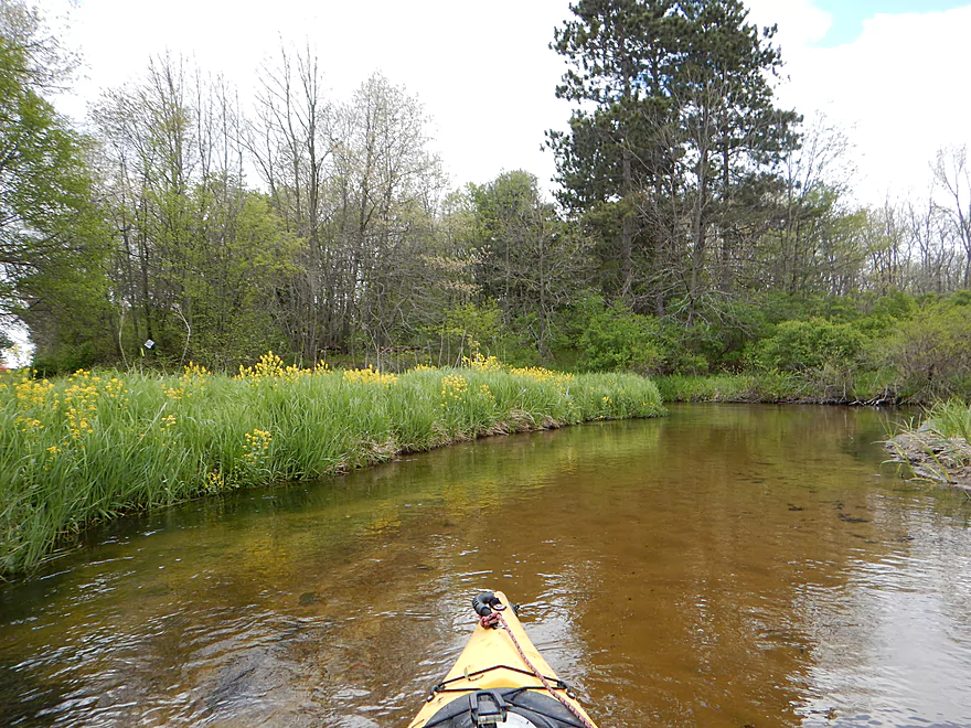
Many nice wildflowers
Approaching the Fire Station (white doors)
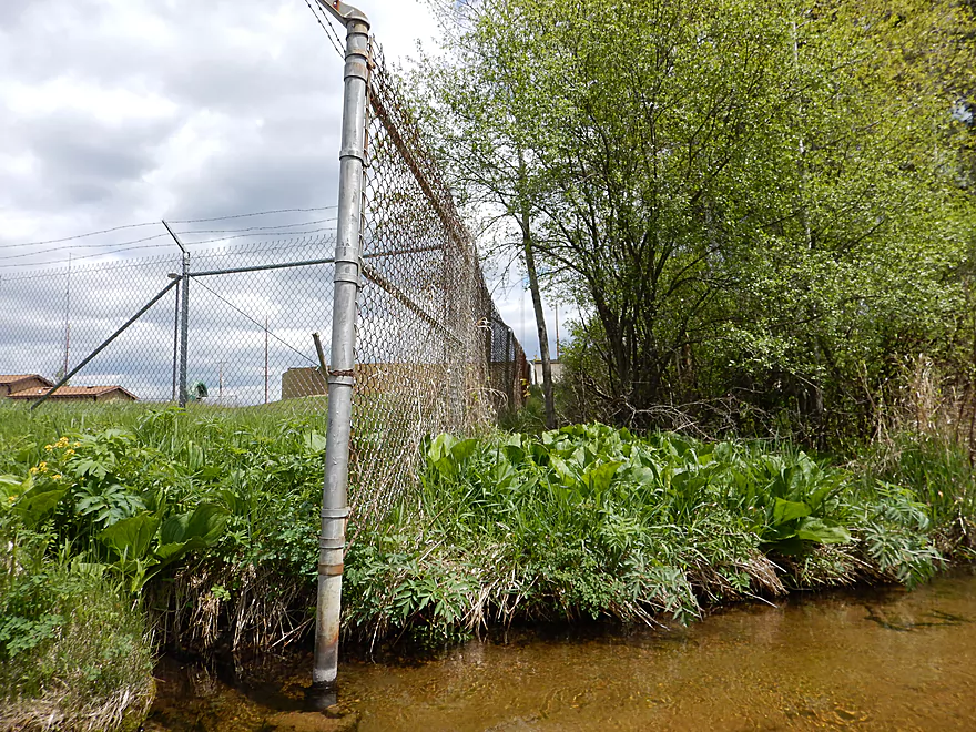
You could launch from the station if you drag your boat along the fence
A rare sunny respite
Time to get poked
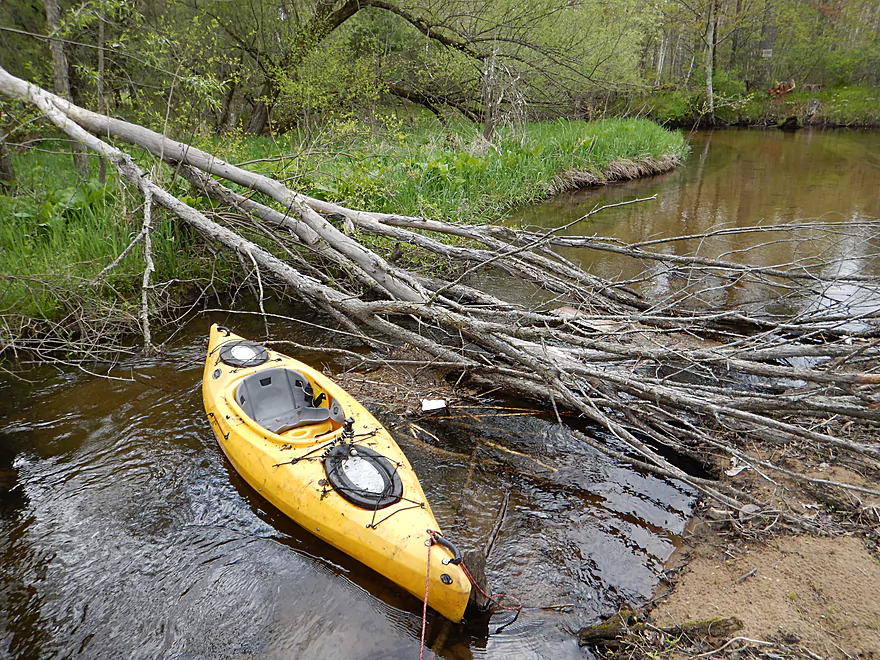
Time to portage
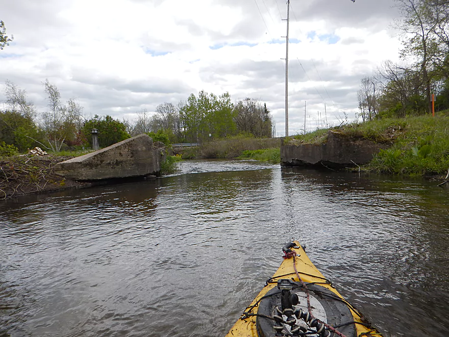
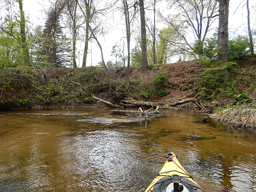
An old washed out bridge
One of my favorite photos
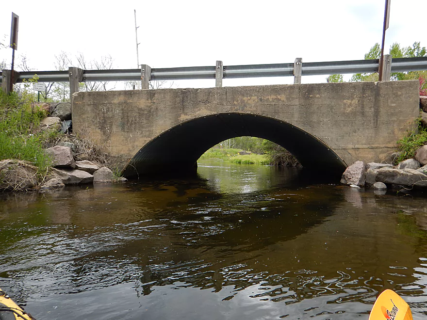
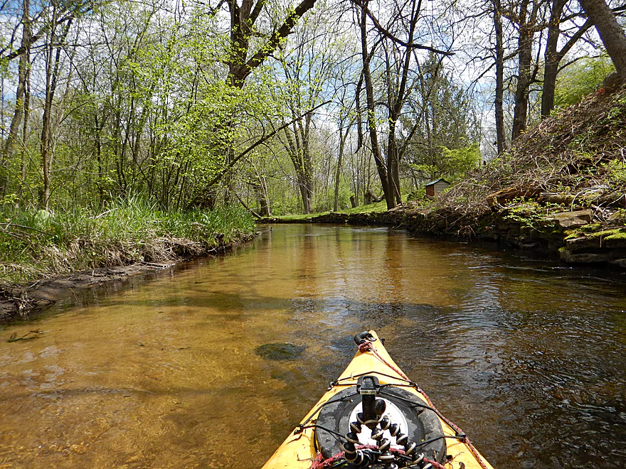
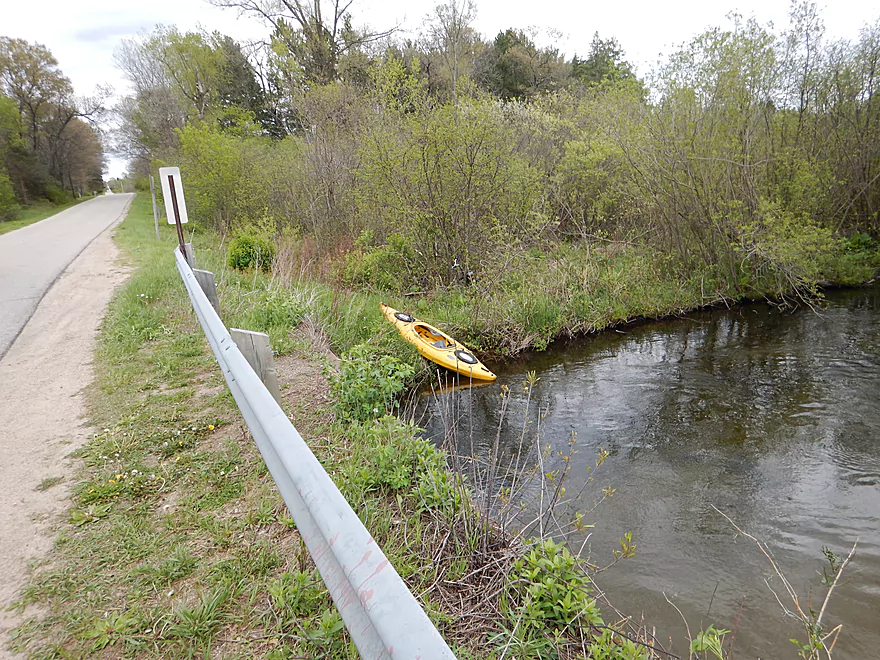
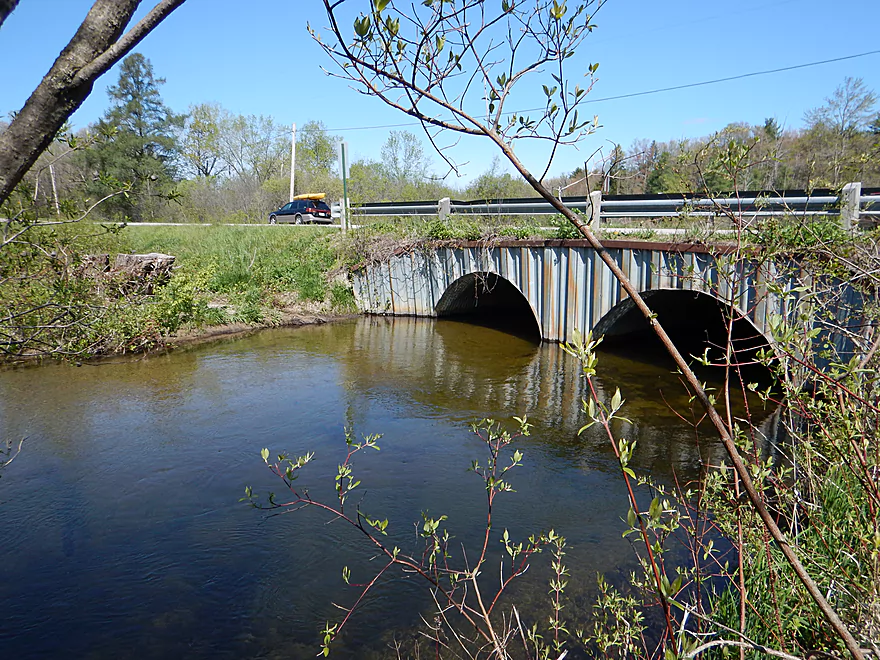
Approaching Chicago Road
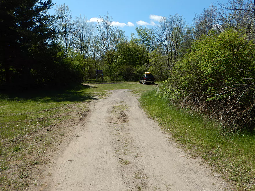
There is parking next to the bridge as this is a good put-in
Mostly done with log jams
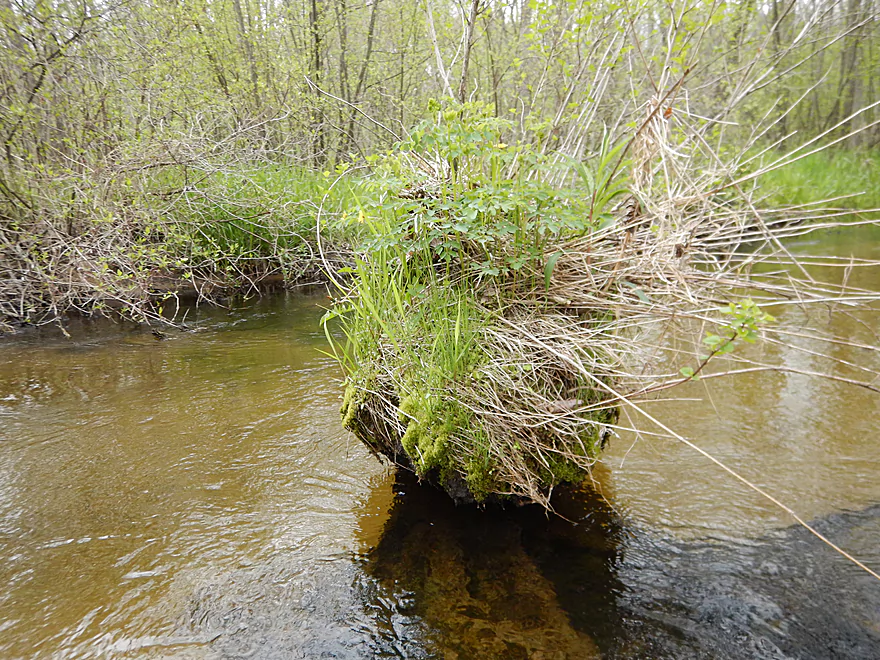
Cute little island
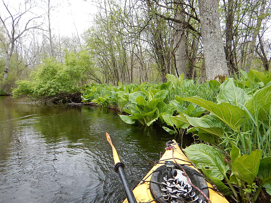
So much skunk cabbage on this trip
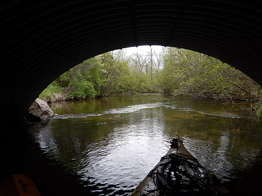
Only portage after Chicago Road
Pretty easy
A one minute window in which the sun came out

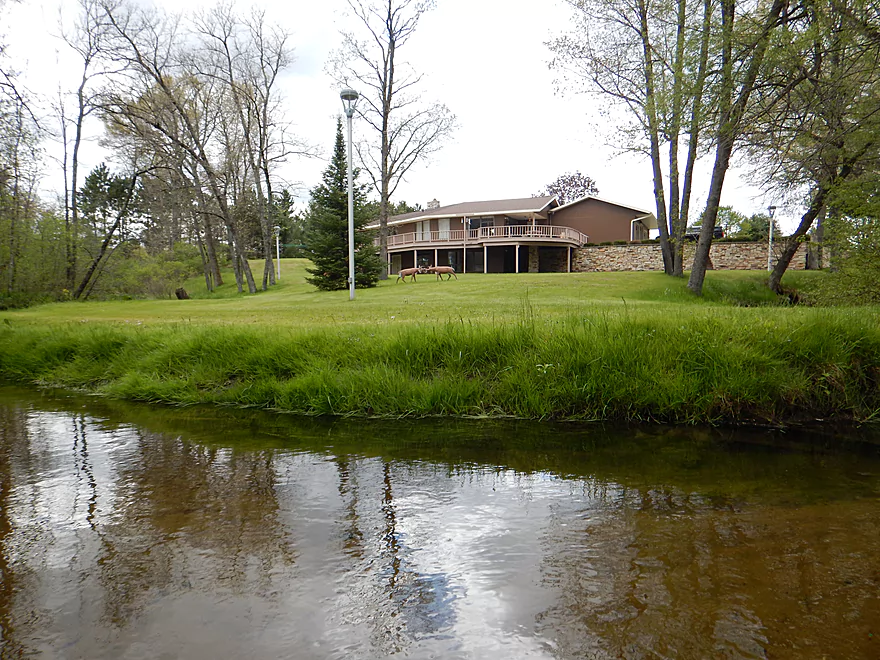
What a huge lawn…
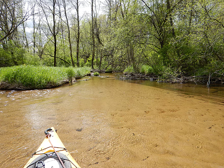
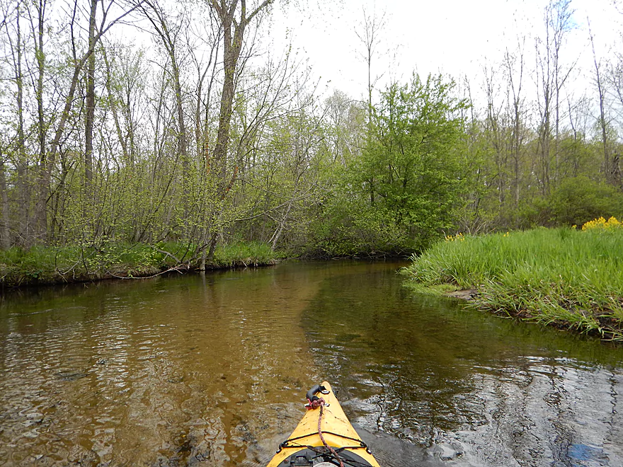
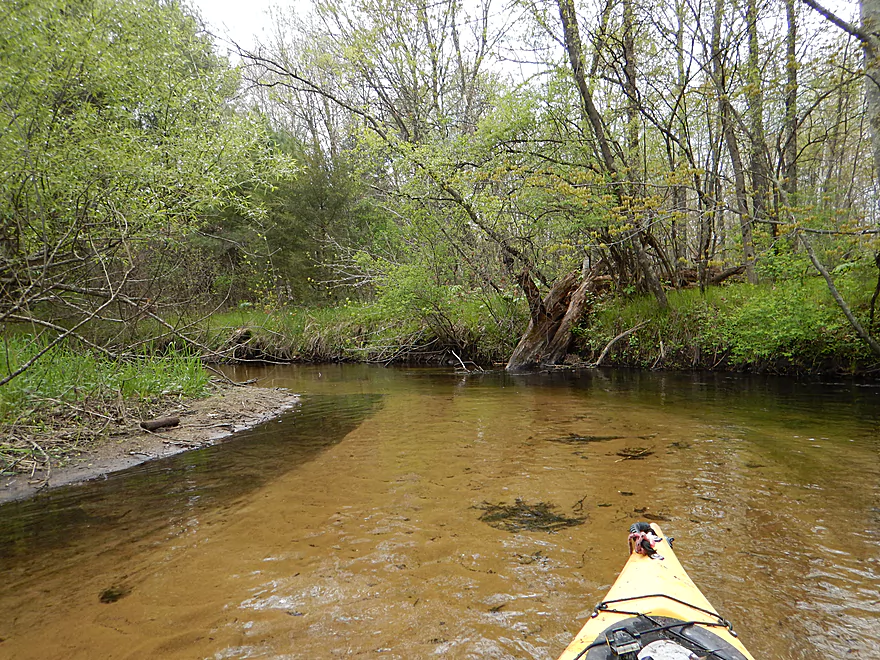
Typical nice scene
Some rare river banks
The West Branch just doubled the river (poorly pictured)
Not a problem if you get a running start
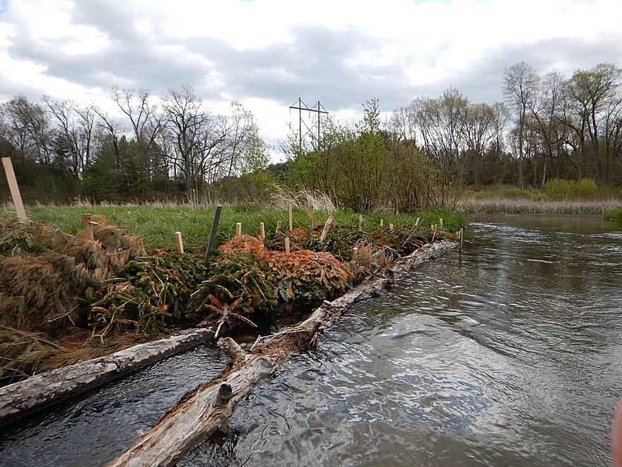
Christmas trees for trout
Final bend
Very striking
Cottonville Lane is glaring at me…
Oh well
Good spot to take out
I am double parked though (better parking around the corner)
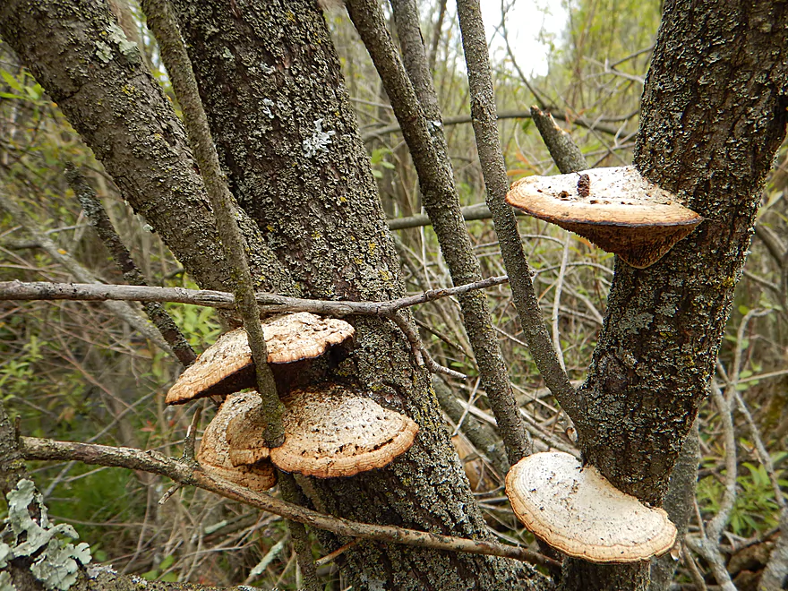
The left fungus is enveloping the branch…
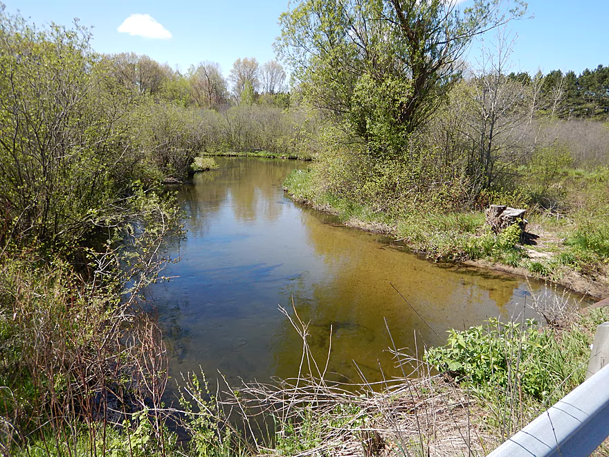
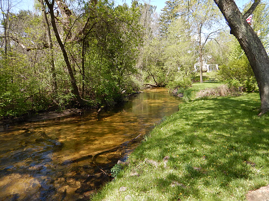
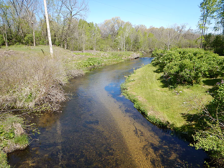
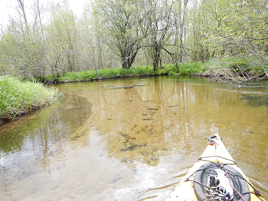
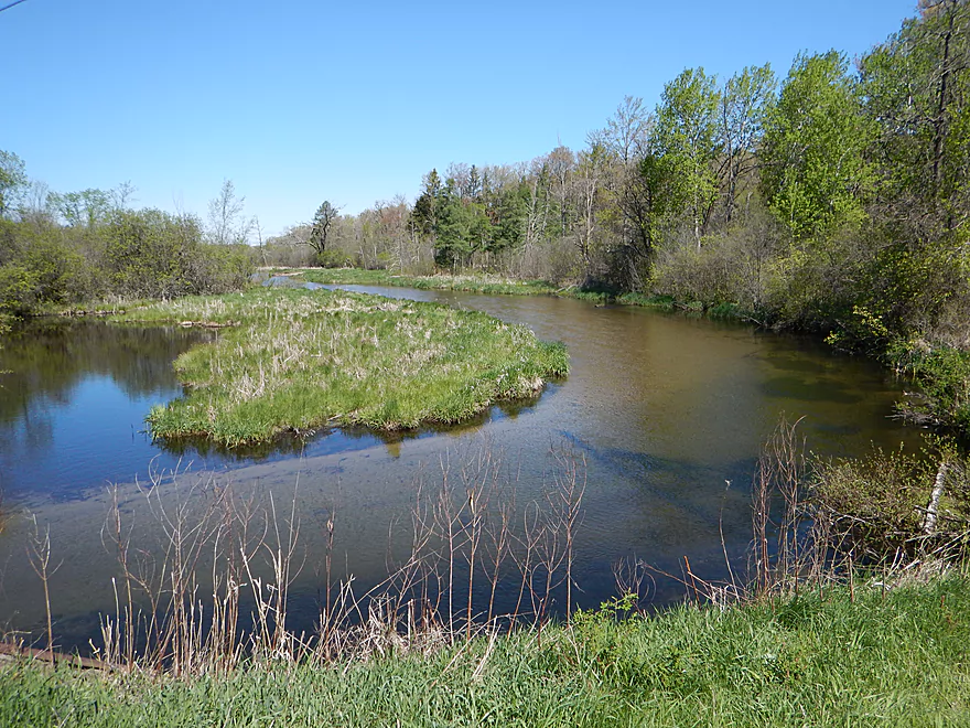
Looking downstream toward the flowage
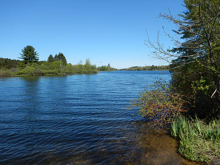
The flowage paddle is somewhat scenic
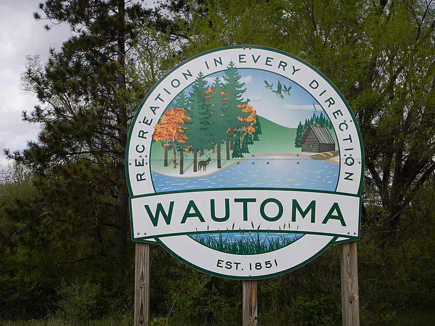
White River – Wautoma

Chicago Road to Cottonville Road on the White River was an interesting prospect submitted to me by a reader. It however was very short at 2.47 miles. I first considered this plus a 2.1 mile paddle on the subsequent flowage, but it was too windy for lake paddling.
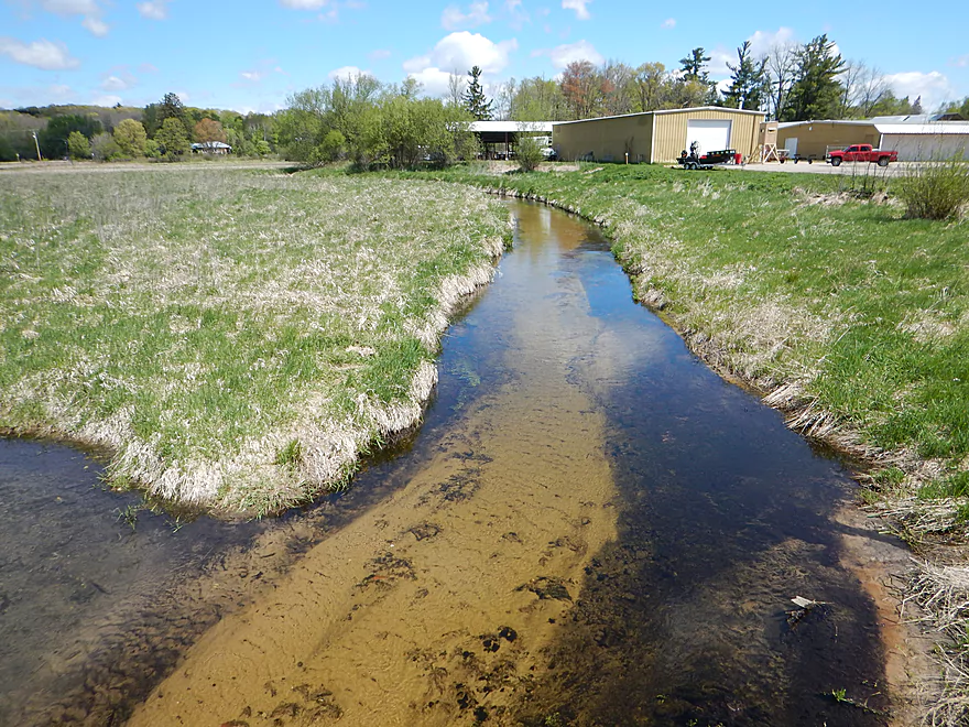
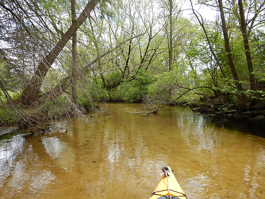
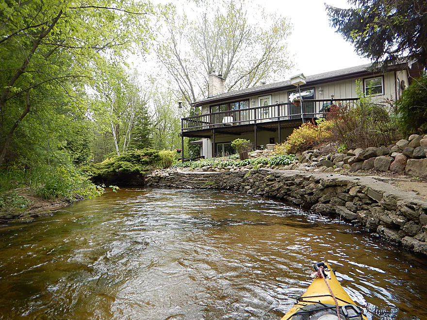
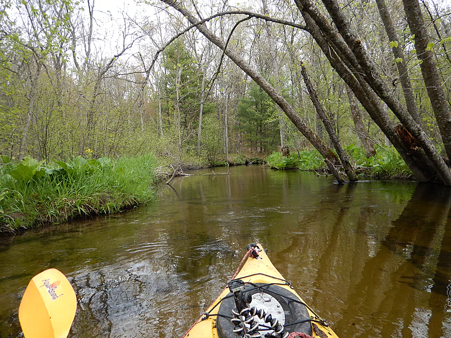
Option #2 was to put in on the north side of Wautoma which would add 2.1 miles to the trip. I had been warned that this section had too many log jams, but it looked scenic when scouting it, so I decided to chance it and launched just south of the library.
At first this seemed like a great decision. Great put-in by the public park, zippy clear water, fun curves and no log jams (well so far).
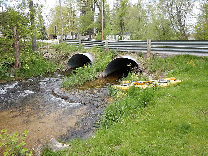
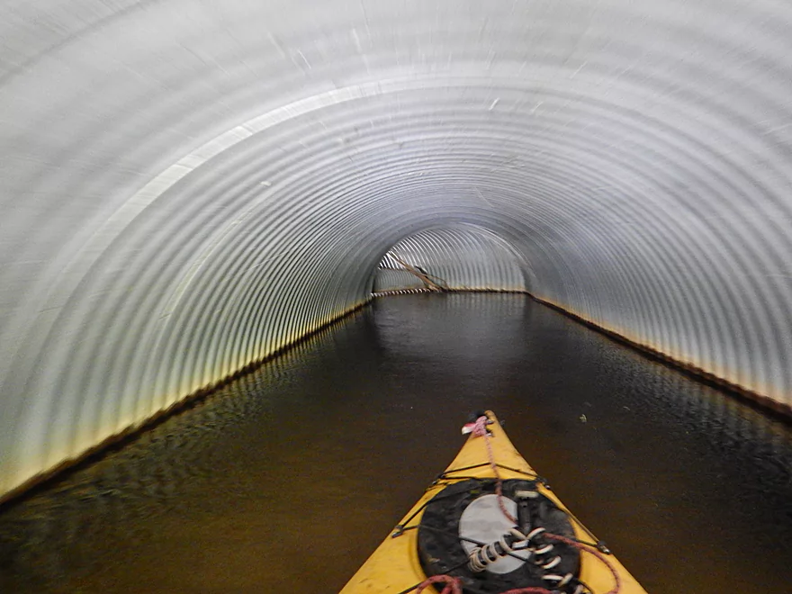
The first problem comes in at W. Elm Street. Fitting inside the culvert is no problem, however there is a “sub-culvert” inside of the culvert that blocked passage and I did have to portage. No problem though, as this is by a public park and very easy to circumnavigate over shallow banks
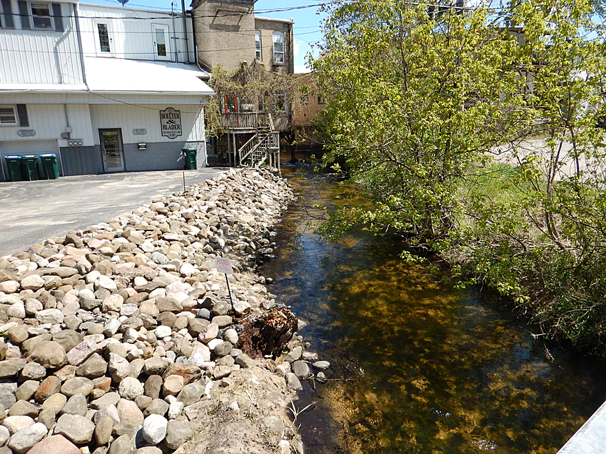
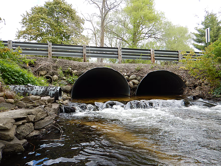
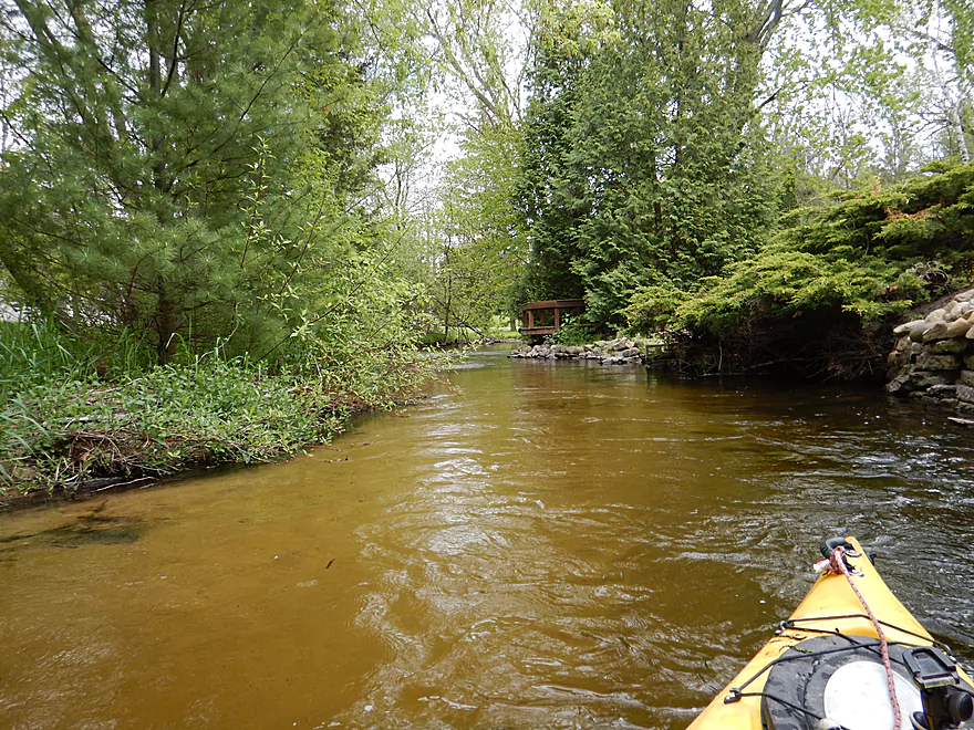
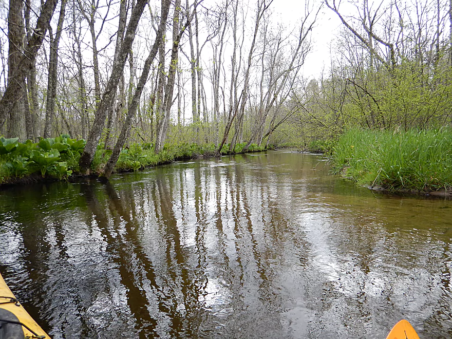
The trip continues on a five star note with more great water clarity, clean shallow banks and over-arching tree branches. Even the urban rip-rap and landscaping added a nice touch to the trip and still no log jams. Then I get to W. River Street. I can’t see through the culvert and I hear rapids on the other side. Uh oh. I poke inside and use my camera flash to reveal that the culvert does a strange elbow turn under the road, but also has a perpendicular “mini-culvert” blocking the path. Fun. So I backtrack and portage this bridge as well. This was NOT easy to portage because of how steep the bank is. Rope was definitely very handy.
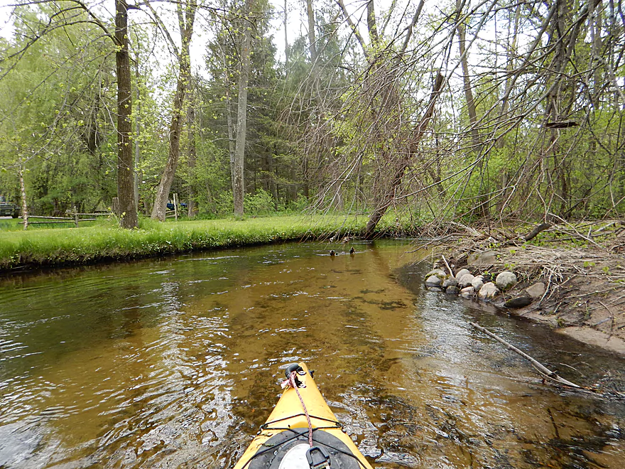
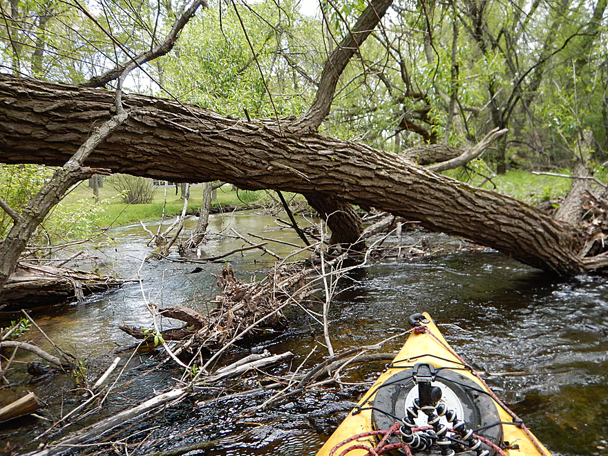
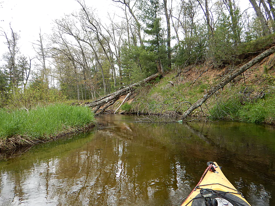
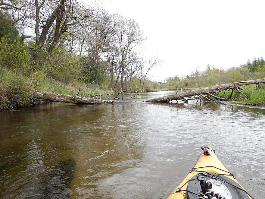
After W. River Street, the log jams kick in. Everything is still super scenic but the log jams and portages just drained my enthusiasm for the upper leg of the river. Some of the more trying ones were directly above and below the W. Division bridge and I was forced to portage on private land (much to the bewilderment of local property owners who were watching me).
Down trees continue to be a problem for a half mile after that. Even those you don’t have to portage, can be a pain to squeak by (literally as one drew blood and another almost stole my hat).
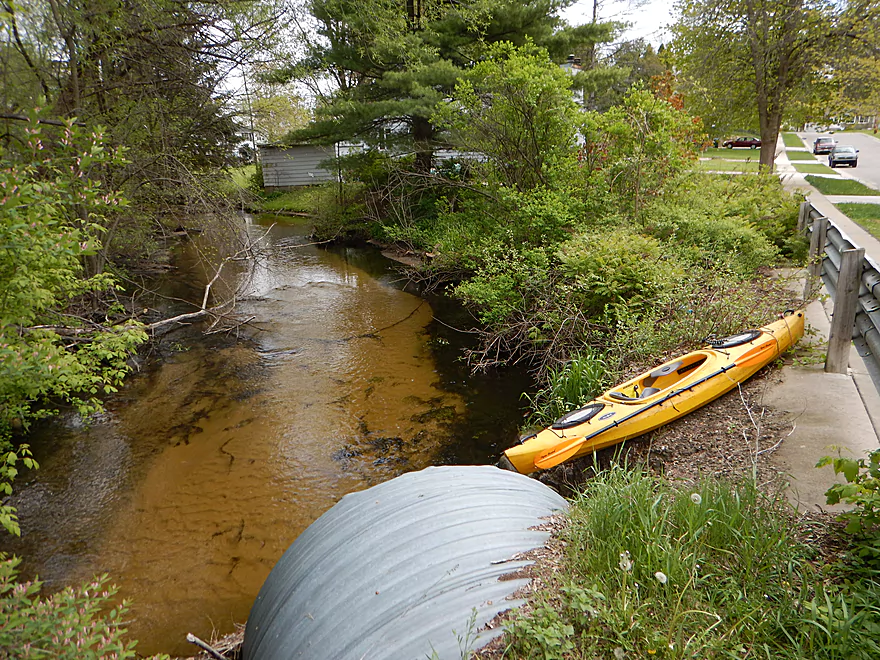
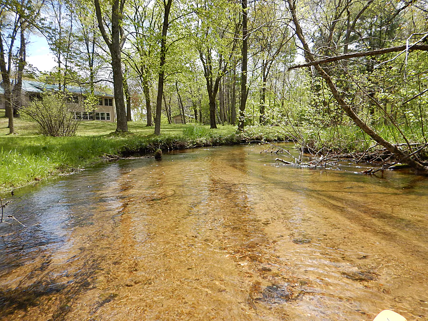
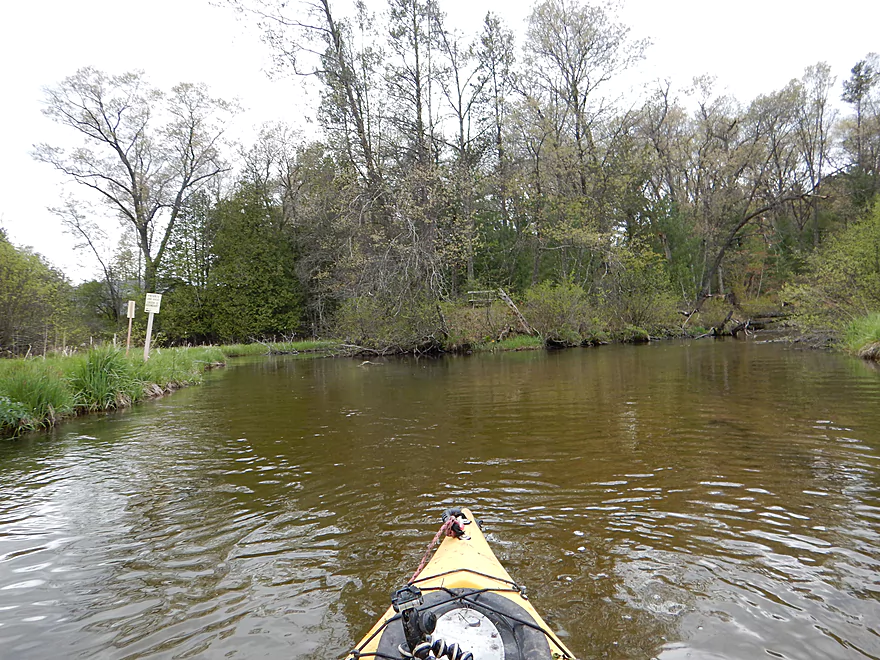
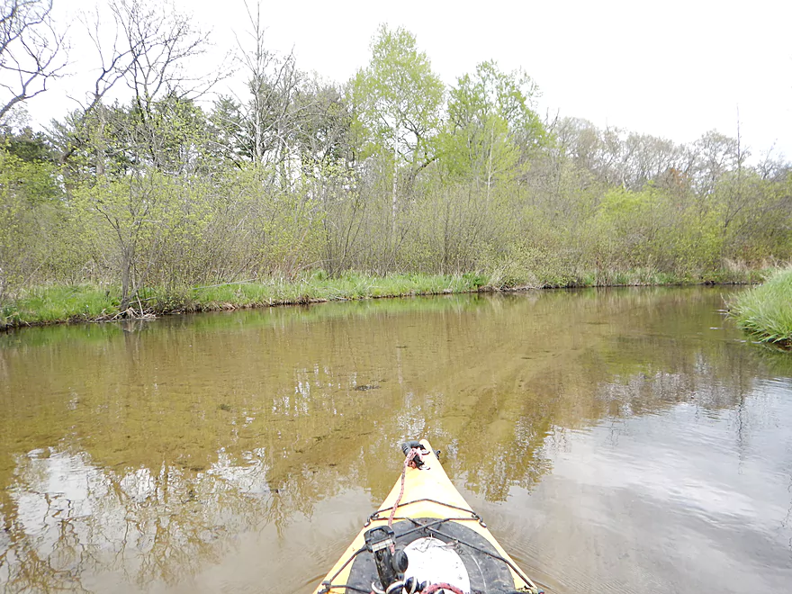
The creek opens up after the Fire Station and you lose most of the jam issues. I still had to squeak by two serious down trees and got poked here and there, but things were noticeably better. I think you can launch at the Fire Station as an option. Just make sure to park far far away from where the fire trucks have to pull out. You would also have to drag your boat 150′ through woods and along a fence to get to the water, but this seems doable.
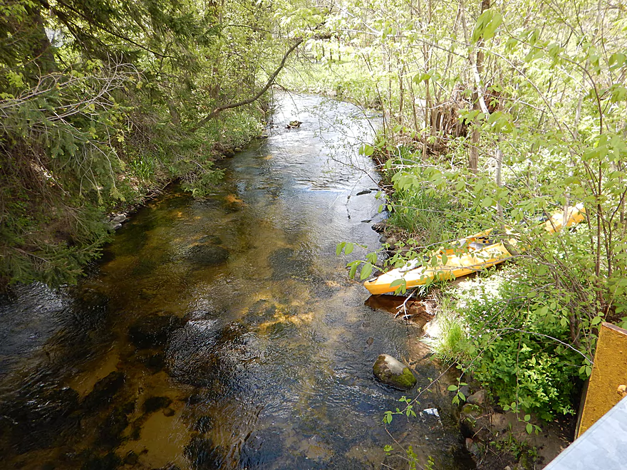
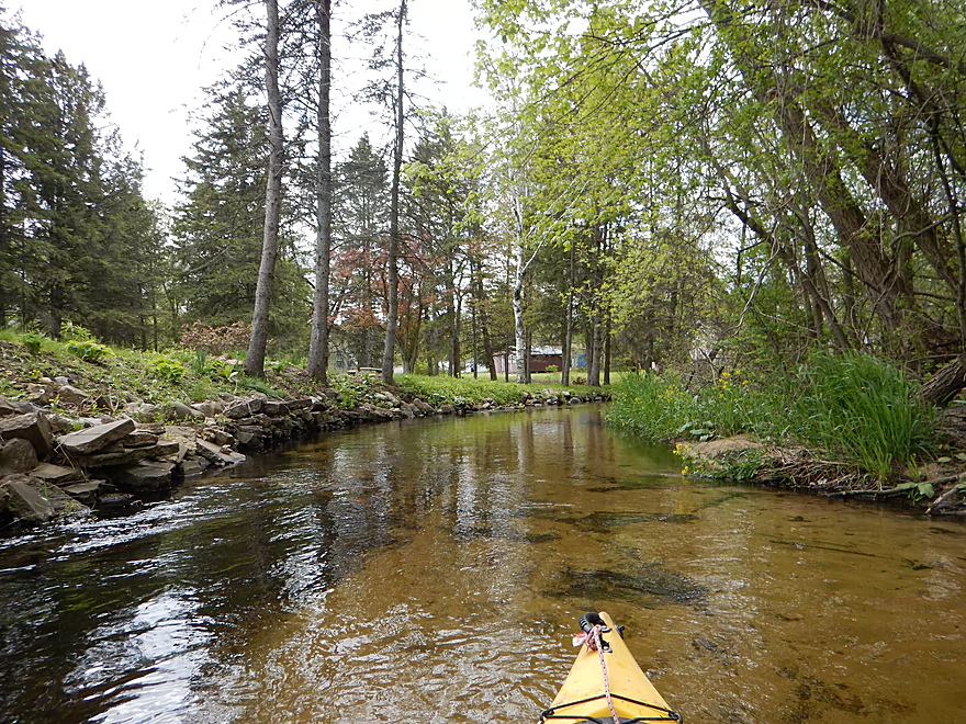
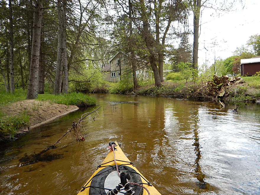
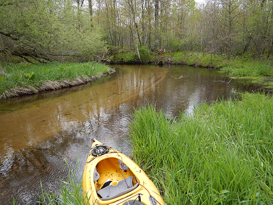
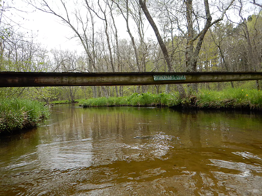
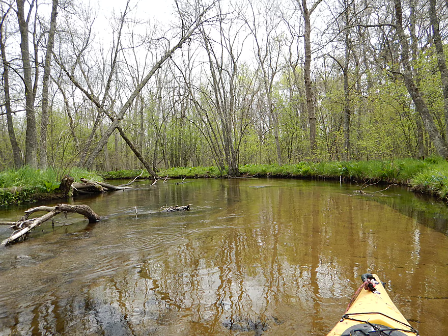
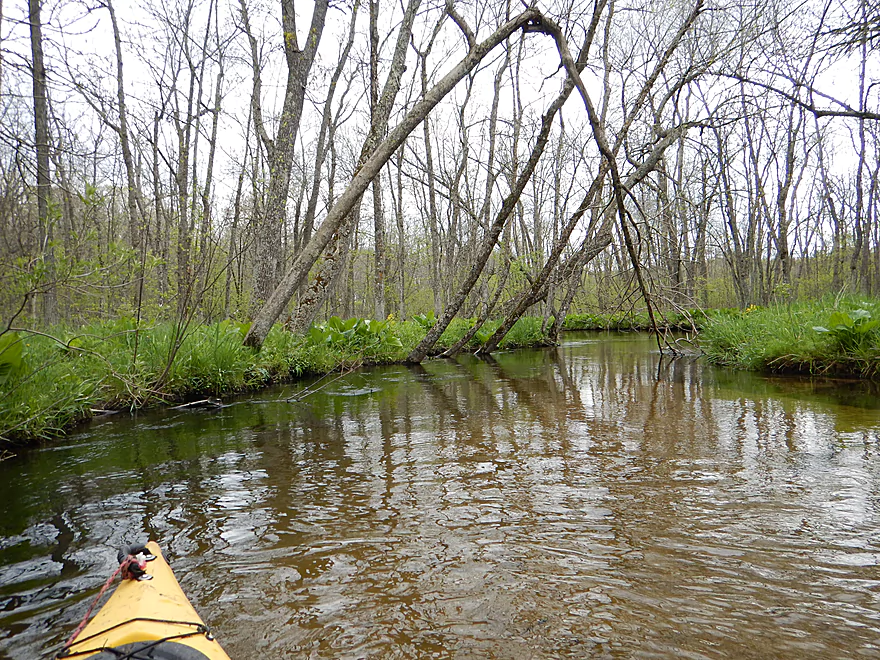
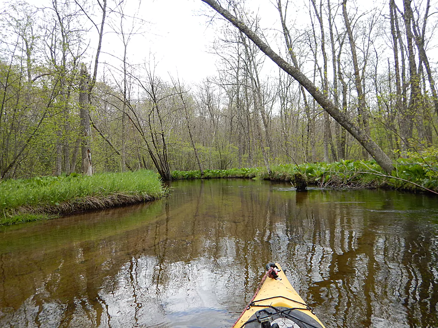
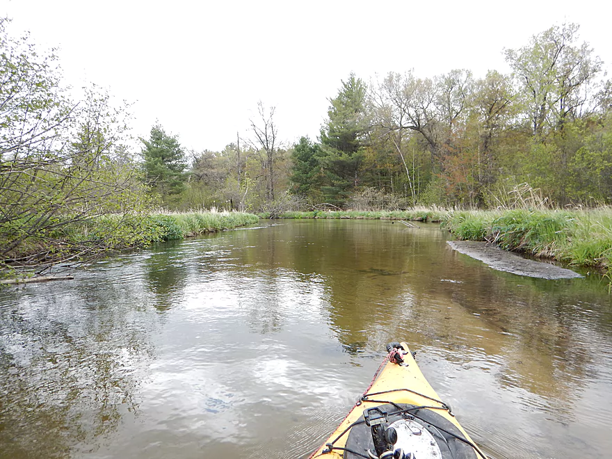
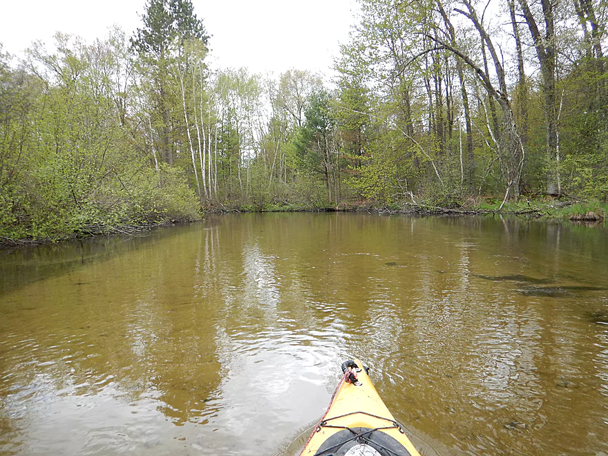
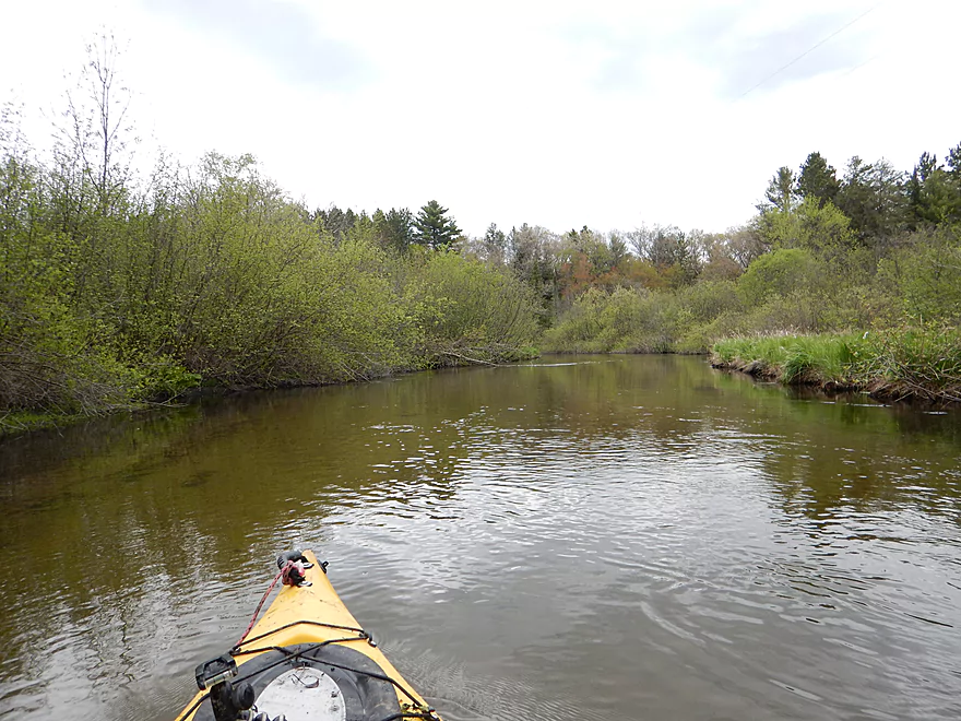
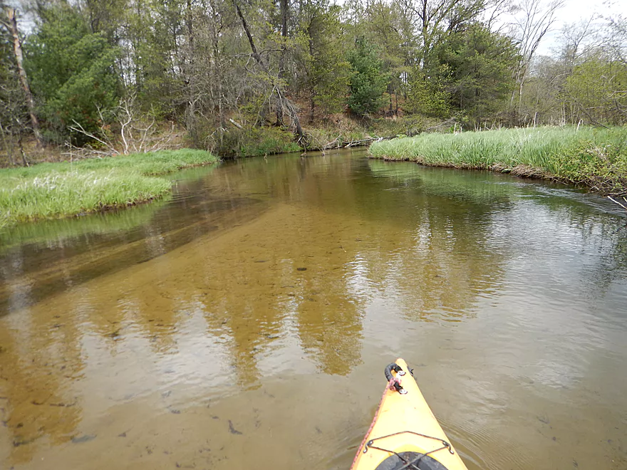
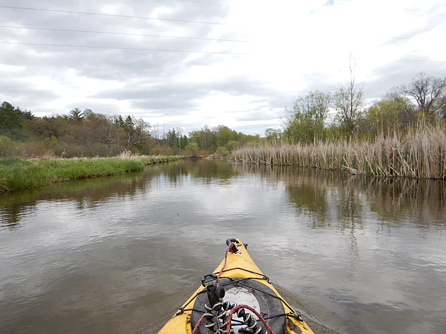
The section after Chicago Road is great and what I should have limited myself to doing all along. The put-in is very nice as there is a public fishing parking lot right next to the bridge. This stretch is very similar to the Mecan River (its cousin to the south) with lots of sand, great water clarity, many alders and up-tempo current. Much of the trip is wooded with the highlight being huge colonies of thick leafy skunk cabbage. I only had to portage once on this leg which was super easy.
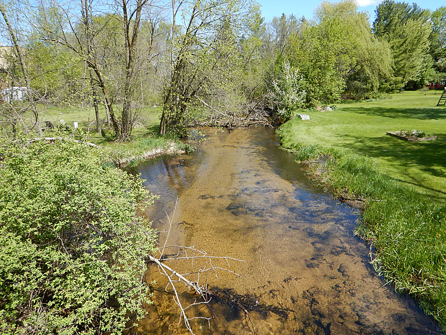
After the West Branch joins the main branch, the river doubles in size and the woods fall back for more of a wetgrass paddle which was still very pleasant.
On a personal note, while I really liked the river, I wasn’t in the best of moods to appreciate it. My shirt had been ripped by log jams, me (and my kayak) were wet, muddy and tired from battling down trees. The temperature dropped and the wind picked up (not ideal when you are wet). Then the nice blue skies from the morning were replaced with overcast clouds that made photography very frustrating (you need sunlight to properly photograph clear water). All that said though, this was a great paddle, just don’t paddle though town and make sure it is warm and sunny out.
Put-in:
On the north side of Wautoma where the dam used to be, there is a nice launch option in “Wautoma Wetlands Park” where I started the trip. You can park in the municipal parking lot directly southwest of the library. I do not recommend launching here because of subsequent log jams (see main write-up). Even if you don’t launch here, it is still worth walking through the park from the library to W. Elm Street to see the creek.
In theory you could put in above the former dam north of the library. But the dam hasn’t been completely removed and the underwater currents look too dangerous to navigate.
There are many other launch options in town. W. Elm Street (nice), W. River Street (not so nice), the elementary school (would require a hike to get to the water) and W. Division Street (possible but not ideal as parking and privacy seem in short supply).
In hindsight, the two best put-in options are the Fire Department or Chicago Road.
Take-out:
Cottonville Lane is a good take-out option for a bridge access. Parking is poor by the bridge, but there is a sneaky public fishing parking lot just around the corner on S. White River Road.
If you want to paddle further, do be advised that the river turns into a flowage. As far as flowages go, it isn’t so bad, but would be 2.1 miles of paddling with no current and exposed wind. There is a nice public ramp off Pine View Road (no outhouse here nor anywhere else on the White River).
Shuttle Information:
Pretty easy and short bike shuttle at just 2.7 miles.
Hazards and Logjams:
Many. Let’s divide the trip into three sections for clarity.
From Wautoma Wetlands Park to the Fire Department, there are too many log jams for this section to be feasible for paddling. On top of this, three of the culvert bridges (Elm, River, Division) are problematic as they have perpendicular culverts INSIDE of the main culverts. I’ve never seen such a thing and they must be to allow plumbing to pass through the bridge. This means you must portage Elm (easy), River Street (not easy), and you will have to duck low through rapids to get through Division Street (doable for experienced paddlers).
From the Fire Department to Chicago Road, there were two log jams that were somewhat negotiable. This section is markably better than the upstream section.
From Chicago Road to Cottonville Lane, there is only one portage which was easy.
Each bridge except for Cottonville has its own set of rapids, but they are all easy and class 1.
River Depth, Navigability and Current:
I suspect this is a stable river because of its many natural springs. The depth of 85 CFS at 10 Mile Creek, correlates to the White being just a bit above normal.
The current is peppy, but never dangerous IMO. It might be during flood stage however.
Noteworthy Wildlife:
Some ducks, small fish darting through the water, three angry dogs, and a trout fisherman.
Special Thanks:
Thanks to Adam Kiernicki for suggesting this as a trip idea (and for some other ideas you may see reviewed in the near future as well). If you have ideas or requests for paddling trips, feel free to let me know.
Detailed Overview
Main Branch:
- Swamp Road to Wautoma Library: (1.94 miles) An interesting prospect with a few log jams. Unfortunately this is scheduled to be turned into a flowage in spring of 2017.
- Wautoma Wetlands Park to the Fire Department: (1.19 miles) A super scenic section but too clogged with jams. Reviewed here.
- Fire Department to Chicago Road: (0.8 miles) A good section with two down trees to circumnavigate. Reviewed here.
- Chicago Road to Cottonville Lane: (2.47 miles) A very nice section. Reviewed here.
- Cottonville Lane to Pine View Road Landing: (2.1 miles) Mostly open flowage paddling, which I assume is uninteresting.
- Pine View Landing to Czech Lane: (4.7 miles) A nice prospect on my to-do list, but will have some down trees and a dam to portage.
- Czech Lane to Neshokoro Dam: (2.64 miles) Probably uninteresting as this is mostly flowage paddling.
- Neshkoro Dam to 22nd Ave Canoe Launch: (3.43 miles) A very good prospect I review here.
- 22nd Ave Canoe Launch to Hwy D: (8.3 miles) A good section that I reviewed here. Liked the stretch, but found the log jams frustrating. Have been told that the main obstructions have been recently cleared out though.
- Hwy D to White River Road: (4.2 miles) A good prospect I had written off due to fear of log jams, but per Tim is mostly clear now.
- White River Road to Mouth on Fox River: (2.1 miles) Am unsure of this stretch and if log jams are an issue?
- Fox River Options After White River Mouth
- You can paddle 1.25 miles upstream to the White River Locks which is a great take-out option
- You can paddle 0.7 miles downstream to Huckleberry Lane where there is a small area for taking out (am not sure this is public or private though)
West Branch:
- Upstream of Hwy T: This leg may have too many logjams. A bigger concern is that the upstream bridge (13th Ave) has a very steep embankment so there really isn’t a good put-in option.
- Hwy T to Hwy 21: 2.2 miles. Very scenic leg with perfect clarity and a number of pine trees. On the downside it is a bit small and obstructed at times. Figure 7-8 logjams total, but it might be worth it.
- Hwy 21 to Cottonville Ave: 2.9 miles. Maybe 6 logjams, but a super scenic stretch with many pine trees. On my todo list.
- Cottonville Ave to Cottonville Lane: 5.0 miles.
- Cottonville Ave to Hwy 22: 2.2 miles. Great stretch with clear sandy water and nice pine trees. Two logjams and one log bridge, but manageable portages.
- Hwy 22 to Mouth on White River: 0.4 miles. Great stretch with more crystal clear water.
- Mouth to S. White River Rd: 1.4 miles. Very nice section with clear water. It’s much wider, deeper and more open that upstream legs. No logjams.
- Cottonville Lane to Pine View Rd: 2.1 miles. Mostly open flowage paddling, which I assume is uninteresting.
Trip Map
Overview Map
Video
Photos Size: