
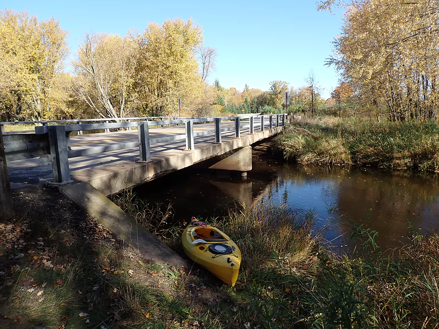
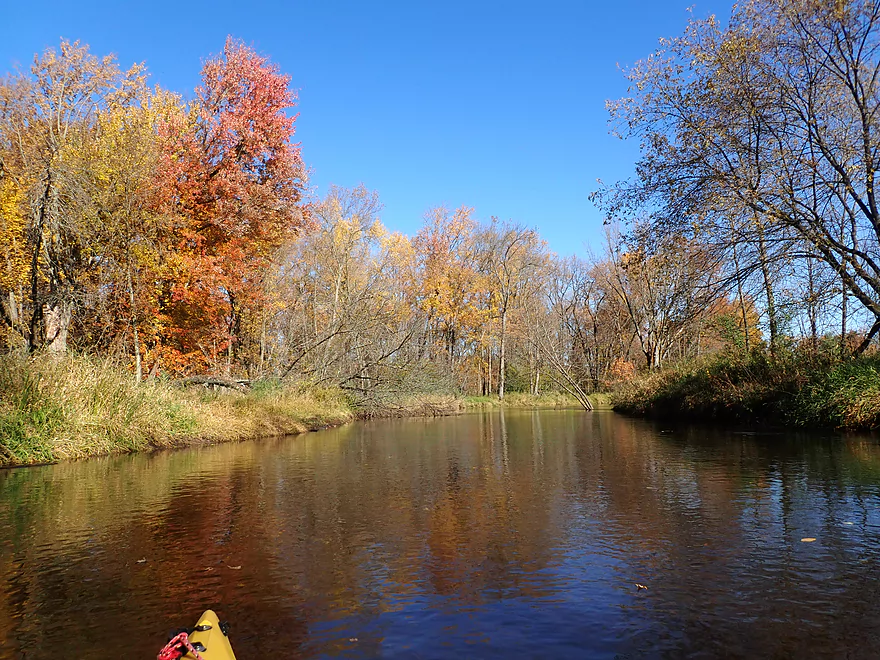
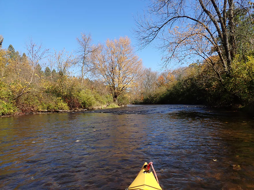
Putting in at Hwy K
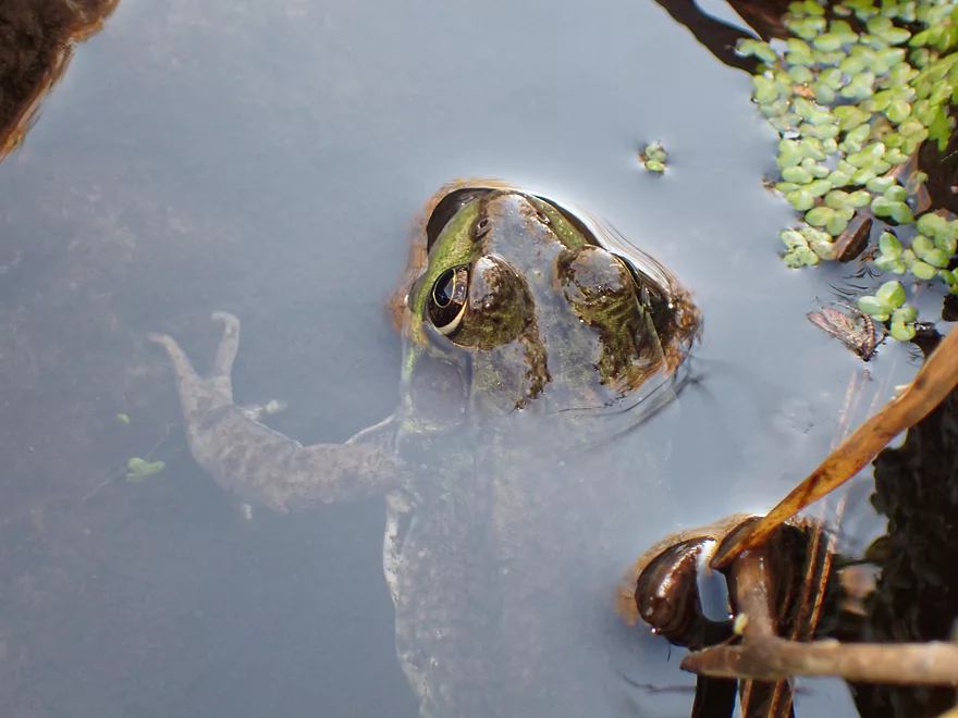
A friendly frog
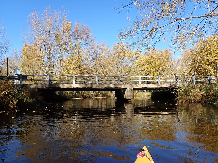
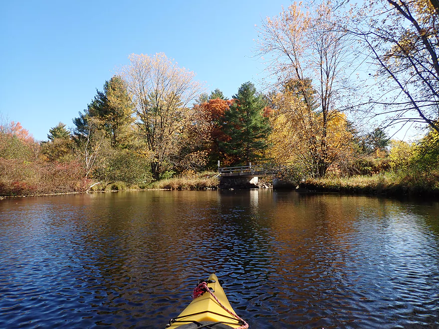
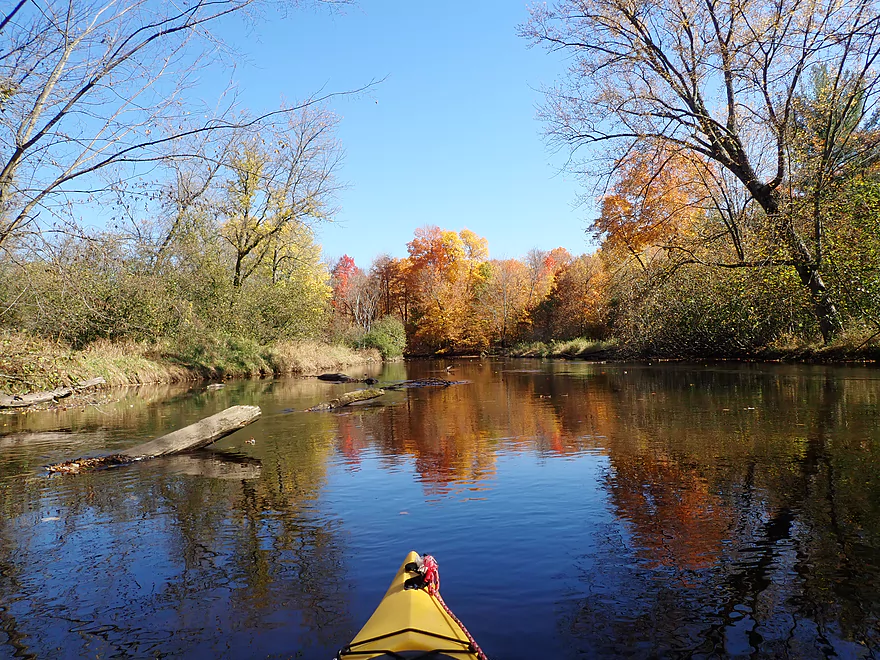
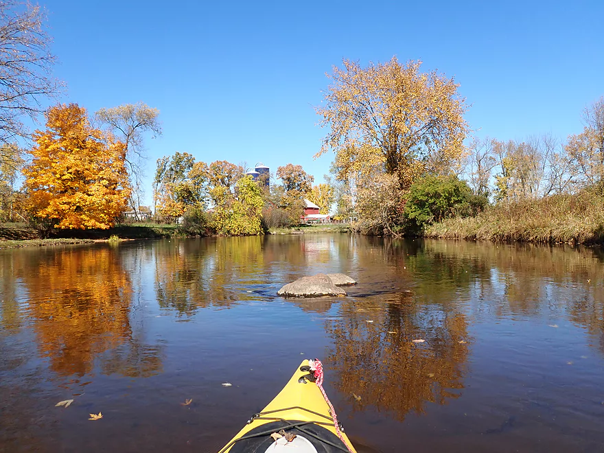
Reverse view
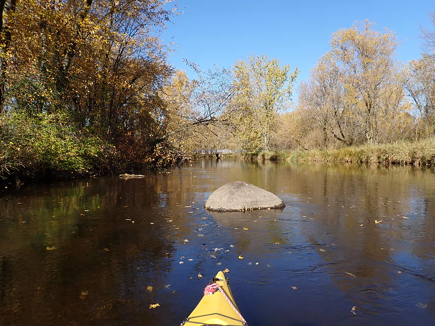
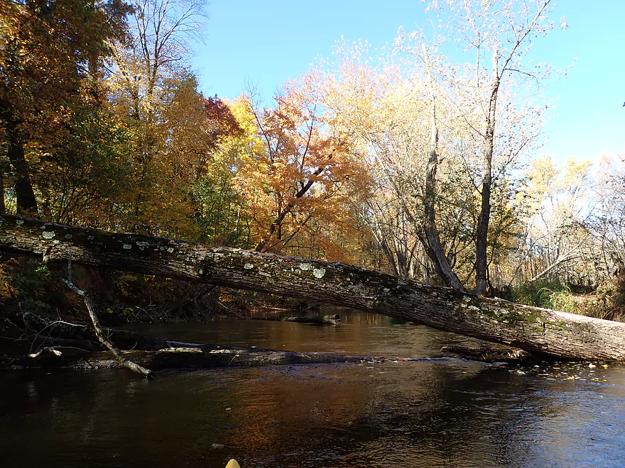
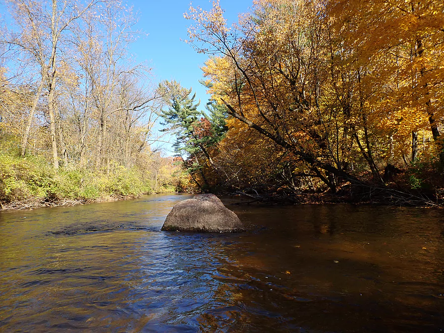
Some boulders….not many
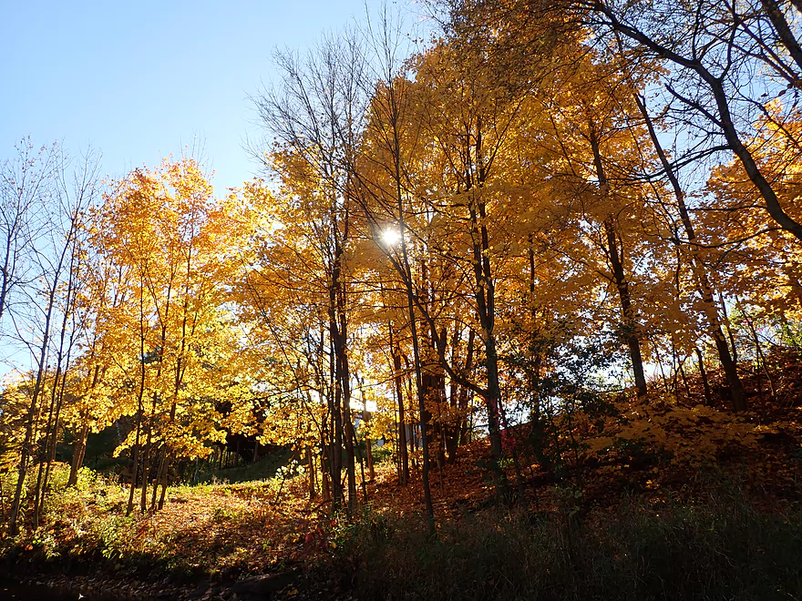
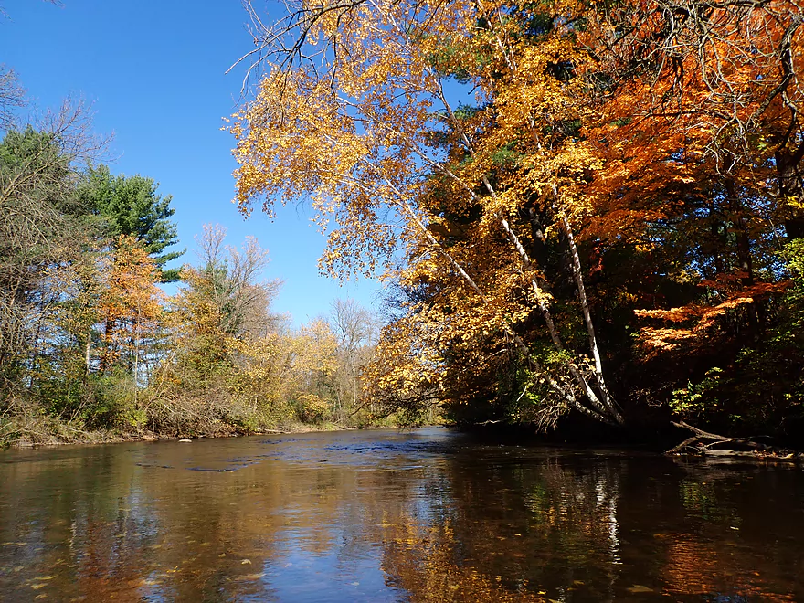
Light flickering through the leaves
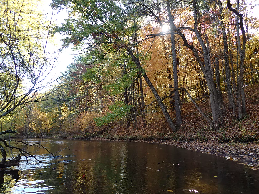
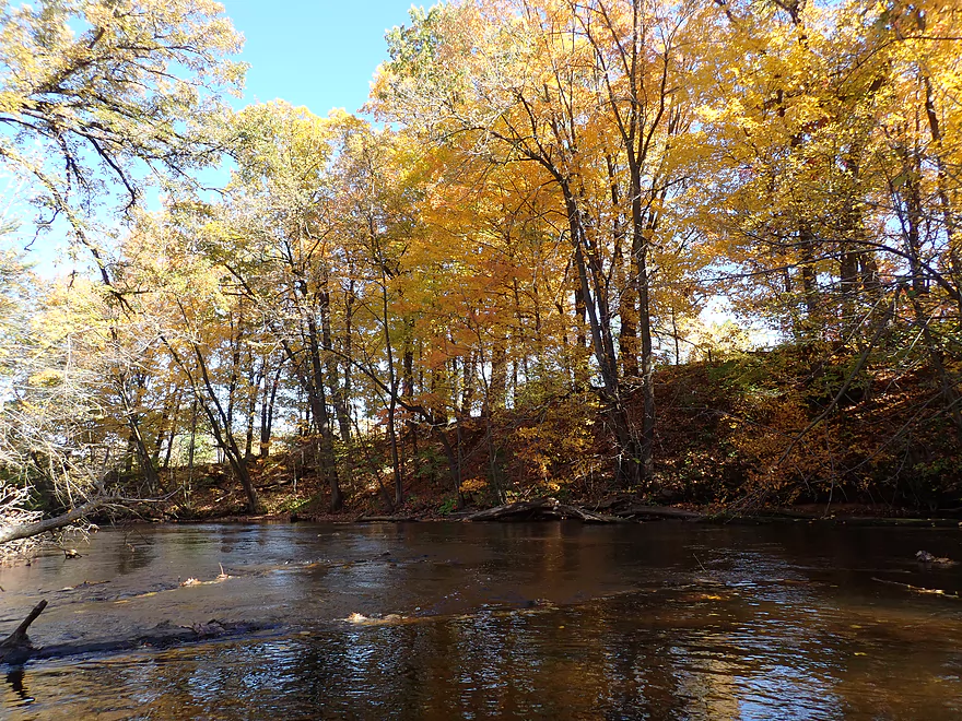
Scenic stretch by a steep hillside
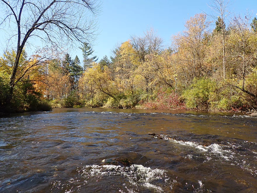
A few squeakers in the first mile
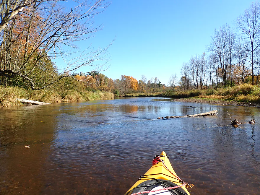
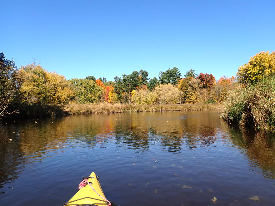
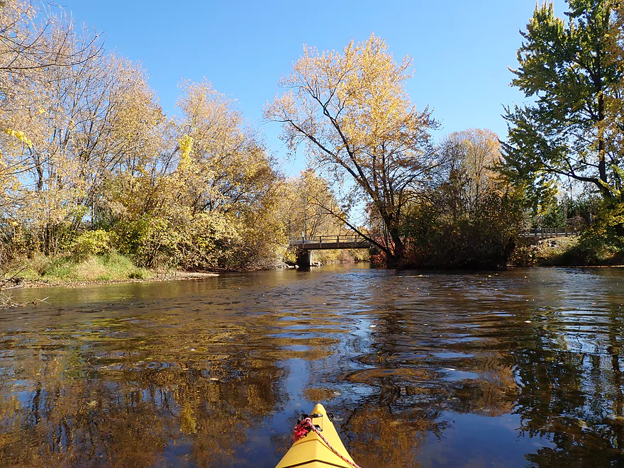
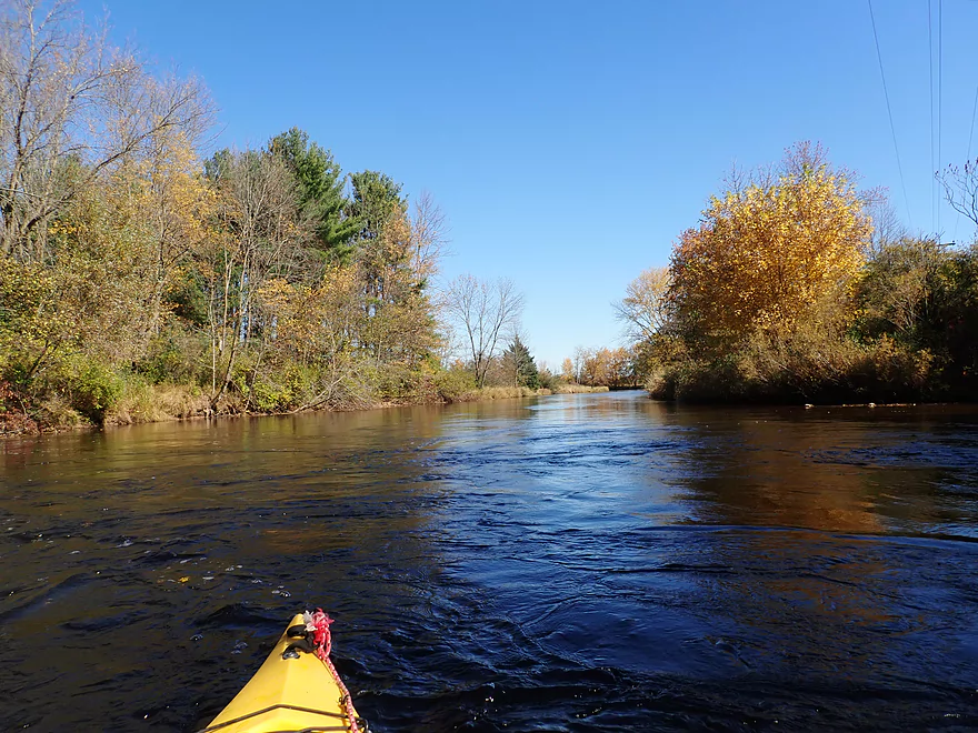
River soon opens up
A good river for maple
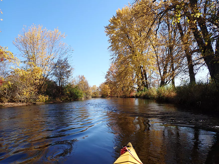
This river really reminded me of the Mecan
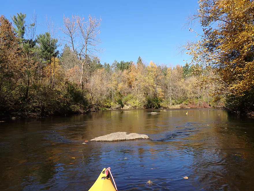
A small boulder garden
N. Military Road
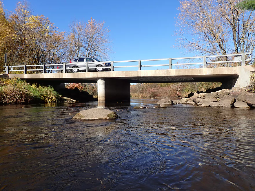
Car stopping to get my picture
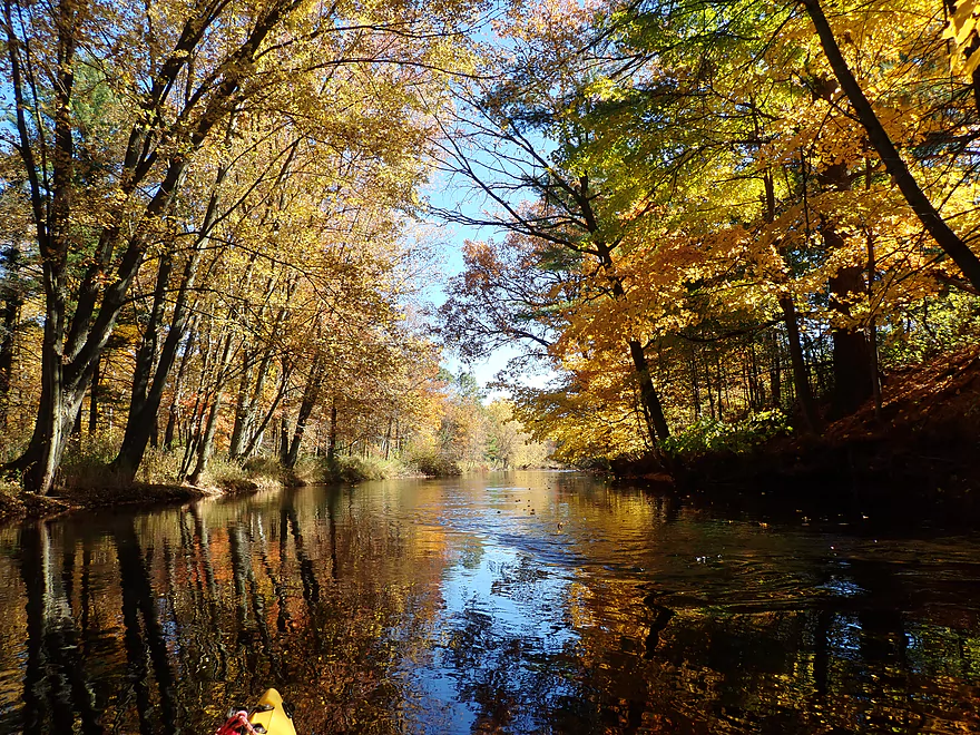
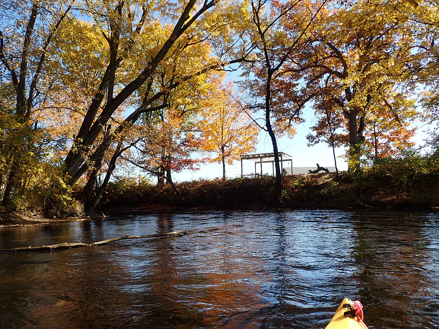
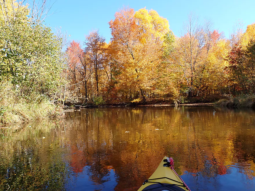
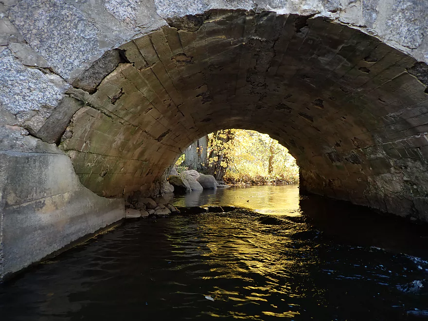
A golden cathedral
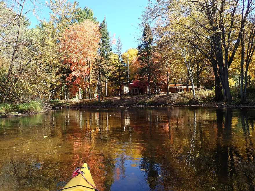
A few cabins…not too many houses on the river though
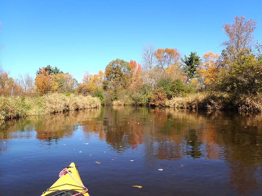
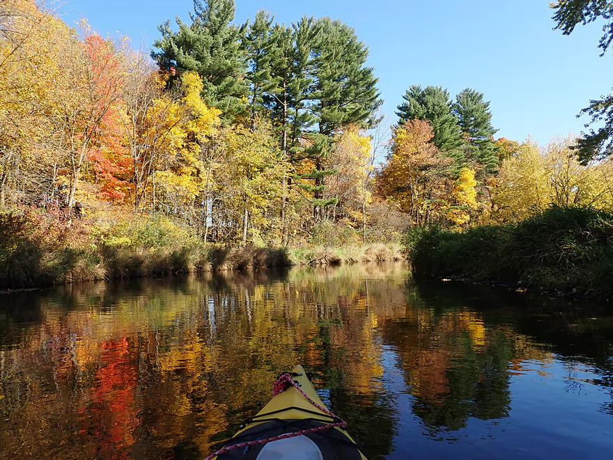
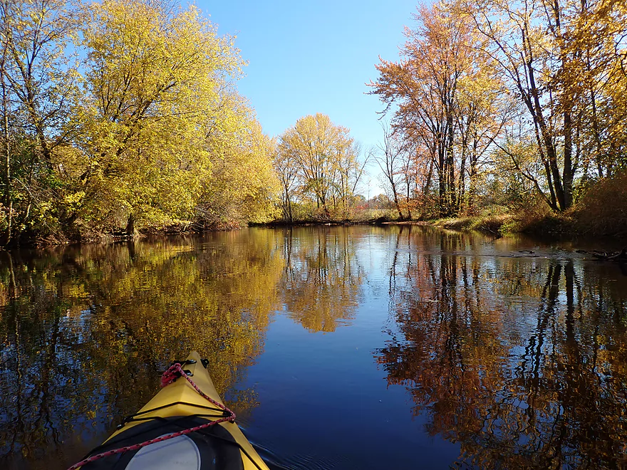
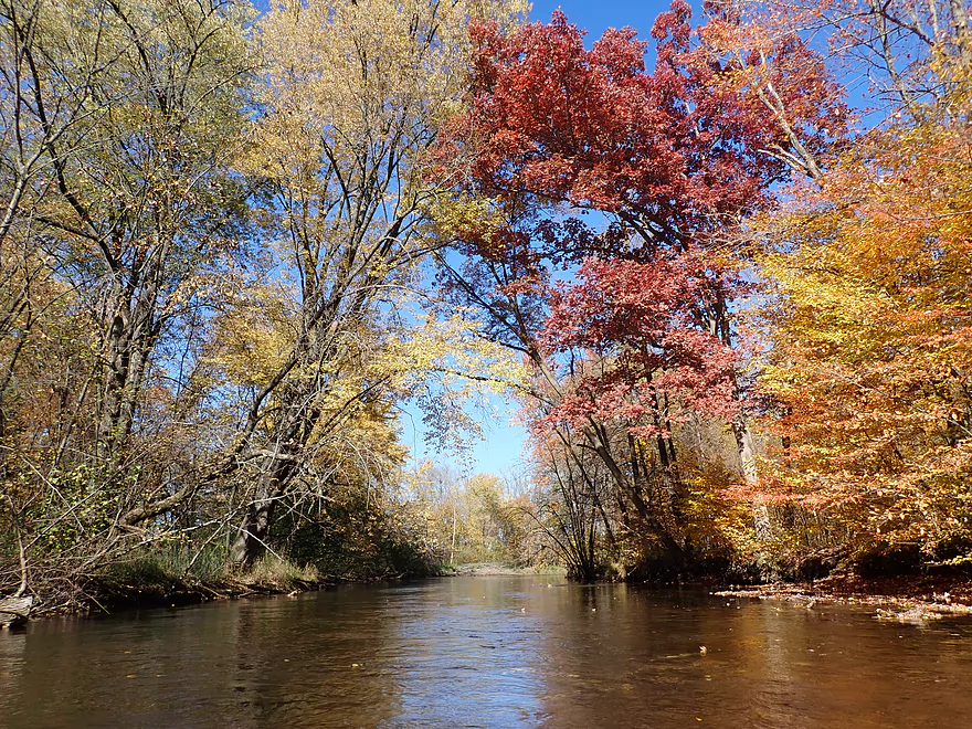
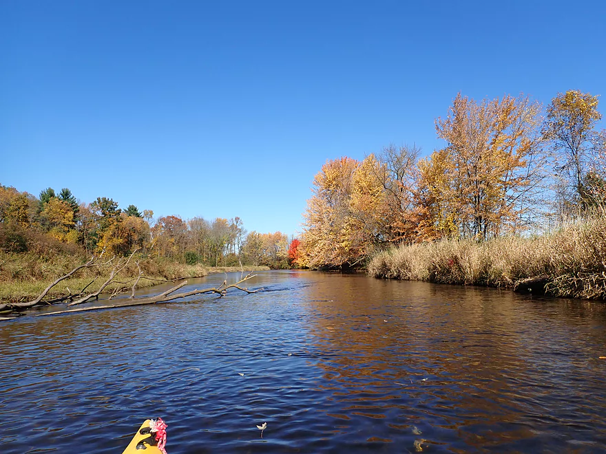
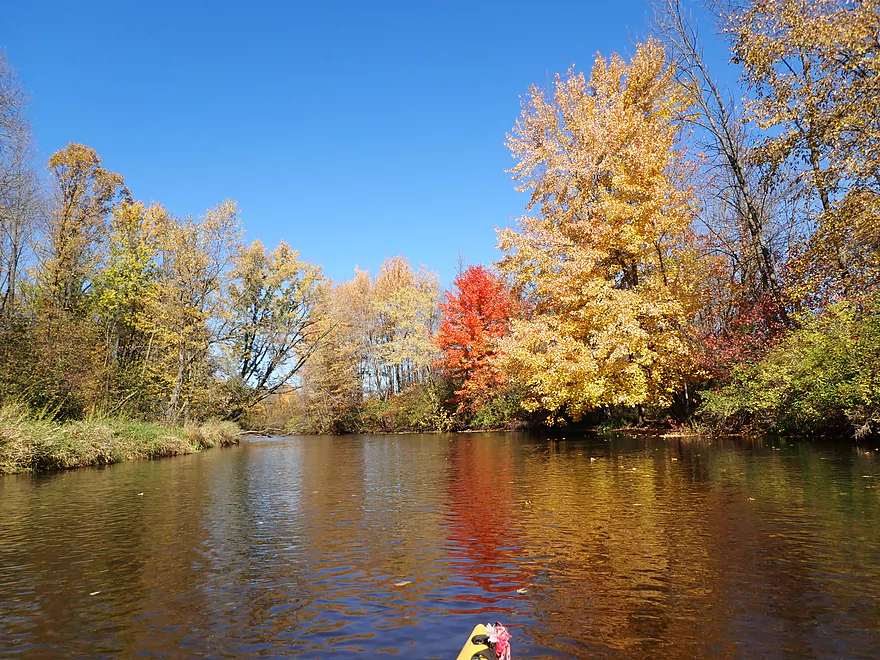
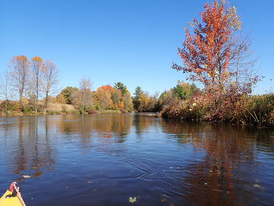
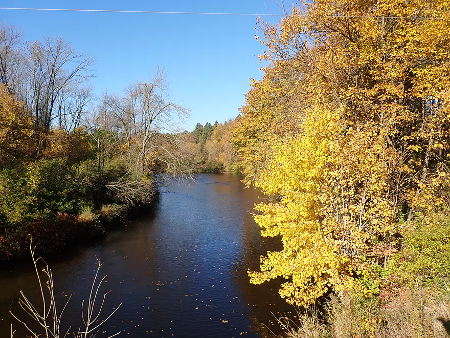
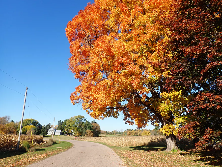
Fantastic color
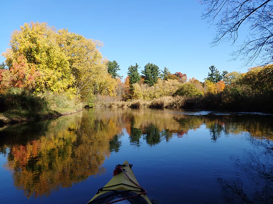
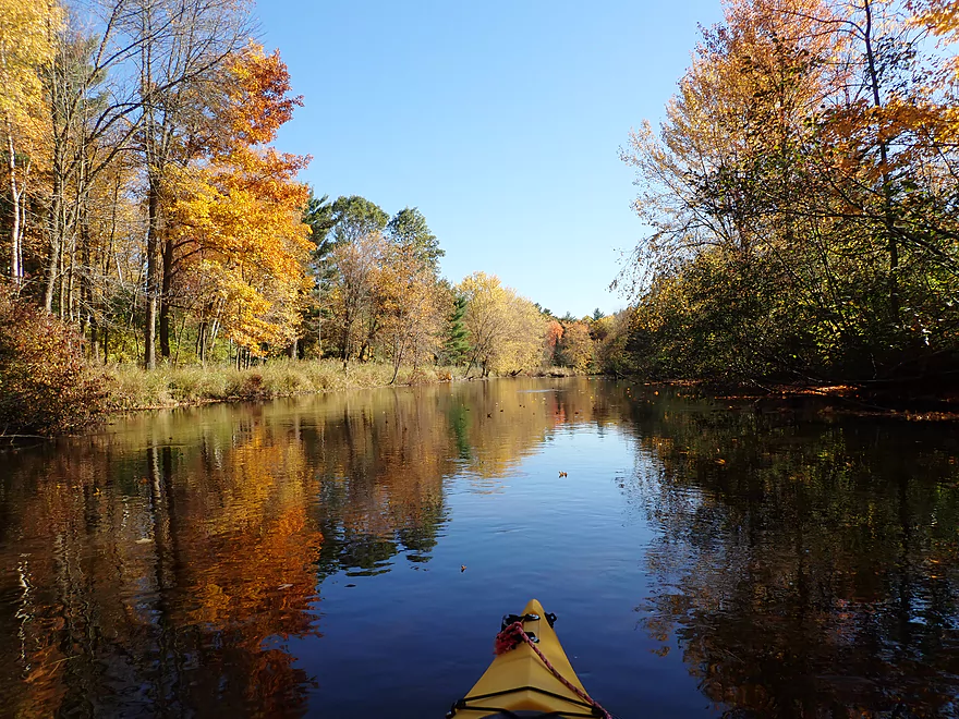
Great reflections
Occasional pines towered over the hardwoods
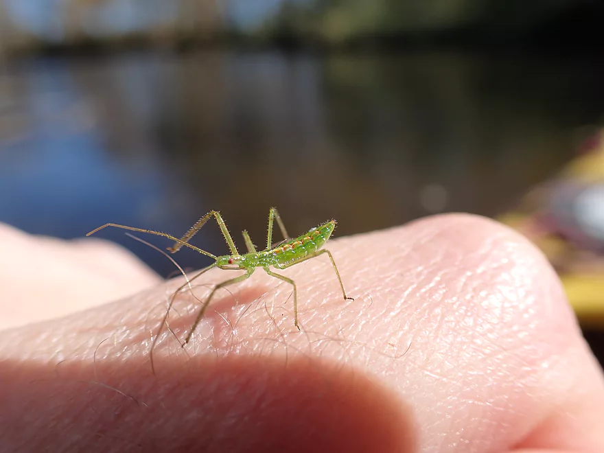
A friendly little insect nymph
Hwy KK
Current wasn’t too fast…kind of a lazy river
Bigalke Road
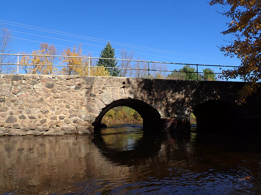
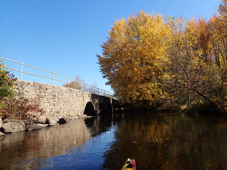
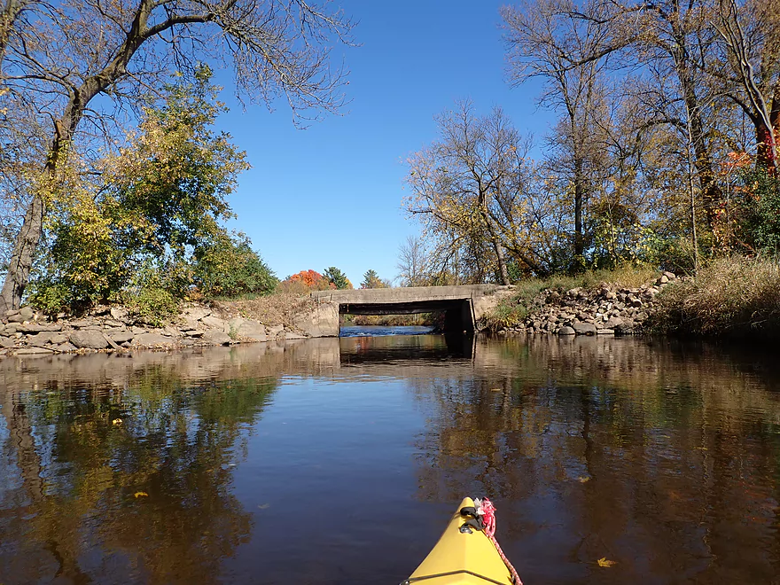
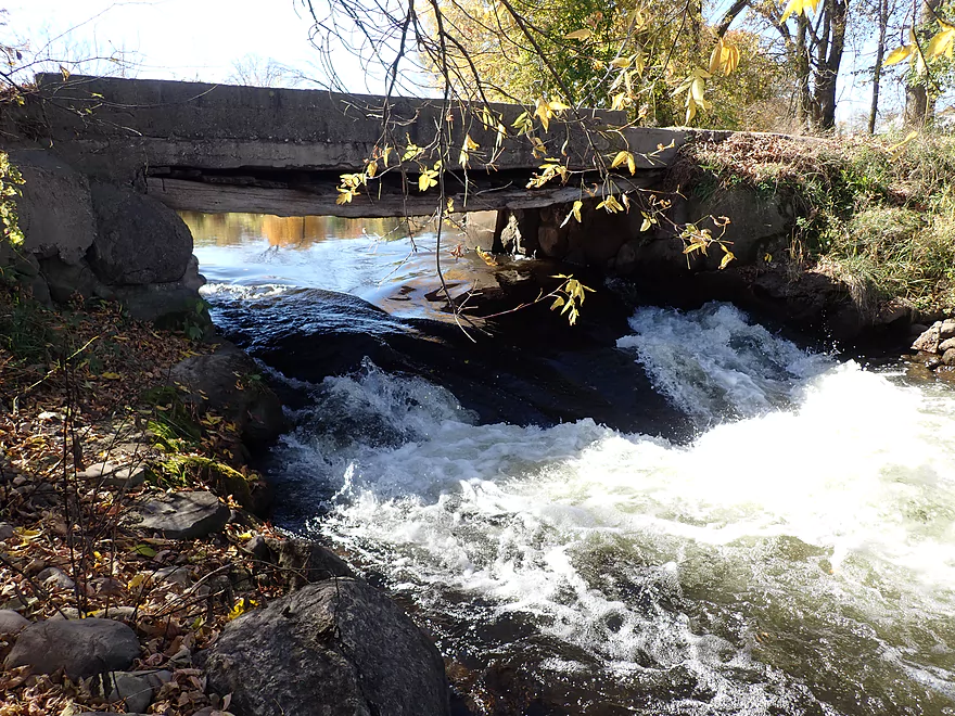
A cool one-lane stone arch bridge
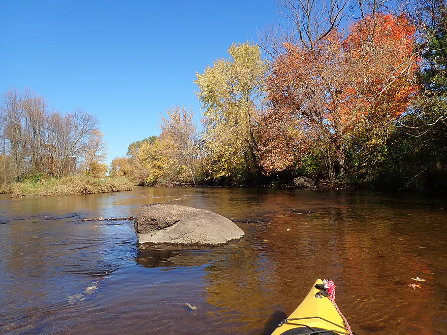
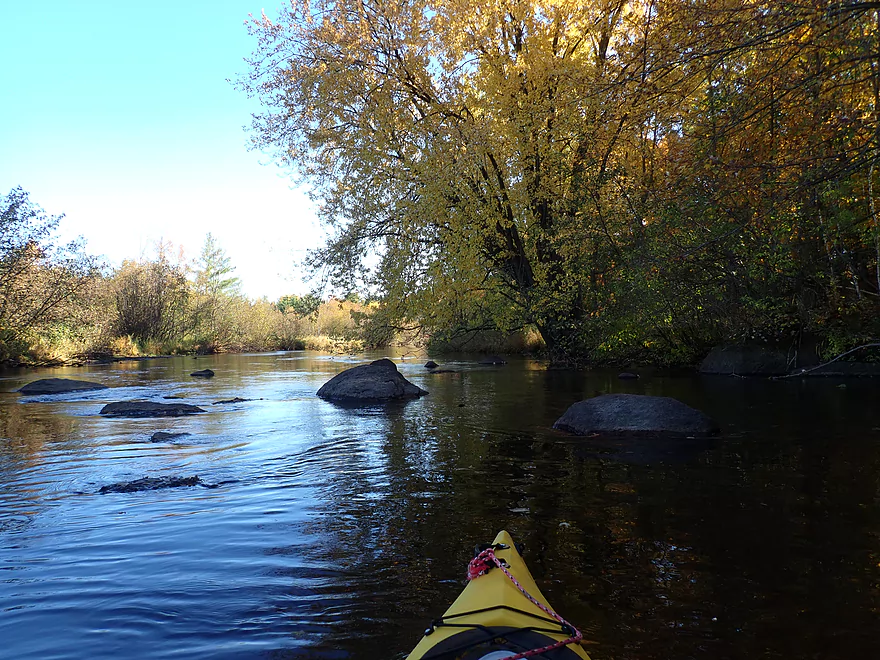
Starting to see more rocks
A farm bridge
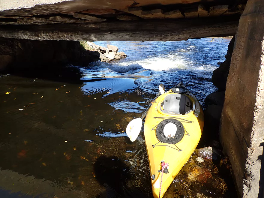
Class 3 rapids–I decided to portage
You can’t see it…but there is a hole at the bottom
Portage re-entry
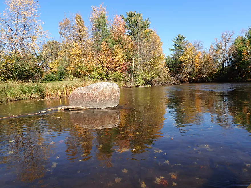
A large glacial erratic
Starting to see more pine trees
The last mile was the most scenic
Trees on fire
One of a few light riffles
Reverse view
Home stretch
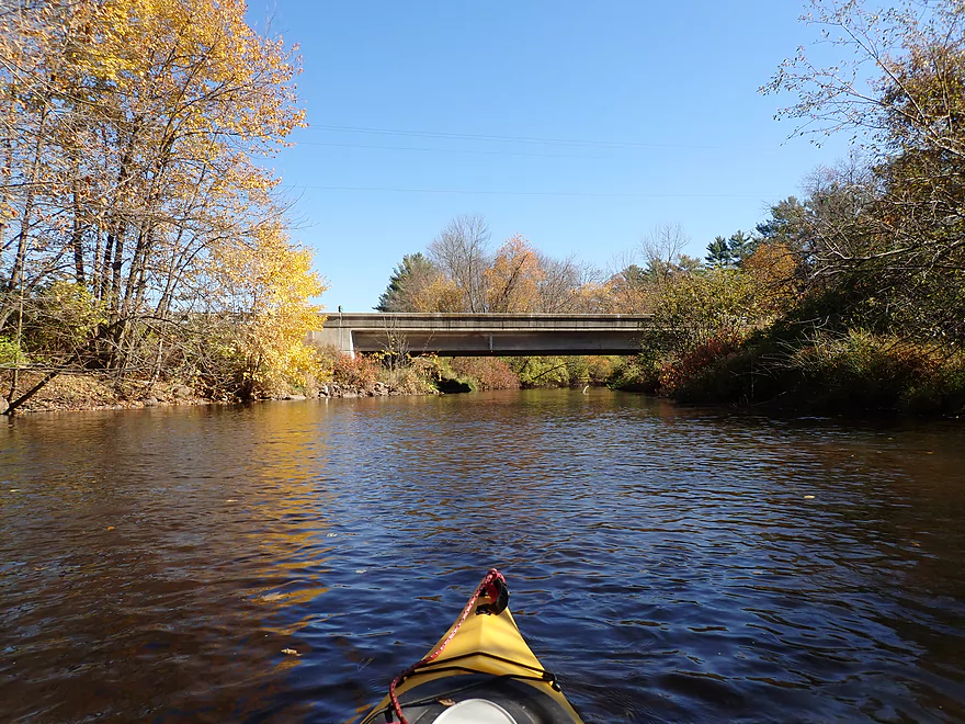
Hwy 22
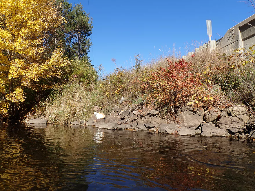
A cat nonchalantly watching me float by
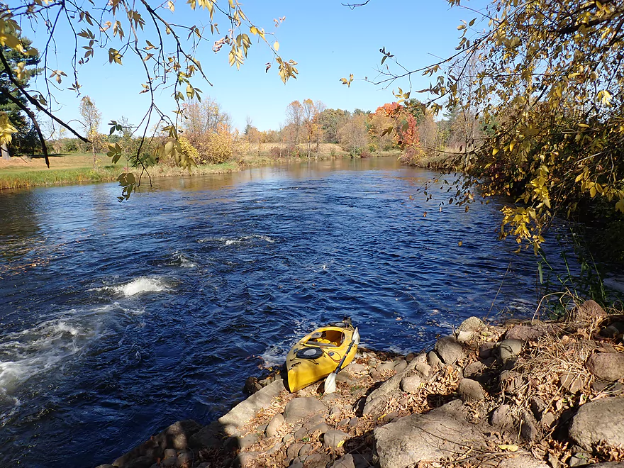
Taking out on the northwest bank
Nice view upstream
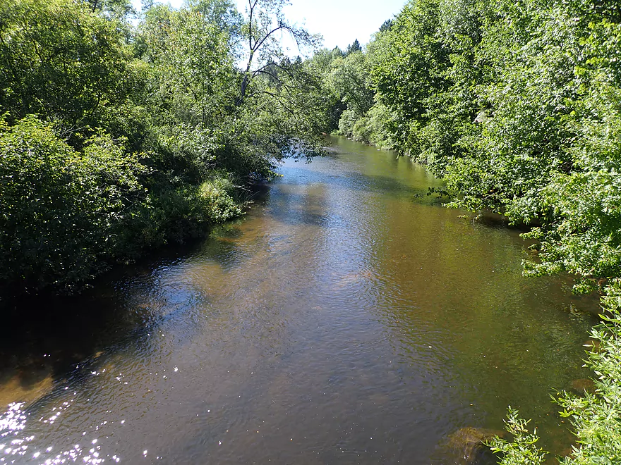
Same view August…what a difference two months make
Bike shuttle was scenic
Scouting Hwy 49 (future trip)
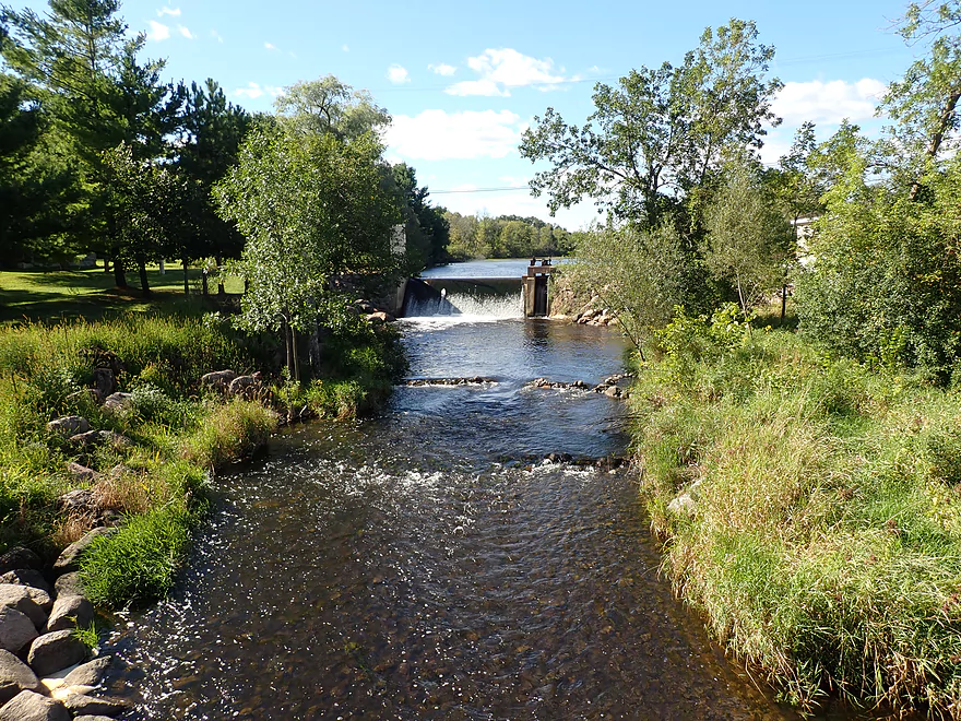
Scouting the Scandinavia dam
Looks like a nice stretch by Mill Street
Little Wolf – South Branch – Hwy K

The Little Wolf River in central Wisconsin is a classic water trail known for its fun rapids and incredible boulder gardens. Less well known is its South Branch tributary which few paddle. I scouted it in depth during my Manawa trip a few months ago and liked what I saw, so I committed to doing this river. There are many sections of the South Branch that can be paddled, but I chose to do the downstream leg which appeared to have the fewest logjams.
I started the trip at Hwy K which was a very nice bridge access. The first leg of the trip (Hwy K to N. Military Road) was 1.4 miles and the most wooded stretch of the trip. There were some downed trees here and there…four of which required hopping or ducking to get past. But it wasn’t bad, and I never had to portage for the entire trip (if required the portages wouldn’t have been difficult). Highlights for this leg included several mini-bluffs and a small boulder garden just upstream of N. Military Road.
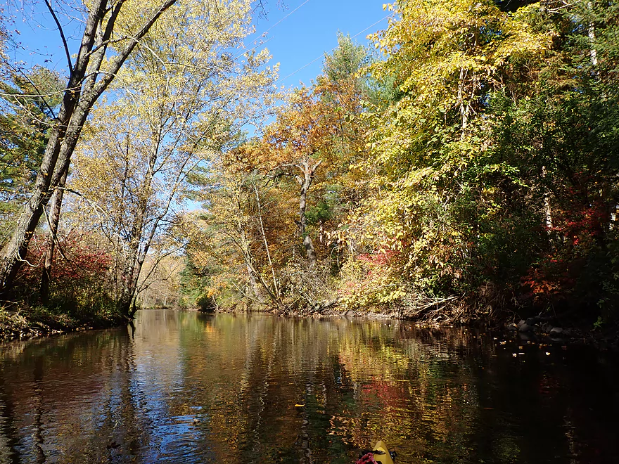
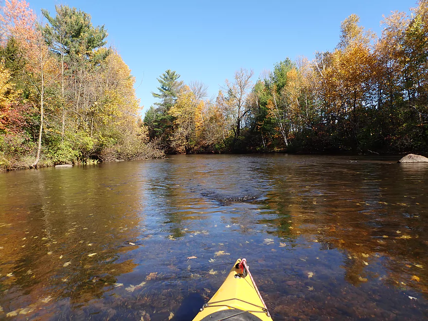
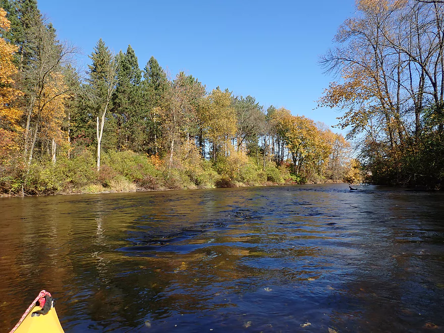
The second leg of the trip (N. Military Road to Hwy KK) would span 2.1 miles. N. Military Road isn’t as nice of a bridge access as Hwy K, but is doable…and scenic. A passing car double-parked on the bridge to take pictures of my kayak back-dropped by some wonderful fall color. This leg was more open with far fewer trees…but the trees that were there had phenomenal color. In fact…in terms of the best leaf color I’ve ever seen on a paddling trip…this might be tops. We were quite fortunate in 2020 to have a really nice sweet spot in early October. In previous years early wind and rain have largely ruined fall color.
The corridor flanking the river was mostly void of development, but in several spots there was a lot of noise. This included chainsaws, farm machinery, and the loudest gunshots I’ve ever heard. Just upstream of the Hwy KK bridge is the “Wisconsin Law Enforcement Association Campground” where an individual was shooting a high-powered rifle in the general direction of the river. I think paddlers are protected somewhat by the river banks, but it is disconcerting having somebody shoot over a public river that could have paddlers. Hwy KK itself is a no-go for a take-out. While it is likely legal to use the DOT right-of-way to take out here…there are unfriendly signs everywhere letting the public know they aren’t welcome.
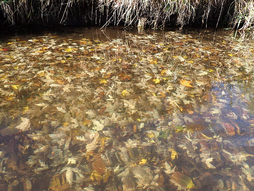
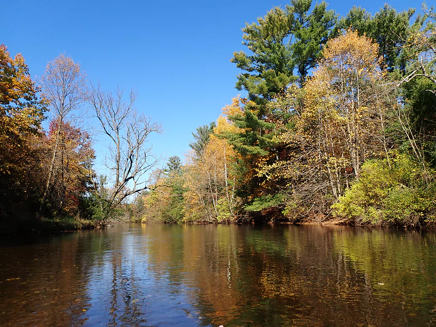
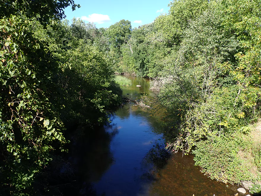
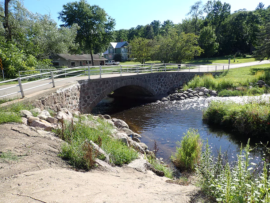
The third leg of the trip (KK to Bigalke Road) spanned the next 1.1 miles. This was a bit more wooded, but still scenic with fantastic fall color. The South Branch reminded me somewhat of the Mecan River because of its occasional clarity (albeit not as good as the Mecan’s) and still water that created picturesque tree reflections. Bigalke Road is a good access option and very scenic. The bridge itself is an old one-lane stone arch bridge that is a treat to paddle under.
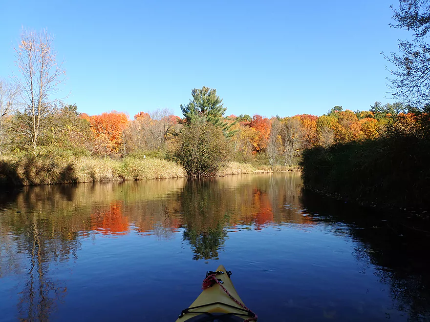
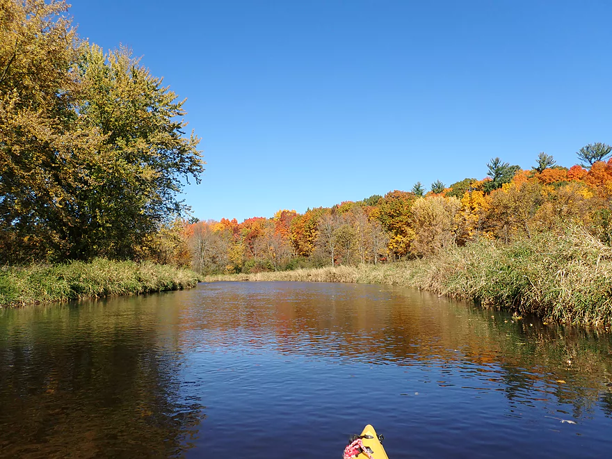
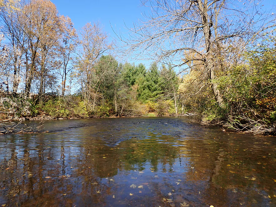
The forth and last leg of the trip (Bigalke Road to Hwy 110) spanned 1.7 miles. This was the best part of the river and by itself I would rank five stars. I finally started seeing more small boulders, riffles, and pines (although not too many). While this trip was devoid of serious rapids (unlike the Upper Little Wolf), it did have a surprise Class 3 under a farm bridge. At first glance it looked like a Class 2 that dropped two feet…but because of the irregular boulder placement it lacked a clear line through. At the base of the rapids was a somewhat hidden but small hole (which you can’t see from my video). Perhaps I could have made it through ok…but I decided to portage. I made this unnecessarily difficult by portaging up the steepest banks…when in hindsight I should have simply gotten out further upstream and chose the west bank, which would have been much easier.
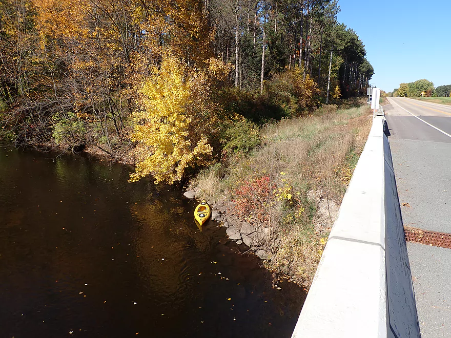
I took out at Hwy 22, which had a longer embankment to walk up, but wasn’t bad. I had scouted this same bridge in August, and it was remarkable what a difference the change in seasons had caused. Before, the river was overgrown with many monogamous dark green leaves blocking out the sun. But now in October the scene was so much more vibrant with bright reds and oranges. The thinning trees and died up grasses also let more light shine on the river. If you’ve never done an October paddle before, you’re missing out on a real treat.
In summary the South Branch was a great trip I enjoyed. I should clarify first though…it is not in the same league as the Main Branch. If you’re new to Little Wolf paddling…you likely want to start with Wolf River Road to Big Falls…or Big Falls to Hwy 110. But, I will say the South Branch is more peaceful and secluded than the Main Branch, and those looking for a new area adventure will enjoy it. I tend to cut my trips short so I have time to take pictures and videos…but those preferring a longer paddles may want to consider going 3.2 additional miles to the mouth…and then an additional 2.9 miles to Royalton (now on the Main Branch). These two legs are neat prospects with good boulder gardens and rapids that I’ll likely do as a future trip.
Sights included turkeys, one frog and several eagles. The highlight was a white cat sitting on the bank peacefully watching me float by.
Hwy K: This was a very good bridge access. Shoulder parking is available on the downstream/south side.
Alternate Put-ins:
- Sunny View Road (3.4 miles upstream of Hwy K): This stretch looks more wooded and may contain 3-4 logjams.
- N. Military Road (1.3 miles downstream of Hwy K): Ok bridge access but tight shoulder parking (Hwy K is a better access). This stretch does have four downed trees, but I was able to barely squeak by without portaging.
Hwy 22/110: This was a mediocre bridge access. The road is busy, the banks somewhat steep, and a guardrail means you have to drag your boat a bit further to reach your car. It’s all doable though.
Alternate Take-outs:
- Bigalke Road (1.6 miles upstream of Hwy 22/110): This is a very good bridge access. But if you take out here you miss out on the best stretch of the river.
- Royalton Canoe Launch (6.1 miles downstream of Hwy 22/110): There is a good public access located downstream from the bridge. Don’t use the upstream access as that is private. This is a longer stretch but a good prospect with several boulder gardens and rapids.
Hwy 110/22 to Hwy K: 4.2 miles with 52′ of ascent. This is a mediocre shuttle. There are a couple of hills, but it’s not too bad. Traffic is light and it’s a scenic rural route.
Fences/Low Bridges: None
Logjams: I didn’t have to portage any logjams. However, there were four downed trees between Hwy K and N. Military Road that required hopping/ducking to get through. They wouldn’t have been super difficult portages if required. The river was surprisingly open after N. Military Road.
Rapids: There are a few minor riffles here and there…nothing worth noting. The one exception is a Class 3 chute located below a farm bridge (here). It looks like a Class 2…but is IMO a Class 3 because the irregular rock placement prevents a clean line through and the drop is significant (maybe 2′). There is also a small hole at the bottom of the chute which is tough to see from the approach. The portage is doable, but you want to take out on the early side as the banks by the bridge are somewhat steep.
Nearest Gauge (Little Wolf @ Royalton): ~1.6′. Note, USGS tragically stopped reporting statistics for this gauge in 2020 “because of budget cuts”. NOAA though still reports on this gauge…but only for the past four days and without CFS.
- 0-1.21′: The river rarely gets this low, but when it does paddlers can enjoy great clarity. You might have to wade past a few sections, but I suspect the river is navigable at these low levels.
- 1.21′-1.5′: An average later summer depth good for paddling.
- 1.5′-1.8′: River is above normal. Clarity isn’t as good but is still ok in spots.
- 1.8′-2.4′: A high depth. This is likely viable for paddling, but the river may not be as attractive at higher levels.
- 2.4’+: Perhaps too high for enjoyable paddling.
- Upstream of Madison Road: I don’t know much, but suspect there are sections up here that can be paddled.
- Madison Road to Tresness Road: 1.2 miles. Narrow, wooded with perhaps some nice pine trees. I don’t know much…could be a logjam or two. Tresness Road bridge is too low to get under so would have to be portaged.
- Tresness Road to Weinmann Road: 6.5 miles.
- Tresness Road to Veterans Memorial Park: 2.2 miles. This is mostly Lake Iola. It’s a mediocre lake with some nice marshy spots, but is nothing special. In later summer and fall, the upper portions can experience abundant weed growth which can make navigation difficult.
- Veterans Memorial Park to Town Line Road: 0.5 miles. Attractive stretch flowing through the outskirts of Iola. Highlights included nice bridges and great water clarity.
- Town Line Road to Hwy G: 2.0 miles. River opens up. This is a great stretch with exceptional water clarity.
- Hwy G to Weinmann Road: 1.6 miles. Good stretch that is more wooded, but still has great clarity. Some deadfall, but locals keep it navigable and no portaging is required. This leg features some faster current and some large granite boulders.
- Weinmann Road to Hwy B: 1.9 miles. From my scouting this looked really really nice. For those wanting to start in Iola, this would be a great bonus leg to include.
- Hwy B to Scandinavia Dam: 0.6 miles. This is Scandinavia Mill Pond, which is a generic impoundment…not super interesting, but not awful.
- Scandinavia Dam to Hwy Q: 1.9 miles. This is more wooded with some faster current, some rapids, and boulder gardens. Has a ton of potential, but there are likely a few logjams to deal with.
- Hwy Q to Hwy 49: 0.5 miles. Scenic leg, but maybe 1-2 logjams. Peterson Creek adds significant volume to the South Branch.
- Hwy 49 to Elm Valley Road1st Bridge: 3.4 miles. A really neat prospect with some boulders and rapids. Pretty wooded with perhaps 2-3 logjams.
- Elm Valley Road1st Bridge to Elm Valley Road2nd Bridge: 0.8 miles. A more wooded and congested section…with maybe 7 logjams.
- Elm Valley Road2nd Bridge to Elm Valley Road3rd Bridge: 0.9 miles. Maybe 2 logjams.
- Elm Valley Road3rd Bridge to Granite Quarry Road: 2.0 miles. Maybe 15 logjams.
- Granite Quarry Road to Casey Road: 2.1 miles. Maybe 18 logjams.
- Casey Road1st Bridge to Casey Road2nd Bridge: 3.5 miles. Maybe 8-12 logjams.
- Casey Road2nd Bridge to Sunny View Road: 1.3 miles. Maybe 1-2 logjams.
- Sunny View Road to Hwy K: 3.4 miles. A more wooded stretch with maybe 3-4 logjams.
- Hwy K to Hwy 22/110: 6.2 miles
- Hwy K to N. Military Road: 1.3 miles. Nice stretch that is more wooded. No portages, but four downed trees require some tight fits.
- N. Military Road to Bigalke Road: 3.3 miles. More open with no logjams. This is a very nice stretch with good scenery.
- Bigalke Road to Hwy 22: 1.6 miles. Maybe the best section on the river with good scenery. There is a Class 3 chute, but this can be portaged.
- Hwy 22 to Mouth on Main Branch: 3.2 miles. Likely a few nice rapids and boulder gardens, but not too many. A good prospect…maybe one logjam.
- Mouth to Royalton Canoe Access: 2.9 miles. Now on the main branch of the Little Wolf. Mostly slow, but there is one really nice section of rapids and boulder gardens.
Trip Map
Overview Map
Video
Photos Size: