
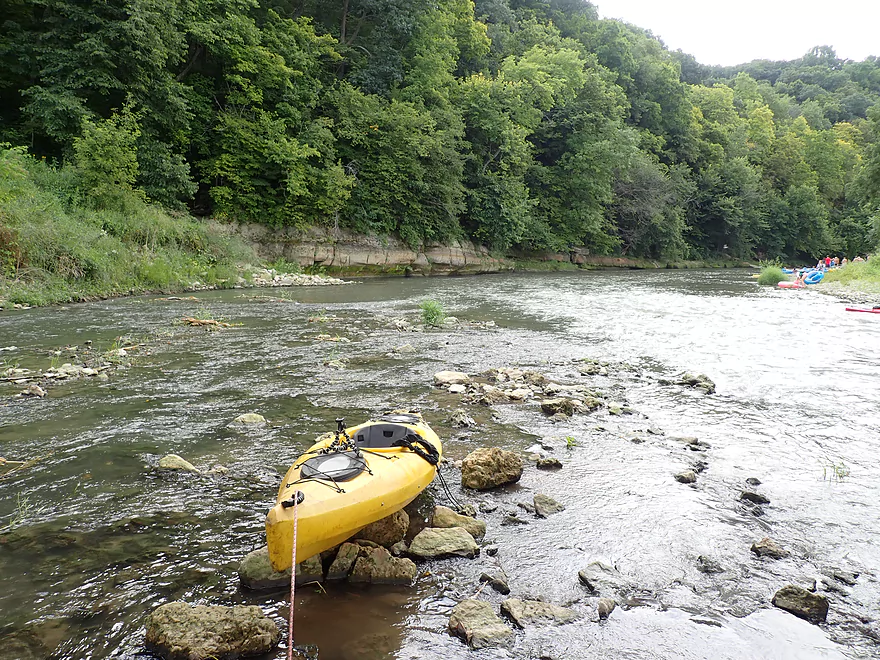
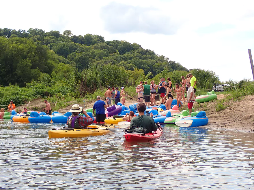
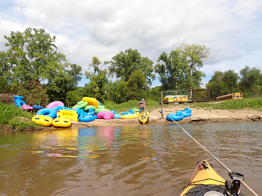
Launch area by Camel Ridge Road
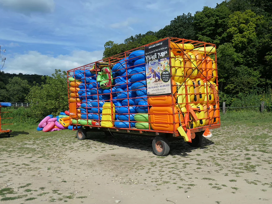
I love how these tubes are stacked in the hay wagon
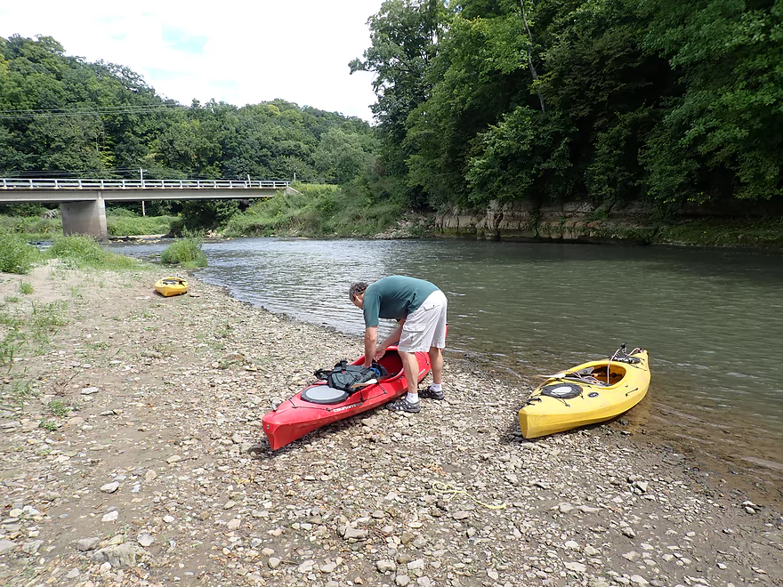
Nice gravel area for launching
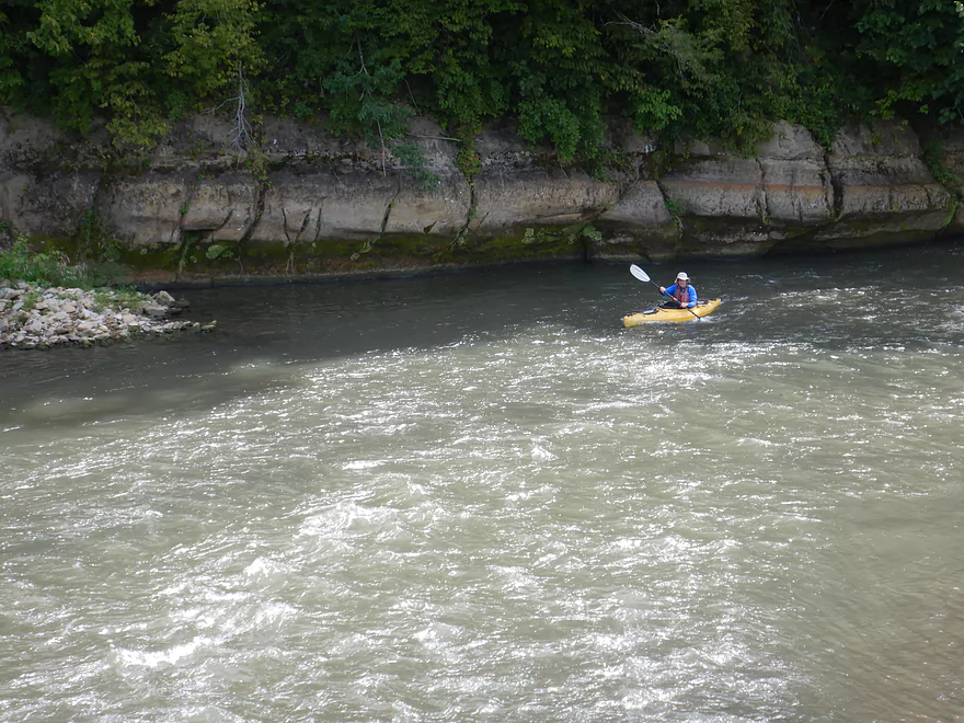
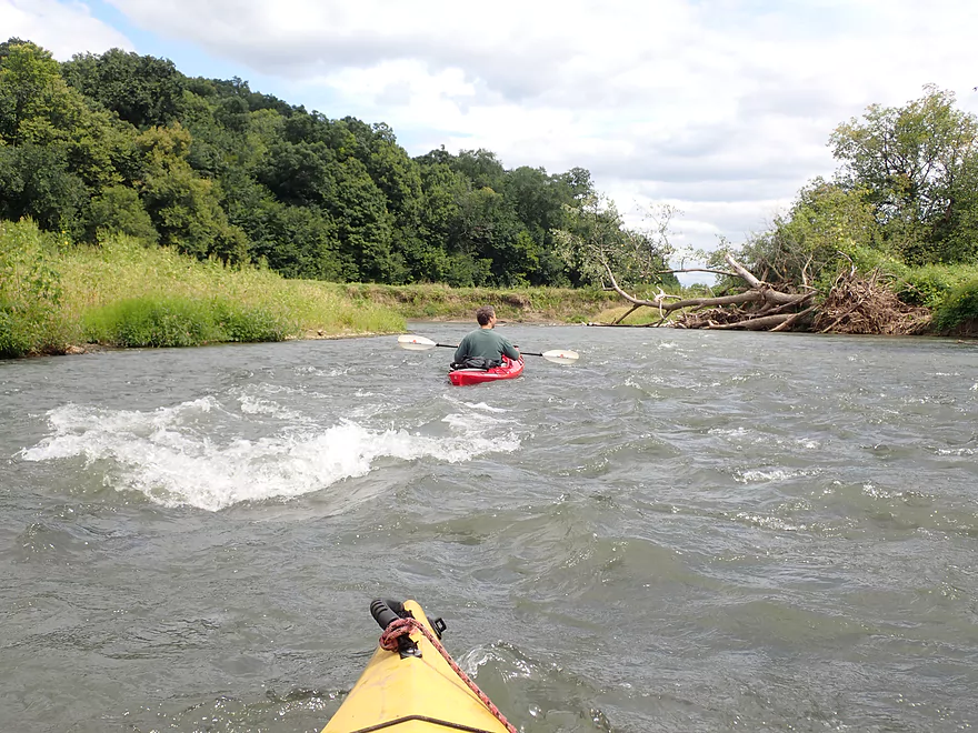
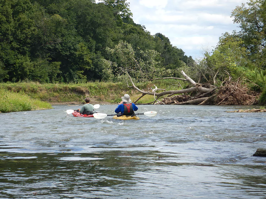
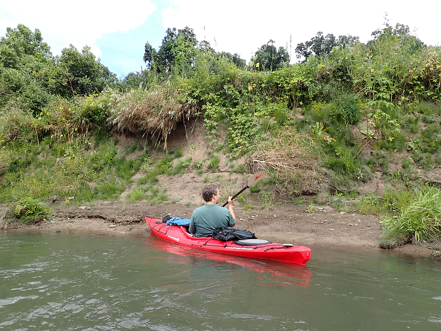
Paddling upstream to explore
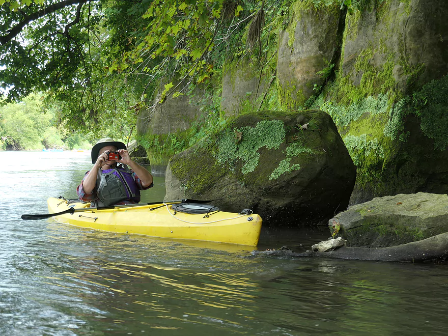
Getting out…
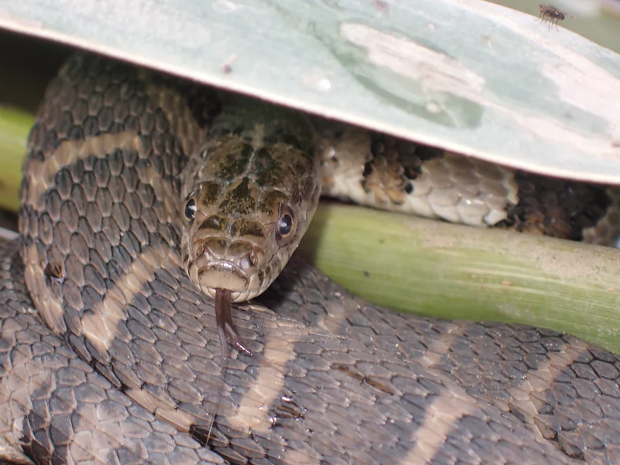
To photo this friendly water snake
There are rapids under the bridge
Class 2 and great fun
View from the bridge
The landing is on the right
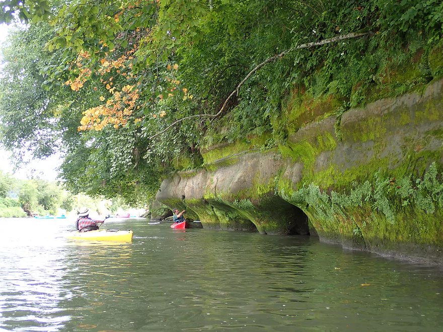
Scenic sandstone outcrops
Narrow Driftless valley
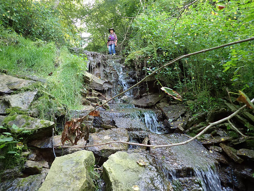
A surprise waterfall
Interesting plants growing under the current
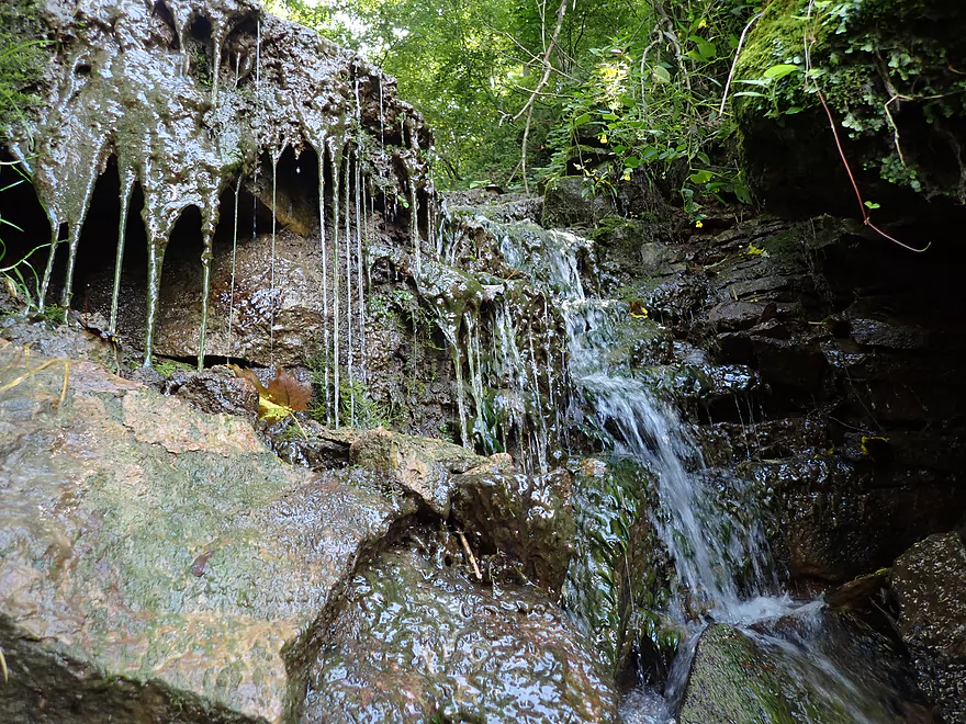
A bowl at the top which is fed by another waterfall
Cool surprise in the moss
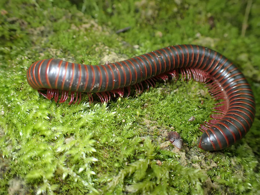
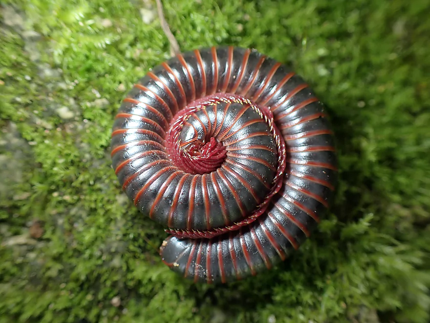
A millipede
Rocky shoreline continues
More rapids
These are just Class 1
No problem for the tubers
Some abstract wood art
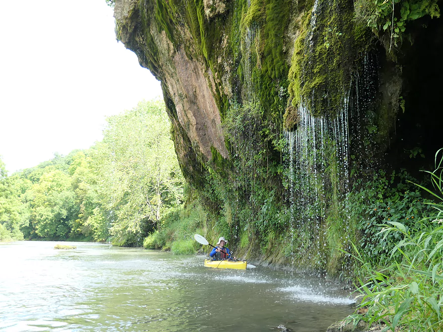
Coming up on the highlight of the trip
Streams of water rained down from this outcrop
Something you would expect in a rain forest and not Grant County
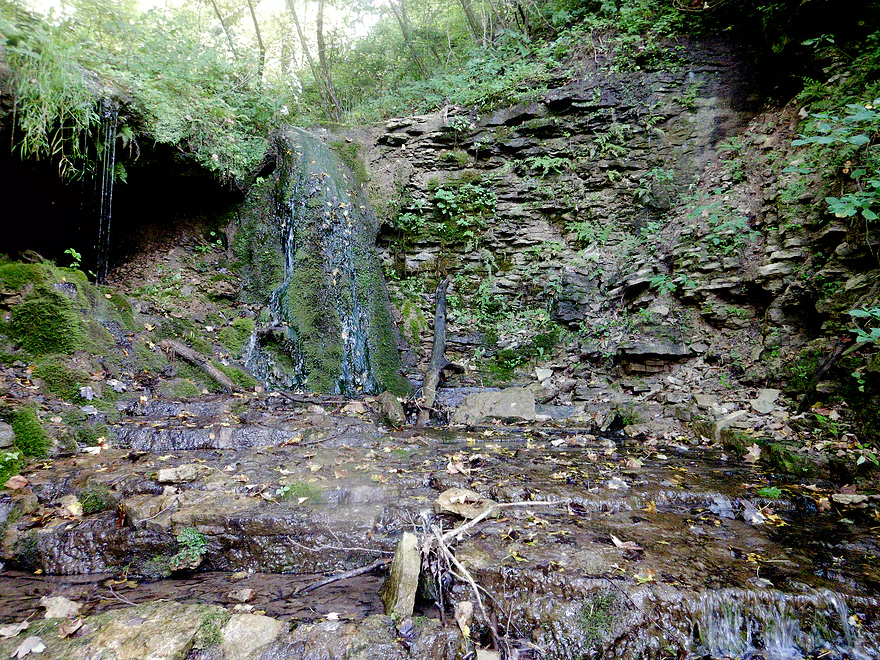
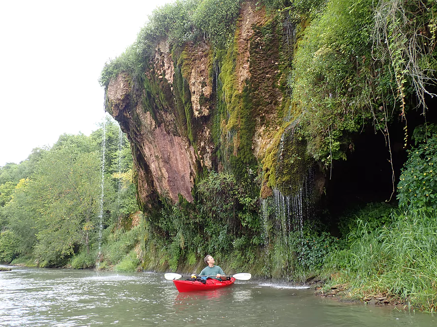
A hidden cave by the waterfall
Offers a great view upstream
…and down
Paddling behind the waterfall
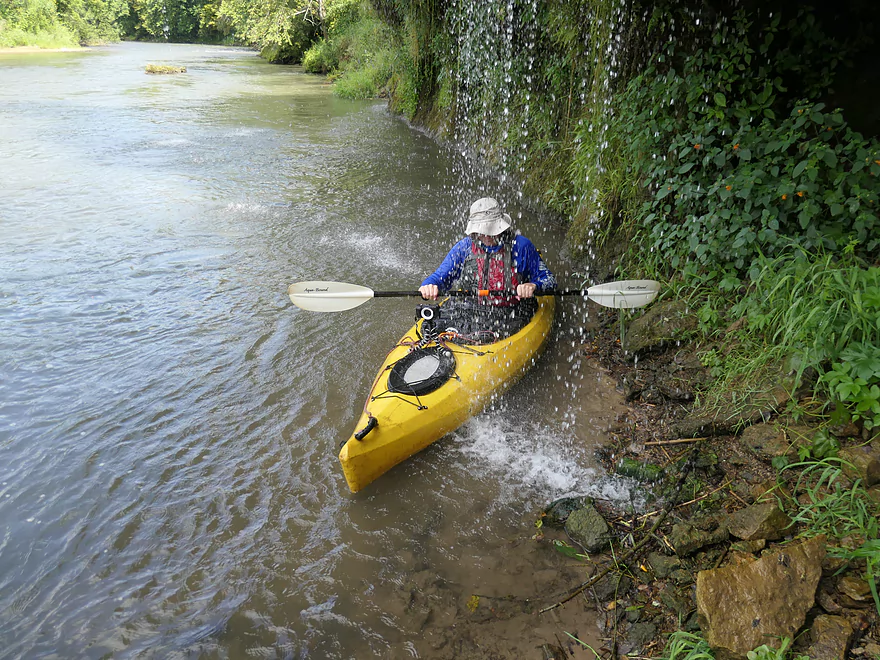
…and into it
Quite fantastic
Continuing on…
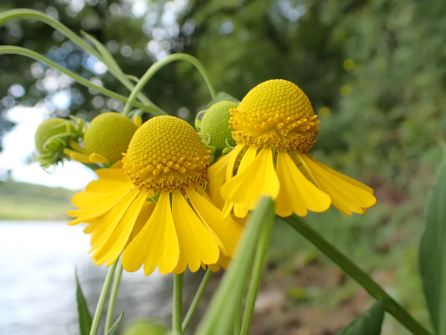
Sneezeweed…looks like Spaceship Earth at Epcot
More Class 1 rapids
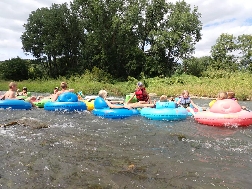
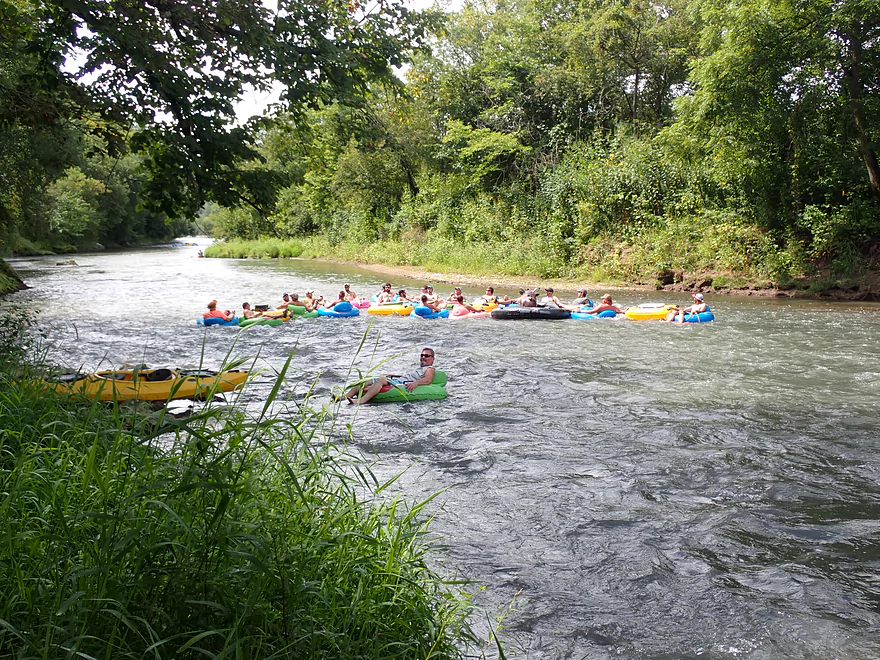
No problem for this tubing convoy
The Grant features large floods which bulldoze trees to the side
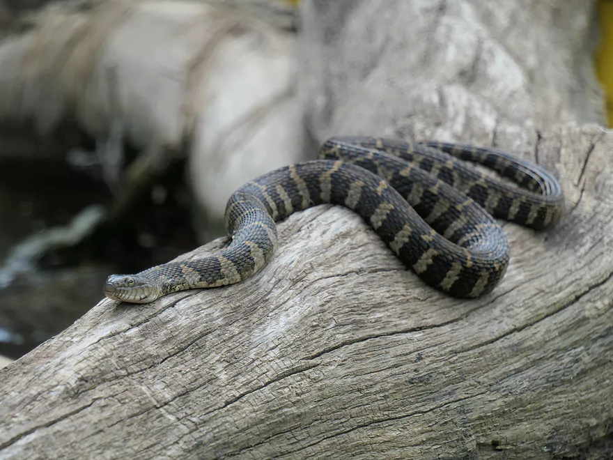
Water snake #2 of 3
Some mud banks, but not as bad as upstream sections
River takes a sharp turn east
And reveals another outcrop
Moss adds a nice touch
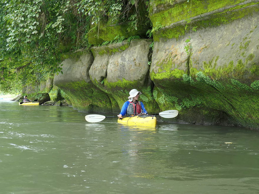
Quite scenic
And photogenic
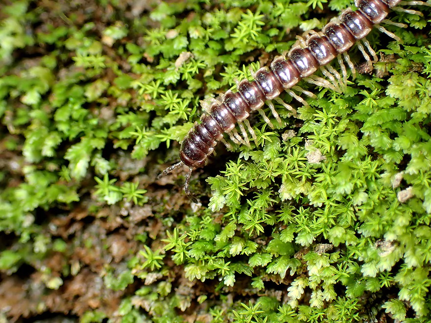
The wall was covered with millipedes
Some more exposed banks
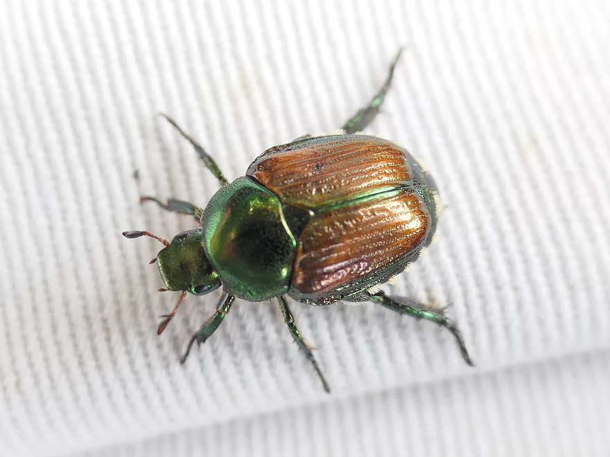
Japanese beetle (invasive but photogenic)
You can see the original river bed below the eroded sediment
Pretty simple paddling with no hazards
Japanese hops are an invasive plant that has plagued the Grant
Highish water buries some of the rapids
A slightly beat up section of the trip
A mudslide used by kids
A pit stop used by tubers
Future logjam
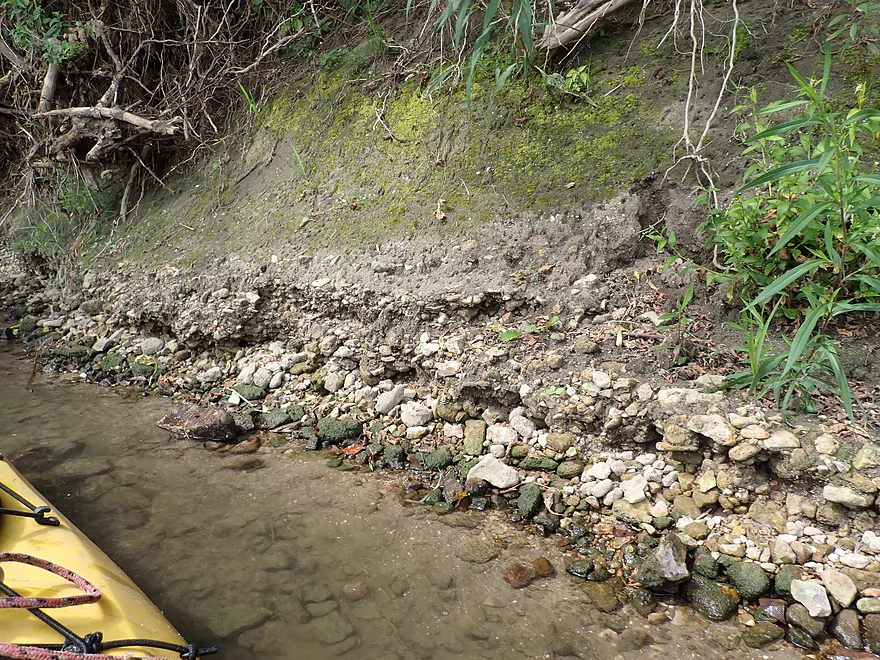
Topsoil erosion is a huge issue in Grant County
Some artificial bank work likely done to repair flood damage
Last of the rapids
Chaffie Hollow Road
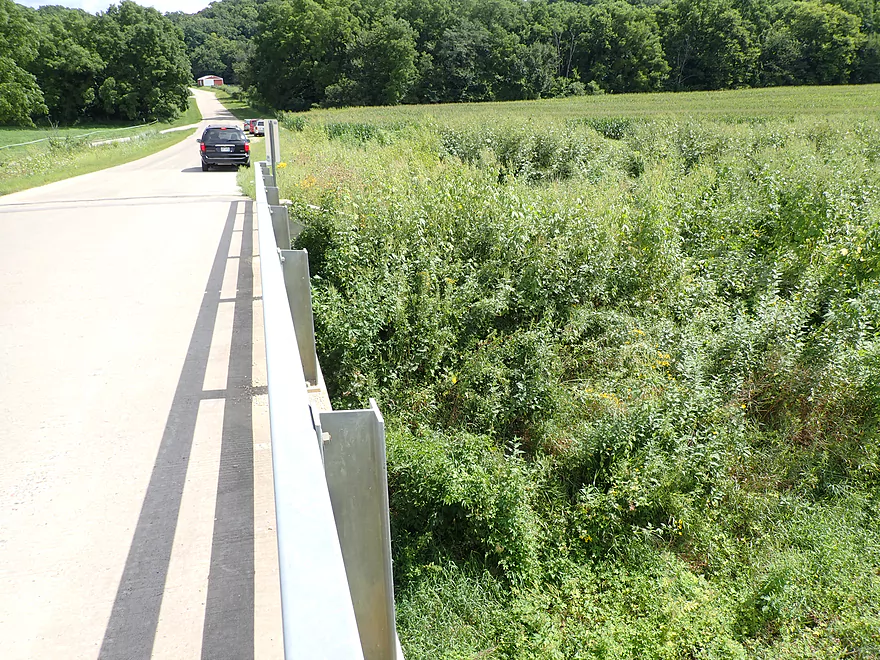
This would be a steep and weedy access
Instead we took out at the nearby landing
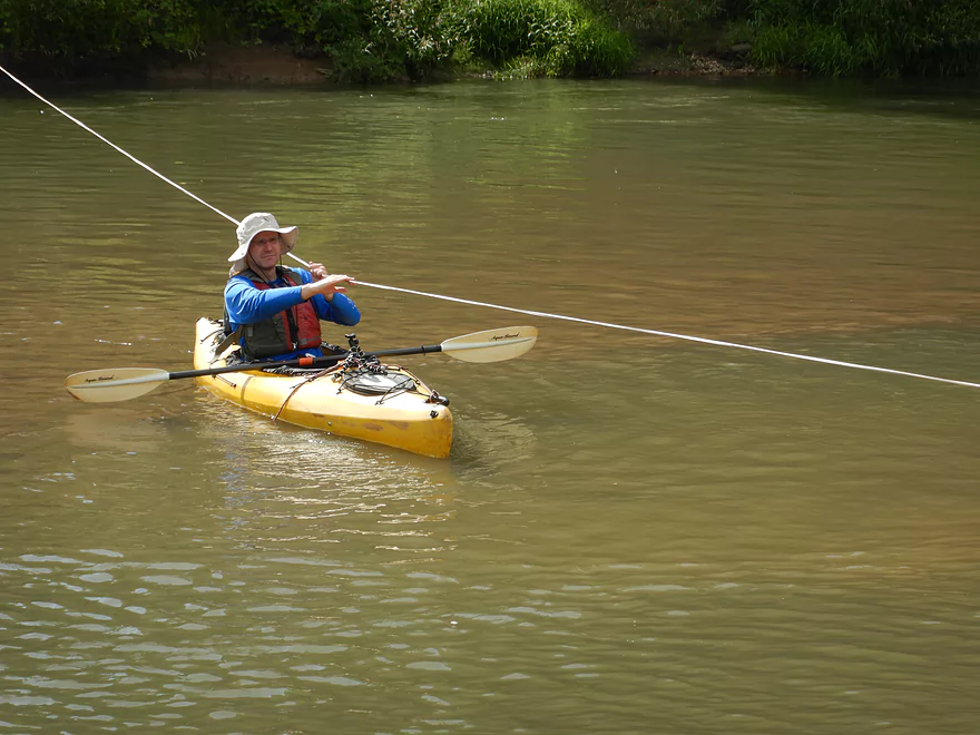
A convenient rope lets you pull yourself ashore
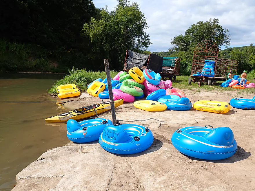
Pretty nice access
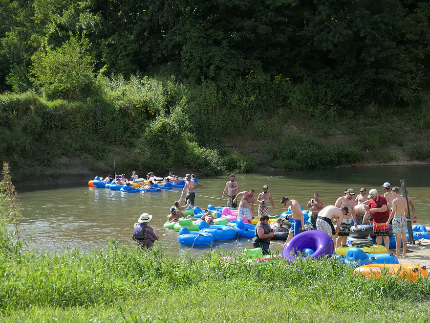
A large convoy taking out
Make sure you get permission from one of the three liveries to use this access
One of several rocky tributaries to the Grant…floods must make these interesting
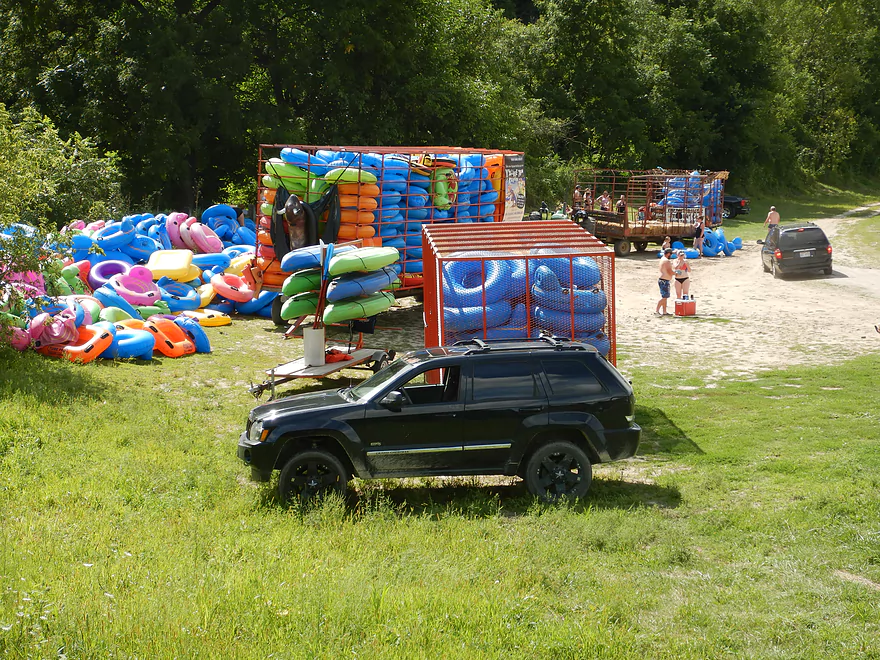
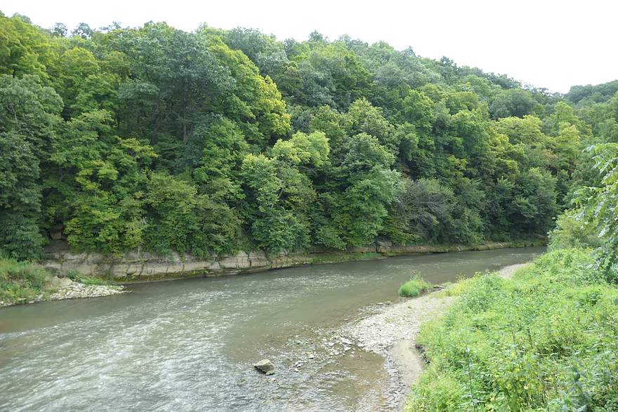
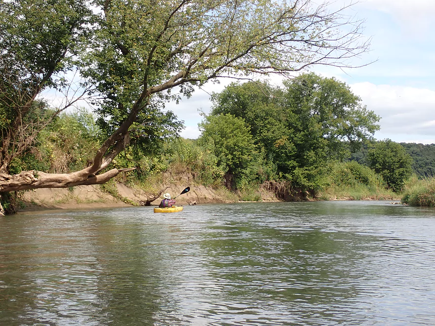
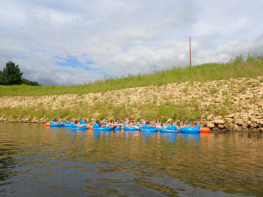
Grant River – Camel Ridge Road

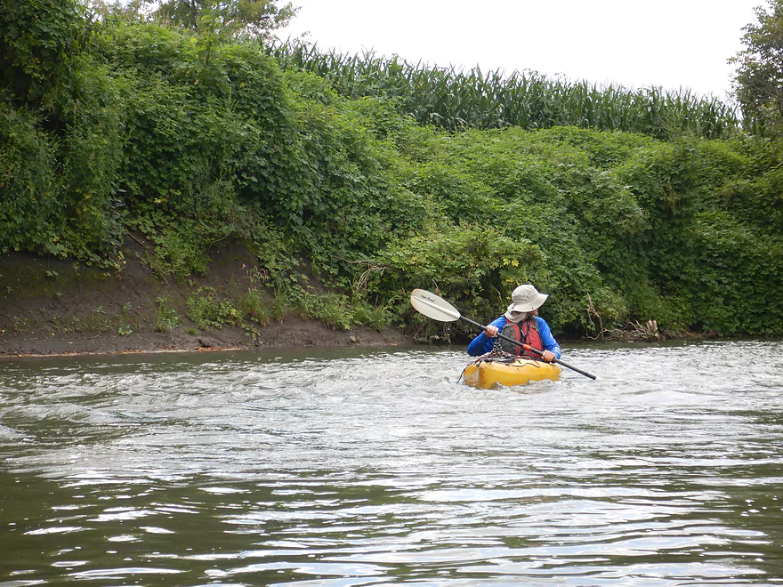
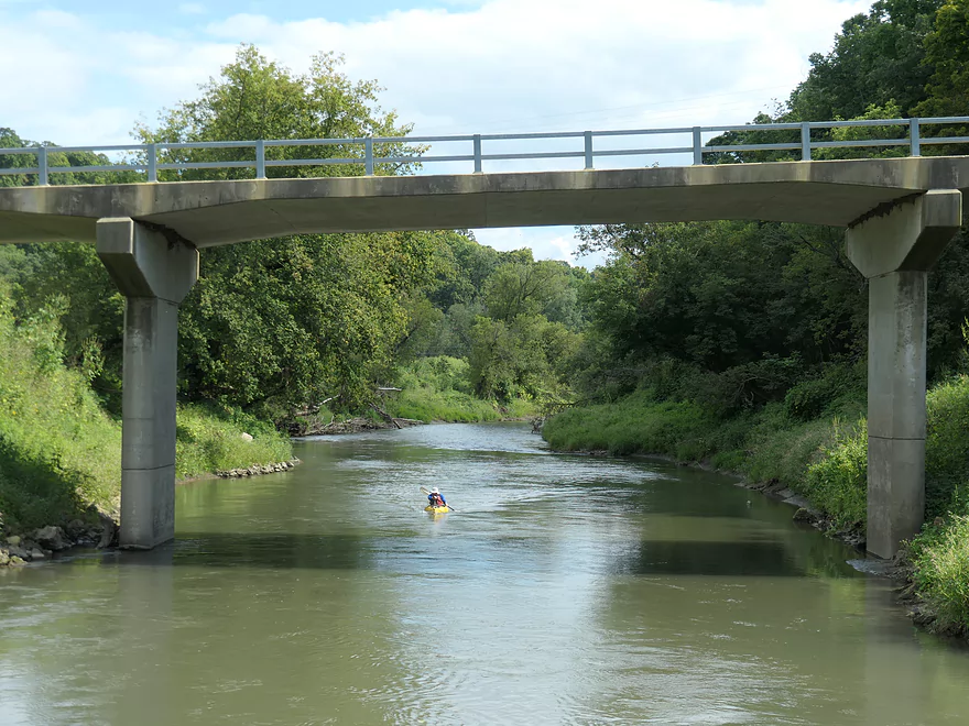
We started the trip at Camel Ridge Road which is a very scenic part of the Grant. Here Class 2 rapids roared under the bridge and a bluff towered over the put-in with scenic sandstone walls at its base. To my surprise, this was also a very popular staging area for tubers. Bright colored tubes were everywhere including in several large hay wagons. Many people, cars, and even a bus packed this access. Despite this landing being private, the owner is very nice and lets the public use it for free. This is quite the contrast to many of the other Grant River landings which are often private and exclusive. It’s unfortunate to see such “paddling feudalism” on such a nice river.
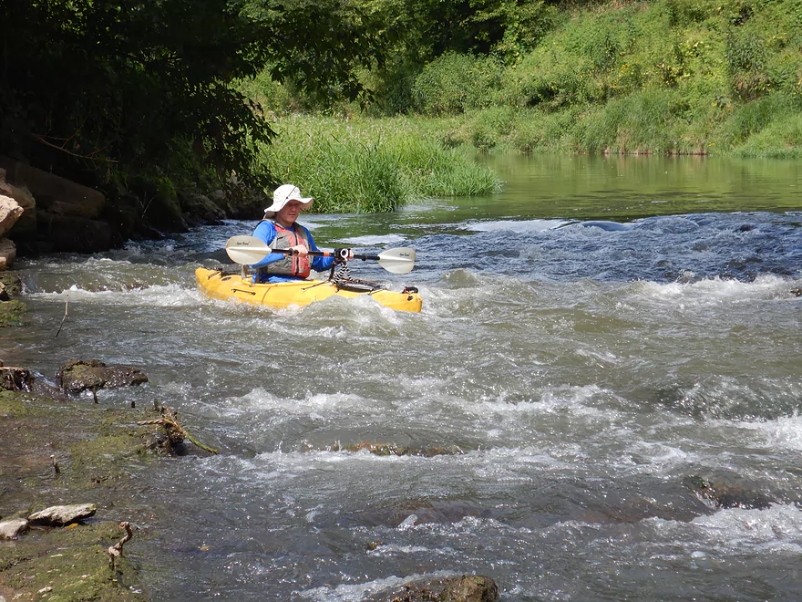
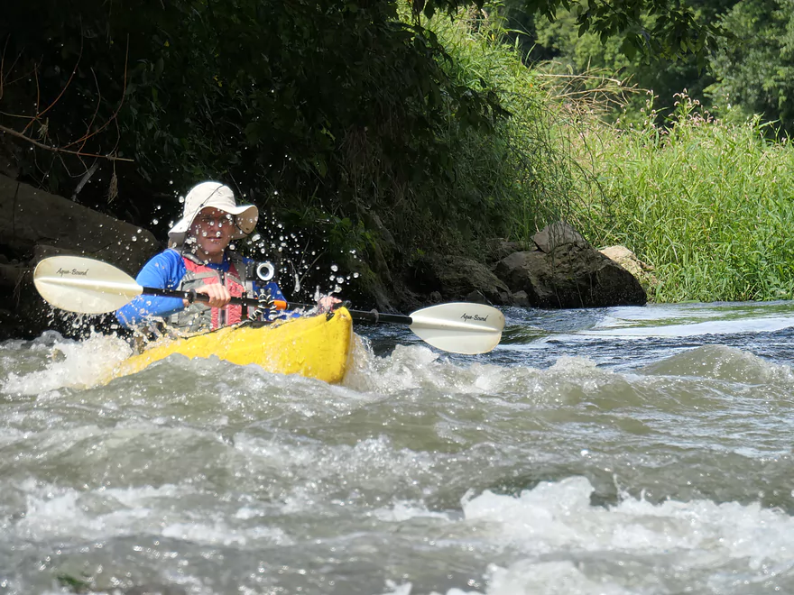
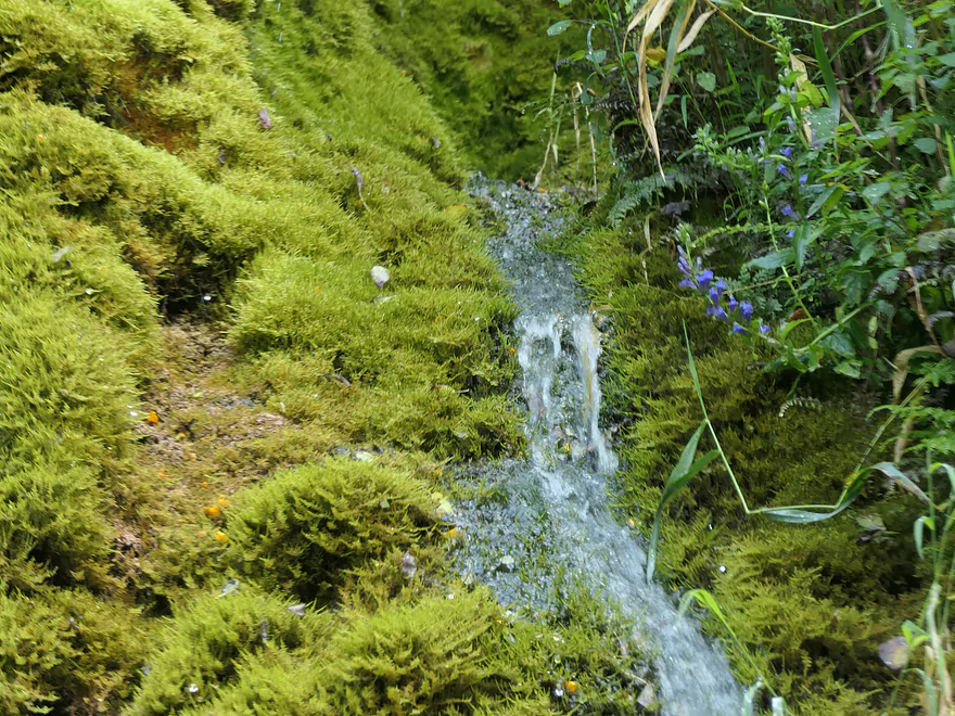
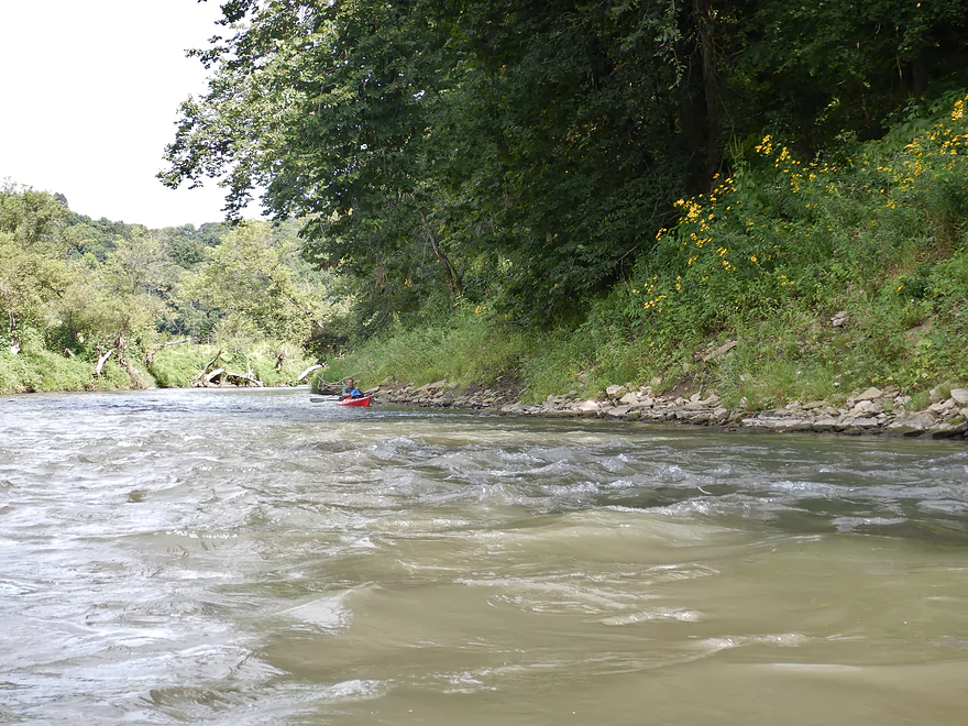
After launching, I went upstream to run the Class 2 rapids which were pretty fun. After the rapids, a scenic stretch of sandstone outcrops followed the east bank downstream. This was soon followed by a small ravine and waterfall that descended over a series of limestone ledges, moss and other plant matter before flowing into the Grant River. At the top was an open bowl which was in turn fed by another small waterfall…quite scenic.
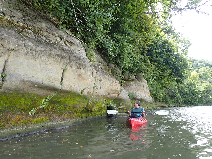
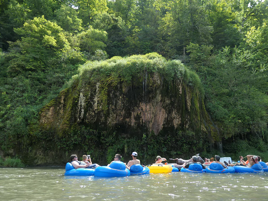
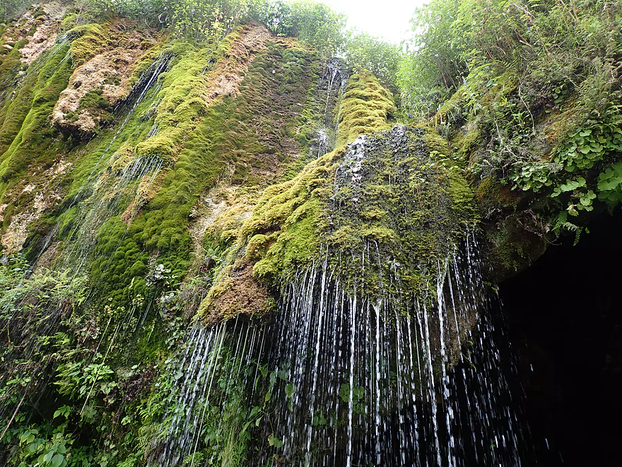
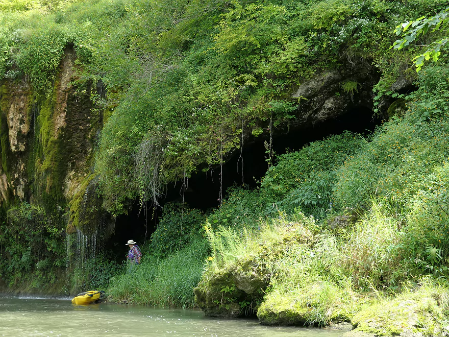
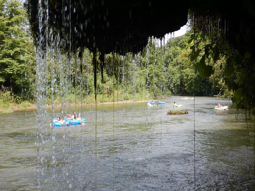
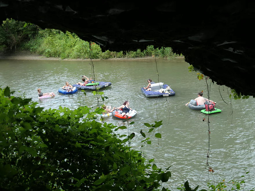
Following a brief set of rapids and many more tubers, we came across a much nicer and larger waterfall. Here a ~40′ sandstone cliff jutted out over the river with splayed out streams of water running over the top. Thick mosses grew on the rock surface and under the streaming water…something you might expect to see in a rain forest and not in southwest Wisconsin. Unaware tubers going down backwards would get quite the shower. I paddled through the main waterfall on purpose and was impressed with the volume of water coming off the cliff. Behind the rock face was a hidden cave which afforded a scenic vista of the river…especially when looking through the streaming water.
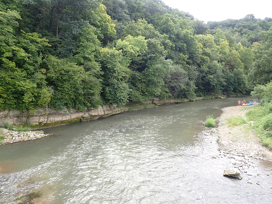
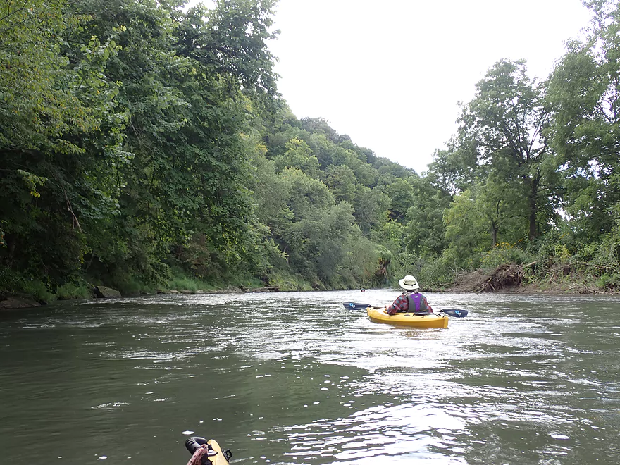
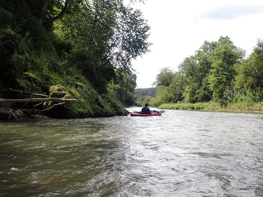
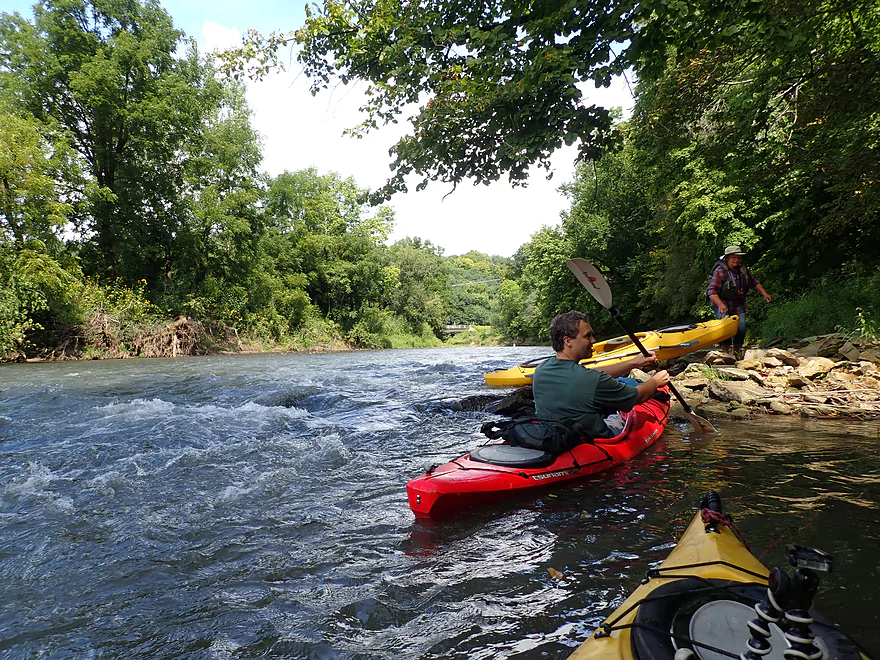
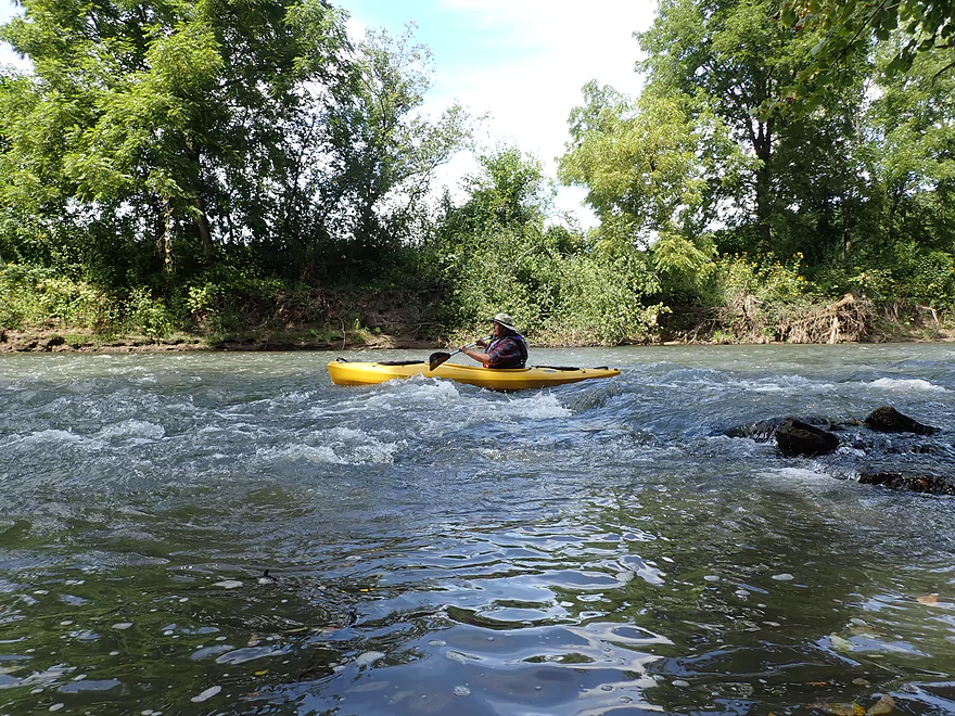
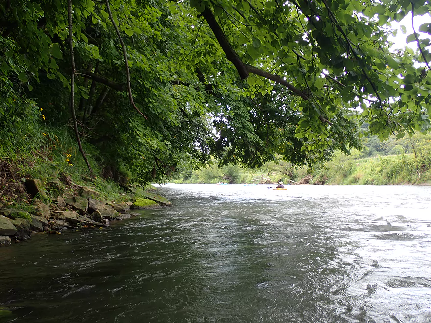
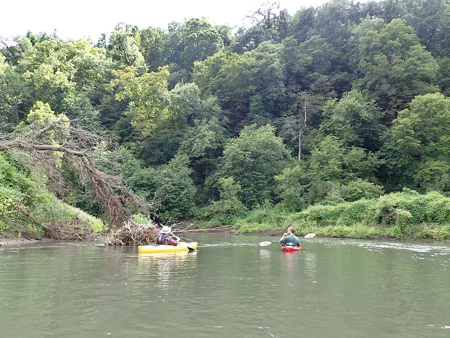
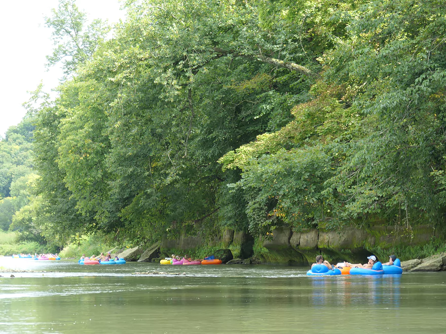
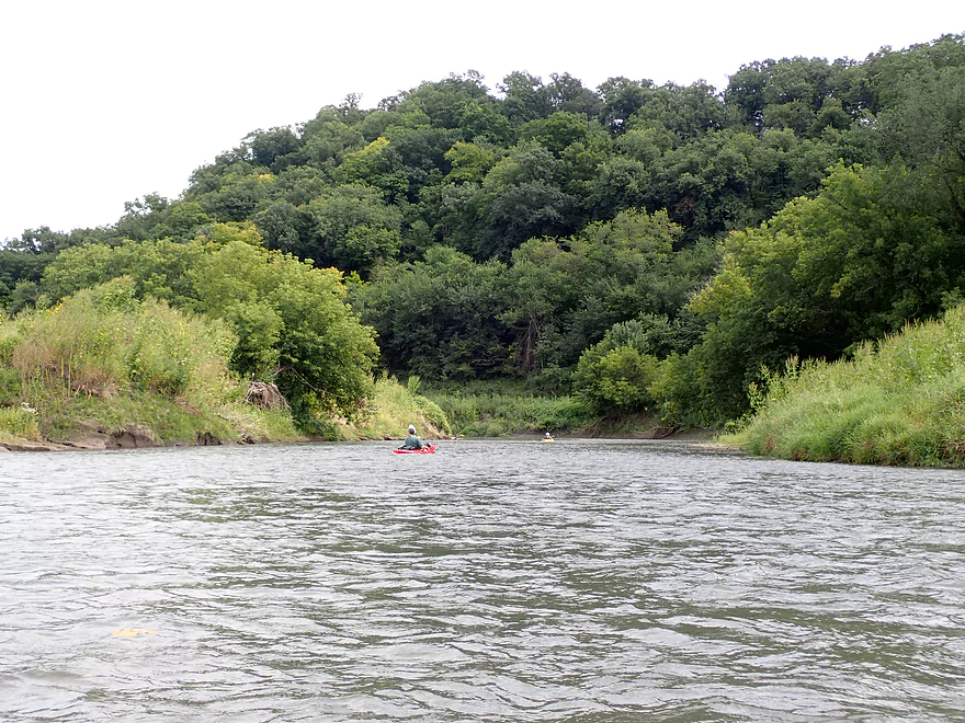
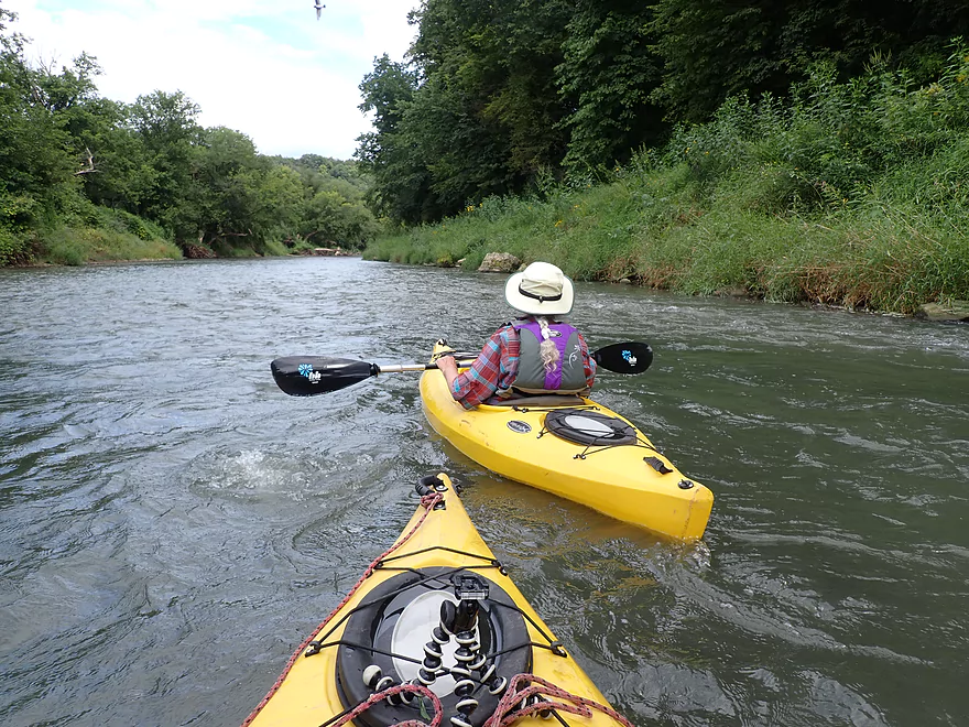
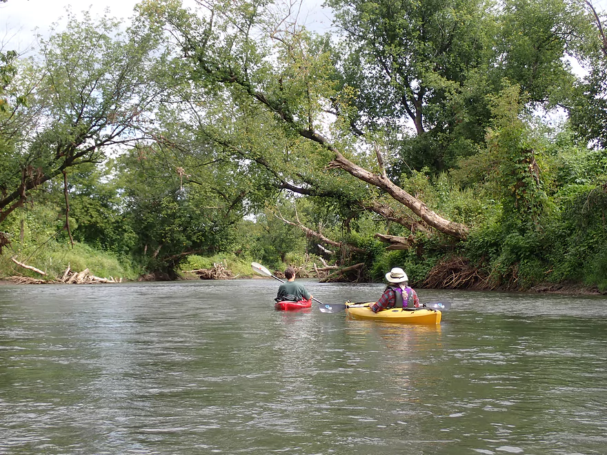
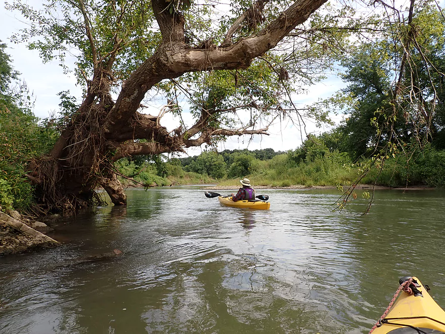
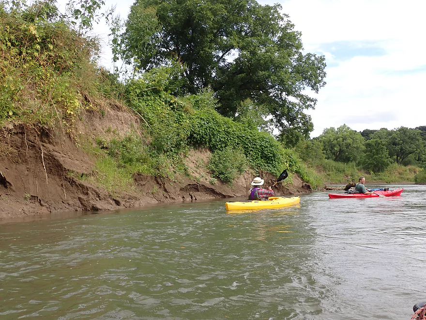
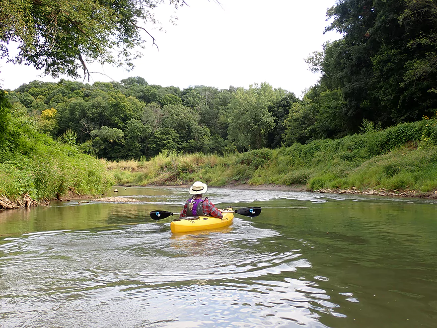
The river stayed scenic after that as it flowed through steep and narrow Driftless ravines. The current stayed fast and riffly as well…in several cases large “tubing convoys” would run the rapids together, but these events were unfortunately uneventful because the rapids were so tame. As the river took a sharp turn east, we encountered a longer and more scenic stretch of sculpted sandstone walls. Unfortunately it was tough to appreciate this scene as nearby kids in tubes were screaming for attention.
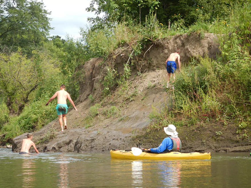
The river became a bit less interesting after that but was still solid. Along E. Haas Lane we came across what can best be described as a tuber pit stop. Here a low rope spanned the river which allowed tubers to pull themselves ashore. Kids would slide down the mud bank like a water slide while adults milled about on what looked like an artificial beach. While there are outhouses and I believe campsites here, I don’t believe you can use them unless you are a customer of Y’Allbe Tubin. Unfortunately…somebody was playing some really loud and obnoxious “music” (more like discordant yelling) over a radio powered by a generator which could be heard for some distance.
A few words here on river etiquette. Many of the tubers were well behaved and the owner of Y’Allbe Tubin was a really nice guy. But…some tubers were not. Several brought along their waterproof radios and played loud music totally oblivious that others might actually have different tastes in music or might view a river trip as an escape from civilization and not want to hear any music at all. Many tubers were drinking beer and inebriated. Because tubes move so slow, they easily got bored which usually resulted in them creating their own entertainment and yelling a lot. Remember sound travels quite far over water and just because you can’t hear others, doesn’t mean others can’t hear you.
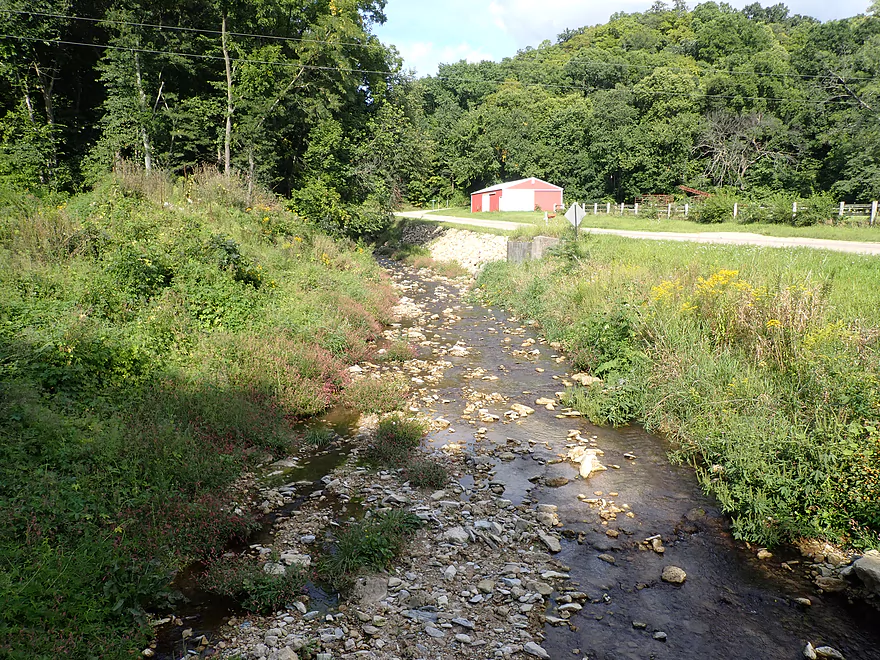
We ended the trip at a private landing off Chaffie Hollow Road. Like the put-in, this access was a scene of frenetic energy as large convoys of tubers took out. A clothesline was strung across the river to stop tubers and aid them in leaving the river.
In summary this was a fantastic trip for its rapids, outcrops and waterfalls. Thanks to the good current, the water quality isn’t as bad as upstream sections and the mud banks are smaller. The downside to this trip were the bad apple tubers…who were just too noisy, drunk and obnoxious. Paddlers may want to plan a trip during off times (anything not a summer weekend or super early in the morning). The only other downer was that the take-out is private…but there are ways to deal with this (see access information below).
We didn’t see much wildlife…most of which were likely spooked by rowdy tubers. However, we did see three water snakes, a really cool millipede, and countless centipedes on the last sandstone outcrop. I wonder if the tubers know there are so many water snakes in the water…
For plants, the banks mostly consisted of hardwood trees with one noticeably long stretch of maple (could be a good fall color paddle). Late summer flowers were a frequent and welcome sight, but unfortunately so was Japanese hops which is an invasive species that has caused issues for many southwest Wisconsin rivers.
We launched at a private landing southwest of Camel Ridge Road. Despite the landing being private, the owner is very nice and allows the public to use it. Both major liveries use this landing quite a bit and it is a major staging point for tubers. There are no outhouses at this landing, so plan accordingly.
An alternate option would be to launch just upstream of the bridge (northwest corner). This would be a steep and weedy access…so why do this when there is such a good access 200 yards downstream? Because there are fun Class 2 rapids that run under the bridge and a scenic bend of sandstone outcrops.
Paddlers interested in a longer paddle, could put in 5.7 miles upstream at Hwy U. This additional leg would have some very good scenic sandstone outcrops.
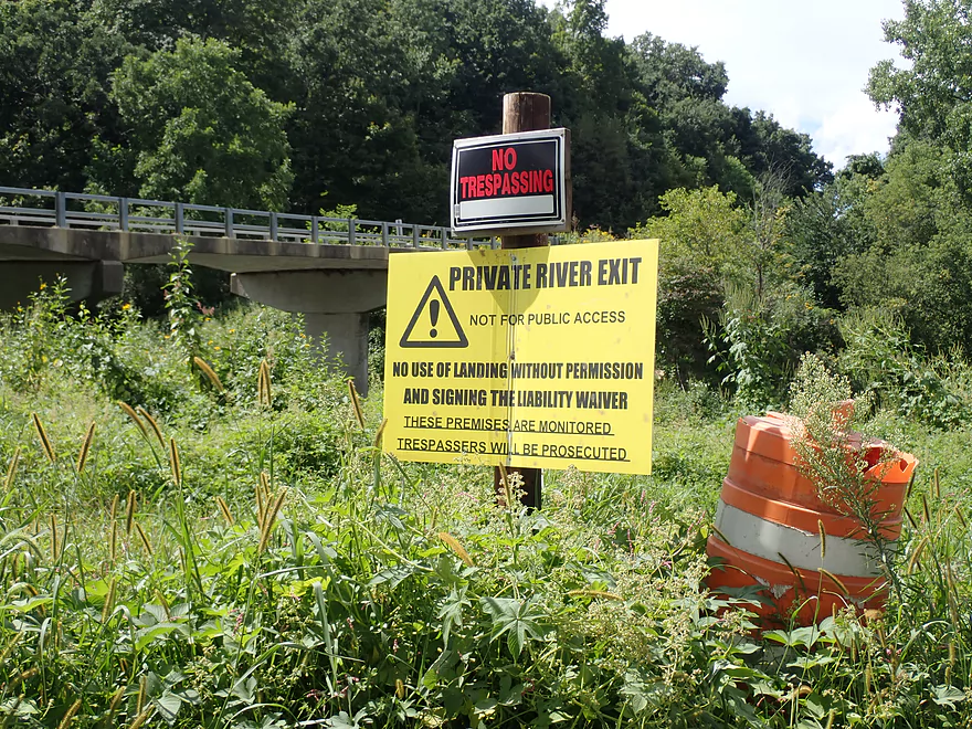
We took out at a private landing near Chaffie Hollow Road. This is a large access mostly used by disembarking tubers. Note, multiple signs warn you not to trespass and that the premises are monitored. To use this landing, you’ll have to pay and/or sign a liability waiver from one of the three livery companies that rent this out from the local owner. In our case we paid Y’allbee Tubin, which had a table at Camel Ridge Road. Note this access does not have an outhouse.
If you do not want to sign legalese or want to paddle during the off season….you could avoid the landing and take out a few hundred yards downstream by the bridge itself, which is publicly accessible. But be warned…the banks here are VERY steep and weedy. The “best” bridge access would be on the southeast side where shoulder parking is available.
Another option would be to simply continue 3.2 more miles to Burton/Hwy N. But be mindful that the landing at Hwy N/Burton is exclusively controlled by “Grant River Tubin’ Co.” and the owner doesn’t want non-tubers using this…even if you offer to pay (we asked). So if you take out here, don’t use the landing (SW side) and just simply take out on the opposite side of the bridge. This is a bit rough but is doable and available to the public via Wisconsin DOT right-of-away laws.
Bike Shuttle: The shuttle route would be only 2.9 miles but would require some serious hill climbing (305′ total).
Liveries/Rentals:
- Grant River Canoe and Kayak Rental: 608-794-2342 – 7961 County U West, Beetown, WI 53802
- Main Route #1: Hwy 35 to Hwy U
- Main Route #2: Hwy U to Camel Ridge Road
- Main Route #3: Hwy U to Chaffie Hollow Road
- Custom trips are also an option
- Y’Allbee Tubin: 608-732-0618 – 9000 Camel Ridge Road, Cassville, Wisconsin 53806
- Main Route: Camel Ridge Road to Chaffie Hollow.
- They also rent out kayaks.
- Grant River Tubin’ Co: 608-763-4021
- Main Route #1: Chaffie Hollow Road to Burton.
- Main Route #2: Camel Ridge Road to Burton.
Current: In general the current moves at a good pace and is a big reason this stretch is so popular with tubers.
Hazards: This is a pretty safe leg. I suppose you could get into trouble if you accidentally strayed into a strainer along the bank, but these should be pretty easy to avoid. The rental companies also do a good job keeping the river cleared of debris.
Rapids: Most of the rapids were pretty tame and no more than Class 1. The strongest rapids (Class 2) are actually just upstream of the put-in and under Camel Ridge Road. Most paddlers easily avoid these by simply launching on the downstream side…but I ran them and they were pretty fun.
There is a nearby gauge in Burton. We did the trip at 279 CFS.
- 0-100 CFS: A bit low with maybe some rocking bouncing, but a great depth with good clarity. The waterfall might be a bit weak though.
- 101-200 CFS: Great paddling depth. Five years ago this would be a very high depth…but in all of 2019, the river hasn’t gotten this low (we’ve had so much rain).
- 201-300 CFS: Good paddling depth and the waterfall should have good volume. Water clarity will be turbid.
- 301-500 CFS: A high depth, but should be plenty fine.
- 501-700 CFS: A very high depth, but likely navigable for experienced paddlers. Water quality likely won’t be good.
- 701+ CFS: Likely the Grant only gets this high if coming from or going to a flash flood. Be careful. For most paddlers these are likely not ideal conditions.
Detailed Overview
- Pine Grove Road to Hwy 61: 2.1 miles. Very small and would need flood-like levels to be navigable. Likely not interesting with several fences, 3-4 logjams, and flowing mostly through cow pasture.
- Hwy 61 to Mt. Ridge: 5.0 miles. A rugged and small paddle that needs high water. Unfortunately there is a lot of mud and pasture to deal with not to mention a few logjams. However, there are many fun rapids and several scenic outcrops.
- Mt. Ridge to Pine Knob Road: 2.6 miles.
- Mt. Ridge to Hwy K: 1.7 miles. Narrow and fast with several rock outcrops. No logjams, but a few tricky strainers.
- Hwy K to Pine Knob Road: 0.9 miles. A neat section with more outcrops, a longer set of Class 2 rapids, and Klondike Springs.
- Pine Knob to Hwy A: 2.7 miles. Likely way too many logjams.
- Hwy A to Grays Mill Road: 0.7 miles. Maybe one downed tree. Mostly a simple farm field paddle.
- Grays Mill Road to University Farm Road: 3.4 miles. Maybe 2-3 downed trees and one set of rock outcrops. River gains significant volume in this stretch from tributaries.
- University Farm Road to Short Cut Road: 3.7 miles.
- University Farm Road to Slab Town Road: 1.5 miles. Very muddy and one noteworthy strainer, but also has a great series of limestone outcrops.
- Slab Town Road to Short Cut Road: 2.0 miles. Less muddy and with several sets of fun rapids, but has only one tiny outcrop and there is a logjam to deal with.
- Short Cut Road to Grant River Road: 5.5 miles. Great section with some attractive outcrops.
- Grant River Road to Hwy U/Blackjack Road: 6.2 miles.
- Grant River Road to Pigeon River Road(1st): 1.4 miles. Great stretch with some of the best outcrops on the river. Grant River Road is a bad access.
- Pigeon River Road(1st) to Hwy U/Blackjack Road: 4.8 miles. A good leg with a mix of sandstone and limestone outcrops. Outcrops aren't as common as other legs, but it's still a nice stretch..
- Hwy U to Camel Ridge Road: 6.0 miles. Good stretch with some nice rock outcrops.
- Camel Ridge Road to Chaffie Hollow Road: 3.2 miles. Very scenic section with good current. Features a waterfall and some nice outcrops. Very popular with tubers.
- Access note – The Chaffie Hollow Road landing is private. Get permission from one of the three liveries like “Y’Allbee Tubin” to use it, or take out under the bridge (the latter is not easy).
- Chaffie Hollow Road to Hwy N/Burton: 3.3 miles. I don’t know much about this section. Likely more open and less interesting…but likely some outcrops and light rapids.
- Access note – The landing at Burton is private. If you take out here, use the bridge instead.
- Hwy N to Great River Road: 8.5 miles. Should be a few nice rock outcrops, but the channel is much larger and muddier. Maybe 3 logjams. Take out at Hwy 133 on SE side…not an ideal launch area.
- Great River Road to Mouth: 1.6 miles.
- Mouth/Mississippi to Potosi Point: 1.2 miles. A short trip on the Mississippi before disembarking at Potosi Point.
Trip Map
Overview Map
Video
Photos Size: