
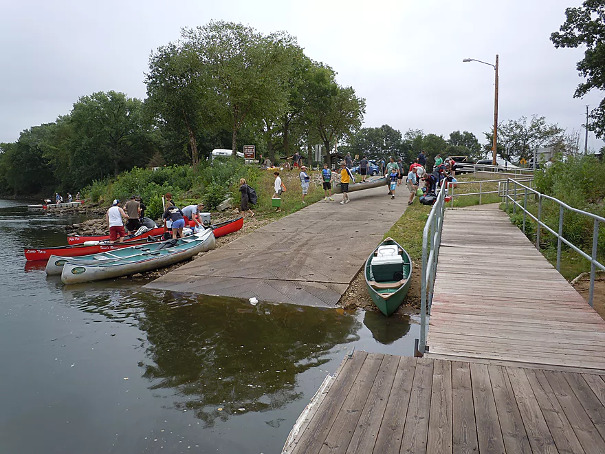
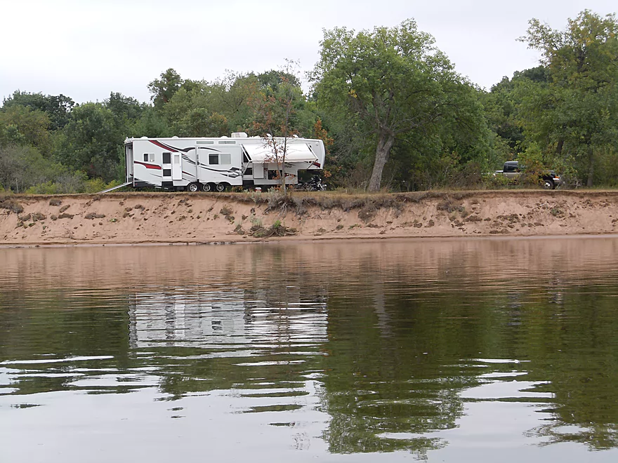
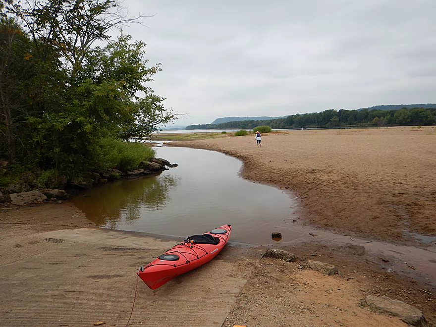
Mazomanie (Adler’s) Landing is a very busy port
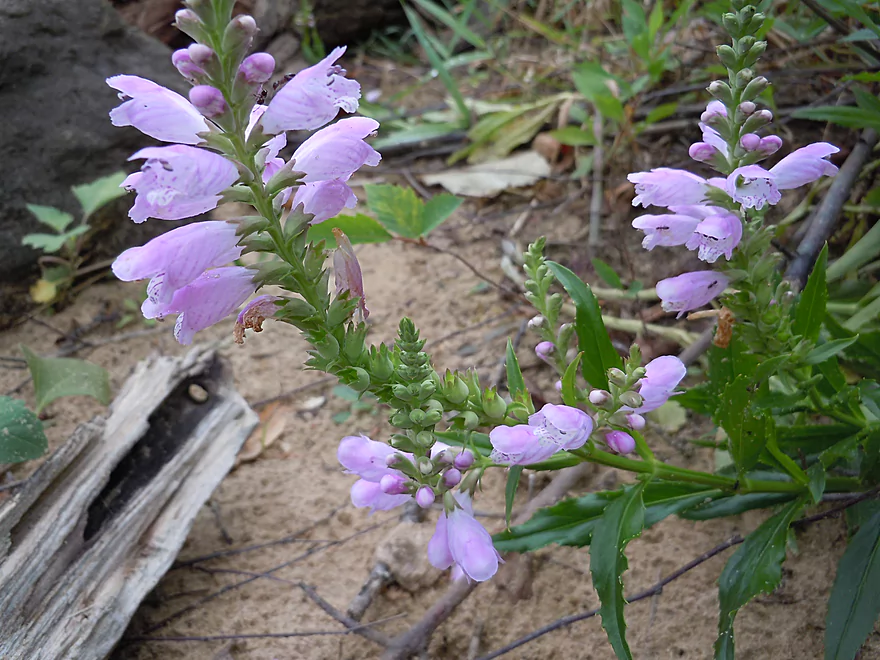
Obedient plant by boat ramp–so called because flowers stay where you push them.
Blackhawk Landing (private launch next to Mazo Landing)
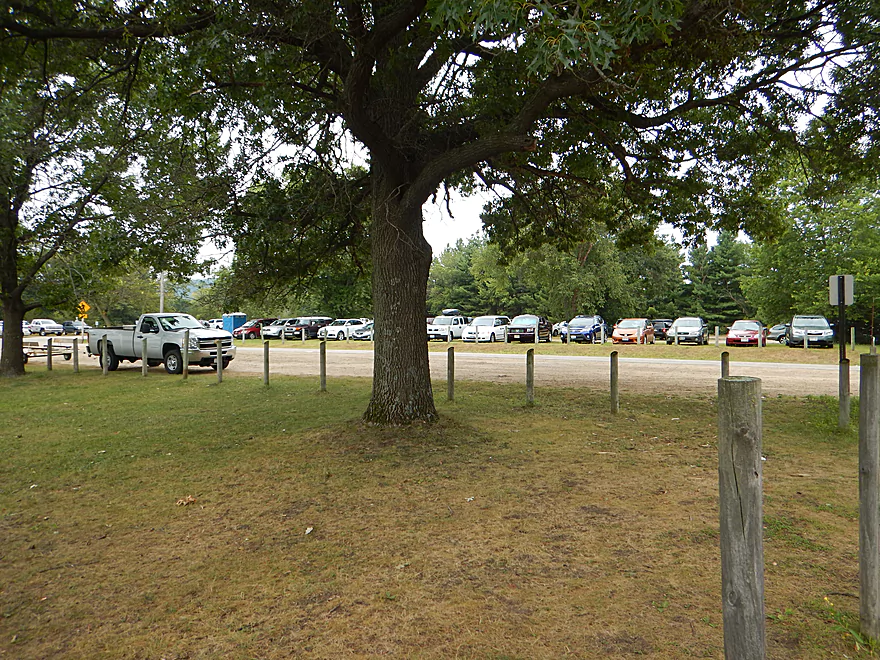
Huge parking lot that can fill up on weekends
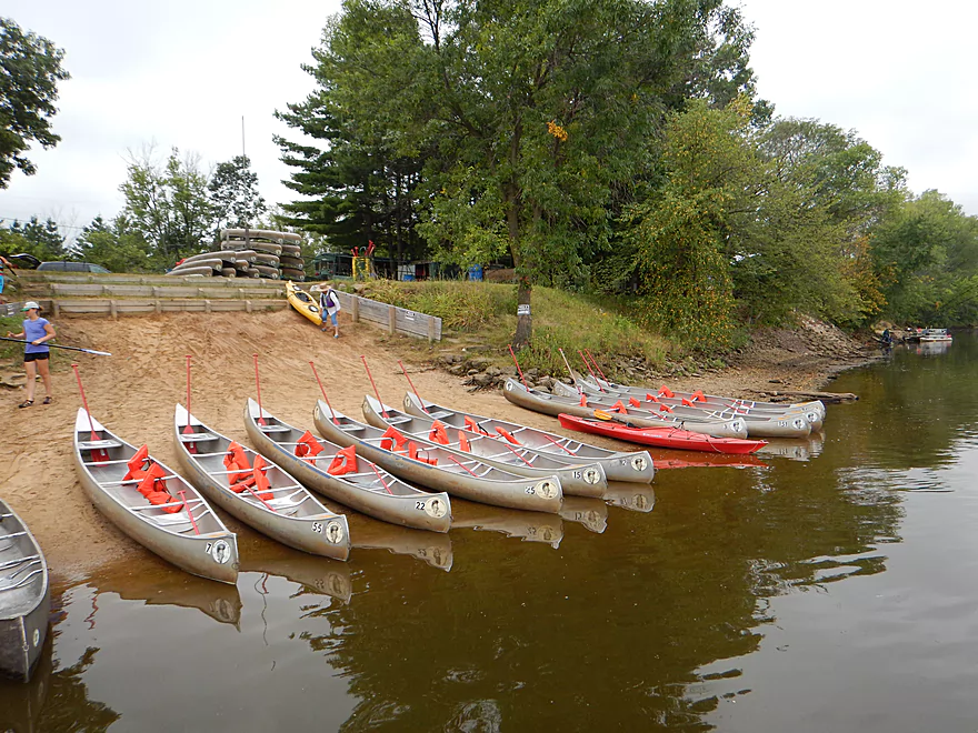
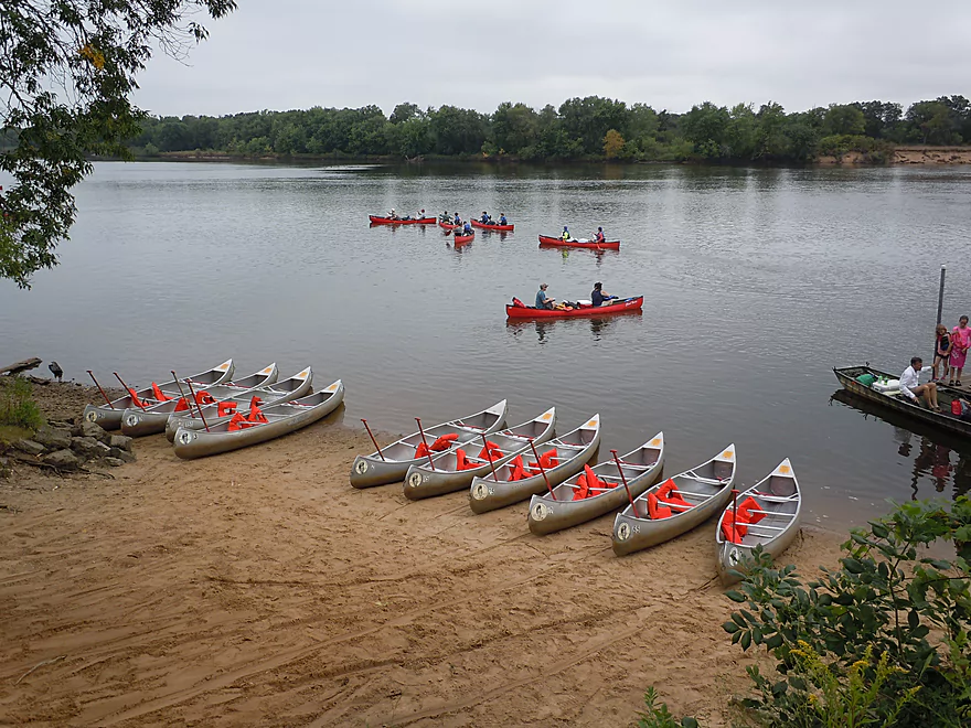
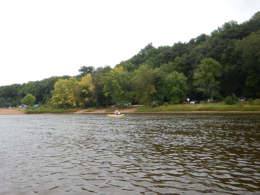
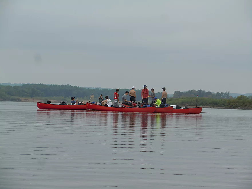
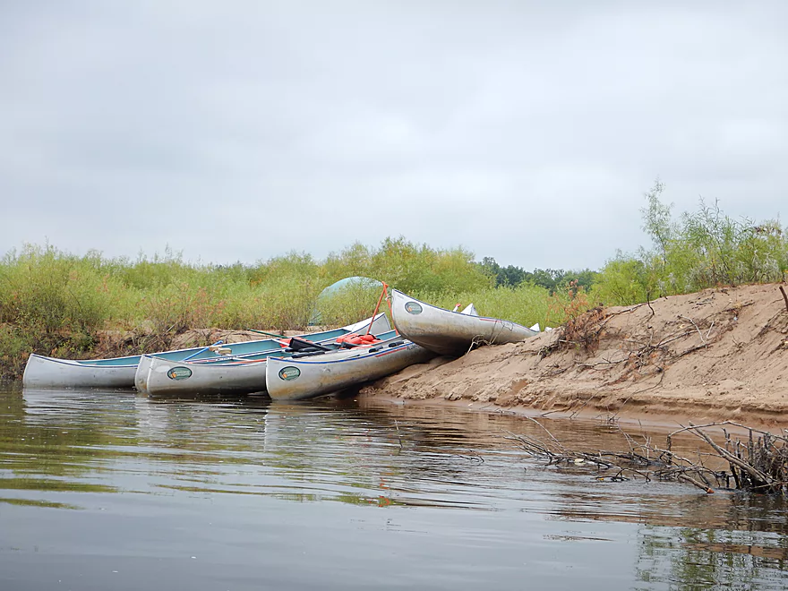
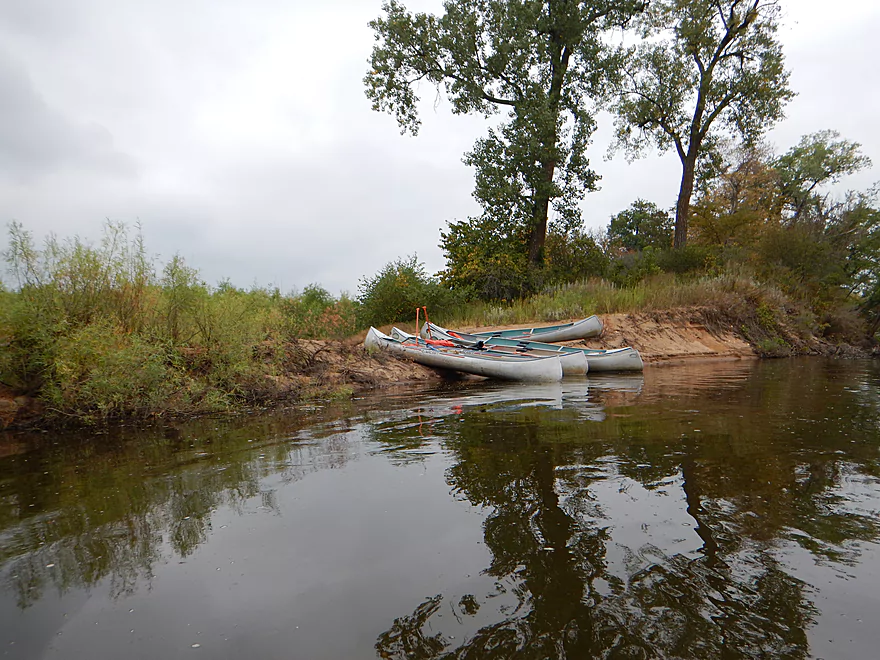
Canoe armada ready to invade the Lower Wisconsin
A really nice gravel bar early into the trip
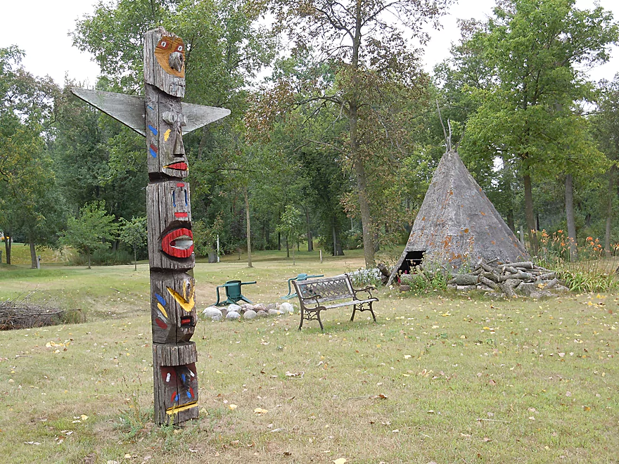
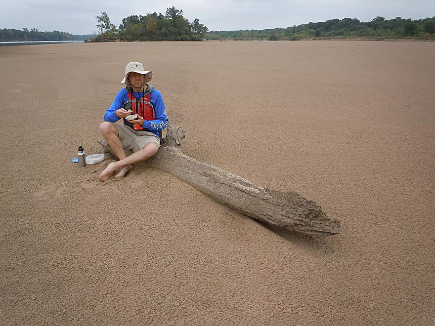
Something tells me this was not constructed by real natives
Some surprise riffles
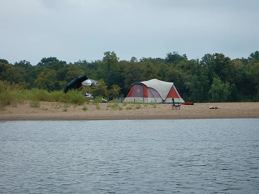
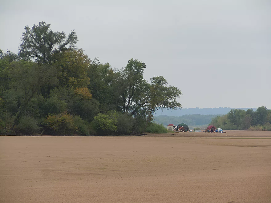
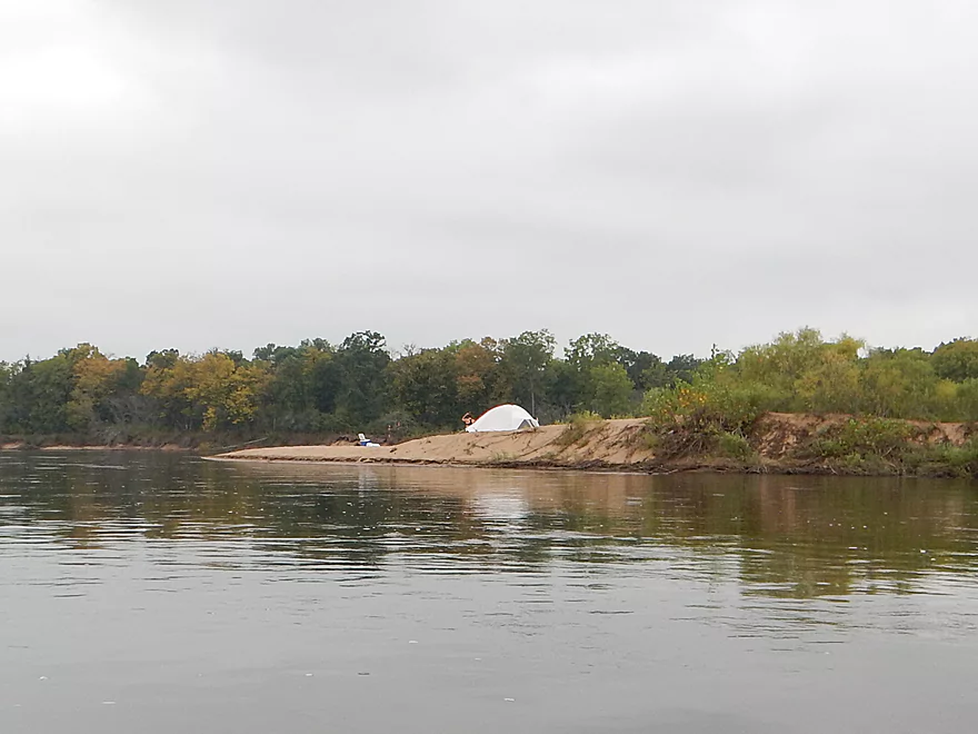
Wish campers like this would park out of sight
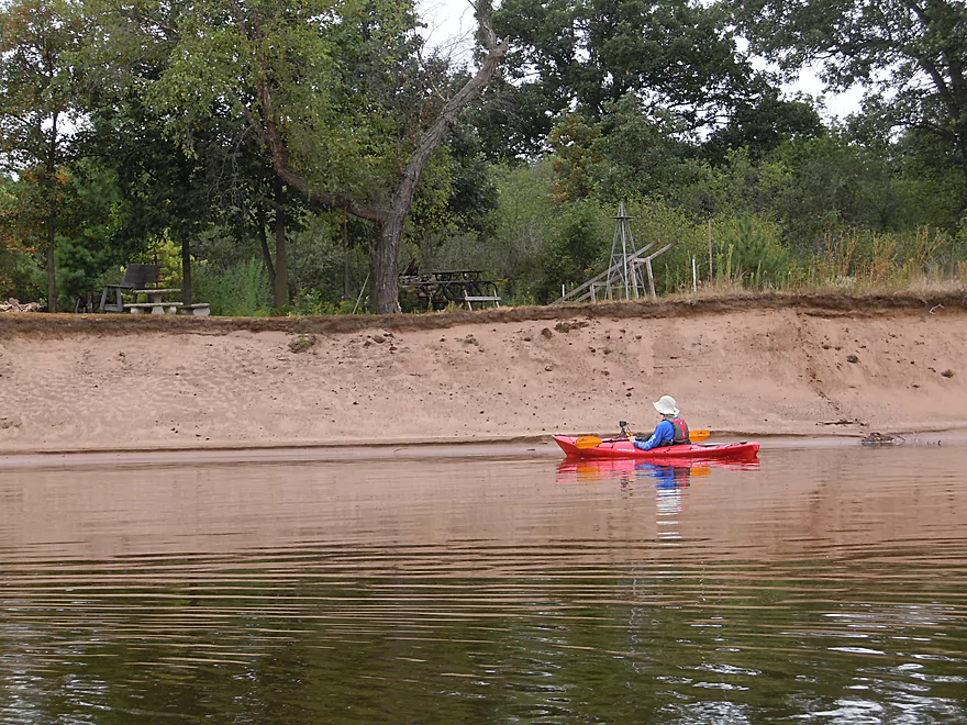
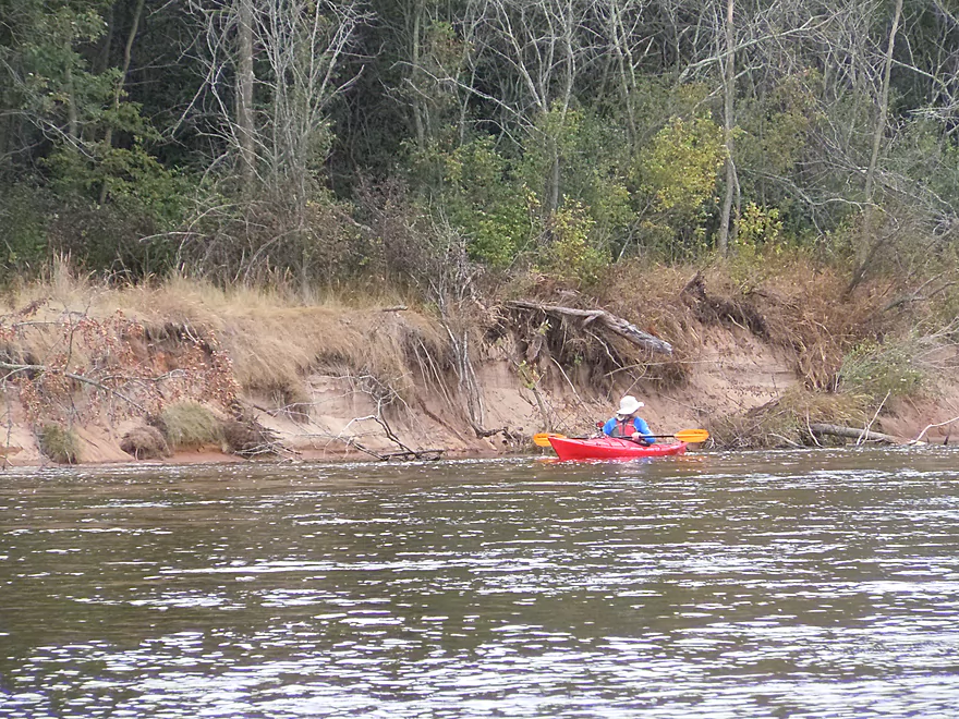
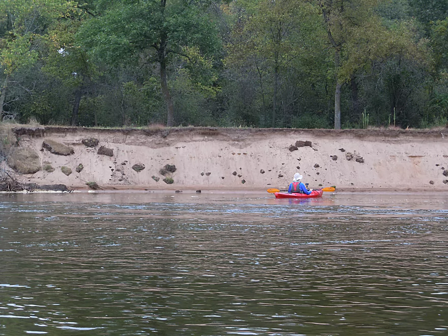
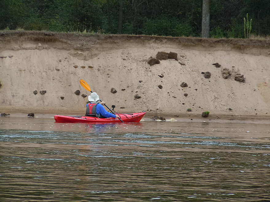
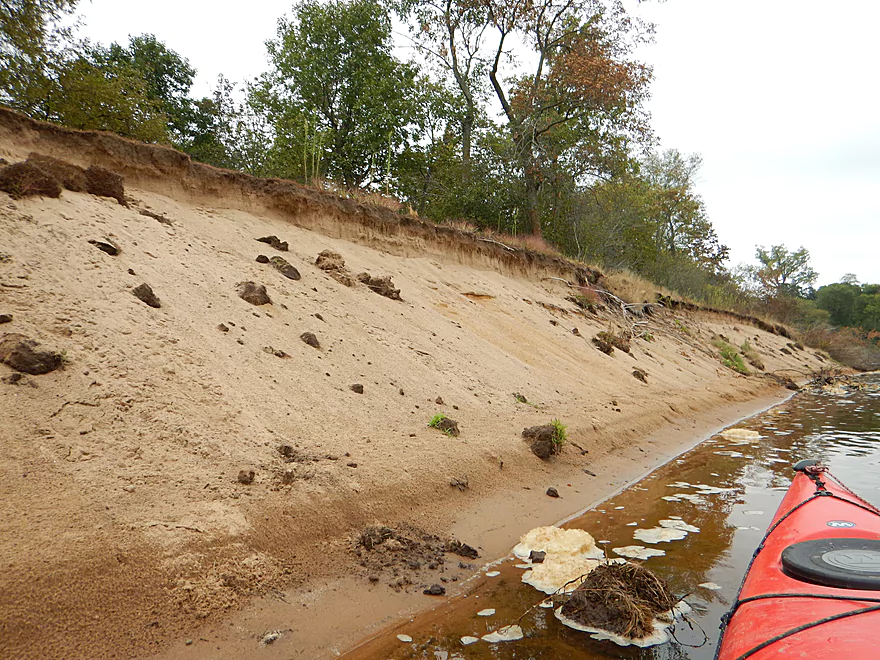
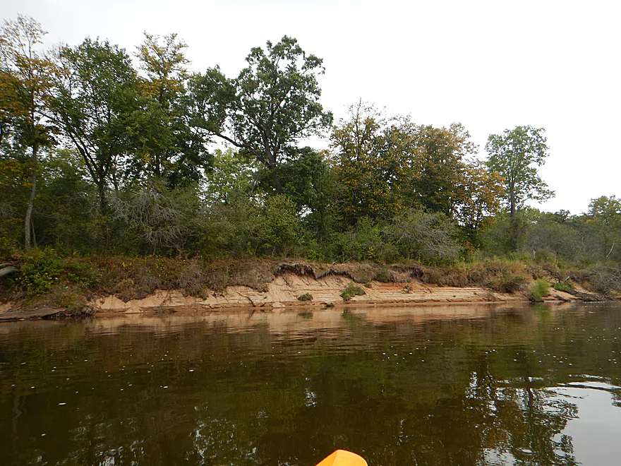
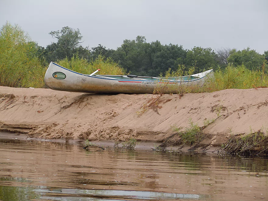
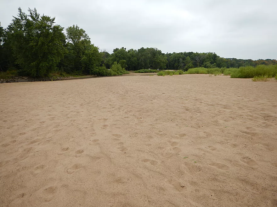
Some nice sand banks
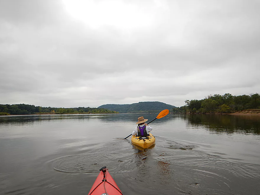
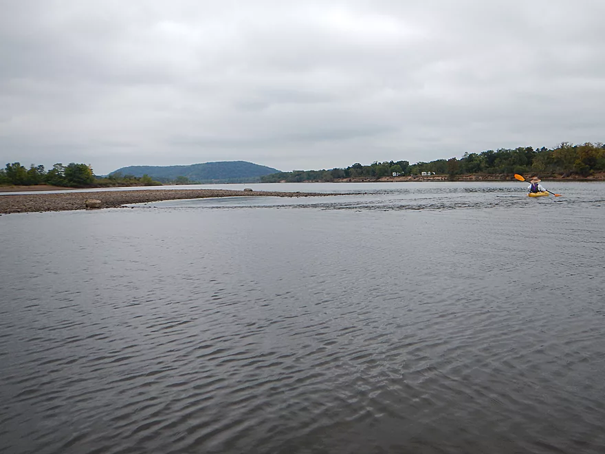
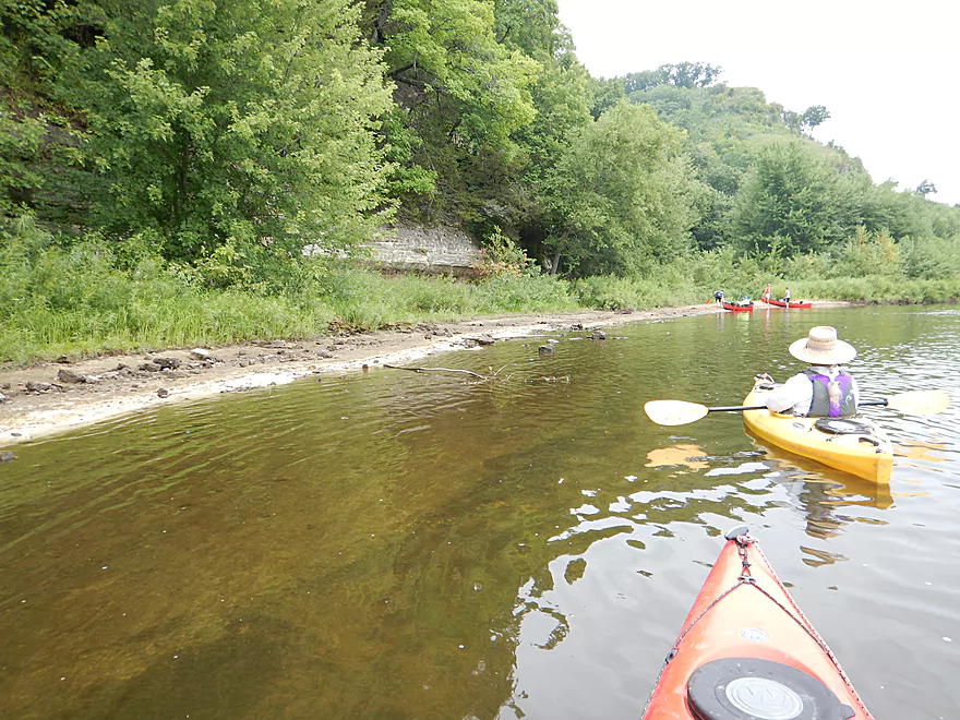
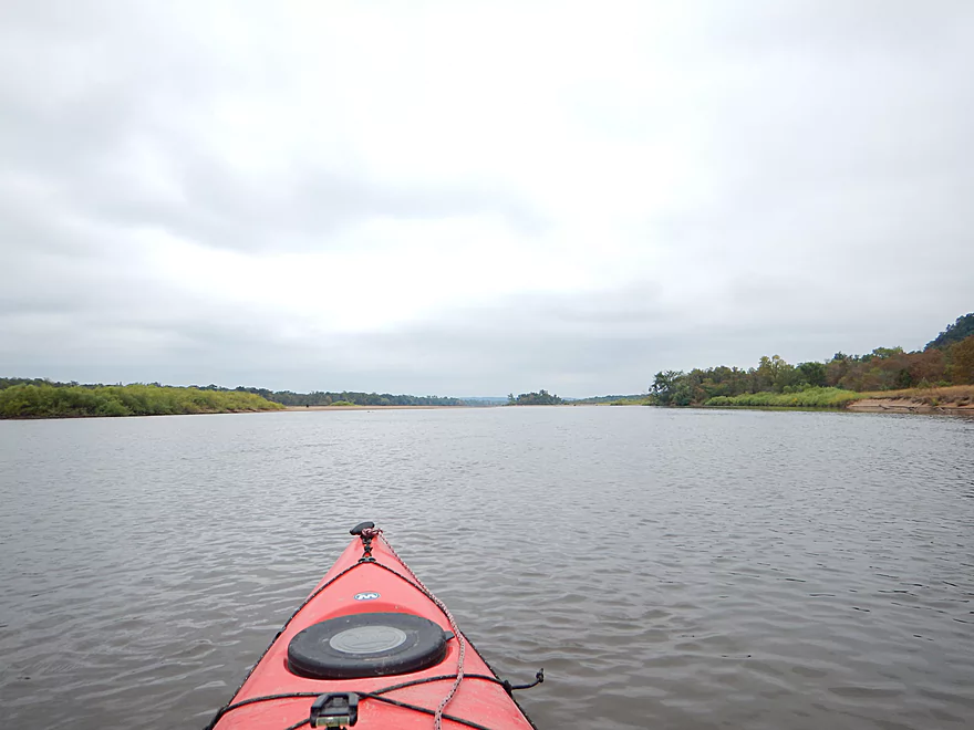
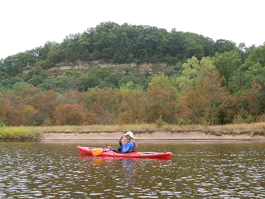
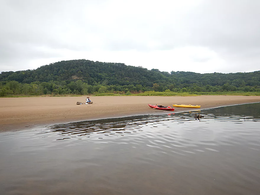
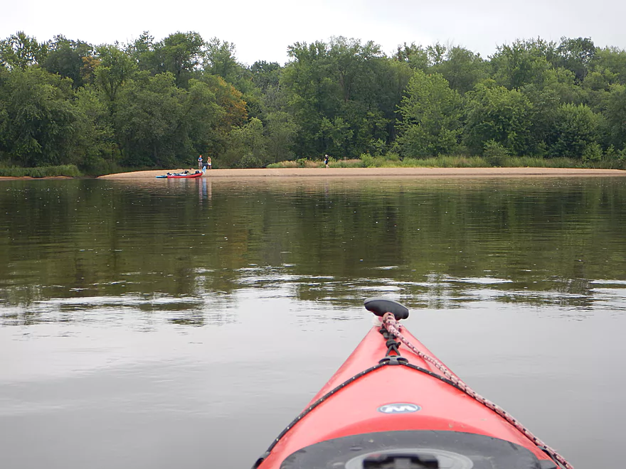
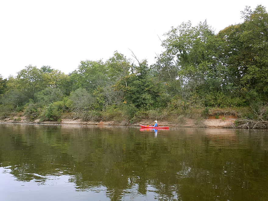
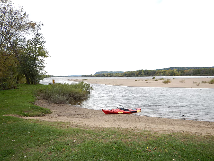
Paddling toward Ferry Bluff
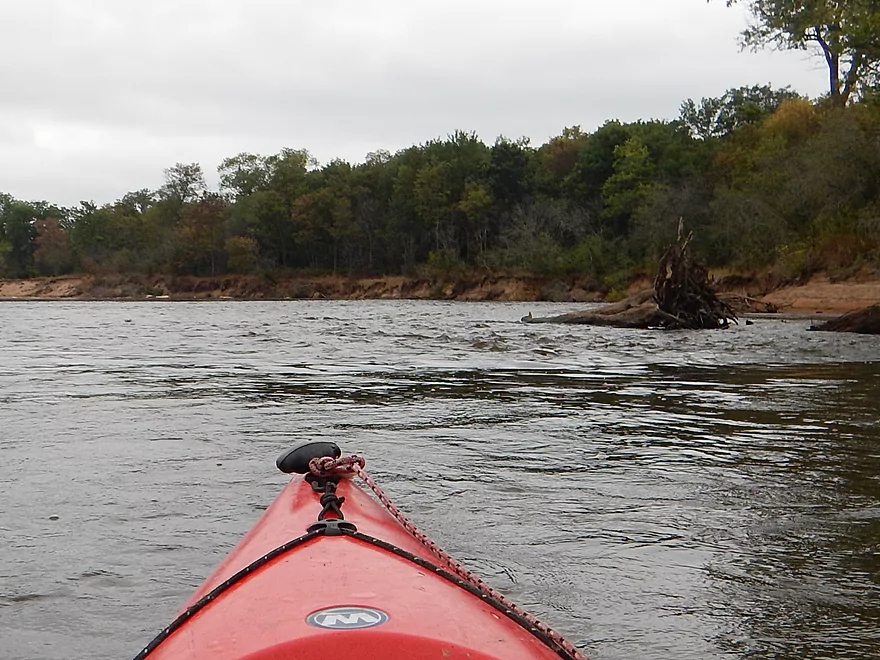
More surprise riffles and strong current
Try not to get caught in a strainer
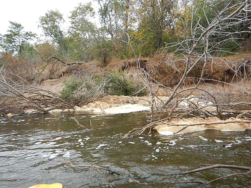
Like this mystery foam
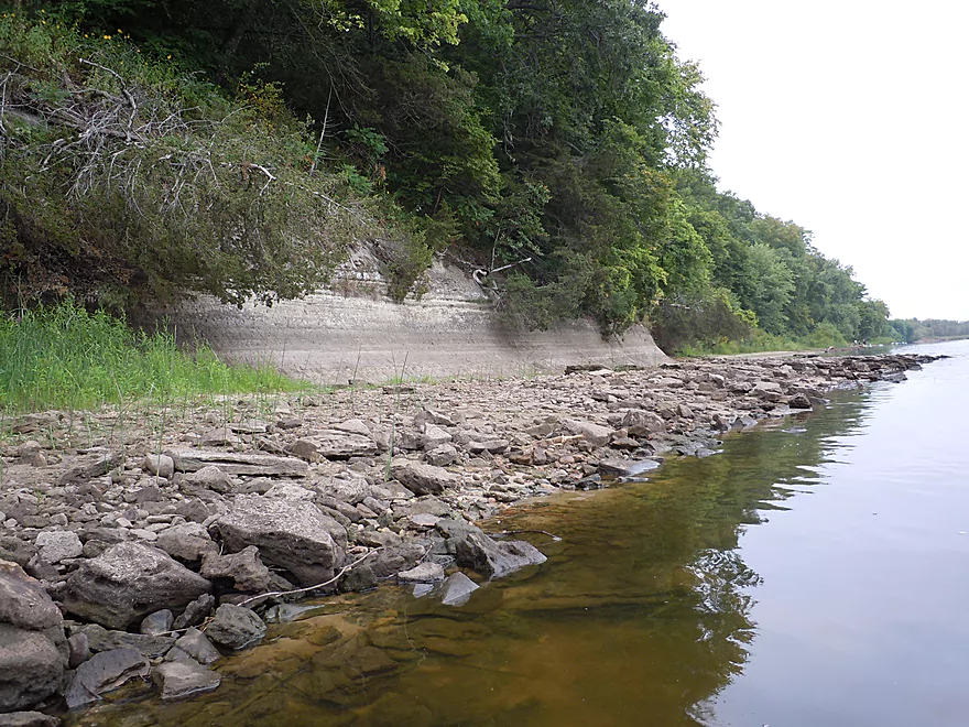
Chunks of sod sliding into the river
One of the nicer banks
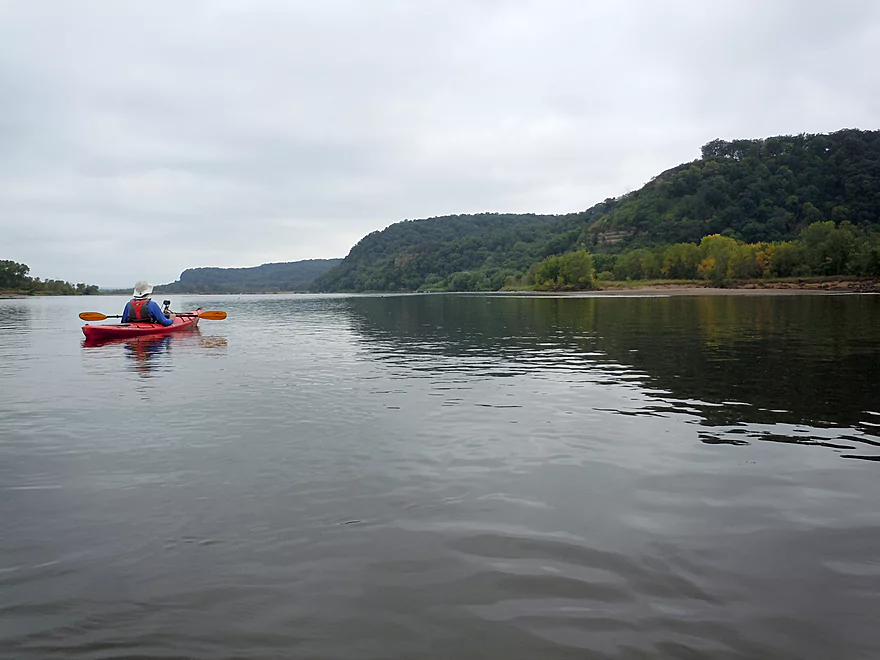
Looking at Hugo’s Bluff (L), Cactus Bluff, and Ferry Bluff (R)
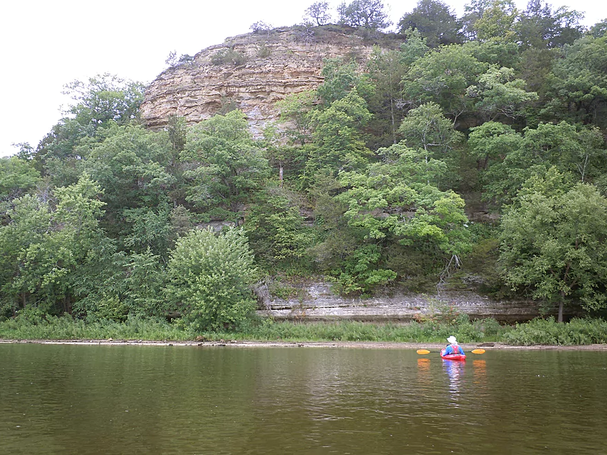
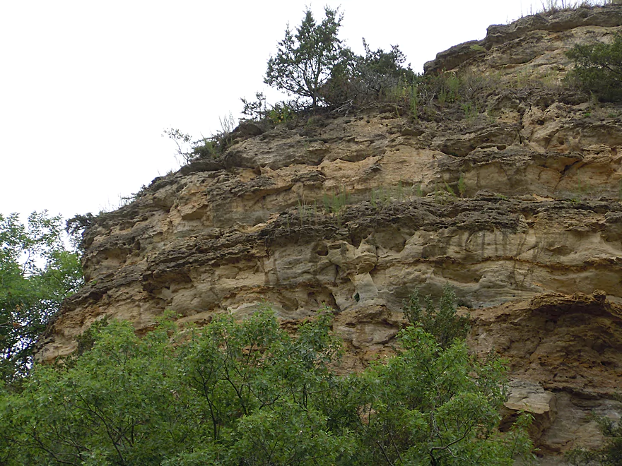
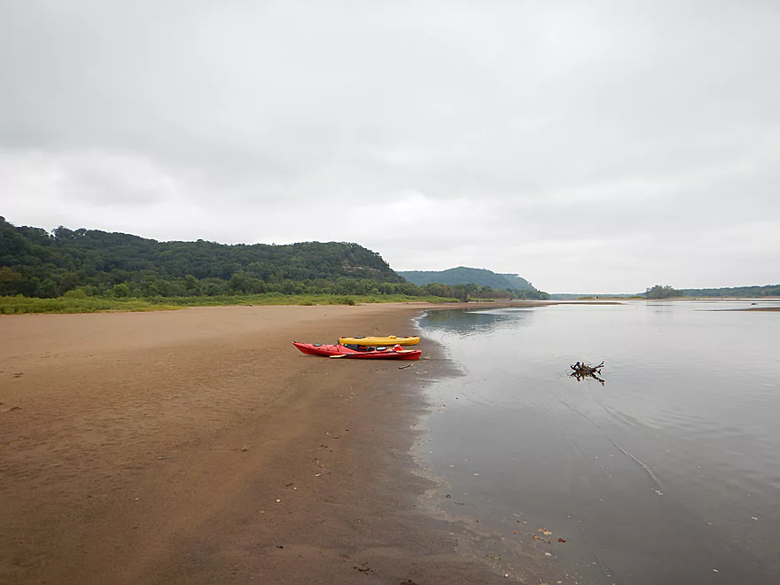
Ferry Bluff is the most scenic of the three
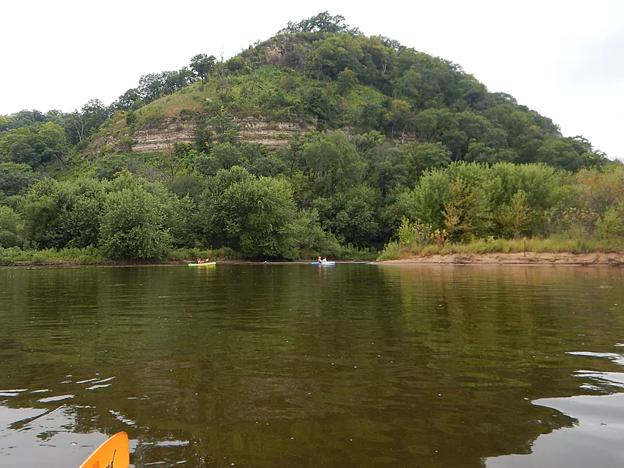
This is now Cactus Bluff (just next door)
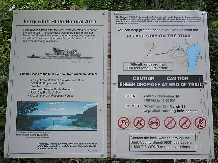
A little background
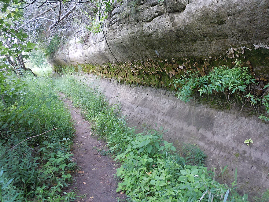
Interesting texture
Paddlers often park below Cactus Bluff and hike to the top
Another nice small bluff
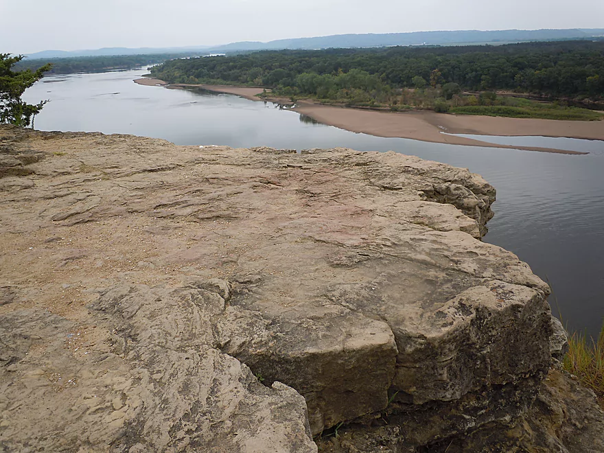
A rock ledge here extends out under the water
This is a private landing for Bender’s Bluff View Canoe Rentals
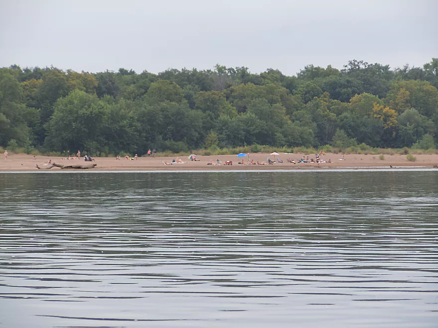
THE Mazo beach (shot tastefully from a distance and out of focus)
Though public, you can only access Hugo’s Bluff from the river
Nice looking sandbar for camping
This sandbar went on forever, like a star destroyer
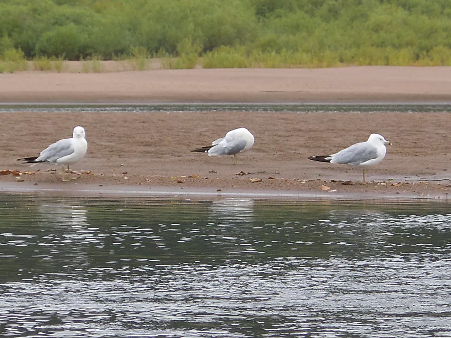
Balancing on one foot (middle gull is not impressed)
Camping or at least a small picnic on a sandbar is a must
This is a nice one, with a great view upstream of the bluffs
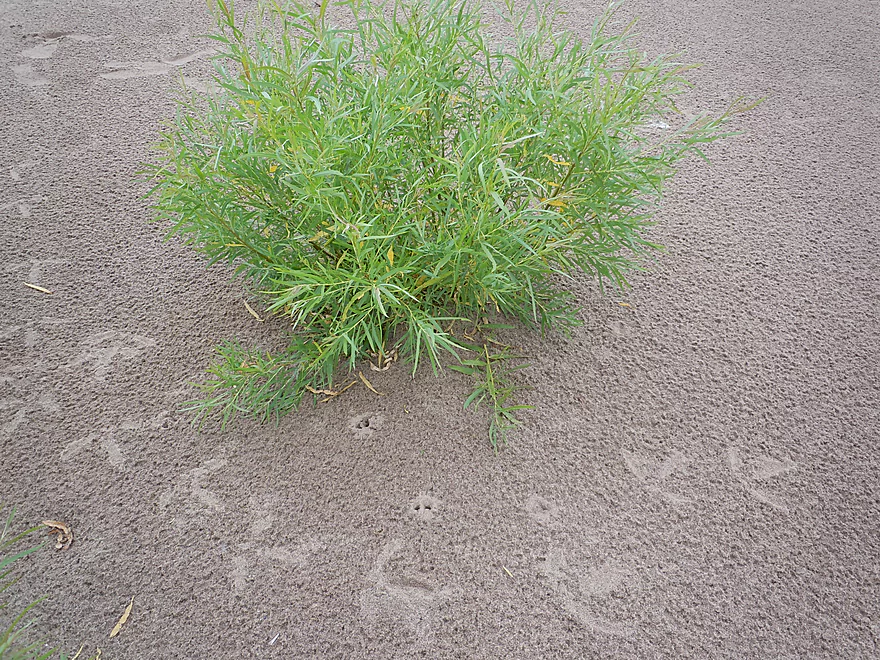
It has some local inhabitants
And some distant ones

Wow…
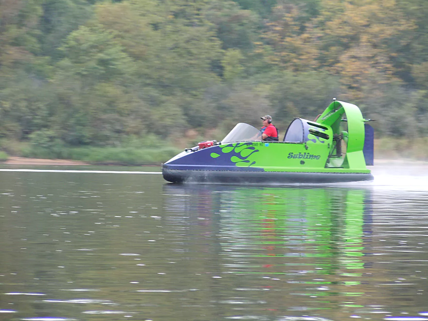
River was too shallow for most boats, but not for air boats (kind of noisy and obnoxious really)
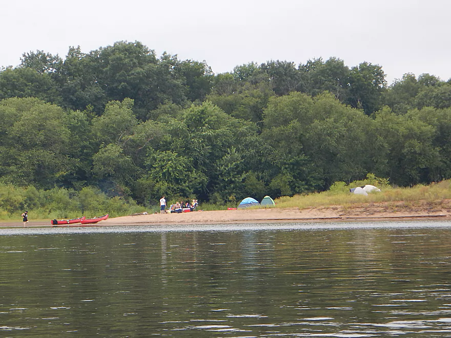
Pretty much every sandbar had a campsite
Which has totally confounded some
So many nice sandbars
Surprise shallows in the middle of the river
Remember to be careful about swimming downstream from sandbars
Islands are getting so big, they have forests growing on them
One of the nicer camping sandbars
How to properly secure your canoe
How not to properly secure a canoe
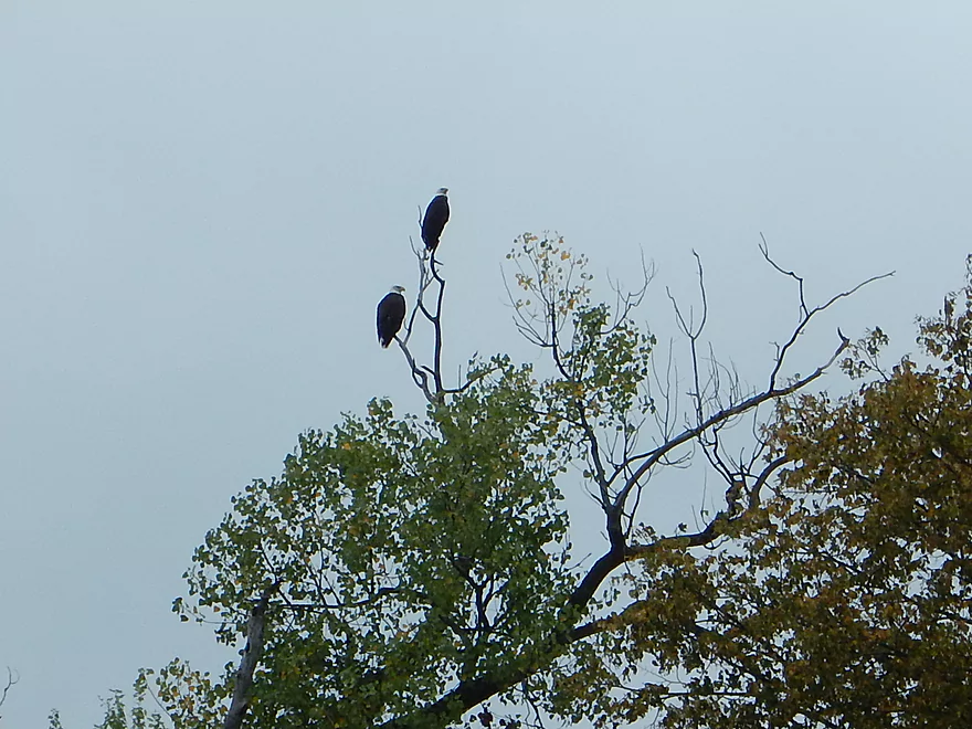
Saw a number of eagles on the trip
Gateway to Arena
More nice bluffs on the north bank
River at this point has broken into channels
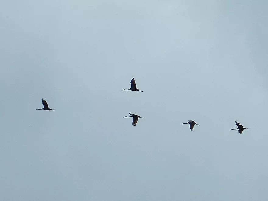
Migrating cranes
Blue Mounds Creek enters the Wisconsin to the left
A fisherman is having difficulty getting out of the Arena landing
Now our turn…
Looking upstream
But this was unexpected
All that remains of this channel is a tiny trickle
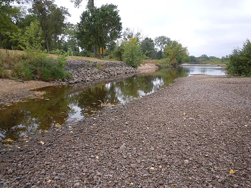
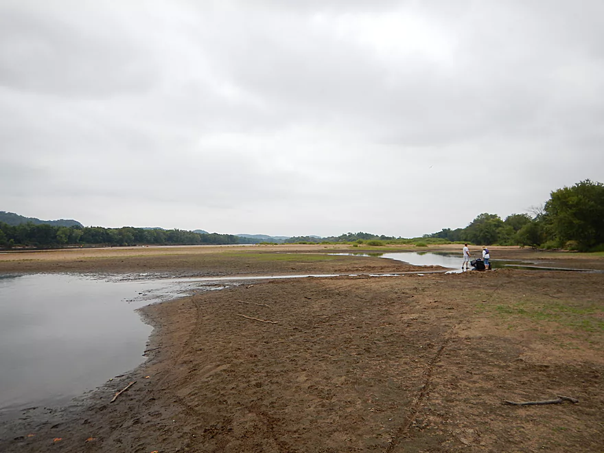
The Arena Boat Landing
How it looks in 2015
How it looked in 2014
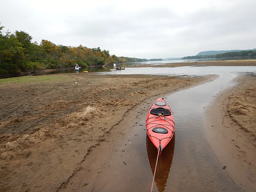
This is actually a terrific sandbar
Many do camp here
It is actually kind of cool to see how this massive sandbar sealed in the landing
Scouting Honey Creek access
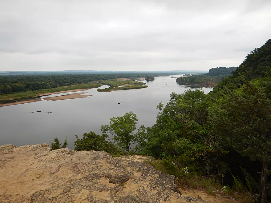
Terrific view looking downstream from Ferry Bluff (toward Spring Green)
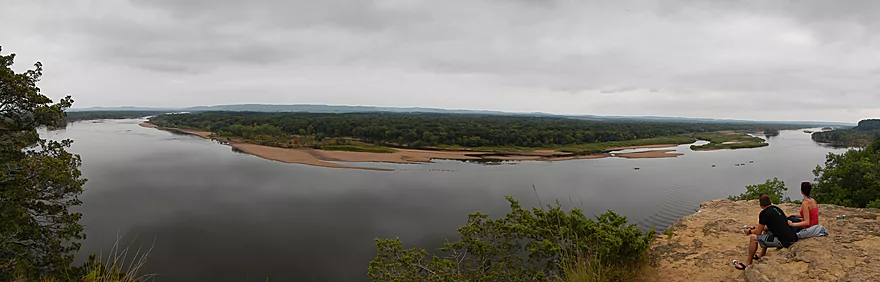
A panorama
And upstream (toward Sauk City)
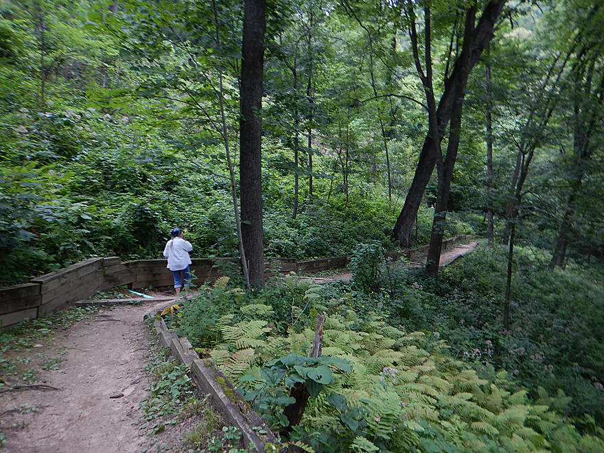
A steep climb to get to the top of Cactus Bluff
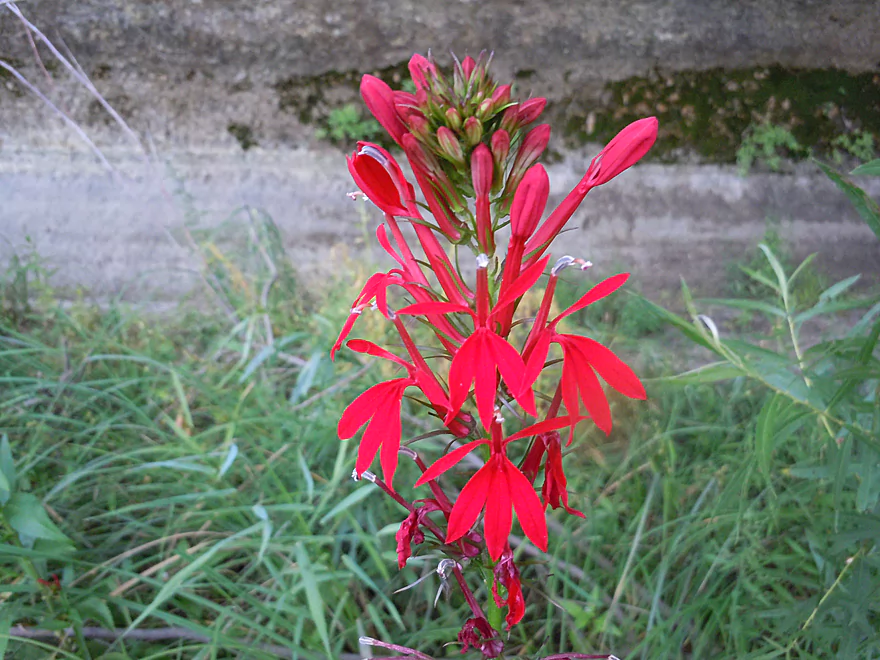
A cardinal flower by the trail
The beach connects with a nice trail
Wisconsin River – Mazomanie

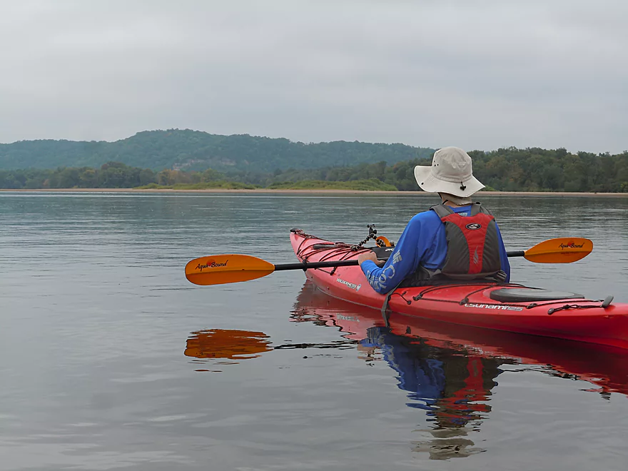
A good trip on the Lower Wisconsin takes some good planning to get right. You want to go when the water is low (for best sandbars), when there is little headwind, and when there are few other people on the river. Practically, this means September/October or a weekday in July/August. You then need to pick the appropriate segment to do (92 miles means a lot of choices).
I suggest not doing Sauk City to Mazo, as this has few if any sandbars (the dam is starving the river here of sediment for islands and sandbars). From Mazo to Spring Green is a great section and the most popular for camping, with plenty of terrific sandbars, but is very busy. From Spring Green to Muscoda is a great section for sandbars, but with fewer people (more powerboats though). From Muscoda to the mouth you gradually lose the sandbars (and most other paddlers), but you still get to enjoy superb bluffs and fun backwater channels to explore.
An advantage of starting this trip at the Mazo landing (besides being on the same side of the river as the Arena landing), is that you’ll get to paddle by three terrific bluffs. The first of which is Ferry Bluff, which is a 300′ sandstone outcrop towering over the mouth of Honey Creek. Right next door is Cactus Bluff, which you can actually climb on top of. Just park your boat directly below the bluff by the sandstone wall and you’ll discover a small trail that leads to the top for spectacular views of the river. You can also access the trail and overlook from the Honey Creek boat launch. The third bluff down is Hugo’s Bluff which, despite being a state natural area, can only be accessed from the water. I did not see if there was a trail that led to the top from the shore, but am curious. You’ll see plenty more bluffs on the trip (which makes the Lower Wisconsin special), but these three were my favorites.
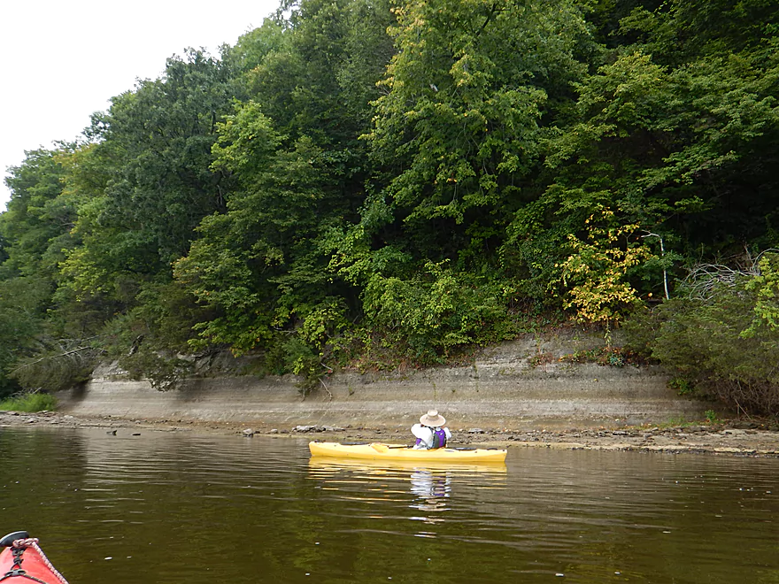
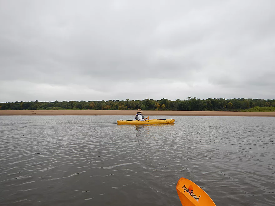
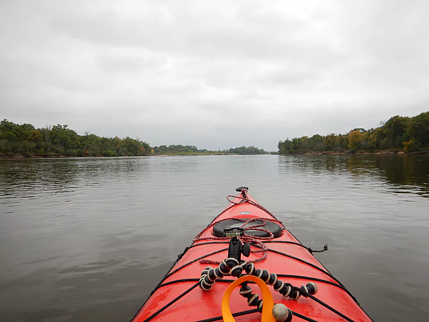
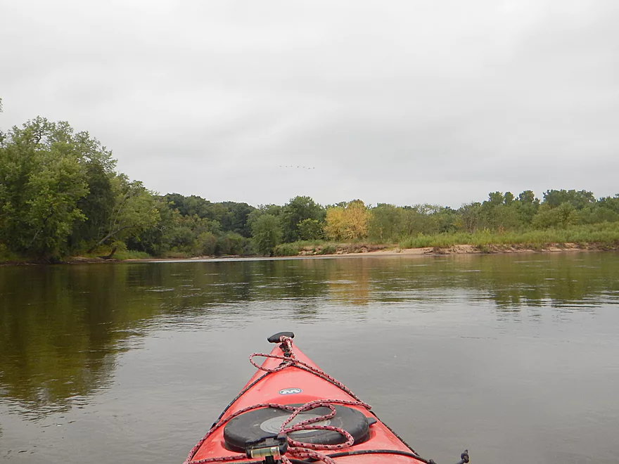
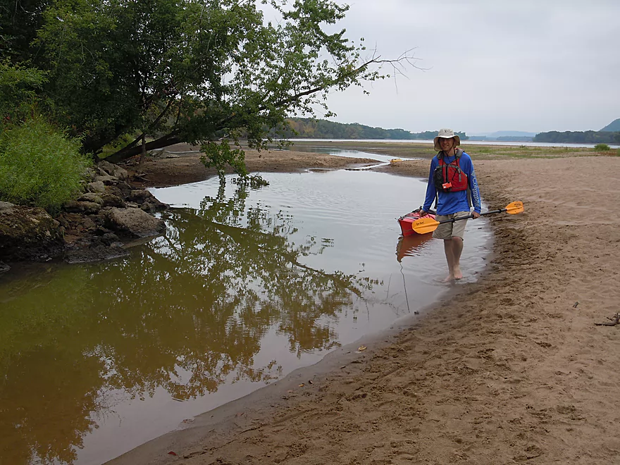
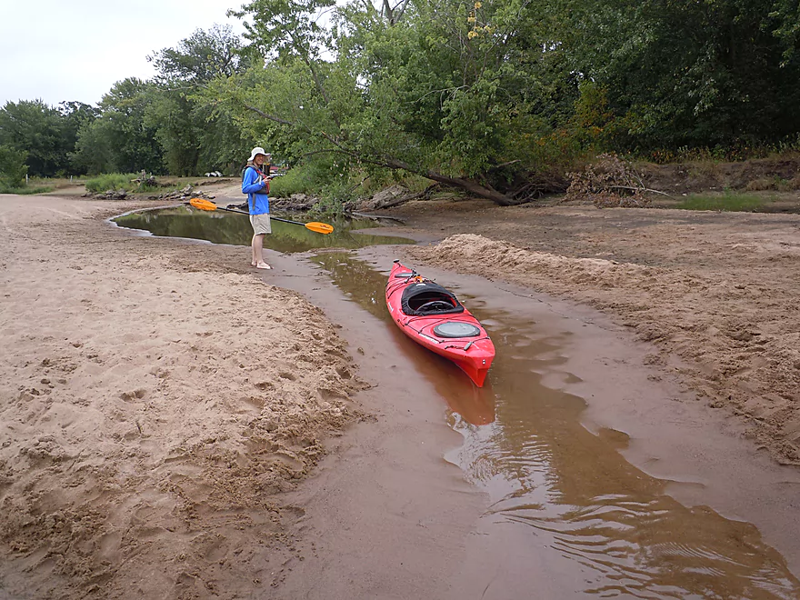
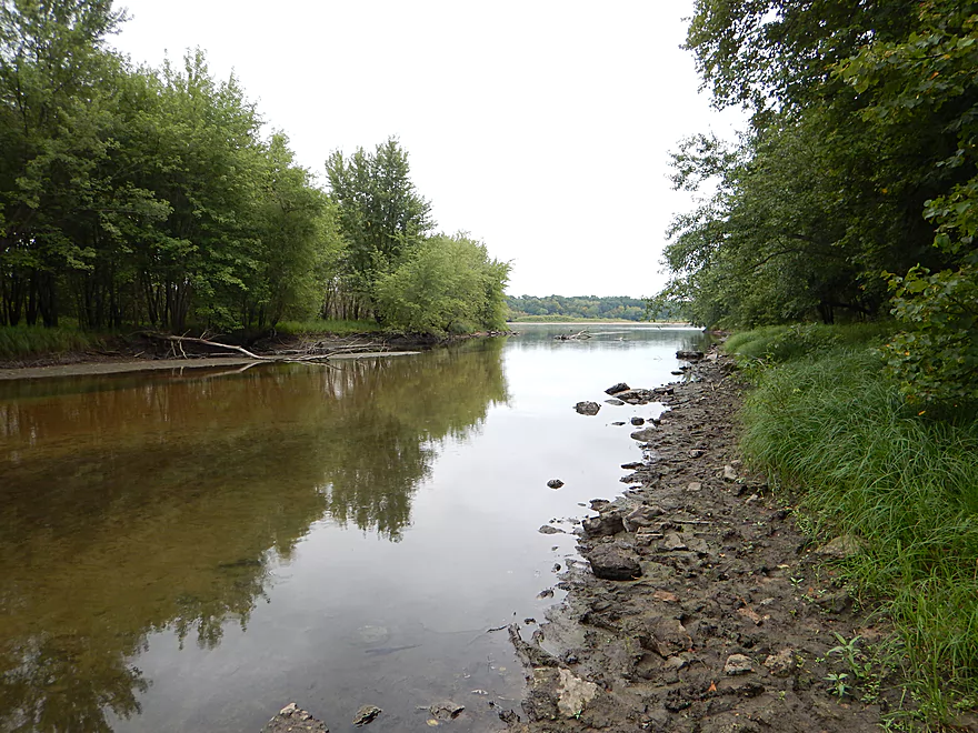
As for the river itself, it is very wide and sandy with turbid water clarity. Not awful, but not great. You can swim in it, but do mind the unexpected drop-offs (and the industrial effluents from up north). For our trip the waves weren’t an issue but can be with a decent wind. What is striking is just how sandy everything is, especially where the river takes big bites out of the shore leaving really nice sand banks (not as epic as the ones by Gotham, but still cool).
The main reason why you want to do this trip is for the sandbars. They are huge, clean and open to the public. No other sandbars in the state rival those of the Lower Wisconsin. This is a top-notch section for camping (although Arena to Spring Green might be even better). Campers should remember that camping is not allowed on the river by the Mazomanie bottoms (including islands). Roughly speaking, you can finally start camping after the famous Mazo beach (you CAN’T miss it…especially on a weekend).
Camping and picking a sandbar require a bit of strategy… Use satellite maps to get a feel for where the best ones will be (roughly). Many good sandbars hide on the downstream side of large wooded islands. Generally speaking, on a weekend most sandbars will be taken, but the further you paddle, the more likely you’ll encounter an uninhabited one. Most are so large though that they can reasonably accommodate multiple campers. Even if you don’t camp, you should at least picnic or take a break on a sandbar to take in the experience.
On the downside, the Lower Wisconsin despite being mostly a protected natural area, has some noise issues. There aren’t too many motorboats because of the shallow depth, but there were multiple hovercraft, which made a TON of noise. Many paddlers were quiet and considerate, but a certain portion played loud music and would yell loud, stupid things (many of whom were under the influence). Sound carries on the water a LONG way and I wish the DNR would create decibel rules and have wardens enforce these with meters (ideally no electronic music, limits on boat noise and shouting…especially at night).
This might be THE most popular paddle trail in the entire state and the number of canoes and kayaks you will see in the water is impressive. Many were severely overloaded (like Indian trucks) and did not look seaworthy. The smart canoers would rent a second canoe just for cargo that they would drag behind. If you pack up for this trip, do remember that glass is not allowed and you must bring a waterproof container for trash.
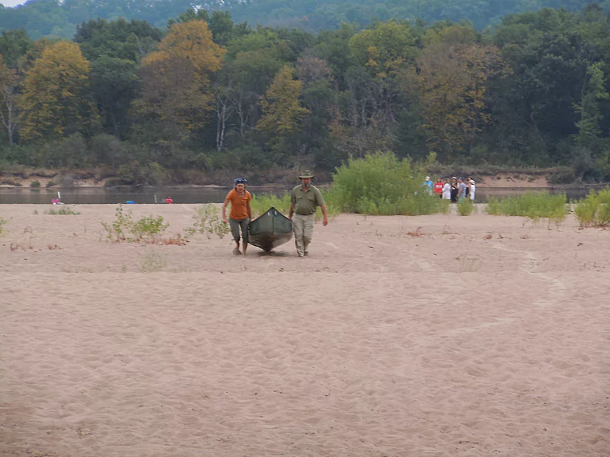
Terrific put-in at Mazomanie (Adler’s Landing). A triple landing of sorts, with a boat landing, canoe launch and then a secondary private canoe launch next door. Massive parking area (that I suspect fills up on occasion) and nearby outhouse. This was a busy port of call with people and boats swarming everywhere. Be careful about leaving your stuff here unattended as thievery has been an issue.
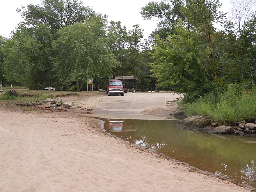
Normally the Arena Boat landing would also be swarming on an early August weekend…but things are a little different with the ramp this year. Basically, the access is “sanded in” (see pictures). Quite amusing, this is still an excellent landing with good parking and outhouses, but you’ll have to walk your boat over sand. We actually helped a fisherman pull a full-sized boat over the sand (weren’t many boaters at this launch). Note, this can be a difficult launch to find from water and the best way to access it is to paddle downstream of a massive sandbar and then paddle upstream to the ramp (at least as close as you can get).
Much of the Lower Wisconsin is a difficult bike shuttle because the river doesn’t meander that much, some roads are busy with poor shoulders, and there are many miles between the bridges. This trip would have been 14.8 miles, which is extremely long for a bike shuttle.
Thankfully, there are a large number of liveries that service the Wisconsin between Mazomanie and Arena:
- Bender’s Bluff View Canoe Rental: (608) 544-2906 – E10032 Huerth Rd, Sauk City, WI 53583
- Jensen’s Blackhawk River Runs: (608) 643-6724 – PO Box 57, Sauk City, WI 53583
- Sauk-Prairie Canoe Rental: (608) 375-5300 – 7554 US HWY 12, Sauk City, WI 53805
- Traders Bar and Grill (aka Sandbar Canoe Rental): (608) 588-7282 – 6147 Highway 14, Arena, WI 53503
- Waz Inn: (608) 583-2086 – 234 S Oak St, Lone Rock, WI 53556
- Wisconsin Canoe Company: (608) 432-5058 – E5016 US Hwy 14, Spring Green, WI 53588
- Wisconsin Riverside Resort: (608) 588-2826 – S13220 Shifflet Rd, Spring Green, WI 53588
We went with Black Hawk River Runs, a livery service I like and felt we were well treated by (I’ve had my share of bad liveries to appreciate good ones). Their headquarters is conveniently located next to the Mazo landing.
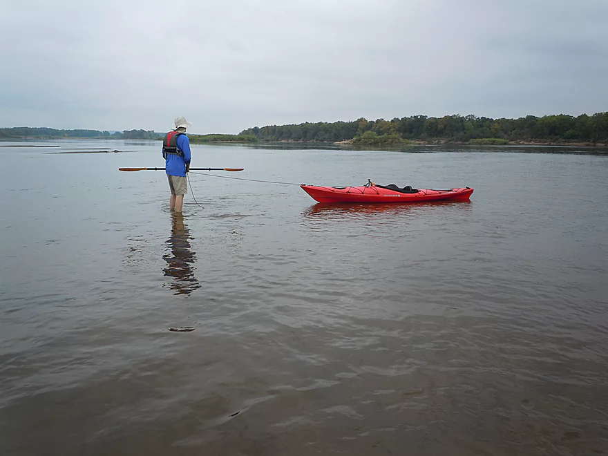
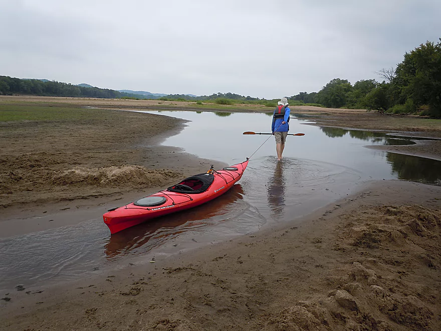
Mostly none and this is a good water trail for beginners. Note, the current is deceptively fast and powerful, and there are sudden and unexpected drop-offs if you are wading. Many have drowned. Also beware of strainers along the edge. My brother flipped his canoe years ago getting too close to one on this very section.
Also beware of the wind and direction. The liveries won’t send out canoes if there are whitecaps (my livery driver shared a story of a canoer who got burnt out a week earlier trying to fight the wind and attempted to walk back to the landing before a warden found her). I suggest avoiding headwinds over 8 mph (important especially for canoes).
Lastly, be aware of water levels (more on this below).
We went at 4850 CFS (at Muscoda), which is a good depth for sandbars and safe paddling. Roughly speaking, you want to paddle 10,000 CFS or lower for the sandbars and frequently this won’t happen until July/August. A rookie mistake is to do a trip on the river in May/June (with exceptions). My personal preference for an ideal trip would be to go at 6000 CFS or lower…at 3000 the River is getting pretty low, but sublime for sandbars and keeping noisy motorboats off the river.
The current is again deceptively fast (at times over 5 mph with some surprise riffles), but does slow down in areas. Roughly speaking it is never too low to run the river. If you read the river wrong, you’ll have to get out and pull your boat, but this is easy with the clean sandy bottom.
I would say 10,000 CFS or higher is too high. The river can become a big monotonous (and dangerous) conveyor belt that is no fun, has dirty flood water and lacks sandbars.
An osprey, flock of geese, some painted turtles and a flock of cranes. Normally this is a great section for clams, but none were seen. The highlight (as expected) were the eagles which numbered 7-8 just for this short stretch.
- “Paddling Southern Wisconsin” by Mike Svob: A classic and contains a terrific top-to-bottom reference for the Lower Wisconsin
- Wisconsintrailguide.com: Another fine top-to-bottom guide to the Lower Wisconsin
- Lower Wisconsin State Riverway Guide: Terrific PDF/Map put out by the DNR.
- Friends of the Lower Wisconsin River – This facebook page is a great source of news for the latest happenings on the Lower Wisconsin
- History of conservation on the Lower Wisconsin
Quick Overview
- Upstream of Stevens Point: I don't have information yet on these stretches.
- Stevens Point to Lake Petenwell: ~42 miles. This stretch in Central Wisconsin used to have many natural rapids, but most have been buried under 8 dams, some of which are now difficult portages. Despite this there is still some good paddling to be had in this region.
- Lake Petenwell: 14.9 miles. This is a large flowage lake that is challenging for paddlers because of frequent strong winds and big waves.
- Castle Rock Lake: 14.5 miles. Another large flowage lake that is likely too big for enjoyable paddling.
- Castle Rock Lake Dam to Lemonweir River: 9.4 miles. This pre-Dells leg isn't elite, but is a pleasant stretch.
- Lemonweir River to Indian Trails Landing: 21.7 miles. This includes the famous Upper Dells and Lower Dells which feature many scenic sandstone outcrops.
- Indian Trails Landing to Portage: 16 miles. This is an overlooked section sandwiched between the Dells and Portage. While the scenery isn't top-notch, it does have many sandbars and few people, which is a nice combination.
- Portage to Lake Wisconsin: 14.3 miles. This is a neat stretch of the river with many sandbars and cliffs, but the shoreline is very developed and motorboat traffic can be heavy on weekends.
- Lake Wisconsin: 14.5 miles. This is a challenging lake for paddling because of the huge and frequent waves created by motorboats.
- Prairie du Sac Dam to Port Andrews: 57 miles. This is the first half of the famous Lower Wisconsin Riverway. This is a super popular stretch for paddlers with the highlights being large sandbars, big bluffs, occasional cliffs, and fun side sloughs to explore.
- Port Andrews to Wyalusing: 40 miles. This is the second half of the Lower Wisconsin Riverway which has far fewer paddlers and sandbars. But the bluffs and sloughs are larger and more interesting.
Detailed Overview
- Upstream of Merrill: I don't have enough information yet on these legs to comment.
- Merrill Dam to Riverside Park: 0.5 miles. Might include some light rapids below the dam.
- Riverside Park in Merrill to Wisconsin River Forest Landing: 8.6 miles. A good prospect.
- Wisconsin River Forest Landing to Brokaw Boat Landing: 5.7 miles.
- Wisconsin River Forest Landing to Jesse Park: 1.4 miles. A terrific stretch with small boulder gardens, one set of Class 1-2 rapids, gravel bars and a nice sand bank.
- Jesse Park to Brokaw Boat Landing: 4.3 miles. A good stretch with scenic wooded banks and occasional gravel bars.
- Brokaw Boat Landing to Gilbert Park: 5.1 miles. River slows down and becomes hillier. This stretch is an ok prospect and goes past the old Brokaw paper plant that has been shut down. Paddlers must navigate Class 1 rapids and a 2' drop where the old Brokaw dam used to be.
- Gilbert Park to Wausau Boat Dock: 1.5 miles. An impounded stretch through Wausau. There are numerous alternate access options to choose from.
- Wausau Boat Dock to Oak Island Boat Ramp: 1.2 miles. A nice stretch that includes Barkers Island and Isle of Ferns Park. But the Wausau dam does require a portage. This stretch parallels the famous Wausau Whitewater Park.
- Oak Island Boat Ramp to Rothschild Dam Access: 5.8 miles. Likely mostly uninteresting flowage paddling. There are many alternate access options to choose from.
- Rothschild Dam Access to Zimpro Park: 1.0 miles. This might be a nice stretch.
- Zimpro Park to River Road Boat Landing: 7.6 miles. The first half of this leg is likely nice river paddling, but the second leg is probably just an uninteresting flowage.
- Chucks Landing/Mosinee Dam to Bean's Eddy Boat Landing: 2.8 miles. Likely a nice leg. You might be able to launch by the dam where there should be some nice rapids and boulders.
- Bean's Eddy Boat Landing to Seagull Boat Landing: 5.1 miles. Mostly uninteresting flowage paddling. Although there might be some nice sand banks on the eastern shore.
- Seagull Boat Landing to Dubay Dam Access: 5.3 miles. Mostly uninteresting flowage paddling.
- Dubay Dam Access to River Road Landing: 5.5 miles. This could be a nice stretch of river.
- River Road Landing to Old US 10 Landing: 2.3 miles. Likely an ok leg.
- Old US 10 Landing to Stevens Point Dam: 5.6 miles. Probably uninteresting flowage paddling. Many alternate access options closer to Stevens Point.
- Stevens Point Dam to Blue Heron Boat Landing: 4.2 miles.
- Steven Point Dam to Whiting Dam: 2.6 miles. Starts slow and uninteresting, but the river becomes very scenic after the Hwy HH bridge. The rock formations below both dams are very striking. Many alt access points.
- Whiting Dam to Kimberly Clark Dam/Al Tech Park: 0.6 miles. Incredible scenery with exposed bedrock and boulder gardens below the Whiting Dam. Some rapids, but nothing major. The Kimberly Clark Dam is a dangerous low-head dam and should be treated carefully.
- Kimberly Clark Dam to Blue Heron Landing: 1.0 miles. Class 2 rapids below the dam, but after that the river slows dramatically and splits into many sub-channels and islands. Round trips on this leg are possible. I chose the far western channel where there were some nice rocky stretches.
- Blue Heron Landing to Mill Creek Landing: 4.1 miles. Likely a mediocre paddle with nothing special. Galecke Park is an alternate access.
- Mill Creek Landing to Biron Dam North Gate: 7.6 miles. Mostly uninteresting flowage paddling. Several alternate access options on route.
- Biron Dam North Gate to Veteran's Memorial Park: 4.5 miles.
- Biron Dam North Gate to Biron Landing: 1.0 miles. Super scenic stretch by two islands with many granite boulders.
- Biron Landing to Legion Park: 3.0 miles. A nice stretch by Big Island. The west channel is more undeveloped...but the east channel has several scenic granite islands.
- Portage through Legion Park: 680'. A steep wall separates the park from the river but in two locations the wall is short enough to get over (see map). Paddlers may want to consider a longer portage to bypass some of the shallow rocky stretches by Legion Park.
- Legion Park to Veteran's Memorial Park: 0.4 miles. A scenic stretch that features a large boulder field and the powerhouse for a large paper mill.
- Veteran's Memorial Park to Port Edwards Landing: 3.8 miles
- Veteran's Memorial Park to Demitz Park: 0.8 miles. A pleasant stretch that includes Belle Island.
- Demitz Park to Ben Hansen Park: 1.2 miles. This leg goes by Garrison Island and Edwards Island. Lyon Park is located across the river from Demitz Park and is another access option.
- Ben Hansen Park to Port Edwards Landing: 1.8 miles. Above the Centralia dam there are several small but nice islands. Portage the dam on the left bank (follow the 1000' trail through the golf course). Below the dam there are scenic rock formations. Close to the Port Edwards dam are a few more scenic islands you can explore.
- Port Edwards Landing to Nekoosa/Riverside Park: 3.6 miles.
- Port Edwards Landing to Port Edwards Powerhouse: 1.3 miles. A half-mile portage is required (east bank). A very scenic boulder field is located below the dam. At high levels, the rocks are submerged and produce a half-mile stretch of rapids (some strong).
- Powerhouse to Moccasin Creek Landing: 1.8 miles. A generic wooded stretch that isn't super interesting.
- Moccasin Creek Landing to Riverside Park: 0.5 miles. During the Nekoosa dam drawdown, this stretch had nice boulder fields and rapids.
- Riverside Park to Hwy 73: 0.8 miles. An ok stretch of the river. There are scenic cliffs south of Hwy 73, but these are past the dam warning line. Hwy 73 is not a good access option.
- Hwy 73 to Point Basse Ave (Portage of the Nekoosa Dam): 1.5 miles. A difficult 1.5 mile portage through downtown Nekoosa. Don't try to portage the south bank. There is a steep hill, cliffs, and large Domtar paper mill fences to deal with.
- Point Basse Ave to Jim Freeman Memorial Boat Landing: 0.8 miles. A generic stretch going by historic Point Basse. If you're willing to backtrack to the dam, you can see scenic boulder fields (during low flows) and a few cliffs. Point Basse Ave is a somewhat speculative access, but it seems public and doable for launching.
- Jim Freeman Memorial Boat Landing to Plank Hill Small Boat Access: 2.0 miles. A generic stretch.
- Plank Hill Small Boat Access to 19th Drive Landing: 5.3 miles. Features two epic sand banks. The main channel has some minor sandbars. Several of the side sloughs can provide fun side adventures.
- 19th Drive to the Petenwell Dam: 14.9 miles. This is Lake Petenwell which is a large and challenging lake for paddling. Waves and strong winds are frequently an issue. But when calm there are nice sandbanks on the northwest shore, hidden sloughs, and large islands to explore. See the overview map for more info.
- Petenwell Dam to Ganter Lane Landing: 3.8 miles. This stretch isn't too impacted by dams and may have nice sandbars at low levels.
- Ganter Lane Landing to Castle Rock Lake Dam: 10.7 miles. Castle Rock Lake is likely too big (wind/waves) for enjoyable paddling. There are many alternate launch options along the shore.
- Castle Rock Lake to the Lemonweir River: 10 miles. An ok section.
- Lemonweir River Mouth to River Bay Landing: 7 miles. The first half of the classic Upper Dells.
- River Bay Landing to Blackhawk Island: 6.5 miles. Second half of the classic Upper Dells, known for its fantastic outcrops. Note, the Blackhawk Island landing is no longer accessible without special permission from the Upham Woods Outdoor Learning Center.
- Black Hawk Island to Wisconsin Dells Dam: 2.0 miles. More nice sandstone outcrops. You can take out at a public ramp off Indiana Ave or portage the dam and take out SW of the dam by a launch off Wisconsin Dells Pkwy/Hwy 12.
- Dells Dam to Indian Trails Landing: 6.2 miles.
- Dells Dam to Newport Park: 2.2 miles. This is the heart of the famous Lower Dells with many scenic outcrops. Unfortunately jet boats are a serious plague on this stretch.
- Newport Park to Indian Trails Landing: 4.0 miles. Features the famous "Sugar Bowl" formation and four super cool caves. The outcrops soon disappear and this stretch is mostly uneventful (but peaceful) big river paddling.
- Indian Trails Landing to Pine Island Boat Ramp: 9.8 miles. Few paddle this stretch as it isn't as interesting. But...it does have a good concentration of sandbars and few competing paddlers for them.
- Pine Island Boat Ramp to Portage/Hwy 33 Access: 6.0 miles. Not an elite section that is lacking in cliffs and bluffs. It does have good sandbars though.
- Portage to Dekorra Park: 7.7 miles
- Portage to Baraboo River/Thunderbird Road: 5.2 miles. A good section with great sandbars. Close to Portage there are few motorboats.
- Baraboo River to Dekorra Park: 2.5 miles. River splits around massive Lib Cross Island. West channel has nice sandbars. St Lawrence Bluff has scenic sandstone outcrops and includes a cave you can paddle into.
- Dekorra Park to James Whalen Memorial Park: 6.6 miles.
- Dekorra Park to Camp Rest Park: 5.1 miles. A terrific section with rock outcrops, large island deltas, hidden sloughs, and nice sandbars. Unfortunately this part of the river is popular with motorboats and jet skis which can be a plague. Multiple alternate access options.
- Camp Rest Park to James Whalen Memorial Park: 1.5 miles. Not a great section because of the open water paddling, powerboats and big waves. The west shore though does have nice outcrops.
- James Whalen Memorial Park to Merrimac Memorial Park: 4.4 miles. River turns into "Lake Wisconsin". Generally speaking this isn't ideal for kayaking as motorboat traffic can be heavy and waves can be surprisingly big. The most direct route is the north shore which has a few bluffs, but generally speaking isn't that interesting.
- Merrimac Memorial Park to Veterans Memorial Park/Prairie du Sac: 9.6 miles.
- Merrimac Memorial Park to Moon Valley Landing: 3.3 miles. Includes a lot of developed shoreline. The ferry, railroad bridge, and Moon Bay are highlights.
- Moon Valley Landing to Veterans Memorial Park/Prairie du Sac: 6.3 miles. Other than Moon Bay and the dam, this is a boring stretch. There are numerous alt access options on this route.
- Prairie du Sac to Mazomanie: 8 miles. An ok section of the Wisconsin but lacking in sandbars.
- Mazomanie to Arena: 9.7 miles. A great section with nice sandbars and scenic bluffs.
- Arena to Hwy 14: 8.0 miles. Good section with a high concentration of sandbars. One of the more popular legs on the Lower Wisconsin.
- Hwy 14 to Hwy 23/Spring Green: 2.2 miles. Neat mini-section with sandstone outcrops. Very popular in the summer.
- Spring Green to Lone Rock: 7.4 miles. Another fine sandbar/bluff section with some nice rock outcrops too.
- Lone Rock to Gotham: 8 miles. This stretch has super impressive rock outcrops and sand banks.
- Gotham to Muscoda: 7.6 miles. This leg includes more large sandbars and great outcrops. Bonus highlights include fast current and not seeing as many people.
- Muscoda to Port Andrew: 7 miles. A good stretch with many islands and sandbars.
- Port Andrew to Boscobel: 9 miles. Wooded islands start to get massive.
- Boscobel to Woodman/Big Green River: 9 miles and start of the less paddled stretch of the Lower Wisconsin. Far fewer sandbars from here to the mouth, but good bluffs and side sloughs to explore.
- Woodman to Millville: 7.7 miles. A good stretch with large bluffs and sandbars.
- Millville to Bridgeport: 5.3 miles. Huge islands, bluffs and sandbars are the highlight on this second-to-last leg on the Wisconsin River.
Bridgeport to Wyalusing (the mouth): 9 miles.
Trip Map
Overview Map
Video
Photos Size:
I paddled the Wisconsin River from Blue River down to Boscobel with my new packraft. It was a very enjoyable trip. I did have to get out and walk once. I was hoping to see more wildlife though, so that was a little disappointing. I plan on coming back next year to float the Kickapoo.
Thanks for the comment Robert! Am definitely looking forward to doing this section in the future. As far as wildlife goes, it’s mostly timing really. I recently did the Yellow River which seemed kind of dead as well. The main reason being that so many birds have migrated south already. I’m sure things are much more interesting in the spring and summer.