
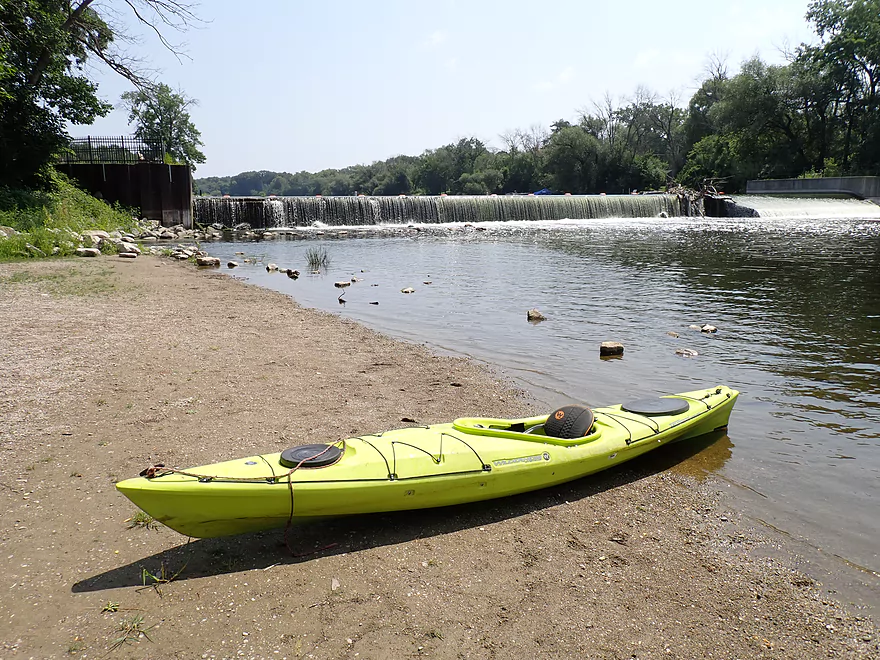
Starting the trip at the Thiensville Village Park Launch
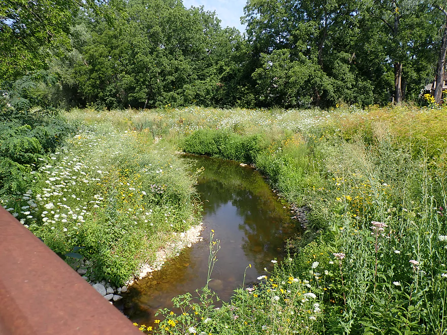
The local fish passage looked interesting….
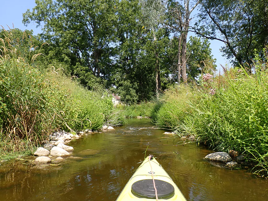
So I decided to kayak it
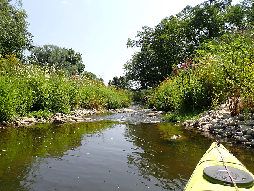
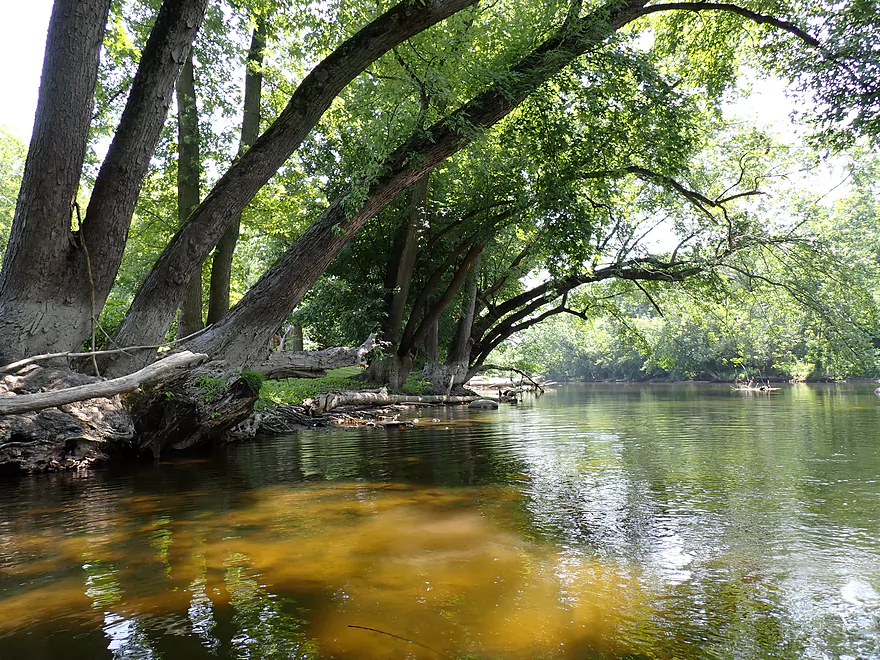
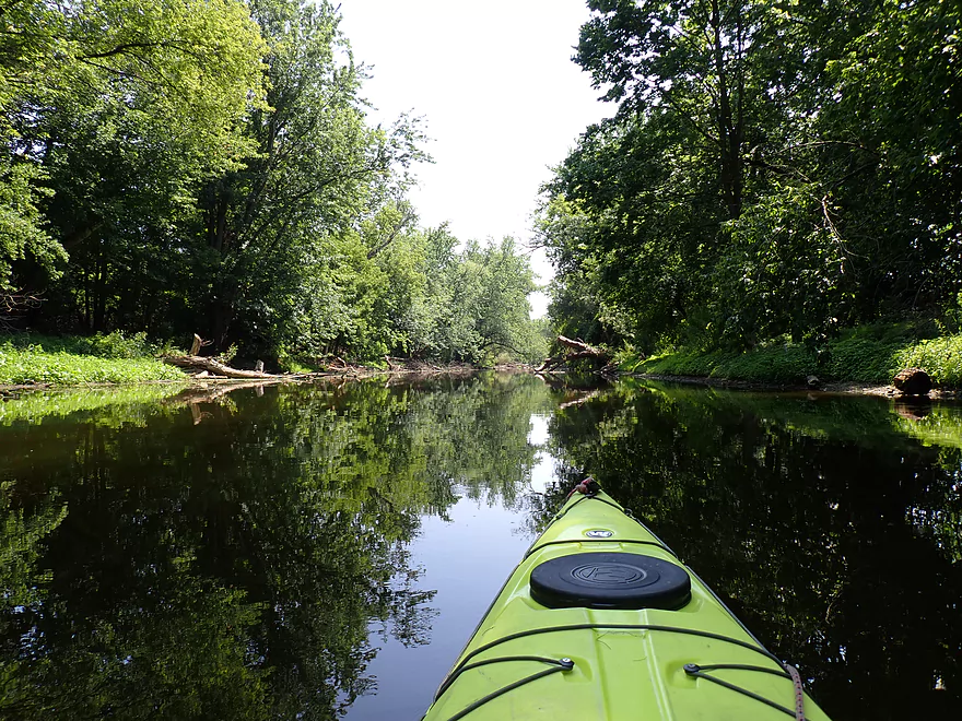
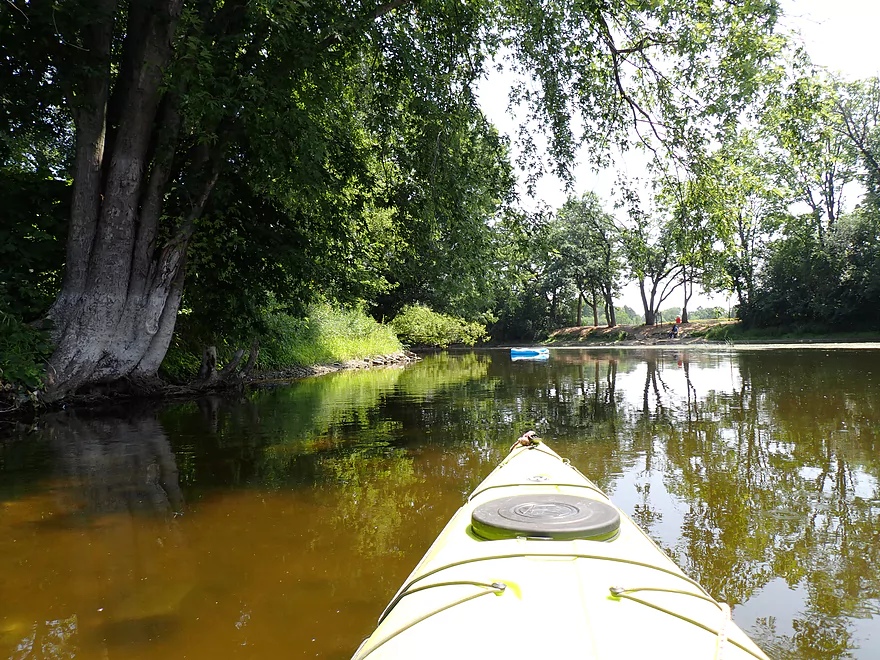
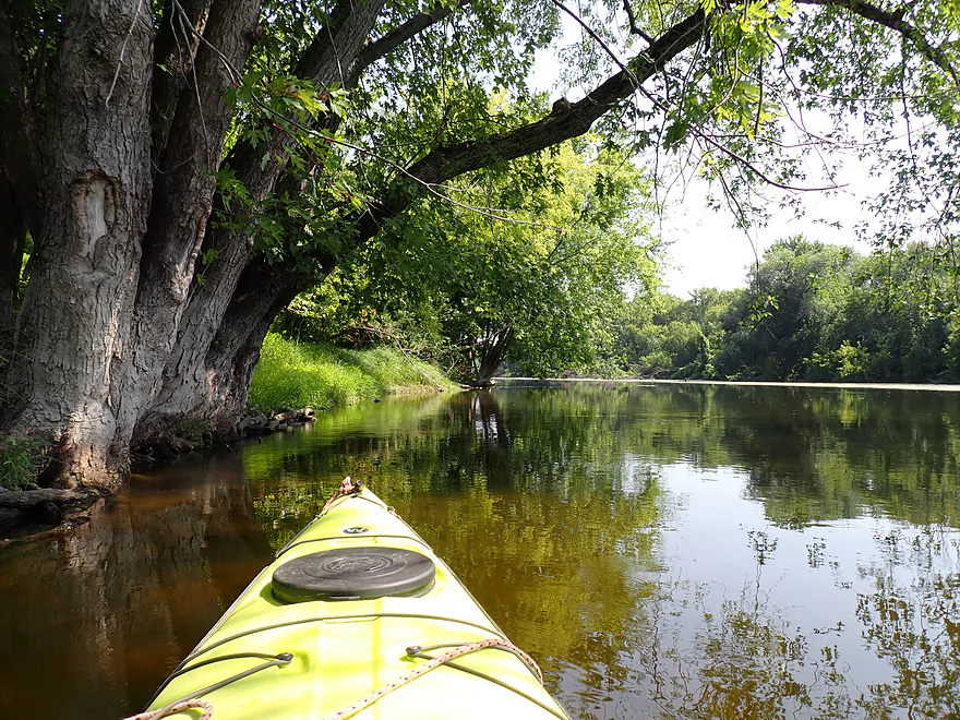
Very scenic
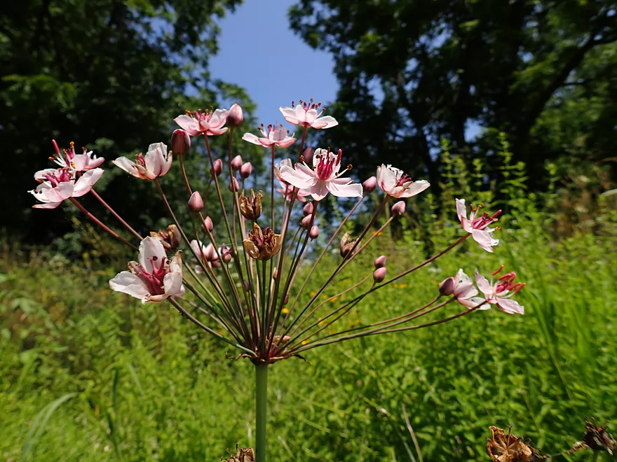
Flowering rush–an invasive ornamental
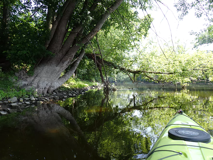
A little congested in spots
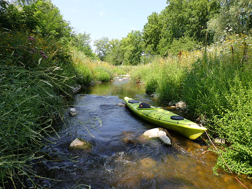
I had to wade this part
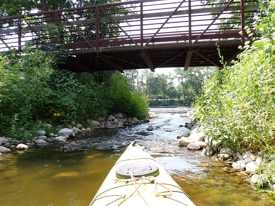
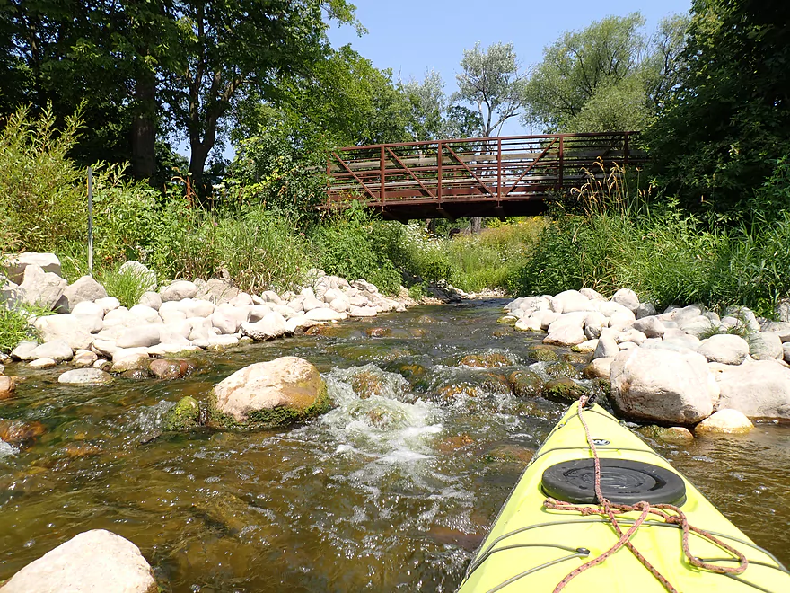
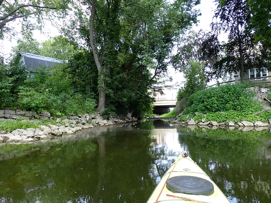
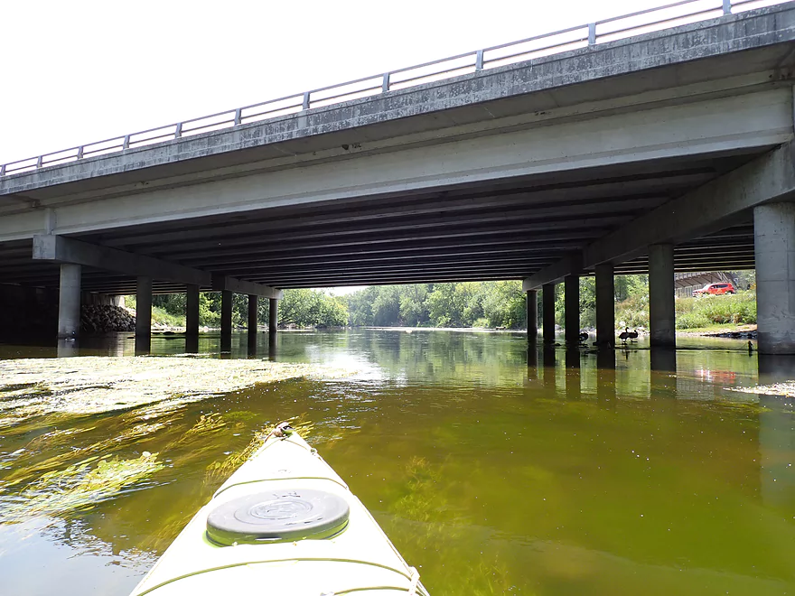
The Fishway runs under the Rotary Riverwalk
…and empties back into the Milwaukee River
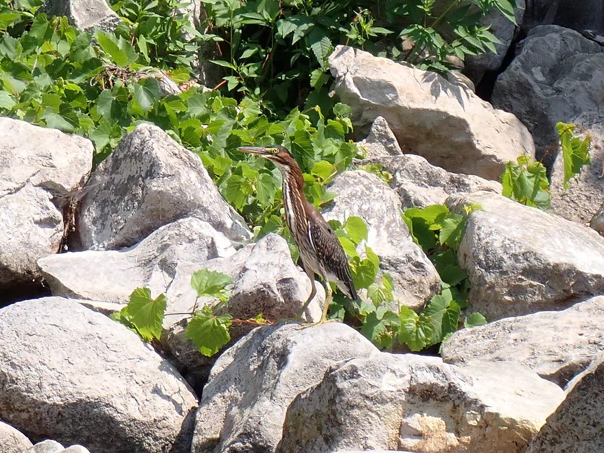
A surprisingly friendly green heron
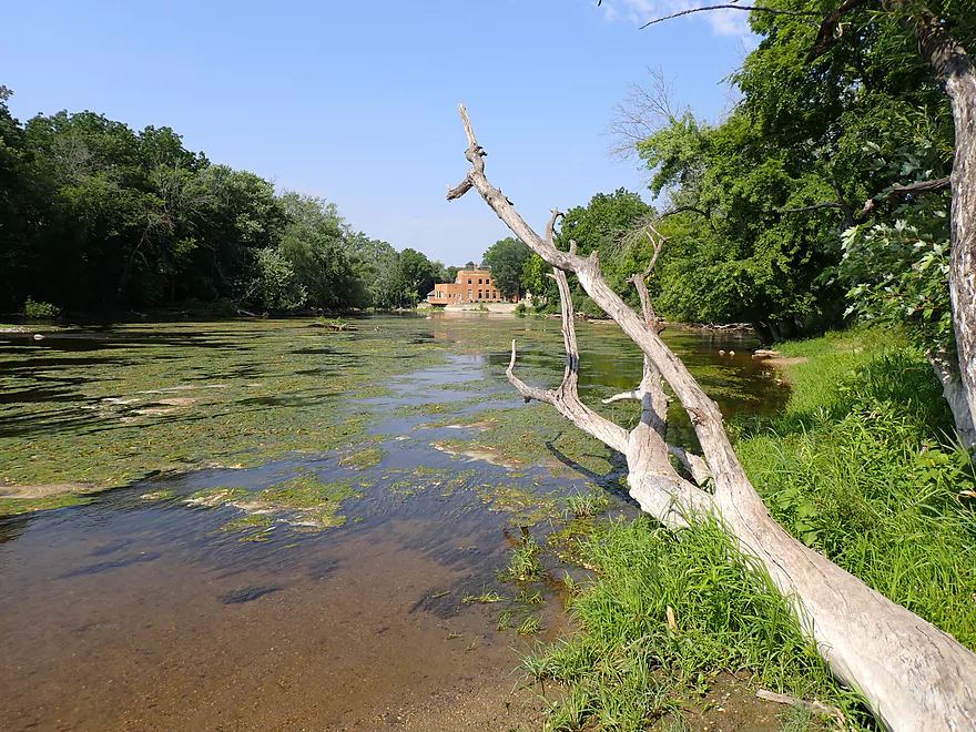
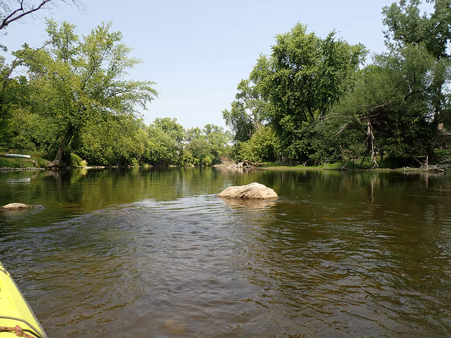
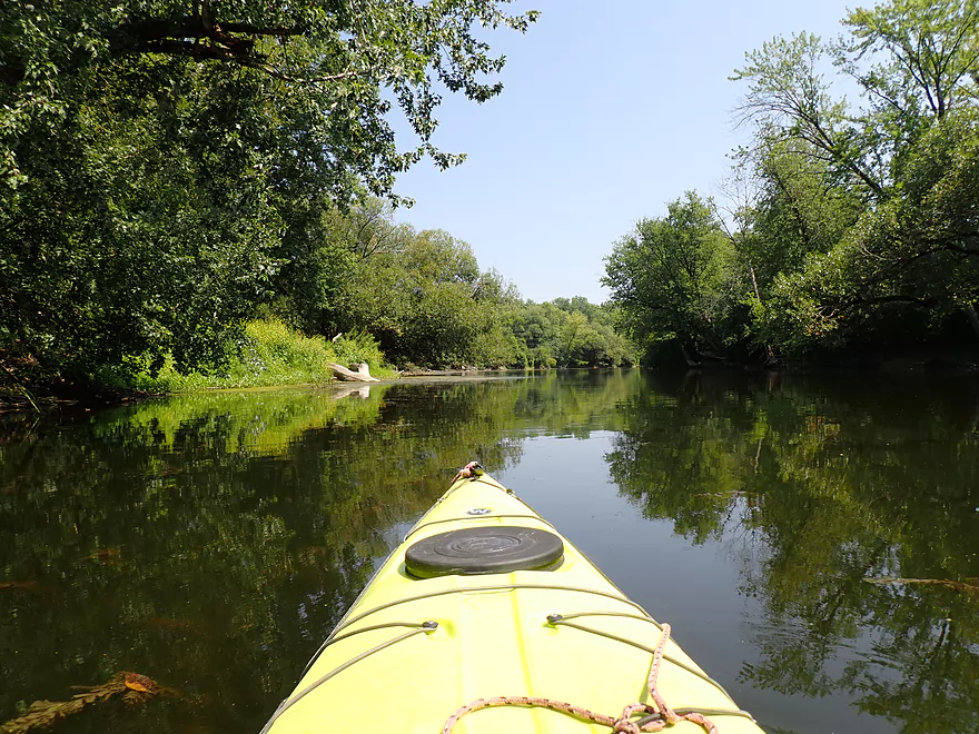
Back on the main river
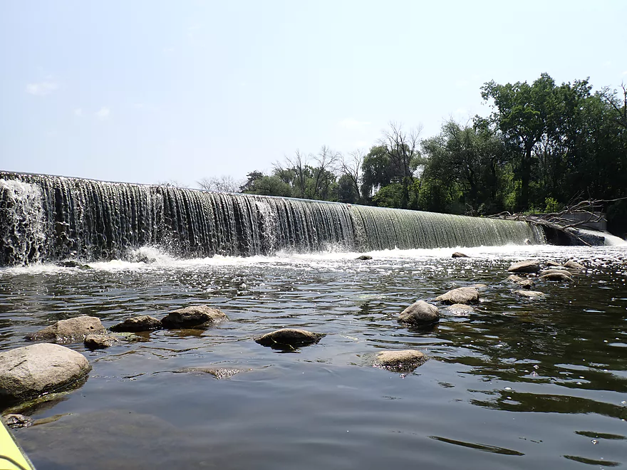
The Thiensville Dam
The far end is sloped…maybe runnable by advanced whitewater paddlers in high water
Nice rock wall
Pigeon Creek looks pretty dried up
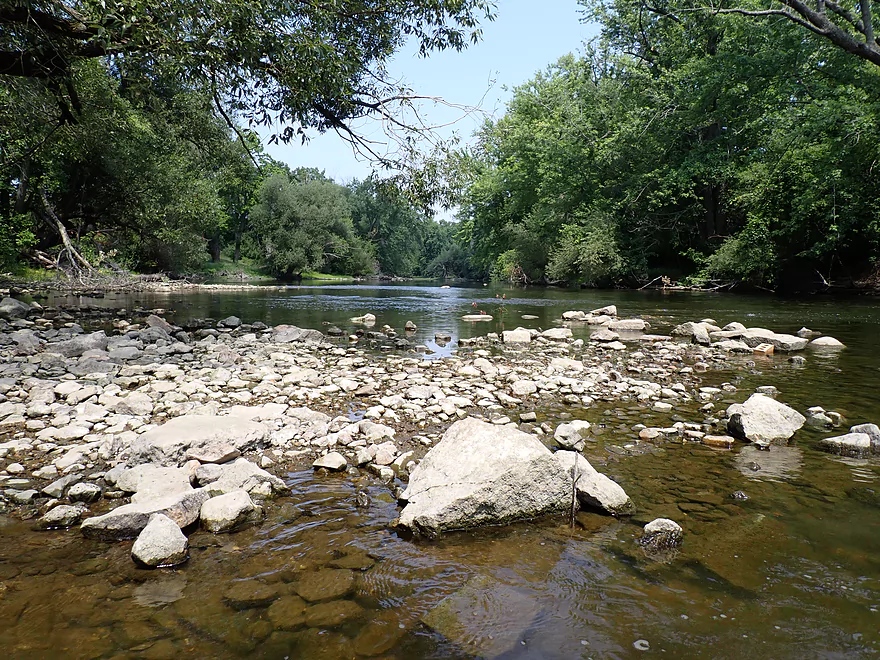
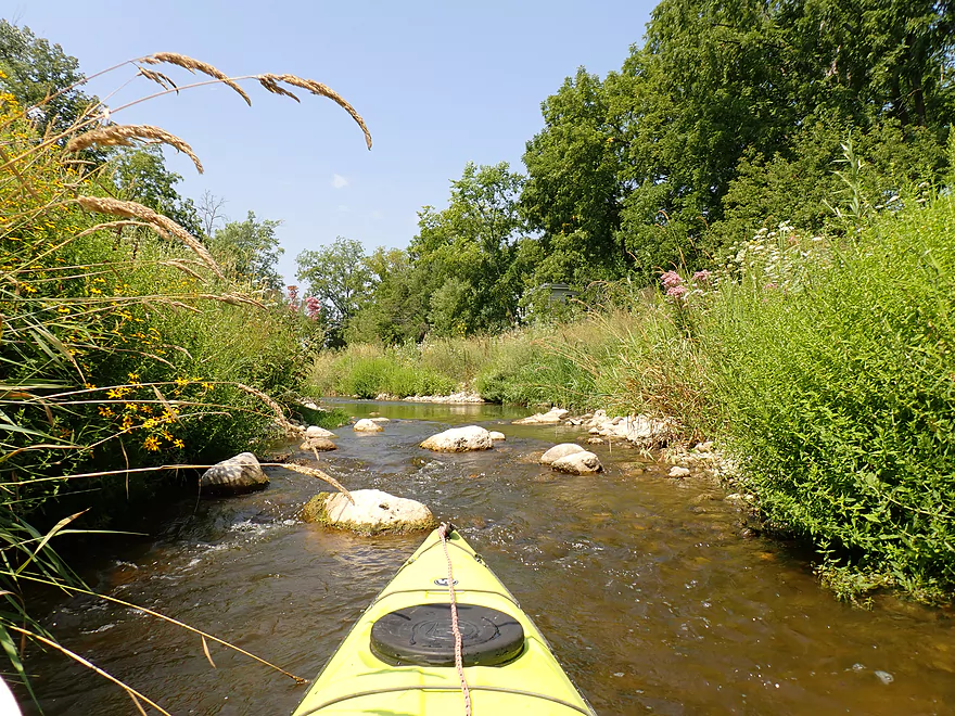
First mile was kind of rocky
Settlers Park is likely an access option but not as good as the Thiensville Dam
Hwy 57
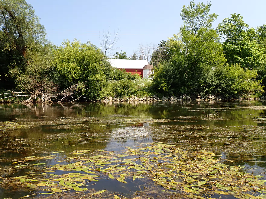
Coming up on a large golf course
Occasional erratics
Trees show the high water line
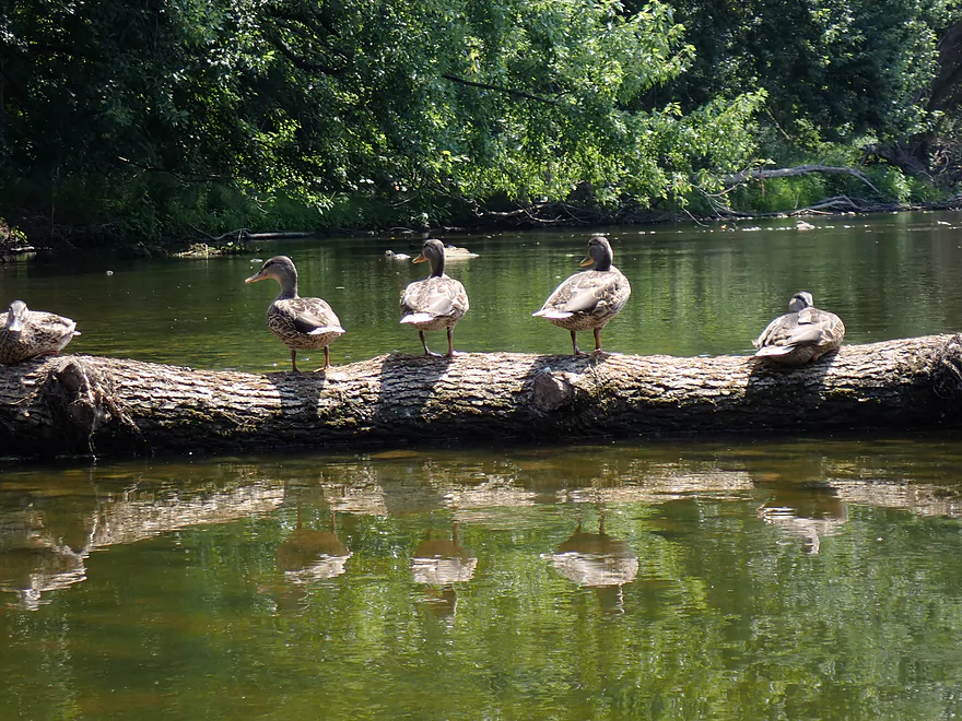
Very tame ducks
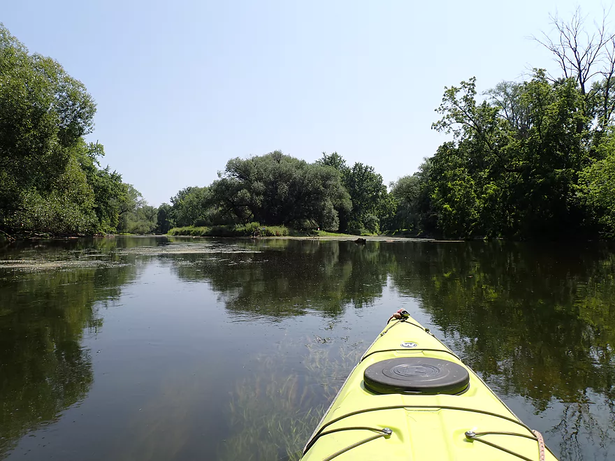
Approaching a large island
I chose the right channel
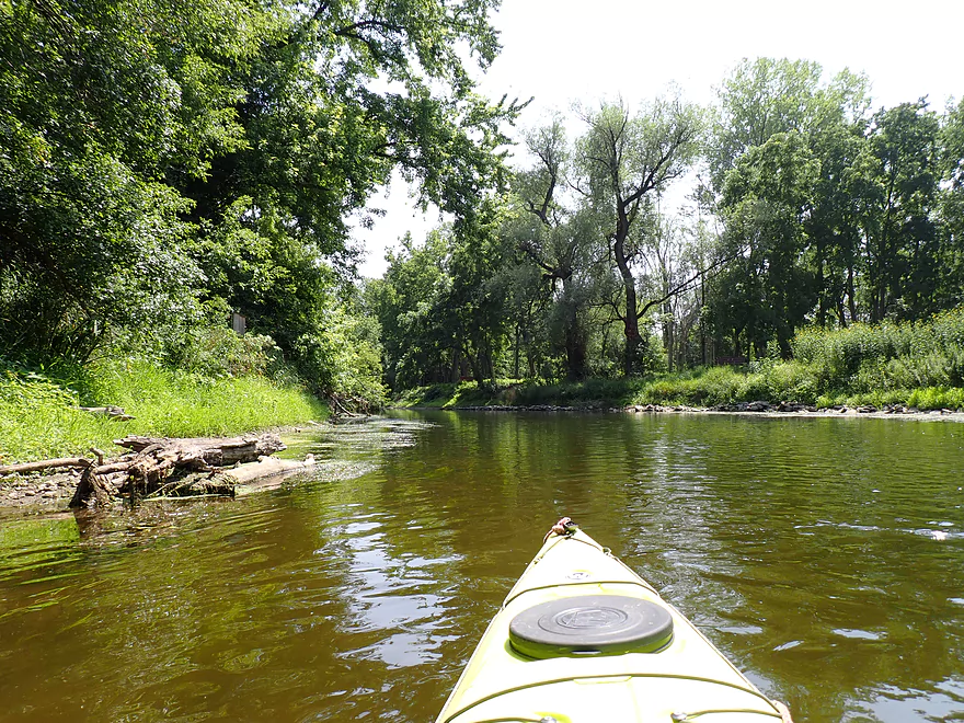
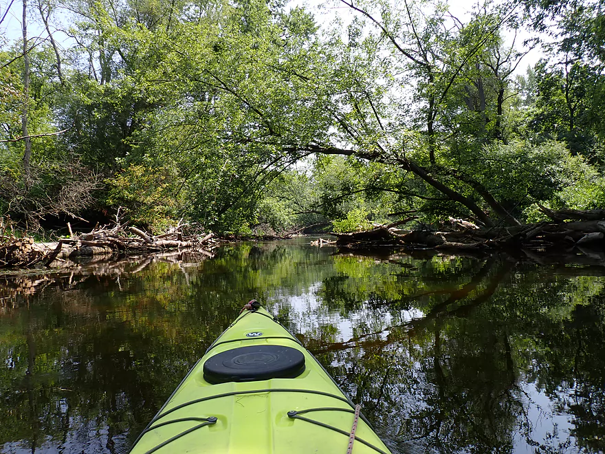
Scenic stretch
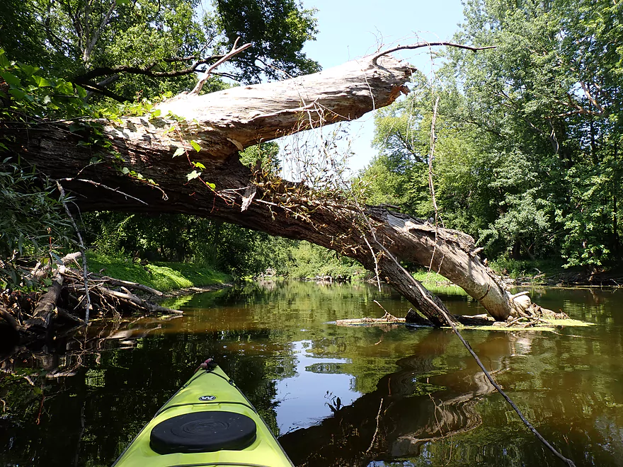
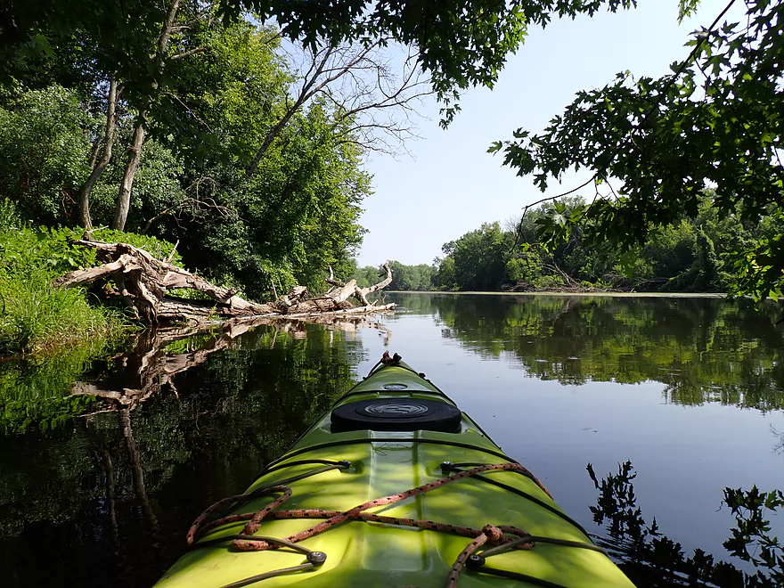
Logjams were never an issue on this trip
Cool stonework
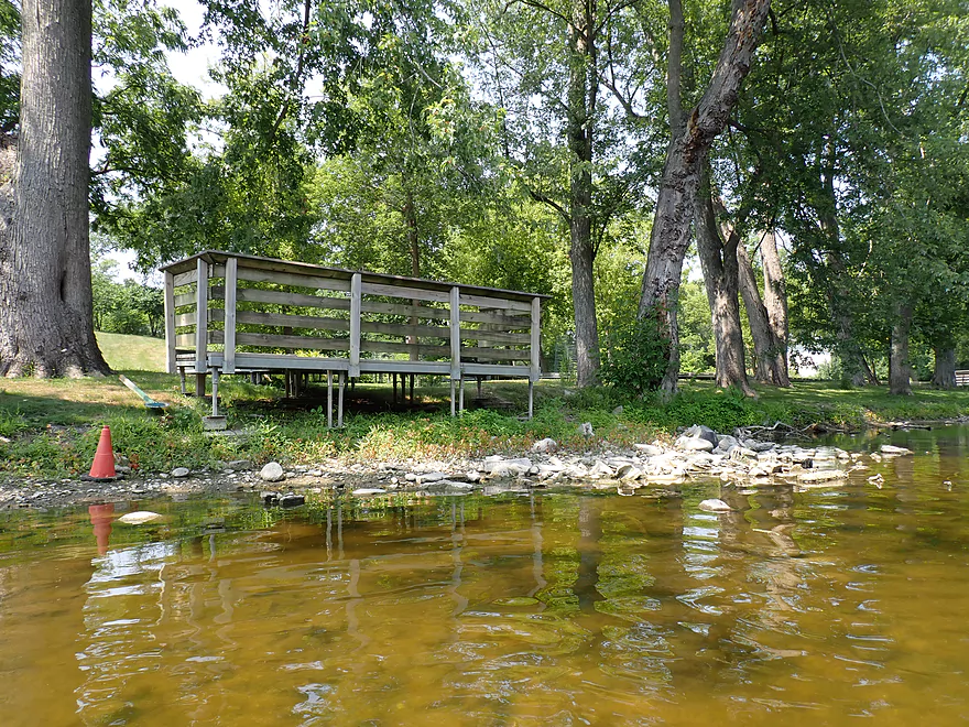
River Barn Park is an access option (but not a good one)
Another high water mark…river was pretty low for this trip
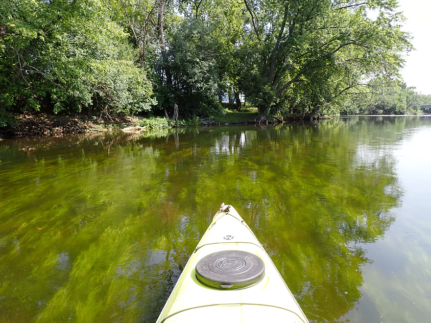
Aquatic weeds start to become common
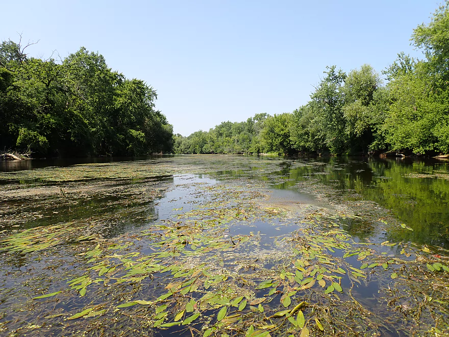
There were usually open paths around the weeds
Another sign the Milwaukee River is low
Small boulder garden
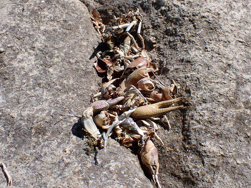
Odd pile of crayfish parts
River is really slow here
Paddling over swaying plants
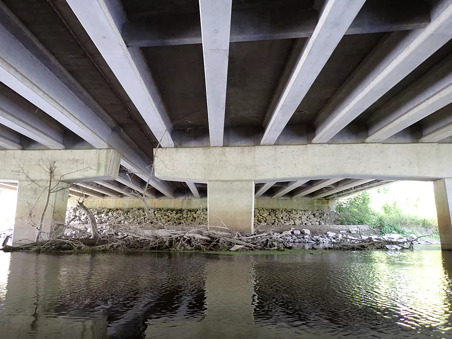
Bottom side of Hwy 100 (aka Brown Deer Road aka Alt 45 aka ALT I-41)
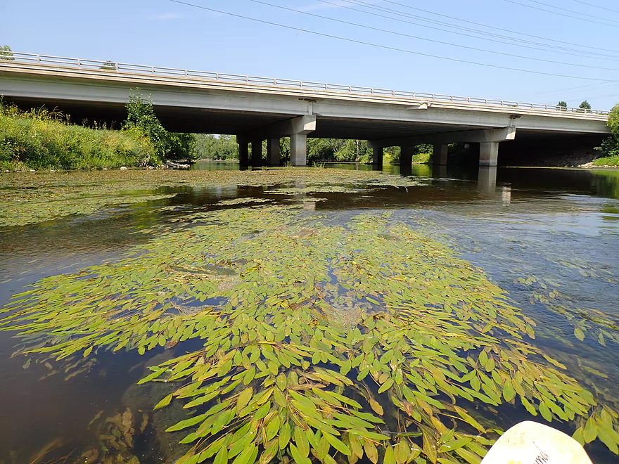
A mat of floating potamogeton leaves
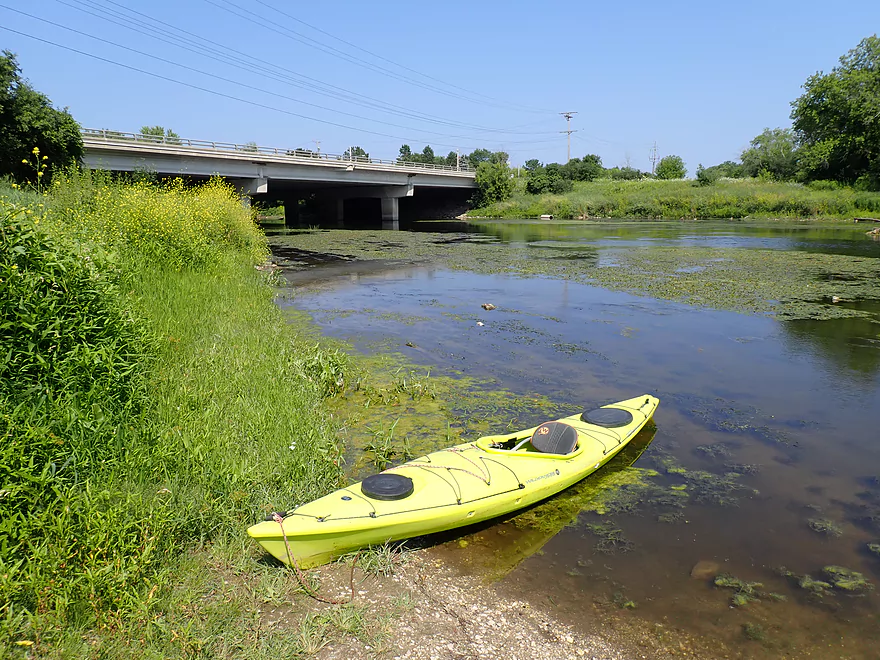
Taking out at Badger Meter River Park
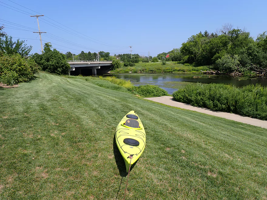
Nice public access, but paddlers do have to drag their boats up a bit of a hill to reach the parking lot
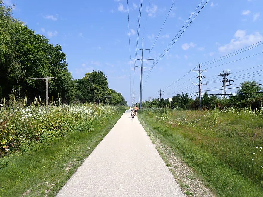
Great bike shuttle on the Ozaukee Interurban Trail
Milwaukee River – Thiensville


The goal for this week’s trip was to explore the river that flows through Milwaukee’s northern suburbs which is typically overlooked by other water trail guides. I chose to start at Thiensville Village Park which has a nice launch option and is located by the Thiensville Dam. With the Estabrook dam recently removed, the Thiensville and Kletzsch dams are some of the last left on the Lower Milwaukee.
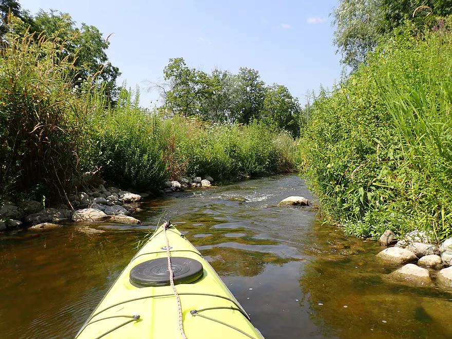
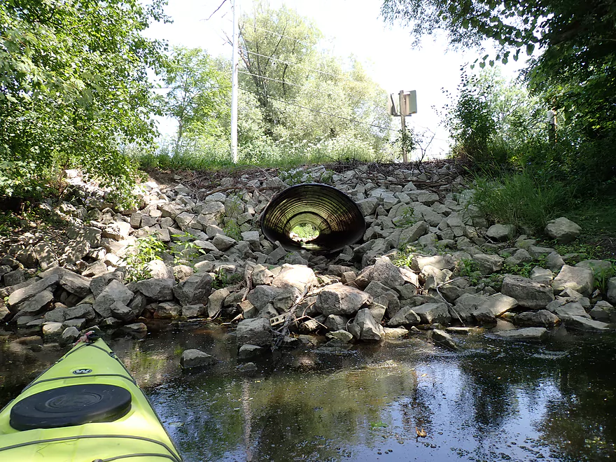
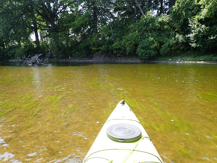
One of the more remarkable features of the Thiensville dam is a 1200′ fish passage that connects the north end of the dam to the main channel. The idea (in theory) is fish that normally would be blocked by the dam can swim up the passage and around the dam. It is actually a small creek and looked navigable so I opted to start the trip here. The passage (while artificial) is quite scenic with many boulders and huge prairie grasses that dwarf the channel. Little ledges separate the passage into a series of small pools. Most I was able to get past, but a few were tricky and had to be waded. In hindsight, water levels were likely too low to run the fish passage.
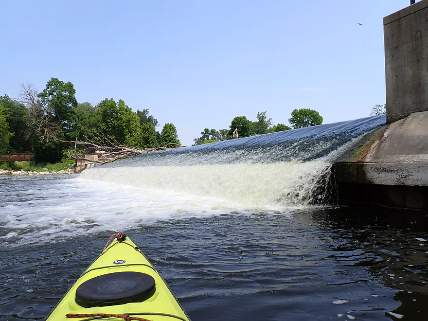
In the end the passage looped back on itself, flowed under a bridge and emptied back into the Milwaukee River over a small ledge. I think the idea behind the fish passage was sound but misguided. I suspect it’s too fast/steep for small fish and too shallow/narrow for big fish. The barrier by the dam itself may also be a tricky impediment. I fear this fancy fish passage may be used as an excuse to NOT remove the dam, which would be a much better solution.
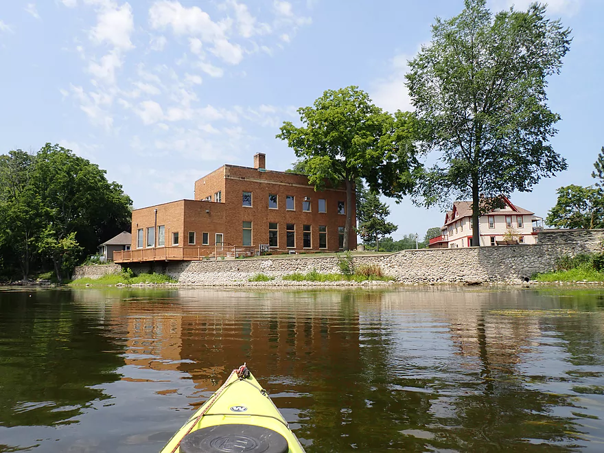
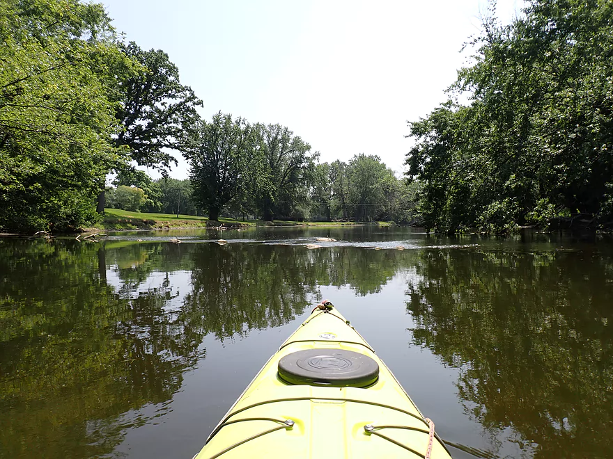
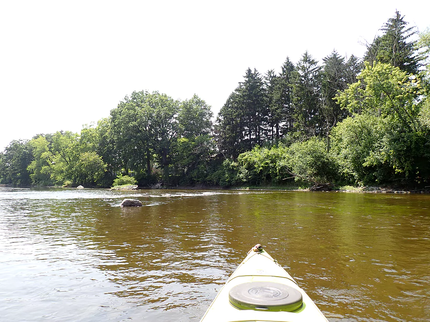
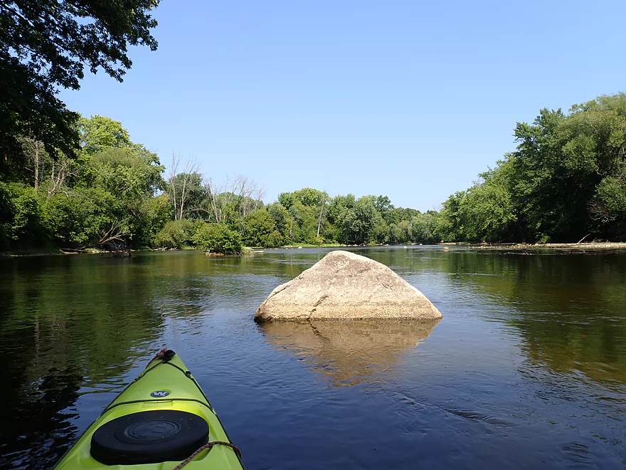
The first mile of the trip (up to the I-43 bridge) was nice aside from some loud road noise. Here the waterfowl were suspiciously tame (local signs warned against feeding animals), the channel rocky, and the banks wooded with interesting buildings. It was also somewhat shallow, thanks to the drought, but if you are good at reading the river, you can almost always paddle around the shallow spots and find consistently navigable water.
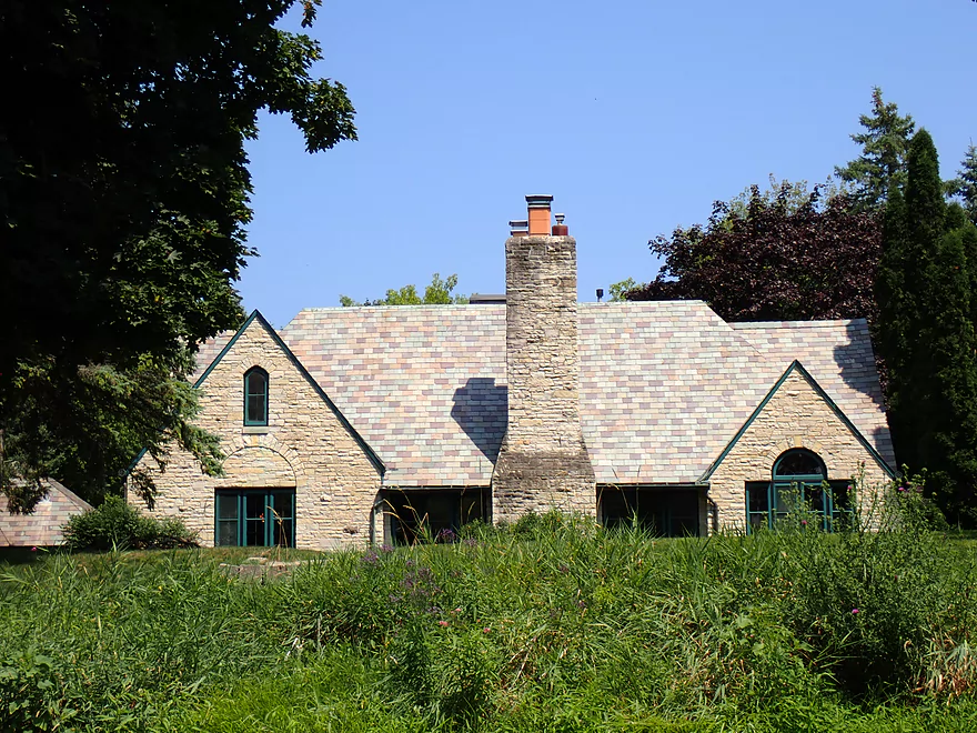
Past the golf course, the river slowed down a bit and the banks while wooded seemed to contain more “weed trees” which weren’t as attractive.
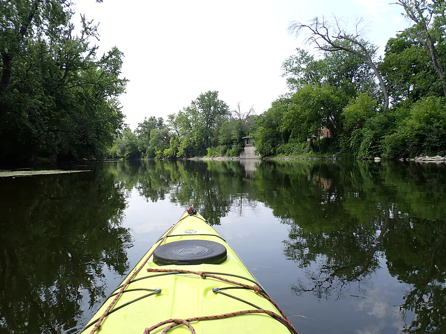
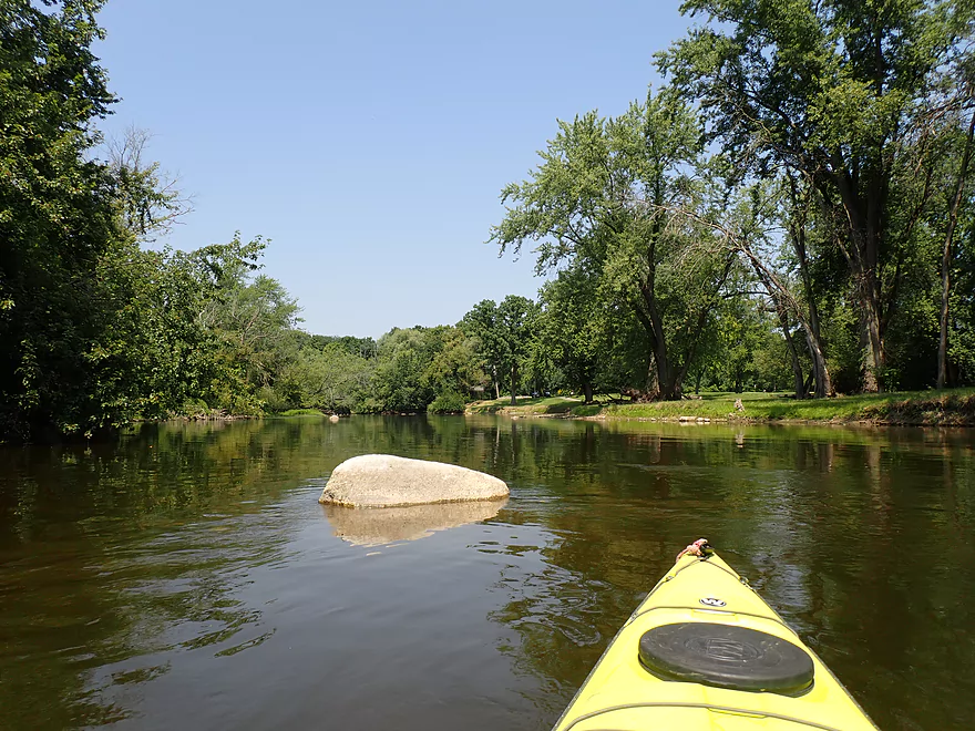
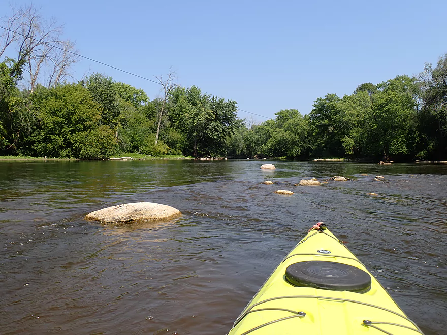
The halfway point in the trip is marked by a long island (about a third of a mile long) which was plastered with some of the most No Trespassing signs I’ve ever seen on an island. Paddlers will have a choice…the left/east channel is wider, while the right/west channel is narrower. I chose the latter and really liked this attractive stretch of the river which featured a number of nice shade trees.
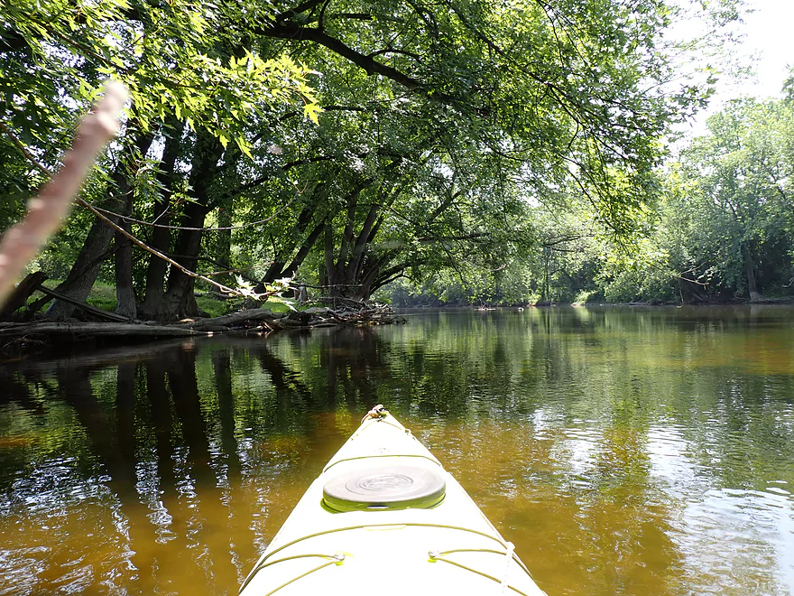
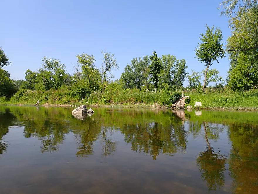
The second half of the trip wasn’t as interesting. The current slowed so much that I thought (incorrectly) I was coming up on a dam. There was one last small boulder garden which was nice, but aside from that, the river was a bit monotonous with similar looking wooded banks and odd generic homes popping up on the shoreline. Frankly it wasn’t that interesting. I ended the trip at Badger Meter River Park which was a nice area of the river and a good spot to wrap up the trip.
In summary this was a slightly disappointing trip. It wasn’t bad, and locals may want to explore it. But it lacked unique traits that make other Milwaukee River segments special. If you’re new to the Milwaukee River, I suggest instead to focus on the “Big 3” sections first:
- West Bend to Waubeka: Much less developed and has really nice water clarity.
- Grafton Section: Features fun rapids and attractive rock formations. This can get too shallow though.
- Downtown Stretch: A terrific trip through downtown Milwaukee which features some neat urban scenery.
Thiensville Village Park Launch: This is a public park with options to launch above or below the dam. It is a good access with restrooms.
Alternate Put-ins:
- Pioneer Road (6.9 miles upstream from Thiensville Park): This is an ok access option. The upstream leg should be nice but would include some flowage paddling. There are a number of alternate landings between Pioneer Road and Thiensville Park.
Badger Meter River Park: This is a very good public access option. The park doesn’t feature playgrounds or picnic tables, so it’s really just for paddlers and you’ll likely have it to yourself. The only downside is you have to drag your boat up a 300′ grassy hill to reach the parking lot, but I didn’t think that was a big deal. A hidden path on the south side of the park can offer a shorter route to the parking lot.
Alternate Take-outs:
- Kletzsch Park (5.3 miles downstream from Badger Meter Park): There are multiple access options in Kletzsch Park. The leg downstream from Badger Meter River Park should be a good prospect.
Bike Shuttle: 4.8 miles with 23′ of ascent. Other than a busy stretch by the take-out/Hwy 41, this was a really nice bike shuttle and mostly along the Brown Deer Trail and the Ozaukee Interurban Trail. The bike trails in the Milwaukee metro area are very underrated. Many are paved, flat, mostly secluded from traffic, and often close to rivers so can be used in combination with kayak shuttles.
Current/Rapids: There were a few minor riffles that almost weren’t worth mentioning. The current varies…but in general isn’t super fast. The second half of the trip featured especially slow and stagnant current.
Logjams/Hazards: None. This is a pretty easy & safe leg (as long as levels aren’t crazy high).
- 0-100 CFS: Exceptionally low. Some sections may require walking.
- 101-200 CFS: On the low side but with good navigation you can avoid grounding out.
- 201-300 CFS: An average depth.
- 301-400 CFS: A slightly above average depth.
- 401-600 CFS: A higher depth.
- 601-800 CFS: A high depth. Likely navigable but the river won’t be attractive.
- 801+ CFS: Maybe too high for enjoyable paddling.
Detailed Overview
Additional access options are visible on the overview map. Special thanks to Milwaukeeriverkeeper.org which has some detailed information on the river, including this great map.
- Upstream from Happy Road: Not viable for kayaking.
- Happy Road to Meadow Road: (0.7 miles) Small but mostly open stretch partly straightened by farmers. Likely ok.
- Meadow Road to Cty W: (1.5 miles) Very open stretch that flows past wetgrass marshes and farms. Likely an ok prospect with no logjams.
- CTY W to CampbellSport: (4.5 miles)
- Hwy W to Campbellsport Wayside: (4.1 miles) Starts as a narrow wet grass marsh and widens into a slower cattail marsh. Marsh recedes when sandwiched between two drumlins and becomes rockier and faster with some rapids. Overall a varied and scenic paddle. As of 2025 one logjam will have to be portaged.
- Campbellsport Wayside to Columbus PARC: (0.4 miles) A pleasant and scenic leg flowing past the outskirts of Campbellsport and a local town park.
- Campbellsport/Columbus PARC to Cty Y: (2.8 miles) Maybe 2-3 logjams. Otherwise this is a scenic stretch.
- Cty Y to Hwy 45: (1.7 miles) Maybe 3-5 logjams.
- Hwy 45 to Auburn Ashford Drive: (1.3 miles) Maybe 1-3 logjams...some riffles.
- Auburn Ashford Drive to Old Bridge Road: (0.7 miles) Maybe 1-3 logjams.
- Old Bridge Road to West/Main Branch Confluence: (2.0 miles) Maybe two logjams. For those launching above Kewaskum, I think they will start on the West Branch instead.
- Alternate - Hwy 45 to West/Main Branch Confluence: (0.7 miles) Probably one logjam...but more viable than starting from Old Bridge Road.
- West Branch/Main Branch Confluence: (2.8 miles) A mediocre prospect. Maybe one logjam..I don't know much more.
- Kewaskum Dam/Park to Cty H: (2.9 miles) Solid prospect.
- Cty H to First West Bend Dam: (6.3 miles) A solid prospect with some flowage paddling at the end. The take-out entails dragging your boat across a private parking lot.
- First West Bend Dam (Barton Ave) to the Second West Bend Dam: (1.3 miles) Mostly an urban flowage paddle. The first dam is a difficult portage or put-in.
- 2nd West Bend Dam to Quaas Creek Park: (3.8 miles)
- 2nd West Bend Dam (Washington Street) to South River Road: (2.1 miles) Terrific section with a restored prairie, fast current, light rapids, and good urban scenery.
- South River Road to Quaas Creek Park: (1.7 miles) A paddle through urban woods...pleasant but not top-notch.South River Road to Cty M: (6.3 miles) A pleasant stretch with little development and clear water.
- Cty M to Main Street Bridge (Newburg): (3.4 miles) Good prospect with small boulder gardens in shallow water.
- Main Street Bridge (Newburg) to Cty A Bridge: (6.3 miles) A popular paddle with great water clarity.
- CTY A to Waubedonia Park (Waubeka): (5.7 miles) A decent leg with good current, some rocky stretches, and nice color in the fall. North Branch joins up and significantly enlarges the river.
- Waubedonia Park to Ehlers Park/Mink Ranch Road: (5.3 miles) A good stretch with a number of light rapids.
- Ehlers Park to Peninsula Park: (2.5 miles) A suburban stretch with maybe one set of rapids.
- Peninsula Park to Grafton Canoe Launch (south Saukville on Cty O): (1.9 miles) Kind of a suburban paddle.
- Grafton Canoe Launch to Veterans Memorial Park (Grafton): (4.1 miles) Some suburban and flowage paddling, although I think there are minor rapids in the upper stretch.
- Grafton Dam (SW of Bridge Street) to Lime Kiln Park: (1.3 miles) A terrific section with class 2-3 whitewater and scenic dells.
- Lime Kiln Park to Hwy T: (1.6 miles) A good section with the scenic 'Grafton Dells' and some Class 1 whitewater. I'm not sure Cty T is a good take-out.
- Cty T to Pioneer Road: (1.9 miles) A solid prospect.
- Pioneer Road to Thiensville Park: (6.9 miles) A solid d prospect but with some flowage paddling at the end.
- Thiensville Park to Badger Meter River Park: (4.8 miles) This is a less popular stretch of the Milwaukee. While not bad, it had somewhat repetitive scenery and lacked unique features.
- Badger Meter River Park to Kletzsch Park: (5.3 miles) This is a solid prospect.
- Kletzsch Park to Estabrook Park: (4.1 miles) Some flowage paddling and a nasty low-head dam to portage. A second dam has been, I believe, recently removed so this section might be very different now.
- Estabrook Park to Riverside Park: (3.1 miles) A number of decent rapids in this wooded but urban paddle.
- Riverside Park to McKinley Marina: (6.3 miles) A great trip on the last section of the Milwaukee.
- Riverside Park to Bruce Street Boat Ramp: (3.9 miles) A scenic paddle through downtown Milwaukee featuring some skyscrapers and great architecture.
- Bruce Street Boat Ramp to McKinley Marina: (2.5 miles) A bonus add-on section along Lake Michigan that features scenic vistas of the downtown.
Trip Map
Overview Map
Video
Photos Size:
Hi,
Curious about the large island that is passed just after the Thiensville Dam. Does anyone know if that is a private or state owned island? or of any signage posted on the island? Curious if that could be camped on.
That’s a good question I don’t know the answer to. You contact the Mequon Parks department…if they didn’t know the answer they likely would know who to contact.
RE: islands within Milwaukee River: most of the sizable islands are under control of the federal BLM (Bureau of Land Management), and are designated for ‘day use only’.
Katie, it does not look like any camping is offered on that island property https://www.ci.mequon.wi.us/parks/page/shoreland-nature-preserve
Shoreland Nature Preserve is not an island, and lies upstream of the dam at Thiensville, thus is not the property which was inquired about.
Aaron, I didn’t take many pictures but I highly suggest you come out to paddle the Grafton section of the River. I started at the Grafton portage launch just downstream of the dam, and took out on Highland Road. My trip was 7.8 miles but I suspect most would want to take out on Pioneer Road for a more succinct trip ~5 miles. There are some class II rapids just south of the portage, and another fun set of class I rapids/shelves in Lime Kiln Park. Nearly constant Riffles until you reach Lakefield Road. Plus there are some of the great limestone borders and geology that the Cedarburg segment has making you feel like you are more in Door County than Suburban Milwaukee.
Thanks Gregor for the heads up. It’s on my todo list!