
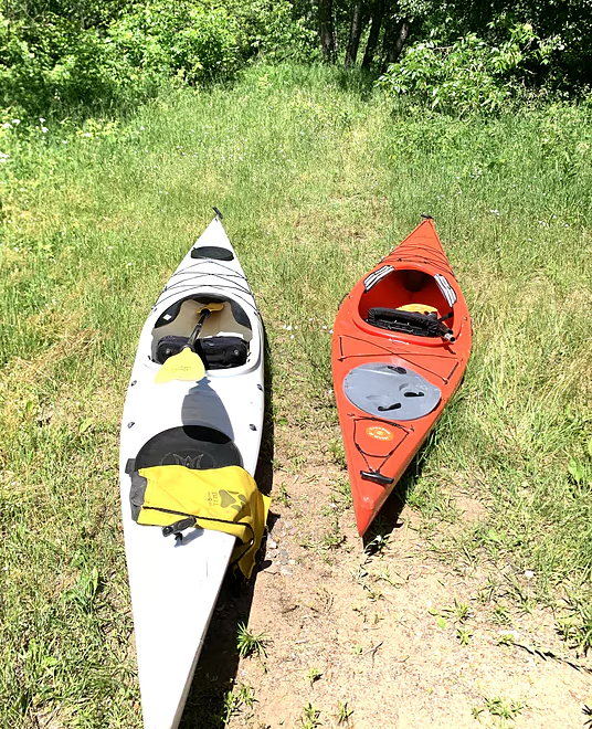
As nice as a put-in gets
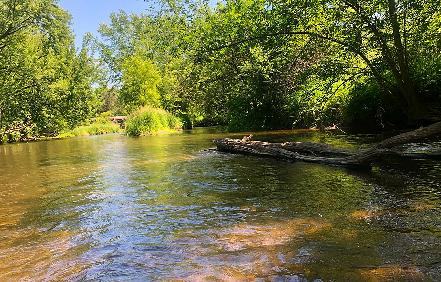
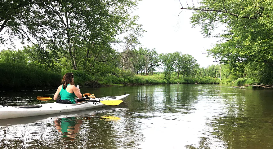
First look upstream after launch
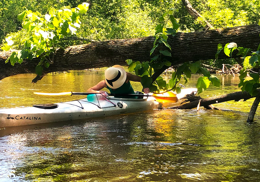
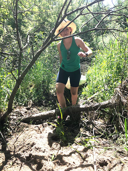
Not infrequent encounter with a tree
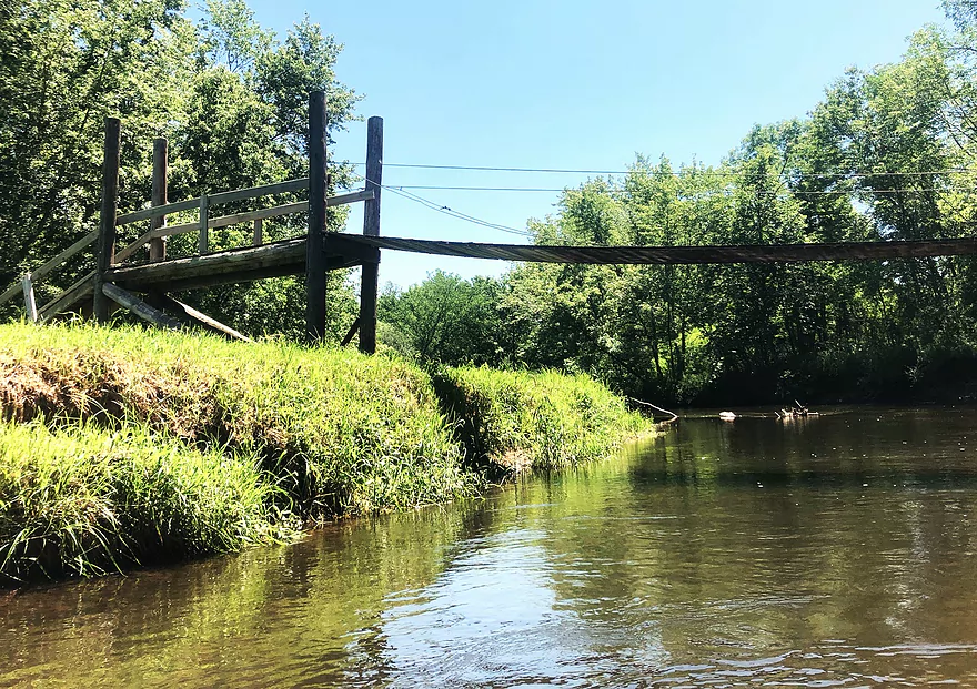
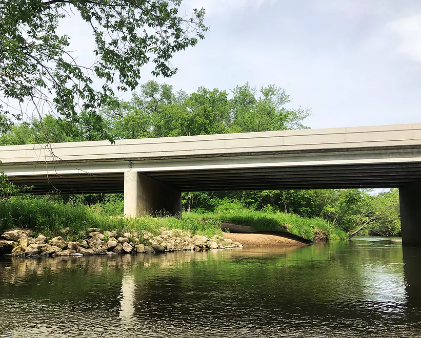
Fewer obstacles for a while, after this suspension bridge
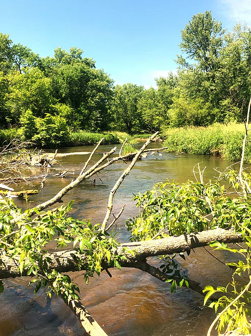
We got through this one — as we did most snags
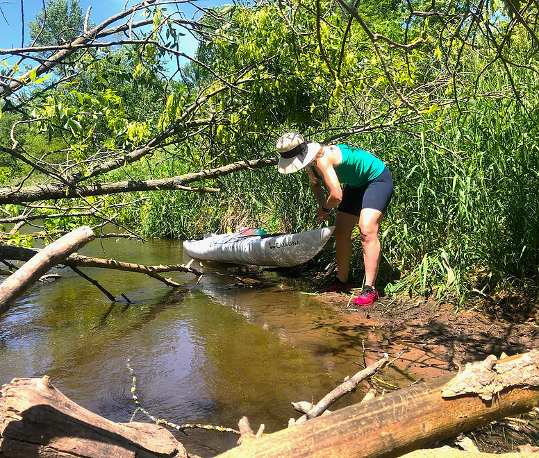
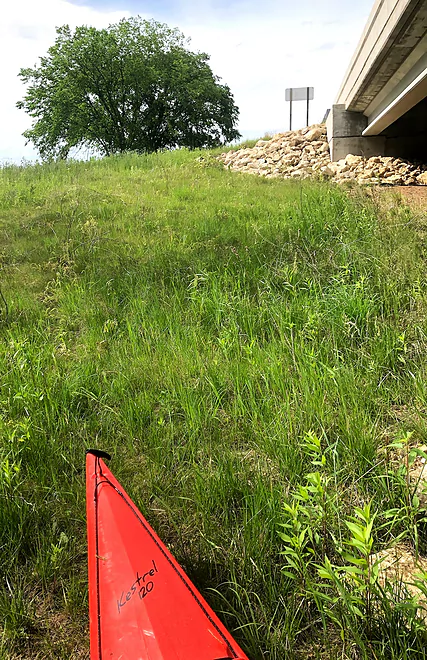
First of only 2 portages
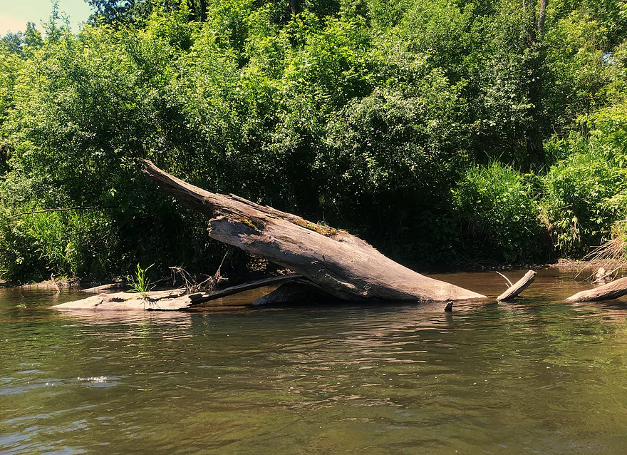
Giant swordfish in the river!
Gaping jaw on the right ready to devour creature on the left
2nd portage — short but brushy
Home stretch is placid and open
Sandbar at Hwy. 25 takeout beckons
Takeout is an easy pull up to the road
Hay River – Dunn County

The only thing keeping me from dropping one superlative after another about the Hay River is the fact that many paddlers don’t share my appetite for navigating snags and deadfalls in a river. There are upwards of 20 such obstacles in this stretch of the Hay, but so many other benefits offset those occasional blockages, most of which are navigable, with patience and good boat control. I’m grateful to my daughter Amanda’s not just lack of fear of but downright eagerness for the occasional horizontal tree-climb.
One superlative – or is it two? – is the put-in and the take-out. Both are reassuringly easy and gently sloped, even the parking space on busy WI Hwy. 25 at Wheeler. The put-in on County FF (river left, downstream from the bridge) is well used – but beware the poison ivy.
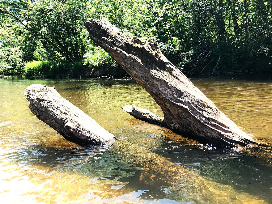
Two other constants in the Hay that deserve superlatives: crystal-clear water, a byproduct of the sandy soil of the watershed (and not the loamy soil that ends up as murky sediment and mud in most southern Wisconsin rivers), and, well, the sand. I don’t recall encountering any mud, anywhere. And when you have to navigate your way through deadfalls, sometimes on foot and out of your boat, having sand under your feet is pure pleasure.
Oh, and there’s a third superlative: the current is rarely pushy but rarely lets up, even toward the end of this segment when the river is deepened by the arrival of the flow of the South Fork of the Hay. Count on steady riffles (no real rapids) throughout this trip. The river’s level on the day daughter Amanda and I traveled it was 250 cfs at Wheeler, a bit below the median.
As she put it, the Hay is “a river that gives you enough time for uninterrupted conversation until you are pleasantly interrupted.” Those pleasant interruptions were the occasional snags and deadfalls. On the upper end of the segment we paddled, river angels had done some clearing. Beyond a pedestrian suspension bridge (a surprising find), the river is briefly free of blockages – but don’t be lulled into thinking that will last, as your conversation will be interrupted often by a downed silver maple here or an ancient basswood there, at times with heavy intermarriages across several tree species. I regret not bringing my small handsaw, as I could have put it to good use on a couple of the “pass-throughs” and on the two (yes, only two) portages we made.
On the banks, wooded of oaks and occasional pine plantings, there was just a handful of structures and no cropland was visible. There’s just one road crossing (Dunn County Hwy. N) and a powerline surprises you with its presence, as it has no counterparts.
The South Fork of the Hay, coming into the mainstem on river right, signals the turn to the east of the Hay, adds more flow, and the widening of the river is attended by a total disappearance of deadfall. It’s a relaxing cruise to the end of this segment. A leading indicator of the takeout is a sandbar (river left) under the Hwy. 25 bridge. An easy pull awaits you to get your boat up to the highway.
Is there more hay to make on the Hay? From what I gathered at a brewery in Menomonie following my trip, the more common run on this river is from Wheeler to Tainter Lake. It’s shorter, the flow is slower, the river is wider and mostly free of deadfalls. But Tainter “Lake,” an impoundment of the Red Cedar River, makes for an unpleasant ending, according to Rick Kark’s experience from the late 1990s.
In 2003, Kark paddled upstream of where we put in, starting at Dunn County Road F. It’s a good guess that snags and logjams would be present in that stretch.
Thanks Denny for the review! WisconsinRiverTrips.com is always very appreciative of guest reviews, and if you the reader is ever interested in submitting one, you can use this online form.
- Upstream from 7th Ave: The river is likely navigable up to Hwy 8 and beyond.
- 7th Ave to 6 1/2 Ave: 0.8 miles.
- 6 1/2 Ave to 5th Ave: 2.7 miles. Maybe 2 outcrops and one logjam.
- 5th Ave to 8 3/4 St: 3.1 miles. Maybe 4 outcrops.
- 8 3/4 St to 2 3/4 Ave: 1.7 miles. Maybe 1-2 outcrops.
- 2 3/4 Ave to Prairie Farm Dam: 0.7 miles. The Prairie Farm Flowage.
- Prairie Farm Dam to 1 1/4 Ave: 1.1 miles. Maybe 1-2 outcrops.
- 1 1/4 Ave to CR FF: 19.1 miles. This is reviewed by author Michael Duncanson in the book “A Canoeing Guide to the Indian Head Rivers of West Central Wisconsin“. Quote: “Sandstone cliffs give this area a dells-like atmosphere, and are very scenic. Fences are a problem here, and must be negotiated with care.” Rick Kark also reviews this stretch and remarks: “We enjoyed maneuvering past islands and observing the sandstone cliffs topped by white pines and birches.”
- CR FF to CR V: 6.9 miles. Maybe five outcrops (likely the most scenic stretch on the river), but also some fences to go over/under.
- CR V to CR F: 4.2 miles. Maybe 2 outcrops.
- CR F to Hwy 64: 4.3 miles. Maybe 1-2 outcrops.
- Hwy 64 to CR FF: 3.7 miles. Maybe 3 outcrops.
- CR FF to Hwy 25: 9.4 miles. Reviewed here by Denny Caneff.
- CR FF to CR N: 4.5 miles.
- CR N to Hwy 25: 4.9 miles.
- Hwy 25 to Hwy 170: 3.8 miles. Generic stretch but should include one very large sandbank.
- Hwy 170 to Peninsula Park Boat Ramp: 5.2 miles. Rick Kark remarks this stretch is filled with backwater sloughs and large trees. Finding the take-out can be a challenge because Upper Tainter Creek can become choked with vegetation.
- Peninsula Park Boat Ramp to Northwest Landing Park: This is mostly lake paddling on Upper Tainter Lake and Tainter Lake. Tainter Lake represents the mouth on the Red Cedar River and the end of the Hay River.
Note, the South Fork of the Hay River joins the main branch upstream of Hwy 25. Rick Kark remarks “The South Fork of the Hay is only OK – it is deadfall prone. The nearby main Hay River is a much nicer option“.
Trip Map
Overview Map
Photos Size: