
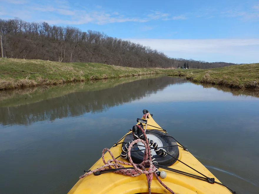
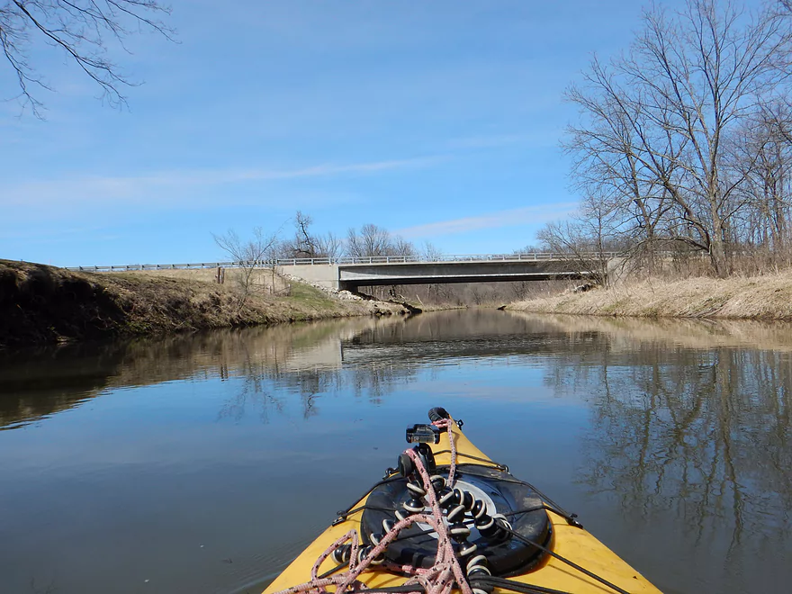
Putting in at Church Road
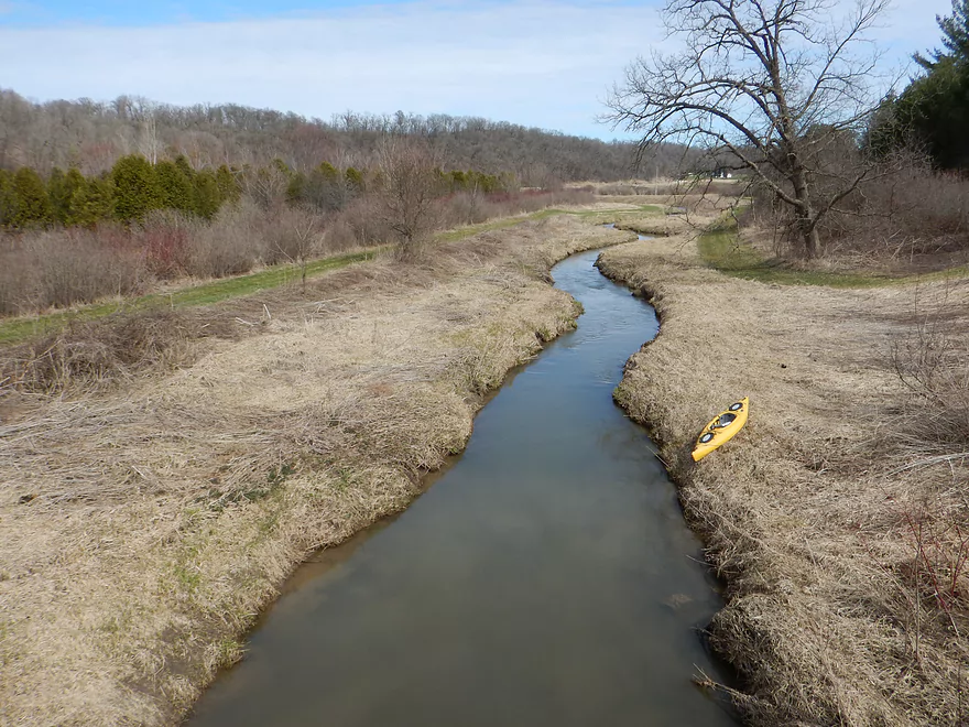
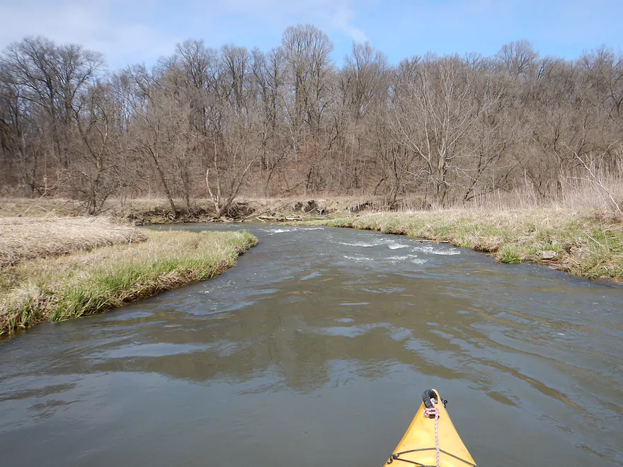
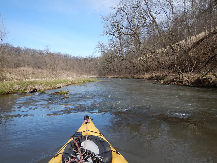
Very narrow to start
In fact too narrow…I’m stuck
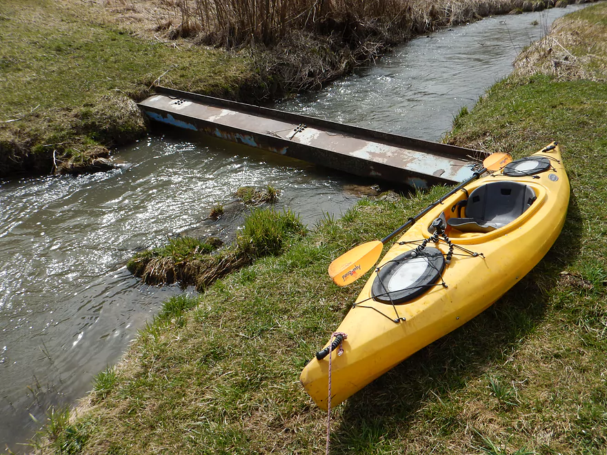
Only portage of the trip
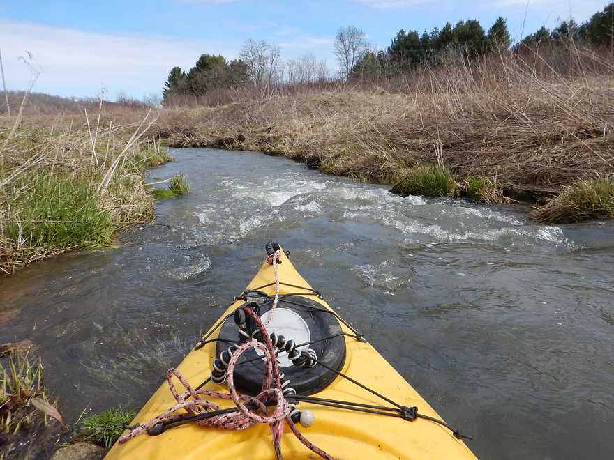
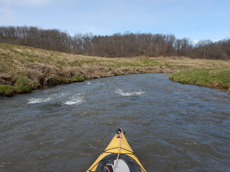
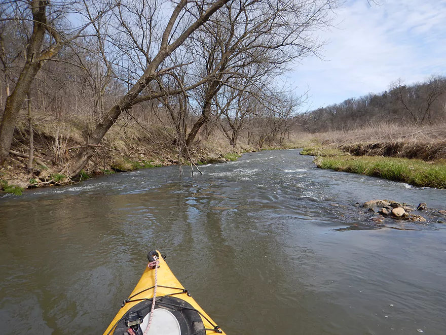
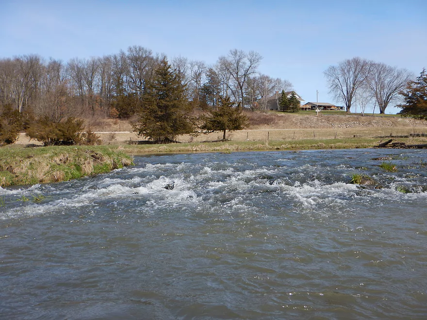
Small but mighty rapids
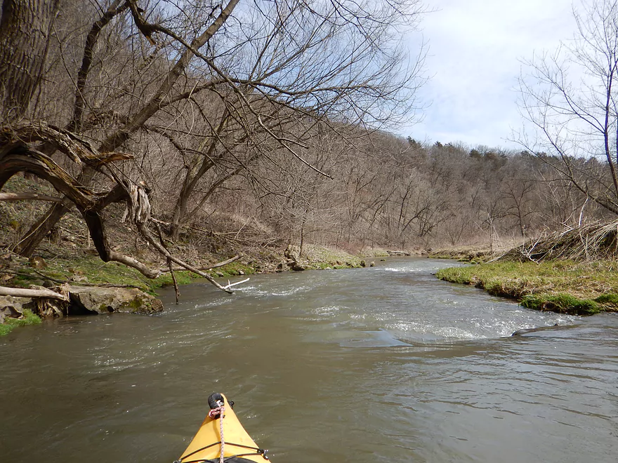
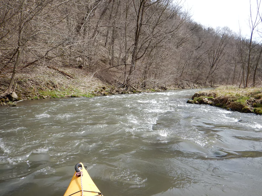
Lot of rapids on the creek
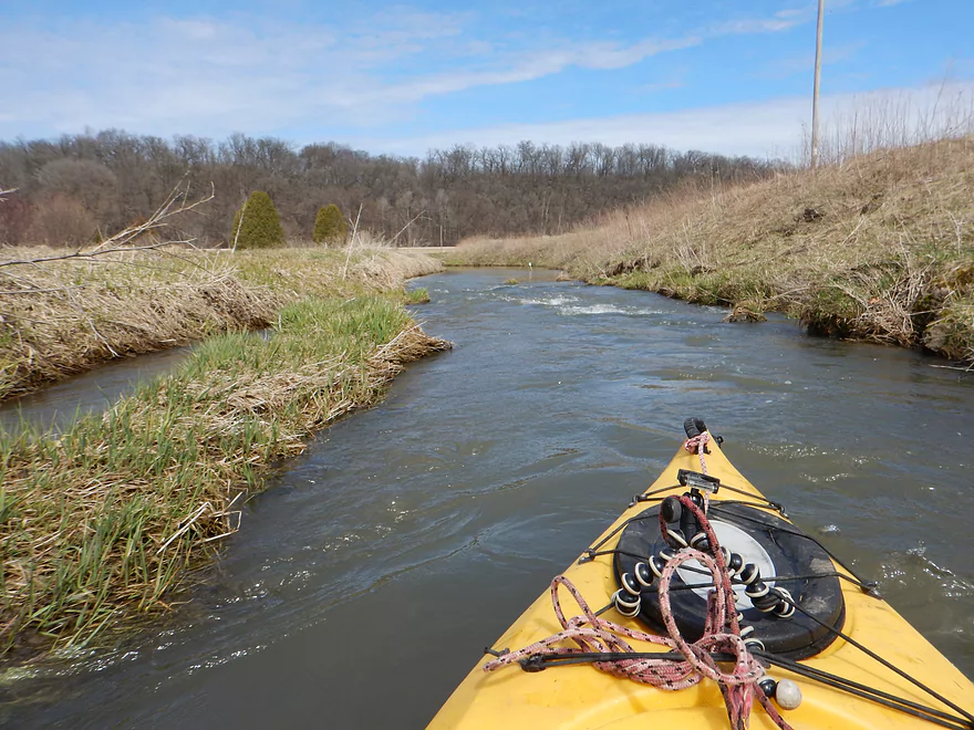
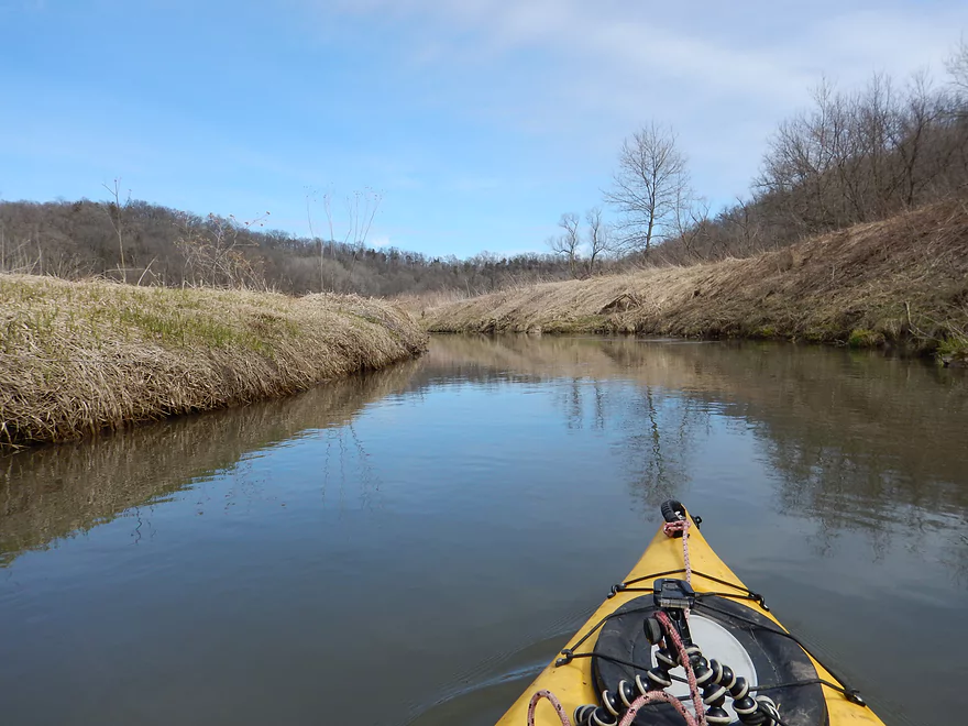
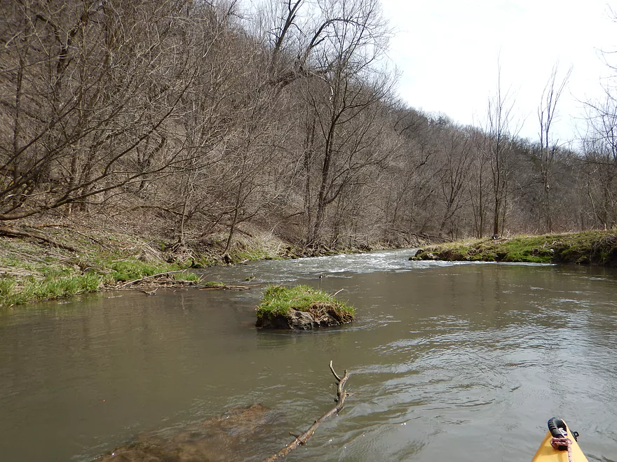
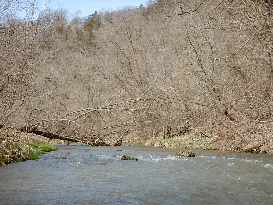
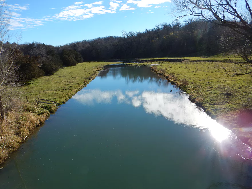
Mostly open and grassy banks
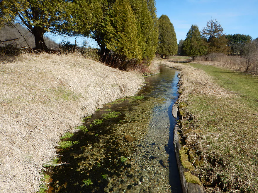
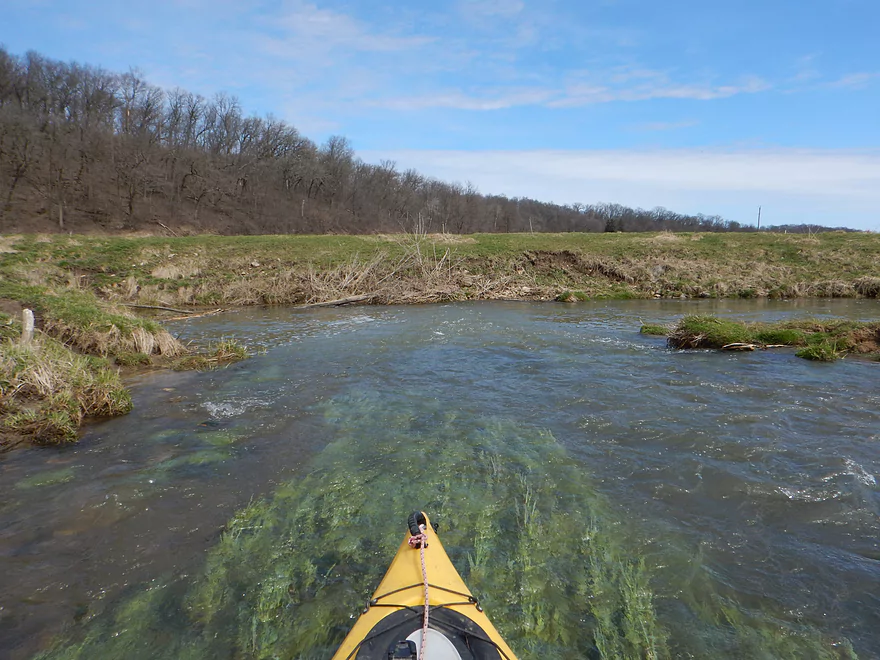
Crystal clear natural spring joins the creek
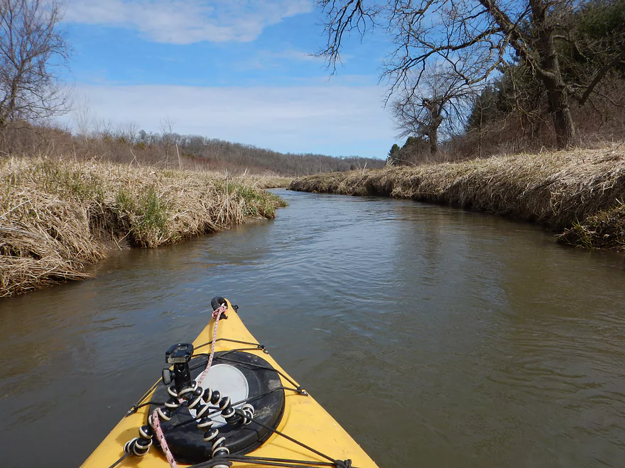
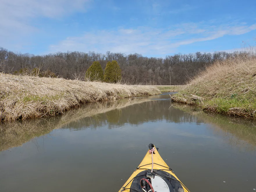
After a few tributaries the creek is plenty big enough
Normally the creek is clear, but today it was pretty opaque
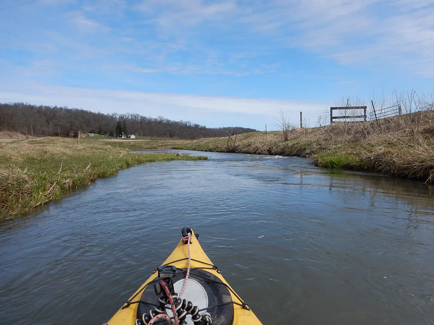
Paddling through farm country
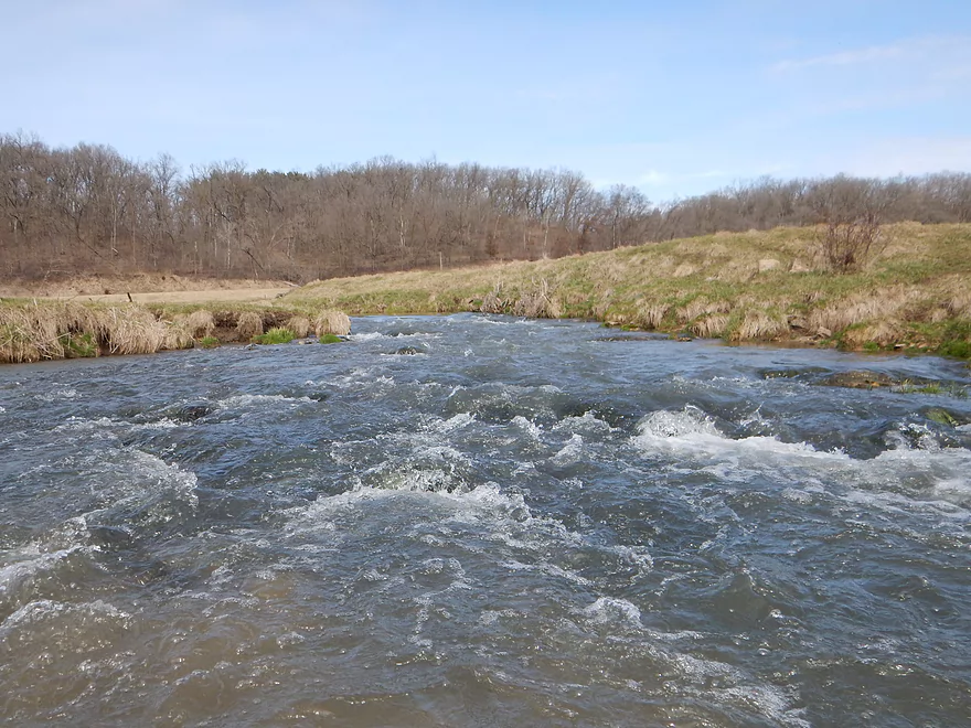
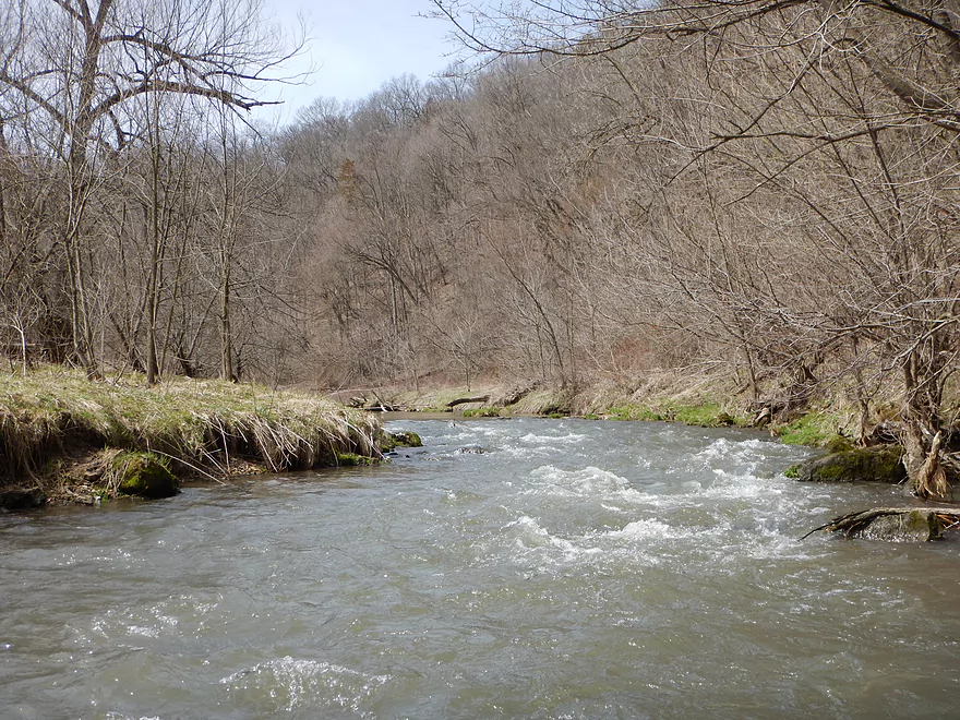
Some of the bigger rapids
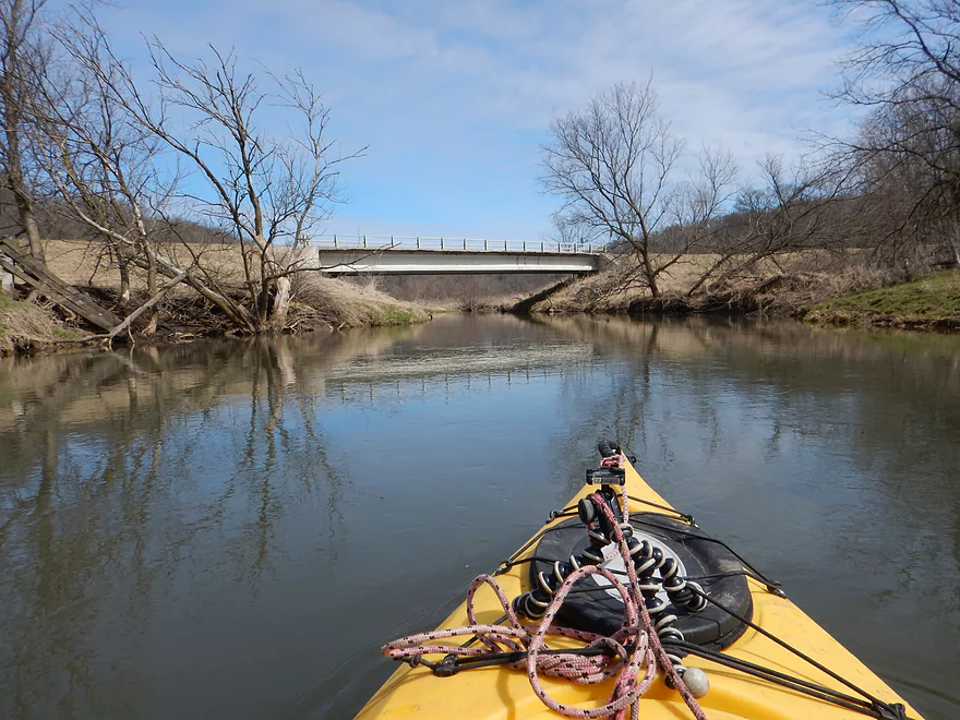
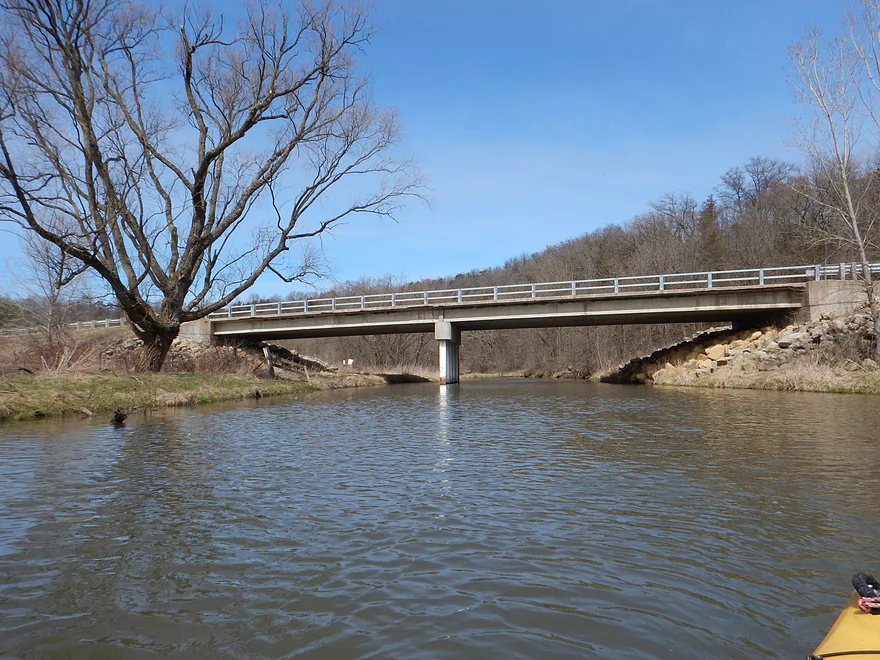
The first Hwy Q bridge is an access option
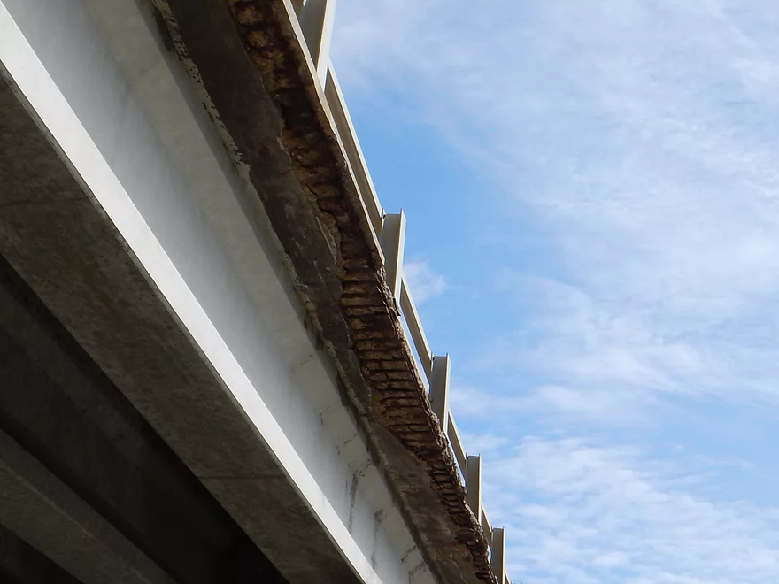
It seems to be falling apart…
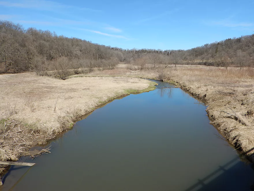
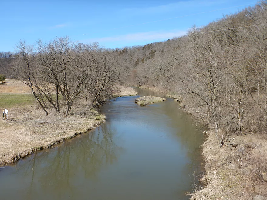
View from the bridge
More fun rapids
The creek was plenty deep enough to paddle
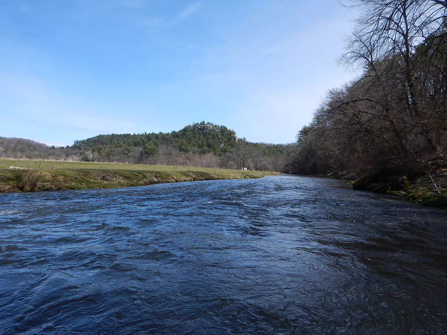
Going by Cedar Cliff
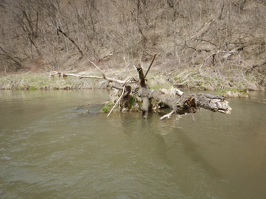
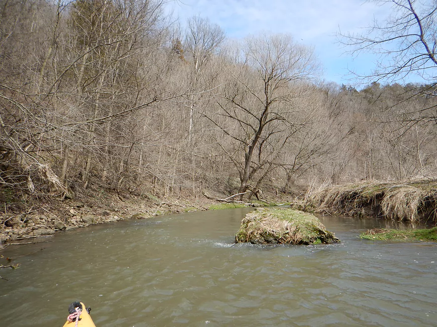
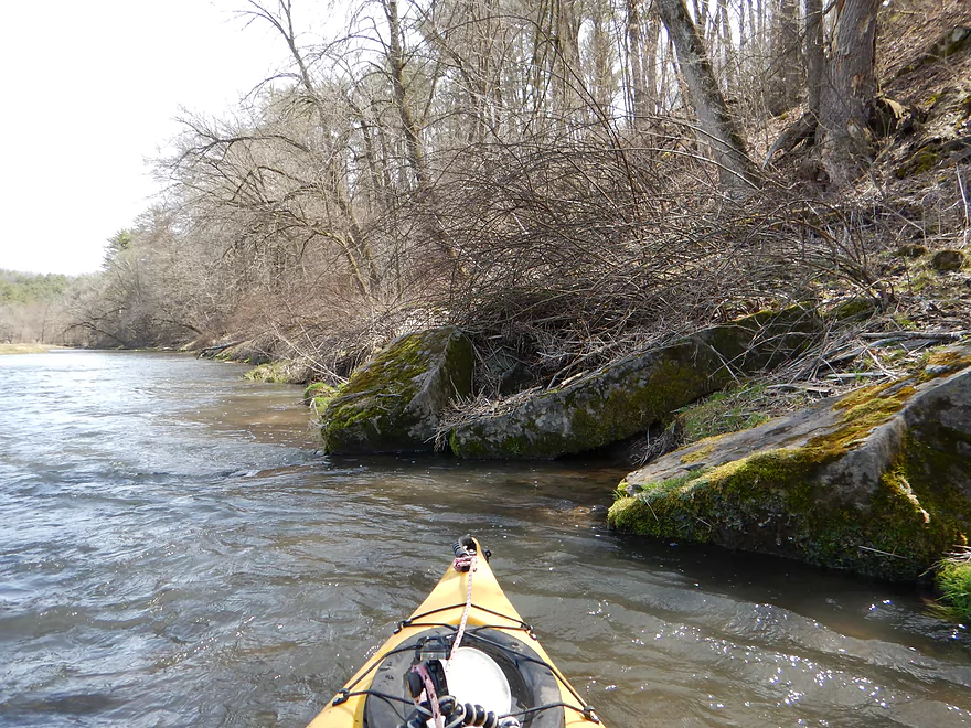
Logjams get bulldozed out of the way by the current
Deja-Platte
A really neat section of the creek
Which stays zippy
Looking back toward Cedar Cliff
The 2nd Hwy Q access option
The Blue River living up to its namesake
Only shallow part of entire trip
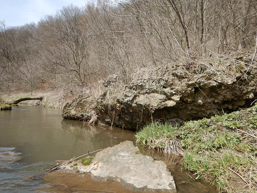
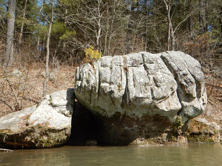
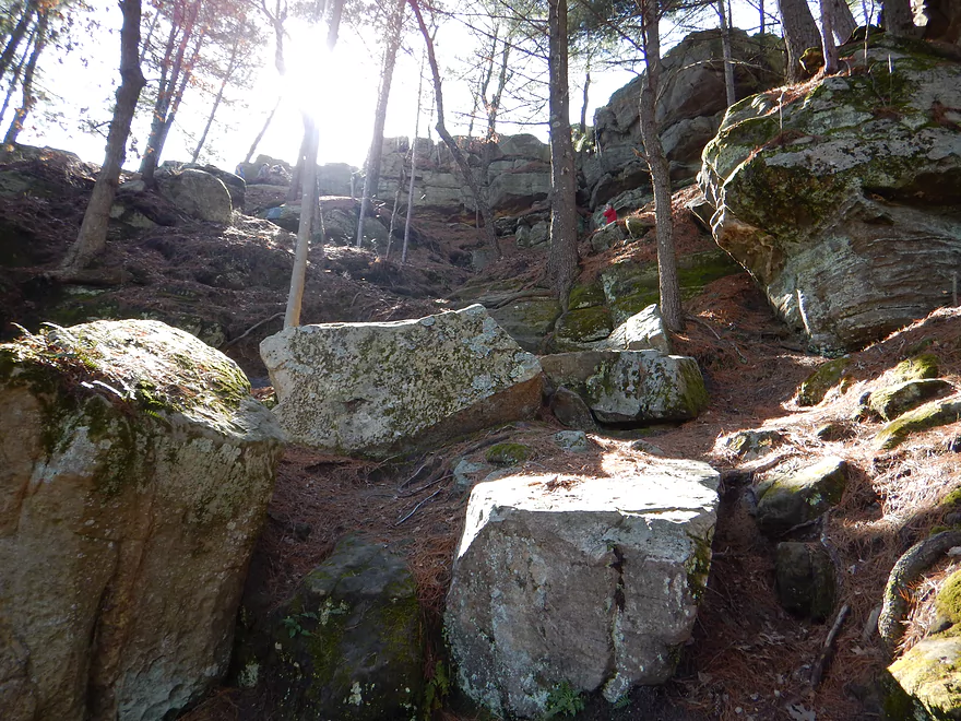
More interesting geology
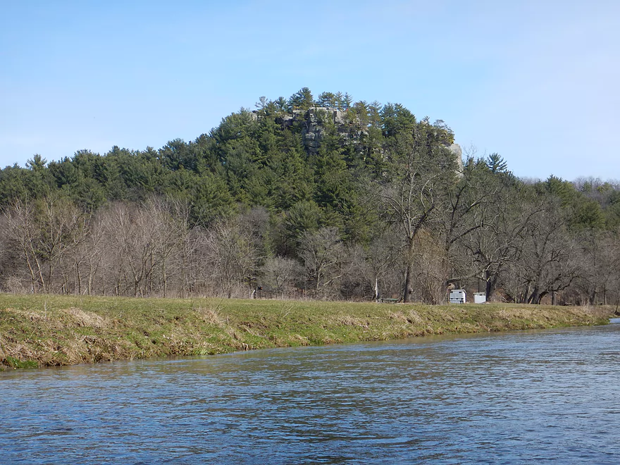
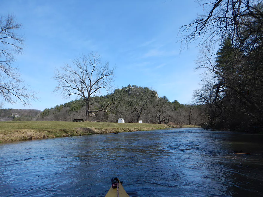
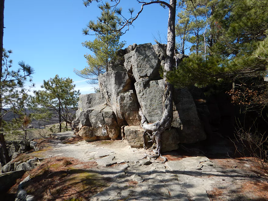
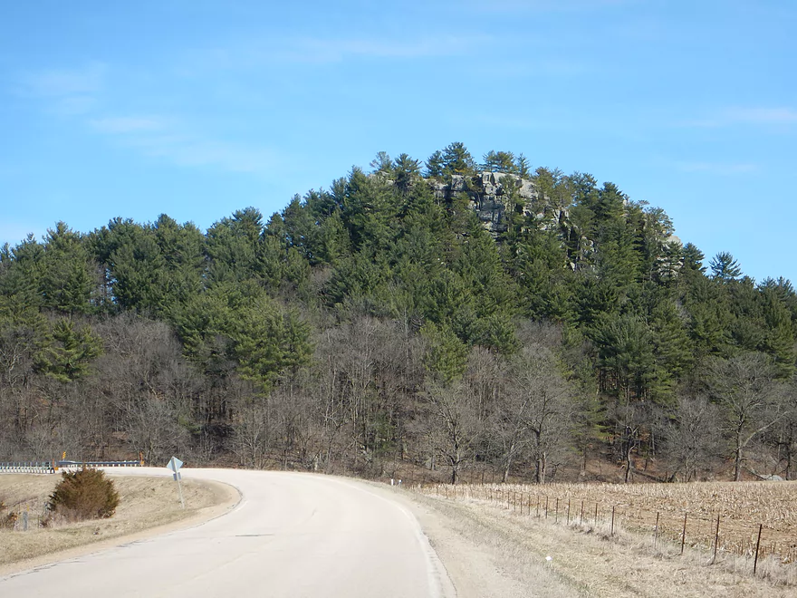
Castle Rock towers over the creek…very scenic
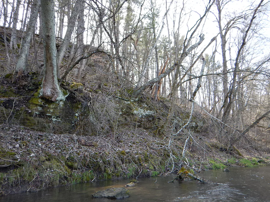
Some sandstone outcrops
There are actually people on the summit watching me
Paddling by some trout fishermen
Paddling under Castle Rock

A scenic bend
Natural anvil shape
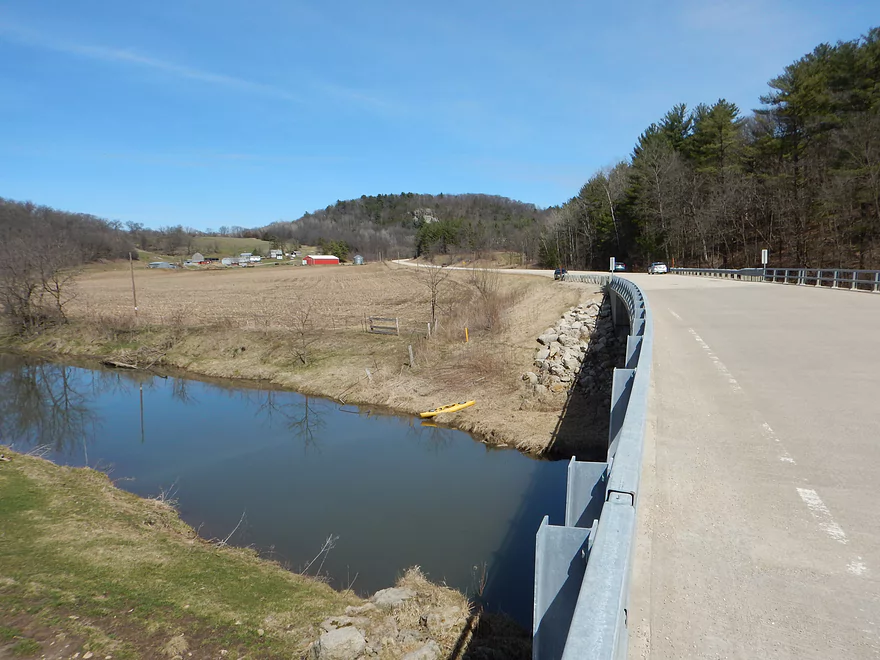
Taking out at the third Hwy Q bridge
Decent bridge access
But you do have to drag your boat some ways to the car
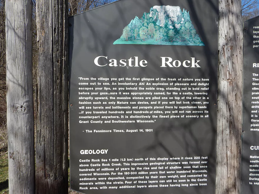
History of Castle Rock – Part 1
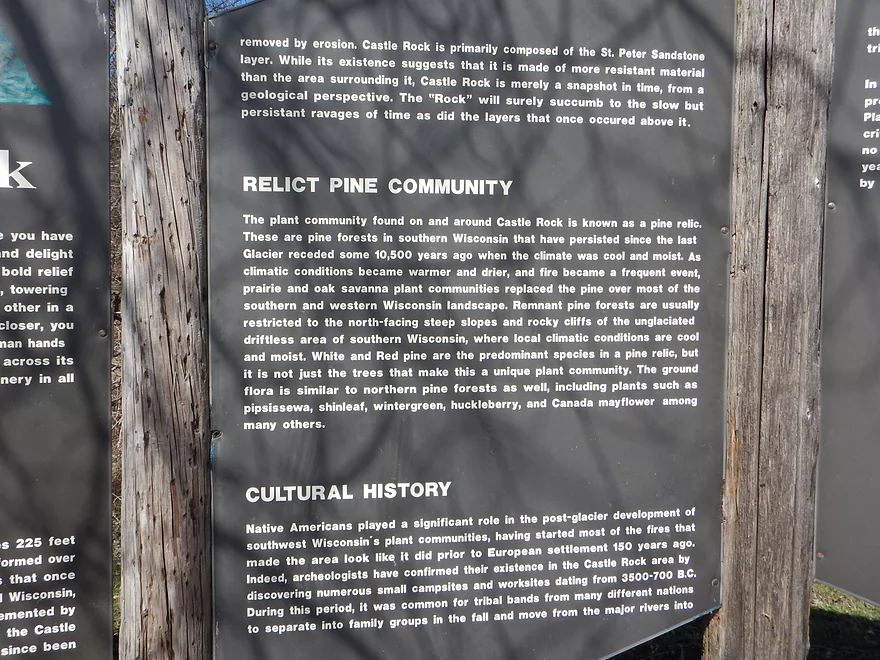
Part 2
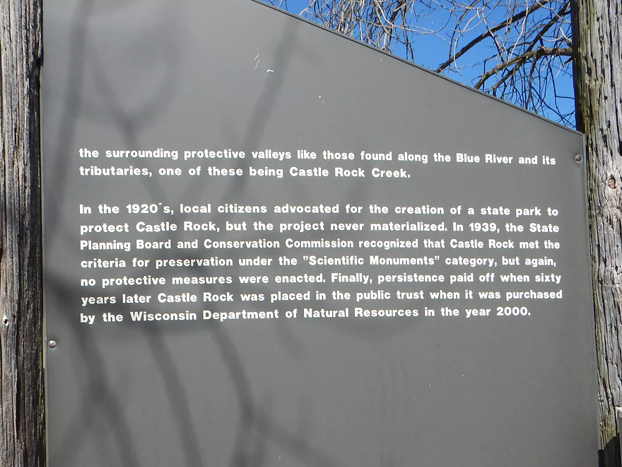
Part 3
Scaling the rock is popular but difficult because of the steep climb
Nice plateau and view from the top though
Saying goodbye to Castle Rock
The next downstream access option is Witek Road
The Blue River – Main Branch is a neat prospect too
There is a massive underwater cave hiding under these springs
Castle Rock Creek


Located 10 miles south of Muscoda, Castle Rock Creek (aka Fennimore Fork) is a tributary of the Blue River. Rarely paddled for good reason, this creek usually doesn’t have enough depth to run. But not always… After a few days of rain, a rare window opened and I jumped at the opportunity.
I knew this would be a relatively short trip, so wanted to put in as far upstream as possible. I decided on Church Road where while the creek looked narrow, it did look navigable and is part of a public fishing easement. Castle Rock Creek is a popular trout stream, and chances are you’ll see trout fishermen walking along the nearby mowed paths.
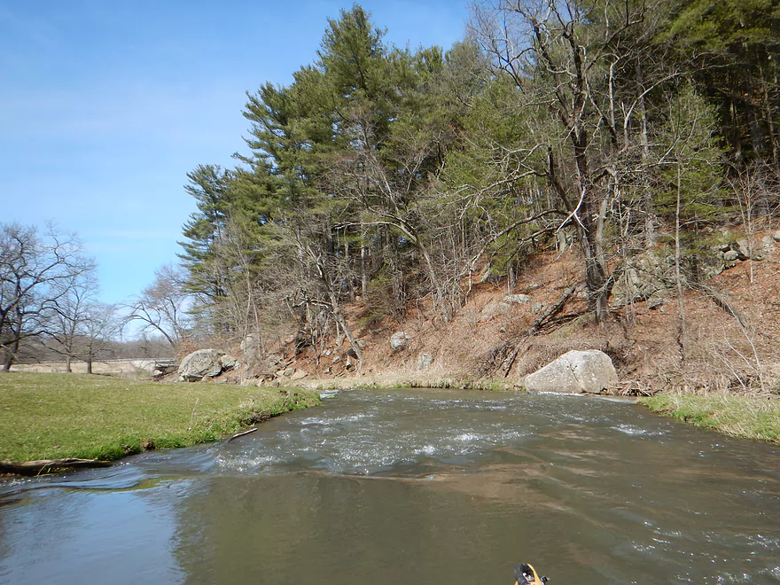
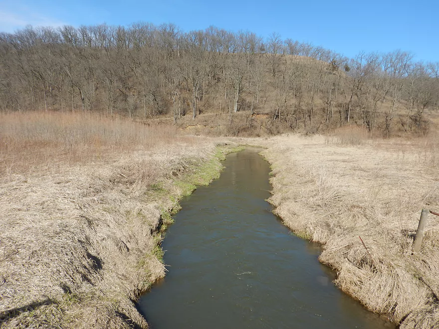
The trip starts with a narrow, winding and surprisingly fast channel. The water is muddy (although it does clear in the summer) and atypically deep (usually 2′), while the flat grassy banks afford nice views of the surrounding driftless hills.
The first (and only) problem of the trip comes up almost immediately. The current picked up and was pushing me toward a makeshift I-beam bridge that I wasn’t getting under. I turned sharply, but because the channel was less than 10′ wide and my boat 10.5′, I got jackknifed and stuck between banks. The mild rapids were pinning my boat sideways, and had I not good boat control (and a ridiculously stable boat…Equinoxes are awesome), I would have taken on water. So after precariously climbing over my bow, I was able to make a pretty easy portage.
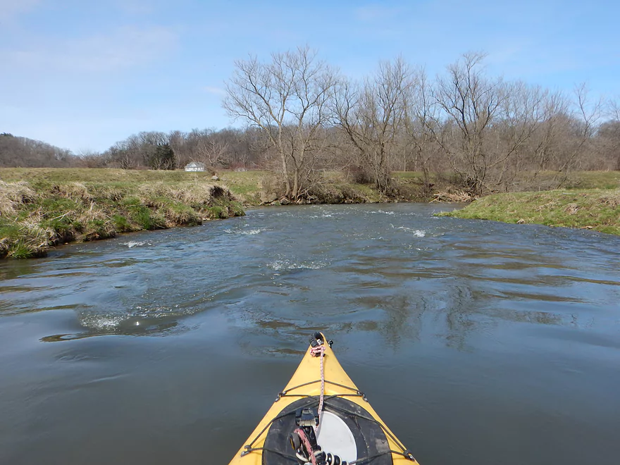
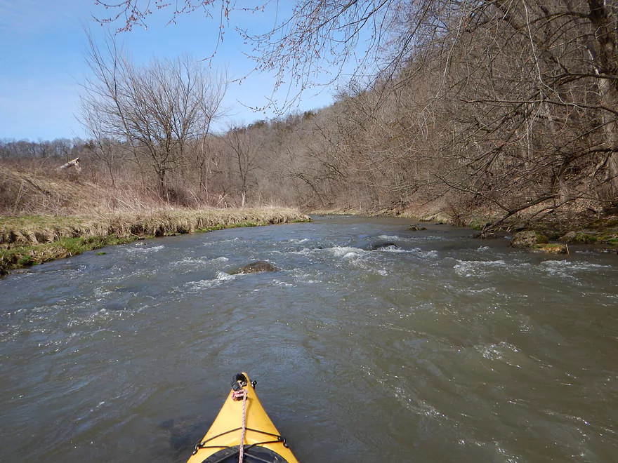
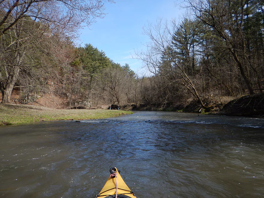
For rapids…that’s just the start. The entire trip is filled with them. Almost all Class 1, with a few strong ones that are almost Class 2. The creek is classic pool and riffle. You have deep pools and then somewhat shallow riffles, but at my depth the riffles were never really a problem. Soon into the trip, two tributaries dramatically swell the creek and kayak sandwiches are no longer a concern.
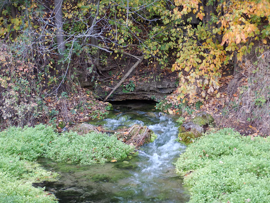
Maybe a mile into the trip, you’ll see a gorgeously clear spring creek enter the main branch from your left (I’ve marked this on the map). I do suggest hiking along the fishing path after your paddle to follow the springs to their source, where they come gushing out of a bank under Hwy Q. There actually is an underwater cave under the springs. If you’re not claustrophobic, check out this video of some divers swimming around in it.
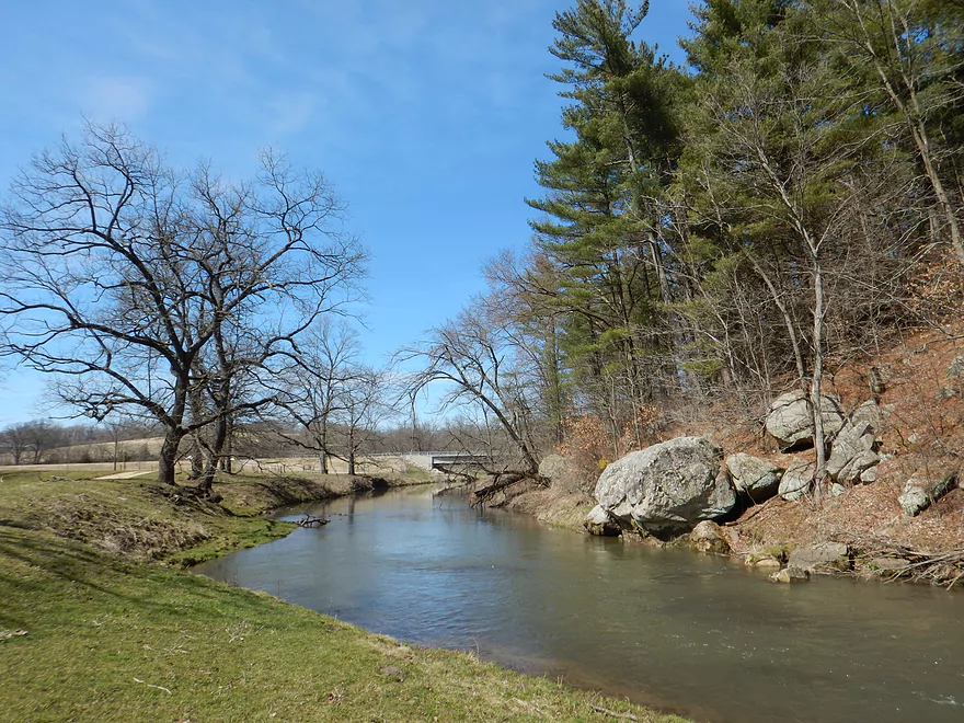
About halfway into the trip, I came up on the first of three Hwy Q bridge crossings. This is a popular spot for trout fisherman and an option for putting in with a public parking lot and historical markers talking about Castle Rock (we’ll get to that later).
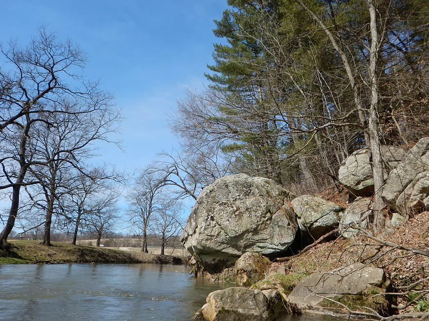
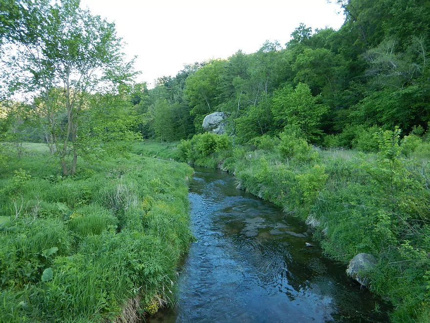
After a gorgeous oxbow, the river beelines for Cedar Cliff which is a steep hill on the south side of the Snow Bottom State Natural Area. This was my favorite part of the creek because of the multiple rapids, boulders in the water, and steep rocky hillside. It’s a neat scene that would probably be more striking in the summer when everything is lush, green and shady.
After Q bridge #2 (another public fishing and access option), the river widens out and loses some depth. On this last leg, you might bump over a few rapids, but it mostly wasn’t bad. One of the biggest and shallowest set of rapids you can scout downstream from the bridge which is tricky to get through. Ideally somebody in the future will move some of the rocks to form a navigable channel through here.
What is most striking about this last leg is the view of Castle Rock which towers over the creek and is the creek’s namesake. With little people sitting on the summit and pine trees growing from the crown, it has a very Devil’s Lake like feel to it. Soon the river picks up and you’ll paddle under Castle Rock, past some cool outcrops, over some Class 1 rapids, and then you’ll be at the take-out.
Castle Rock itself has an interesting history which you can read about below from the historical signs I photographed. Basically, the locals wanted to turn it into a state park which never did happen, but it did eventually get handed over to the DNR which made it available to the public. If you wish, you can actually climb up on top…which a LOT of people do. I think I counted at least 15 groups that parked by Hwy Q to take the small dirt path up to the summit. For being a surprisingly popular trail, it is actually kind of dangerous. What hikers do is scramble up the slope on the east side which is very steep and slippery, and actually requires a little bit of mountain climbing to get over a large boulder. If you reach the top, though there is a nice view of the river valley below. Webmaster’s update…a teen was just killed falling off the rocks. If you climb these, stay safe.
Something else to check out after the trip is Snow Bottom State Natural Area, which is just north of Castle Rock. It’s kind of inaccessible but worth the effort. Basically it is a very secluded and scenic river valley. The creek creates an impressive oxbow and is flanked by steep hillsides, which could be a neat paddling trip. By foot you can access the SNA by parking on Cedar Rock Road and hiking down one of the ravines to reach the valley floor.
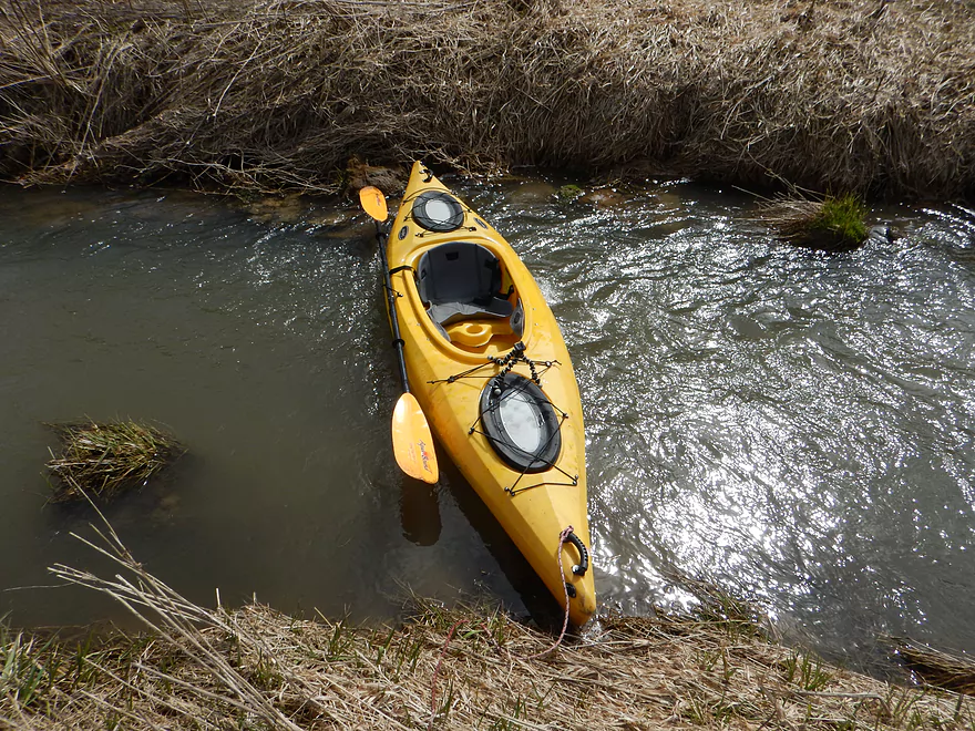
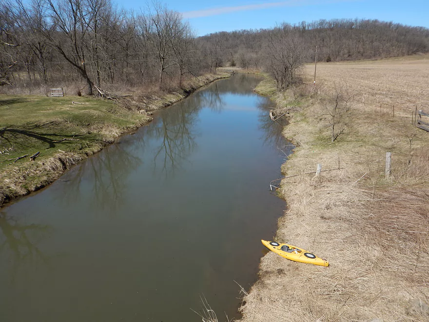
Decent bridge access off Church Road. Here (like much of the creek), there are public easements for fishing access and a nicely mowed path NW of the bridge leading to the water typically used by trout fishermen.
The last of the three Q bridges is a decent bridge take-out. You will have to drag your boat up a grass embankment to reach your car though. You’ll also compete for shoulder parking spots with the hoards that park here before hiking Castle Rock, but it shouldn’t be a problem.
I’m not aware of any local liveries. For bike shuttlers this is easy-peasy. Mostly flat with just a few minor hills and only 2.4 miles (23 minutes)
No logjams (current is too fast and rocky for them). I was worried there would be electric fences, but there were no fence issues anywhere.
Webmaster’s update…a reader has mentioned there are two new fences (likely not legal). Details in the comments below.
The current is very fast and this should be considered a light whitewater river. Most rapids are Class 1 with a few approaching or borderline Class 2. In several cases the pushy current can jackknife you horizontally against the rocks which can be an issue, but experienced paddlers in small boats should be fine.
The depth I went at was great. Much of the upper section was 2-3′ deep on average and I was able to get over all but one set of rapids without getting stuck. The current was on the verge of being pushy, but was ok. Nevertheless I would recommend this trip only for experienced paddlers in smaller boats. There is no gauge on the creek, but you can use other clues. In my case it had rained in the area 0.4 inches 60 hours earlier. The Platte River gauge for the trip read 223 CFS (above normal but not exceedingly), the Fever River gauge was at 3.21 (above normal but not close to flooding), but I think the most representative gauge would be Black Earth Creek which was at 90 CFS.
A rough unscientific depth guide using the Black Earth gauge:
- 0-45 CFS: Probably way too shallow (I did scout this at 40 CFS).
- 46-75 CFS: The flat sections will be navigable but the rapids will be pretty bumpy.
- 76-105 CFS: Probably a good target (trip was done at 90 CFS)
- 106-130: Probably too strong for casual paddlers but a great depth for whitewater paddlers.
- 131+ CFS: Suspect the banks are spilled at this stage.
Four woodchucks (mind you in 4 completely separate locations and times) and some redtails soaring over Cedar Cliff. Also saw several trout fishermen and some fish.
Blue River – Main Branch:
- Upstream of Blue River Road: Likely not practical for paddling.
- Blue River Road → County Road I: 1.4 miles. Mostly clear of logjams, but shallow and would require high water to be navigable.
- County Road I → Bluff Road: 0.9 miles. Nice section that goes through a small woods. Maybe 1 or 2 jams. In hindsight, I wish I had done this. A shallow section but looked just doable when I scouted it during my first trip.
- Bluff Road → Bowers Road: 4.1 miles. Five star trip. Reviewed May 2017.
- Bluff Road → Snowbottom Road: 2.4 miles. Fantastic section through driftless valleys with many light rapids.
- Snowbottom Road → Bowers Road: 1.6 miles. A good section through a small woods then through an open area reminding me of the Platte River.
- Bowers Road → Shemak Road: 6.6 miles. One of the best paddles in Southern Wisconsin with massive boulders, fun rapids and scenic driftless hills. Reviewed Oct 2017.
- Shemak Road → Biba Road: 1.7 miles. Mostly open farm country paddle. Maybe 2 logjams.
- Biba Road → Hwy G: 5.0 miles. Maybe 15-20 logjams.
- Hwy G → Studnika Road: 1.0 miles. Maybe 3 logjams.
- Studnika Road → Forest Road: 6.7 miles. Maybe 3-4 logjams. Otherwise a nice open prospect. Might be able to subdivide using access roads.
- Forest Road → Hwy 133: 6.3 miles. Maybe 3 logjams. The river is wide enough here you might be able to squeak past most of these. Hwy 133 is a busy road with long guardrails, which would make this take-out annoying, but I think it should be doable from the SE side.
- Hwy 133 → Wisconsin River: 1.0 miles. Maybe 6 logjams. This is floodplain forest now.
- Wisconsin River – Cross Slough: From here you can paddle a mile north to reach the Port Andrews Boat Landing. Alternatively, you can paddle down Cross Slough for 3 miles which is like a mini-river and might be a unique paddling experience.
—
Castle Rock Creek (aka Blue River – Fennimore Branch):
- Upstream of Hwy Q1st: The creek is probably too small to run.
- Hwy Q1st → Homer Road: 0.5 miles. Very small. A simple cow pasture paddle that probably isn’t special. Homer Road is not a great take-out…small, near a home, and a nasty pit bull chased me when I tried to scout this bridge.
- Homer Road → Hwy Q2nd: 0.3 miles. Simple open section through overgrazed and eroded banks. The second Hwy Q bridge is a decent access used by fishermen, but there is nowhere to park.
- Hwy Q2nd → Church Road: 0.4 miles. Paddle goes by a steep hillside and quarry. Maybe some interesting geology.
- Church Road → Hwy Q5th: 3.1 miles.
- Church Road → Hwy Q3rd: 1.2 miles. A nice open pasture section with many riffles, but one I-beam to portage.
- Hwy Q3rd → Hwy Q4th: 1.1 miles. A neat section with many rapids that goes by Cedar Cliff.
- Hwy Q4th → Hwy Q5th: 0.7 miles. Shallowest part of the creek during low water. Some neat geology in this section with more great rapids and a spectacular view of Castle Rock. Hwy Q5th is a doable take-out but does require some dragging to get past the guardrails. Many hikers park by the bridge before climbing Castle Rock.
- Hwy Q5th → Witek Road: 7.3 miles. River flows through a massive hidden valley flanked by steep hillsides. Includes the western unit of Snow Bottom State Natural Area. While mostly open, the river does have three logjams that must be portaged. After Snow Bottom, the river loses most woods, gains a lot of mud, and flows through farm country.
- Witek Road → Neff Road: 3.9 miles. A farm pasture paddle with likely a number of downed trees (maybe 7 portages).
- Neff Road → Hwy M: 1.9 miles. Mostly open farm pasture paddle. Maybe one logjam.
- Hwy M → Confluence with Blue River: 3.8 miles. Maybe 3-5 logjams.
Trip Map
Overview Map
Video
Photos Size:
Just wanted to say your website is awesome and much appreciated!
Thank you!
Looks like fun. Is this canoeable too or better for kayaks?
Hey Mythbusta,
This absolutely would not be a good canoe creek. Just too many sharp turns. My advice would be to only run this in a boat 11′ or shorter.
My wife & I just kayaked this creed today (5/27/17) after your blog was shared on Facebook by The River Alliance. Please note THERE ARE NOW TWO FENCES ACROSS THE CREEK between the put-in at Church Rd and the first highway bridge. The first was just after the I-beam that you (and we) had to portage over. It was barbed wire and fortunately located on a calm patch of water, and relatively easy to (carefully) navigate beneath. Around the next turn there were cows in the water — not inherently dangerous, but very large and easily startled by our boats–got a little stampede-ey. A ways farther on we came to the second fence across the creek, which APPEARED TO BE ELECTRIC. This was unfortunately located right above the start of some fast-moving water. Taking no chances, we got into the water and walked our boats underneath it.
After that the paddle was a lot of fun, with plenty of good riffles to keep us attentive. It was a little higher, I think, than when you posted this review – the Black Earth Creek gauge was at 111 CFS that morning. The gnats, however, were terrible on the slower stretches.
Anyway, thanks for the review pointing us to this fun little creek, but please update your blog to include the fences across the creek. I would recommend putting in at the next highway bridge instead of Church Road. Thanks
Thank you for the reply. Note, I do not recall these fences and they are likely new. Very unfortunate especially as these fences are likely not legal (the DNR had farmers take down similar fences on the Fever River). I’ve updated the main write-up with your notes.
My family on the orth side settled 2 farms in castle rock , 1800s one farm is right near the rock , I have pitures of that farm when it was being built .