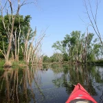
Bark River

This is my personal favorite river for Southeastern Wisconsin.  Despite flowing through suburban Milwaukee, the Bark is surprisingly clear, rocky and wild.

Trip Reports

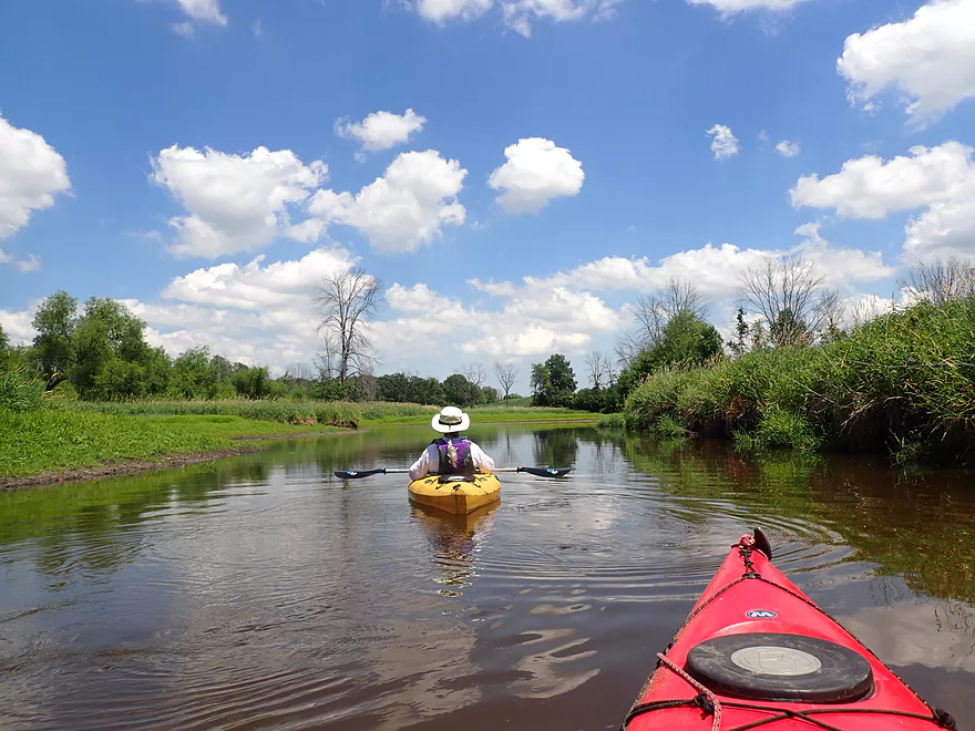
Merton Dam to Bark River Park


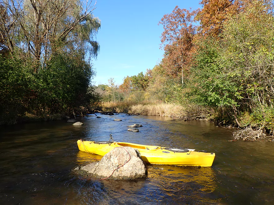
Date Paddled: October 20th, 2019
Distance: 4.9 miles
Time: 5 hours 13 minutes (2-3 hours would be more typical)

Another Ice Age paddle with some great fall color.  While the upper Bark River has some five star scenery, there are a few logjams to deal with.

Read More...

Bark River Park to Delafield Post Offcie


Date Paddled: August 10th, 2019
Distance: 6.2 miles
Time: 6 hours 33 minutes (3 hours would be more typical)

A varied paddle with a mixture of light whitewater, lake, marsh, and urban paddling.  Overall a nice trip but could be an elite trip if a few logjams were to be cleared out.
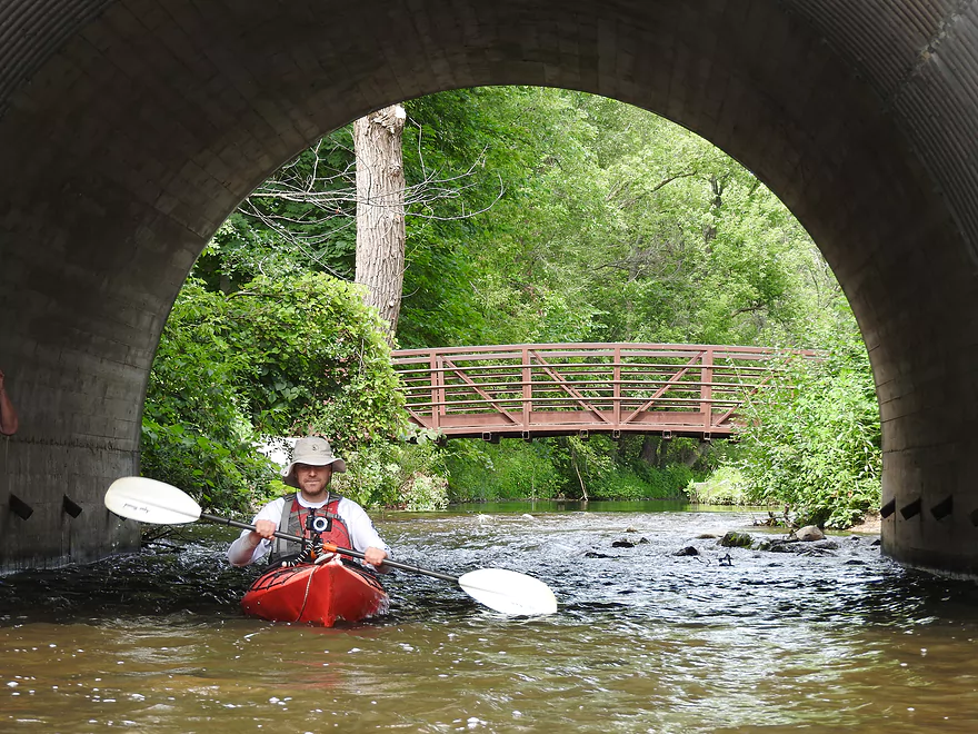
Read More...

St. John's Park to Hwy 67


Date Paddled: August 6th, 2016
Distance: 7.8 Miles
Time: 6 hours 5 minutes ( 3-4 hours would be more typical)

This is a very nice section on the upper Bark River that runs from Nagawicka Lake to Dousman.  Part creek, part urban paddle, part lake paddle, part woodland paddle, and part marsh paddle, this has something for everybody.
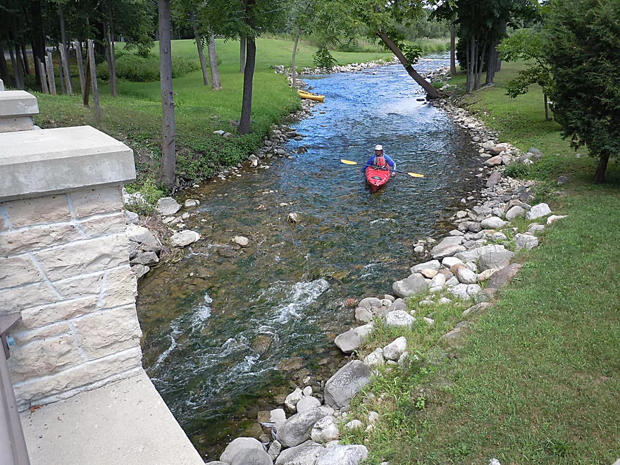
Read More...

Rome Dam to Cushman Road Bridge


Date Paddled: August 30th, 2015
Distance: 5.6 Miles
Time: 4 hours 38 minutes (2-3 hours would be more typical)

A really nice paddle without too much development, great water clarity, fun riffles and interesting wildlife.
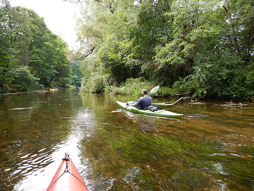
Read More...

Cushman Rd to Hwy 106


Date Paddled: June 19th, 2021
Distance: 4.4 miles
Time: Expect 2 hours

This leg marks a major demarcation in the Bark as it transforms from a shallow, rocky river with super clear water, to a beat-up floodplain paddle.  The first half of this trip was excellent, but the second half not so much.

Read More...

Overview Map

Detailed Overview

Nearby Guages

Videos

Comments

Apr 29th, 2023 - Aaron from Dell Creek
Thanks Jon for all the updates. Hopefully somebody clears out those low branches by the arched bridge. I did just recently update the main review to show that the construction is done and the dam is mostly runnable. The news about the tubers is actually really bad. Tubers can be noisy, drunk and disruptive. Hopefully they don't ruin this stretch of the river for paddlers.
Apr 29th, 2023 - Jon from Starkweather Creek
Paddled from Sawyer Rd. to Hwy 67 on 28Apr2023. This gauge was at 43CFS, 12.7FT: https://waterdata.usgs.gov/monitoring-location/05426067/ I'm not sure how well this gauge predicts paddling conditions, so we scouted at the Mill Rd. rocky riffles to see if we wanted to put-in in downtown Delafield. The water level looked scrapey, and I didn't feel like walking my kevlar canoe, so we put in below the weir/dam at Sawyer Rd. instead. (See this link to photos: https://photos.app.goo.gl/wk7bD26dEp6JoUR8A ). The water was crystal-clear for almost the entire trip. Notable wildlife included a pileated woodpecker, sandhill cranes (flying), cardinals, lots of Canada geese and red-winged blackbirds. As usual, we portaged some of the pedestrian/farm bridges and ducked under others, but I recommed careful scouting. Beware of the large downed tree just past the arched pedestrian bridge downstream from Genessee Lake Rd. Unless this blockage gets trimmed, paddlers will probably want to portage around it. My friend managed to make it through (see video in photo album), but described it as "a little gnarly". As usual, we parked on Whitaker Ln. near the Hwy 67 takeout. The Bark River between Delafield and Hwy 67 is one of my favorite paddles in the area. Note to Aaron - maybe you want to update your descriptions of construction to reflect conditions in 2023. Also, during the summer, Sawyer to Genessee Lake Rd. has become a popular run for tubers, with lots of cars parked on the shoulder of Sawyer Rd. (Thanks, Aaron for this site.)
Jul 16th, 2022 - Aaron from Dell Creek
Thanks for the update...I think these downed trees are recent as that stretch used to be open.
Jul 16th, 2022 - Megan Ehster from Bark River Hartland
My husband and I did this section of the Bark today. CFS around 23. I would highly recommend putting in at Sugar Island in Nemahbin and then taking out no later than the first HWY 18 Bridge. Delafield to Nemahbin is very shallow and we were constantly getting out of our yaks to get over rocks. It's a scenic stretch to be sure, but more frustrating than fun. After the 1st Hwy 18 bridge all the way to the Hwy 18 Wayside takeout is log jam after log jam. There are quite a few downed trees across the river that necessitate a portage. Again, this section is more frustrating than fun. I In between was beautiful and I would highly recommend.
Aug 15th, 2021 - Willie Gonwa from Underwood Creek
I just Kayaked from Delafield to Hwy 67. There are no snags that impede navigation but the low water level caused a lot of walking through the water between Delafield and Upper Nemahbin Lke. It was a very nice paddle.
Aug 9th, 2021 - Cat Fleming from Menomonee River
If anyone does the stretch from the Sugar Island launch to Whitaker Lane after the rain Aug 9th-10th, can you let me know if you come across any major obstacles and also the navigability of the bridges and low head dam? I am looking to take Girl Scout's on this stretch and need to assess skill level required. Thanks so much!
Aug 1st, 2021 - Aaron from Dell Creek
I honestly don't know if there are practical camping options on the Bark. Sorry :(
Aug 1st, 2021 - Richard Shaw from Brookfield
Looking to a 2-3 day camping trip. I would like to do some fishing. Is that possible? If so, how do I set this up? Thank you.
Jun 18th, 2021 - Aaron from Dell Creek
Thanks for the comment...your timing is funny. I was just thinking of doing the Bark tomorrow.
Jun 18th, 2021 - Gary Kutzler from Rock River
Been very dry. Last night storm motivated me to try. Gage just under 20CFS. Nice trip. Bumpy at the removed dam site above Upper Nemahbin. River was beautiful after Sawyer rd. Clear and hard bottom. Got out at Genesee Lake rd. Had to drag through some shallow just before Gen. Lk Rd. Easy Bike shuttle, little narrow on Sawyer Rd and a short section of Delafield Rd. Seemed like we had river to ourselves, but much evidence of river use based on the cars with kayaks and racks parked at put-ins and take-outs. All-In-All we had a great trip thanks to wisconsinrivetrips.com
Jun 7th, 2021 - Aaron from Dell Creek
I believe it! Southeast Wisconsin is I believe technically in a drought and it's really affected local rivers.
Jun 7th, 2021 - Jody from Bark River
We "paddled" from Rome to Hebron on 06/07/21. ~1.54ft... Super low! We walked our kayaks a lot! Still a beautiful stretch. Saw a ducks, herons, turtles - maybe even the snapper you saw and a young bald eagle with a mature eagle.
Apr 26th, 2021 - Aaron from Dell Creek
The Bark has recently been cleared out from Centennial to Nixon Park which is great news!
Dec 9th, 2020 - Aaron from Dell Creek
Thanks for the feedback Jonathan. I'm surprised that you had some hangups at 74 CFS.
Dec 9th, 2020 - Jonathan from Starkweather
Paddled from Pickets to Hagedorn Rd. on 09Dec2020. Rome gauge at 74 cfs at ~2.06 ft. Some scraping and hanging up, especially below Cushman Rd. I'd recommend taking out at Cushman if in doubt about how much water you need to avoid knuckle walking your kayak.
Jul 31st, 2020 - Aaron from Dell Creek
So that mess must have been between Hwy 18 wayside to E. It's too bad to hear about your experience...but hopefully others can learn from this.
Jul 31st, 2020 - Joan from Mukwonago
We put in at summit. We took out on e. The last 2 miles were horrible. Apparently there had been a tornado that took out a lot of trees. Guess where we found them. We had to wade in chest high water and pull our kayaks through it. Our 11 mile kayak trip took almost 8 hours because of the last two miles. Before that it has been beautiful. Saw an eagle cranes and even a painted turtle.
Jul 28th, 2020 - Aaron from Dell Creek
Thanks Eric for the update!
Jul 27th, 2020 - Eric G. from Wingra Creek
I did this trip on 7/22 levels were about 33 CFS and 12.68 ft, higher than in your review but the water clarity was still fantastic. There is now a dedicated kayk/canoe launch across the street from the post office. Very nice concrete ramp that goes right into the water (see pics) There were a few low bridges to deal with but no blockages. I was able to get under all the bridges by laying down in my solo canoe but my paddle pal had to portage one bridge, but it is a very simple portage. We were both able to easily run the low head dam at Saywer Rd. Usually not recomended but it was easy and safe at these levels as there was plenty of water going over the lip and there was no backroller/hydraulic, but I cant speak for other levels. There were several people swimming there and they said kayakers run it all the time. We did a bike shuttle which I would strongly recommend as it is paved, fairly flat and goes through several very pretty areas. The amount of flowers, insects, wildlife and fish we saw was simply amazing, deer, eagles, owls, heron, crane, ducks, geese, muskrats, monarchs, swallow tails,and 1000's of dragonflies link to a couple of pics https://1drv.ms/a/s!AjC8S6n5i35VgnfajP3H8Km6SFSR https://1drv.ms/a/s!AjC8S6n5i35VgnfajP3H8Km6SFSR
Jun 21st, 2020 - Aaron from Dell Creek
At the time the Delafield branch did list your phone number as the contact. This has been updated and you will no longer receive kayak inquiries from this website. Thanks for the heads up.
Jun 21st, 2020 - Ryan Rodriguez from Elkhorn
Google "kayak 2154128". In the website description it list a phone number for Clearwater outdoor in Lake Geneva. The number listed is incorrect. That number belongs to me. Please correct the number as I am recieving multiple calls a day asking for kayaks.
Aug 28th, 2019 - Aaron from Dell Creek
Thanks for the comment!
Aug 28th, 2019 - Phil (PJ) Williams from The Bark at Delafield
I was raised in Delafield from about 1950 until 1966. I now live in the Seattle area. Me and one of my friends had a canoe that we mostly used on Lake Nagawicka. But in around 1960 (I was about 12 or 13) we launched our canoe just below the Nagawicka dam and paddled to Upper Nemahbin. Your pictures brought back so many great memories. Wow. Thank you so much.
Jun 21st, 2019 - Aaron from Dell Creek
Yeah the Post Office sounds like a nicer launch option than the park. The bike shuttle also sounds great and I wasn't aware it was paved. I do agree this is a must do trip for those living in SE Wisconsin...I would never have expected a Milwaukee suburb paddle to be so nice.
Jun 21st, 2019 - Eric G from Wingra Creek
We did the section from Delafield to Hwy67/Summit St. bridge in Dousman yesterday, with a bike shuttle. The water levels seemed perfect (39 cfs and 12.75 ft) just a few shallow spots and we were able to squeeze under all the bridges. The only portage was the low head dam, but that was very simple. Excellent water clarity and a nice current the whole way. This is a trip I would recommend to anyone, truly a delightfully diverse and enjoyable trip from start to finish. Great scenery, lots of wild life, some development, but we only saw a few other people and that was on the lakes. It would be a great trip for someone who wants to try a bike or walk/running shuttle, as it is only about 6.5 miles, and it is on paved level bike trails (Glacial Drumlin , Cushing Park, and Ice Age Trail) the whole way except for a very short 2 block section from the take out to where you get on the Glacial Drumlin bike trail. The trails lead right back to the post office and go through some beautiful natural areas. I would recommend putting in across the river from the Post Office as it is a bit more level and there is a small gravel parking lot for unloading (I'm not sure if you can leave a car there but there is street parking nearby) at the take out there is a spot for parking on the north side of Whitaker Lane, we spoke to a nearby resident and he said it was fine as long as you were off the road way. A must do trip for anyone in southeastern Wis, and one well worth traveling to for the rest of us.
Jun 16th, 2019 - Aaron from Dell Creek
That doesn't seem too bad...it's definitely on my todo list. Thx for the heads up.
Jun 15th, 2019 - Shawn from dousman
So i live in dousman and if you go past 67 and on to the park takout o. The far side of dousman there are a few spots where a tree is particularly blooking the river. A bit past the BP you will hit the first it is low so you have to go over the second there is a small slot on the left hand side there is a 3rd a fair bit down river from there where someone cut a path through it. Thats all i can remember its a really nice trip but the water is not as clear as pre 67
Aug 12th, 2018 - Aaron from Dell Creek
I appreciate the updates!
Aug 12th, 2018 - Steve Bettwy from Pewaukee River
Nice paddle and very much like you described. Two updates 1) They have re-done the river banks at the put-in in Delafield. The nice sloping grass is replace with a steeper bank and rip-rap rocks. Launching is still very do-able, but it's either a 2 person job now or a scrape across some rocks. The launch / take-out at the base of the dam is not as friendly anymore. There's still construction going on we'll see how it all ends up. 2) There is bridge construction at the Summit Rd take-out through Sept 2018. The river is actually closed about 2 miles upstream of that, right at the take-out at Genessee Lake Road.
Jul 12th, 2018 - Brad from Bark river
I've gone up river from genesee lake road to the nemahbin lakes several times. It might be a bit much at times for smaller children if that as a concern. However as long as you stay to the slower side of the river (typically the inside of the bends) it can be a nice way to work your way up to the lakes to spend time at one of the sand bars that always have people hanging out around. While still having a nice lazy river float down the bark to end the day.
Jul 12th, 2018 - Brad from Bark river
You won't be able to due to the construction. But you can park on Whitaker ln and take out at the last bridge. The farm has a grass path to the east of the bridge that runs south to the road.
Jul 7th, 2018 - Aaron from Dell Creek
Typically no. The current is usually too strong. But there are exceptions. Flowage and lake paddles can be done as round trips. Some slow rivers like the Crawfish or Rock can be done (partly) also as round trips. I usually post the gradient on a review. Anything over 1' per mile is likely too fast to paddle against.
Jul 7th, 2018 - Jessica from FOX River
So I'm sure this is a dumb question, but I'm a novice kayaker. Does anyone go down and then paddle back instead of shuttling cars back and forth?
Jun 25th, 2018 - Shelley from Lower Nemahbin
Does anyone know if you are able to get through the river at hwy 67 in Dousman? They are working on the bridge that crosses there, and there are signs posted about not crossing the river there. Just curious if you can still get through there.
Jun 25th, 2018 - Aaron from Dell Creek
The water levels are at 30 CFS now, which is much higher than the 18 CFS. I would aim for a minimum of 20 CFS...but you will still hit some rocks regardless. You could scout this before running...if too shallow, you could just do the section below I-94 which is much deeper. There are no real hazards, but there are a few low bridges that might need to be portaged later in the trip.
Jun 25th, 2018 - Shelley from Lower Nemahbin
Has anyone recently taken this trip in a canoe? In some of the photos and video posted the water levels seem quite low. I'm concerned about scrapping the bottom with the canoe. I'm also interested in knowing if there are any areas this year that need to be portaged. Thank you!
Jun 22nd, 2018 - Kristen from Columbia River
Hi Aaron, ok, figured it out, a couple photos are near the Nemahbin Dam removal, if we would like to borrow images when discussing recreational opportunities around the removal, whom shall we talk to? Thanks
Jun 21st, 2018 - Aaron from Dell Creek
Hi Kristen. Each photo in this write-up corresponds to the above write-up and map. If you have specific questions, I would be happy to help you.
Jun 21st, 2018 - Kristen from Columbia River
Hi Aaron, i am curious about some of the photos. Can we learn more? Thanks
Oct 19th, 2017 - admin
Appreciate the information Theresa. Launching at the Post Office was a good idea. The Bark River really is one of the state's most underrated paddling rivers.
Oct 19th, 2017 - Theresa Stegemann from Bark River
Thank you so much Aaron for your very helpful review. Six of us paddled this segment (Delafield to 67) on 10/19/2017 (CFS 31.7, Height 12.70'). Our group enjoyed this paddle very much and plan to keep it in our regular rotation. We put-in at the Delafield post office (across the street from St John's park), which eliminated having to transport our kayaks 400' at St John's park. After shuttling the cars to Whitiker Lane (at the intersection of Whitiker and 67 (Summit)), we transported the drivers in one car back to St Johns park to leave the car there. The put-in and take-outs were easy to manage. We were able to find our way into the cattail area channel on Lower Nemahbin Lake quite easily. On the day we paddled, the channel was much wider that what you describe as a tunnel. There was an area in the cattail channel, just as we were approaching Crooked Lake, where we could go either left or right. We initially chose right, but a low bridge would have required a portage. We decided to backtrack and follow the left channel which had low bridges that we could squeeze under. We were fortunate on this particular day that we were able to scoot our kayaks over the new spillway dam at Sawyer Rd and the water level was shallow enough that we were able to squeeze under numerous low bridges. I am happy to report that not a single portage was necessary the entire distance. Our favorite aspects of this segment of the Bark is the intimate river feel, ever changing landscape, quick current, rock garden run and crystal clear water.
Sep 19th, 2017 - admin
Appreciate the update Jack!
Sep 19th, 2017 - Jack Manierre from Whitewater Lake
I have kayaked the Bark on 3 different occasions. Saturday was our best trip. Put in Prince’s Point. Take out Burnt Village. Easy put in...gravel ramp. Take-out had improved concrete. Portapotty & picnick table at the take out. The bark has been cleared with no snags. 2 1/2 hrs-3 hrs. Mild current. No nearby farms or bridges crossing over the river. Abundant wildlife: eagle, cooper hawk, many blue herons, green herons aand kingfishers. Worth highlighting on the web site.
Jul 3rd, 2017 - admin
Really appreciate the comments Allison! Yeah, the Bark has unfortunately been high all year. I scouted it actually two days ago and saw kayakers easily go over the Sawyer Drive dam it was that high. But it still looked nice!
Jul 3rd, 2017 - Allison Curty from Bark River
Hi, we took the canoe along this stretch today, this guide and photos were really helpful so thank you. We put in at Sawyer Rd. just below the dam, and took out at Summit/67. The water was high and fast and there were more bridges than I remember from the last time we paddled this. We passed easily under some, VERY narrowly squeaked under two more but had to portage three, including one that required a steep bank climb and descent, and the final (the farm bridge at the end) that required us lifting the canoe straight up and over and straight down, which was challenging for me and my kiddos. The rains have left a lot of downed trees and branches also, making navigation a little challenging in parts. We will look into the Delafield stretch next time, maybe taking out at Sugar Island. Anyway, thanks again for the info and the photos. Happy 4th!
Oct 6th, 2016 - admin
Thanks for the feedback Barry. I totally agree...and frankly am not sure why so many paddlers focus on the far downstream sections.
Oct 6th, 2016 - Barry from Rock River
We paddled yesterday from Slabtown to Cushman. It was very pleasant. We like it better than Princes Point to Rock River.
Dec 20th, 2015 - Timothy Bauer from Madison
One final update: I paddled this again yesterday, 12/19/15, at a shocking 250 cfs. Put in at Rome, took out at Green Isle bridge in Hebron, just below the 2' drop. The current was swift from Rome to the Duck Creek confluence, the riffles were exquisite, and the light rapids approaching Cushman were wavy and rollicking. Water clarity was hardly compromised at all despite the higher level, and rarely was the river deeper than 2'. After Duck Creek the gradient disappears in a floodplain forest more reminiscent of the lower Bark by Prince's Point and Burnt Village. The notable exception to that is the short mile-and-change segment below Hwy 106. There the current picks up again, the gradient increases, and it's constant riffles and light rapids. At 200+ cfs there were fun standing waves below the pedestrian bridge, and the rapids at the dam remnants in Hebron, immediately upstream from Green Isle Rd bridge, were raging. There's a formidable backroller hydraulic at the bottom of the drop in the center section -- be careful. My friend got caught in it and capsized -- and it was 23 degrees outside! (He's fine; the car was right there.) It's a rare river than can be paddled at 41 cfs and 250 cfs without its appearance or the experience of paddling it changing drastically!
Dec 13th, 2015 - admin
Thanks Tim for the update!
Dec 13th, 2015 - Timothy Bauer from Madison
FYI, I paddled this exact trip yesterday, Dec. 12, 2015, at 125 cfs. The riffles were delightful, and the 1-2 light rapids were fun play! It was an overcast drizzly day, but still the river was clear. Water clarity was not compromised at all despite the higher level. 125 cfs is the highest I've paddled this mid-section of the Bark, and I absolutely recommend it!
Oct 23rd, 2015 - Timothy Bauer from Madison
Also, for point of reference, there are two alternate takeouts in between Rome and Hebron. The first is at the confluence of Duck Creek and the Bark River, along Hagedorn Rd (hard to find but easy to access; there's a walking trail that many others have used -- plus it's a great alternative to the "ask for permission" dilemma at Cushman Rd immediately upstream)​. The second is at the Hebron Campground just downstream from the fun drop at the dam remnants at Green Isle. The owners of the campground, Ralph and Joann, are very nice and supportive of paddlers. There's no official launch, but it's easy to use the grassy banks, and parking is nearby.
Oct 22nd, 2015 - Timothy Bauer from Madison
I've been on this segment of the Bark as high as 90 cfs, and it is by no means dangerous. I've been on it as low as 40 cfs, and the difference between the trips in terms of depth or current speed was not terribly notable. Except for in times of intense rain, this segment is typically below 80 cfs due to the decent gradient.
Oct 10th, 2015 - admin
Thanks for the info! That the next 4-5 miles is free is huge news. Unfortunately, I don't know much about the Bark River dam situation. Often times in fall, dam operators will wind down their flowages in preparation for next spring's flood. Usually they don't do this on a weekend...but not always. I'm not sure if this is the case? If you hear anything else about the Bark, let me know!
Oct 10th, 2015 - Theresa Stegemann from Bark River
Thank you so very much for your excellent review. We kayaked from the Rome Pond Dam to Hwy 106 for a total of 9.6 miles, on October 9, 2015, @ 45 CFS. We did not have to portage at all. There were some areas where we scraped, but we could either scoot over those areas or walk our kayaks. Rapids were very mild and not quite class 1. The river was shallow enough to walk almost the entire distance. The highlight of the trip was the crystal clear water and ever changing scenery. Lots of maples were lit up with beautiful fall color and the wildlife was amazing! This truly was one of the best kayak outings of the year! Thank you, thank you, thank you for your awesome review! One thing: I worry about for future paddles on this stretch of the Bark, I noticed, after returning home, that the CFS climbed to above 70 CFS. There was no rain that day, so I'm assuming that water was released upstream for some other reason. I worry that I would unknowingly be in a situation of high/fast water. Do you know anything about the Bark's CFS fluctuations?

How did your trip turn out? Questions or comments? Feel free to leave your feedback.

SUBMIT COMMENT!
Be notified when future paddle reviews go live by subscribing!
Contact WisconsinRiverTrips.com