
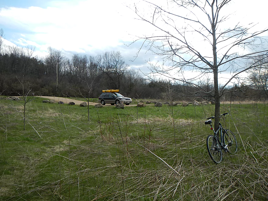
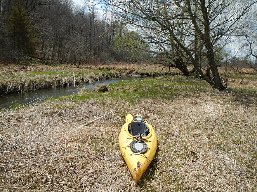
Public Access – Lee Road
Very shallow here
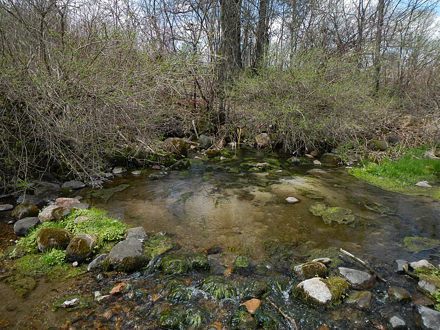
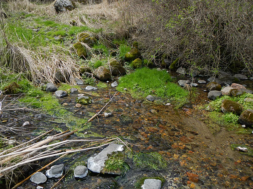
Cool seep
Coming right out of hill!
Very striking
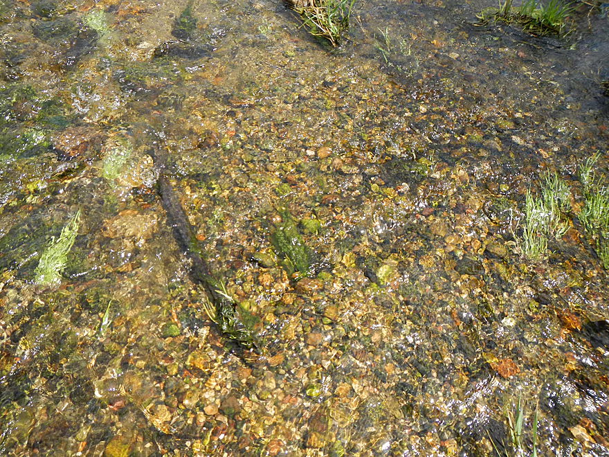
Nice pebbles
Nice sandy bottoms (to start)
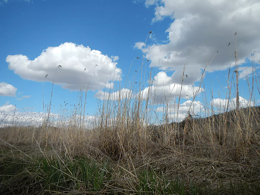
Nice hilly vistas
This first mile is very shallow

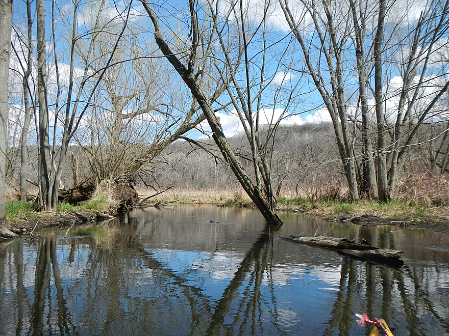
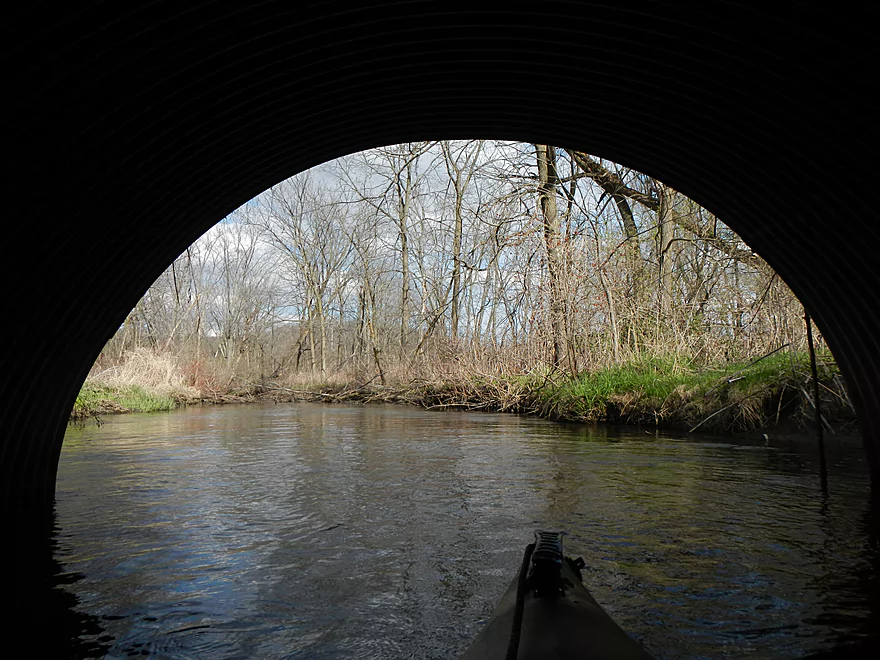
Entering the wooded section
First of MANY portages
Another as soon as you get back in
Ugh
Time for a super portage
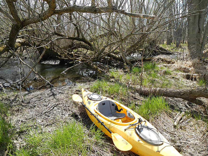
Dragged my kayak over a half mile to avoid the log jams
More great water quality
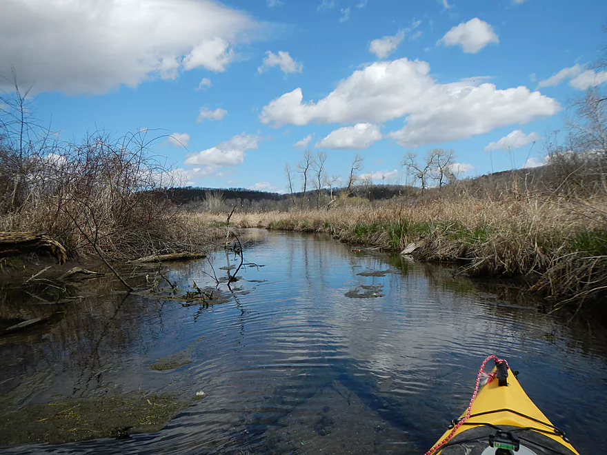
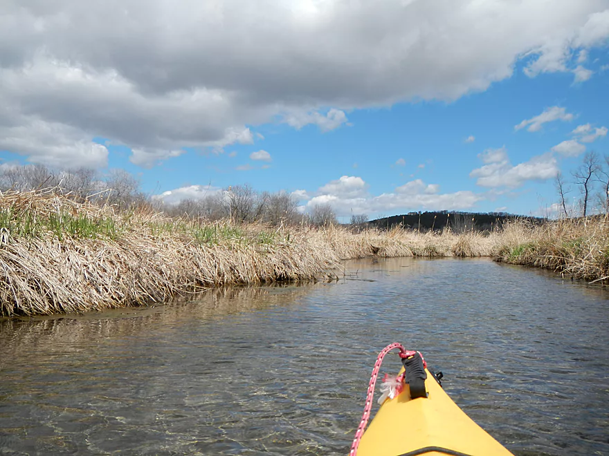
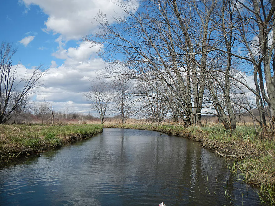
Starting to open up…
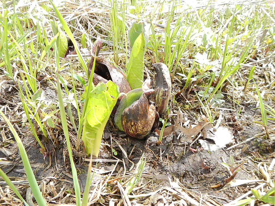
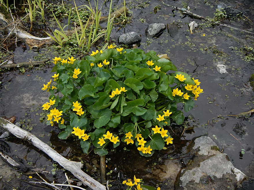
The marsh has a lot of wonderful skunk cabbage
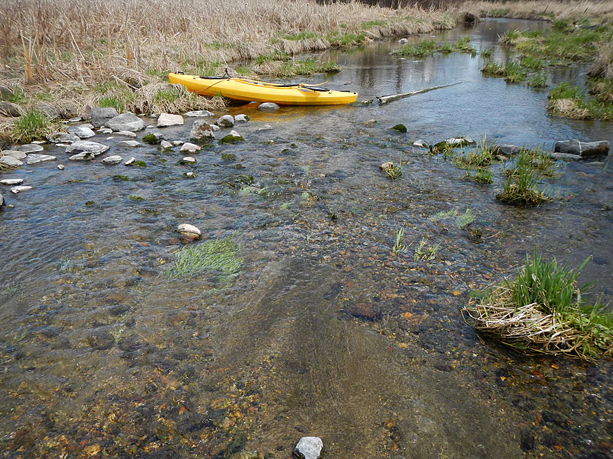
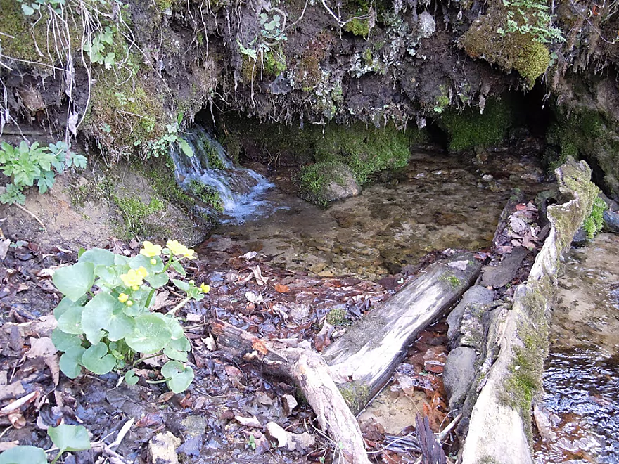
One of the major seeps (very cool)
Just about done with my super portage
From here on, there were ‘only’ like 4-5 more portages. That’s good!
Plenty of water for navigating
There is a seep to the right worth checking out
Not on the main creek, but a side seep
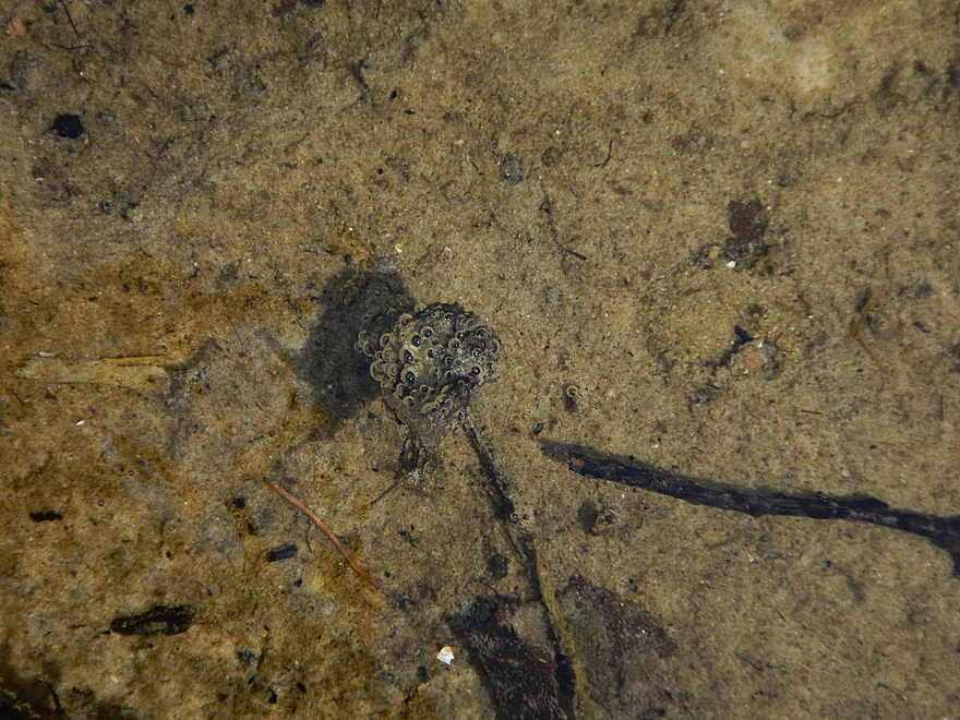
Frog eggs?
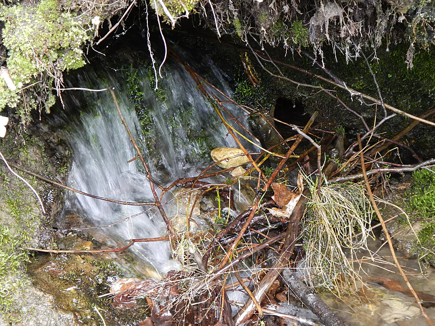
Micro-waterfall coming out of the hillside
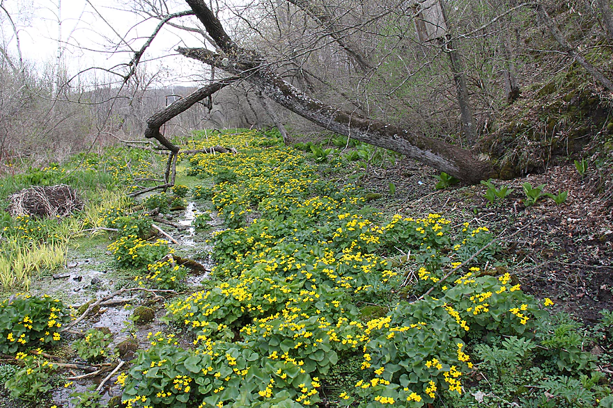
Great area for spring wild flowers
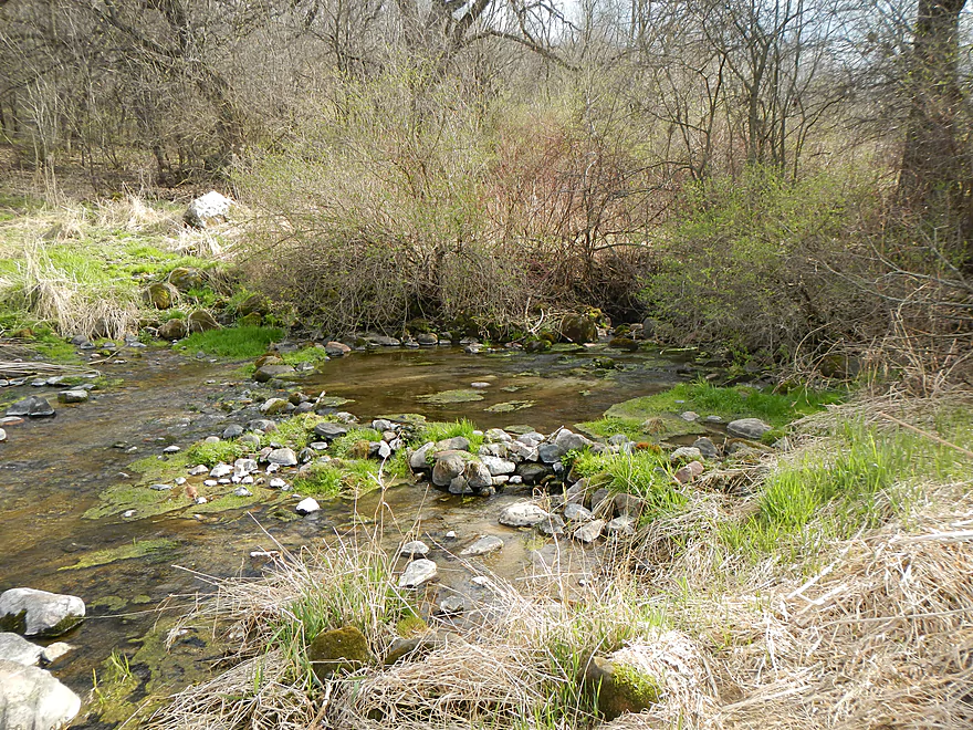
This spot is accessible from land
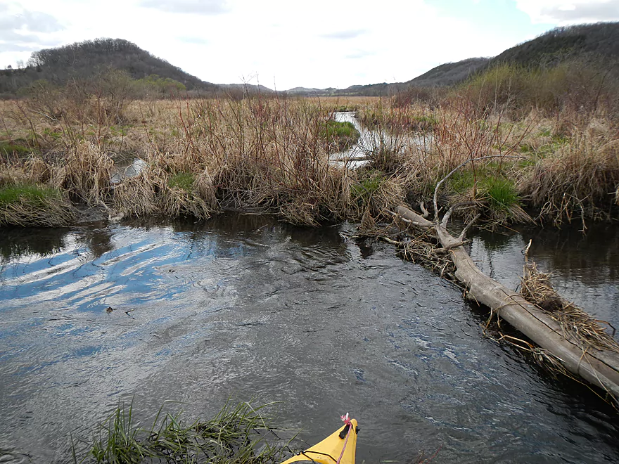
Another log jam
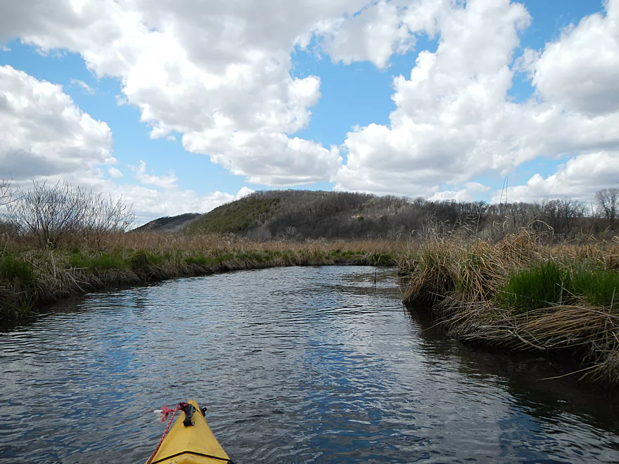
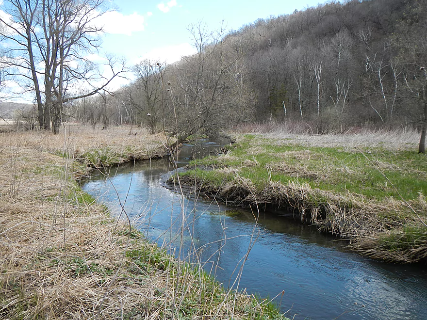
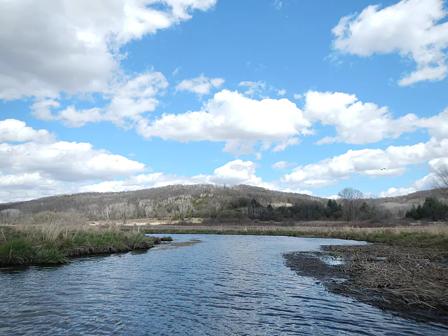
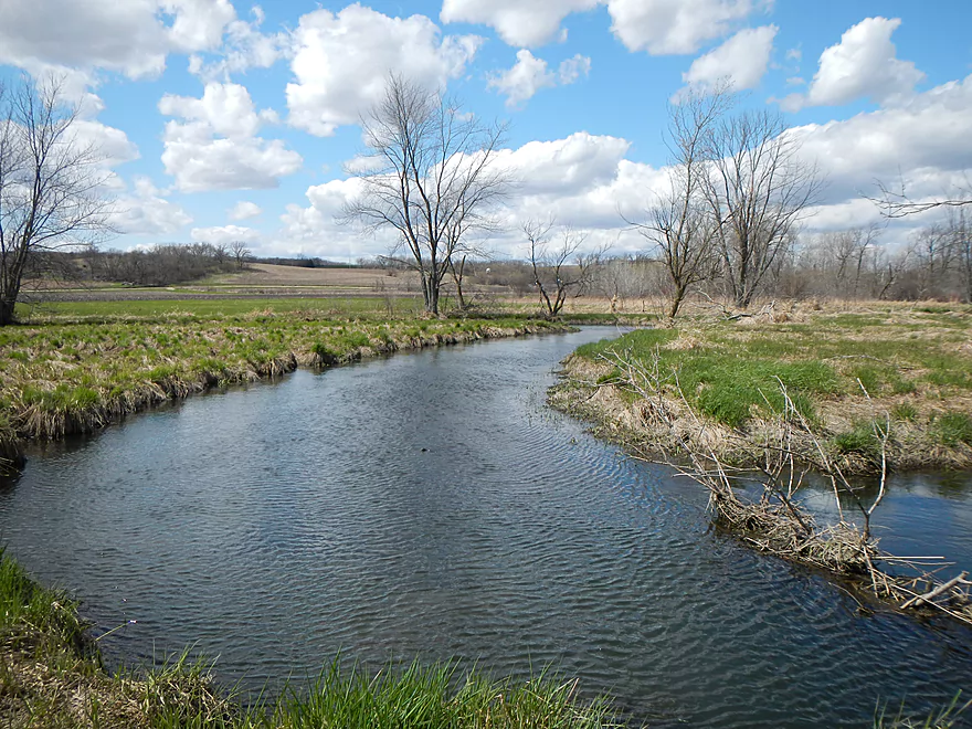
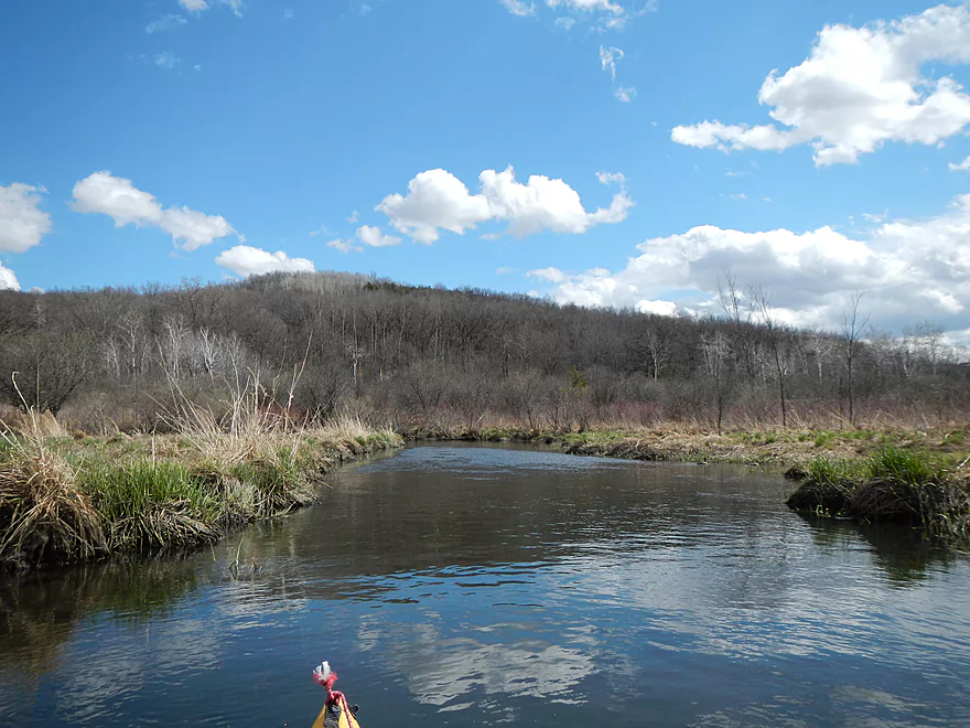
Attractive hills that flank Lodi Valley
Another mini-woods
Not bad, only one portage
Back in the open
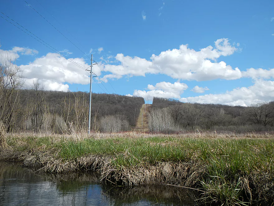
Power lines are a good landmark
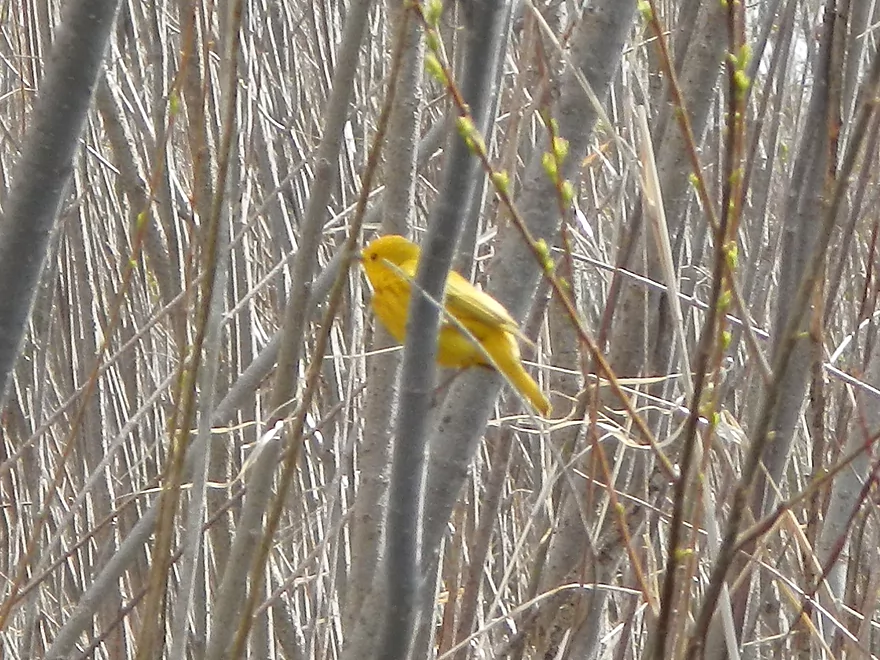
Yellow Warbler
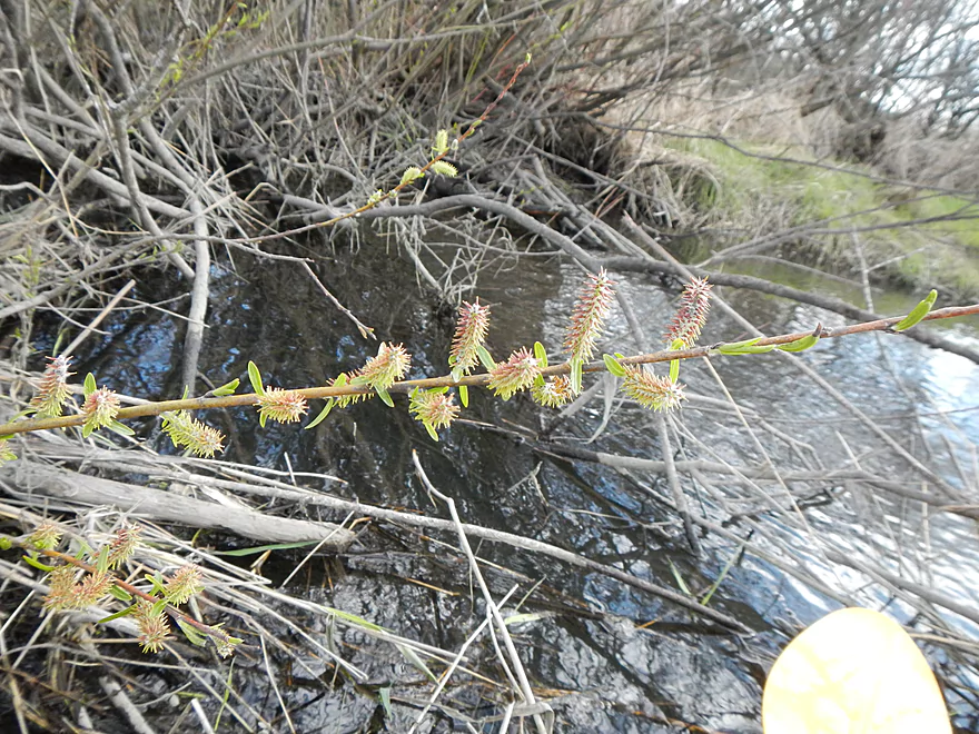
Cool plant
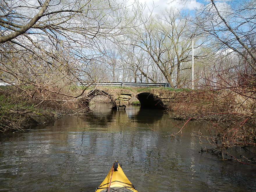
Snowmobile bridge
Another wooded corridor
Maybe ~3 jams in this section
Not happy to see me
Final stretch
Fishermen who actually want to paddle this segment!
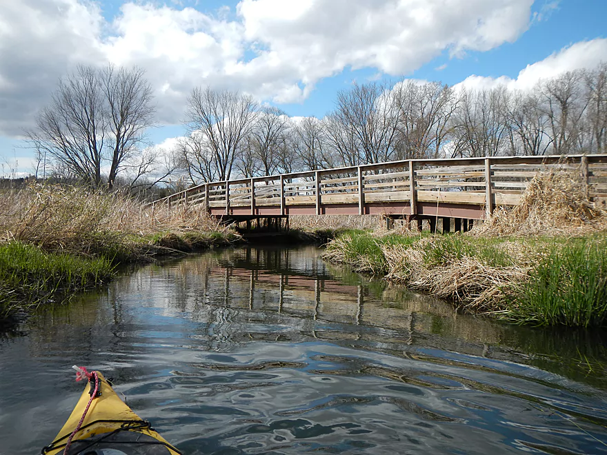
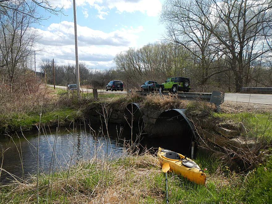
Take-out (Riddle Road Bridge)
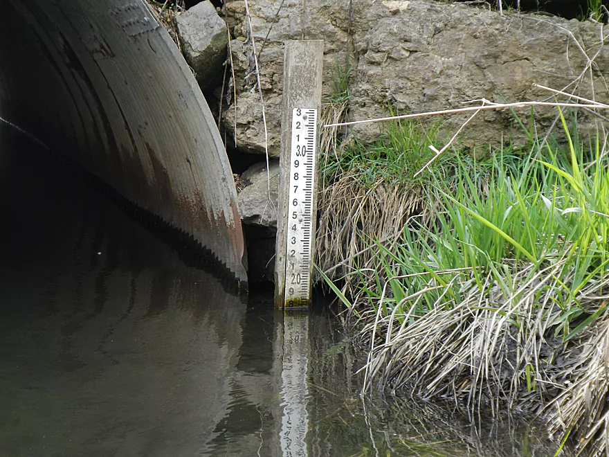
1.8 for the depth (which is high). More official gauge in my description.
Nice parking
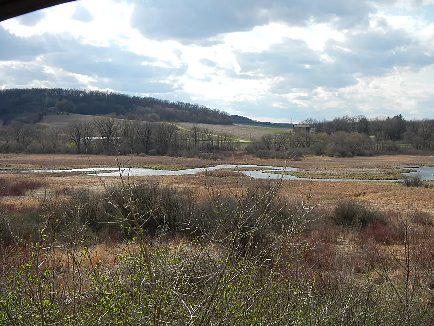
Lodi Marsh


Lodi Marsh is a very nice natural area located a half hour north of Madison. Basically, it is an open valley marsh that is fed with freshwater springs and accumulates into “Spring Creek.” There it in turn flows through the city of Lodi and then eventually into the Wisconsin River at Okee Bay. There is a terrific trail system in the area that affords great views of the valley, wildlife, and marsh. The DNR has an official map with the four main public access areas that you can download here. I’ve hiked quite a bit of this trail system and it has a nice (albeit artificial) prairie and bluff overlooks. The best part about the trail system is the access to the water, and more specifically the freshwater springs that gush out of the hillsides, the wonderful spring wildflowers and terrific skunk cabbage colonies. Two of the three main springs are accessible from the trails, but you have to be on the water to access the third. If you’re curious, the official website and map for the Ice Age Trail in Lodi can be downloaded here.
I’ve long wanted to paddle the marsh but access (well, boat access) is very poor. The take-out at the Riddle Road bridge is a fine bridge take-out with pull-off parking for fishermen. But, within eyesight of the bridge is a logjam (always a bad sign). There are no real bridges on the southwest portion of the marsh (again, largely a spring-fed watershed), but there is a public access area on Lee Road which can be a makeshift put-in. In the days prior, there had a been a lot of rain, so I reasoned the marsh would be quite navigable and rolled the dice that this would be a feasible trip due to the high water. I’m glad I did the trip, and I really like the marsh and being able to access it from water…but logjams were a serious issues (more on that later).
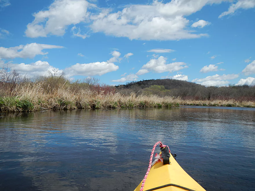
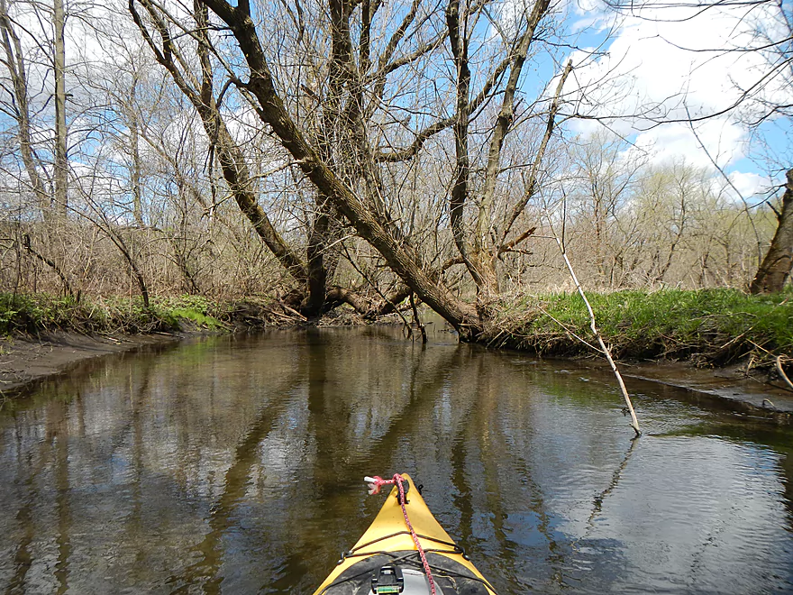
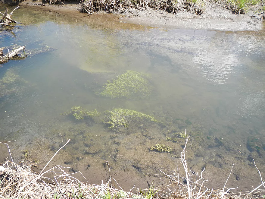
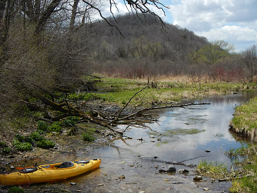
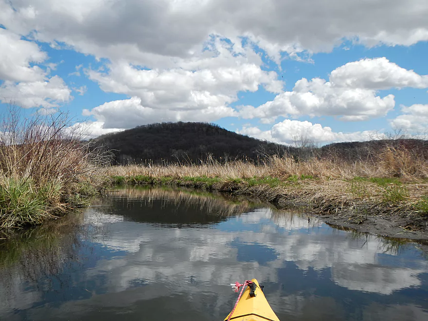
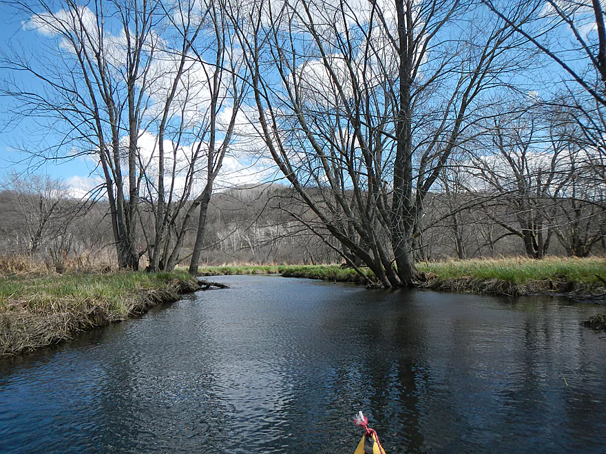
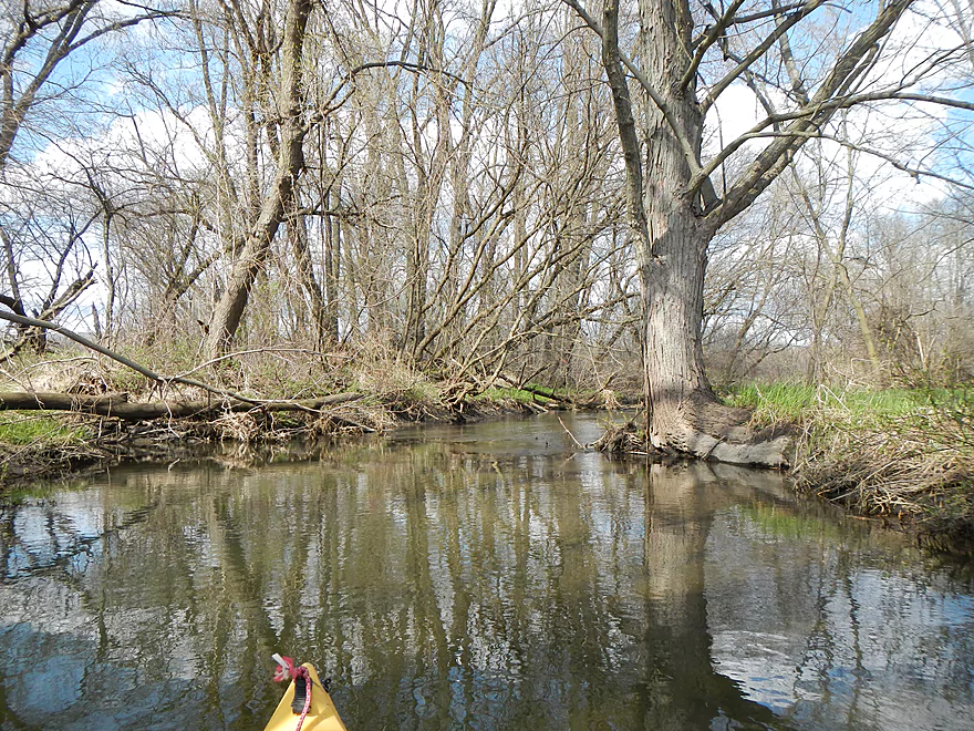
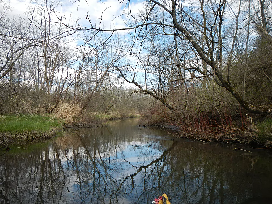
To start the trip, I put in at the public access on Lee Road (marked on the map). This does not connect to the trail system and the only reason this remote pulloff is established is it provides access to one of the three large freshwater springs that feed the marsh. In a sense, this is the start of Lodi Marsh (aka Spring Creek)…very literally so, as water will be gushing out of the ground to form the creek at this location. Very cool! This pulloff is not designed for kayaks, but works. Parking is good, but you do have to drag your kayak maybe 90′ to the creek. For this trip, you’ll want to bring towing rope, amphibious shoes, a change of clothes, and a shorter/flatter kayak that is easy to drag around logjams (more on this later). The water is a little shallow at the start–you’ll probably have to wade for maybe 10-15 yards until the water gets deep enough to launch. The water quality is terrific and the substrate filled with clean sand and nice pebbles (this will change).
The first mile or so is very shallow. I have a very good shallow water kayak because of its flat bottom, but I got hung up more then I would care. I never had to get out, but it wasn’t ideal trying to brute force your way through the muddy bottoms (which had replaced the nice sand I saw earlier). In fact, the mud might have been dangerous to try to walk on because it was so soft (who knows how far down it went). Something to keep in mind was that I went during high water (4.3′ on the official gauge), so normally this would be much more trying. The shallow waters don’t last long, as soon tributaries provide enough water for mostly smooth sailing. But then a new problem pops up…
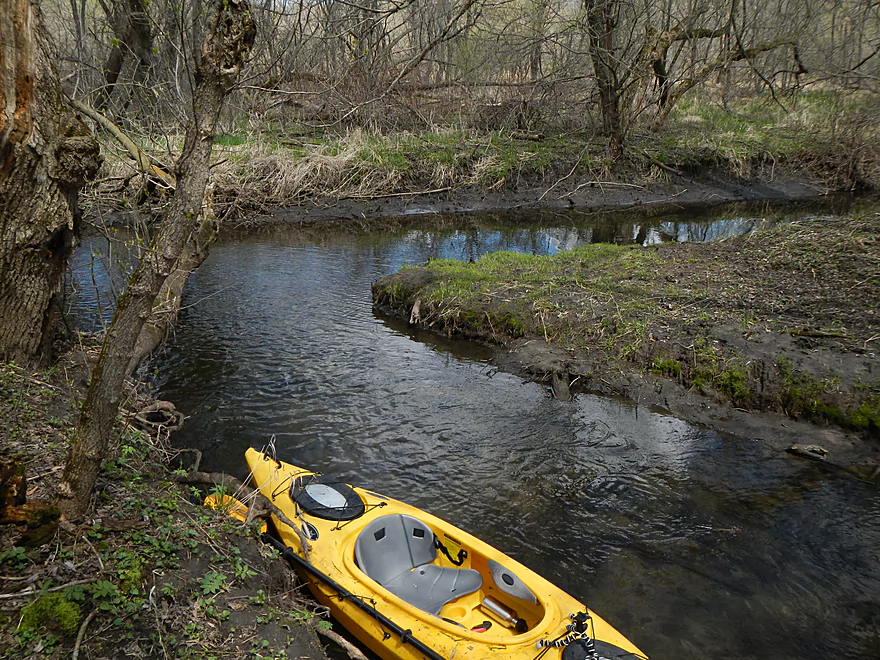
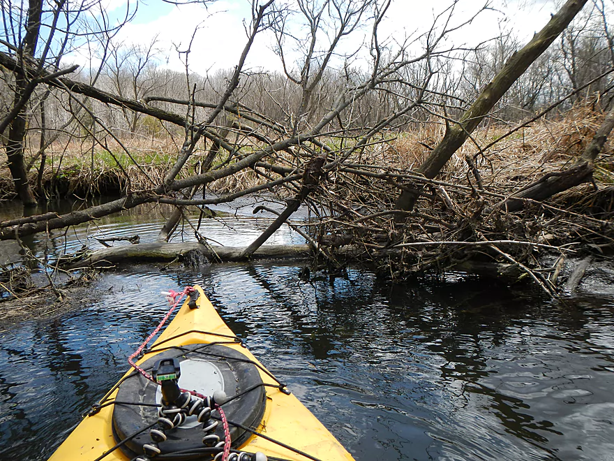
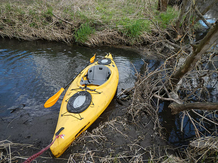
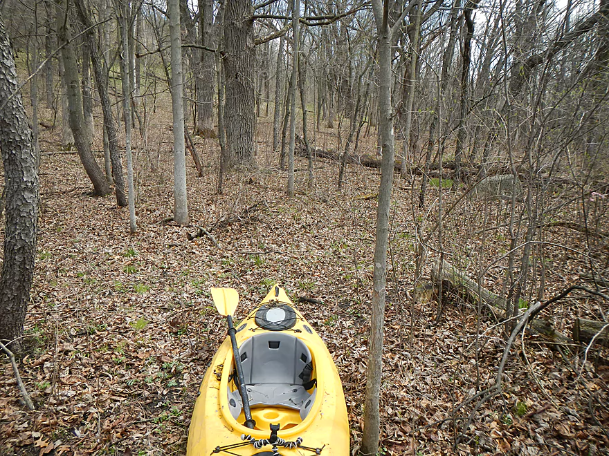
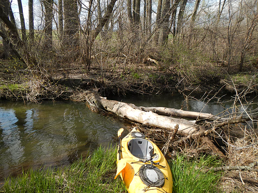
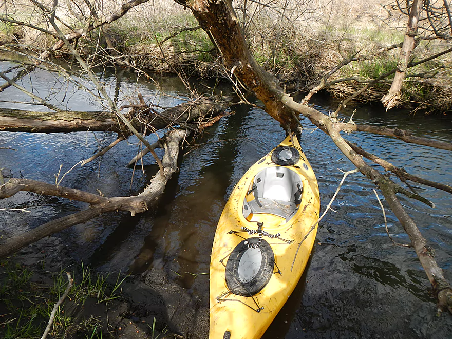
Before going on this trip, I had studied the satellite maps and knew an early half-mile stretch would be trouble (basically, I couldn’t see the creek from the satellite view, which almost always means logjams in my experience). I reasoned this wouldn’t be too bad and would necessitate some portages, but after that, the satellites showed the creek cleared up. It turns out this was a very trying part of the trip. At first there weren’t any logjams…just annoying “squeakers” that took a lot of maneuvering and got you and your kayak dirty (as well as your camera, hat, tripod, etc…) But after a while I had to get out, which was not easy. The foliage was so dense, it was difficult to actually drag the kayak around the logjams. Putting back in, you had to deal with serious muddy banks, which is never ideal for launching. As soon as I would get out and get back in…there would be another jam…sometimes just 10 yards down the creek. I debated aborting the trip and backtracking to my bike…but the thought of going through the logjams and mudjams again was not attractive. It was also extremely windy (watch the forecast for this trip) and I also would be returning into a nasty headwind. I knew from memory that this half mile of dense tree cover by the creek would go away, so I decided to do a “super portage.” So, basically, with my handy rope, I dragged my kayak away from the creek to get onto more towable marsh grass and pulled my kayak for 2-3000′ around this evil section. Not fun…especially with the “land logjams,” but better than the water logjams.
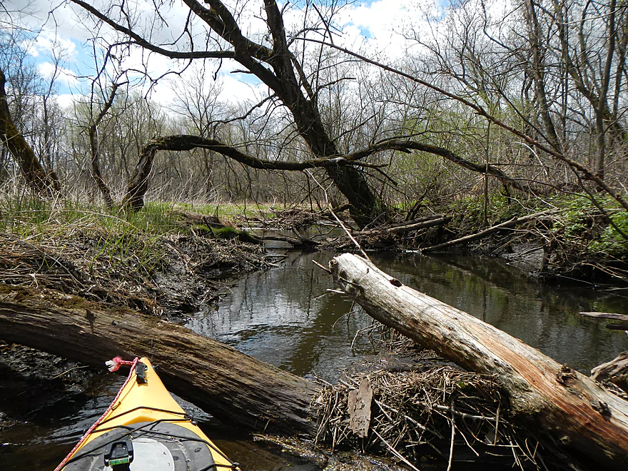
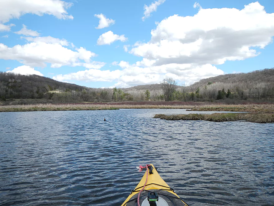
Eventually, as predicted, the trees (and their accompanying logjams) cleared out and I was able to get back on the water. From here on out there weren’t too many logjams to the end (maybe ~6)…good relative to what I just went through. The middle open area (see satellite map) is definitely pretty logjam free. I’ve marked some (not all) of the logjams on the map. There are easily double this in serious squeakers, and longer/bigger boats would have to do more portages. Some of the “duckers” I did were pretty extreme. At times I limboed deep into my cockpit and got under some logs with maybe 6 inches to the top of the kayak. Normally this would be dangerous, but the water was mostly shallow and current very slow.
After ending my super portage, I soon encountered my second major fresh water spring–very clean and attractive, with oodles of skunk cabbage growing in the vicinity (there is a picture in the photo gallery).
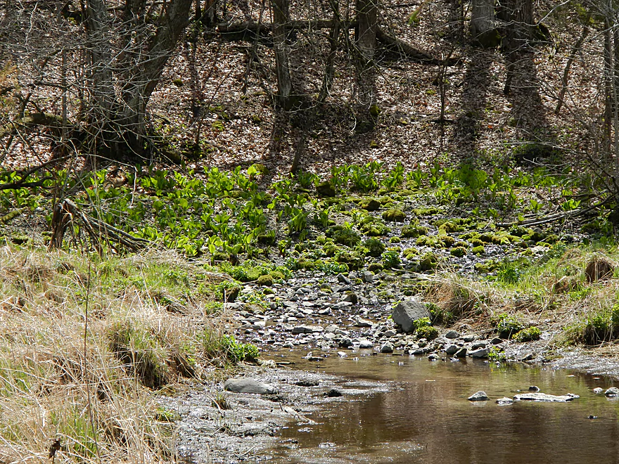
After a couple more miles of easy paddling, you’ll encounter a small tributary on the right which I suggest paddling up to. Very shallow…and you’ll probably have to get out, but it is worth it IMO, as this is the third and best fresh water spring–basically a very nice micro-waterfall coming out of “nowhere”–but also a terrific field of marsh marigolds and skunk cabbage enjoying the crystal clear spring water. This gushing seep is accessible from the trail system (marked on the map).
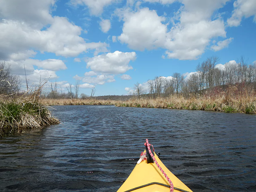
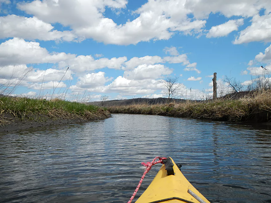
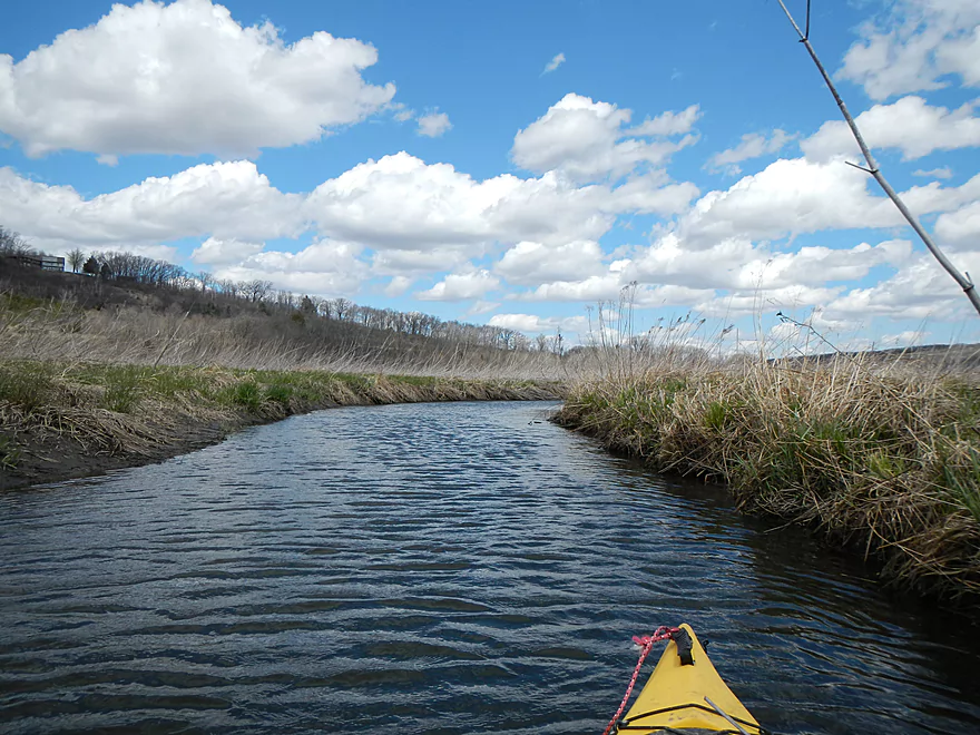
Continuing on, the creek gets to be quite wide and open. The Lodi Valley is kind of bowl-shaped (one giant glacial moraine) and the hills provide attractive backdrops and contrast with the flat open marshland you paddle through. Again, wind can be an issue.
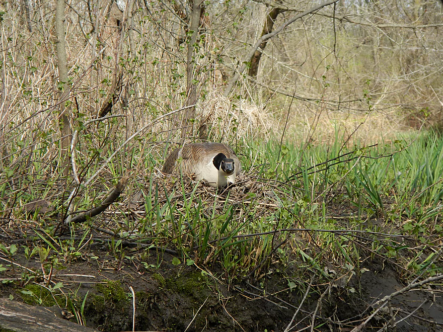
Wildlife was terrific, with lots of geese (who weren’t happy to see me). Saw a muskrat or beaver (have a video of him), yellow warbler, ducks, blue heron, and many birds I didn’t recognize. Unlike some marshes (Grand, Horicon), cattails are not as epidemic and the plant life is much more diverse and attractive. My theory is that marshes with dams artificially encourage cattail growth, which is why Lodi Marsh, without a dam (unlike Grand or Horicon), is so nice.
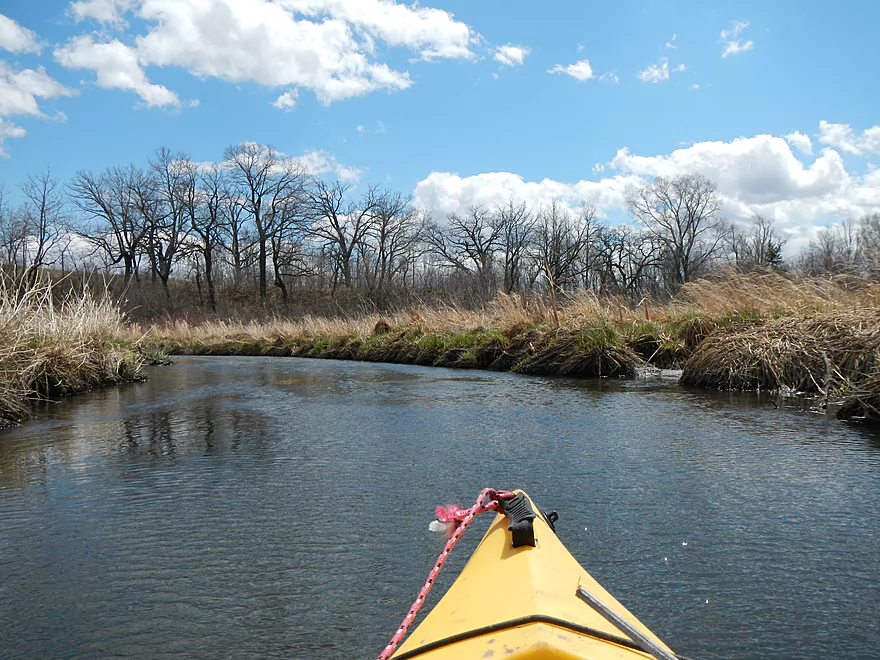
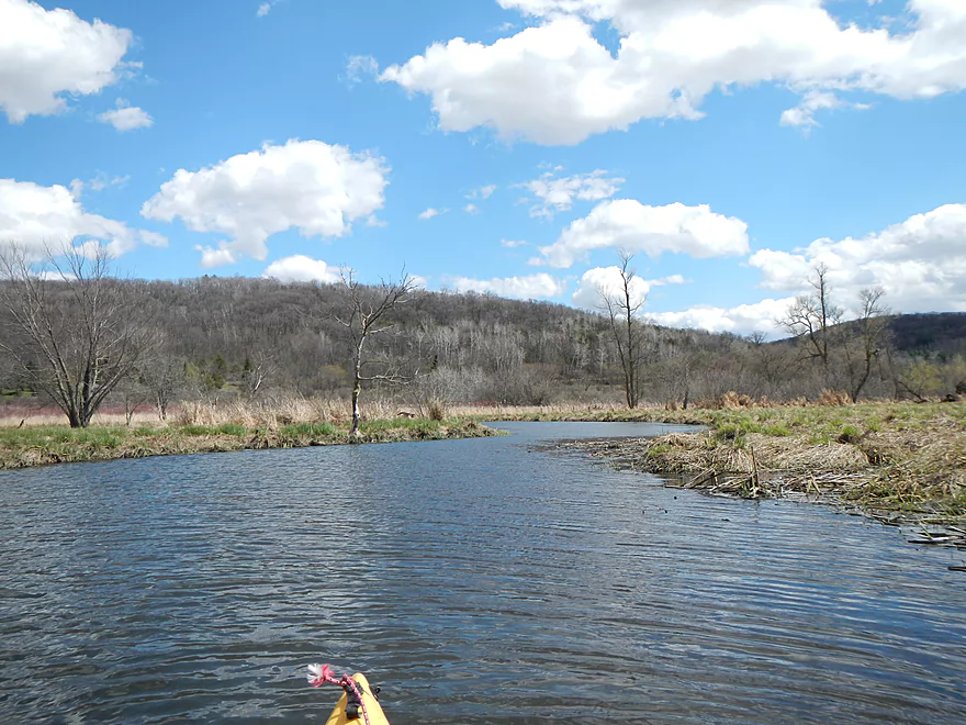
The creek starts to narrow and encounters another wooded section. This time the extra girth of the creek from the additional tributaries cuts down on the number of complete logjams, but I did have one (not too bad) and a couple of serious squeakers. The creek opens up again…clear sailing and pleasant paddling, for the most part, for the final couple of miles. Then trees envelop the creek one last time, which results in maybe 3-4 more jams and numerous serious “almost jams.”
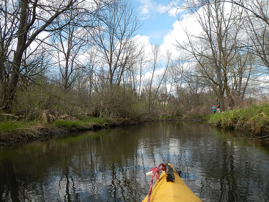
Just before my take-out at Riddle Road, I encountered some fishermen on the bank. They commented that they wanted to paddle the marsh! Small world… I warned them about the logjams, but don’t know if I was too persuasive… They also said they had paddled Spring Creek to the Wisconsin River last year (which I had also done last year…review here). There had been a log clearing effort a couple of years ago, but unfortunately, things have filled in since then. The fisherman and his girlfriend had said the jams were so bad they couldn’t even be portaged…which is a worrisome sign. If I had a “log clearing genie” with only 3 requests…this creek would be one of them.
The bike shuttle is only 3.5 miles and affords a fine view of the marsh (a little hilly, but not bad). No shuttle services are in the area.
If you REALLY want to do this marsh…you’ll want to plan better than I did. Don’t put in at Lee Road (logjams are too bad). Try putting in at Cty. Y (marked on the map). There is a small drainage ditch which is barely navigable…maybe not even… from Y to the main creek. Even if you drag your kayak with rope (which you should bring), this would be better than what I had to endure as it will significantly cut down on the number of log jams and pretty much eliminate the mud jams if the water is as high as it was for me. If the ditch is too shallow, it would be a 1400′ drag over mostly grass (ok in my book if prepared). The land here is all public, so access, while not ideal from Hwy Y, would be the best bet IMO. From here on, there should be just a couple of jams until you get to the final forest section.
You can avoid some (not all) of these final jams by taking out at Hwy Y close to close to Riddle Road (see map…some kayak dragging involved), but my vote would be to finish this up, endure the jams, and take out at the bridge.
Alternatively, hiking is a fine way to experience the marsh. You can get to all the springs except for the second one, which doesn’t have direct access…but if you are really determined and go off trail and over a serious hill, you can get to that as well.
Detailed Overview
- Upstream of Lee Road: There really isn't much to paddle (the creek starts as a natural spring).
- Lee Road to Hwy Y Side Channel: 1.4 miles. A nightmare tangle of logjams. Not recommended (reviewed May 2014).
- Hwy Y Side Channel to Riddle Road: 6.6 miles. Scenic wetland paddle with multiple natural springs, but probably 5 logjams (reviewed May 2014).
- Riddle Road to Pleasant Street: 0.7 miles. A frustrating wooded section because of 10 logjams (reviewed May 2015).
- Pleasant Street to Fair Street/Sanitation Plant: 1.1 miles. Very scenic part through downtown Lodi with some fun rapids and no logjams (reviewed May 2015).
- Sanitation Plant to Hwy J: 1.1 miles. Attractive paddle, but ~7 logjams (reviewed May 2015).
- Hwy J to Hwy 1131st: 1.0 miles. More of an open grassland paddle with no logjams but a few low fences (reviewed May 2015).
- Hwy 1131st to Hwy 1132nd: 1.3 miles. A frustratingly muddy section with many downed tree and three major logjams (reviewed May 2015).
- Hwy 1132nd to Hwy K Landing: 2.1 miles. Surpsingly nice and attractive wooded section but there will be a serious logjam or two to deal with. Trips ends on Okee Bay (reviewed May 2013).
Trip Map
Overview Map
Video
Photos Size:
Ive canoed or kayaked this a few times. Its a beautiful and scenic trip but access is tough I have carried out my canoe from by the snowbile bridge on spring creek because lower portion has log jams.
The logjam situation really is quite tragic. Hopefully somebody will clear this out in the future.
My partner and I tried this creek for the 4th of July. We put in at the bridge at Riddle Rd and paddled upstream so that we would not need to shuttle. It was slow going with lots of overs, unders, and throughs to negotiate but we accomplished most of them by shimmying over logs. Our 10-ft, hard plastic recreational kayaks worked out perfectly and allowed us to make tight turns to line our boats up in snags to shimmy over the lowest parts of downed logs. I would not take a delicate boat here. Taking a longer kayak or a canoe would have meant more portaging, which could make this an annoying creek. We were able to stay in our boats almost the whole time by shimmying. My partner cleared some branches which made our return trip smoother. If you are inclined to carry a small saw with you, that could be helpful for yourself and future paddlers.
We were able to travel much more quickly after we reached the snowmobile bridge; there were far fewer snags. However, we did not paddle long before the creek became too weed-choked for our kayaks. There was also a lot more foul-smelling algae at this point. I did not bring great portaging footwear (I’d recommend rubber boots) so we turned around when we reached this shallow part. We paddled for about 3 hours, which included about a 15-minute break for an Independence Day cold one. It broke down to about 2 hours on the way upstream and 45 minutes on the return trip. I can’t believe it was only 3 hours. We felt like we had entered a whole new world (the solitude and obstacles really were fun), even though we were close enough to the roads to hear cars.
If you are trying to put on the miles or going for a workout, this is not your creek (though I’d love to come back and try it earlier in the spring after some rain for comparison). However, we had the creek entirely to ourselves, and I thought all of the obstacles added a sense of adventure or exploration. We had a great mini-adventure here. I was also impressed that on a 90+ degree day, we were mostly in the shade and never felt overheated. We even left our lifejackets on because, after putting in, we simply forgot to take them off and tuck them behind our seats. We were in more sun after reaching the snowmobile bridge (again, traveling upstream) but we were fine. This is a great creek if you enjoy observing plant and wildlife species. Do watch out for cow parsnip. We were able to avoid it without issue.
I read this page before picking our put-in site. I’m glad we put in at Riddle Road. There was ample space to park on the side of the road. Although we traveled much faster on the return downstream route, the current was not strong and paddling upstream was just fine. Our speed probably increased as a result of our bushwacking and experience negotiating the obstacles on the way out as well. It would have been great to continue paddling downstream to Lake Wisconsin if we had had a shuttle.
I appreciate the update and the details. I didn’t consider this before but in later summer, weeds can be an issue in marshes like this. Your idea to do an up-and-back was a good one…very easy to backtrack if things go wrong.