
Good Marl Lake put-in, but no parking
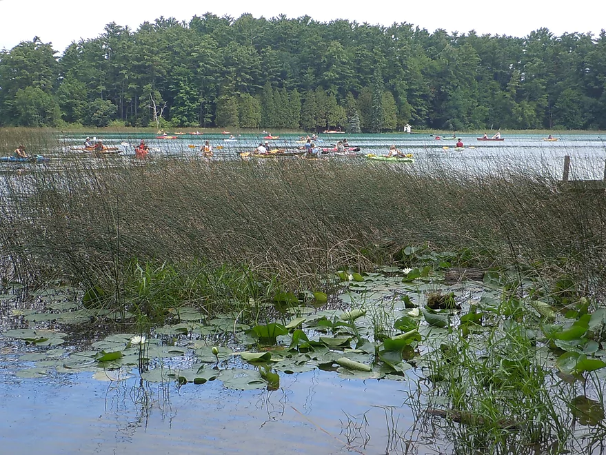
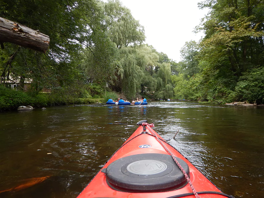
A large herd of kayakers
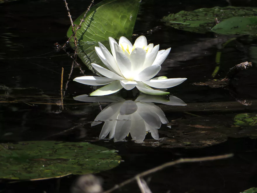
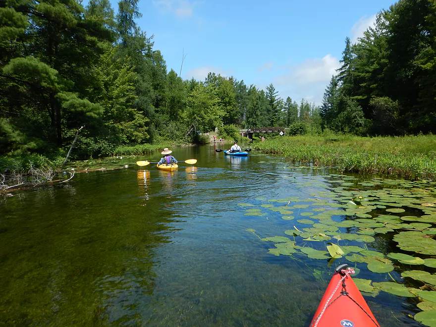
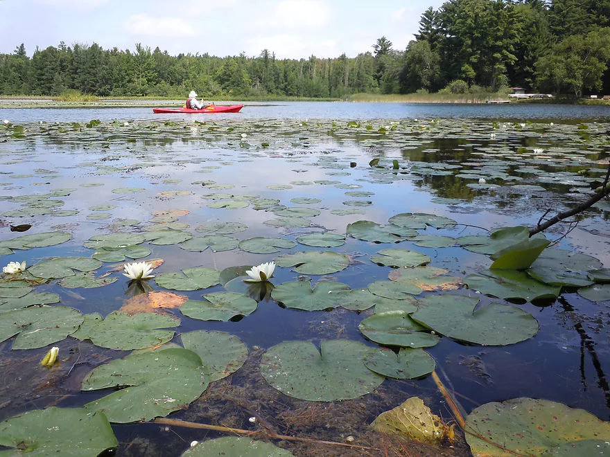
White water lily reflection
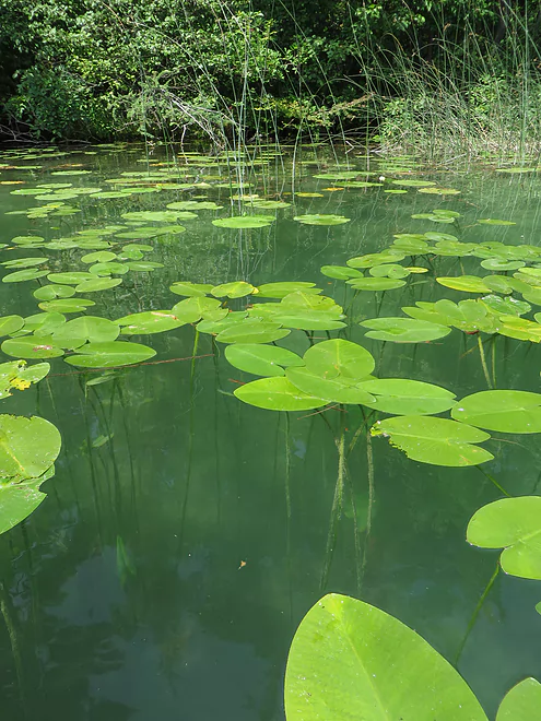
More cool lilies
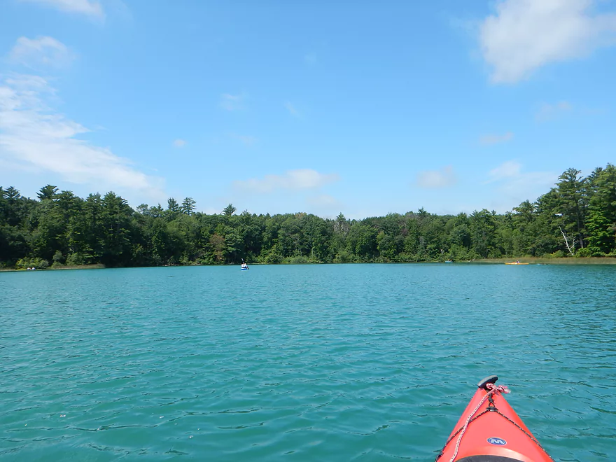
Terrific turquoise water color
Deep but clear lake
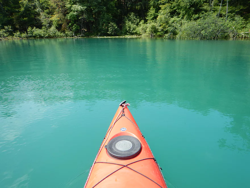
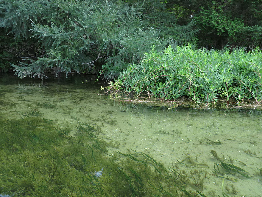
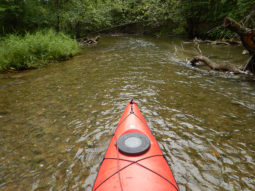
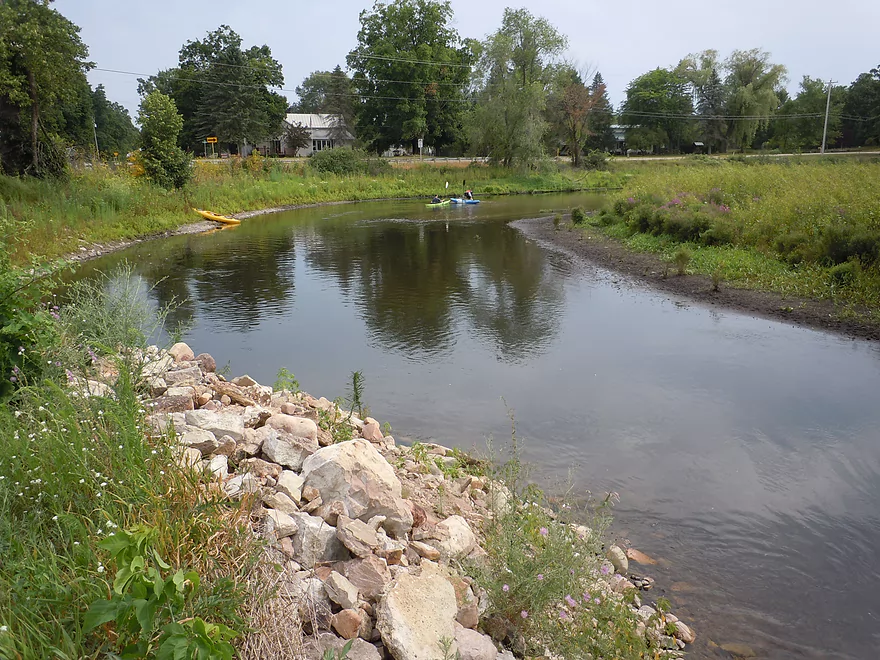
Marl Lake has the best color of the lower lakes
Exiting Marl Lake
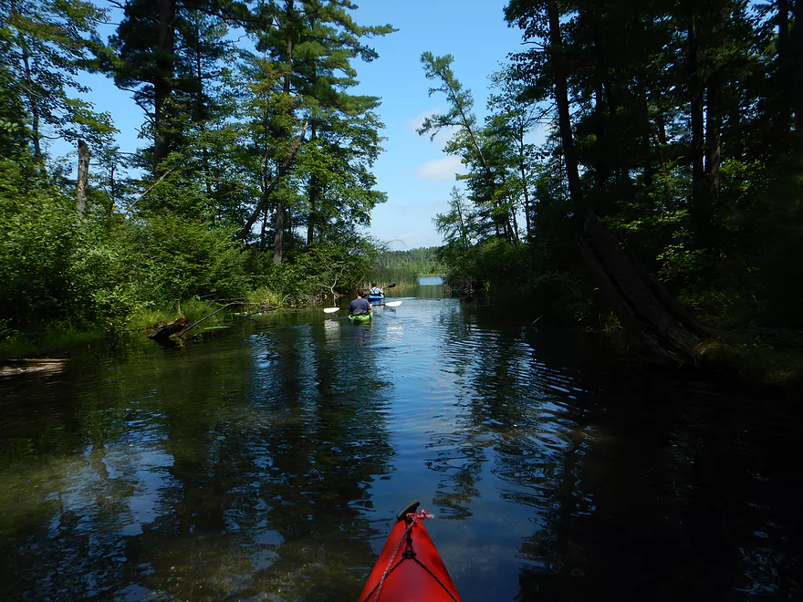
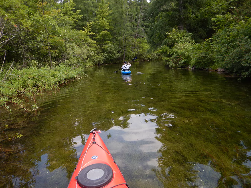
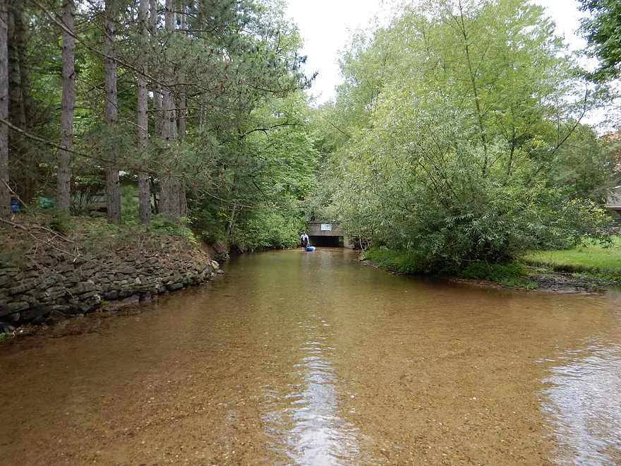
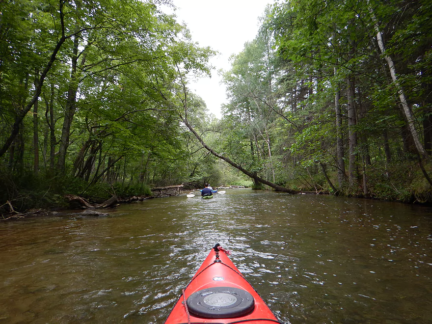
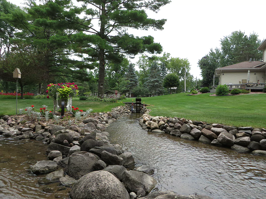
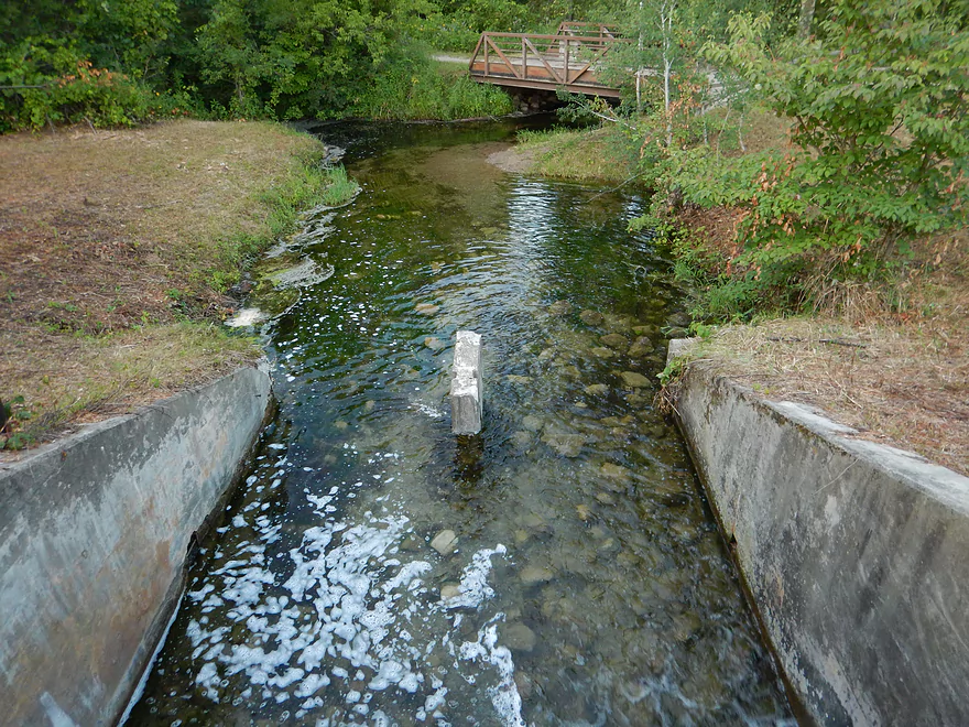
Nice connecting stream
Entering Pope Lake
Another cool connecting stream
Trying to find Manomin Lake
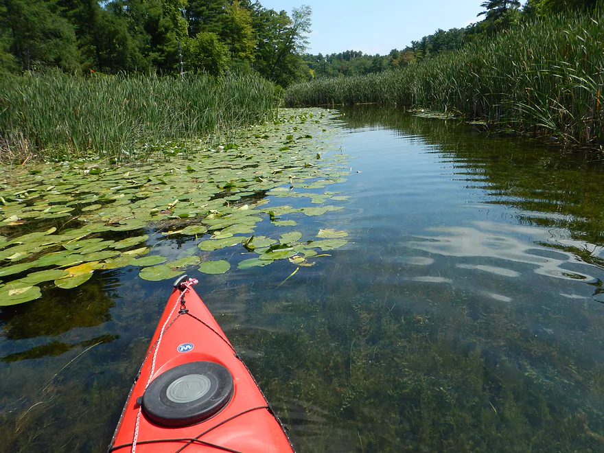
Flowing aquatic plants in crystal clear water
Seeking Knight Lake
Knight Lake access is actually good
Entering Knight Lake
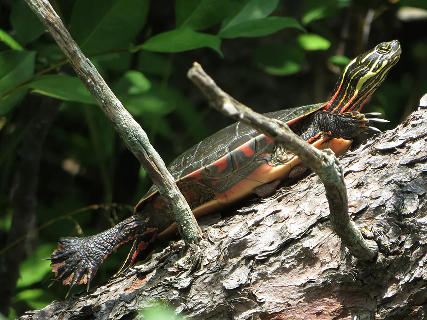
Painted turtle doing yoga stretches
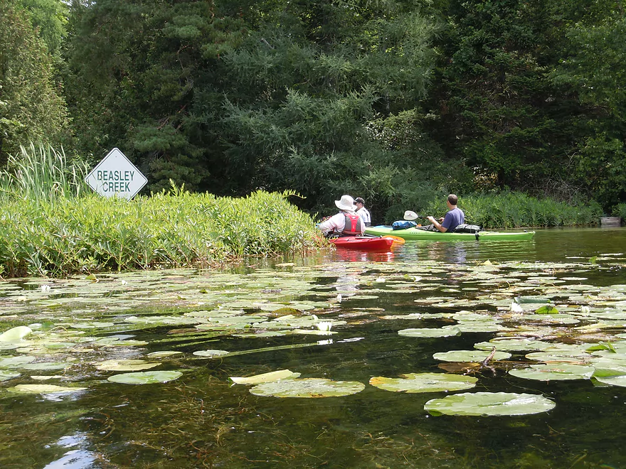
Now entering Beasley Creek
You almost can’t tell there’s water here it’s so clear
Creek is very shallow
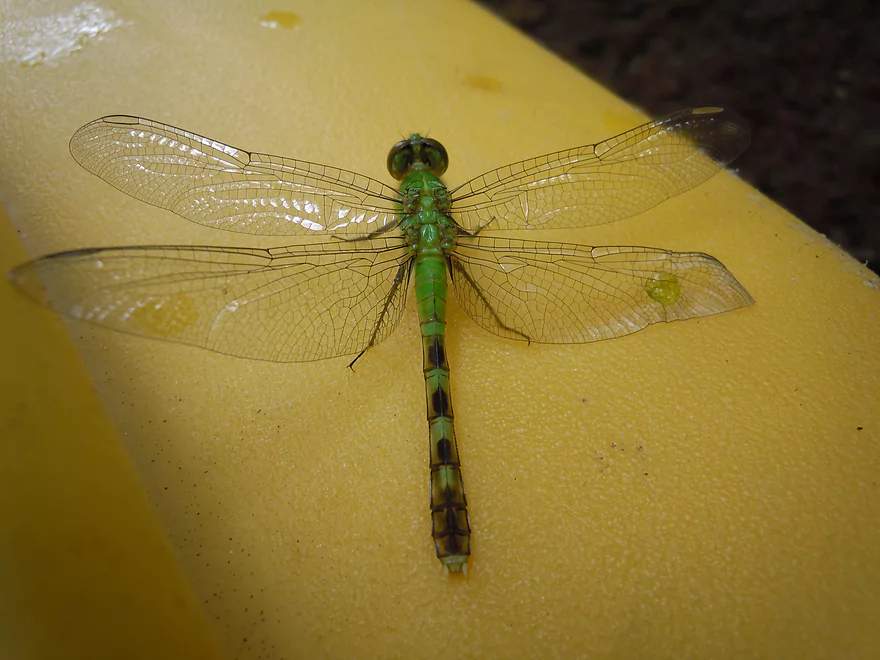
Green jacket (blood on right wing means he just emerged)
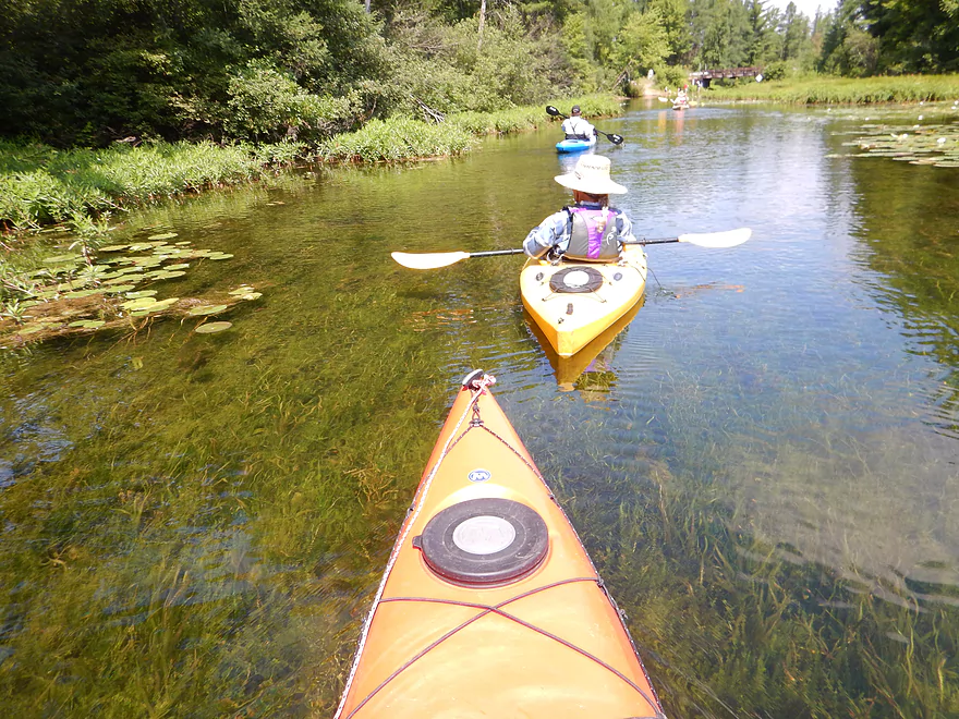
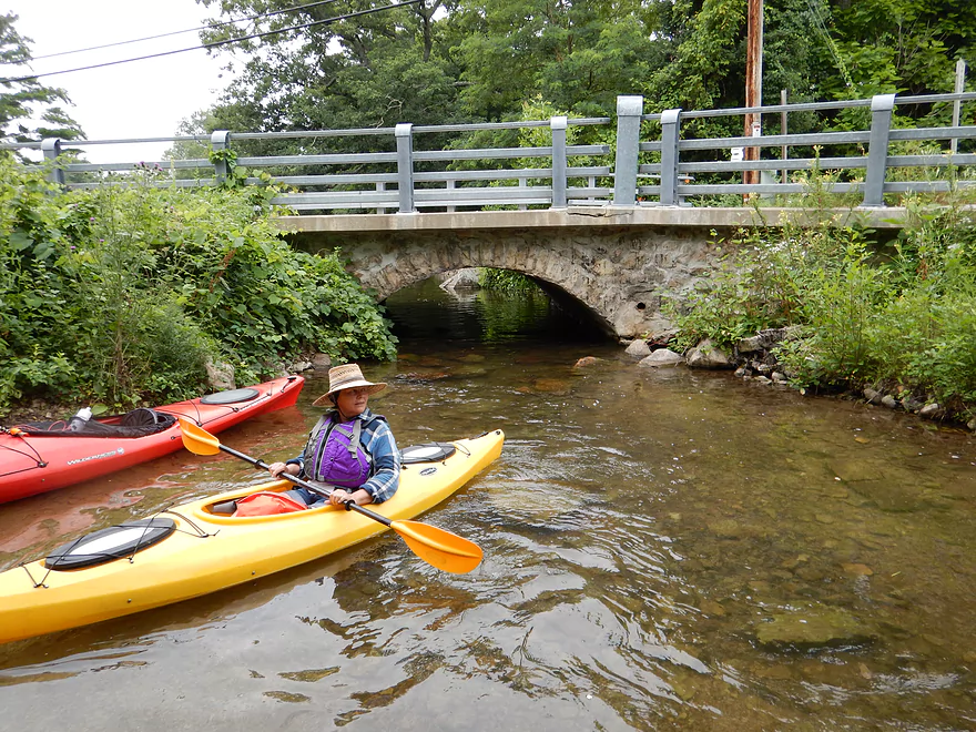
Whispering Pines road bridge
Lot of people walking their boats here (no problem)
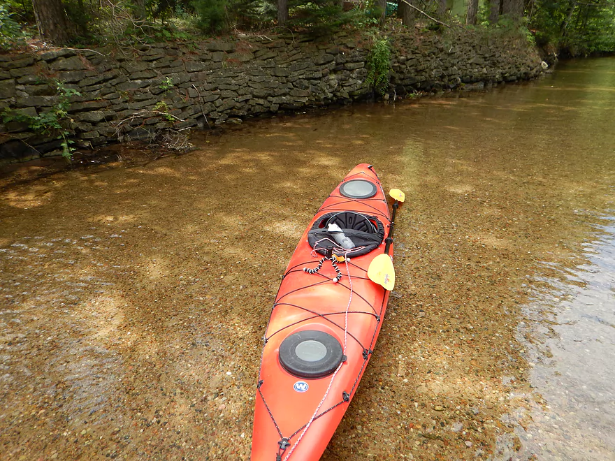
Beautiful sand and pebble bottom
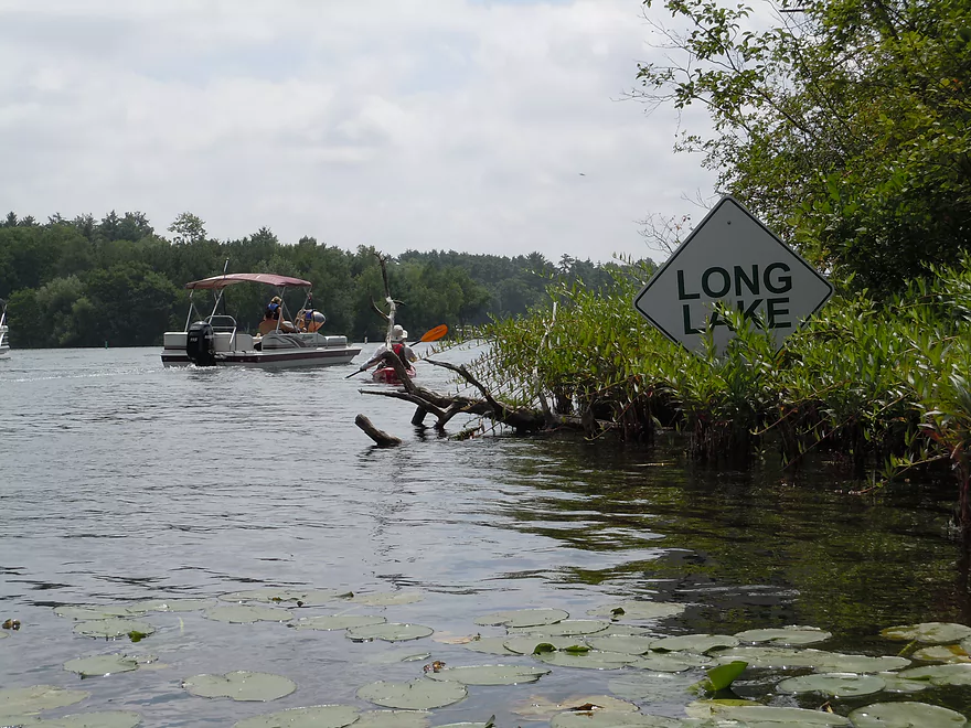
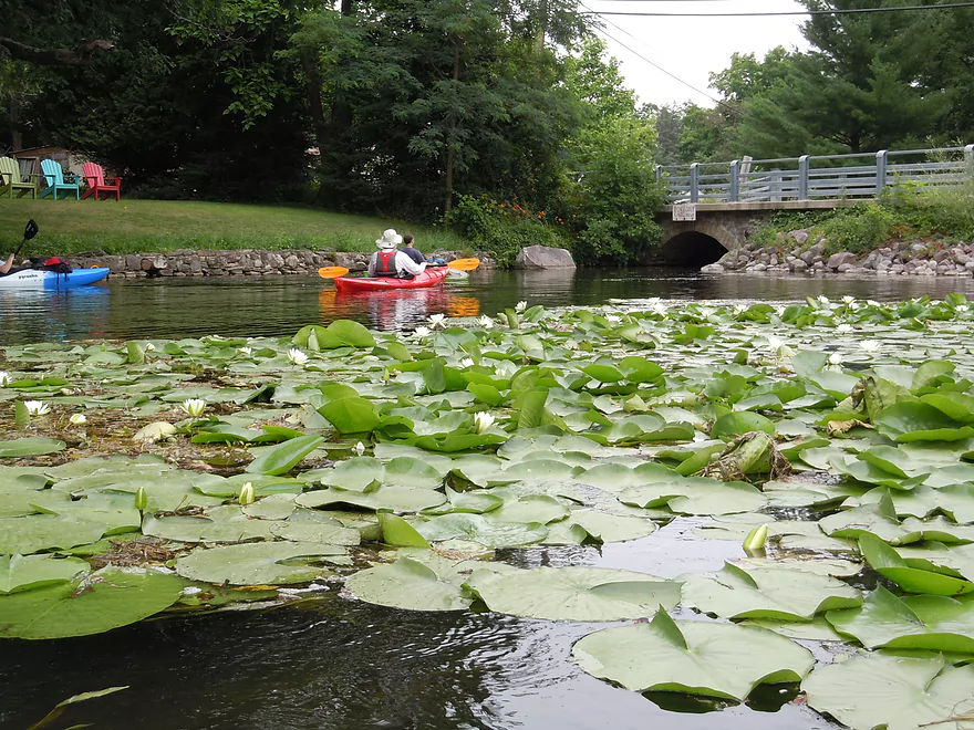
Entering Long Lake
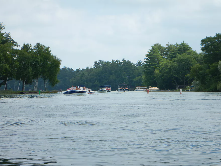
Ton of motorboat traffic
This is the bad lake

A very big & strange motorboat (might be a shuttle for Dings Dock)
What happens when there are not sandbars on a lake
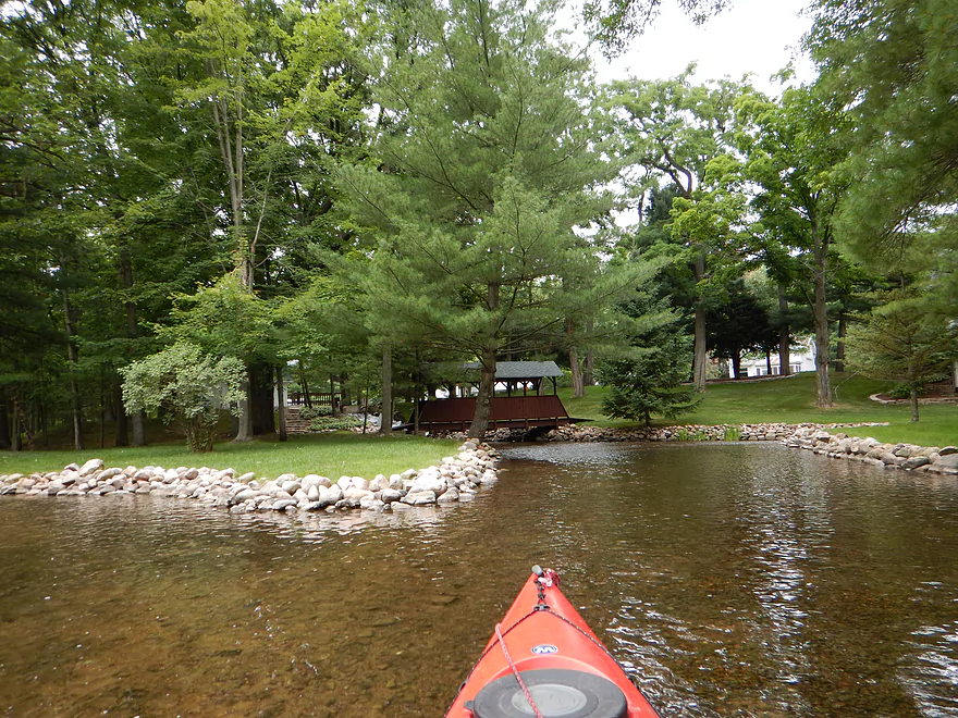
Finally in the Crystal River proper
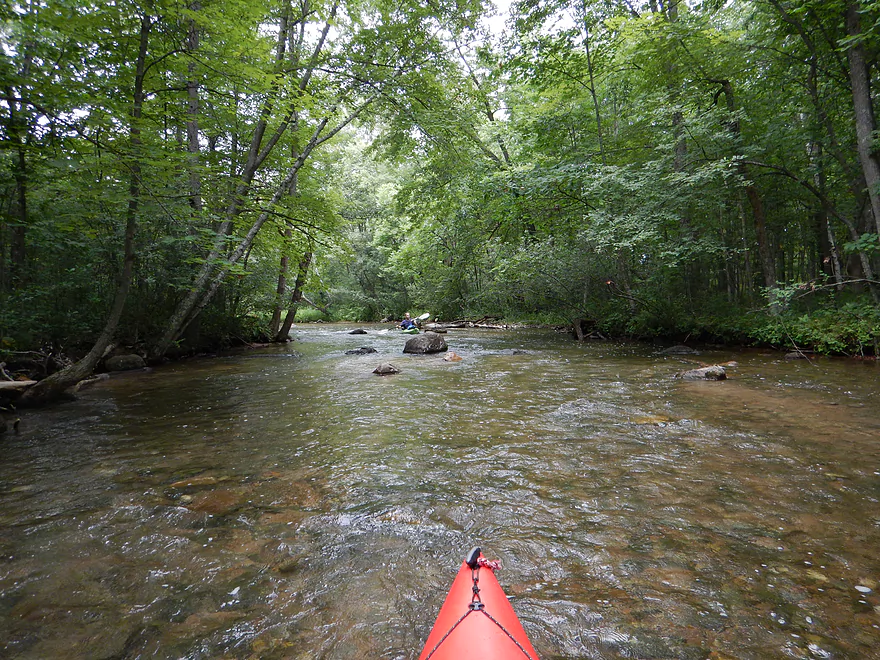
Shallow but runnable
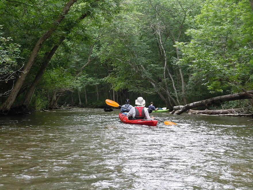
Nice tree canopies
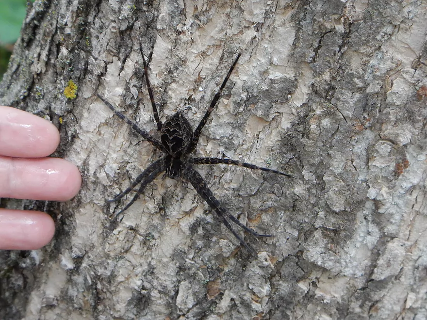
Large fishing spider
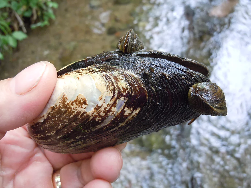
Clam with zebra mussel friends
Some nice boulder gardens
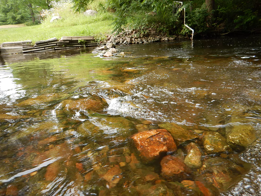
Superb water quality
Rapids here are easy
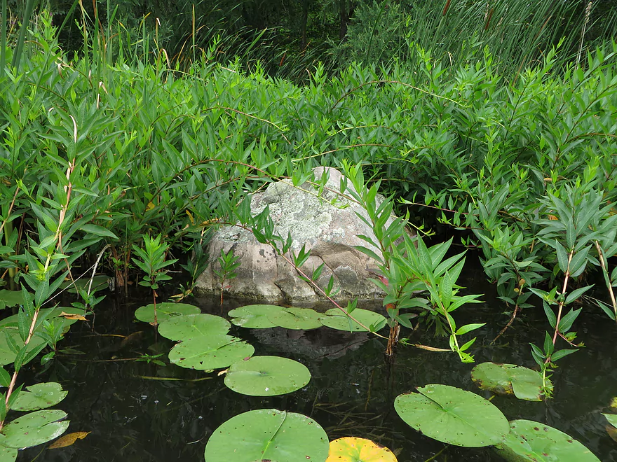
Random giant boulder
Somebody wanted us to see their manicured lawn
Close-up of swamp loosestrife/water willow
Go left (right tunnel is over a dam)
Left channel leads to an old mill race
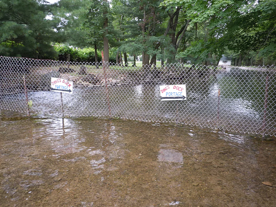
But fence prevents you from exploring it
Have to portage here back to right channel
Spectators waiting for paddlers to choose the wrong tunnel
Entering the town of Rural
Mini water wheel and mill race
Where the main mill race rejoins the river
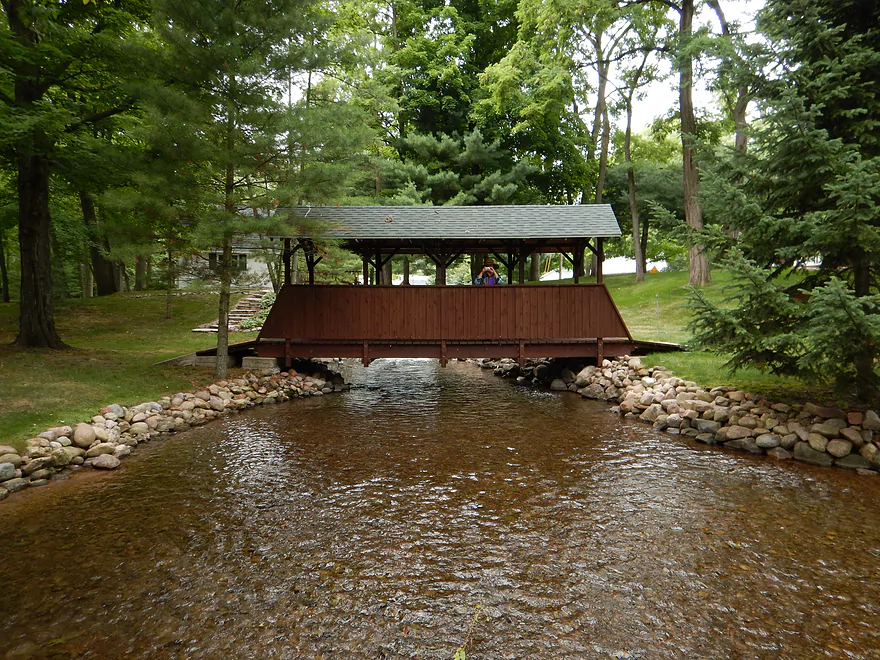
Covered walk bridge
Might have been a mill here back in the day
Junction Lake (not a flowage)
Do not rent the local canoes
They are glorified bathtubs
Rapids start to pick up in the next mile
Boulders, rapids, clear water and tree canopies for an amazing scene
Number of pedestrian bridges on the river
More rapids
Terrific boulder garden
Wing dam
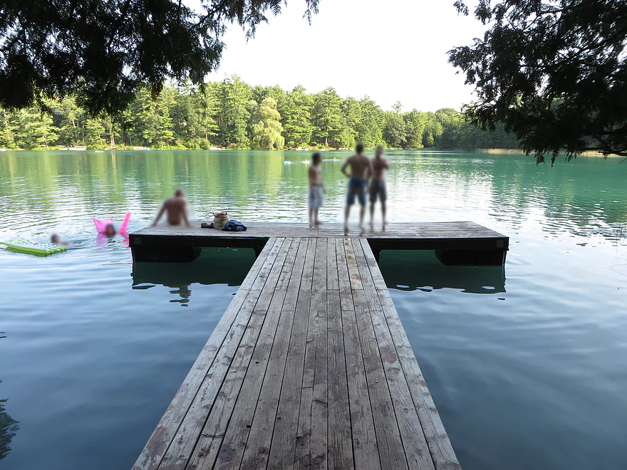
Tubers (ugh)
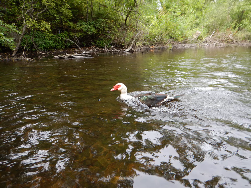
A mixed wild/domestic duck
More serious rapids (but safe at our depth)
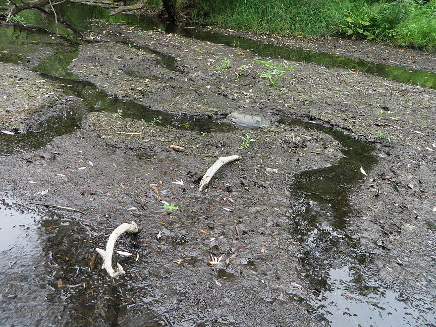
Snapping turtle canals
Easy ledge
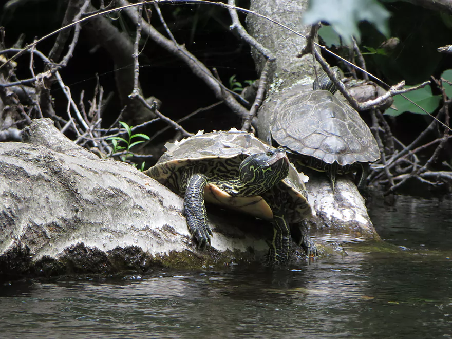
Colorful neck patterns on the map turtles
Bumpy riffles
If you rent a bathtub, you take out here (notice how stackable they are)
Left tunnel is less bumpy
Attractive beds
Dock to nowhere (this used to be a flowage lake)
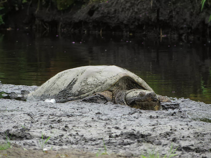
Third snapping turtle on the trip
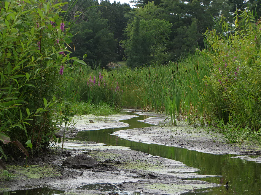
Cool micro-creek
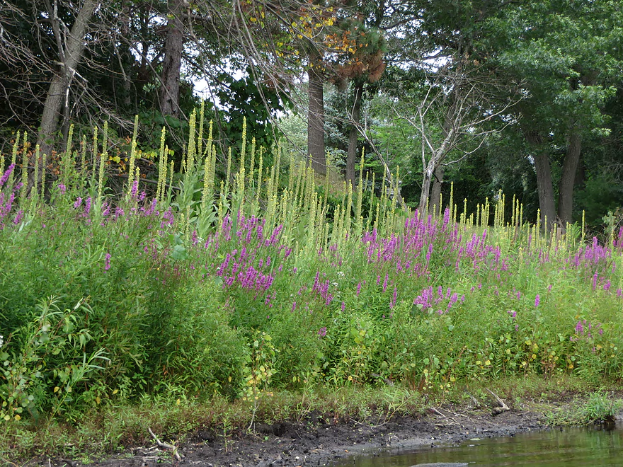
Purple loosestrife and mullein weed
The old flour mill
Looking over the old flowage area
The mostly but not completely removed dam
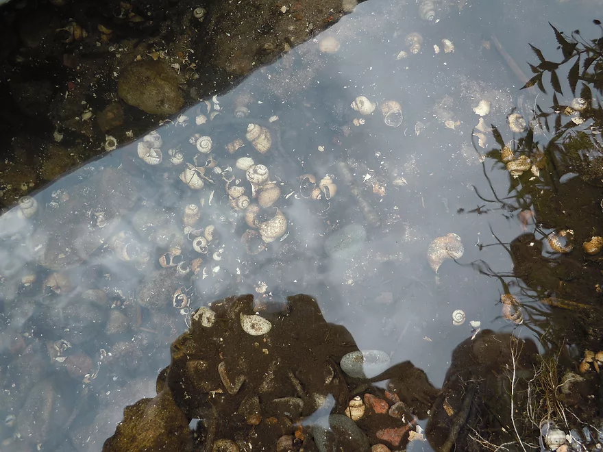
Lots of snail shells on the bottom
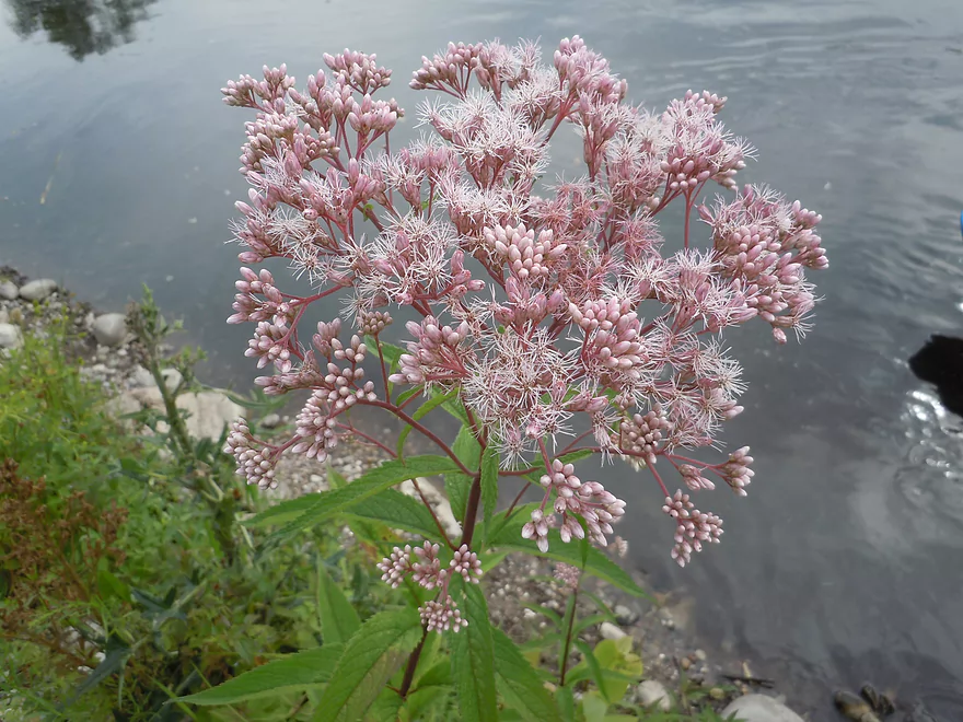
Joe-pye weed
Bit of a hydraulic at the bottom
So we portaged
Nelson Park is a good take-out option with facilities
But if you take out there, you do not get this view
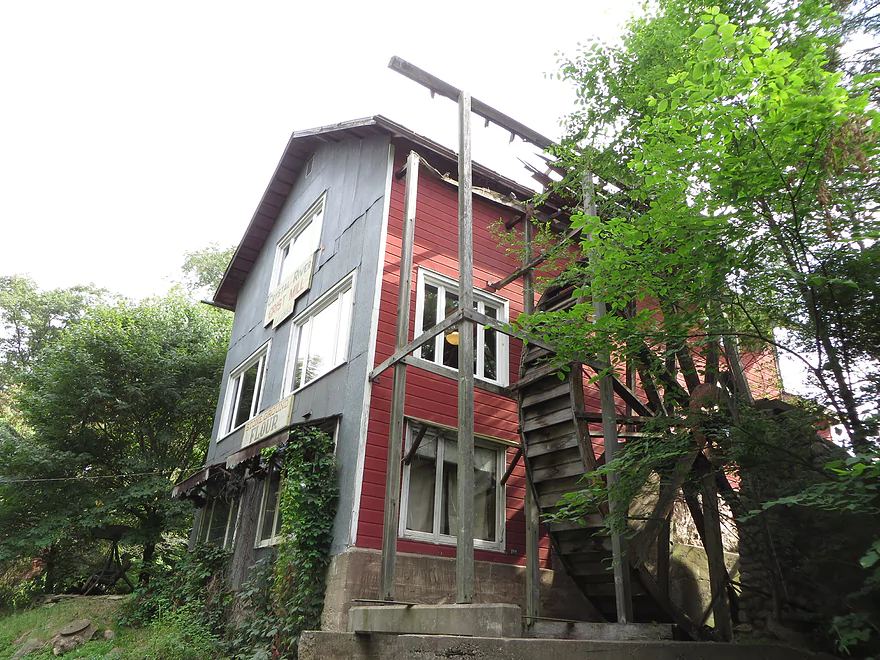
The old water wheel
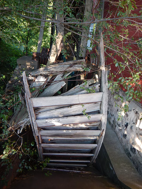
In disrepair, unfortunately
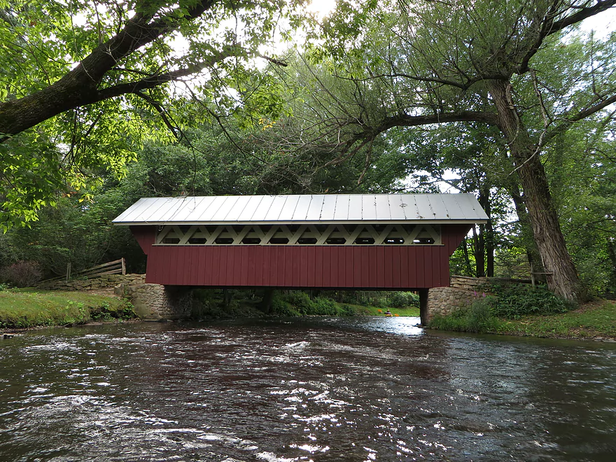
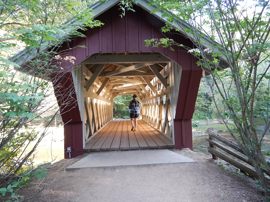
Very nice covered bridge
Amazing light reflections
A mini chapel
Lot of weddings held on these grounds
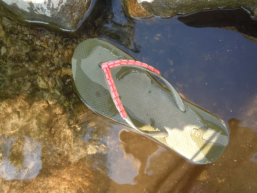
Lot of these on the river (tubing and flipflops don’t mix)
Shadow Road take-out is good
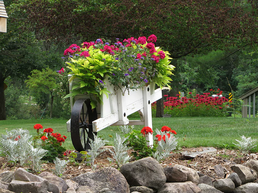
Scouting the Whispering Pines park by Marl Lake
Otherwise good alternative put-in
Hartman Creek below dam–maybe barely navigable
Saying goodbye to the Chain O’ Lakes
Crystal River

A must paddle for southern Wisconsinites! This is actually a two-part trip that can be split in half. The first four miles run through the terrific Chain O’ Lakes and the second half consists of small river paddling with clear, riffly water and (for once) tasteful bankside landscaping.
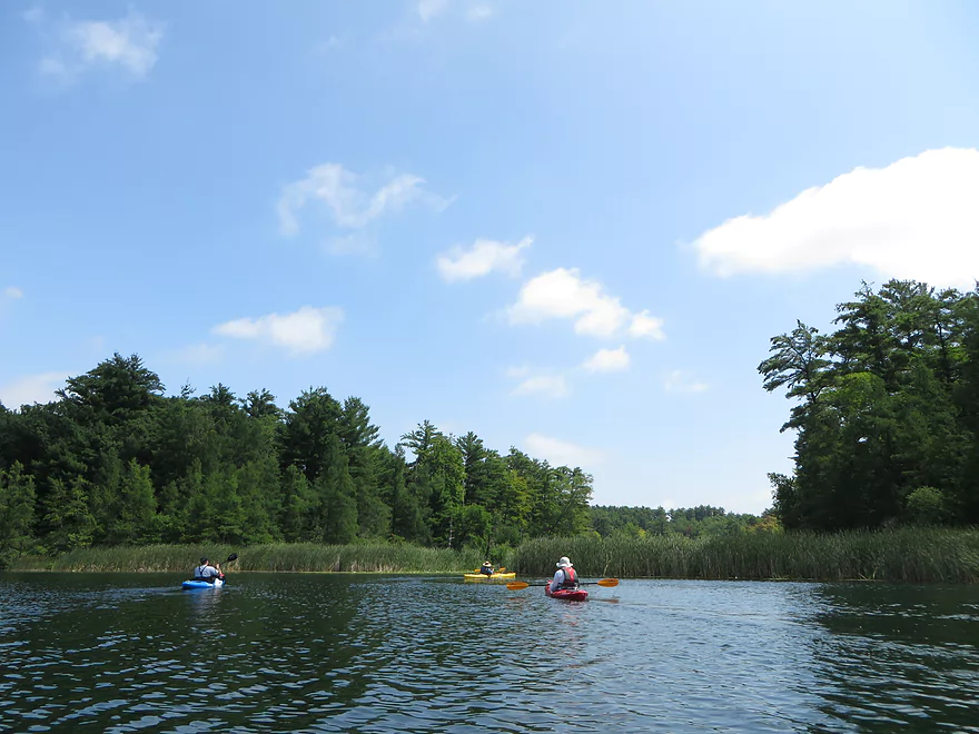
Both sections are five star prospects by themselves. I’ll start with the Chain O’ Lakes and a little background first. It’s located perhaps halfway between Stevens Point and Appleton and just south of the Waupaca River (which it joins shortly, as this is not a long river). The headwaters of the Crystal River are really this chain of roughly 22 spring-fed lakes. What makes this lake chain unique is the terrific clarity, water quality, and unique turquoise color caused by the mineral composition (called marl) of the water (the DNR has a better explanation).
There are three clusters of note when it comes to the Chain O’ Lakes. The first cluster is the northern lobe, from Otter Lake down to Long Lake. While most of these are “marl lakes,” they aren’t great prospects for paddlers because the area has been way over-developed and powerboaters are a serious nuisance. Might be worth checking out on a non-summer weekend, but this shouldn’t be your first priority. The second cluster of note is the lake cluster by Hartman Creek State Park, which is nice and peaceful but not too exotic. Two of the Hartman Park lakes are “fake” (dammed flowages) and these lakes, while without powerboaters and with good water quality, don’t appear to be marl lakes. More on Hartman Creek State Park later… The third cluster is the chain to the east of the park and this you want to check out, with “Marl Lake” being the crown jewel.
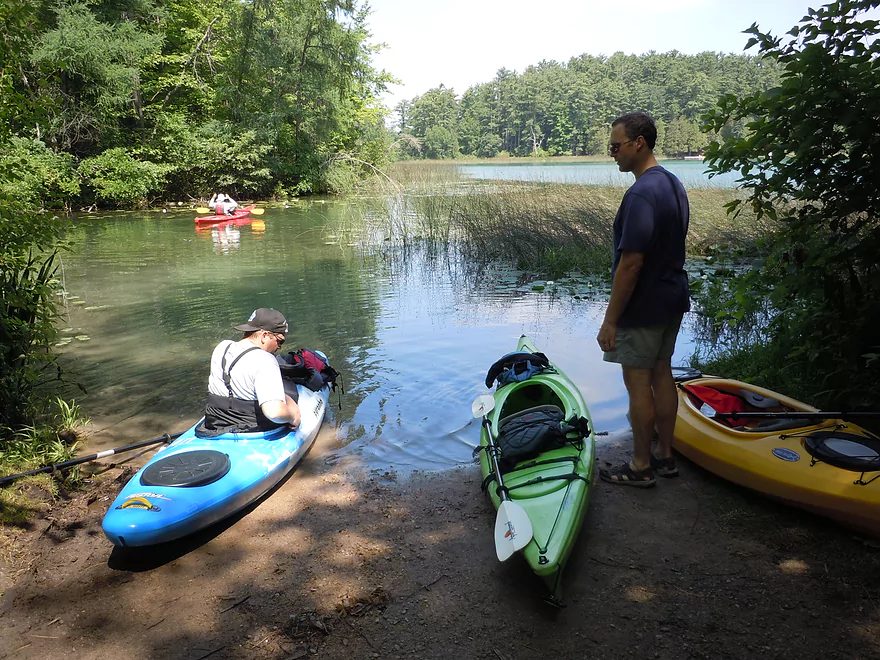
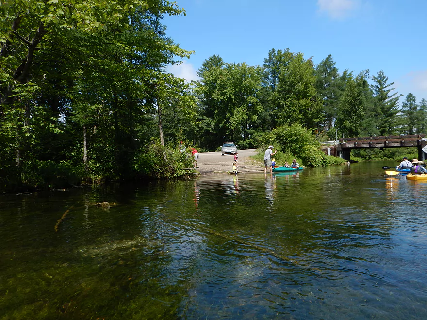
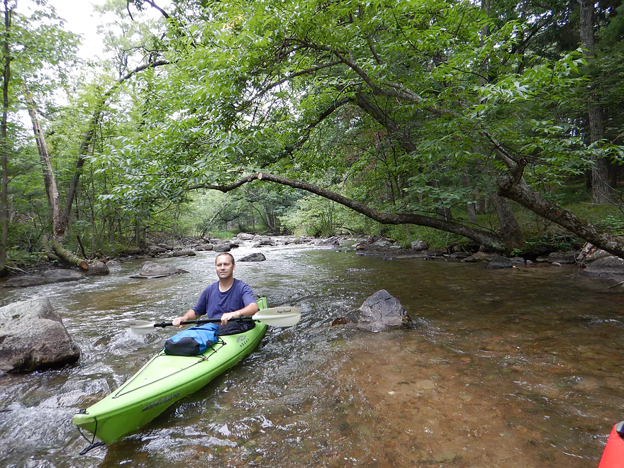
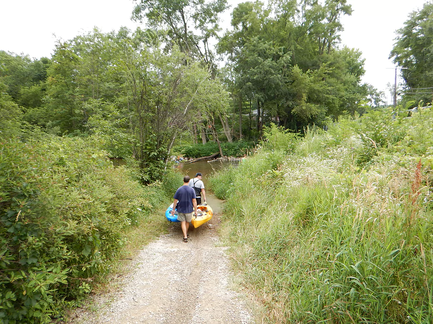
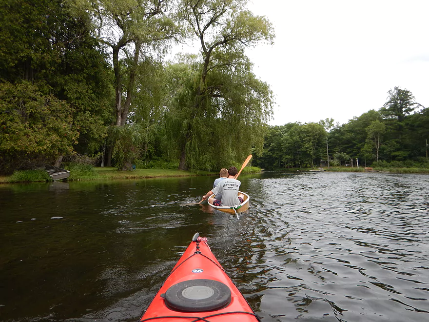
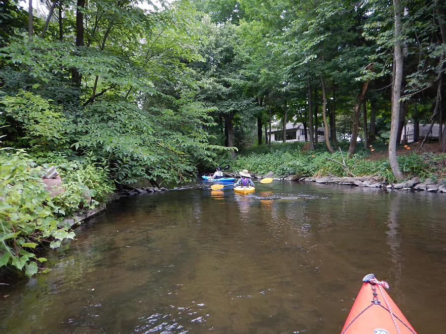
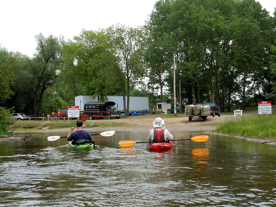
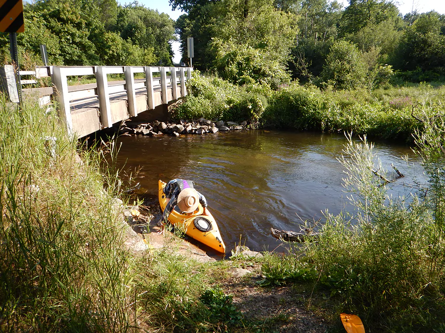
The put-in options for Marl Lake are more complicated than they should be. There is a major livery (Ding’s Docks) that puts in at Hwy Q, but that is at the heart of the powerboat hornet nest and you would be putting in too far north to practically tag the western cluster of lakes and the Crystal River to the east in one trip. We put in at the southern boat launch of Marl Lake…but this launch has no parking–as if it is designed for bike shuttlers! (or the local livery company…) Think you can just park on the road? Nope…there are no-parking signs everywhere, which is very annoying. You pretty much have to park at Whispering Pines (a state park access) and hike 2400′ back to the landing. Morrall Films (their video review was a big inspiration for this trip), decided to use the Whispering Pines parking lot and hike the local trail to access a public dock on the north end of Marl Lake. Unappetizing option, as you would have to drag your boat 900′ over concrete and down steep steps to reach the water. This trail does, however, have the only public facilities on the lake. A third option is to not put in at Marl Lake, but put in at the public launch on Knight Lane bridge, which should have good parking and has a good launch area. But to check out Marl Lake (which you should do), you would have to backtrack, which would add a half mile to your trip. You could (and a lot of people do this), just do Marl Lake to Beasley Lake as one big loop, which would be a nice no-fuss paddle.
From Marl Lake to Shadow Lake Road is a good bike shuttle–just five scenic miles on a mostly speed-controlled road that is relatively flat and without gravel.
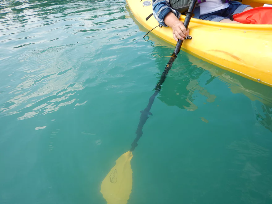
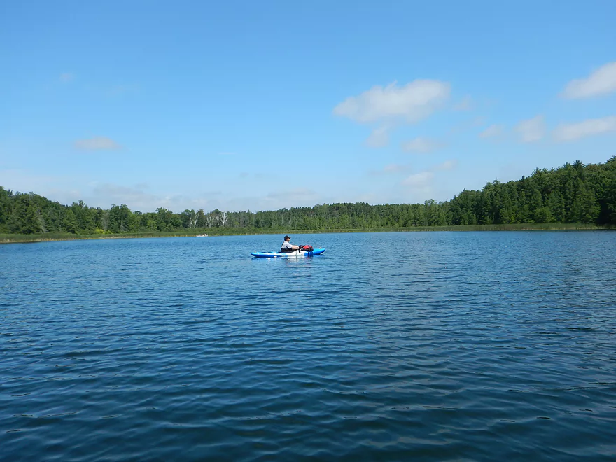
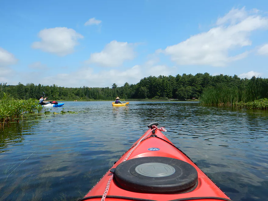
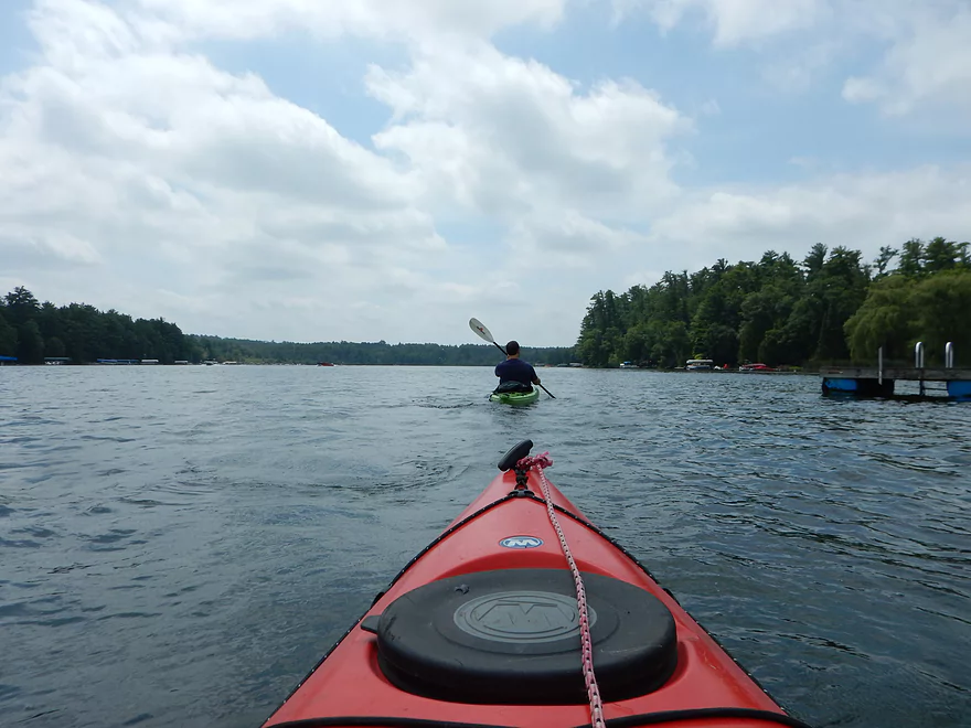
Getting back to the lake itself… Marl Lake is quite a treat, with terrific water clarity and a wonderful Caribbean turquoise color. The aquatic plants are striking, as the clear water affords a rare opportunity to see the entire plant both above and below the surface. Fish are also easy to spot and fun to track in the clear water. The lake is actually quite deep, with a maximum depth of 59′. Humans are a bit of an issue on this lake, so it might not be a bad idea to visit during an off time, but the lake is no-wake, which is very nice (unfortunately, powerboats are allowed…only Hartman Creek State Park prohibits them).
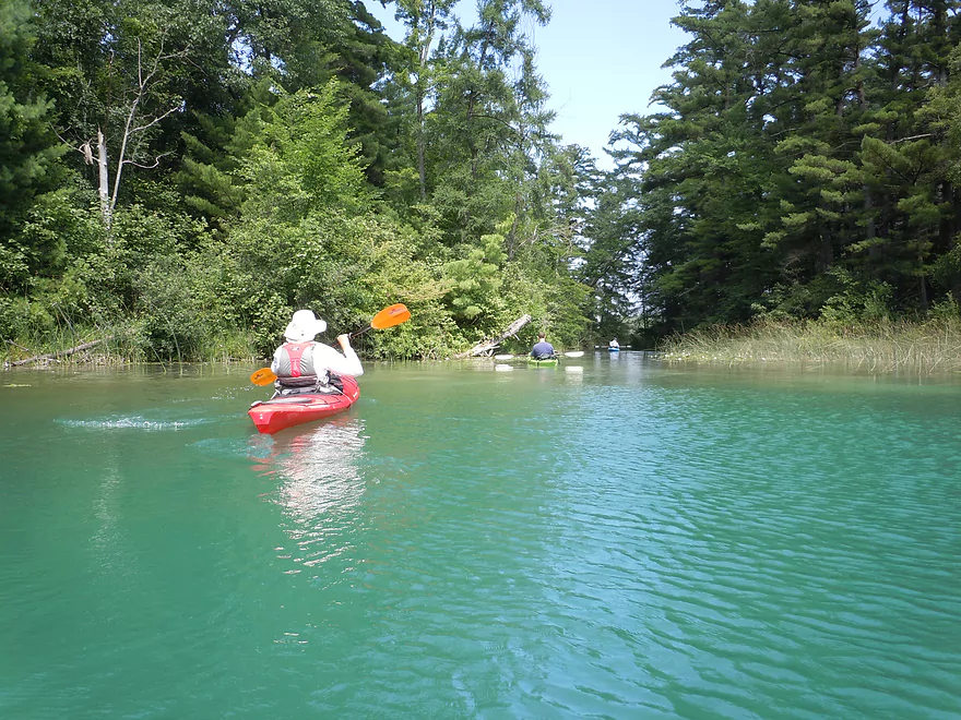
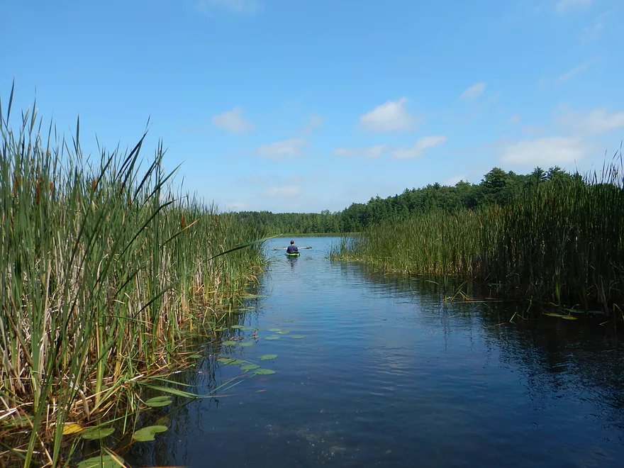
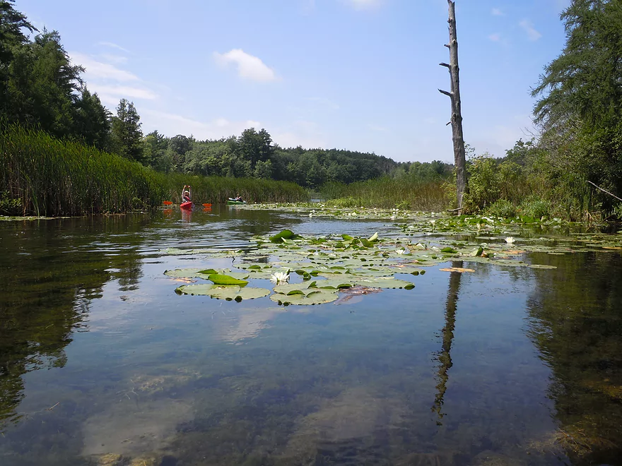
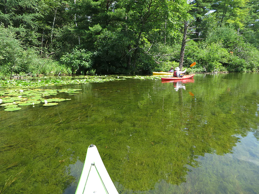
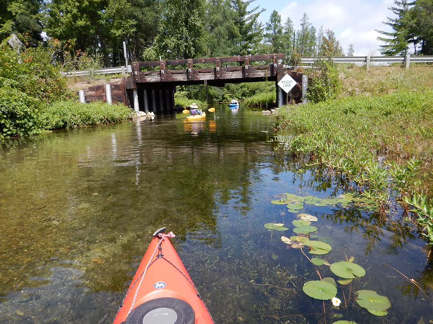
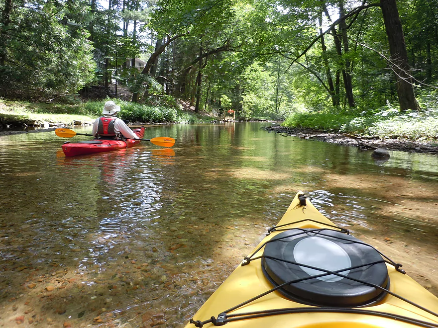
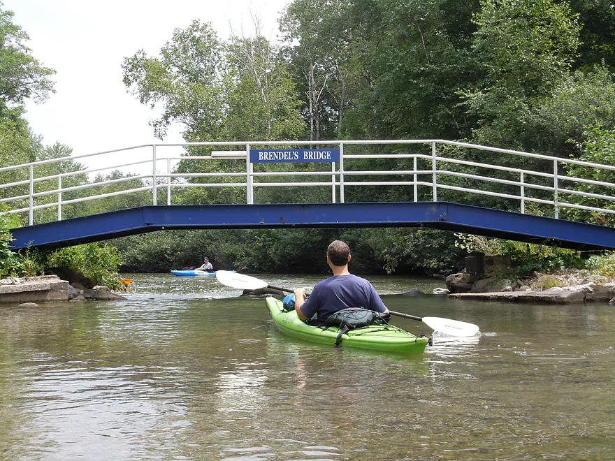
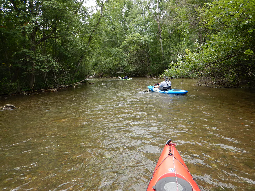
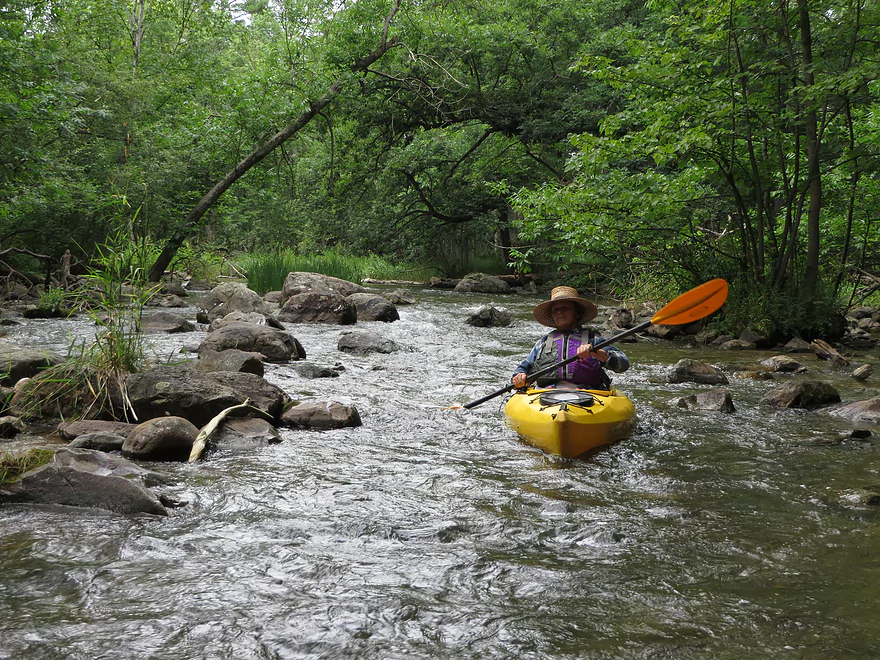
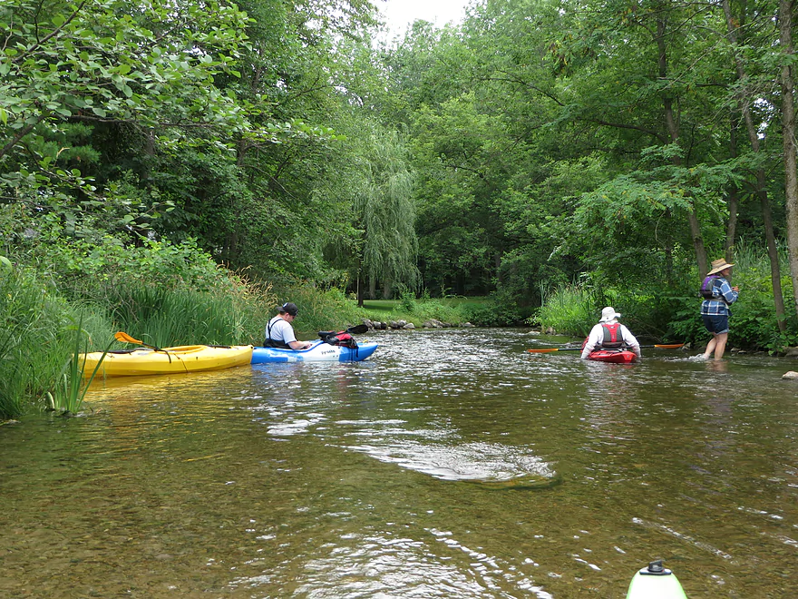
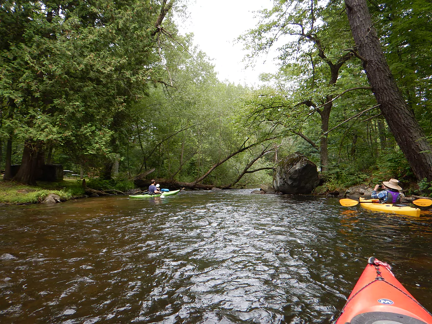
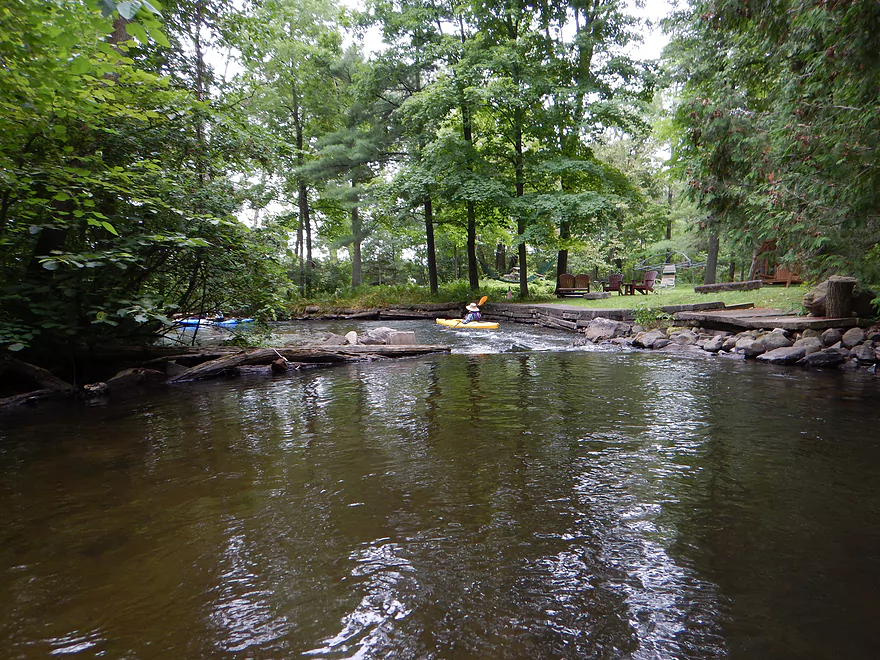
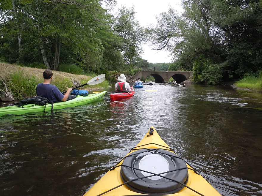
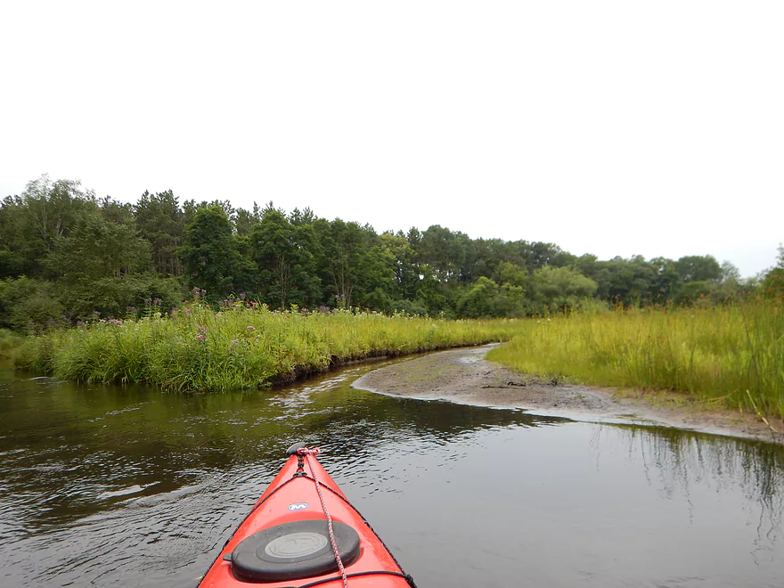
Marl then connects to Pope Lake via a hidey connecting creek. Pope is not as turquoise, but a great lake, with no development, attractive pine banks, nice aquatic plants and terrific views of the lake bottom through the clear water. Pope then morphs into Manomin Lake, which then, via another nice connecting channel, connects to Knight Lake. Here is where the alternate launch is. Knight then flows into Lake Orlando where you’ll come to Beasley Creek, the “gateway” to the main chain of lakes. The creek is really quite striking, with crystal clear water and attractive gravel substrate. The shoreline is developed but done so in a somewhat tasteful way with attractive block walls. One of my favorite sections of the trip, but with one caveat: you will have to walk it (most likely). It is super shallow and there was quite the convoy of kayakers walking their kayaks up and down this connecting corridor. This is super easy though and not that far. It is actually a good thing that the creek is so shallow as it keeps the invasive species out (powerboaters) that lie in the circus to the east.
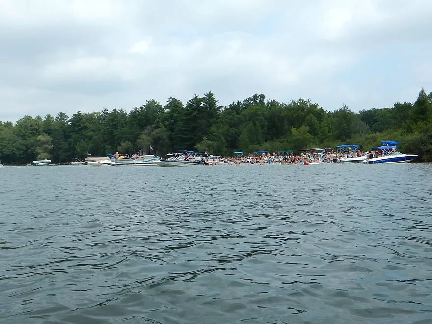
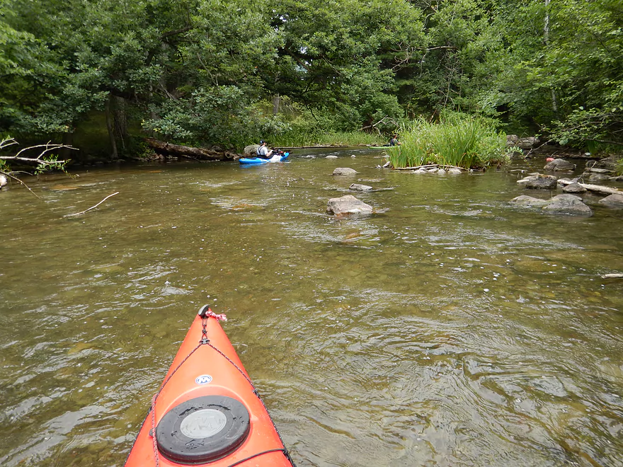
Now for the low-light of the trip. Long Lake (and by extension, Beasley Lake) were lousy paddling experiences. The water clarity dropped (still not bad and a bit turquoise). But the big issue was the sheer number of motorboats on the lake. They are loud and fast and create a huge amount of wake. Long lake is “long” (about a mile) and is not super interesting in and of itself–kind of just open, boring and packed to the teeth with shoreline development. If you are not careful you could be capsized by the wake of some of these boats, so you may want to hug the west shoreline for safety. Worst part was loud thug music that could be heard across the lake (and into the river).
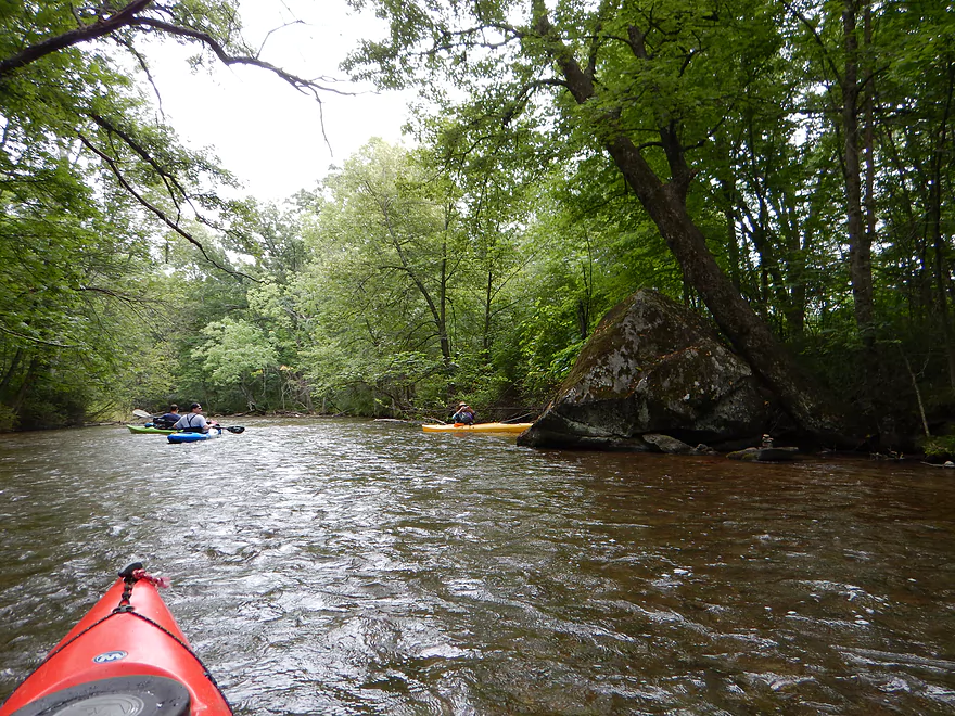
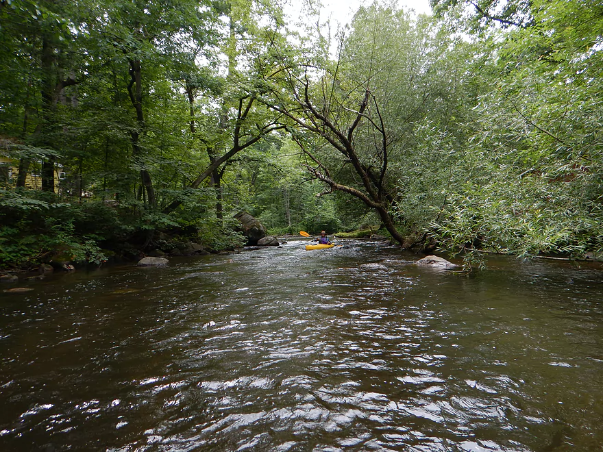
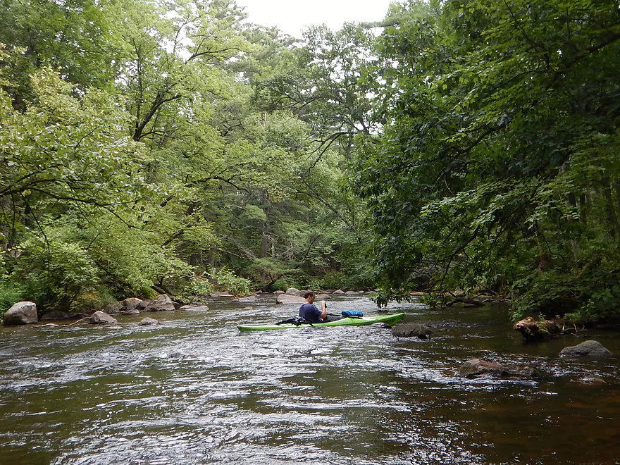
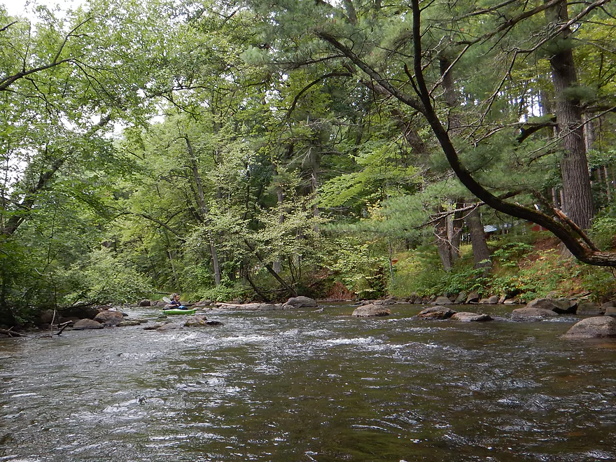
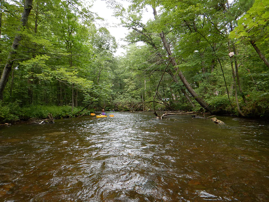
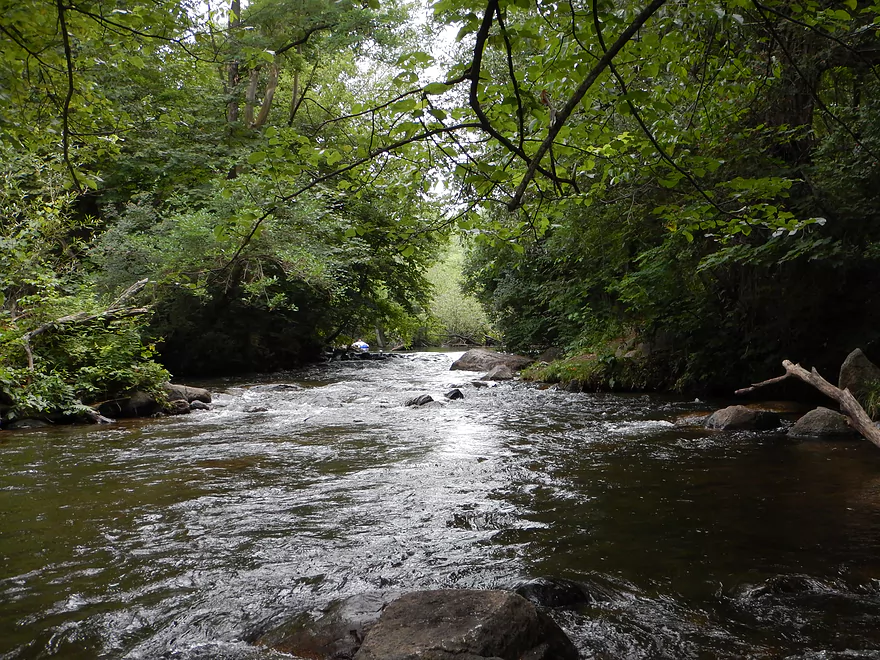
After finally escaping the madness of Long Lake, we finally came to the Crystal River proper–a wonderful river that retains the good water quality but is quite shallow and riffly. For the most part, the Crystal is a pretty stable river because it is largely groundwater fed…but it can run shallow during dry times. We ran this at a low time (160 CFS or 1.56′), but I only had to get out for Beasley Creek, and never for the main channel. We were worried when scouting the town of Rural, as the water level looked low, but this was deceptive because of the clarity. Canoers and deeper drafting boats might have a rougher time and they would probably want to go during a higher time. Note, the gauge I use is on the Waupaca, maybe 3 miles to the north and on a slightly larger flowing river…but this is deceptive, too, as the Waupaca is more volatile then the spring-fed Crystal, so keep this in mind. If in doubt, you could call the local livery (715-258-2612), but the livery reviews said they didn’t like to be asked about water levels!
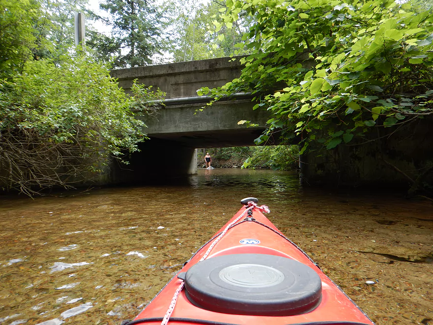
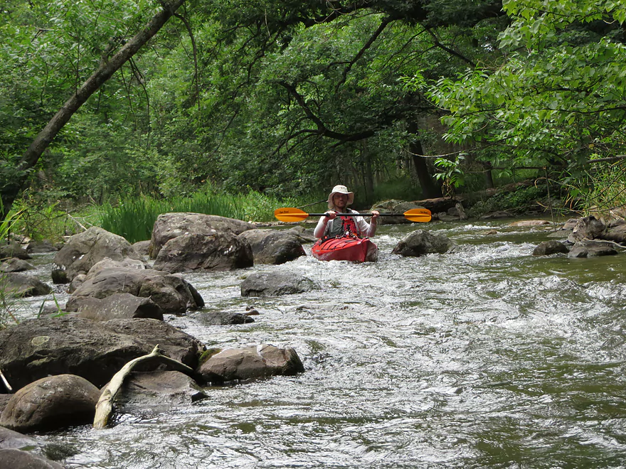
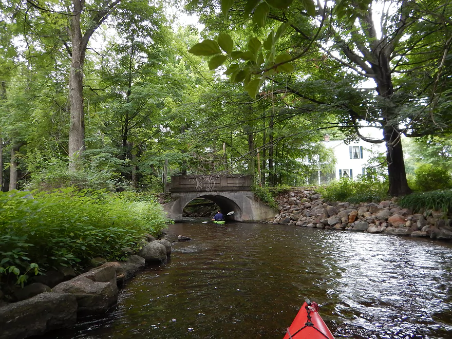
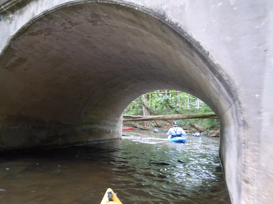
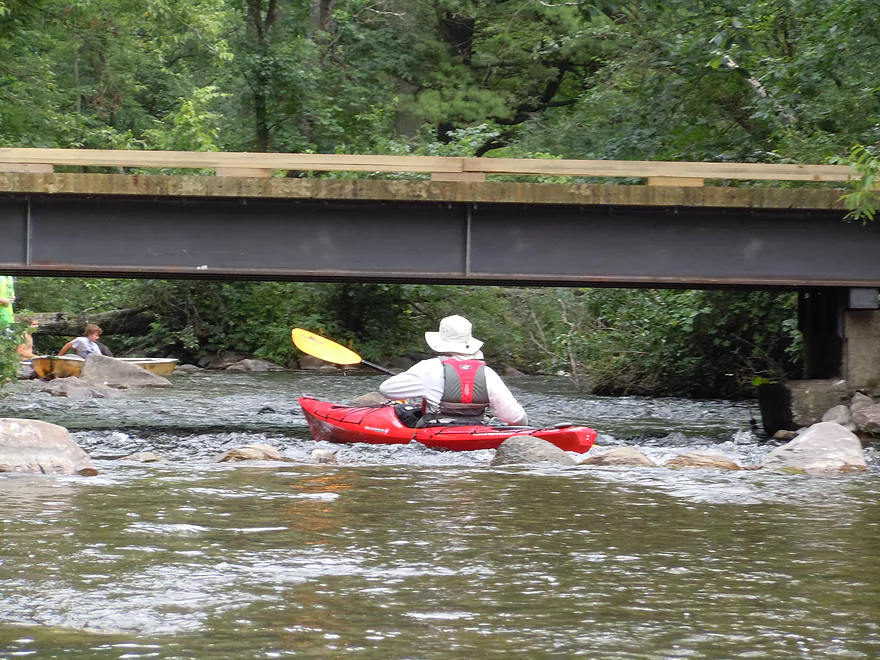
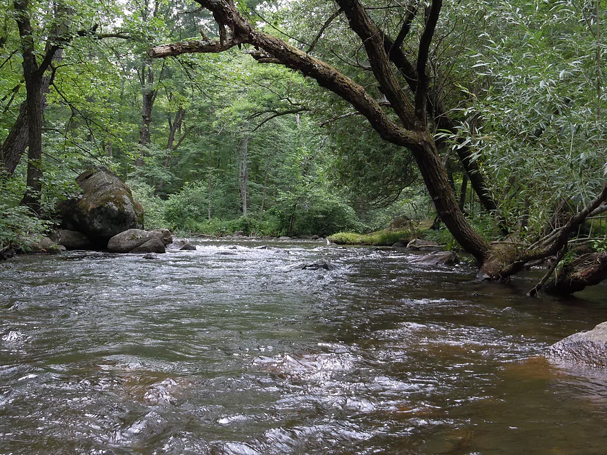
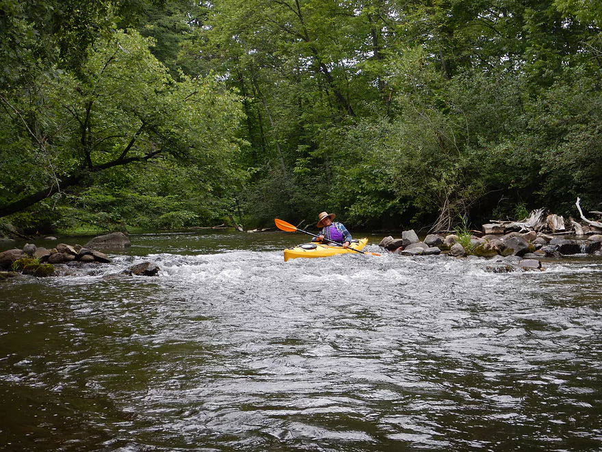
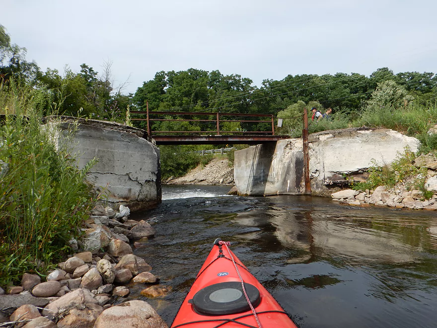
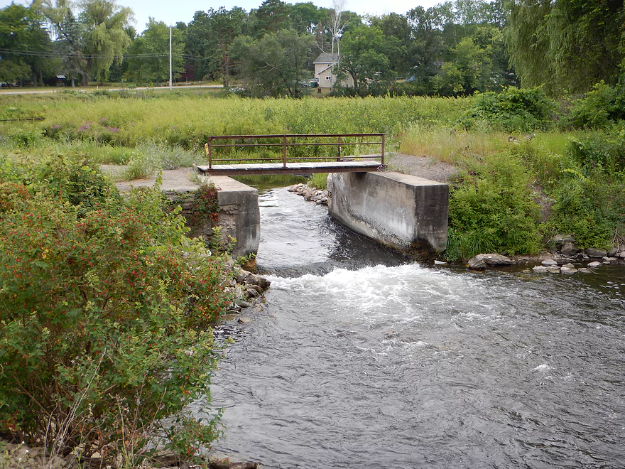
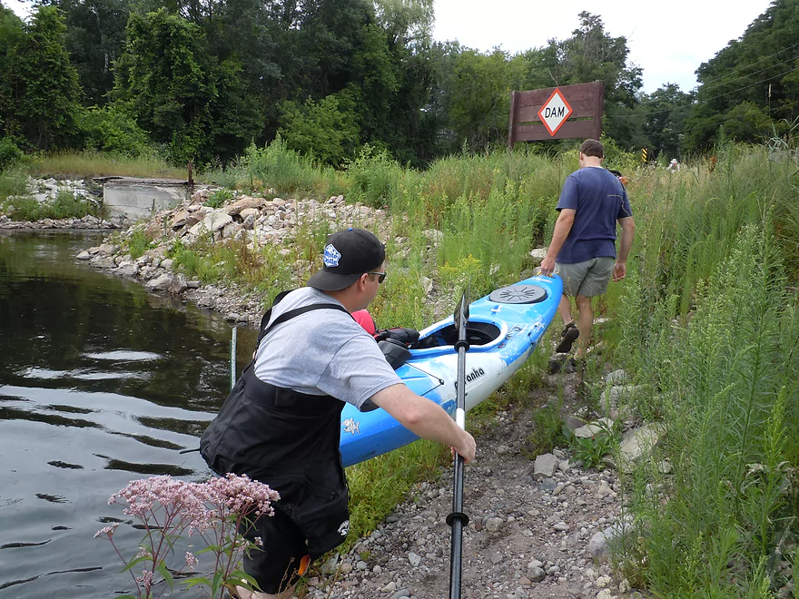
This upper mile of the Crystal is again very nice, with attractive tree canopies, minor boulder gardens and minor rapids. Nothing to worry about here. Soon, you’ll encounter Hwy 22, with a choice of two tunnels. The right tunnel is over a dam that would be a nasty ledge to go over. The left tunnel is where you want to go (and there is a gaudy Ding’s Docks sign above that tunnel to alleviate any confusion). Here you could in theory take out or put in to split the trip in half (as suggested by canoe author Mike Svob). The river channel after the north tunnel is a fenced off mill race, which forces you to get out of the water and use the small portage trail to join the south channel below the dam. All pretty easy. At the bottom of the portage path, we encountered a family that had set up lawn chairs in the river by the right tunnel (the bad one with the dam). They didn’t say…but it sure looked like they were seated waiting to see hapless paddlers who accidentally went down the right tunnel by mistake.
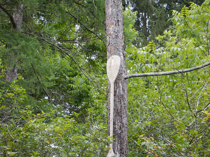
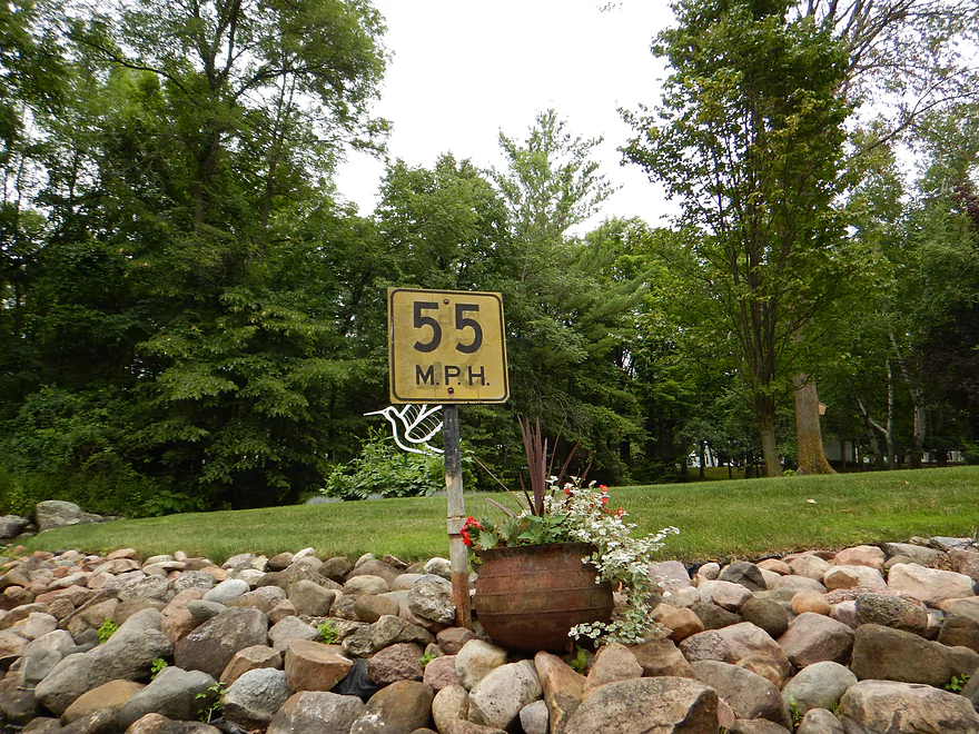
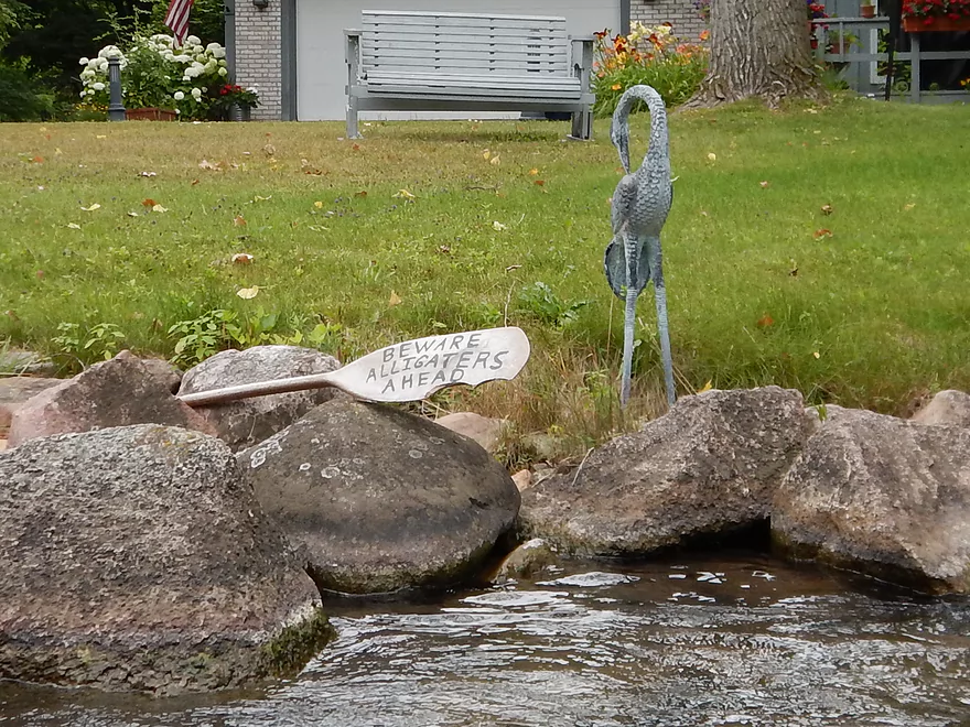
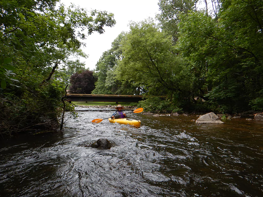
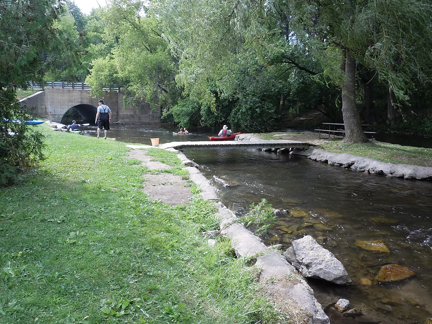
The next section of the river, through the little town of Rural, was my favorite. The banks are lined with small, rounded, light-colored rocks, but done so in a tasteful organic and “feng shui” manner, with occasional stone bridges. Even the outdoor knick-knacks were tasteful, with clever touches like a mini (and working) waterwheel, a 55 mph speed limit sign (for paddlers), and a paddle with a written warning about alligators (and with a big bite-mark in it). The flowers and plantlife were topnotch as well. Normally, humans don’t improve a shoreline…but this is one of those rare, rare, rare circumstances where it actually worked.
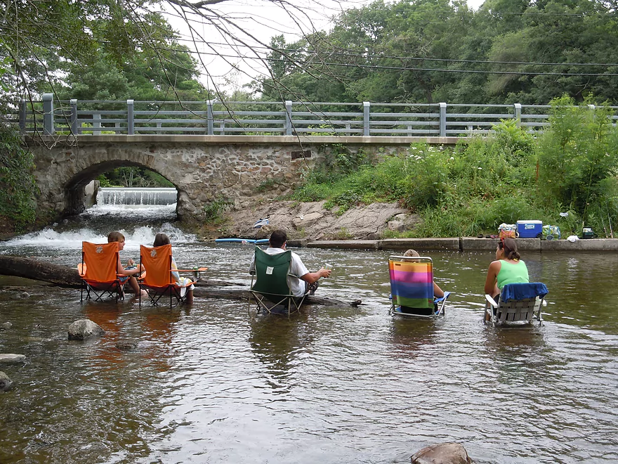
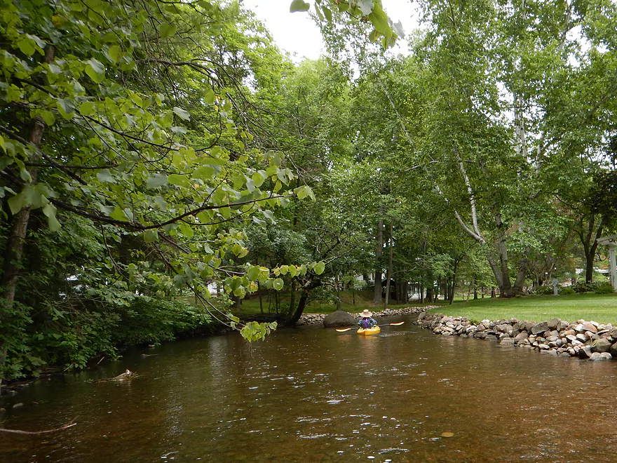
Soon the fast current will slow and you’ll enter Junction Lake (a natural lake, for once) and this is a nice, pleasant paddle. The next mile of river paddling is terrific, with attractive rocks and the best rapids paddling on the river. Never too dangerous (because of how shallow the river is), these are quite fun, but a tad bumpy. One of the most significant runs will be by the Hwy K and Rural Road intersection. The first section isn’t too bad, but requires maneuvering and is quite bumpy. At the bottom there were people everywhere (this is a public access area) and many were actually sitting in the river in lawn chairs, drinking their beer and smoking their cigarettes while they watched paddlers and tubers bump down the rapids and occasionally tip over. One local was nice enough to warn me that the next set of rapids under Rural Road was severe and a lot of paddlers had flipped on them. The key was to stay to the left as there were rocks on the right that you didn’t want to land on. Still pictures were hard to get on this section, but some of the rapids are viewable in the videos below.
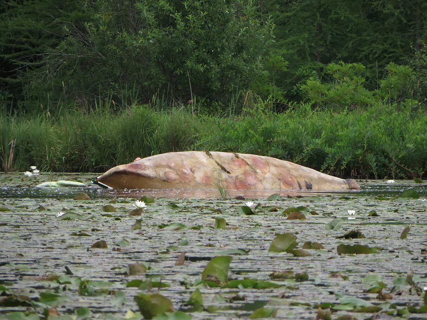
The following mile is very nice, but the Crystal is slowly starting to lose its magic. Tubers are a problem here (although we met some who were actually not too drunk and loud which was a nice surprise). Prior to the Parfreyville Road bridge, you’ll see a massive take-out area, with not one, not two, but three gaudy, large “no trespassing” and “customers only” signs (this is for Ding’s Docks’ southern unit) and happily the river is free of their customers after this point. A quick word on Ding’s Docks and hopefully this doesn’t sound too negative. The reviews for this livery are not flattering. The main issue seems to be the “unique” boats they use. They look like homemade fiberglass canoes, but they are small, tippy and draft deep. Customers complained about not being able to run the river because of their low clearance, and that the boats kept filling with water. These are rickety boats and I don’t recommend using them. In fact, we saw some paddlers on this trip who were really struggling with this “bathtub” and hopefully, in the near future, Ding’s will modernize to kayaks. Also, if you use their livery, be careful of their routing…pay attention to my map (bottom of page) as it will show the good areas, but this being a business, Ding’s will probably try to convince you to paddle what is convenient for them but not for you (the advantage of car shuttling or bike shuttling).
Some of my favorite Ding’s Dock quotes:
- The canoes are fiberglass, which is itchy. Try not to touch it.
- At the mouth of the river, jump out of the boat into the lake and grab your fiberglass canoe. Don’t waste time looking for a good one-there aren’t any.
- About an hour later you will encounter some rapids that will probably spill you. No worries, you should be used to that by now.
After Ding’s, the river opens up and takes on a very different character. There used to be a flowage lake here, but a couple of years ago the dam was removed. This section is going through typical dam-detox as it flushes out the excess dam silt built up over many years. As this gets washed away, the gravel bottom should be reclaimed and it should be a very nice subsection of the river in the future. The River Alliance used to do a great job of promoting dam removal in Wisconsin (they don’t as much anymore, unfortunately), and this was one of the dam removal projects they were advocating. Really good organization that has worked well with local governments to clear up the many pro-dam myths that are out there.
Plantlife was topnotch for this trip, with many nice aquatic plants, and wildflowers growing on the shore. Bank quality was very good, with shady tree cover (quite a few oaks), but no log jam issues. For animals, we kept our snapping turtle streak alive, as we saw three large snappers (next week’s trip will have a snapping turtle, too!). Some nice wild birds (like green and blue herons, and geese), some domestic animals (some kind of hybrid duck and a few chickens), and some domestic animals pretending to be wild animals–a white domestic goose was mingling with a big flock of Canadas and tried to fly away with them when we approached (which it couldn’t do…). A lot of crayfish on the river and small fish. Also a lot of dragonflies, damselflies, clams, and snailshells. Fortunately, biting insects weren’t a major issue.
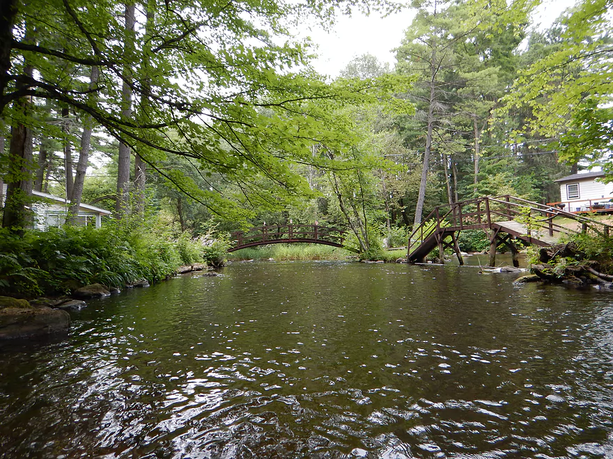
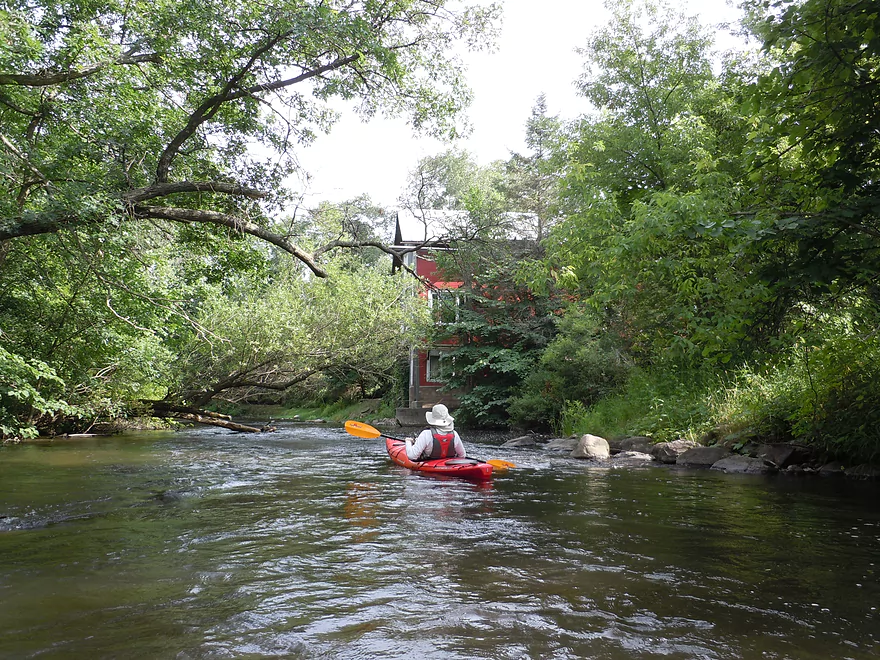
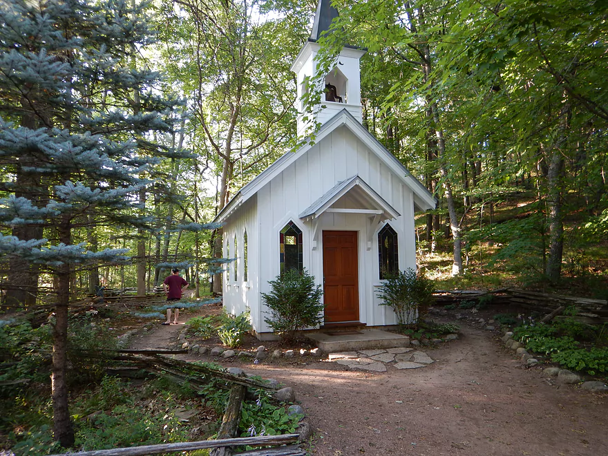
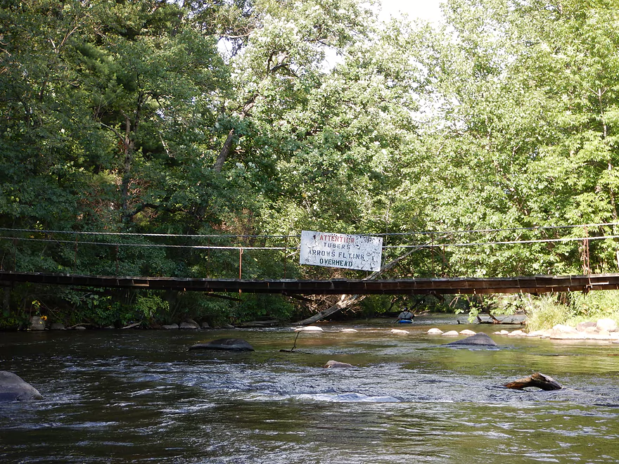
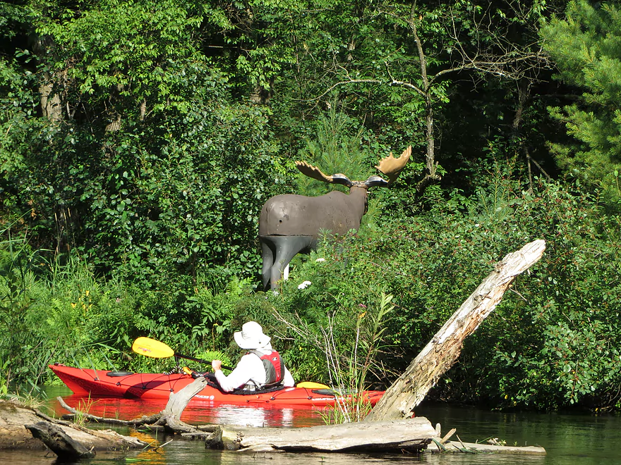
Close to the Hwy K bridge, you’ll see the remnants of the old dam. The local government neglected to completely remove it…and there is a whitewater run over the remains. Didn’t look too bad…but the smooth dam ledge caused a hydraulic motion at the bottom which can be dangerous to paddlers, so we portaged just to be safe. Not a great portage on the right bank…but manageable. After the dam, you can take out at Nelson Park, which is a good option with facilities. You would, however, miss some nice downstream attractions, with the first being a rustic old flour mill. Very striking, the water wheel remains, but is in disrepair and the mill race has long been removed. Soon after the mill, you’ll paddle underneath an attractive covered bridge and will see a mini chapel on your left. This complex is all part of the same private grounds and is very popular for weddings…all very nice. The remaining mile is still nice but, again, more of the Crystal magic is lost. A warning sign to paddlers about flying arrows from a nearby archery range and a “moose” in the weeds keep things interesting though.
Take-out is on Shadow Lake Road (northwest side of river left before the bridge). Good take-out with nice parking. No bathrooms though. According to paddle author Mike Svob, the remaining two bridge access points before the Waupaca aren’t great and he doesn’t recommend them (don’t know though).
So, all in all, a terrific trip that should be on your to-do list. Again, the trip can be split into two, with either section being quite nice, but I do recommend combining them, as 8.7 miles isn’t bad in fast current. Be careful if doing a trip on the Crystal below our depth (the Chain O’ Lakes would be fine). Canoes and heavier boats should go at slightly deeper levels. This is a high gradient river, so you probably don’t want to go when it is too high (plus that covers up the water clarity).
As for other nearby options… Again, don’t know too much regarding the last couple miles of the Crystal to the Waupaca. The Waupaca itself is a nice river which I recommend (but do like the Crystal better). You could also paddle the north end of the Chain O’ Lakes, but this can be very busy. Here is a blog that covers some of the upper lakes. Way to the west, you can, of course, paddle the Hartman Creek State Park lakes–not exotic but peaceful and pleasant. Don’t think you can paddle between the lakes like you can to the east. There are dams on two of the lakes and Hartman Creek (which connects most of the lakes) doesn’t seem big enough to paddle. The one exception might be after the last dam on Hartman Lake. In theory, you could put in at the beach, paddle east and portage the dam (easy) and enter the creek below. The creek is small here but looks to be barely navigable. Water definitely looked very nice here and this might have some of the magic of the lower sections. I don’t know though. Log jams could be a serious issue as could surprise rapids. I thought I saw a log jam from the dam and also thought I heard some rapids, so this would be quite the gamble for a canoe route. If it worked though, you would make it to Pope Lake which would connect with the rest of the Chain O’ Lakes and the Crystal River.
- Marl Lake South Access to Shadow Road: 8.7 miles.
- Marl Lake South Access to Knight Lane Landing: 0.5 miles. Nice paddle through Marl, Pope & Manomin Lakes.
- Knight Lane to Main Street: 3.4 miles. More nice lake paddling, although Long Lake isn’t as interesting. Then the river starts which is very nice.
- Main Street to Rural Road Launch: 2.1 miles. Great section with some fun rapids.
- Rural Road to Neslon Park: 1.7 miles. A more open section running through a former flowage.
- Nelson Park to Shadow Road: 1.0 miles. Section with a unique old mill and covered bridge.
- Shadow Road to South Park: 3.8 miles. Less frequented section and might be downed trees. Take-out is actually on Shadow Lake.
- South Park to Mouth on Waupaca: 3.8 miles. Downed trees might be an issue on this section. One flowage and dam to contend with.
- Waupaca Mouth to Harrington Road: 6.0 miles. A long paddle on the Waupaca to reach the next access.
Note, there are additional trips that can be done on the upper Chain O’ Lakes and possibly even on Hartman Creek itself. See the overview map for more information.
Trip Map
Overview Map
Video
Marl Lake 0:00
Beasley Creek 1:32
Long Lake 1:58
Crystal River 2:16
Main Street tunnel & dam 4:35
Town of Rural 5:14
Old mill race 5:55
Classic Ding's Dock scene 6:26
Start of the rapids 6:38
Where most canoes go over 9:24
Mostly removed Rural Road dam 10:54
Covered bridge 11:17
Whispering Pines (alternative Marl Lake access) 11:49
Below is a bonus video taken from a second camera:
Photos Size:
My family has enjoyed doing the Crystal River canoe trip through Ding’s Dock for many many years. We are city folk who just like to have a fun few hours on the river each summer without any investment. We enjoy the challenge of navigating the rapids without tipping over or getting stuck, and stopping for ice cream at that old general store halfway through the trip. We loved how easy it was with the drop off/pick up they did. This year we learned that Ding’s Dock is no longer doing the canoe trips on weekends unless you have a group of 20+. Do you know of any other places that do something similar on the Crystal River? Or is there another similar trip somewhere else in WI, within 3 hours drive of Milwaukee? Thanks for any suggestions you may have.
The small general store where you bought ice cream rents kayaks I believe
Thanks Tina for the update. Sad to hear that Ding’s Docks is scaling back their operations. As for alternatives, I don’t know of any others. You might contact the Waupaca Tourism Bureau for further information.
There are of course many paddling prospects within 3 hours of Milwaukee, including some great ones in your back yard. The Oconomomoc in some ways is like the Crystal, the Bark is great and the Pewaukee is quite underrated. Parts of the East Fork of the Milwaukee are kind of like the Crystal.
Other rivers in central Wisconsin that are somewhat similar, might be the Waupaca River or Little Wolf. But truely the Crystal is very special.
My fiancé and I did this route 5/11/19. CFS was high at ~500 so the river was very fast and enjoyable. We only had to portage the “Old Mill channel” which was clearly marked. Some of the rapids may have been class 2 (I’m not an expert) and were extremely fun. We saw a guy go through on a paddleboard (kneeling) which was interesting. I think the dam that you had to portage from the pictures has been removed? On a personal note I proposed at the covered bridge and she said yes! Thank you for guides this river and adjourning lakes are true Wisconsin treasures!
Congrats on the marriage! I think you’re right about the removed dam…I heard elsewhere that this has been cleaned up which is great for paddlers.
Is there anyway to bypass Long Lake but still do the entire run?
Paddled this trip on 8-17 2019
Beautiful trip. Thank you for posting!!
Trip is really worth it. We had a few apprehensions about being able to stay on course all the way to shadow lake but it was not an issue. Just stay on the main river and you will have no problem. There is a nice sign that indicated which turn off to get to Shadow lake.
A couple things have changed since originally posted. You can now park by the launch point by Marl lake, which makes it extremely convenient. The other thing that seems to be different was there doesn’t seem to be to old dam after Hwy K. At least we didn’t notice it. Highly suggest this trip for all ages!!
You didn’t mention logjams! This is a big deal as central Wisconsin was plastered by storms and it appears the Crystal was spared. Great tips on the dam and Marl Lake access. The Shadow Lake leg of the Crystal is on my todo list…
We didn’t experience any issues with log jams. On the last section after red mill we did have to maneuver around some down trees but you could get through. Just enough to make you practice your maneuvering skills.
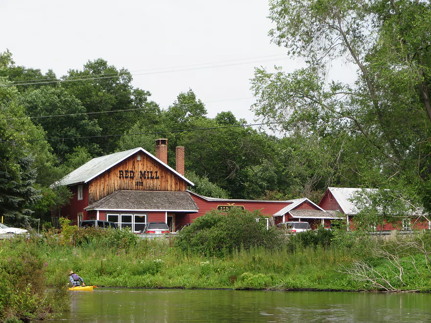
I did this trip on 5/20/20, with a bike shuttle, and had just about a perfect trip. I can verify the fact that you can legal park at the launch site on Marl Lake, there is room for 5-10 cars along the right side of the gravel rd off Whispering Pines Rd. The paddle through the 5 small lakes was easy and the water was exceptal clear. It was nice to see all of the water plants starting to grow up from the bottom. There were numerous other people on the water, I suspect it can get really crowded in the height of summer. Long lake was surprising nice, due to the fact that there was just a bit of wind at my back and no pontoon boats or Jet Skis. As nice as the lakes were, the river was even better, Gin clear water, varied shore line, decent current. no log jams, and only one easy portage. The trip took me about 3 1/2 hours, 3 hours on the river and 30 min bike ride (including a stop for ice cream at the Red Mill) Link to some of my photos
https://1drv.ms/a/s!AjC8S6n5i35Vgh_1BBPX136qE0NW
Thanks Eric for the update! Yeah, the public parking for Marl Lake is new..and that’s a good thing. It’s also been my understanding that this area has seen an uptick in paddling traffic so things may be more crowded now. Great pictures…especially the snapper!
Is the crystal river good for kayaking now in the fall?
Yes! Tomorrow is a perfect day to go…great color. Next week will also be good…but might be a bit past prime.
I am so sad to hear that Ding’s has gone downhill. I have fond memories from my childhood going there with my family and the race car club. We would camp and go down in the as we called them the peapod boats, ambushing and tipping each other over. I was hoping to take my grandkids there but I guess we will find another trip to take. Thanks for the reviews, they help make for a better outing.
How is the section of the river where u took out to shadow lake. Thinking about all the way to shadow lake
I honestly don’t know as I haven’t done that leg. I suspect it isn’t as nice and is somewhat wooded…but should be solid. There might be some logjams. If you do this stretch, let me know how it turns out.
We’re thinking of going all the way to Shadow Lake as well. I’d love to hear if you did that trip and if so, how the conditions were. Thinking of taking the family so wondering if there are any tricky places, rapids, trees down, etc. that might be tricky for 10 year old paddler. Thanks!
Shadow Lake is likely fine. Upstream of Shadow lake there might be some logjams. Downstream from Shadow Lake to the Waupaca, I’m fairly sure there are many logjams.
Bummer. Well thank you for your counsel. Guess we’ll have rethink it.
My brother and I just Compleated an epic 5-day paddle from the launch on Columbia lake behind scoopers ice cream shop to north asylum bay in Oshkosh! The Crystal River leg was fantastic as always. A few short shallow spots and a log here and there to paddle over but nothing we had to get out of the yaks for untell after Churchill st damn. The portage reentry is pretty steep, but beautiful when you get in the water. Sadly the fun kinda ends there for the crystal river though. the last stretch is uncut wilds, with 8-10 trees down in the path. We pushed through it though, going around felt like cheating. Once you hit the Waupaca your home free untell Weyauwega damn.
Hey there.
Thinking to take our family, with our 10 year old, in her own kayak past Shadow Rd where this trip ended all the way to Shadow Lake. Do you happen to recall if there were class I or II rapids or anything tricky from Shadow Rd to Shadow Lake?
Thanks much!
Juliann
Thanks for the comment. I had been curious to know what the logjam situation was like on the far lower Crystal.
Adventure Outfitters did a big cleanup recently on the Crystal River. “We spent some time today cleaning up on the Crystal River from the Red Mill down to Shadow Lake. Lots of downfall to the first bridge! We kept it adventurous, but made it passable.” https://www.facebook.com/adventureoutfittersllc/
I paddled the Crystal River on a beautiful and sunny Sunday, 04/14. We put in just past the dam on Main St. in Rural, and were able to navigate the Shadow Lake section people have been asking out without a hitch. There is maybe one log jam in this section but can be portaged or gone under. We took out at Berlin road, but in hindsight would recommend Shadow Lake/South Beach park as a take out. There are actually less obstructions in the shadow lake road section than there are now just past the Red Mill. There are several fresh jams past the covered bridge that were tricky and haven’t been dealt with yet.
This was a great trip and we loved the Piney scenery and exceptional water clarity. However, it was a slightly bumpy trip already this early in the season, so I’m not sure what the summer will bring for water depth and navigability. I mostly wanted to post this comment to clarify that it is completely doable to paddle to Shadow Lake or Berlin Road.
Thanks as always for the update Gregor. I definitely want to do the leg by Shadow Lake.