
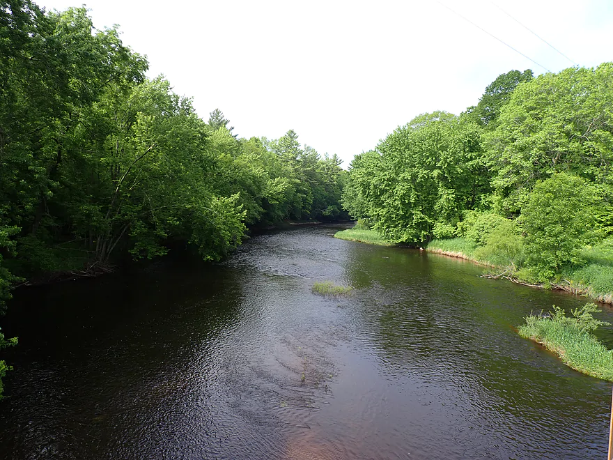
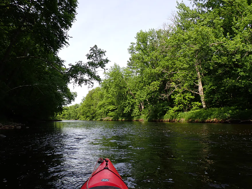
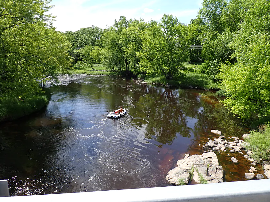
Starting the trip at Hwy O (inviting vista from the bridge)
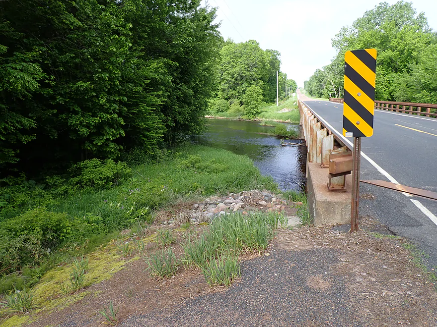
Ok parking area east of the bridge
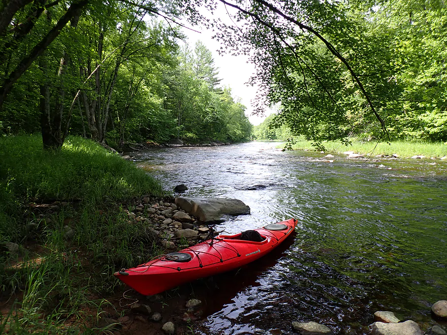
Easy to launch by the bridge pillars
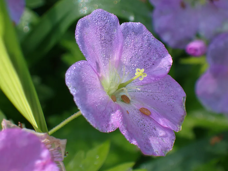
Wild geraniums
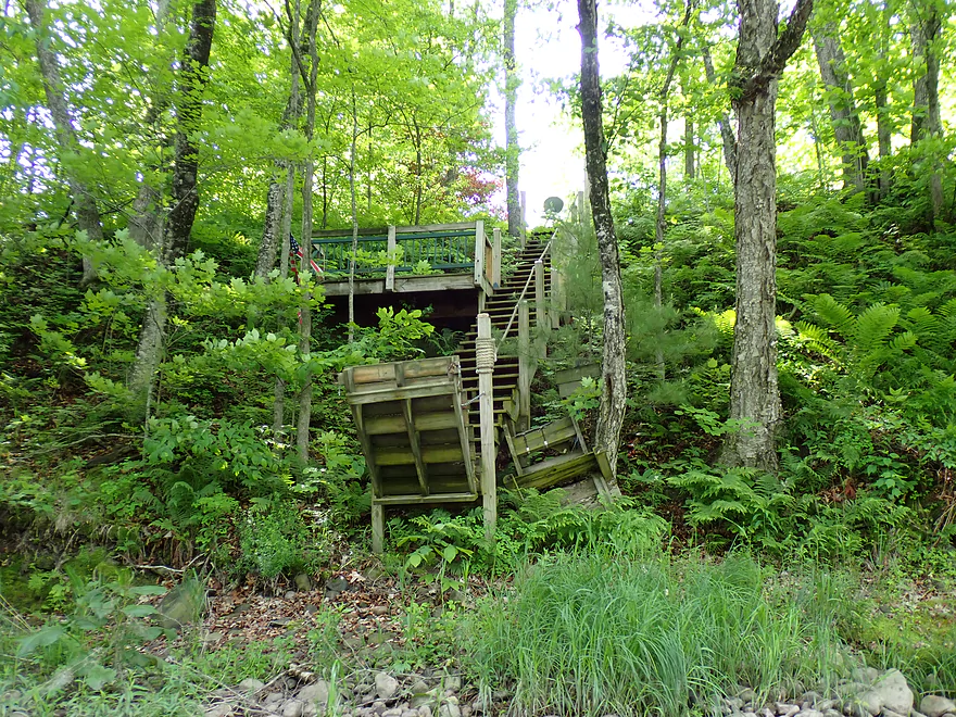
Cool retractable stairs and ferns
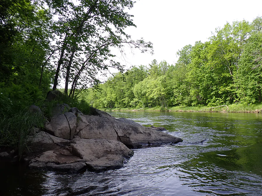
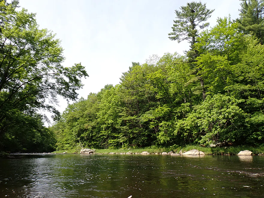
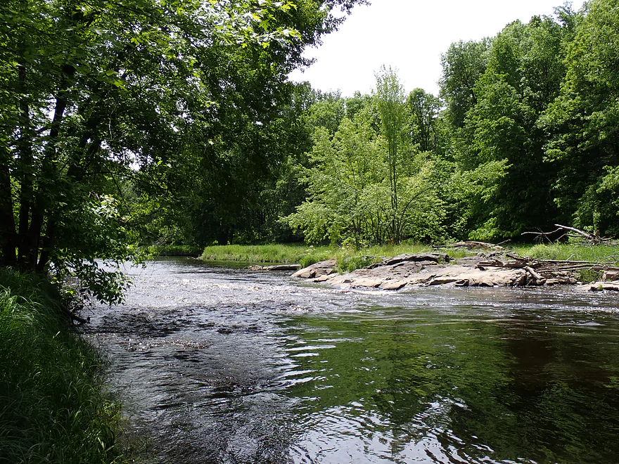
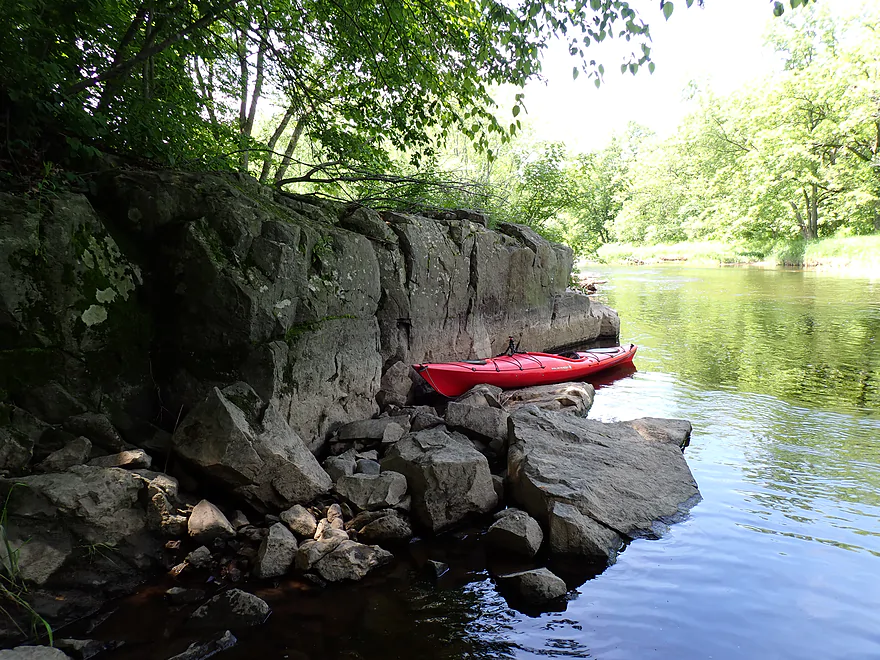
First outcrop of the trip
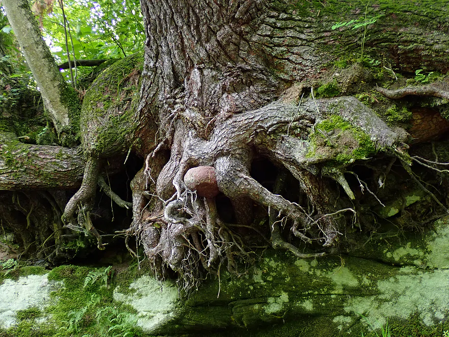
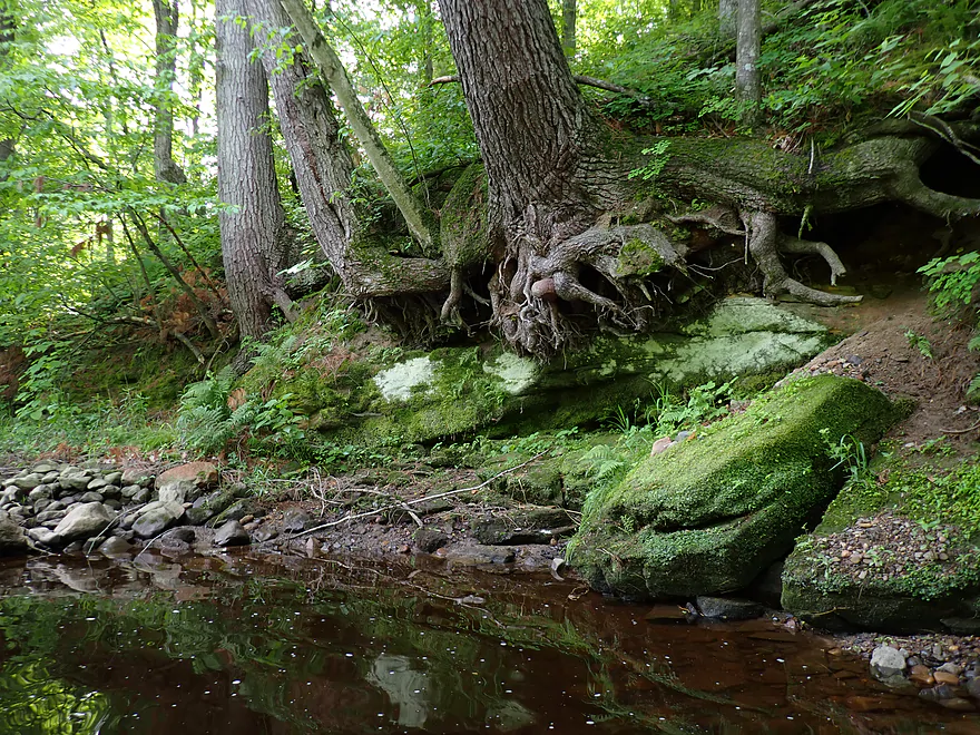
Greedy tree roots gobbling up a rock
Not a huge outcrop but nice
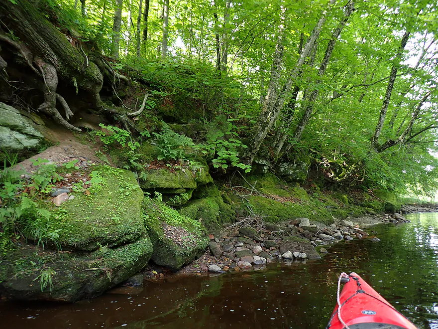
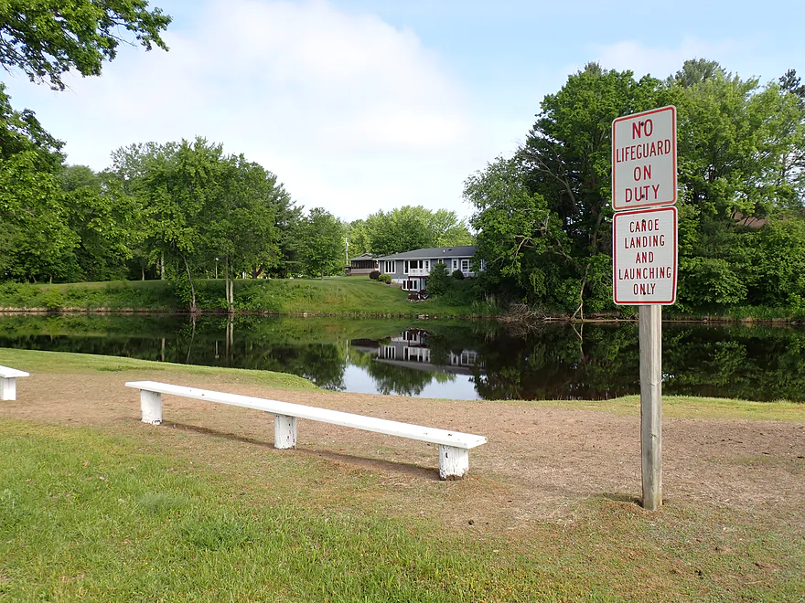
High water line…don’t think you want to be on the river when it’s flooded
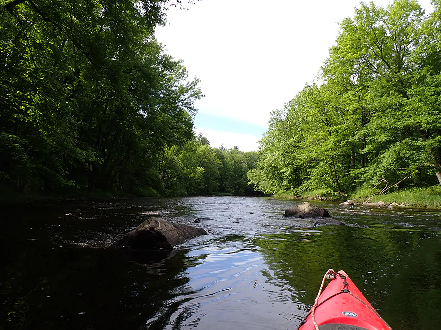
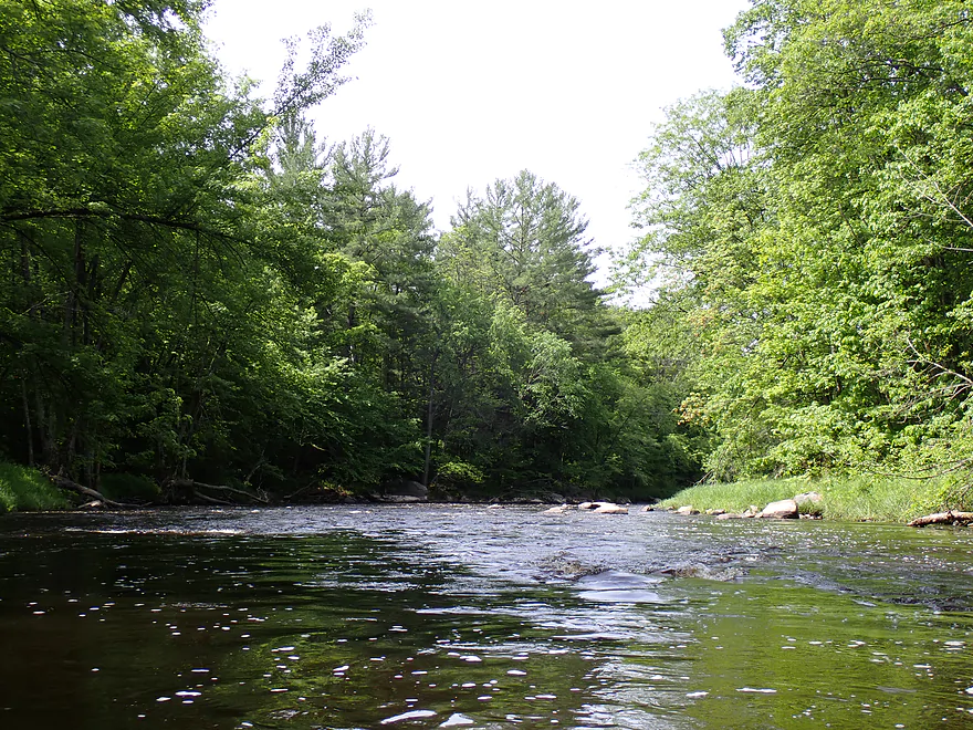
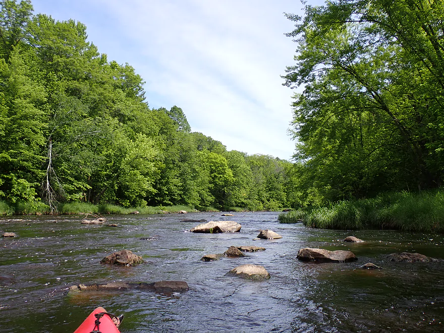
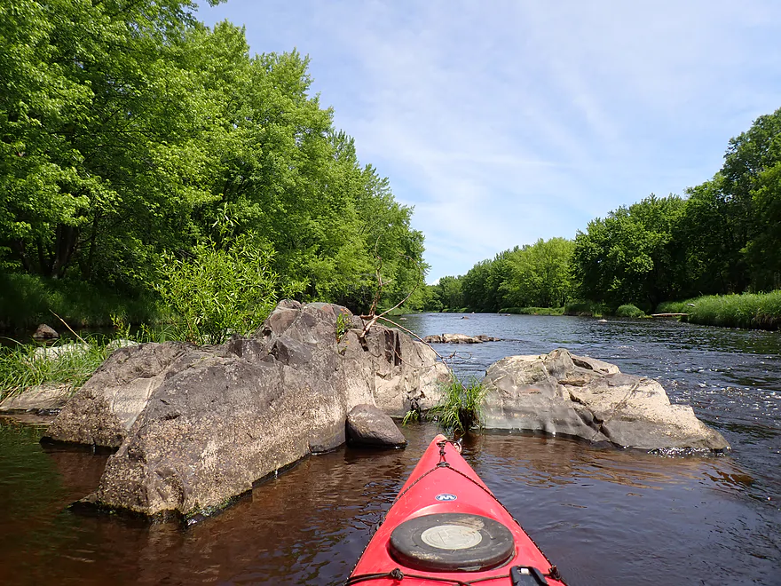
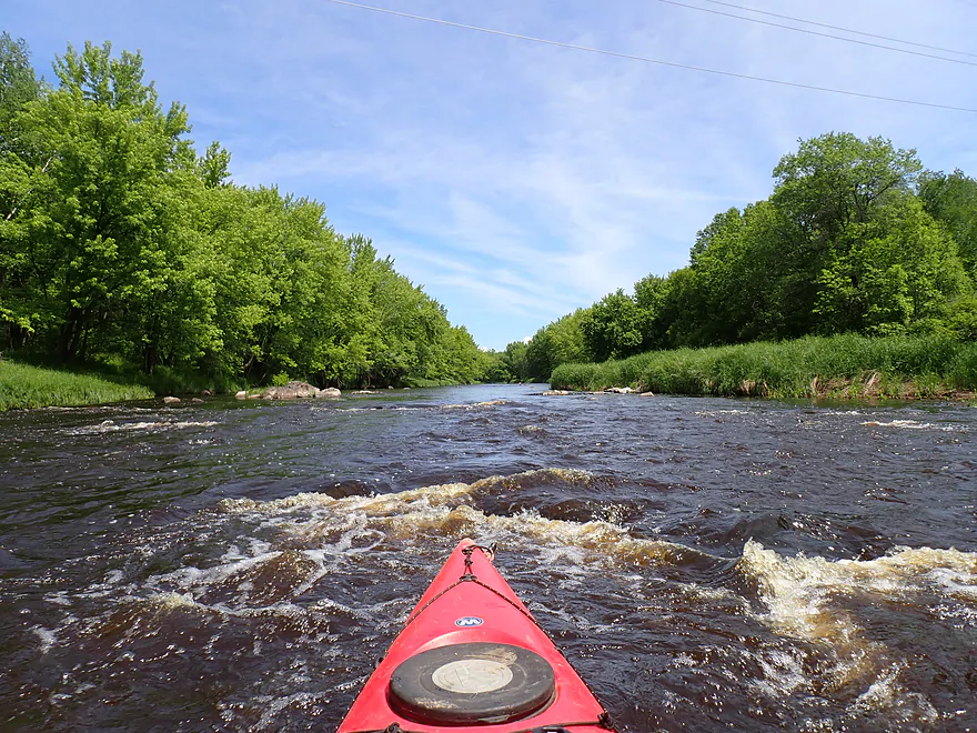
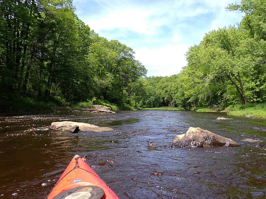
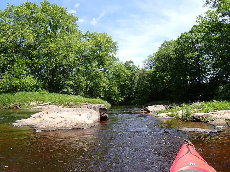
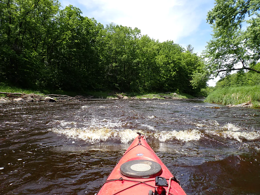
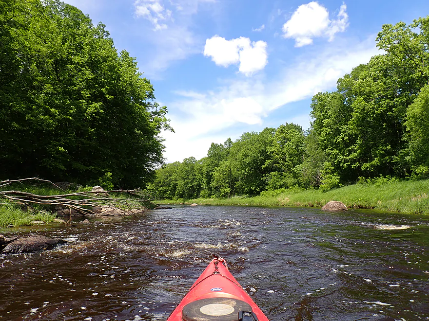
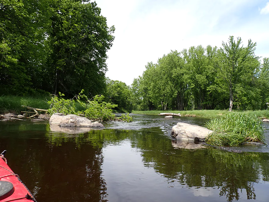
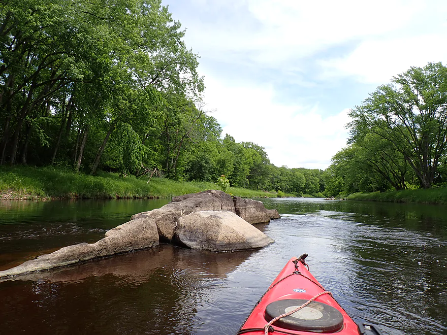
First boulder garden of the trip
Getting out for pictures
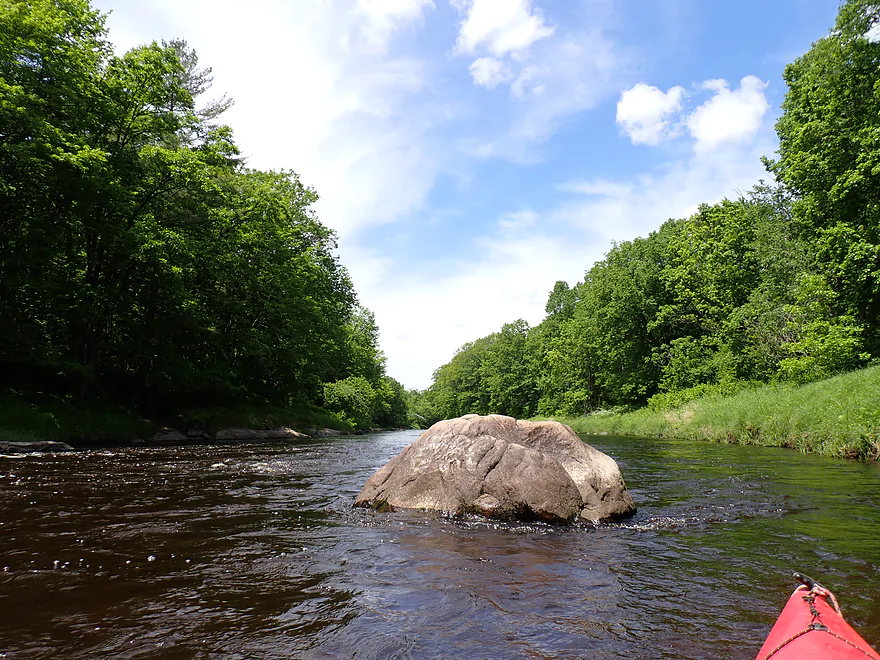
Some of the shore-side boulders were huge
Exposed granite bedrock
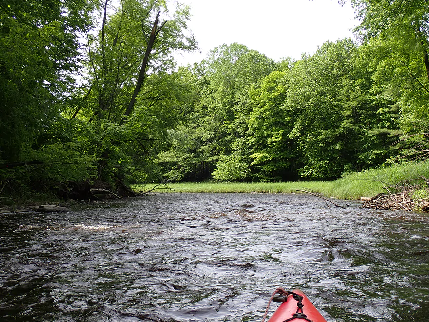
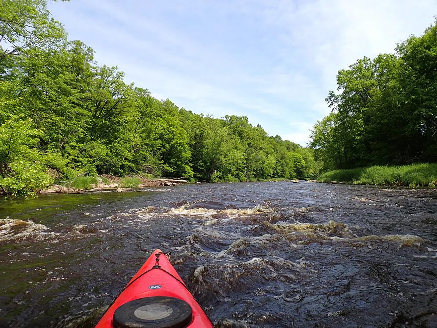
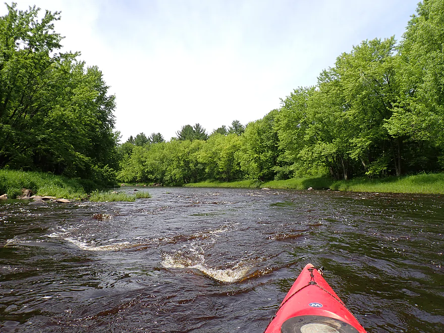
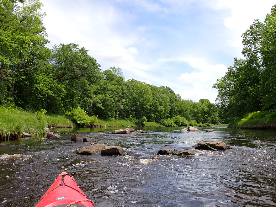
Some easy Class 1 rapids
Can you spot the eagle nest?
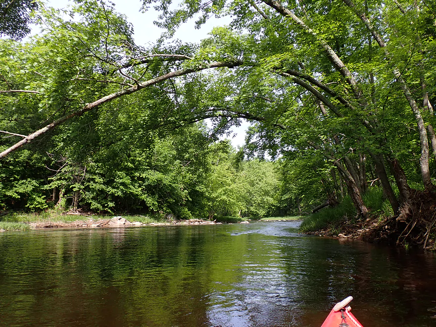
Coming up on a scenic stretch
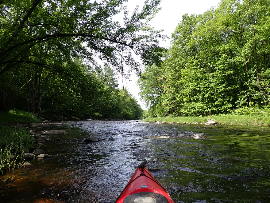
More Class 1 rapids
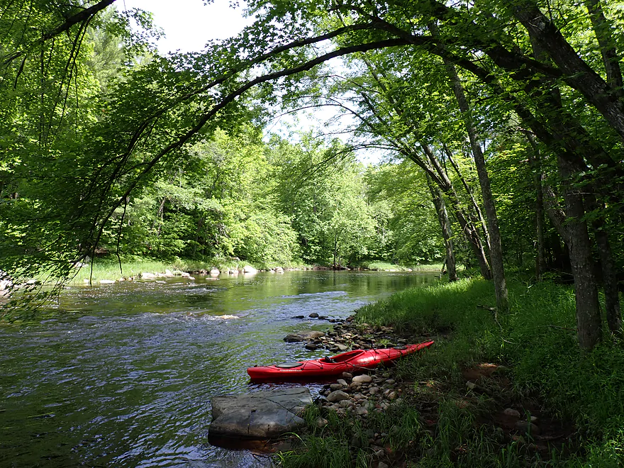
Getting out for pictures
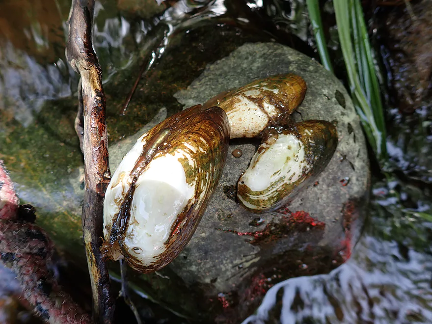
Clams on the river
Not apparent from photo…but this is maybe a half-foot ledge
Reverse view
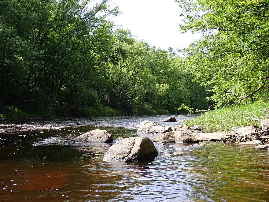
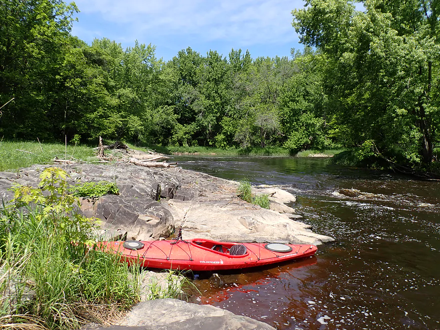
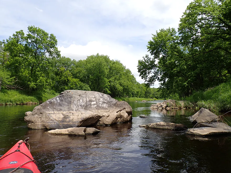
One of the nicer boulder gardens
This was a great depth for the rapids
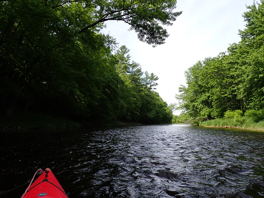
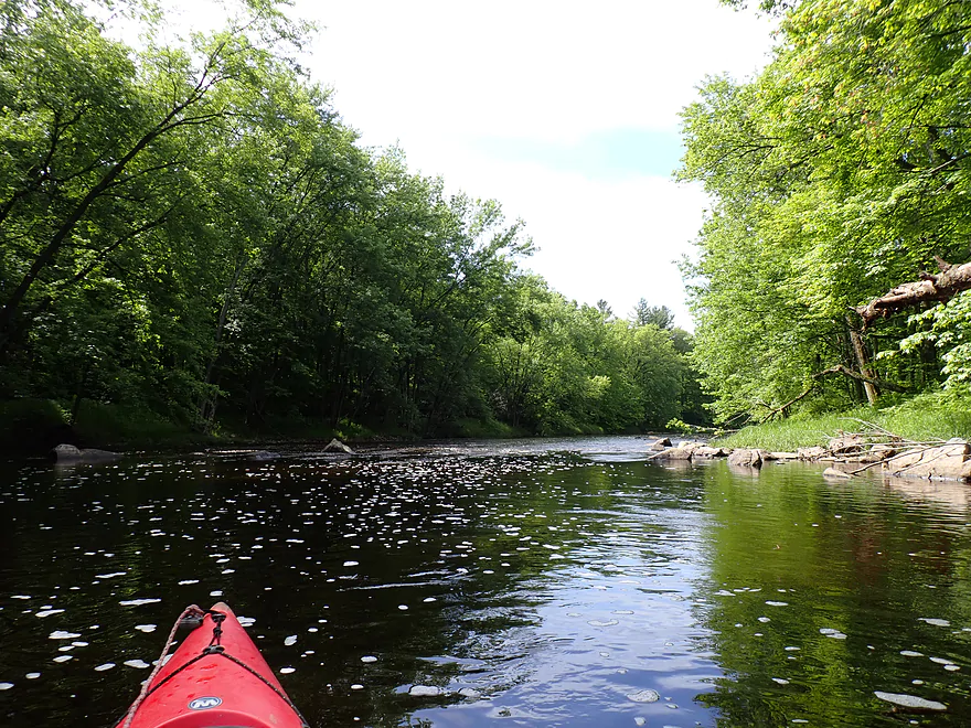
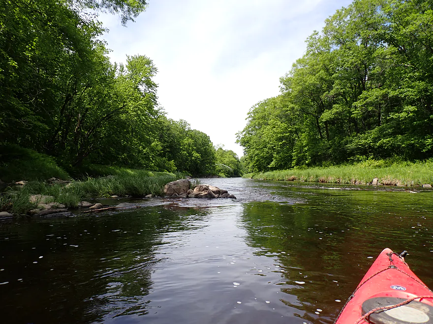
The banks on this trip were heavily wooded
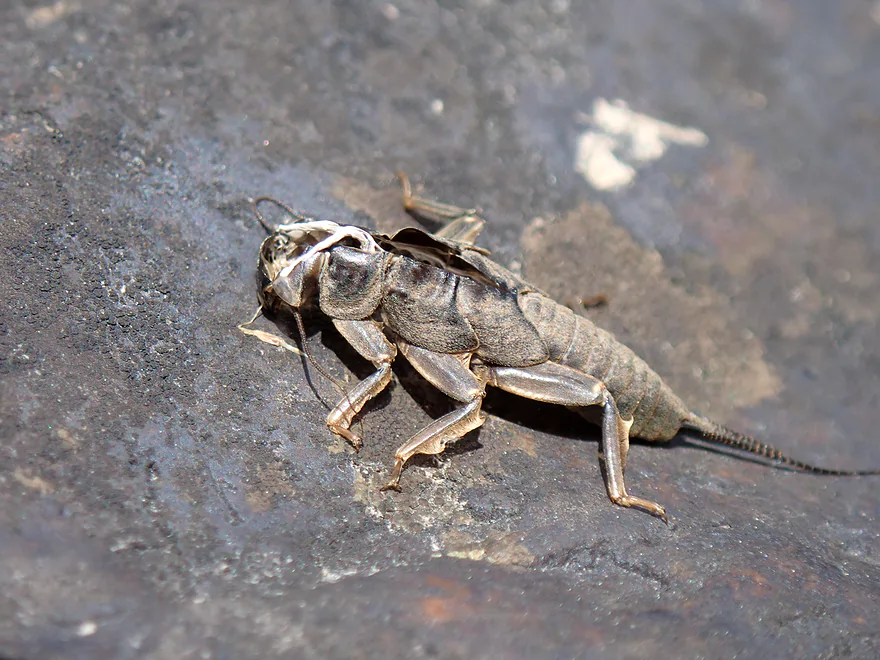
A stonefly exuvia
I bet this would be a great fall color paddle
Another nice boulder garden
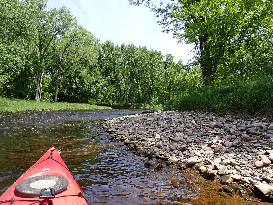
Attractive gravel bar
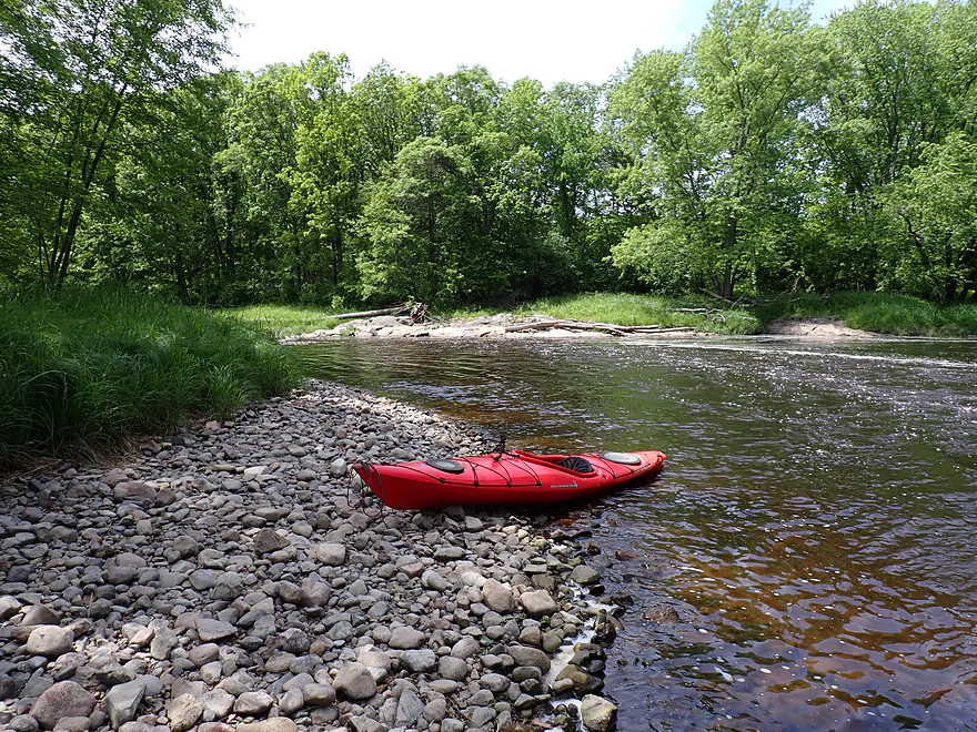
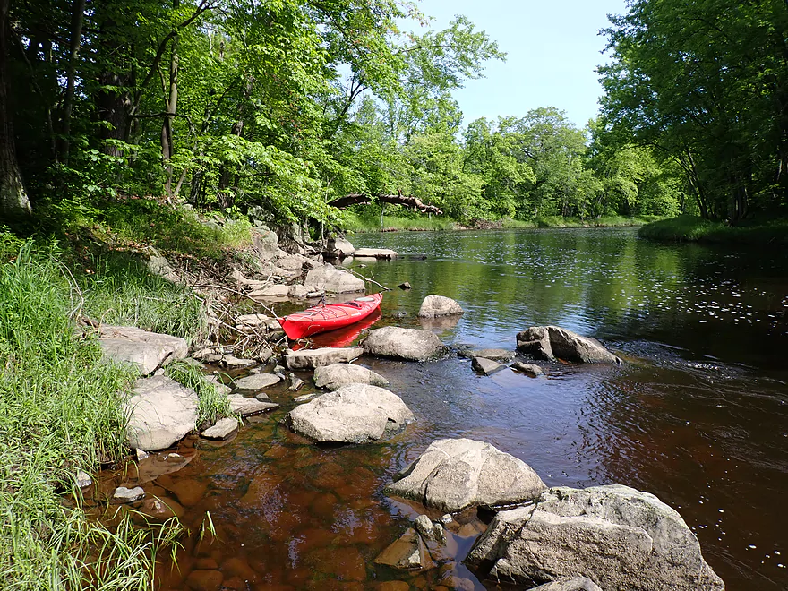
Getting out for photos
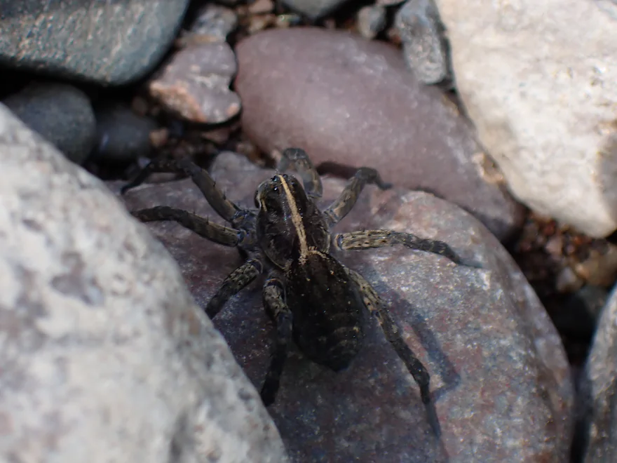
Maybe a giant wolf spider
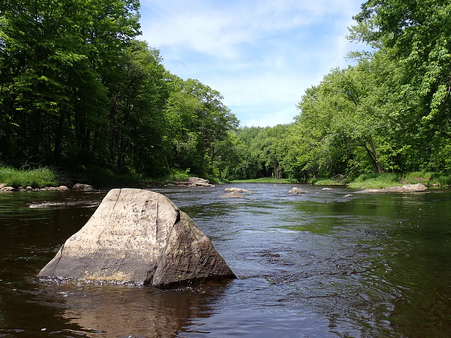
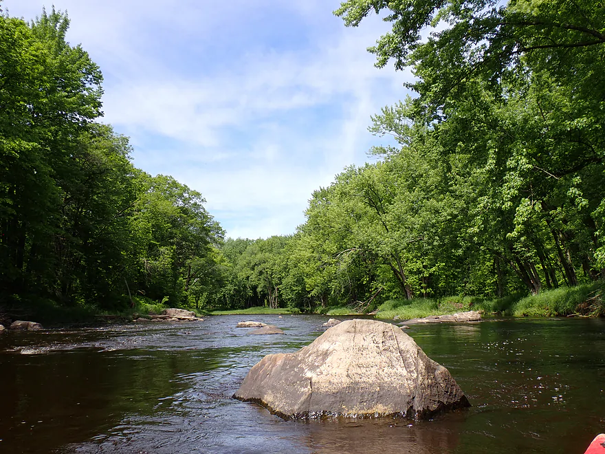
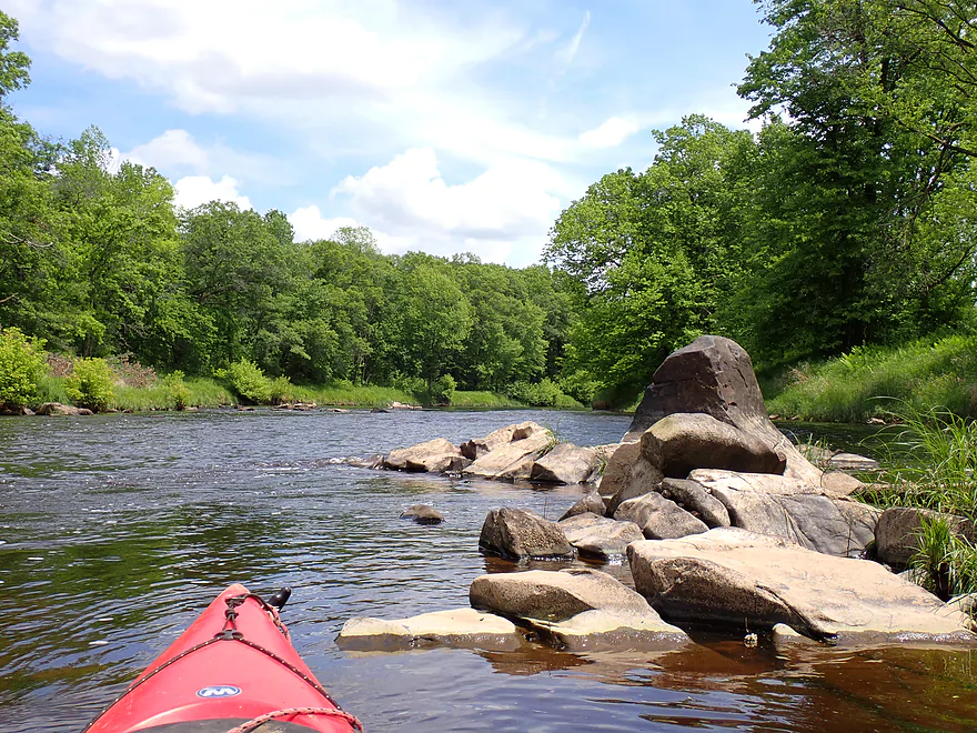
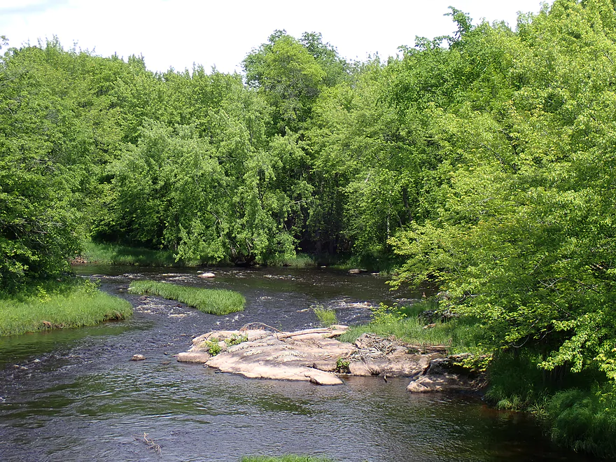
Great exposed bedrock and rapids
Reverse view
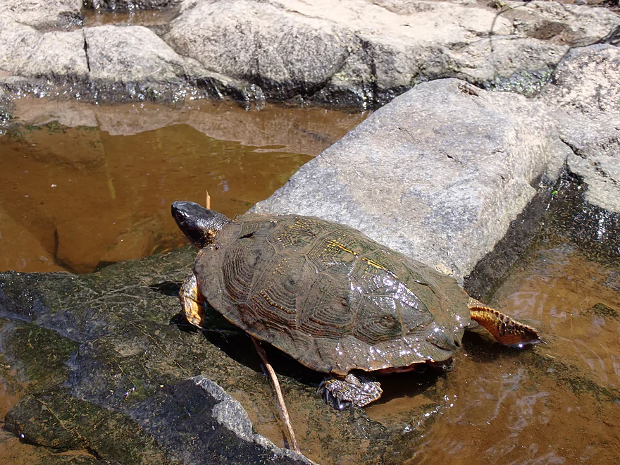
A wood turtle (state threatened species)
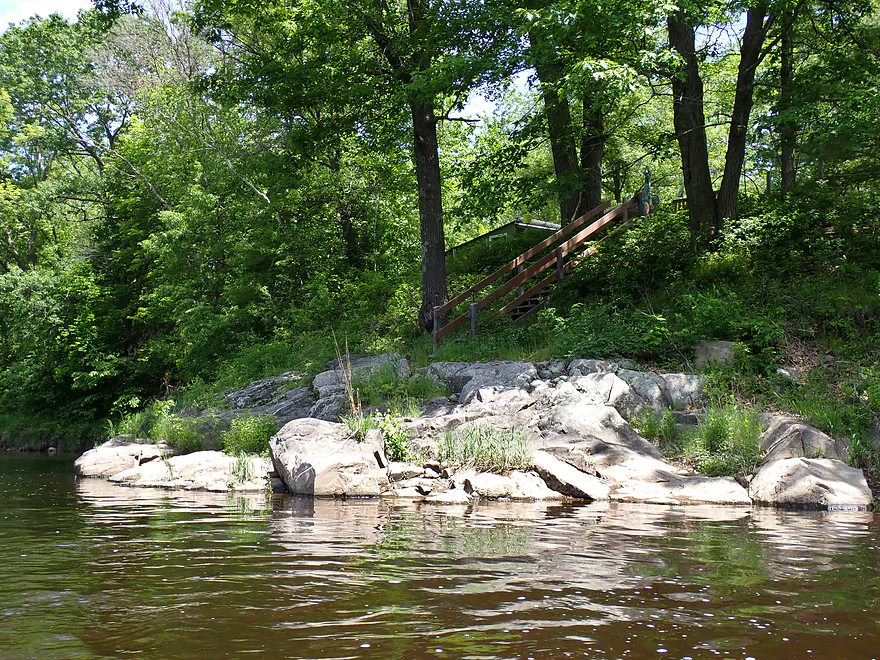
One of only a very few private homes on the trip
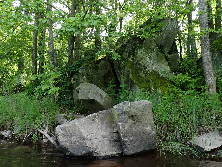
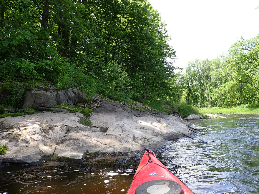
Cool little outcrop
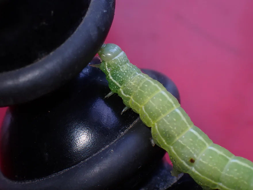
Friendly caterpillar, checking out my GorillaPad
More exposed bedrock
More Class 1 rapids
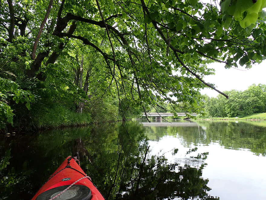
Finally get some blue skies
Coming up on an island
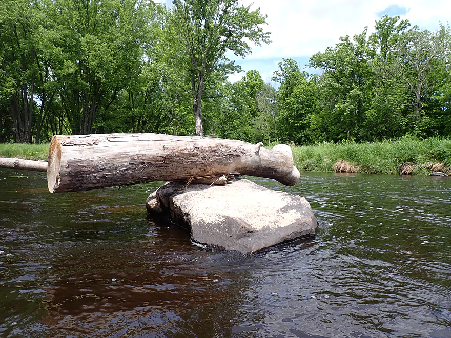
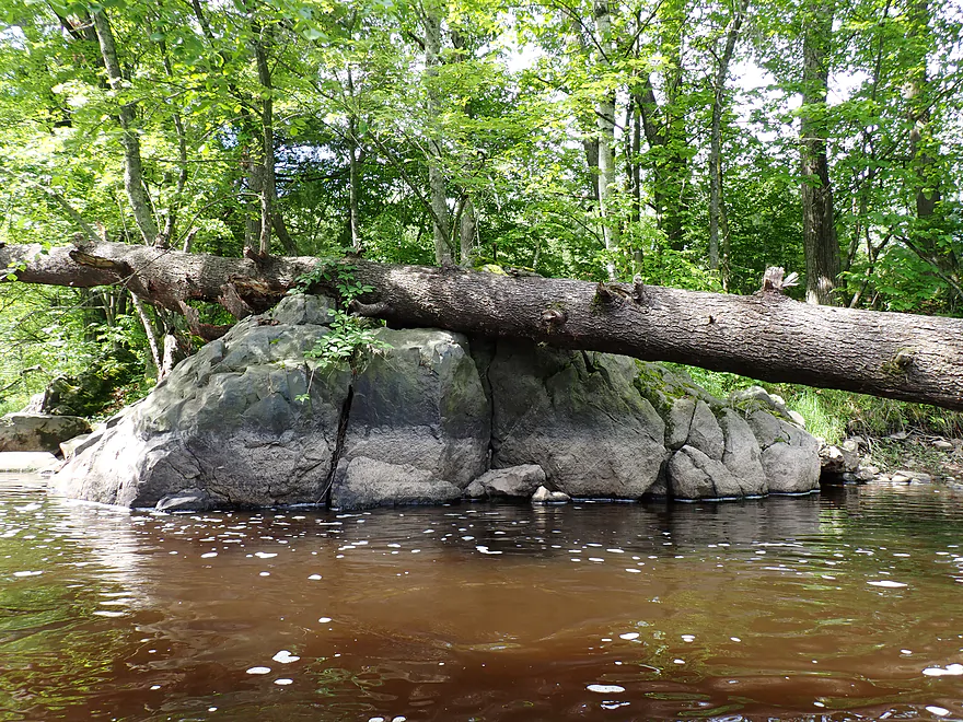
Quite the balancing act
Another photo showing the high water line
Final boulders
Paddling on the Cadott Millpond (aka the Cadott Flowage)
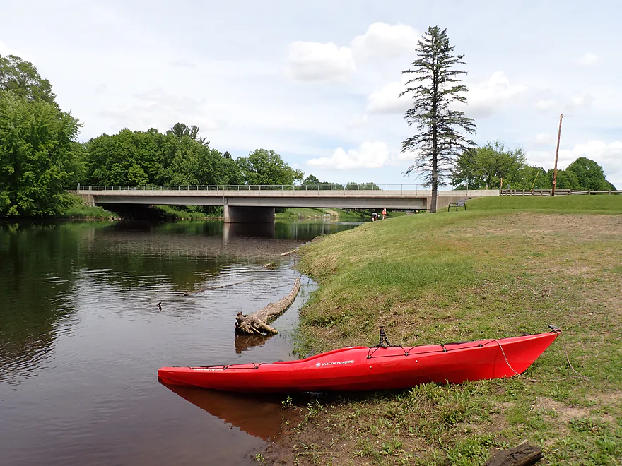
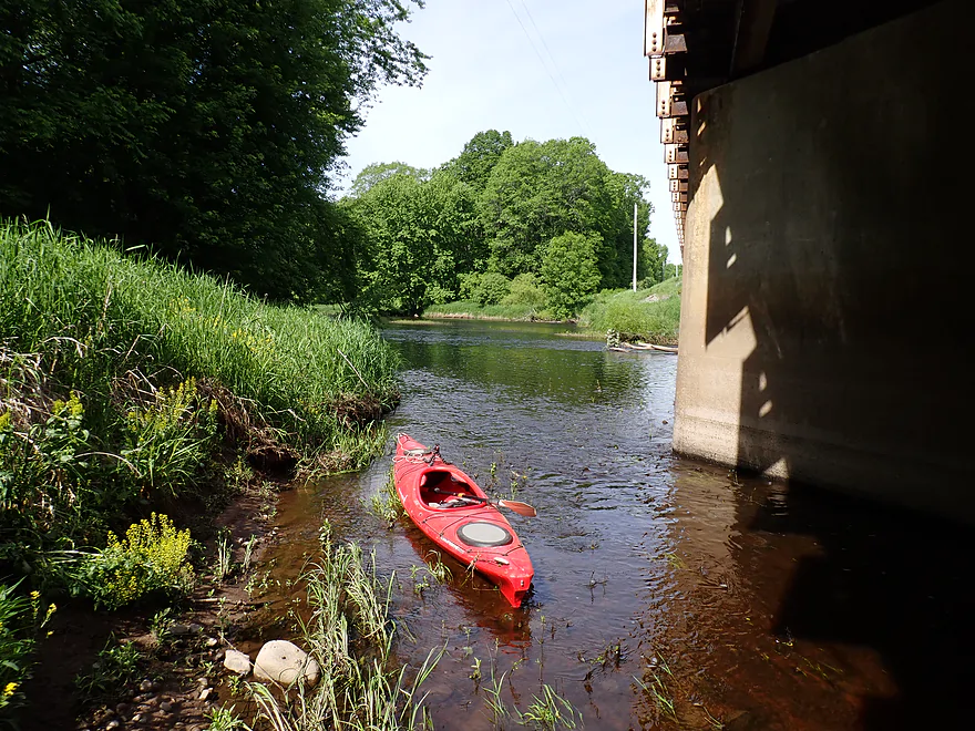
Taking out at Riverview Park
Nice dedicated access for paddlers
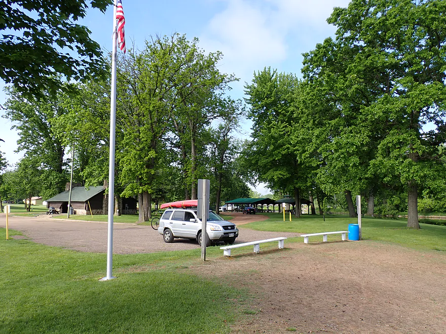
Nice park
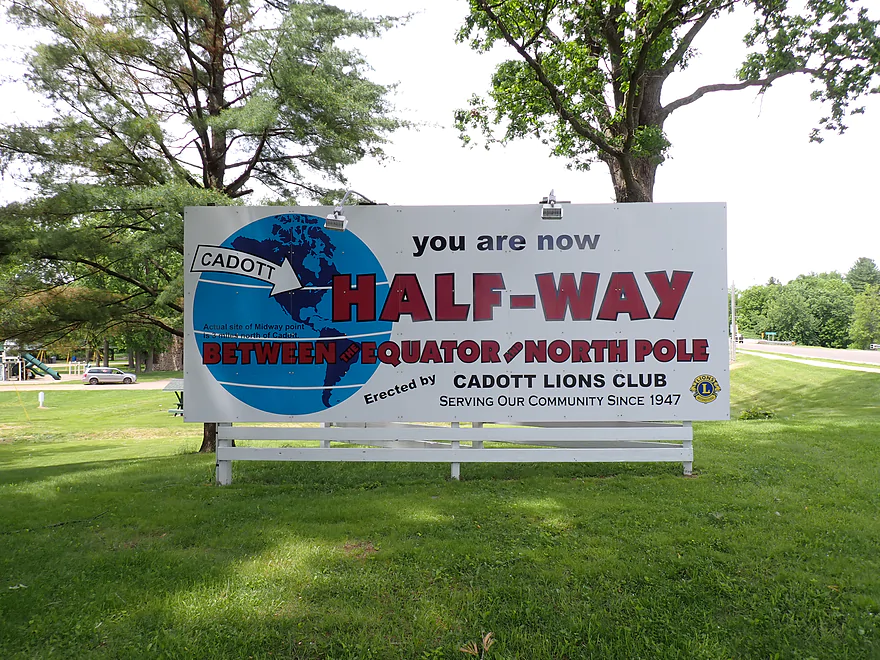
Funny that the small print says the actual center is 3 miles north
Scouting Hwy D
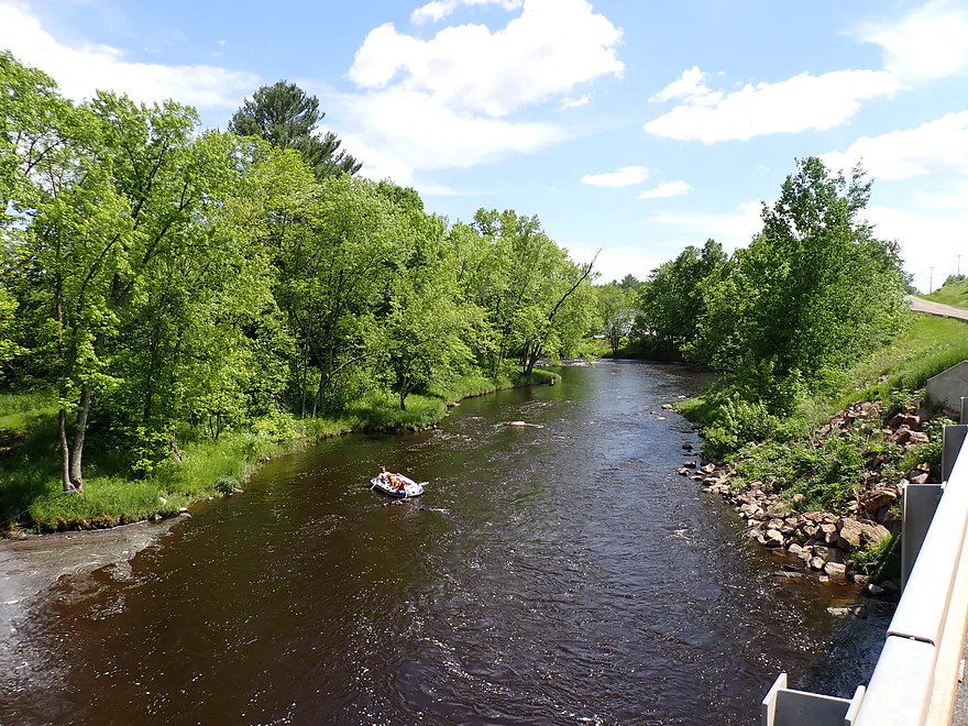
Downstream view…rafters took out by 120th Ave…decent shoulder access
Scouting 130th Ave…scenic rapids and granite
Yellow River (North Central Wisconsin) – Hwy O

Located northeast of Eau Claire, the Yellow is an overlooked paddling river. Part of the reason is because it’s usually shallow and overshadowed by more famous rivers in the area. Its name as well contributes to its obscurity…not 1, not 2, but 3 other rivers in the state are called “Yellow River”. All that being said, this is a great paddling river and might be the best and most scenic of the four. Being somewhat new to the area I decided to opt for an easy section with a short bike shuttle…which, by my estimation, meant Hwy O to Cadott.
Hwy O was a good bridge access with a scenic vista of the downstream river bend. While many rivers in southern and eastern Wisconsin were running crazy high, the northwest area of the state (which tends to drain fast) was actually in good shape and only was somewhat above normal. This is a good thing for the Yellow. Google Street View took a scenic snapshot of the river by the Hwy O bridge during the 2023 drought which shows how low the river can get.
The first half mile was a bit disappointing. I had expected big outcrops, huge boulder gardens, and exotic rapids. But all I saw were a few micro-riffles and several small outcrops. The boulders along the banks though were cool.
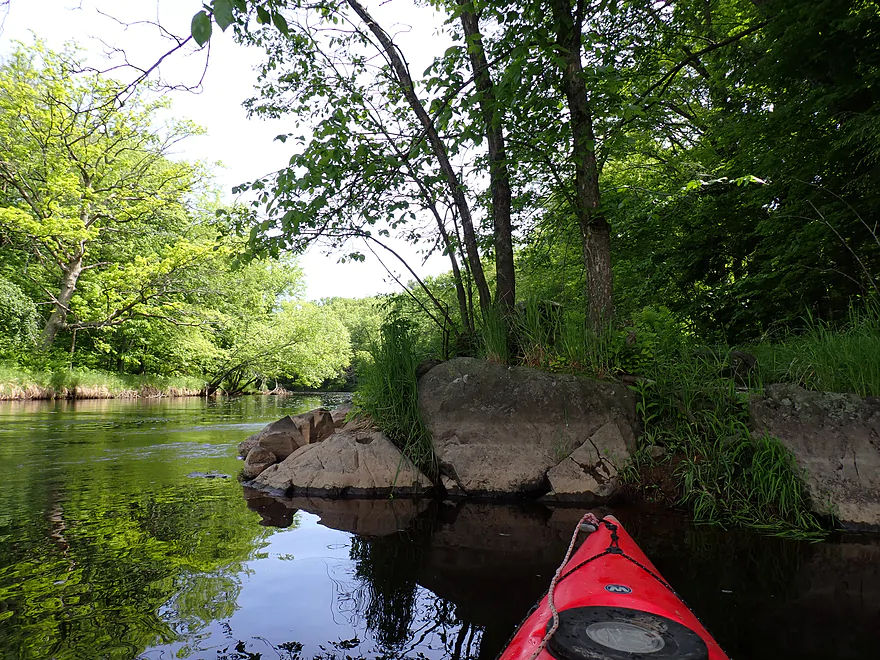
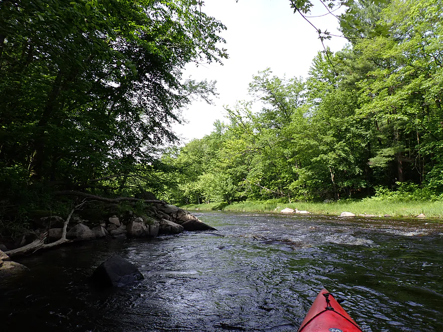
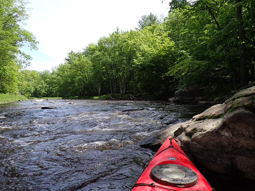
Eventually the current picked up and I experienced the first of many Class 1+ rapids. These were pretty straightforward, but I assume would get pretty “boney” when the river got low. I started to see some nice boulder gardens with some bigger specimens. In a few stretches there was even exposed bedrock which is always a neat sight. The banks were very wooded and the trip very much reminded me of the Upper Black (a compliment).
Shortly after the second power line, the river slowed, widened and straightened out. The last mile of the river was impounded by the Cadott dam, and that was less interesting. I ended the trip at Riverview Park which has a great public take-out located just upstream from the dam.
In summary, this was a fun trip and I had a great time. In fact, given the Yellow is only a two hour drive from my house, I don’t know why I haven’t reviewed this river years ago. Note, the leg I did likely isn’t the best or most scenic…the upstream legs should be even better. In fact I suspect the leg between Riverview Supper Club and Hwy O has one of the best combinations on the river of Class 1-2 rapids, boulder gardens, and big cliffs. That stretch is definitely on my todo list.
Sights included a great blue heron, one large raptor, some small minnows, geese (and tons of teenage goslings), stonefly exuvia, a wolf spider, several caterpillars, and clams. It was a great to see a wood turtle…they are rare (state threatened species). While they are not as large as a snapper or softshell, they are bigger than painted turtles and have distinct shell patterns. The highlight was seeing all the crayfish. There were actually more dead crayfish than live…disembodied crayfish claws were everywhere.
Halfway Point: The village of Cadott is the half-way point between the equator and the North Pole. It’s the town’s slogan and paddlers won’t miss the giant sign at Riverview Park which celebrates this. Honestly, I’m not sure most will care, but geography buffs might find this interesting. What’s amusing is that in small print it states the exact half-way point is ACTUALLY 3 miles north of Cadott.
Hwy O: This is a good bridge for launching. The west side is posted, but the east side has a nice open area and wide shoulders for parking.
Alternate Put-ins:
- Hwy D (5.5 miles upstream from Hwy O): I think most paddlers will prefer to start here and there are several launch options. The best is the lawn in front of Riverview Supper Club, but that is private and will require permission. Another option is to launch from the bridge itself…steep/rocky but plenty doable. Perhaps the best spot is to actually launch downstream off the 120th Ave Shoulder. I saw a rafting couple get out there and it seemed to work well. This bonus leg would be very good and include some impressive cliffs.
Riverview Park: This has a terrific public canoe/kayak access and is a nice park. No parking fees are required and outhouses are available at the top of the hill. Only downside is there are goose droppings everywhere.
Alternate Take-out:
- Cadott Dam (900′ downstream from Riverview Park): I think you can take out north of the dam where I believe (don’t quote me) there is a public access and small public parking area there. All that being said though, Riverview Park is the better access.
Bike Shuttle – Riverview Park to Hwy O: 4.3 miles with 121′ of ascent. There are several medium-sized hills to climb and Hwy 27 is a busy road with narrow shoulders…but all in all this should be a relatively easy bike shuttle for those in bike shape. Google will suggest you take 80th Ave…don’t…that is gravel. Hwy 27 and Hwy O are paved and better options for bike shuttlers.
Logjams/Fences: None.
Strainers: There are a few downed branches in fast current, but generally speaking the river is wide enough to simply paddle around them. These may be difficult in very high water.
Dams: There are no dams on this leg itself, but the final half mile is impounded by a dam in Cadott. You could likely take-out at the dam itself (which is in eyesight of Riverview Park).
Rapids/Current: Generally speaking the river moves at a good clip (except for the last half mile). There are many light rapids…most aren’t too difficult and are rated as Class 1+. These might be more difficult in very high water.
Closest Gauge: North Fork of the Yellow River @ Perkinstown
Trip Depth: 8.98′
Navigability Estimates: Note, this gauge is located VERY far upstream from Cadott so may not be accurate. Also note, there isn’t a lot of good historical data to reference, so depth estimates are very sketchy. Always use your own judgement and assume these estimates are inaccurate. If you do this stretch, please share your depth and how viable it was in the comments below.
- < 8.65′: Many of the rapids will be very shallow and paddlers may hit a lot of rocks.
- 8.65-9.9′: Slight above average levels. Most rapids should be well padded. Great target range.
- 9.91′-10.26′: Above average levels. I think most paddlers should be able to deal with this ok and have a good time.
- 10.27′-10.78′: High levels. Likely a fun depth for adventurous paddlers as the rapids will start to get rowdy. Clarity won’t be that good and some of the nicer boulder gardens may become submerged. Warning, the sections upstream from what I did have a different character with more advanced rapids. Those stretches at these levels actually might be dangerous. This guide is only for the O to Cadott stretch.
- 10.79′-11.62′: Very high levels. I think it might be navigable but perhaps only for skilled paddlers.
- > 11.63: Crazy high flood levels. Likely unsuitable for paddling.
Detailed Overview
Click here to see an overview map of the Yellow River.
- Upstream from Yellow River Road: The river splinters and may be less kayak-friendly, but I suspect there are viable sections for determined paddlers.
- Yellow River Road to FR 575: 7.1 miles. Technically this is the North Fork. Rick Kark describes this as having lovely surroundings, being shallow, having a number of rocks, and two sets of Class I rapids.
- FR 575 to Hwy M: 3.8 miles. I don't know much about this leg. It seems to start wooded and ends in a marsh.
- Hwy M to Diamond Drive Ramp: 1.4 miles. The north end of Chequamegon Waters Flowage.
- Diamond Drive Ramp to Miller Dam: 2.7 miles. The western end of Chequamegon Waters Flowage.
- Miller Dam to Beaver Creek Road: 1.1 miles. Attractive wooded section with light rapids, and rocks.
- Beaver Creek Road to Gilman Scout Park: 7.4 miles. Some light rapids and rocks, but not as many as the previous stretch. Still very wooded.
- Gilman Scout Park to Gilman Public Park: 0.3 miles. Short stretch between the Gilman Parks. Highlights include several scenic bridges.
- Gilman Public Park to Polley Lane: 4.2 miles. One of the best stretches on the river with some fun Class I-II rapids including "Oxbow Rapids". There should be a few small cliffs on this leg as well.
- Polley Lane to River Road: 3.0 miles. A pleasant leg with a few potential outcrops.
- River Road to Hwy S/H: 1.8 miles. Good stretch with more woods, light riffles, and rocks. But maybe not as good as the previous two legs.
- Hwy S/H to Hwy S: 1.5 miles. Very shallow rocky stretch by Hwy S. (Streetview Image)
- Hwy S to 350th Street: 2.3 miles. Rick Kark was disappointed with this leg and thought it was a bit monotonous and lacking in rapids.
- 350th Street to Hwy G: 3.0 miles. Rick Kark was disappointed with this leg and thought it was a bit monotonous and lacking in rapids.
- Hwy G to 327th Street Access: 3.1 miles. Probably an OK stretch...but be warned this leg could have several serious logjams.
- 327th Street Access to Patty's Park: 3.4 miles. Likely a good leg with a few nice boulder gardens.
- Patty's Park to 130th Ave: 2.1 miles. A good prospect with a number of shallow light rapids. There appears to be a scenic boulder garden and maybe a Class II chute above 130th Ave. (Streetview Image)
- 130th Ave to Hwy D: 2.3 miles. A very good prospect with likely some cliffs, boulder gardens and rapids. There may be a significant Class II ledge located downstream from 130th Ave.
- Hwy D to Hwy O: 5.5 miles. A good prospect with some nice cliffs. (Streetview Image)
- Hwy O to Riverview Park: 4.8 miles. A great trip with some nice boulder gardens, fun Class I+ rapids, pleasant wooded scenery, and small outcrops. There is a bit of flowage paddling near the end of this trip.
- Cadott Dam to Hwy XX: 4.4 miles. I don't know much about this leg, but looking at satellite maps, it looks like a generic bottomland paddle with a few minor boulder fields and one nice sandbank. The boulder field and rapids below the Main Street bridge are likely the trip highlight.
- Hwy XX to Hwy K: 5.3 miles. Very nice stretch with a mix of bottomlands, minor rapids, gravel bars, and several scenic sandbanks. The highlight is the final half-mile which features attractive granite boulders and exposed bedrock.
- Hwy K to Lake Wissota Landing - 196th Street: 0.8 miles. A possible short add-on stretch through Lake Wissota's Moon Bay to reach a public ramp. I think this would be a mediocre lake paddle. Note parking at the 196th Street ramp may be difficult.
- Lake Wissota Landing - 196th Street to Lake Wissota - State Park Ramp: 0.8 miles. Another possible short add-on stretch through Lake Wissota's Moon Bay to reach a public ramp. I think this would also be a mediocre lake paddle. The State Park Landing is very good, but it would necessitate an unpleasant shuttle because it's at the end of a long dead-end road.
Trip Map
Overview Map
Video
Photos Size: